February 5, 2026 Thursday Winter Weather
Extreme cold returns for several days across Northeast prolonging frigid period
February 2026 was the 4th-warmest February in the 132-year national record (1895–2026), at 40.3°F against a 1991–2020 normal of 35.6°F (+4.6°F).
February 2026 was the 5th-driest February in the 132-year national record (1895–2026), at 1.4in against a 1991–2020 normal of 2.1in (-0.7in).
NOAA/NCEI Climate at a Glance, contiguous United States. This is the observed record for the month, not a score of anything said in this piece — the forecast ledger begins 2026-08-17 and cannot reach earlier posts.

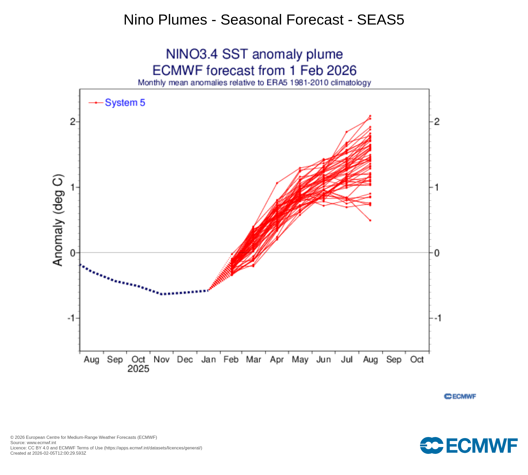
The 5th of every month is ECMWF Seasonal Day when the 7-month forecast is released from their coupled atmosphere-ocean climate model. The ensemble plumes for the NINO3.4 box in the Pacific switch quite warm > 1.5°C by middle of summer 2026 indicating the rapid onset of El Niño. However, there remains uncertainty about the timing of the Niño onset as well as the final intensity of the Pacific warm water along the Equator.
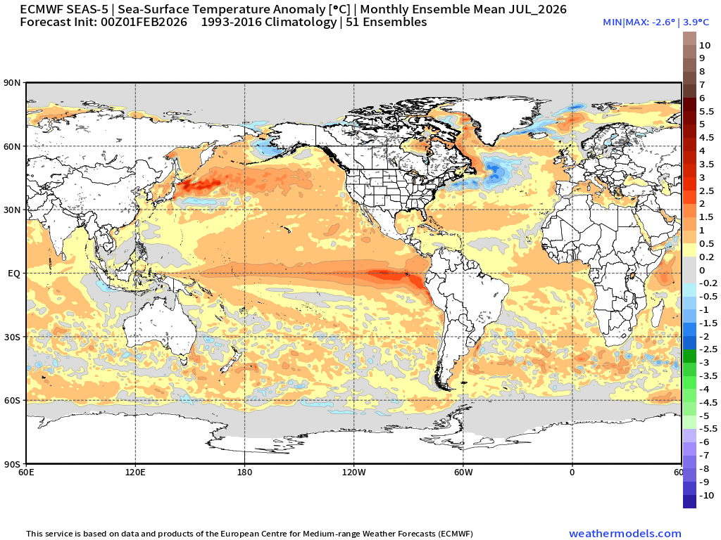
The SST anomaly map for July 2026 from ECMWF SEA5 shows the warmth along the equator off the coast of South America suggesting a more canonical El Niño development. The Atlantic is a tick above the 30-year climatology but not “on fire” as in years past suggesting a more moderate hurricane forecast not even taking into account the wind shear expected from El Niño raging on the Pacific. Not much more to be said at this juncture as the “spring predictability barrier” limits seasonal forecast skill in the Northern Hemisphere until April onward.
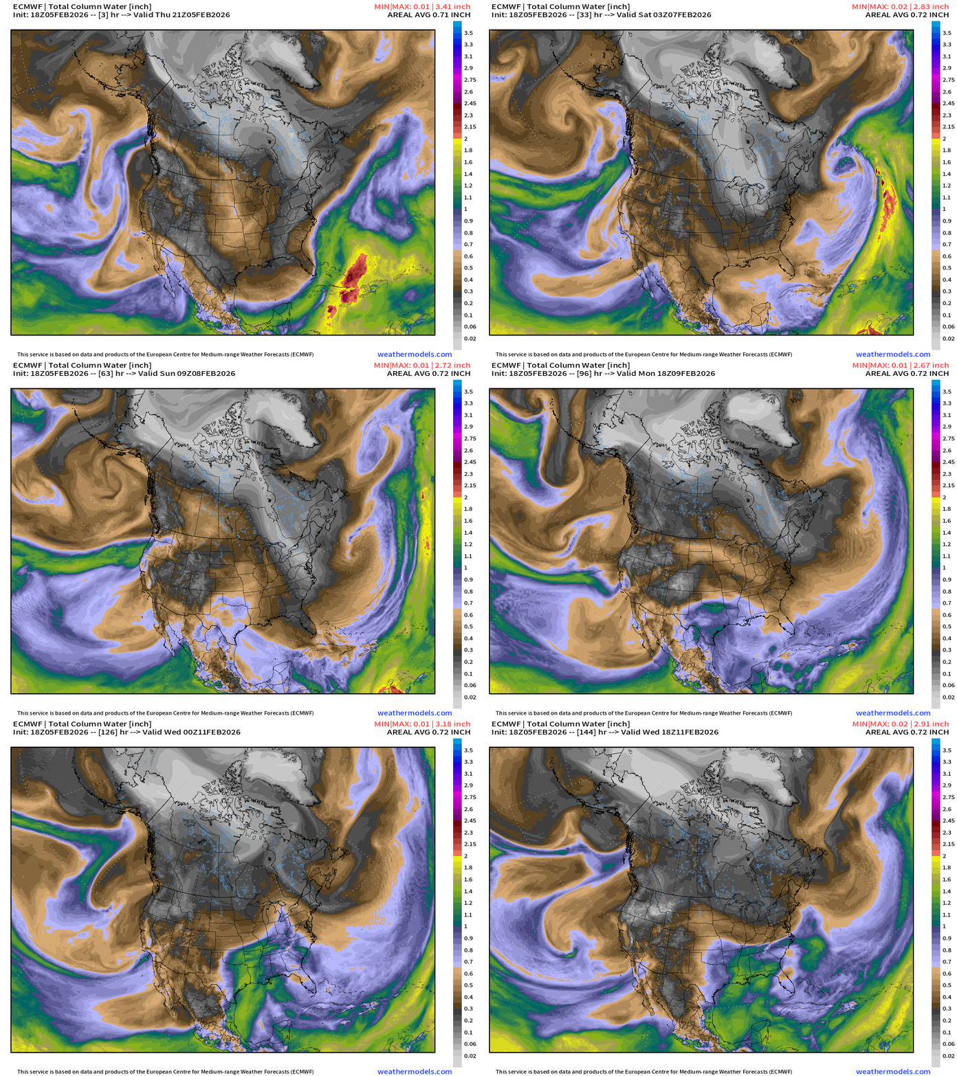
ECMWF IFS 18z | Precipitable Water Next 6-days
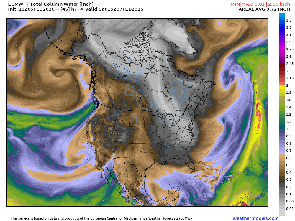
My favorite parameter — showing the blast of cold and dry Canadian Arctic air into the Lower 48 through the Great Lakes into the Mid-Atlantic like a tendril of smoke.
The Atlantic storm track remains active but low pressure systems form and intensify well off the East Coast avoiding impacts.
On the west coast — an atmospheric river landfalls WA/OR this weekend and lingers into California into next week. Plenty of welcome moisture for snowfall will be delivered to higher elevations. This AR is from the due west — warmer origin. However, into middle of next week, the flow is decidedly out of the north and within a building trough from Alaska — much colder —> pattern shift ahead, finally.
Snowfall from that ECMWF 18z run over the next 6-days
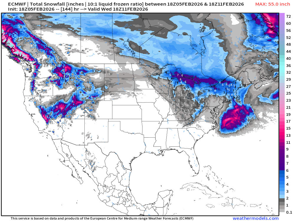
Great to see Nevada and Utah getting heavy snowfall. The Northeast is spared major impacts from any large storms, but could still see 3” to 6” of fluffy snow from Clipper systems that have access to Pacific origin moisture.
One more Major Arctic Blast at least for the Winter
ECMWF 18z Temperature Anomaly | Next 6-days
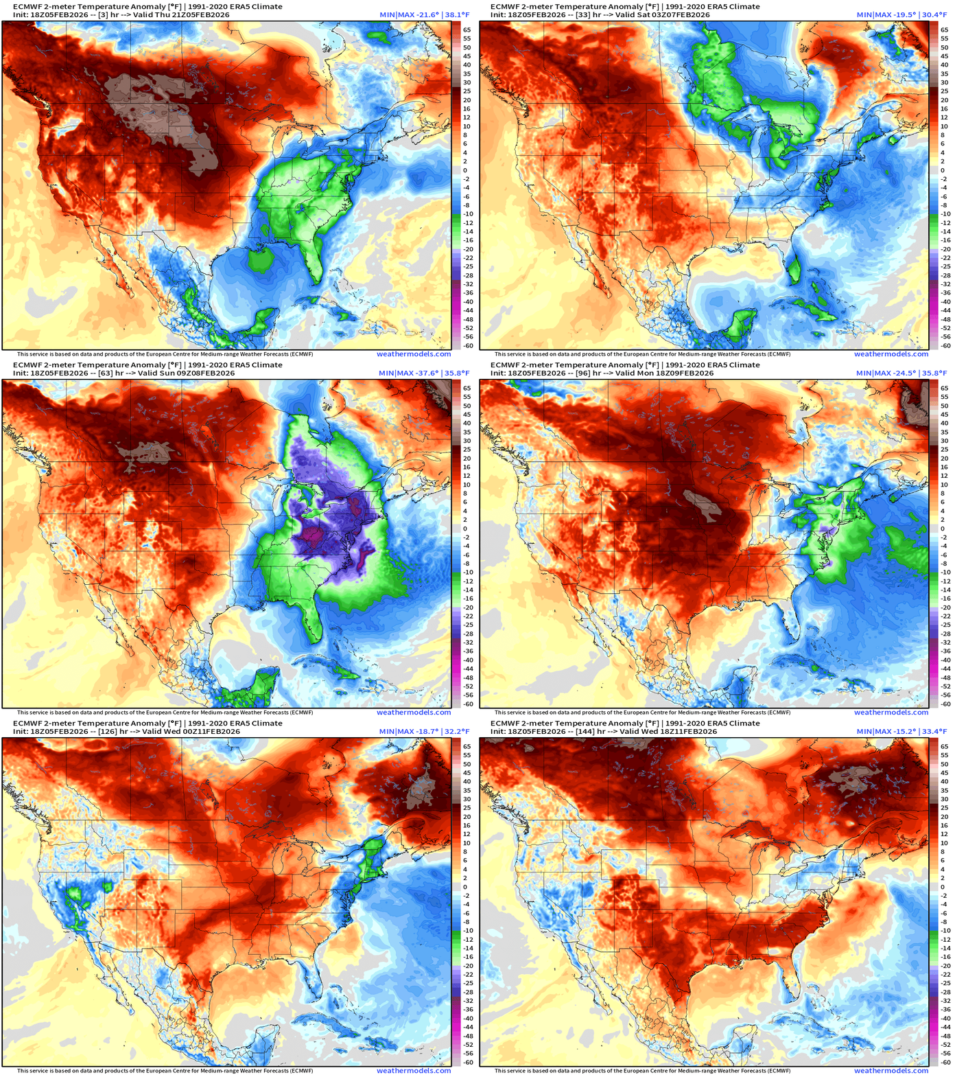
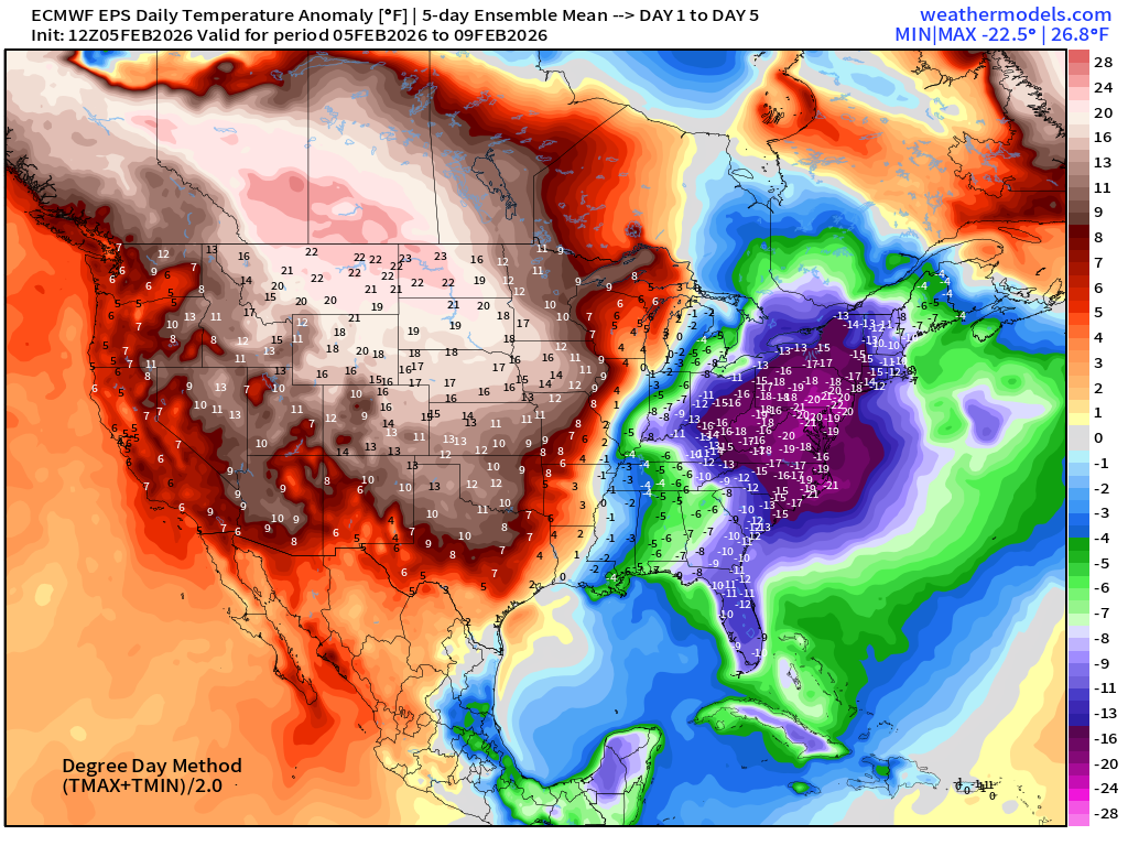
Weekend: purple is -30° to -40°F below normal — in Ohio and Pennsylvania over snow pack meaning that temperatures could crater with calm winds and clear skies Sun/Mon mornings. The cold air mass finally erodes into Tuesday, but not exactly a major warm up thereafter. It will feel considerably better, though.
Meanwhile, a lot of RED across the western U.S. into the Plains finally pushes eastward on Tuesday.
Upper-Level “Tropospheric Polar Vortex” Pattern for Saturday morning
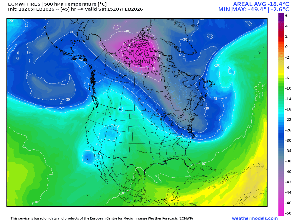
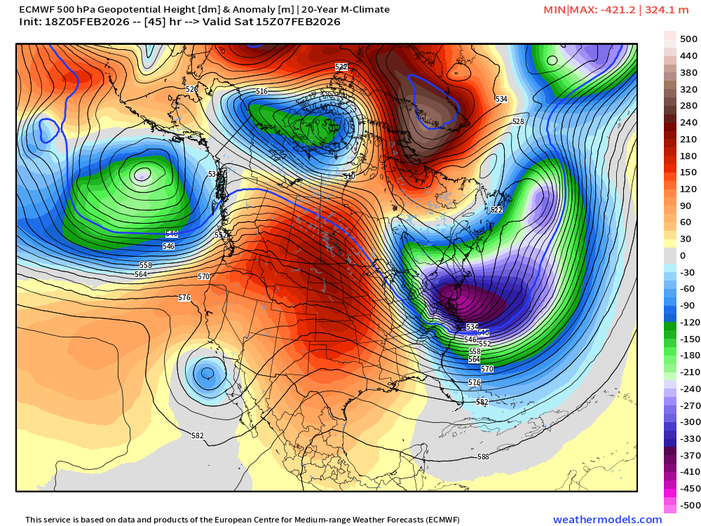
The 500 mb trough and temperatures colder than -35°C extending from Hudson Bay to off the Mid-Atlantic coast — actually quite impressive. The weakening trend seen over the past couple days in the model has reversed.
500 mb Height Anomaly Saturday late morning
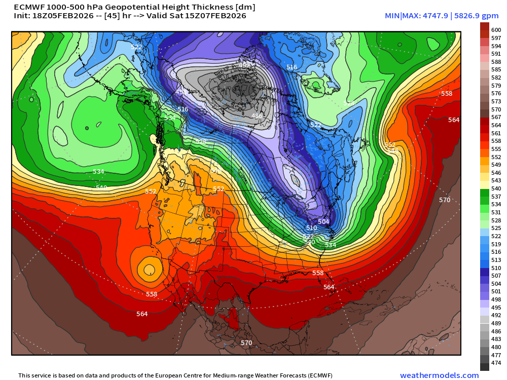
Thickness also Saturday morning
Precipitable Water Saturday morning
And, temperature anomaly the next morning on Sunday
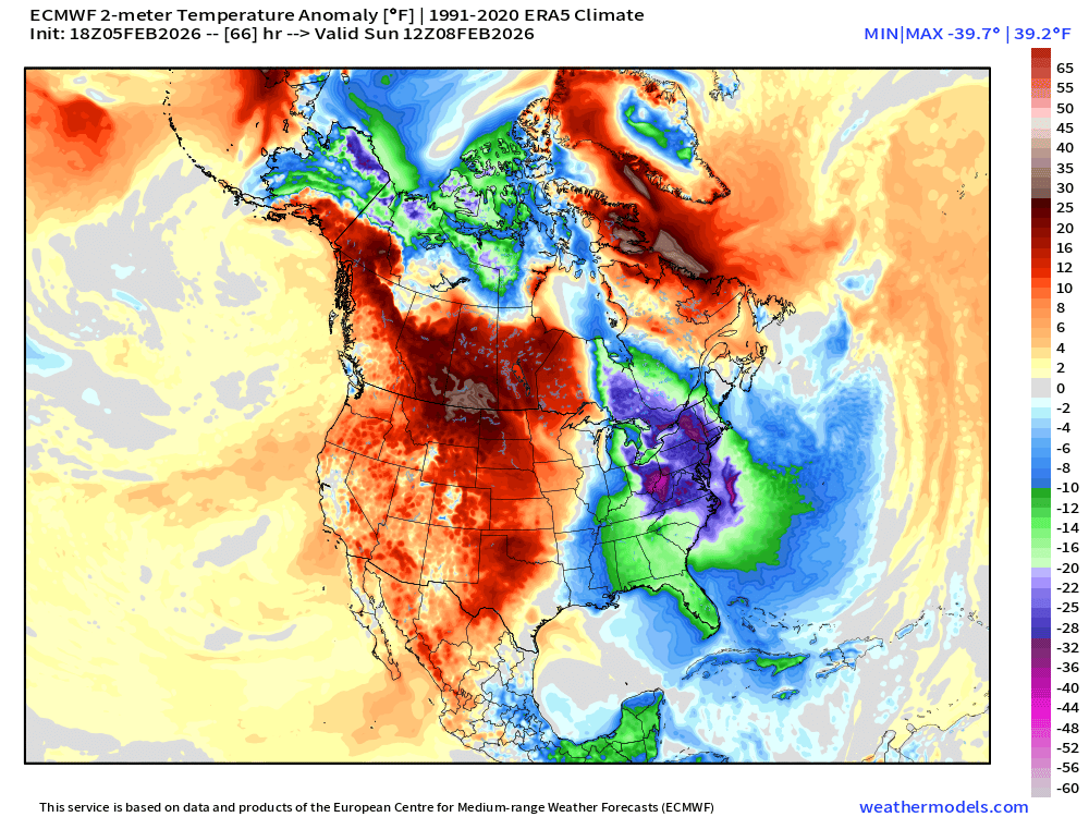
This is a heavy duty blast of cold air — and compounds the previous 2-weeks+ of brutal cold + snow cover that just won’t thaw until maybe next Wednesday.
While individual daily record lows may not be shattered, the longevity and cumulative nature of the cold is quite serious as it stresses pipes, wears out heating, and we start to see failures from prolonged winter.
Moisture Transport Next 10-days | Integrated Vapor Transport
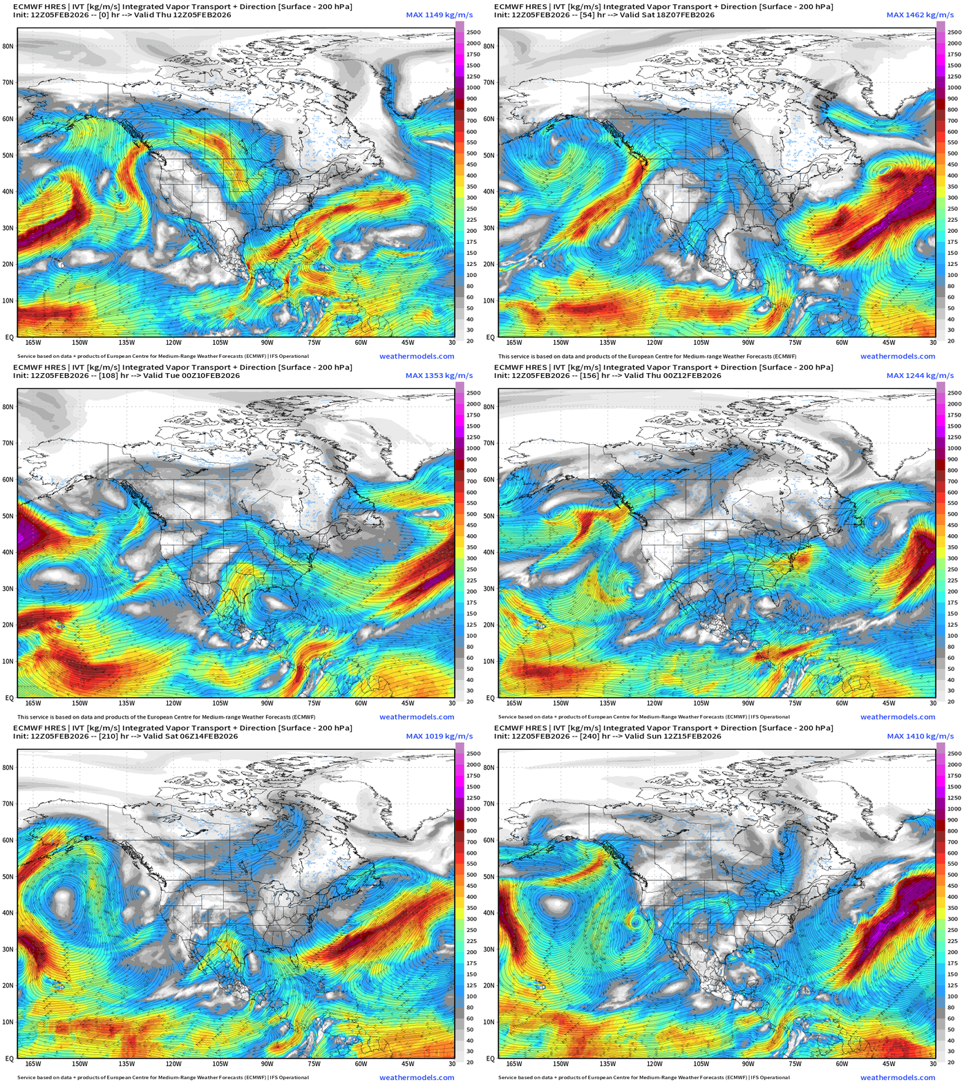
Pacific moisture goes up and over the Western U.S. ridge through Southern Canada and dips into the Lower 48 (Great Lakes —> Mid-Atlantic) as part of Clipper Systems. Not seeing a Nor’easter any longer into Day 10, just a quiescent pattern, which also means very dry.
Atmospheric Rivers make landfall along the WA/OR and California coast perpendicular, so even if not too intense, this is welcome moisture for the mountains with snowfall.
European 6-day Precipitation Type and Intensity
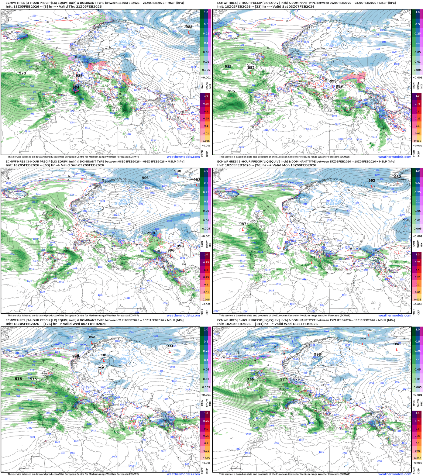
Busy pattern continues across Southern Europe with multiple little storms crossing into the Med. and continuing onward with plenty of moisture from the Atlantic.
Spain and Portugal will continue to see major rainfall … but also through the Mediterranean for Italy, Greece, and Turkey.
ECMWF 18z Precipitation Type + Intensity | Next 6-days
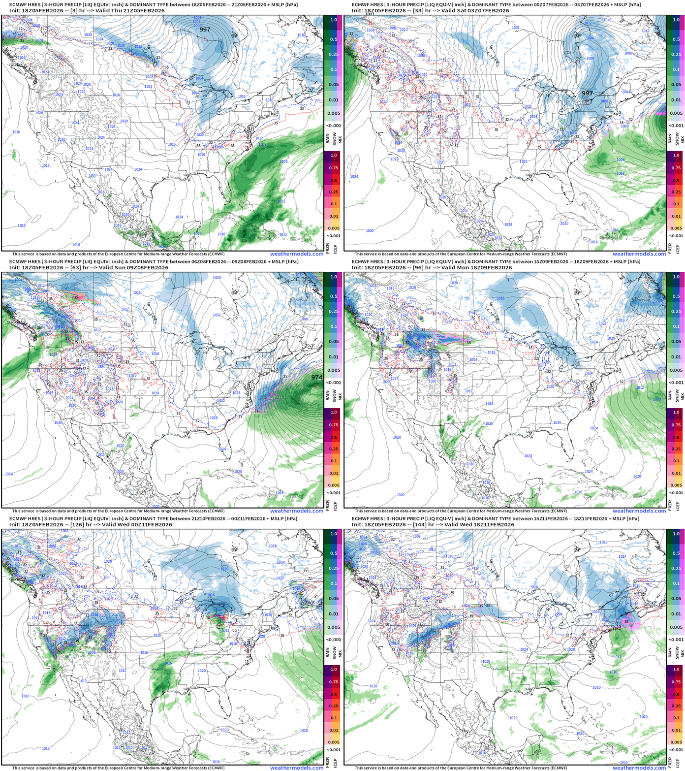
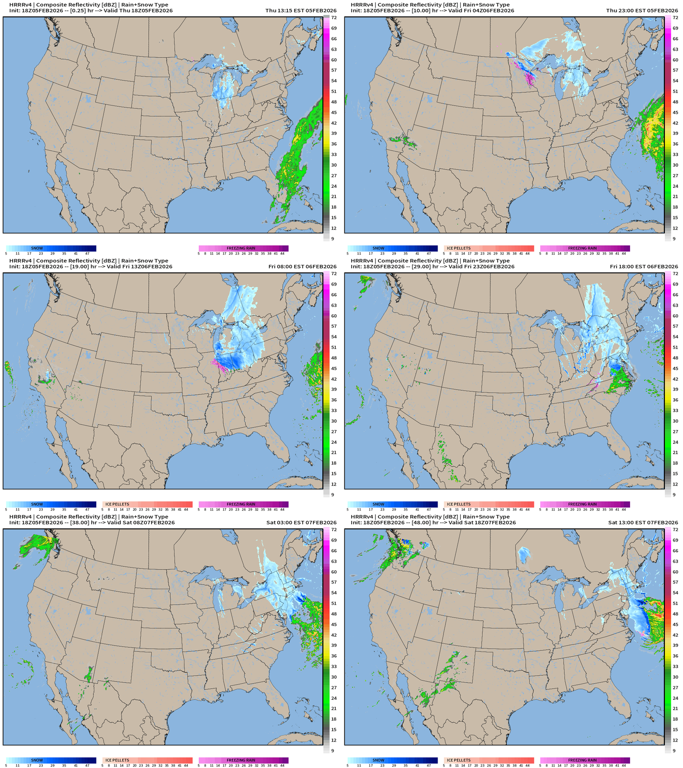
A Clipper (shortwave) tracks through the Great Lakes Fri into Sat and develops well off the New England coast / Gulf of Maine. Prior to scooting offshore, a few inches of fluffy snow could fall.
Perhaps another weak Clipper system next Tues-Wed across Great Lakes into NE
Heavy rain and snow returns to the Pacific Northwest, and moisture heads into the Great Basin primarily from a secondary surge (river) through California.
West Coast USA Zoom | Next 6-days
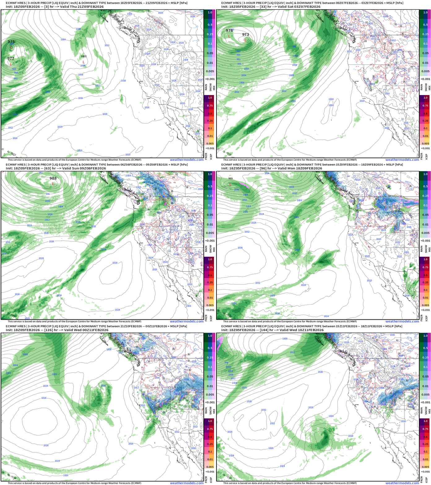
Atmospheric river landfalls the Pacific Northwest through Monday out of the Southwest. Then, the pattern shifts to a trough and the moisture will come out of the Northwest = much colder air mass = huge snowfall on the way.
East Coast USA Zoom | Next 6-days
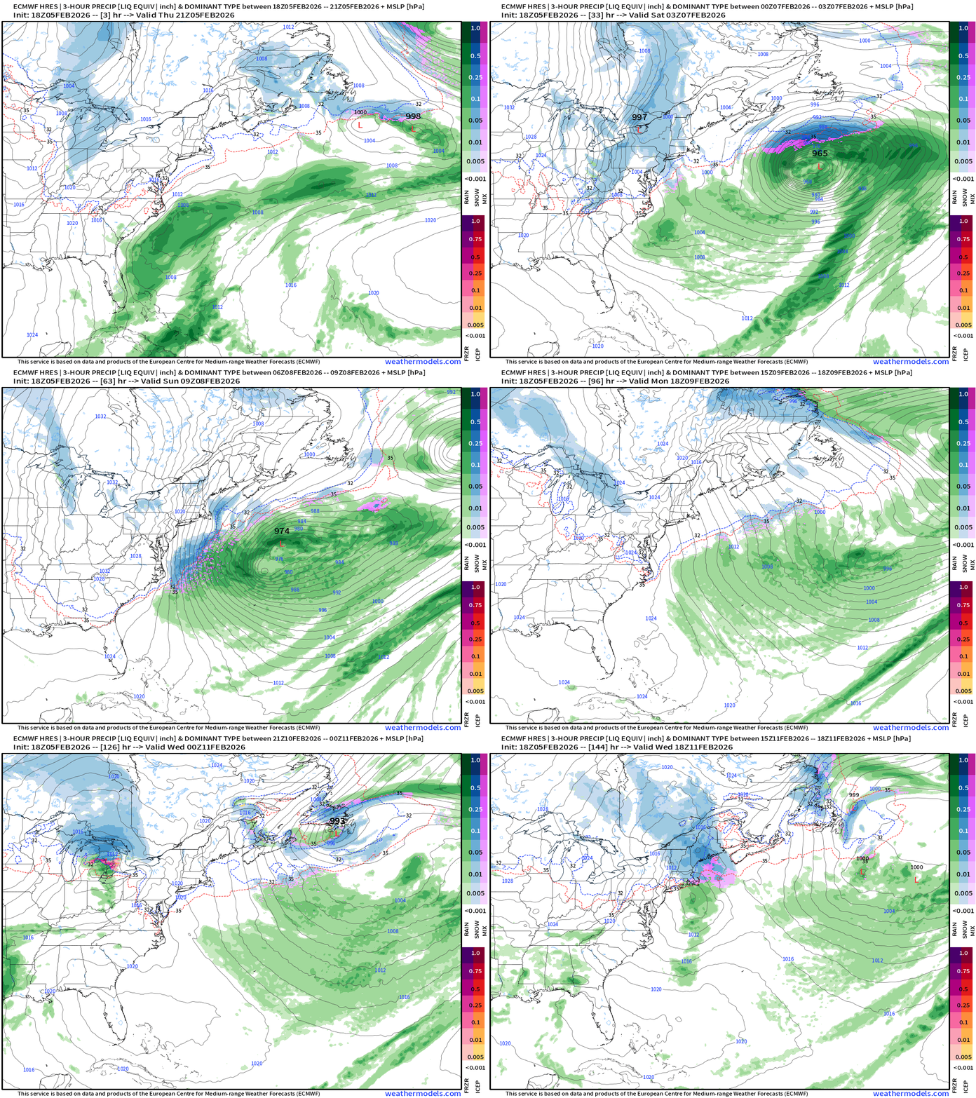
More cold Canadian Arctic air for the Northeast as storm systems form/track well offshore. The Clippers may drop a fresh blanket of snow prior to exiting into the North Atlantic.
Tomorrow morning’s weather —> This evening’s Frontal Boundaries
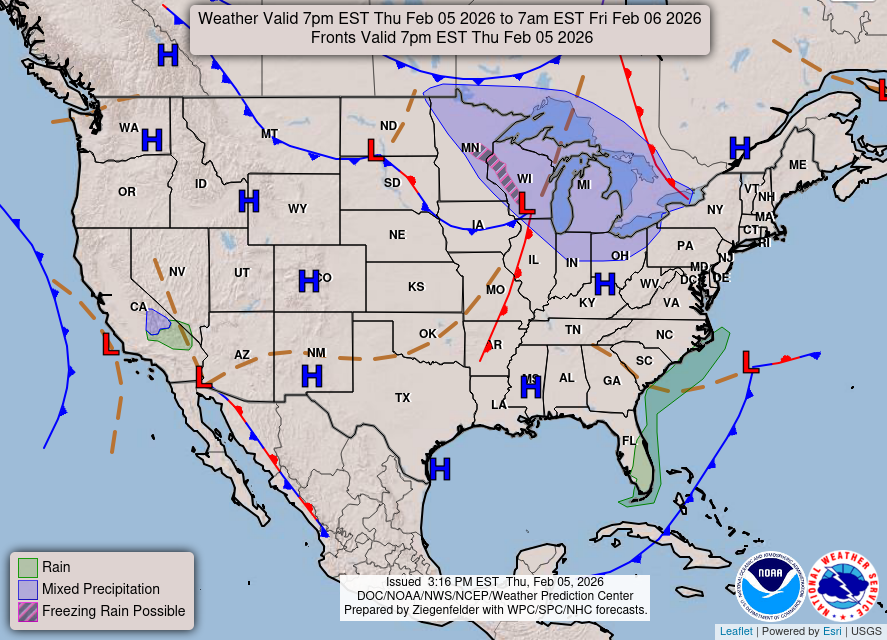
HRRR Simulated Radar Next 48-hours
NWS NDFD Snowfall next 3-days
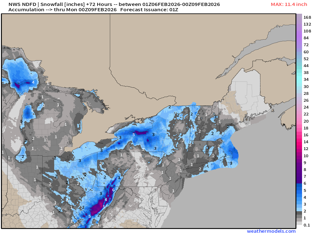
Fresh blanket of light snowfall for even colder conditions during overnight Sat/Sun into Monday — with temperatures cratering under clear skies.
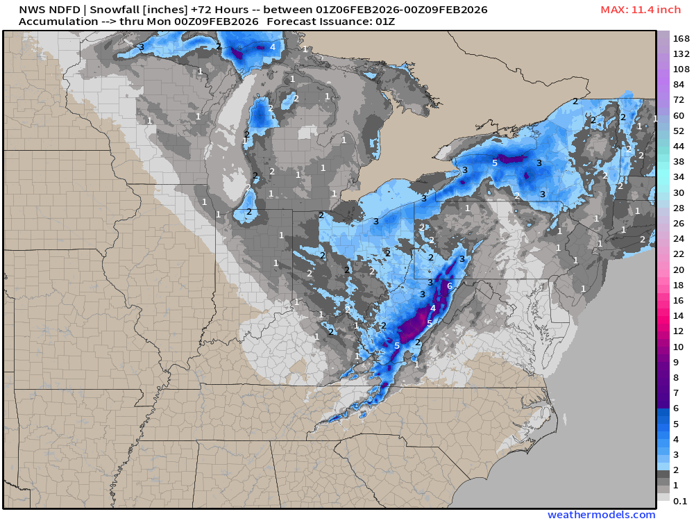
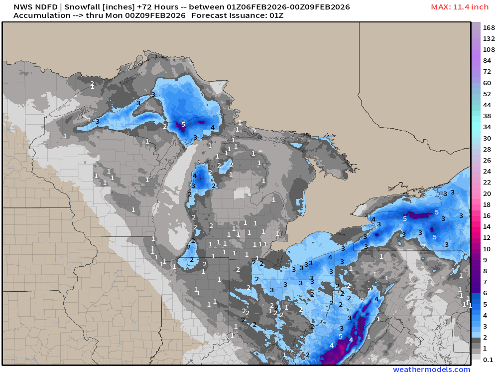
NWS NDFD Precipitation (QPF) next 3-days
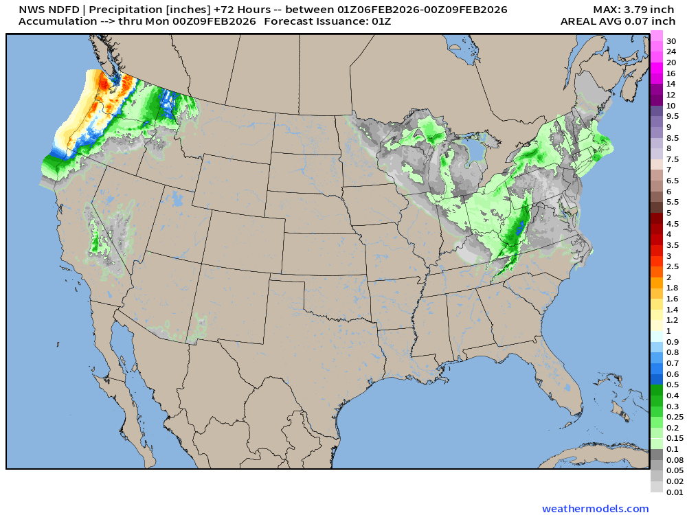
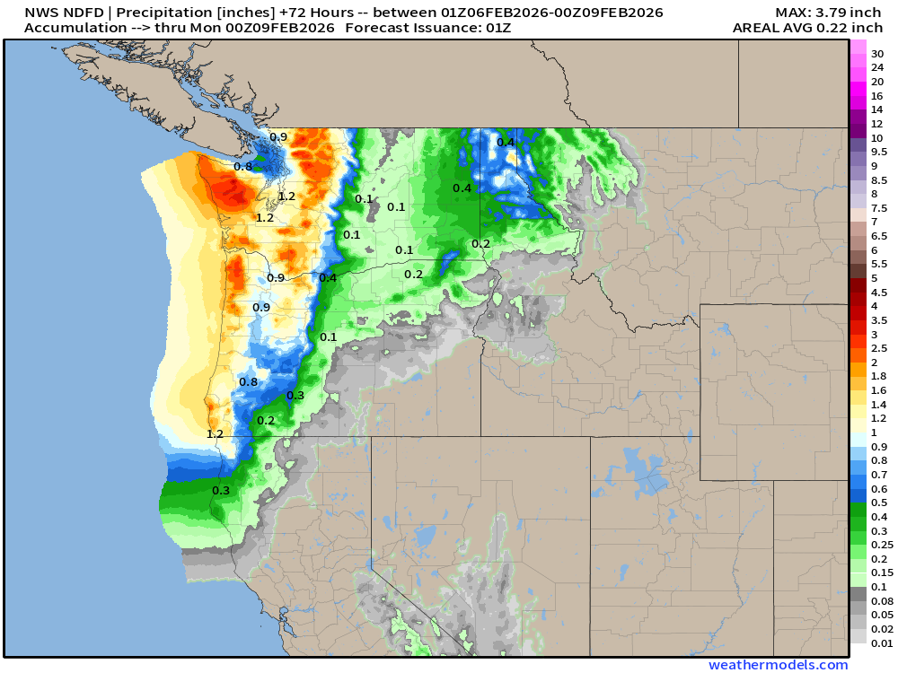
RTMA | Temperature Analysis | 8:00 PM ET
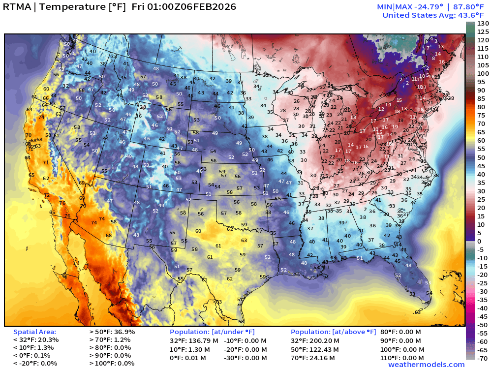
Avg Lower 48 temperature was 43.6°F — 137 million below freezing.
Temperature Anomaly | 8:00 PM ET
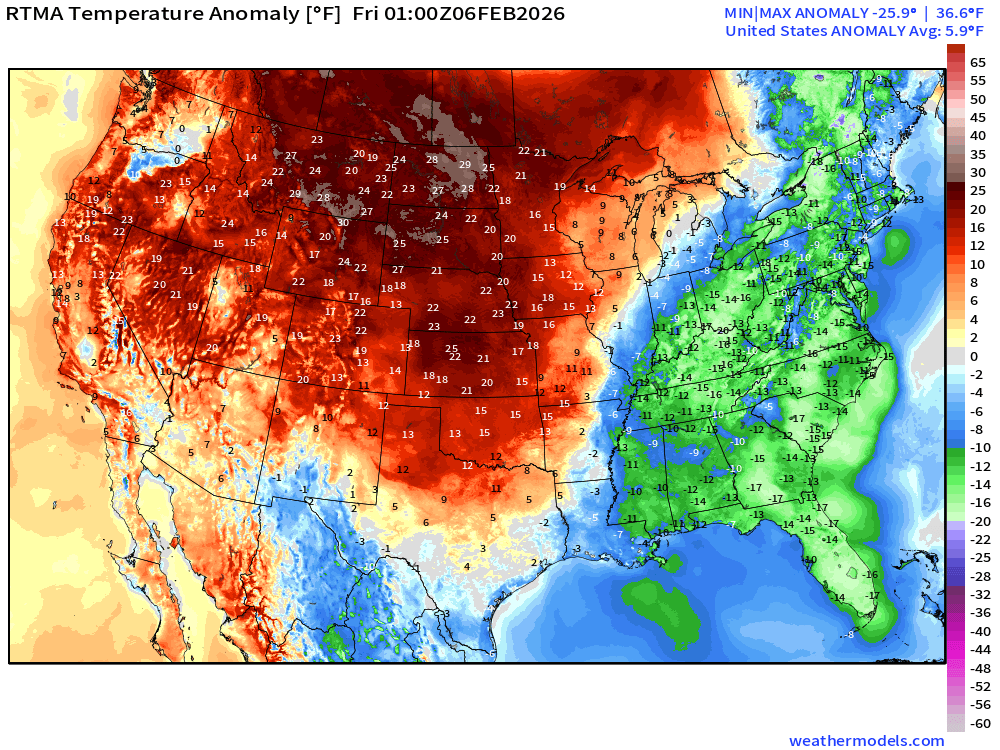
Lower 48 Temperature Anomaly above normal by 5.9°F
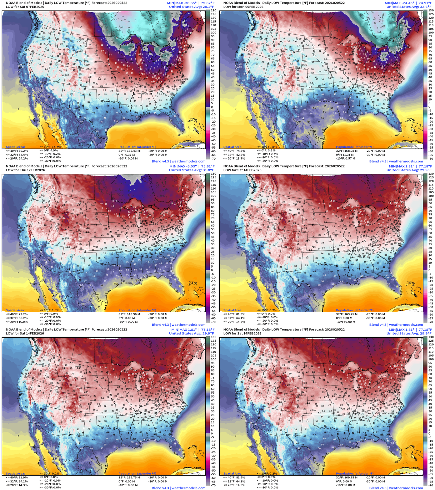
Low Temperatures next 8-days
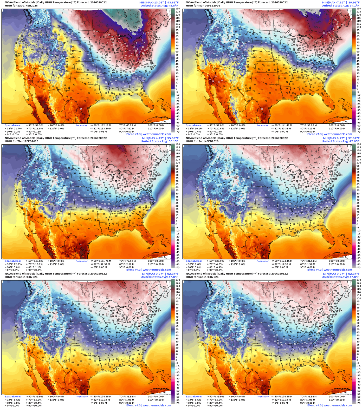
High Temperatures next 8-days
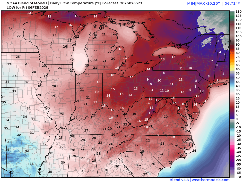
Low Temperatures Friday
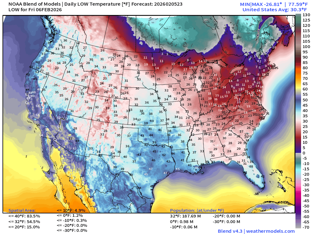
188 million below freezing — average of 30.3°F
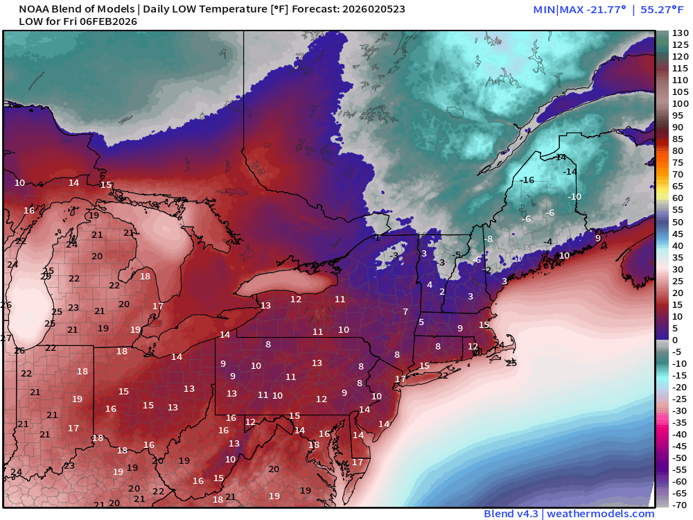
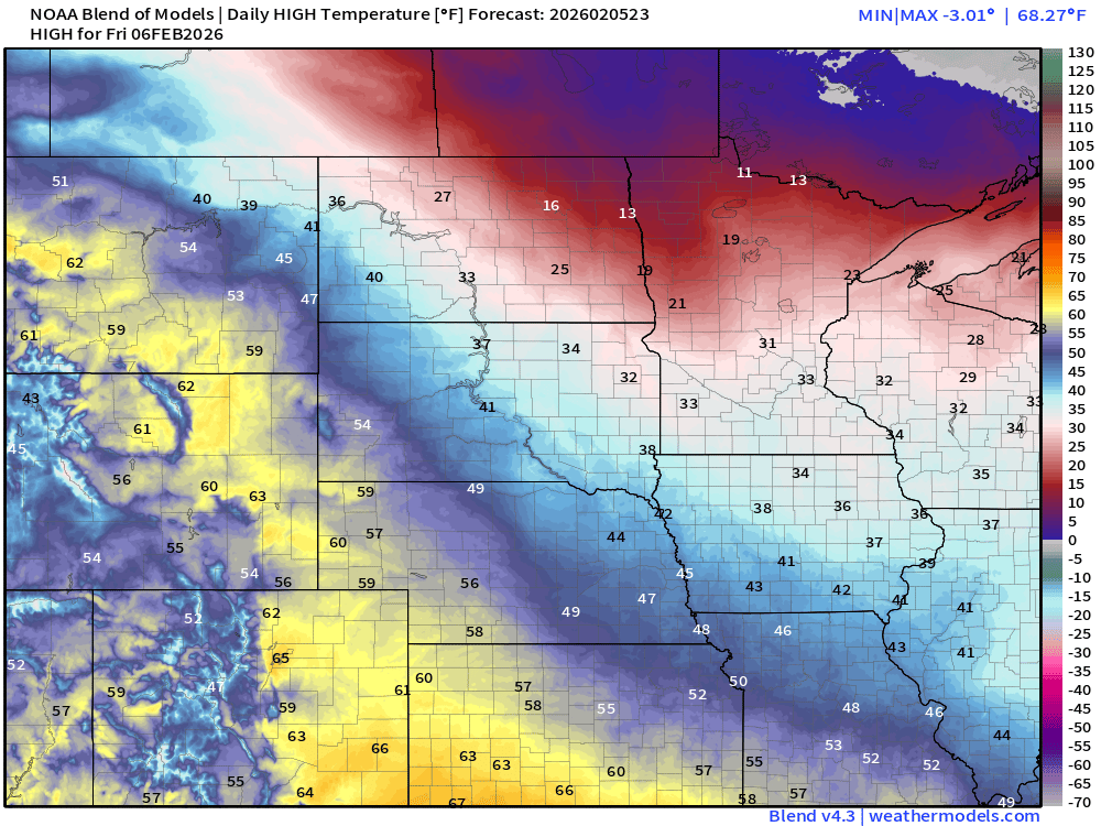
High Temperatures Friday
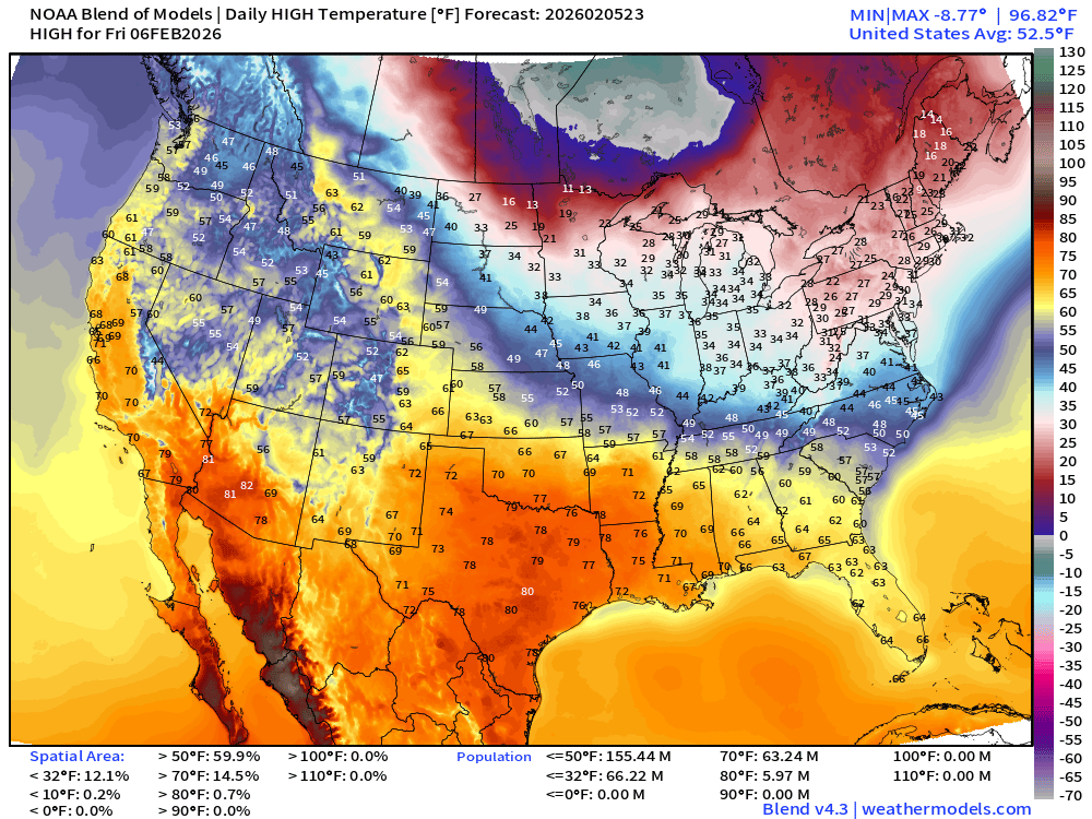
Still 66 million stay below freezing during day mainly across Northeast. 70s and nearly 80°F in Texas.
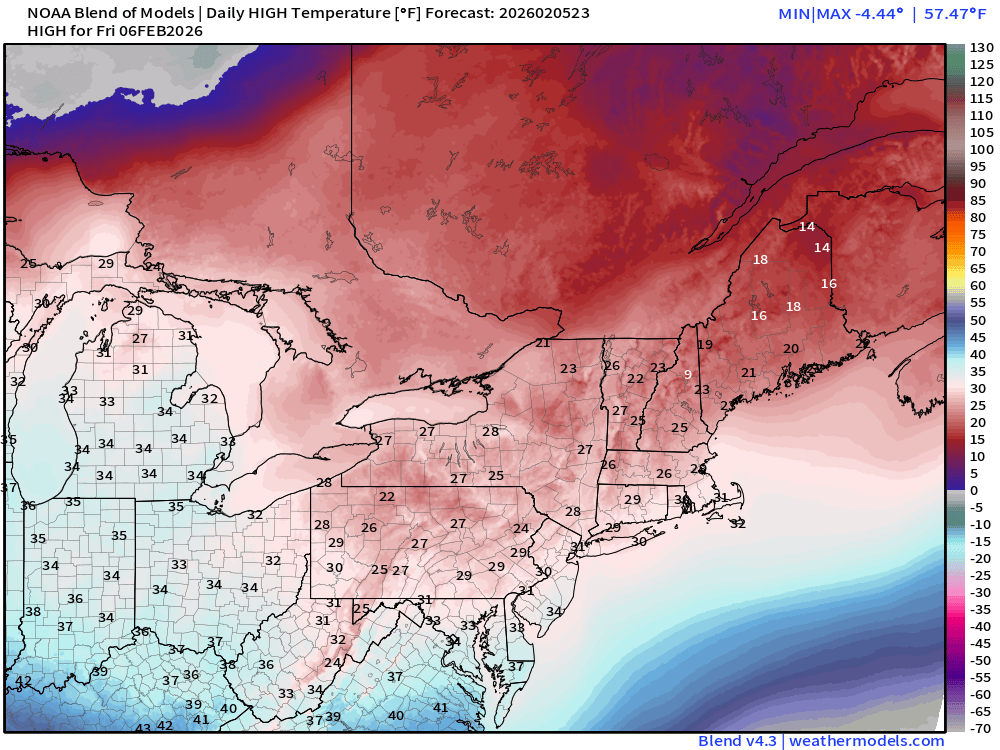
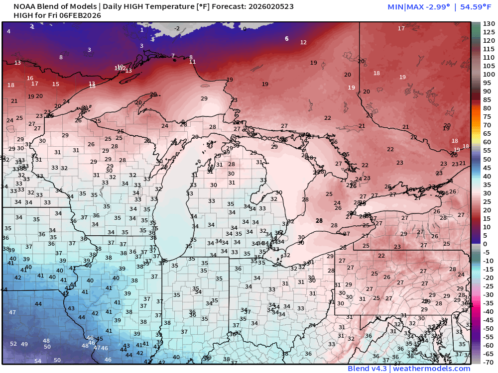
Saturday Low Temperatures
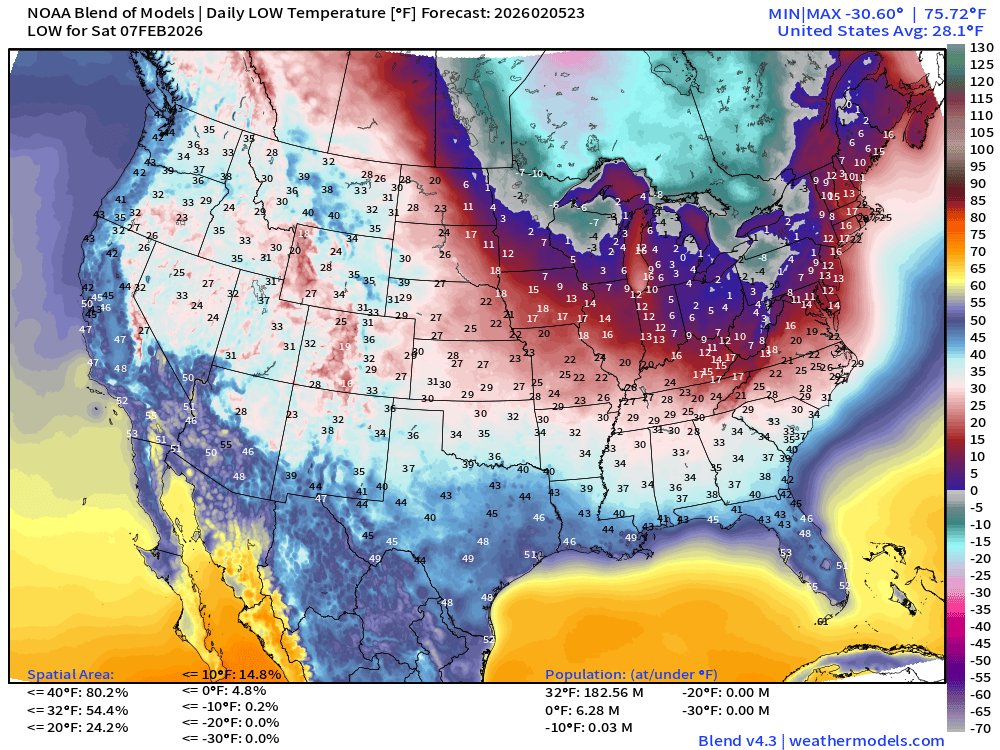
Bottom drops out in Great Lakes especially in Ontario and Quebec.
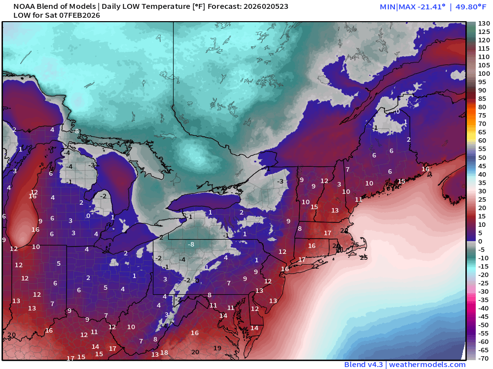
High Temperatures on Saturday
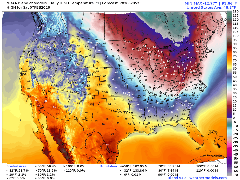
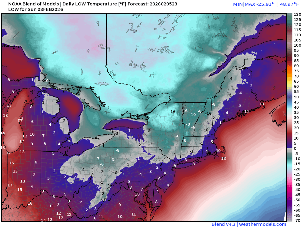
Sunday Low Temperatures
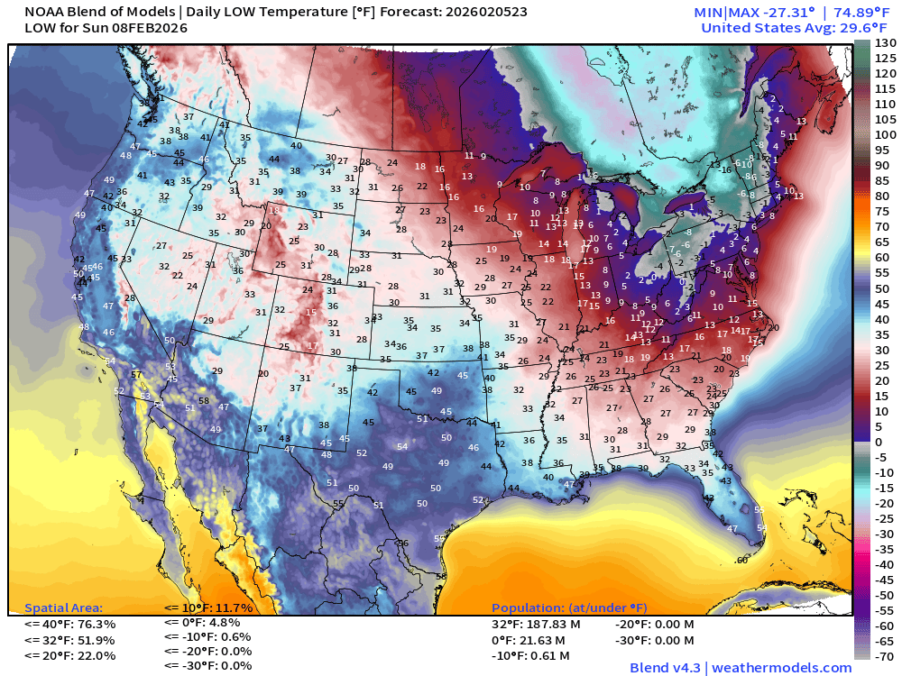
Even colder across the region with subzero actual temperatures capturing several states. Single digits along I-95 corridor from Washington D.C. to Philly, NYC and Boston.
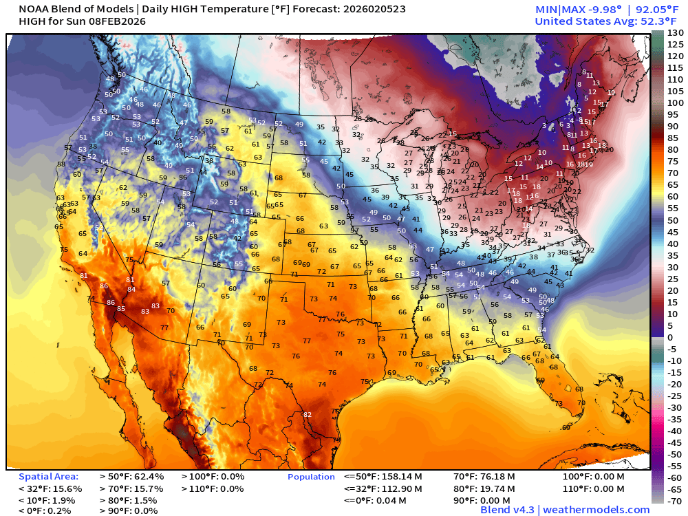
High Temperatures on Sunday
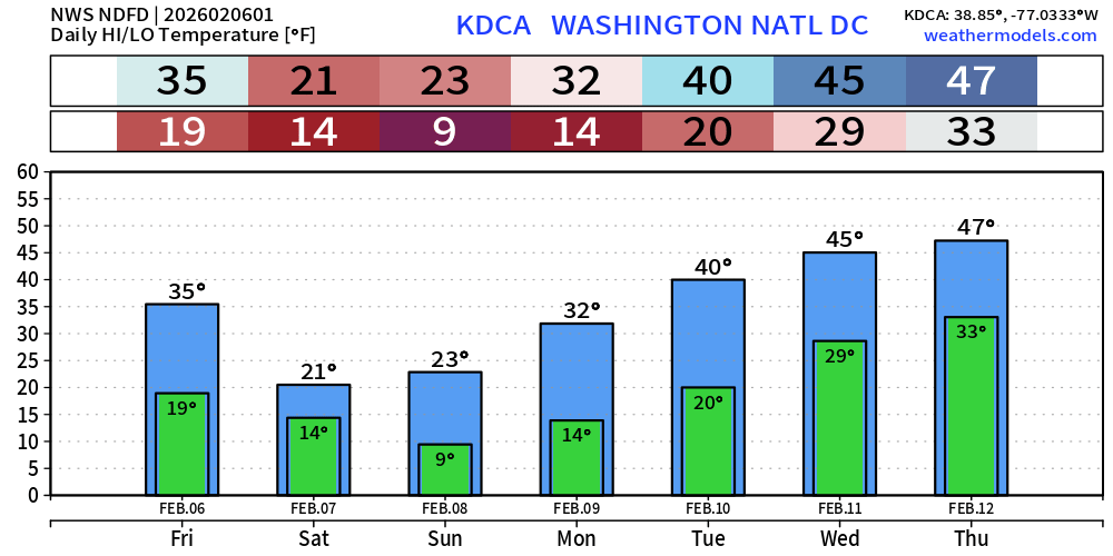
Low Temperatures on Monday
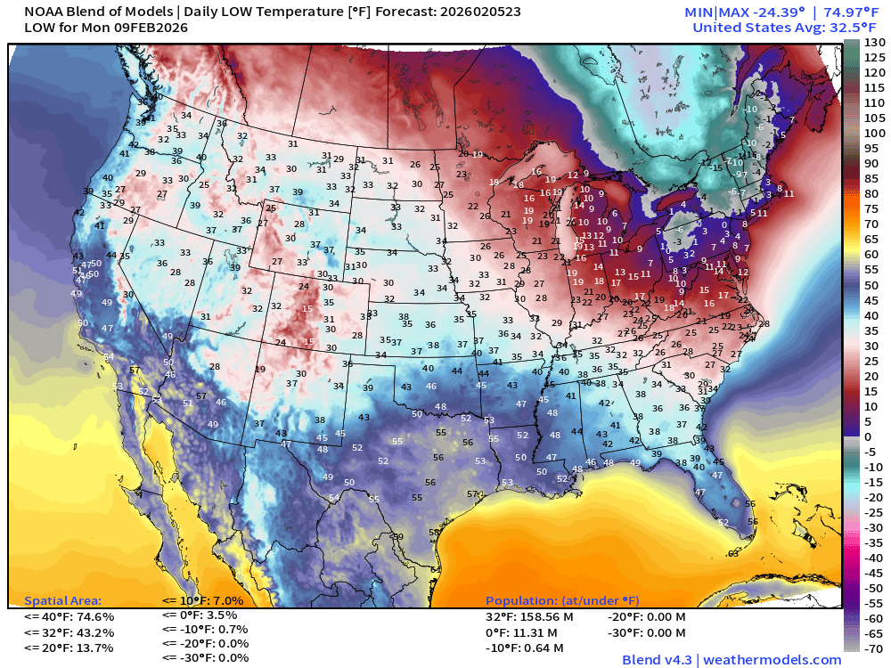
And, the cold continues into Monday morning!
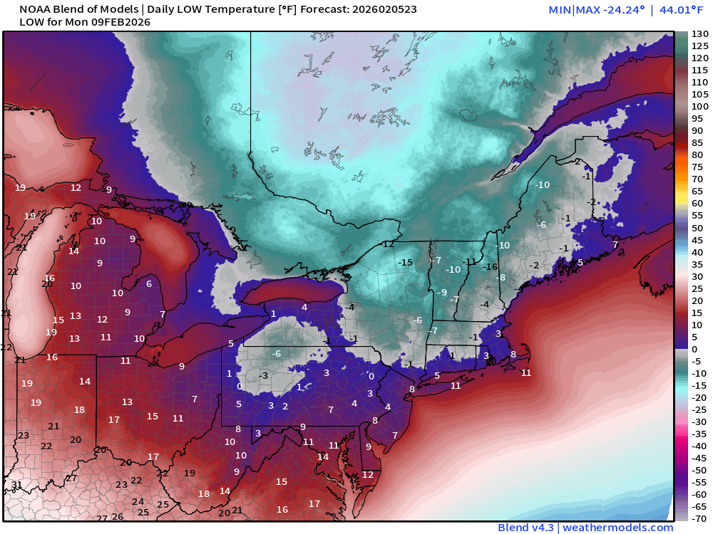
Boston next 7-days (NWS) —> relief/thaw arrives by next Wed/Thurs
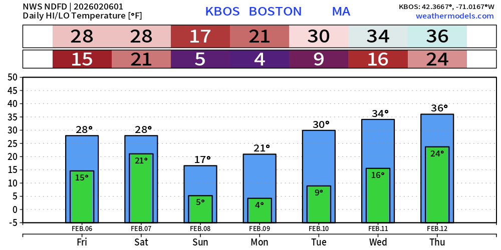
NYC next 7-days (NWS)
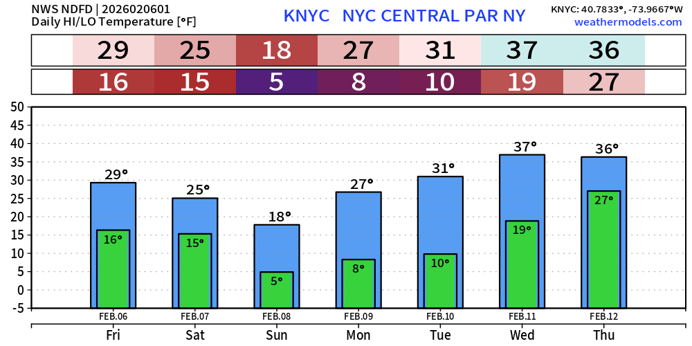
Washington D.C. next 7-days (NWS)
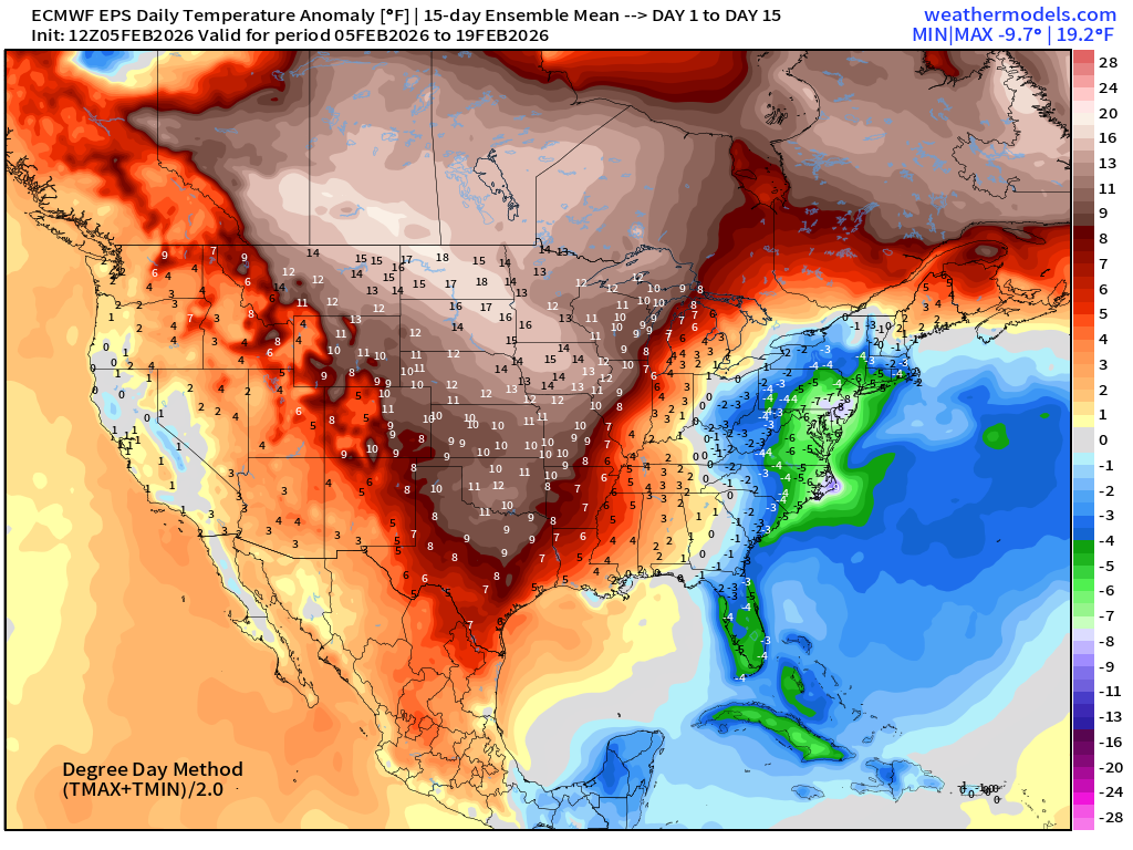
Flagship ECMWF 12z EPS | Temperature Anomaly | Next 15-days
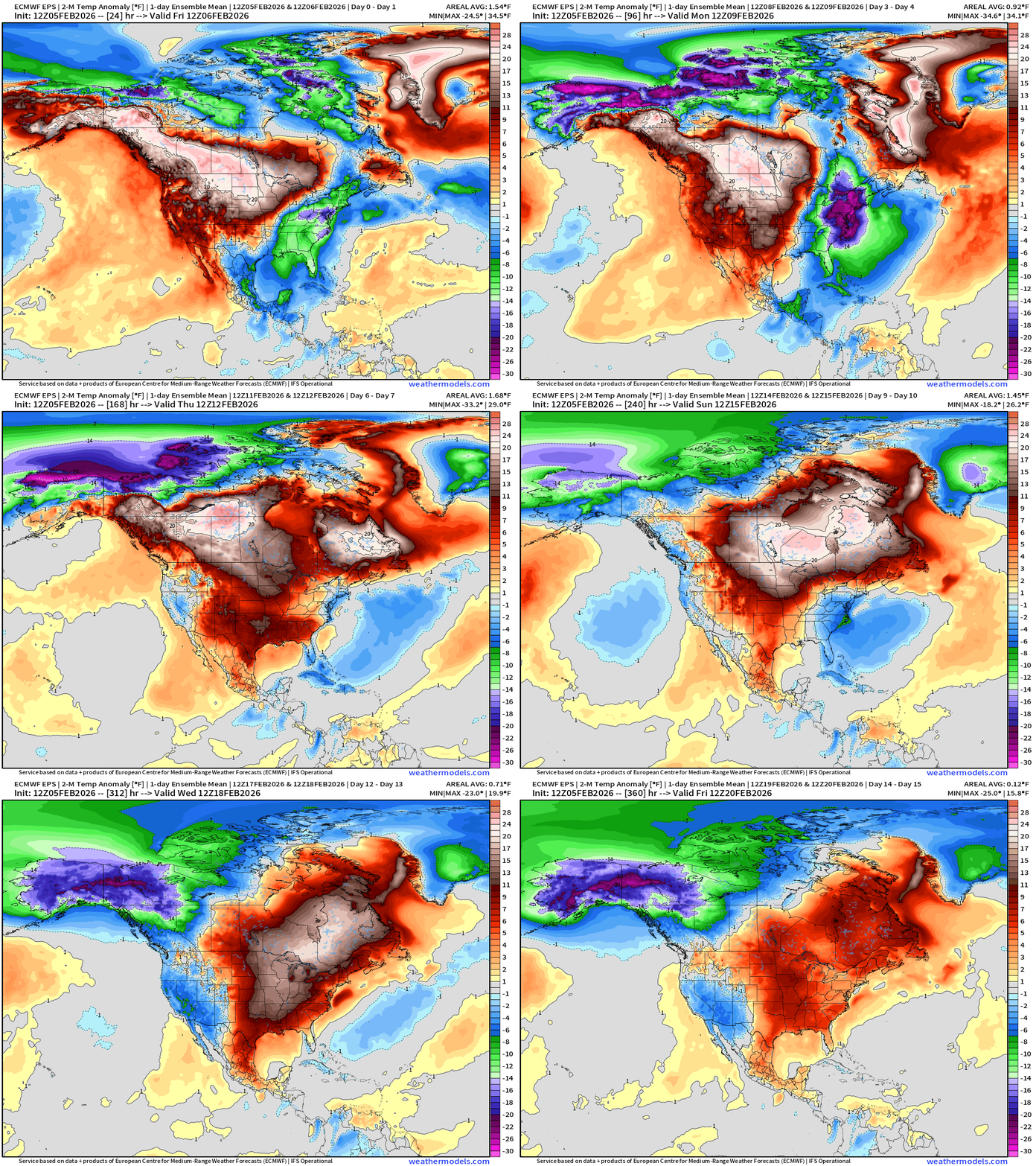
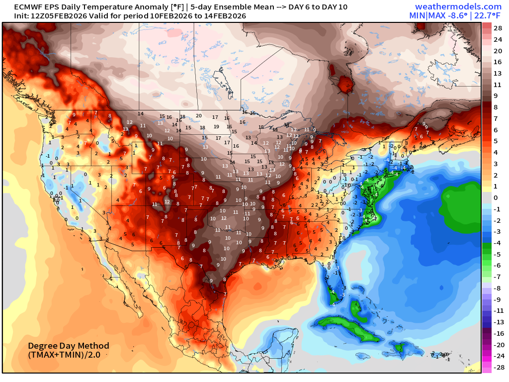
Very significant warming trend for the central U.S. into Days 6-10, but it now appears we have a return of a trough into following weekend before trying again to warm up the East Coast entirely.
ECMWF AIFS-Single 18z | Temperature (500 hPa) Next 12-days
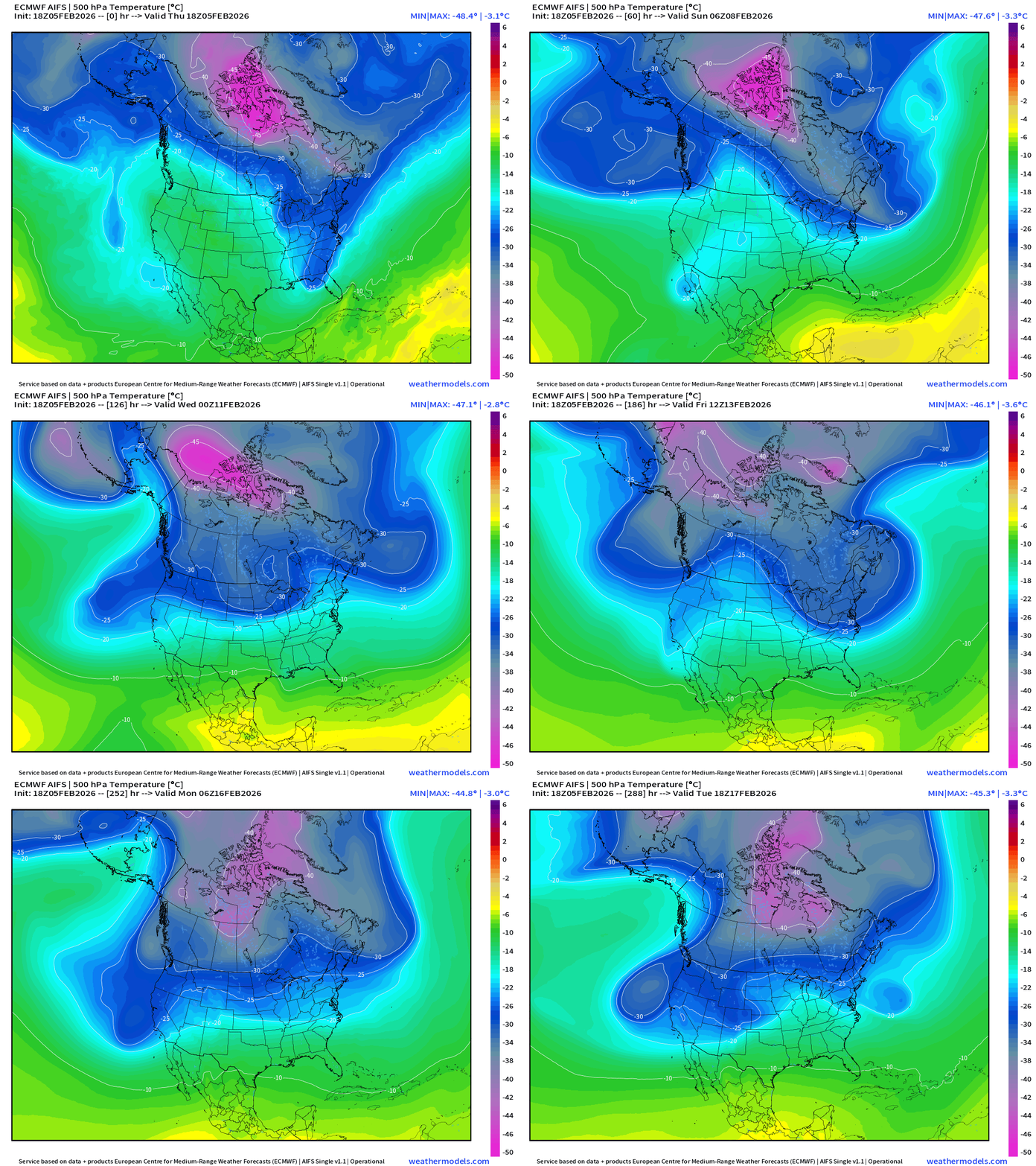
The temperature at 500 mb is the easiest way to highlight the “polar vortex” across North America with the coldest pool at -40°C (pink) with the -25°C contour usually associated with below freezing temperatures at 2-meters (surface).
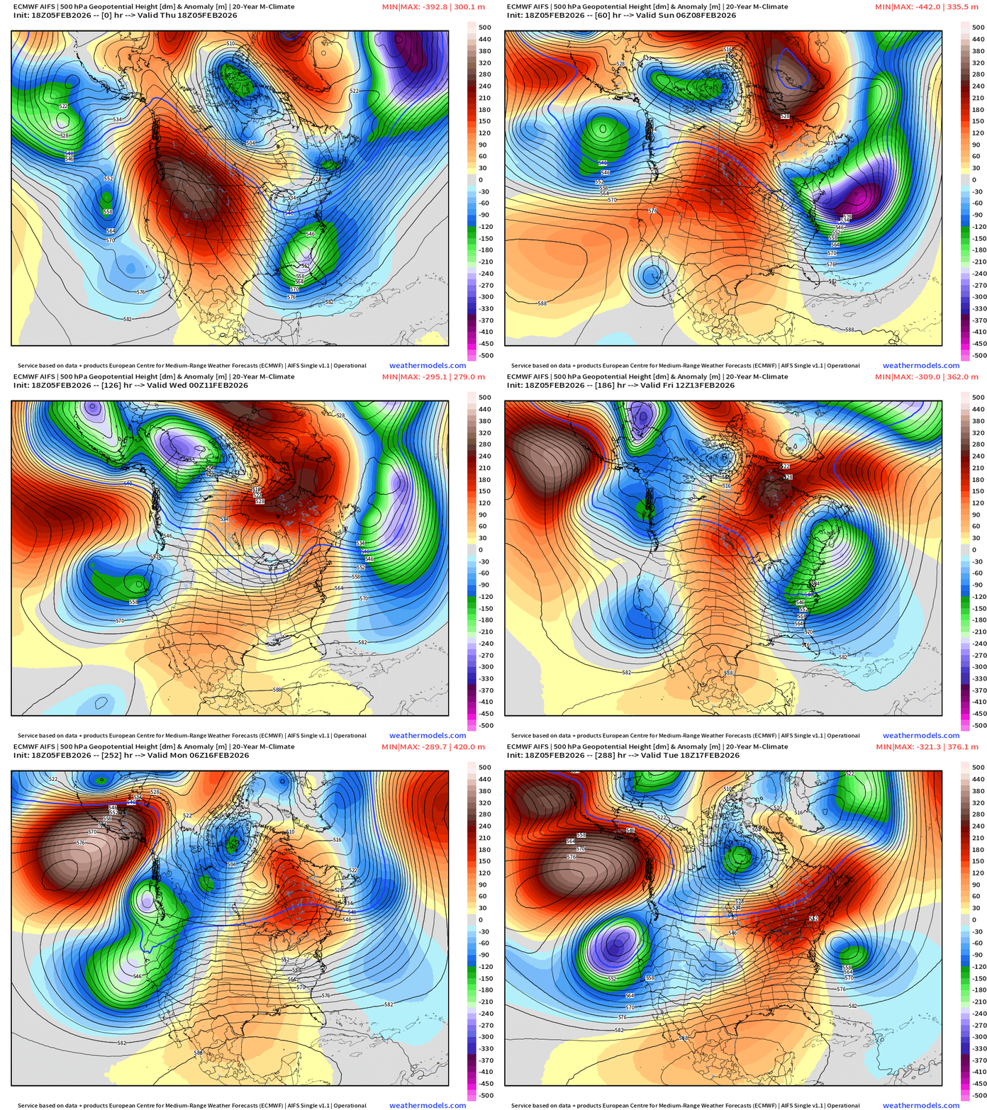
You can see from AIFS the trough formation at Days 7-9 again in the Northeast — that is not a warm single for Valentine’s Day!
Quick Look at European Temperature Anomaly over next 15-days
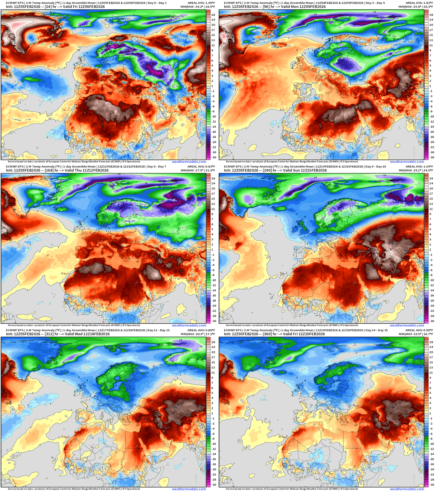
Northern Europe remains very cold — but the warmth from the Atlantic moisture feed will keep the entire Mediterranean much warmer than normal.
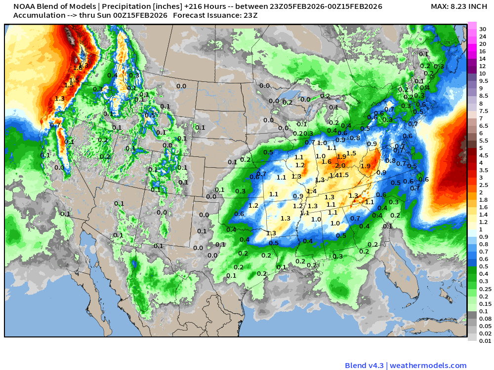
Blend of Models | 7 Days Precipitation Total
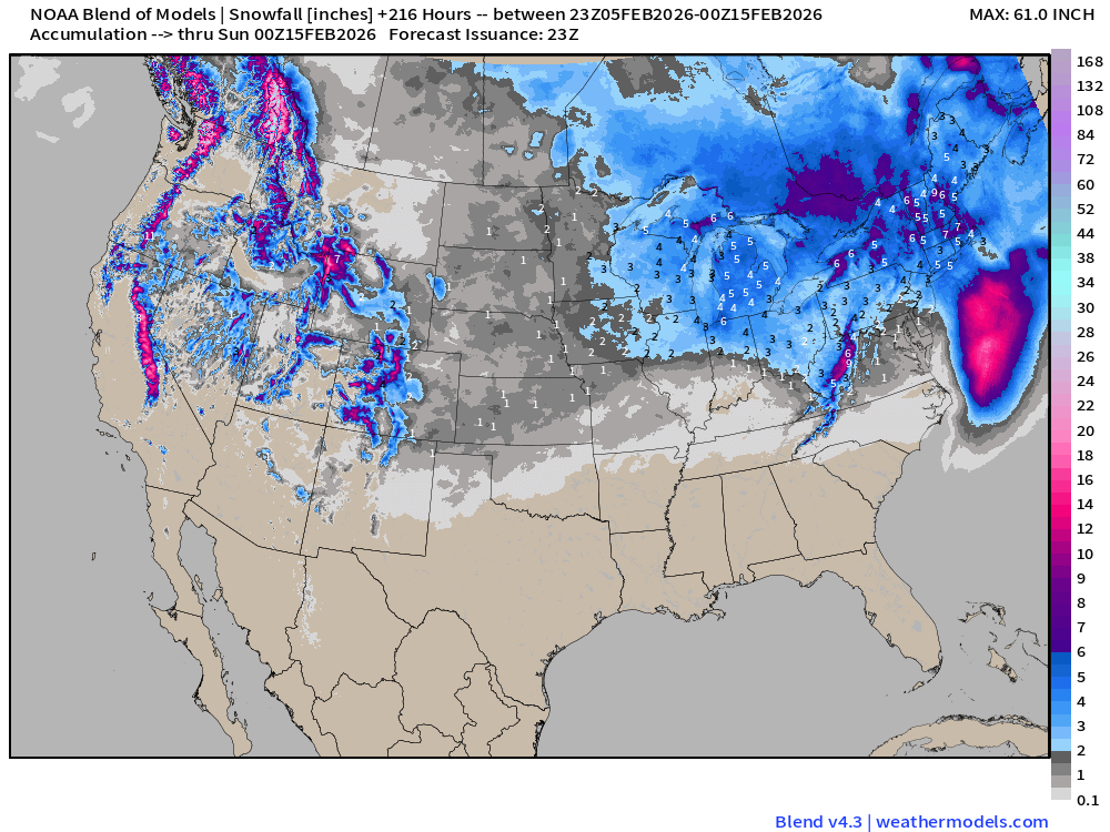
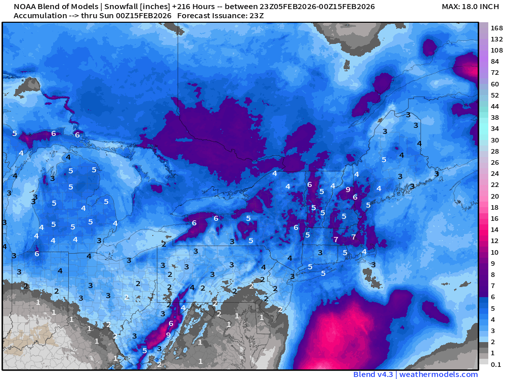
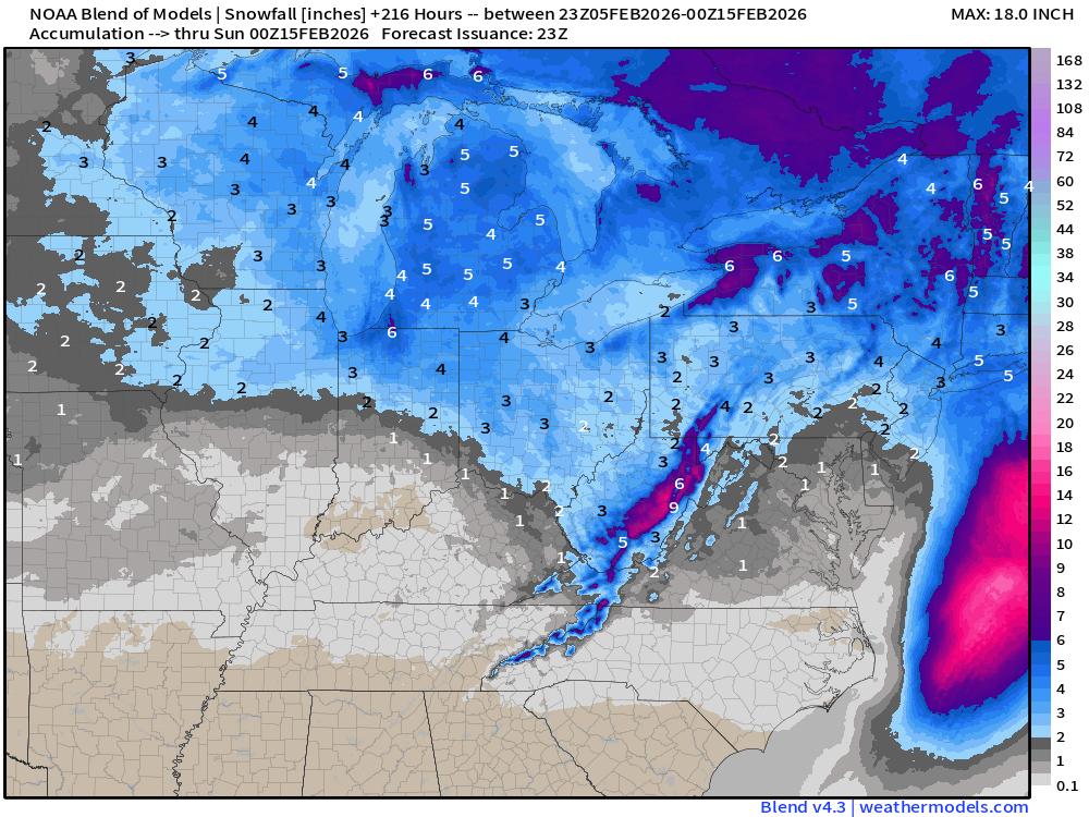
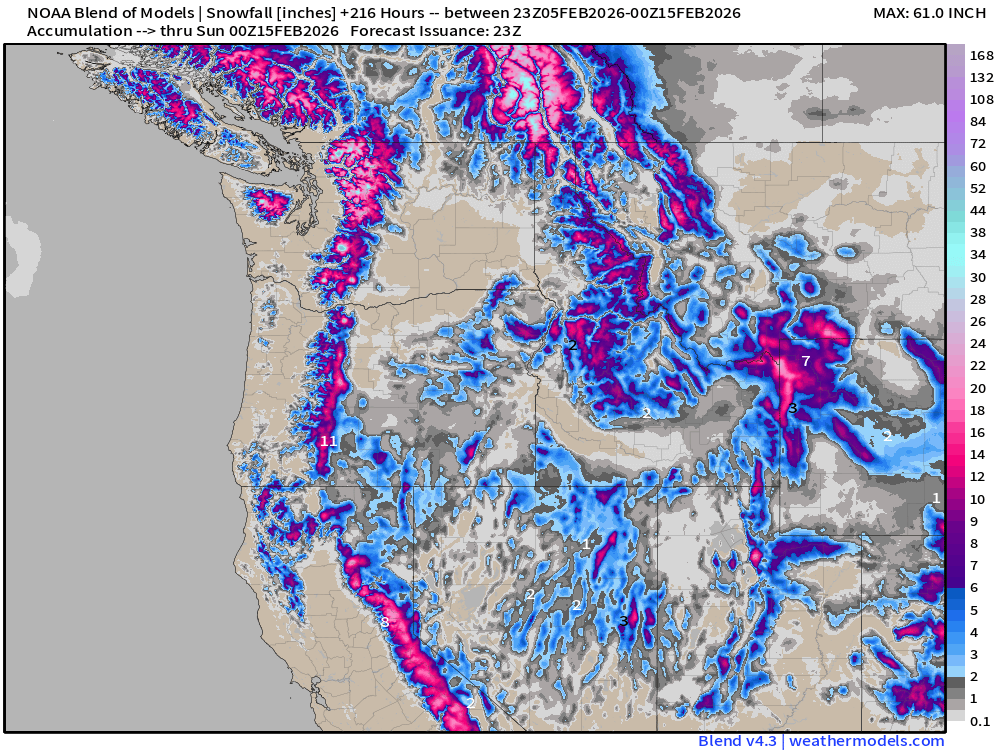
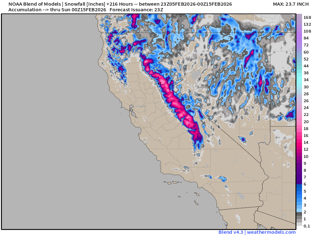
Blend of Models | Total Snowfall Next 9-Days
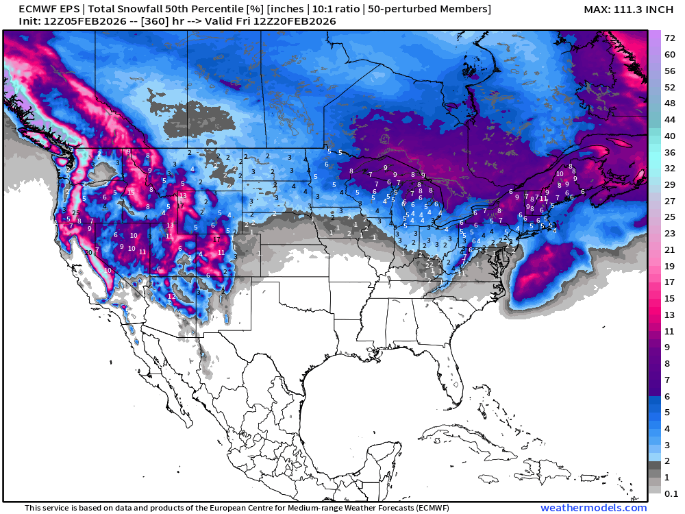
Long Range Snowfall | EPS 12z — Next 15-days Ensemble Median
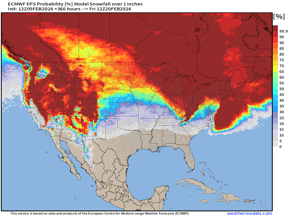
Probability of at least 1” snowfall next 15-days
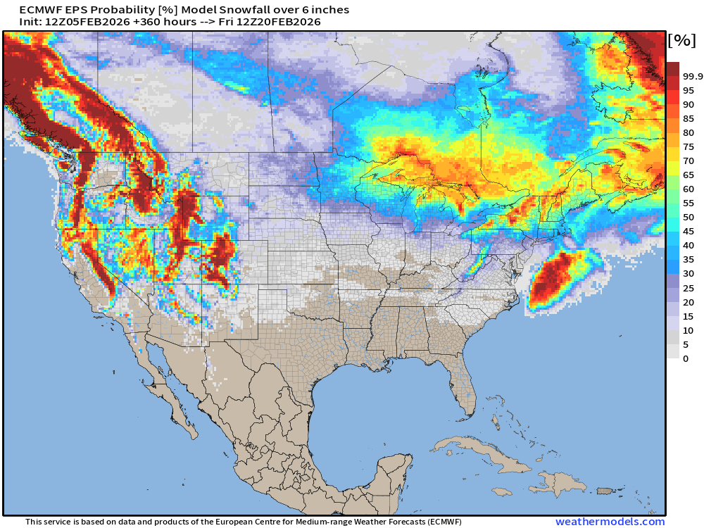
Probability of at least 6” snowfall next 15-days
Temperature Anomaly | Next 15-days | ECMWF EPS 12z
5-Day Chunk #1 | Temperature Anomaly | Feb 5 - Feb 9
5-Day Chunk #2 | Temperature Anomaly | Feb 10 - Feb 14
5-Day Chunk #3 | Temperature Anomaly | Feb 15 - Feb 19
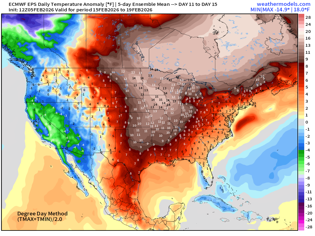
Much warmer across the Central and Eastern U.S. as California and the West Coast goes negative anomaly — and strongly so.
Maps sourced from weathermodels.com designed and innovated by yours truly! Please subscribe there for real-time access to the newest maps, charts from all of the weather models including ECMWF and AIFS, NOAA AI-GFS/AI-GEFS
- Milepost
- 860 · laid 2026-02-06T02:51:27.838000Z
- Source
- https://weather.substack.com/p/february-5-2026-thursday-winter-weather
- Digest
- a5684f5ac721d37e70a6e8365f911e9d9a830e423e84a46afc055702e8d3c626
- Machine
- JSON