February 4, 2026 Wednesday Winter Weather
Pattern change will bring Winter back to the Western U.S. with plenty of snow next week
February 2026 was the 4th-warmest February in the 132-year national record (1895–2026), at 40.3°F against a 1991–2020 normal of 35.6°F (+4.6°F).
February 2026 was the 5th-driest February in the 132-year national record (1895–2026), at 1.4in against a 1991–2020 normal of 2.1in (-0.7in).
NOAA/NCEI Climate at a Glance, contiguous United States. This is the observed record for the month, not a score of anything said in this piece — the forecast ledger begins 2026-08-17 and cannot reach earlier posts.

Since it’s rather quiet, I thought I’d post some weather model “fantasy land” imagery to show that winter is not over by a long shot just because we’ll have a huge warm up across much of the Lower 48 including the Mid-Atlantic and Northeast by middle of next week. That means it’s cold at least for another 5-7 days, and then we’ll get the train on the tracks for a thaw east of the Mississippi.
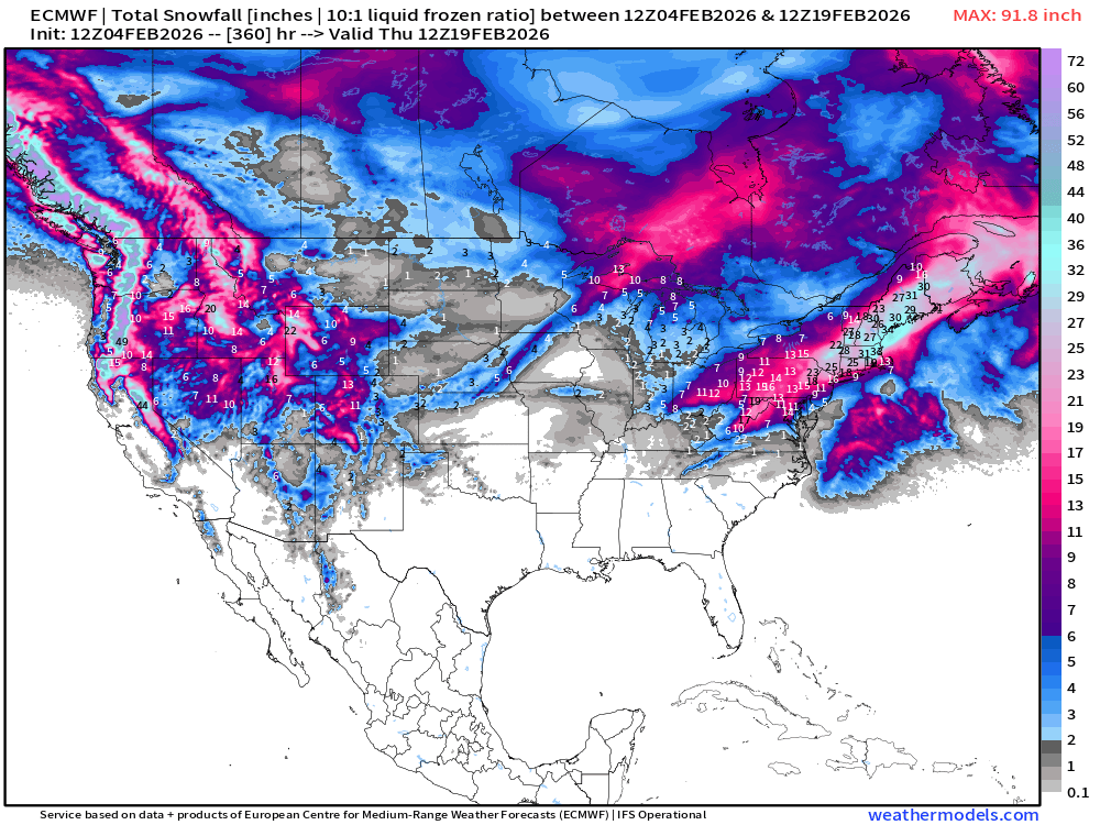
ECMWF HRES 15-days Long Range Snowfall has a LOT of Western U.S. snowfall with atmospheric rivers guided by a strong jet stream into WA/OR and California. This is exciting news for snow starved ski resort — and load up the snowpack into the back half of winter.
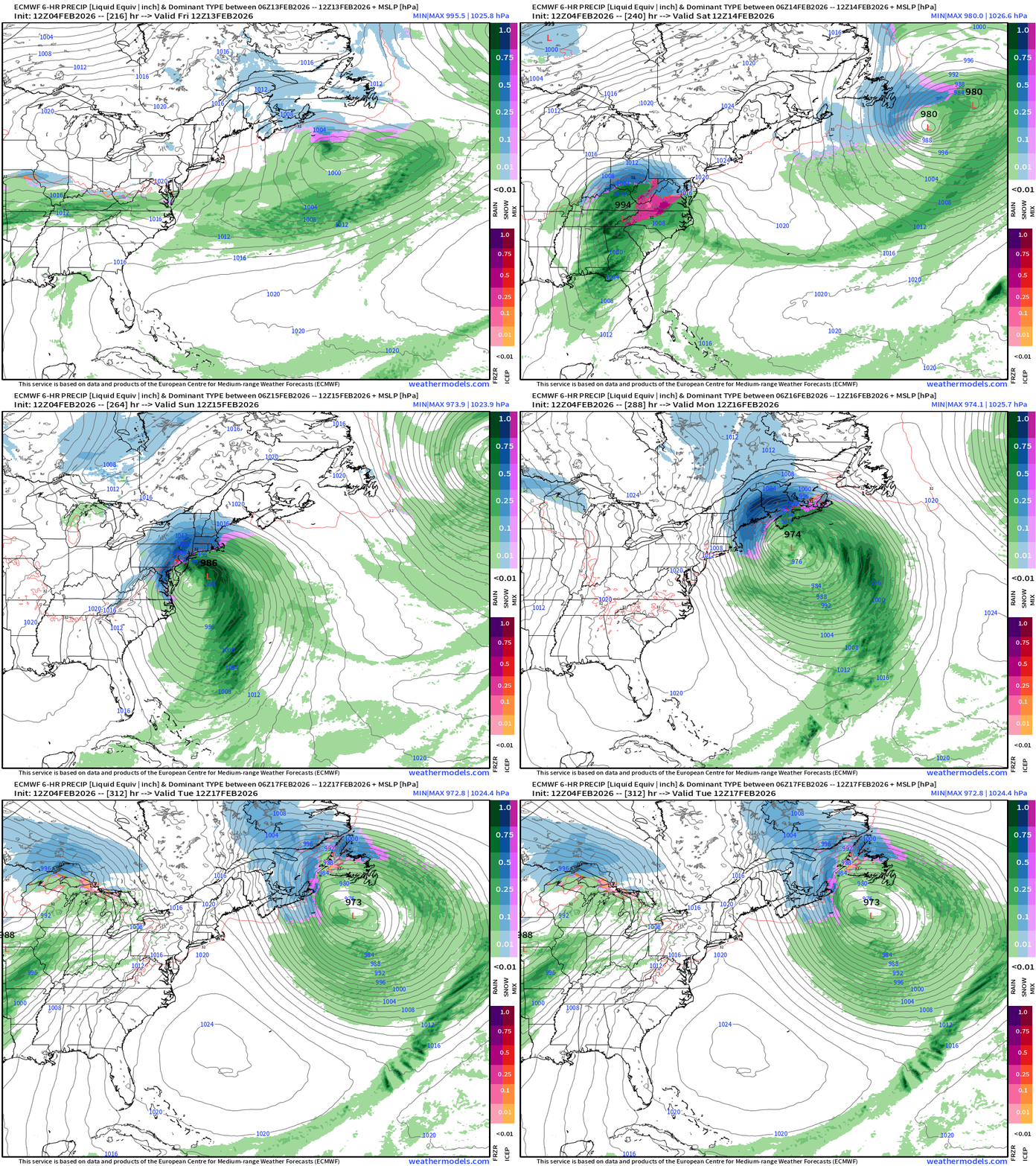
From the 12z cycle, a “Miller-B” type storm system at Day 8 forms and tracks northeast to be a perfect “blizzard” to dump 2-3" feet on the big cities for Valentine’s Day weekend.
Of course, I know — and you know — this is just one scenario out of hundreds/thousands that will be generated over the coming days, but it’s the only show in town, so we’ll marvel at the computer generated extreme weather event. If this was within 7-days rather than 8 or 9, then we could get more excited. Worth keeping an eye on the overall pattern, however, with this southern stream storm track.
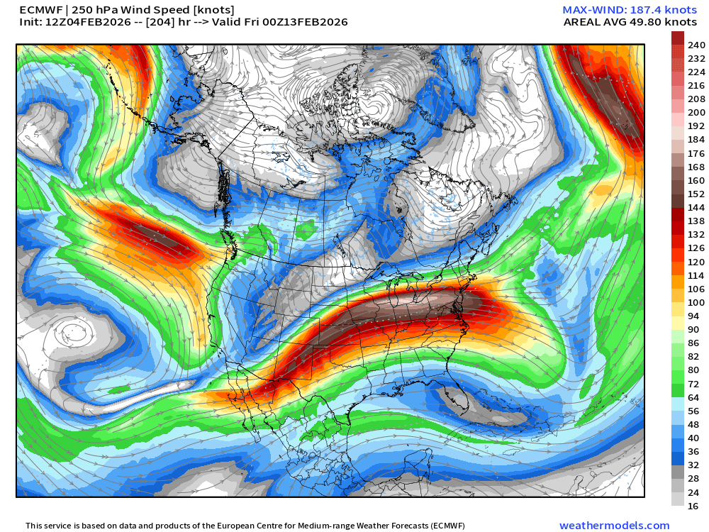
Loaded “jet stream” over the Ohio River Valley end of next week would favor storm formation on the southern periphery, and then generate a Nor’easter
ECMWF 18z Temperature Anomaly | Next 6-days
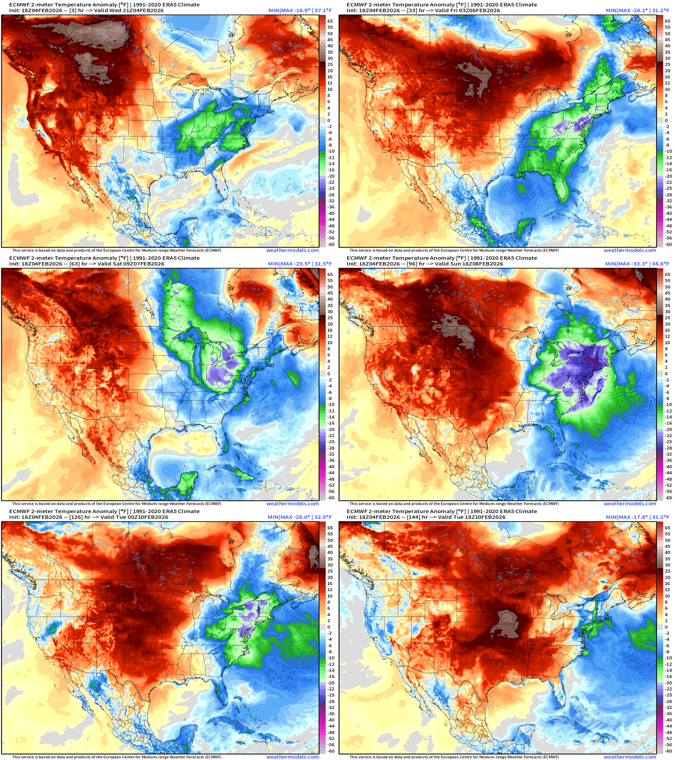
A mini-blast of cold Canadian air dips again through South Florida — not as brutally cold as last weekend, but again, chilly into Friday.
Weekend: purple is -30° to -40°F below normal — and that’s brutal in Ohio and Pennsylvania over snow pack. Temperatures could crater with calm winds and clear skies Sun/Mon mornings. The cold air mass finally erodes into Tuesday.
Meanwhile, a lot of RED across the western U.S. into the Plains can’t break the grip of the Polar Vortex quite yet. We’ll need to wait until next Monday at least to push a warm front across the Great Lakes, and the leading edge of moister/warmer Pacific air. It will be a long time coming and very welcome thaw!
Upper-Level “Tropospheric Polar Vortex” Pattern for Saturday morning
The trough is not as intense as predicted over past few days, but still quite significant. The lack of a strong surface cyclone limited the scale of the trough — now rather elongated.
Moisture Transport Next 10-days | Integrated Vapor Transport
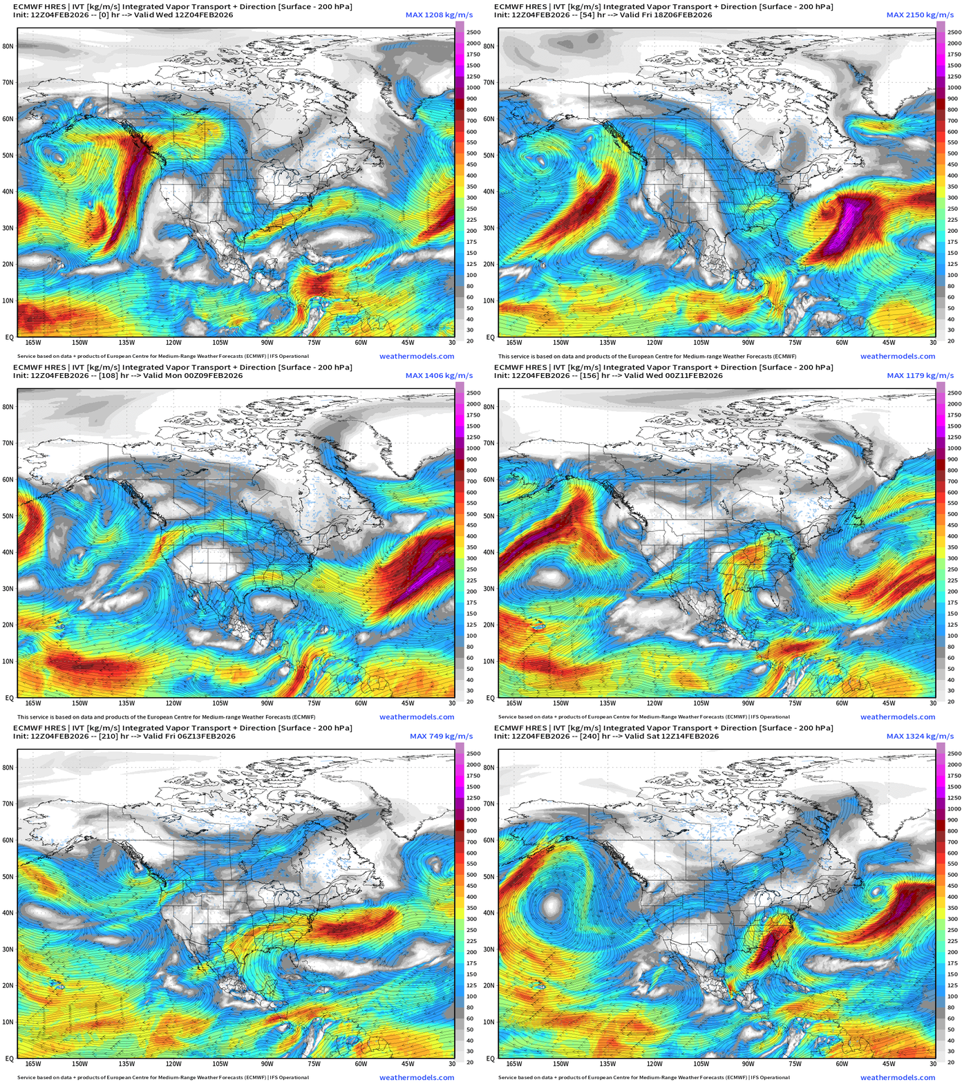
Pacific moisture goes up and over the Western U.S. ridge through Southern Canada and dips into the Lower 48 (Great Lakes —> Mid-Atlantic) as part of Clipper Systems. Then next week some Gulf of Mexico moisture is tapped as the pattern change favors southerly flow and potential Nor’easter formation
Atmospheric Rivers make landfall along the WA/OR and California coast perpendicular, so even if not too intense, this is welcome moisture for the mountains = snow is back!
European 6-day Precipitation Type and Intensity
Quite a busy pattern with multiple little storms crossing into the Med. and continuing onward with plenty of moisture from the Atlantic.
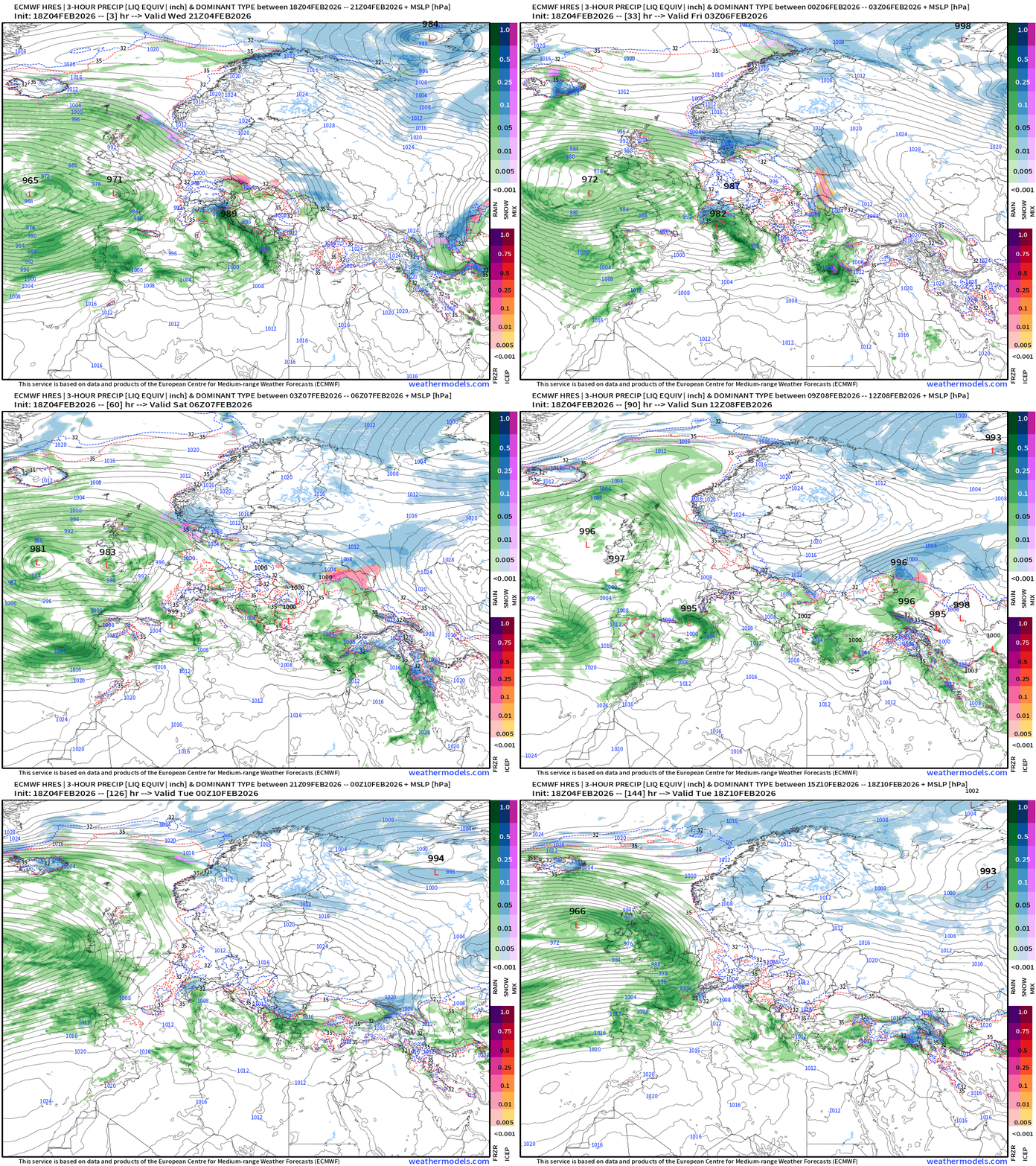
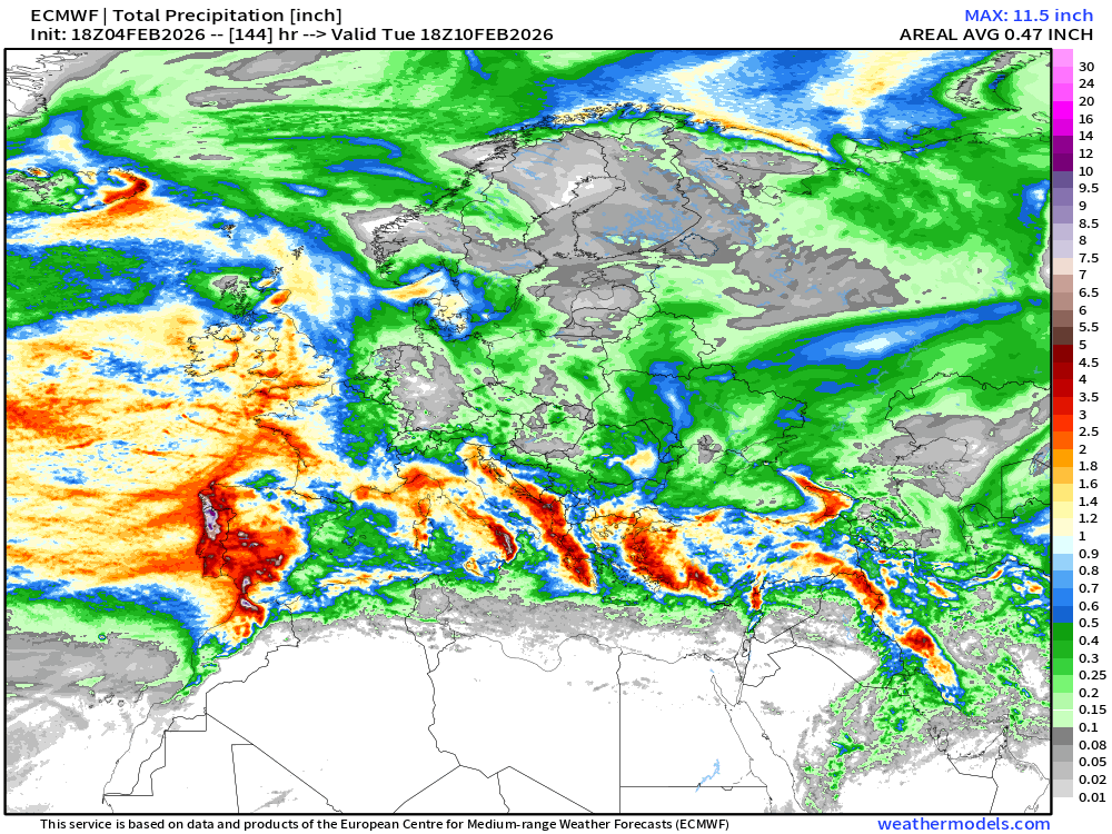
Spain and Portugal will continue to see major rainfall … but also through the Mediterranean for Italy, Greece, and Turkey.
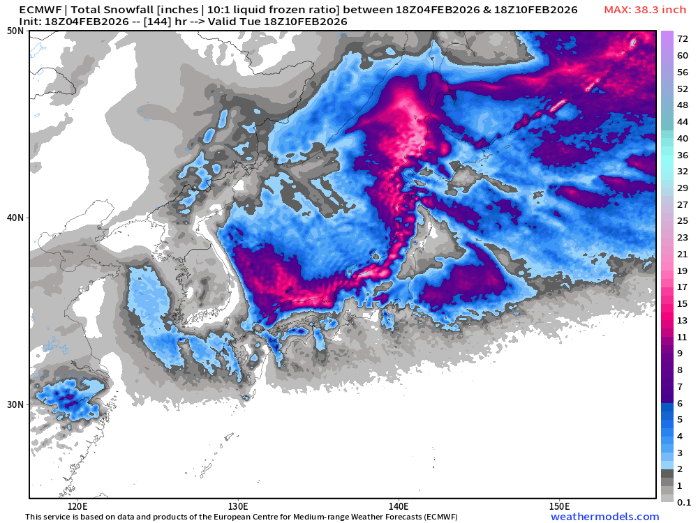
Snow in Japan —> cool animation —> watch it a few times
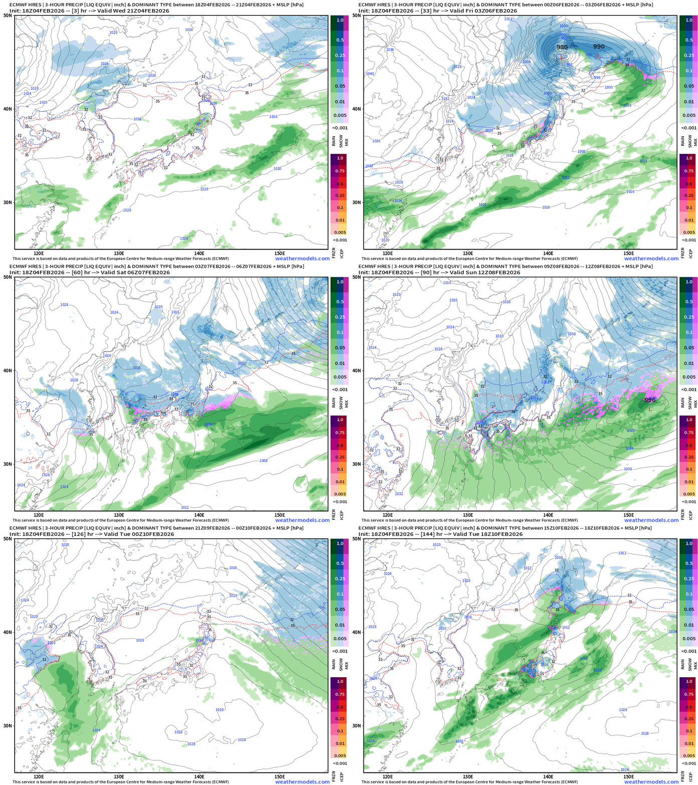
The cold air descends south out of Russia and crosses the Sea of Japan. Normally this would be just snow on the windward side and Tokyo escapes any major winter precipitation. Then, this fast moving frontal wave comes out of China and taps into the cold air just enough to lay down some snow for Tokyo.
ECMWF 18z Precipitation Type + Intensity | Next 6-days
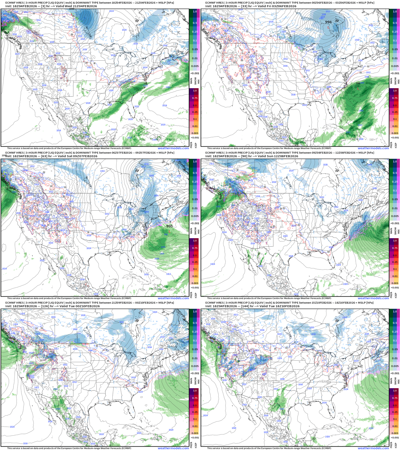
A Clipper (shortwave) tracks through the Great Lakes Fri into Sat and develops well off the New England coast / Gulf of Maine with minimal coastal impacts.
Heavy rain and snow returns to the Pacific Northwest, and moisture heads into the Great Basin.
West Coast USA Zoom | Next 6-days
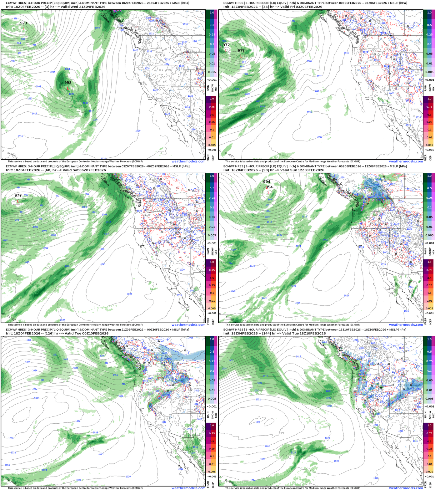
Very nice atmospheric river does make it into the Pacific Northwest through Monday out of the Southwest. Then, the pattern shifts to a trough and the moisture will come out of the Northwest = much colder air mass = huge snowfall on the way.
East Coast USA Zoom | Next 6-days
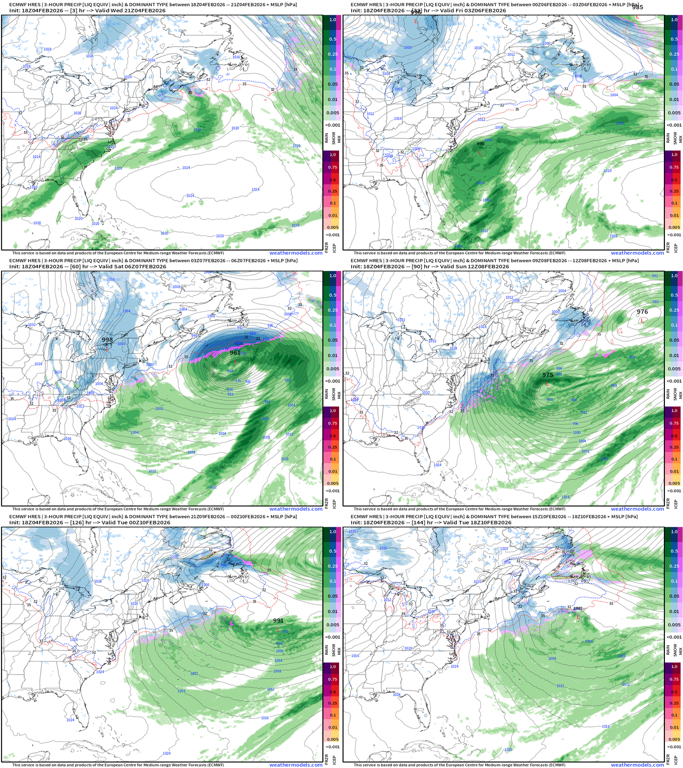
More cold Canadian Arctic air for the Northeast as storm systems form/track well offshore.
Tomorrow morning’s weather —> This evening’s Frontal Boundaries
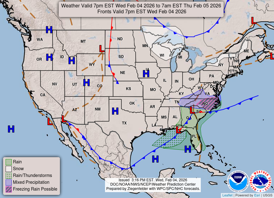
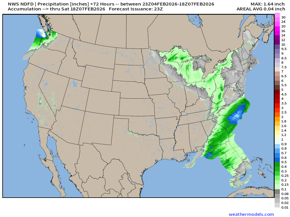
Rain and some mix/snow will move through North Carolinas with minimal accumulations this evening into Wednesday morning. A cold front through the Southeast will have all rain (thankfully) but colder air behind it — yet again!
HRRR Simulated Radar Next 48-hours
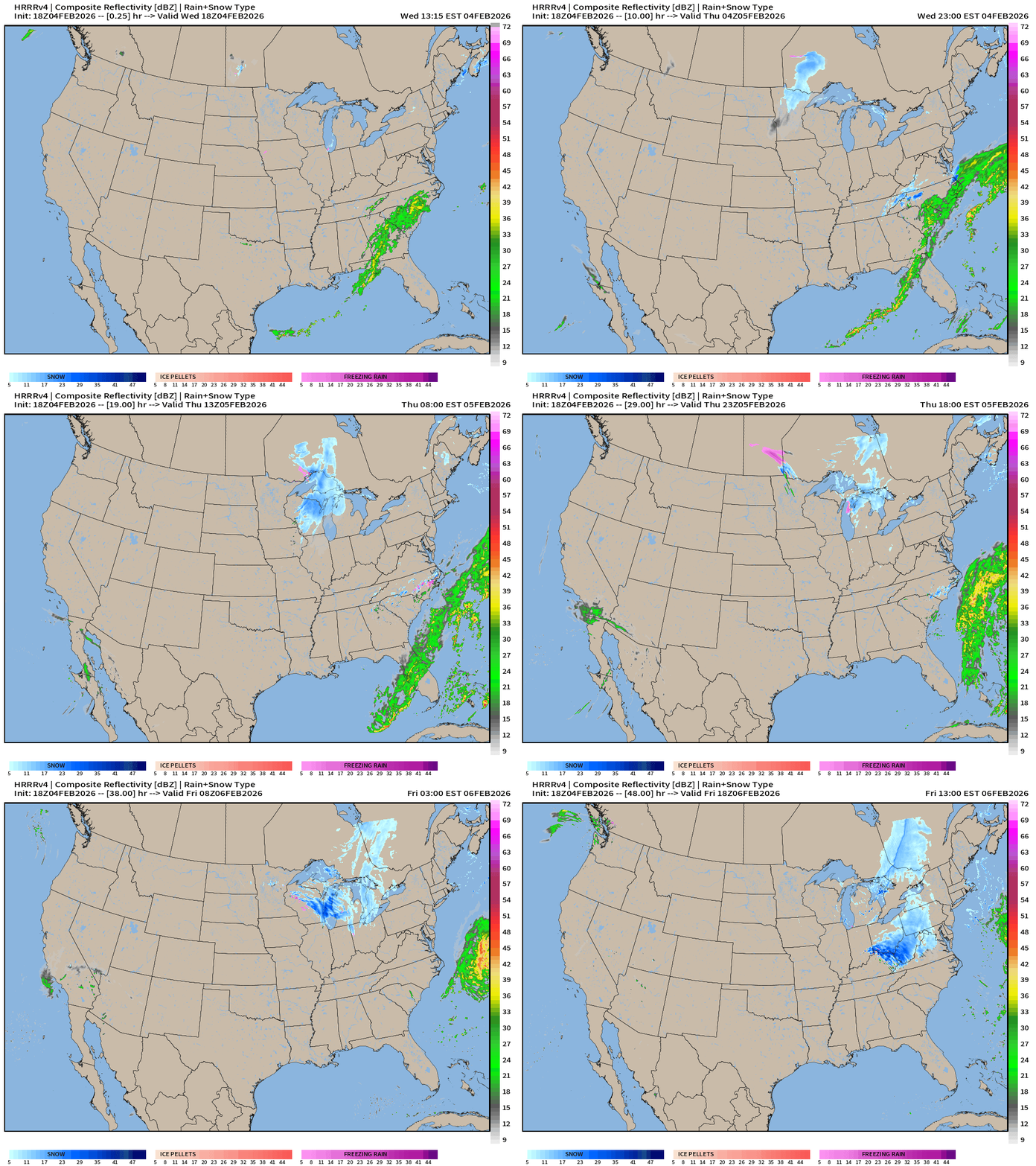
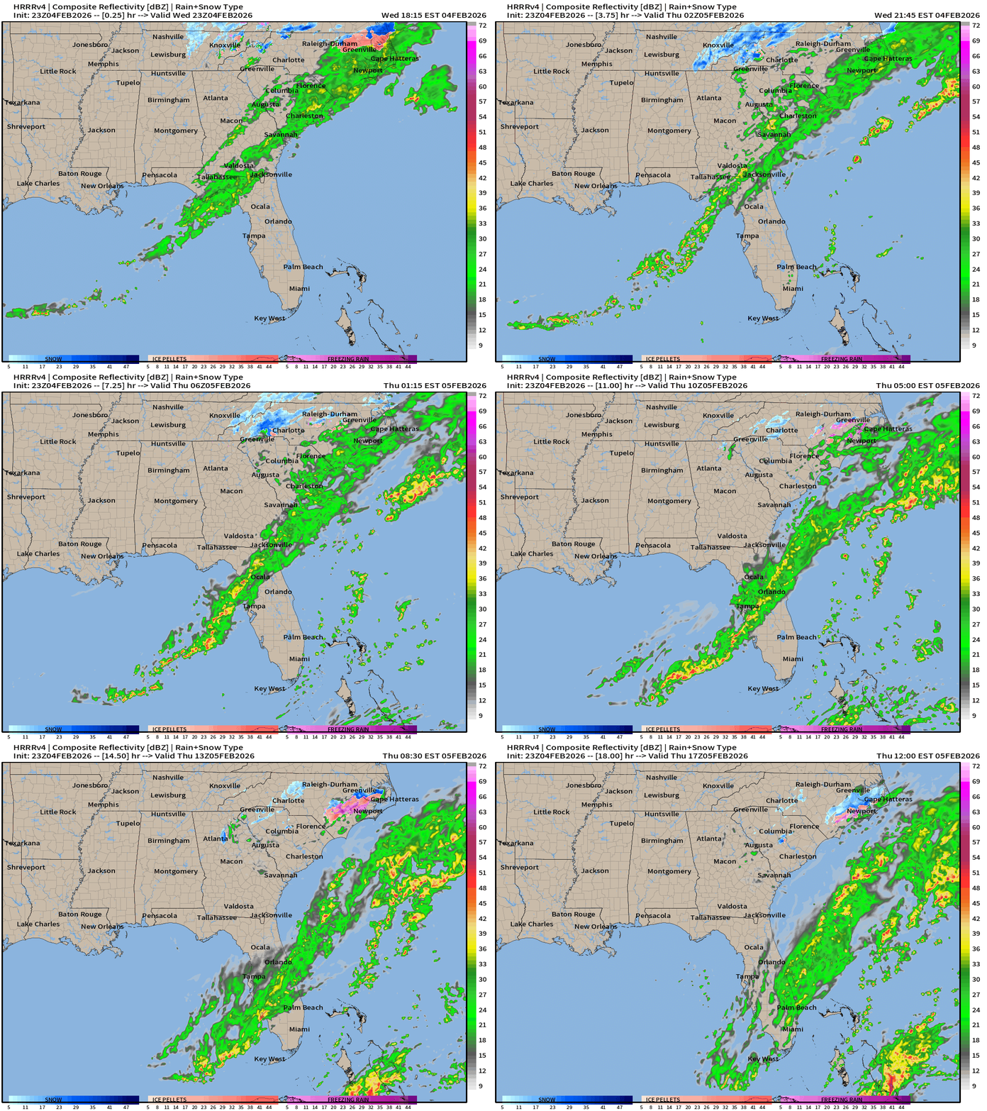
Could see some snowflakes east of Atlanta through Thursday morning but no accumulations or impacts expected. The front crosses central Florida by morning.
NWS NDFD Snowfall next 3-days
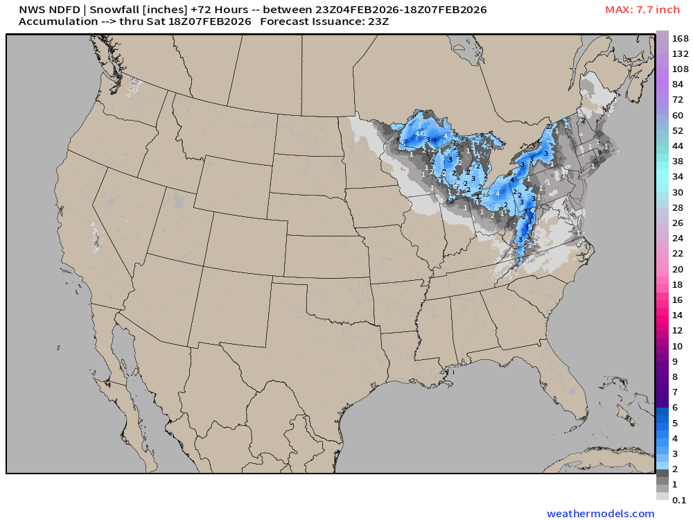
Snowfall from Clipper System could add another 3”-5” across Great Lakes into Ohio and Pennsylvania, providing a fresh blanket for the arrival of the cold Canadian Arctic air mass.
NWS NDFD Precipitation (QPF) next 3-days
RTMA | Temperature Analysis | 8:00 PM ET
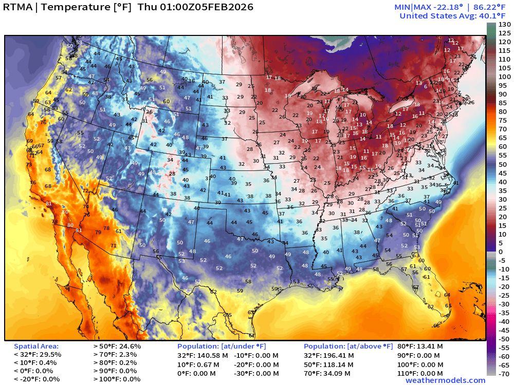
Avg Lower 48 temperature was 40.1°F — 141 million below freezing.
Temperature Anomaly | 8:00 PM ET
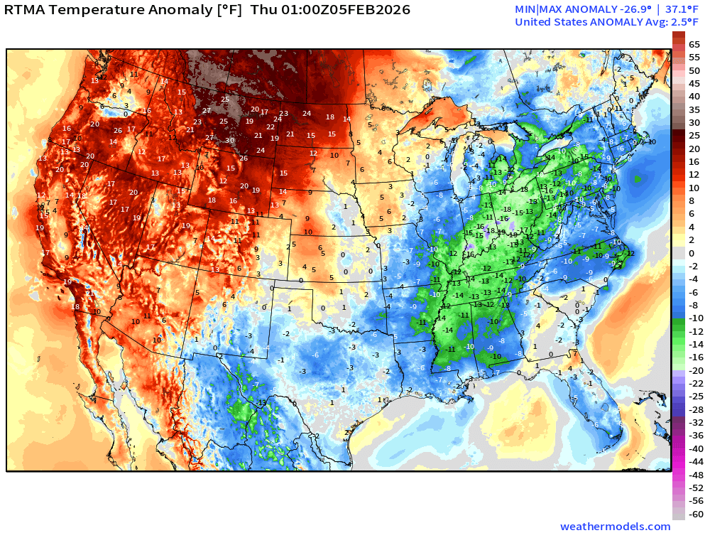
Lower 48 Temperature Anomaly above normal by 2.5°F
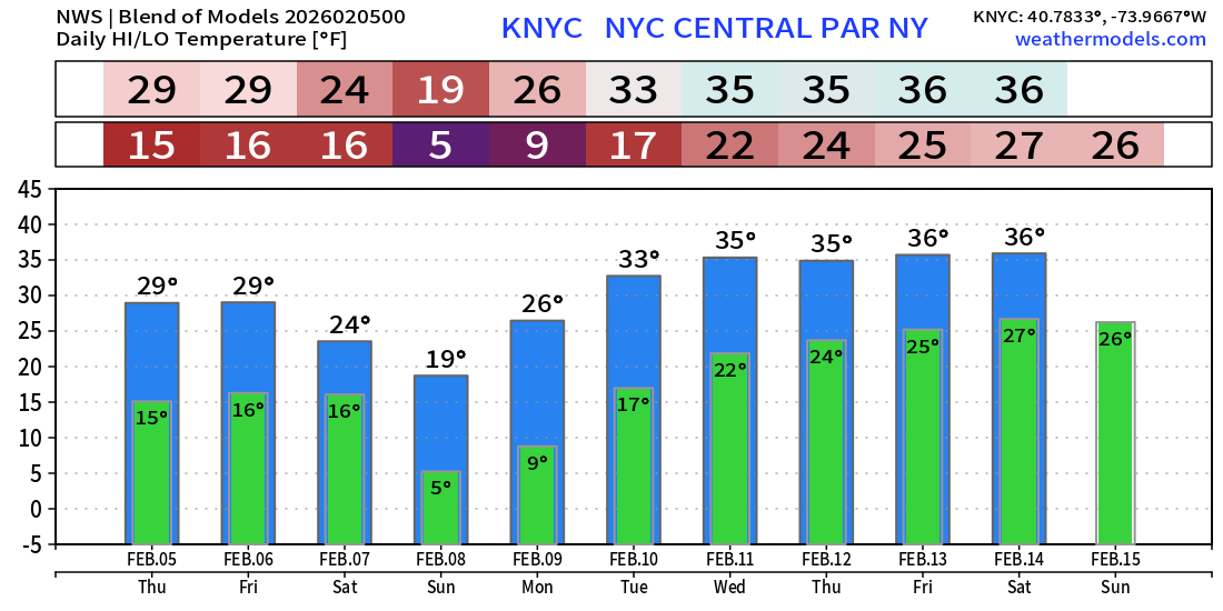
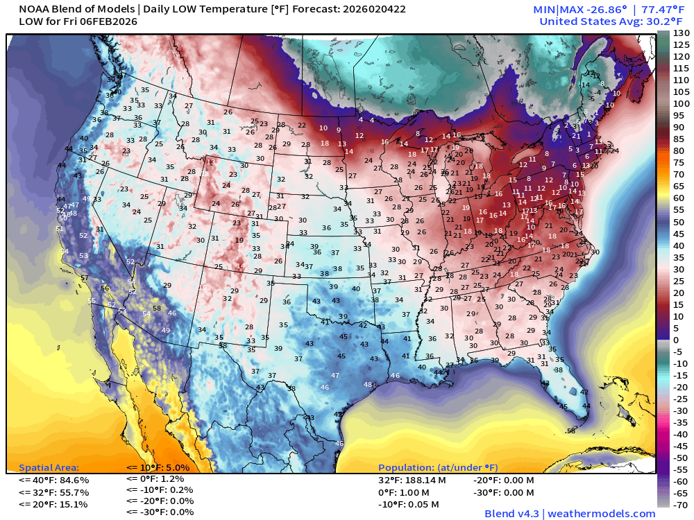
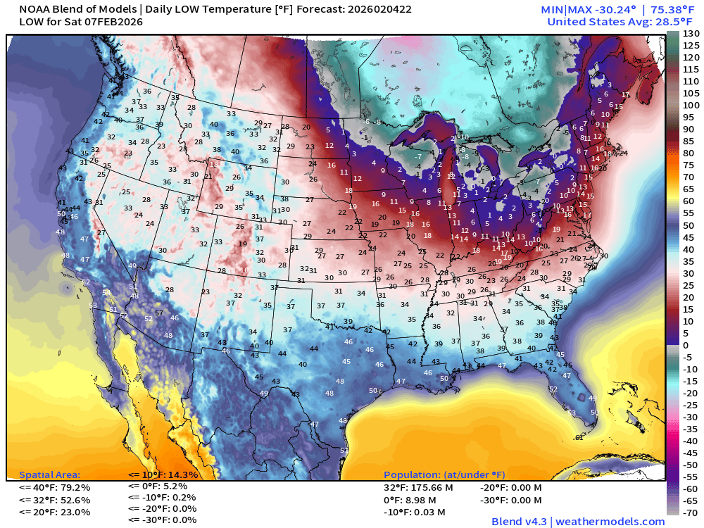
Low Temperatures next 8-days
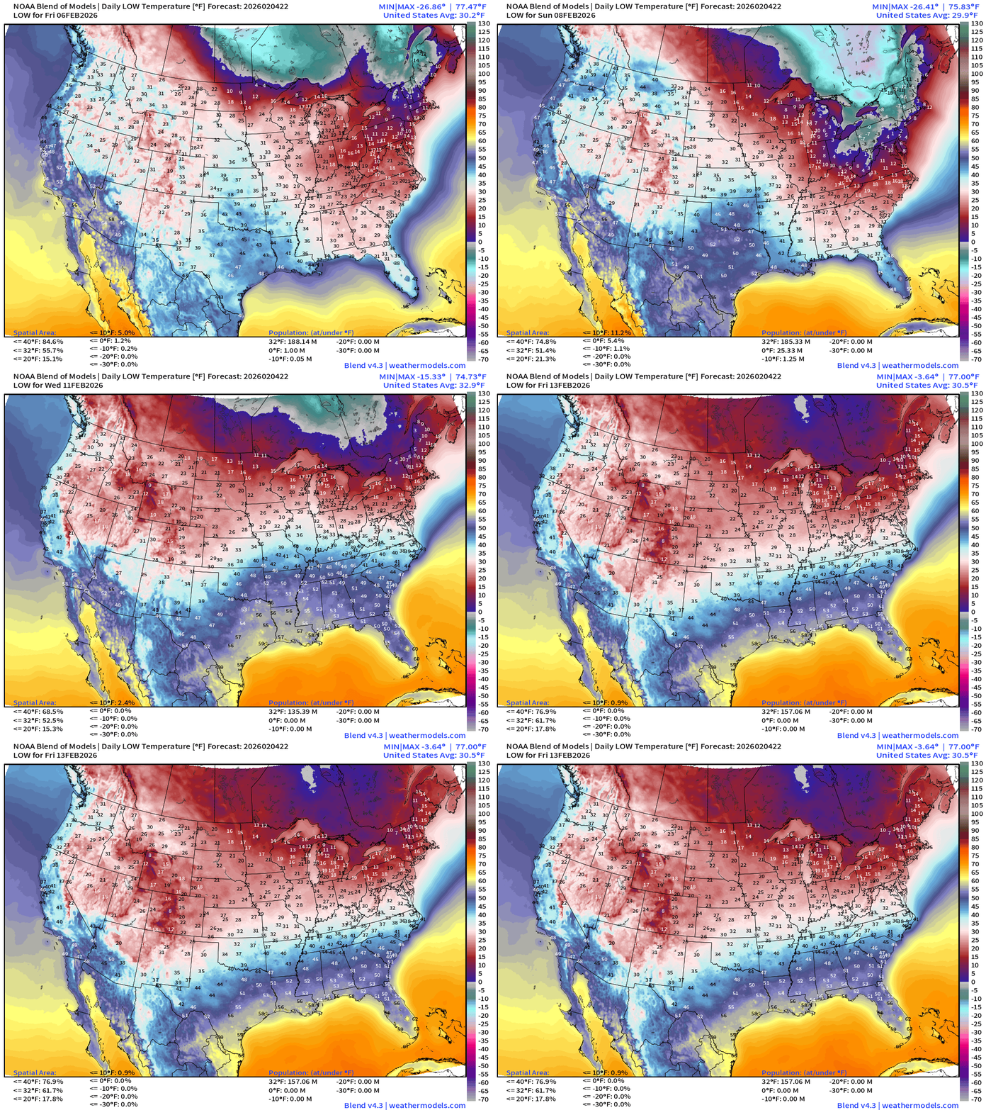
NYC will have highs in the mid-30s next week have this next cold spell.
Low Temperatures Thursday
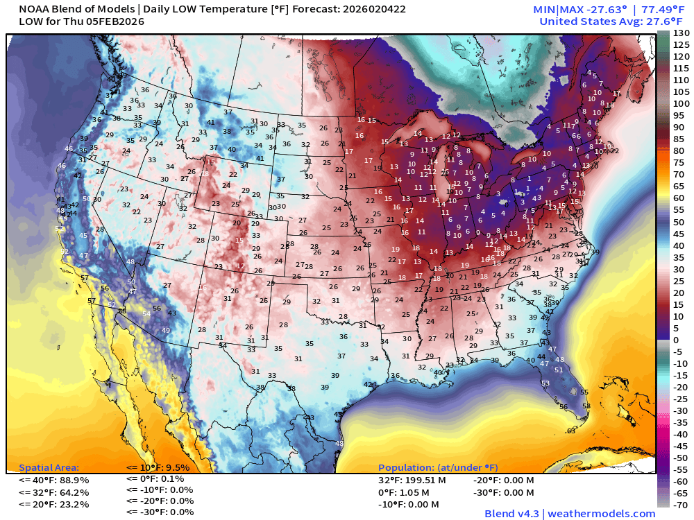
200 million below freezing — average of 27.6°F
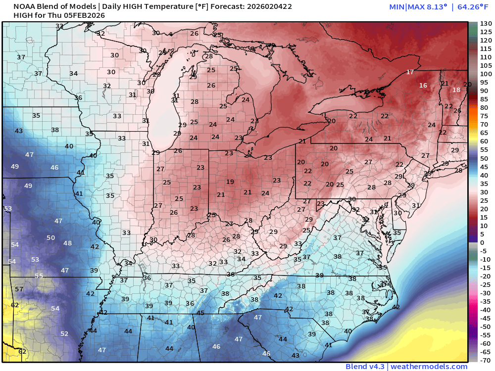
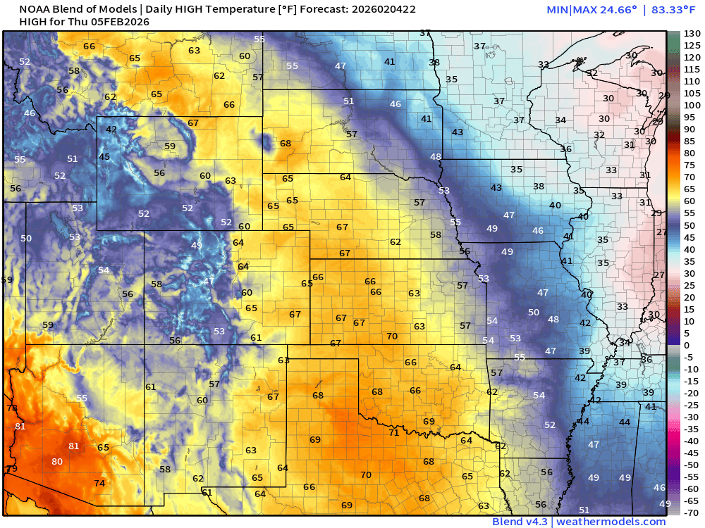
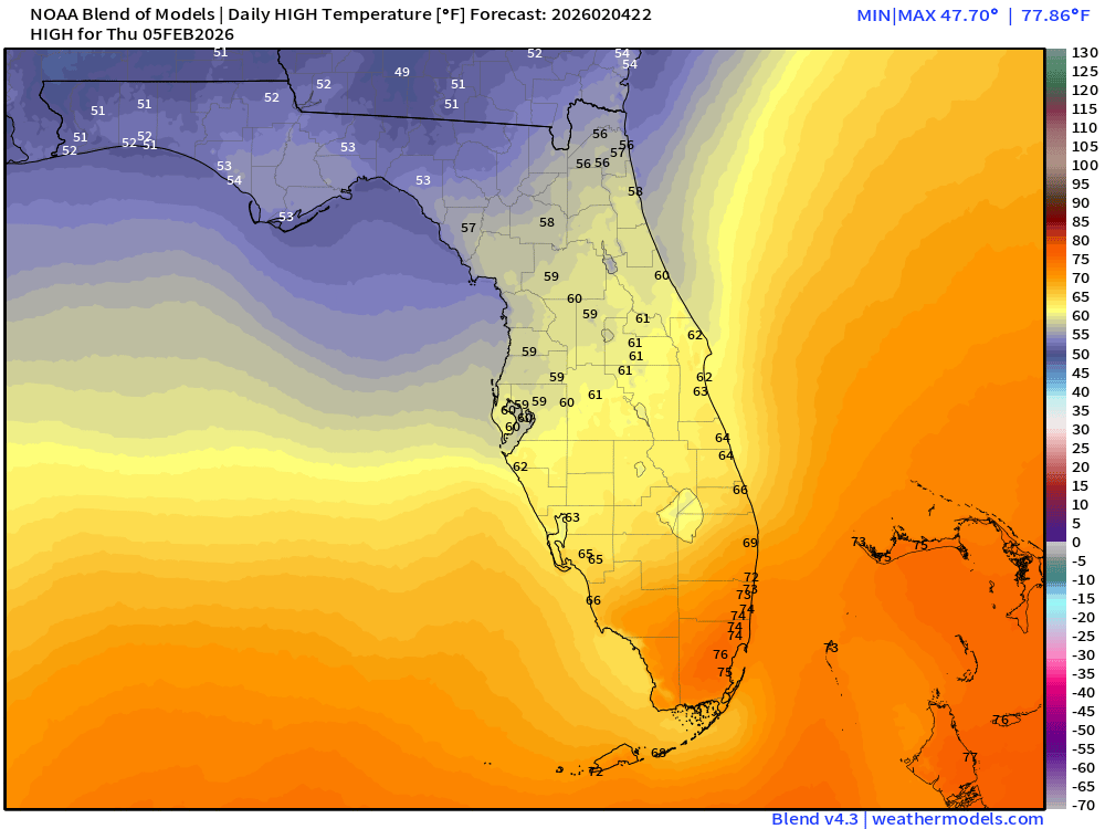
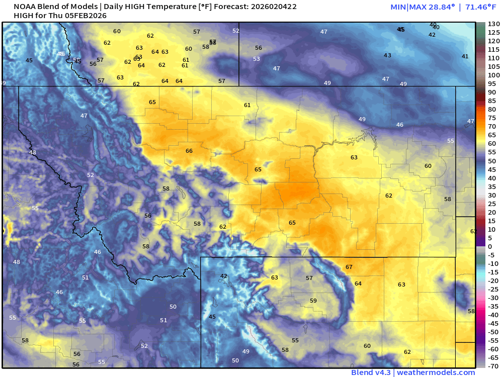
High Temperatures Thursday
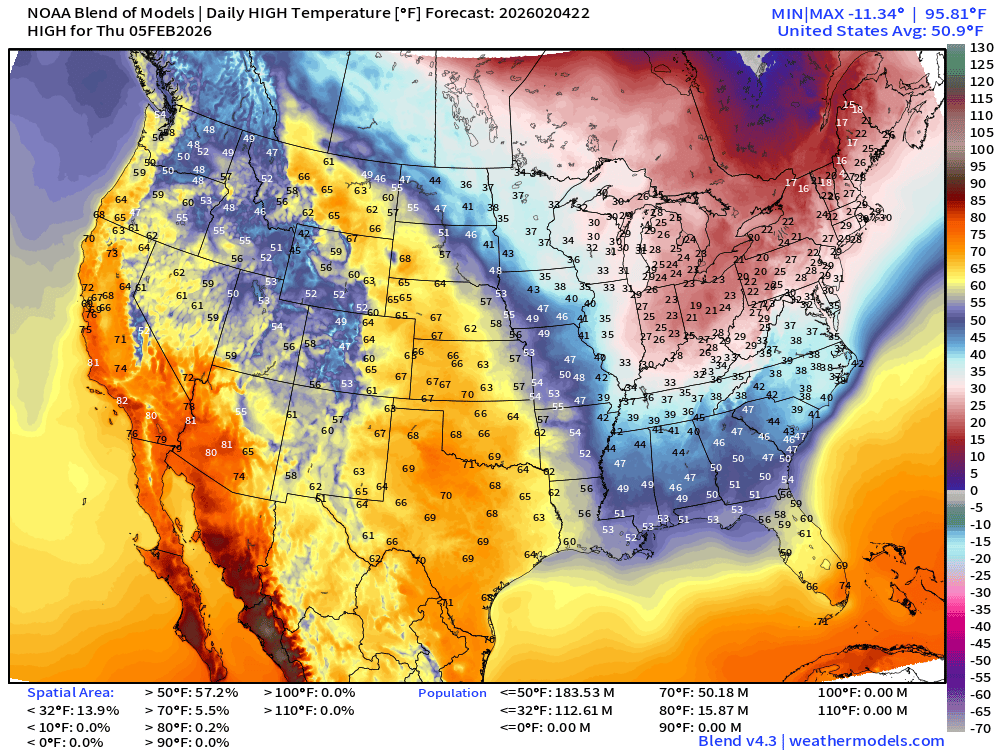
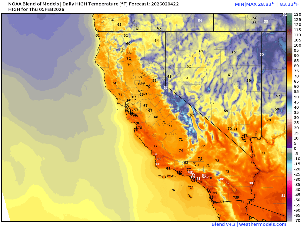
113 million stay below freezing during day … continued very warm in the Southwest including Southern California. 80s also possible up to Monterey Bay. Golf in Scottsdale starts tomorrow — very windy (gusts > 40 mph out of east) during the morning, and temperatures cranking up into the 80s (bone dry).
Highs in the 20s in the Great Lakes and into New England.
60s across the Plains into Montana!
It will be warmer in Billings, Montana (65°F) than Orlando, Florida (61°F) Thursday
Low Temperatures Friday
Saturday Low Temperatures
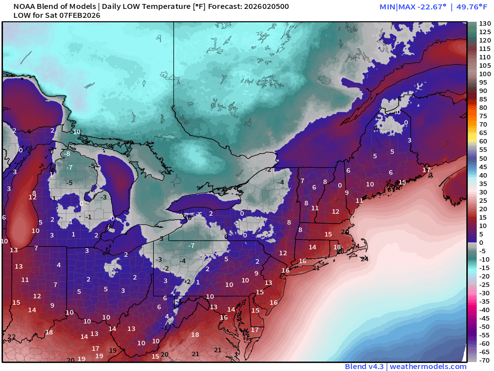
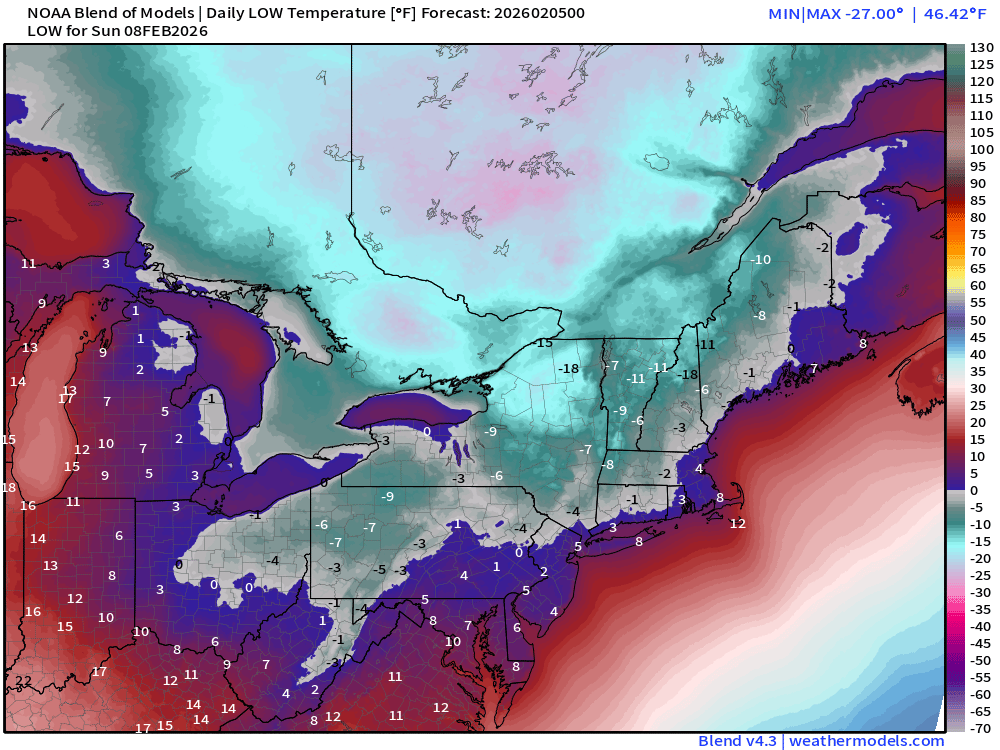
Sunday Low Temperatures
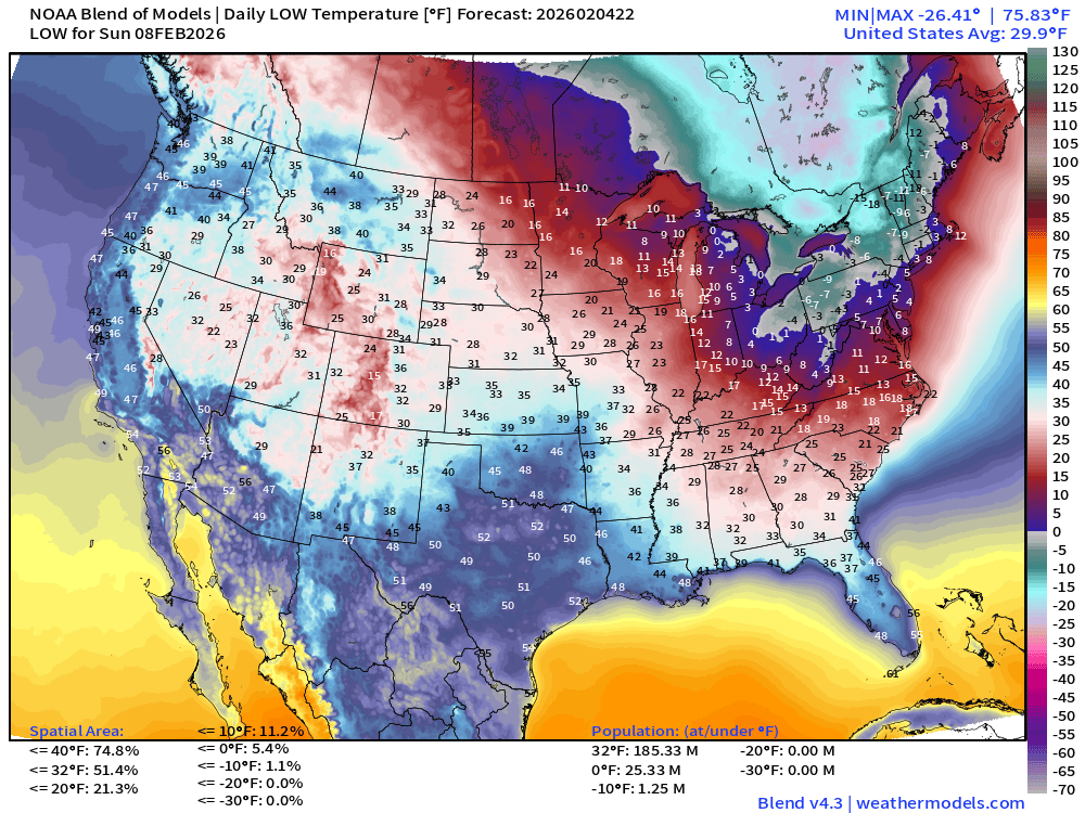
Temperatures could really crater Sunday morning … we’ll see how these numbers trend in the models tomorrow.
ECMWF IFS 18z | Precipitable Water Next 6-days
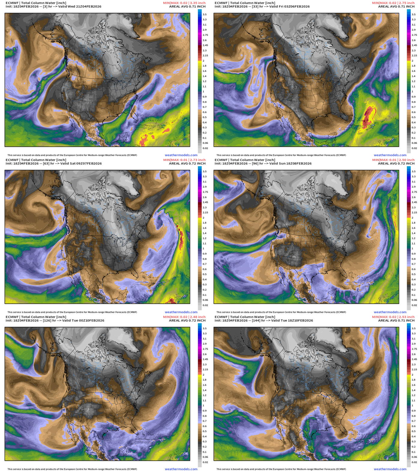
Pacific moisture from atmospheric rivers on the horizon into weekend. Two blasts of cold/dry Canadian air east of the Mississippi again make it through South Florida.
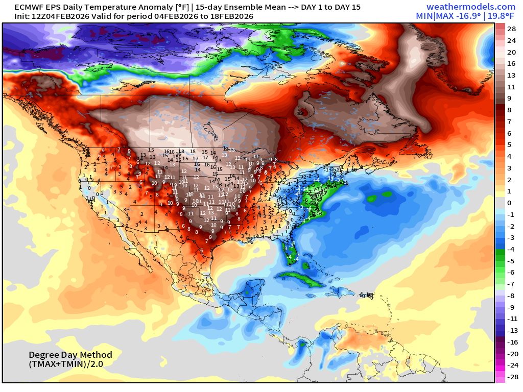
Flagship ECMWF 12z EPS | Temperature Anomaly | Next 15-days
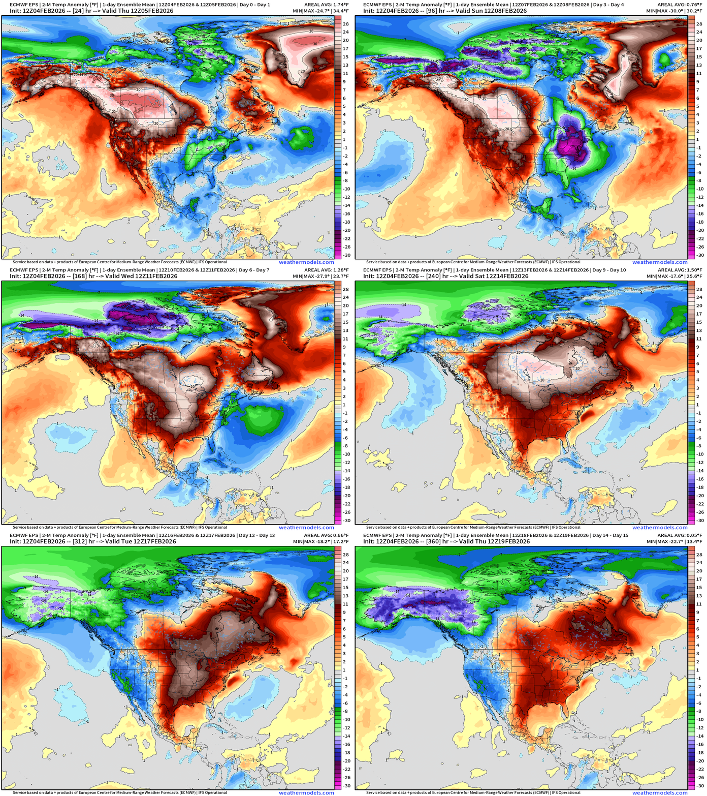
Very significant warming trend for the central U.S. into Days 6-10, and then pushes Eastward by shutting the door on the Northwest Flow out of Arctic.
ECMWF AIFS-Single 18z | Temperature (500 hPa) Next 12-days
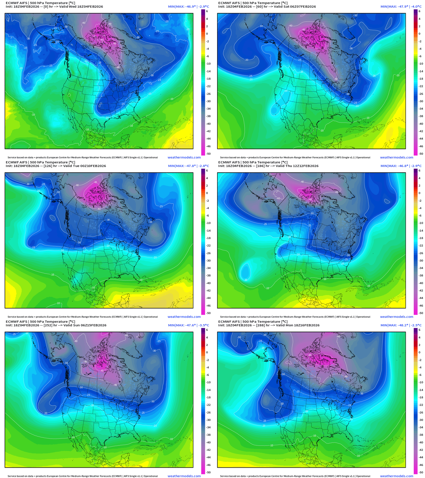
The temperature at 500 mb is the easiest way to highlight the “polar vortex” across North America with the coldest pool at -40°C (pink) with the -25°C contour usually associated with below freezing temperatures at 2-meters (surface).
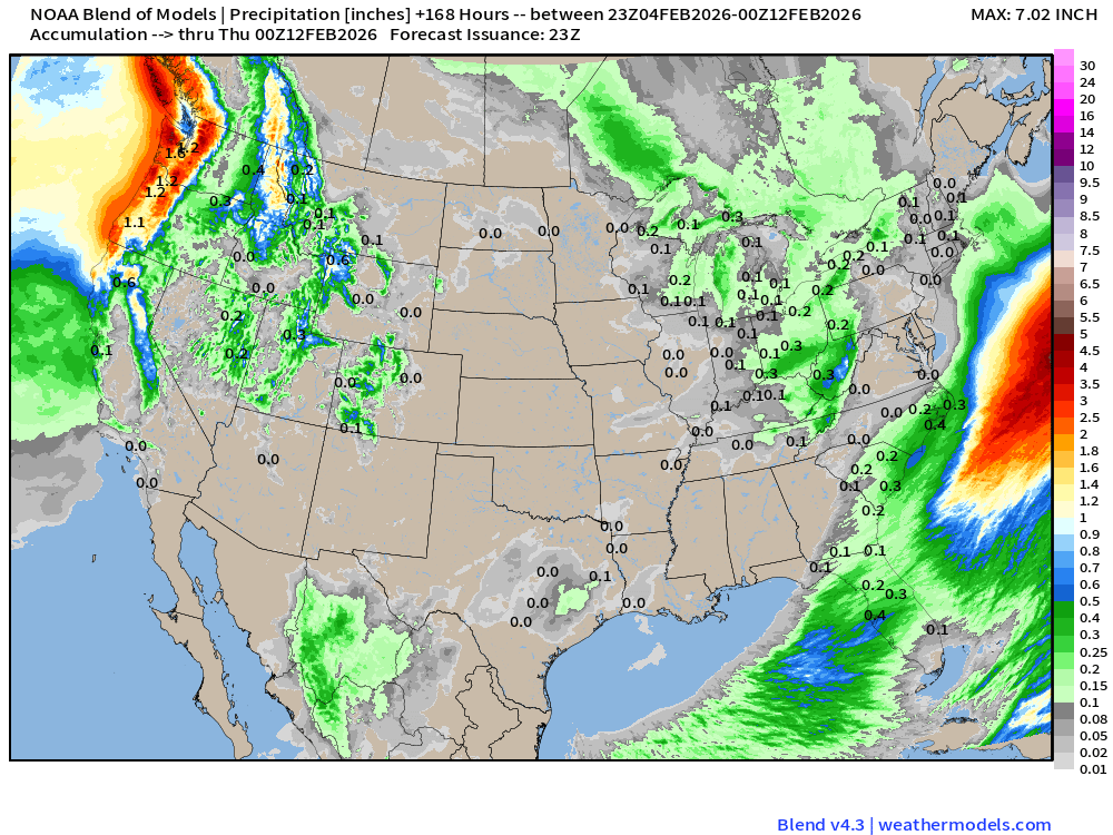
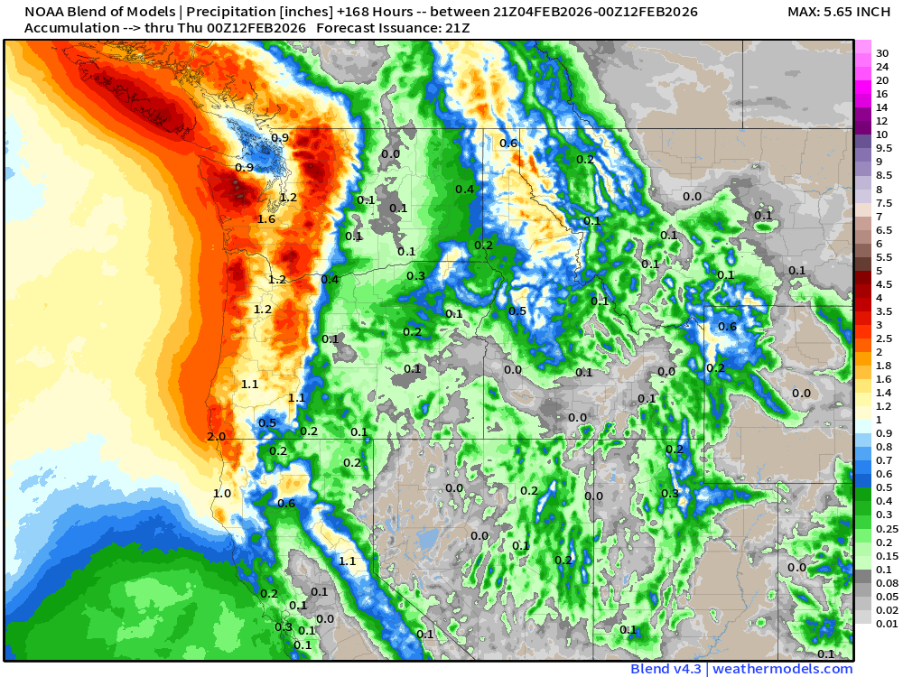
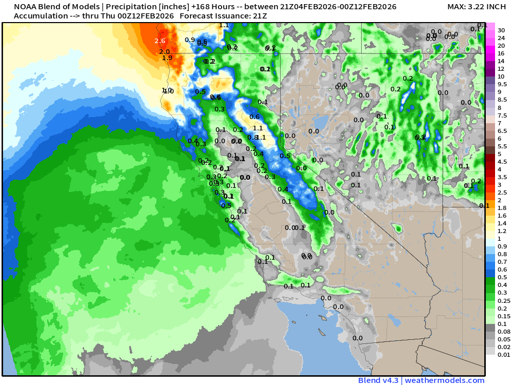
Blend of Models | 7 Days Precipitation Total
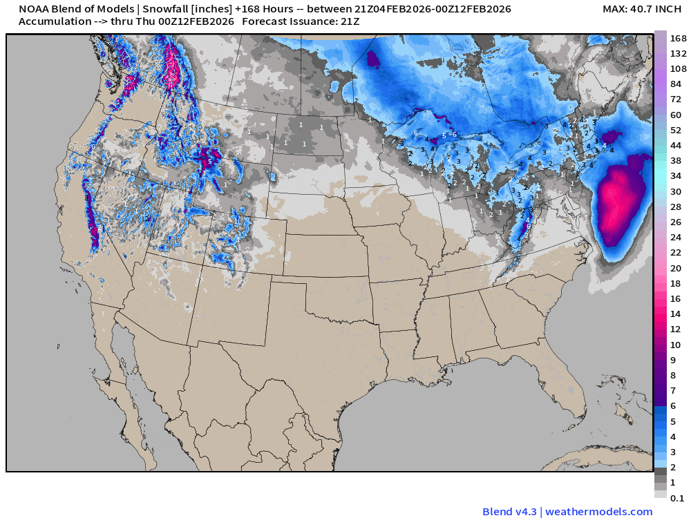
Blend of Models | Total Snowfall Next 7-Days
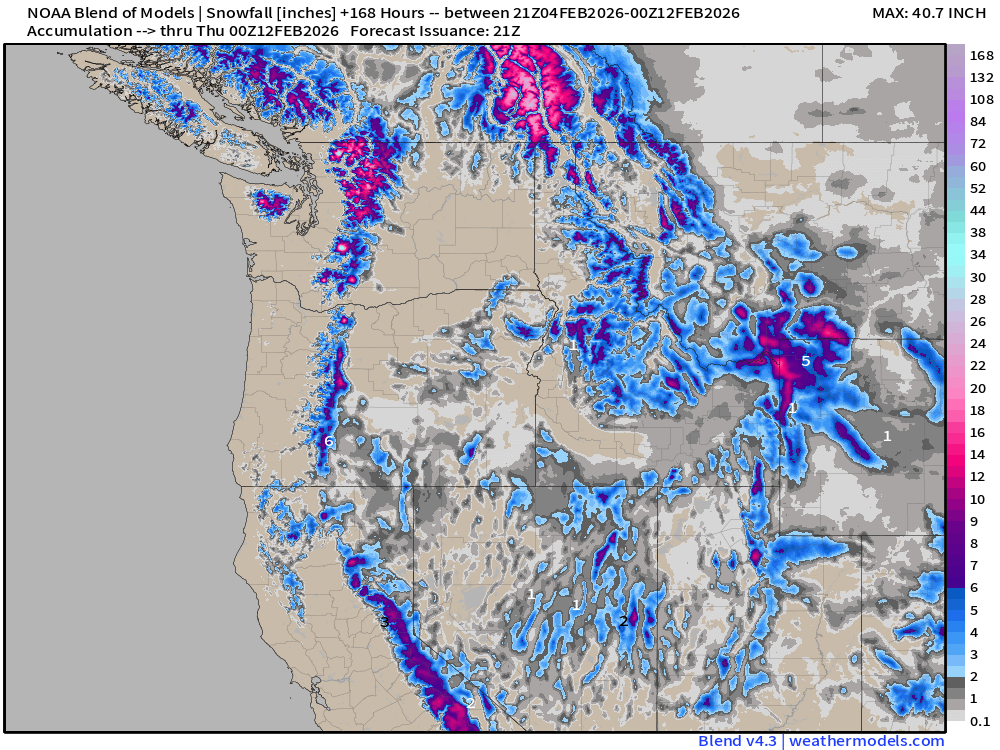
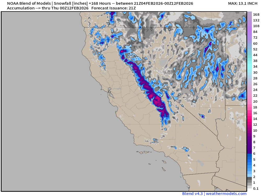
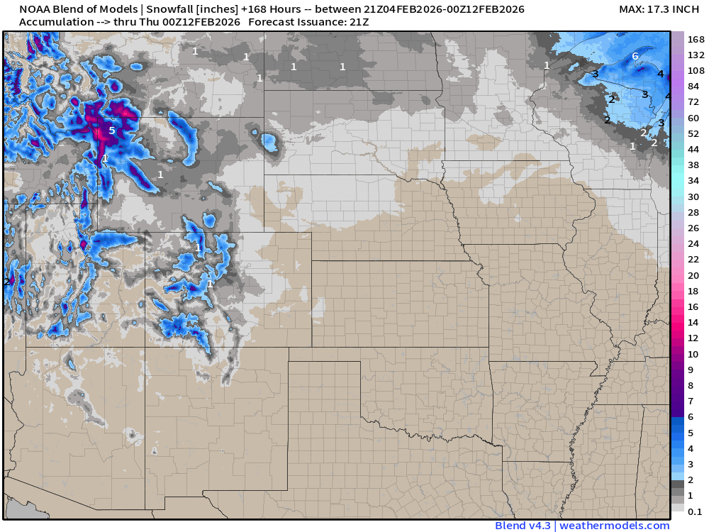
ECMWF AIFS 15-day Snowfall | Long Range Look
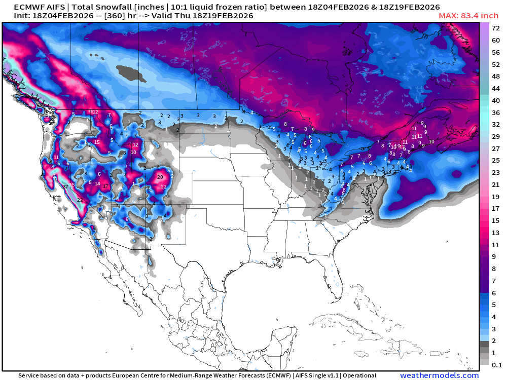
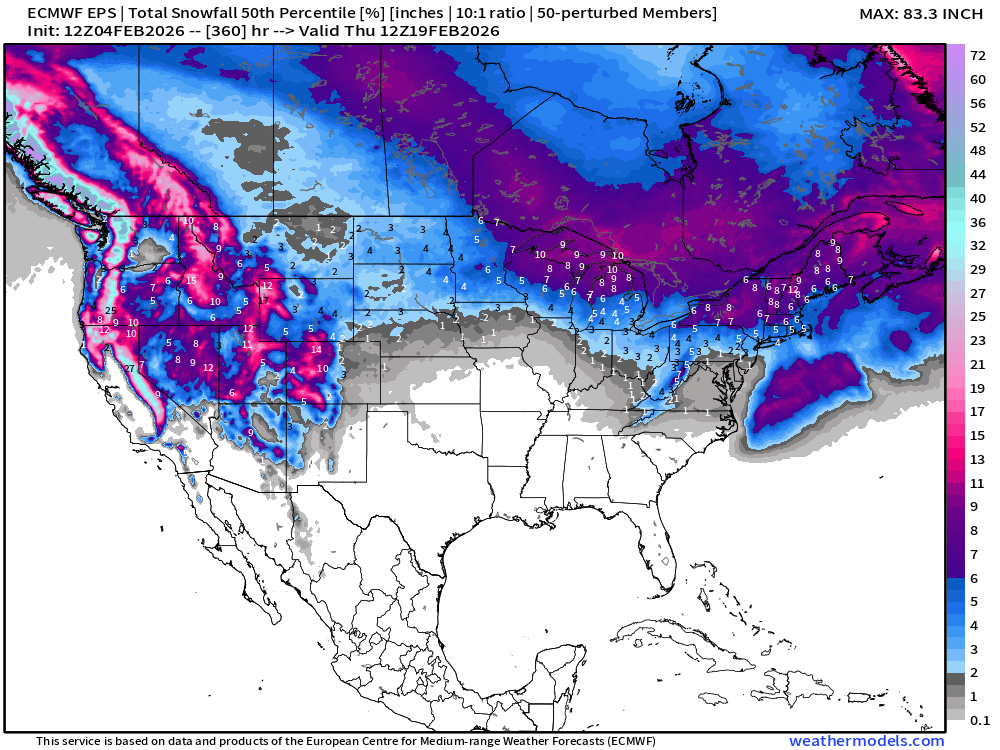
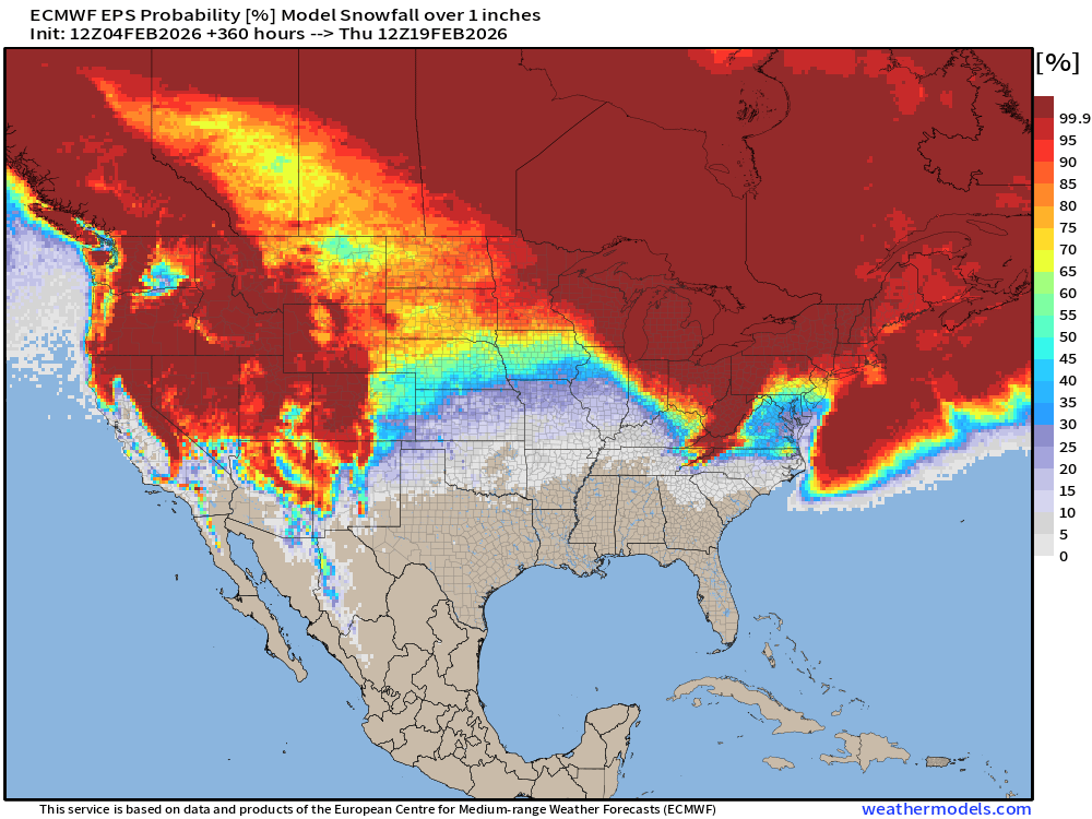
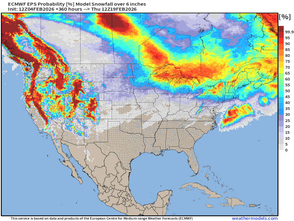
Huge Western Snowfall Returns! Also some potential storms in the Great Lakes and Northeast past Day 10, so winter is NOT over.
Long Range Snowfall | EPS 12z — Next 15-days Ensemble Median
Probability of at least 1” snowfall next 15-days
Probability of at least 6” snowfall next 15-days
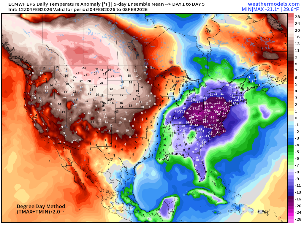
Temperature Anomaly | Next 15-days | ECMWF EPS 12z
5-Day Chunk #1 | Temperature Anomaly | Feb 4 - Feb 8
5-Day Chunk #2 | Temperature Anomaly | Feb 9 - Feb 13
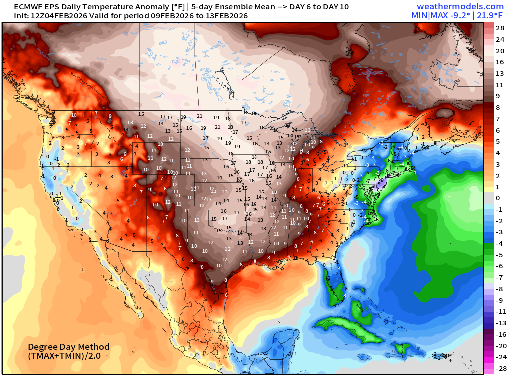
Still can’t shake the extreme cold in the Mid-Atlantic and Northeast + Florida.
5-Day Chunk #3 | Temperature Anomaly | Feb 14 - Feb 18
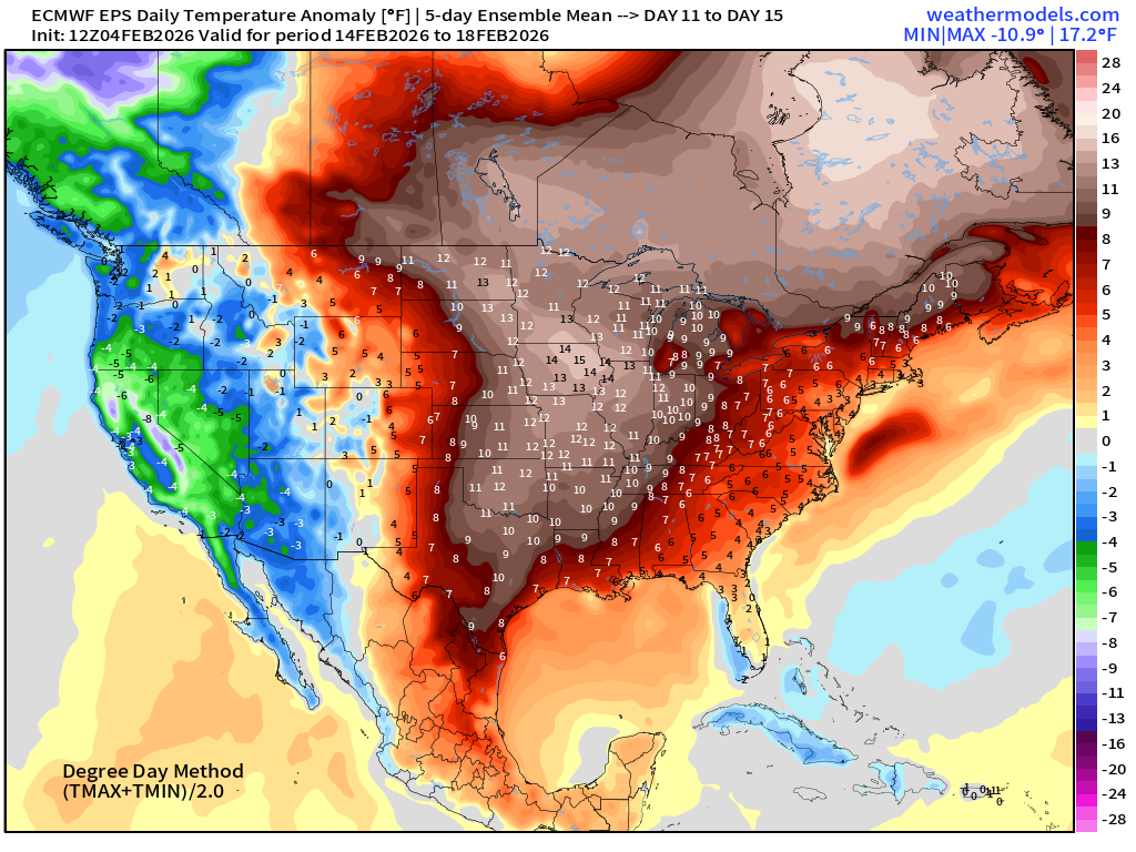
Much warmer across the Central and Eastern U.S. as California and the West Coast goes negative anomaly — and strongly so.
Maps sourced from weathermodels.com designed and innovated by yours truly! Please subscribe there for real-time access to the newest maps, charts from all of the weather models including ECMWF and AIFS, NOAA AI-GFS/AI-GEFS
- Milepost
- 859 · laid 2026-02-05T01:56:21.345000Z
- Source
- https://weather.substack.com/p/february-4-2026-wednesday-winter
- Digest
- 662ebcc8e4d1f35be3c247f7369a7a80a8aa03d53bbc0a72884139e775b7aa4d
- Machine
- JSON