February 2, 2026 Monday Winter Weather
Major Arctic blast to settle across Great Lakes and Northeast into Weekend
February 2026 was the 4th-warmest February in the 132-year national record (1895–2026), at 40.3°F against a 1991–2020 normal of 35.6°F (+4.6°F).
February 2026 was the 5th-driest February in the 132-year national record (1895–2026), at 1.4in against a 1991–2020 normal of 2.1in (-0.7in).
NOAA/NCEI Climate at a Glance, contiguous United States. This is the observed record for the month, not a score of anything said in this piece — the forecast ledger begins 2026-08-17 and cannot reach earlier posts.

Groundhog Day! February 2, 2026

Phil saw his shadow at the Punxsutawney Groundhog Club at Gobbler’s Knob in western Pennsylvania = 6 more weeks of winter! (Whether you like it or not!)
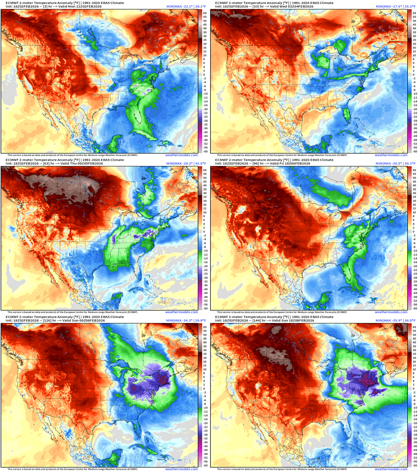
Definitely another 8-10 days of winter in the Northeast U.S. with an Arctic blast that seems to “settle in” for a bit longer that initially thought. Well below average temperatures continue and the cold intensifies Saturday and Sunday.
Well above normal temperatures dominate west of the Mississippi with warm weather expected in Santa Clara for Super Bowl LX on Sunday (no precipitation, temps in the 60s)
ECMWF 18z Temperature Anomaly | Next 6-days
Moisture Transport Next 10-days | IVT
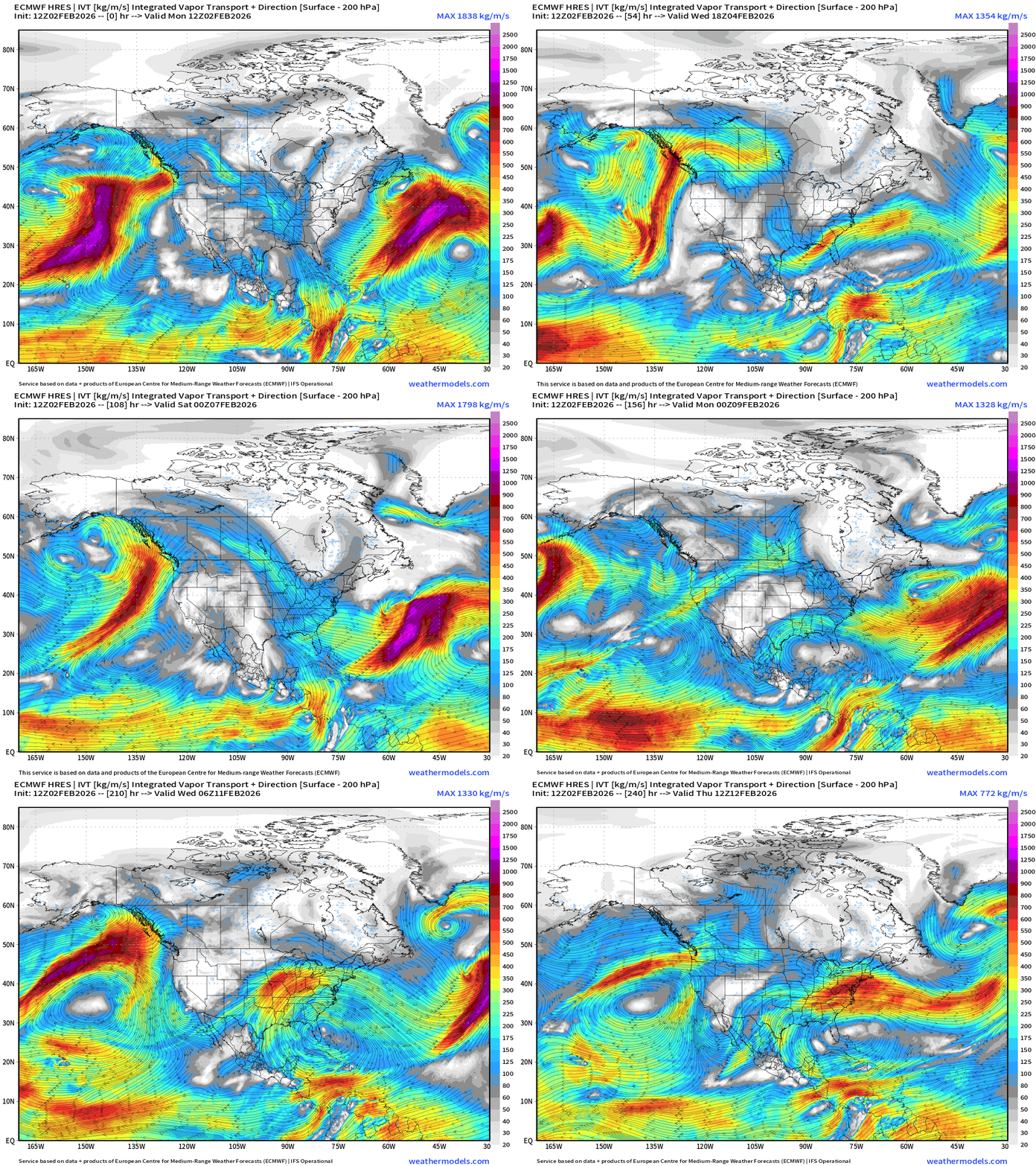
Cool to see the Pacific moisture going up and over the ridge through Southern Canada and dipping into the Lower 48 (Great Lakes —> Mid-Atlantic) as part of Clipper Systems.
Atmospheric Rivers do make landfall along the WA/OR and California coast but are rather diffuse and wash out — but that’s still decent moisture breaking through the ridge — enough with cooler temperatures to kick start snowfall accumulations again this winter.
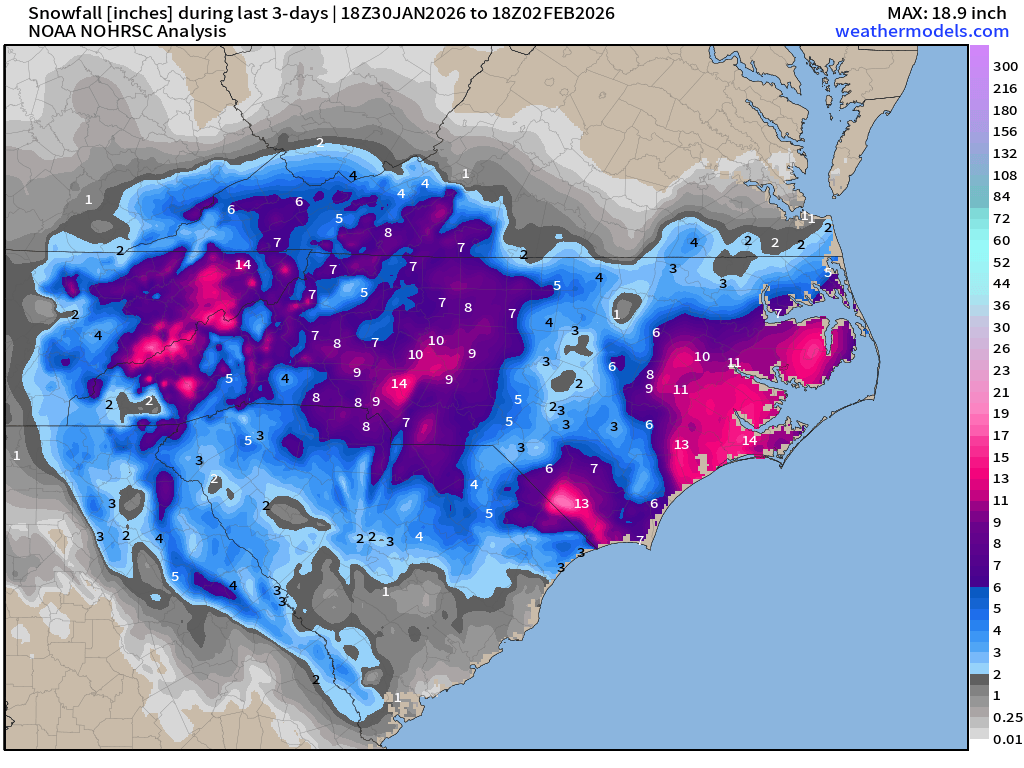
Observed / Analysis of Snowfall Last 3-days
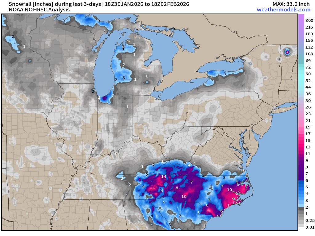
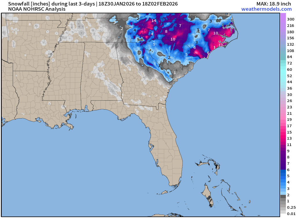
As forecast, we saw most snowfall along and near the North Carolina coastline
ECMWF 18z Precipitation Type + Intensity | Next 6-days
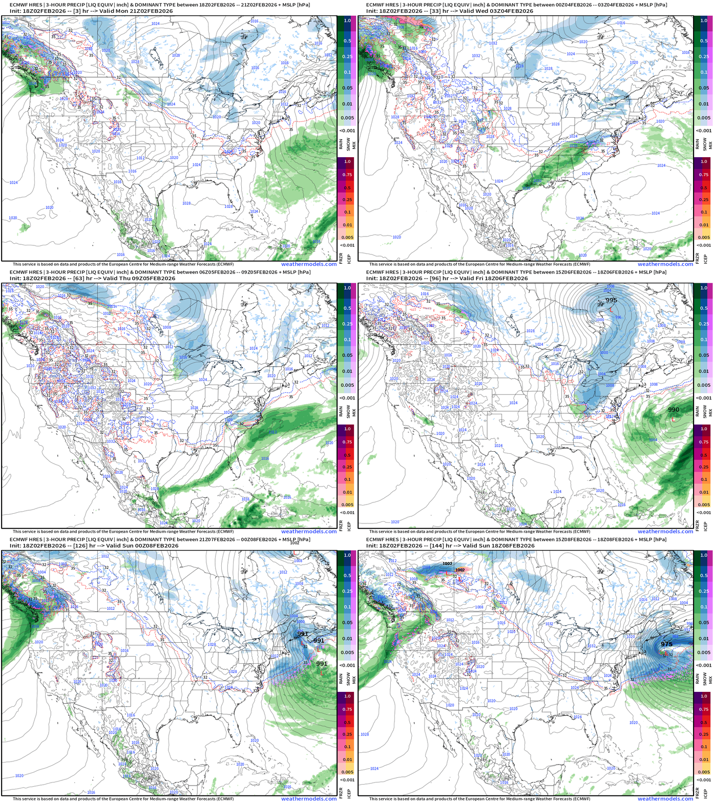
Weak Clipper system Wednesday may bring a dusting of snowfall to the Mid-Atlantic, and rainfall to the Southeast into Thursday.
A Clipper (shortwave) tracks through he Great Lakes Fri into Sat and develops off the New England coast / Gulf of Maine —> today’s 18z cycle shows rapid intensification right off the coast of Maine and the backside snowfall perhaps impacting New England Sunday with another westward nudge of the track or the overall large low pressure gyre dependent upon the trough.
Day 6 (Sunday 18z) depiction of the coastal storm by ECMWF 18z
West Coast USA Zoom | Next 6-days
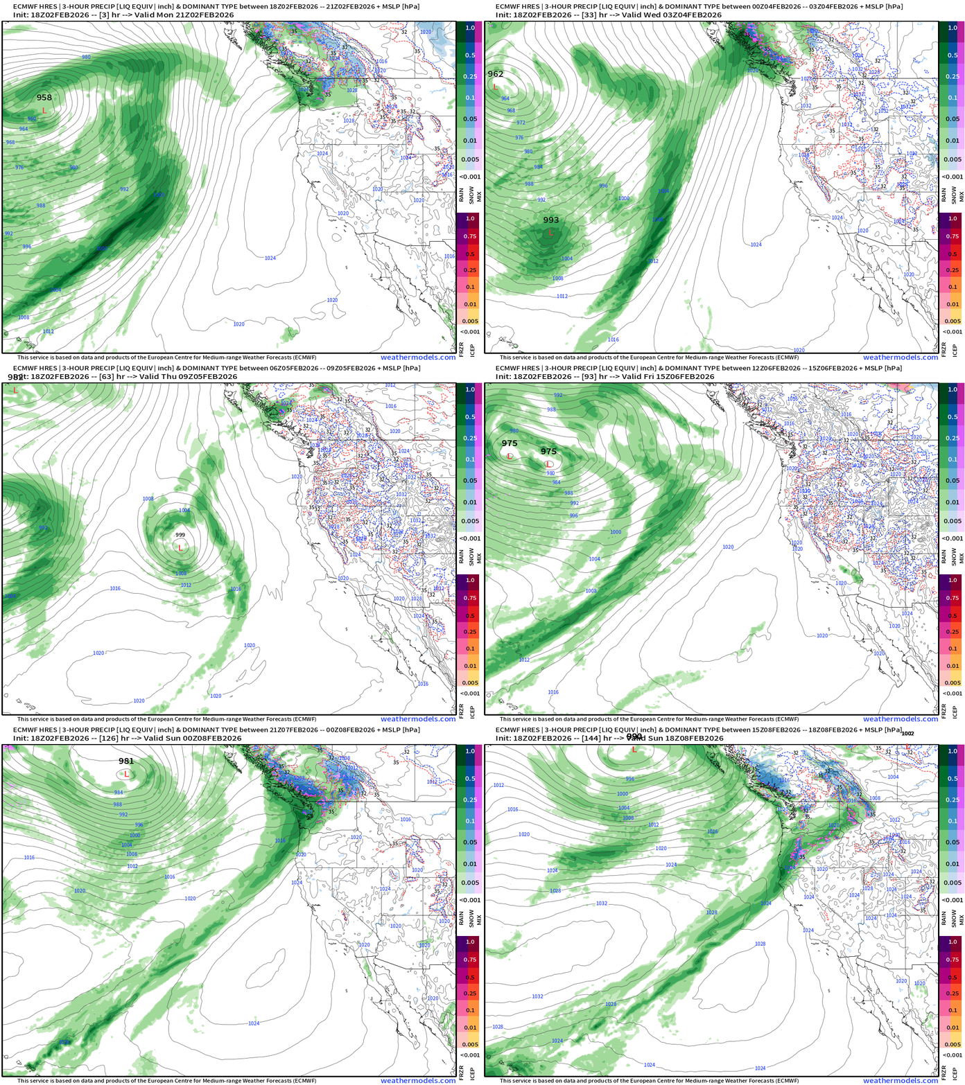
Very nice atmospheric river does make it into the Pacific Northwest and perhaps northern California by Sunday. That would be opportunity for welcome precipitation (after the Super Bowl) and snowfall at higher elevations.
East Coast USA Zoom | Next 6-days
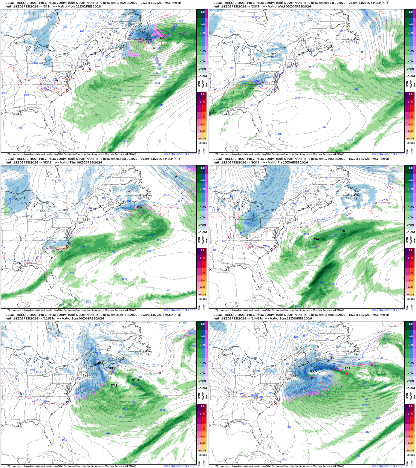
This potential “bomb cyclone” is associated with a very intense and sharp trough and thickness anomaly connected to the main PV up in Arctic Canada.
NOAA GFS Dynamic Tropopause Next 3-6 days
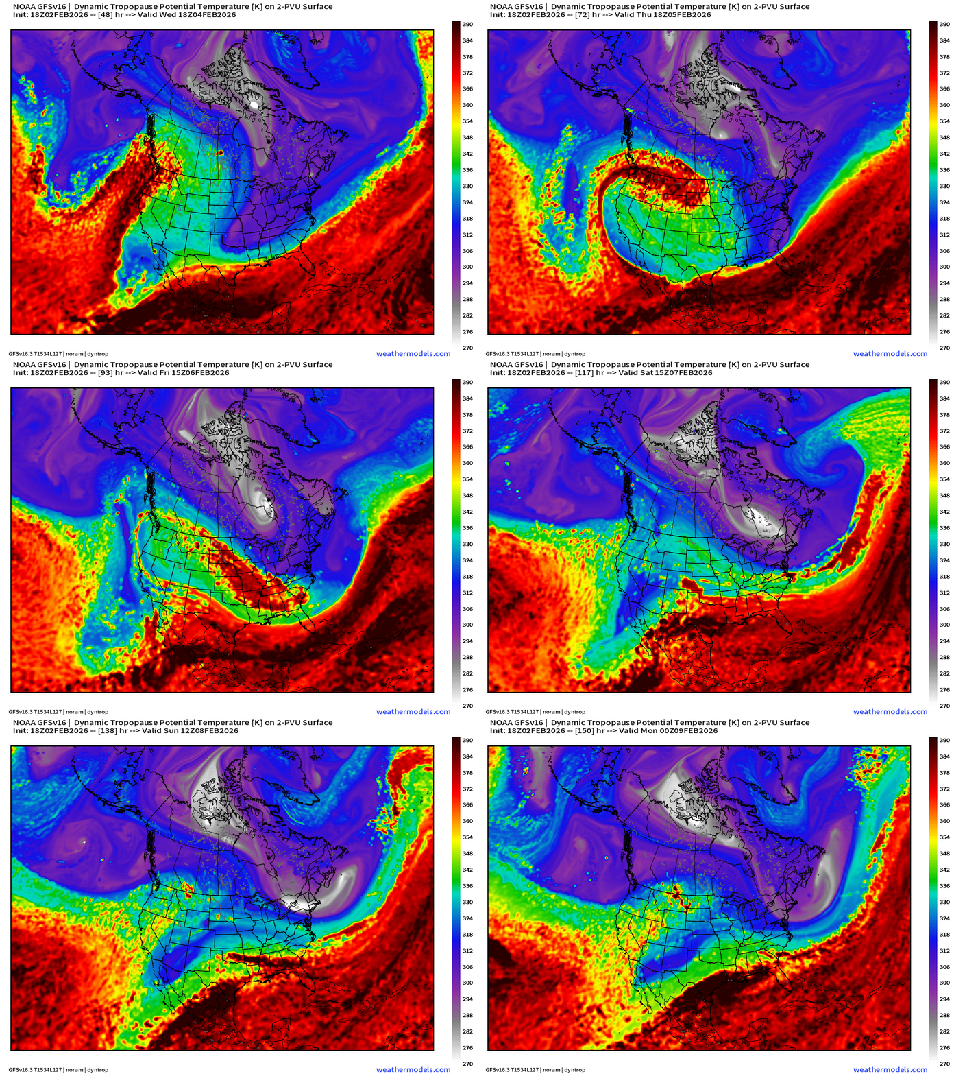
This is an excellent diagnostic to show the extreme cold of “Tropospheric Polar Vortices” or TPVs — with stratospheric air (cold, dense) punching downward.
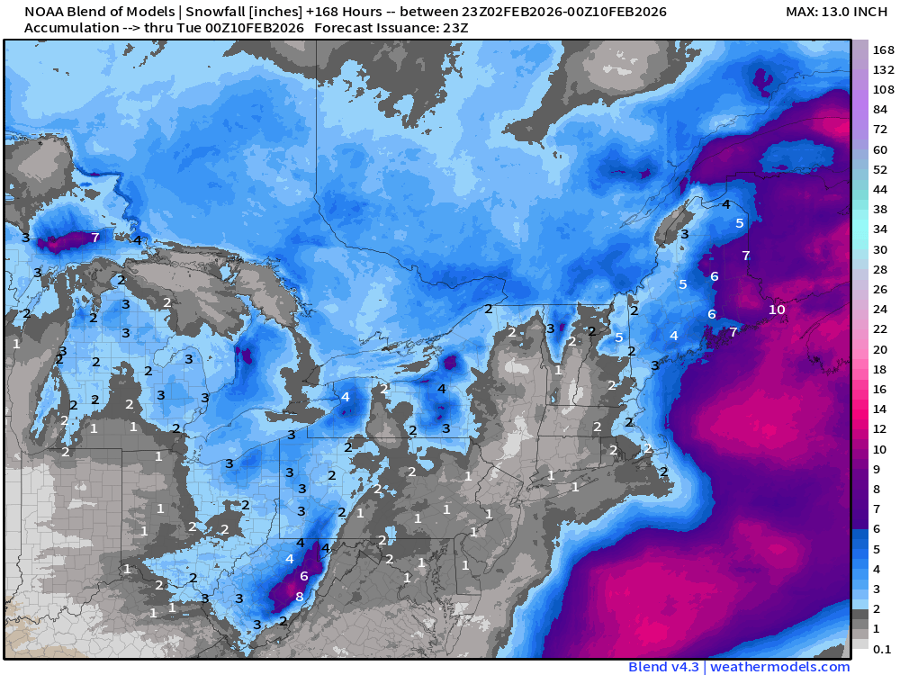
Atmospheric Thickness (1000 mb - 500 mb) Next 6-days
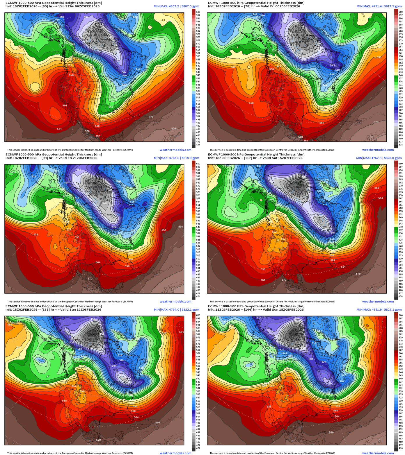
The main TPV splits off the “lobe” into the U.S. Northeast and then retrogrades WNW to the edge of the Arctic Ocean in Canada by Sunday — seeming to leave the playing field for Arctic blasts into next week.
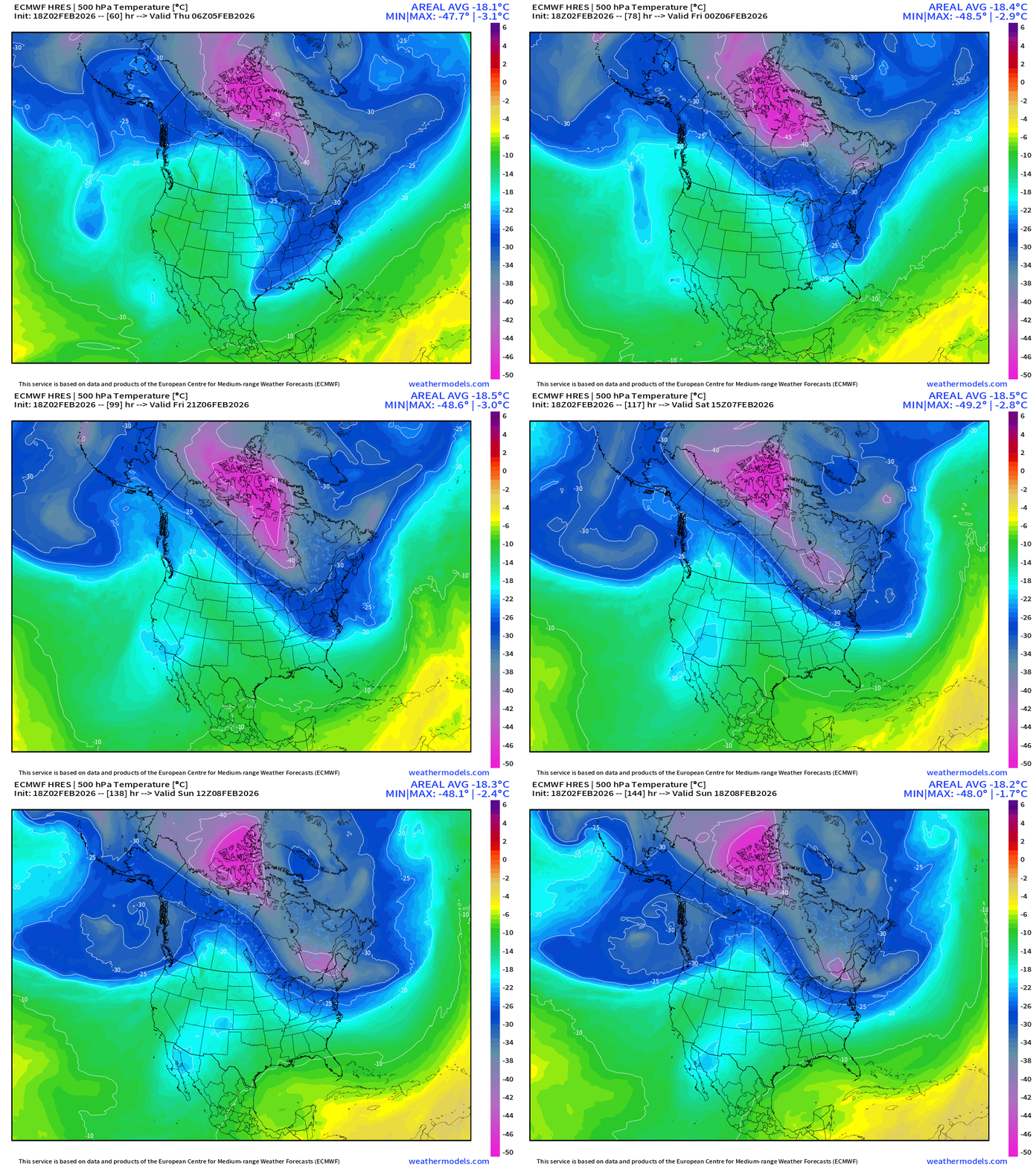
ECMWF 500 mb Temperatures highlight nicely the cold pool splitting off a lobe or trough into the Northeast. The large reservoir of -48°C air then secludes and heads poleward.
If you are a first time visitor but not signed up to receive my daily update emails — please do! There is no A.I. content generation here unless it is a global weather model like AIFS! Will hit 900 updates/posts in mid-March 2026, and 1,000 by June 1, 2026 — start of hurricane season.
If your subscription lapsed for whatever reason and want to return at your original rate (50% off) as initial annual member from 2024 & 2025: Link to Come Back your continuing support is appreciated!
HRRR Simulated Radar Next 48-hours
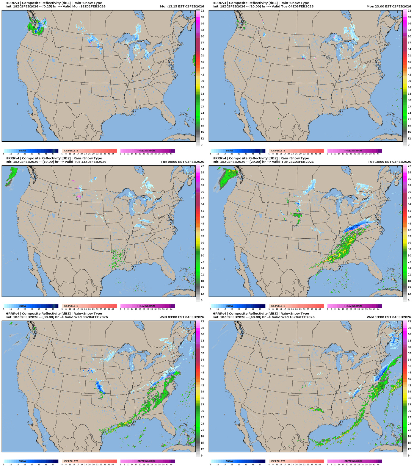
Weak Clipper System + some rainfall with a frontal boundary through the Southeast — nothing too exciting.
NWS NDFD Snowfall next 3-days
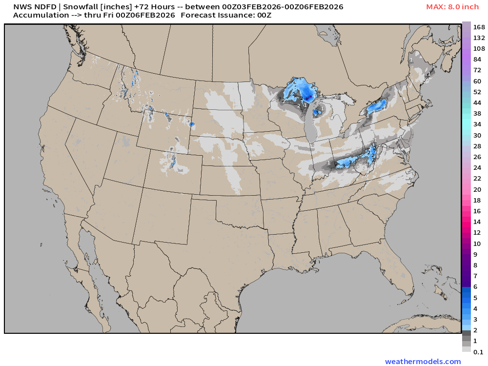
Just some minor accumulations with Clipper System over the next few days.
RTMA | Morning Temperature Analysis | 7:45 PM ET
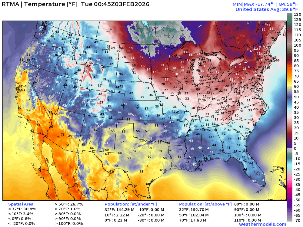
Avg Lower 48 temperature was 39.6°F — 144 million below freezing.
Temperature Anomaly | 7:45 PM ET
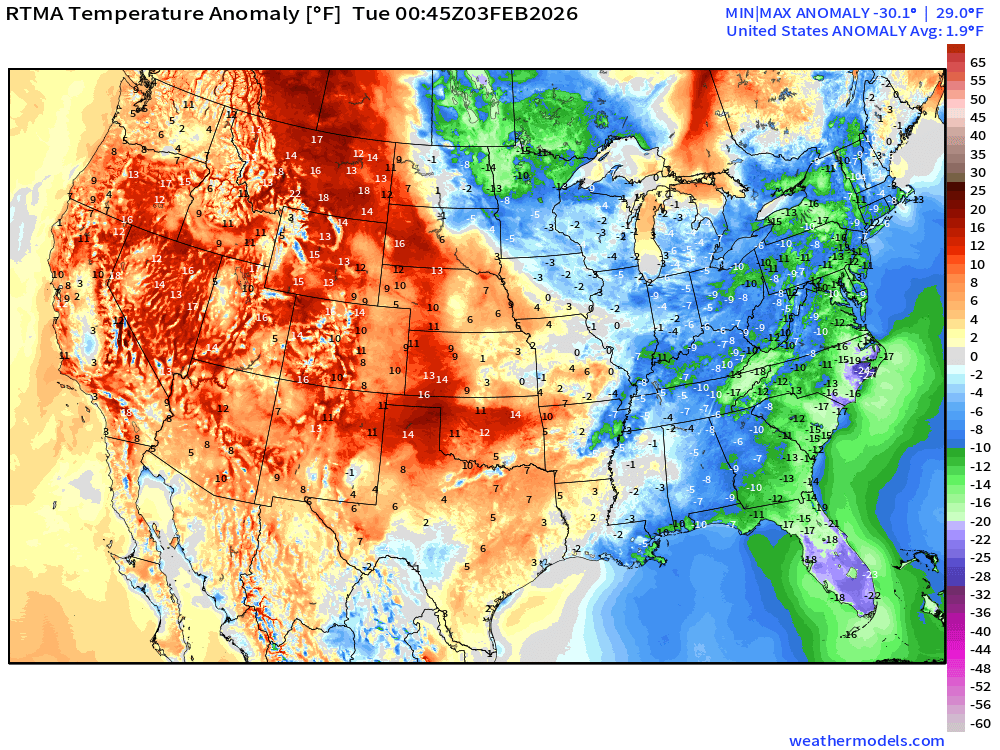
Lower 48 Temperature Anomaly above normal by 1.9°F with the coldest anomaly in Florida
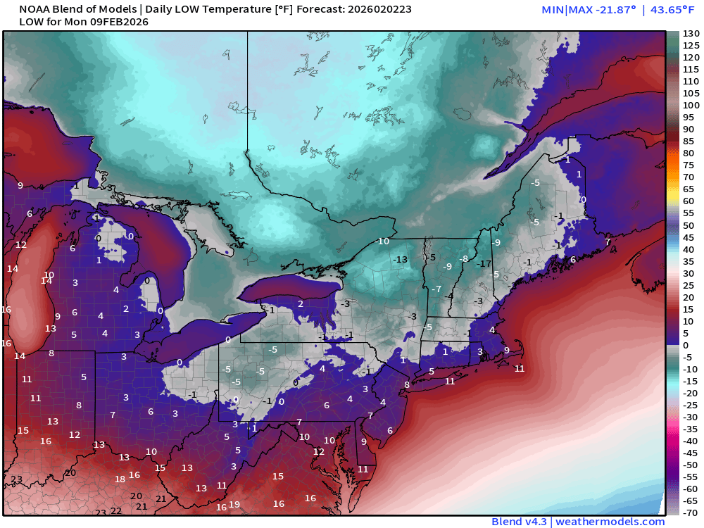
Lows next 8-days
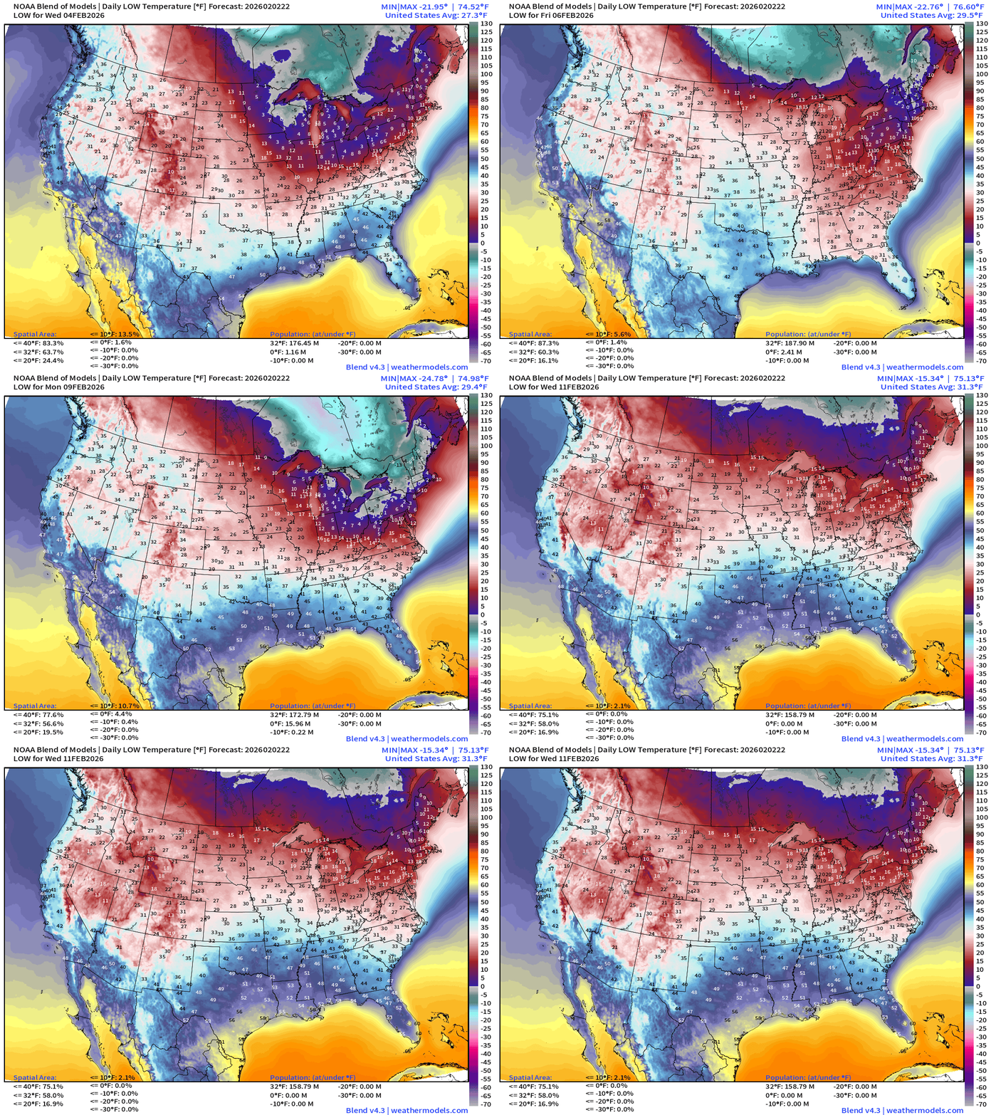
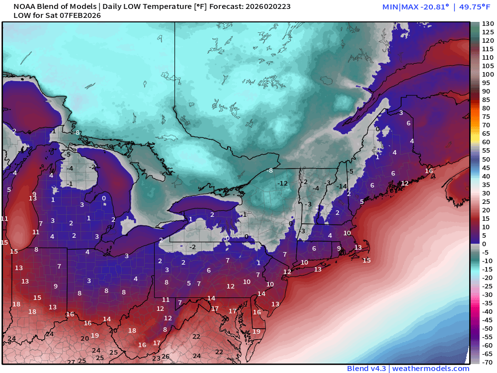
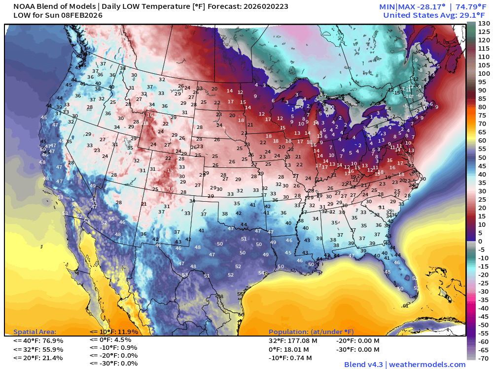
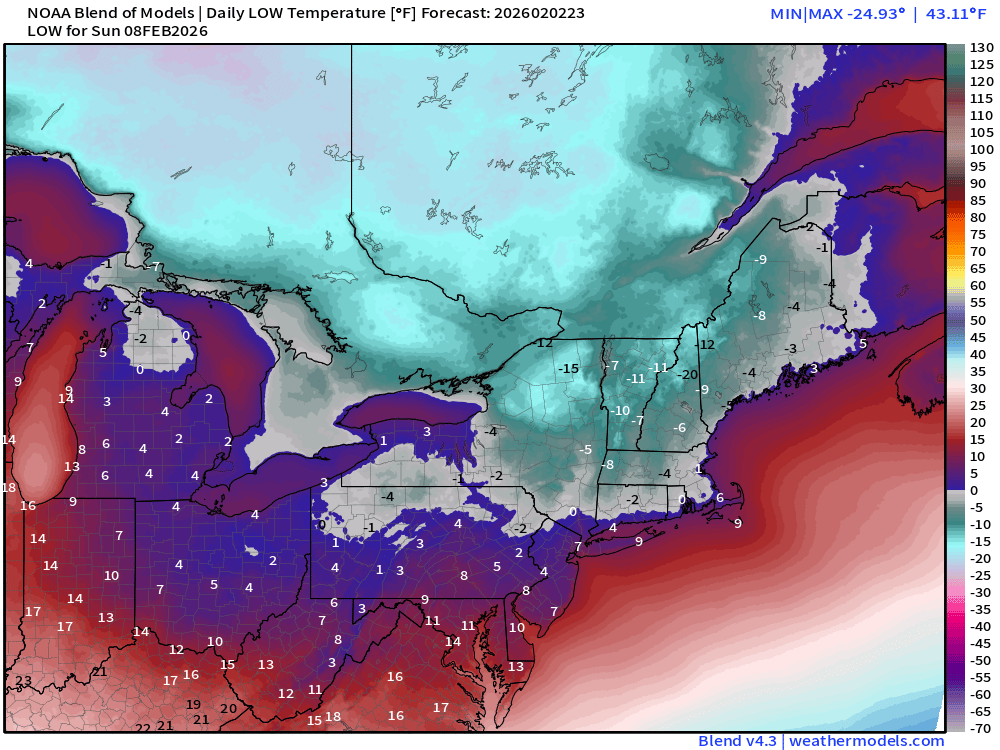
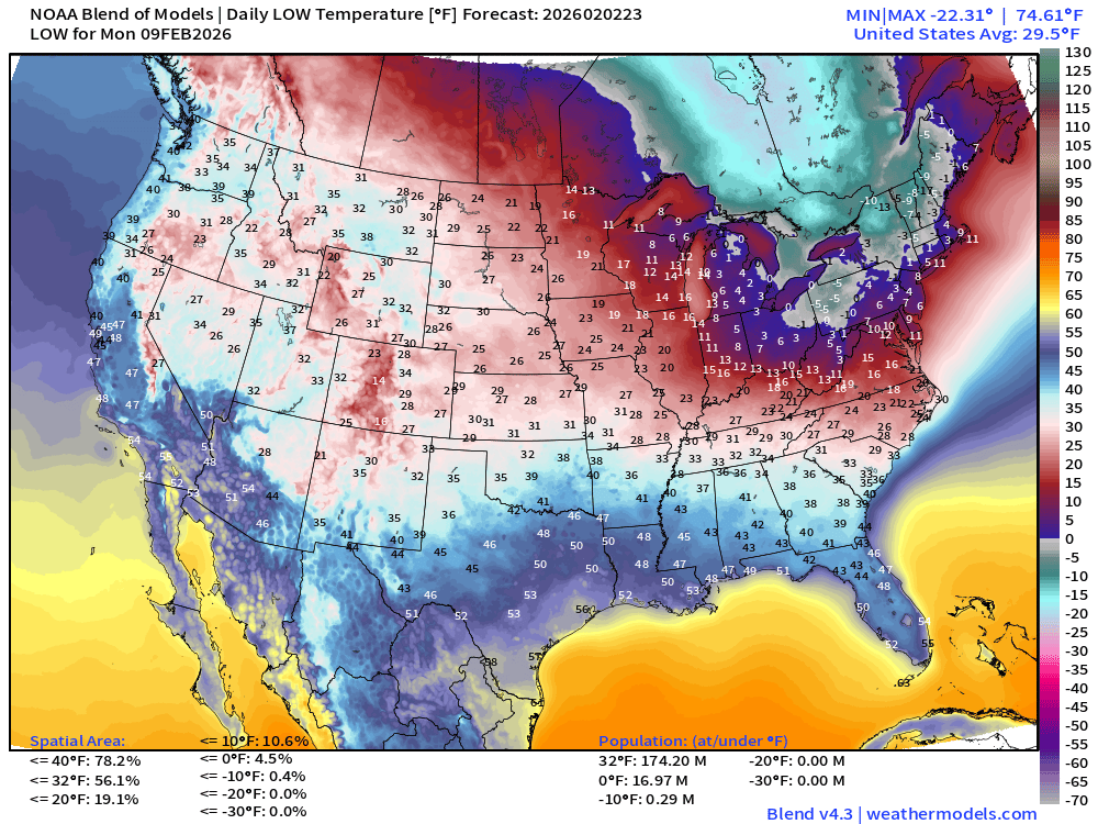
The Arctic air finally retreats by middle of next week across Great Lakes and Northeast! But until then, yikes, it’s going to get really cold.
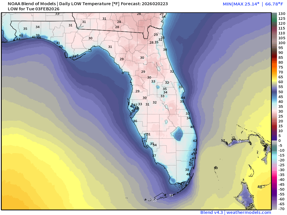
Low Temperatures Tuesday
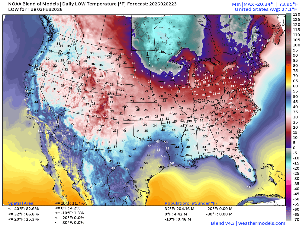
204 million below freezing — average of 27.1°F
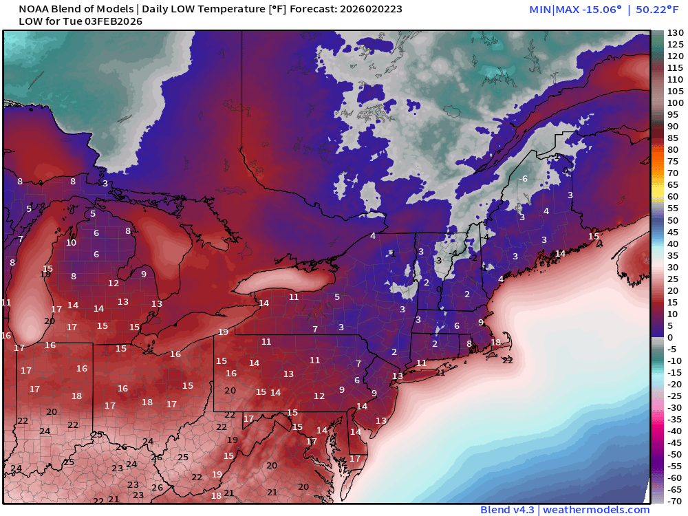
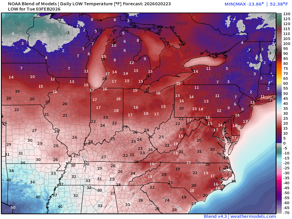
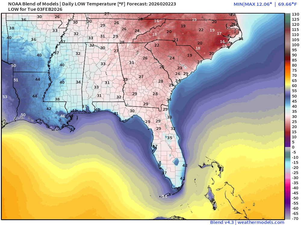
Still freezing in Florida Tuesday morning down the peninsula to Everglades!
High Temperatures Tuesday
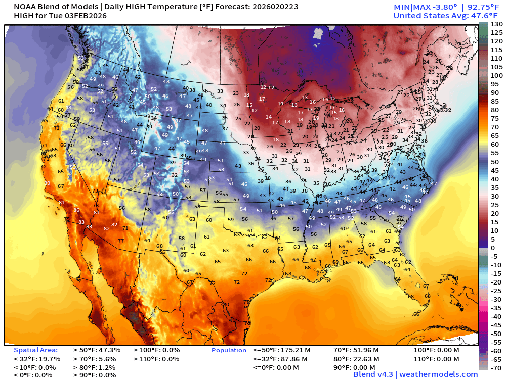
88 million stay below freezing during day … very warm in the Southwest including Southern California. 70s and 80s … look at all of those orange/red colors!
Meanwhile back in the Great Lakes and Northeast — Highs in the 20s.
Low Temperatures Wednesday
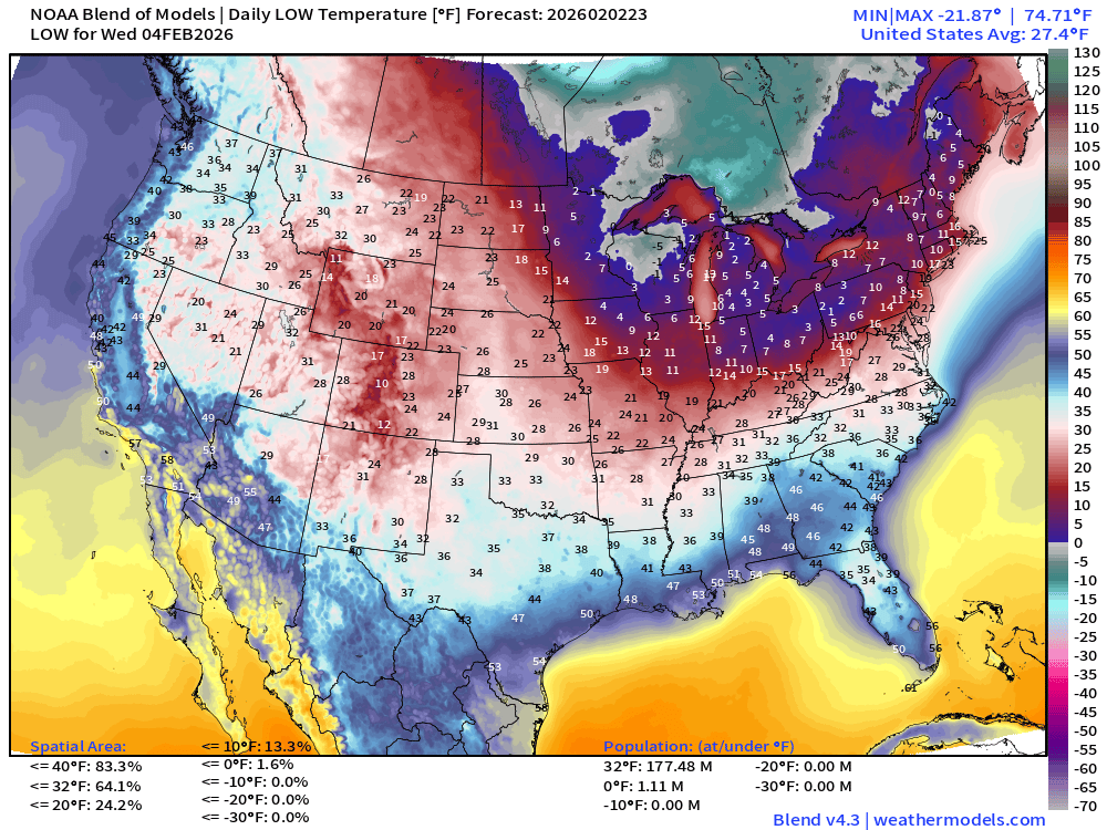
And, we’re down in the single digits again!
Next Weekend | Saturday Low Temperatures
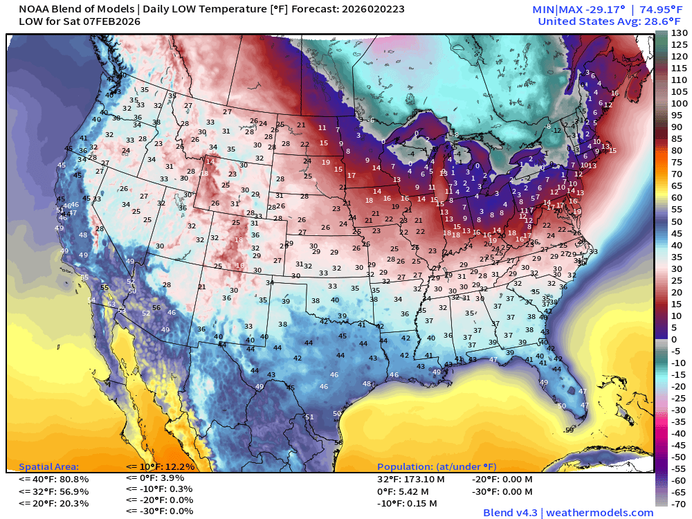
Next Weekend | Sunday Low Temperatures
Next Week | Monday Low Temperatures
ECMWF IFS 18z | Precipitable Water Next 6-days
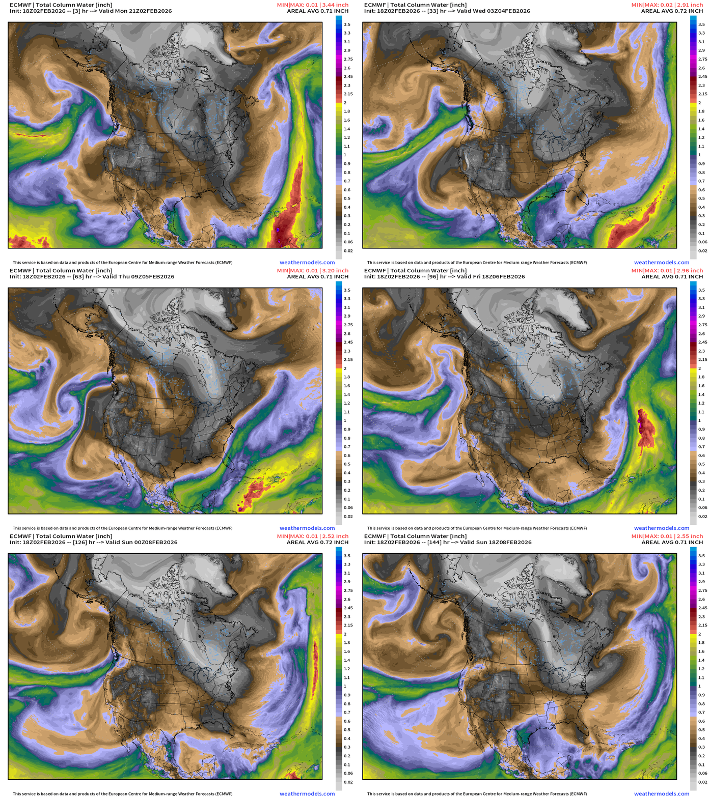
Pacific moisture from atmospheric rivers on the horizon into weekend as the strong Canadian Arctic trough carves a path through the Northeast but hopefully doesn’t come much further south.
Flagship ECMWF 12z EPS | Temperature Anomaly | Next 15-days
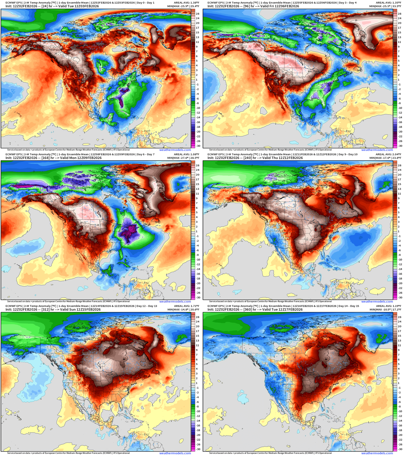
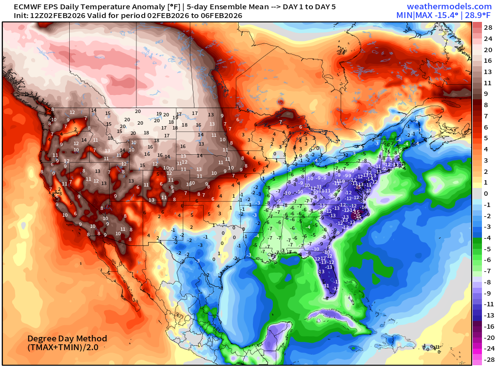
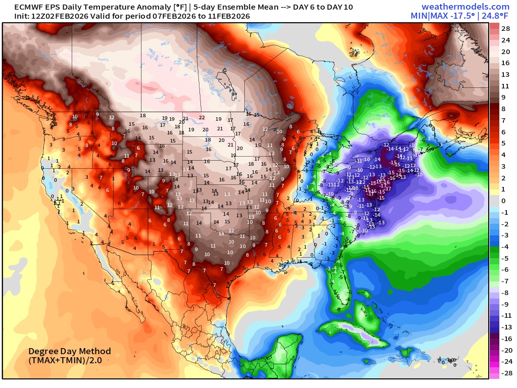
Very significant warming trend for the central U.S. into Days 6-10, and then pushes Eastward by shutting the door on the Northwest Flow out of Arctic — we’ll see how durable this Pacific warmth will be past mid-February.
ECMWF AIFS-Single 18z | Temperature (500 hPa) Next 12-days
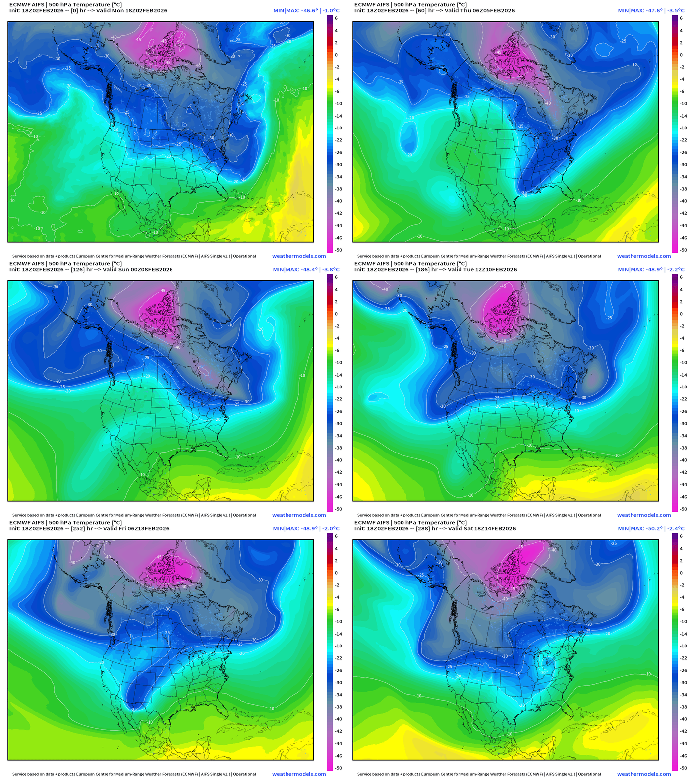
The temperature at 500 mb is the easiest way to highlight the “polar vortex” across North America with the coldest pool at -40°C (pink) with the -25°C contour usually associated with below freezing temperatures at 2-meters (surface).
The main -45°C pink air mass is mostly sectioned off and unable to dip out of the Arctic ocean latitude 70°N — quite a distance away for Lower 48 impacts into mid-February. We can see the same story in the thickness fields with the gray TPV well north over edge of the Arctic Ocean.
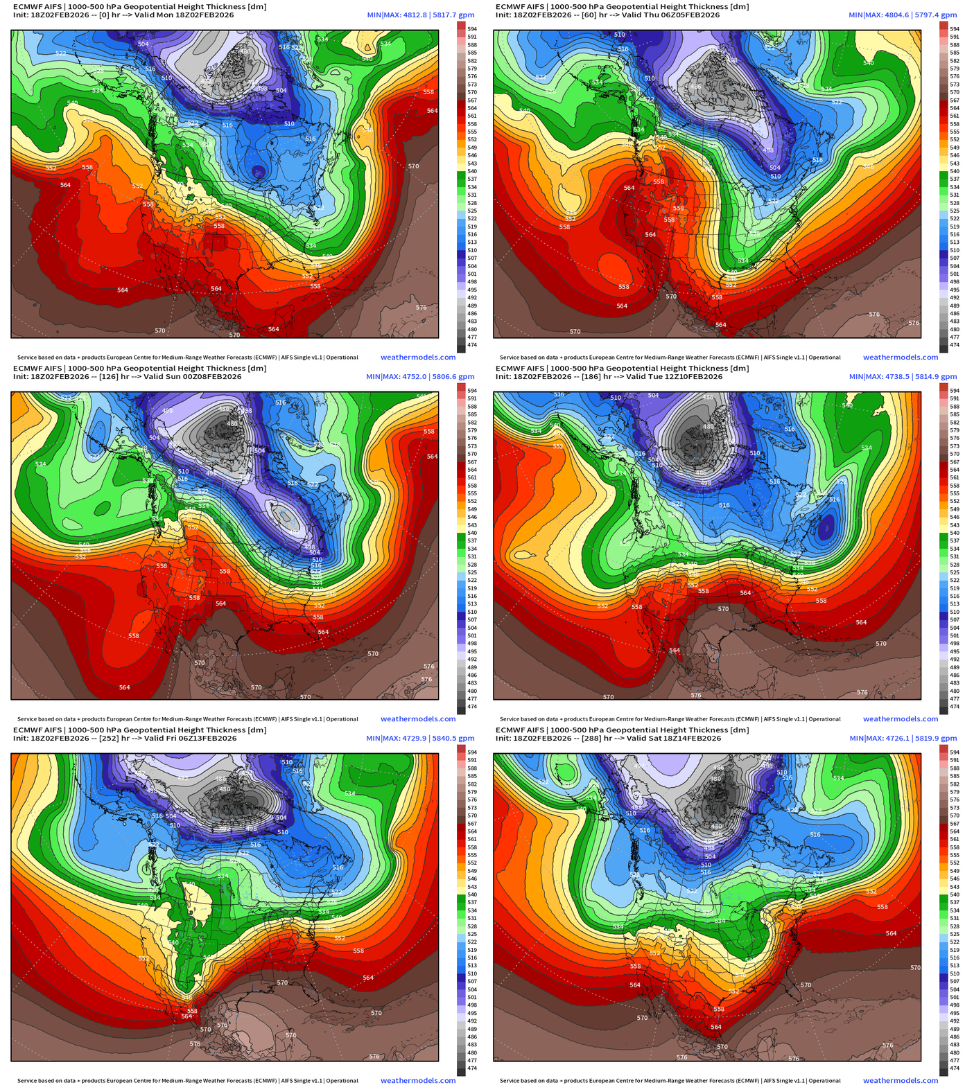
Blend of Models | 7 Days Precipitation Total
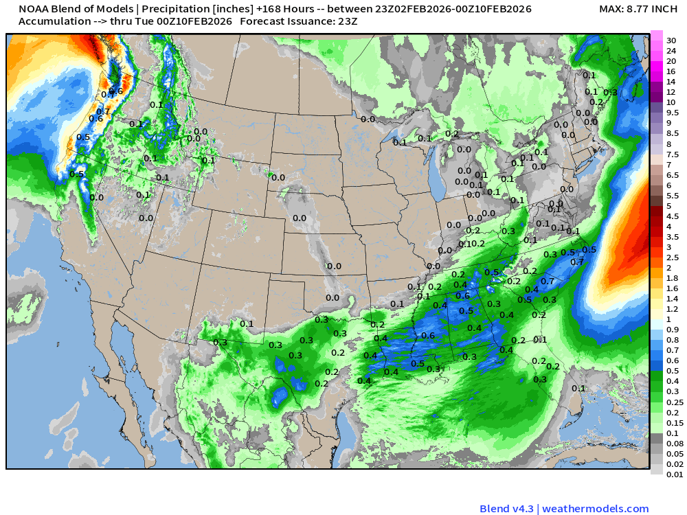
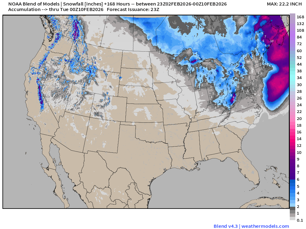
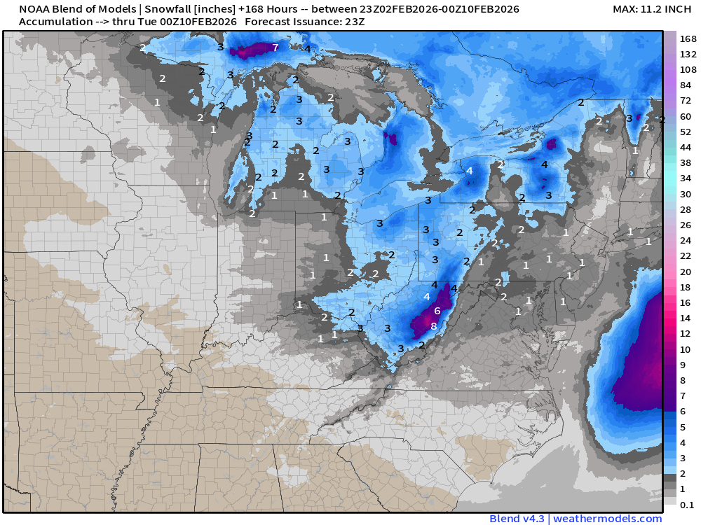
Blend of Models | Total Snowfall Next 7-Days
ECMWF AIFS 15-day Snowfall | Long Range Look
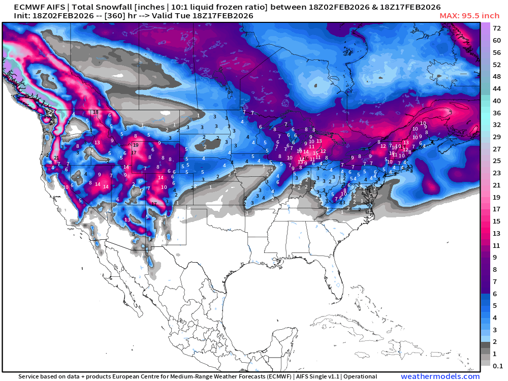
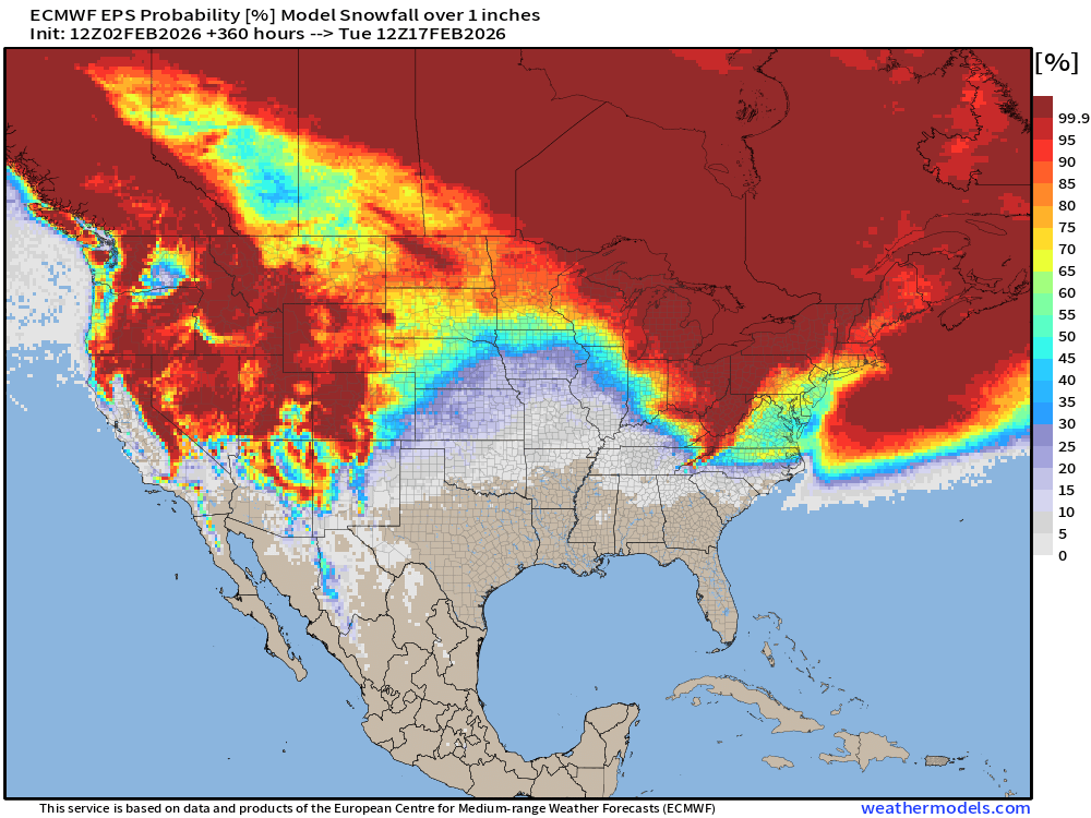
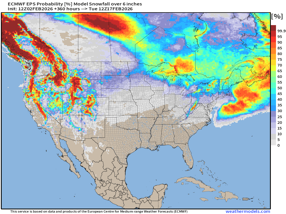
Western Snowfall Returns! Also some potential storms in the Great Lakes and Northeast past Day 10, so winter is NOT over.
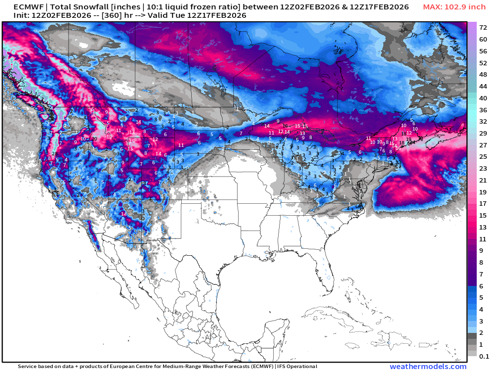
ECMWF HRES 15-days Long Range Snowfall Also shows the welcome return of snowfall and moisture to the Pacific Northwest and Rockies.
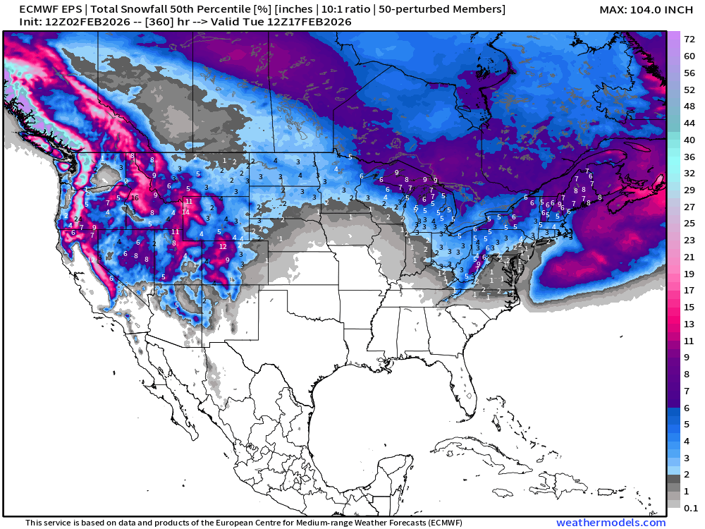
More Long Range Snowfall | EPS 12z — Next 15-days Ensemble Median
Probability of at least 1” snowfall next 15-days
Probability of at least 6” snowfall next 15-days
Temperature Anomaly | Next 15-days | ECMWF EPS 12z
5-Day Chunk #1 | Temperature Anomaly | Feb 2 - Feb 6
5-Day Chunk #2 | Temperature Anomaly | Feb 7 - Feb 11
5-Day Chunk #3 | Temperature Anomaly | Feb 12 - Feb 16
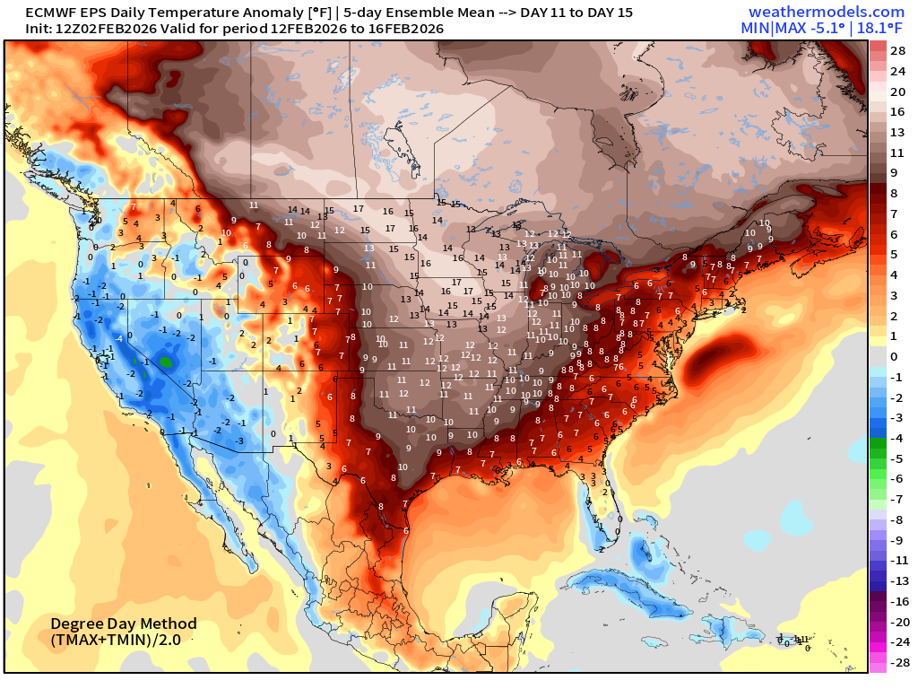
Much warmer across the Central and Eastern U.S.
Maps sourced from weathermodels.com designed and innovated by yours truly! Please subscribe there for real-time access to the newest maps, charts from all of the weather models including ECMWF and AIFS, NOAA AI-GFS/AI-GEFS
- Milepost
- 857 · laid 2026-02-03T01:41:59.972000Z
- Source
- https://weather.substack.com/p/february-2-2026-monday-winter-weather
- Digest
- 2e083d4463610d02e9d2bac9808987a883a79be239dacc2352747b148452f406
- Machine
- JSON