February 1, 2026 Sunday Winter Weather
Quiet weather until next weekend when Northeast suffers yet another Arctic blast
February 2026 was the 4th-warmest February in the 132-year national record (1895–2026), at 40.3°F against a 1991–2020 normal of 35.6°F (+4.6°F).
February 2026 was the 5th-driest February in the 132-year national record (1895–2026), at 1.4in against a 1991–2020 normal of 2.1in (-0.7in).
NOAA/NCEI Climate at a Glance, contiguous United States. This is the observed record for the month, not a score of anything said in this piece — the forecast ledger begins 2026-08-17 and cannot reach earlier posts.

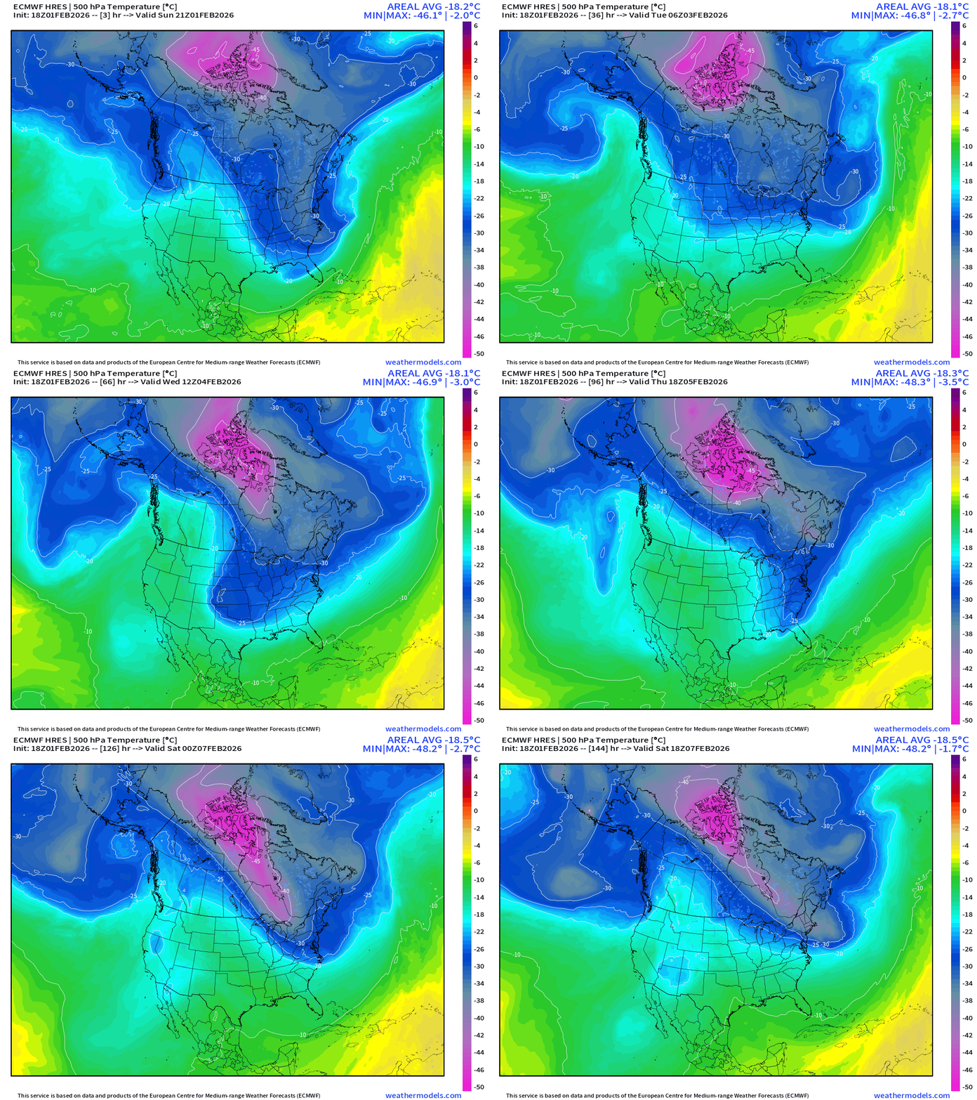
We still have another “Arctic Blast” coming this next weekend cross the Great Lakes and Northeast. The main reservoir of mid-level super-cold air (-45°C) in the pink is stationary over Arctic Canada but Pacific shortwave disturbances along the jet stream are able to pull the “lobes” southward, but not the whole tropospheric “polar vortex” suggesting we might be seeing a well-deserved break from the extremely cold air into the second week of February.
ECMWF 18z Precipitation Type + Intensity | Next 6-days
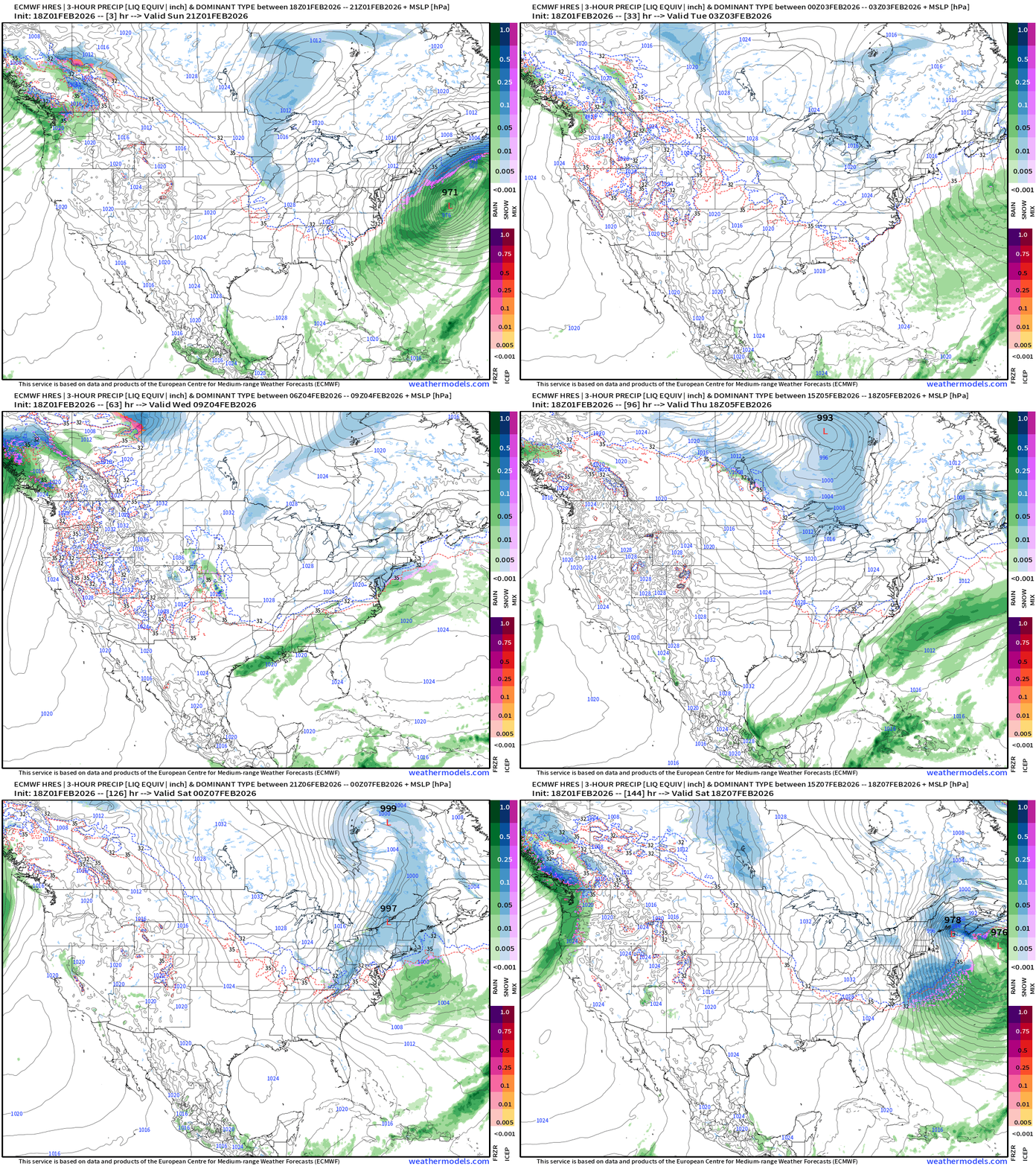
Weak Clipper system mid-week might bring a dusting of snowfall to the Mid-Atlantic
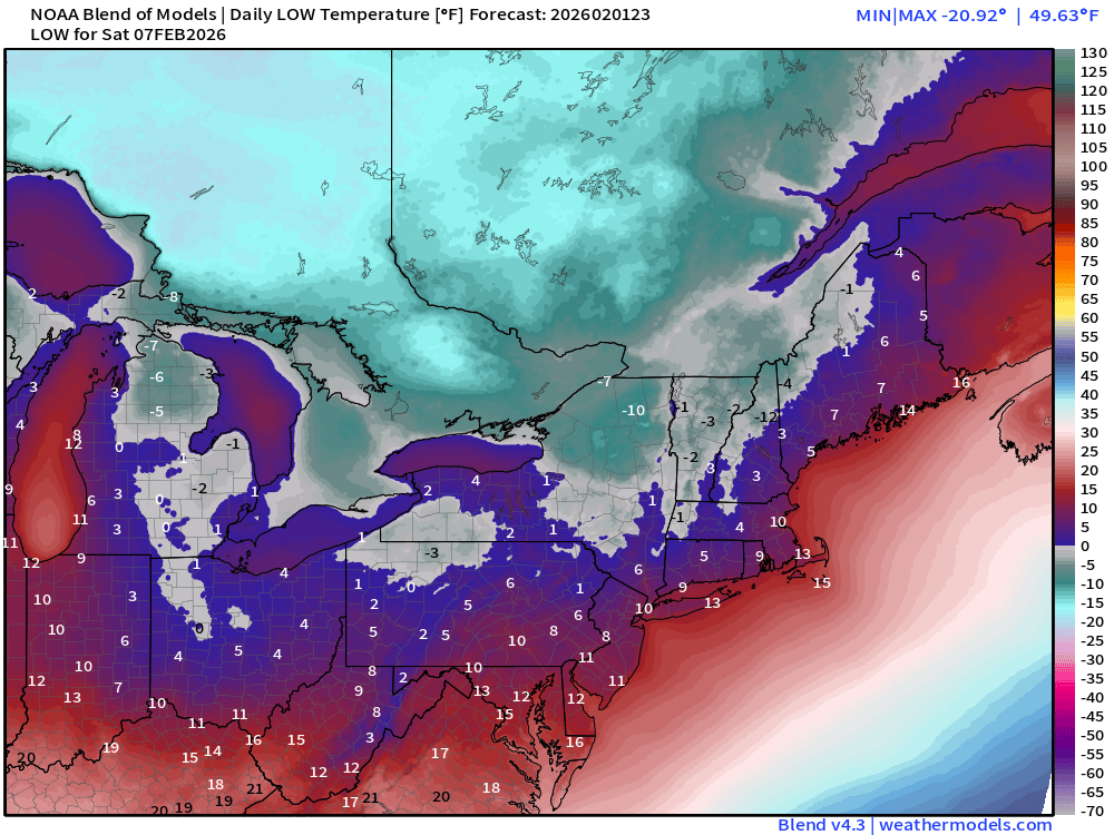
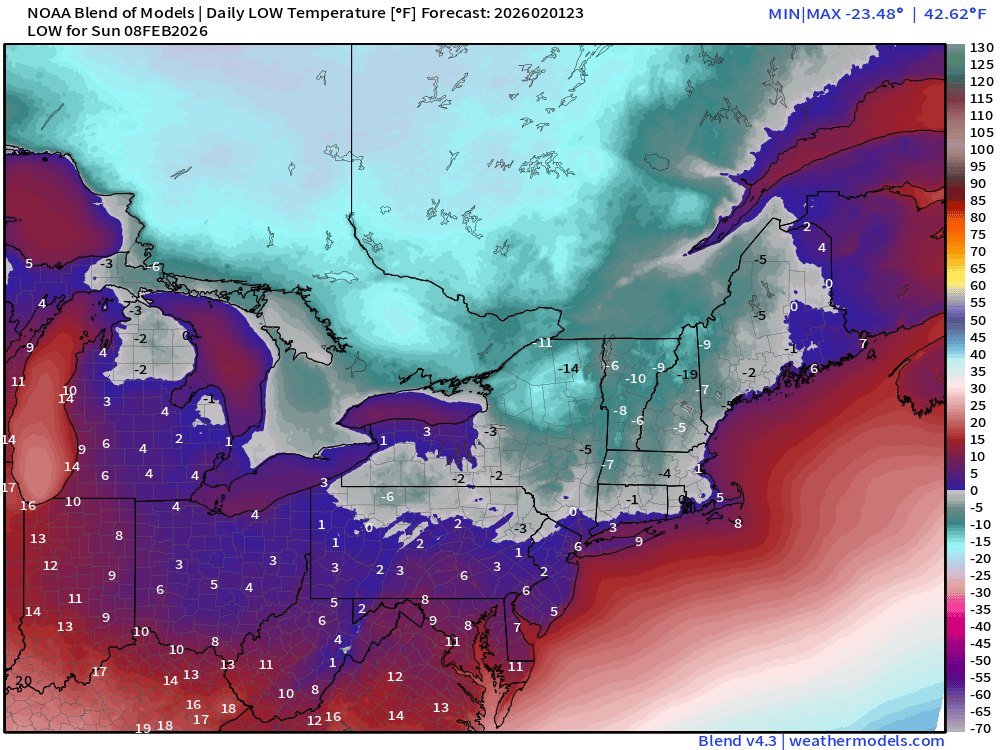
Another Clipper tracks through he Great Lakes Fri into Sat and develops off the New England coast / Gulf of Maine. Still a lot of time to watch this storm evolve, and we could have more impacts to the Northeast, or the development occurs much further off shore. Regardless of this Nor’easter, very cold air will rush into the Great Lakes, Ontario, Quebec, and the Northeast for the weekend — perhaps the coldest of the Winter Season.
East Coast USA Zoom | Next 6-days
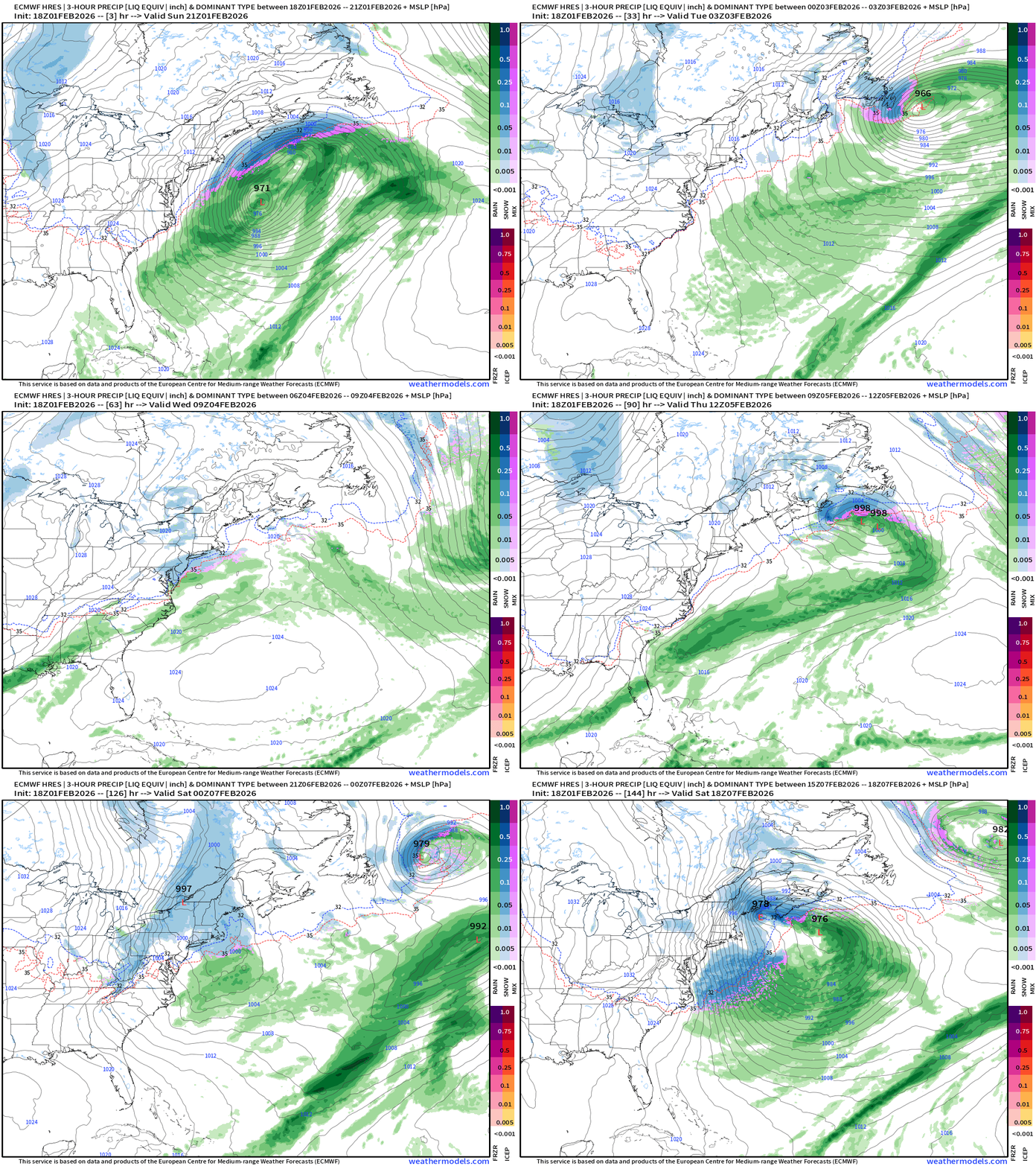
This potential storm system is associated with a very intense and sharp trough and thickness anomaly connected to the main PV up in Arctic Canada.
Some Day 6 Maps: Thickness (1000 mb - 500 mb)
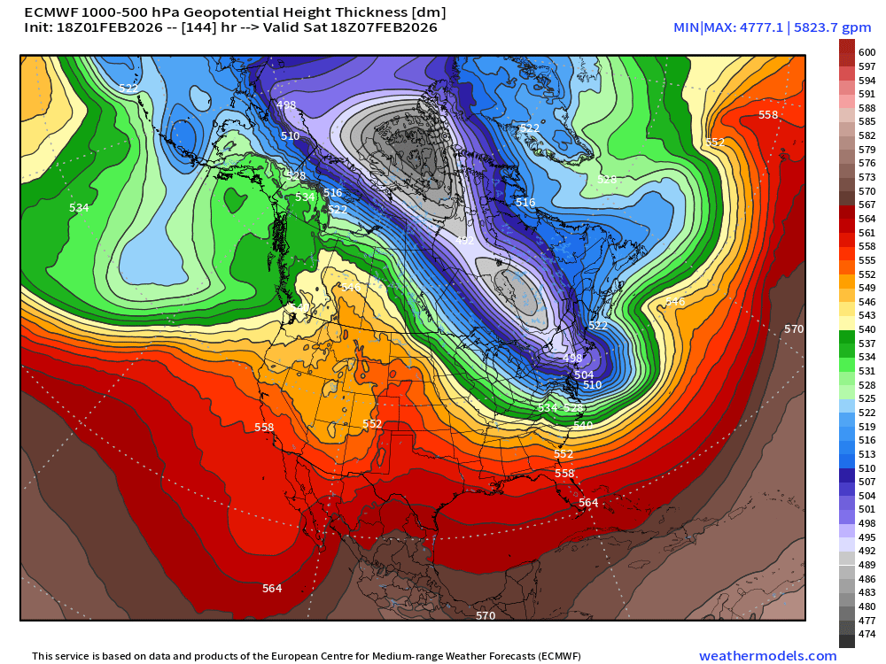
Typical “PV lobe” structure and evolution for a major cold blast. Huge height anomaly (-500 m)
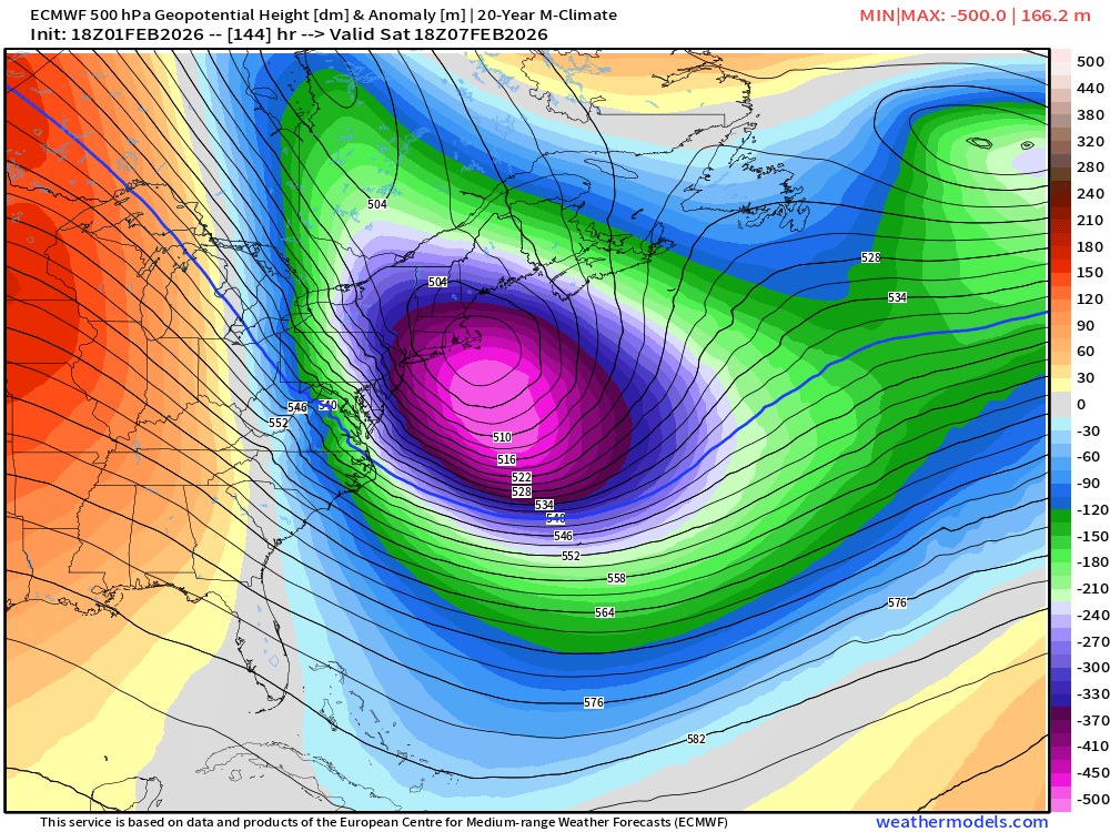
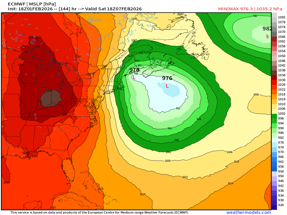
This would spawn a very large storm system yet again — not the typical Shapiro-Keyser lifecycle from a frontal wave and rapid intensification, but more of a gyre type development due to rapid height and pressure falls with the main upper-level baroclinic energy w/jet stream.
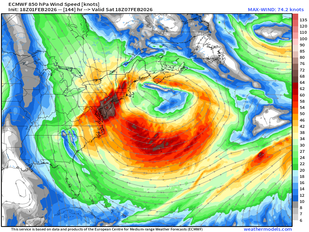
Central Pressure would be low but over a large area with multiple centers making predictability difficult.
Very cold air pours out of Ontario and Quebec into the Mid-Atlantic and Northeast with temperatures 30°F to 40°F below normal — for February 7th — and that’s darn cold.
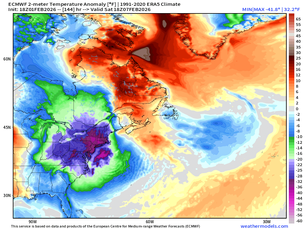
Evolution of Temperature Anomaly over next 6-days
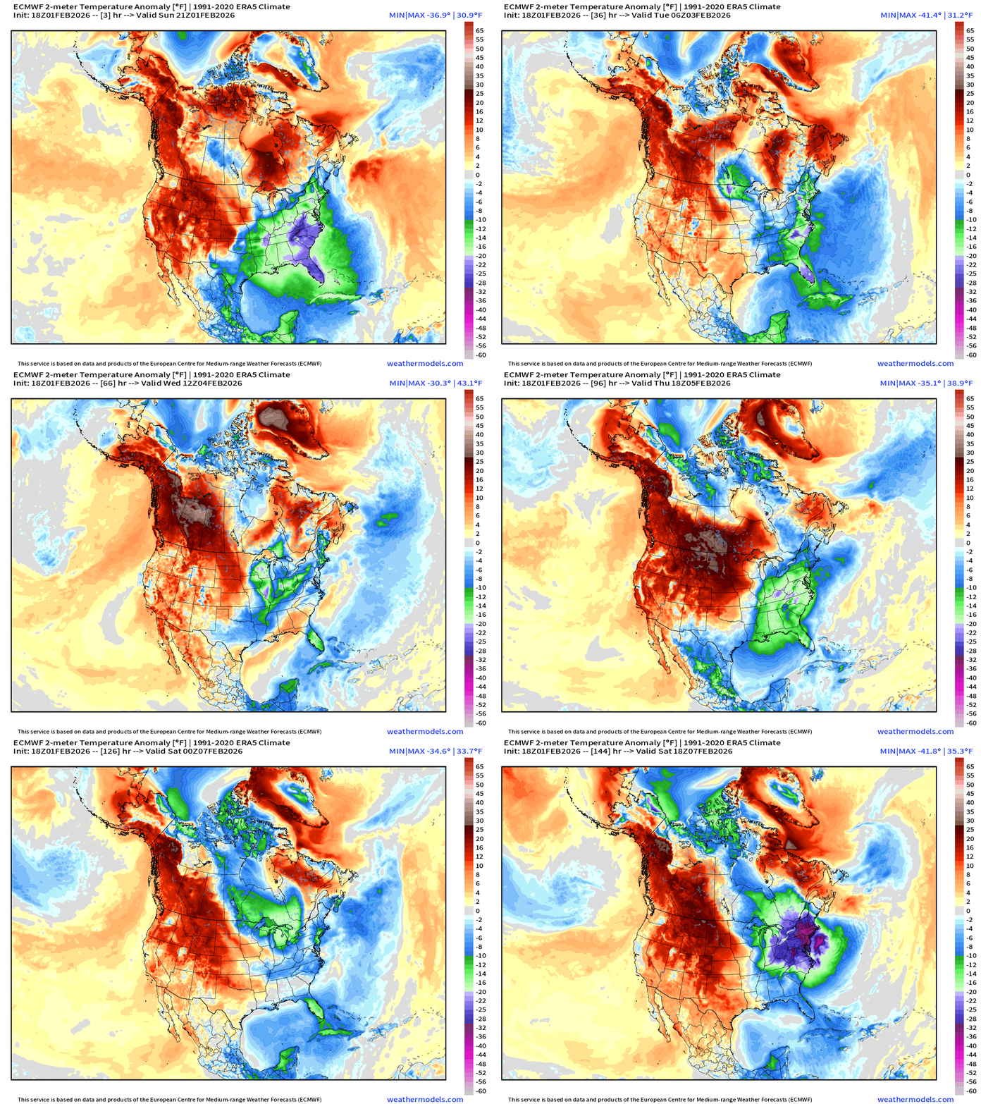
Significant western warmth — above normal at last — will continue to build and attempt to push eastward after our Weekend Arctic blast
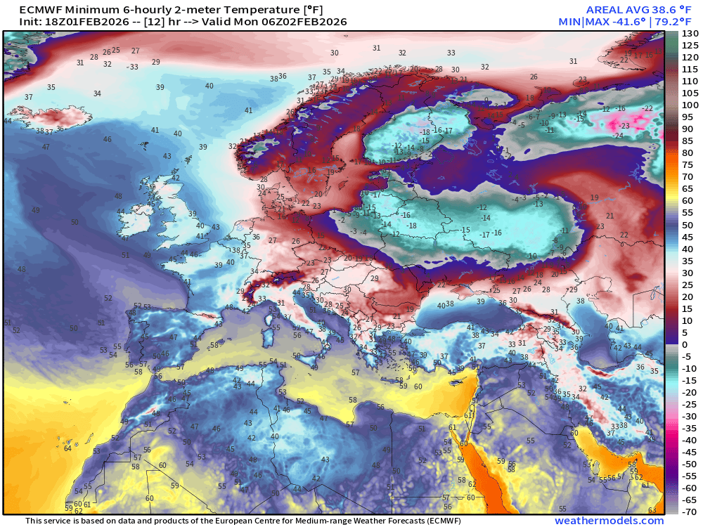
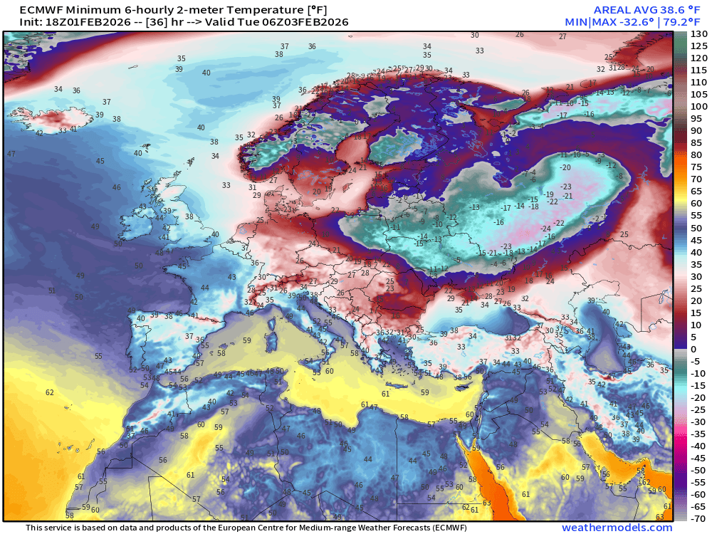
Eastern Europe Extreme Cold
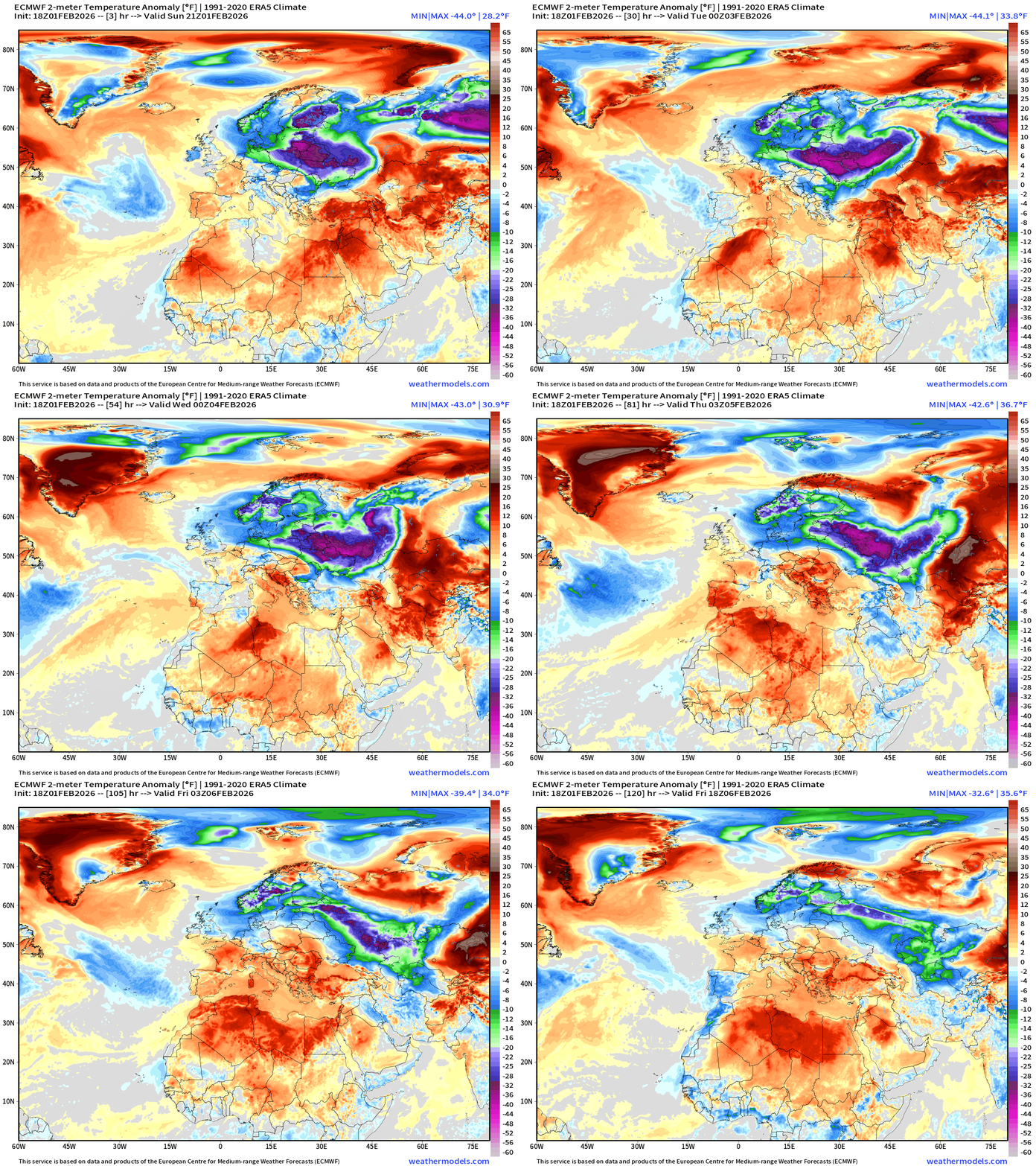
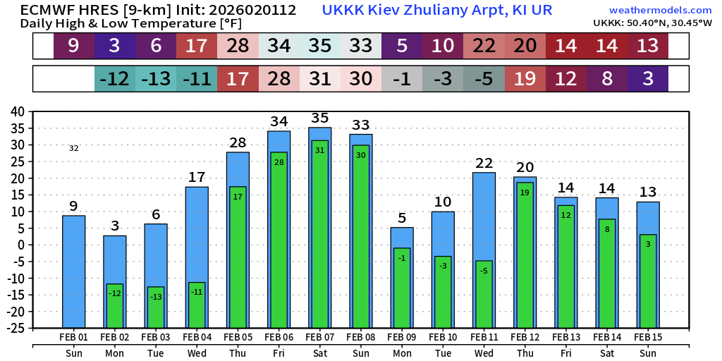
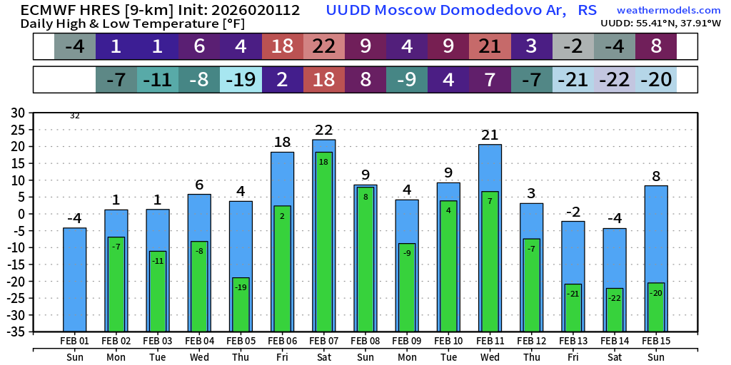
Poland, Belarus, Ukraine, and Russia into Moscow are all seeing brutal cold temperatures well below zero at night … Kiev in the minus 10s °F
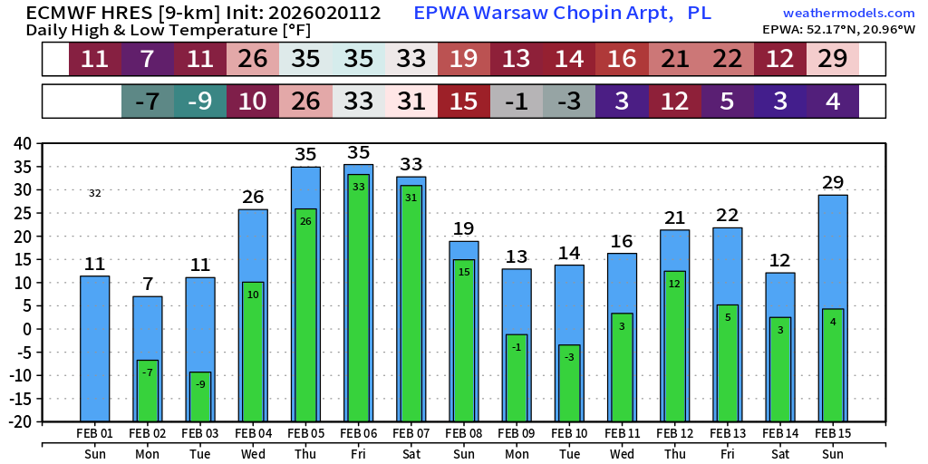
Warsaw, Poland down to -7°F and -9°F next two mornings, with some thawing later in the week before turn to much colder conditions.
Europe Lows on Monday morning
Europe Lows on Tuesday morning
Europe Lows on Wednesday morning
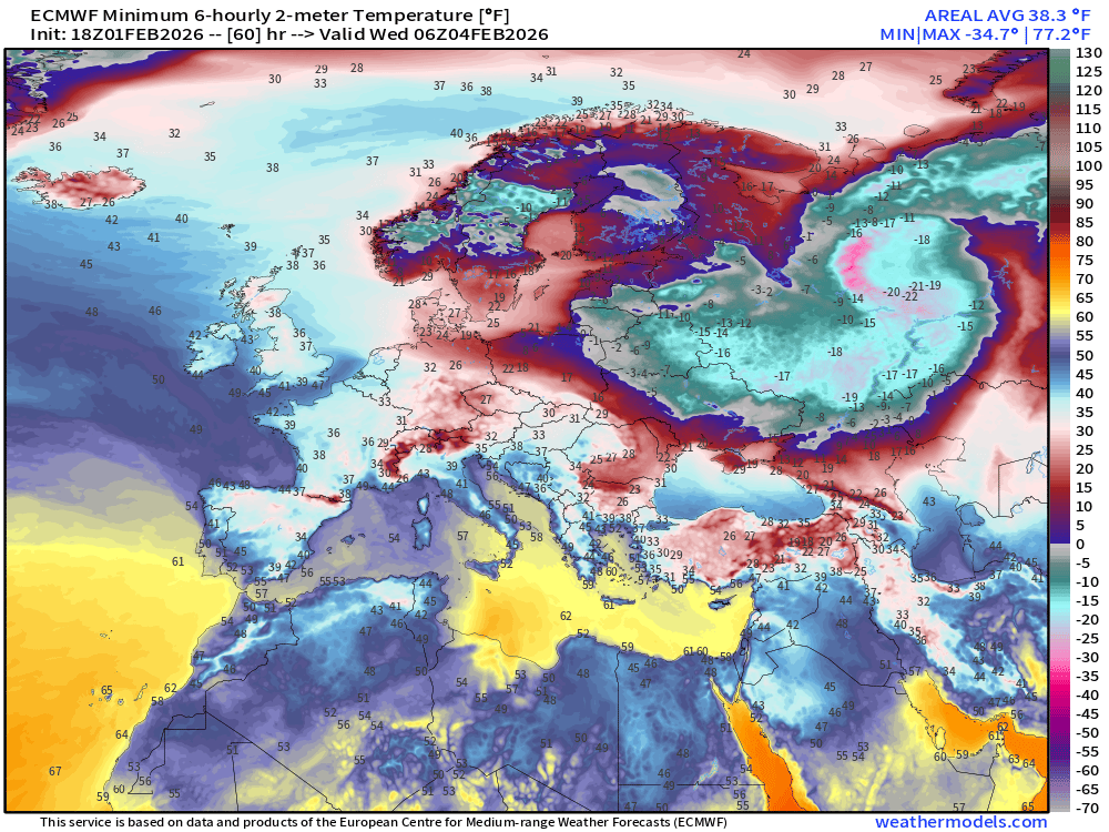
By Wed - Thurs the cold pool moves east to Moscow and ECMWF 12z had -19°F for Thursday’s low. Yikes.
If you are a first time visitor but not signed up to receive my daily update emails — please do! There is no A.I. content generation here unless it is a global weather model like AIFS!
If your subscription lapsed for whatever reason and want to return at your original rate (50% off) as initial annual member from 2024 & 2025: Link to Come Back your continuing support is appreciated!
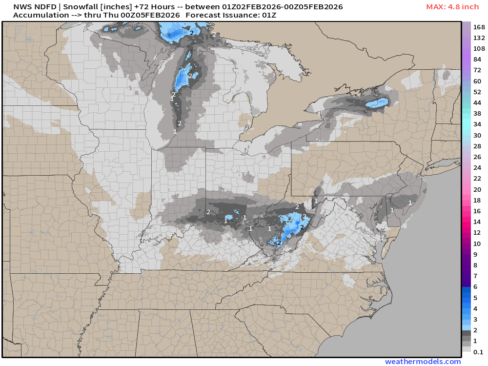
NWS NDFD Snowfall next 3-days
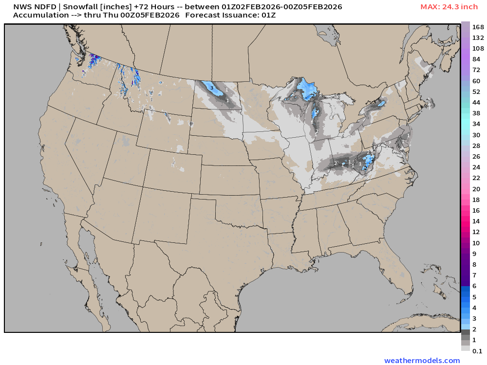
Just some minor accumulations with Clipper Systems over the next few days.
RTMA | Morning Temperature Analysis | 8:00 PM ET
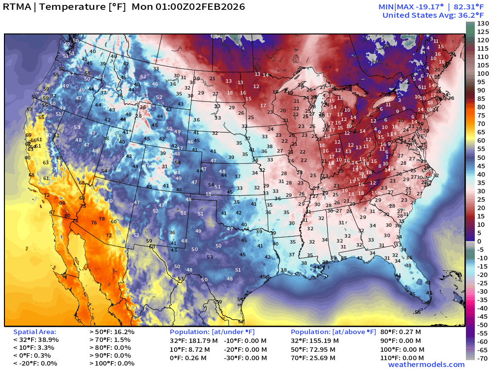
Avg Lower 48 temperature was 36.2°F — 182 million below freezing.
Temperature Anomaly | 8:00 PM ET
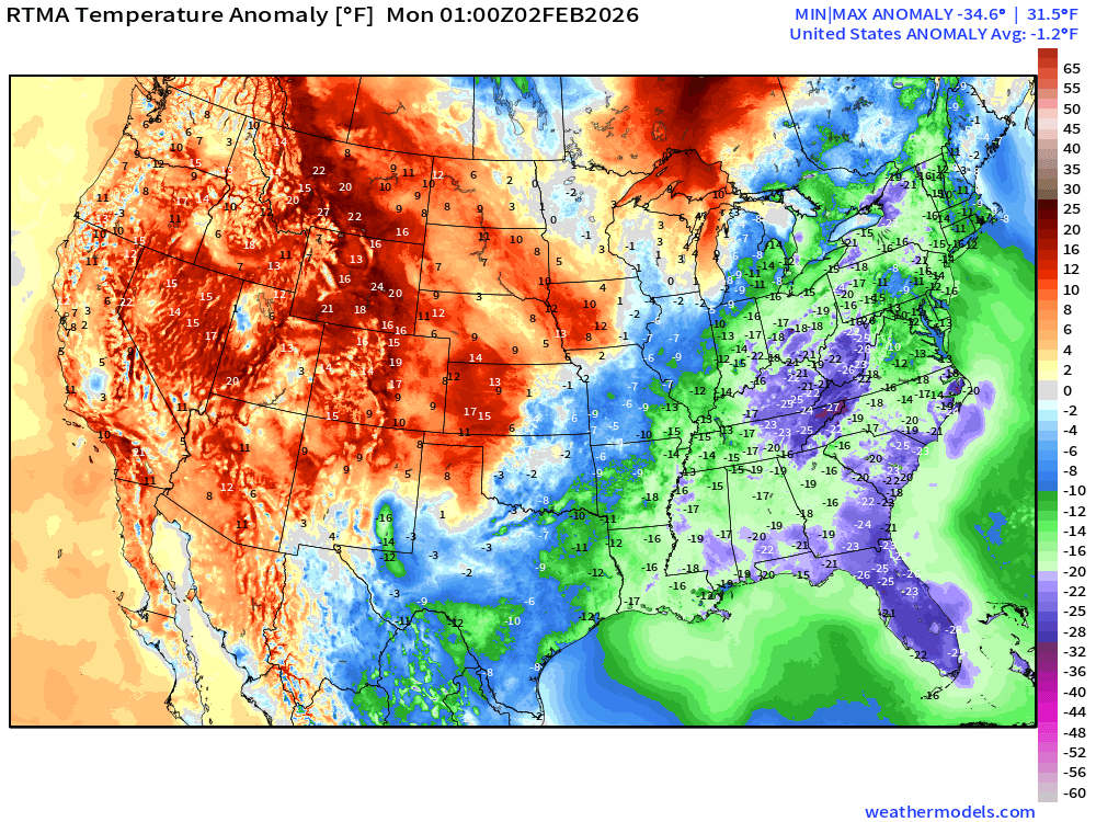
Lower 48 Temperature Anomaly below normal by -1.2°F
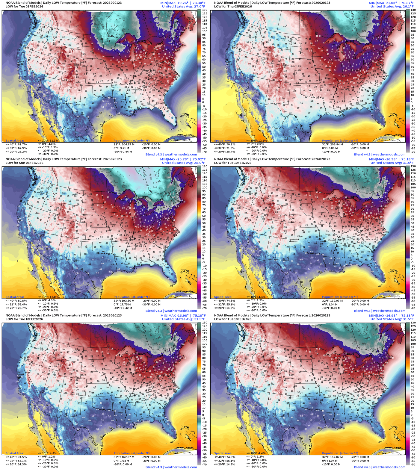
Lows next 8-days
Low Temperatures Monday
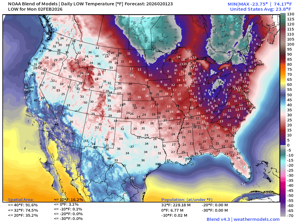
228 million below freezing — average of 23.8°F
Florida could be nearly as cold Monday morning as Sunday.
How cold was Florida this morning? 8 AM ET analysis
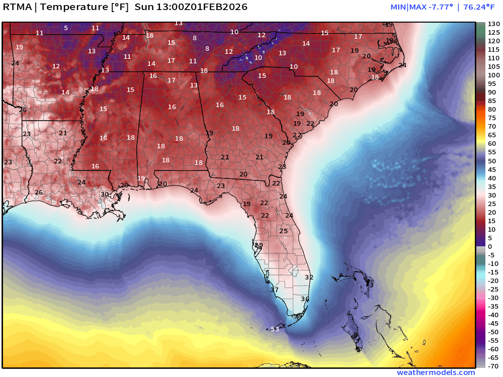
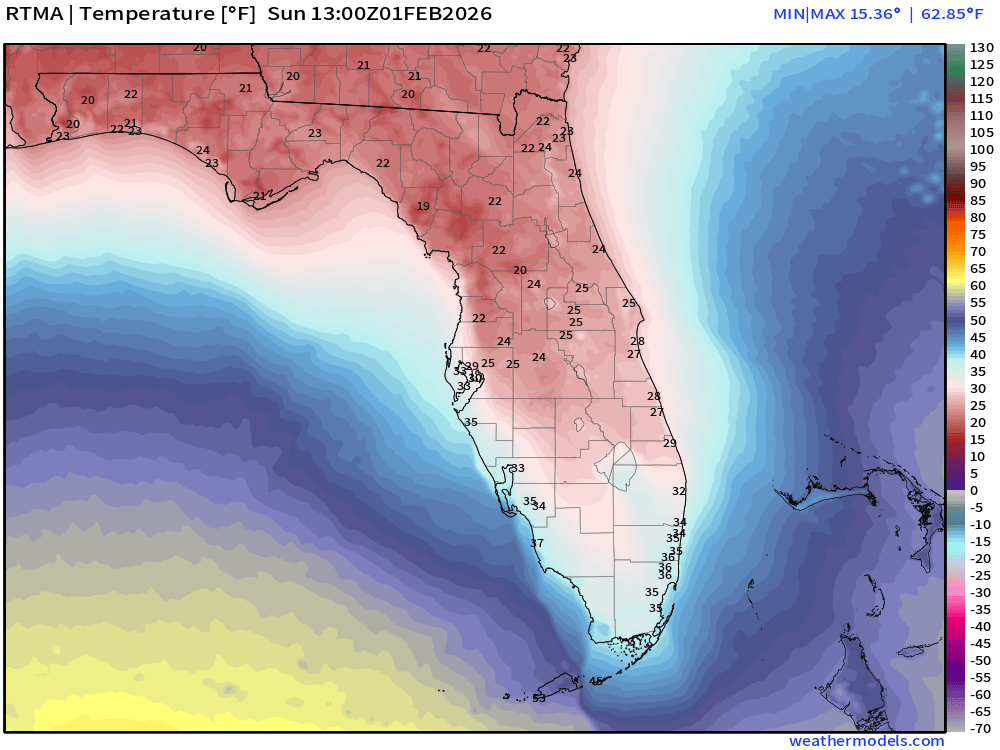
While Miami only dipped to 35°F that was the coldest February temperatures since the 1950s. Daytona Beach fell to 23°F also the coldest Feb temp since records started in 1923. This blast was in some places comparable to 1977 and 1989 but the synoptic setup was not perfect for the coldest air to crash through Miami.
High Temperatures Monday
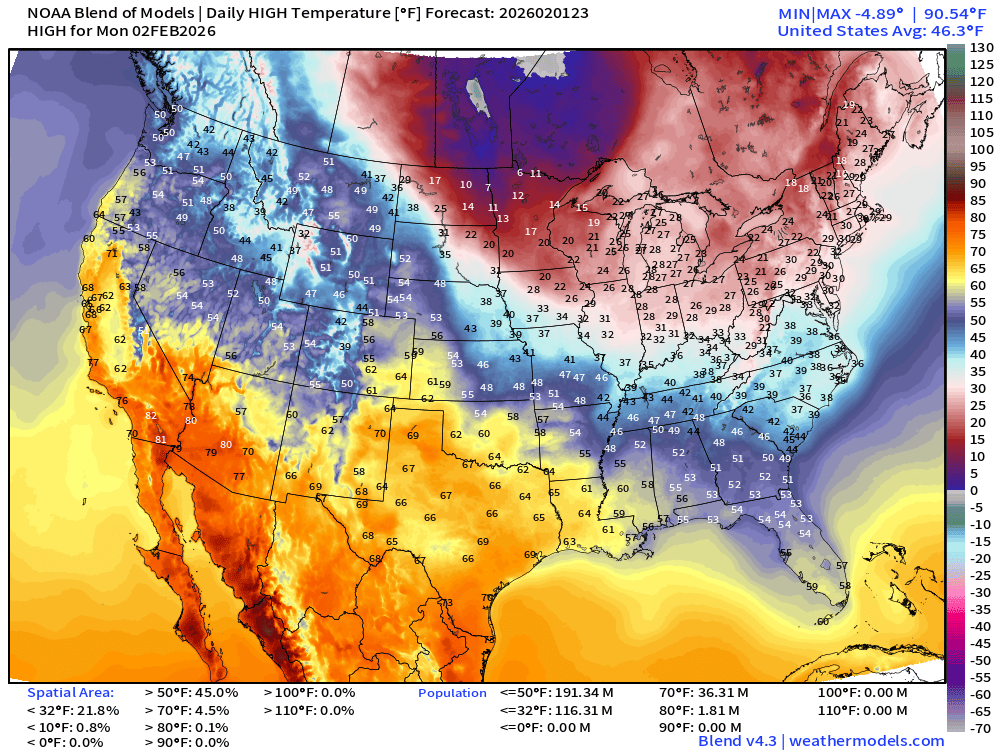
116 million stay below freezing during day … quite warm in the Southwest including Southern California. 60s and low-70s
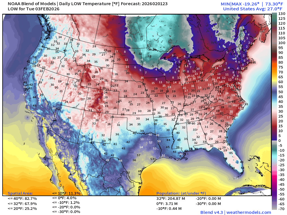
Low Temperatures Tuesday
Next Weekend | Saturday Low Temperatures
Next Weekend | Sunday Low Temperatures
ECMWF IFS 18z | Precipitable Water Next 6-days
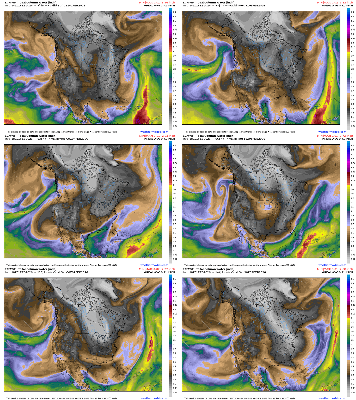
Pacific moisture from atmospheric rivers might be on the horizon into the weekend as the strong Canadian Arctic trough carves a path through the Northeast.
Flagship ECMWF 12z EPS | Temperature Anomaly | Next 15-days
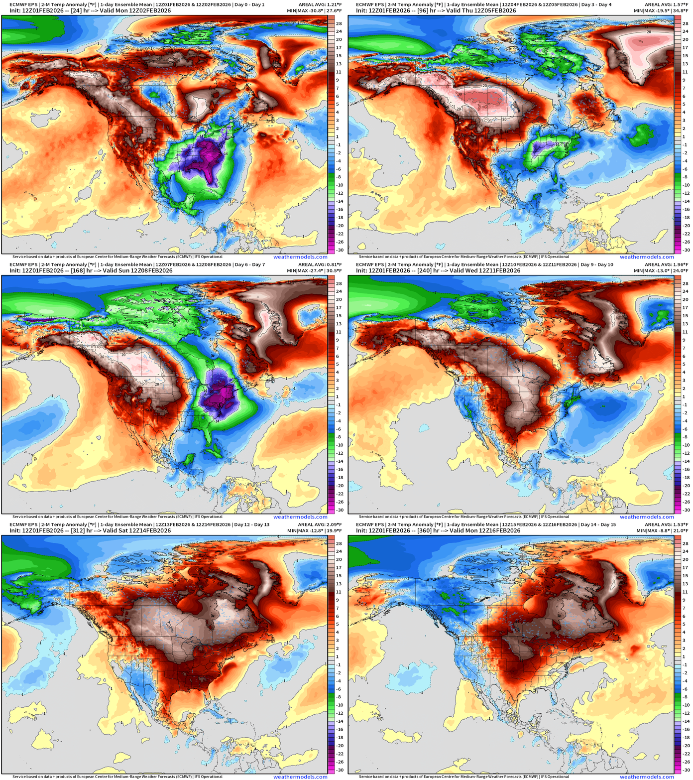
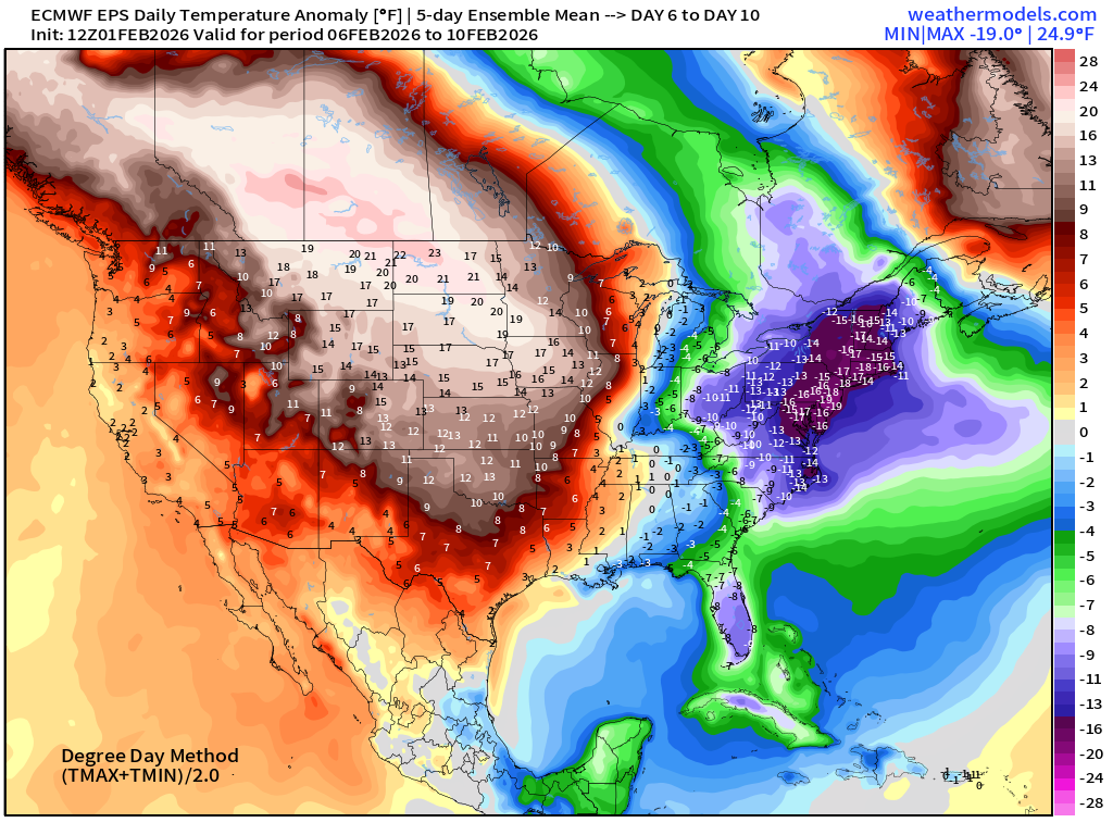
Significant warming trend for the central U.S. into Days 6-10, and then pushes Eastward by shutting the door on the Northwest Flow out of Arctic — we’ll see if this comes to fruition. The models have tried to push this Pacific air mass over the Rockies and each time over past few weeks came up empty.
ECMWF AIFS-Single 18z | Temperature (500 hPa) Next 12-days
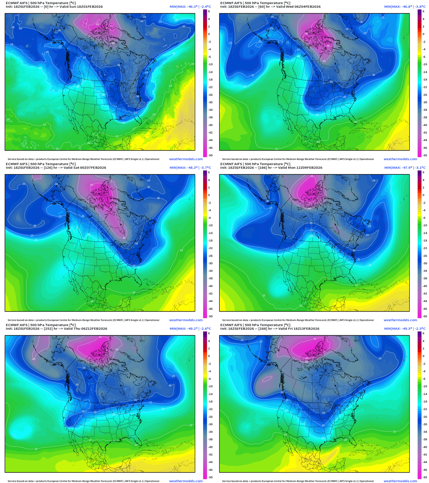
The temperature at 500 mb is the easiest way to highlight the “polar vortex” across North America with the coldest pool at -40°C (pink) with the -25°C contour usually associated with below freezing temperatures at 2-meters (surface).
The main -45°C pink air mass is mostly sectioned off and unable to dip out of the Arctic ocean latitude 70°N — quite a distance away for Lower 48 impacts into mid-February.
Blend of Models | 7 Days Precipitation Total
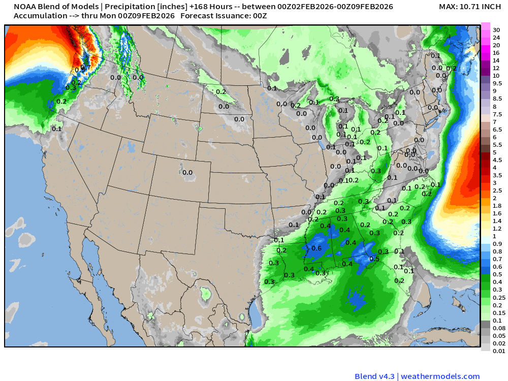
Blend of Models | Total Snowfall Next 7-Days
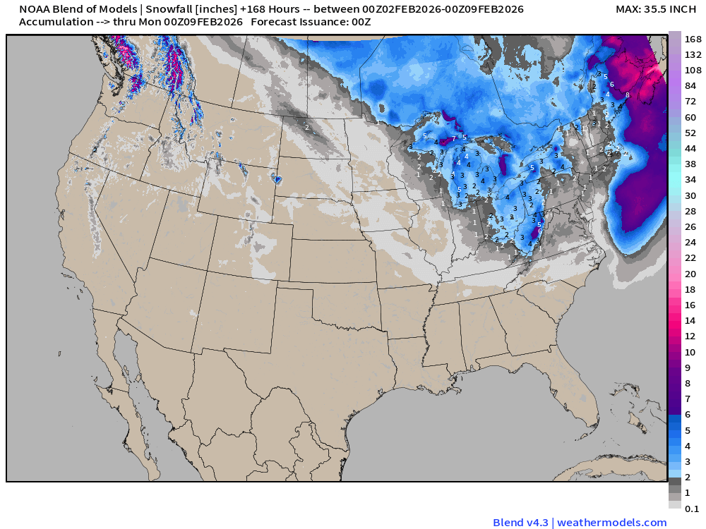
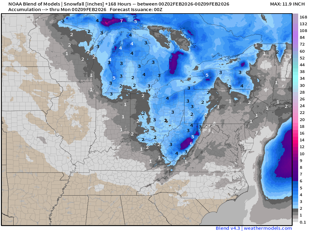
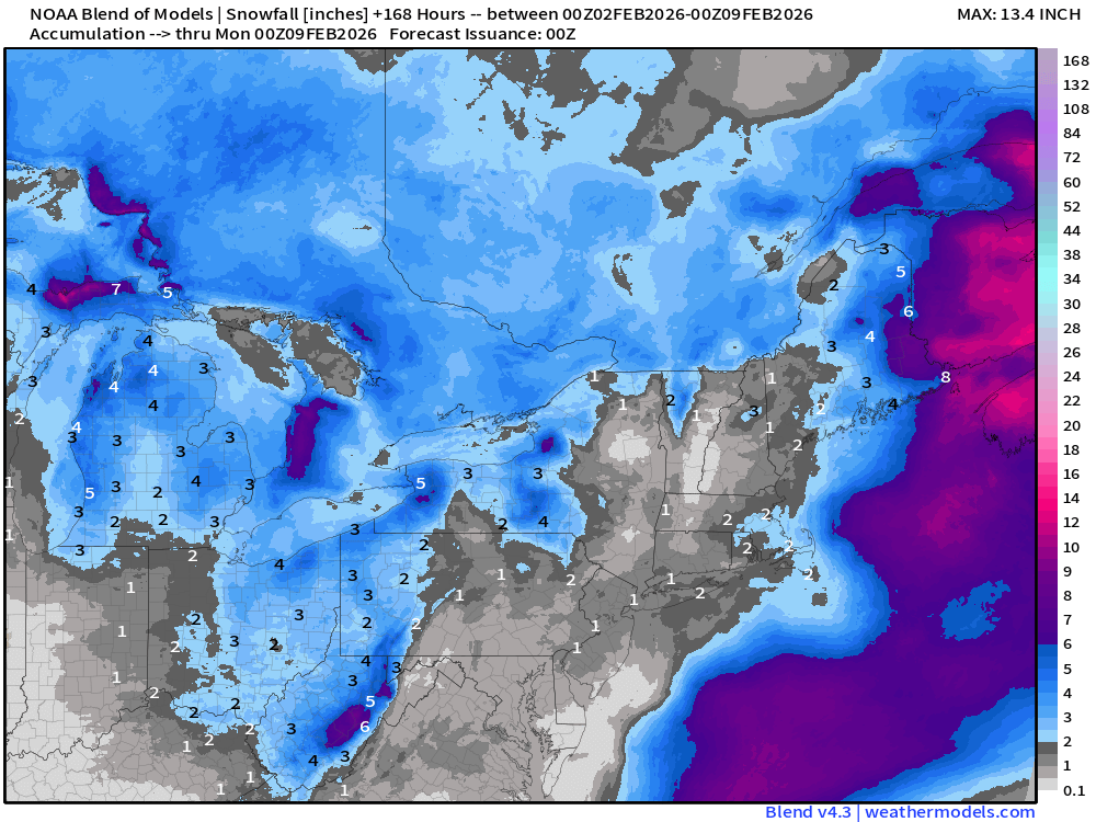
ECMWF AIFS 15-day Snowfall | Long Range Look
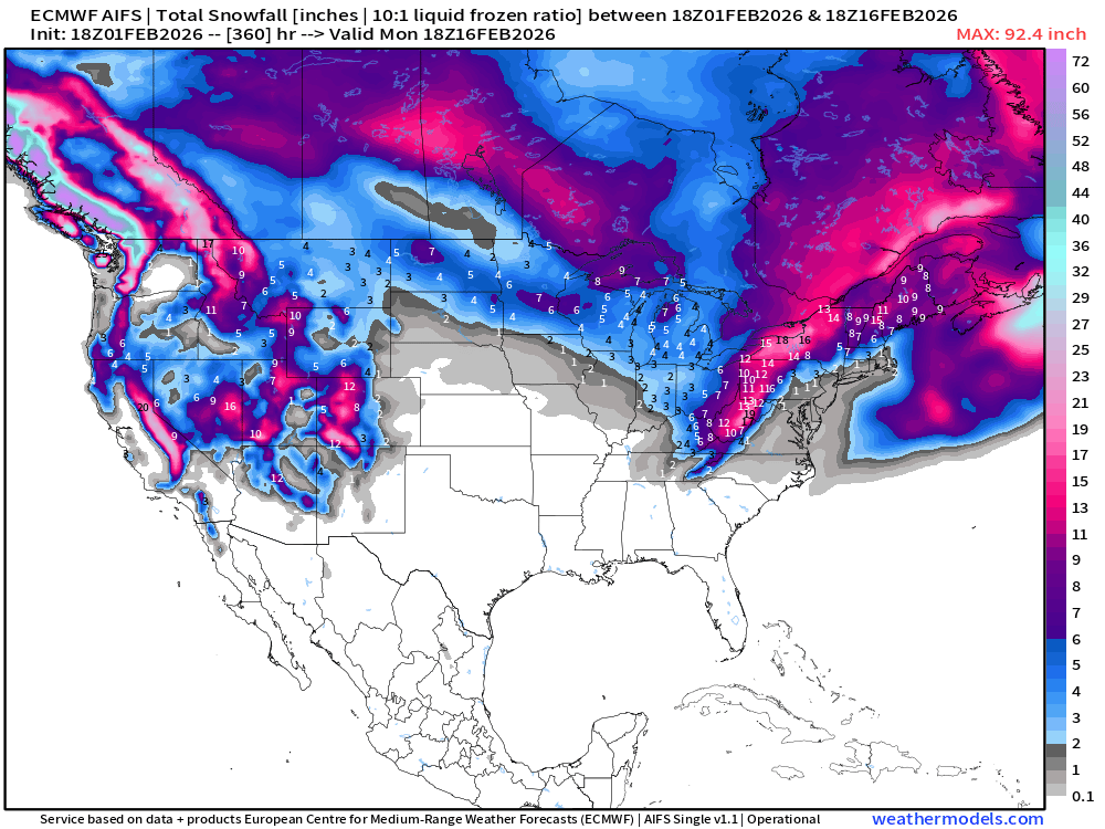
Western Snowfall Returns!
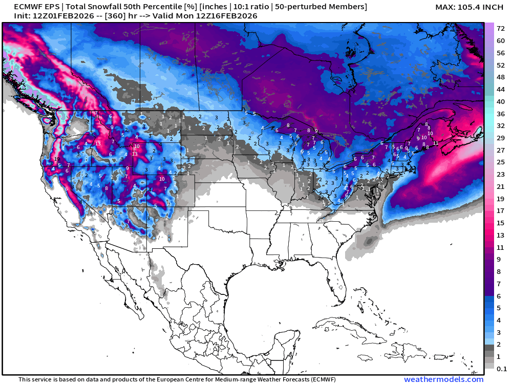
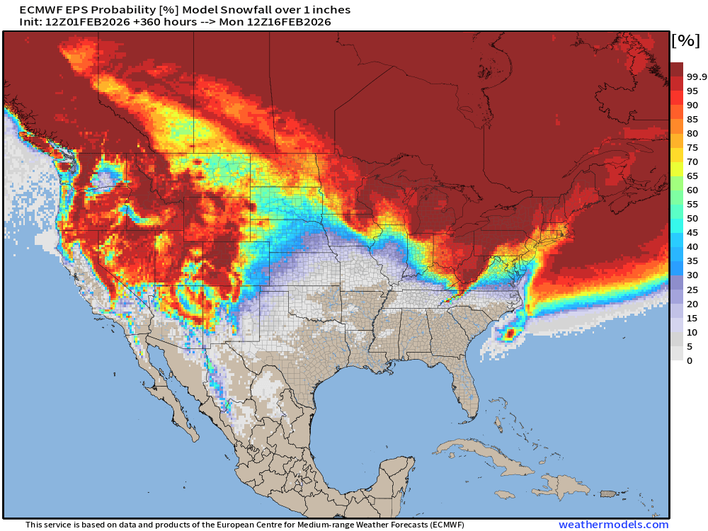
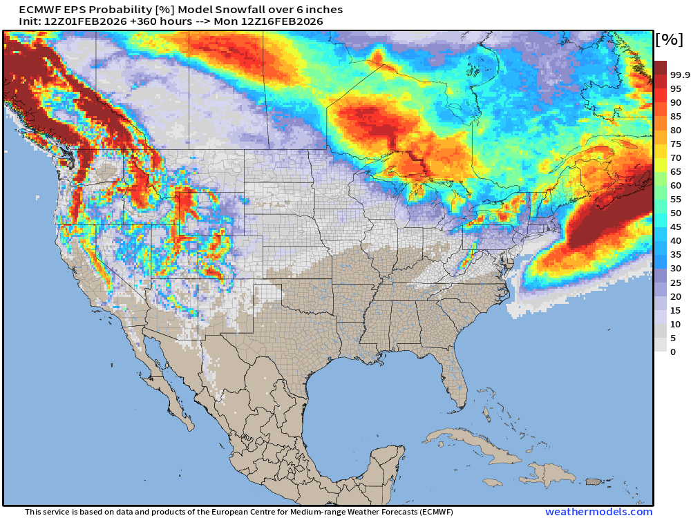
ECMWF HRES 15-days Long Range Snowfall Also shows the welcome return of snowfall and moisture to the Pacific Northwest and Rockies.
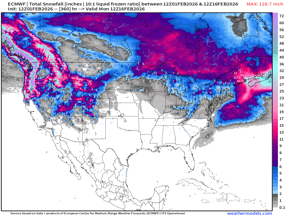
Long Range Snowfall from EPS 12z — Next 15-days Ensemble Median
Probability of at least 1” snowfall next 15-days
Probability of at least 6” snowfall next 15-days
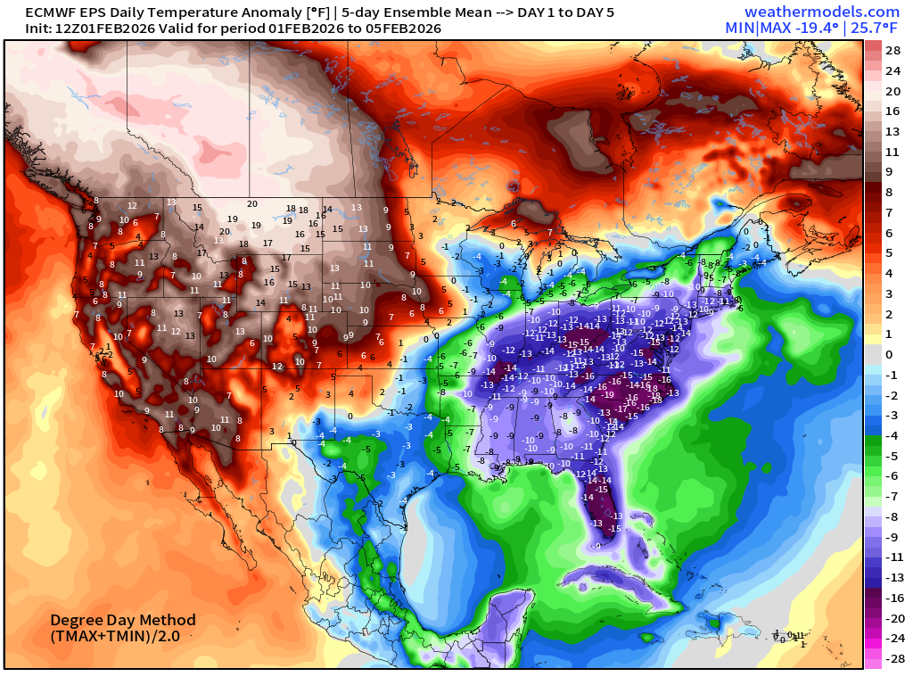
Temperature Anomaly | Next 15-days | ECMWF EPS 12z
5-Day Chunk #1 | Temperature Anomaly | Feb 1 - Feb 5
5-Day Chunk #2 | Temperature Anomaly | Feb 6 - Feb 10
5-Day Chunk #3 | Temperature Anomaly | Feb 11 - Feb 15
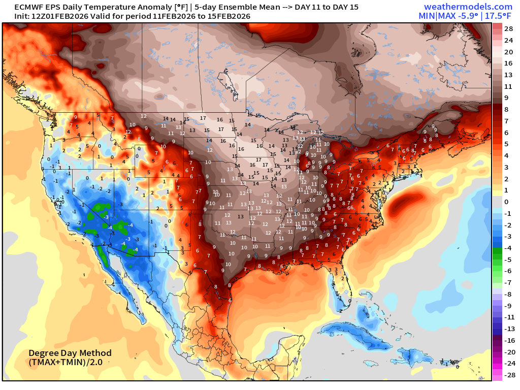
Much warmer across the Central and Eastern U.S.
Maps sourced from weathermodels.com designed and innovated by yours truly! Please subscribe there for real-time access to the newest maps, charts from all of the weather models including ECMWF and AIFS, NOAA AI-GFS/AI-GEFS
- Milepost
- 856 · laid 2026-02-02T02:37:44.048000Z
- Source
- https://weather.substack.com/p/february-1-2026-sunday-winter-weather
- Digest
- cdb2b911d50179b382a559d189344f8bdee0cd0f33db1fd8571b62133344583f
- Machine
- JSON