January 26, 2026 Monday Frigid Weather
Extreme cold intensifies into the weekend with potential of blockbuster blizzard
January 2026 was the 25th-warmest January in the 132-year national record (1895–2026), at 33.1°F against a 1991–2020 normal of 32.3°F (+0.8°F).
January 2026 was the 12th-driest January in the 132-year national record (1895–2026), at 1.6in against a 1991–2020 normal of 2.3in (-0.8in).
NOAA/NCEI Climate at a Glance, contiguous United States. This is the observed record for the month, not a score of anything said in this piece — the forecast ledger begins 2026-08-17 and cannot reach earlier posts.

If you are a visitor and not signed up to receive my daily update emails — please do!
If your subscription lapsed for whatever reason and want to come back at your original rate as an initial annual member from 2024-2025: Link to Come Back
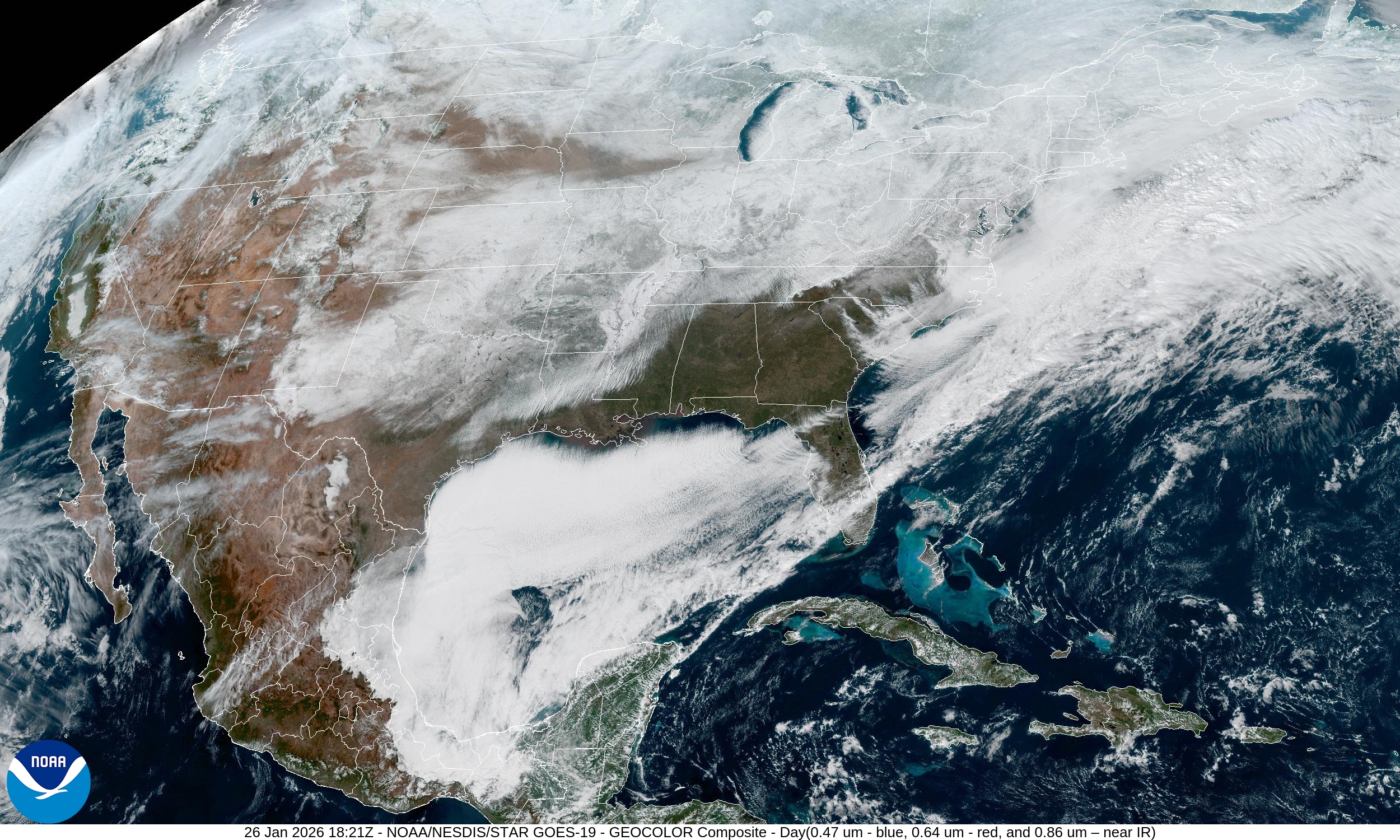
Top Story for the next week will be the development of a massive coastal storm that could have major impacts for the Mid-Atlantic and Northeast.
This storm is going to happen, but the track is uncertain, as well as the snowfall and potentially damaging winds from the Carolinas to the I-95 corridor.
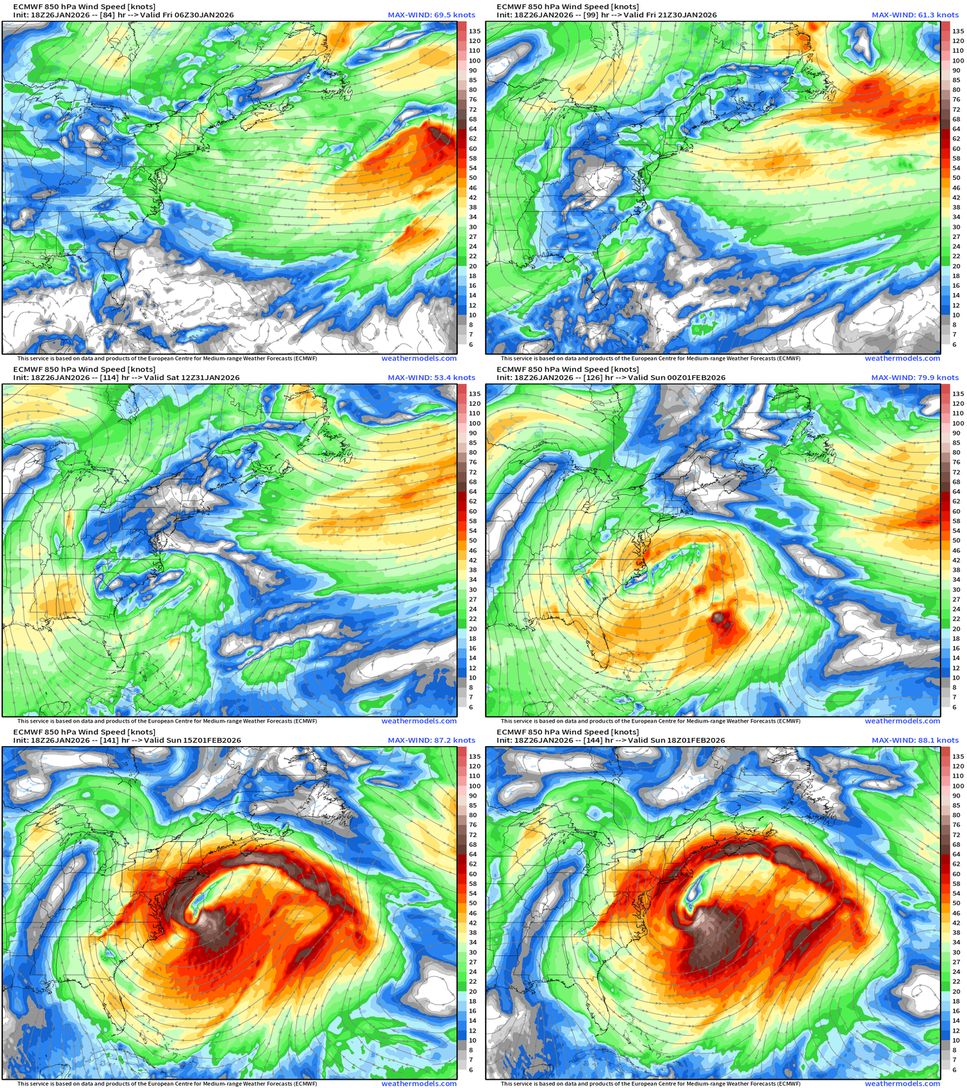
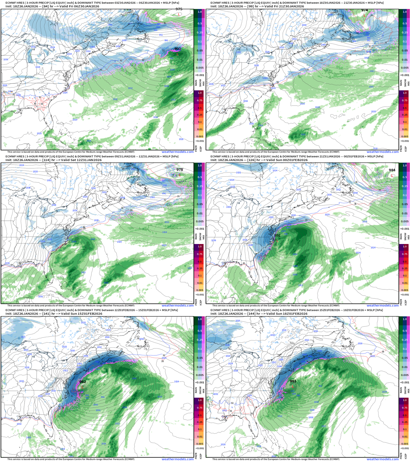
Through 6-days, the MSLP gets down to 961 mb with an out-to-sea track seemingly underway with considerable coastal snowfall and gusty winds —> potential blizzard conditions from North Carolinas to Boston. Other models are on board with the blizzard, as well but there is no consensus on the track as of yet. Hopefully by tomorrow evening we can make some final determinations.
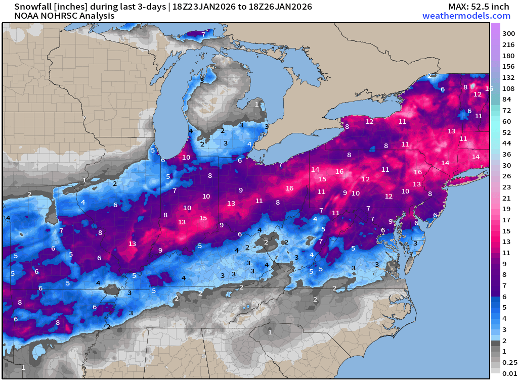
Snowfall Analysis from the Winter Storm Fern
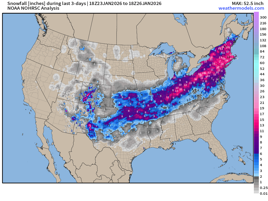
Data is still coming in over the next few days so the patchiness will resolve.
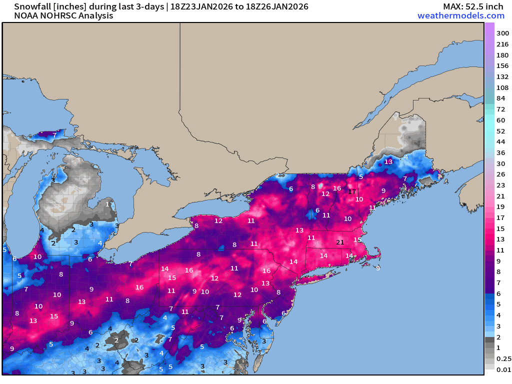
Already seeing some 20”+ showing up in New England and New York and Pennsylvania
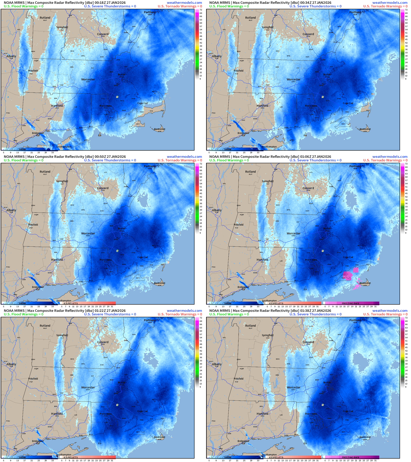
And, we will be adding to Boston snow totals this evening!
RTMA | Temperature Analysis | 6:30 PM ET
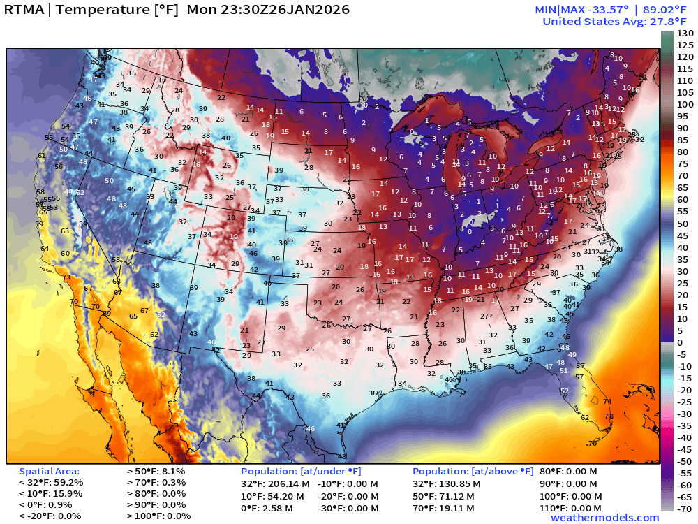
Average Lower 48 temperature was 27.8°F with 206 million below freezing.
Temperature Anomaly | 6:30 PM ET
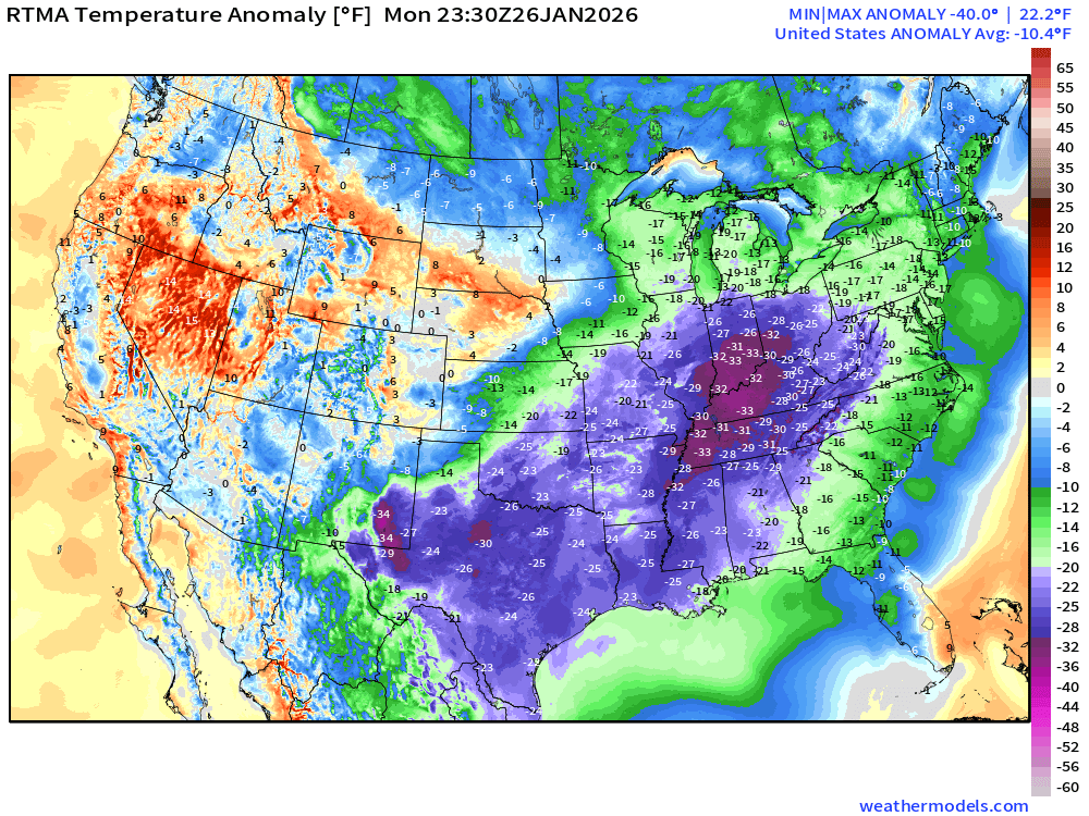
Lower 48 Temperature Anomaly below normal by -10.4°F
Precipitation Type and Intensity Next 6-days (ECMWF 18z)
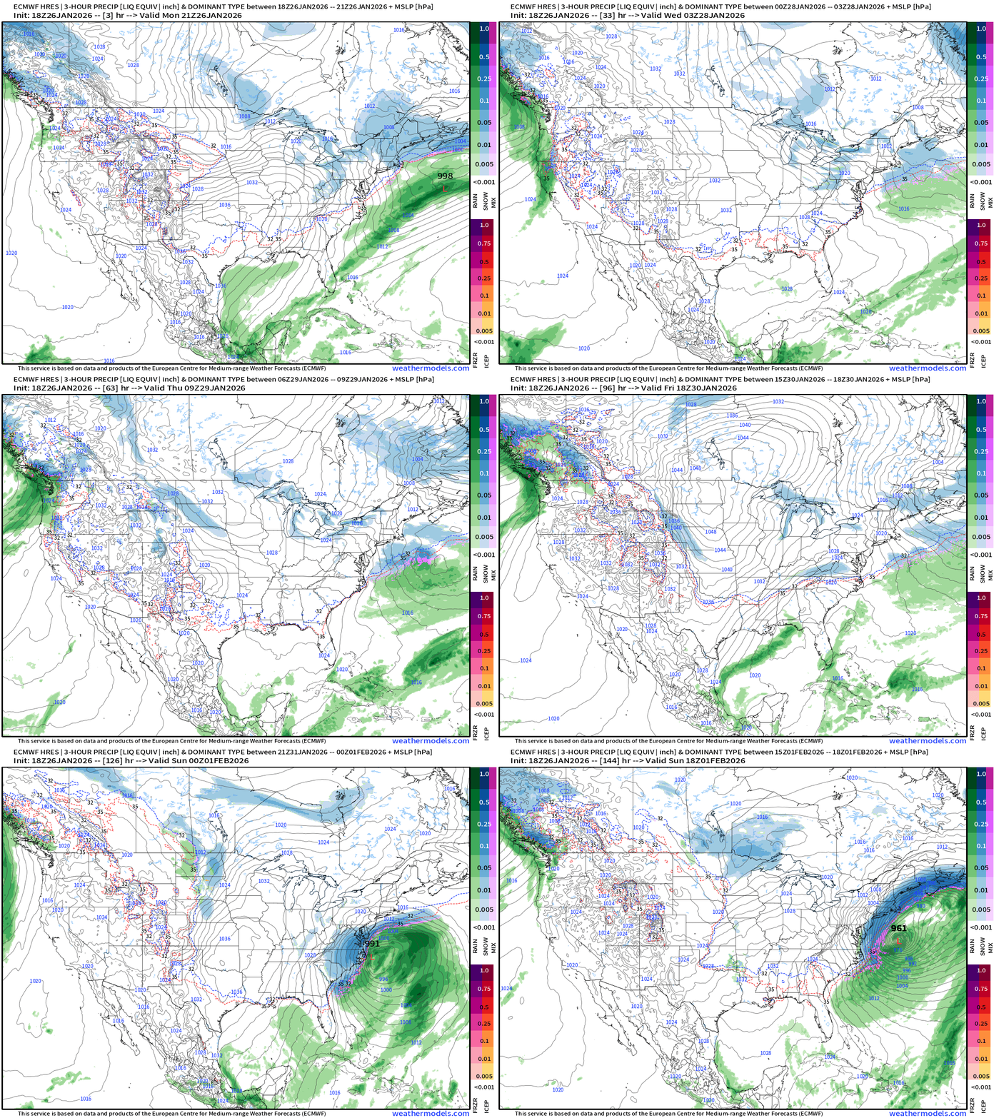
Some rainfall and mountain snow finally returning to the Pacific Northwest.
Otherwise, the rest of the U.S. to the East Coast will be under the firm grip of Arctic high pressure. The storm system develops on the periphery of a “polar vortex” lobe trough moving through the Southeast. The surface low phases with the jet stream over the warm Gulf Stream and “bombs out”. The full-physics IFS model goes out to 6-days, so we’ll look at the AIFS-18z which extends to 15-days for some idea of potential snowfall if — and that’s still a big if — this storm wrecks the breadth of the coastline.
NWS NDFD Snowfall next 3-days | Lake Effect until they freeze over
AIFS Sunday +6 days | Monster Blizzard at 969 mb
AIFS Snowfall Next 8-days
First Guess at Impacts if Storm Tracks Closer to the Coast
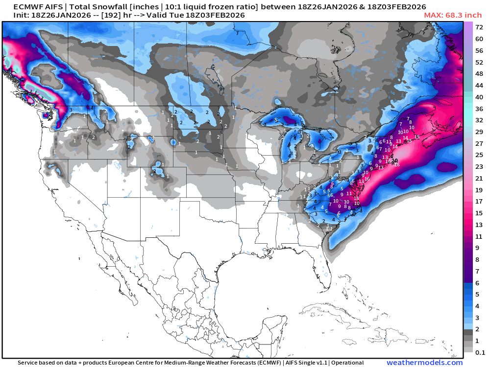
Snow to liquid ratios would be well in excess of 10:1 to these totals would be underestimates.
Other Top Story — Brutal Cold
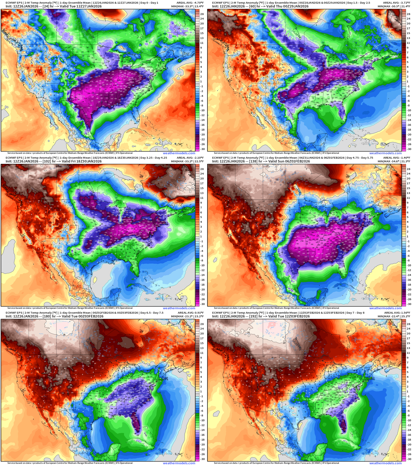
ECMWF Temperature Anomaly Next 6-days
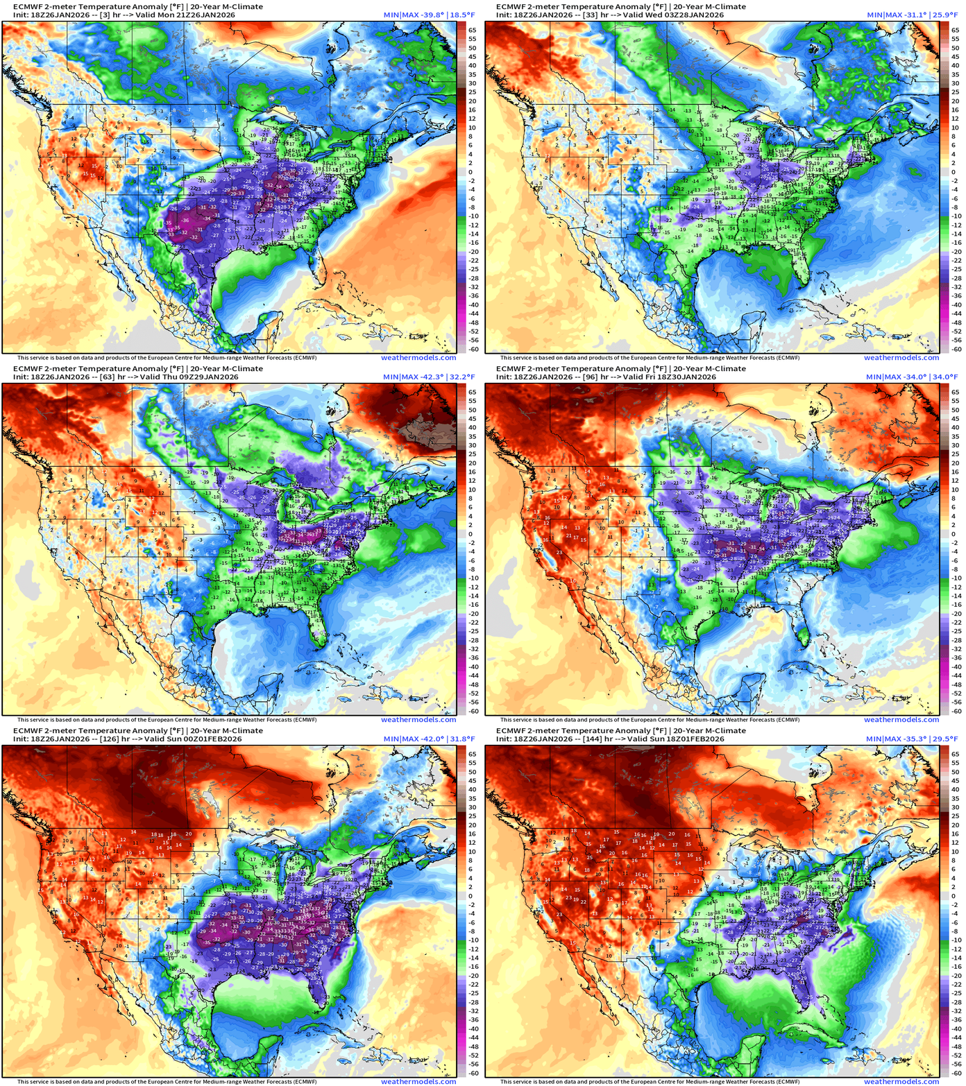
Bottom drops out again this weekend with Florida under threat of a devastating freeze with teens and 20s to Interstate 4 and potential for Miami to see low-30s.
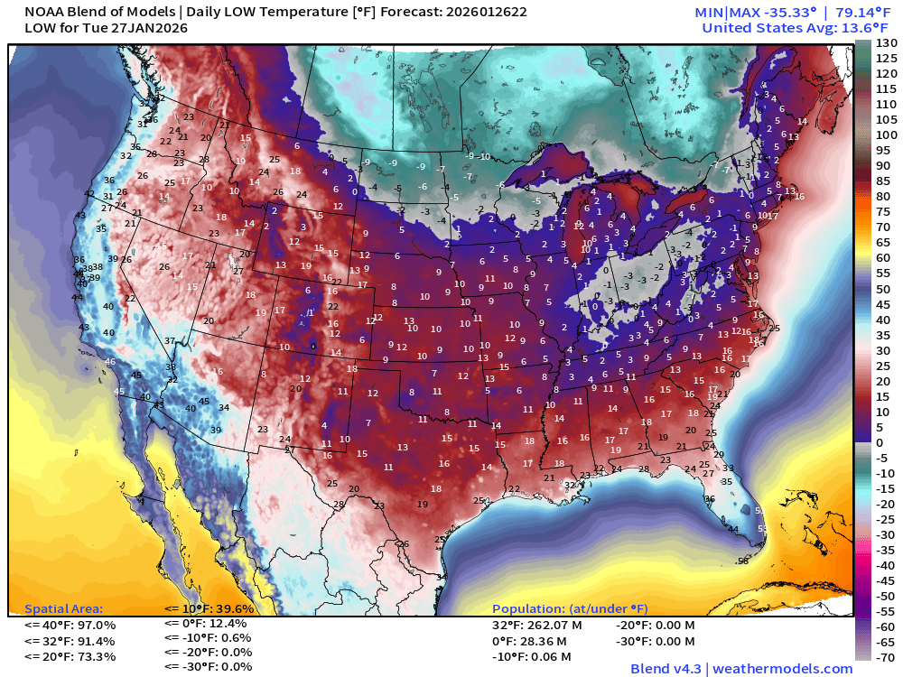
Low Temperatures Tuesday | 262 million freezing | Lower 48 avg: 13.6°F
High Temperatures Tuesday
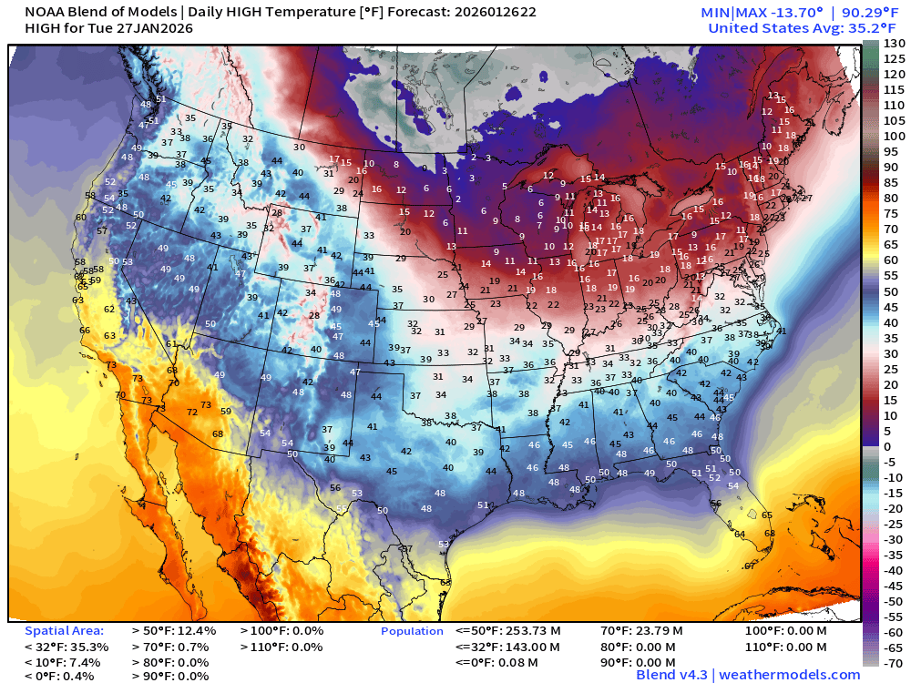
Still 143 million freezing during day, but warming underway across Texas and the South into the 40s at least with sunshine. Florida finally gets washed out by the Arctic cold front
Low Temperatures Wednesday
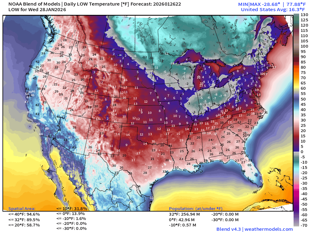
Another cold pool dips into the Midwest and Great Lakes with subzero temperatures along I-80 from central Illinois to western PA.
High Temperatures Wednesday
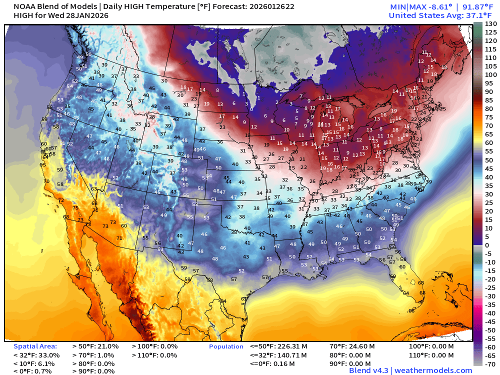
Midwest and Great Lakes are frigid with highs still subzero in North Dakota and Minnesota. Teens across Michigan into New England. Brrr.
ECMWF AIFS 18z | Precipitable Water Next 6-days
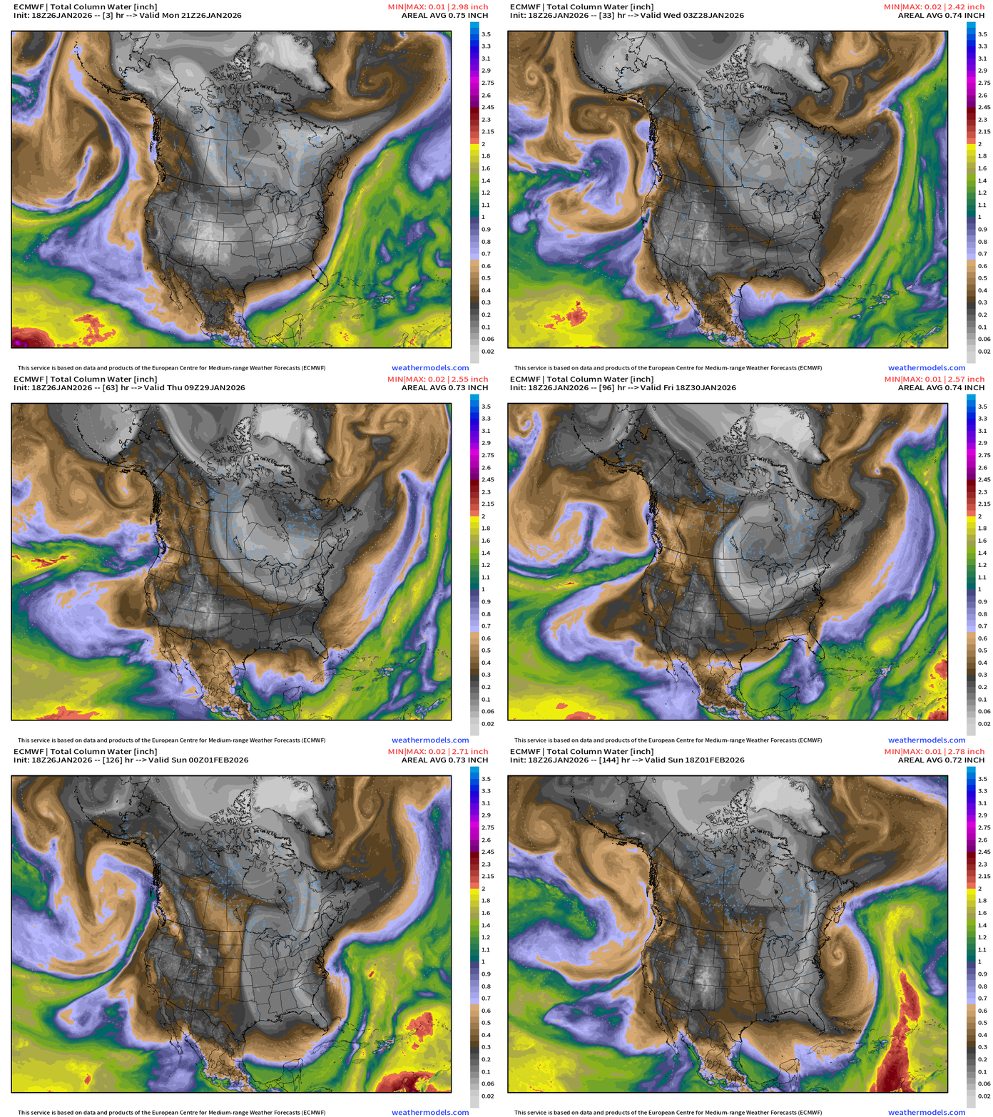
Cold front clears south Florida but then moisture returns to fuel our “bomb cyclone” Friday into Saturday. Bone dry Arctic air mass “flushes” right through South Florida into Sunday with perhaps the perfect angle to bring a freeze to the Everglades.
Flagship ECMWF 12z EPS | Temperature Anomaly | Next 8-days
Incredible animation of the extreme cold compared to normal dumping right down the Florida peninsula unabated.
Flagship ECMWF 12z EPS | Temperature Anomaly | Next 15-days
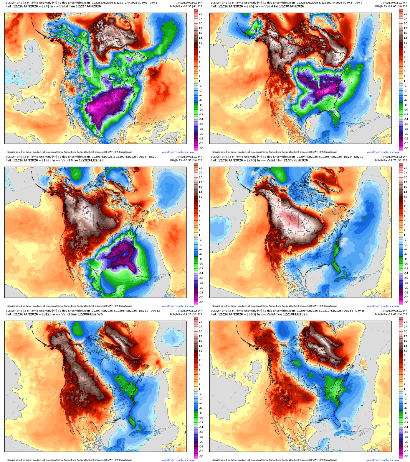
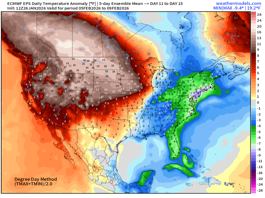
Looking into Days 11-15, there is an attempt to bring the westward warmth across the Rockies, but not so much … we may be seeing the opening up of the entire Arctic “ridge bridge” and Polar Vortex cold southward yet again for second 10-days of February.
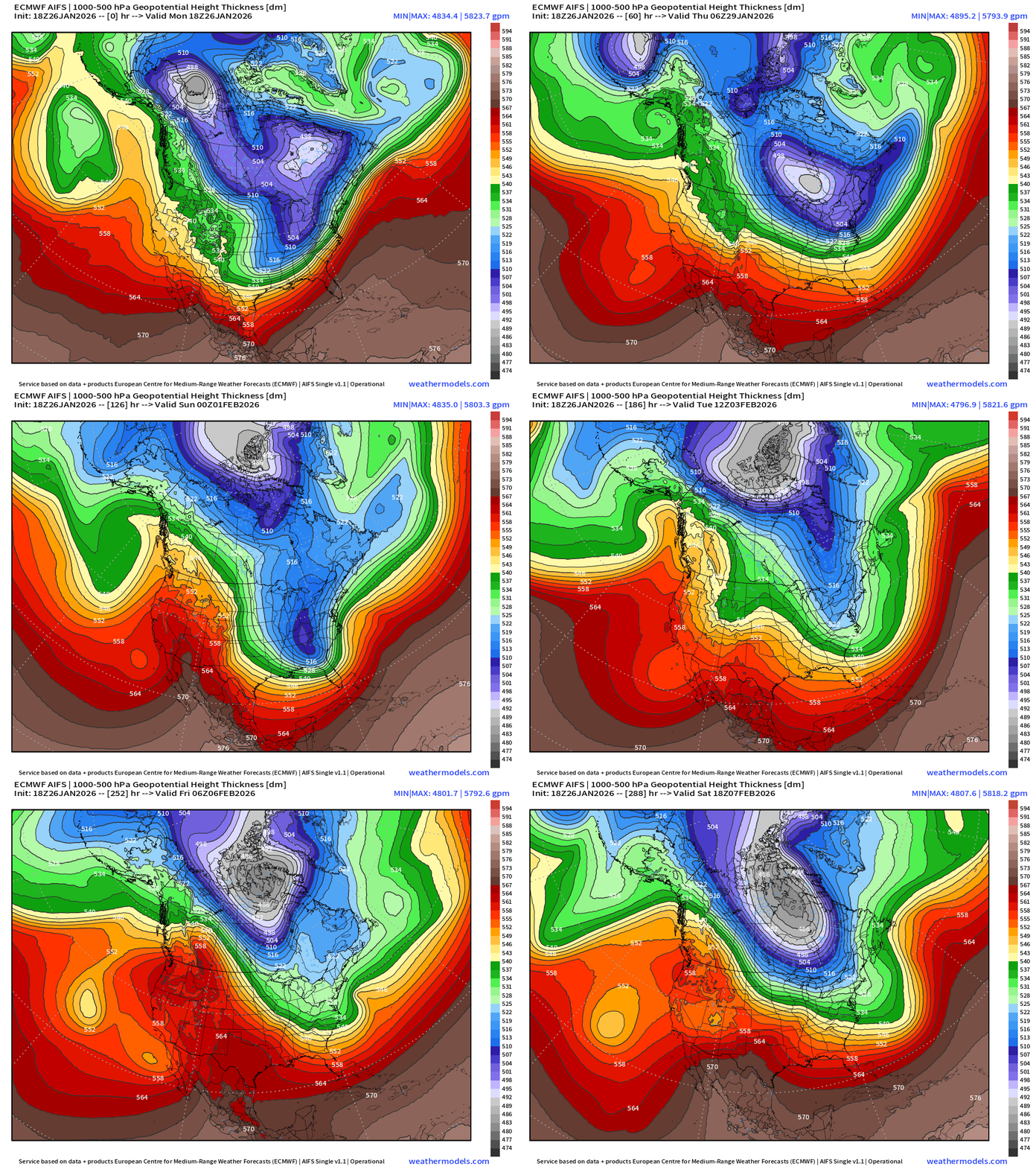
ECMWF AIFS-Single 18z | Height Anomaly (500 hPa) Next 15-days
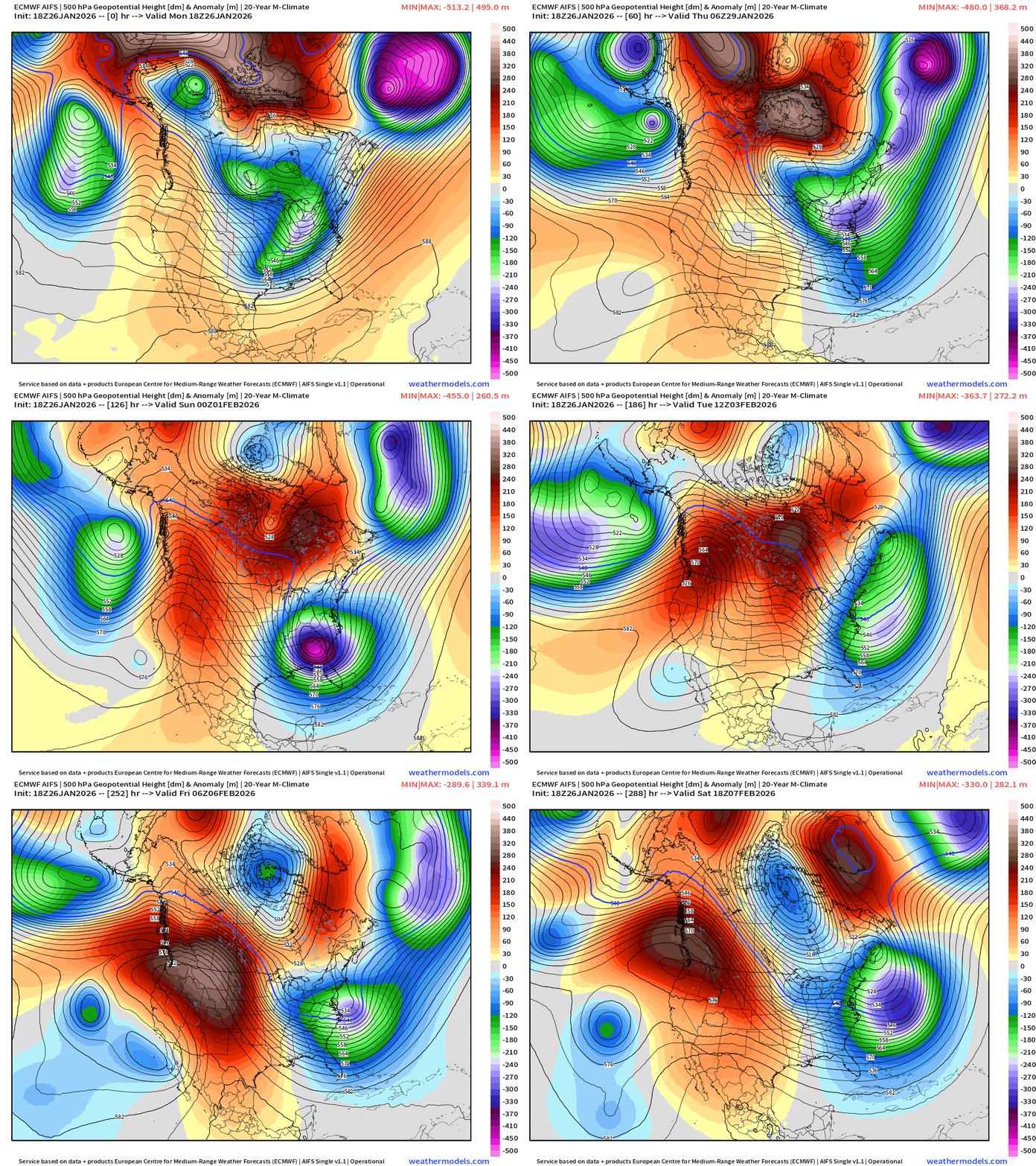
Incredible height anomaly associated with the first blizzard AND then a second one plausible off the Northeast at Day 11.
Thickness snows the “full load” polar vortex (gray) arriving to Hudson Bay on Day 12 (February 7) Where does it go?
ECMWF AIFS-Single 18z | Temperature (500 hPa) Next 15-days
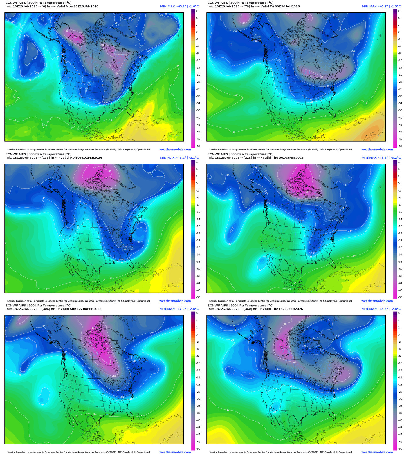
Let’s look at the rest of the 15-days from the 500 mb Temperature to see the evolution of the upper-level “polar vortex” related circulation pattern over North America.
Yet another “extreme cold” outbreak would be in the cards for Feb 8-11+ and then still no improvement. Talk about Groundhog Day.
The temperature at 500 mb is the easiest way to highlight the “polar vortex” across North America with the coldest pool at -40°C (pink) with the -25°C contour usually associated with below freezing temperatures at 2-meters (surface).
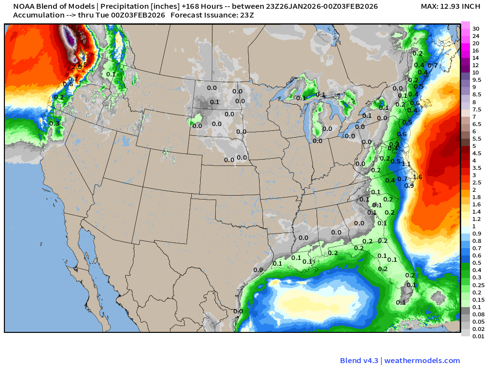
Blend of Models | 7 Days Precipitation Total
Blend of Models | Total Snowfall Next 7-Days
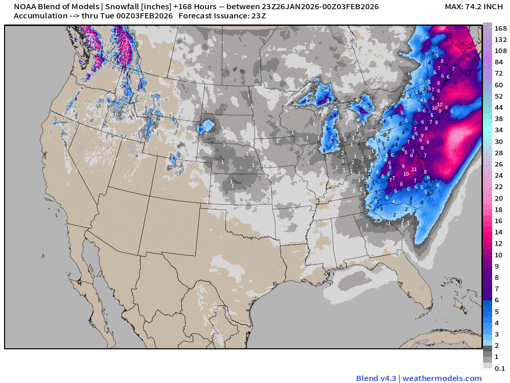
Seems the “blend of models” is hedging on the coastal storm and delivering accumulations. However, too soon to be making snow maps for this particular storm.
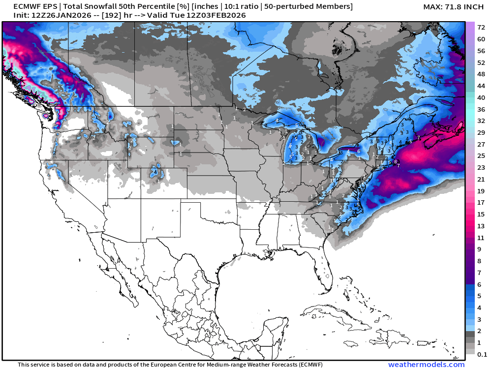
ECMWF EPS 12z | Ensemble Median Snowfall Next 8-days
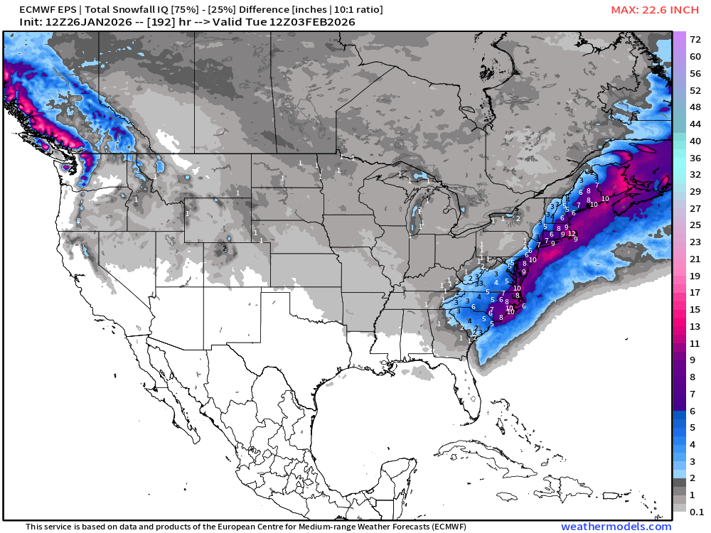
The 25th to 75th percentile Interquartile Range is quite large and shifted west over the coast
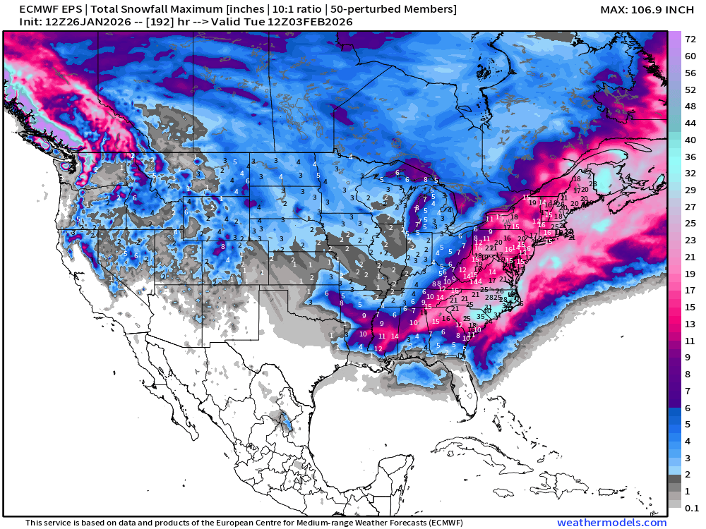
The maximum or “worst ensemble amount” possible is incredible, if the stars align.
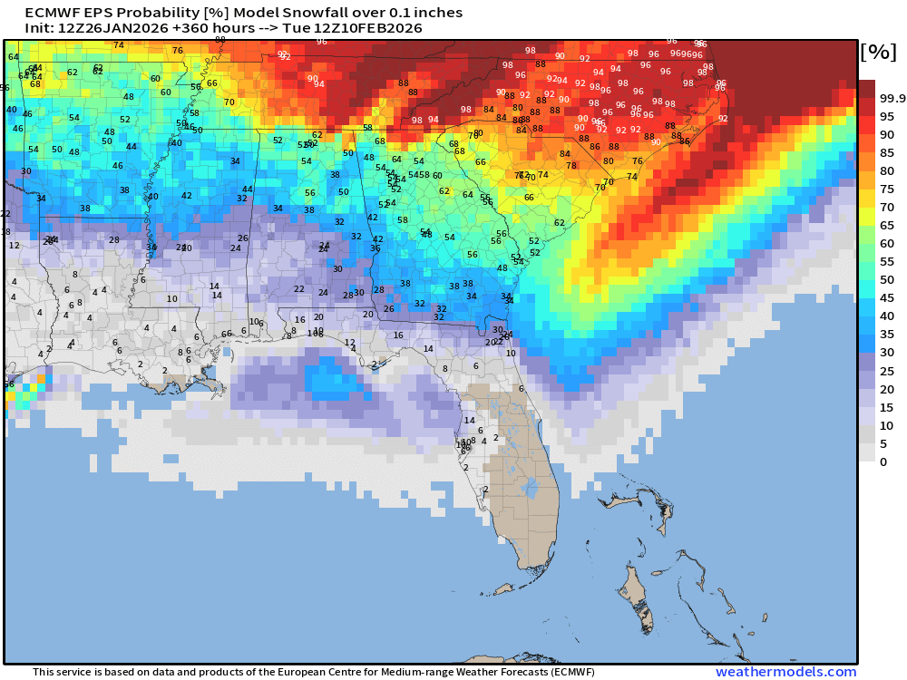
Probability of some Snowfall (0.1”) in next 15-days
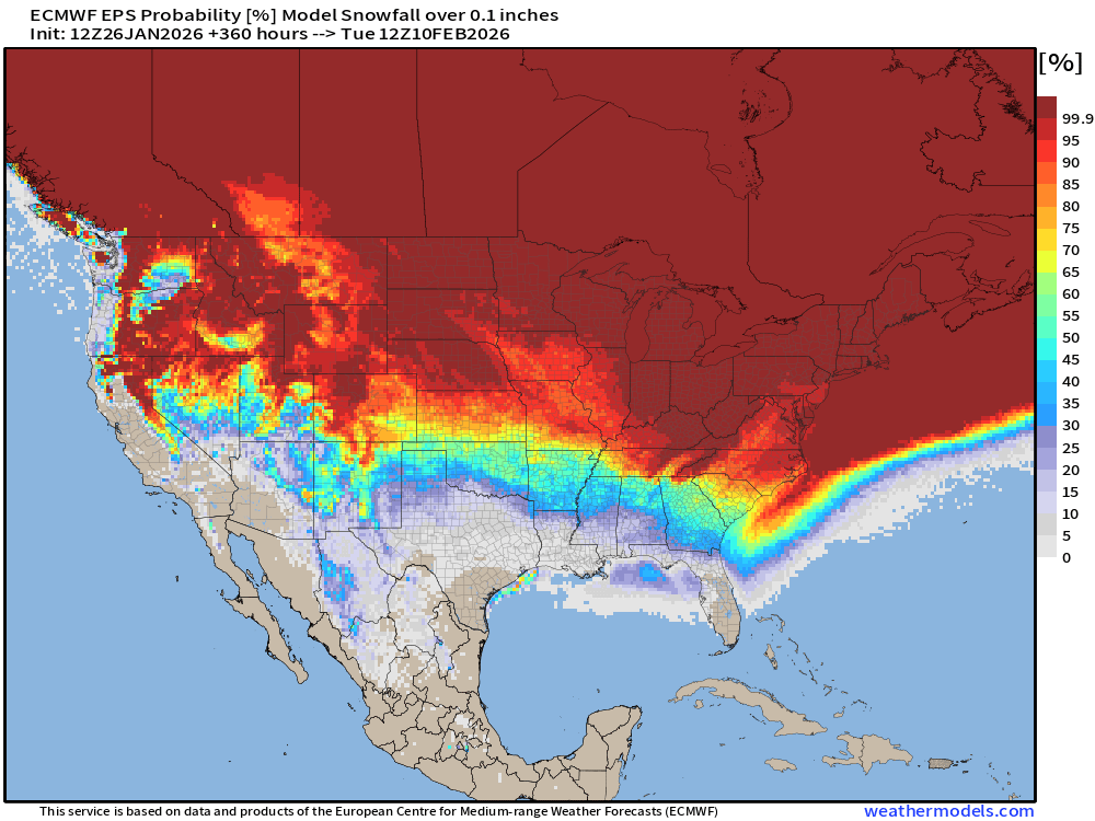
Florida snowfall chances are small, but creeping upward to ~10% to 20% over the panhandle, and maybe 10% around Tampa Bay
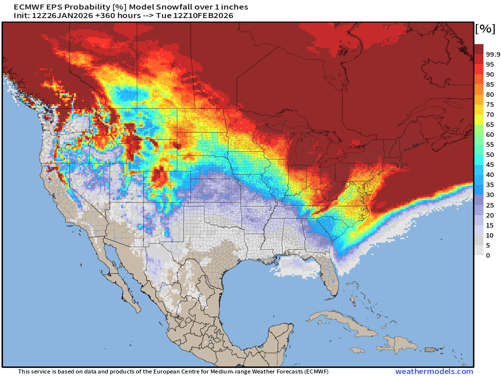
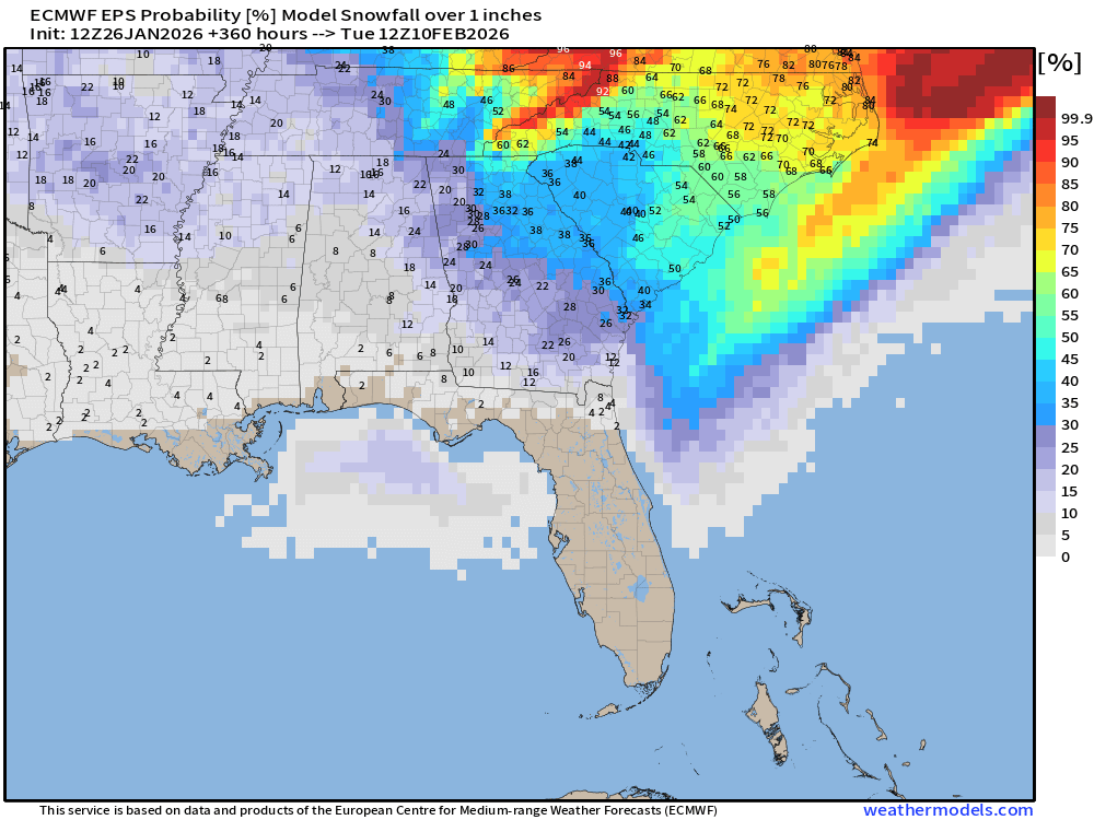
Probability of 1-inch Snowfall in next 15-days
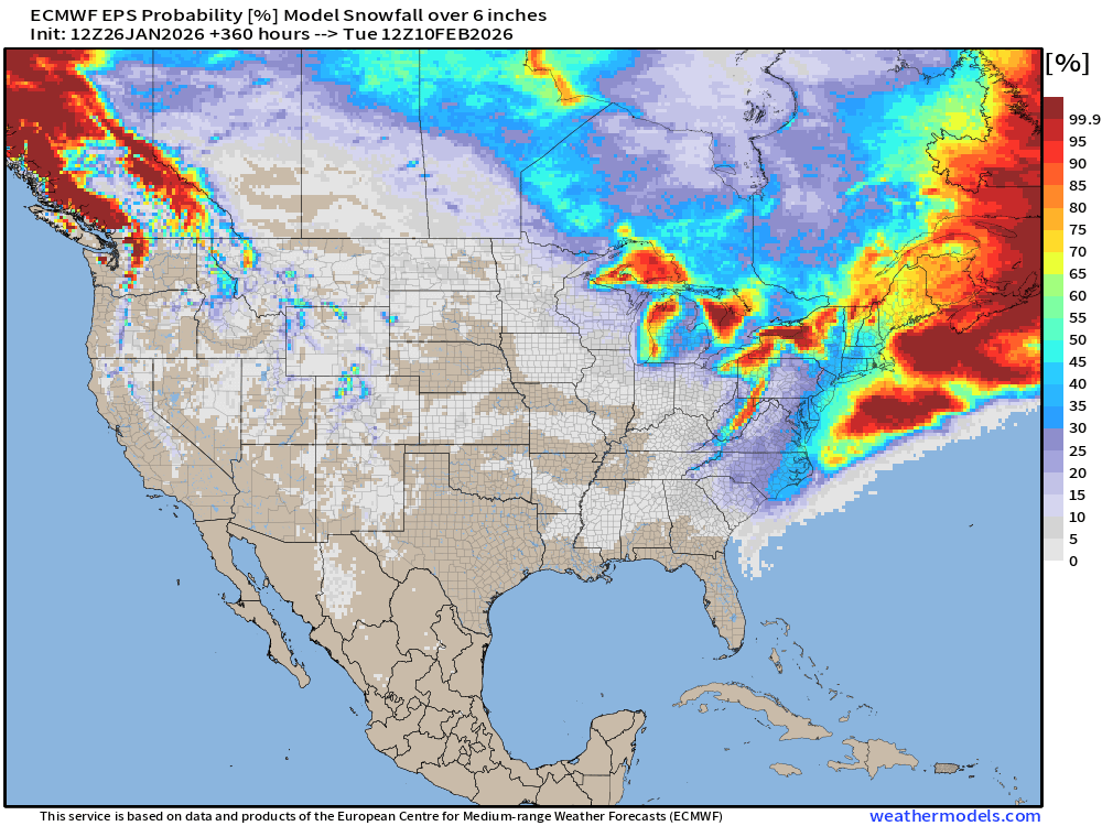
Probability of 6” of Snowfall next 15-days
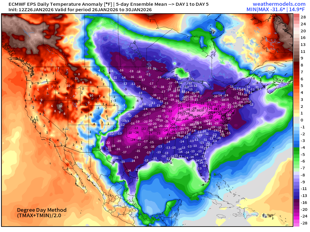
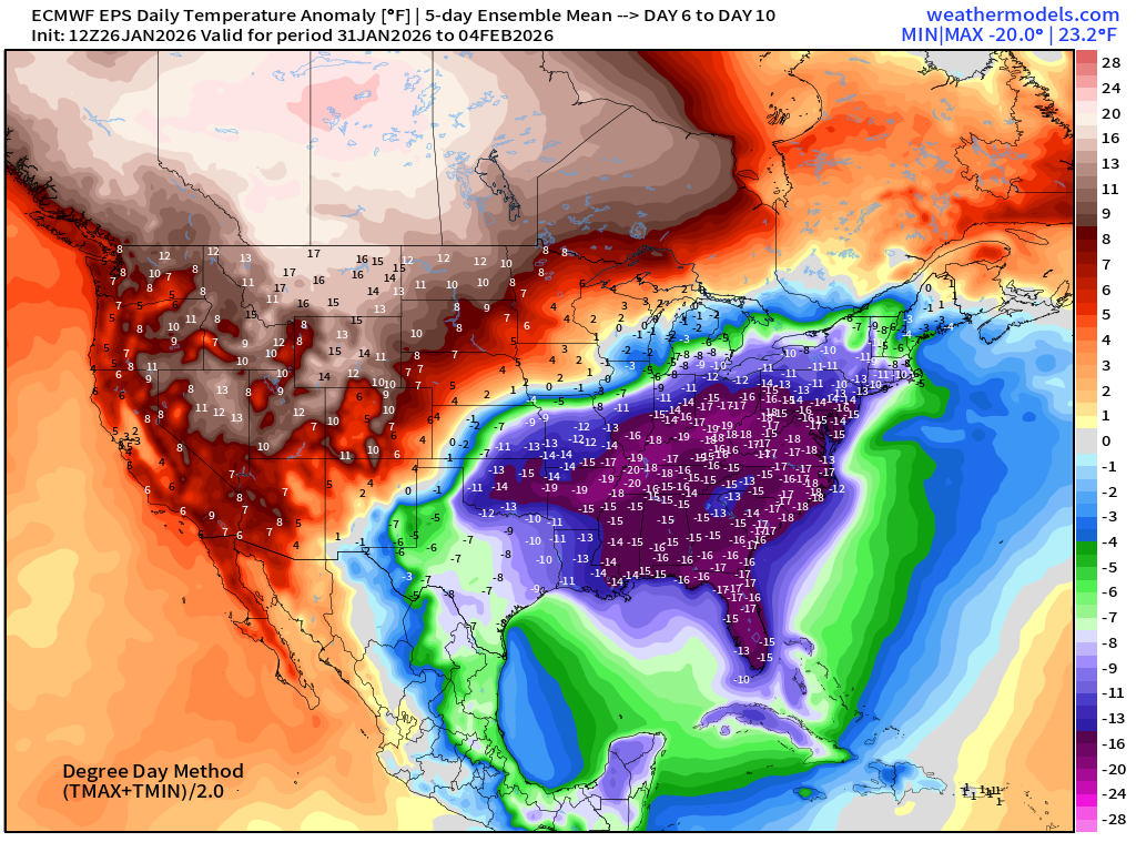
Temperature Anomaly | Next 15-days | ECMWF EPS 12z
5-Day Chunk #1 | Temperature Anomaly | Jan 26 - Jan 30
5-Day Chunk #2 | Temperature Anomaly | Jan 31 - Feb 4
5-Day Chunk #3 | Temperature Anomaly | Feb 5 - Feb 9
Maps sourced from weathermodels.com designed and innovated by yours truly! Please subscribe there for real-time access to the newest maps, charts from all of the weather models including ECMWF and AIFS, NOAA AI-GFS/AI-GEFS
- Milepost
- 850 · laid 2026-01-27T01:52:52.937000Z
- Source
- https://weather.substack.com/p/january-26-2026-monday-frigid-weather
- Digest
- 3dd1e607269bea63d0f46bbd40ad20948befa728f814648952df67c70ae15b67
- Machine
- JSON