January 22, 2026 Thursday Massive Storm
A major multi-day winter storm followed by hazardously cold air
January 2026 was the 25th-warmest January in the 132-year national record (1895–2026), at 33.1°F against a 1991–2020 normal of 32.3°F (+0.8°F).
January 2026 was the 12th-driest January in the 132-year national record (1895–2026), at 1.6in against a 1991–2020 normal of 2.3in (-0.8in).
NOAA/NCEI Climate at a Glance, contiguous United States. This is the observed record for the month, not a score of anything said in this piece — the forecast ledger begins 2026-08-17 and cannot reach earlier posts.

Splitting the articles apart in order to focus on the Winter Storm first — and then worry about temperatures in a follow-up. Today has been busy.
ECMWF Precipitation Intensity — Next 6-days
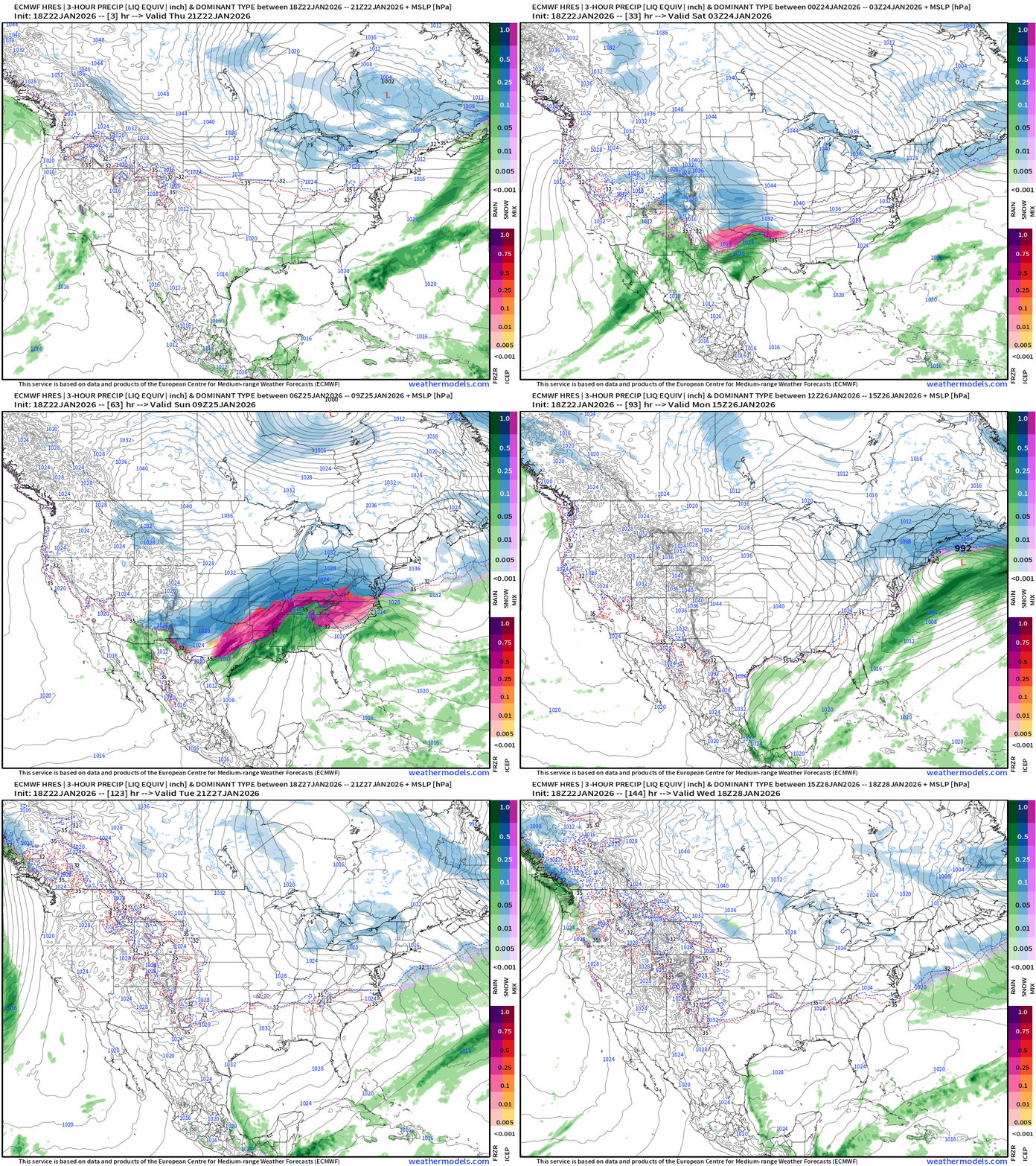
The storm gets going in New Mexico and Texas with moisture from the subtropical Pacific and then another plume once the circulation pulls into the Gulf of Mexico. I’ll focus on Texas, the Southeast, and Mid-Atlantic + Northeast in separate zooms. We don’t expect many major changes with the forecast philosophy as this is a large scale system and “going with the flow”
Clashing of the Airmasses | 850 mb Temperature Next 6-days
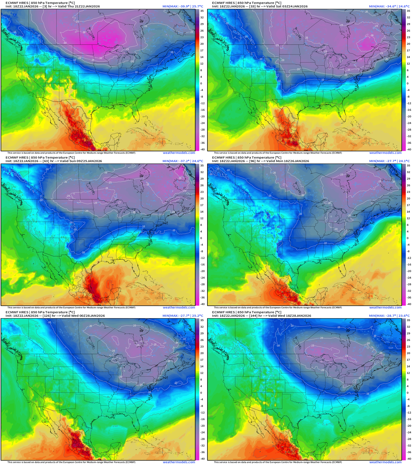
The Arctic cold is impressive with almost -40°C at 850 mb dumping into the Midwest and Great Lakes. The cold pool spreads out but still remains around -25°C for the next 6-days.
Important to note the yellow coloring ahead of the trough (polar vortex lobe) in Texas. Yellow is > 10°C or 50°F and that air is about 1.5 miles up in the boundary layer and moisture laden with 1.5” to 1.8” PWAT.
That warm air rises, condenses, and then easily forms precipitation, which will fall through the Arctic air at the surface —> recipe for sleet and freezing rain.
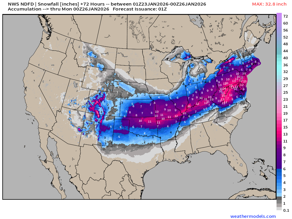
To the north, heavy snowfall. NWS is a little light on amounts — I think. My case for higher amounts would come from the cold air + snow to liquid ratios (SLR) of 15:1 or 18:1 and the heavy QPF.
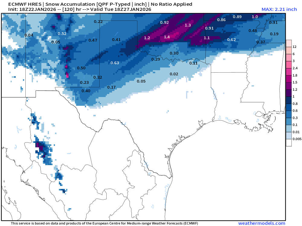
Let’s look at ECMWF 18z Snowfall with the Dynamic SLR
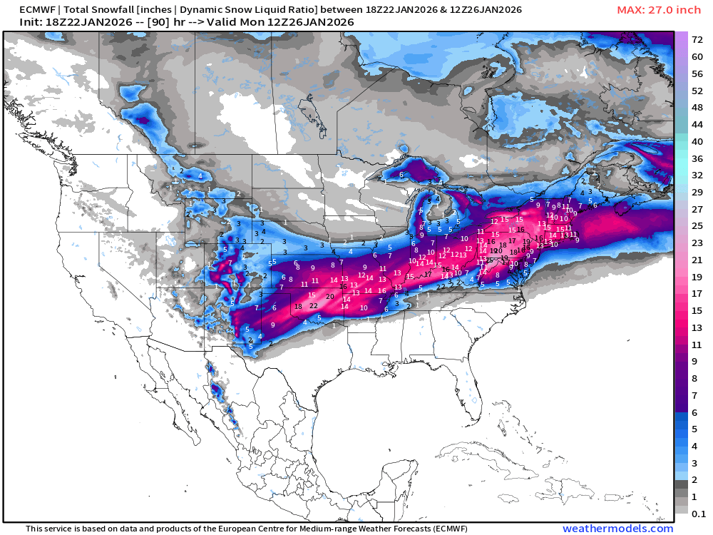
Quite the jackpot in Oklahoma based upon 1.3”-1.4” QPF precipitation typed as snowfall. I like these colors — updated the map with them for this storm.
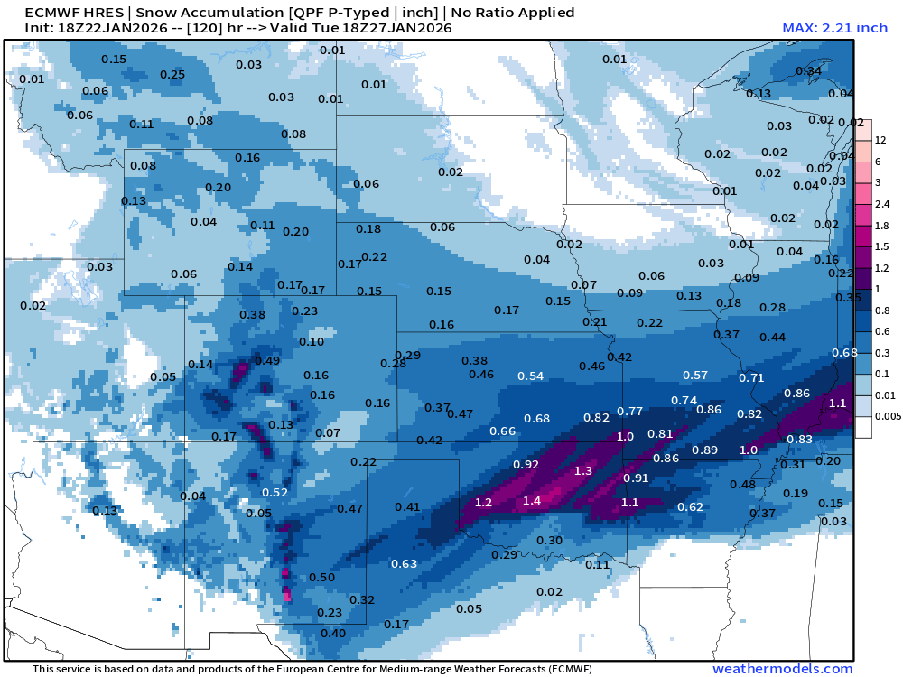
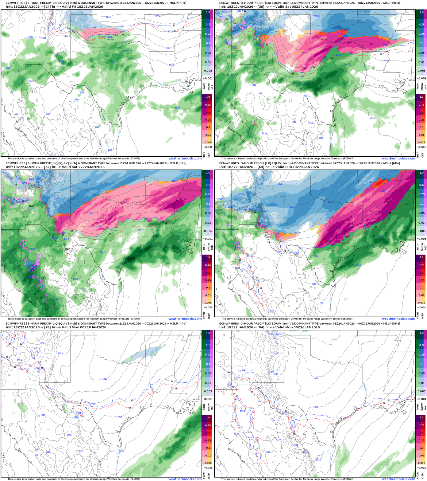
The snowfall extends almost back to El Paso. Only 0.02” in DFW — so we worry about snowfall in the Metroplex.
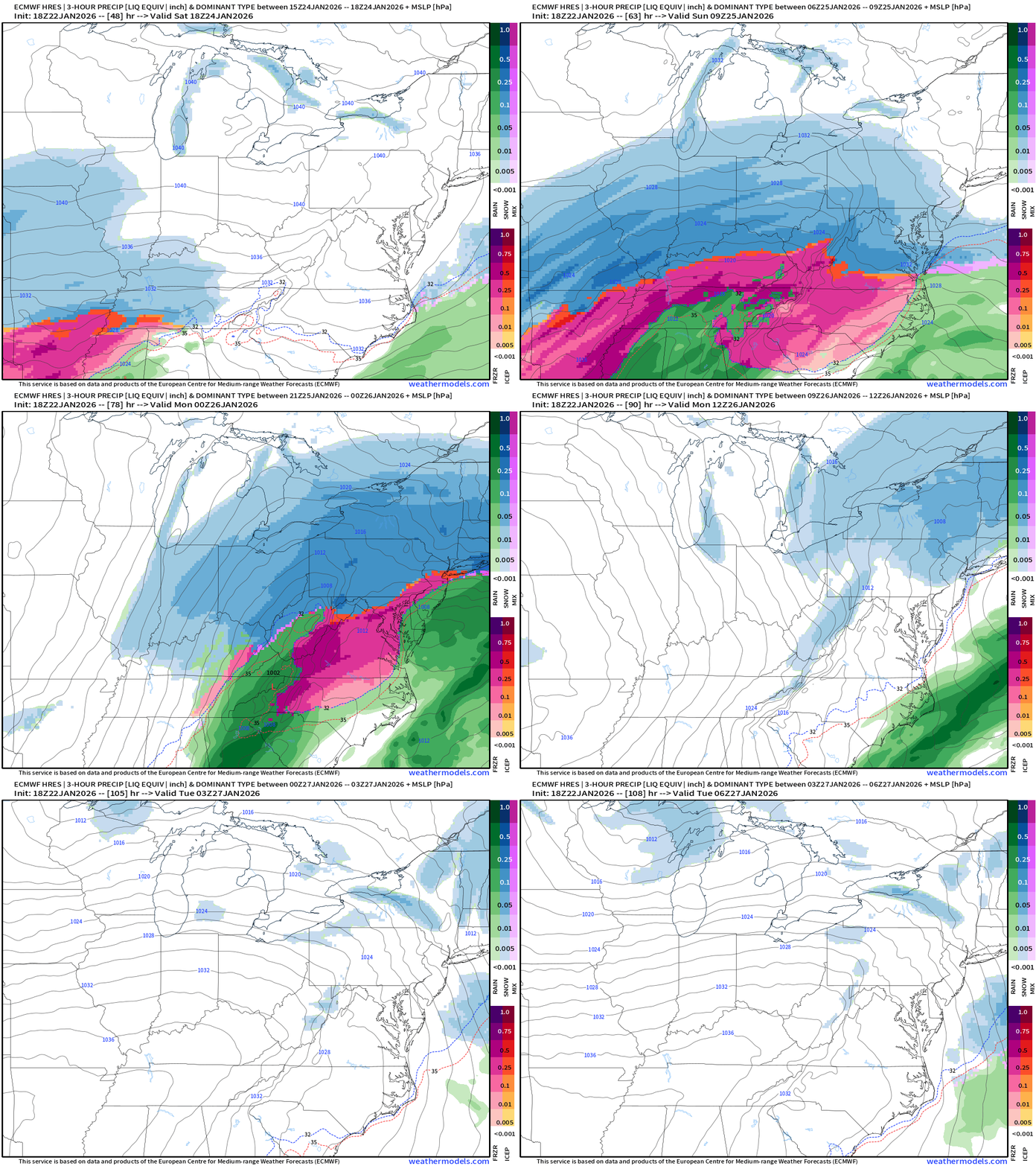
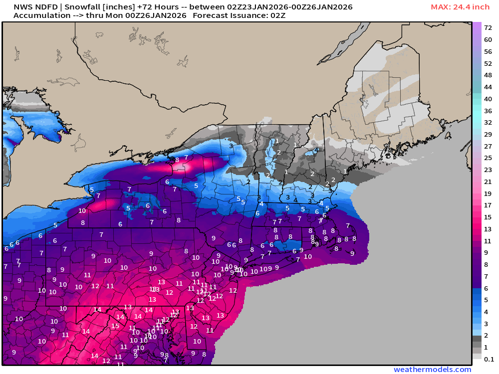
Moving to the Northeast and Mid-Atlantic —> HUGE snowfall QPF
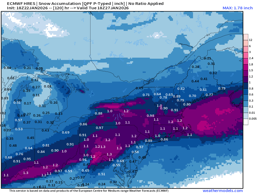
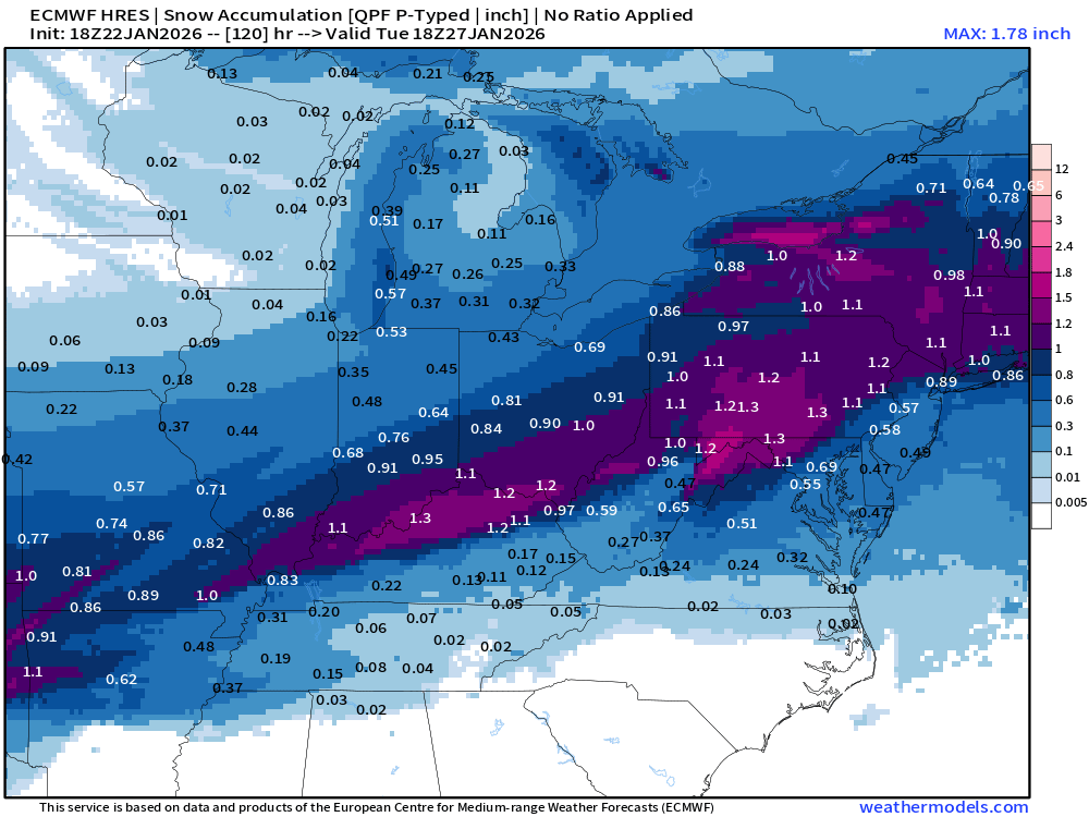
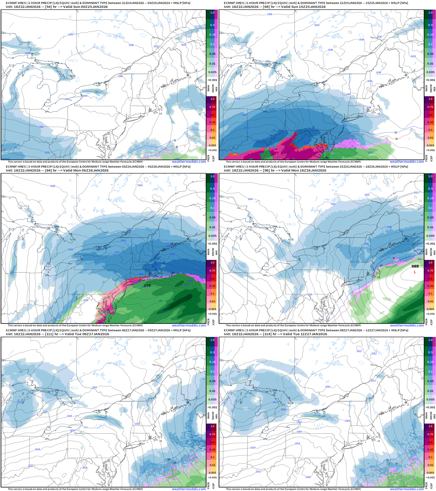
0.89” in NYC — 1.2” in Boston — I’d go with 15” to 20” along that corridor. The 1.2” QPF as snow = 12” to 18” (at least) extends back along the Ohio River into Louisville. We’ll see what the National Weather Service says shortly.
Freezing Rainfall Next 6-days
(note — some of this is probably misdiagnosed as sleet or ice pellets but not much!)
Not good! This will not all “stick” or encrust trees and power lines, but if only a fraction did, then it’s major / catastrophic damage.
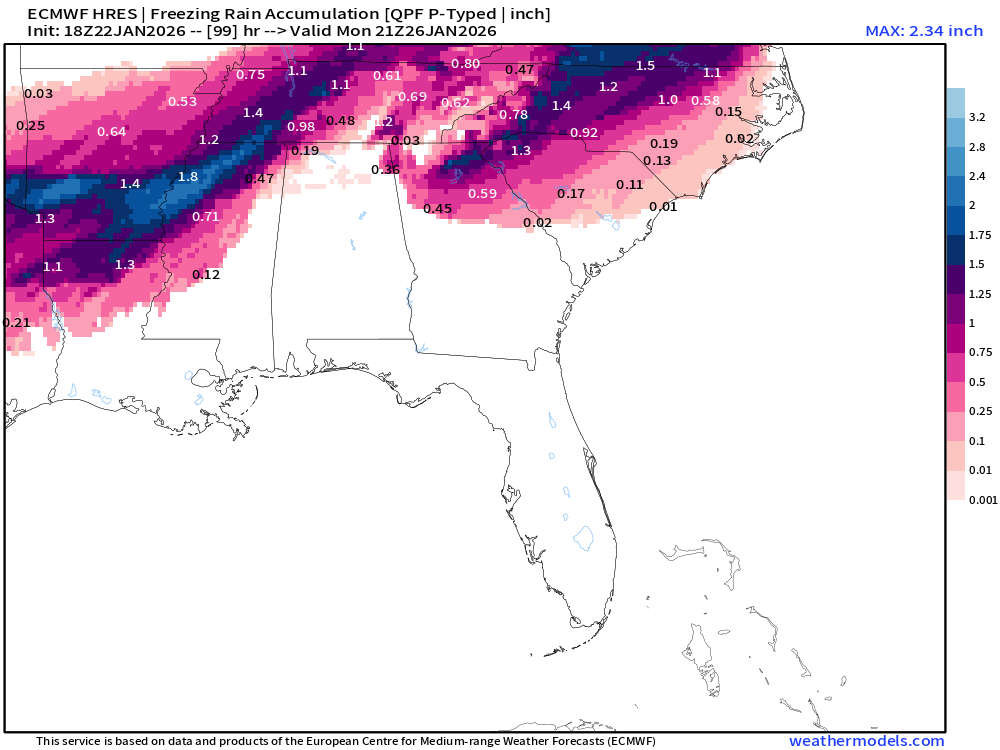
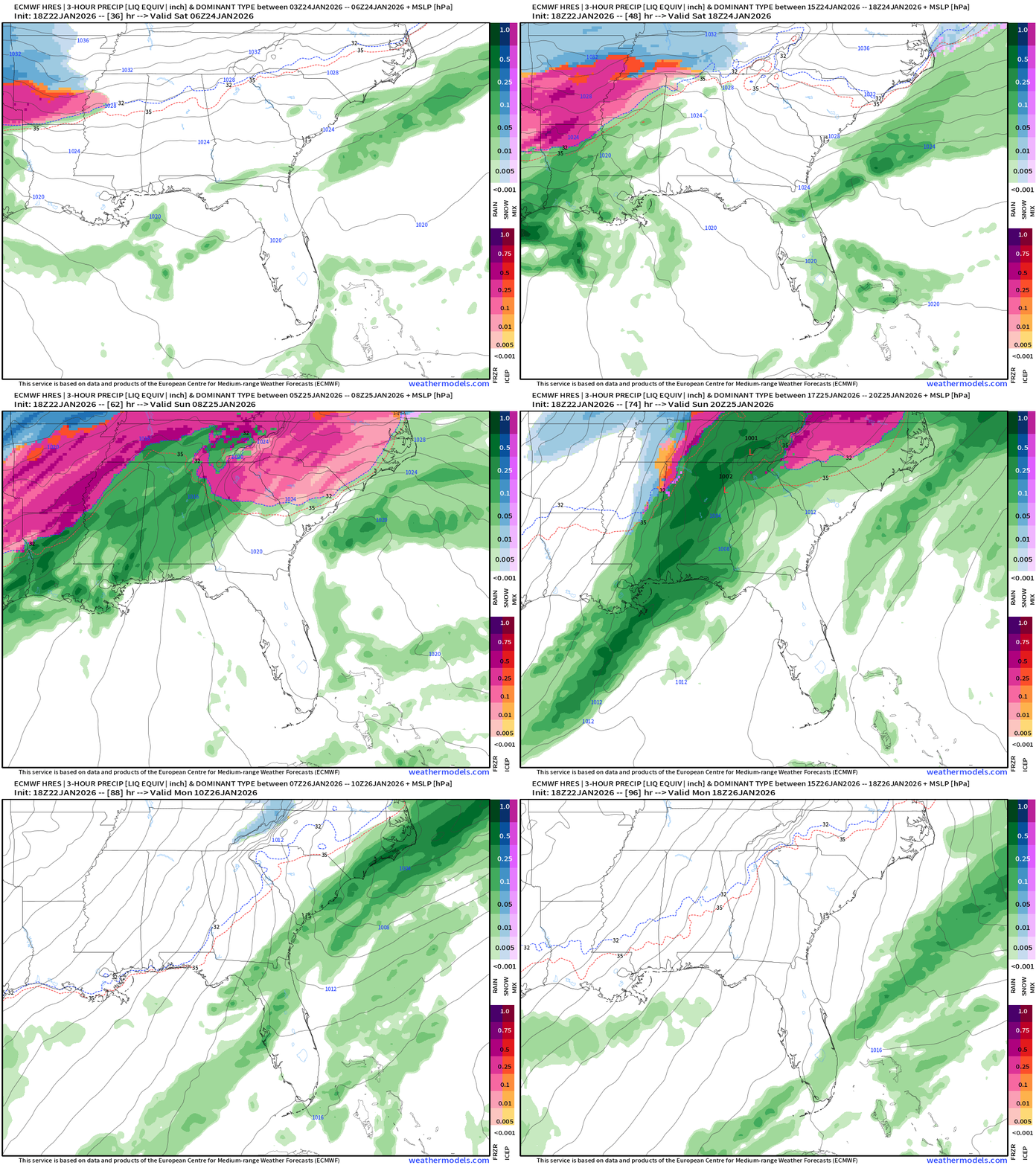
The wedge in Atlanta is usually underestimated in the models — but we’re on schedule for ice accumulation at least in northeast Georgia.
Texas Zoom
Southeast Zoom
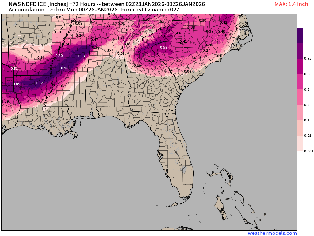
Atlanta will be battling the “wedge” of cold air damming against the higher terrain to the ENE
Mid-Atlantic and Great Lakes Zoom | Huge Snowfall Event
Northeast Zoom | Mainly All Snow for NYC into New England
RRFS-A Snowfall Amounts — I want show this model since it’s the flagship replacement from NOAA — and it’s worthwhile to record what it thinks
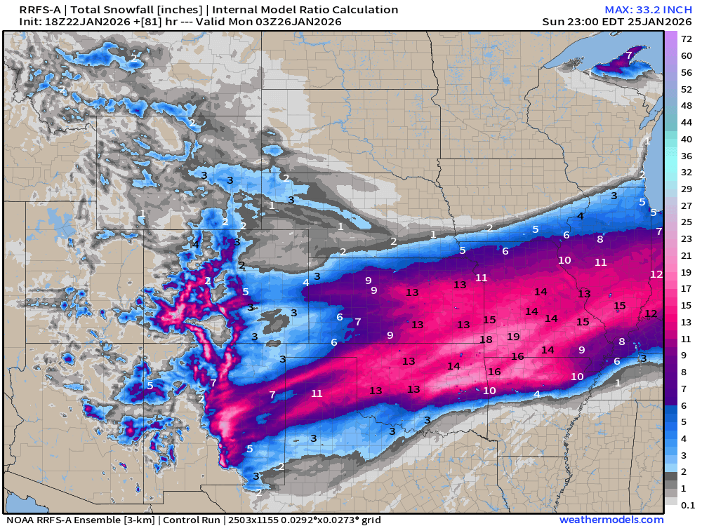
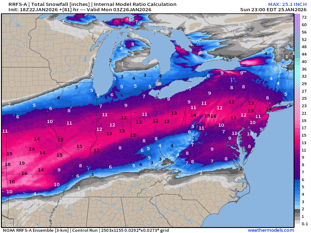
At Monday 06z — the storm is still going full blast over the Northeast — meaning the snowfall amounts are still incomplete. The next 06z cycle will have the entire event.
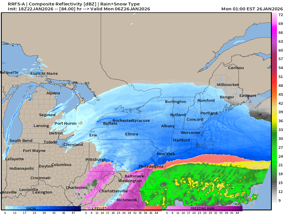
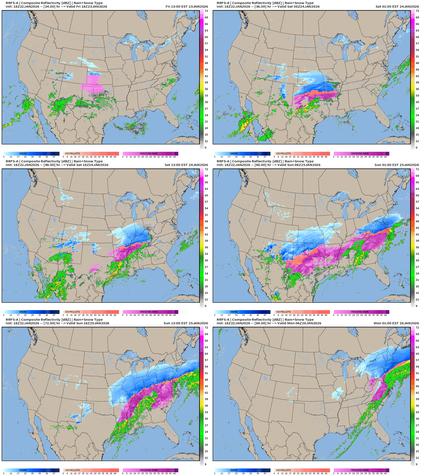
And the 18z animation from 24-84 hours getting us to Monday 1 AM ET
ECMWF 18z | Precipitable Water Next 6-days | My Favorite Parameter
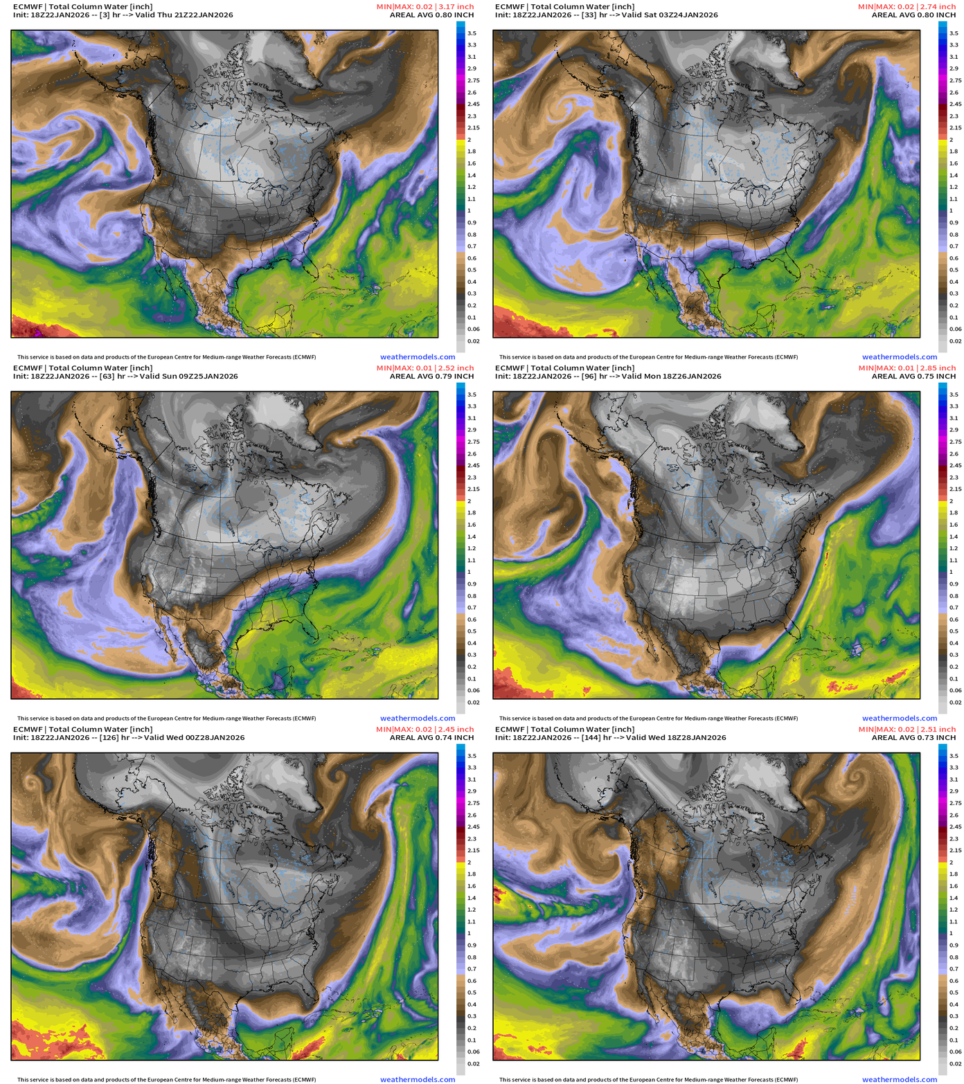
The collision of the extremely cold and dry/dense Arctic air will undercut the very moist and warmer air coming from the Gulf of Mexico and Pacific subtropics. The result is a battleground of frozen precipitation from freezing rain, sleet, ice, and snow to whatever else you can think of —> massive frozen precipitation mess.
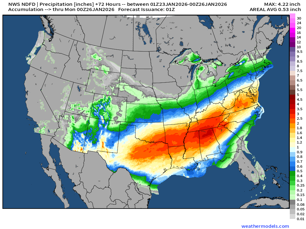
NWS Precipitation Next 72-hours | Doesn’t yet include entire NE event
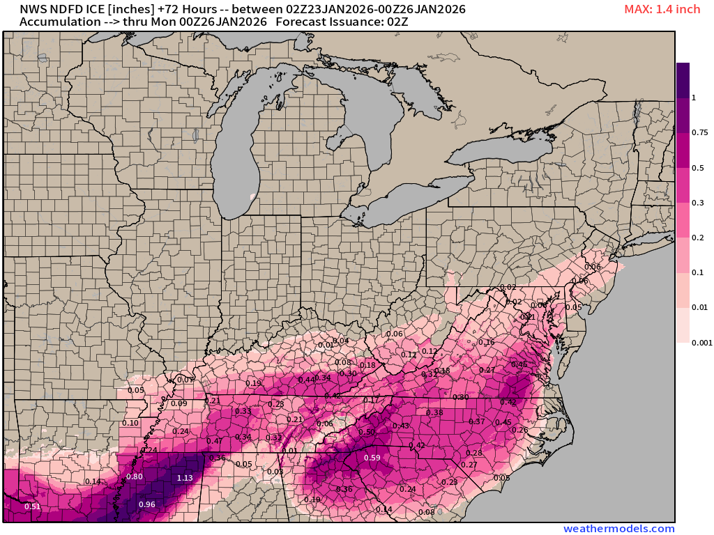
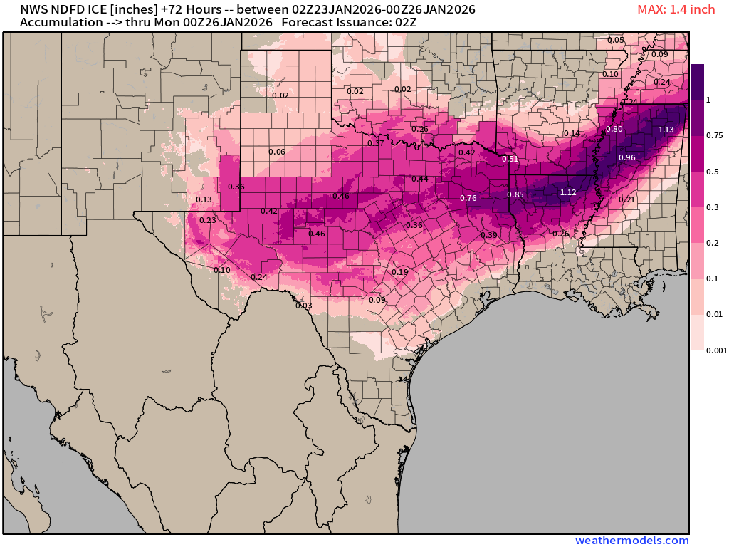
Ice Accumulation from NWS through 72-hours (Sunday 7 PM ET)
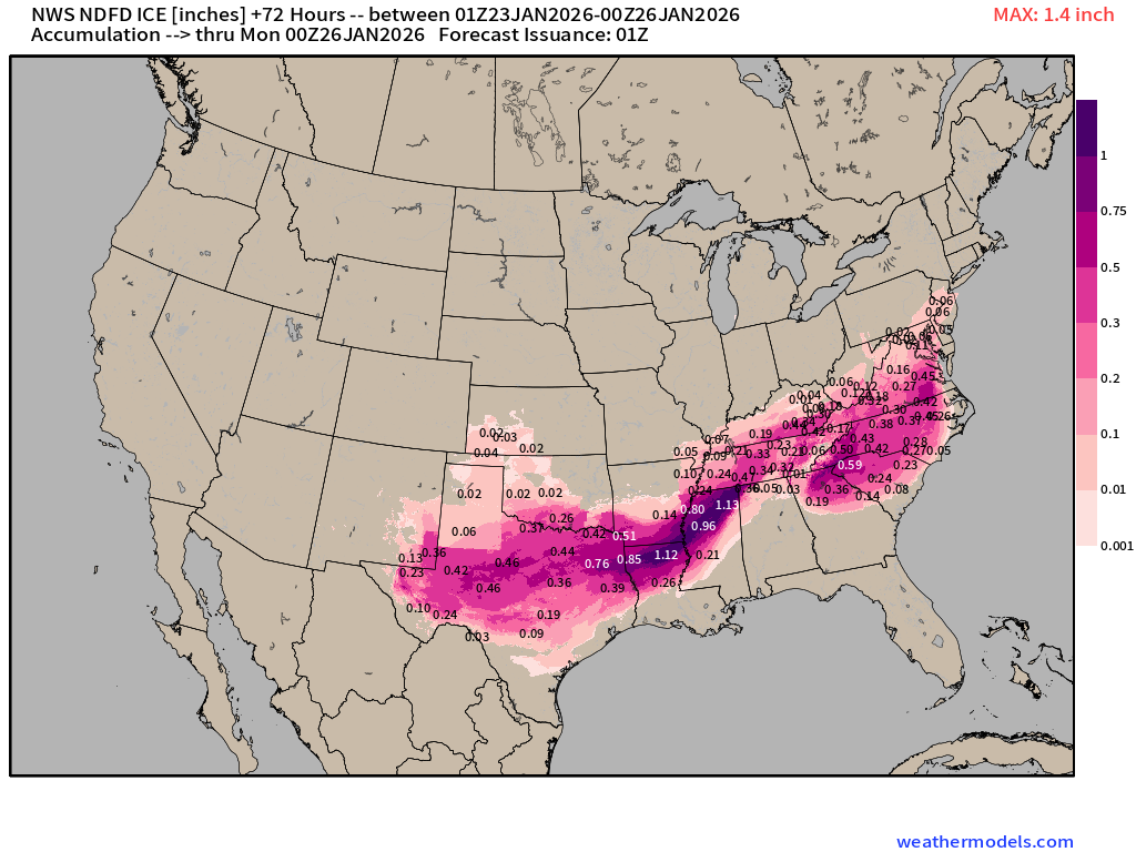
NWS has severe ice storm warnings for the pile up of > 1” of ice in northern Louisiana to Mississippi perhaps most since the January 1994 “Delta Ice Storm”
Atlanta is included in the ice for now. This would be Sunday until about noon — so travel into Hartsfield might be mucked up.
The snow actually happens first in Washington D.C. and then freezing rain comes on top — which is interesting. This doesn’t include the entire event — so we’ll update tomorrow for the storm totals.
Texas —> Louisiana and Mississippi —> Yikes!
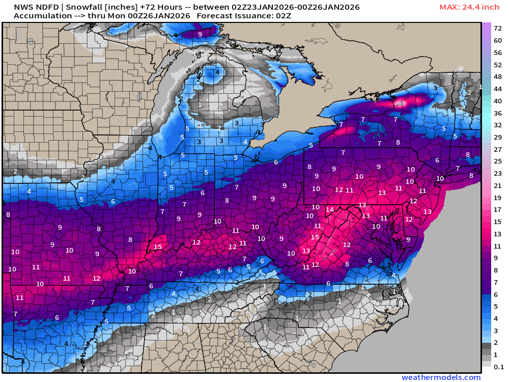
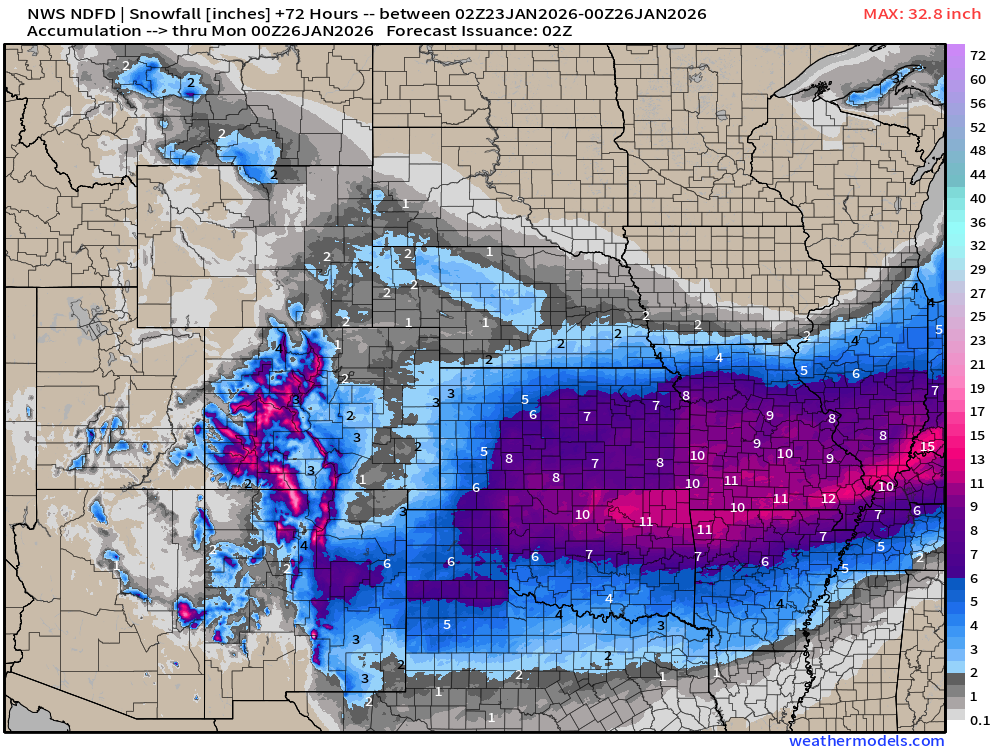
NWS Snowfall Next 72-hours until Sunday 7 PM ET | Still going
Blend of Models | 7 Days Precipitation Total
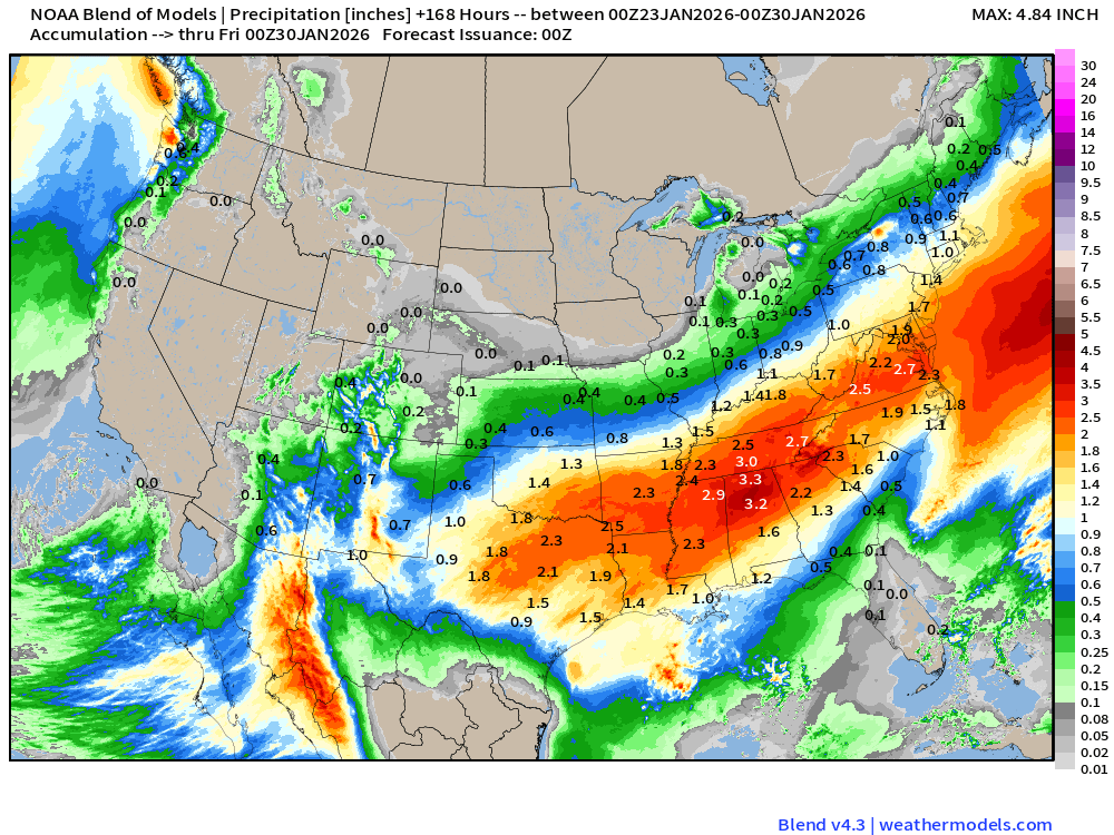
That’s a lot of QPF from this subtropical atmospheric river
Blend of Models | Total Snowfall Next 7-Days
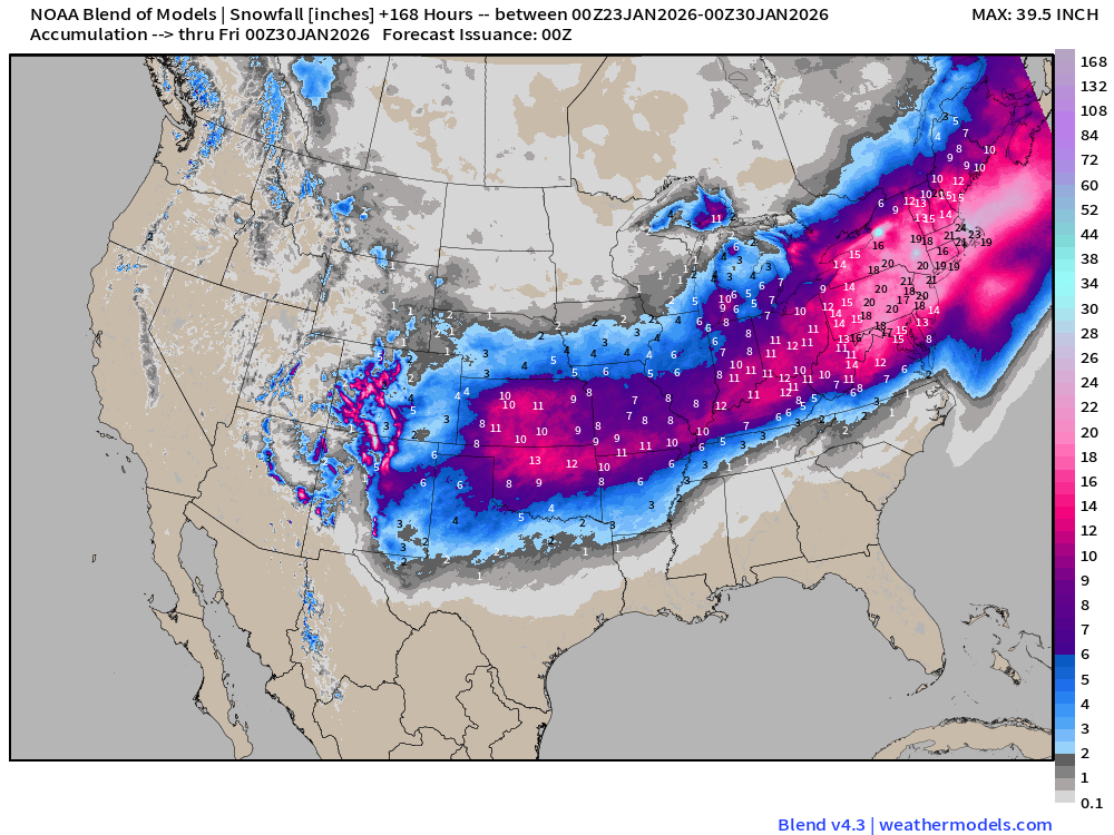
The snow to liquid ratios (SLR) are incorporated directly into the Blend of Models snowfall forecasts —> quite amazing totals in Washington D.C. + Philly —> NYC and Boston. Wow!
Extended Range
ECMWF EPS 12z | Ensemble Median Snowfall Next 15-days
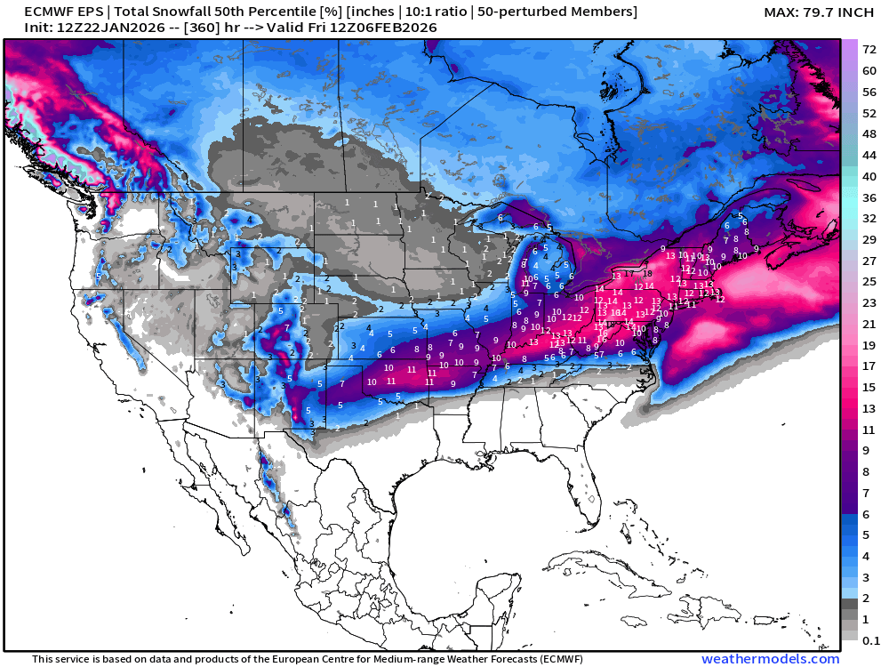
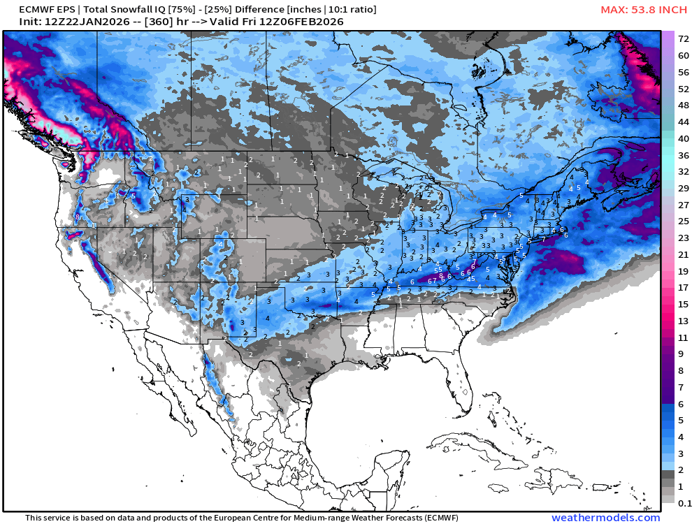
This is a still an underestimate. There is a very wide distribution of solutions with the Interquartile range (25% to 75%) the same amount as the median = boom or bust & the snow-to-liquid ratio will be upwards of 15:1 or higher in the cold air, so we could double the median snowfall amounts.
IQ (25-75%) range through 15-days
Ensemble Maximum through 15-days: Boom Potential Dialed up to 100%
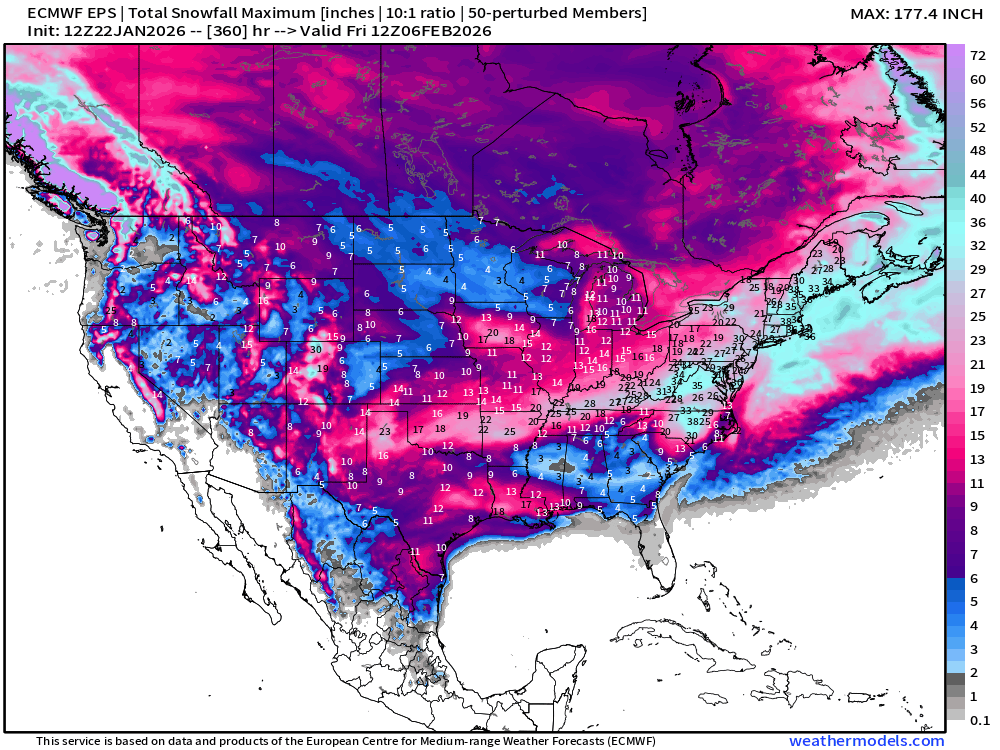
—> this map is a “worst case scenario”
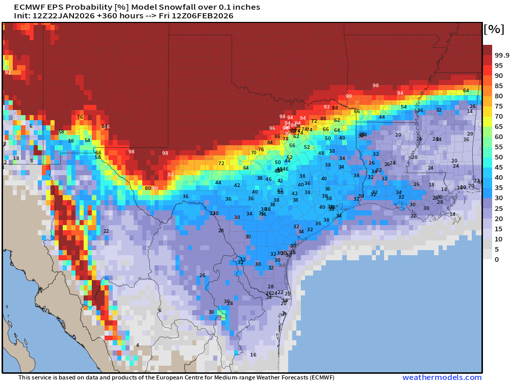
Probability of some Snowfall (0.1”) in next 15-days
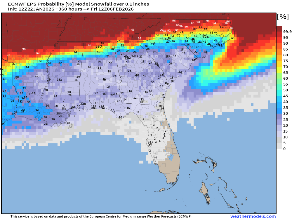
At least 2 ensembles show a dusting along Interstate 4 — it could happen 4% chance!
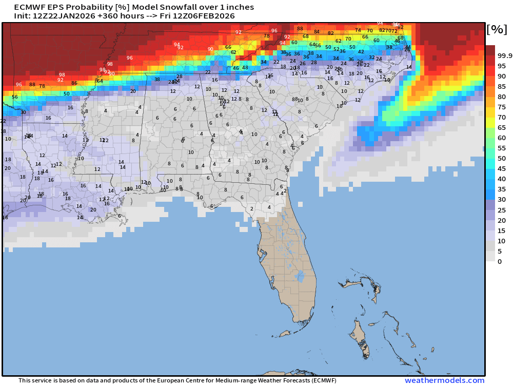
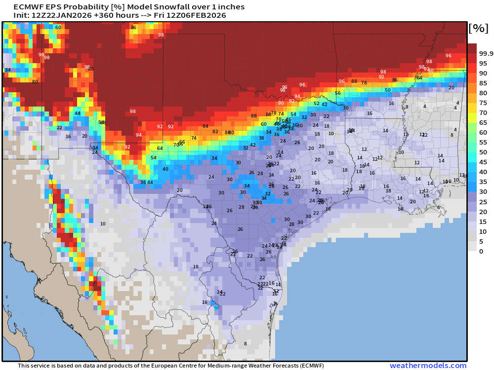
Probability of 1-inch Snowfall in next 15-days
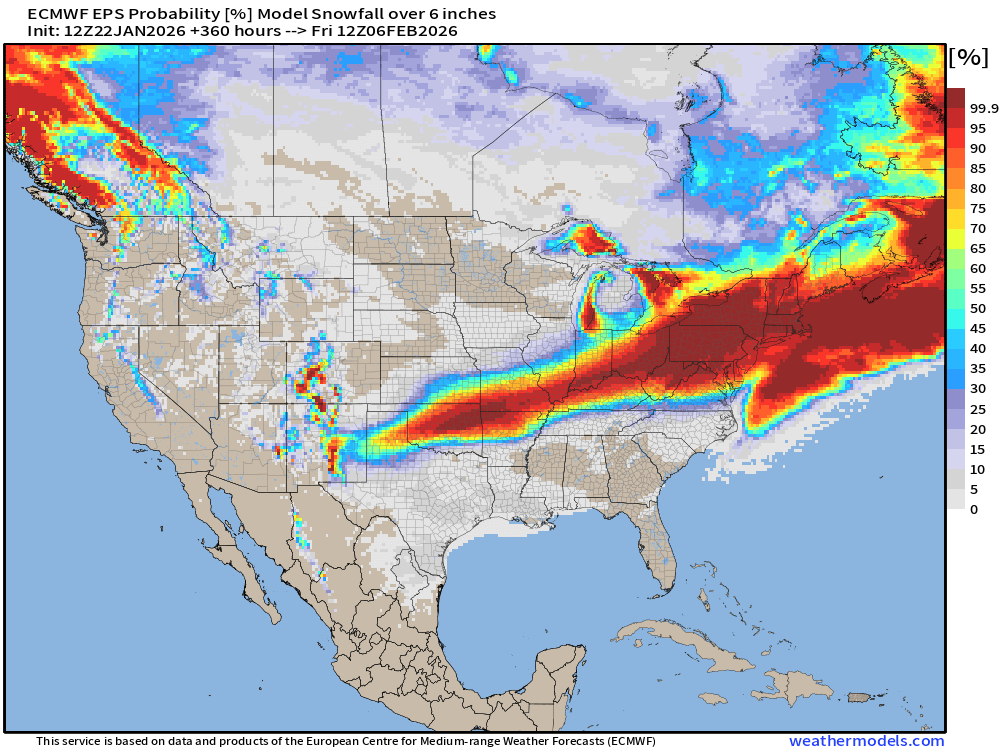
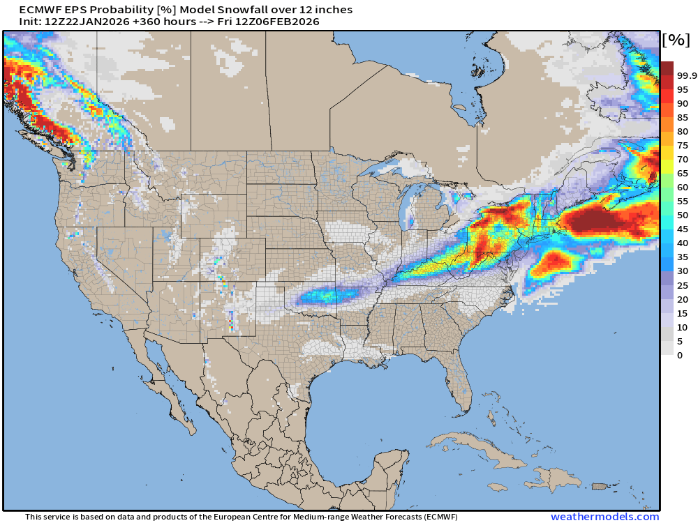
Probability of 6” and 12” of Snowfall next 15-days
Maps sourced from weathermodels.com designed and innovated by yours truly! Please subscribe there for real-time access to the newest maps, charts from all of the weather models including ECMWF and AIFS, NOAA AI-GFS/AI-GEFS
- Milepost
- 847 · laid 2026-01-23T03:14:50.895000Z
- Source
- https://weather.substack.com/p/january-22-2026-thursday-massive
- Digest
- 557069298193aef8f3651b86092a47832fa2a9b833006d08fb201941b8f409e8
- Machine
- JSON