January 16, 2026 Friday Winter Weather
Next week the Polar Vortex is fully loaded with potential for extremely cold conditions across Midwest and Great Lakes
January 2026 was the 25th-warmest January in the 132-year national record (1895–2026), at 33.1°F against a 1991–2020 normal of 32.3°F (+0.8°F).
January 2026 was the 12th-driest January in the 132-year national record (1895–2026), at 1.6in against a 1991–2020 normal of 2.3in (-0.8in).
NOAA/NCEI Climate at a Glance, contiguous United States. This is the observed record for the month, not a score of anything said in this piece — the forecast ledger begins 2026-08-17 and cannot reach earlier posts.

Flagship ECMWF 12z EPS | Temperature Anomaly | Next 15-days
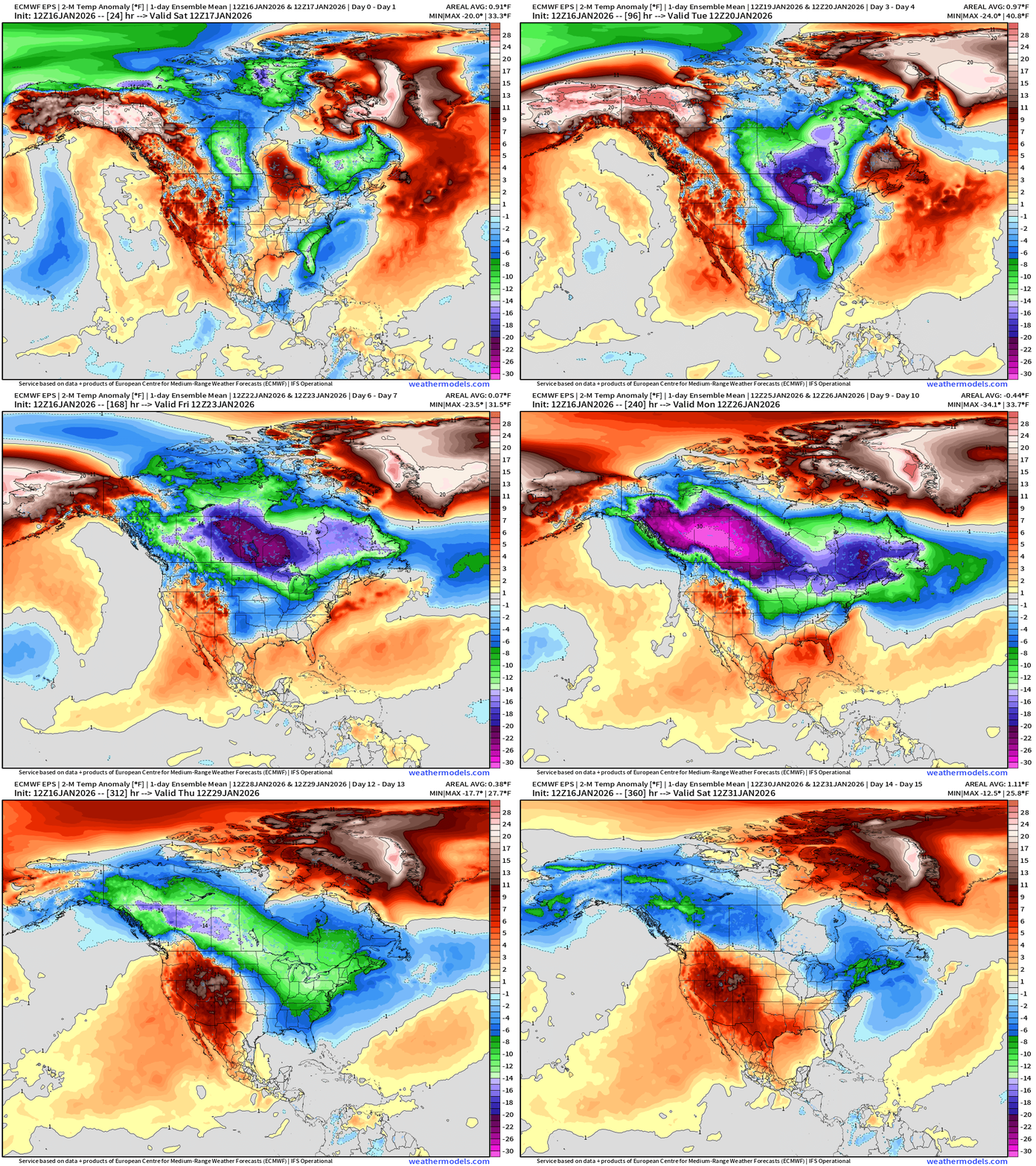
Amazing period of extreme cold over the next 10-12 days including multiple cold fronts/Arctic blasts into the Eastern U.S. with a massive expansion westward across all of Canada as the “polar vortex” anchored over Hudson Bay intensifies significantly — this is a MAJOR and long-lasting cold event.
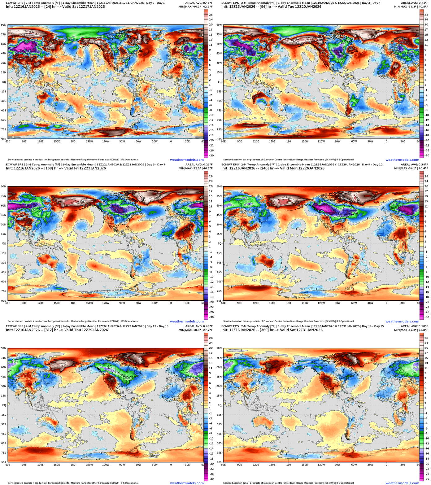
Zoom Out Globally to see the “cold continents” pattern on steroids with huge cold pools over Eurasia/Siberia and North America. Warm advection + moisture over the North Pacific and North Atlantic further distrup the Arctic polar circulation and align the jet stream to simply transfer cold air from Siberia to North America and keep the pattern locked/blocked or repeating for the next 2-weeks.
Lower 48 | Low Temperatures through Next Sunday January 25, 2026
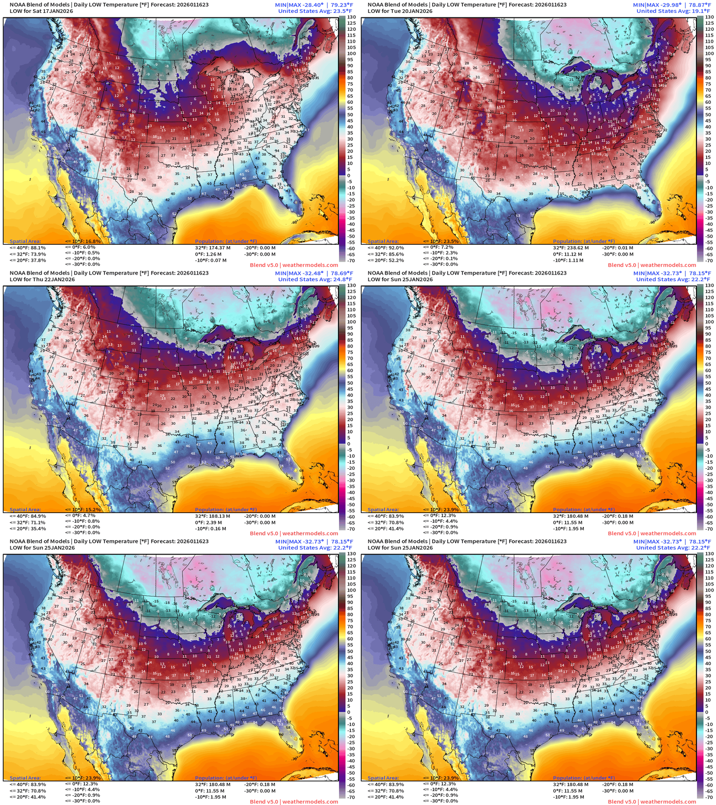
Very cold for the next 7-10 days across much of the eastern United States — with subzero temperatures lurking in the Midwest and Great Lakes, and single digits + teens dipping into Missouri and Tennessee middle of next week. Some moderation toward next weekend across the South.
ECMWF 18z | Temperature Anomaly Next 6-days
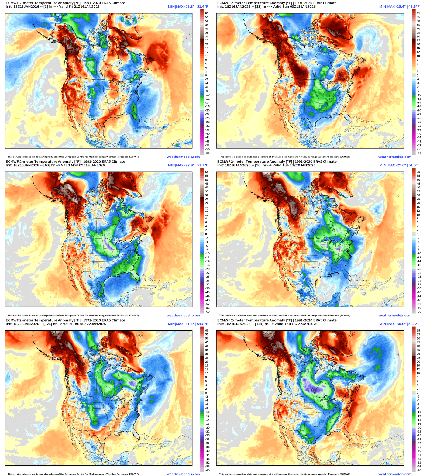
Compared to normal — we can see in the next 6-days the rotation of Arctic blasts through the Great Lakes connected to a semi-permanent mid-level trough connected to tropospheric polar vortex over Hudson Bay.
Through the next week, conventional cold fronts with Northwesterly flow behind — brings colder, Canadian continental air largely out of the Hudson Bay region. However, look at Day 6, and see the “loading phase” of a MAJOR tropospheric “polar vortex” setup for the ages.
Day 6 — looks ominous on its own, but there’s another “thickness” anomaly coming in from the Arctic ocean associated with a surface high pressure … that will combine forces with now entrenched PV over Manitoba/Ontario. All systems go for potential of extreme cold. Solutions from the ensembles at 12z were outlandish — historical.
Sunday —> Florida / South Georgia Snowfall + Northeast Extension
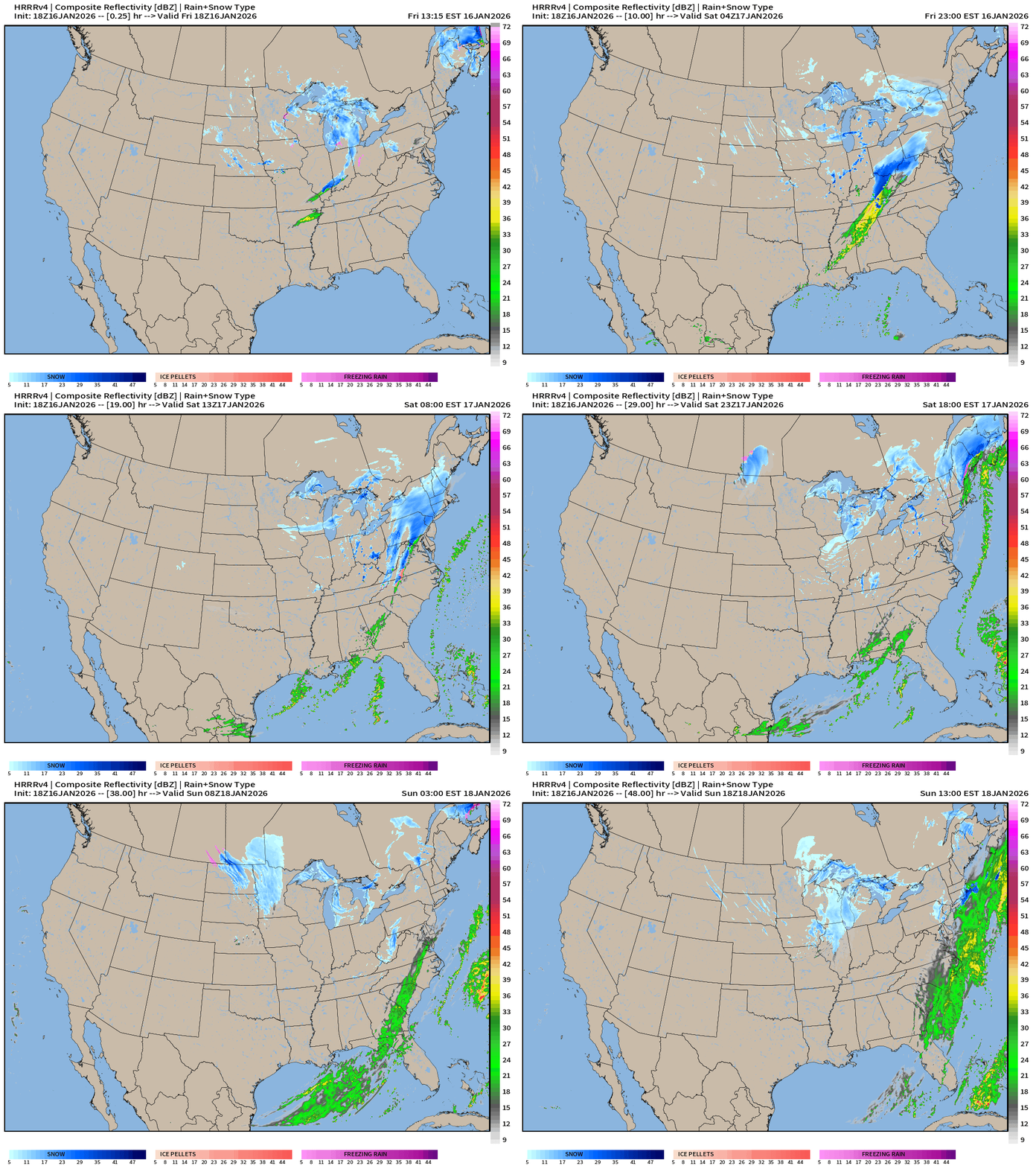
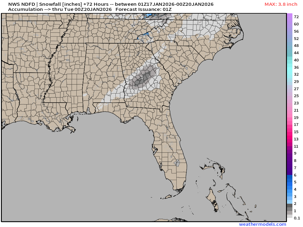
The RRFS-A (next flagship NOAA mesoscale model) largely gave up on the snowfall across the Southeast — but there is still a narrow band of 1” over Macon — this is Sunday morning.
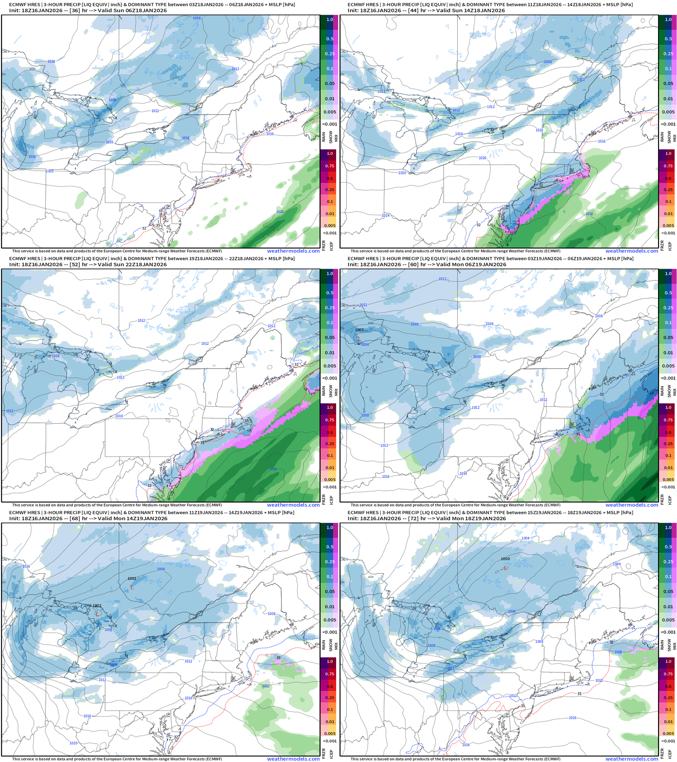
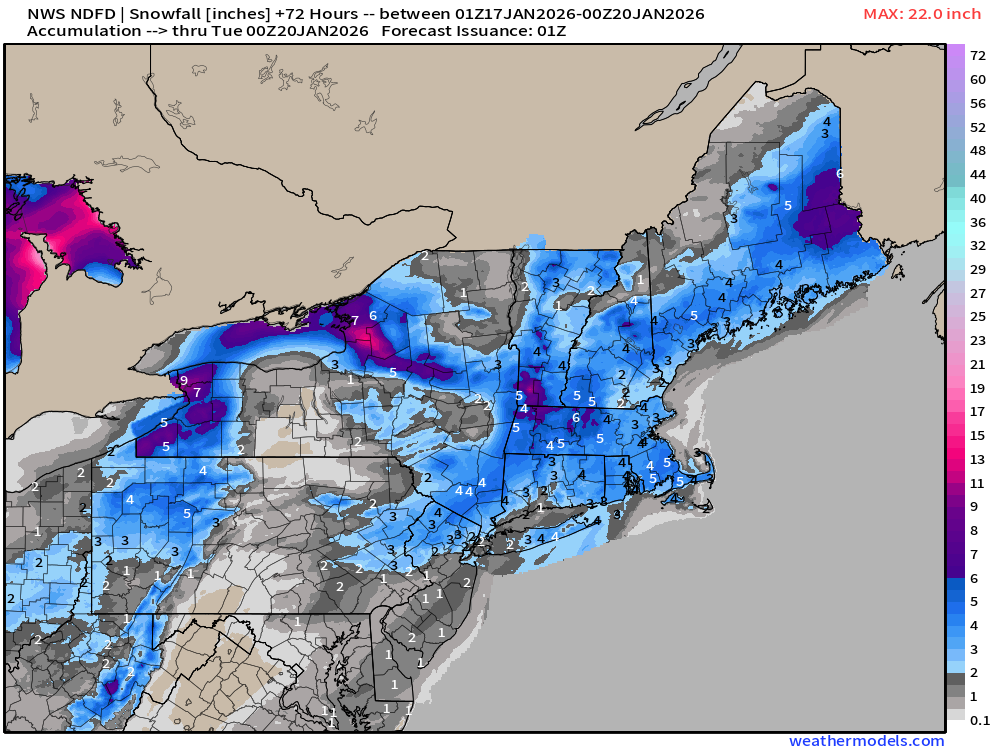
However, later Sunday evening —> coastal snowfall event for the Northeast including NYC (lighter amounts) and Boston (2”-4”) — we’ll see the NWS amounts shortly.
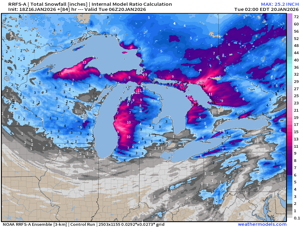
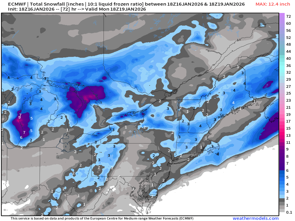
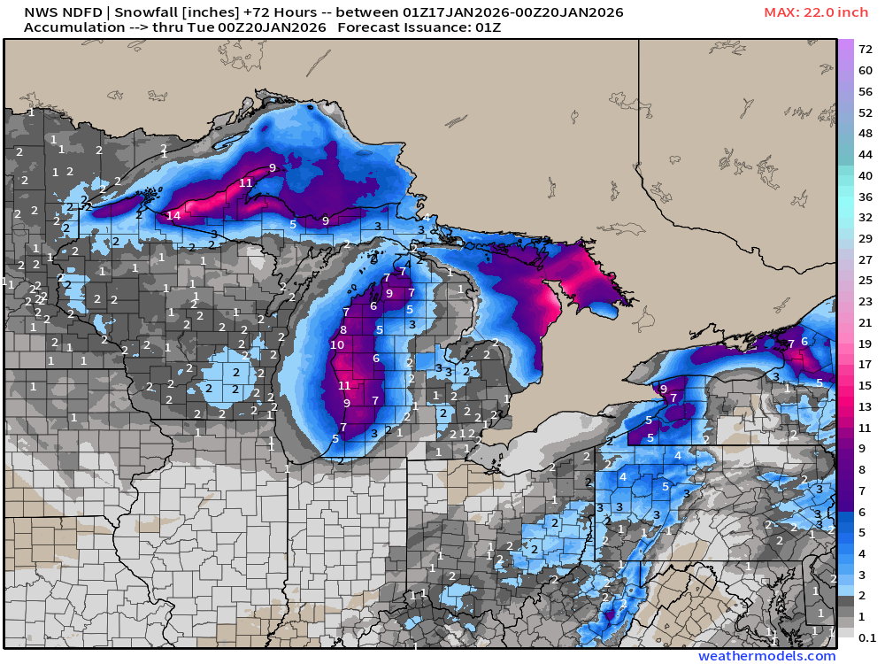
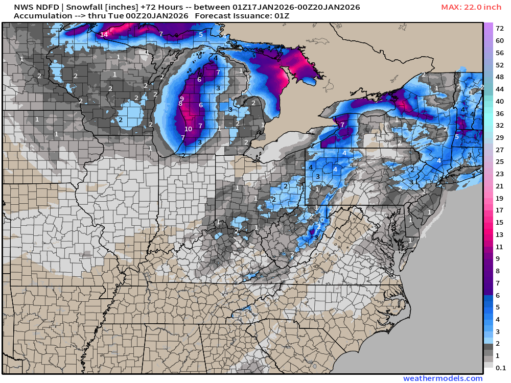
Great Lakes Effect Snow Machine continues at full blast … 3 day snowfall totals:
Southeast Snowfall From ECMWF 18z —> most reliable model
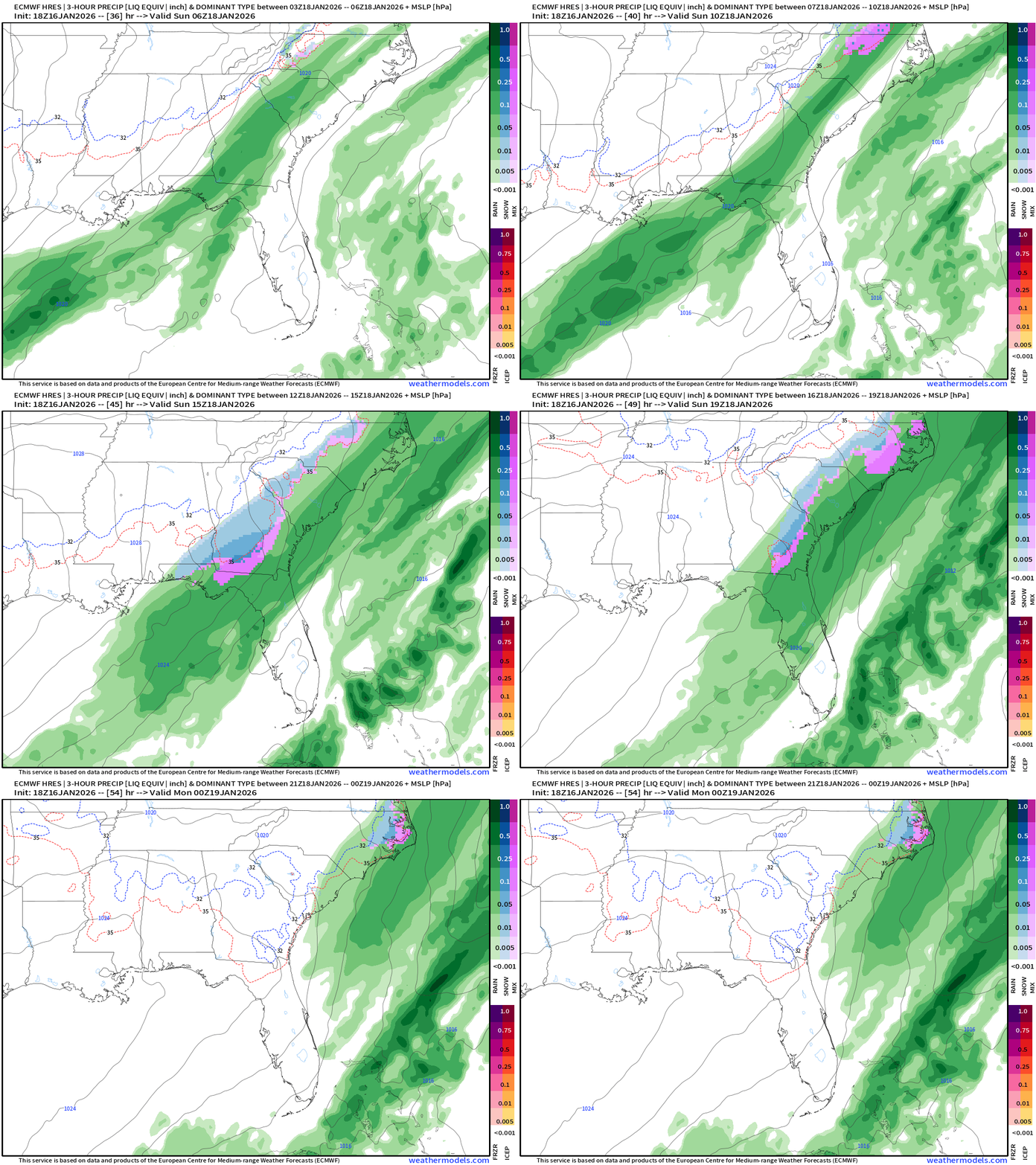
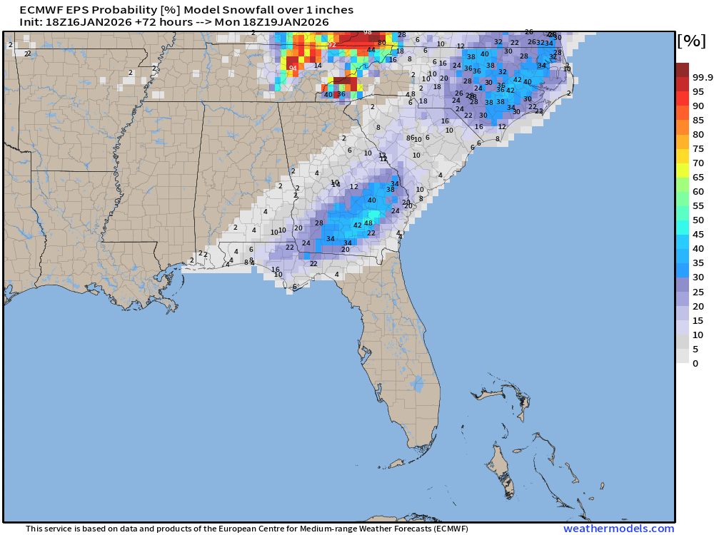
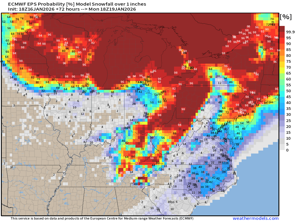
Still an area of > 1” in South Georgia — we’ll see how this evolves into the morning forecast cycle. This would be “daytime” snowfall with dynamic cooling from the precipitation within the cold Arctic air mass, so not the most optimal setup for heavy snowfall. However, if the cooling is underestimated on Sunday, then we could see a surprise dumping.
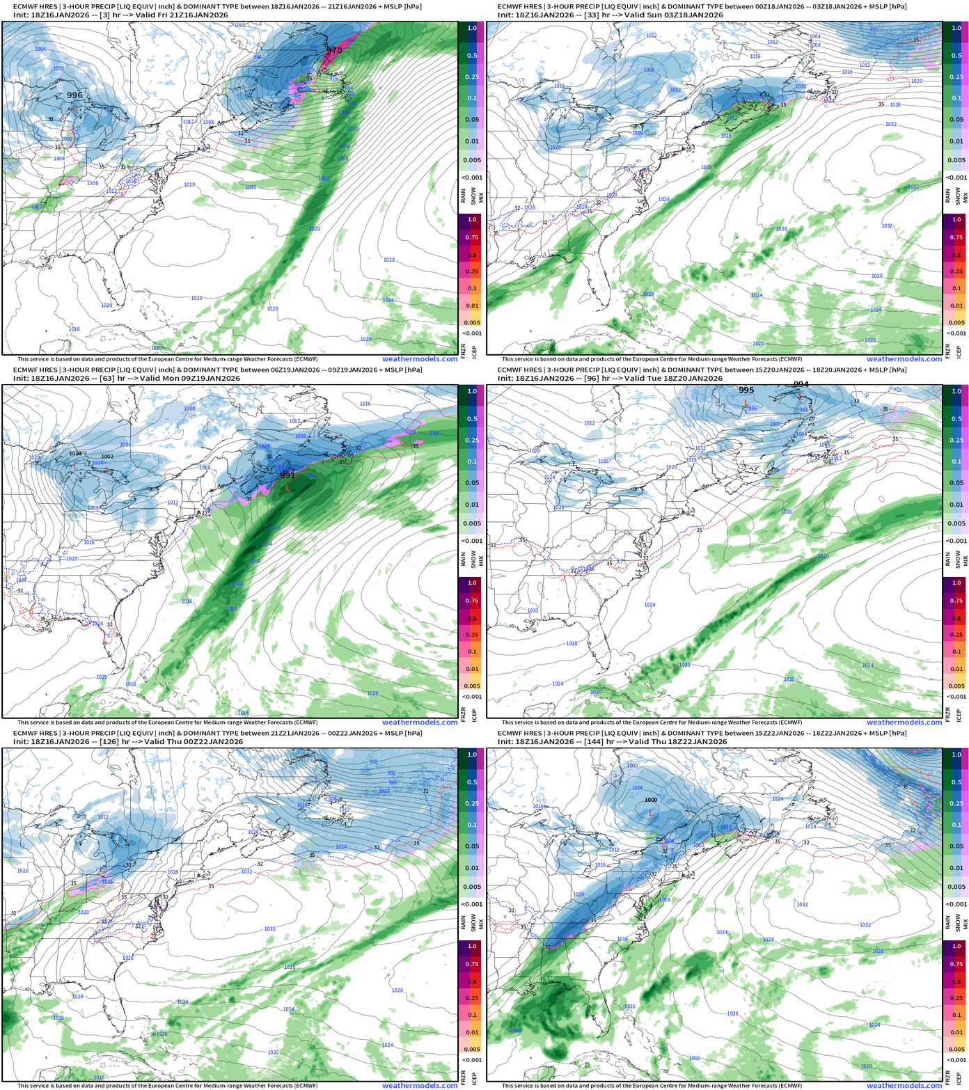
Northeast ECMWF 18z —> Sunday and Monday with coastal snowfall
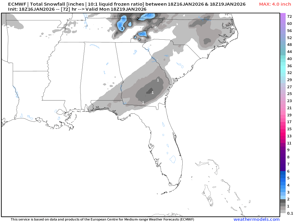
Snowfall Total through 3-days from ECMWF 18z
ECMWF AIFS-Single 18z | Height Anomaly (500 hPa) Next 10-days
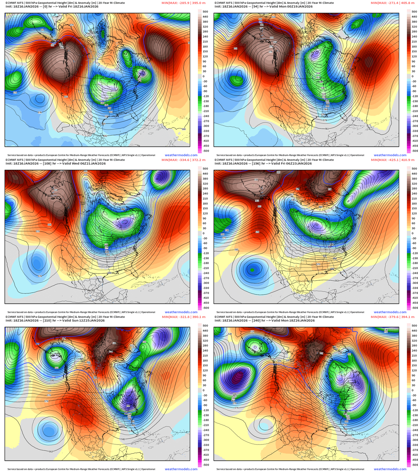
Amazing sequence of troughs digging into the Great Lakes and Northeast through next 10-days with multiple major Arctic blasts. Ridging across the Western U.S. remains largely intact, too — we’re in a stuck pattern for the rest of January.
ECMWF AIFS-Single 18z | Temperature (500 hPa) Next 10-days
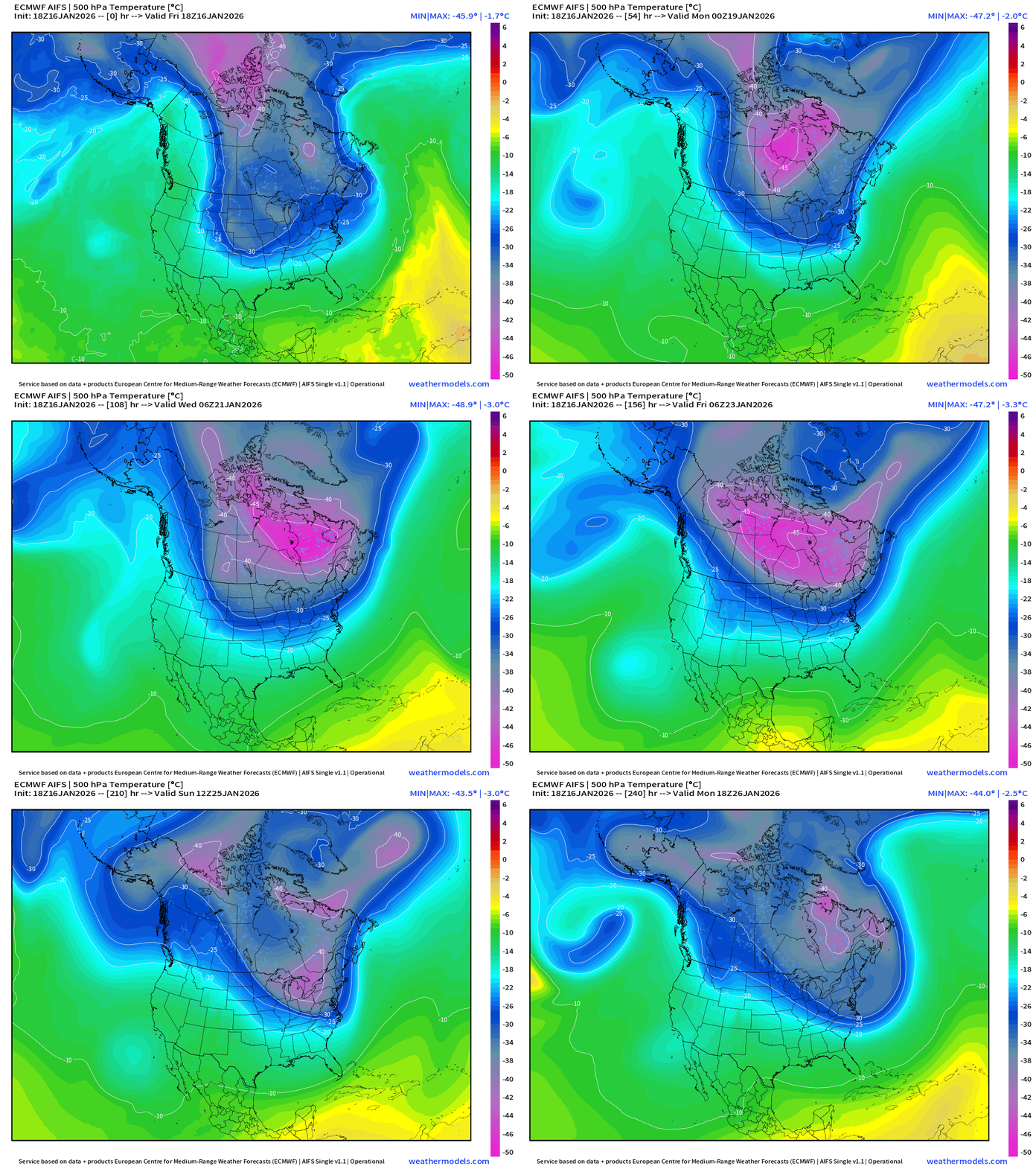
The temperature at 500 mb is the easiest way to highlight the “polar vortex” across North America with the coldest pool at -40°C (pink) with the -25°C contour usually associated with below freezing temperatures at 2-meters (surface).
The Western U.S. and Pacific Northwest ridge is very apparent and firmly entrenched vs. the Hudson Bay / Arctic Canada undulations are dipping southward into the eastern U.S. = cold. The reservoir of cold air remains largely intact through 10-days centered over Ontario/Quebec. Amazing to see the -40°C to -45°C contours dipping into the Great Lakes and Northeast —> risk for extreme cold.
HRRR Next 48-hours Radar | Through Saturday 1 PM ET
ECMWF 18z | Precipitable Water Next 6-days | My Favorite Parameter
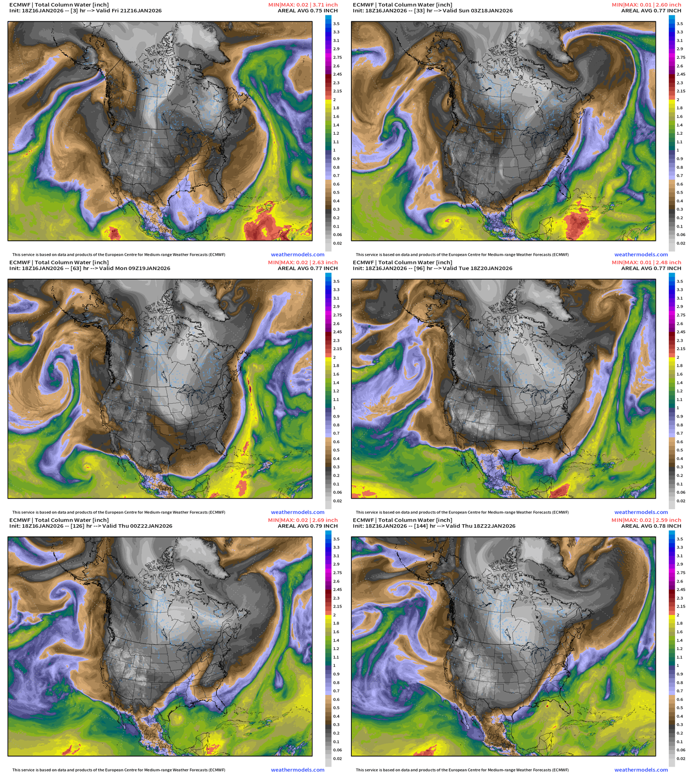
Multiple Arctic blasts crash out of Canada into the Lower 48 — reaching the Gulf Coast and draining through Florida. Very cold period starting — underway east of the Rockies.
ECMWF 18z Precipitation Type and Intensity | Next 6-days
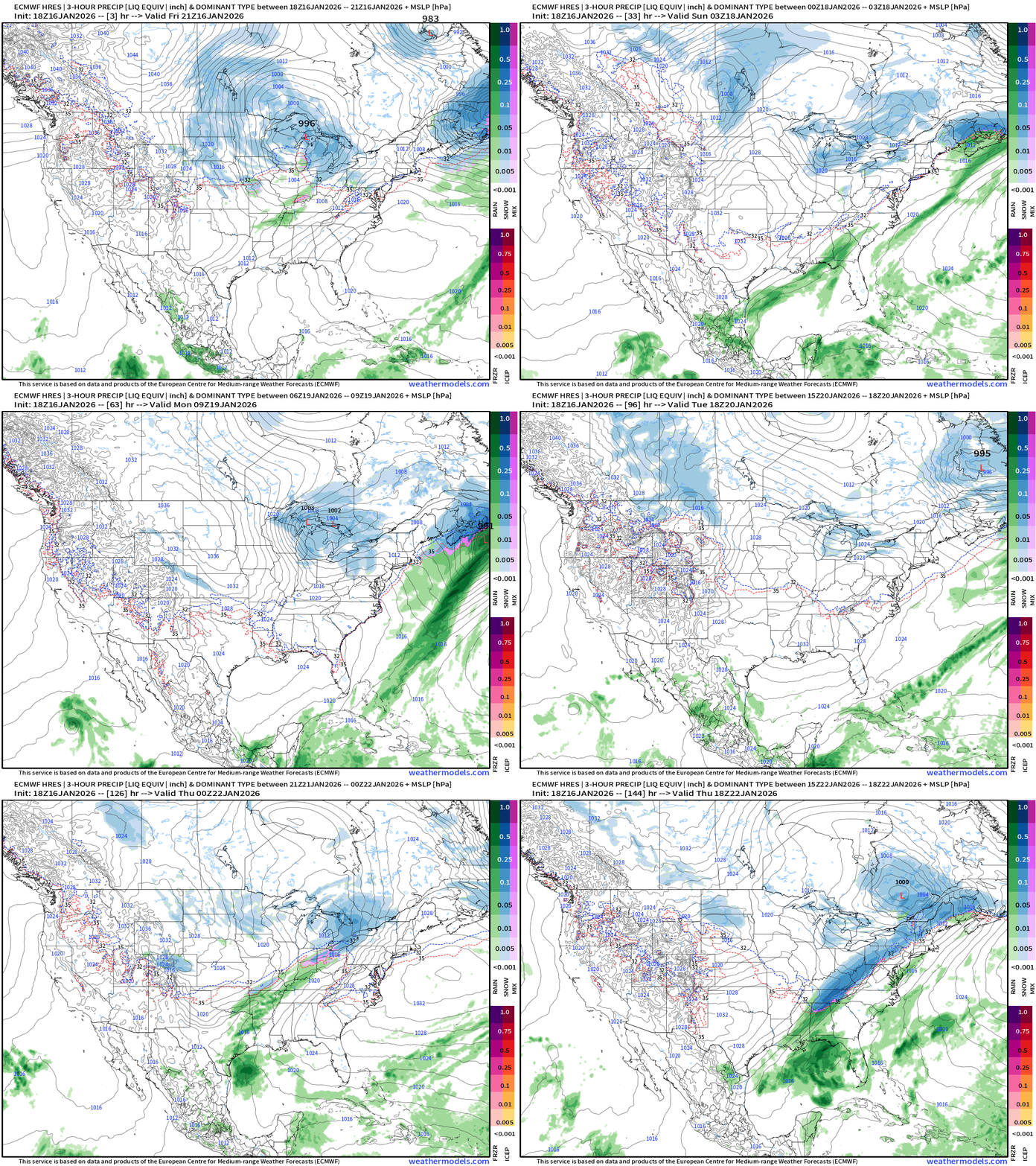
Southeast —> East Coast moisture plume but misses phasing
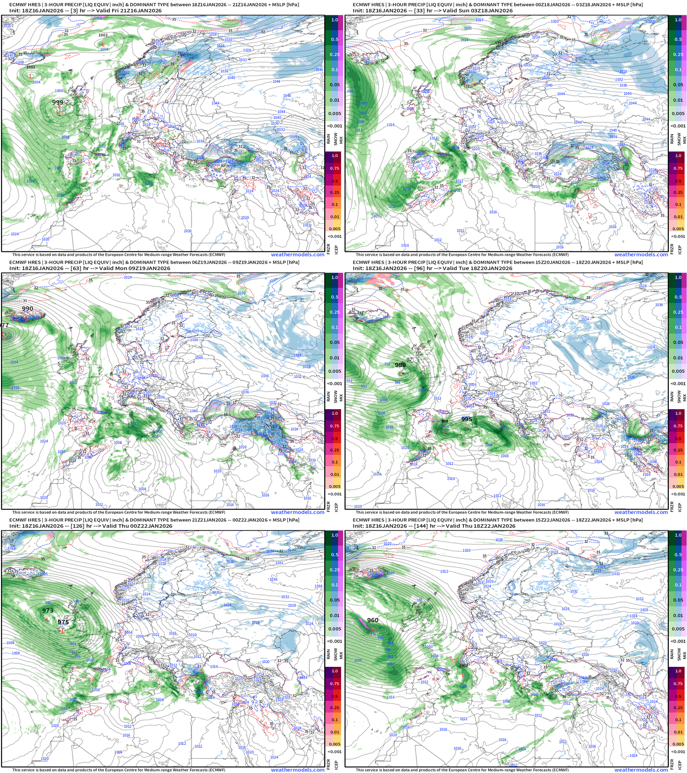
Europe Storm Systems next 6-days
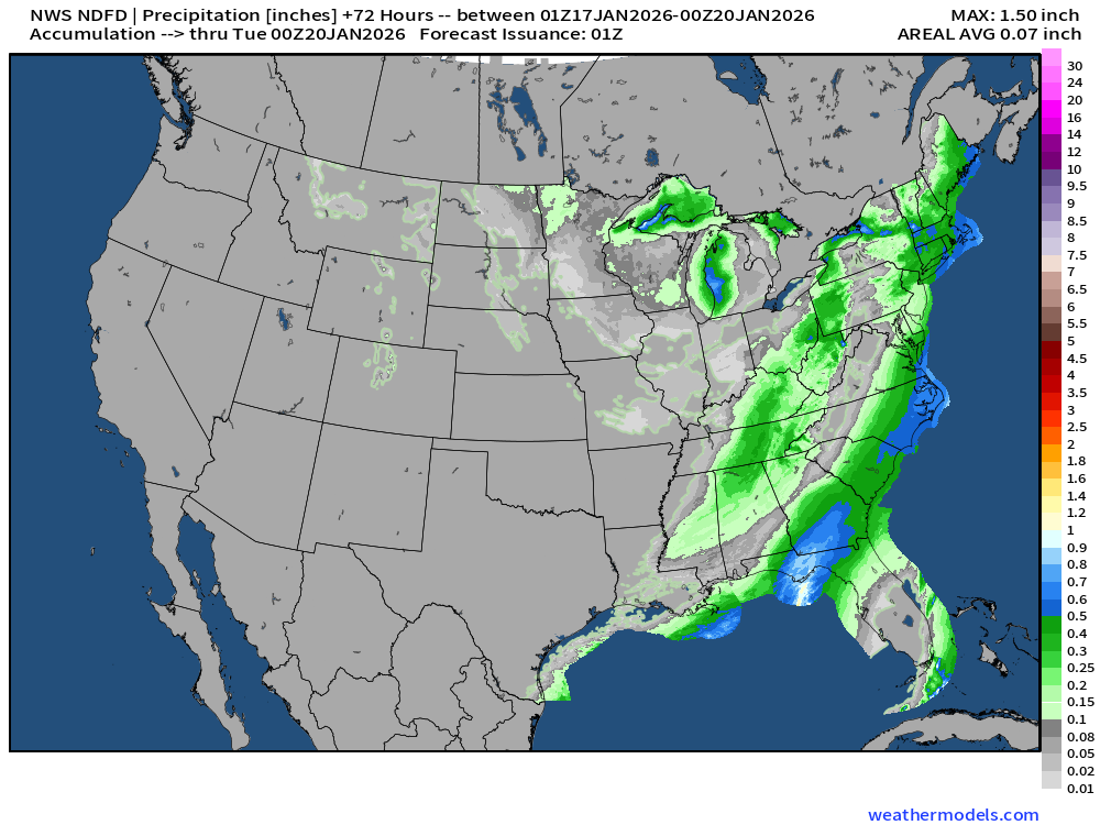
NWS Precipitation Next 72-hours
NWS Snowfall Next 72-hours
RTMA | Temperature Analysis | 8:00 PM ET
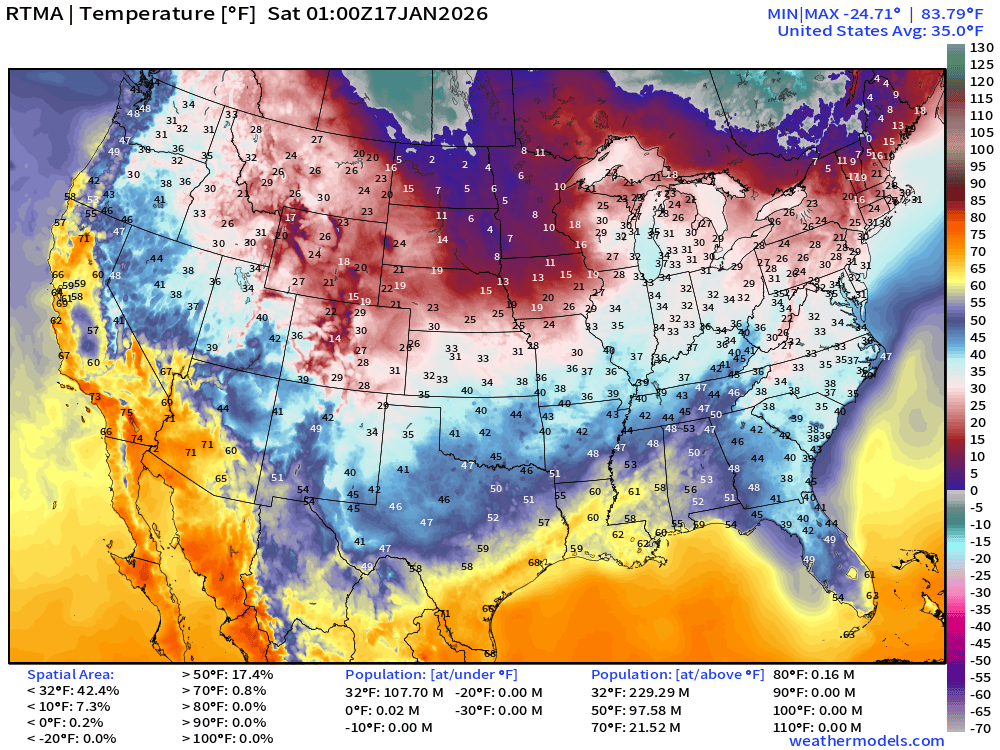
Average Lower 48 temperature was 35.0°F with 108 million below freezing.
Temperature Anomaly | 8:00 PM ET
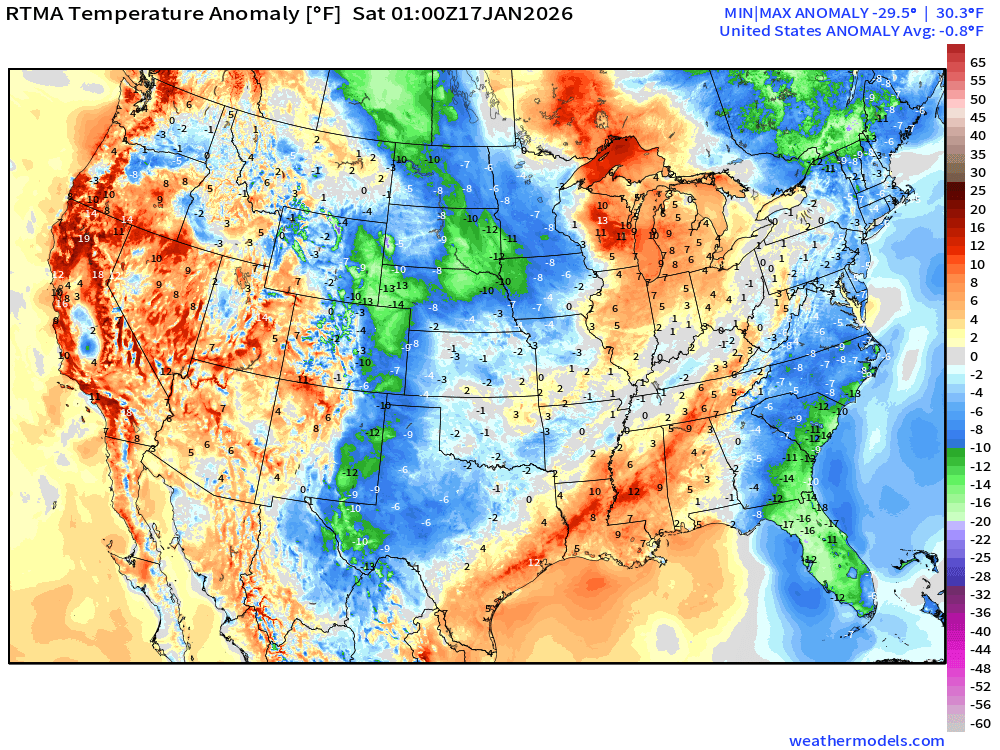
Lower 48 Temperature Anomaly below normal by -0.8°F
Saturday Morning Low Temperatures
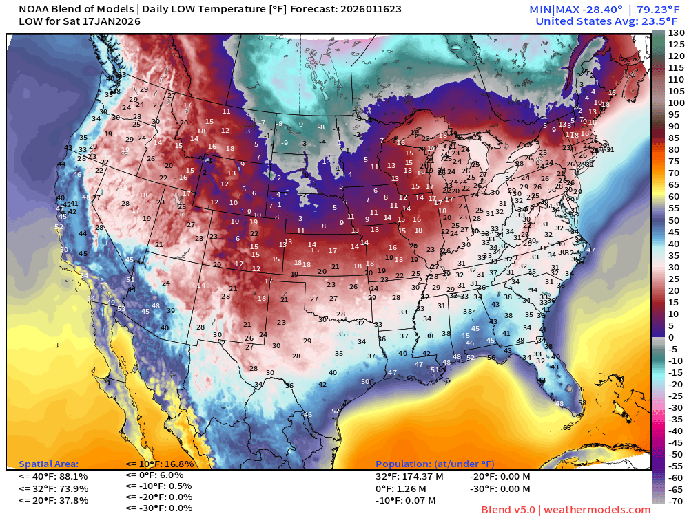
174 million below freezing — nationwide average of 23.5°F
Saturday High Temperatures
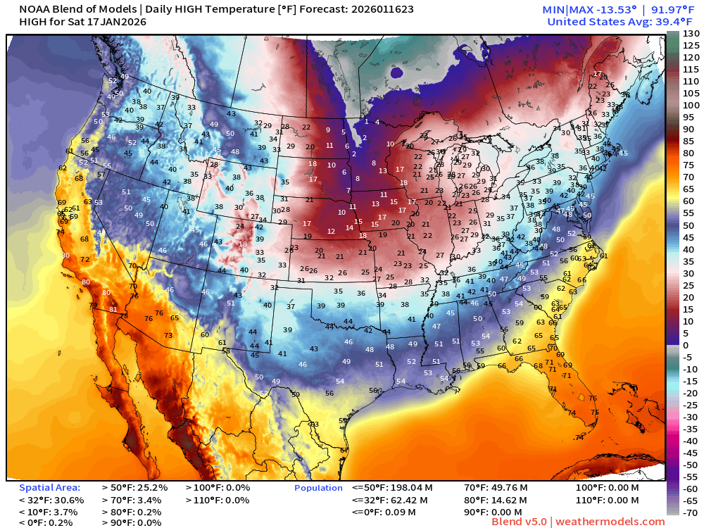
Nationwide average of 39.4°F
Sunday Low Temperatures
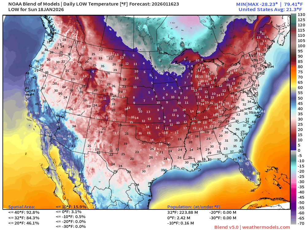
Frigid with 224 million at/below freezing
Sunday High Temperatures
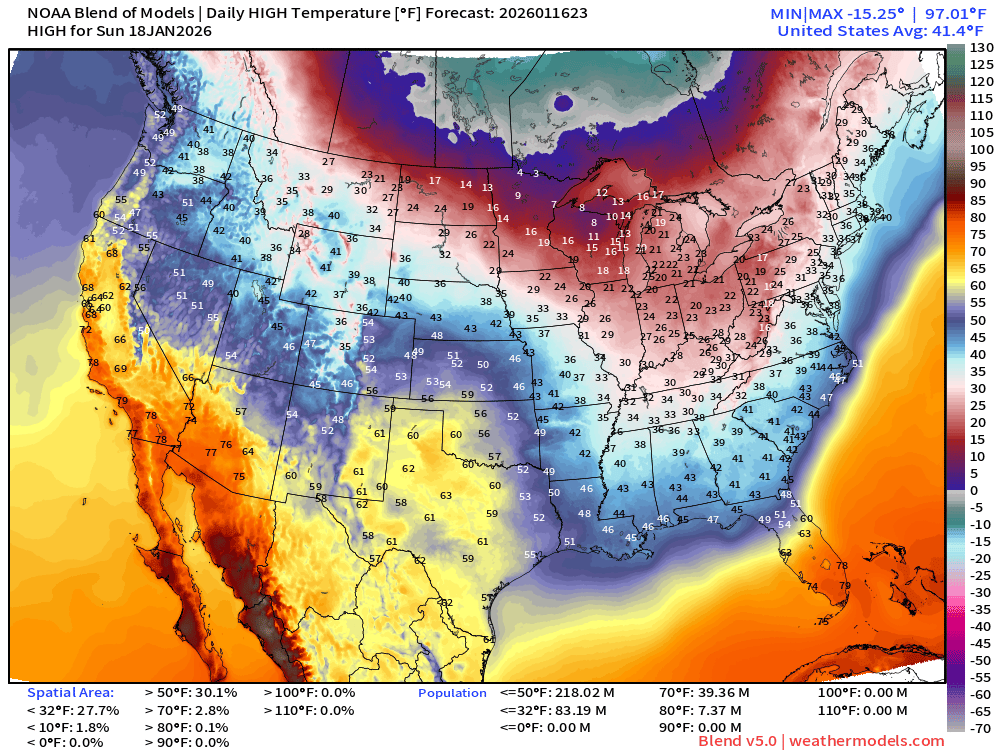
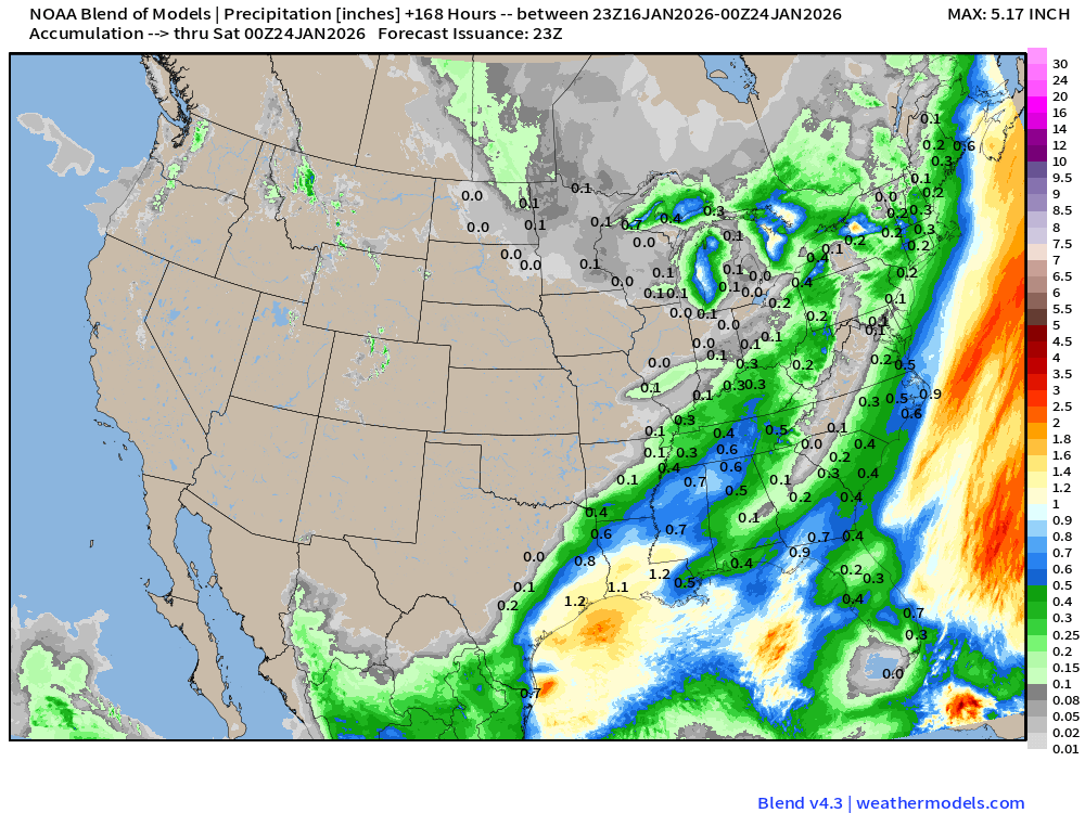
Blend of Models | 7 Days Precipitation Total
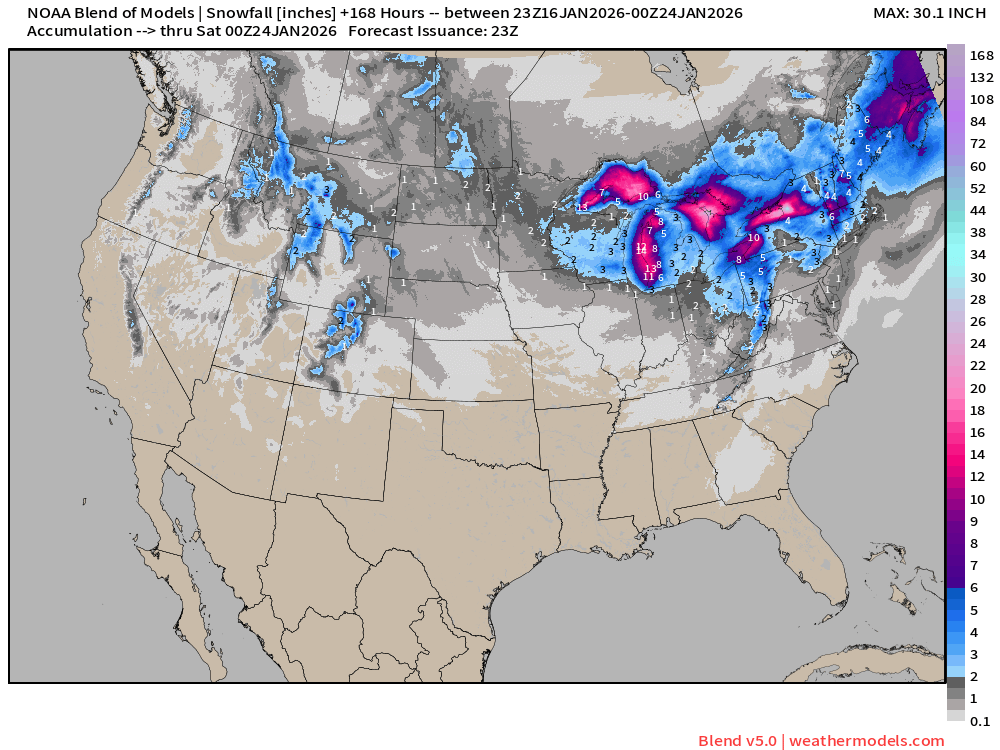
Blend of Models v5.0 | Total Snowfall Next 7-Days
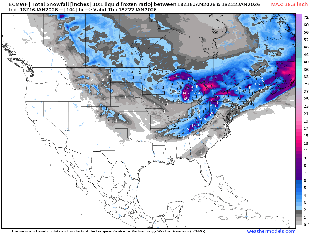
ECMWF 18z | Snowfall Next 6-days
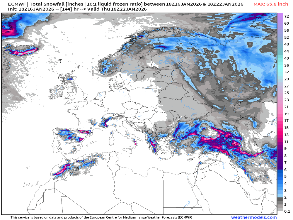
European Winter | Snowfall Next 6-days
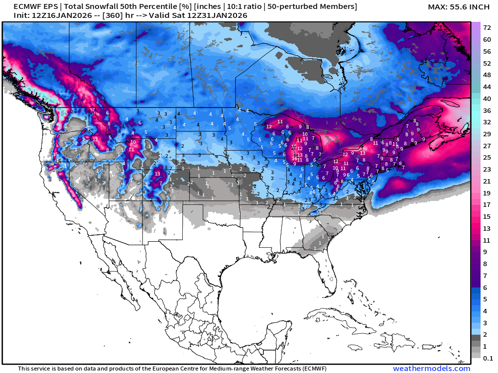
ECMWF EPS 12z | Ensemble Median Snowfall Next 15-days
Probability of 0.1-inch or more Snowfall in the next 6-days [18z]
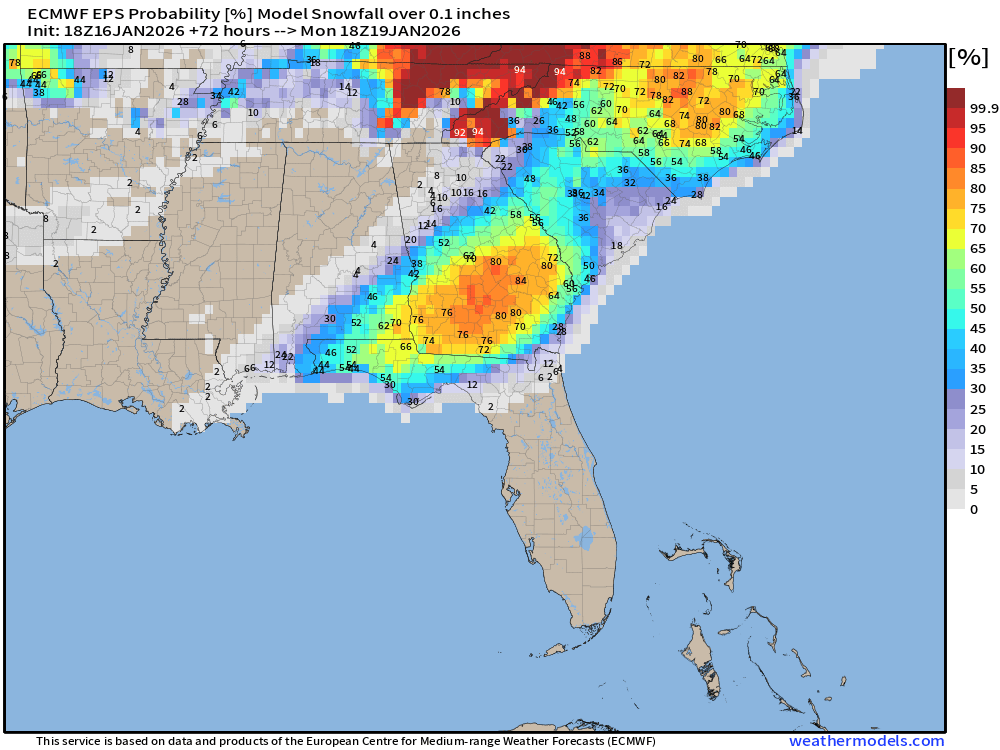
50-75% chance of snowfall > 0.1” (accumulations) from Florida panhandle through South Georgia and up into the Carolinas
Probability of 1-inch or more Snowfall in the next 3-days [18z]
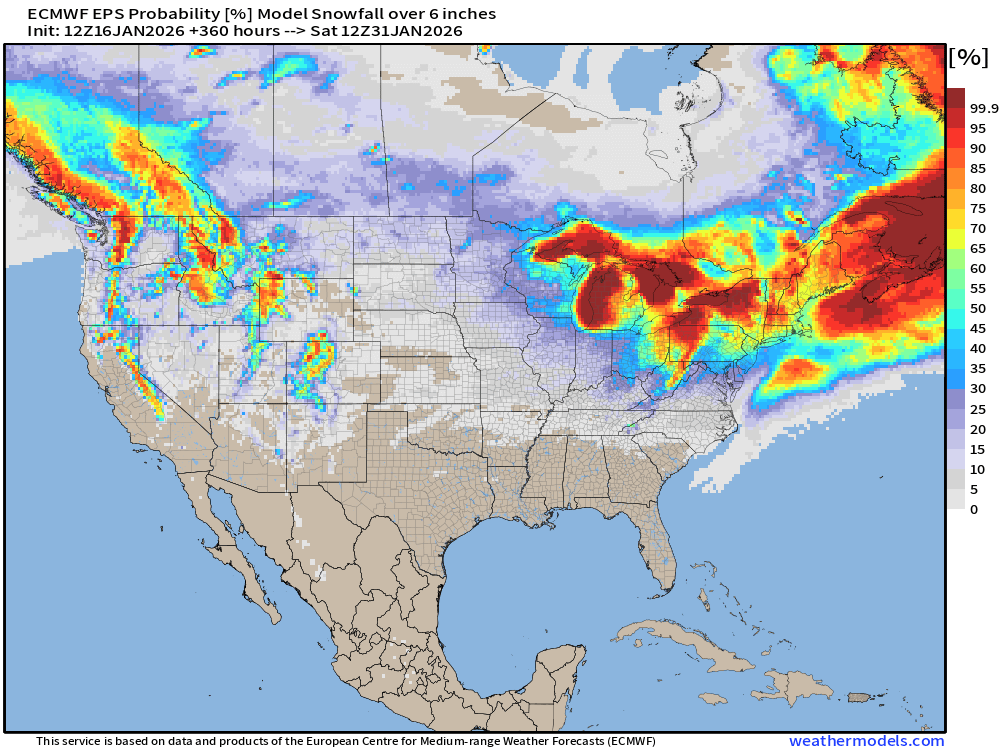
Probability of 6-inch or more Snowfall in the next 15-days
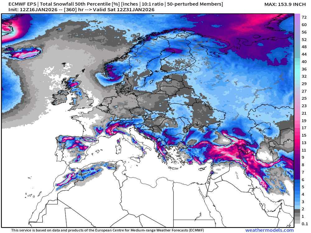
Ensemble Median Snowfall for Europe Next 15-days
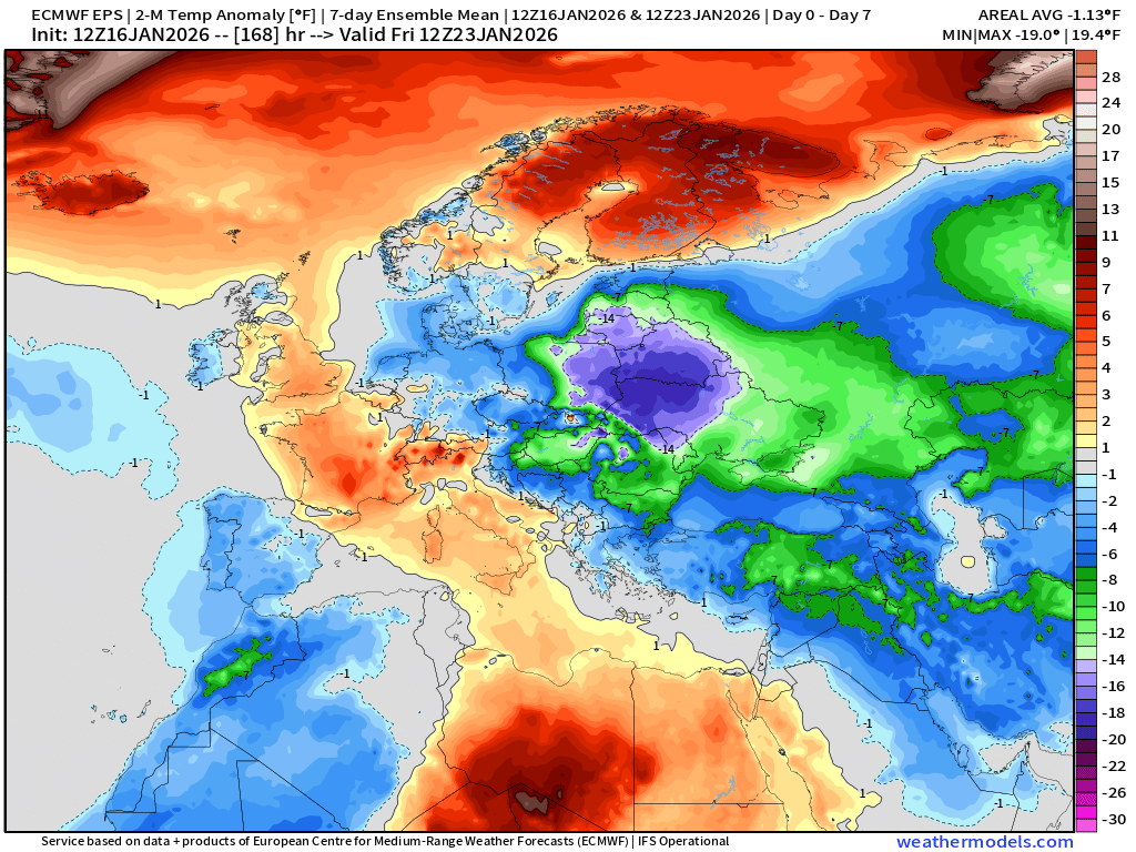
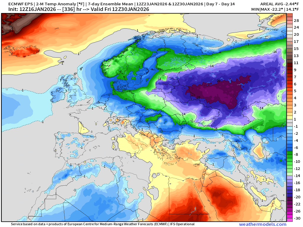
Europe Temperature Anomaly | Week 1 and Week 2
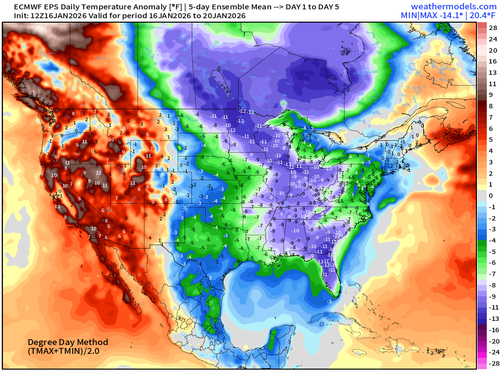
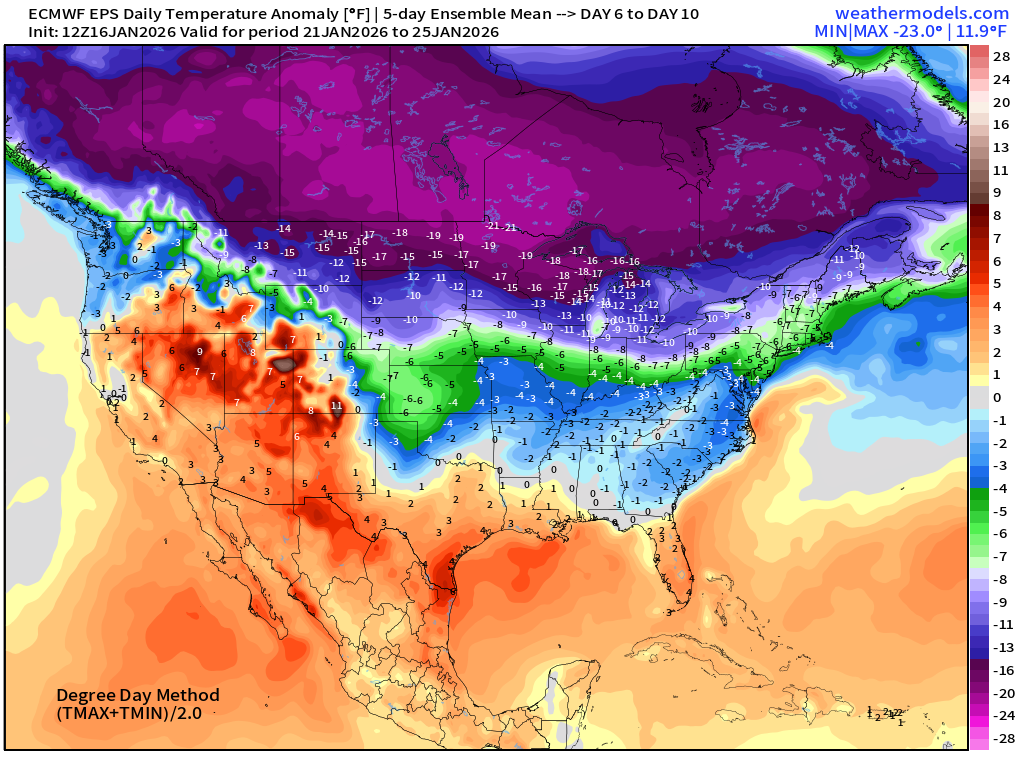
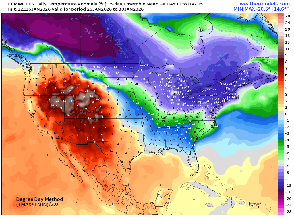
Lower 48 Temperature Anomaly | Next 15-days | ECMWF EPS 12z
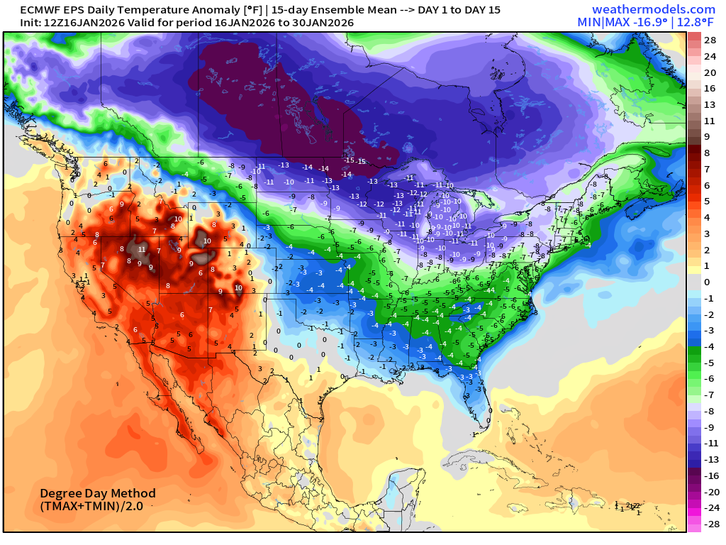
The back half of January will see much below normal temperatures east of the Rockies and across all of Canada.
5-Day Chunk #1 | Temperature Anomaly | Jan 16 - Jan 20
5-Day Chunk #2 | Temperature Anomaly | Jan 21 - Jan 25
5-Day Chunk #3 | Temperature Anomaly | Jan 26 - Jan 30
Maps sourced from weathermodels.com designed and innovated by yours truly! Please subscribe there for real-time access to the newest maps, charts from all of the weather models including ECMWF and AIFS, NOAA AI-GFS/AI-GEFS
- Milepost
- 842 · laid 2026-01-17T02:45:09.277000Z
- Source
- https://weather.substack.com/p/january-16-2026-friday-winter-weather
- Digest
- 8cb344f09c55b81399896b79ed08044745a2c6451131727a2ef80cfd9b59b165
- Machine
- JSON