January 15, 2026 Thursday Winter Weather
Multiple Arctic blasts will continue through end of January
January 2026 was the 25th-warmest January in the 132-year national record (1895–2026), at 33.1°F against a 1991–2020 normal of 32.3°F (+0.8°F).
January 2026 was the 12th-driest January in the 132-year national record (1895–2026), at 1.6in against a 1991–2020 normal of 2.3in (-0.8in).
NOAA/NCEI Climate at a Glance, contiguous United States. This is the observed record for the month, not a score of anything said in this piece — the forecast ledger begins 2026-08-17 and cannot reach earlier posts.

Low Temperatures through Next Saturday January 24, 2026
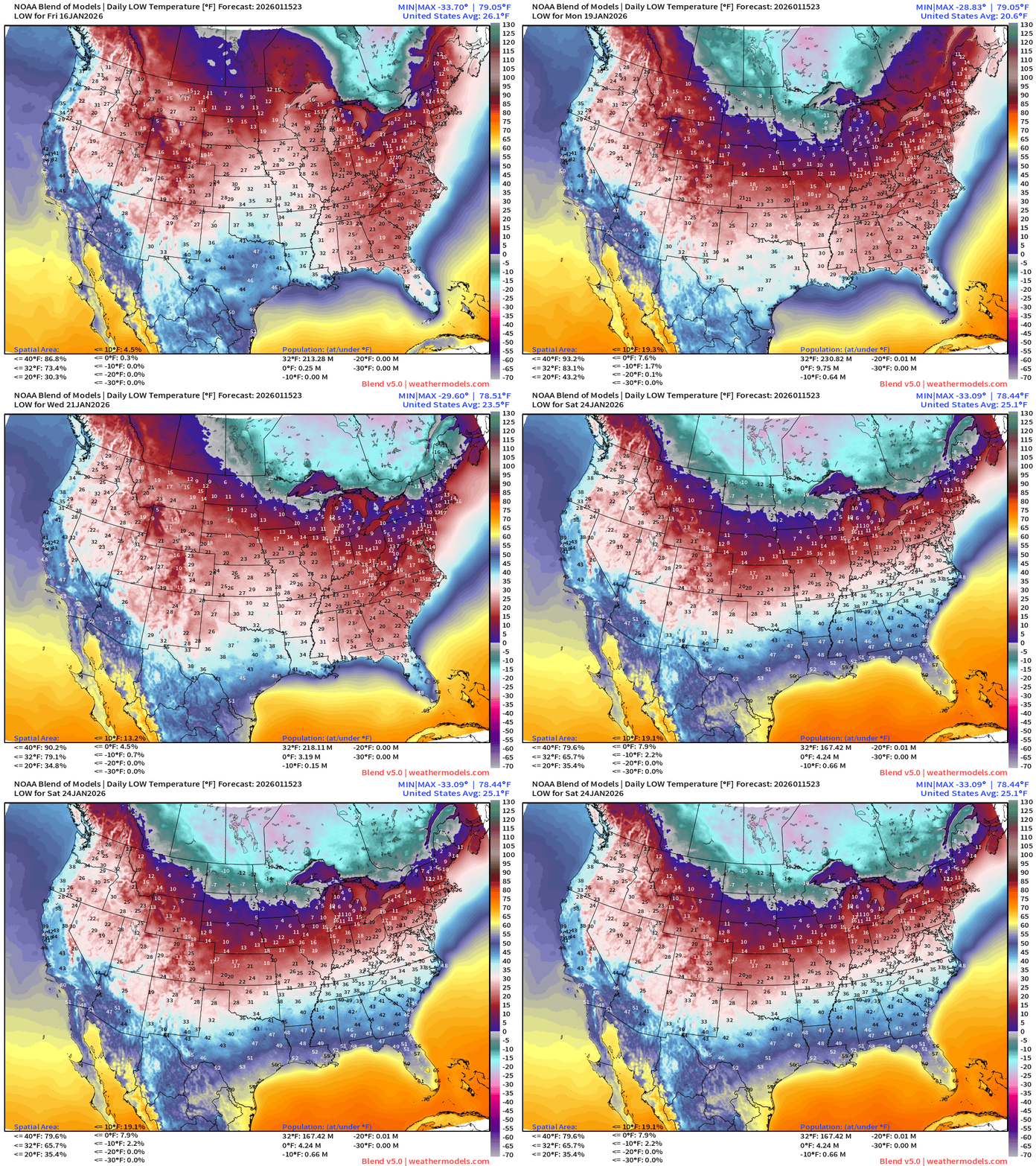
Very cold for the next 7-10 days across much of the eastern United States — with subzero temperatures lurking in the Midwest and Great Lakes, and single digits + teens dipping into Missouri and Tennessee middle of next week.
Temperature Anomaly Next 6-days
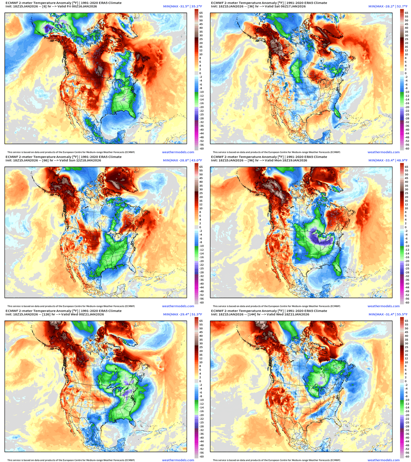
Compared to normal — we can see in the next 6-days the rotation of Arctic blasts through the Great Lakes connected to a semi-permanent mid-level trough connected to tropospheric polar vortex over Hudson Bay. Nothing too complicated about this pattern: a ridge bridge allows the jet stream to connect with polar air originating from Alaska and Siberia to bridge across the frozen Arctic Ocean and dip through Canada. Going to be a while to break this western ridge down — and kick along the “polar vortex” anchored over Hudson Bay.
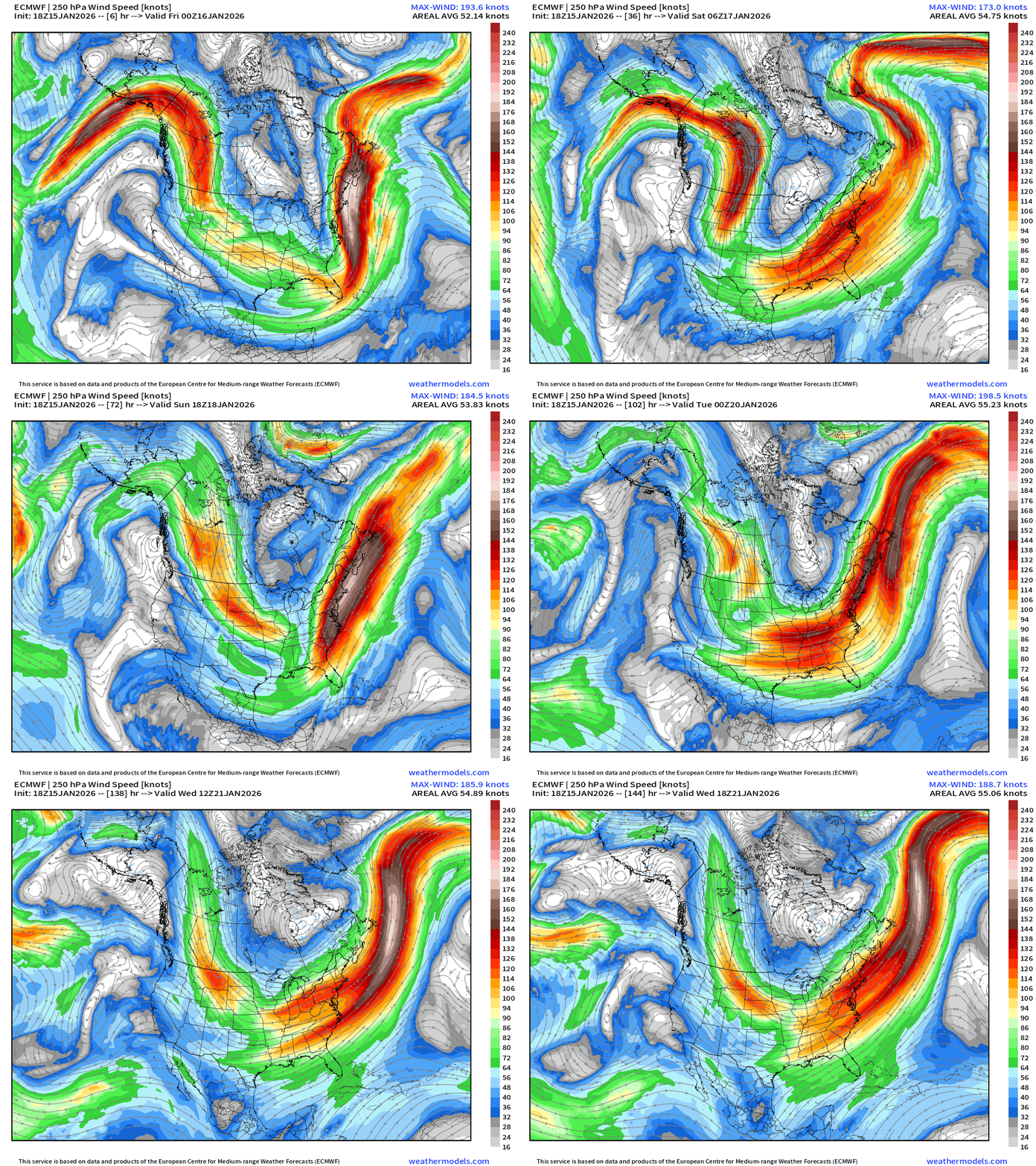
Headlines Thursday Evening
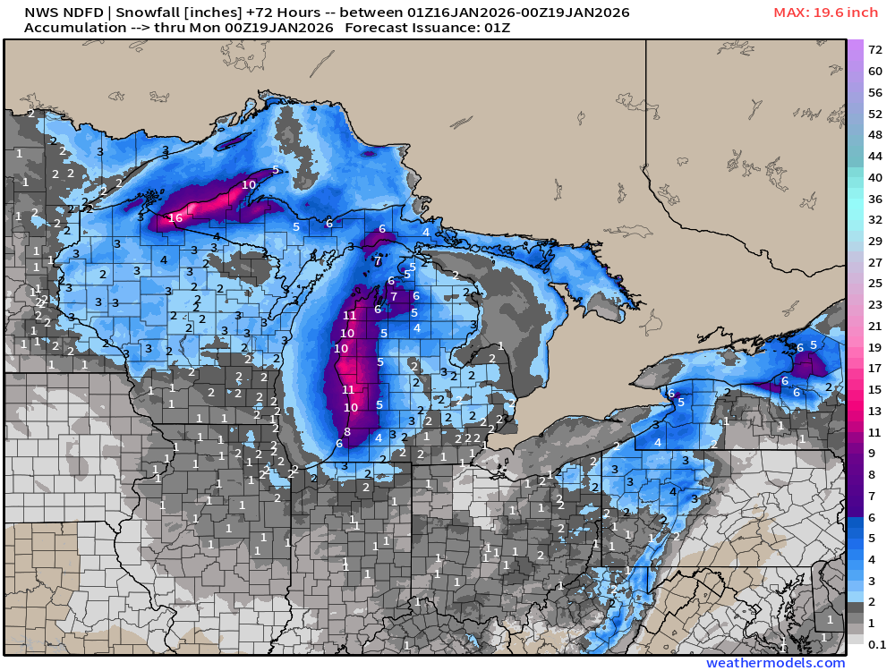
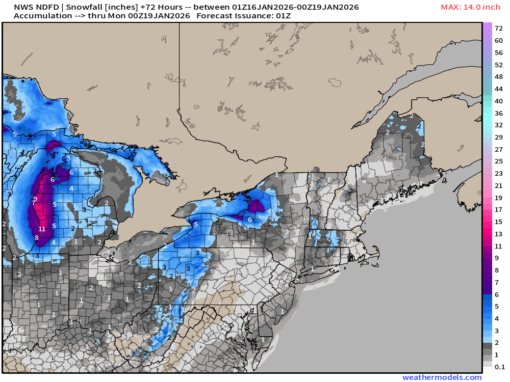
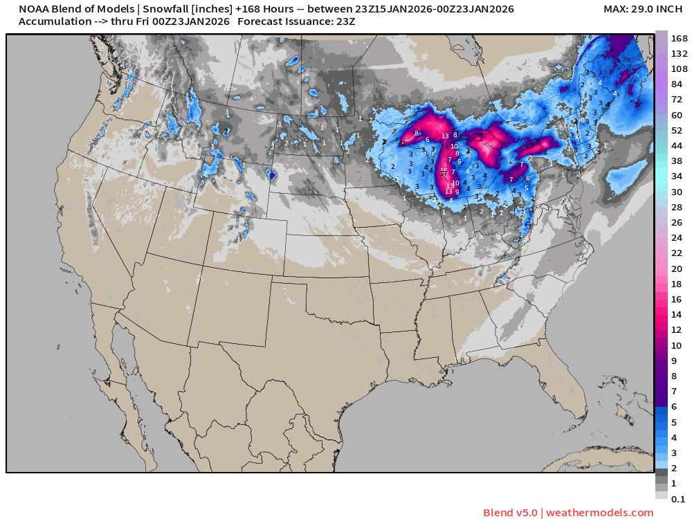
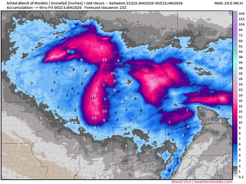
Great Lakes snowfall machine cranked up for the next several days — with huge snowfall totals along the lakes
Cold front crashing through Southeast will reach Florida by Friday morning with freezes through Orlando — 20s well south of Interstate 4
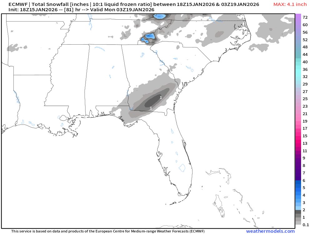
Another Arctic blast dialed up for this weekend — cold front crashes through Eastern U.S. but with chance of snowfall on tail end as moisture from Gulf of Mexico crawls northward. Looking at low accumulations on the order of 1” to 2”
Florida / South Georgia Snowfall
The RRFS-A (next flagship NOAA mesoscale model) shows much more snowfall on the backside of the moisture plume moving through the Southeast and then up the East Coast.
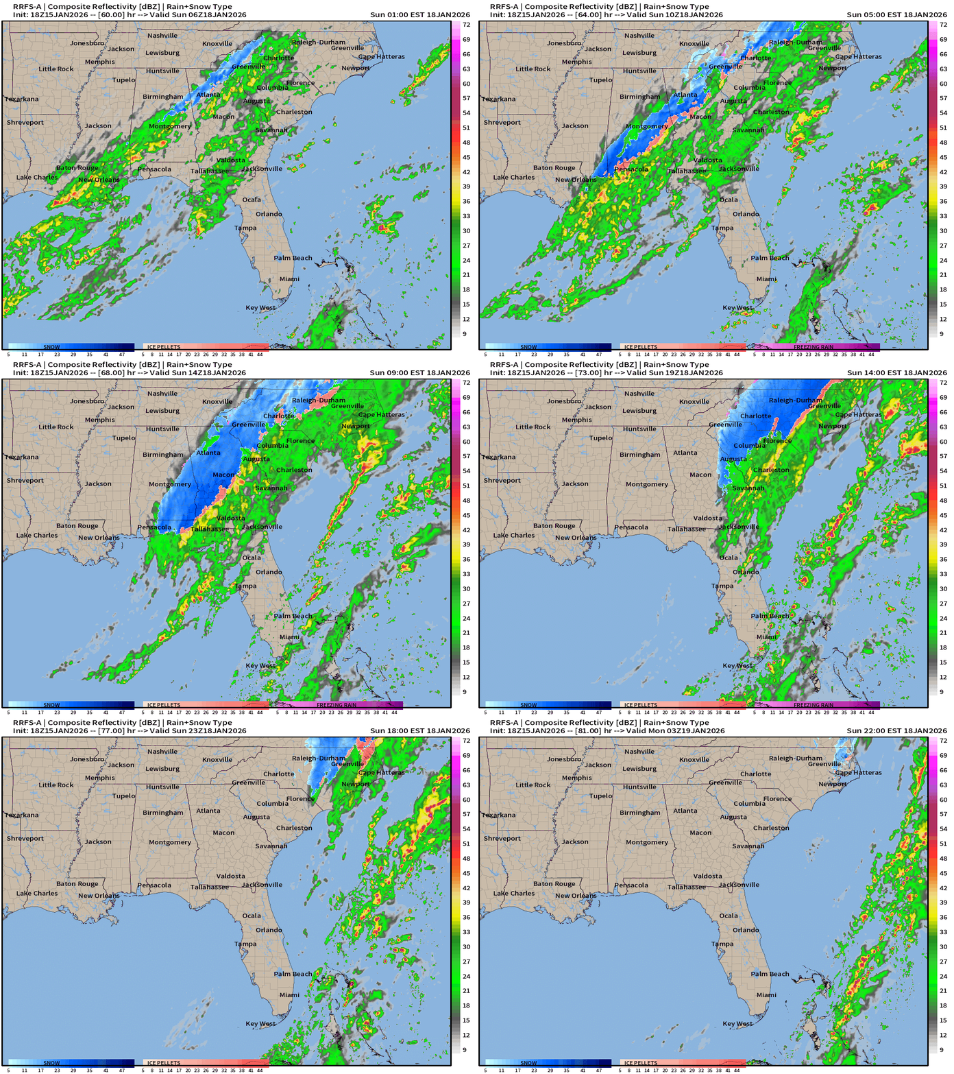
The snowfall amounts from RRFS-A would seem to be an “upper bound” of potential from this system … especially the impacts up the Mid-Atlantic and into NYC and New England.
ECMWF 18z Model Simulation
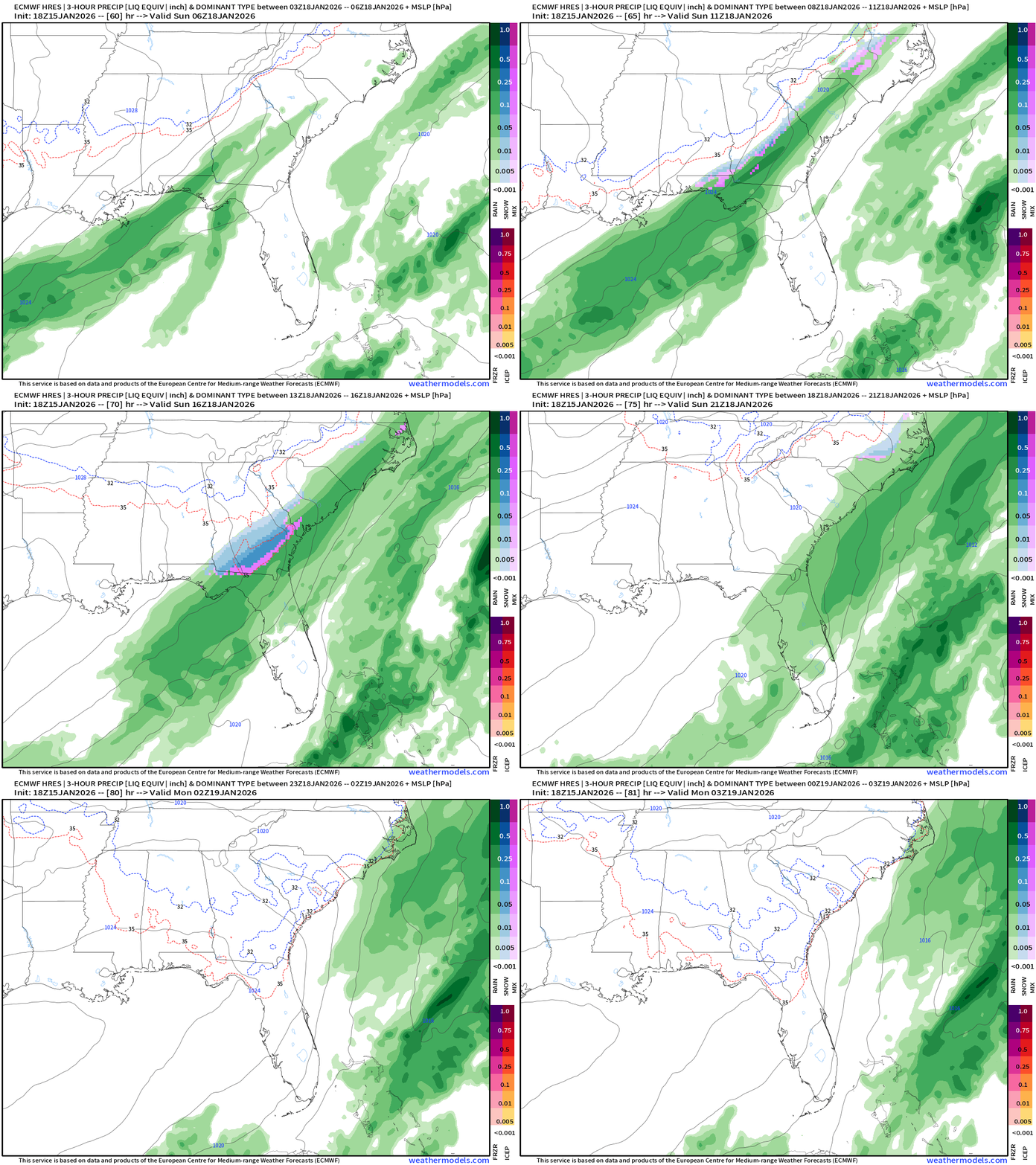
The “Euro” has been quite consistent with lighter snowfall accumulations — and trending downward. Still 2-days away, so we can always adjust the other direction.
ECMWF AIFS-Single 18z | Height Anomaly (500 hPa) Next 10-days
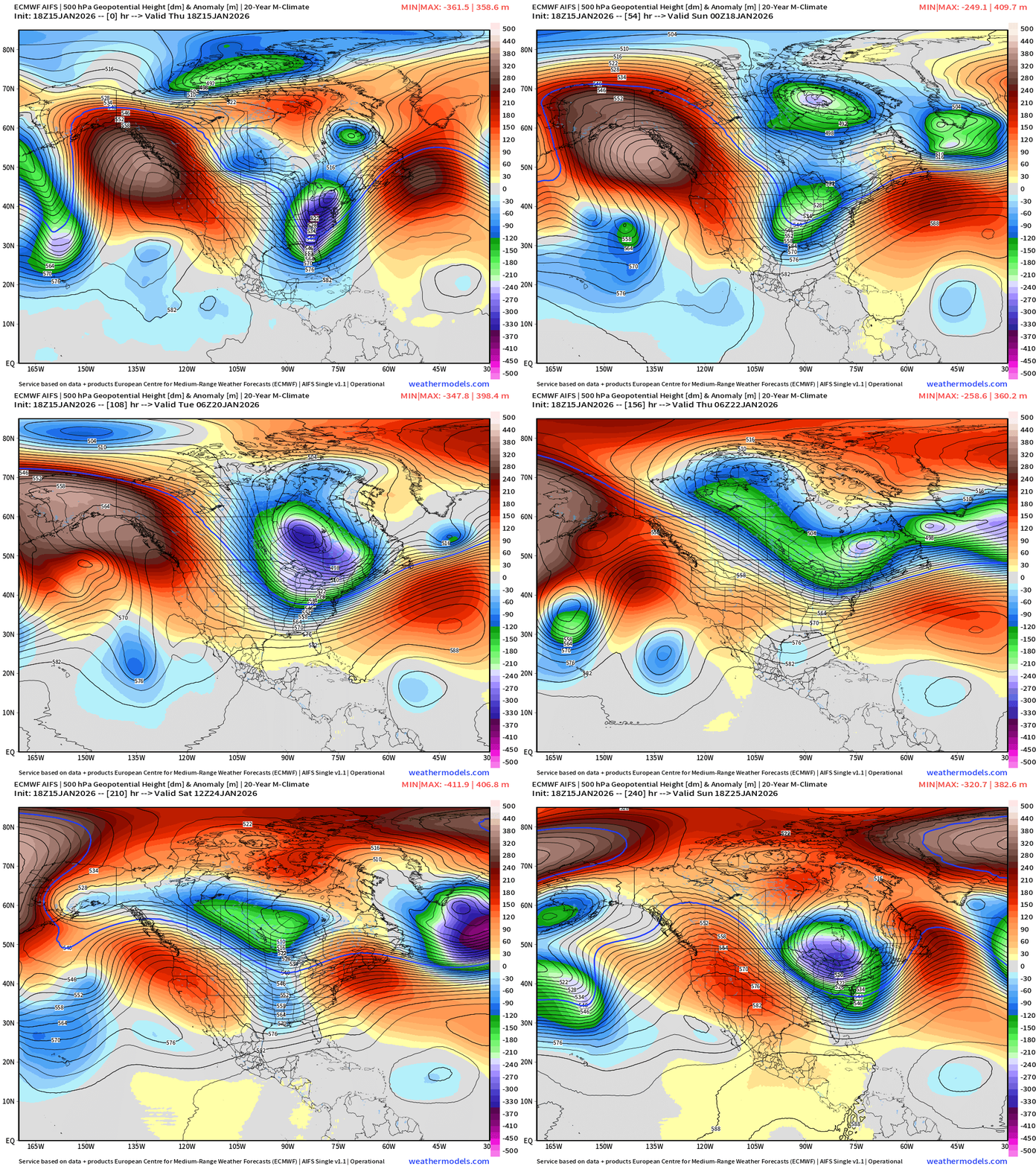
3 significant Great Lakes upper-level troughs — each with significant blasts of Canadian Arctic cold air … as the Western ridge blocks / forms a bridge for the jet stream to continuously tap the Siberian/polar air masses
ECMWF AIFS-Single 18z | Temperature (500 hPa) Next 10-days
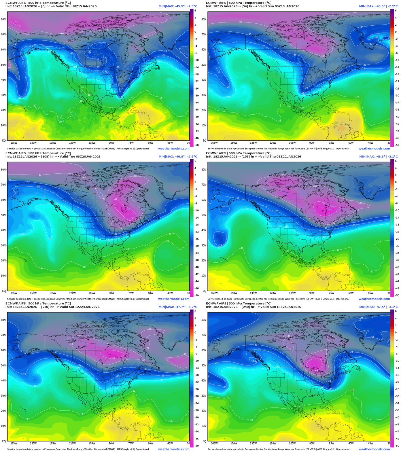
The temperature at 500 mb is the easiest way to highlight the “polar vortex” across North America with the coldest pool at -40°C (pink) with the -25°C contour usually associated with below freezing temperatures at 2-meters (surface).
The Western U.S. and Pacific Northwest ridge is very apparent and firmly entrenched vs. the Hudson Bay / Arctic Canada undulations are dipping southward into the eastern U.S. = cold. The reservoir of cold air remains largely intact through 10-days centered over Ontario/Quebec. Very impressive to see the -40°C to -45°C contours dipping into the Great Lakes and Northeast —> risk for extreme cold.
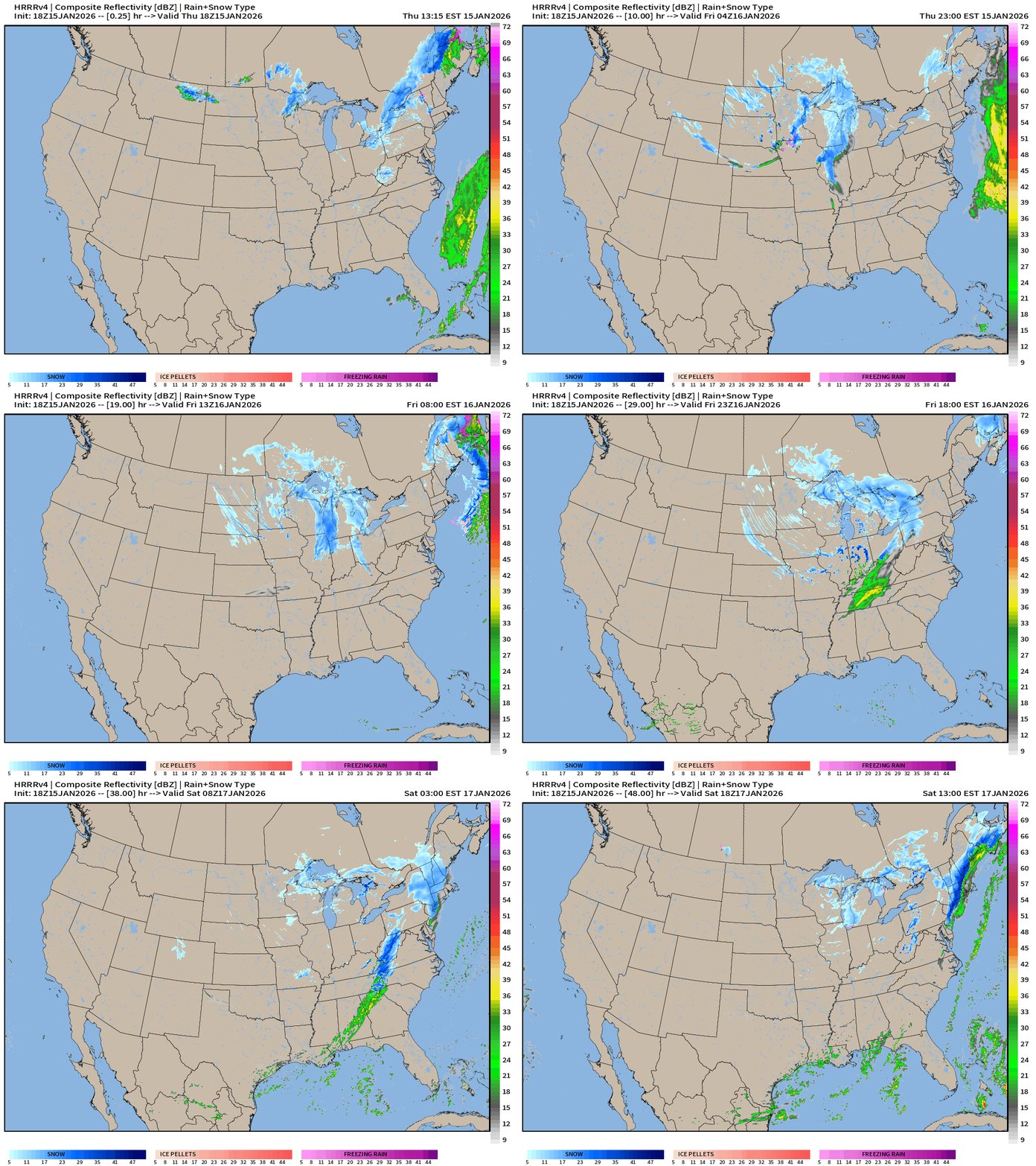
HRRR Next 48-hours Radar | Through Saturday 1 PM ET
ECMWF 18z | Precipitable Water Next 6-days | My Favorite Parameter
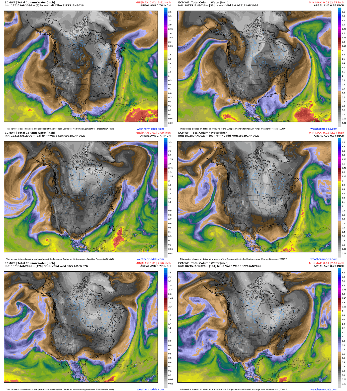
Multiple Arctic blasts crash out of Canada into the Lower 48 — reaching the Gulf Coast and draining through Florida. Very cold period starting — underway east of the Rockies.
A rare January tropical storm may also be classified in the Eastern Pacific but not impact land.
ECMWF 18z Precipitation Type and Intensity | Next 6-days
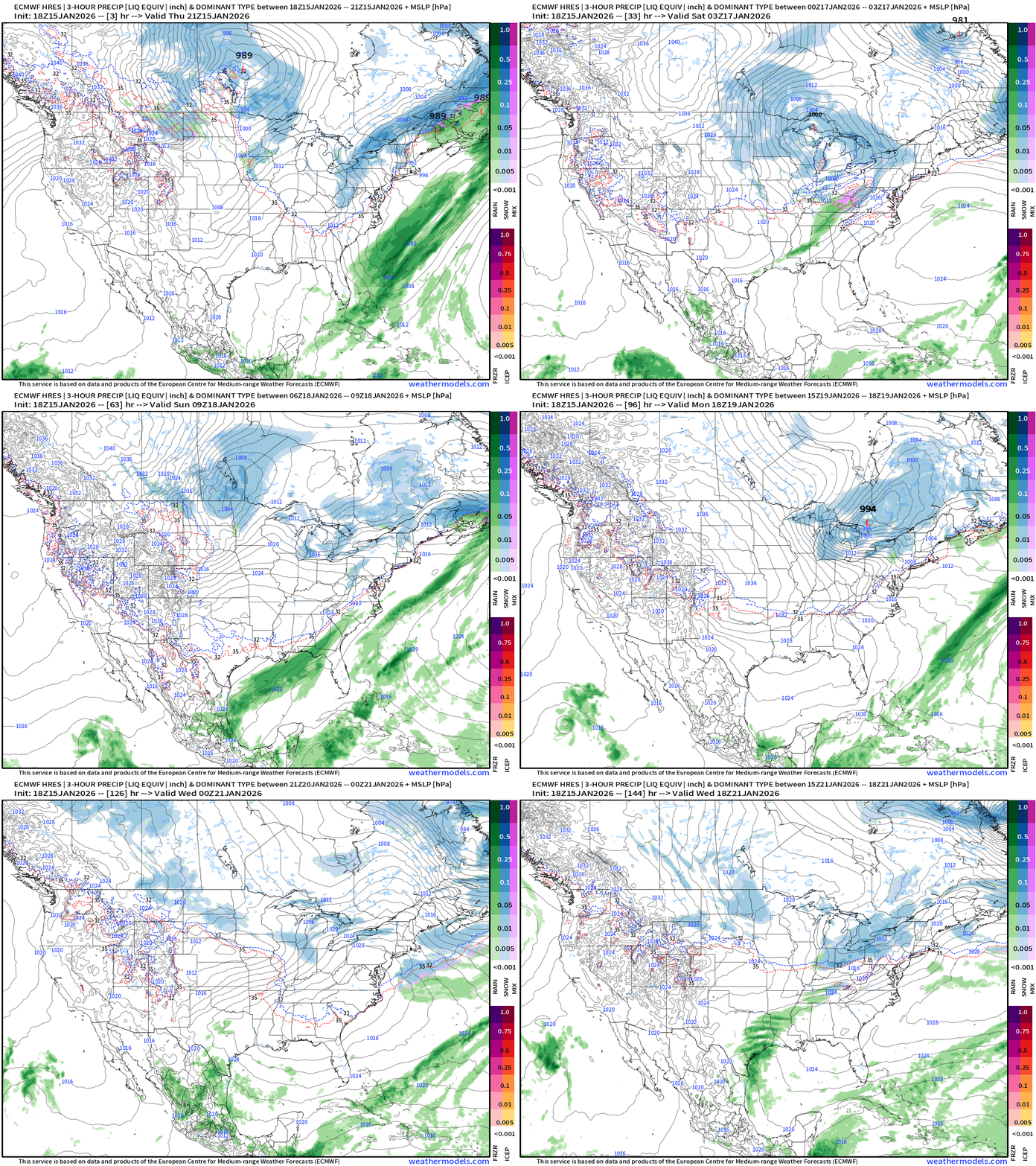
3 Clipper systems with snowfall track through Midwest, Great Lakes and Northeast
Current storm bombarding Toronto into interior New England
Clipper for Friday — Saturday
Another early next week
Southeast —> East Coast moisture plume but misses phasing
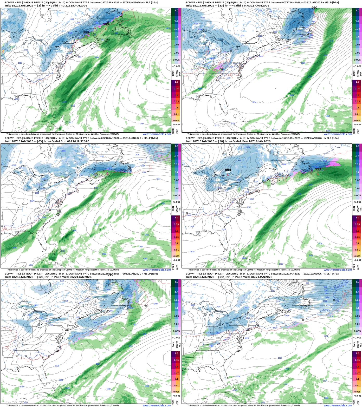
The frontal boundary that delivers the snowfall to the Southeast does have a surface low pressure forming off the Mid-Atlantic but it remains well off the coast and far enough away from the upper-level jet to phase properly and intensify. Instead the low remains flat and races NNE. The Canadian Maritimes get walloped again.
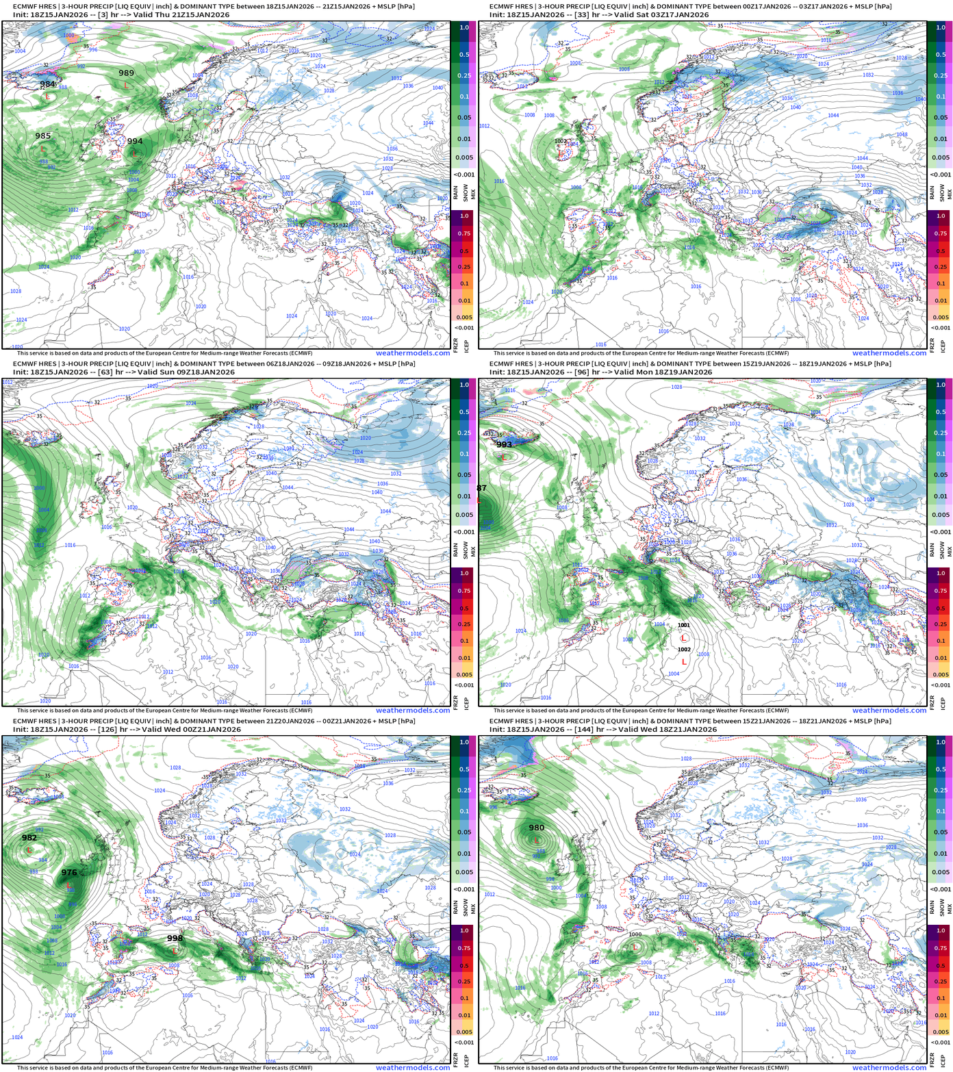
Europe Storm Systems next 6-days
Flagship ECMWF 12z EPS | Temperature Anomaly | Next 15-days
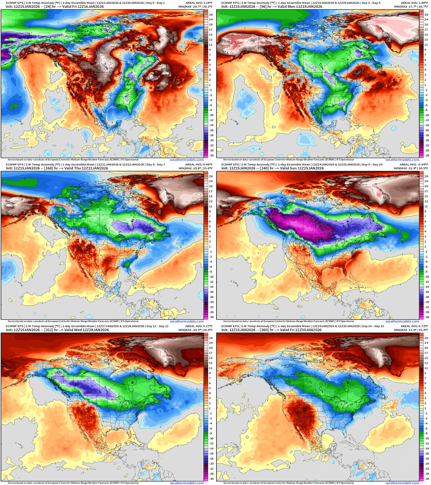
Into Days 10 —> check out the enormous Canadian cold pool and intensity (more than 30°F below normal in the ensemble mean)
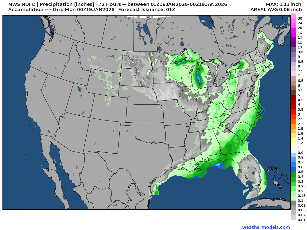
NWS Precipitation Next 72-hours
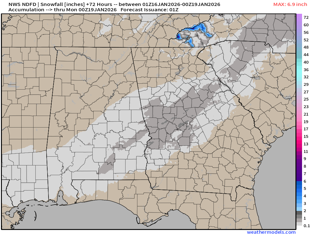
NWS Snowfall Next 72-hours
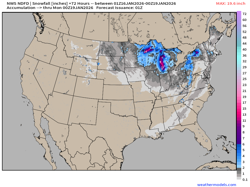
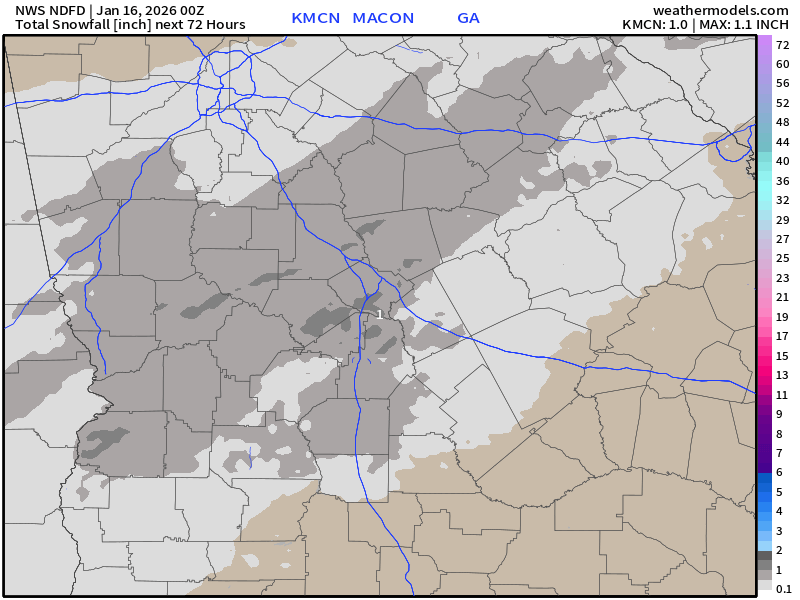
We are getting some central Georgia snowfall in the NWS grids > 1” around Macon.
RTMA | Temperature Analysis | 8:30 PM ET
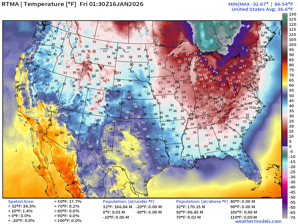
Average Lower 48 temperature was 36.6°F with 167 million below freezing.
Temperature Anomaly | 8:30 PM ET
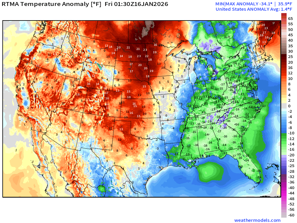
Lower 48 Temperature Anomaly above normal by 1.4°F
Friday Morning Low Temperatures
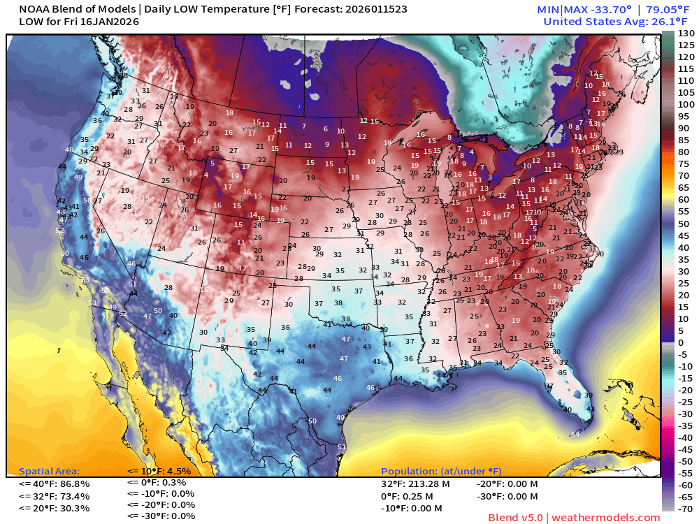
213 million below freezing — nationwide average of 26.1°F
Friday High Temperatures
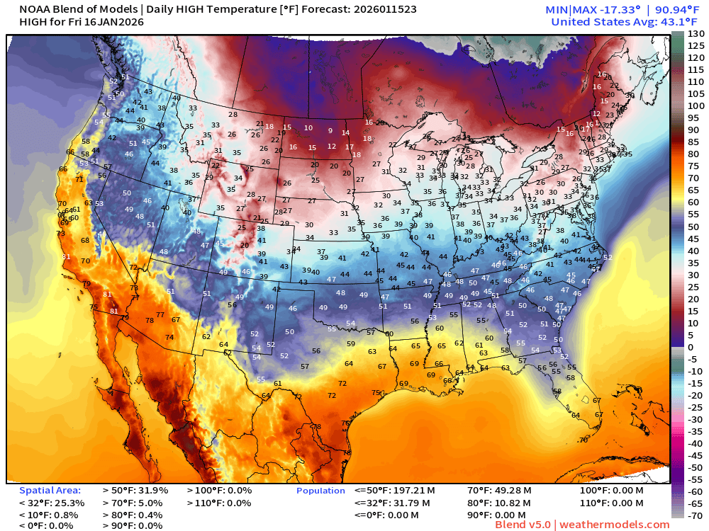
Nationwide average of 43.1°F
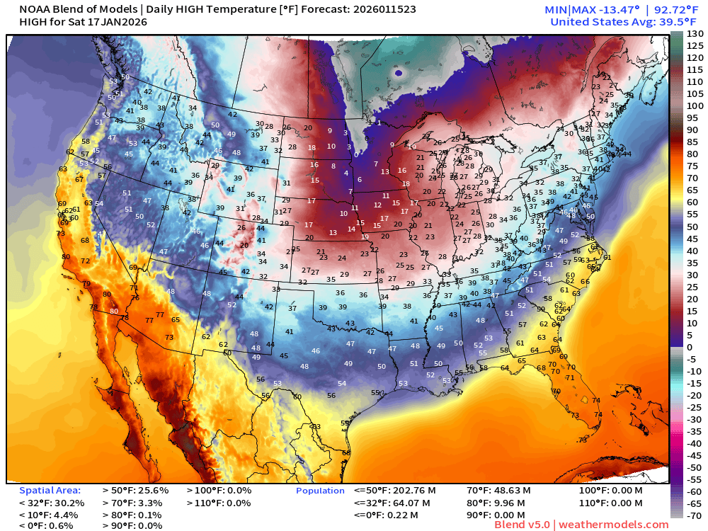
Saturday High Temperatures
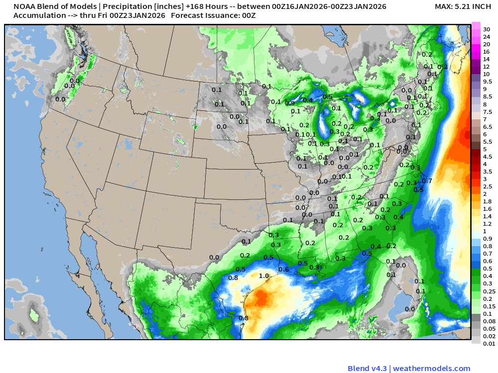
Blend of Models | 7 Days Precipitation Total
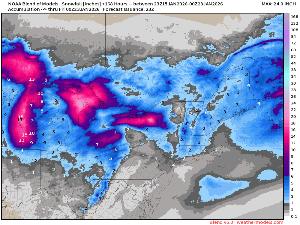
Blend of Models v5.0 | Total Snowfall Next 7-Days
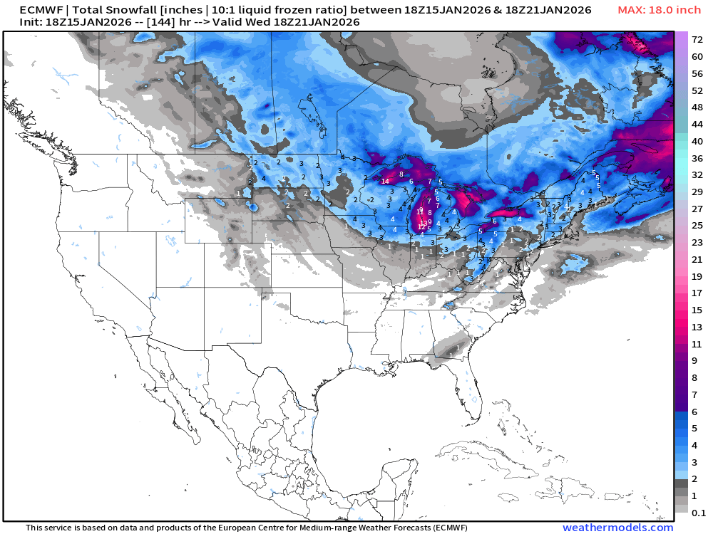
ECMWF 18z | Snowfall Next 6-days
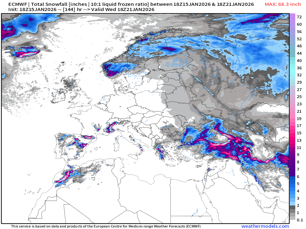
European Winter | Snowfall Next 6-days
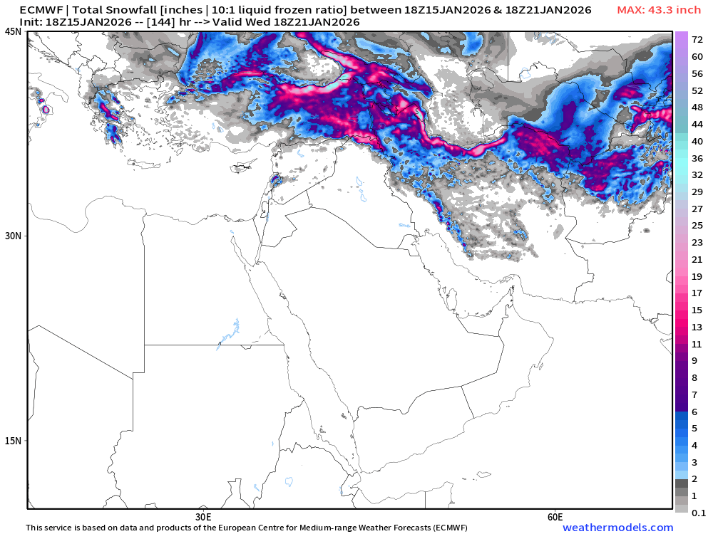
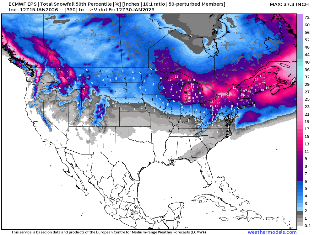
ECMWF EPS 12z | Ensemble Median Snowfall Next 15-days
Probability of 0.1-inch or more Snowfall in the next 6-days [18z]
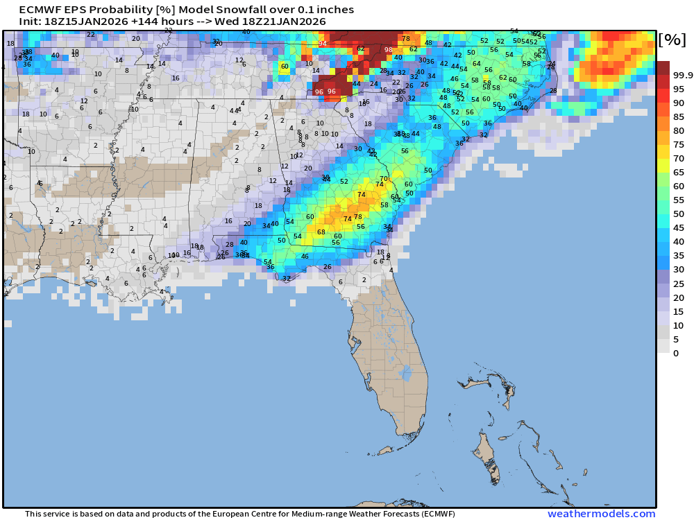
50-75% chance of snowfall > 0.1” (accumulations) from Florida panhandle through South Georgia and up into the Carolinas
Probability of 1-inch or more Snowfall in the next 6-days [18z]
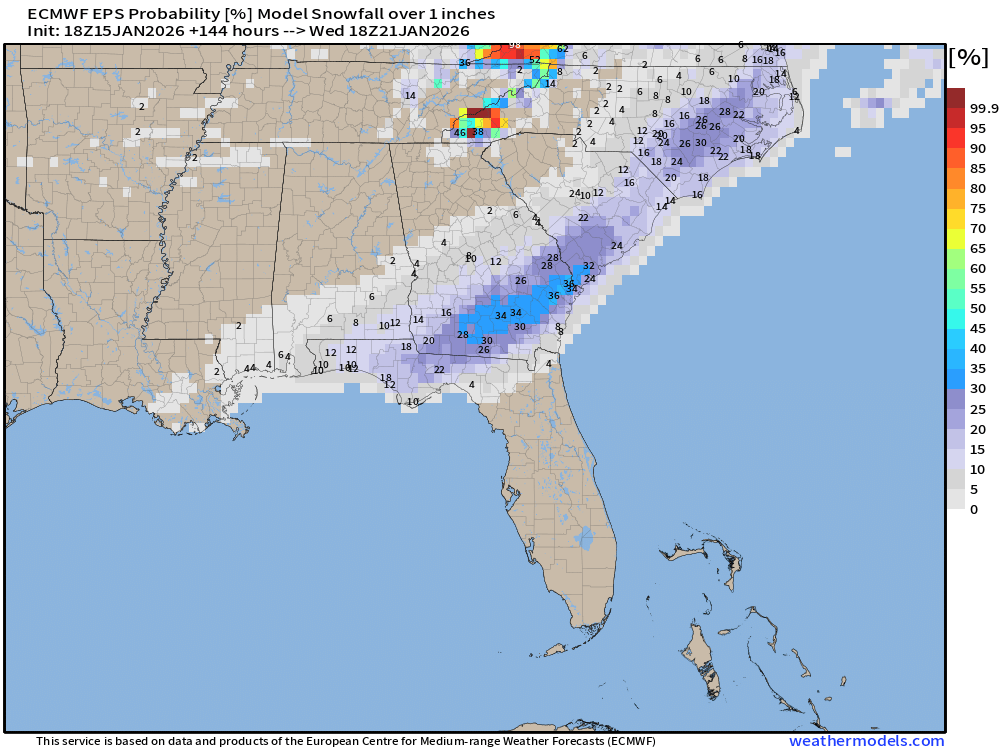
Still 10-20% chance of at least an inch of snowfall (that’s impressive) from Pensacola to Tallahassee, and higher > 30% to Savannah.
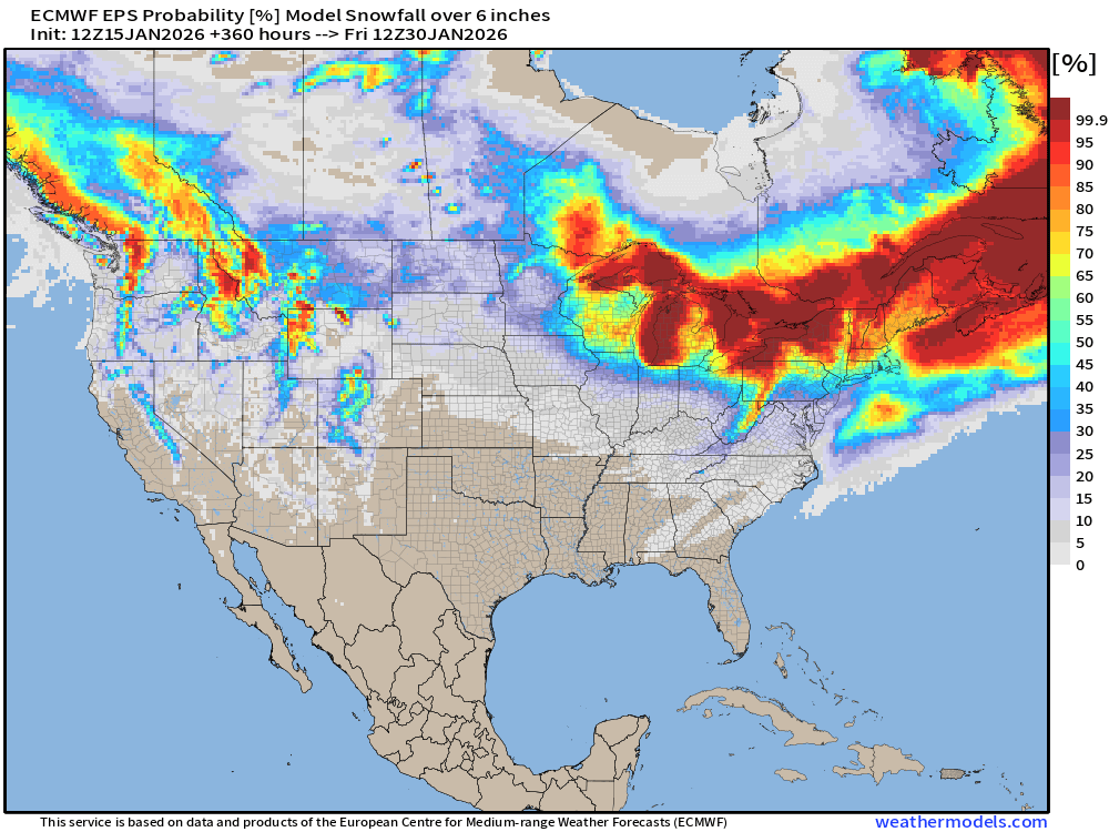
Probability of 6-inch or more Snowfall in the next 15-days
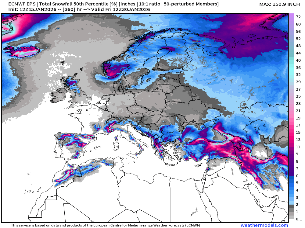
Ensemble Median Snowfall for Europe Next 15-days
Eurasia Temperature Anomaly | Week 1 and Week 2
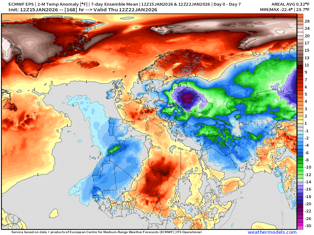
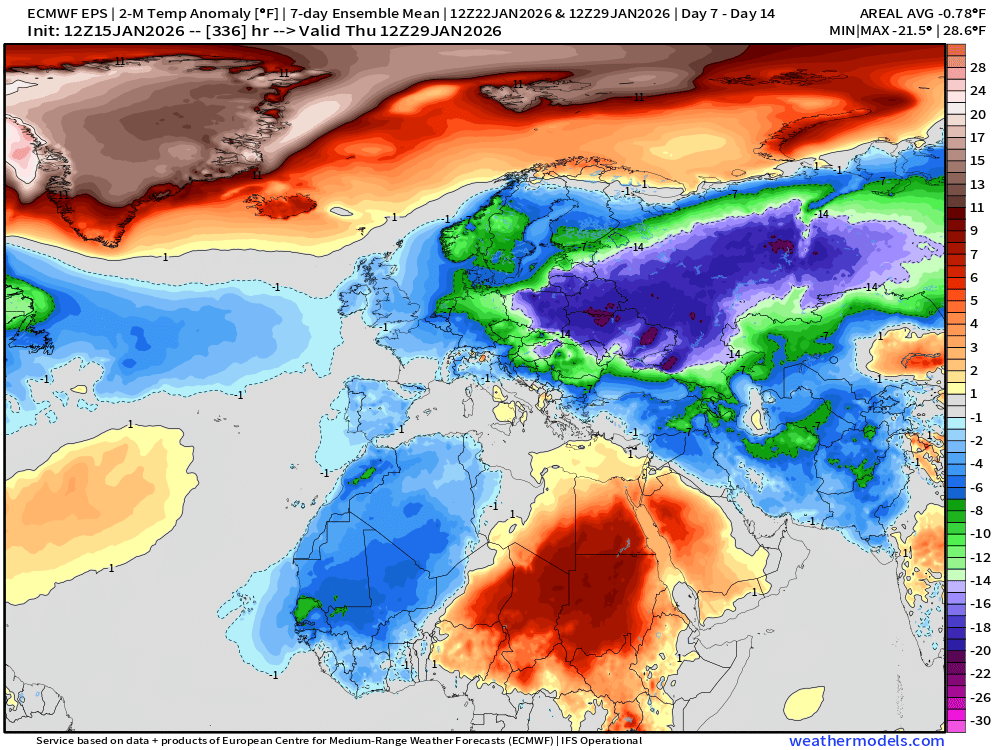
Brutal cold for Eastern Europe into Russia.
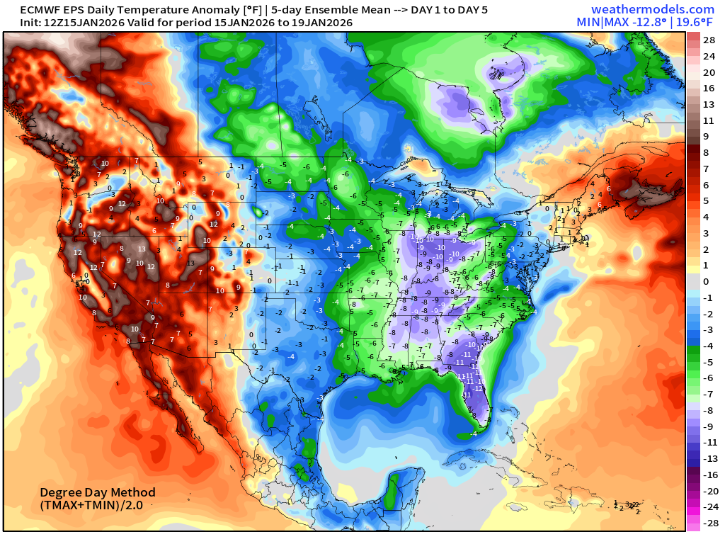
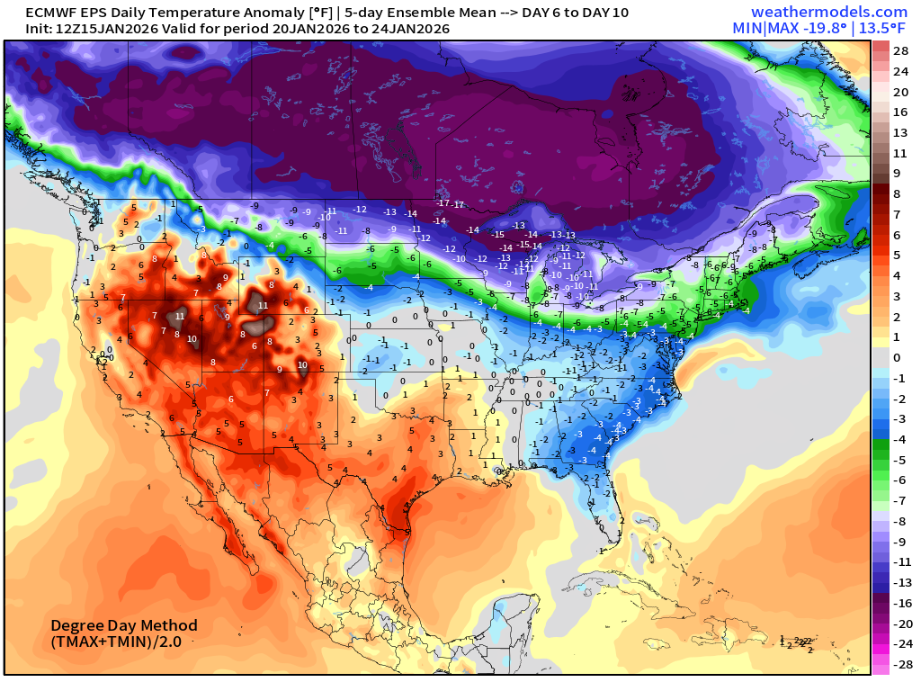
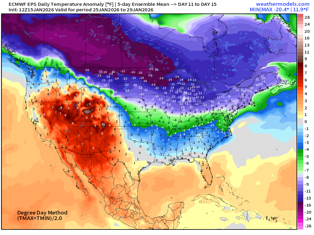
Lower 48 Temperature Anomaly | Next 15-days | ECMWF EPS 12z
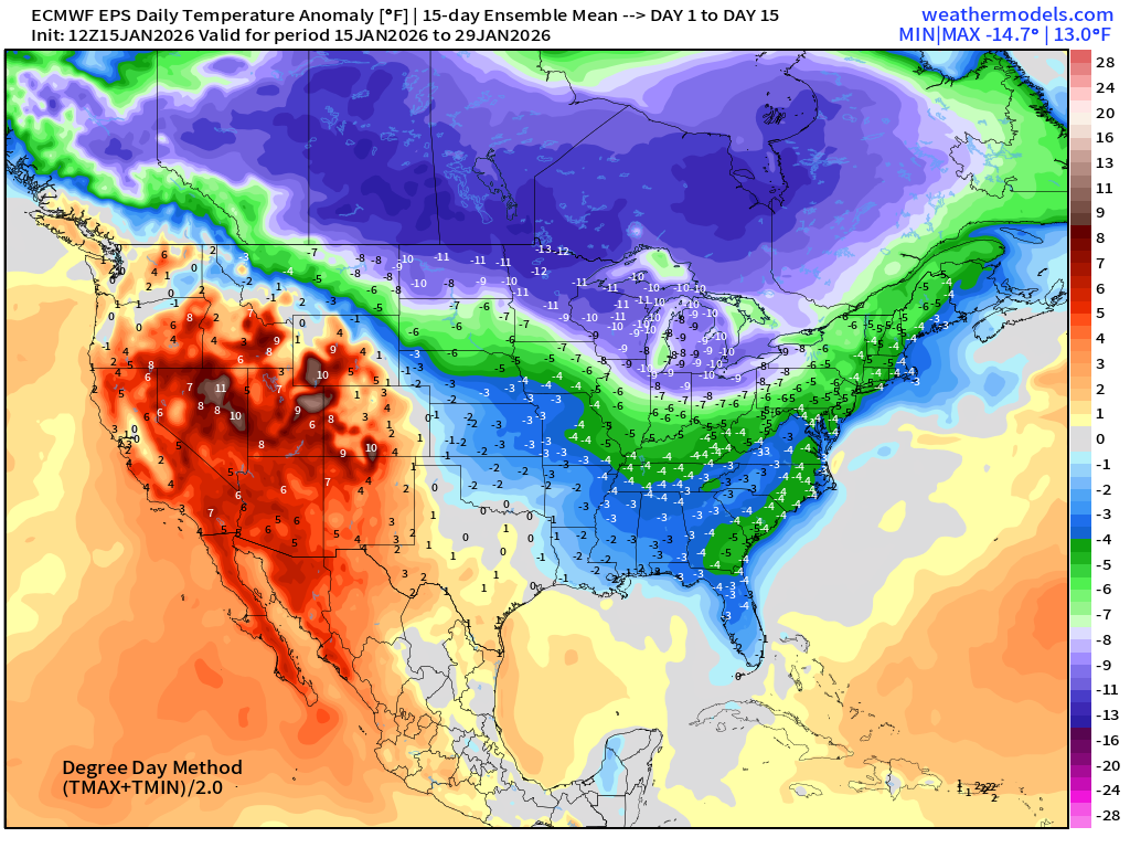
The back half of January will see much below normal temperatures east of the Rockies and across all of Canada.
5-Day Chunk #1 | Temperature Anomaly | Jan 15 - Jan 19
5-Day Chunk #2 | Temperature Anomaly | Jan 20 - Jan 24
5-Day Chunk #3 | Temperature Anomaly | Jan 25 - Jan 29
Maps sourced from weathermodels.com designed and innovated by yours truly! Please subscribe there for real-time access to the newest maps, charts from all of the weather models including ECMWF and AIFS, NOAA AI-GFS/AI-GEFS
- Milepost
- 841 · laid 2026-01-16T02:12:51.206000Z
- Source
- https://weather.substack.com/p/january-15-2026-thursday-winter-weather
- Digest
- c8666820c9f51c4c562a698d35b44ea628b3cbdd15dee5582b5135f7e26b300d
- Machine
- JSON