January 8, 2026 Thursday Winter Weather
Ensembles show major Canadian cold pool reforming next weekend
January 2026 was the 25th-warmest January in the 132-year national record (1895–2026), at 33.1°F against a 1991–2020 normal of 32.3°F (+0.8°F).
January 2026 was the 12th-driest January in the 132-year national record (1895–2026), at 1.6in against a 1991–2020 normal of 2.3in (-0.8in).
NOAA/NCEI Climate at a Glance, contiguous United States. This is the observed record for the month, not a score of anything said in this piece — the forecast ledger begins 2026-08-17 and cannot reach earlier posts.

Powerful “bomb cyclone” impacting southern England today
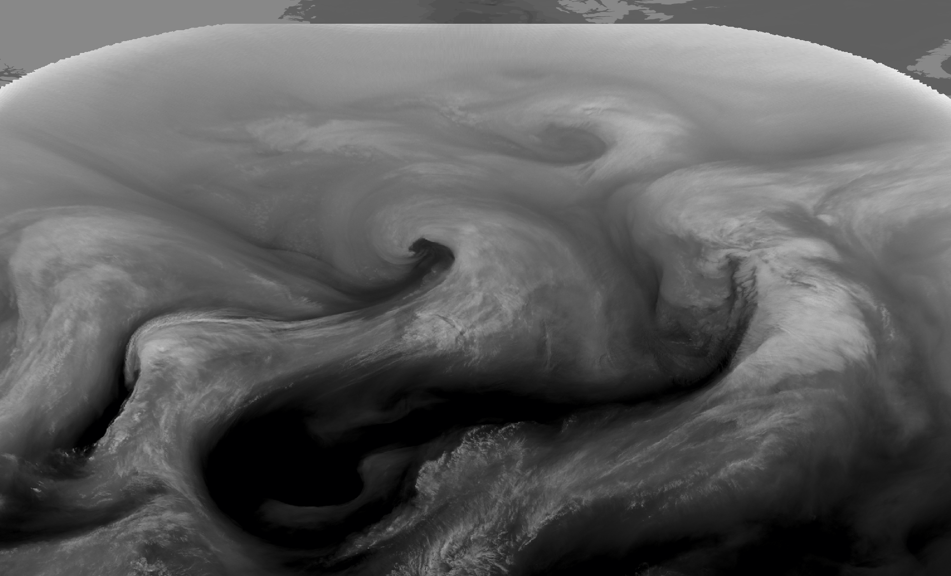
The area of low pressure intensified by > 24 mb in 24-hours meeting the requirements of “bombogenesis” … the tail end of the cold front is attached to another cyclone upstream as seen from my favorite variable: precipitable water.
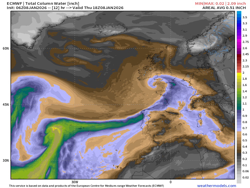
On the back side of the low pressure center, there is plenty of moisture falling into colder Arctic air —> snowfall upwards of 12-15” over England NW of London including Birmingham — huge amount for this area.
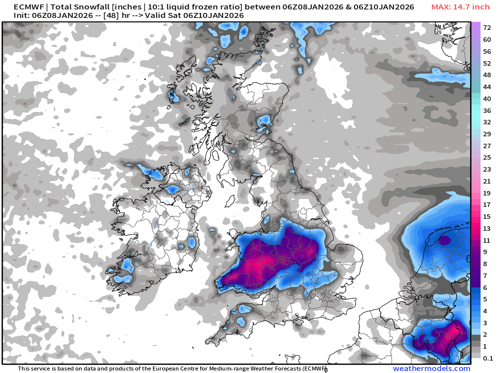
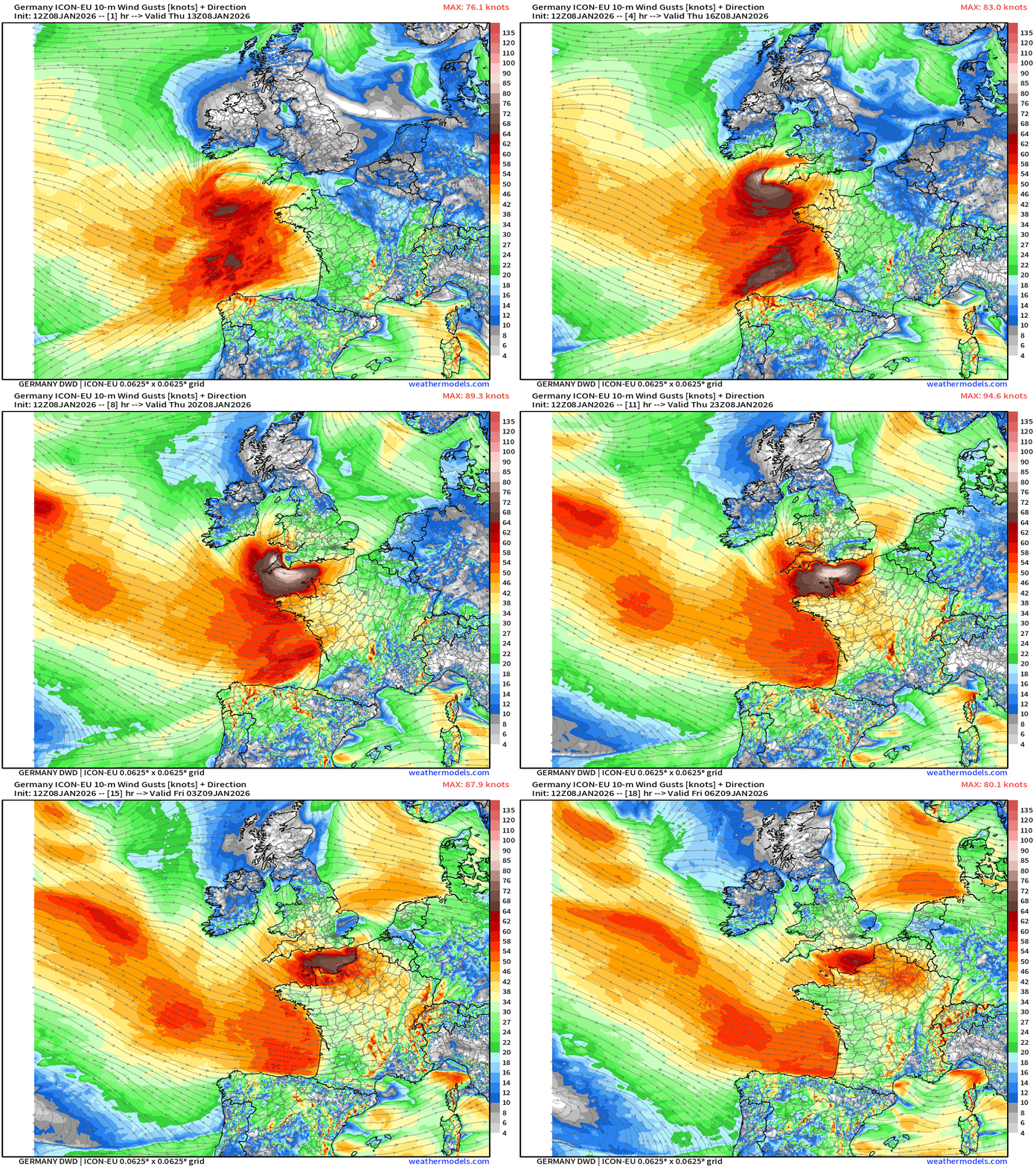
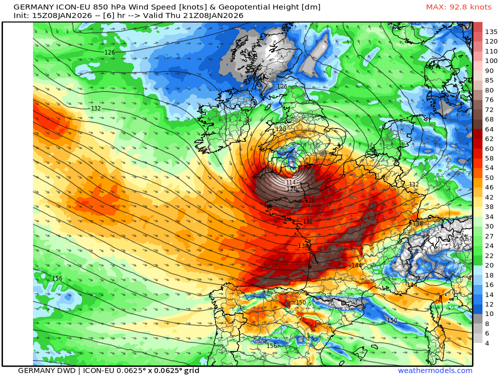
On the southerly periphery of the low, a chevron shaped band of gusty winds > hurricane force whips through the English Channel. The next 18-hours of wind gusts from Germany’s ICON-EU mesoscale model:
And Zooming out to show Northeast Atlantic at 850-mb wind speeds.
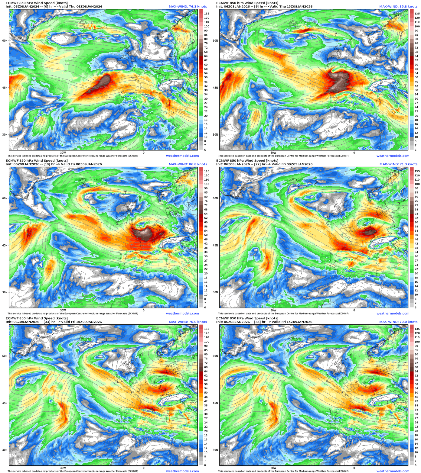
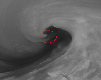
Central Pressure is 968 mb … and we can see the dynamic tropopause pressure all wrapped up in a serpentine coil over London.
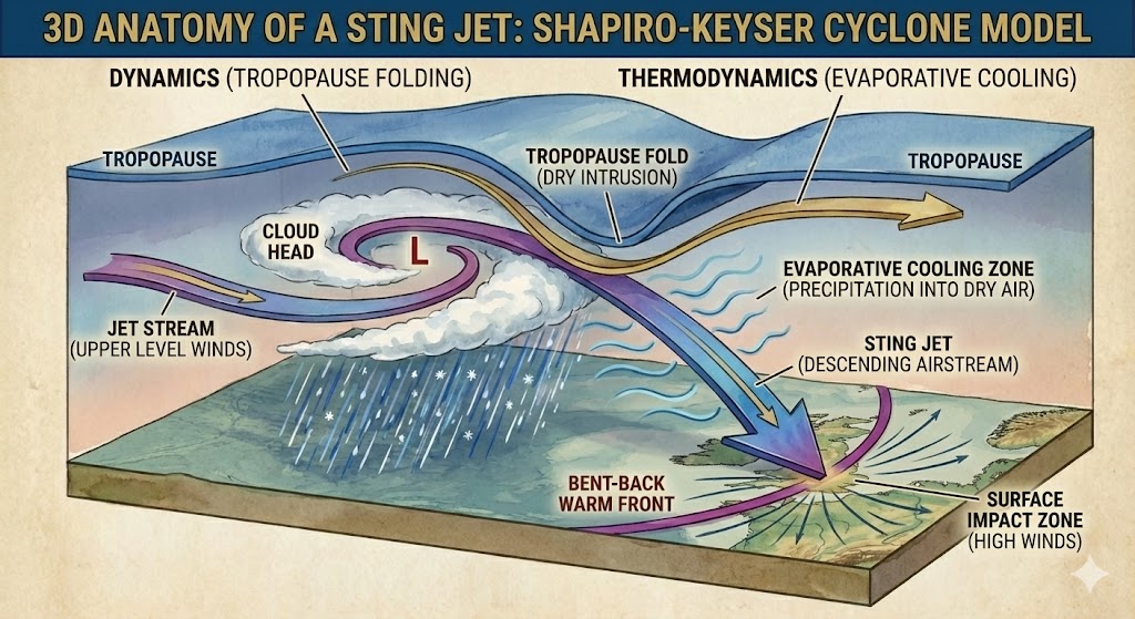
What causes this Sting Jet phenomena? Dynamics: The tropopause descends downward — quite significantly, associated with the jet stream (sharp gradient aloft) — guiding high-momentum air to near the boundary layer. This near stratospheric origin air is VERY dry.
But, in order for that air to get to the surface, need evaporative cooling — a thermodynamic process — to further cool that air mass to make it denser and continue its descent. Moisture from the “cloud head” is wrapped around the storm but evaporates so quickly that we see a dry slot.
This is deceiving to say nothing if we say nothing is happening here, but it’s clear air mega-turbulence with high-momentum, very dry, and dense air wrapping around the storm’s center.
Gemini 3 Pro makes incredible diagrams if prompted correctly and guided. I wish I had this one for my dissertation!
850 mb Wind Speed Snapshot
Wild Winter Weather in Europe —> “bomb cyclone” underway
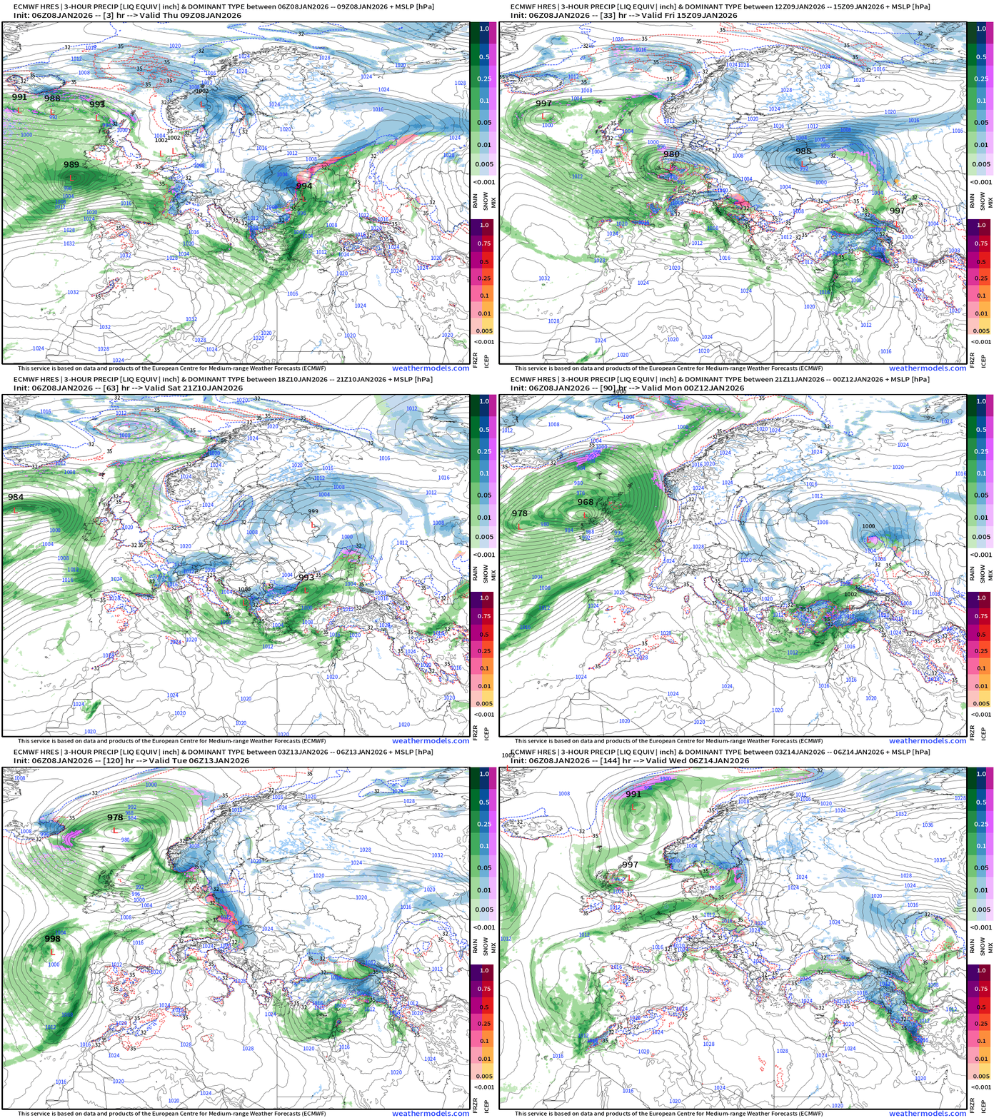
Hard to keep track of all the low pressure systems across the Eastern Atlantic into Europe. This is a similar look to the West Coast of North America with an active polar vortex … but here it’s associated with the Icelandic Low.
USA Storm Systems
HRRR 12z shows the next 48-hours through Saturday 7 AM ET
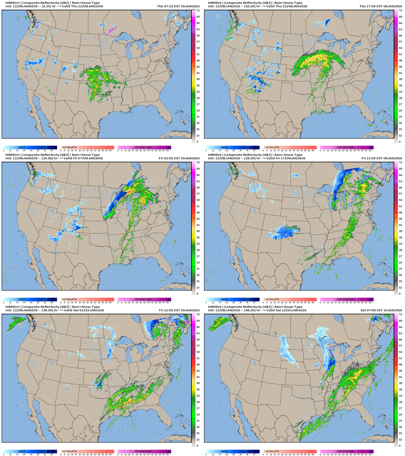
(1) Ongoing storm system moving through central Plains into the Great Lakes into Friday
(2) Another developing storm to the south with much more moisture for the Southeast, but then more snowfall for the Great Lakes
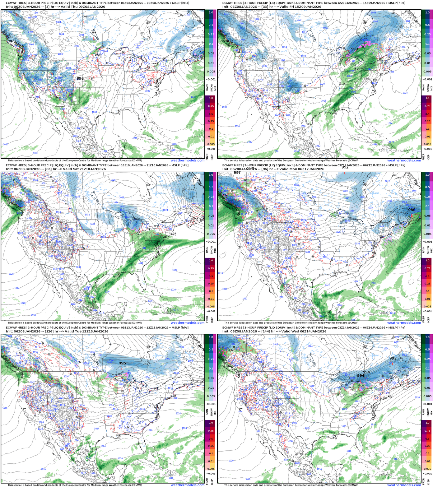
ECMWF 06z Precipitation Type and Intensity | Next 6-days
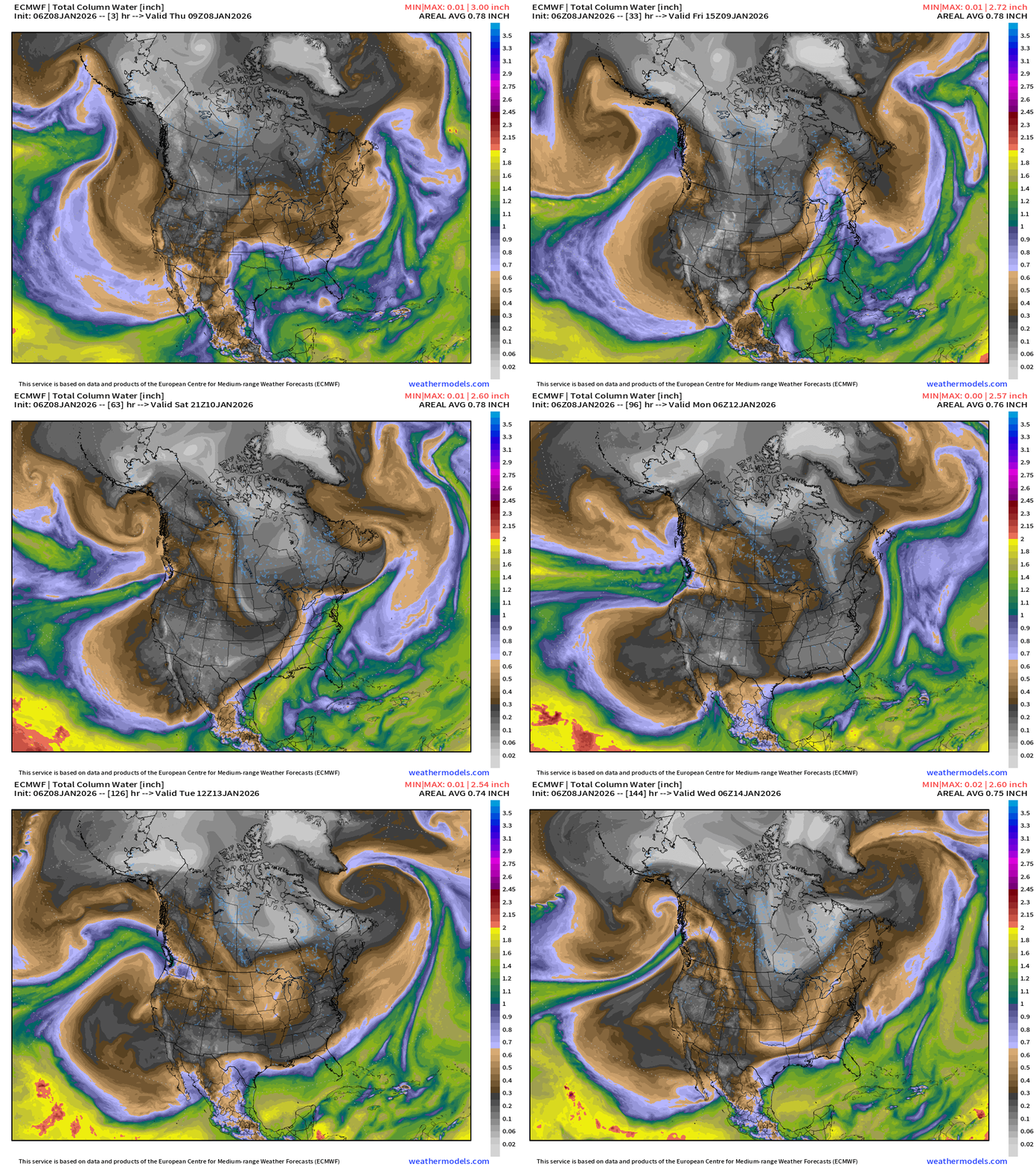
ECMWF 06z Precipitable Water Next 6-days | My Favorite Parameter
High Temperatures through Next Friday (January 16)
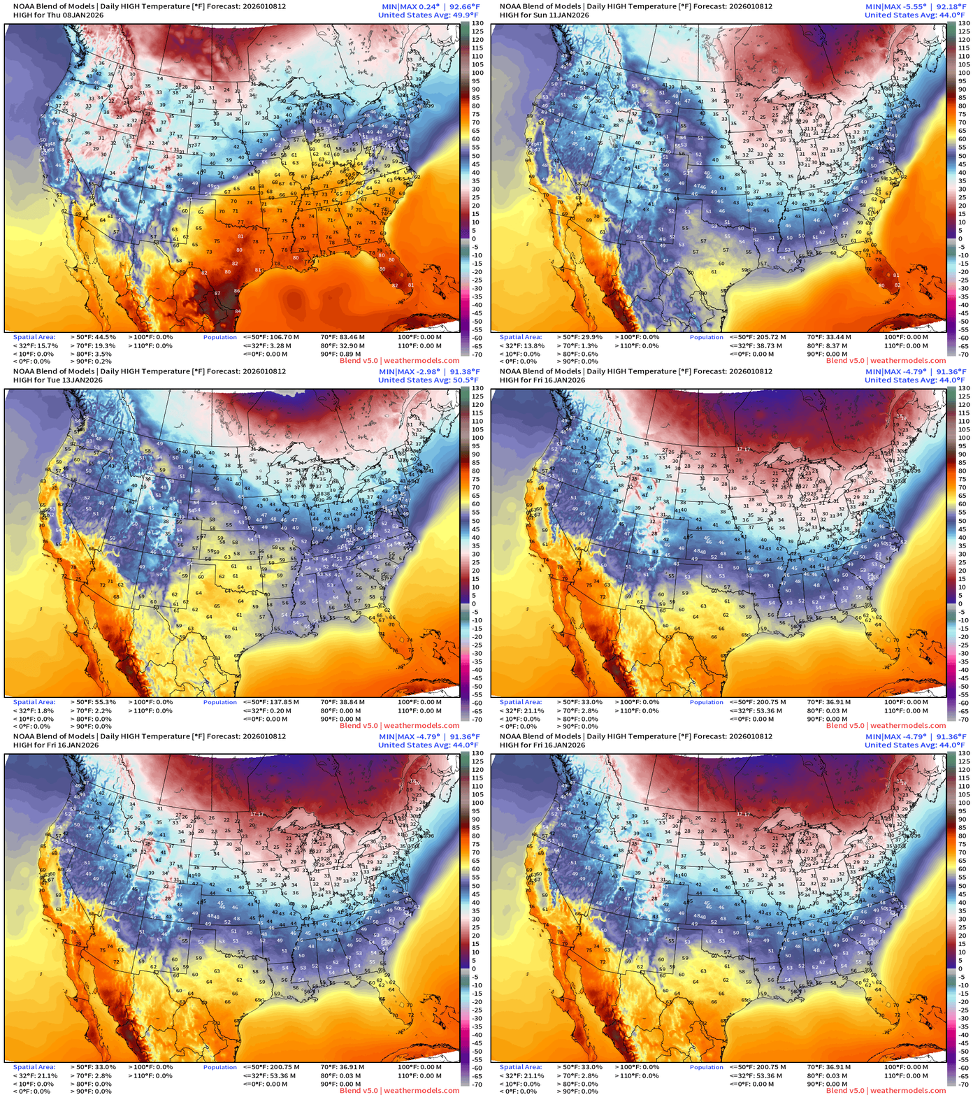
Seasonable temperatures for the next 8-10 days without risk of extreme cold. Temperatures dip into the 20s for highs in the Great Lakes behind passing storm systems but the available reservoir of cold air in Canada is limited for any major “polar vortex” intrusions for the next 10 days, but the risk increases into the last third of January.
Weather Trader is an entirely subscriber-supported publication [sweat equity] from Dr. Ryan Maue. To receive all new posts, consider becoming a free [1-2 updates per week] or paid subscriber [golden ticket] and please LIKE and SHARE posts.
ECMWF 00z EPS | Temperature Anomaly | Next 15-days
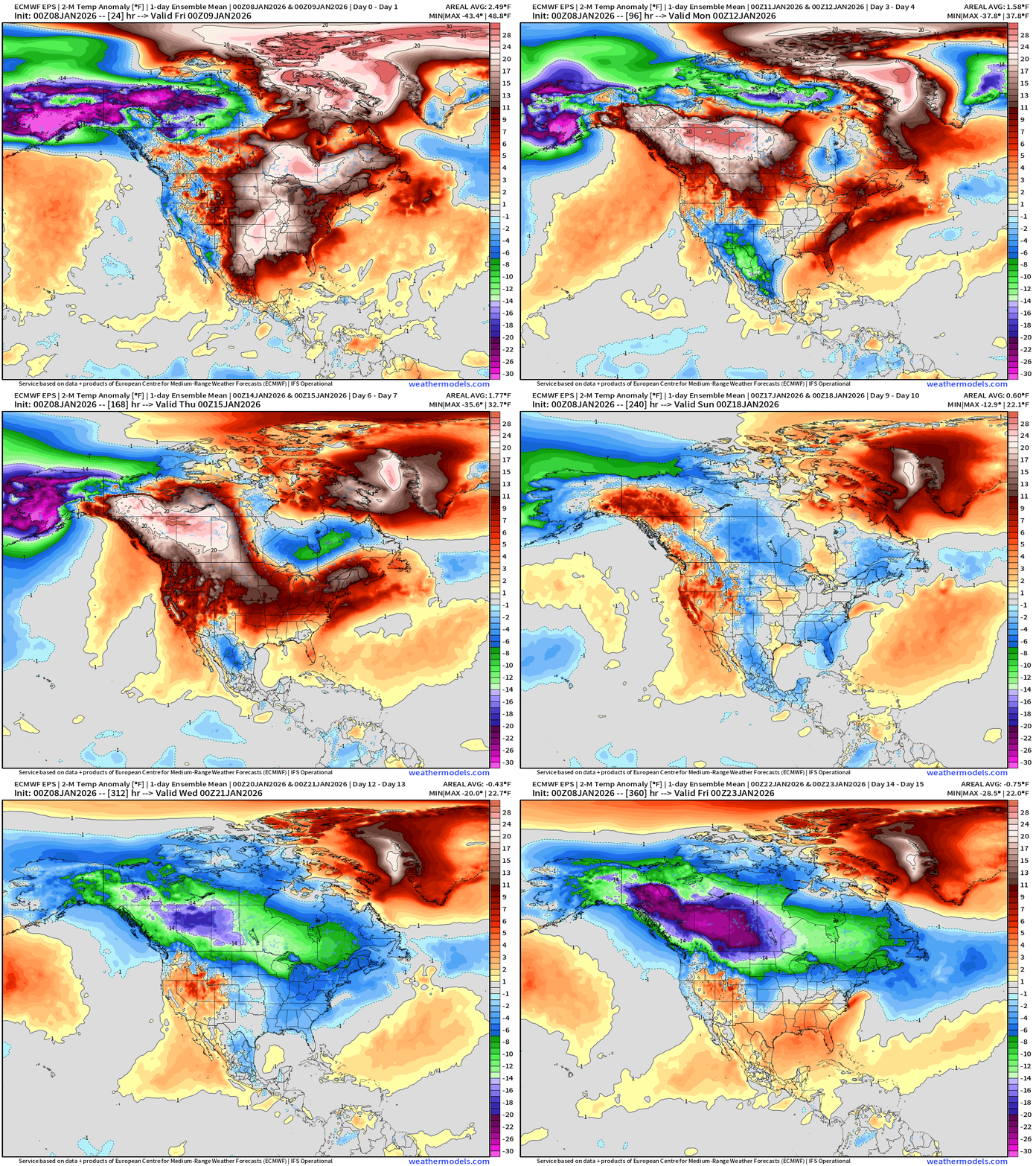
Huge pattern shift into Days 10-15 with massive Canadian cool pool formation from flagship ECMWF 00z (ensemble mean)
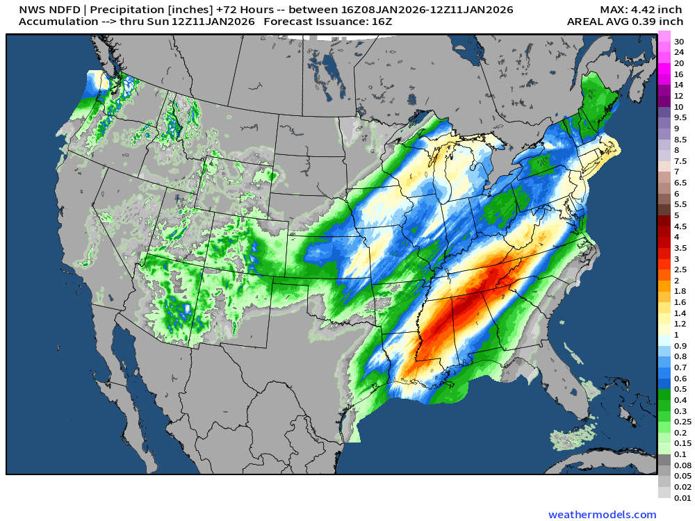
NWS Precipitation Next 72-hours
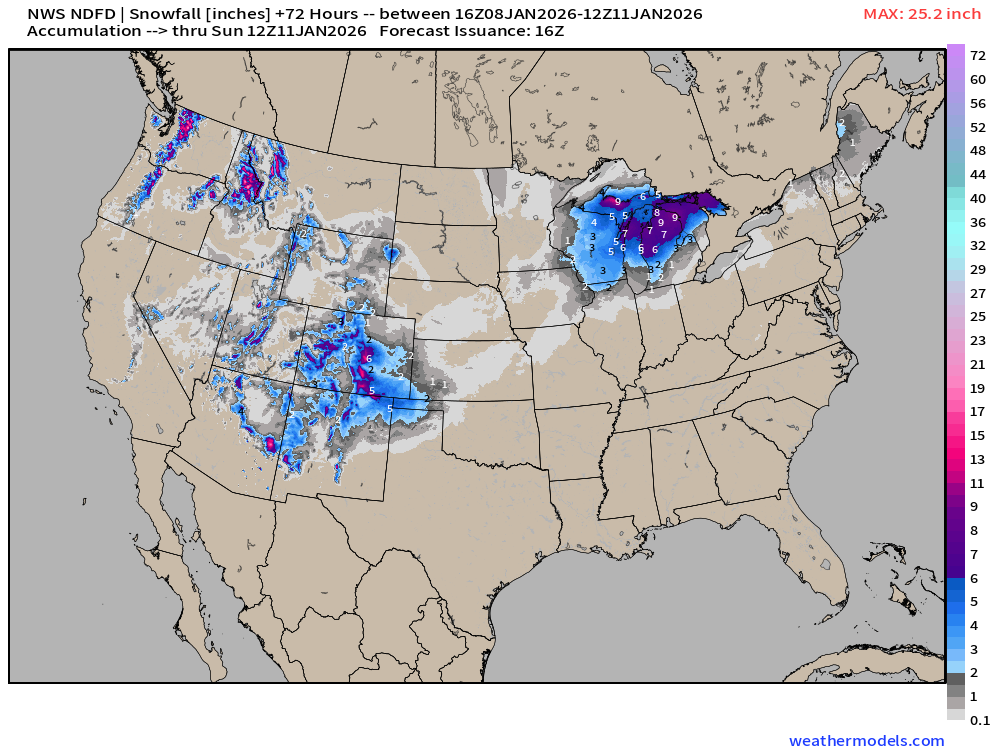
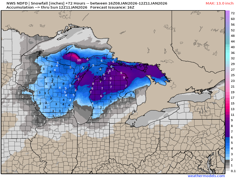
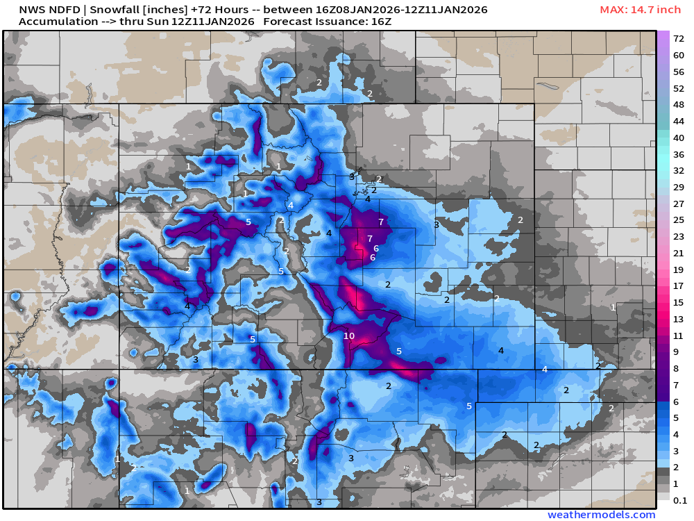
NWS Snowfall Next 72-hours
RTMA | Current Temperature Analysis | 12:30 PM ET
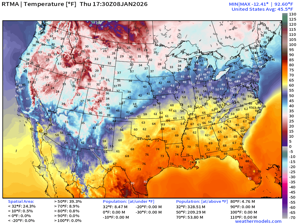
Average Lower 48 temperature was 43.9°F with only 20 million below freezing.
Temperature Anomaly | 12:30 PM ET
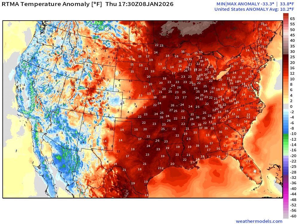
Lower 48 Temperature Anomaly whopping above normal by 10.2°F
Thursday High Temperatures
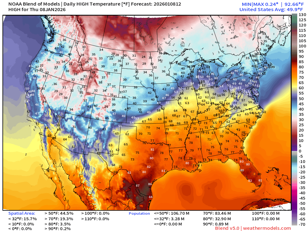
83 million at least 70°F and almost 33 million at 80°F
Friday Morning Low Temperatures
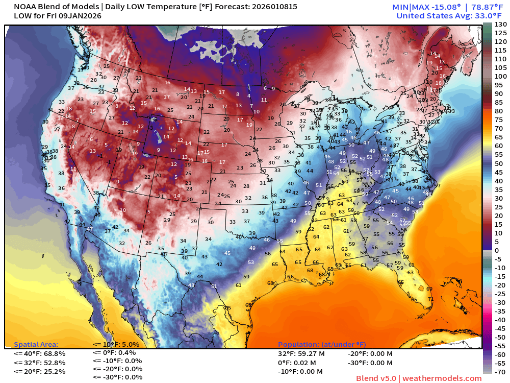
59 million below freezing — nationwide average of 33.0°F
Friday High Temperatures
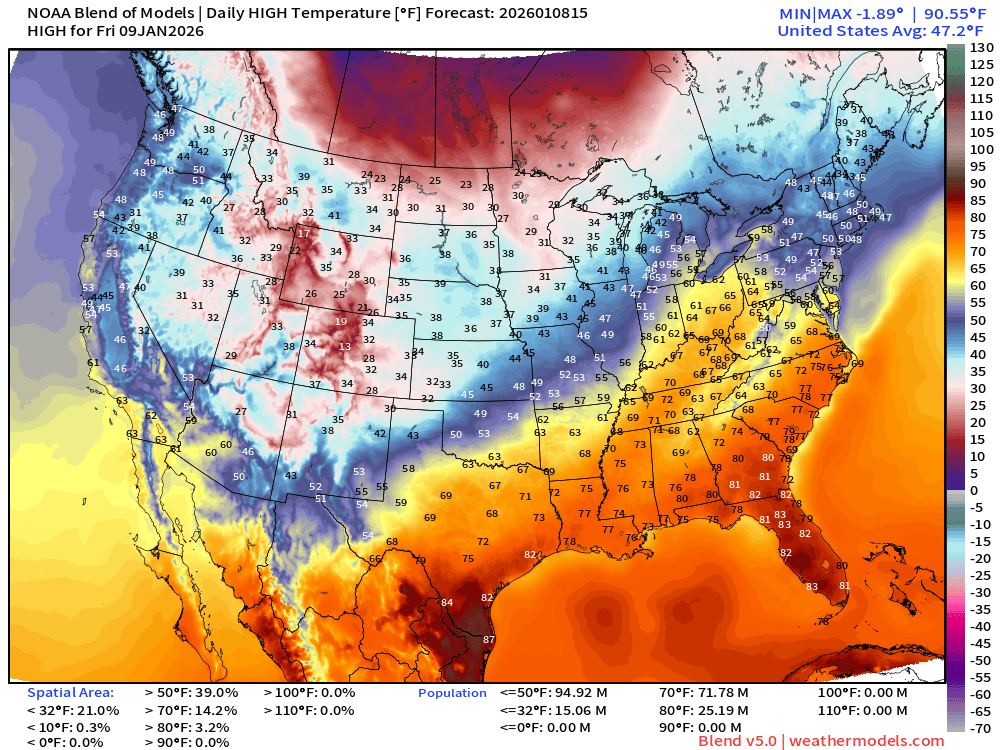
72 million at least 70°F —> nationwide average of 47.2°F
Blend of Models | 7 Days Precipitation Total
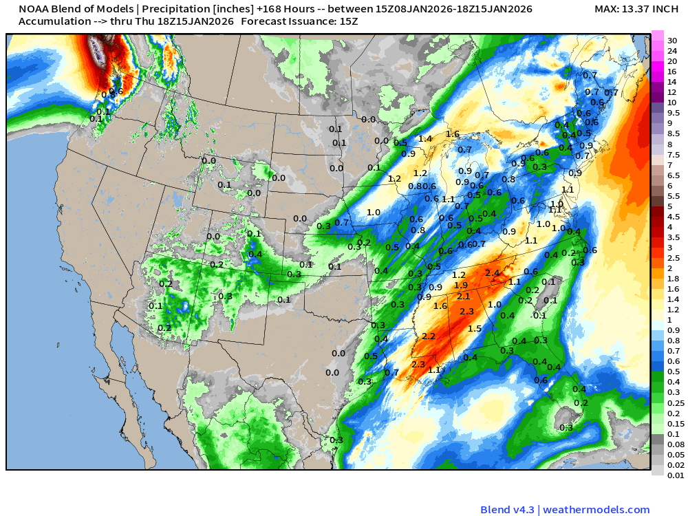
Huge rainfall totals across MS/AL into NW Georgia and Tennessee
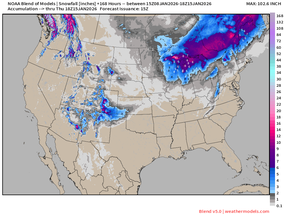
Blend of Models v5.0 | Total Snowfall Next 7-Days
ECMWF AIFS-Single 06z | Height Anomaly (500 hPa) Next 10-days
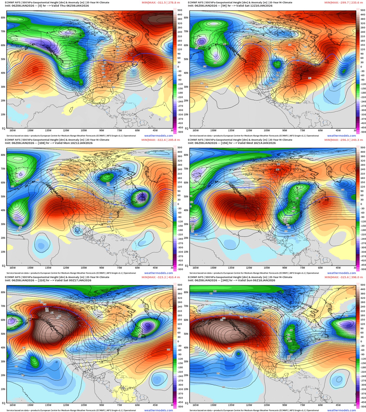
Major blocking ridge forms over Gulf of Alaska with AIFS-06z. That’s interesting.
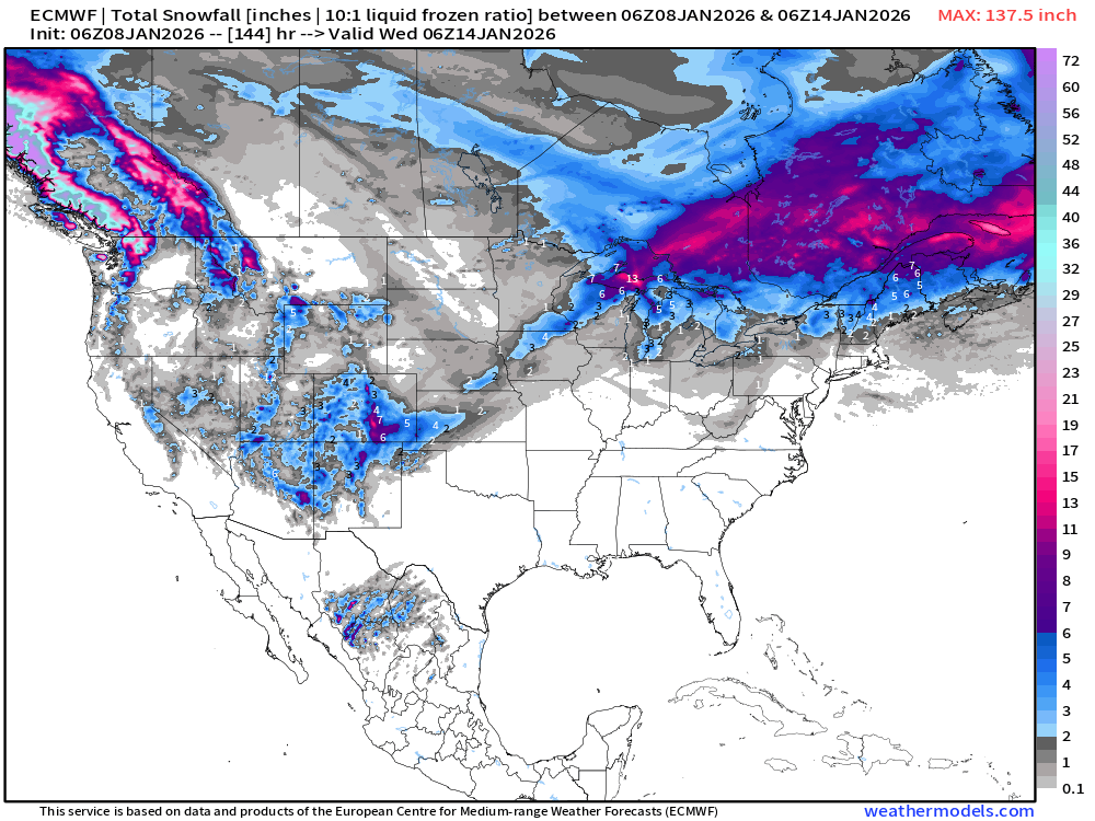
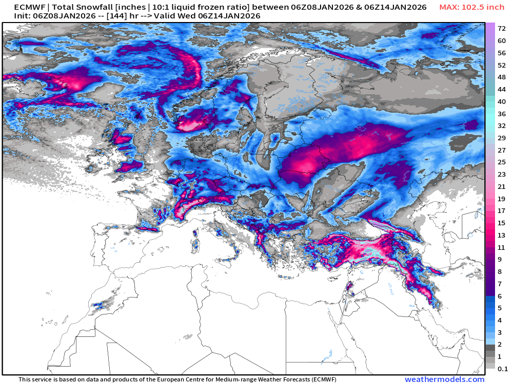
ECMWF 06z | Snowfall | Next 6-days | Lower 48 and Europe
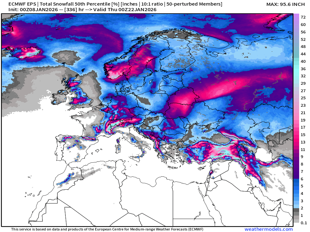
European Winter | Heavy Snowfall
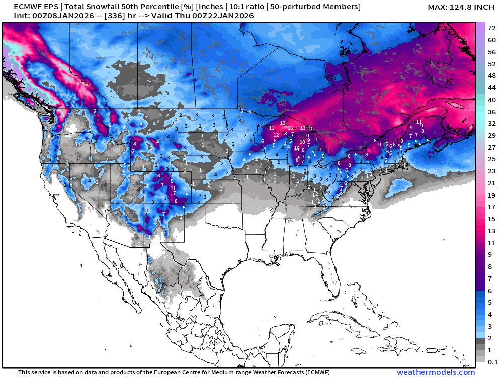
ECMWF EPS 00z | Ensemble Median Snowfall Next 14-days
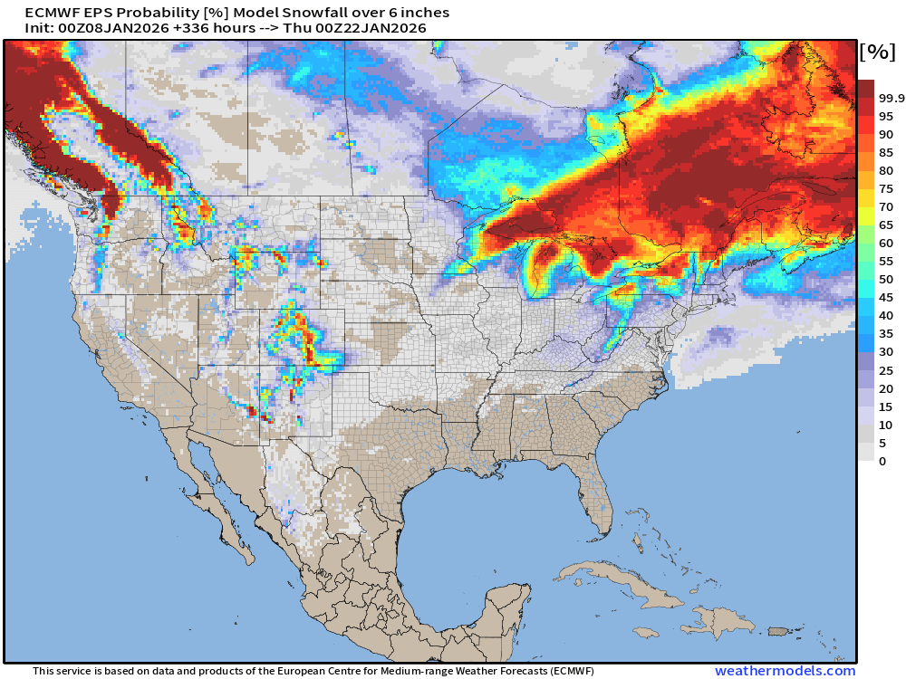
Probability of 6-inch or more Snowfall in the next 14-days
Ensemble Median Snowfall for Europe Next 14-days
European Temperature Anomaly | Week 1 and Week 2
Lower 48 Temperature Anomaly | Next 15-days | ECMWF EPS 00z
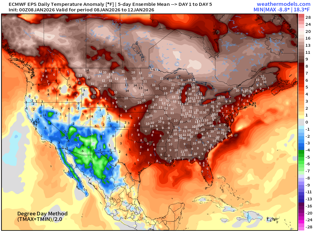
5-Day Chunk #1 | Temperature Anomaly | Jan 8 - Jan 12
5-Day Chunk #2 | Temperature Anomaly | Jan 13 - Jan 16
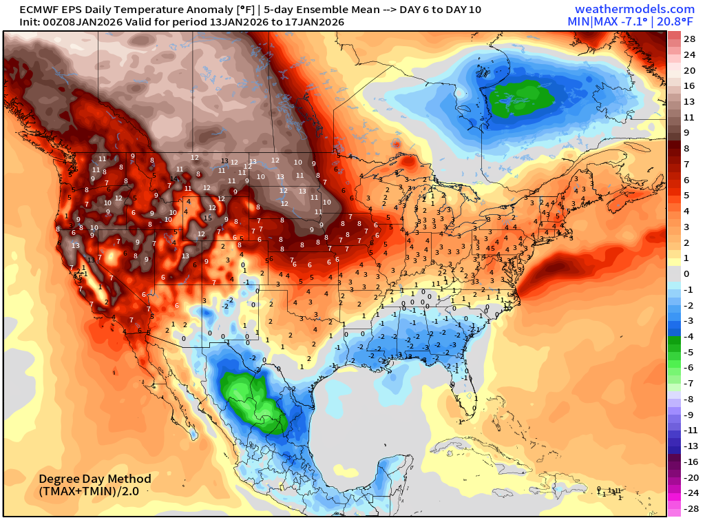
5-Day Chunk #3 | Temperature Anomaly | Jan 17 - Jan 21
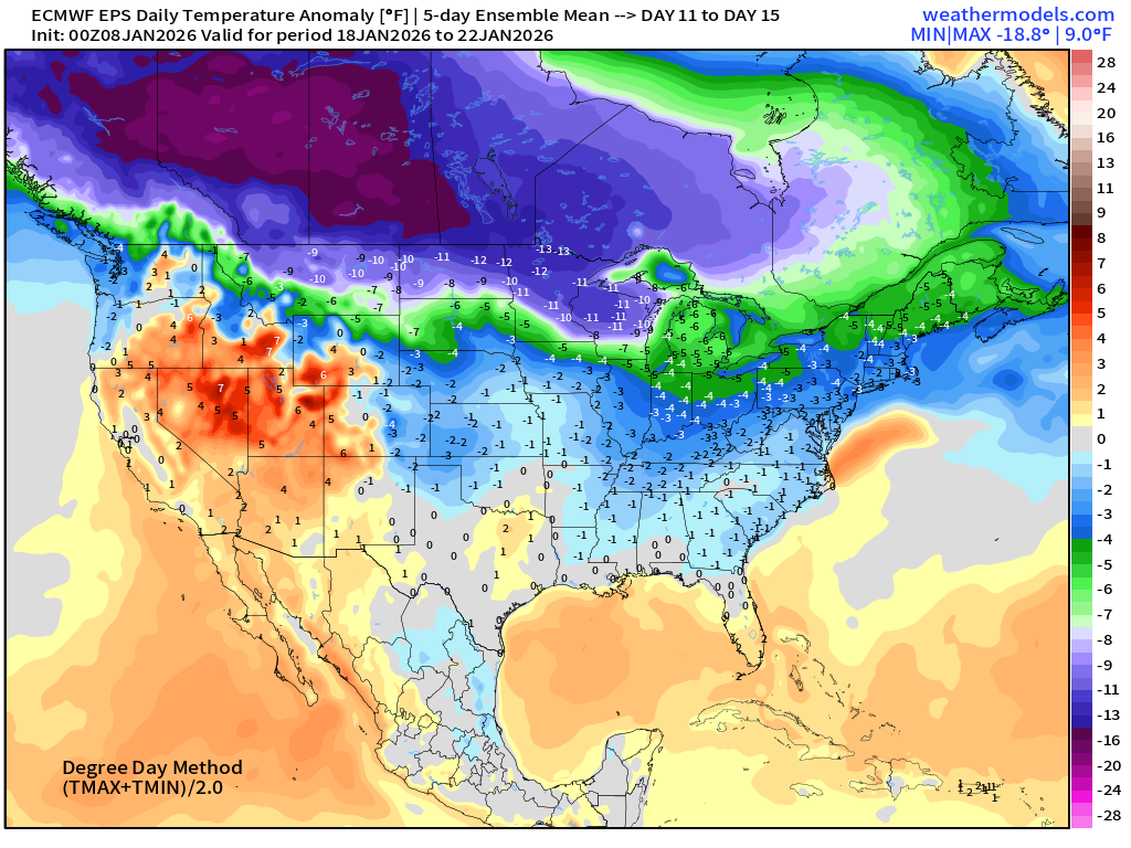
Huge cold pool forming across Canada and crossing into the Lower 48
Maps sourced from weathermodels.com designed and innovated by yours truly! Please subscribe there for real-time access to the newest maps, charts from all of the weather models including ECMWF and AIFS, NOAA AI-GFS/AI-GEFS
- Milepost
- 836 · laid 2026-01-08T18:22:53.837000Z
- Source
- https://weather.substack.com/p/january-8-2026-thursday-winter-weather
- Digest
- dfa0de9709c45f8ae990e61e775222490e8d9bed2f7dfe3631750b2b22ad3b94
- Machine
- JSON