December 29, 2025 Monday Morning Winter Weather
Hudson Bay Polar Vortex Company back in business with much colder air week ahead
December 2025 was the 5th-warmest December in the 131-year national record (1895–2025), at 37.8°F against a 1991–2020 normal of 34.3°F (+3.5°F).
December 2025 was the 37th-driest December in the 131-year national record (1895–2025), at 2.0in against a 1991–2020 normal of 2.5in (-0.5in).
NOAA/NCEI Climate at a Glance, contiguous United States. This is the observed record for the month, not a score of anything said in this piece — the forecast ledger begins 2026-08-17 and cannot reach earlier posts.

Top Story: Powerful “Bomb Cyclone” will dominate the circulation pattern across much of North America with much colder air settling across the Eastern US
ECMWF 06z Precipitable Water Next 6-days | My Favorite Parameter
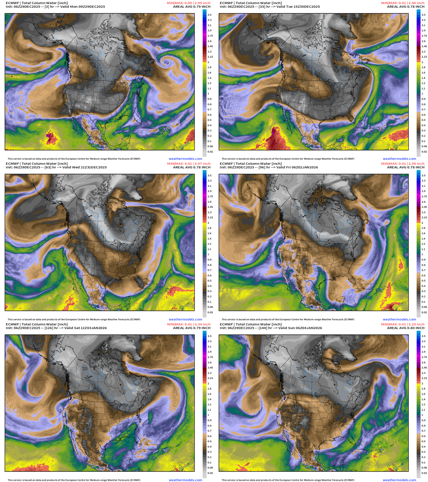
A flood of cold/dry air behind the powerful cold front with the “bomb cyclone” will continue through the week into the weekend for the Northeast = a chilly week ahead until the Western ridge can build back better.
The Arctic cold front blasts through South Florida.
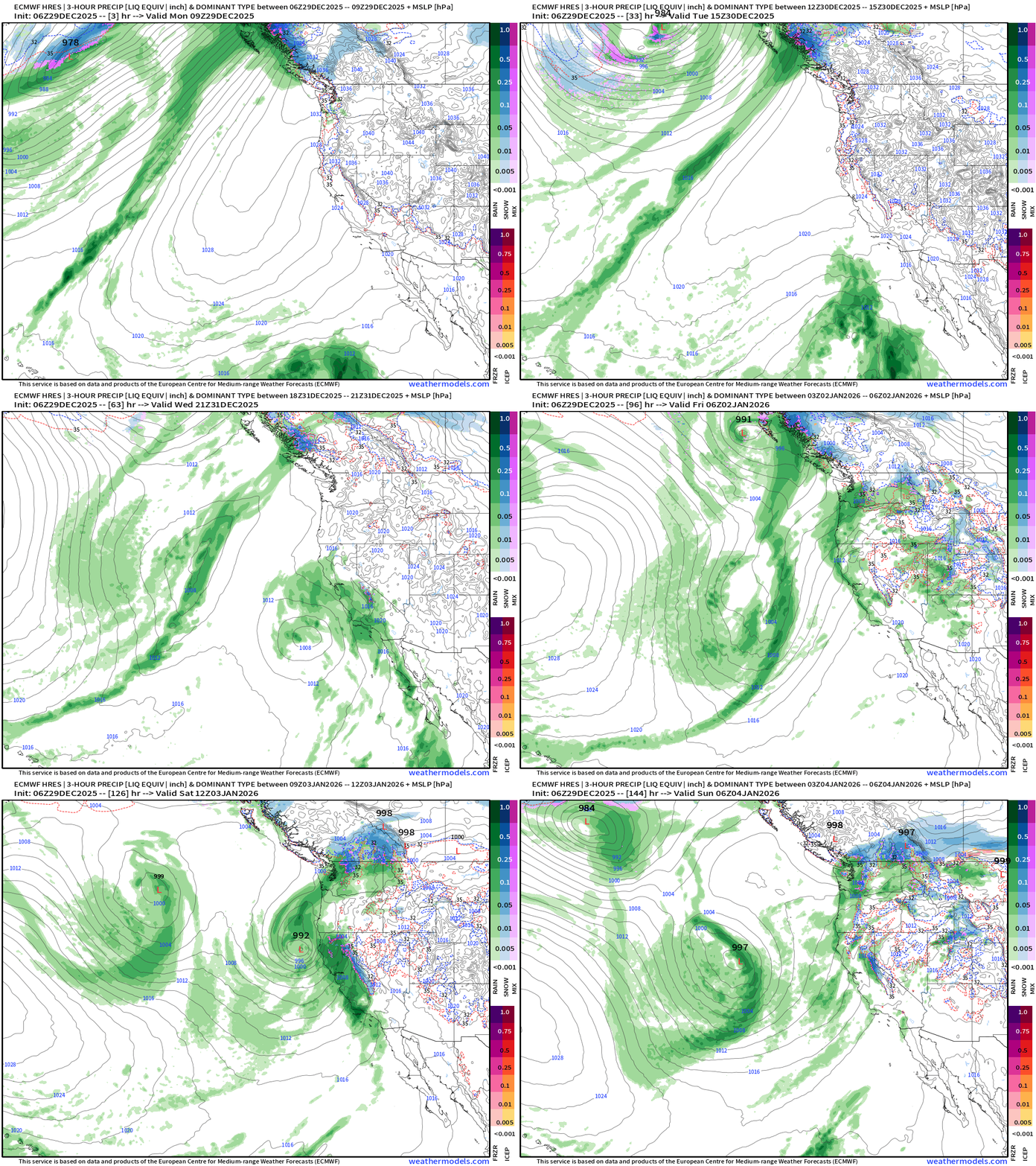
An unusual “subtropical storm” will come out of the tropical Eastern Pacific and “landfall” California — warm origin system so expect more heavy rain.
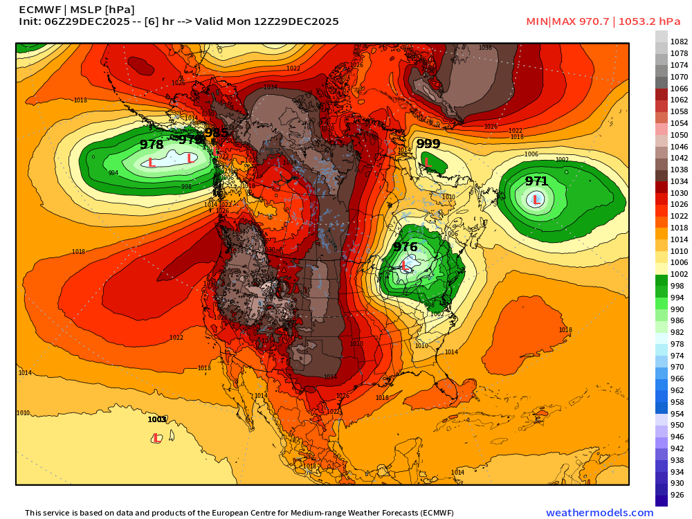
Textbook ingredients to get “Edmund Fitzgerald” type powerful storm system
976 mb “bomb cyclone” vs. 1036 mb high pressure over central U.S. = gradient & very strong winds … another extratropical cyclone is situated off Newfoundland but is blocked from heading out into the Atlantic by the “Greenland Block”
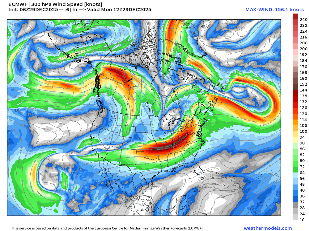
Jet stream — Jet streak aiding in “rapid cyclogenesis” —> front left quadrant
500 mb Height Anomaly — upper level trough associated with “polar vortex” lobe directly upstream = rapid pressure falls
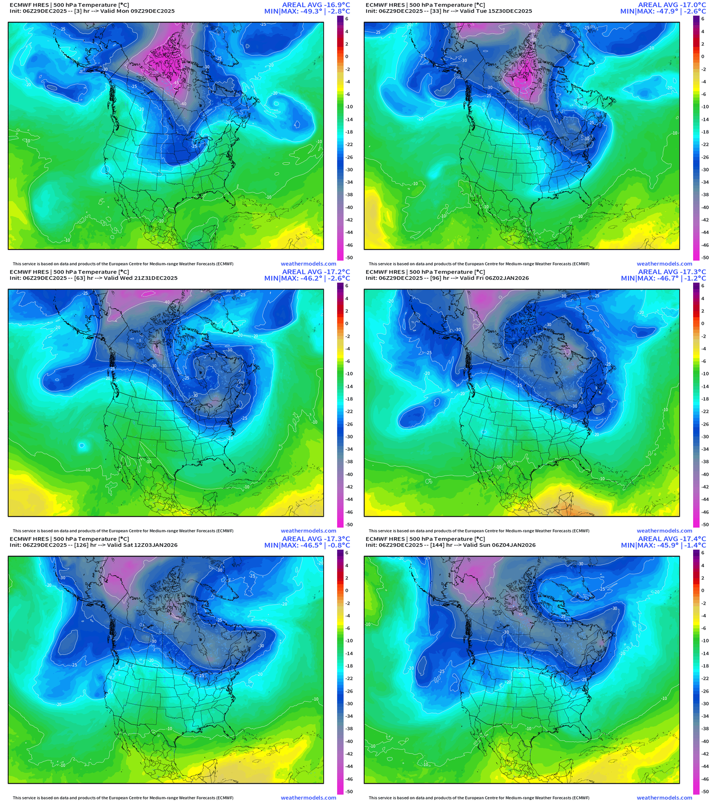
Polar Vortex well positioned to flood Great Lakes and Northeast with cold, Canadian Arctic air: 500 mb Temperature Next 6-days shows a “stuck pattern” with the upper-level trough continuing to wrap up like a “treble clef”
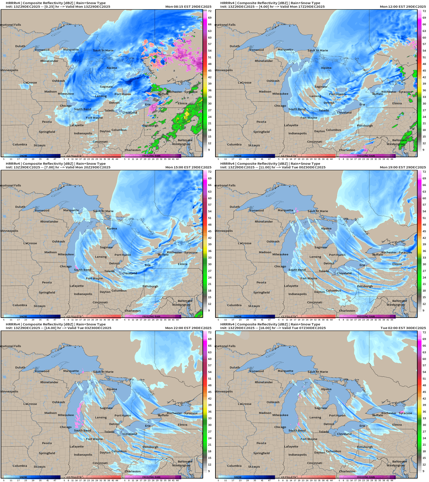
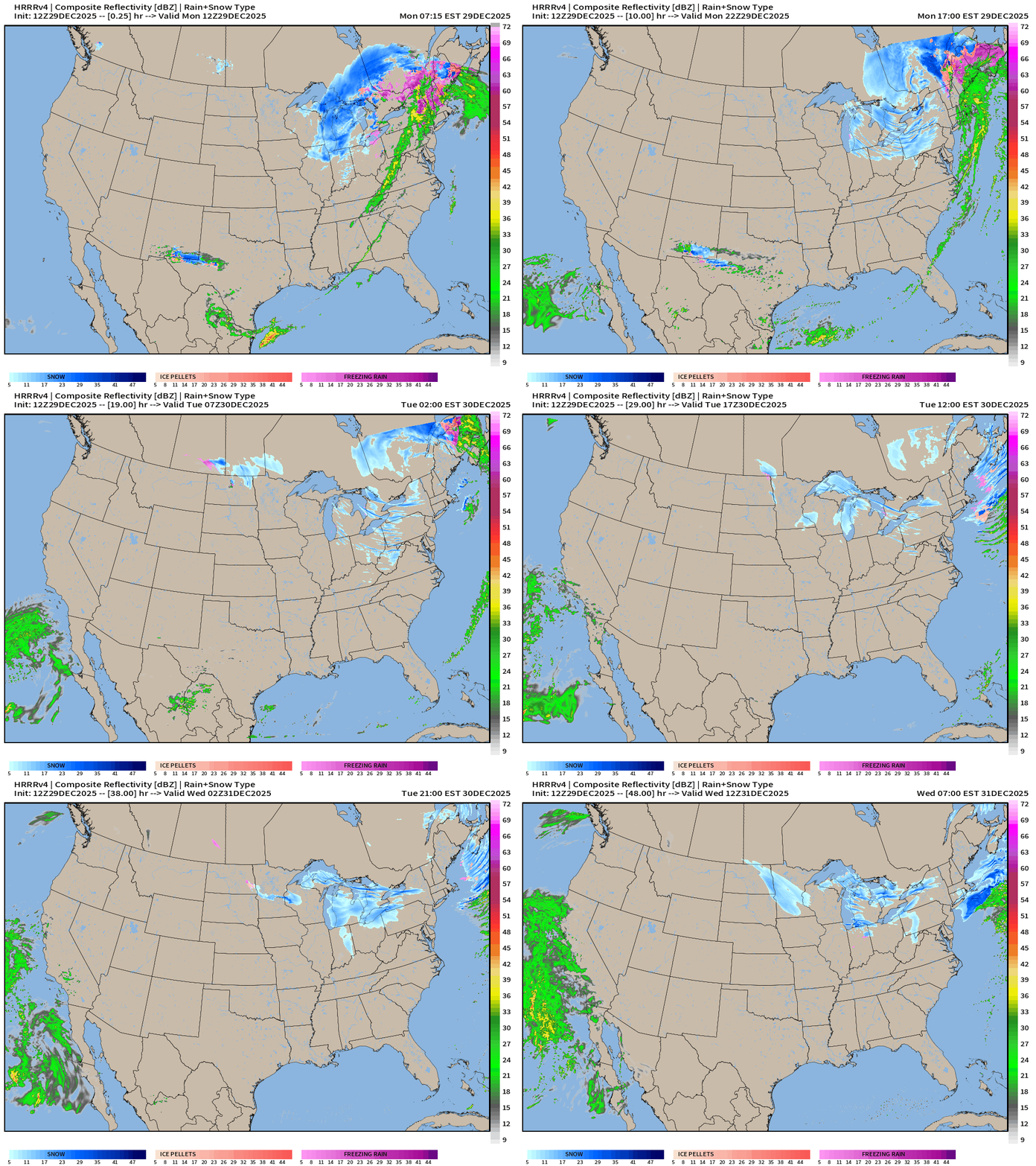
HRRR Simulated Radar Next 18-hours
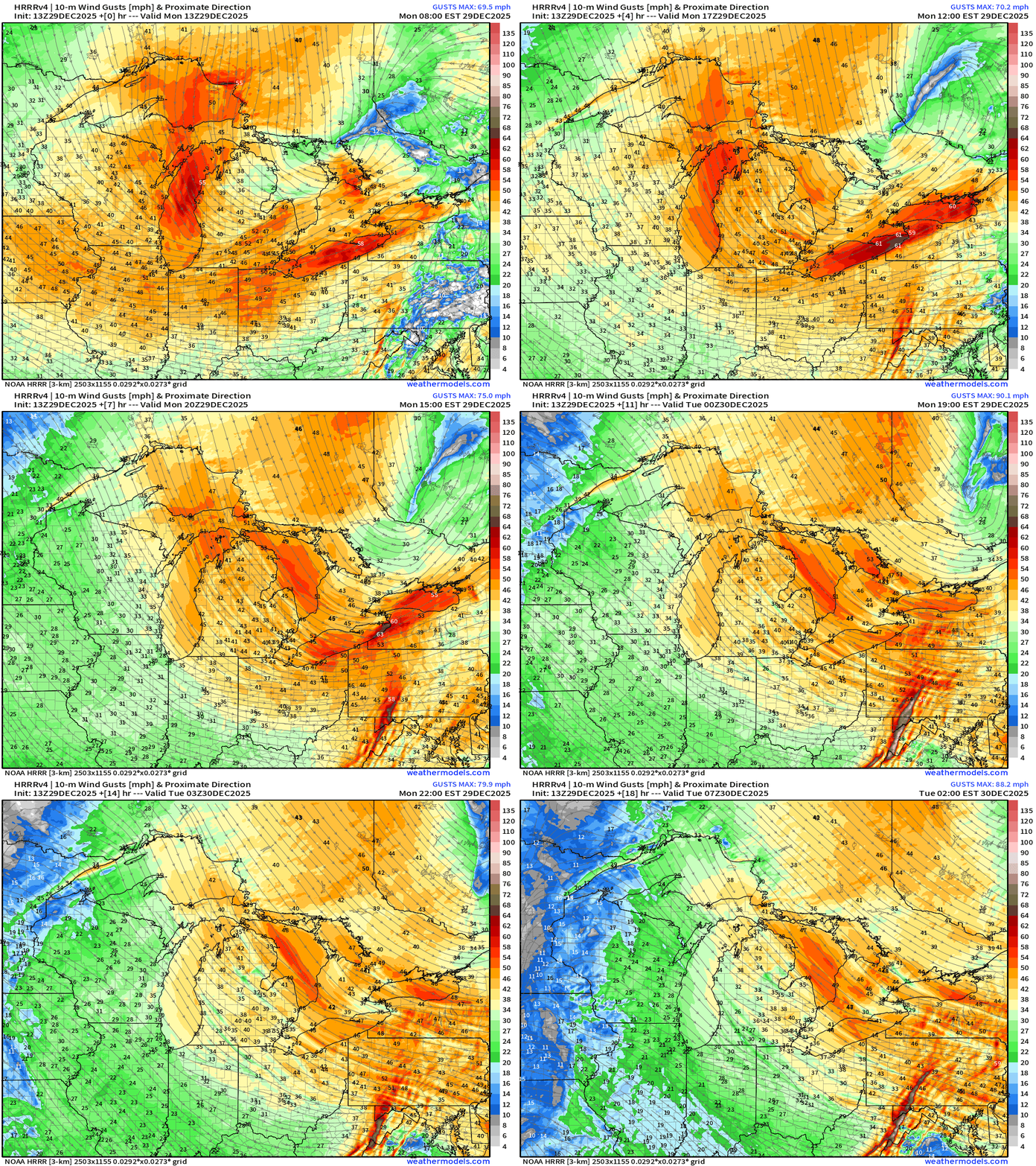
Extreme Wind Gusts over the Great Lakes > 50 to 70 mph
Maximum Wind Gusts from NWS Next 72-hours (red = 50 mph+)
Perhaps near hurricane force (74 mph) along the end of Lake Erie near Buffalo
Current Wind Gusts > 50 mph along Lake Michigan and Lake Erie
Snowfall Next 18-hours | Lake Effect Snow Machine cranked up!
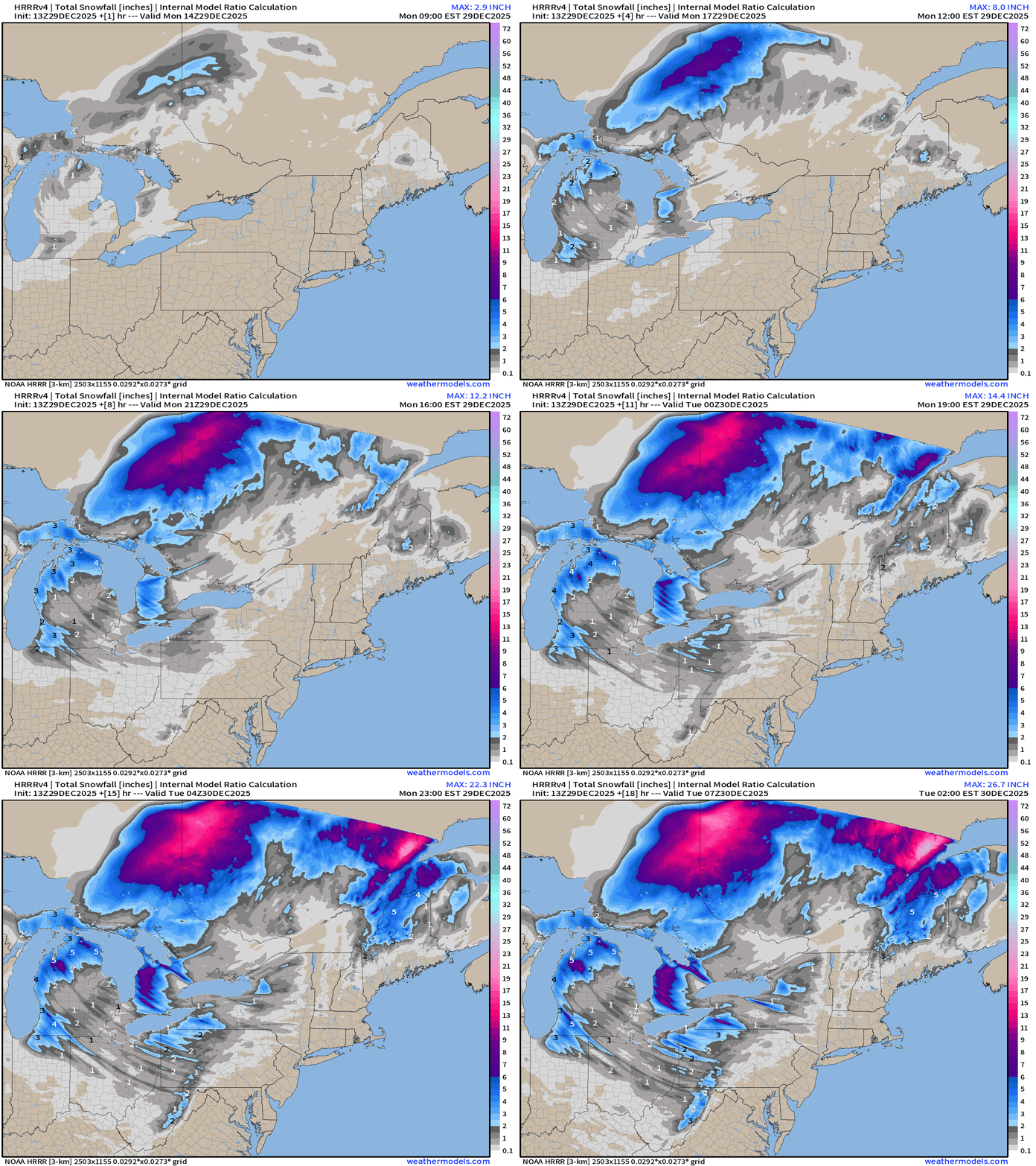
Northeast View — Lake Effect snow bands will streak across from Lake Superior across Huron and into New York and Pennsylvania
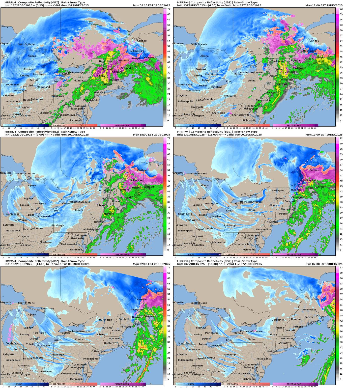
Simulated Radar Next 48-hours into Wednesday 7 AM ET
ECMWF 06z Precipitation Type and Intensity | Next 6-days
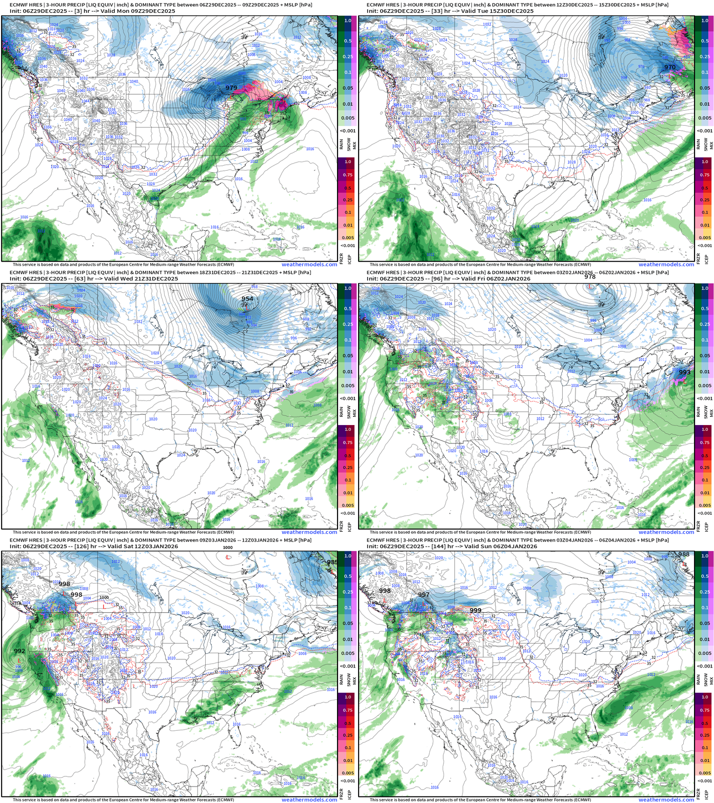
Weird Subtropical System for California — then another sequence of storm systems arriving out of cold, northwest flow
ECMWF 06z Precipitation Type and Intensity | Next 6-days
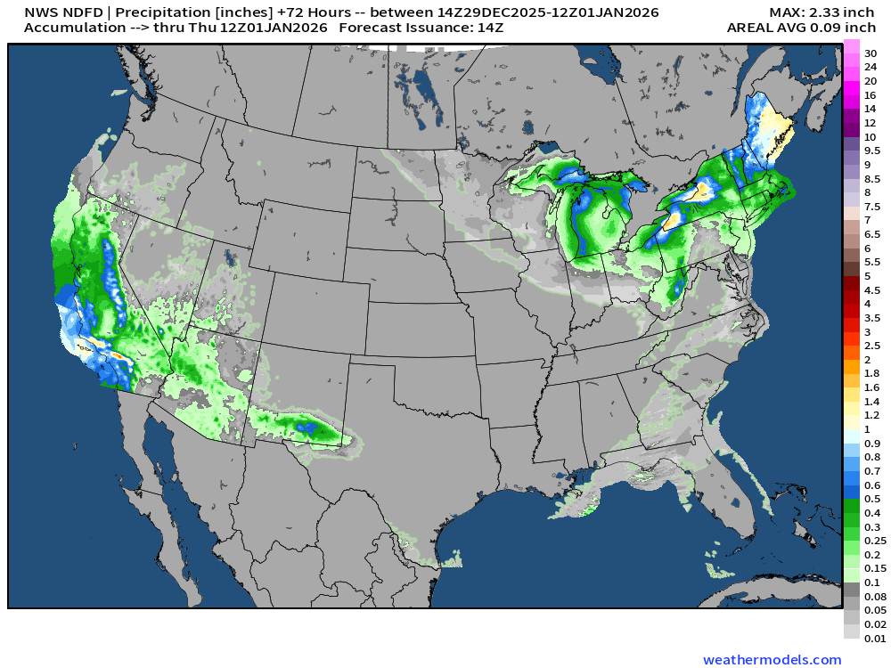
NWS Precipitation Next 72-hours
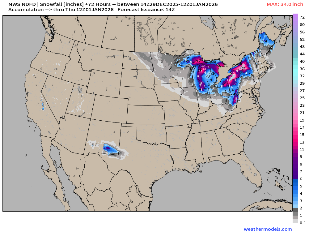
NWS Snowfall Next 72-hours
RTMA | Current Temperature Analysis | 9:00 AM ET
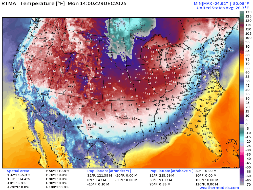
Average Lower 48 temperature was 26.3°F with 121 million below freezing.
Current Dew Point Temperature | 9:00 AM ET
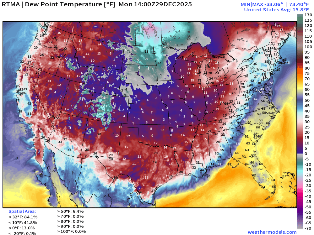
Arctic air shows up well with Dew Point — dry as a bone!
Temperature Anomaly | 9:00 AM ET
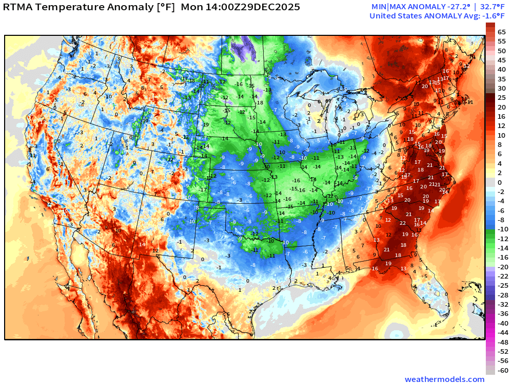
Lower 48 Temperature Anomaly finally has sunk below normal -1.6°F
Monday High Temperatures
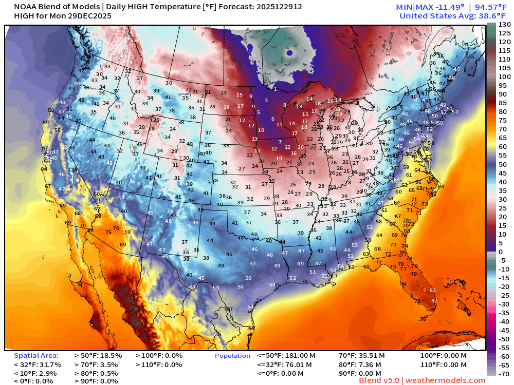
Nationwide average of only 38.6°F.
Tuesday Morning Low Temperatures
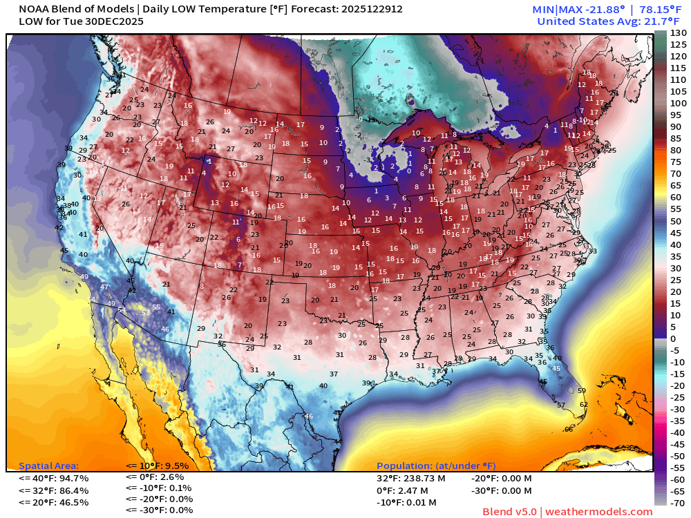
238 million below freezing — nationwide average of 21.7°F
Tuesday High Temperatures
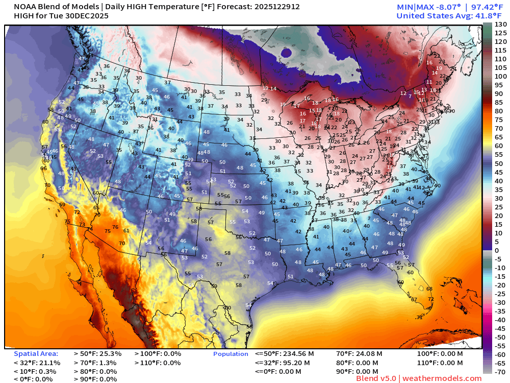
Only 24 million at least 70°F —> nationwide average of 41.8°F
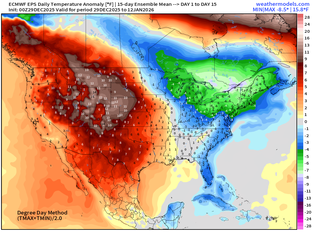
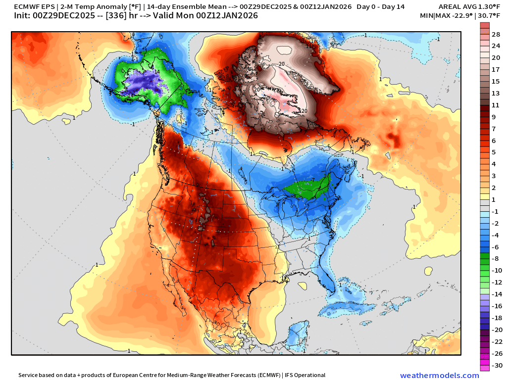
ECMWF 00z EPS | Temperature Anomaly | Next 15-days
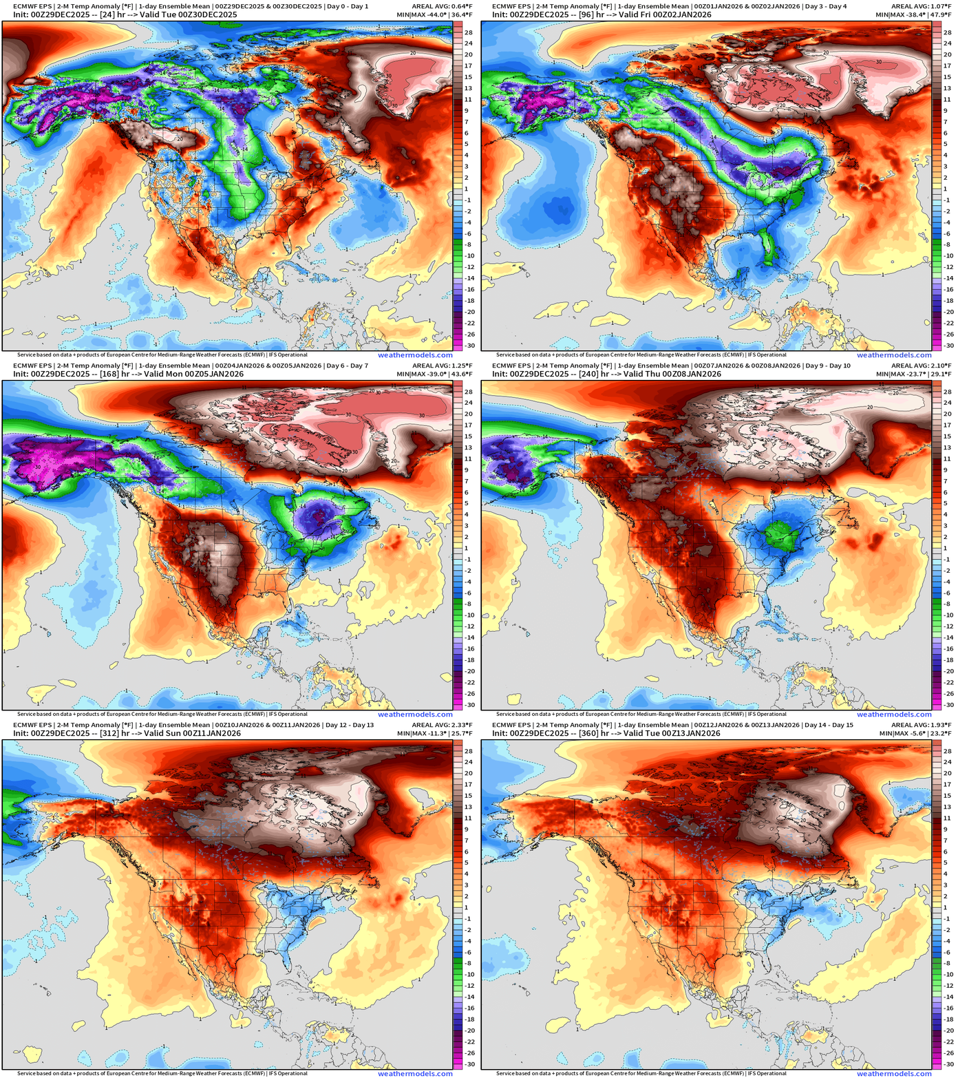
Major pattern shift —> much warmer (relative not normal) Atlantic origin air backs up from the Greenland Block and envelops Canada + ridging over Western U.S. finally erodes most of the coldest air on the continent. However, the Northeast still below average — small area but large population affected.
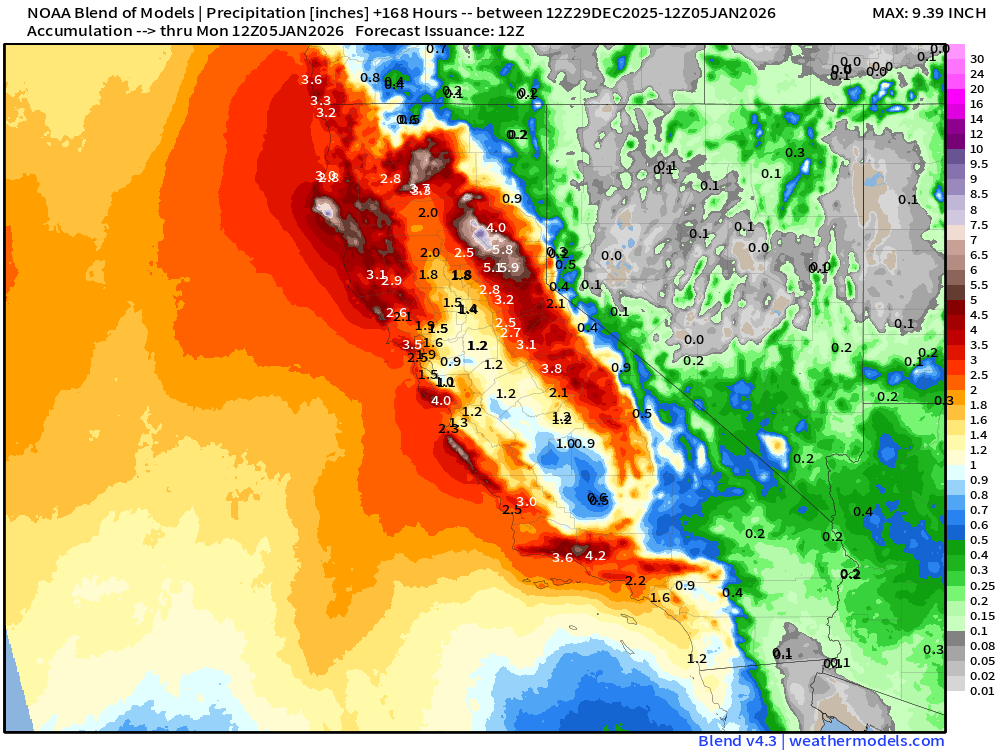
Blend of Models | 7 Days Precipitation Total
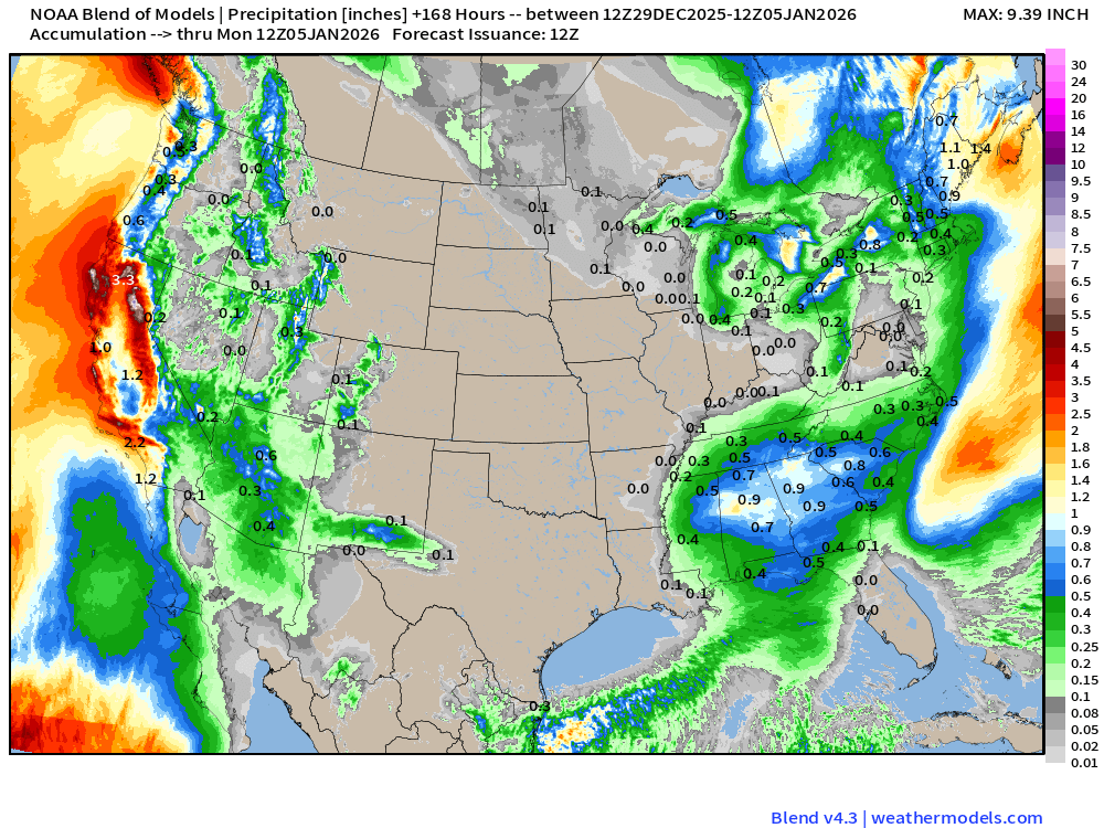
More California rainfall!
Blend of Models v5.0 | Total Snowfall Next 7-Days
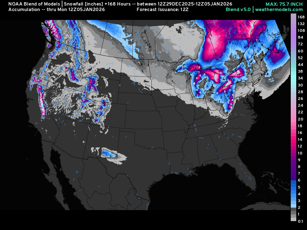
Massive Lake Effect snowfall totals especially downwind of Erie, Ontario, and Huron
ECMWF AIFS-Single 06z | Height Anomaly (500 hPa) Next 10-days
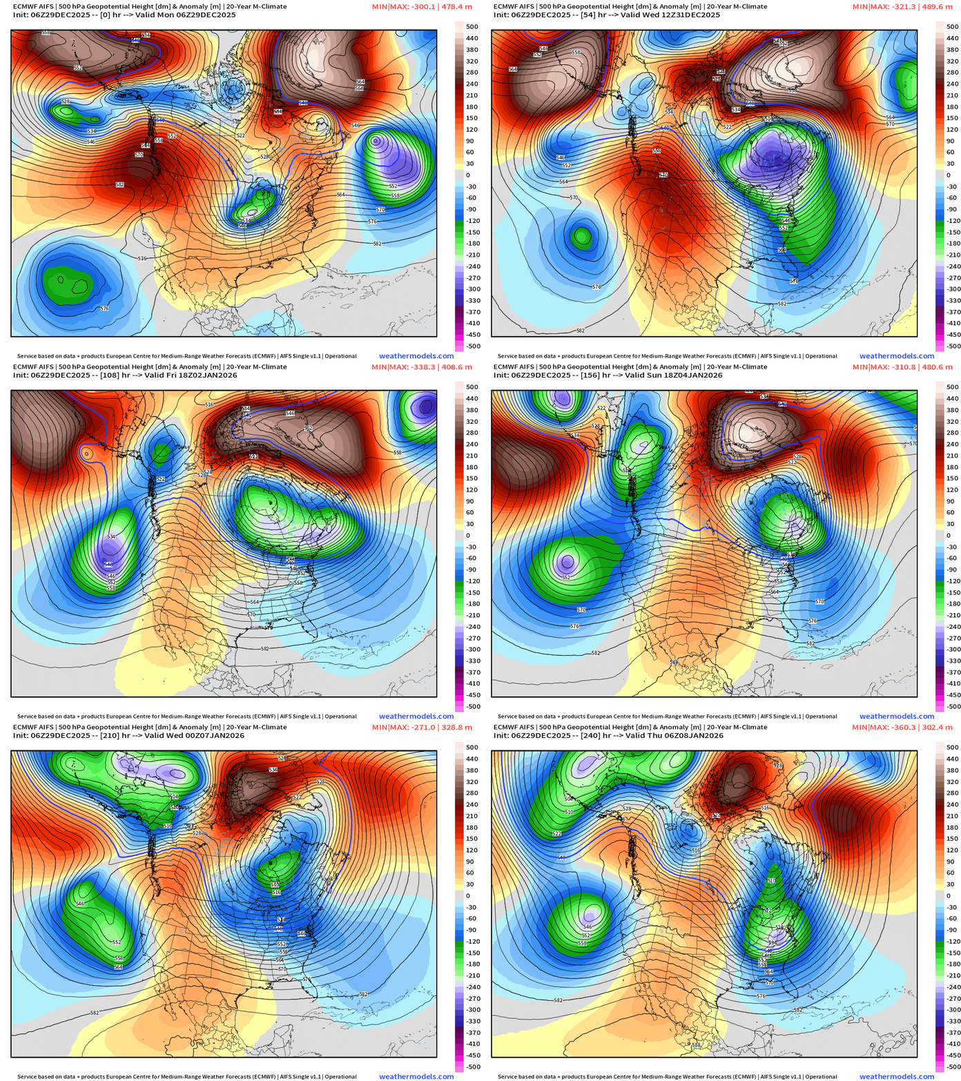
The bomb cyclone interacts with the “Polar Vortex” lobe over the Northeast and then violently retrogrades into Hudson Bay — also due to the Greenland blocking ridge
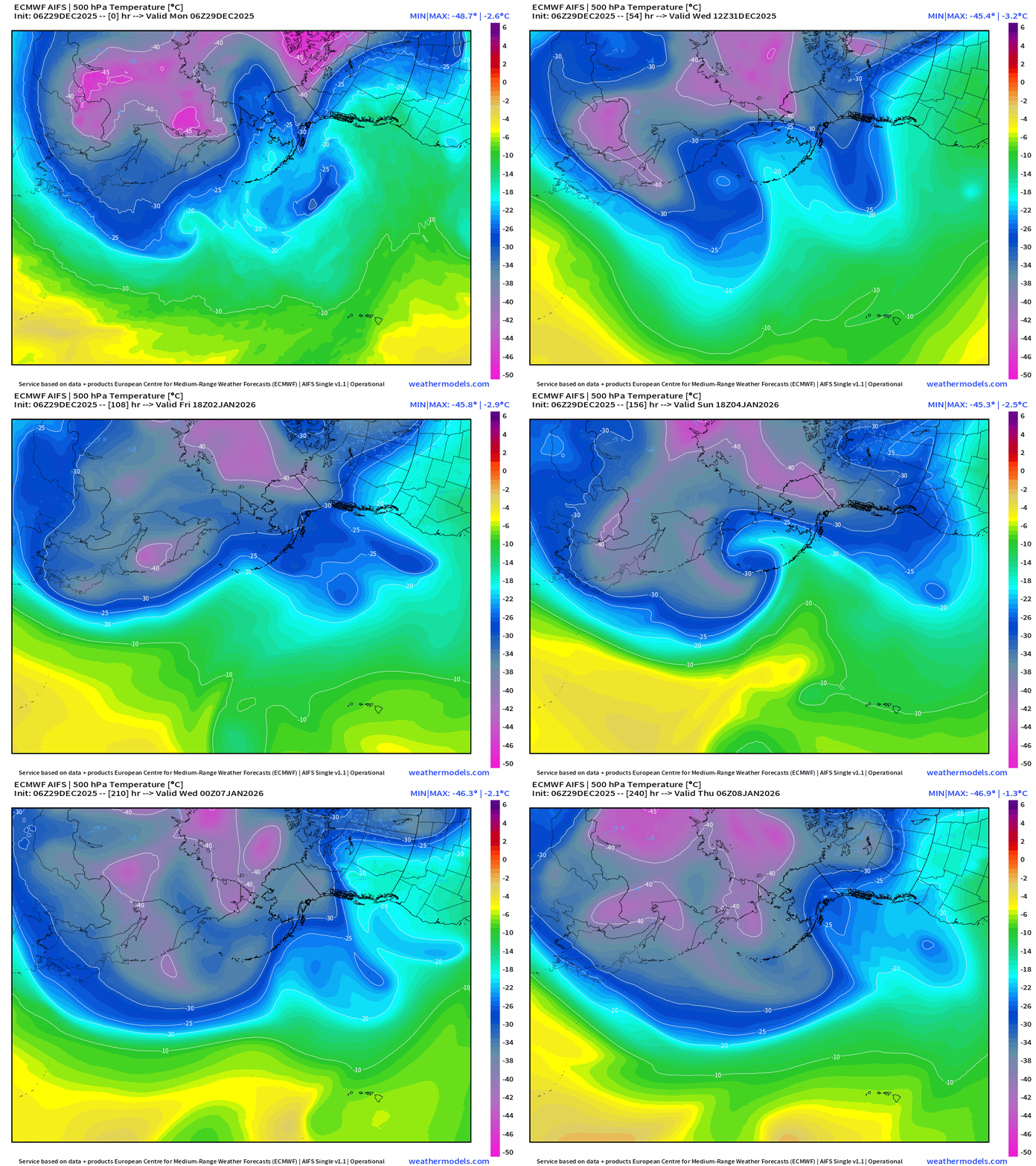
ECMWF AIFS-Single 06z | Temperature at 500 hPa Next 10-days
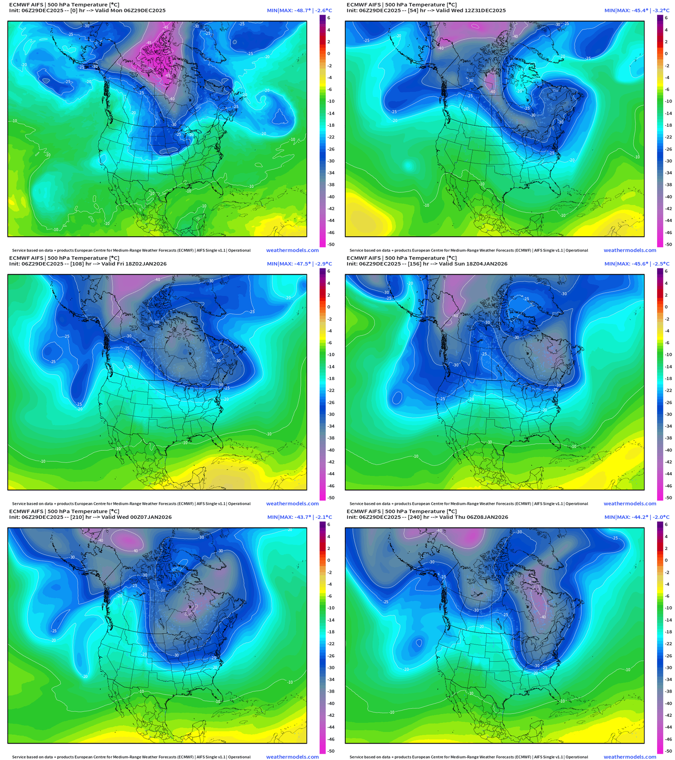
Multiple mid-level cold pools interacting over North America … recharged by Siberian cold pool air
North Pacific View
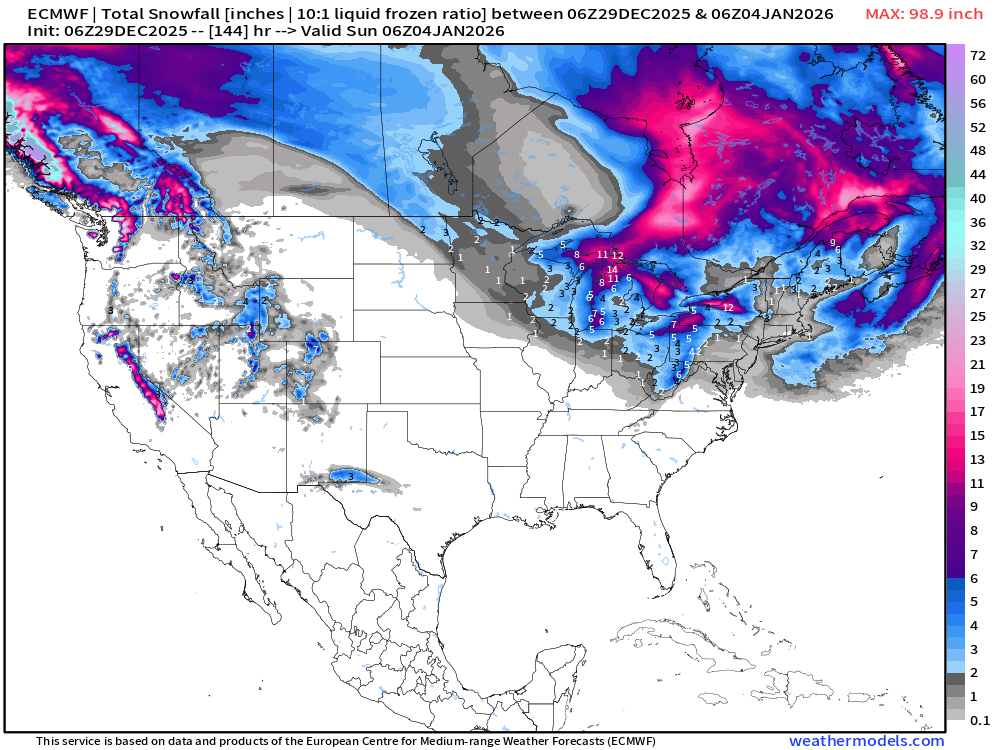
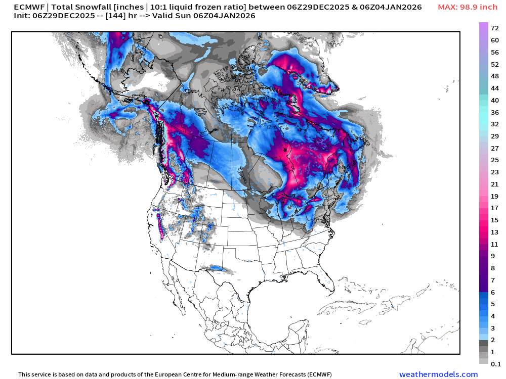
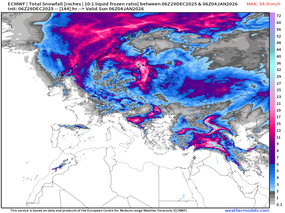
ECMWF 06z | Snowfall | Next 6-days | Lower 48 and Europe
European Winter Begins
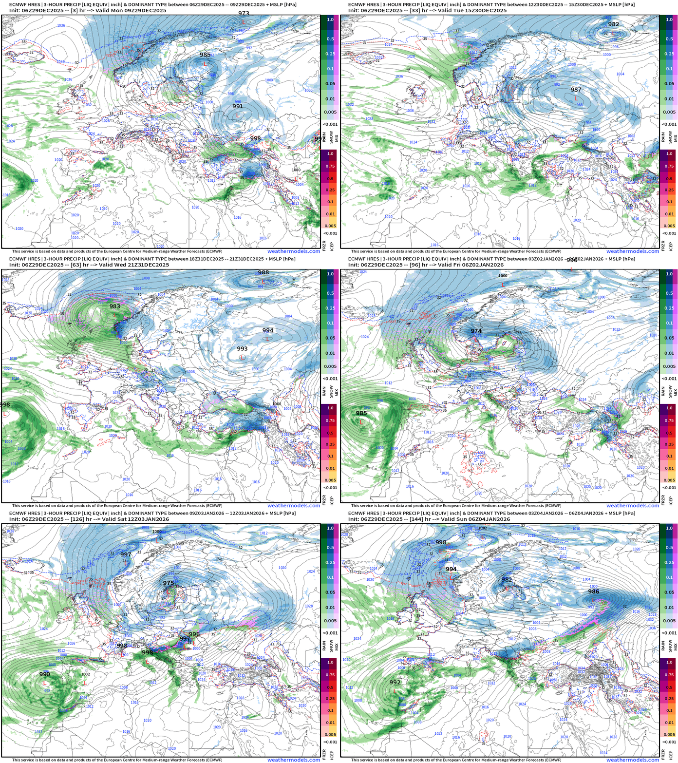
Europe Precipitation Type Next 6-days
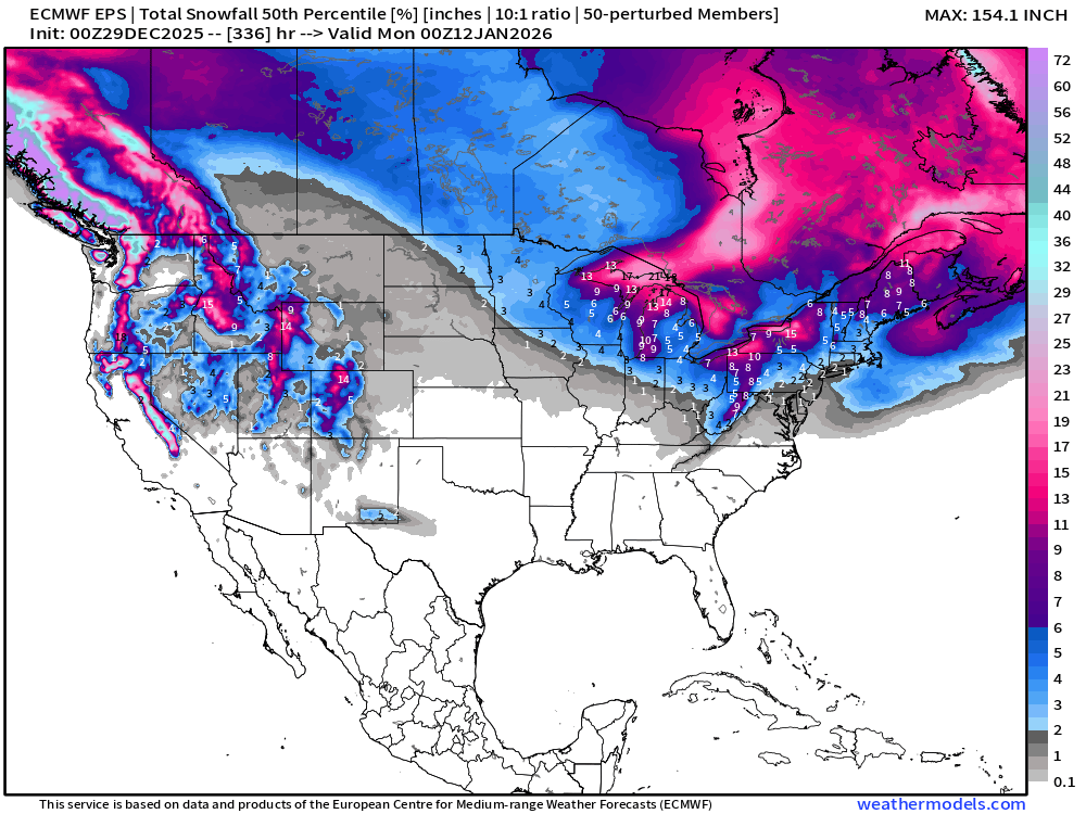
ECMWF EPS 00z | Ensemble Median Snowfall Next 14-days
Ensemble Maximum | Max Snowfall out of 51-members thru 14-days
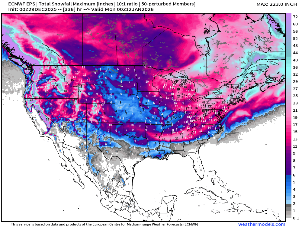
NOTE: this is “worst case scenario” — only to show potential of extreme tails of distribution
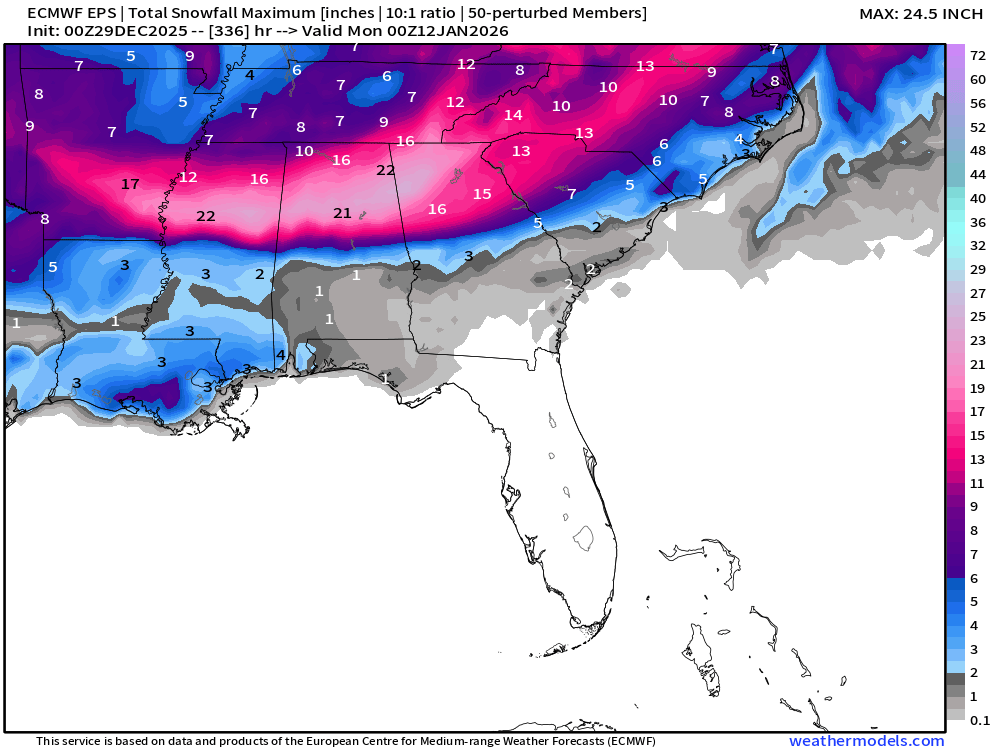
The actual chance of seeing accumulating snow somewhere in the Lower 48 is actually pretty small BUT not zero.
Probability of 1-inch or more Snowfall in the next 14-days
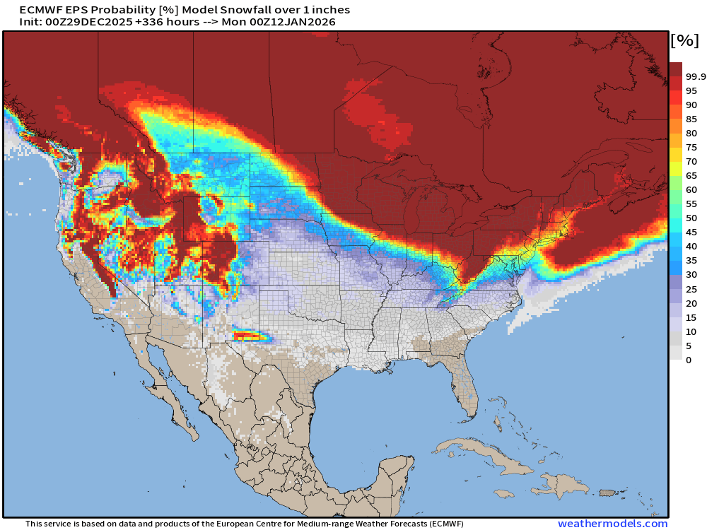
As we can see the probability of snowfall is low in the Southeast — but not zero.
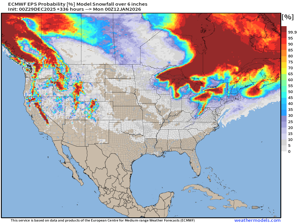
Probability of 6-inches or more Snowfall in the next 15-days
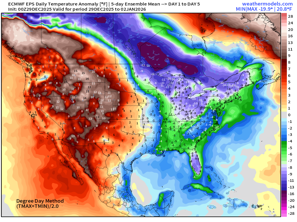
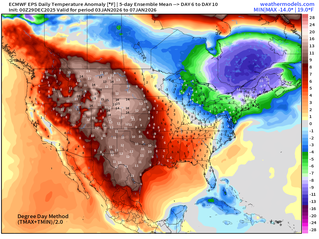
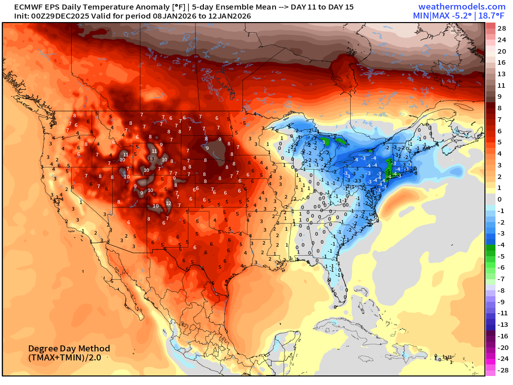
Temperature Anomaly | Next 15-days | ECMWF EPS 00z
5-Day Chunk #1 | Temperature Anomaly | Dec 29 - Jan 2
5-Day Chunk #2 | Temperature Anomaly | Jan 3 - Jan 7
5-Day Chunk #3 | Temperature Anomaly | Jan 8- Jan 12
Maps sourced from weathermodels.com designed and innovated by yours truly! Please subscribe there for real-time access to the newest maps, charts from all of the weather models including ECMWF and AIFS, NOAA AI-GFS/AI-GEFS
Active coupon codes:
None. Please send a message or reply to this email for inquiries.
- Milepost
- 829 · laid 2025-12-29T16:01:44.973000Z
- Source
- https://weather.substack.com/p/december-29-2025-monday-morning-winter
- Digest
- f35b3656aef564b5cb7517065bc737131660c163b46de6e693ee6a213ffe790b
- Machine
- JSON