December 24, 2025 Christmas Eve
Clipper system could deal significant snowfall to NYC through Saturday morning
December 2025 was the 5th-warmest December in the 131-year national record (1895–2025), at 37.8°F against a 1991–2020 normal of 34.3°F (+3.5°F).
December 2025 was the 37th-driest December in the 131-year national record (1895–2025), at 2.0in against a 1991–2020 normal of 2.5in (-0.5in).
NOAA/NCEI Climate at a Glance, contiguous United States. This is the observed record for the month, not a score of anything said in this piece — the forecast ledger begins 2026-08-17 and cannot reach earlier posts.

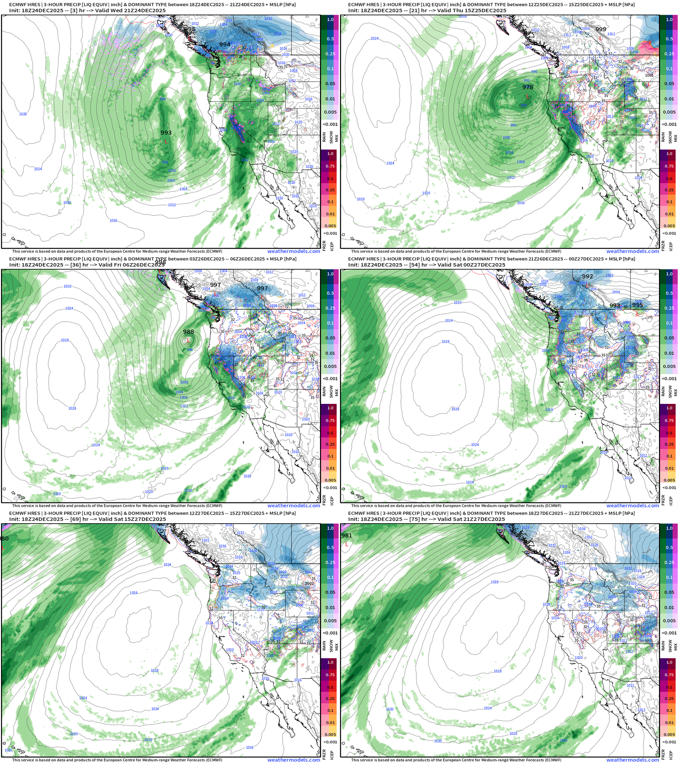
West Coast Atmospheric River + Storm Systems
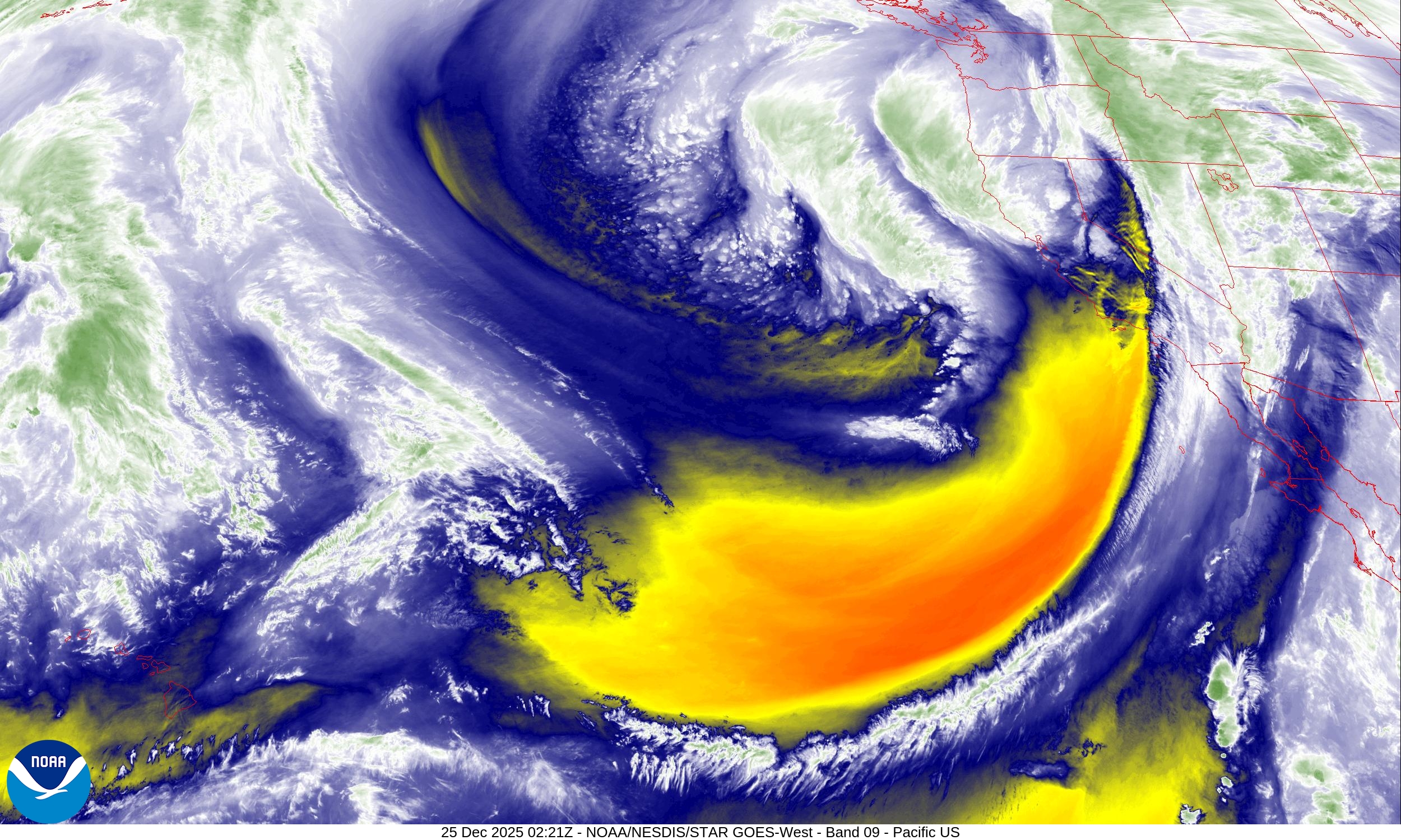
Embedded within the cyclonic flow around an upper-level, polar vortex “lobe” trough off the West Coast of the United States —> highly amplified pattern with a blocking ridge (Omega block)
The 500 mb Temperature is quite cold off the Pacific NW coast associated with highly anomalous trough (geopotential height anomaly) … an extreme weather pattern for late-December especially with the strong ridge formation
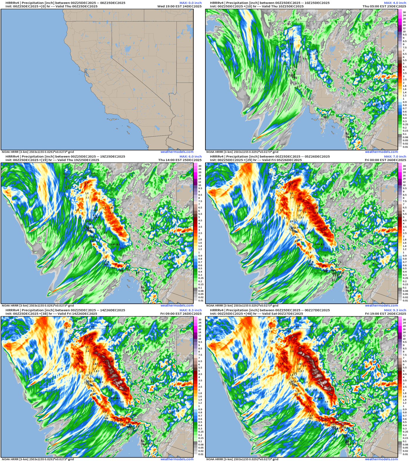
Simulated Radar Next 48-hours into Friday Evening 7 pm ET
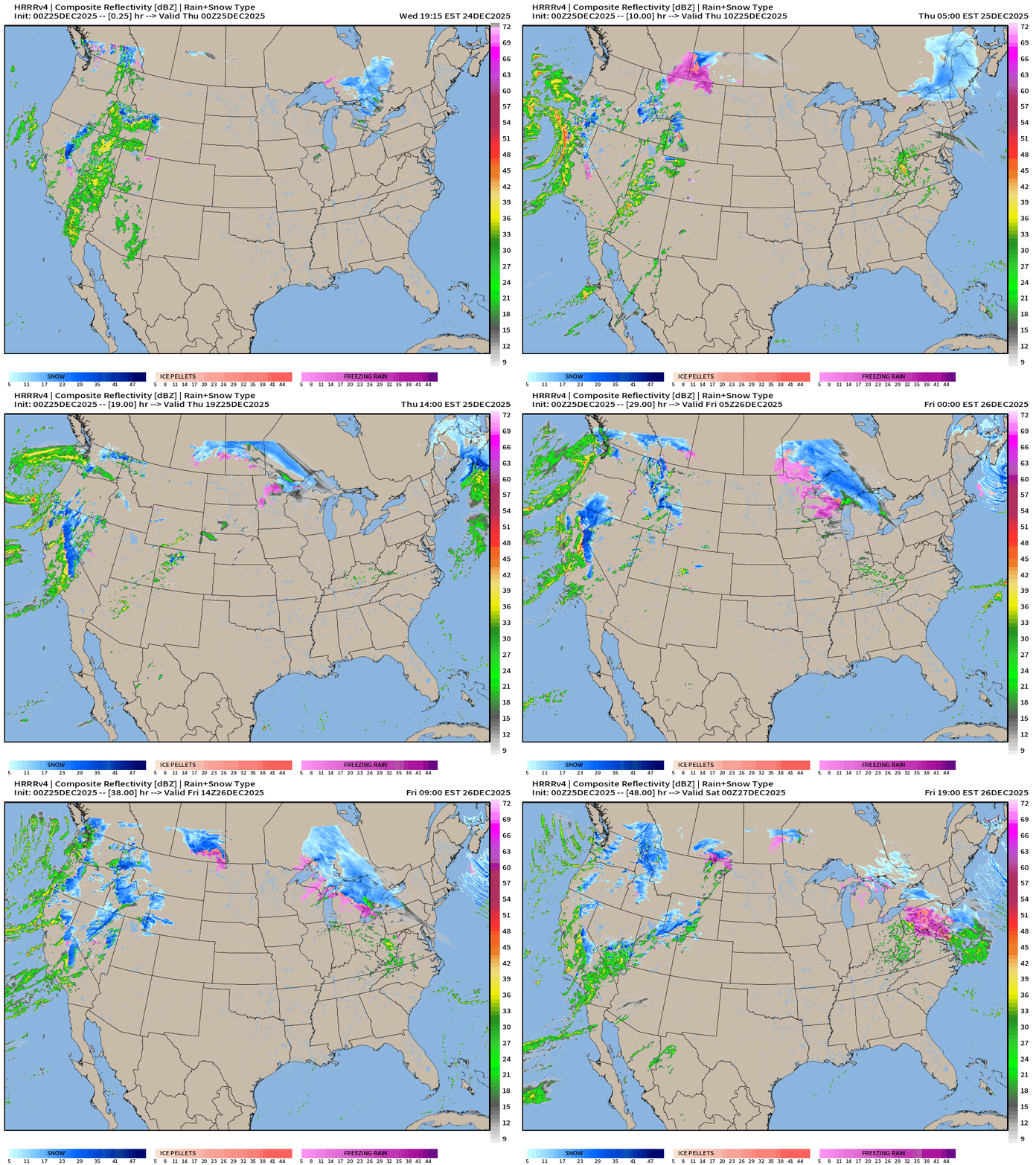
Headlines Wednesday Evening
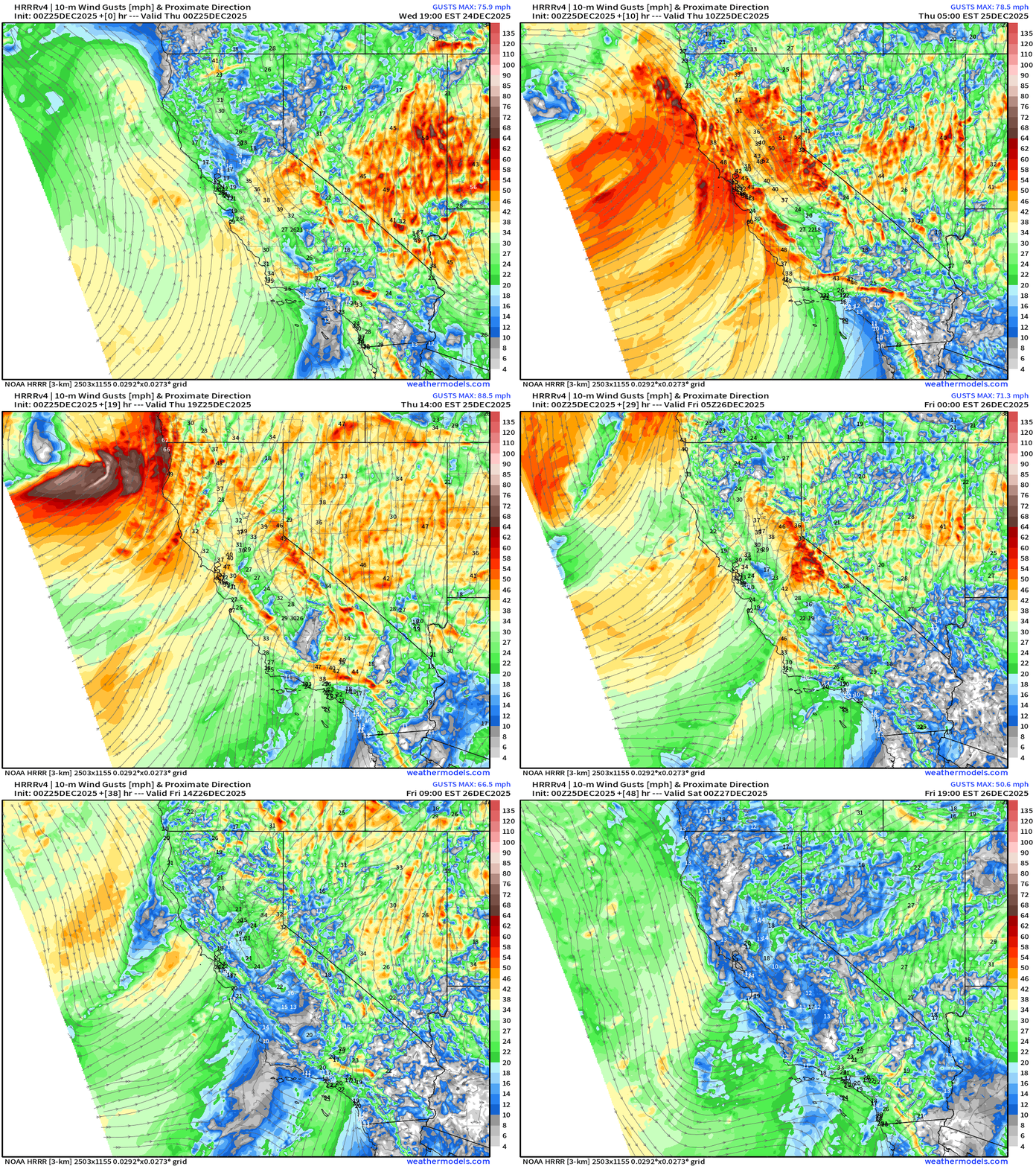
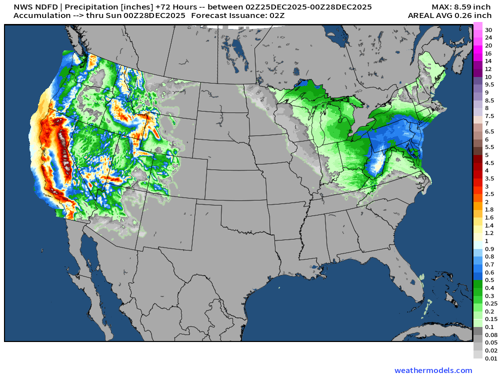
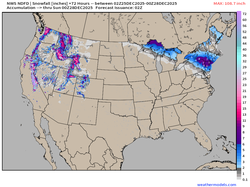
Extreme weather from powerful “bomb cyclone” off California coast — making landfall with gusty winds, torrential rain, and enormous snowfall in Sierra.
Arctic cold pool over Alaska and Western Canada will drain downstream into the U.S. into next week with a substantial blast of well below normal temperatures
Weekend storm system for the Northeast? Still uncertain forecast for maximum snowfall impacts especially for New York City but initial modeling is robust with 6” possible.
ECMWF 18z Precipitable Water Next 6-days
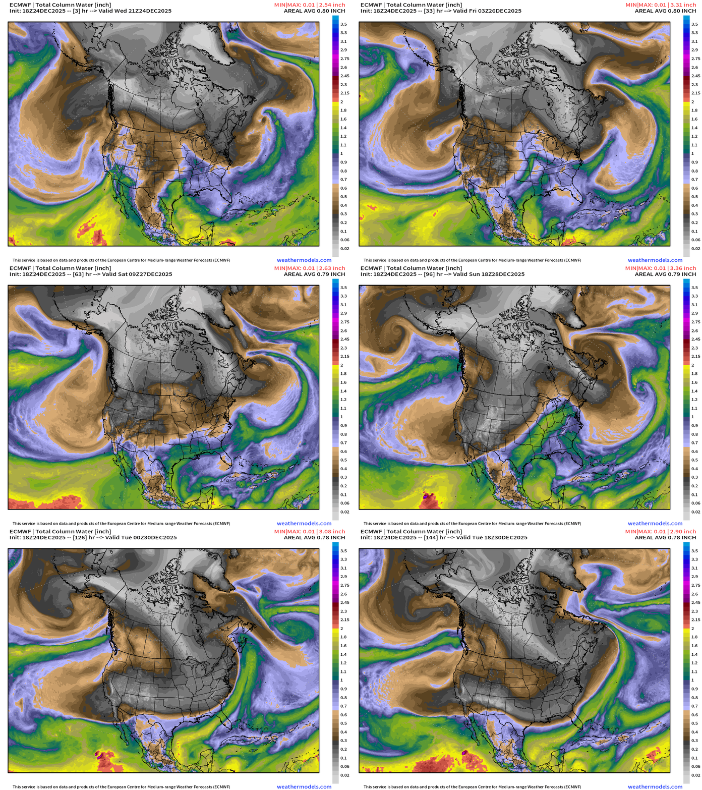
California finally transitions to “offshore flow” under high pressure but that will mean much lower humidity and strong winds — but all of this rain will mitigate any fire danger (thankfully) compared to early 2025.
Mini Arctic blast for New England on Friday followed by a more powerful Eastern U.S. cold event into early next week
ECMWF 18z Precipitation Type and Intensity | Next 6-days
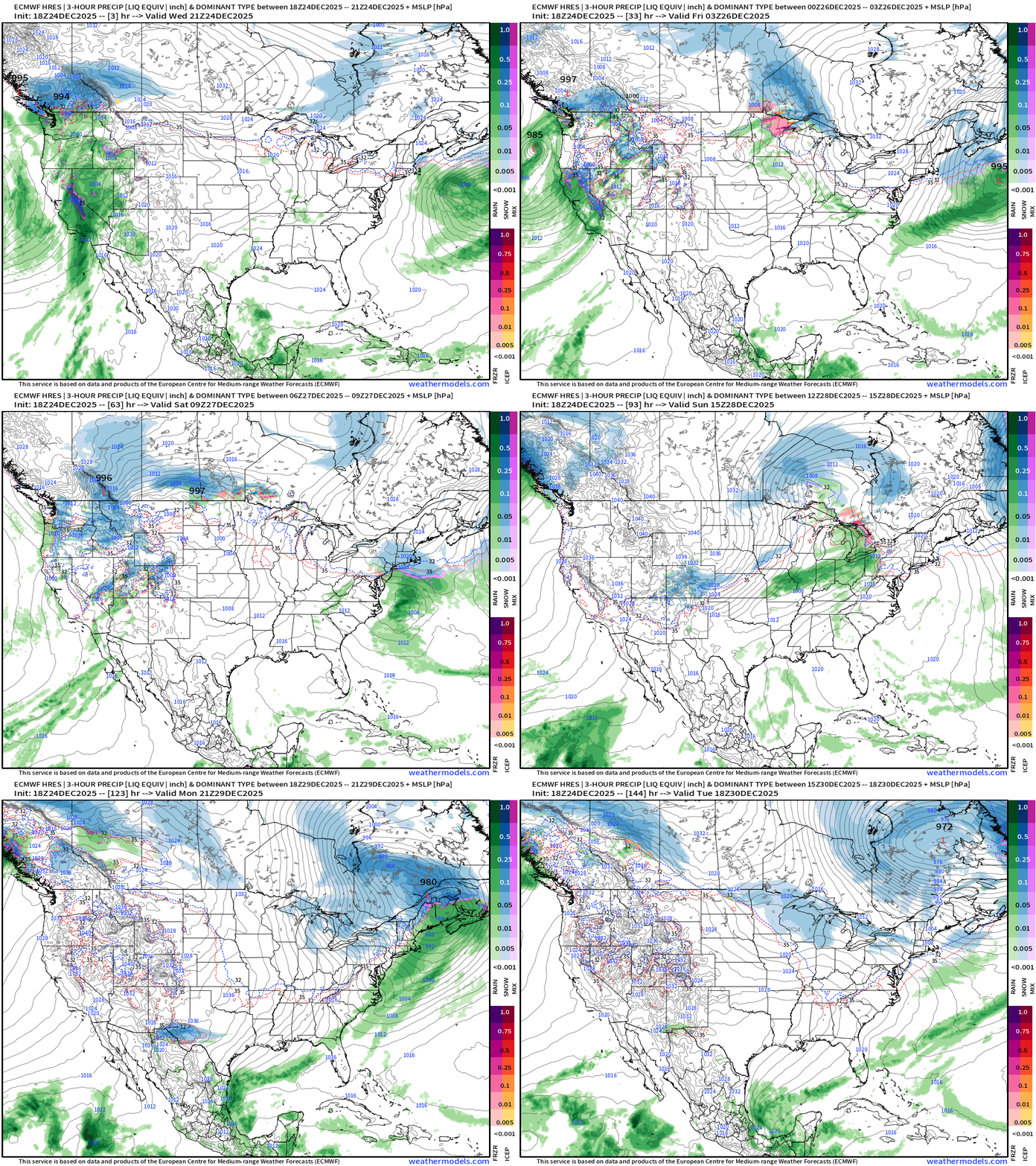
Larger continental view —> main storm track remains across Southern Canada — more so like Clipper systems but they have moisture from the Pacific atmospheric rivers for some precipitation (snow) across the Great Lakes (+Lake Effect) and the Northeast this weekend … but that might not be as substantial as previous thought.
West Coast cyclone — down to about 977 mb within the upper-level low
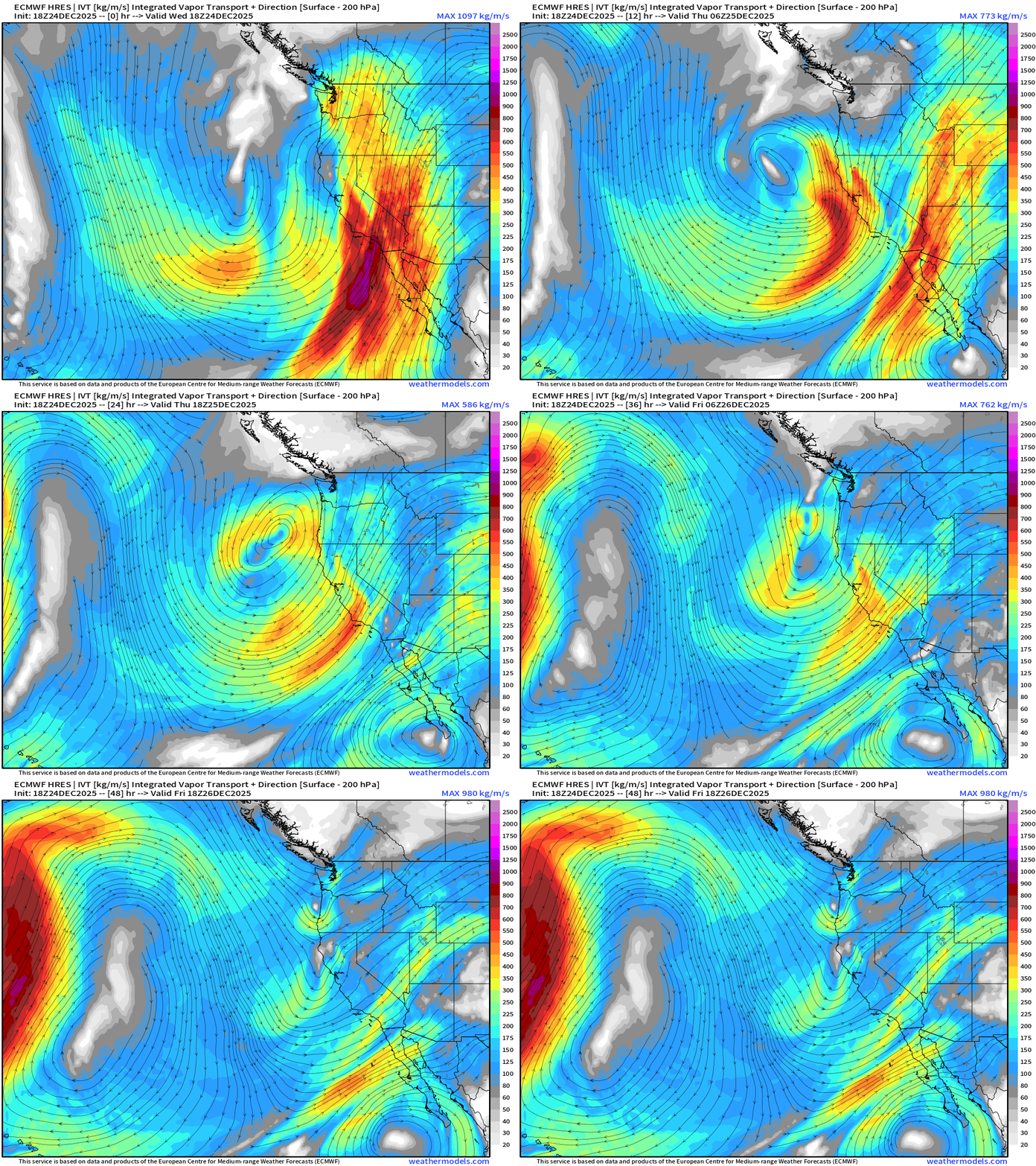
The onshore moisture flow continues until late Friday before the taps are finally turned off. Integrated Vapor Transport next 48-hours
Eastern U.S. Storm Systems
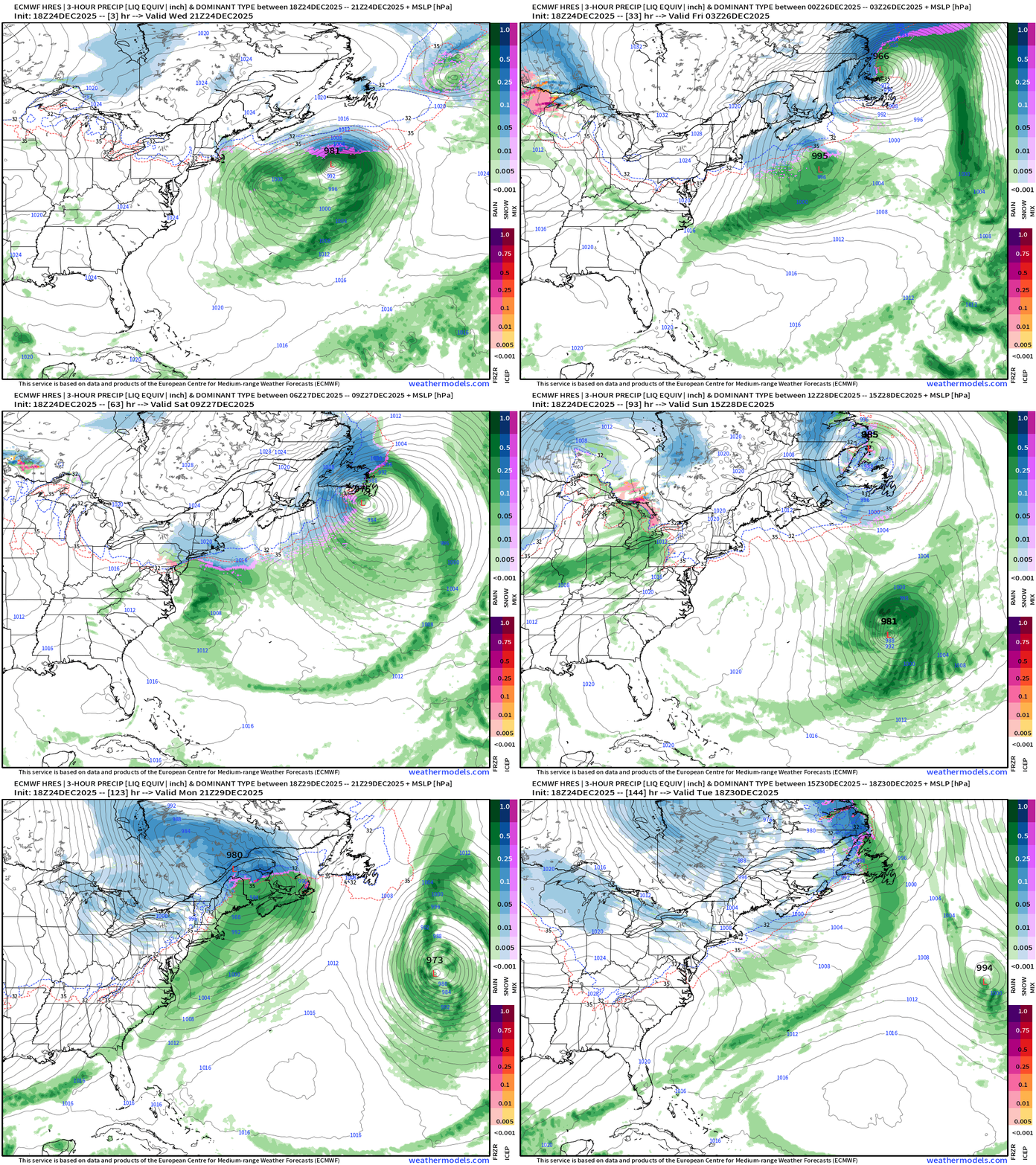
I’d all the storm system a “Clipper” late Friday into Saturday
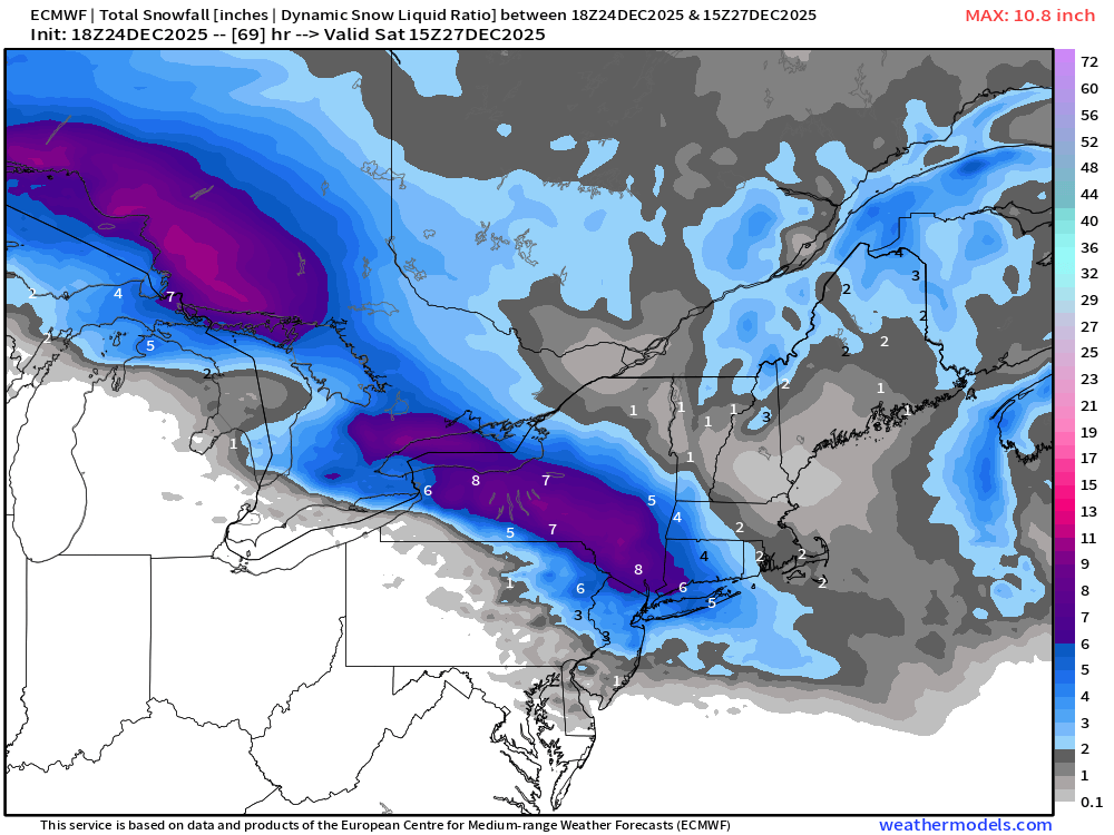
Accumulated Snowfall by P-Type + Estimated Snowfall from SLR
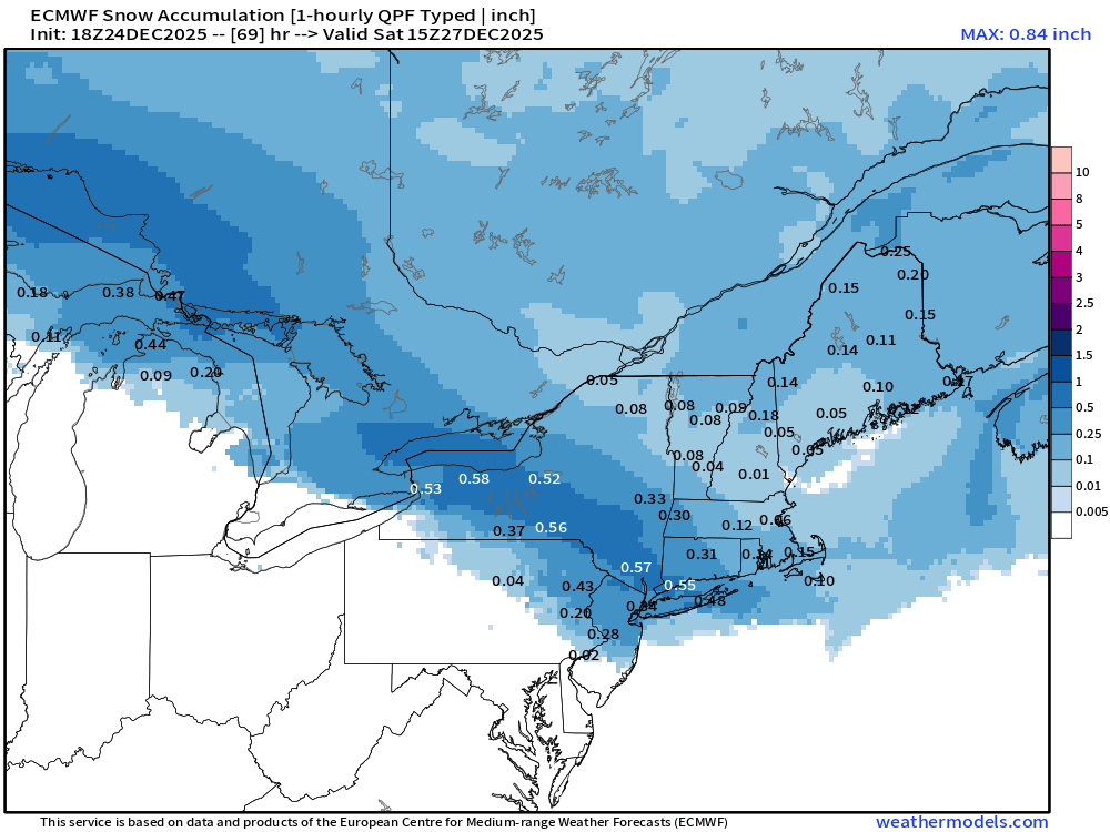
I would be shocked to see > 0.5” of QPF as snowfall in NYC, but that’s the opening bid from ECMWF 18z
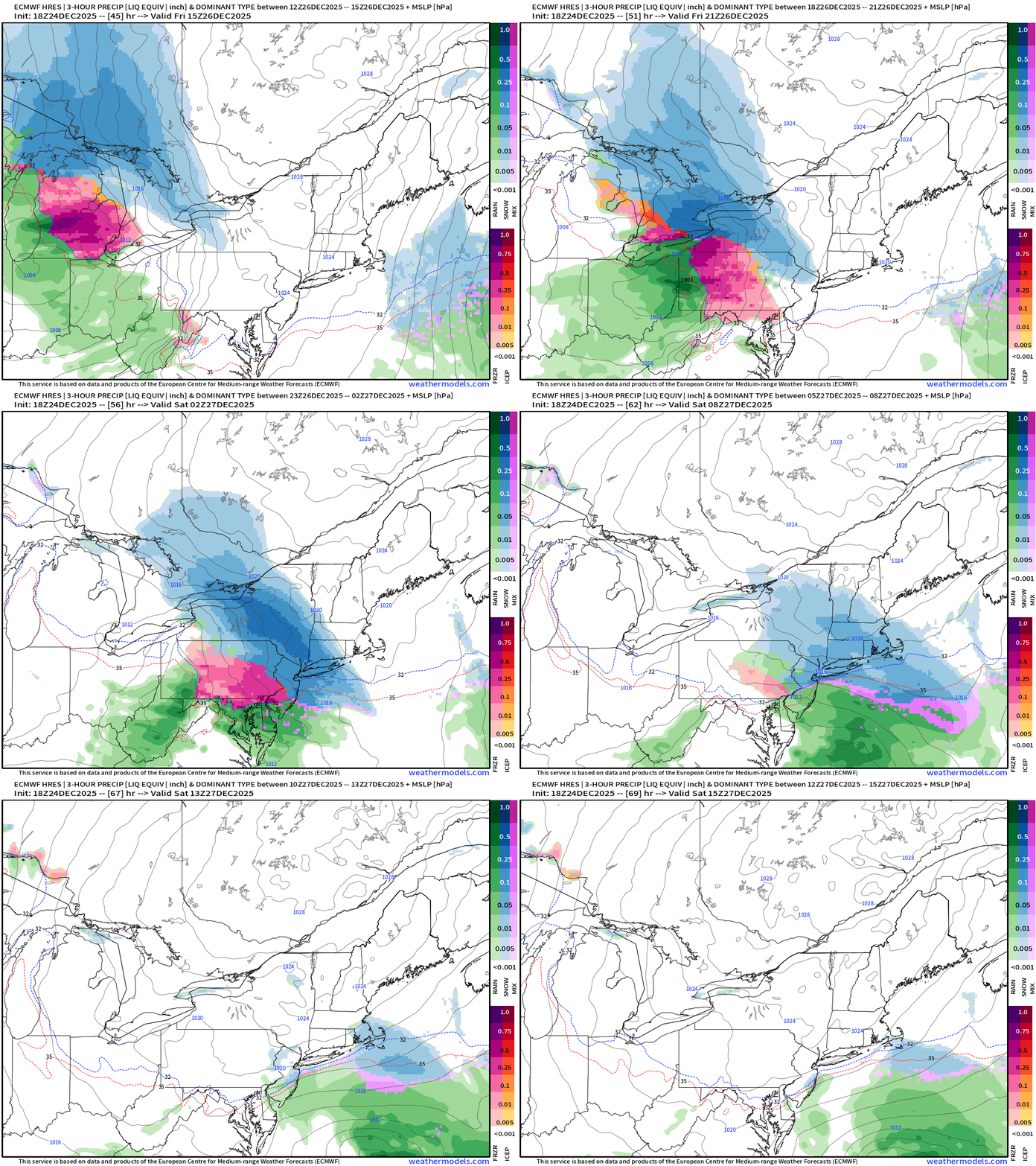
Accumulated Freezing Rain by P-Type
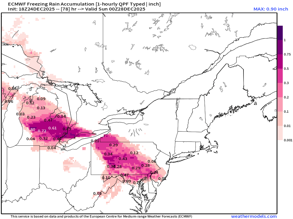
Significant freezing rain possible in Southeast Michigan > 0.5” in Detroit and through Pennsylvania
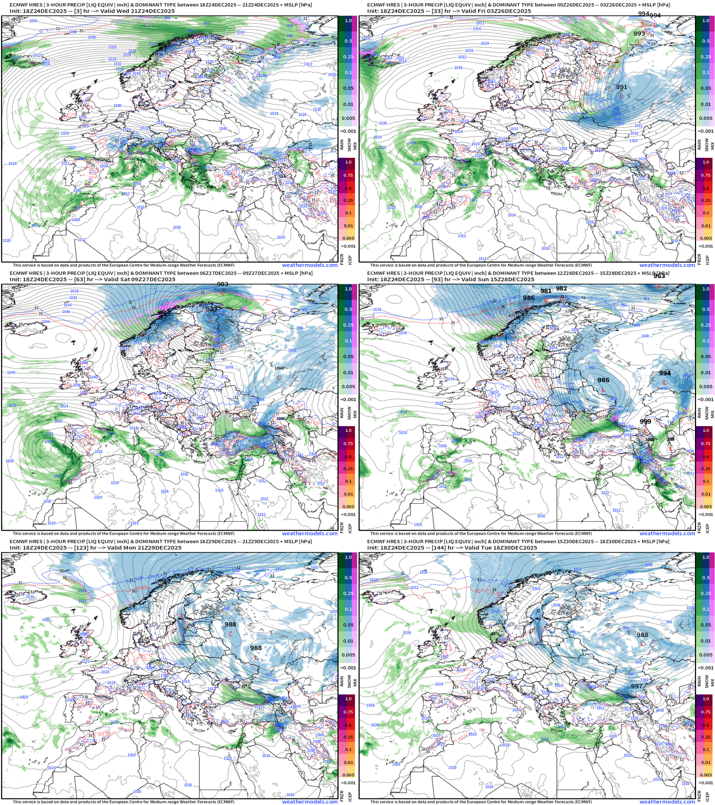
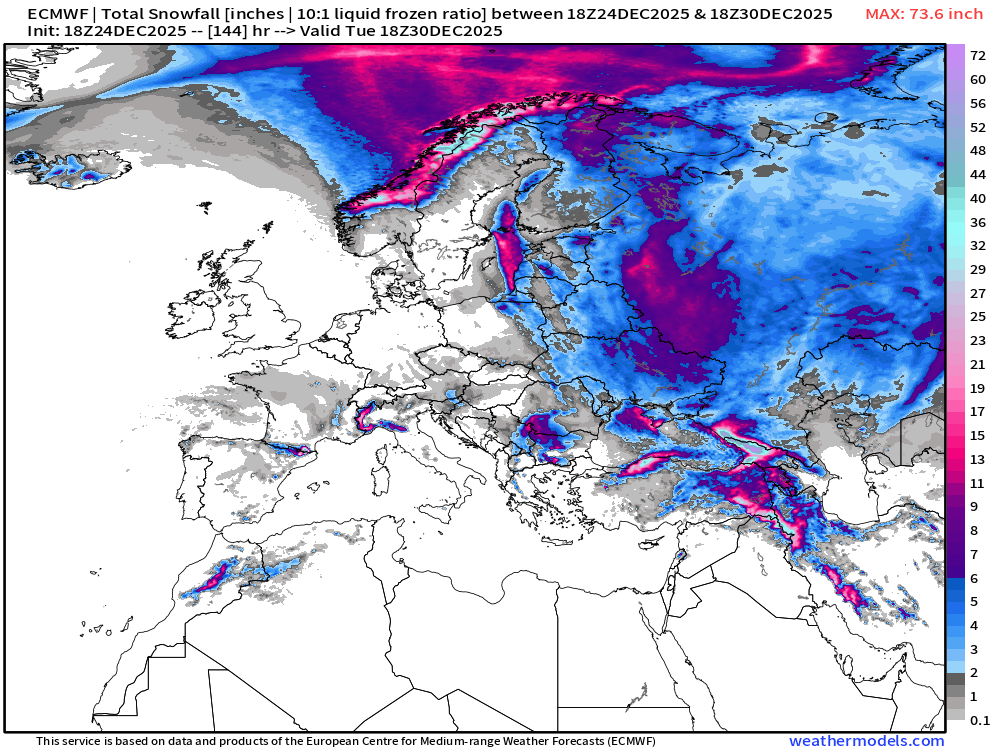
European Winter about to get underway with colder air from the east slowly but surely making its way through France and Spain
Weather Trader is an entirely subscriber-supported publication [sweat equity] from Dr. Ryan Maue. To receive all new posts, consider becoming a free [1-2 updates per week] or paid subscriber [golden ticket] and please LIKE and SHARE posts.
Next 48-hours of Wind Gusts from HRRR
Precipitation Animation Next 48-hours
NWS Precipitation Next 72-hours
NWS Snowfall Next 72-hours
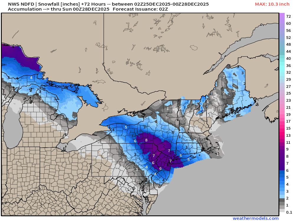
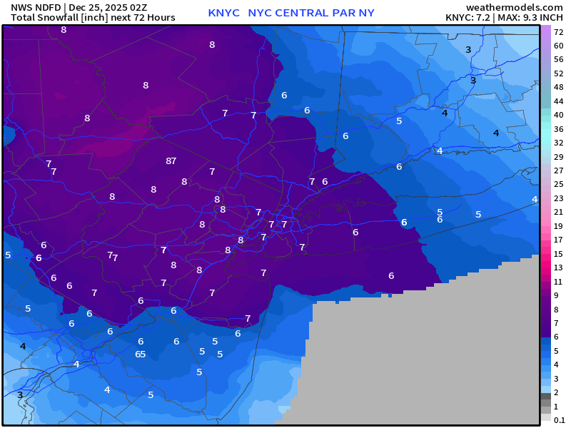
7-inches in NYC | How about that?
RTMA | Current Temperature Analysis | 9:00 PM ET
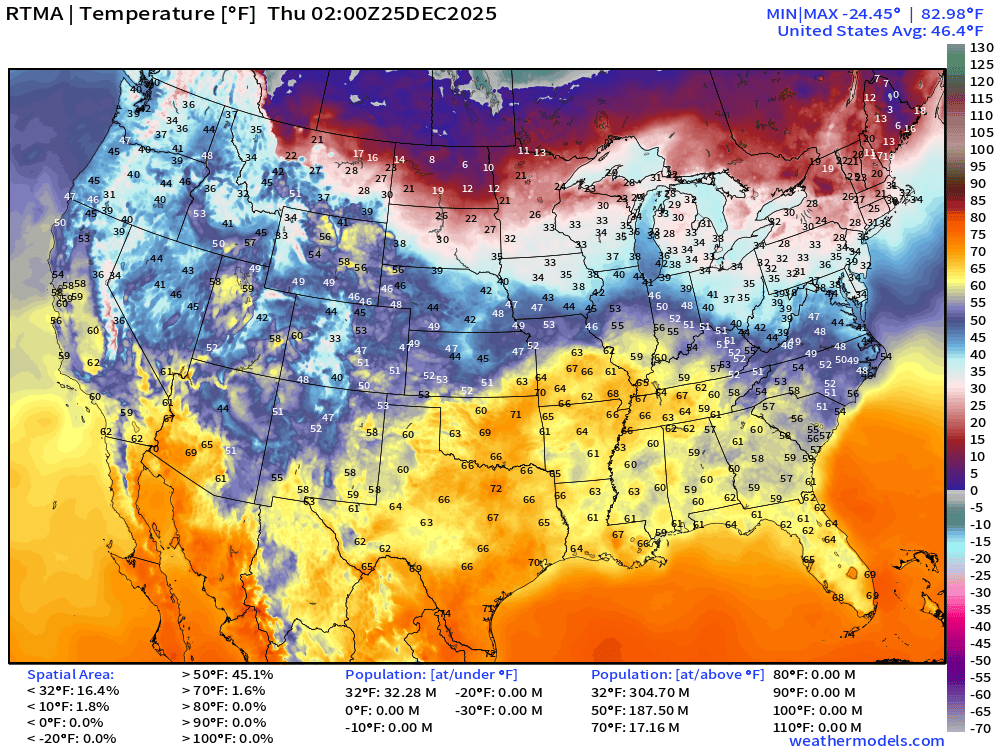
Average Lower 48 temperature was 46.4°F with 32 million below freezing.
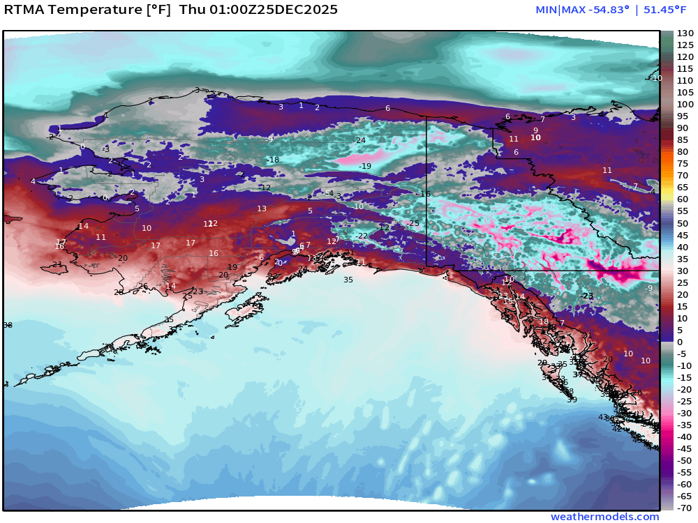
Temperatures have warmed up significantly in Alaska and Yukon — at least up to the -20s but that’s an improvement over -65°F on Wednesday (coldest in 50-years in December in Canada)
Temperature Anomaly | 9:00 PM ET
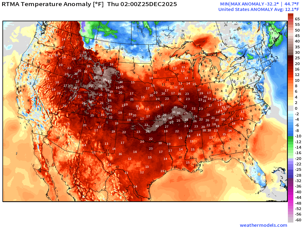
Lower 48 Temperature Anomaly was scorching (!) 121°F ABOVE normal
Christmas Low Temperatures
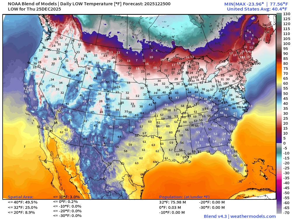
Warmest Christmas morning at least in the past 75-years across the Lower 48
However, still well below freezing in the Midwest, Great Lakes, and Northeast with 76 million population <= 32°F
Christmas Day High Temperatures
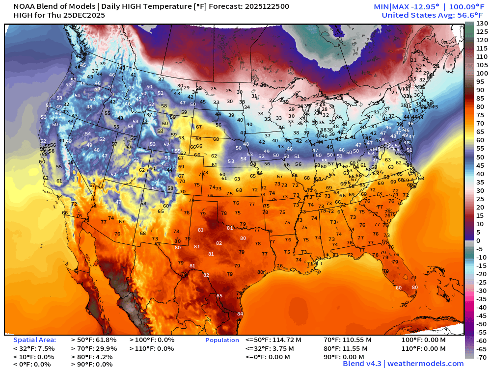
110 million at least 70°F —> nationwide average of 56.6°F. Enjoy!
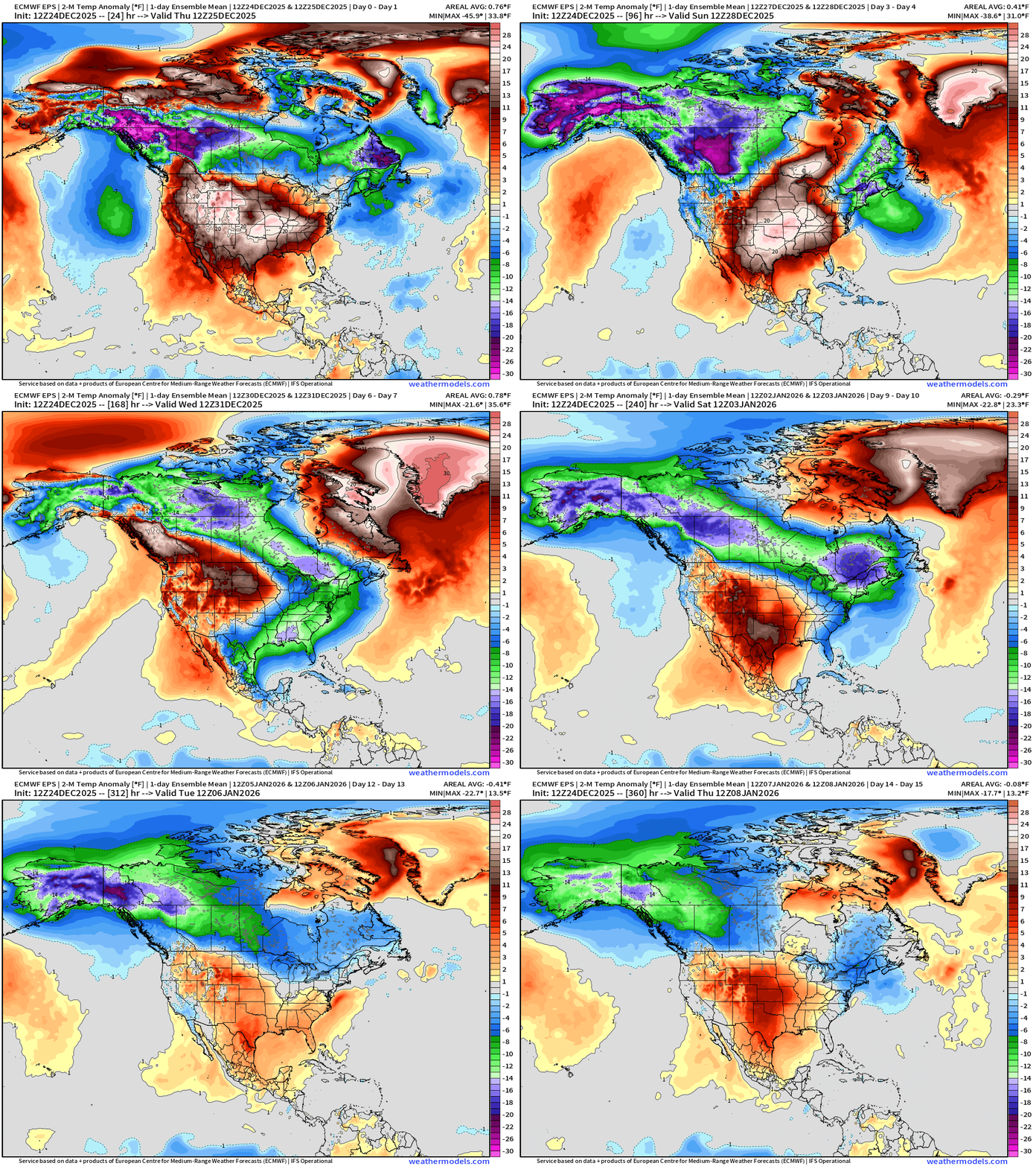
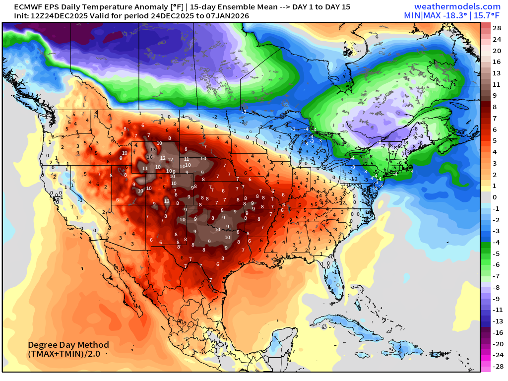
ECMWF 12z EPS | Temperature Anomaly | Next 15-days
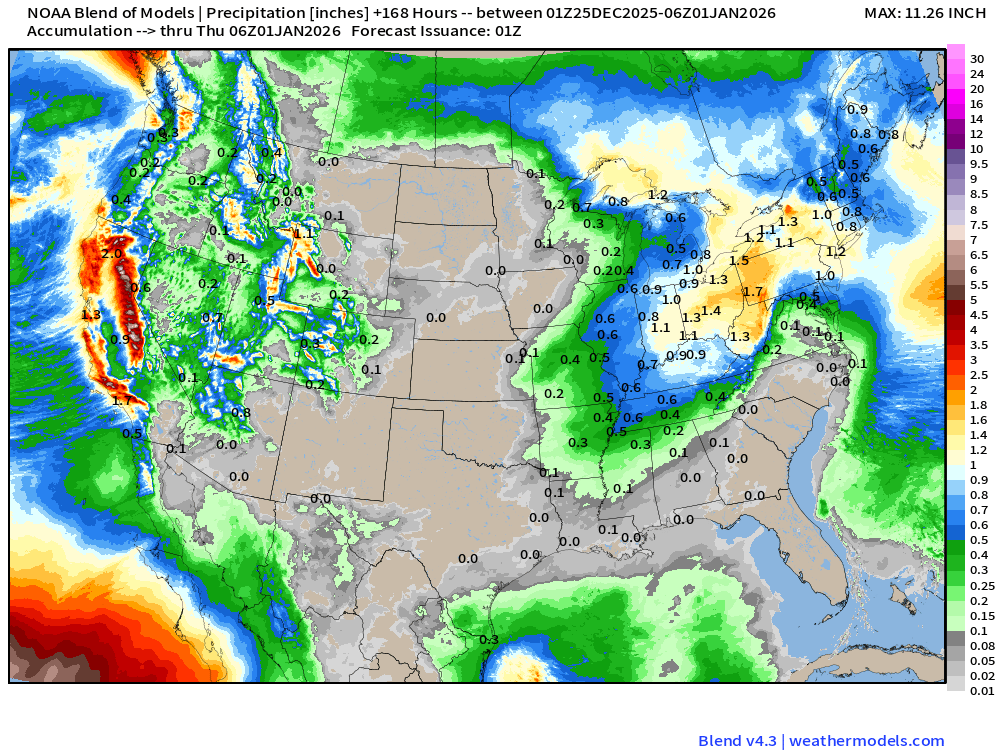
Blend of Models | 7 Days Precipitation Total
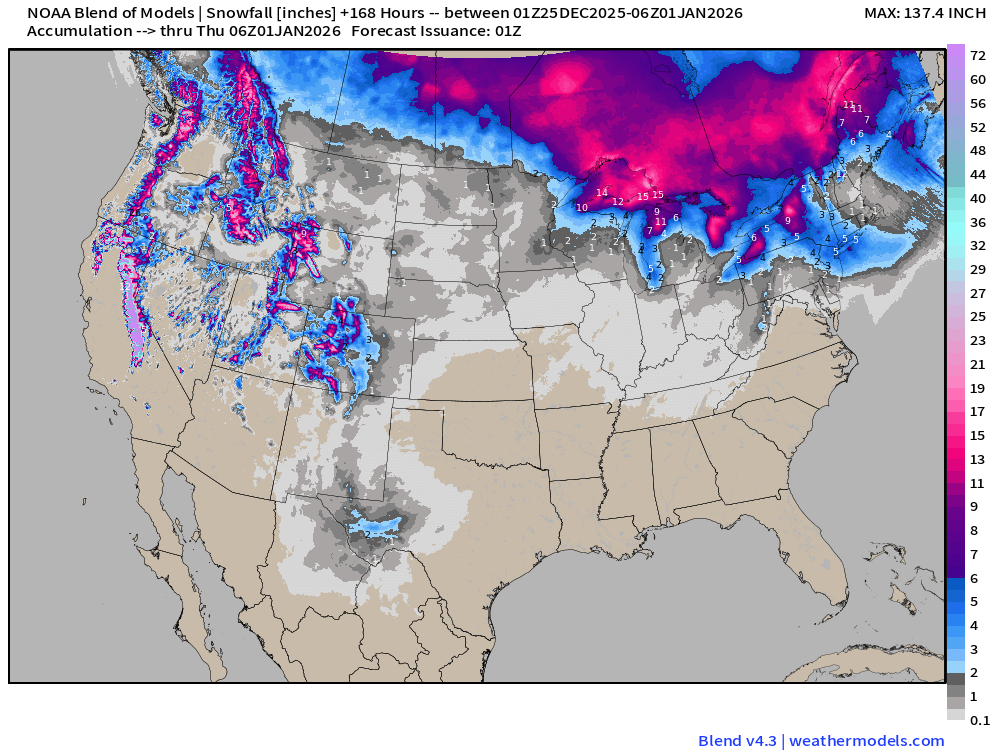
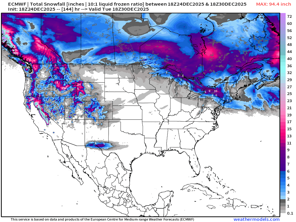
Blend of Models | Total Snowfall Next 7-Days
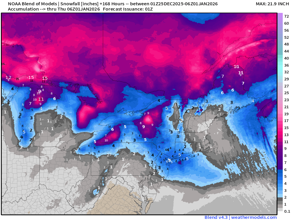
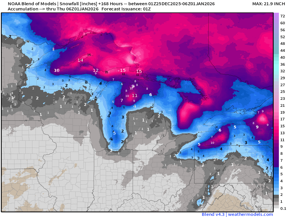
ECMWF AIFS-Single 18z | Height Anomaly (500 hPa) Next 10-days
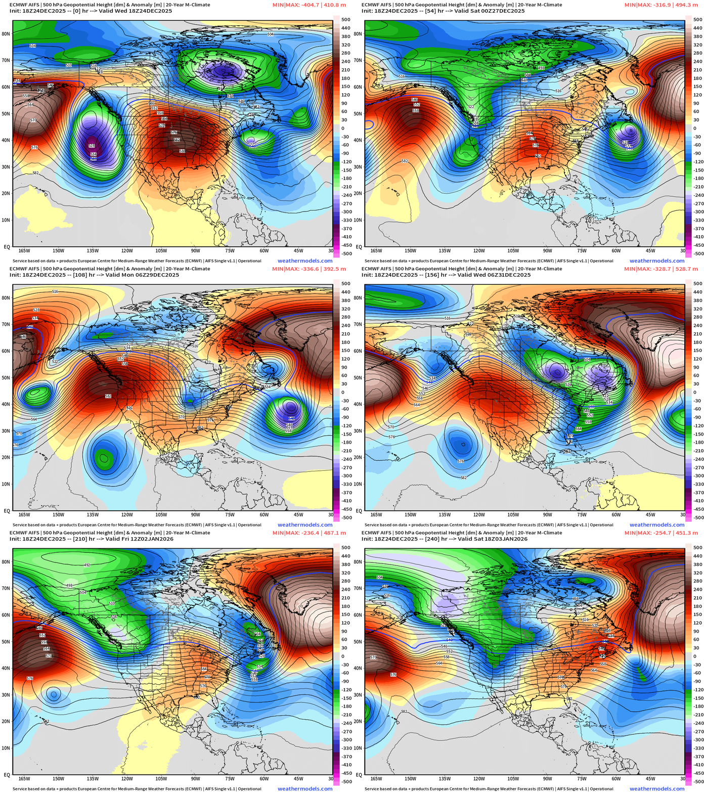
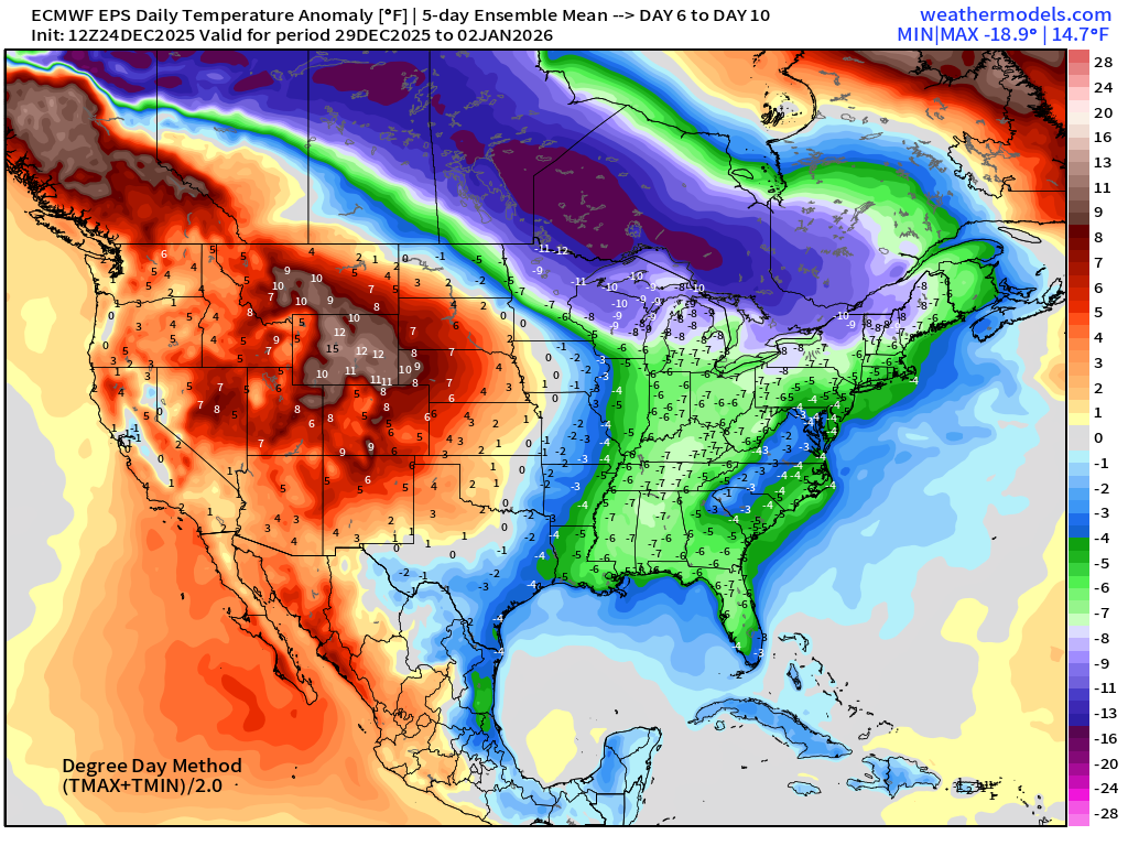
Sharp and intense troughs combine out of the Great Lakes and Hudson Bay into the Northeast by late next week —> much colder
ECMWF 12z | Snowfall | Next 6-days
ECMWF EPS 12z | Ensemble Median Snowfall Next 15-days
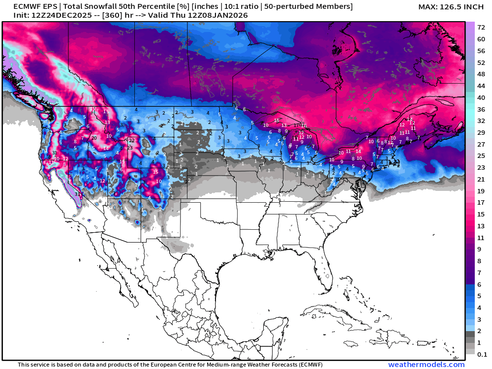
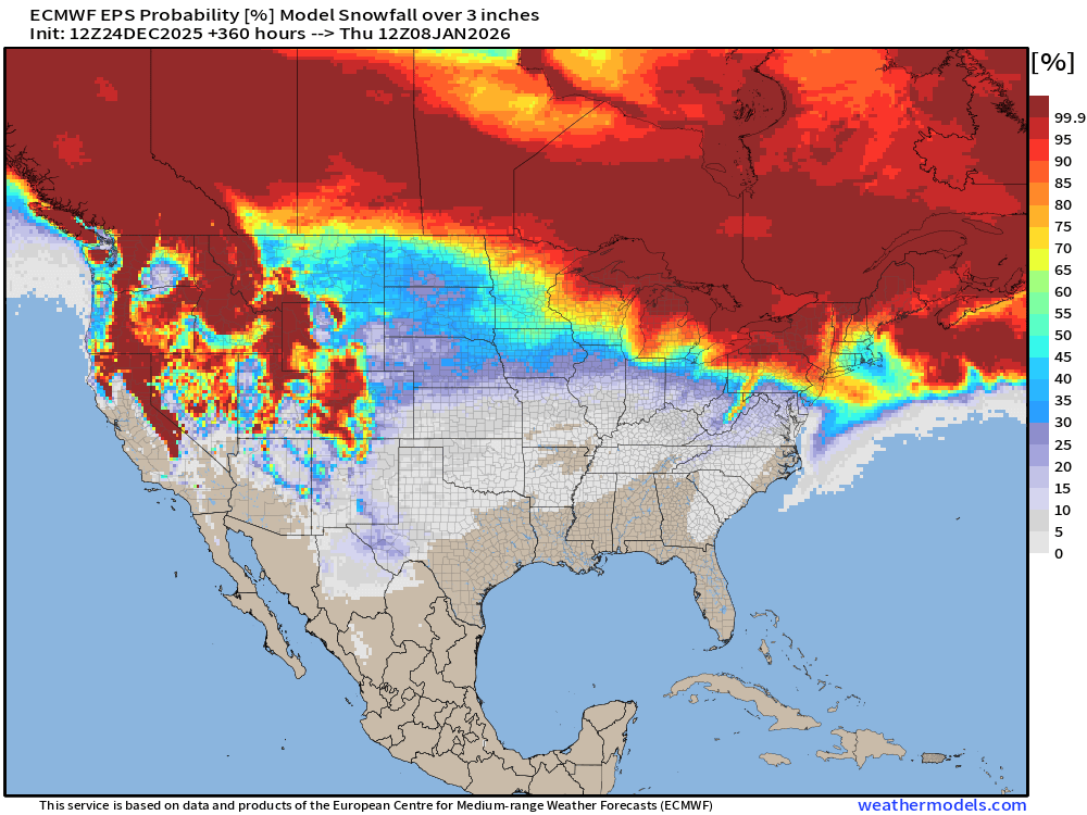
Probability of 3-inches or more Snowfall in the next 15-days
Temperature Anomaly | Next 15-days | ECMWF EPS 12z
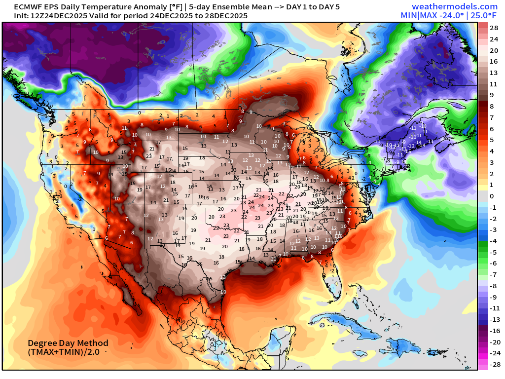
5-Day Chunk #1 | Temperature Anomaly | Dec 24 - Dec 28
5-Day Chunk #2 | Temperature Anomaly | Dec 29 - Jan 2
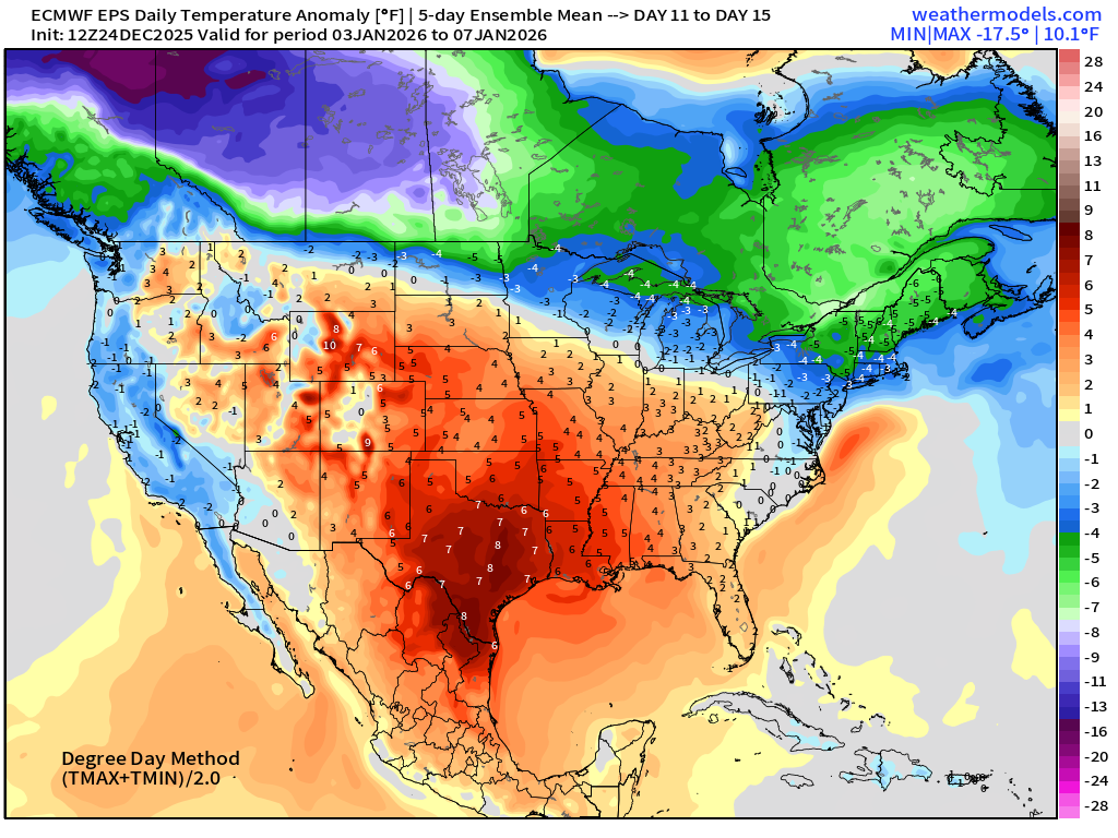
5-Day Chunk #3 | Temperature Anomaly | Jan 3 - Jan 7
Maps sourced from weathermodels.com designed and innovated by yours truly! Please subscribe there for real-time access to the newest maps, charts from all of the weather models including ECMWF and AIFS, NOAA AI-GFS/AI-GEFS
Active coupon codes:
None. Please send a message or reply to this email for inquiries.
- Milepost
- 825 · laid 2025-12-25T03:01:21.224000Z
- Source
- https://weather.substack.com/p/december-24-2025-christmas-eve
- Digest
- 78cb30efa987ae20efeb285c34e68455bce9e1e72270a2c47f6553b30a220c15
- Machine
- JSON