December 12, 2025 Friday Morning Winter Weather
Extreme cold from Midwest blasts into the Southeast by Monday
December 2025 was the 5th-warmest December in the 131-year national record (1895–2025), at 37.8°F against a 1991–2020 normal of 34.3°F (+3.5°F).
December 2025 was the 37th-driest December in the 131-year national record (1895–2025), at 2.0in against a 1991–2020 normal of 2.5in (-0.5in).
NOAA/NCEI Climate at a Glance, contiguous United States. This is the observed record for the month, not a score of anything said in this piece — the forecast ledger begins 2026-08-17 and cannot reach earlier posts.

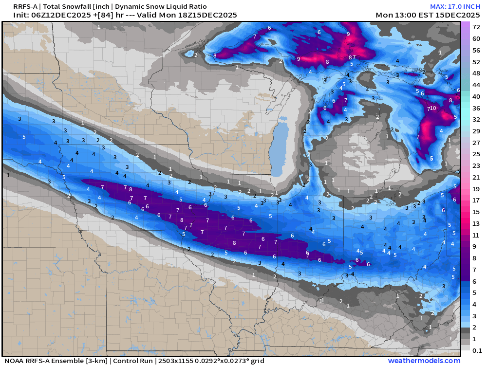
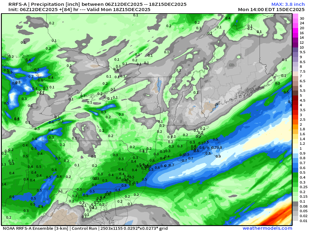
RRFS-A Highest Resolution Snowfall Next 3-days — Monday 1 PM
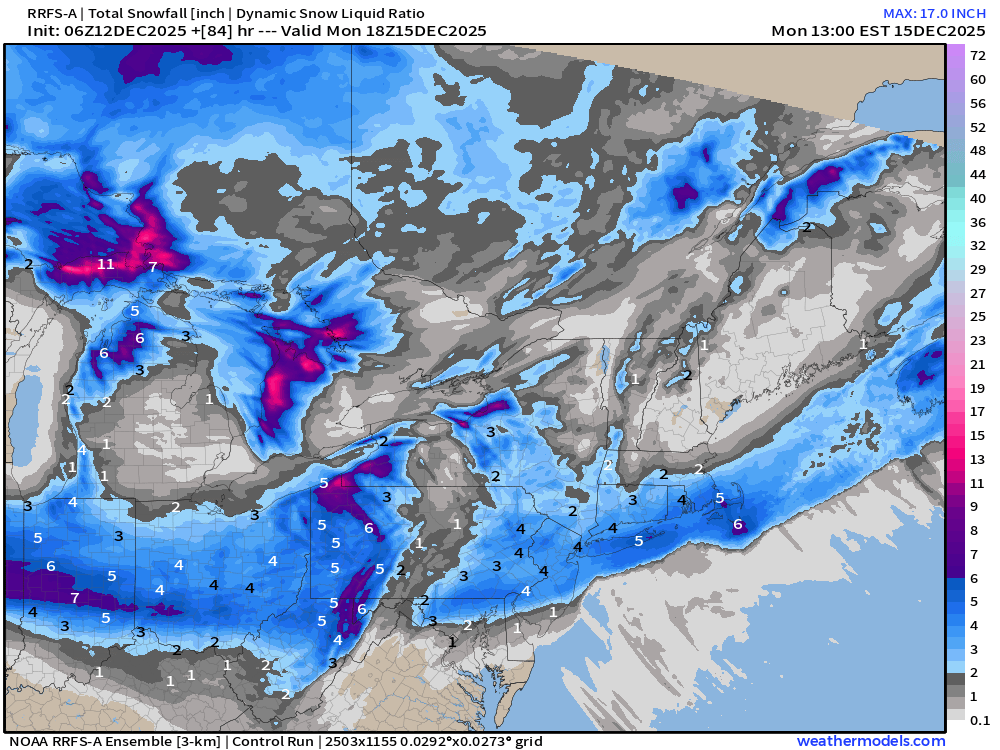
NYC: 4”
Alberta Clippers + Nor’easter backside snow band = huge population seeing at least 3-inches of snowfall … and up to 8” across a stripe of the Midwest from Des Moines to Indianapolis
HRRR 12z | Next 48-Hours through Sunday7 AM ET
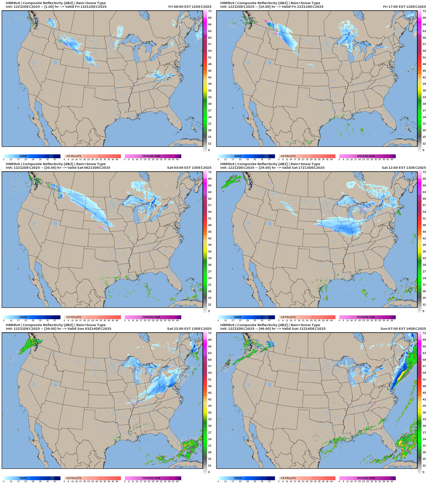
Snowfall with Alberta Clipper rotates around the Great Lakes … to arrive in the Northeast and intensify as the Low pressure center hits the ocean for a wintry Sunday morning across NYC and New England including the Big Cities.
RRFS-A 06z Radar Simulation | Sunday 4 AM ET
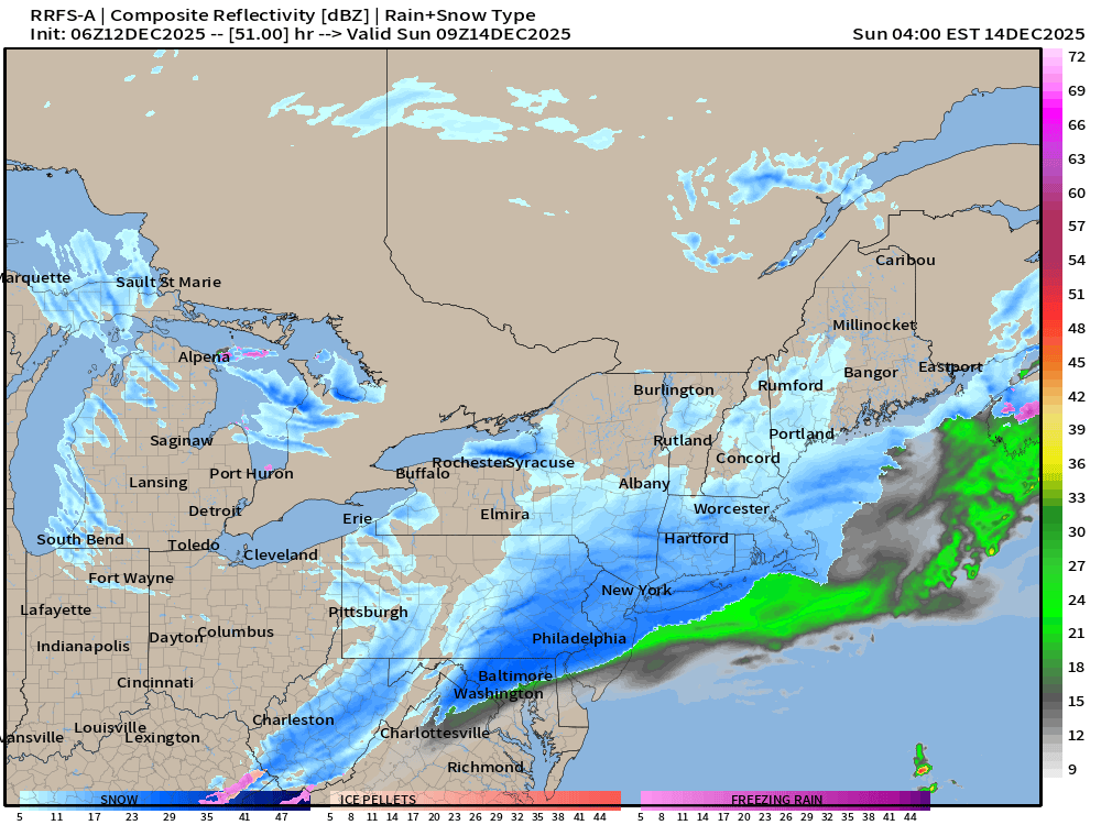
Snowfall could be heavy in a burst of 3-6 hours and add up 3” to 6” — maybe more.
Precipitation Type | Weather Next 6-days | ECMWF 06z
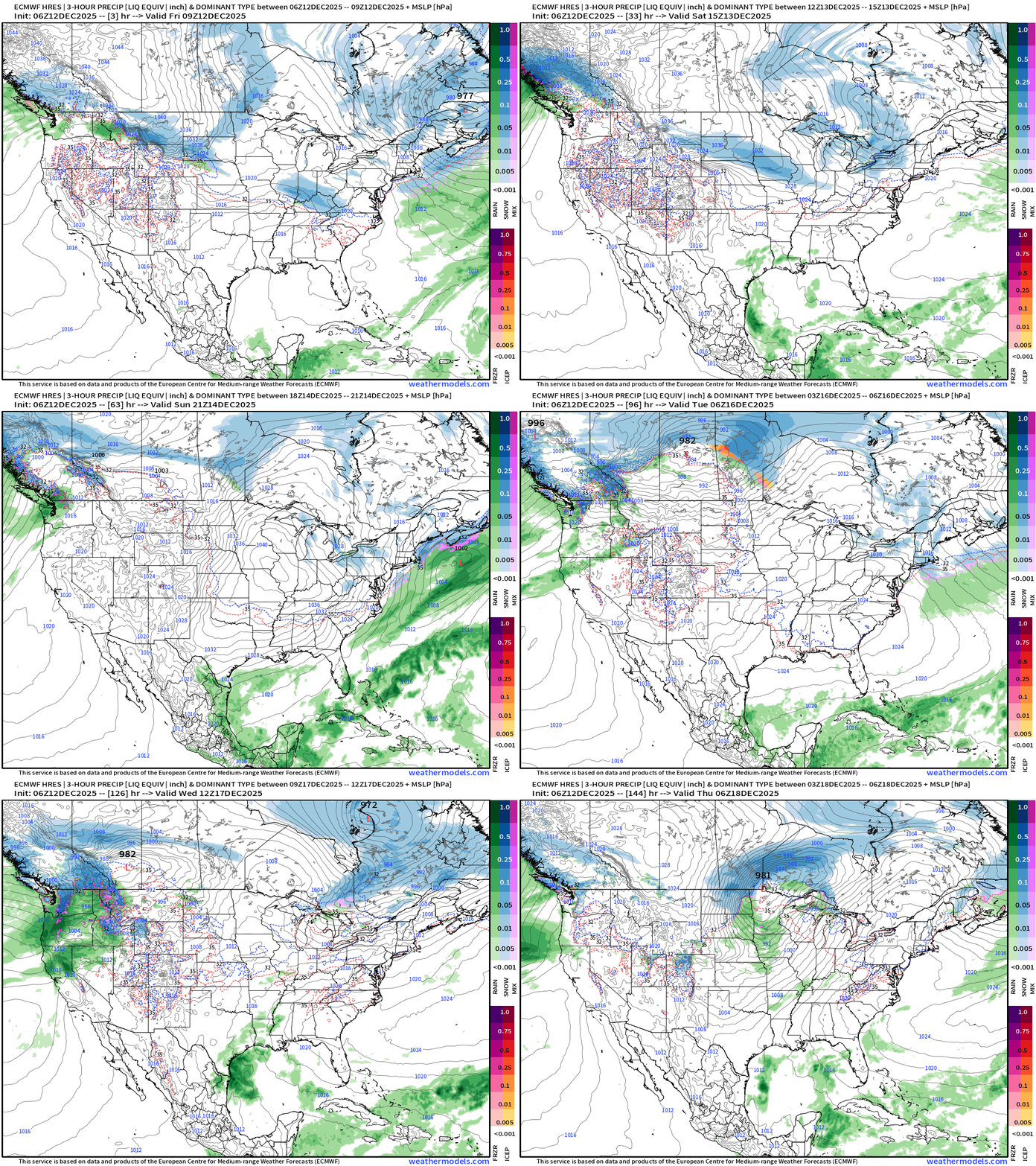
Headlines Friday Morning
Alberta Clipper system —> Northeast backside band of moderate to heavy snow into Sunday morning
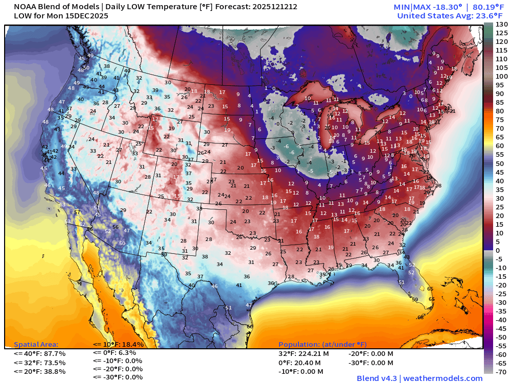
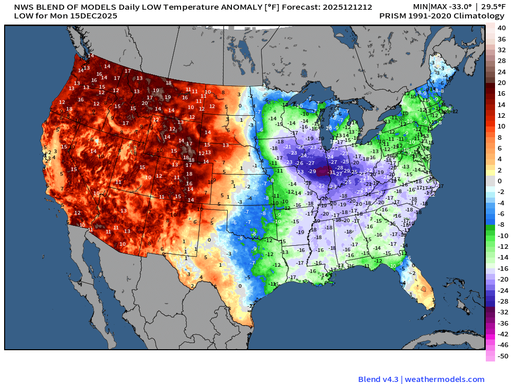
VERY COLD — this weekend across the Midwest/Great Lakes peaking this Sunday with the cold pool flooding into the Southeast for Monday morning.
Ridge builds across the Lower 48 from coast-to-coast into Day 10, but questions remain if Christmas is a “blow torch” or the polar vortex can battle back and drop a few [very cold] troughs/lobes into the Great Lakes and Northeast.
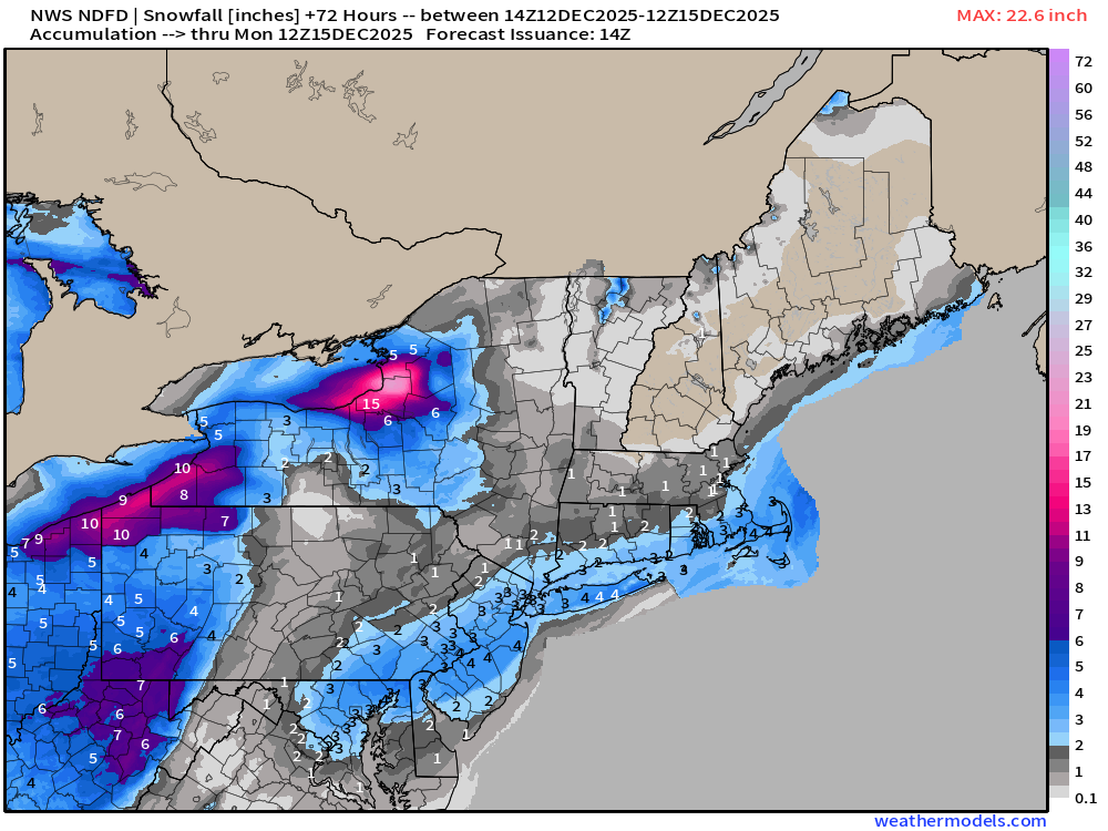
Weekend “baby” Nor’easter — All snow for land areas — woohoo, but how much QPF is available? 0.4” to 0.5” in NYC but less in Boston. So, 10:1 snow to liquid ratio = sweet spot of 4” to 6” of snowfall.
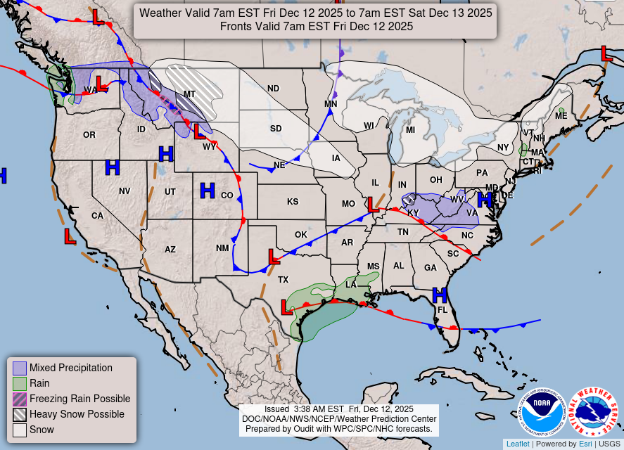
Current Frontal Boundaries and Weather into Saturday morning
Low Temperatures Next 8-days | Until Saturday, Dec 20th
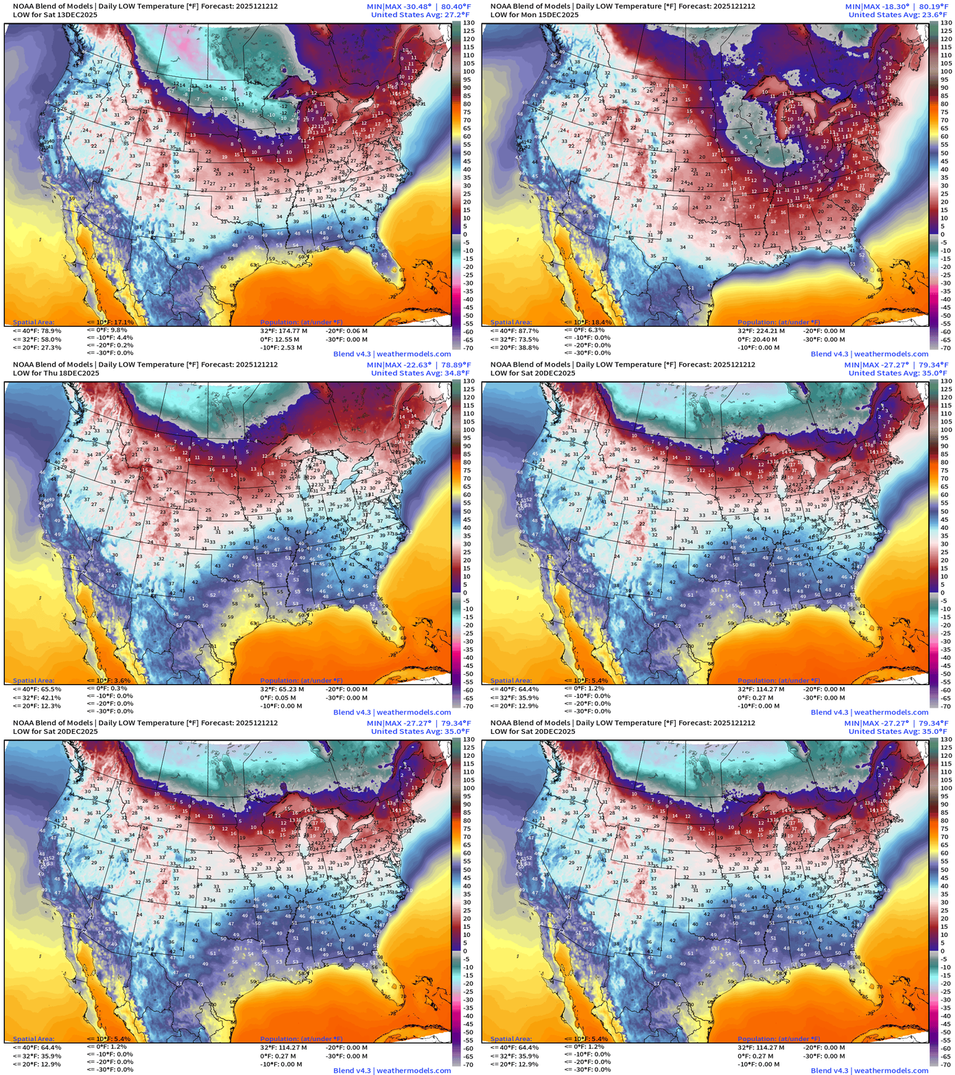
Warming trend after Monday — well deserved after an abnormally very cold start to December.
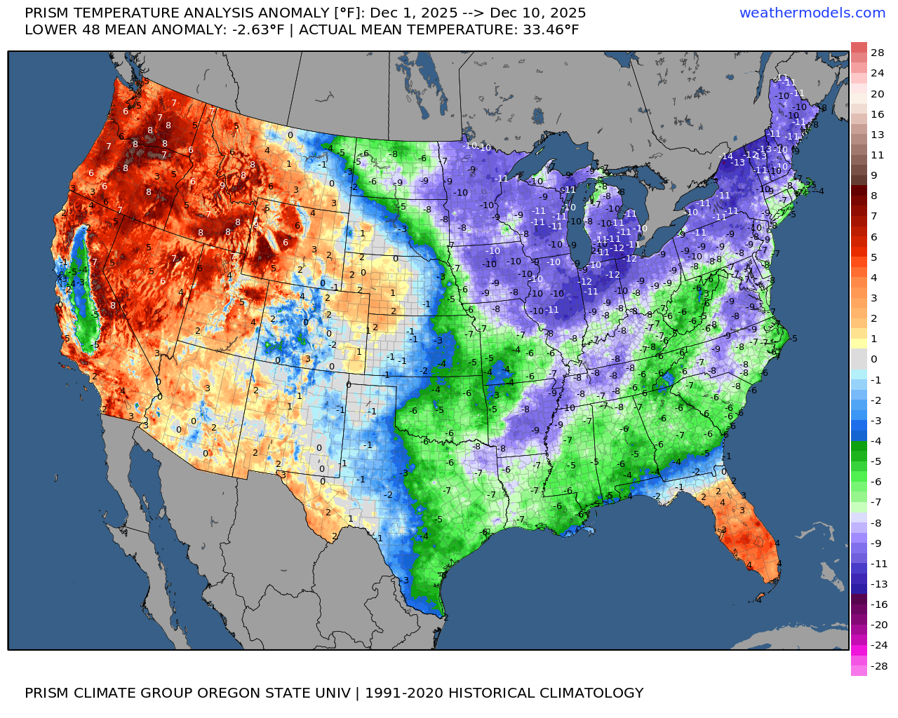
Average Temperature Anomaly | December 1-10, 2025
ECMWF 06z Precipitable Water Next 6-days | My favorite parameter
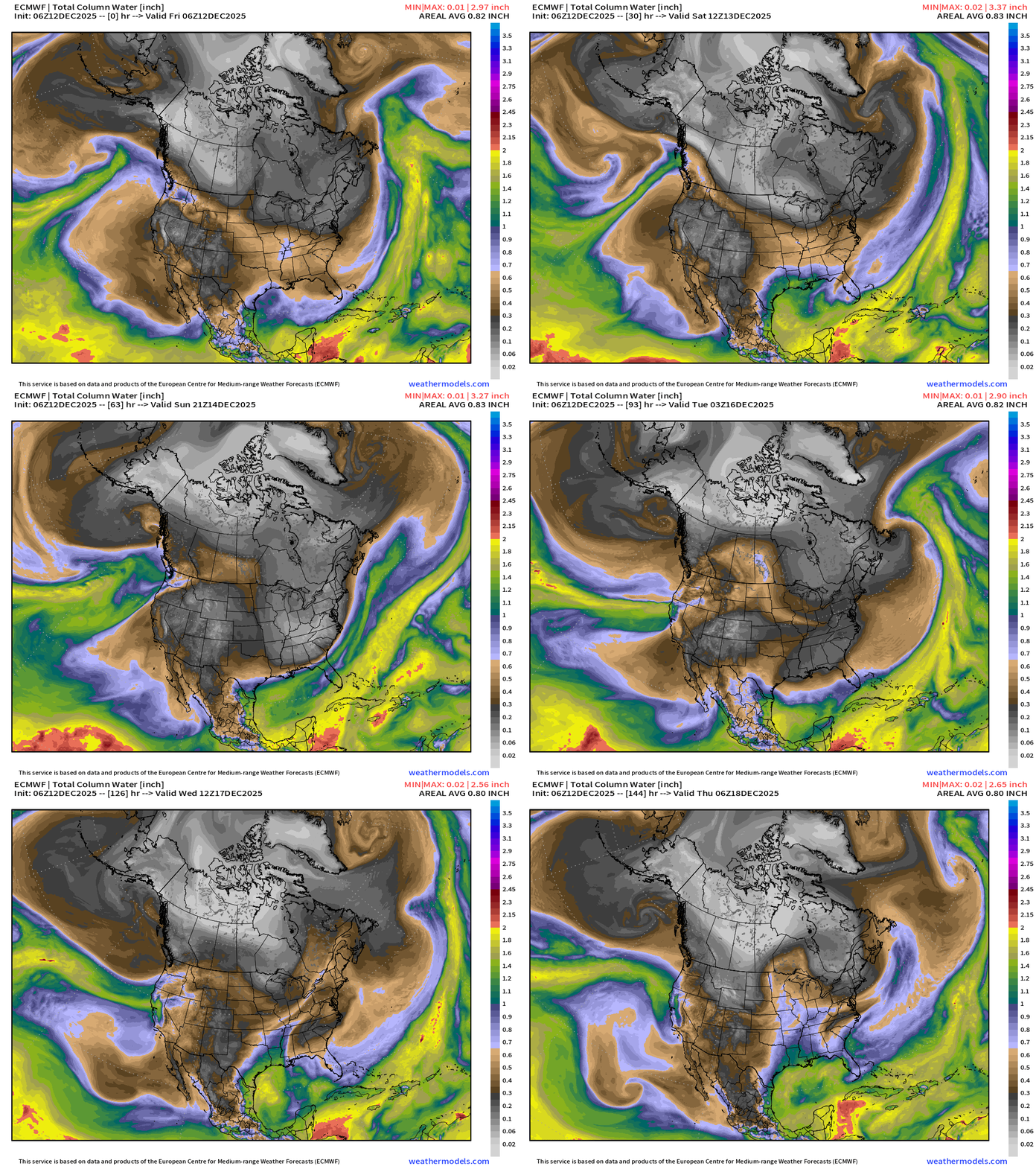
White colored precipitable water = absence of moisture = cold/polar air mass surges southeast out of Western Canada into the Midwest into this weekend and then into the Southeast early next week.
Next [major] atmospheric river for West Coast Mon/Tuesday
Powerful Nor’easter forms from Alberta Clipper Monday — and tracks into the North Atlantic — but won’t bomb out until it moves away from the coast, so we miss out on a blockbuster blizzard but will still see 3”-6” of snowfall.
Temperatures | Current to Next 15-days
Temperature Anomaly | Next 15-days
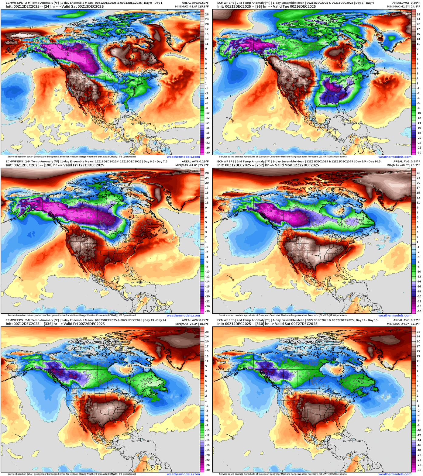
Flagship European model ensemble solution for temperature anomaly next 15-days
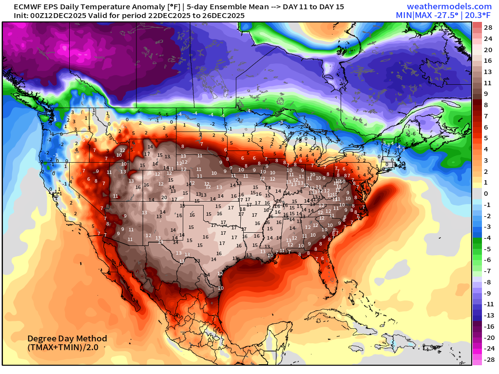
The Lower 48 settles into a “Blow Torch” much above normal temperature pattern into the weekend after Christmas December 27-28, but eventually this pattern MUST break down, and the Canadian cold pool will find its away back into Lower 48. However, no clear signals about when/how that will happen (yet).
Temperature Anomaly Next 6-days | Into Wednesday afternoon
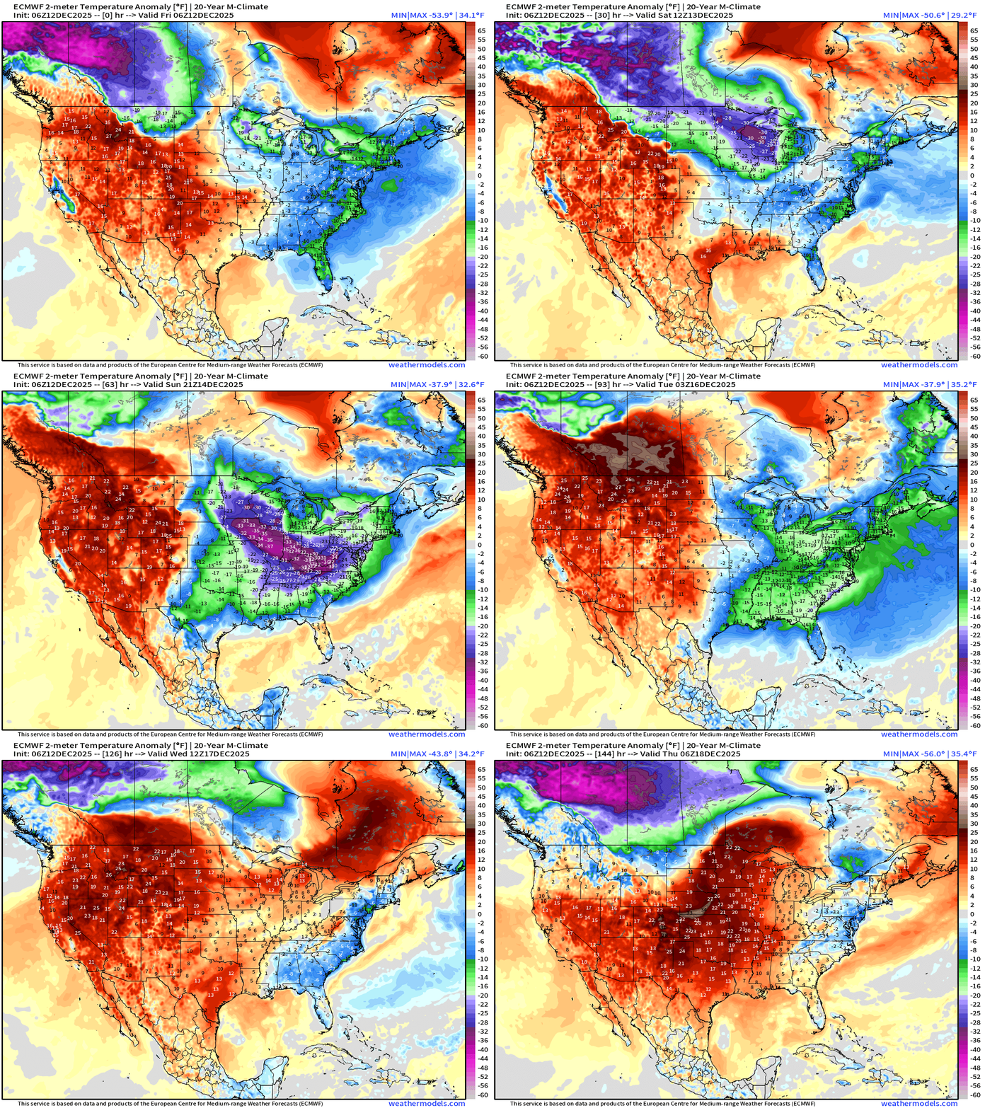
Exceptionally cold air spills into the Midwest and Great Lakes into this weekend, but warmer air from the Southwest and Gulf of Mexico battles back —> Light at the end of the tunnel into middle of next week.
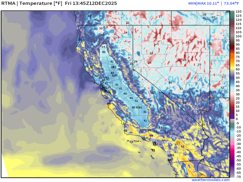
RTMA | Current Temperature Analysis | 8:45 AM ET
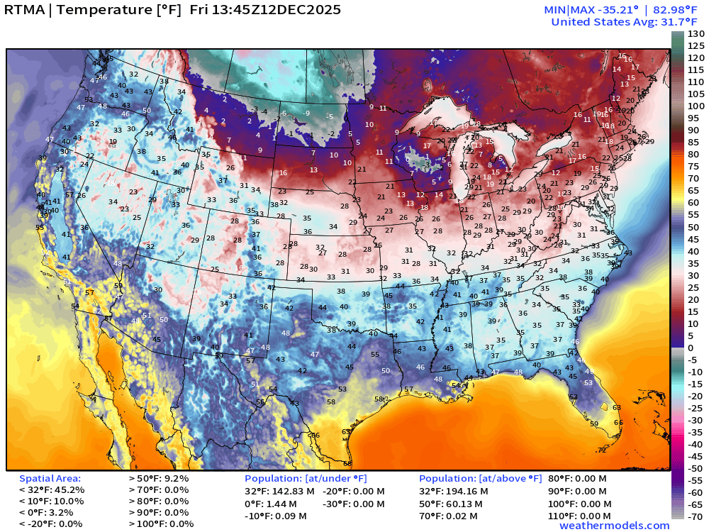
Average Lower 48 temperature was 31.7°F
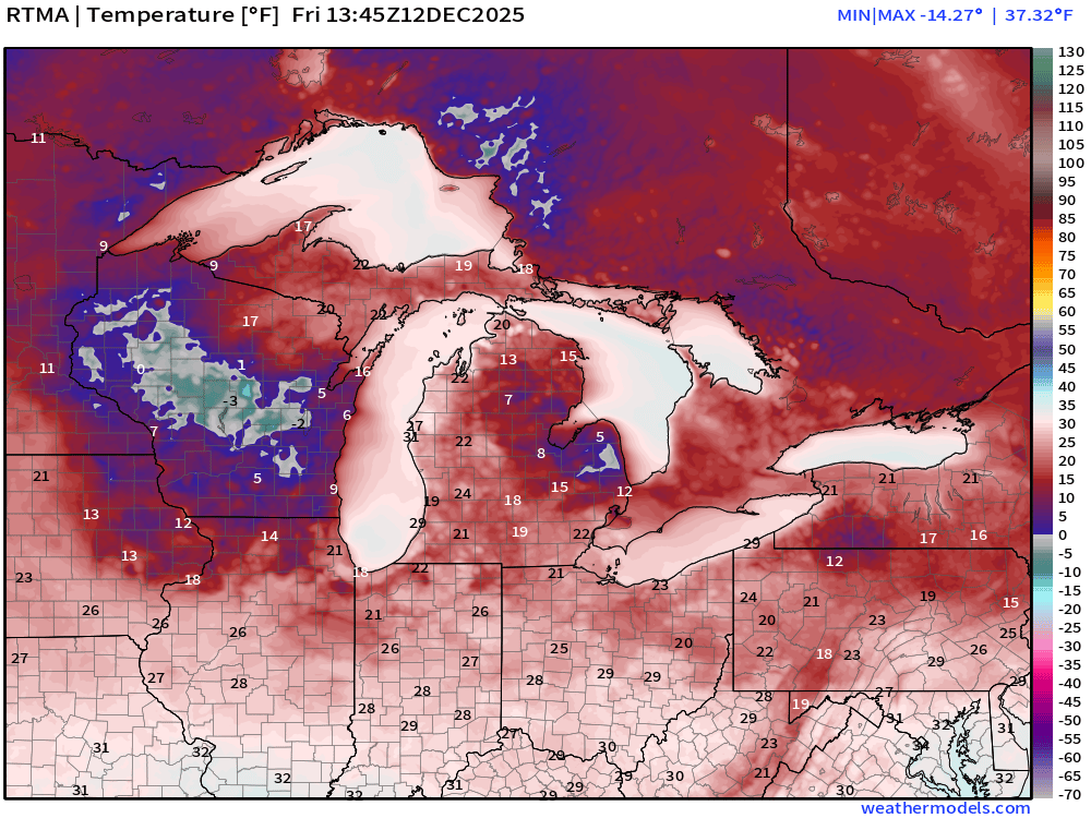
Still dealing with this brutal inversion layer + fog/mist in the California Central Valley — an ocean of fog with temperatures around 40°F
Temperature Anomaly | 8:45 AM ET
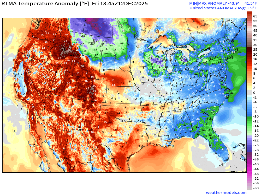
Lower 48 Temperature Anomaly was 19°F ABOVE normal
Friday High Temperatures
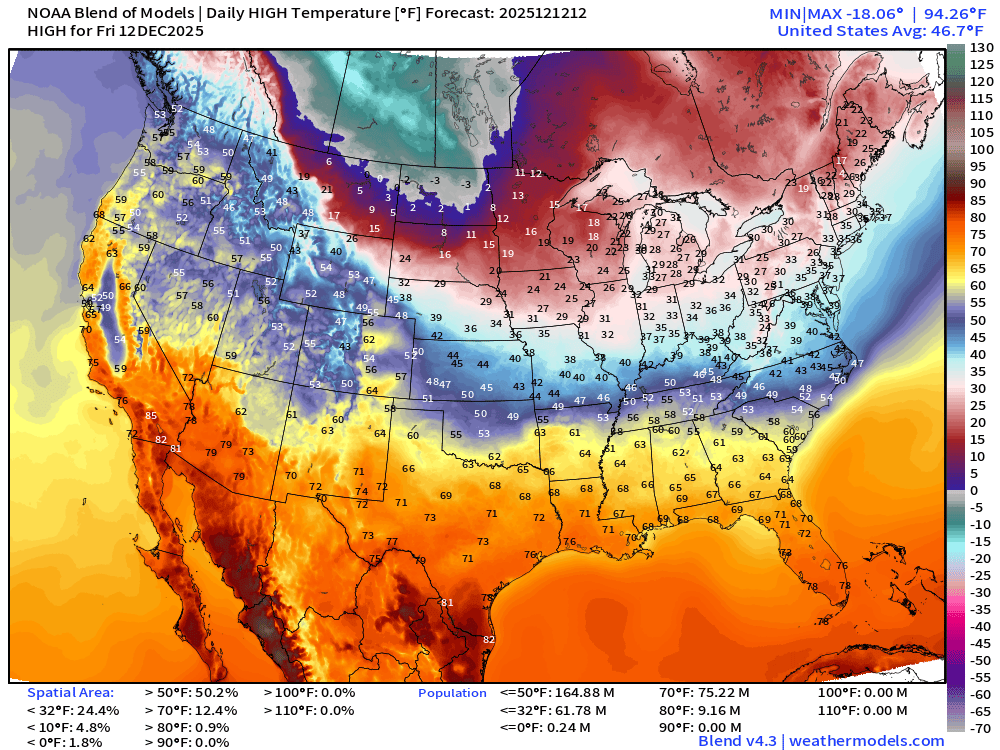
Saturday Low Temperatures
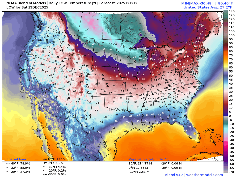
Sunday Low Temperatures | Arctic Blast Peak in Midwest + Great Lakes
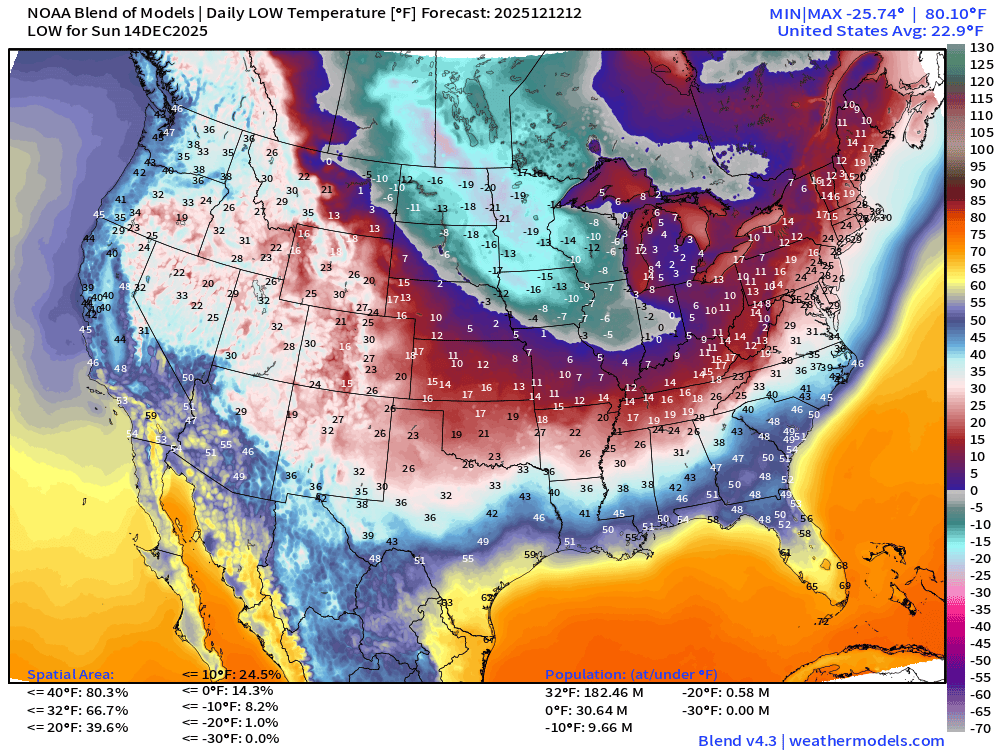
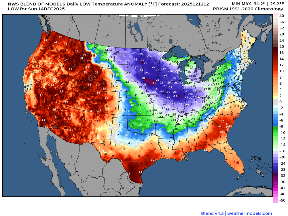
Frigid across the Midwest —> colder than -20°F over Iowa, Minnesota, and the Dakotas
Sunday Low Temperature Anomaly
Monday Low Temperatures | Arctic Blast Peak in Southeast
Monday Low Temperature Anomaly
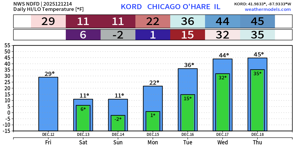
7-Day Forecast | Chicago
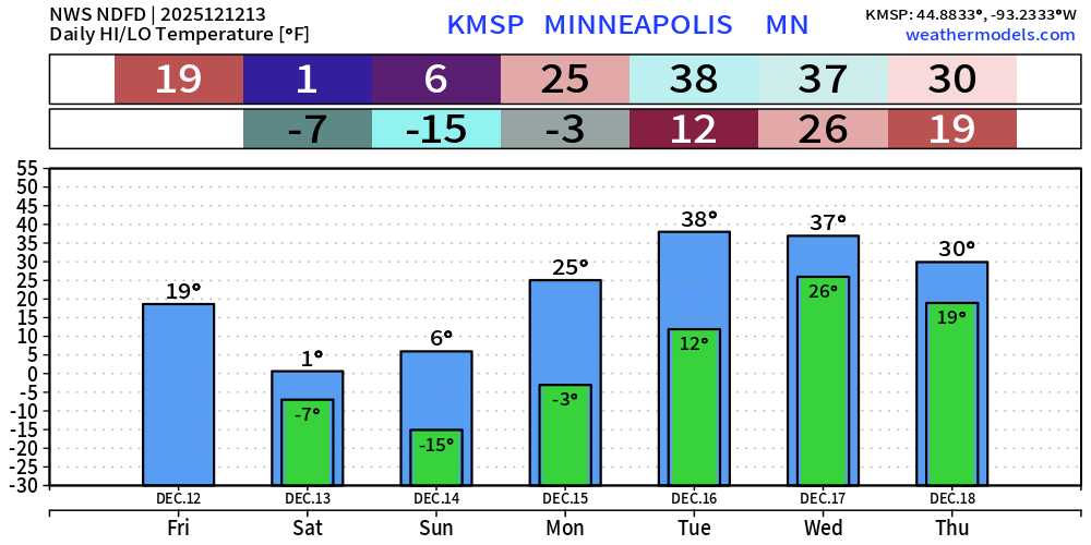
7-Day Forecast | Minneapolis
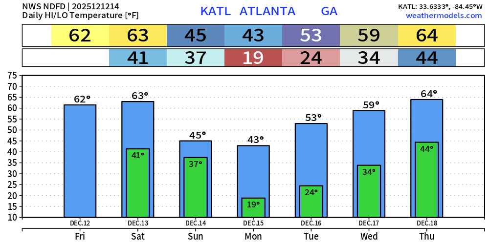
7-Day Forecast | Atlanta
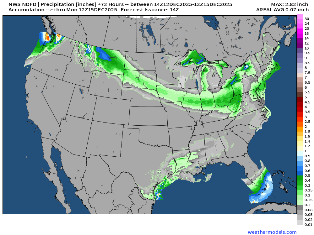
NWS Precipitation Next 72-hours
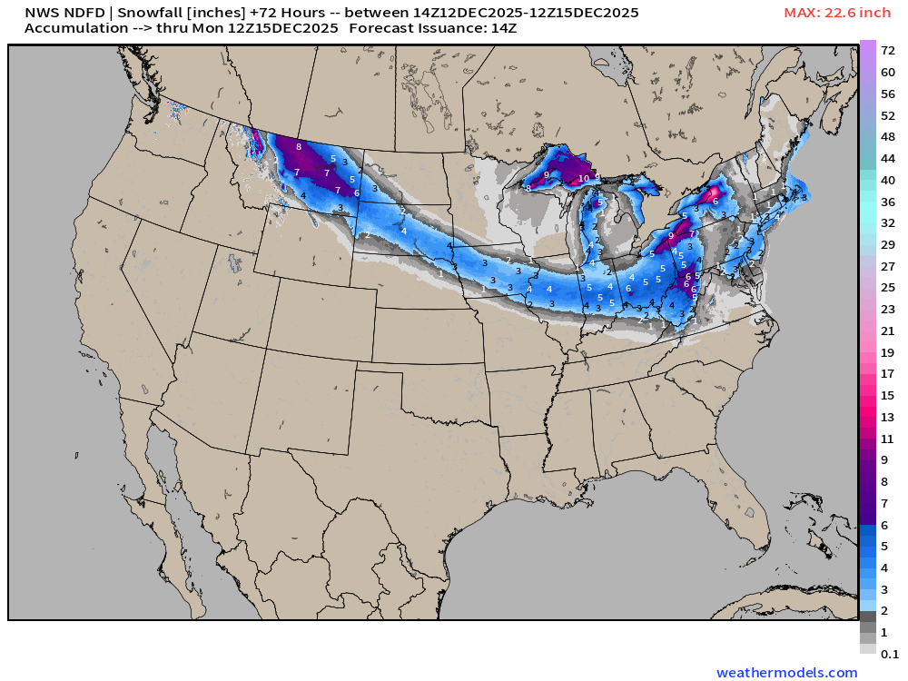
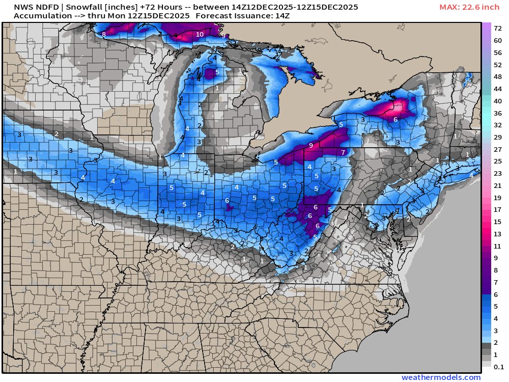
NWS Snowfall Next 72-hours
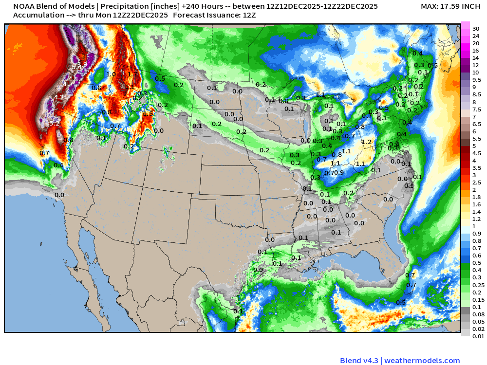
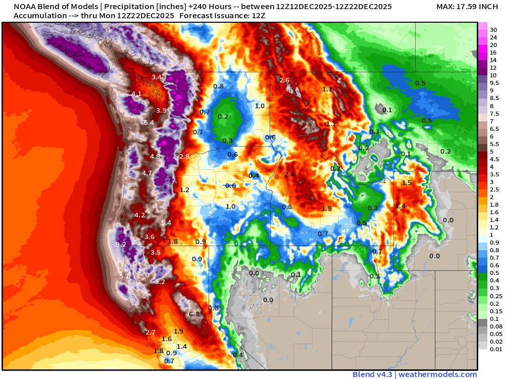
Blend of Models | 10 Days Precipitation Total
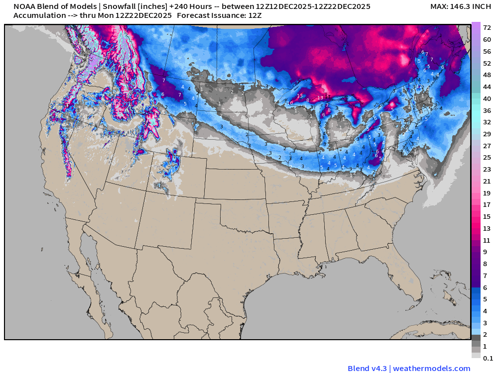
Blend of Models | Total Snowfall Next 10-Days
ECMWF AIFS-Single 06z | Height Anomaly (500 hPa) Next 10-days
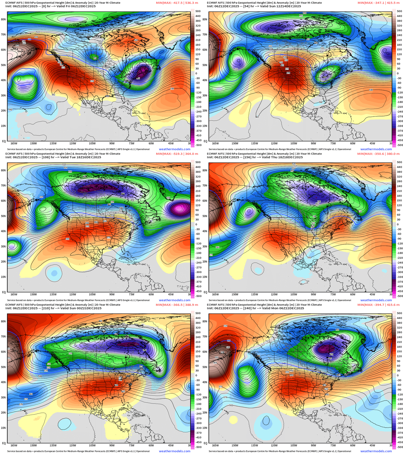
Couple more troughs into next weekend — Days 8-10 … and then the ridge builds across the Rocky Mountains … but notice the subtle trough … as the cold pool can travel downhill into the Great Lakes and Northeast and clip the Lower 48 with brutal Canadian cold. Fine line between warmth / thaw and continued exceptional winter cold into the last 10-days of December.
ECMWF 00z | Integrated Vapor Transport Next 10-days
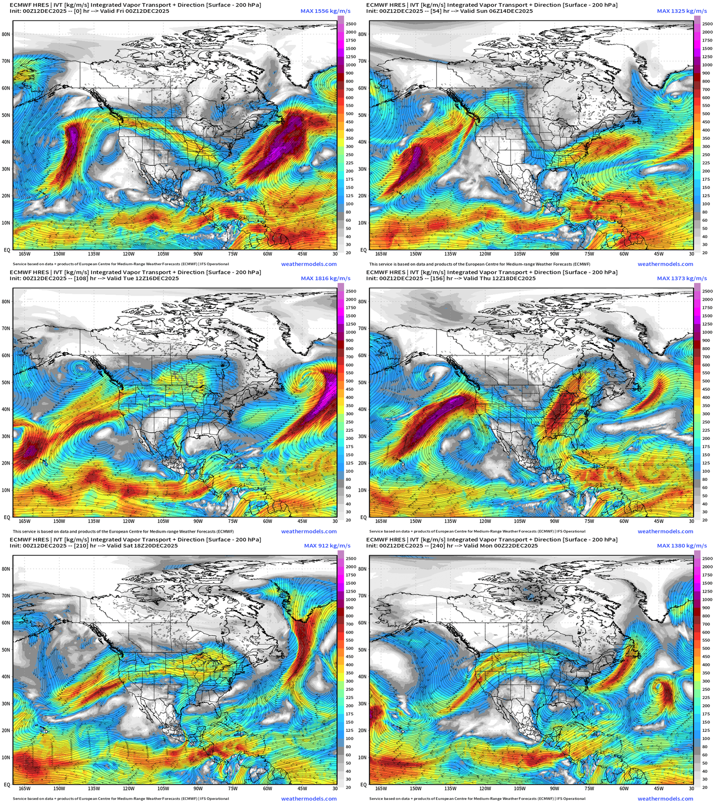
Parameter used for monitoring “atmospheric rivers” usually along the U.S. west coast, but the idea works well for many other areas — highlighting midlatitude storm systems with warm conveyor belts (moisture plumes)
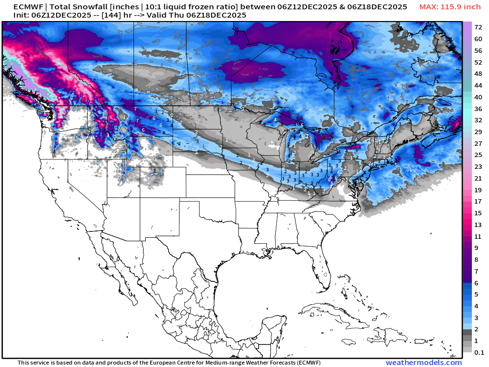
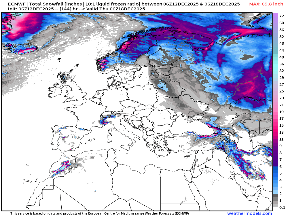
ECMWF 06z | Snowfall | Next 6-days
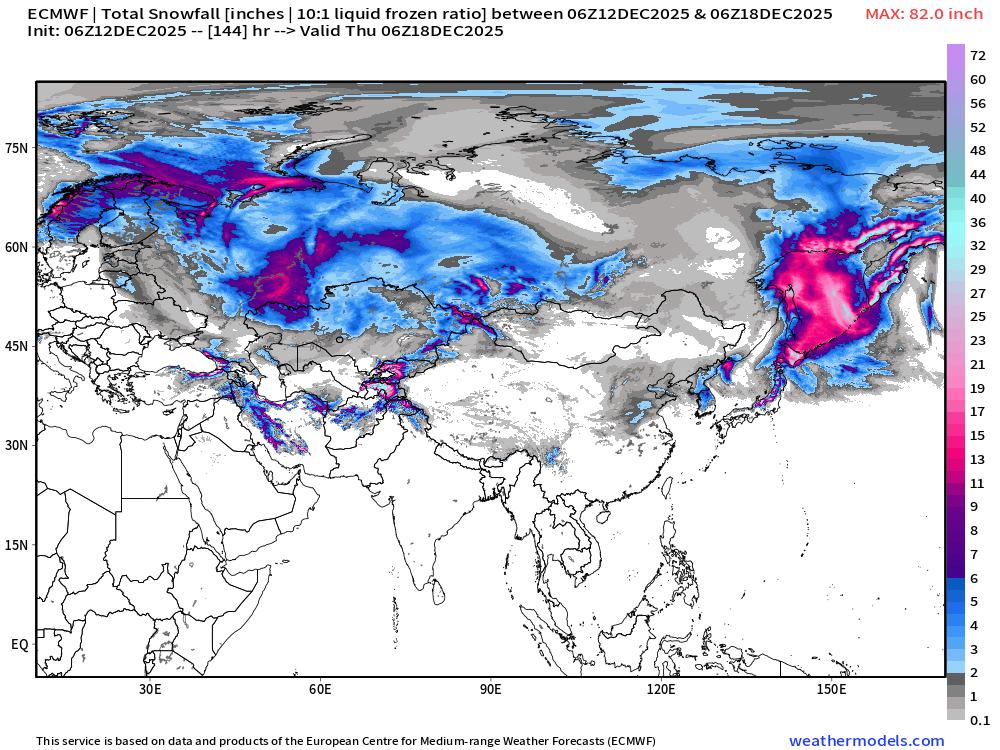
ECMWF EPS 00z | Ensemble Median Snowfall Next 15-days
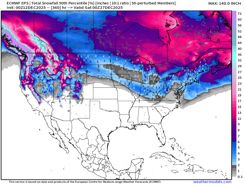
ECMWF EPS 00z | Ensemble Snowfall Probability > 1” | Next 15-days
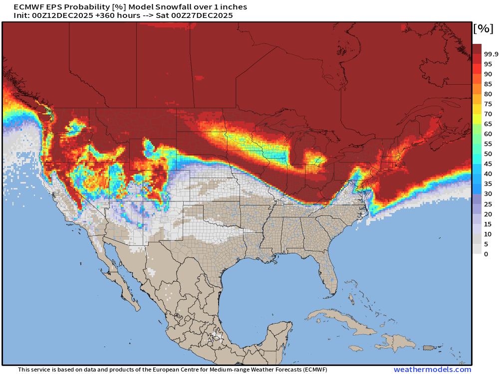
We’ll be monitoring the 1” chance of snowfall for a “White Christmas” in the coming weeks. This map is through morning December 26th.
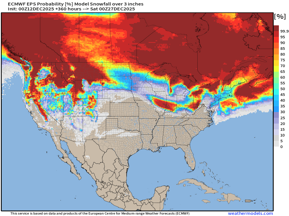
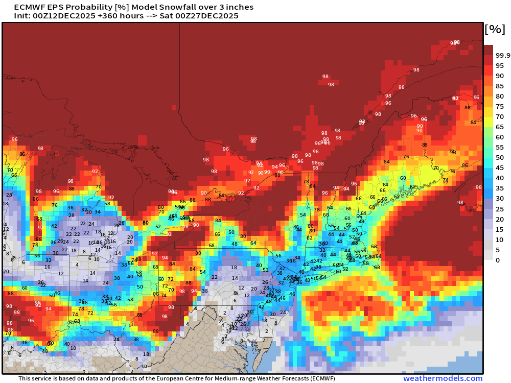
ECMWF EPS 00z | Ensemble Snowfall Probability > 3” | Next 15-days
Next 15-days Temperature Anomaly | Ensemble Mean to December 26
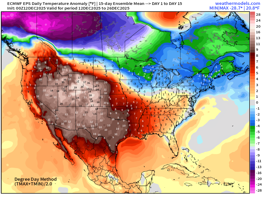
Temperature Anomaly | Next 15-days | ECMWF EPS 00z
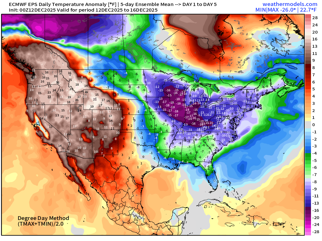
5-Day Chunk #1 | Temperature Anomaly | Dec 12 - Dec 16
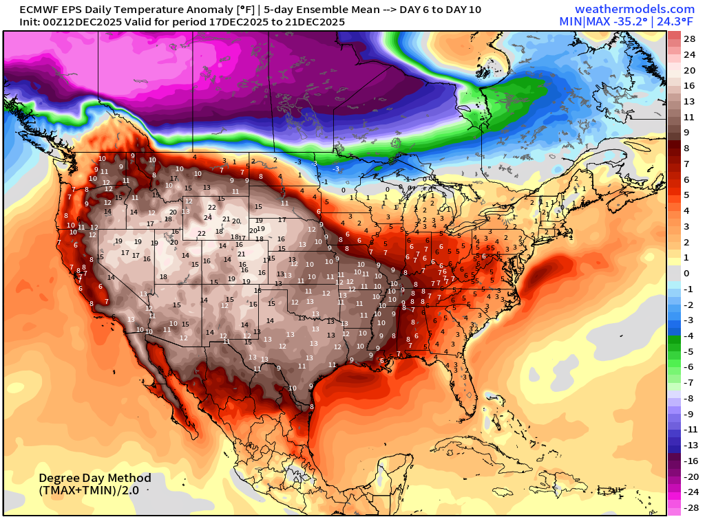
5-Day Chunk #2 | Temperature Anomaly | Dec 17 - Dec 21
5-Day Chunk #3 | Temperature Anomaly | Dec 22 - Dec 26
Maps sourced from weathermodels.com designed and innovated by yours truly! Please subscribe there for real-time access to the newest maps, charts from all of the weather models including ECMWF and AIFS, NOAA AI-GFS/AI-GEFS
Active coupon codes:
- Milepost
- 814 · laid 2025-12-12T15:05:47.292000Z
- Source
- https://weather.substack.com/p/december-12-2025-friday-morning-winter
- Digest
- f1d9525e407023c02ade596e9d9822fab6fc25b2f1afd11459f0ca852e660e04
- Machine
- JSON