December 11, 2025 Thursday Evening Winter Weather
Watching big cities of Northeast for accumulating snowfall this weekend
December 2025 was the 5th-warmest December in the 131-year national record (1895–2025), at 37.8°F against a 1991–2020 normal of 34.3°F (+3.5°F).
December 2025 was the 37th-driest December in the 131-year national record (1895–2025), at 2.0in against a 1991–2020 normal of 2.5in (-0.5in).
NOAA/NCEI Climate at a Glance, contiguous United States. This is the observed record for the month, not a score of anything said in this piece — the forecast ledger begins 2026-08-17 and cannot reach earlier posts.

HRRR 18z | Next 48-Hours through Saturday 1 PM ET
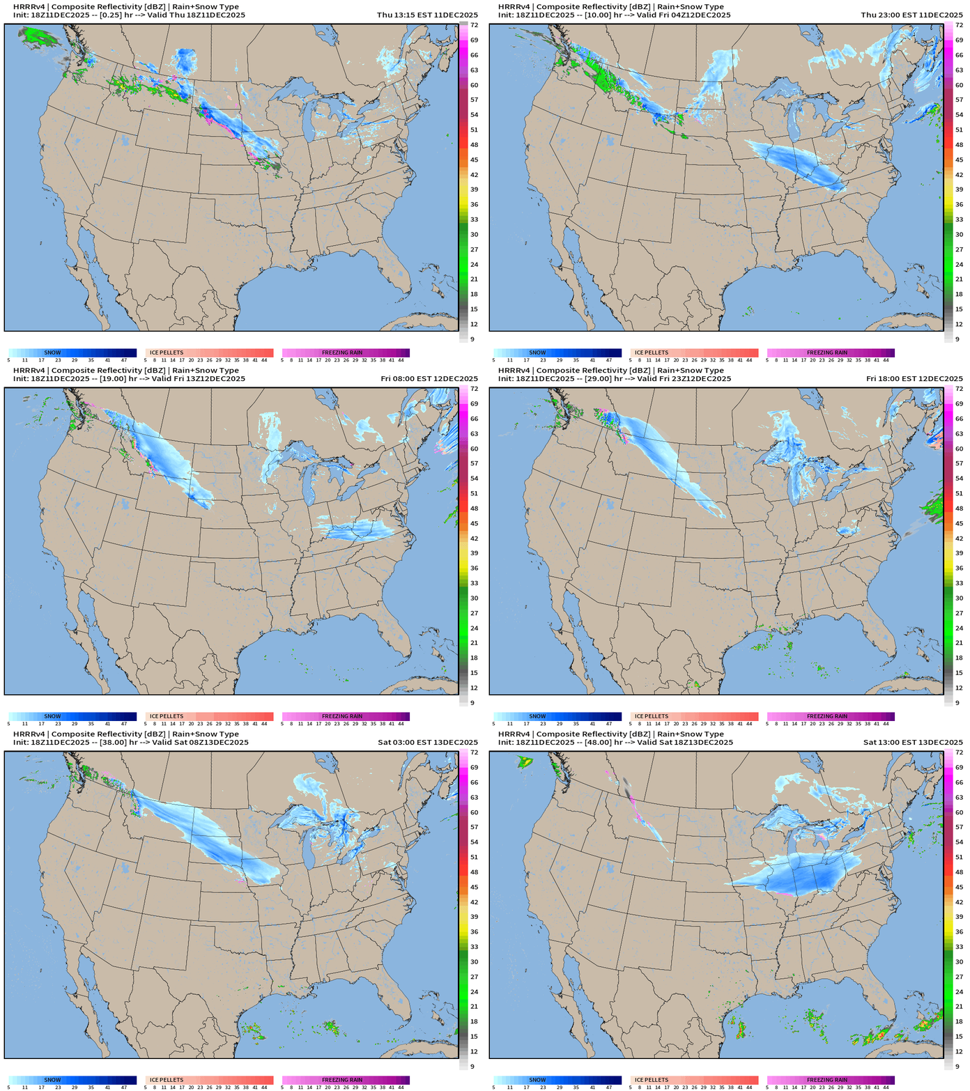
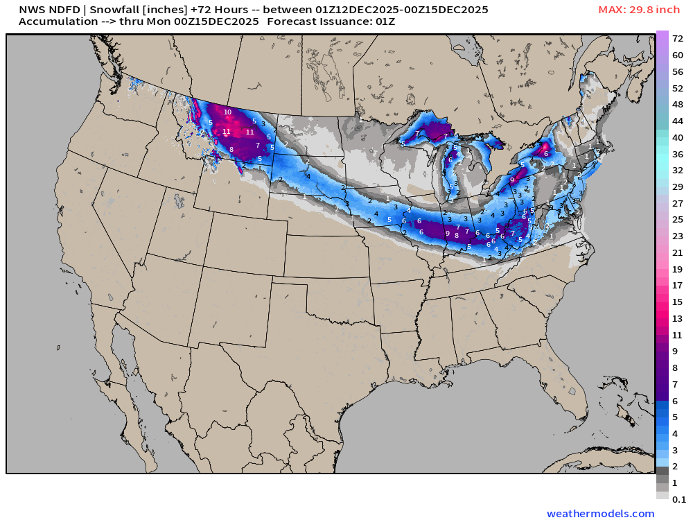
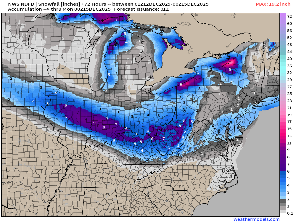
Two bursts of snowfall with Alberta Clippers will travel the same route and blanket the Midwest and southern Great Lakes with nice snowfall accumulations
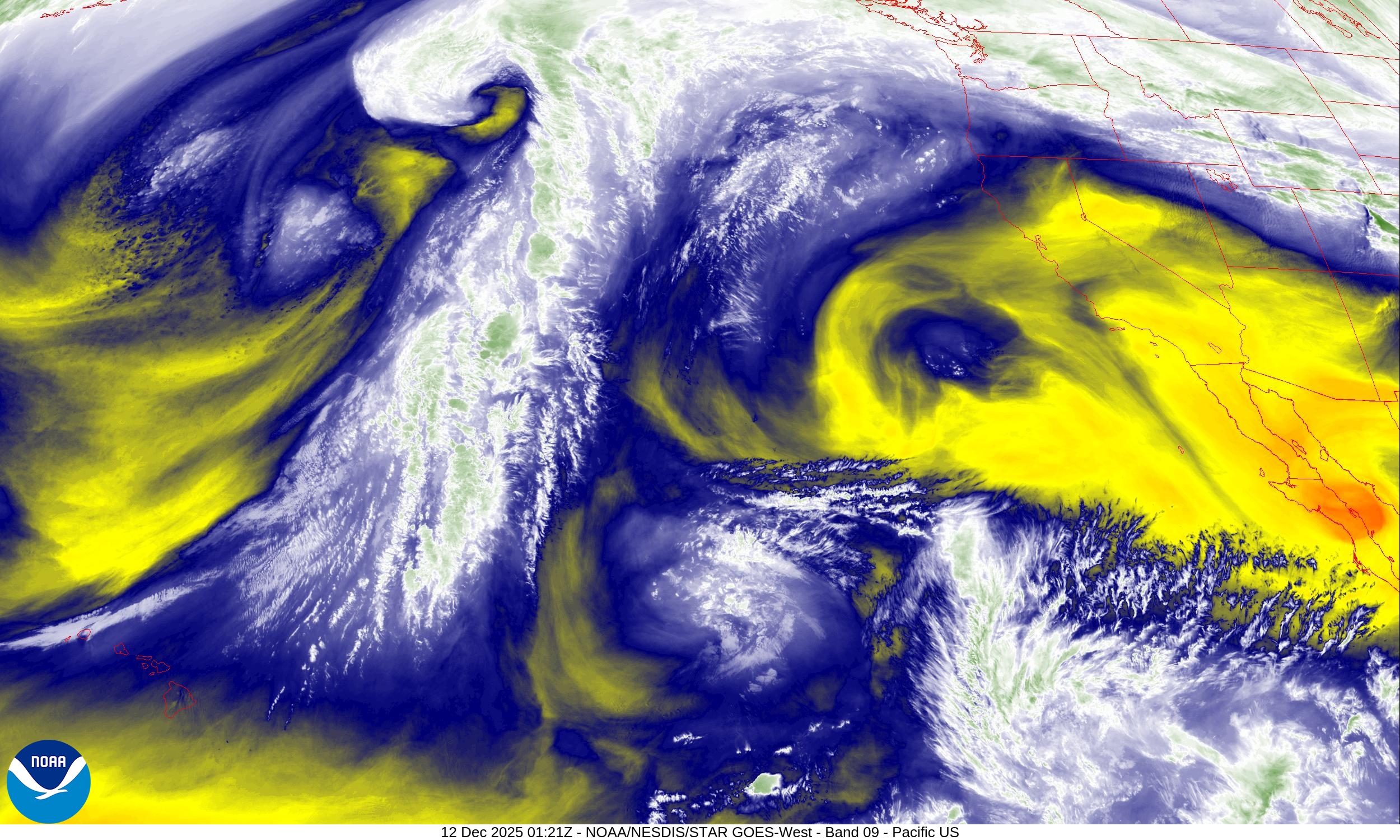
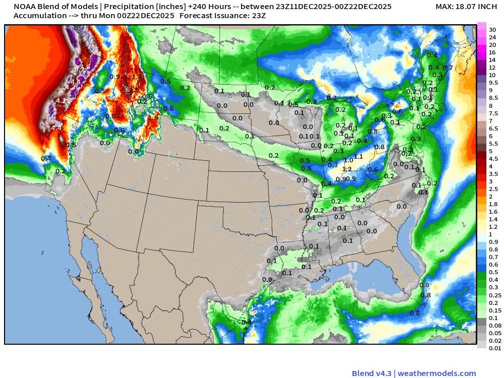
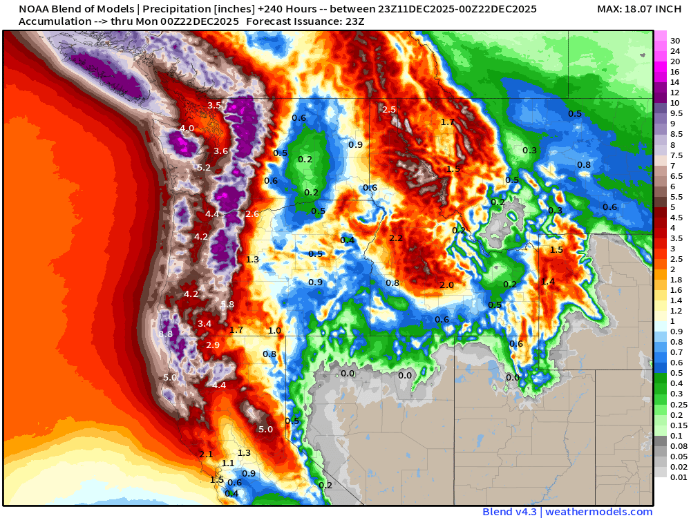
Moisture is courtesy of the landfalling atmospheric rivers in the Pacific Northwest
RRFS-A 18z next 54 hours snowfall —> Through Saturday evening
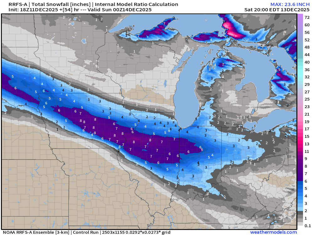
Nice band of 6”-8” across several states. What’s not to like?
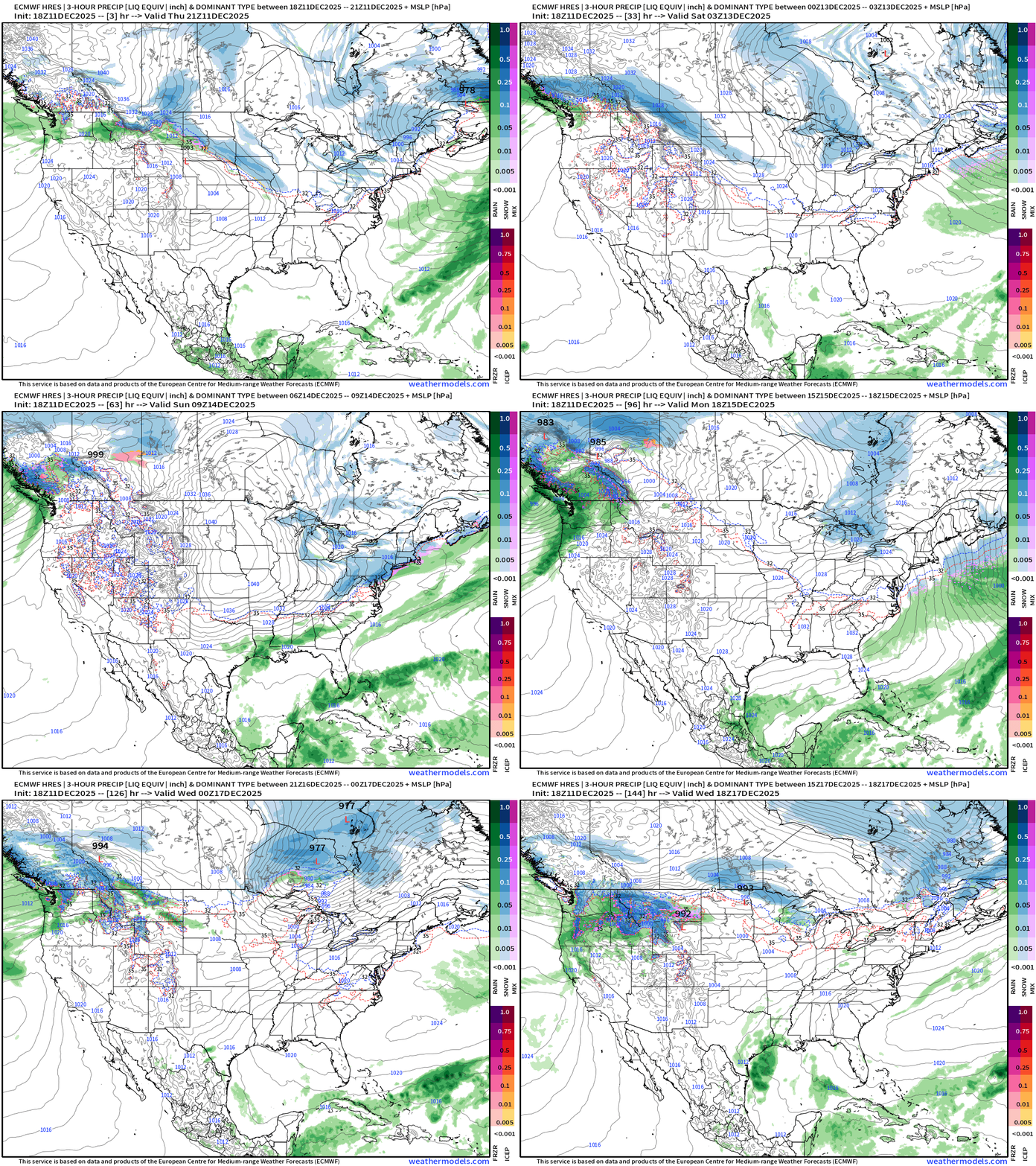
Precipitation Type | Weather Next 6-days | ECMWF 18z
Headlines Thursday Evening
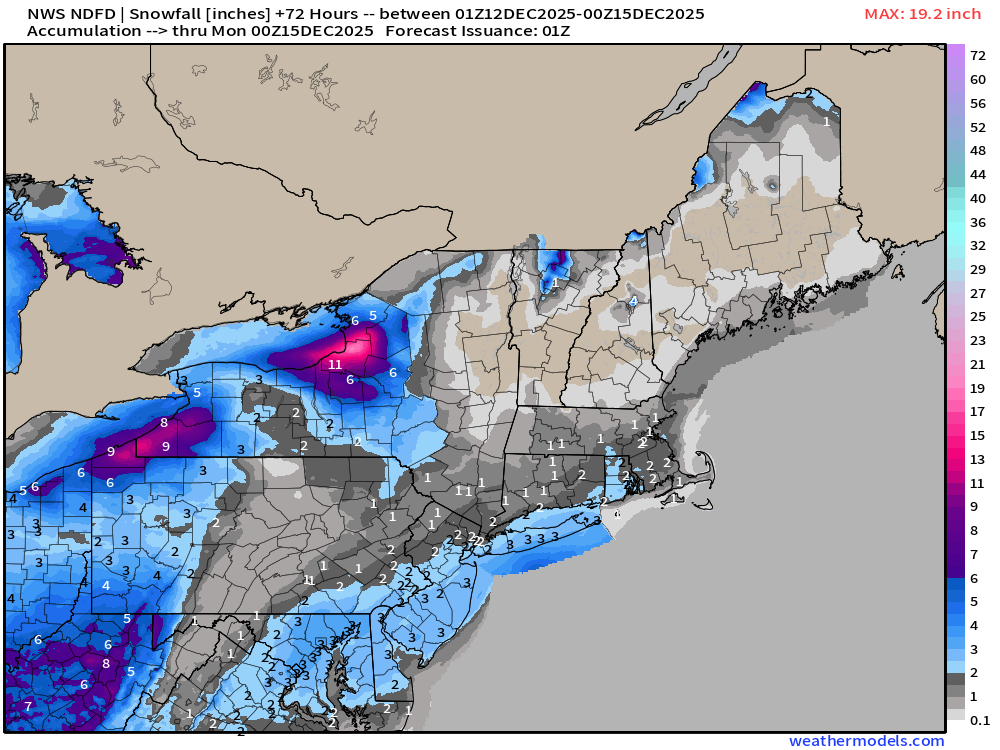
What becomes of the Clipper System this weekend as it emerges off the New England coastline? Plenty of very cold air + potential for burst of snowfall for the big cities along I-95 corridor including NYC and Boston (maybe 2-4”+)
VERY COLD — this weekend across the Midwest/Great Lakes peaking this Sunday.
X is battling it out: will the upcoming Christmas holiday be a “Blow Torch” with very warm temperatures due to a strong coast-to-coast ridge anchored to the U.S. west coast OR will the polar vortex win out? I think there’s going to be some erosion of the ridge at the margins e.g. Great Lakes and Northeast allowing dumps of Canadian Arctic air into the Lower 48 —> but perhaps that will also mean more active storm tracks. That’d be exciting.
Weekend Nor’easter — All snow for land areas — woohoo, but how much QPF is available to this quickly moving, rather weak system?
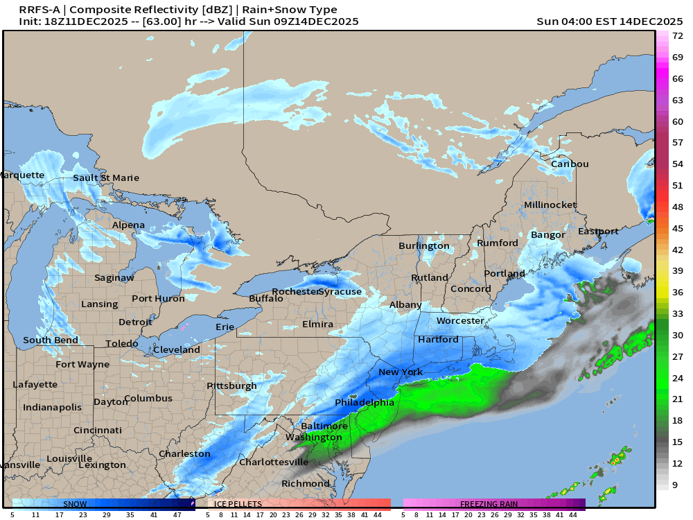
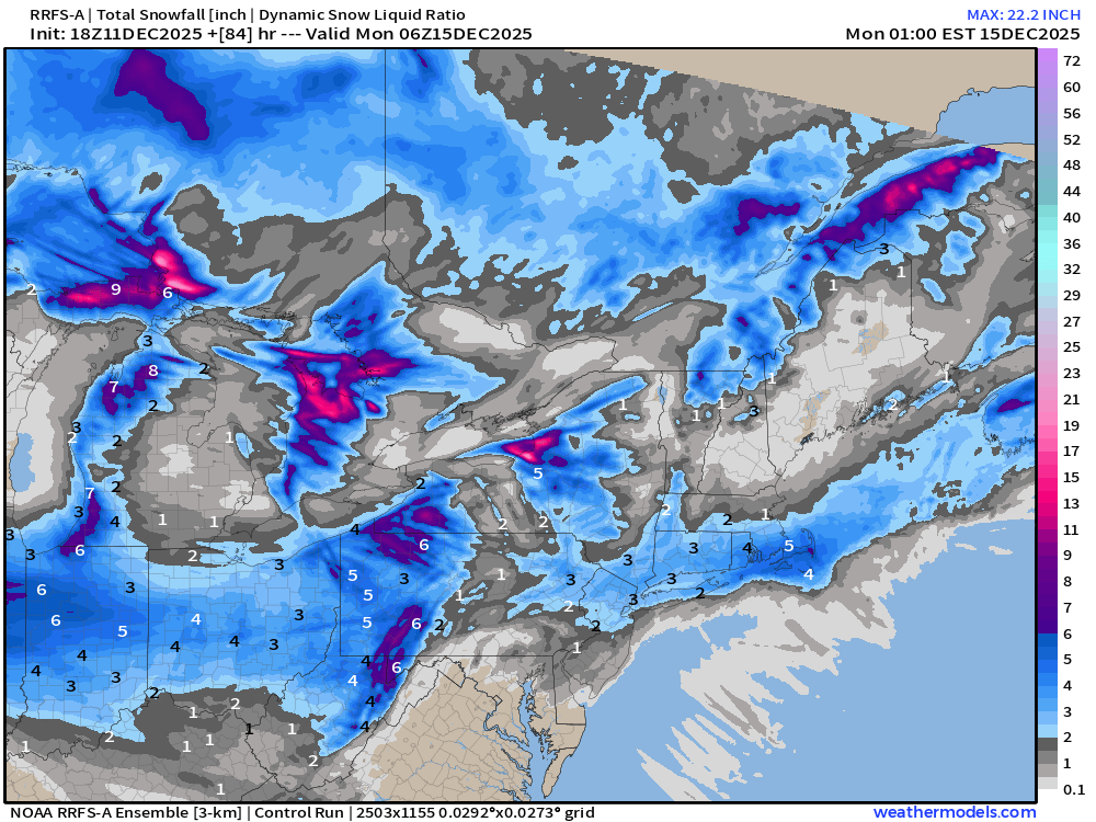
RRFS-A Snowfall is 3”-6” from NYC to Boston. Is that enough?
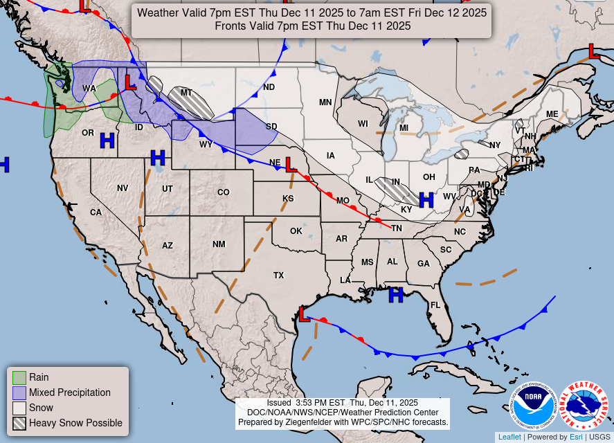
Current Frontal Boundaries and Weather into Friday morning
Low Temperatures Next 9-days | Until Saturday, Dec 20th
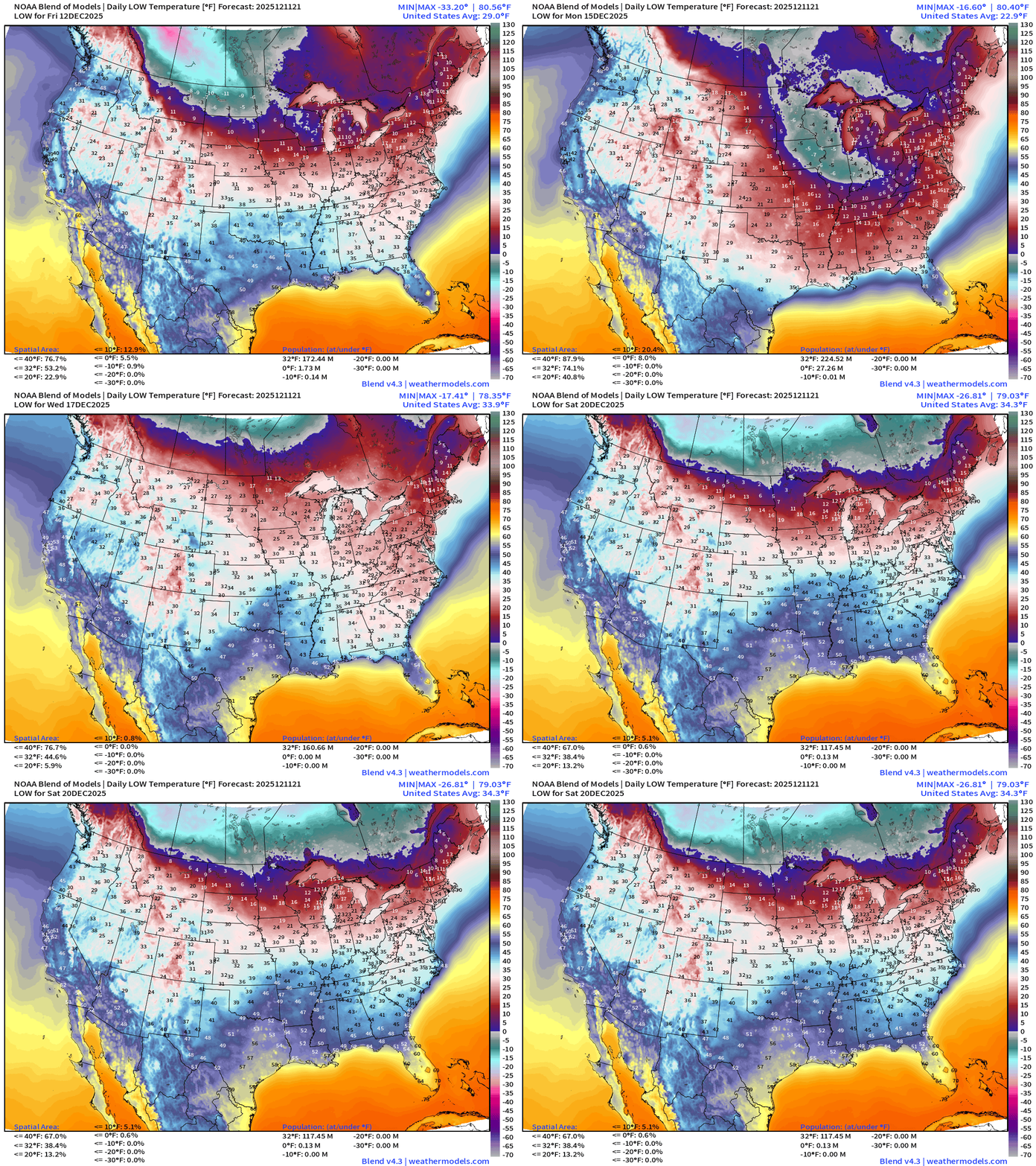
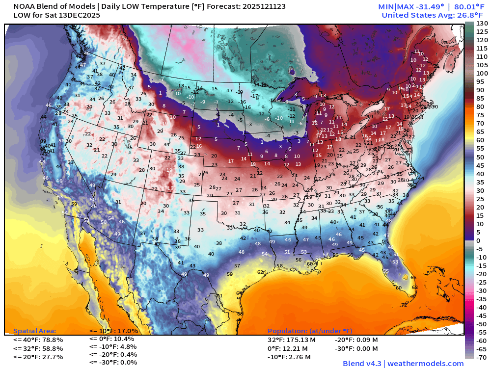
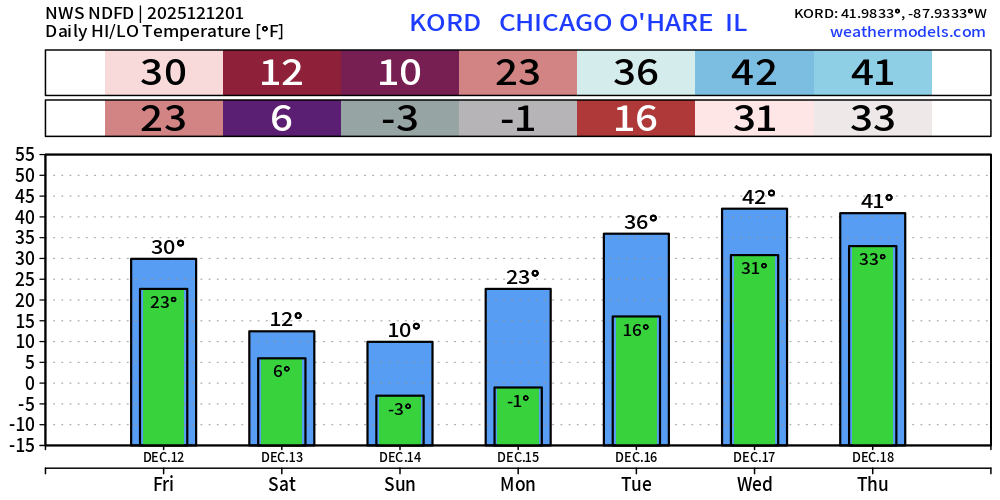
Coldest mornings will be Sat/Sun/Mon across the Midwest and Great Lakes including Chicago at -3°F
ECMWF 18z Precipitable Water Next 6-days | My favorite parameter
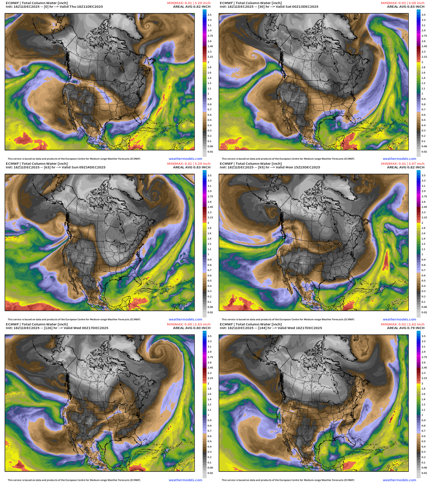
White colored precipitable water = absence of moisture = cold/polar air mass surges southeast out of Western Canada into the Midwest into this weekend.
Next atmospheric river for West Coast Mon/Tuesday
Powerful Nor’easter forms from Alberta Clipper Monday — and tracks into the North Atlantic — but won’t bomb out until it moves away from the coast, so we miss out on a blockbuster blizzard.
Temperatures | Current to Next 15-days
Temperature Anomaly | Next 15-days
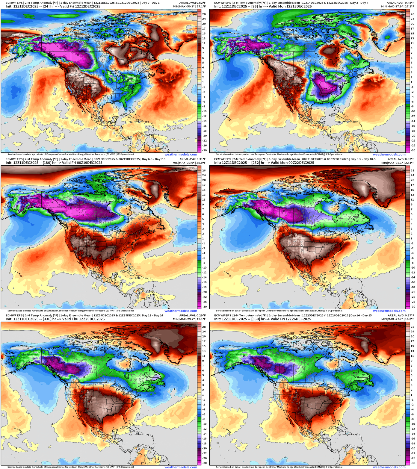
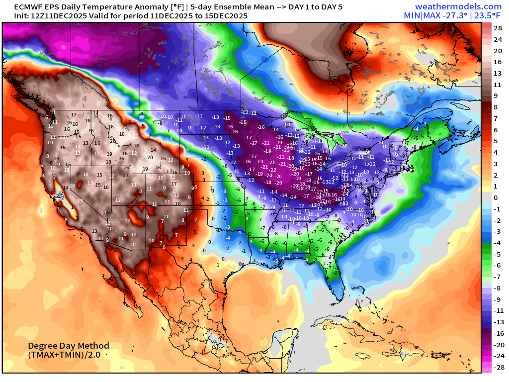
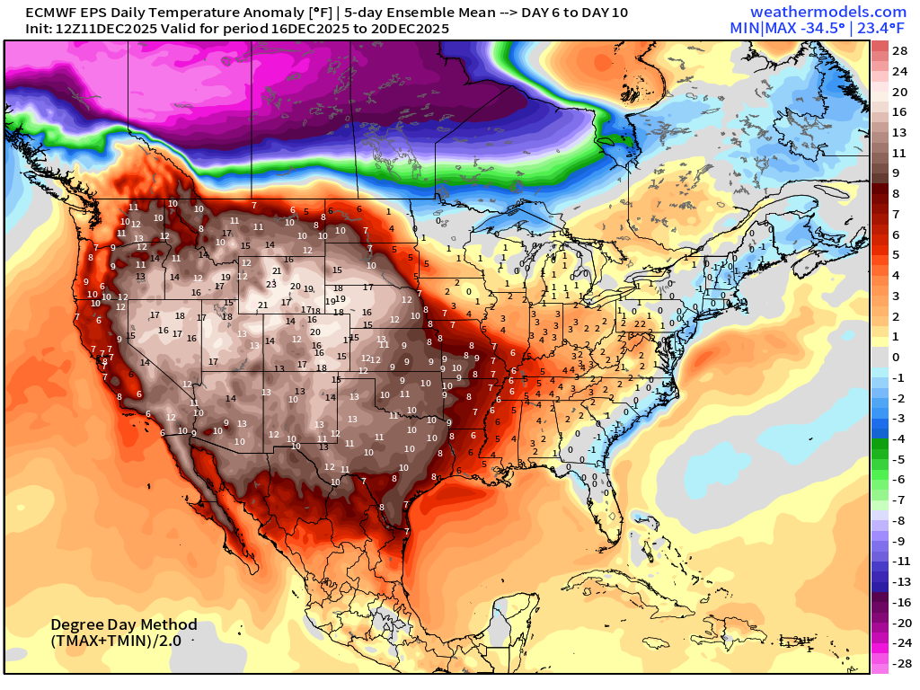
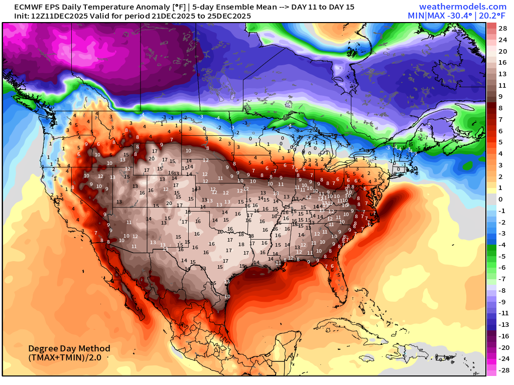
Flagship European model ensemble solution for temperature anomaly next 15-days
One more quick Arctic blast in the Days 8-10 time frame, and then the coast to coast ridge seems to take hold into Christmas — but still some cold in New England. The ridge will be weakest in the Great Lakes and Northeast, so that will be the battleground for the “Polar Vortex” anchored over Hudson Bay.
The Western Canada + Alaska cold pool is NOT going anywhere and continues to generate extremely cold air — available to any “polar vortex” lobes that want it.
Temperature Anomaly Next 6-days | Into Wednesday afternoon
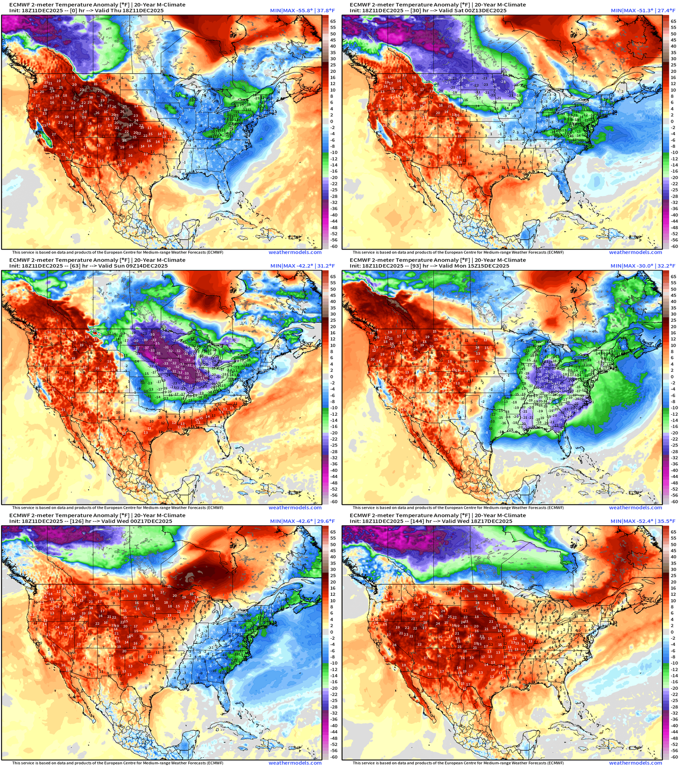
Exceptionally cold air spills into the Midwest and Great Lakes into this weekend, but warmer air from the Southwest and Gulf of Mexico battles back —> Light at the end of the tunnel
RTMA | Current Temperature Analysis | 7:30 PM ET
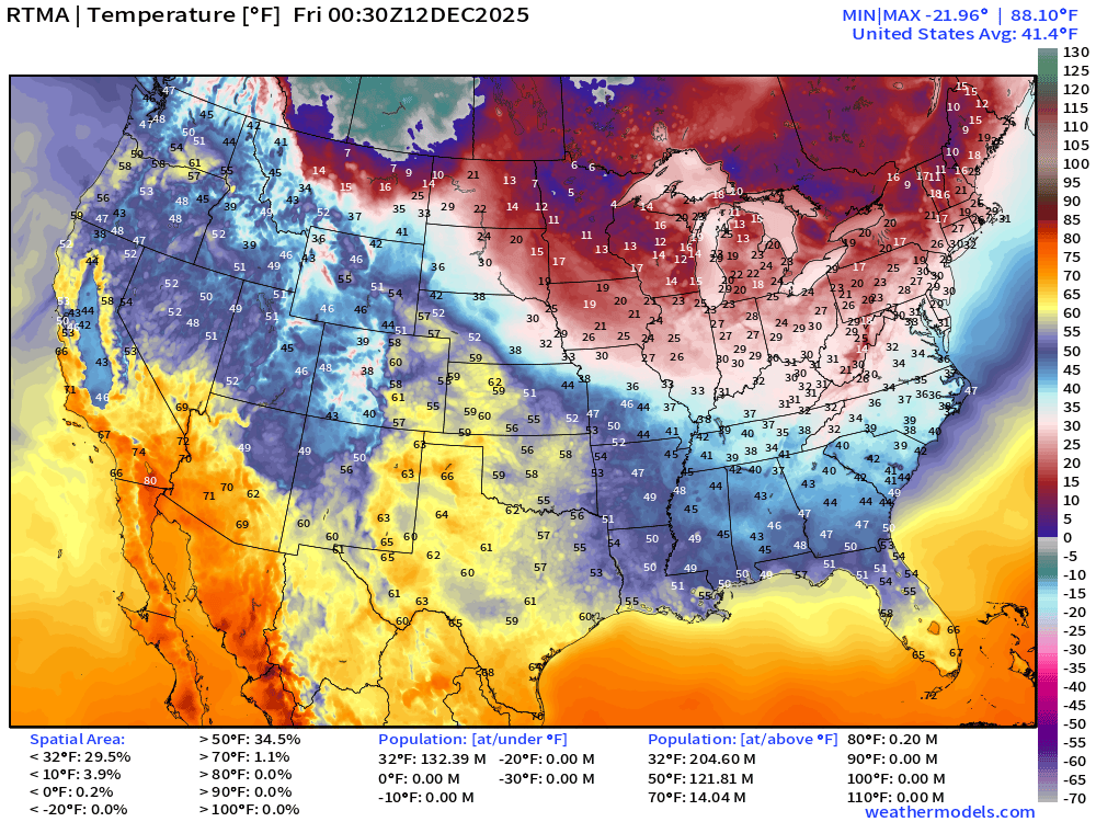
Average Lower 48 temperature was 41.4°F
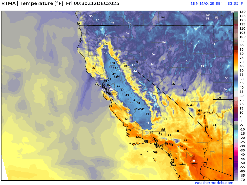
Still dealing with this brutal inversion layer + fog/mist in the California Central Valley — an ocean of fog.
Temperature Anomaly | 7:30 PM ET
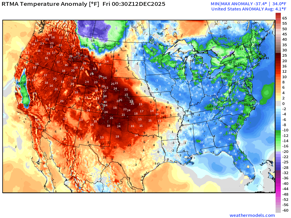
Lower 48 Temperature Anomaly was 4.1°F ABOVE normal
Friday Morning Low Temperatures
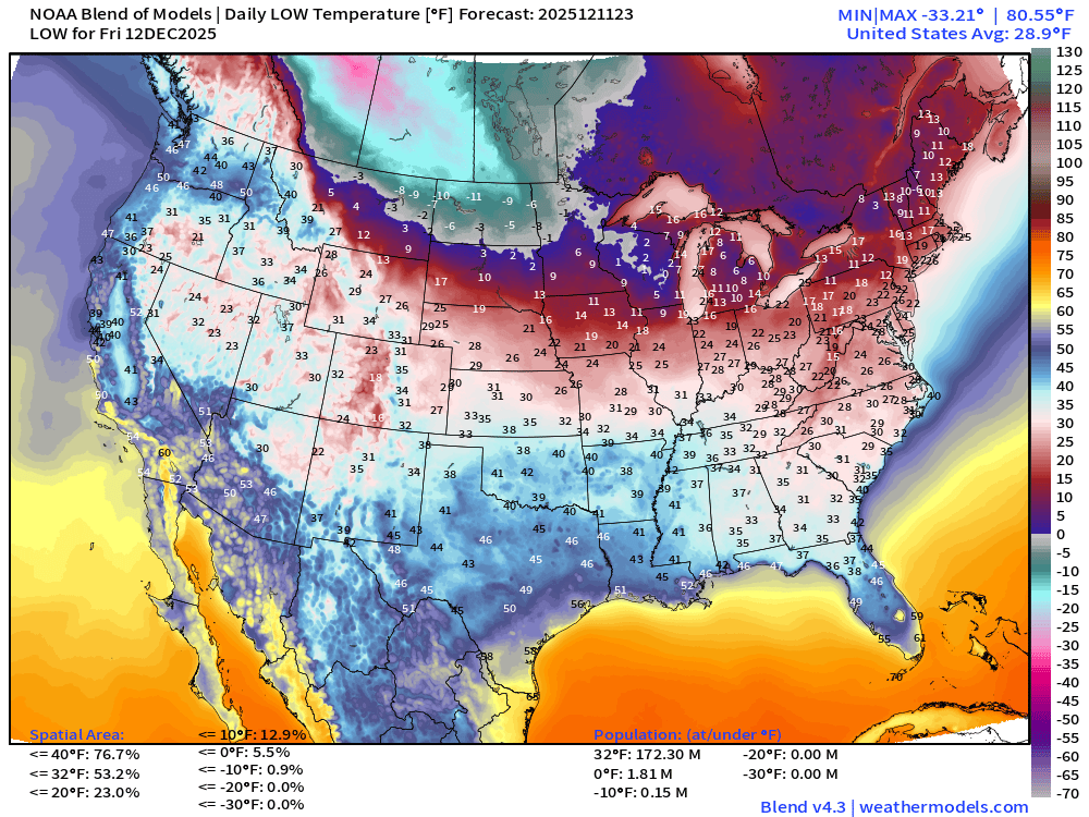
172 million below freezing (Lower 48 average low is 28.9°F)
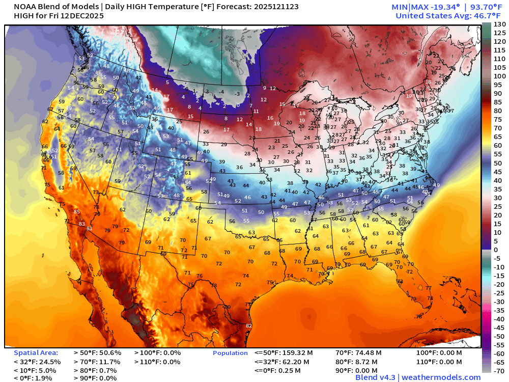
Friday High Temperatures
Saturday Low Temperatures
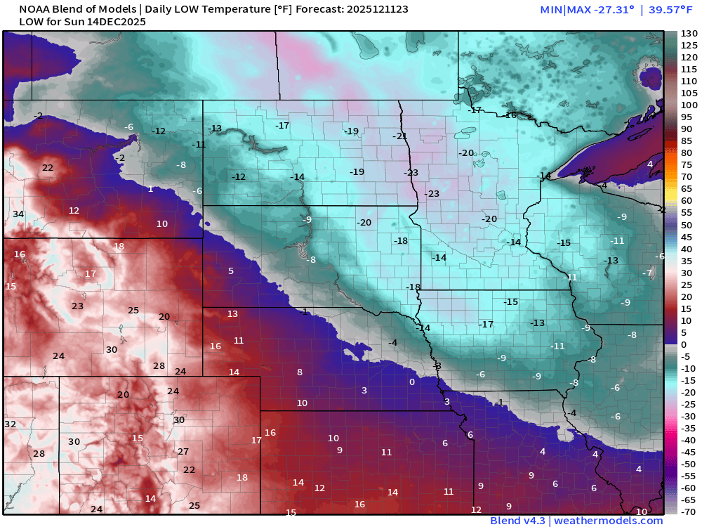
Sunday Low Temperatures | Arctic Blast Peak in Midwest + Great Lakes
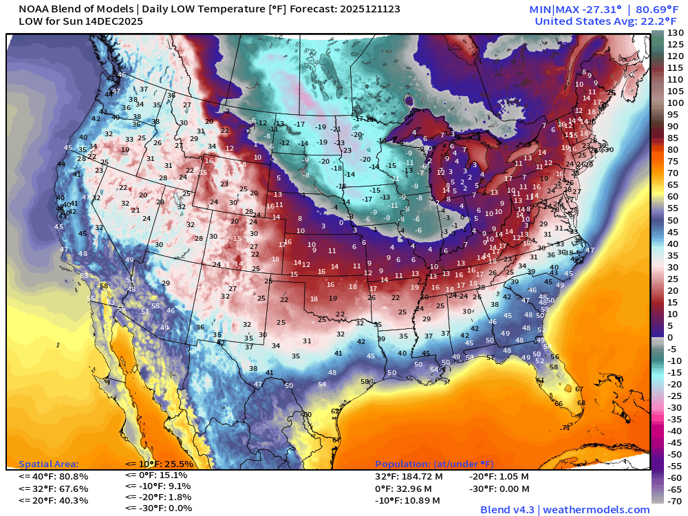
Frigid across the Midwest —> colder than -20°F over Iowa, Minnesota, and the Dakotas
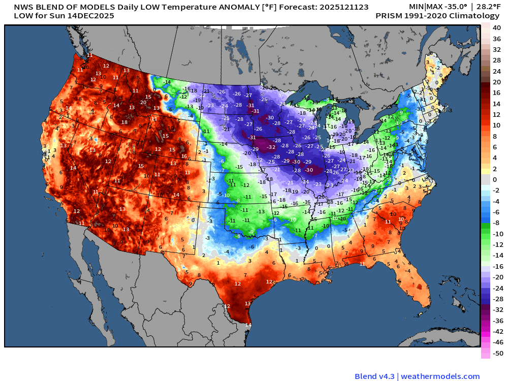
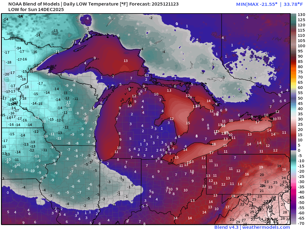
Chicago potential for two subzero mornings (Sunday -3°F and Monday -1°F) then thaw into Tuesday afternoon (!)
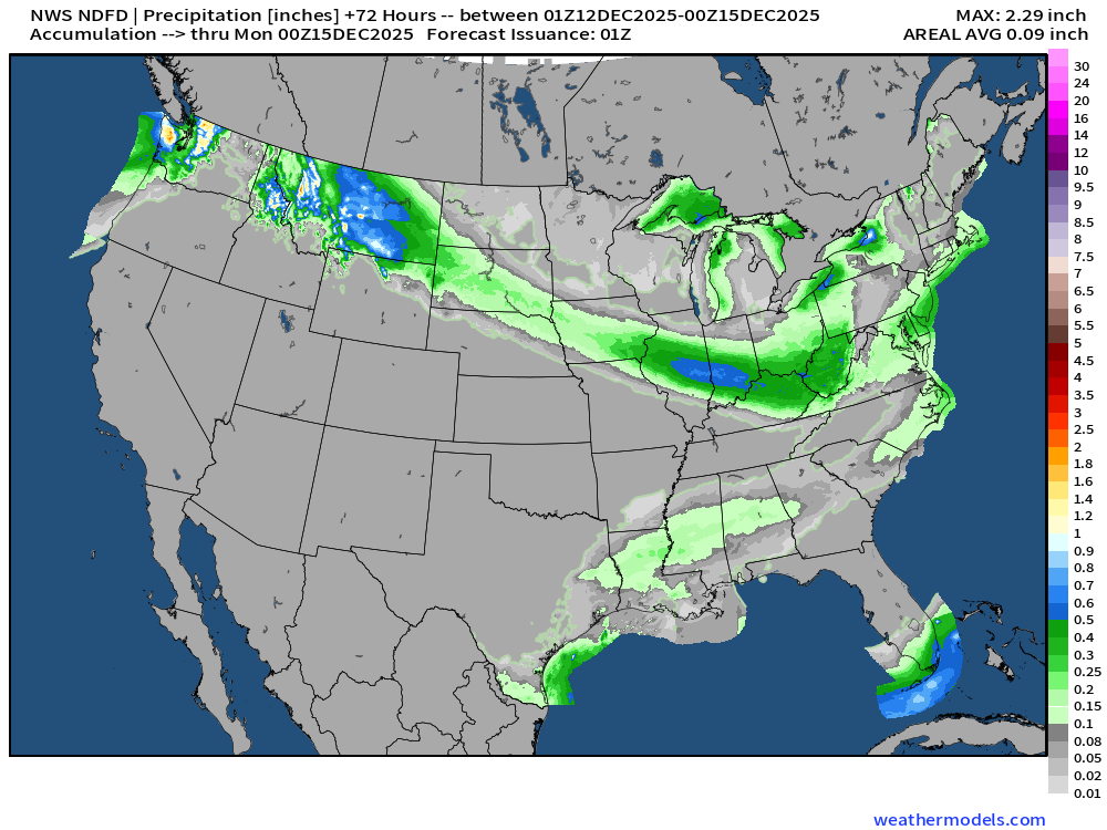
NWS Precipitation Next 72-hours
NWS Snowfall Next 72-hours
Blend of Models | 10 Days Precipitation Total
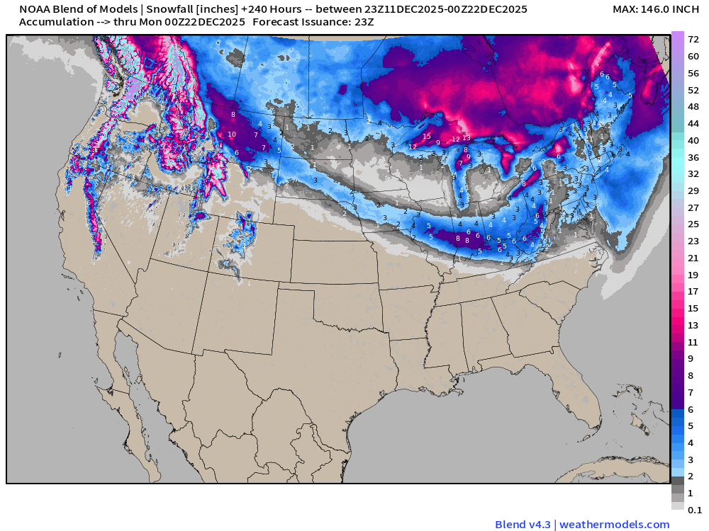
Blend of Models | Total Snowfall Next 10-Days
ECMWF AIFS-Single 18z | Height Anomaly (500 hPa) Next 10-days
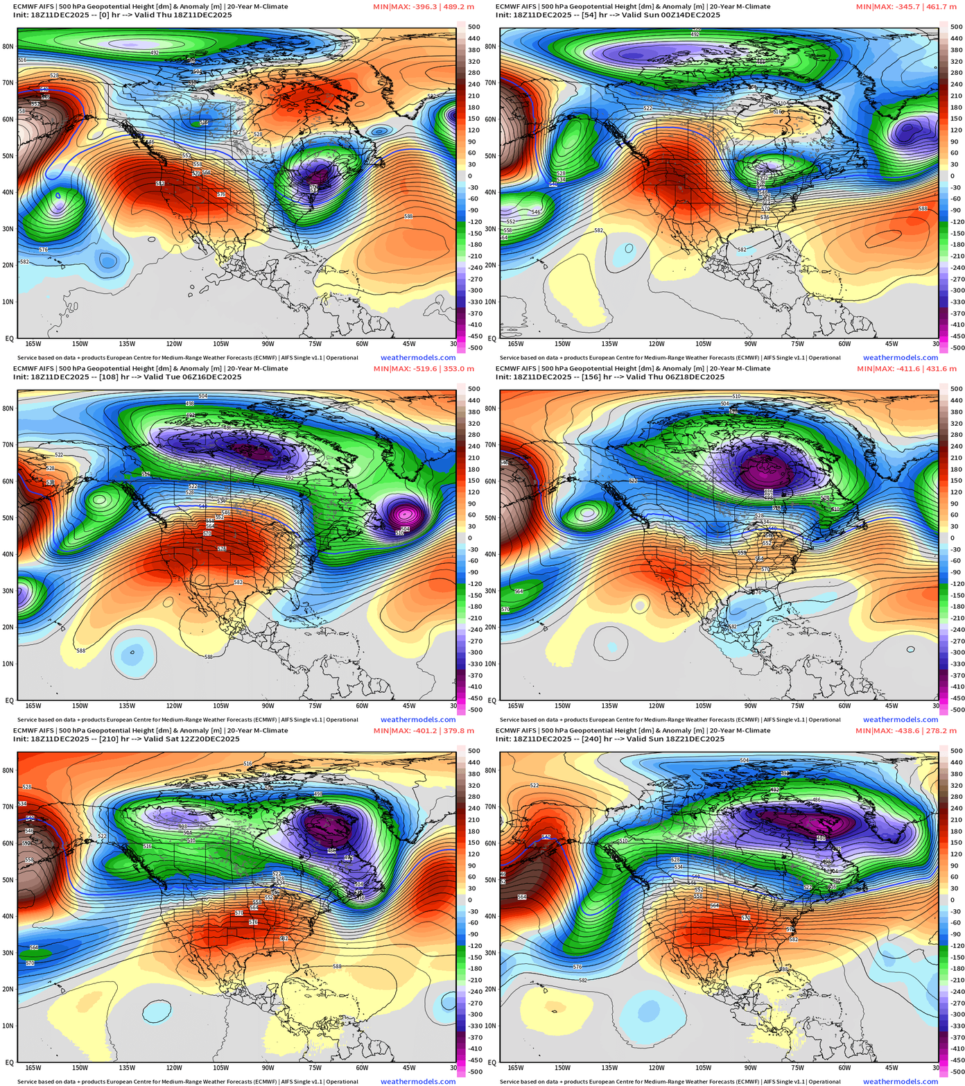
Quick moving trough swings through the Great Lakes and Northeast at Days 8-10 before the blocking ridge solidifies once again. After Day 10, the uncertainty is, of course, highest.
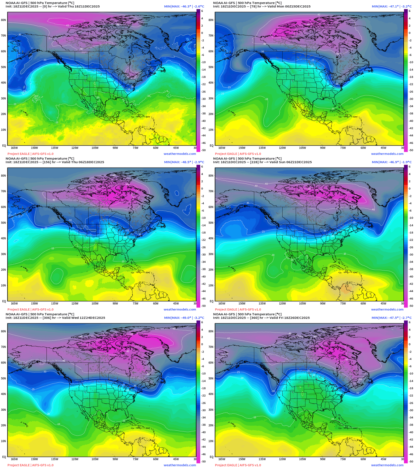
NOAA AI-GFS 18z | 500 mb Temperature | Next 15-days
GFS 18z | Dynamic Tropopause Day 10 Little White Fuzzball
Day 10 | 500 mb Height Anomaly from ECMWF Full Physics Products
Day 10 | 500 mb Height Anomaly from ECMWF AIFS Products
Will the ridging win out — or edge southward just enough to allow the coldest Canadian air to squat over the northern tier of the Lower 48 into the end of December?
ECMWF 12z | Integrated Vapor Transport Next 10-days | North America
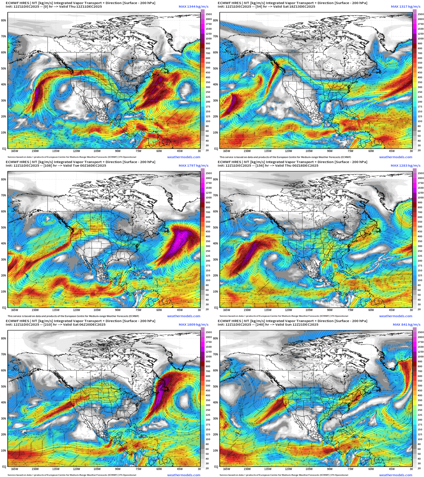
Parameter used for monitoring “atmospheric rivers” usually along the U.S. west coast, but the idea works well for many other areas — highlighting midlatitude storm systems with warm conveyor belts (moisture plumes)
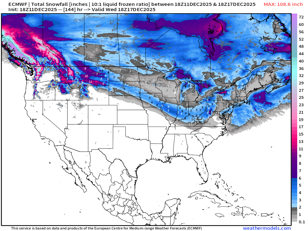
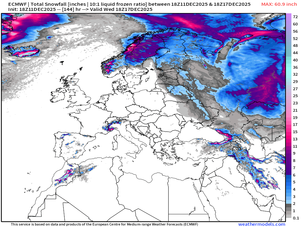
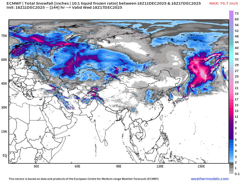
ECMWF 18z | Snowfall | Next 6-days
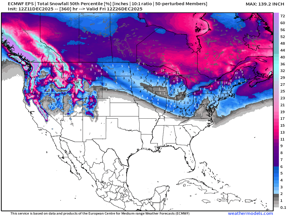
ECMWF EPS 12z | Ensemble Median Snowfall Next 15-days
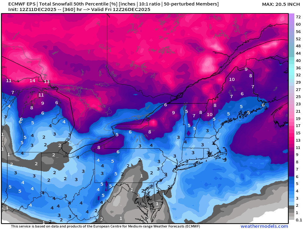
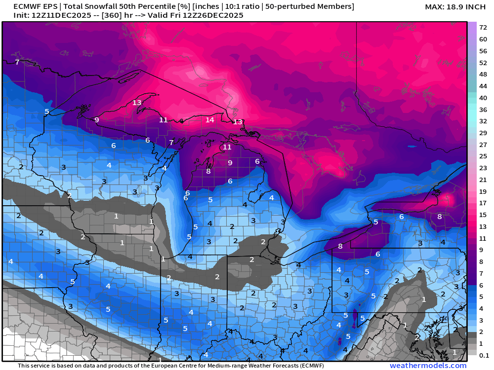
ECMWF EPS 12z | Ensemble Snowfall Probability > 1” | Next 15-days
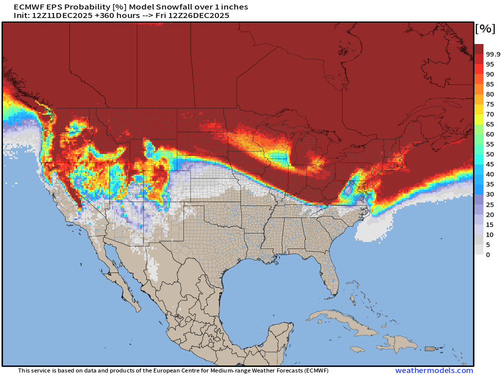
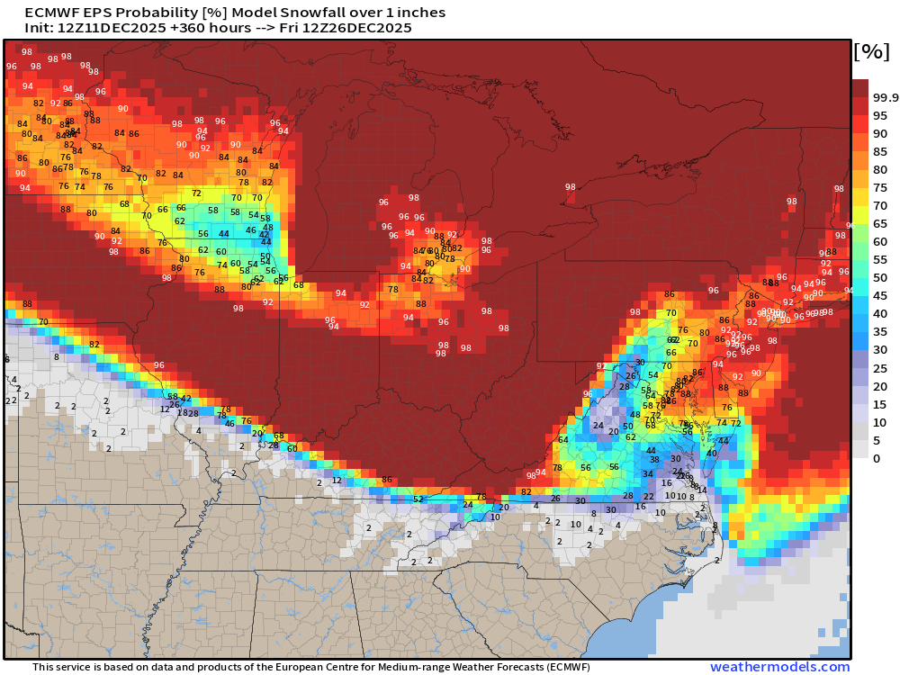
We’ll be monitoring the 1” chance of snowfall for a “White Christmas” in the coming weeks. This map is through morning December 26th.
ECMWF EPS 12z | Ensemble Snowfall Probability > 6” | Next 15-days
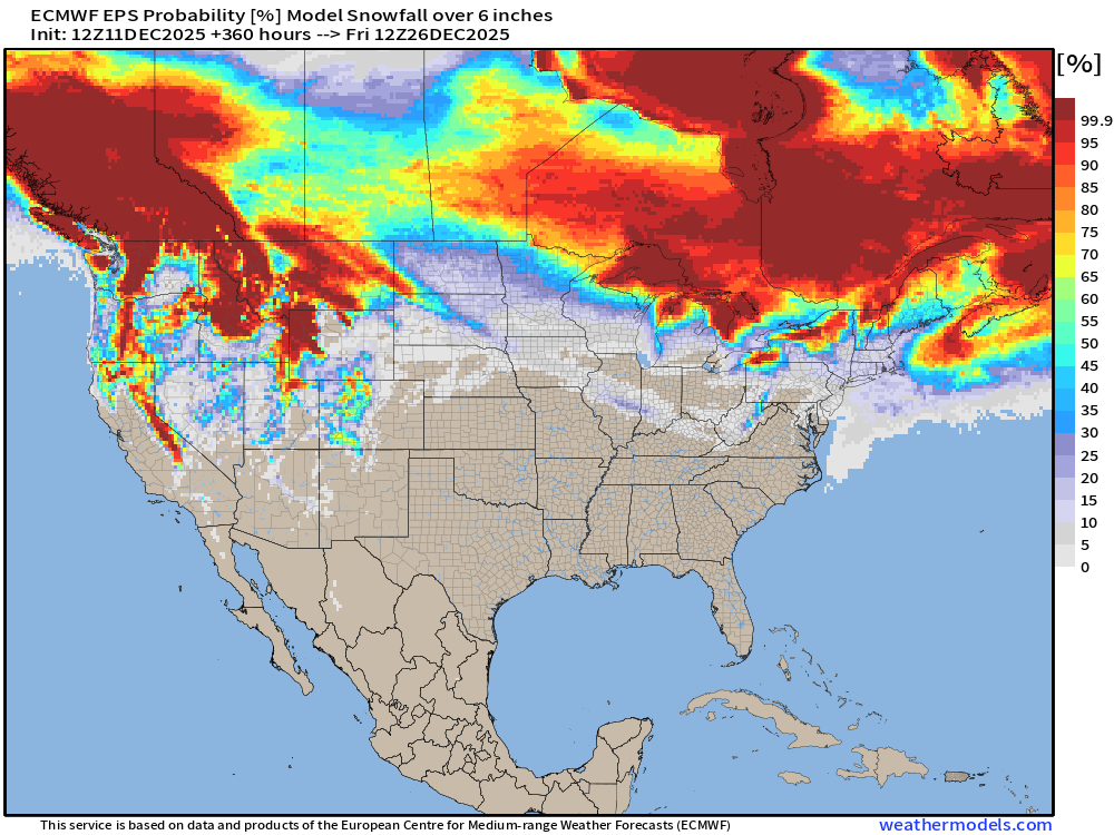
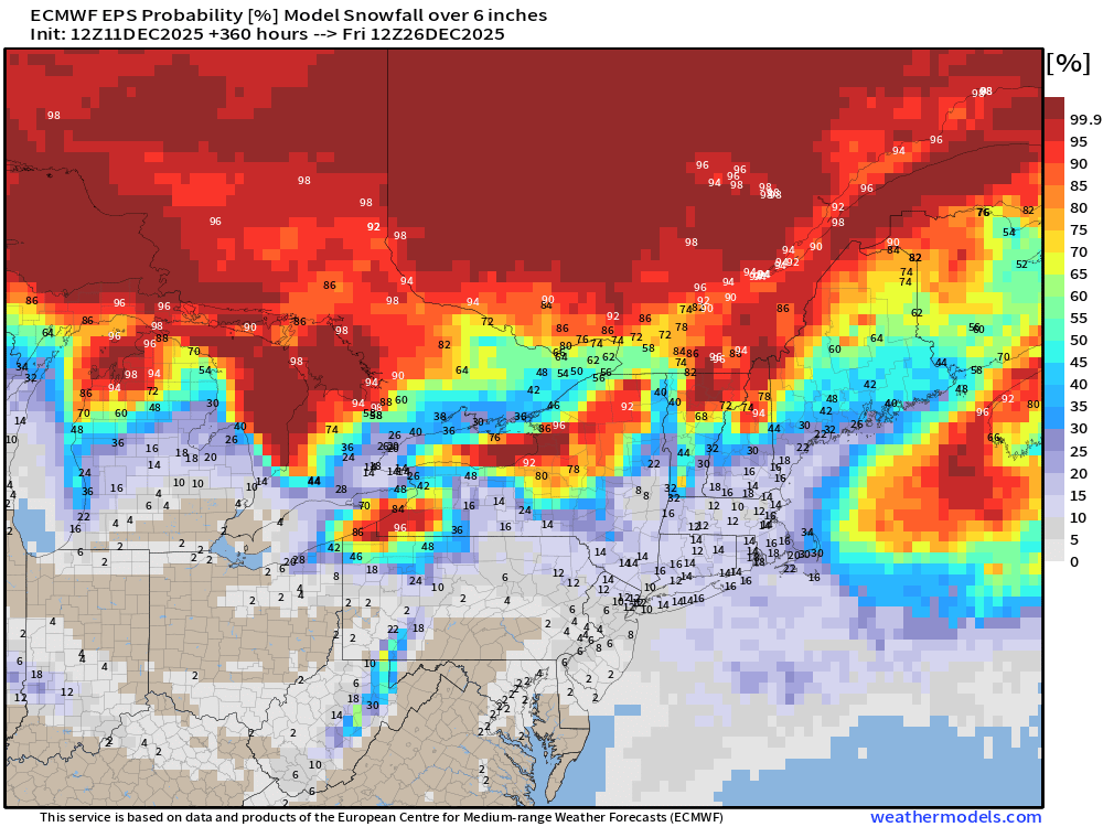
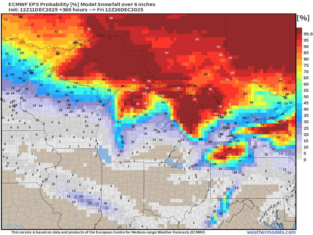
6-inches is sufficient for a “big storm” and Lake Effect machine diagnostic
Next 15-days Temperature Anomaly | Ensemble Mean to December 25
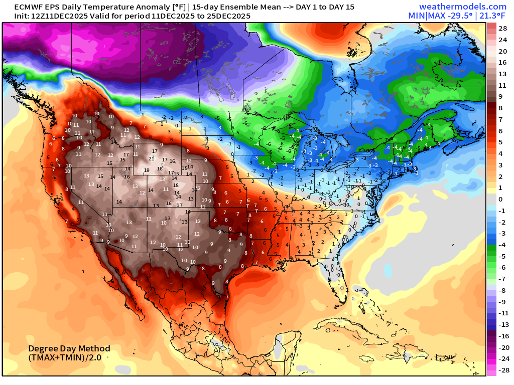
Temperature Anomaly | Next 15-days | ECMWF EPS 12z
5-Day Chunk #1 | Temperature Anomaly | Dec 11 - Dec 15
5-Day Chunk #2 | Temperature Anomaly | Dec 16 - Dec 20
5-Day Chunk #3 | Temperature Anomaly | Dec 21 - Dec 25
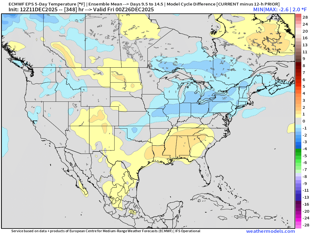
Comparison with 5-Day Chunk #3 from the 00z EPS cycle
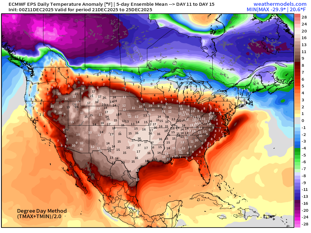
5-day Difference between the previous cycle is quite small — only a minor adjustment
Note, we’ll be watching the Canadian border in the coming days.
Maps sourced from weathermodels.com designed and innovated by yours truly! Please subscribe there for real-time access to the newest maps, charts from all of the weather models including ECMWF and AIFS, NOAA AI-GFS/AI-GEFS
Active coupon codes:
- Milepost
- 813 · laid 2025-12-12T01:59:08.670000Z
- Source
- https://weather.substack.com/p/december-11-2025-thursday-evening
- Digest
- 8316d3c8e379d9328c3d6143f2bbacb51601b2a1ed9428243d30e08ab0cf765a
- Machine
- JSON