August 28, 2023 Hurricane Season
Idalia expected to reach major hurricane status prior to landfall
August 2023 was the 10th-warmest August in the 132-year national record (1895–2026), at 74.4°F against a 1991–2020 normal of 73.1°F (+1.3°F).
August 2023 was the 43rd-wettest August in the 132-year national record (1895–2026), at 2.8in against a 1991–2020 normal of 2.7in (+0.1in).
NOAA/NCEI Climate at a Glance, contiguous United States. This is the observed record for the month, not a score of anything said in this piece — the forecast ledger begins 2026-08-17 and cannot reach earlier posts.
Top stories Monday morning:
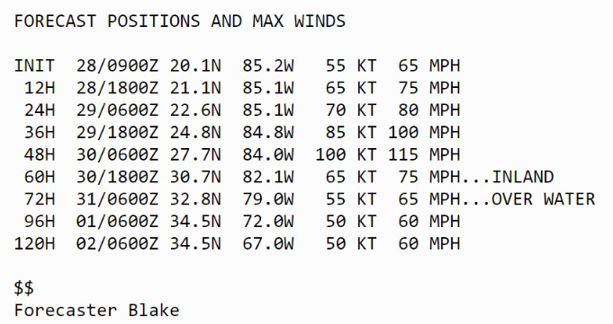
(1) Tropical Storm Idalia is steadily intensifying in the NW Caribbean and nearing hurricane strength. Model and statistical guidance shows a Category 2 or 3 (major) hurricane at landfall in Florida. 100-knots is the first notch in Category 3. Rapid intensification chances are much higher than normal, no surprise over the very warm Gulf of Mexico. There is an increasing risk of a much more intense storm that indicated. Ominous messages from NHC for Idalia’s impact to Florida [8 AM ET]
...IDALIA FORECAST TO BECOME A HURRICANE WHEN IT NEARS WESTERN
CUBA LATER TODAY...
...LIFE-THREATENING STORM SURGE AND DANGEROUS WINDS BECOMING
INCREASINGLY LIKELY FOR PORTIONS OF FLORIDA...
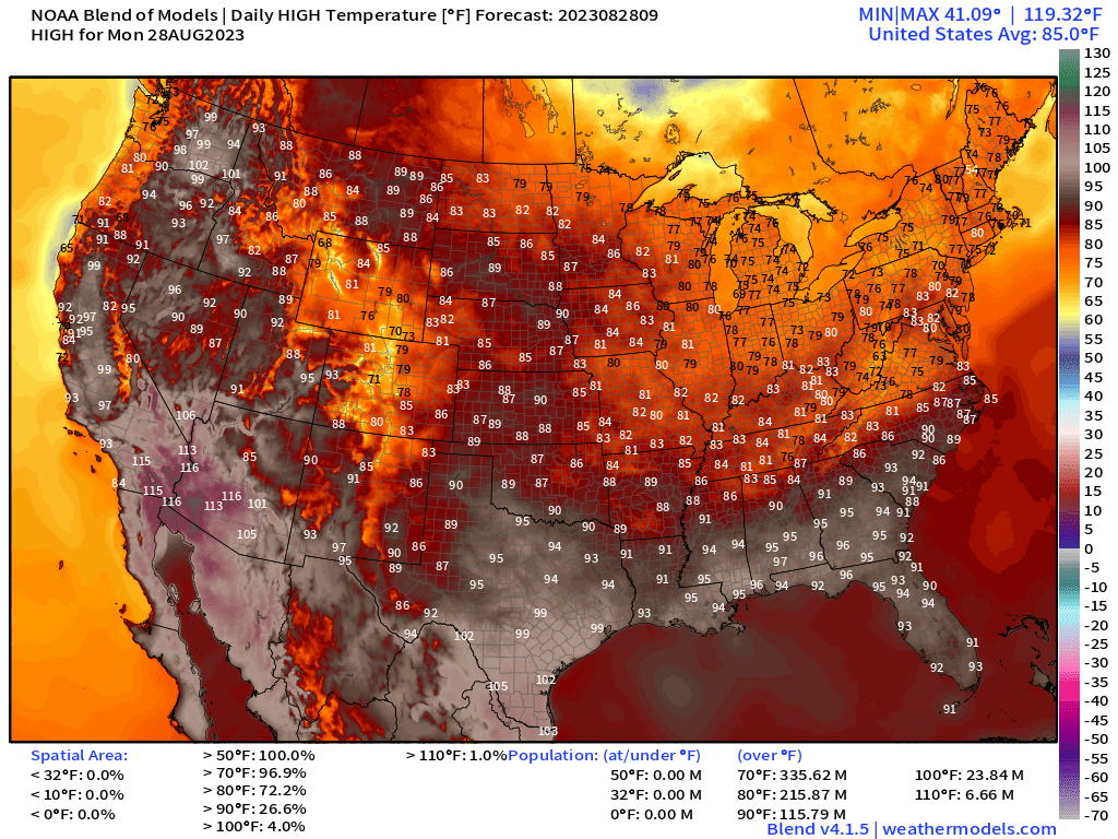
(2) Extreme heat finally has broken in Dallas and New Orleans. After all-time historical record highs in the 100s and 110s, temperatures are settling back into the 90s. The Great Lakes and Northeast remain comfortably in the 70s and 80s.
Dallas: 94°F, New Orleans: 95°F, Atlanta: 91°F
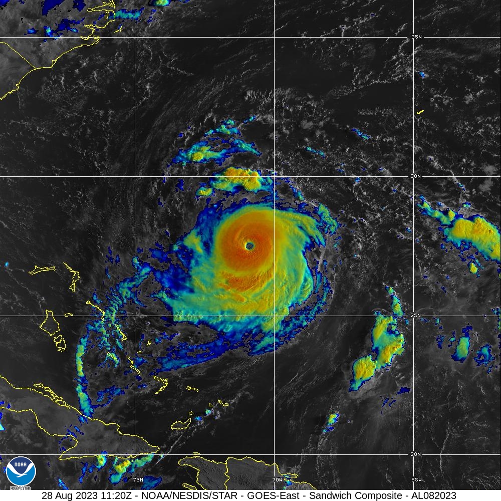
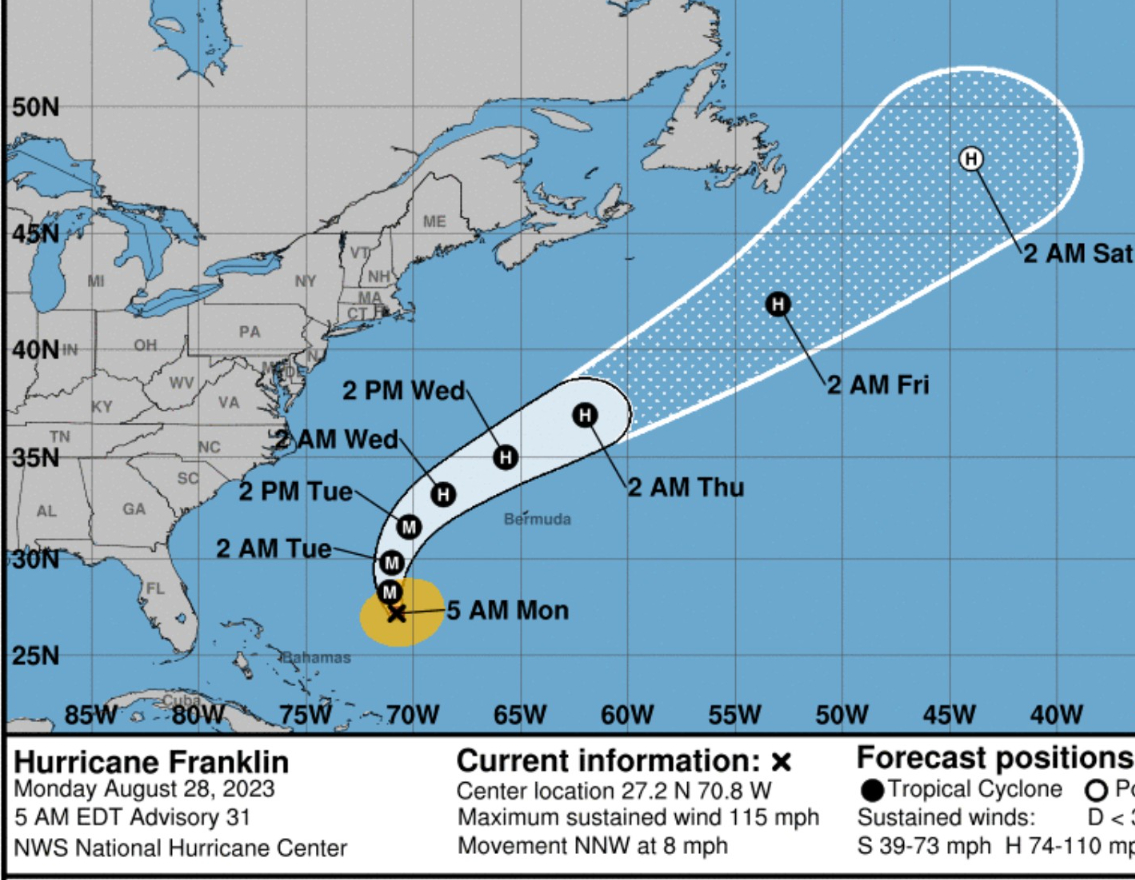
(3) Hurricane Franklin is now 130-mph (942 mb pressure) the first major hurricane of the Atlantic season and expected to become Category 4 later on Monday. Franklin will miss Bermuda to the north and west.
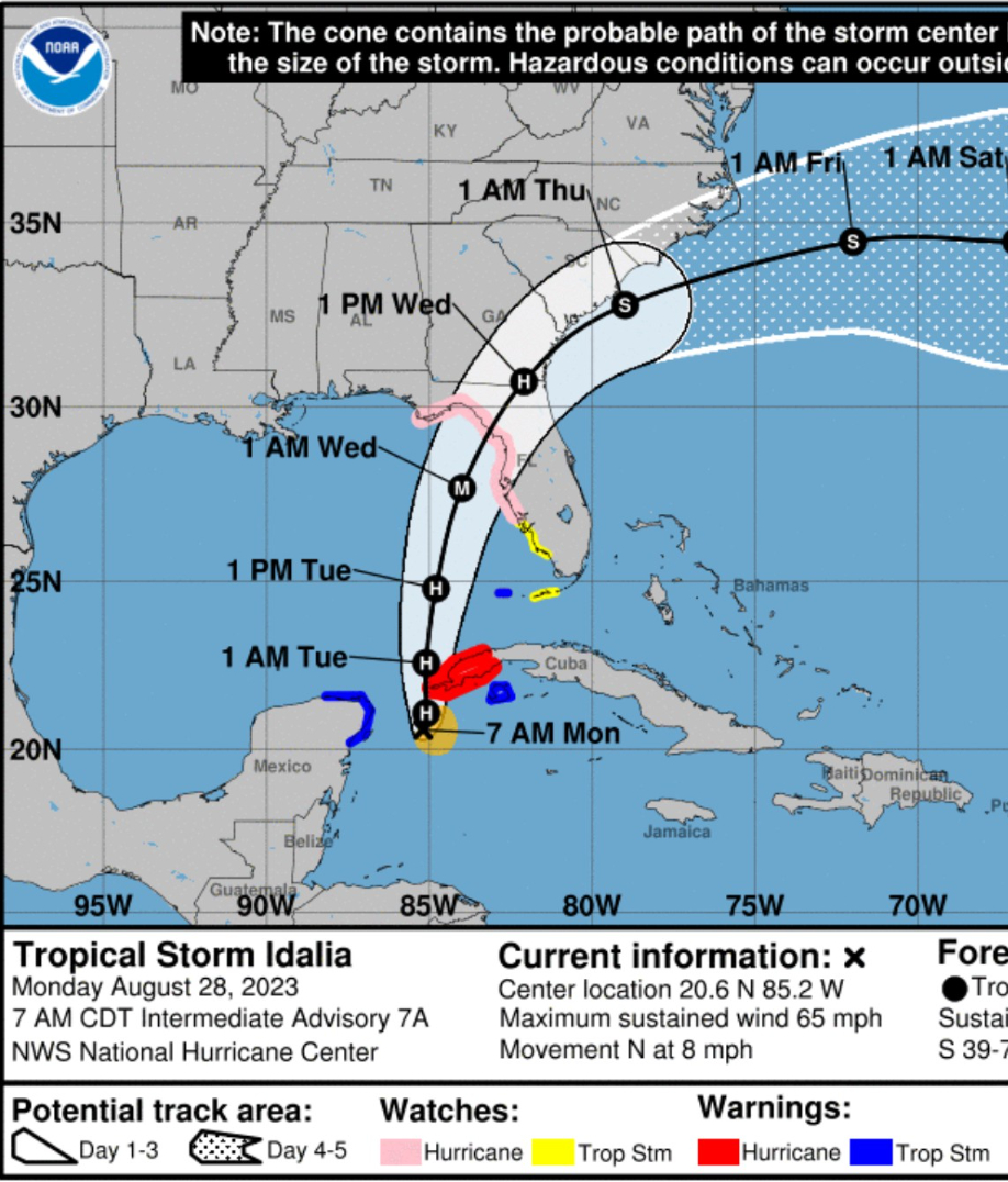
Tropical Storm Idalia
NHC 8 AM ET updated track brings the center of Idalia as a major hurricane west of Tampa Bay at 1 AM Wednesday. There is another 6-12 hours before landfall of additional intensification. The landfall intensity is currently forecast to be at least 100-knots (Category 3).
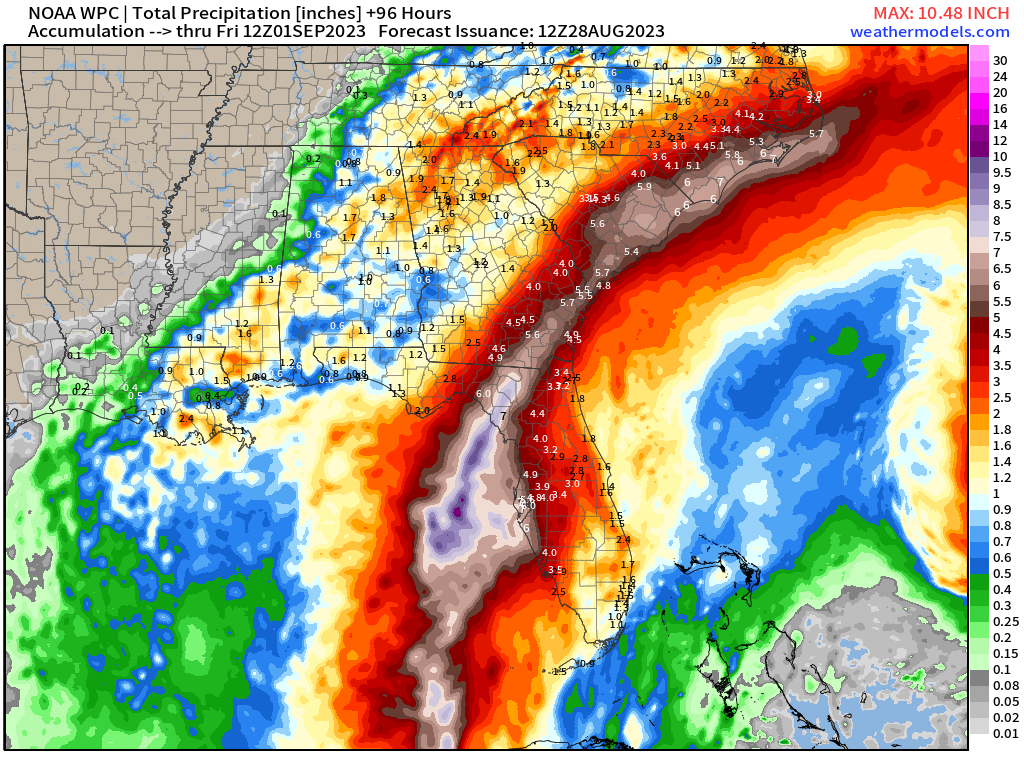
Threats: Rainfall and flooding: 8-inches of rainfall expected near the core of Idalia in the Taylor and Dixie County coastline of Florida’s Big Bend with about 3” in Tallahassee and 4” in Jacksonville and Gainesville. Locally, one can expect these precipitation totals to be significantly more in stronger bands.
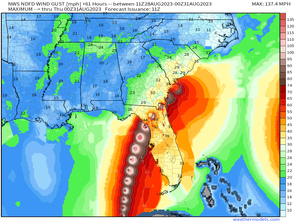
Winds: Hurricane force winds and stronger gusts will extend about 50-75 miles away from the center of Idalia. The current NWS maximum forecast wind gusts is not continuous but shows the snapshot location of Idalia every 6-hours. I see 74-mph winds over Jacksonville, and up to 100-115 mph gusts at landfall. This map will be refined and updated over the next 24-hours.
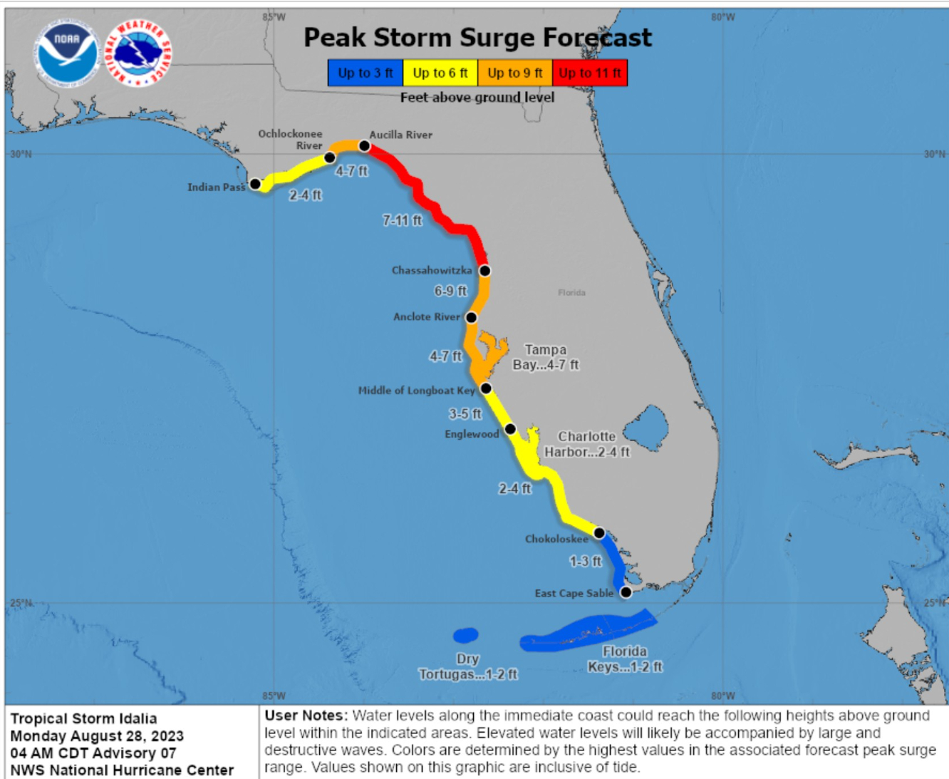
Peak storm surge: Tampa Bay to see 4 to 7 feet of storm surge. Up the coast in the Big Bend 7 to 11 feet.
Short term Atlantic Tropics
Major Hurricane Franklin was visited by aircraft recon and found to be 110-knots (942 mb) early Monday morning. The track of Franklin is also important for Idalia as the large moves and shakers in the tropics and subtropics are all interacting. A slight change in the location of a ridge relative to Franklin could affect the steering or slow / speed up Idalia. Large waves and swell will impact the East Coast, but not as bad since the track of Franklin is to the North and then ENE.
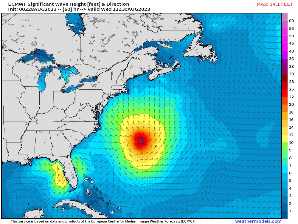
Medium Range Atlantic Tropics
Complete update on the rest of the Atlantic this afternoon.
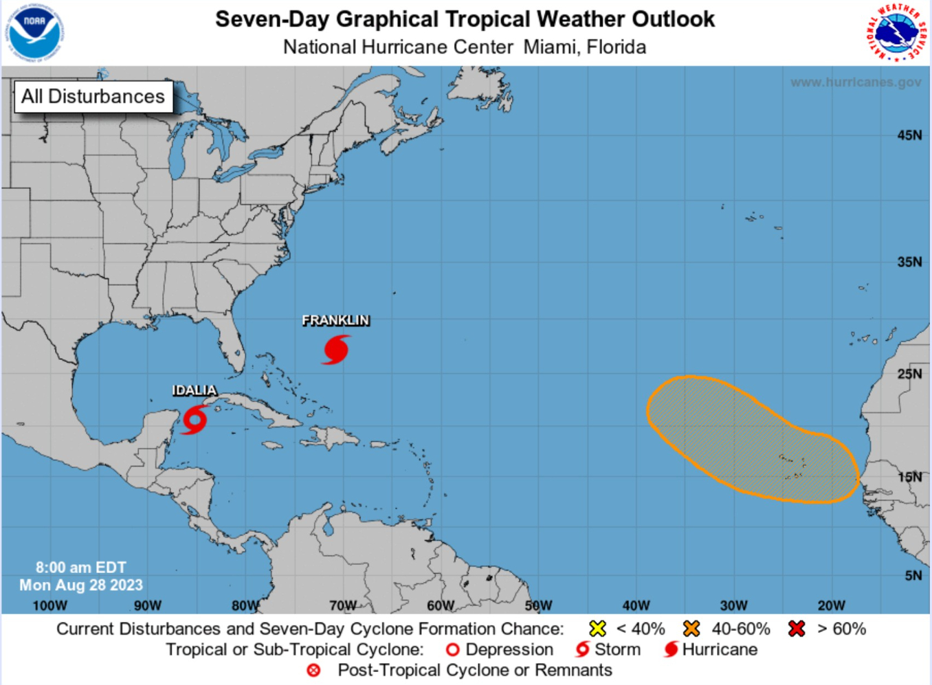
Atlantic 2023 Year to Date | ACE: 30 (110% normal | 27)
Unnamed Storm [January 2023]
Arlene 02L: 35 knots
Bret 03L: 60 knots
Cindy 04L: 50 knots
Don 05L: 65 knots
Emily 07L: 45 knots
Franklin 08L: forecast Hurricane
Gert 06L: 35 knots
Harold 09L: 45-knots
Idalia: forecast major hurricane
Eastern Pacific Hurricane Season
Tropical Storm Irwin (10E) is no threat to land. It is struggling with 35-40 mph winds.
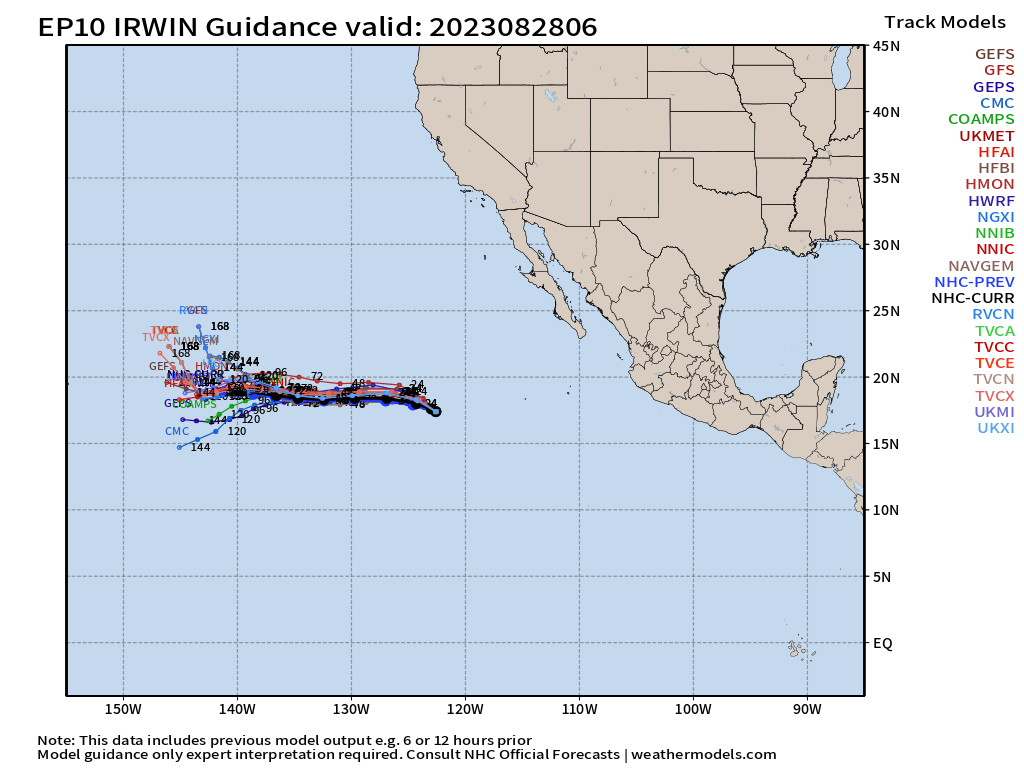
Eastern Pacific 2023 Year to Date
Adrian 01E: 90 knots
Beatriz 02E: 75 knots
Calvin 03E: 110 knots
Four 04E: 30 knots
Dora 05E: 125 knots
Eugene 06E: 60 knots
Fernanda 07E: 115 knots
Greg 08E: 45 knots
Hilary 09E: 125 knots
Irwin 10E: tropical storm
ACE: 105 | 143% of normal (73)
Western Pacific Typhoon Season
Typhoon Saola (09W) has moved away from Luzon and is finishing its CCW loop. It will continue to intensify, currently at 115-knots (Category 4).
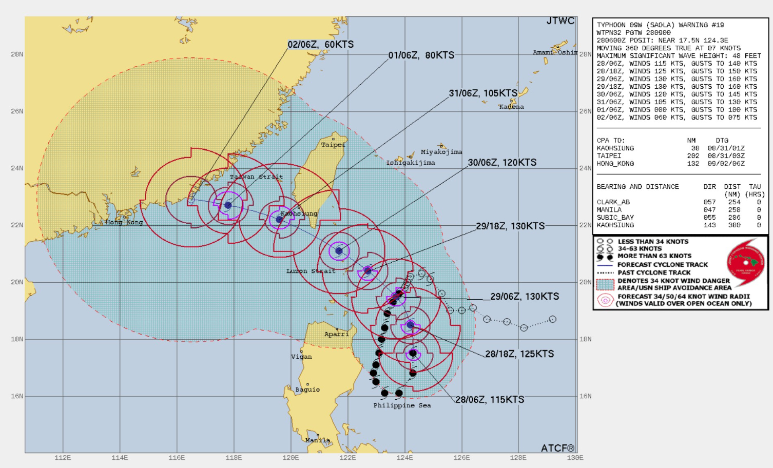
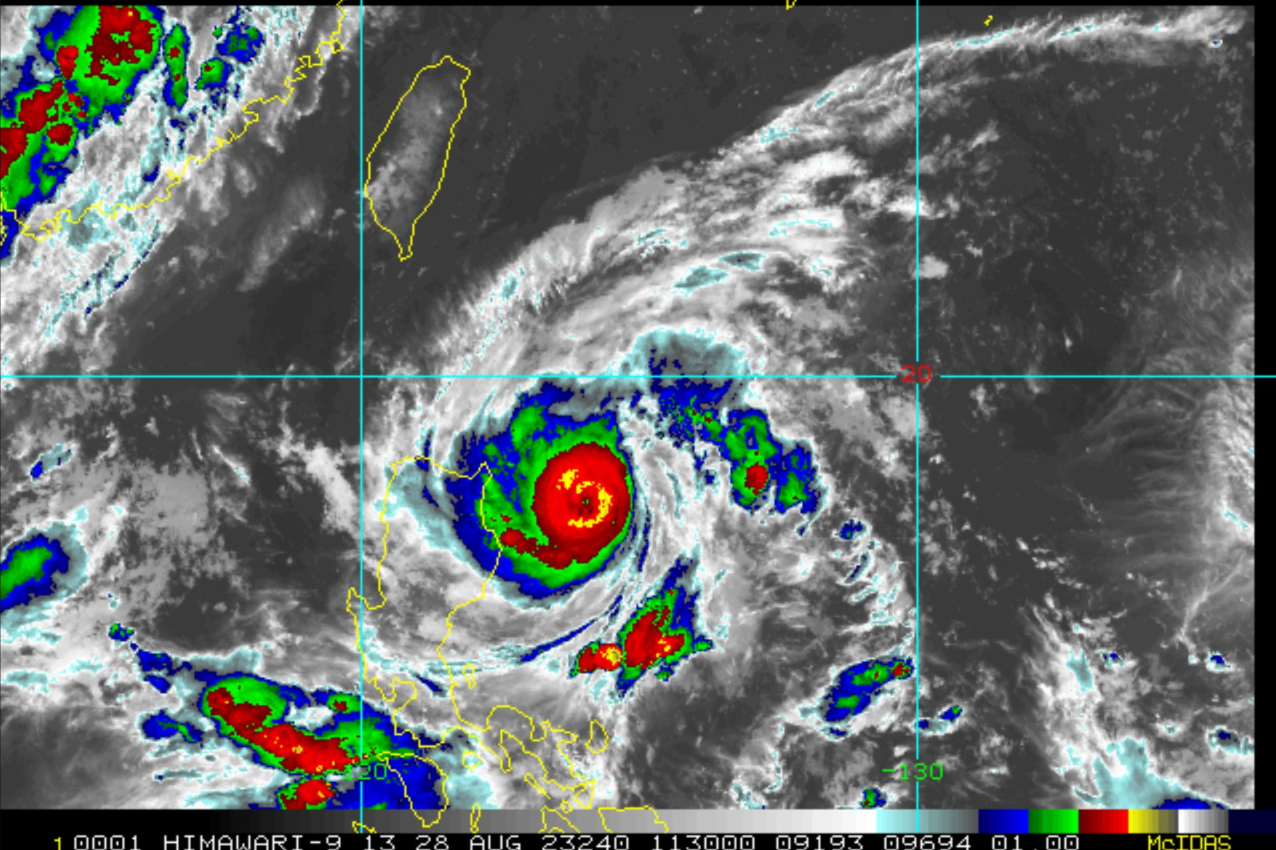
Western Pacific Typhoon 2023 Year to Date
Sanvu 01W: 30 knots
Mawar 02W: 160 knots
Guchol 03W: 90 knots
Talim 04W: 85 knots
Doksuri 05W: 130 knots
Khanun 06W: 120 knots
Lan 07W: 115 knots
Damrey 08W: forecast Typhoon
Saola 09W: forecast Super Typhoon
ACE: 167 | 134% normal (124)
Thank you for subscribing! Your support pays for my servers and product development. Feel free to say hello and follow on Twitter (@RyanMaue)
- Milepost
- 81 · laid 2023-08-28T12:12:50.450000Z
- Source
- https://weather.substack.com/p/august-28-2023-hurricane-season
- Digest
- 16b19d57789996a2d677b0cdde81dfdb0dab6a800ecf0e5896c6048cb4418e13
- Machine
- JSON