November 29, 2025 Weekend Winter Weather
Nor'easter watch for next week
November 2025 was the 4th-warmest November in the 131-year national record (1895–2025), at 46.7°F against a 1991–2020 normal of 43.0°F (+3.7°F).
November 2025 was the 29th-driest November in the 131-year national record (1895–2025), at 1.7in against a 1991–2020 normal of 2.3in (-0.6in).
NOAA/NCEI Climate at a Glance, contiguous United States. This is the observed record for the month, not a score of anything said in this piece — the forecast ledger begins 2026-08-17 and cannot reach earlier posts.

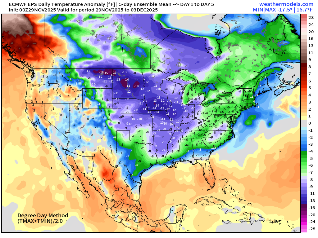
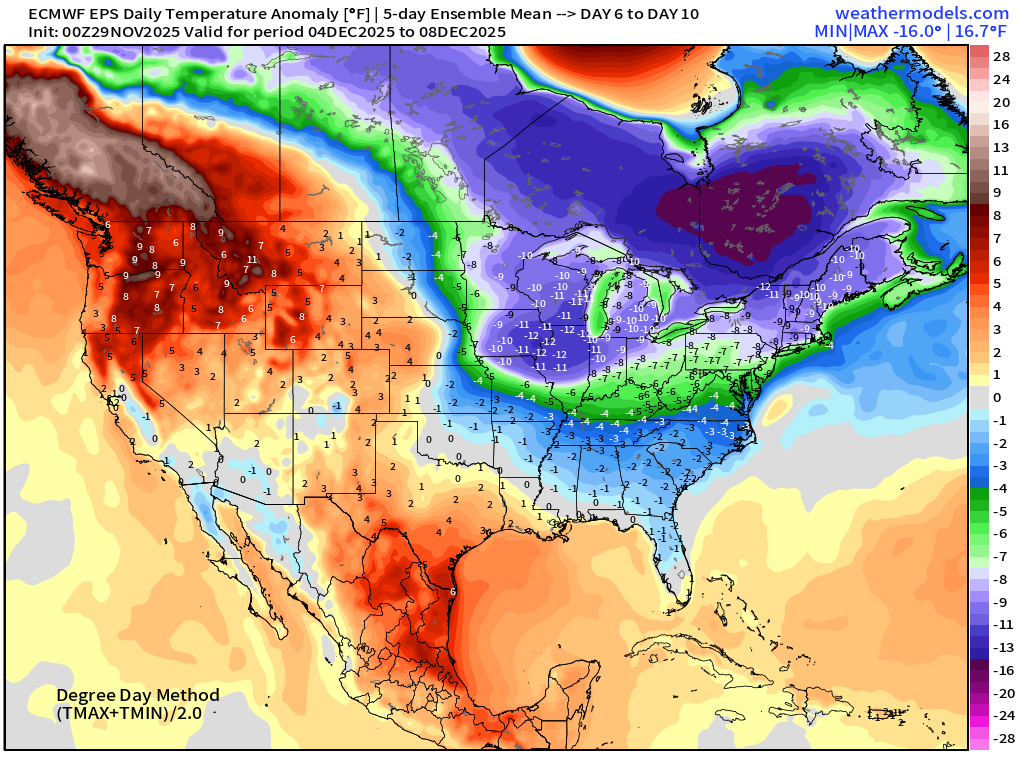
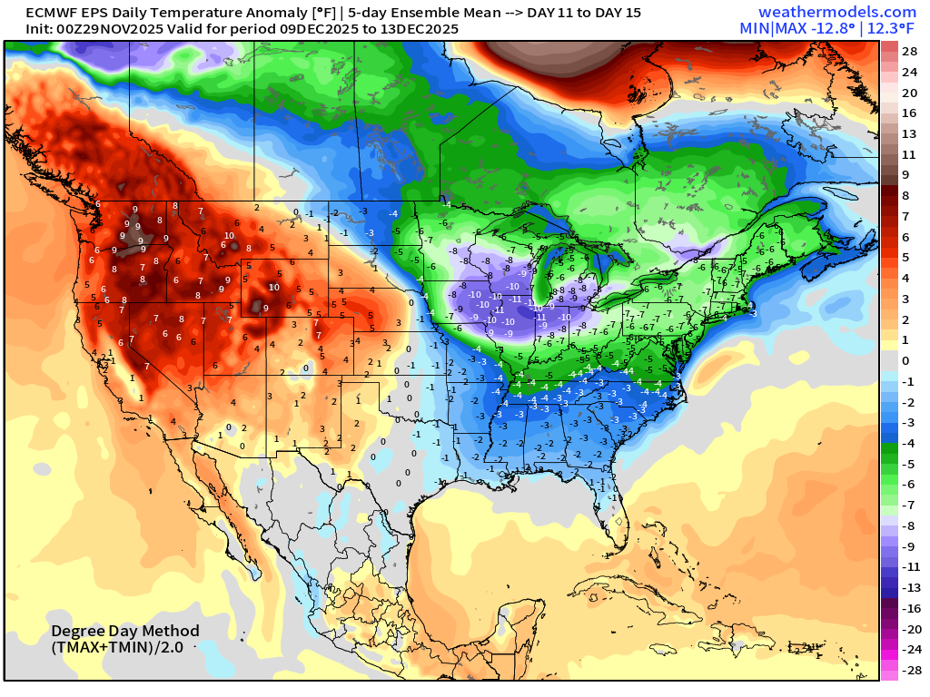
Next 15-days Temperature Anomaly | Ensemble Mean
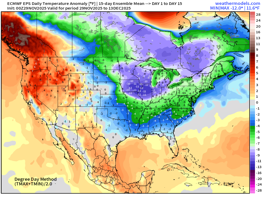
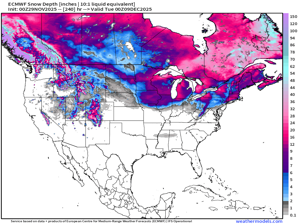
The coldest air in the 15-day mean is centered over Iowa and Chicago — likely due to the snow cover/depth remaining for the next 1-2 weeks without a sustained warmup in the cards. Also, depending upon the track of a potential Nor’easter in the middle of next week, we may have long-lasting snow depth into December across New England.
We really went from those quite warm days of autumn to full-tilt winter in like 2-weeks.
Snow Depth Forecast in 10-days | into December 9, 2025
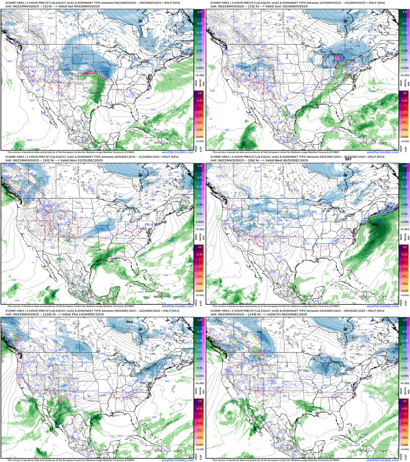
Lower 48 precipitation type + MSLP for the next 6-days | ECMWF 18z
Headlines Saturday Morning
Powerful Midwest —> Great Lakes storm system moves quickly into Quebec dragging another strong Arctic cold front across the eastern U.S.
Nor’easter watch! The ECMWF flagship model keeps flipping between a major 12-18” jackpot over New England to a more management 3-6” event with the difference due to phasing of surface low with the upper-level trough. Tricky forecast! Note the heavier rain along the Gulf coast into the Southeast.
Next 2-weeks remain stuck with well below normal temperatures across the Eastern U.S. as the mega-load of “Polar Vortex” cold pool wobbles around Hudson/James Bay waiting for any shortwave out of the Pacific to capture a lobe.
Black Friday Coupon: Ends November 30, 2025 for new/upgrade. At my end, the goal is to increase membership, both free and paid, to expand my reach on the Substack platform. Sometimes I’m number 5 or 85 [in the category] depending upon the weather. I’ve published over 300 posts per year, so we’re talking 25 cents per daily update! I do not do advertising, and nothing is done with the subscriber list. All growth is entirely organic.
Temperature Analysis | 9:45 AM ET
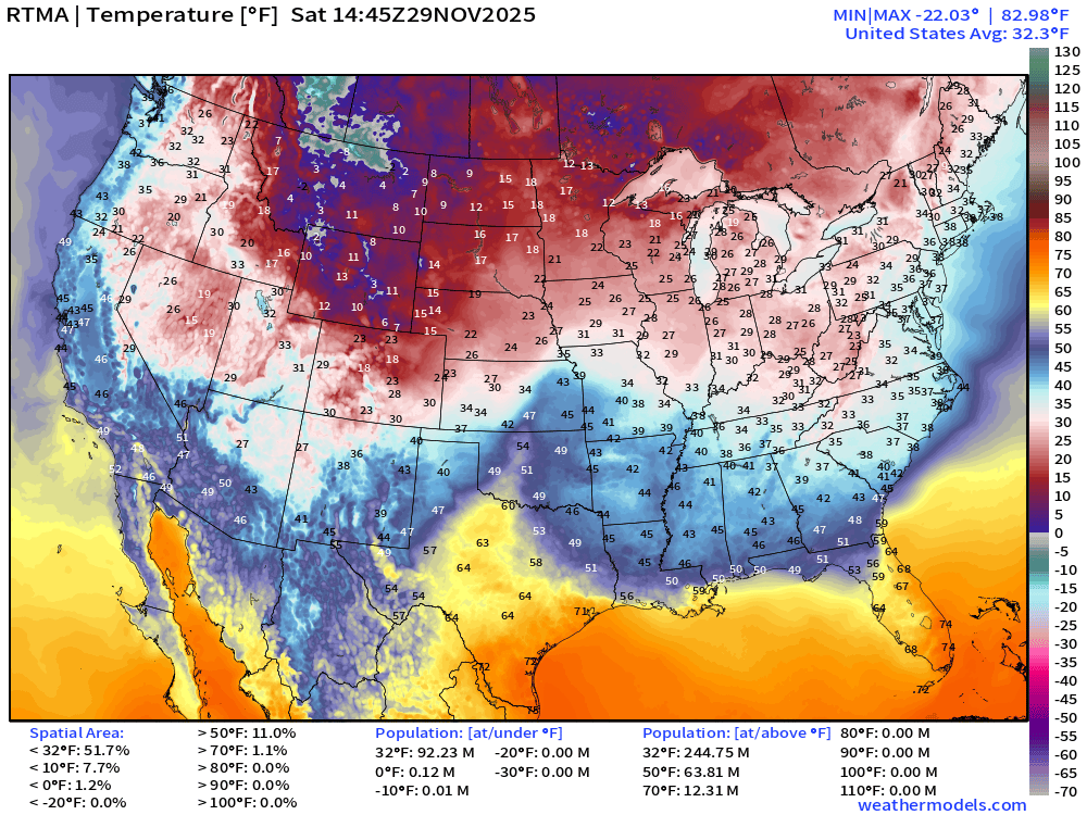
Subzero air in Montana with teens and lower 20s into Minneapolis. Near freezing in Chicago and Detroit
Temperature Anomaly | 9:45 AM ET
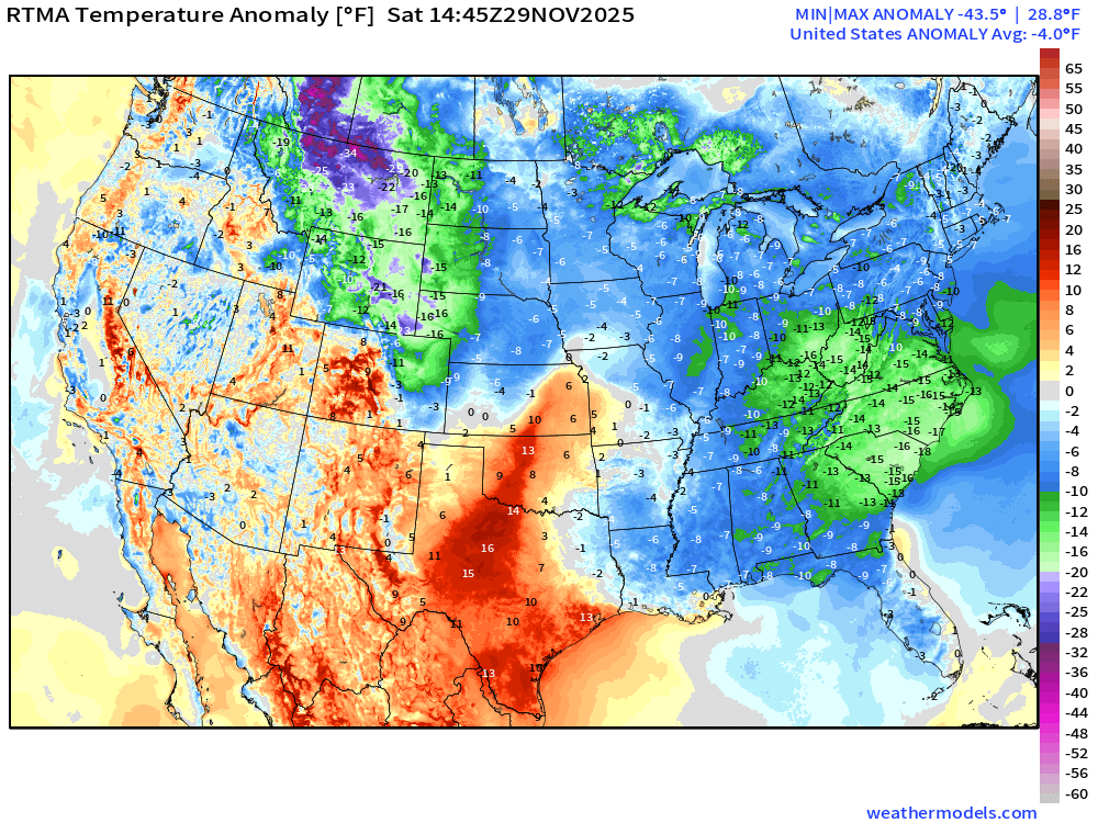
Lower 48 Temperature Anomaly was -4.0°F below normal
Midwest —> Great Lakes Snow Storm Radar through 10:20 AM ET
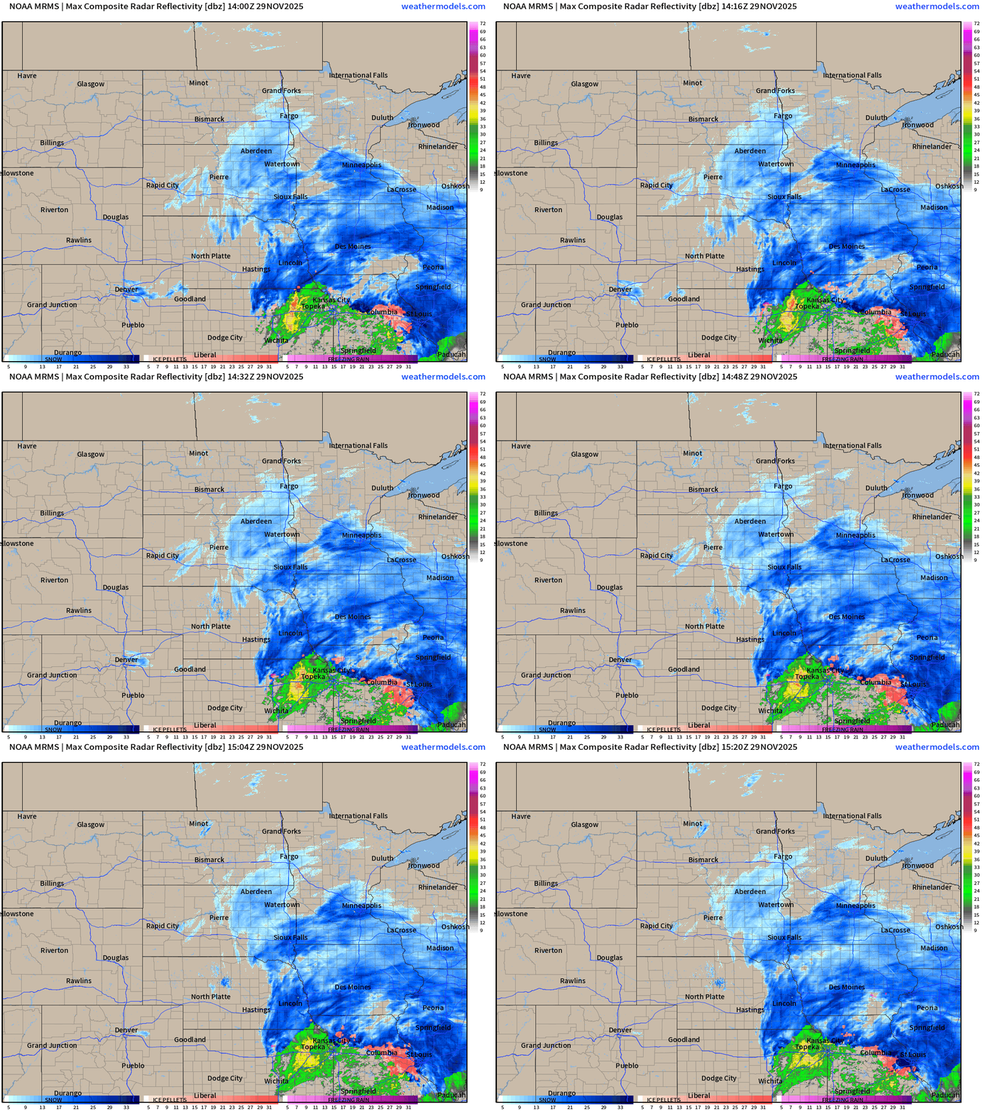
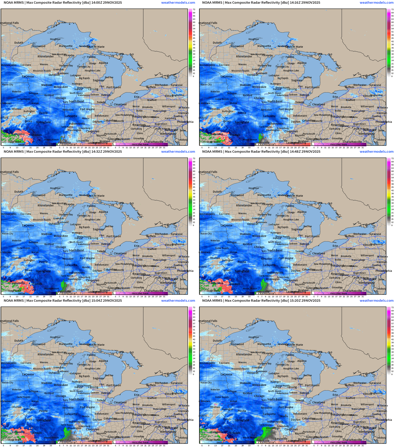
HRRR 12z | Simulated Radar Next 48-hours into Monday Morning
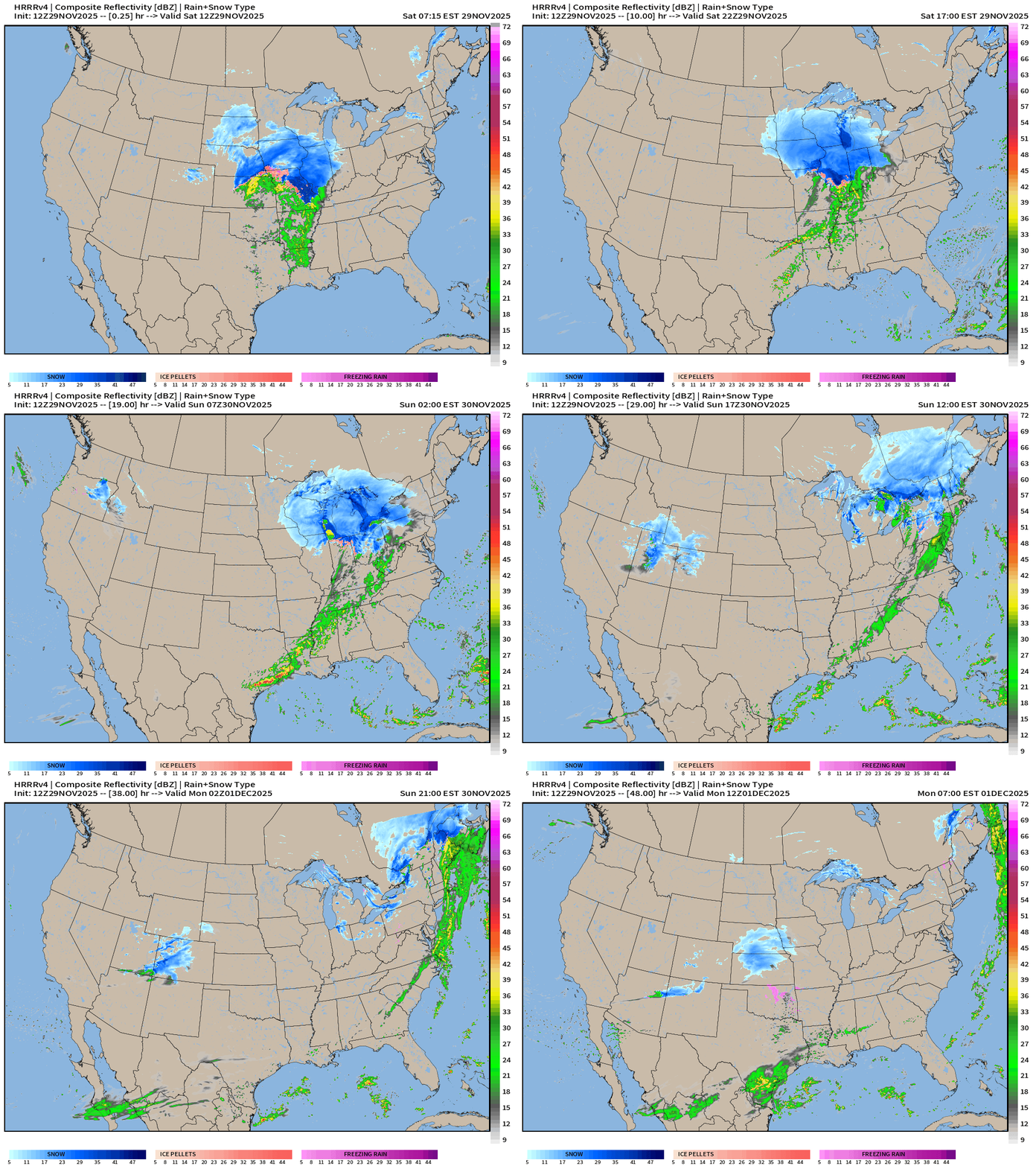
The front fizzles out as it reaches the Southeast with only some lighter showers. The main energy with the surface low quickly tracks into Ontario/Quebec and takes the QPF with it —> but we’ll see quite a blanket of snowfall in excess of a foot for huge area.
Total Snowfall From HRRR Next 18-hours | 12z —> Sunday 1 AM ET
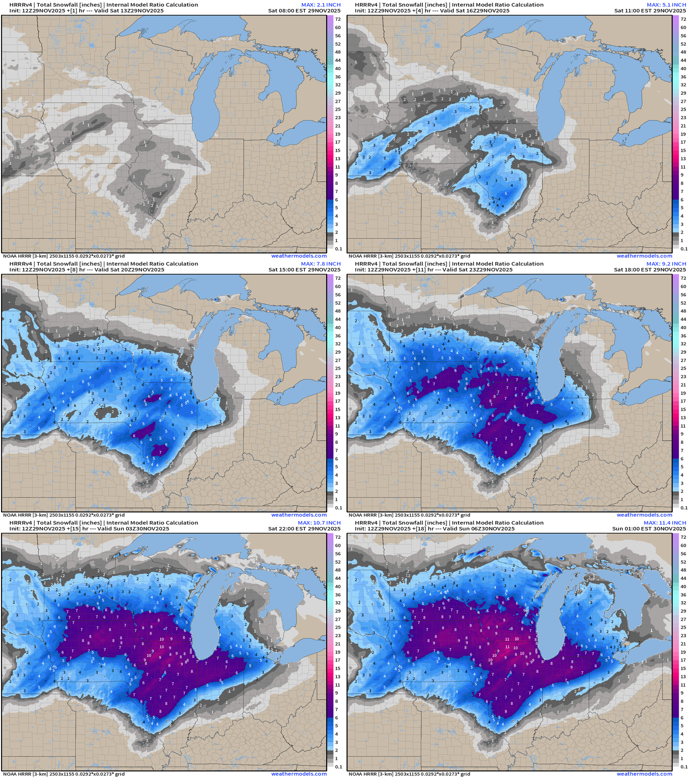
Like taking a paint brush and coloring the canvas with beautiful hues of blue and pink, my favorite maps (aside from precipitable water)
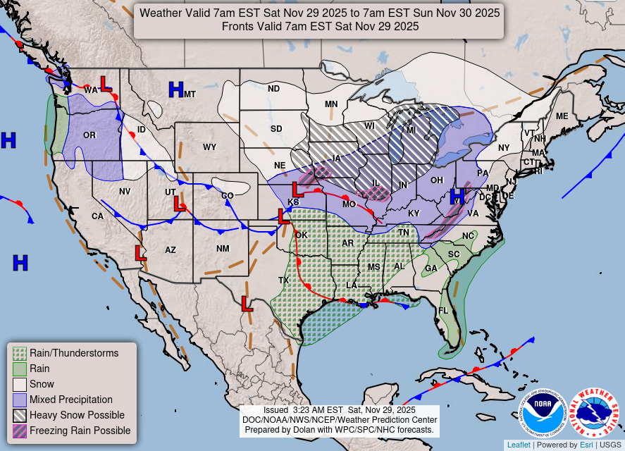
Lower 48 | Frontal Boundaries and storm systems today
NWS Precipitation Next 72-hours
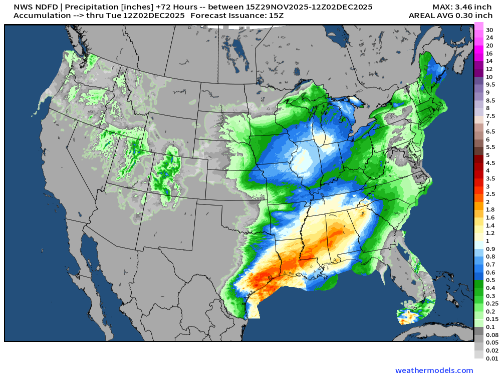
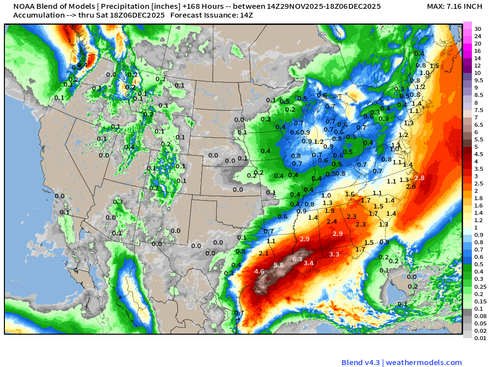
Heavy rain: 1” to 2”+ from the next storm system / potential Nor’easter into early next week across the Deep South and Gulf Coast into the Southeast.
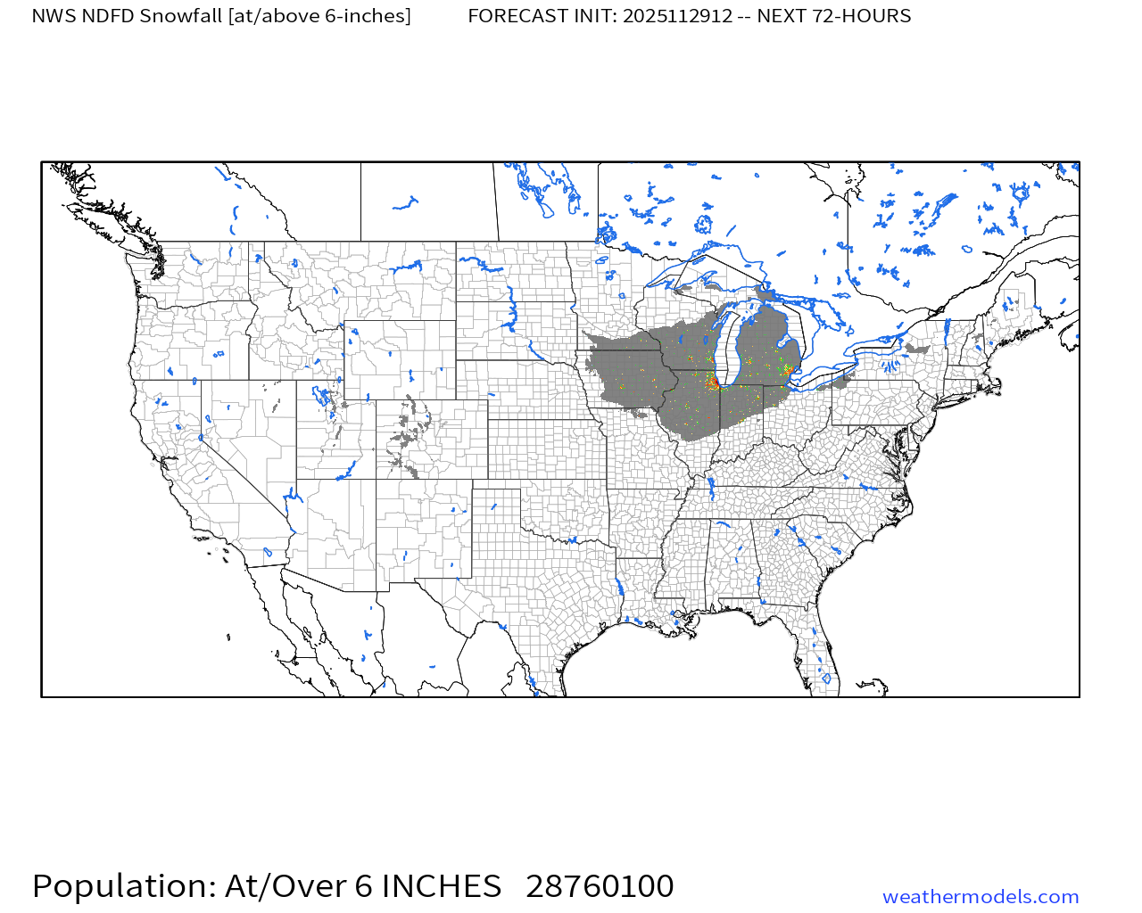
NWS Snowfall Next 72-hours
Chicago, Milwaukee, Des Moines > 12” … we’ll see how much southern Michigan sees — but at least a foot in Kalamazoo, and over 6” in Detroit. Plenty of shoveling and plowing for huge population — roughly 28.7 million from the NWS NDFD through 72-hours for 6-inches+
RRFS-A through 84-hours (Tuesday 2 PM ET) | Snowfall totals
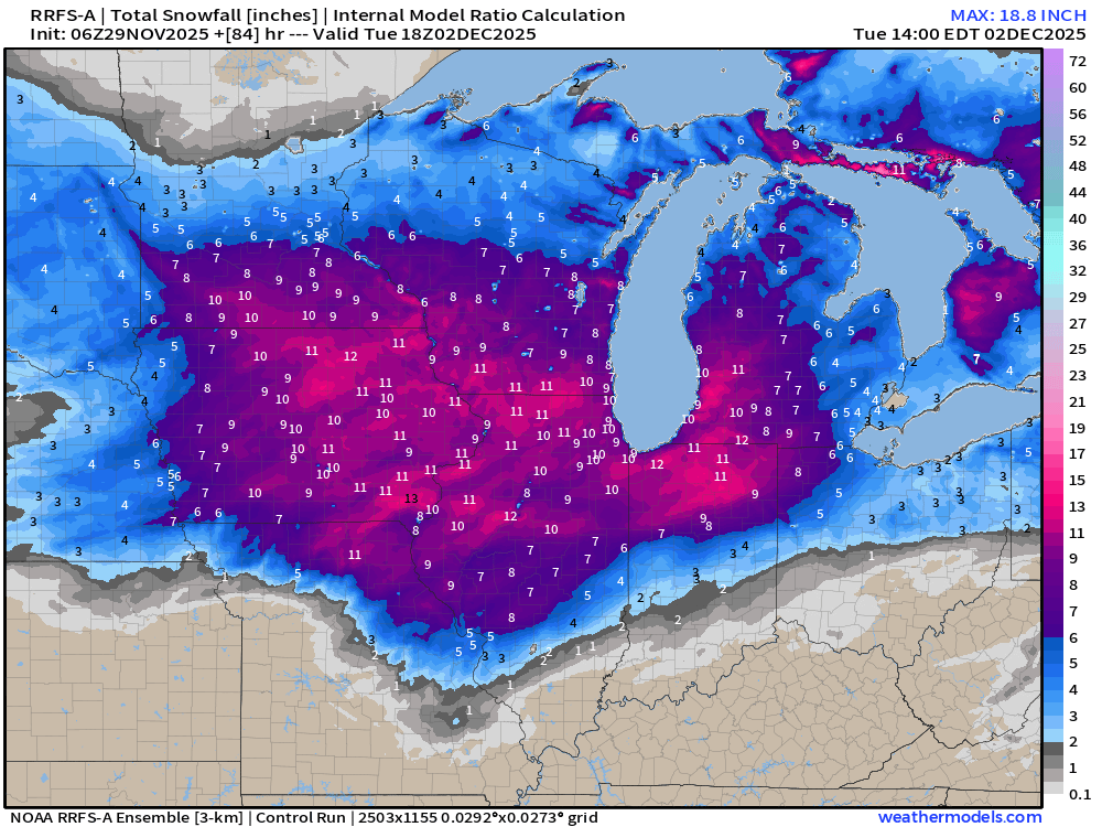
This map is beautiful … RRFS-A is a 3-km resolution model and my color table is dazzling.
Blend of Models | 7 Days Precipitation Total (includes liquid from snow)
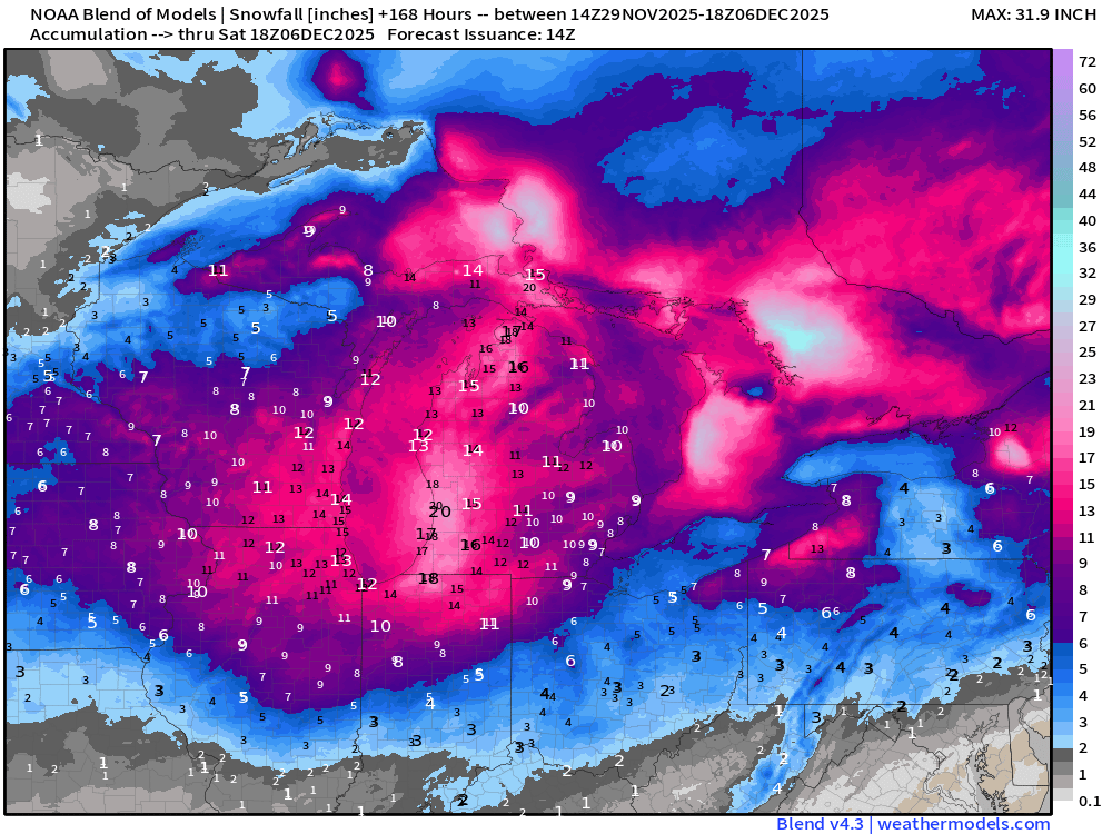
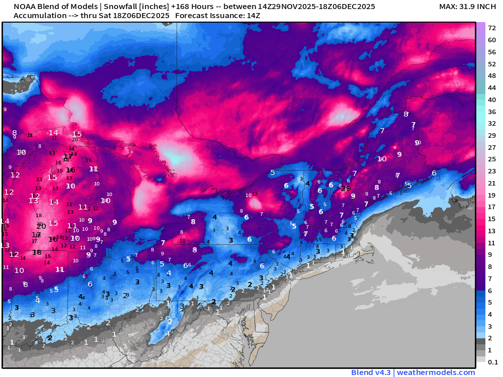
Total Snowfall Next 7-Days
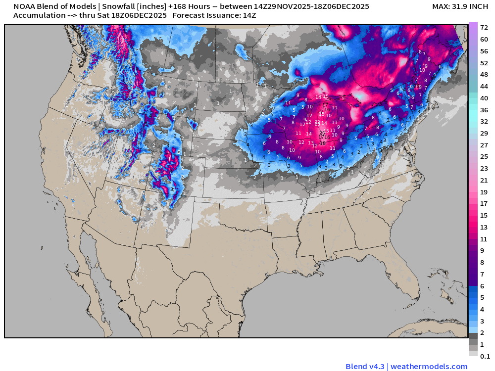
The Blend of Models (ensemble mean) showing snowfall for Northeast and New England that’s generally in the 2” range for NYC and Boston, maybe a little more. Fine line between huge snow storm from the Nor’easter, or a whiff.
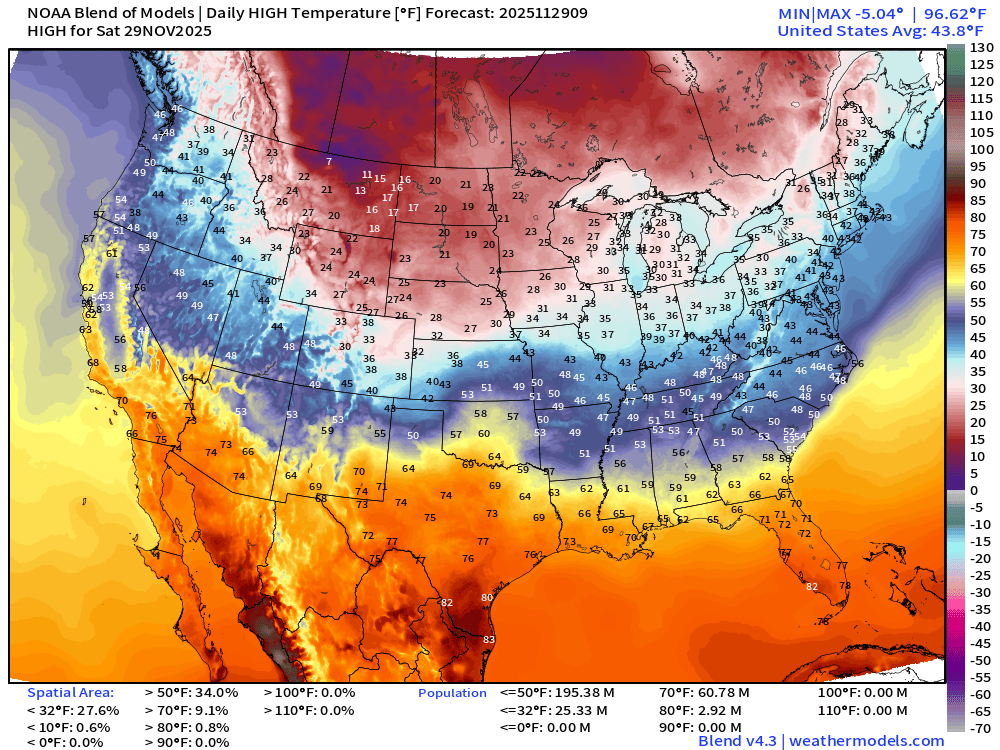
Saturday High Temperatures
Sunday Low Temperatures
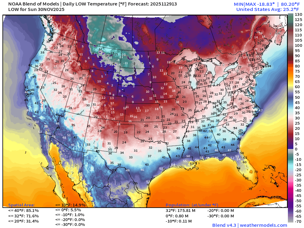
176 million below freezing (Lower 48 average low is 25.2°F)
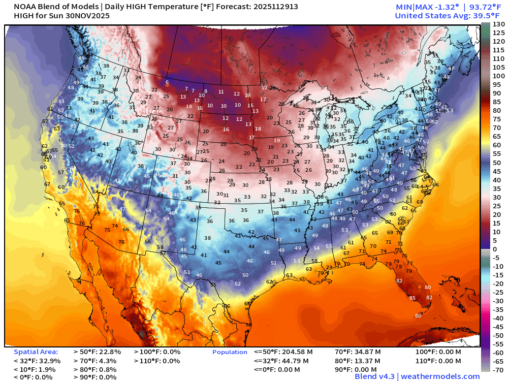
Sunday High Temperatures
Monday Low Temperatures
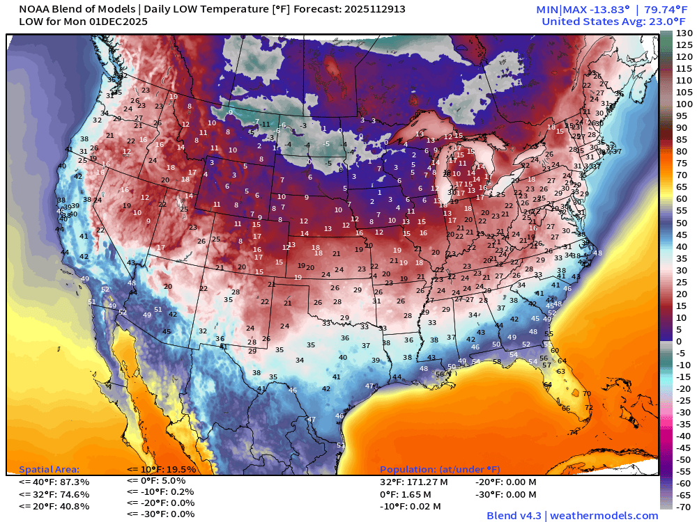
171 million below freezing (Lower 48 average low is 23.0°F)
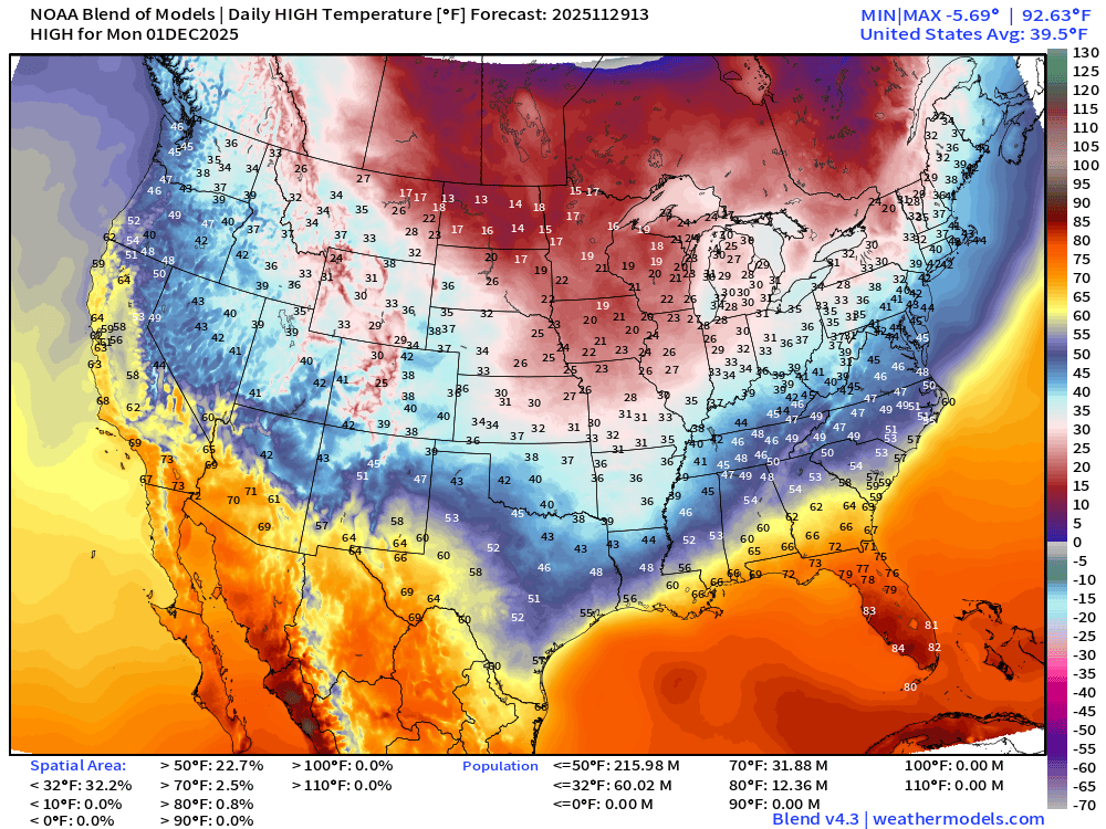
Monday High Temperatures
New AI-GFS | 500 mb Temperatures | Polar Vortex Watch Next 10-days
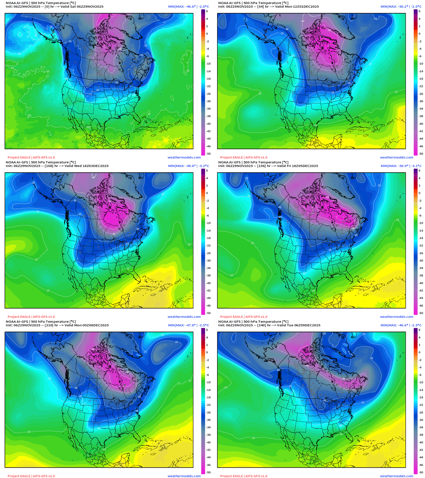
Amazing cold locked up over Hudson / James Bay with -50°C coldest air at 500 mb perilously close to the Lower 48 borders — waiting for passing shortwaves coming out of the Gulf of Alaska to pull down or snatch lobes.
ECMWF EPS 00z | 15-day Ensemble Mean Temperature Anomaly
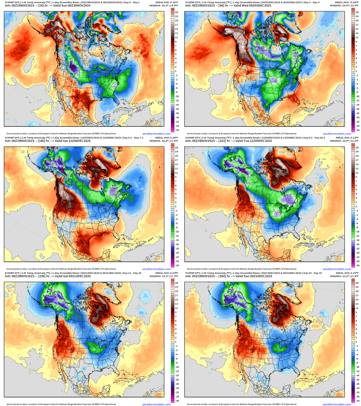
Alaska goes into the deep freeze — but also the Great Lakes, too
Atmospheric Moisture | Precipitable Water Next 6-days
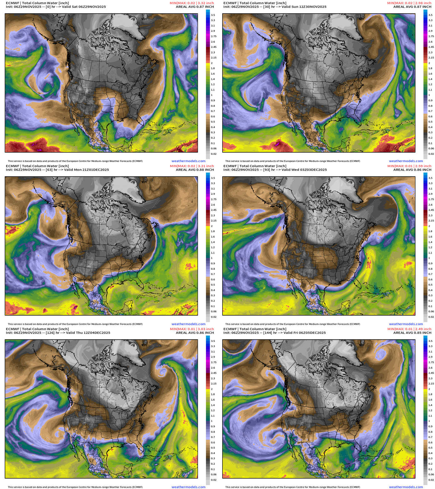
My favorite parameter! The white coloring is the coldest/dries of the tropospheric “Polar Vortex” and you can trace the origin of the air from Greenland and the Arctic Ocean over next 6-days.
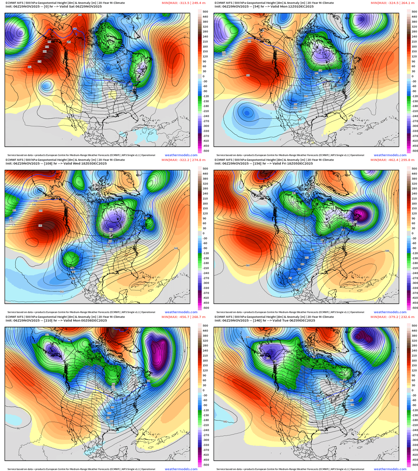
ECMWF AIFS 06z | Height Anomaly (500 hPa) Next 10-days
Integrated Vapor Transport Next 10-days
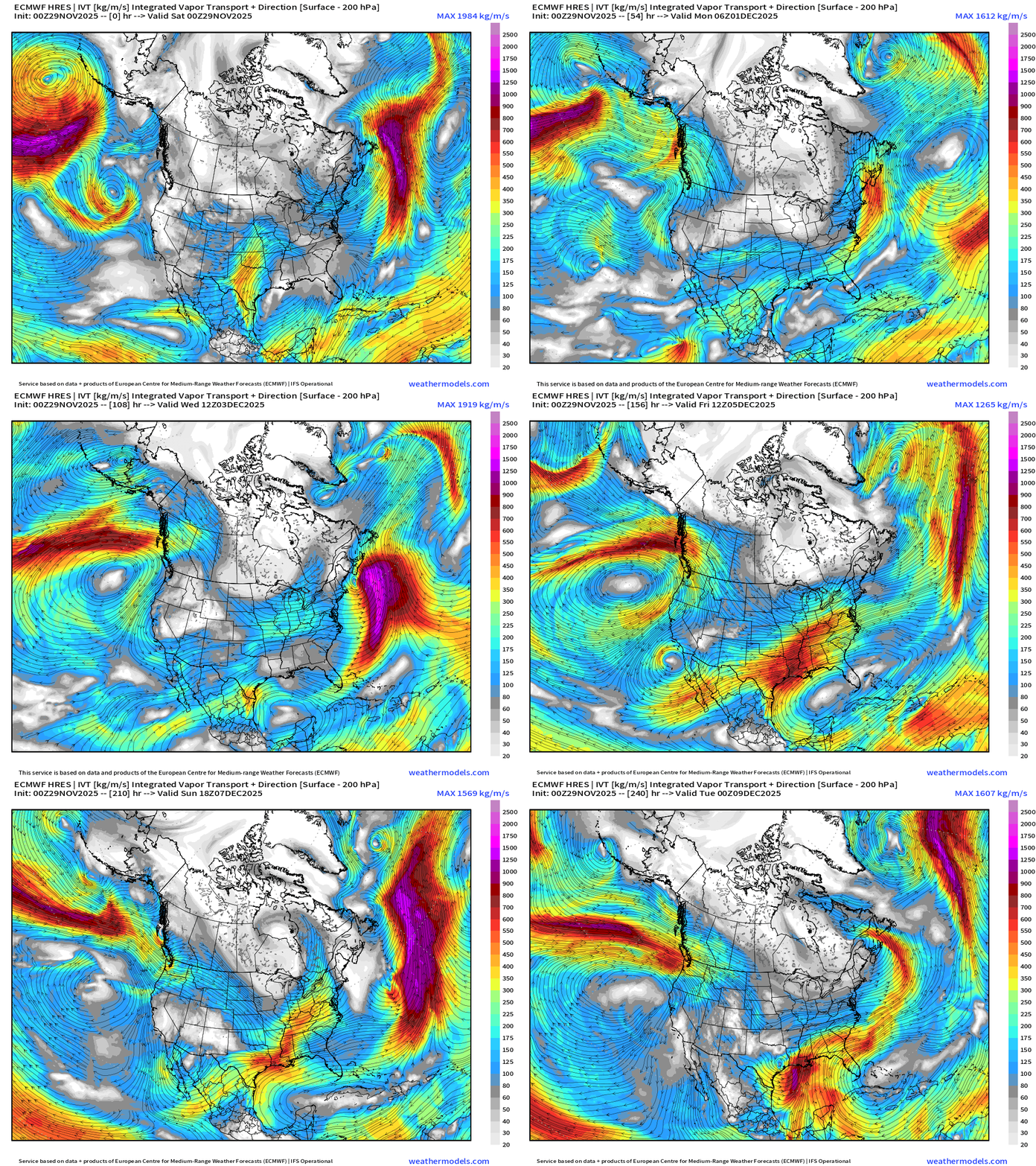
Parameter used for monitoring “atmospheric rivers”
European Weather Next 6-days
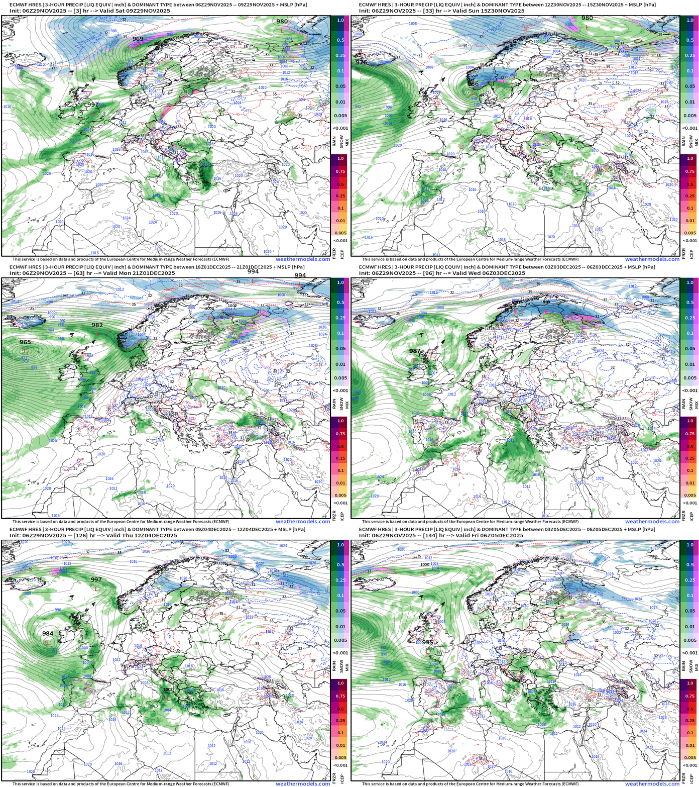
Note the preponderance of “green” for precipitation type of rain … warmer pattern
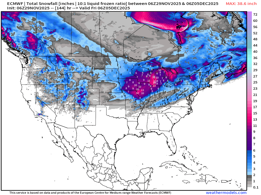
ECMWF 00z and 06z | Snowfall | Next 6-days
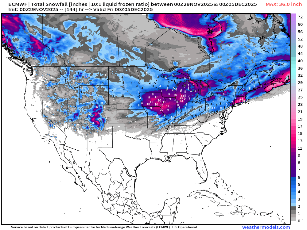
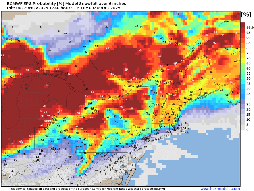
New England — Nor’easter watch!
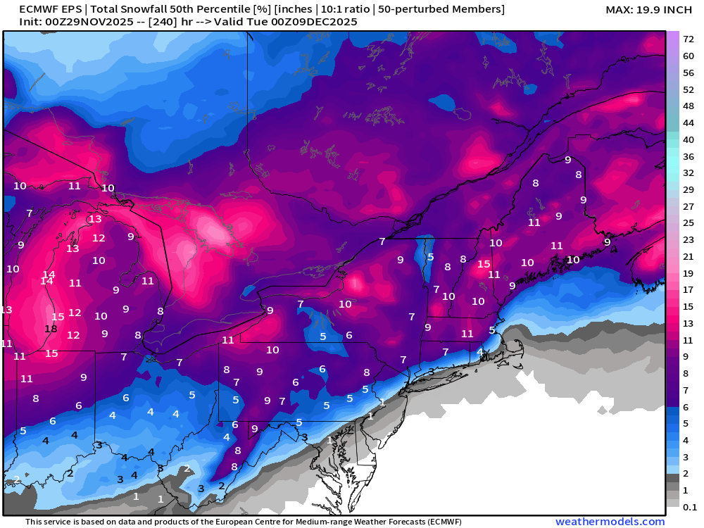
ECMWF EPS 00z | Ensemble Median Snowfall Next 10-days
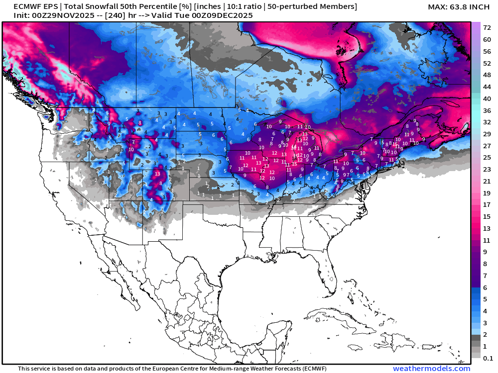
Median from ensembles at 00z was 5” in Boston — right on the edge
ECMWF EPS 00z | Ensemble Snowfall Probability > 1” | Next 10-days
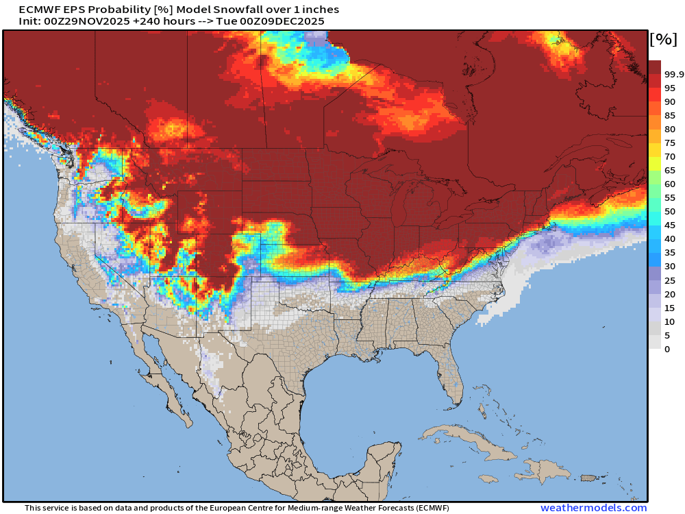
Need to look at the snowfall margin again in the Southeast — thankfully 0% chance in Atlanta for next 10-days, but this is an impressive cold pattern + snow for early December.
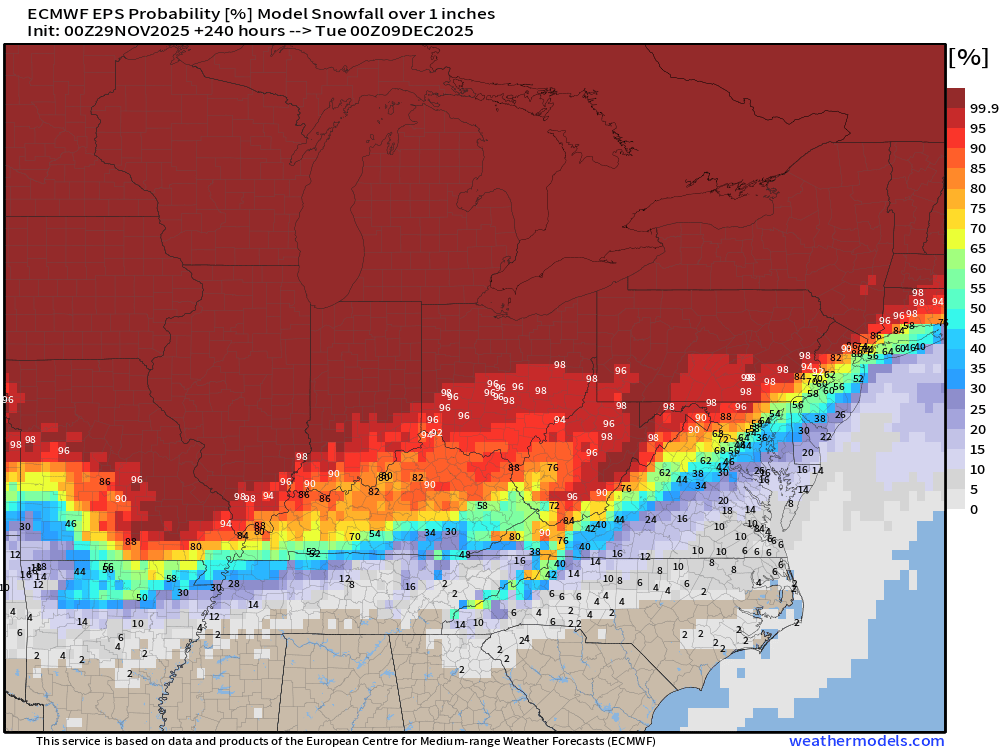
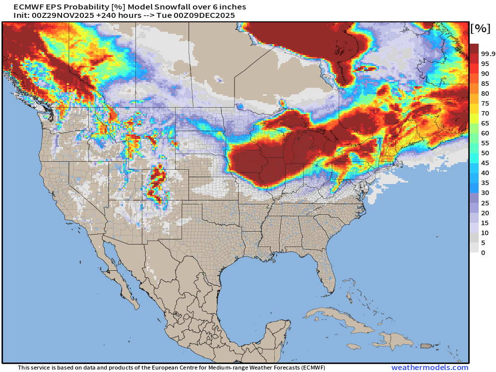
ECMWF EPS 00z | Ensemble Snowfall Probability > 6” | Next 10-days
Temperature Anomaly | Next 15-days | ECMWF EPS 00z
5-Day Chunk #1 | Temperature Anomaly | Nov 29 - Dec 3
5-Day Chunk #2 | Temperature Anomaly | Dec 4 - Dec 8
5-Day Chunk #3 | Temperature Anomaly | Dec 9 - Dec 13
Snowfall Analysis | October 2025 - today
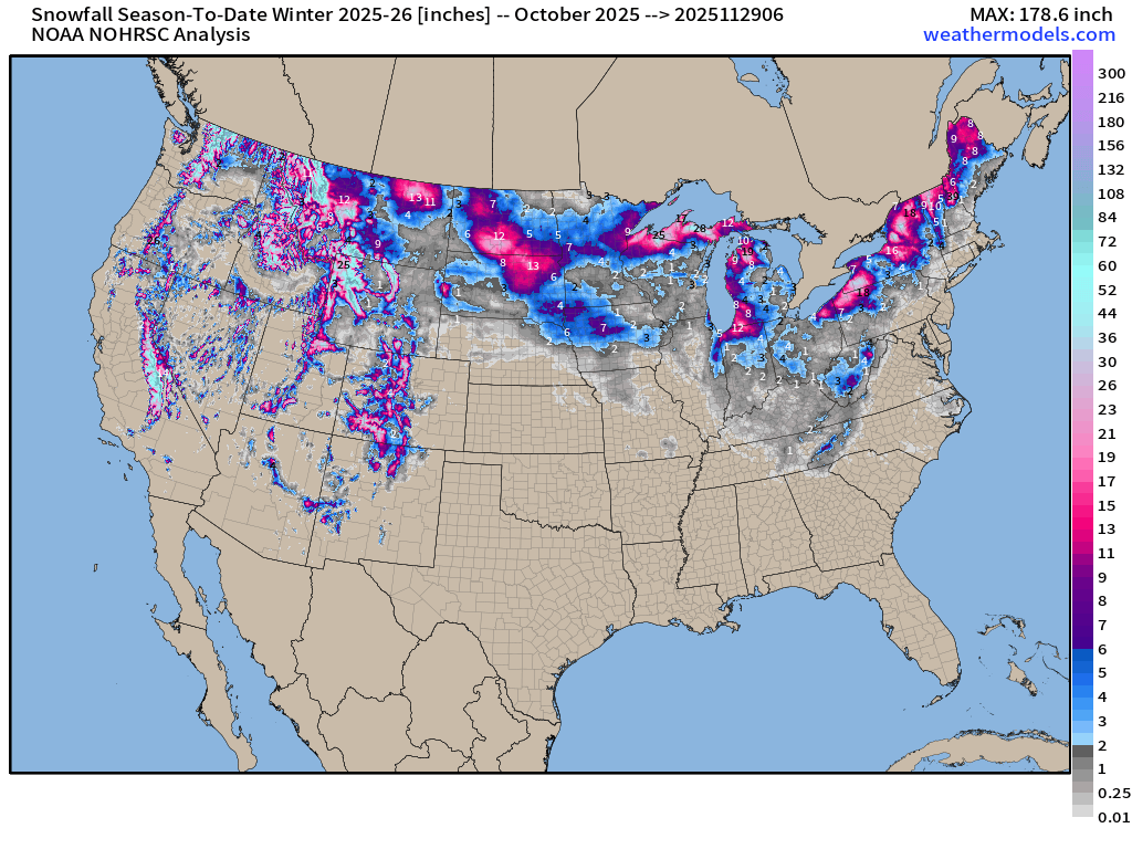
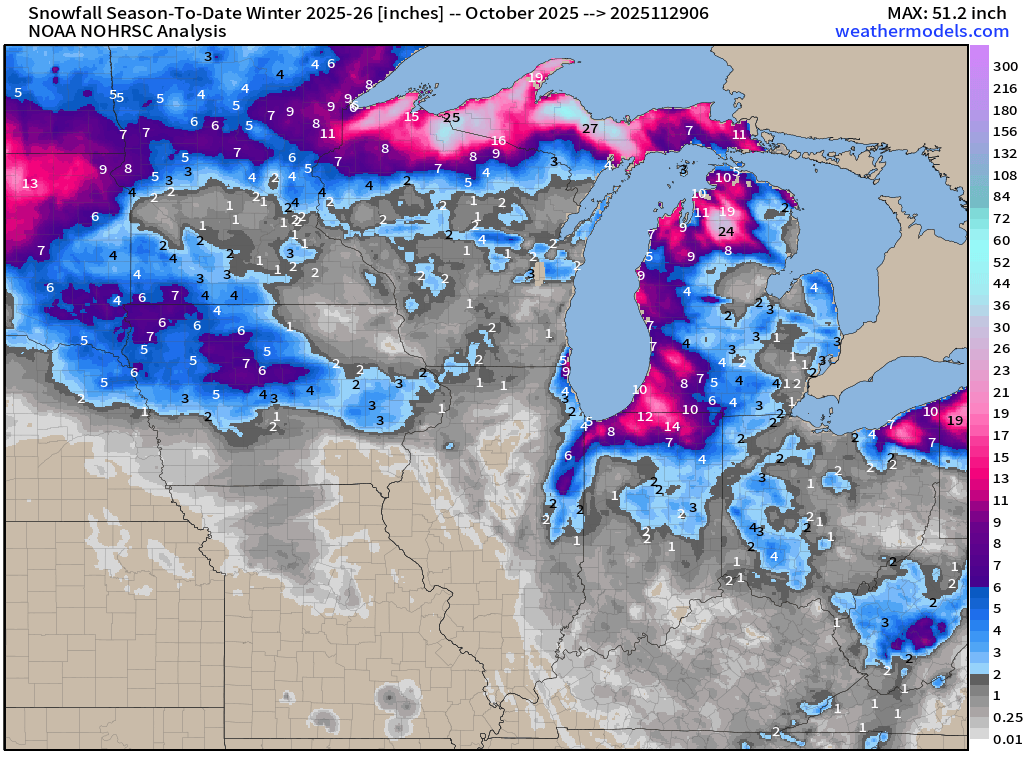
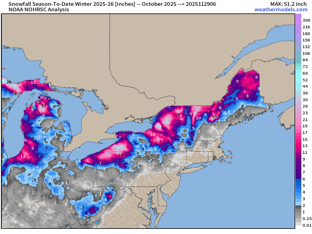
Maps sourced from weathermodels.com designed and innovated by yours truly! Please subscribe there for real-time access to the newest maps, charts from all of the weather models including ECMWF and AIFS, NOAA AI-GFS/AI-GEFS
- Milepost
- 801 · laid 2025-11-29T16:09:45.655000Z
- Source
- https://weather.substack.com/p/november-29-2025-weekend-winter-weather
- Digest
- 9b7e1f1c3865b6124811c27bbcdca87013ce1b81c3df0ed17753c41e27808c7d
- Machine
- JSON