November 26, 2025 Wednesday Winter Weather
Another major winter storm on way for this weekend to snarl holiday travel
November 2025 was the 4th-warmest November in the 131-year national record (1895–2025), at 46.7°F against a 1991–2020 normal of 43.0°F (+3.7°F).
November 2025 was the 29th-driest November in the 131-year national record (1895–2025), at 1.7in against a 1991–2020 normal of 2.3in (-0.6in).
NOAA/NCEI Climate at a Glance, contiguous United States. This is the observed record for the month, not a score of anything said in this piece — the forecast ledger begins 2026-08-17 and cannot reach earlier posts.

HRRR 23z | Simulated Radar Next 18-hours into Noon on Thursday
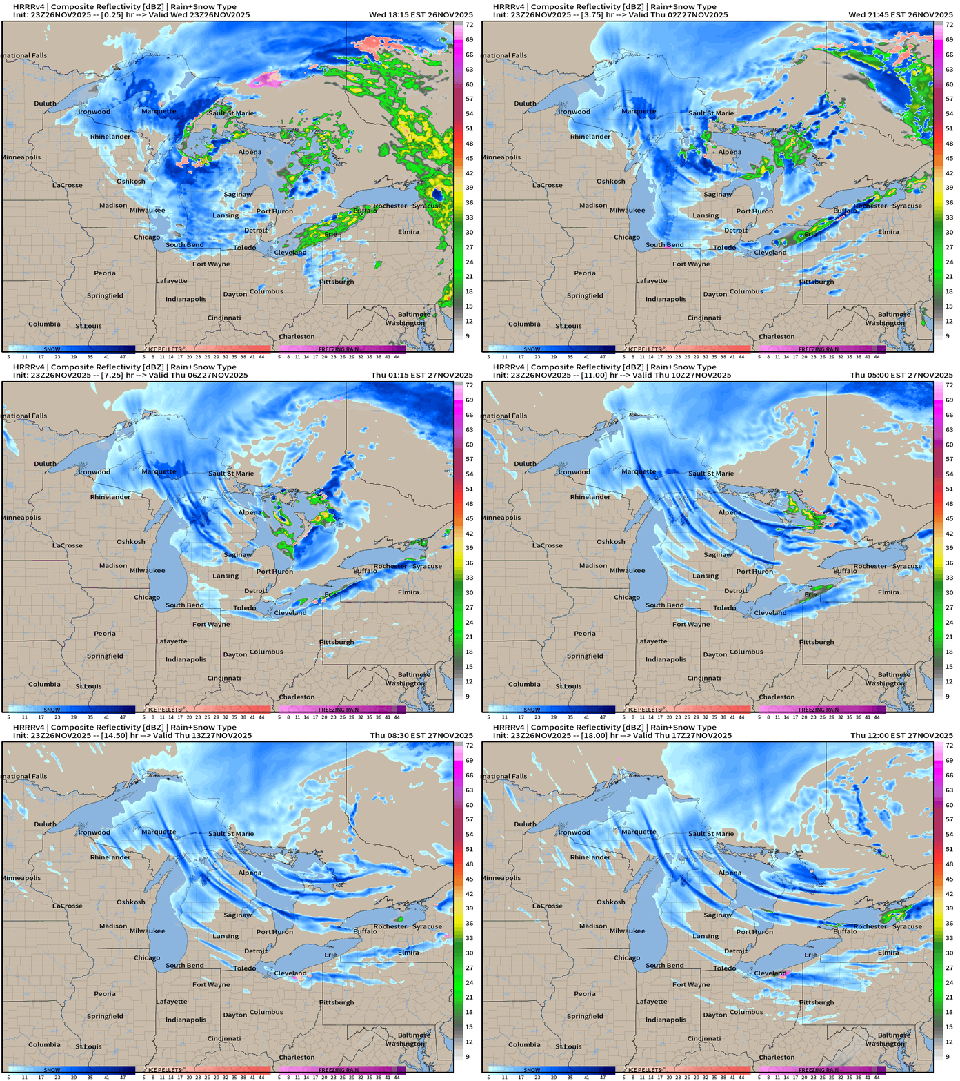
Storm system finally moves away into Quebec but cold Canadian Arctic air spills in behind the cold front for the “Lake Effect Snow Machine” phase of this storm event.
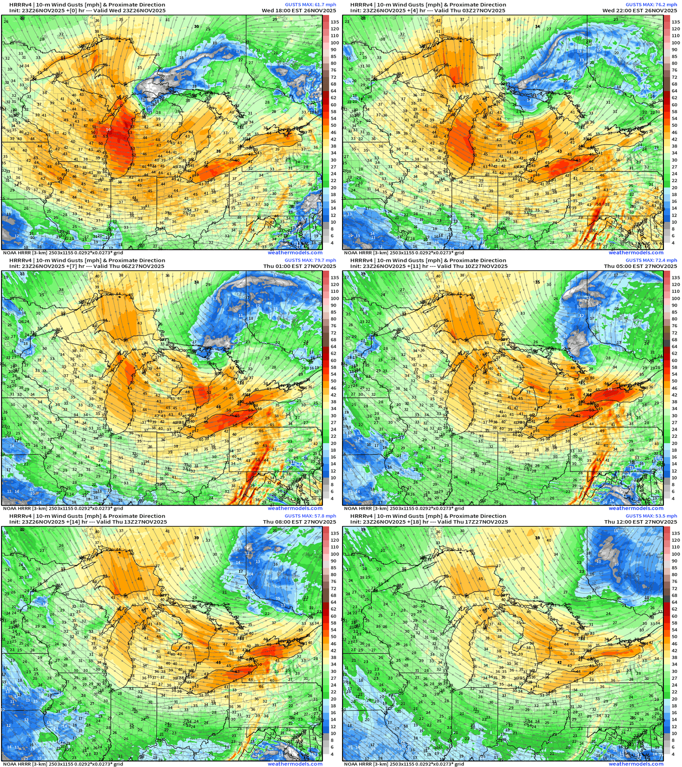
Wind Gusts will slowly die down from the 40-50 mph to around 30-35 mph into midday on Thanksgiving
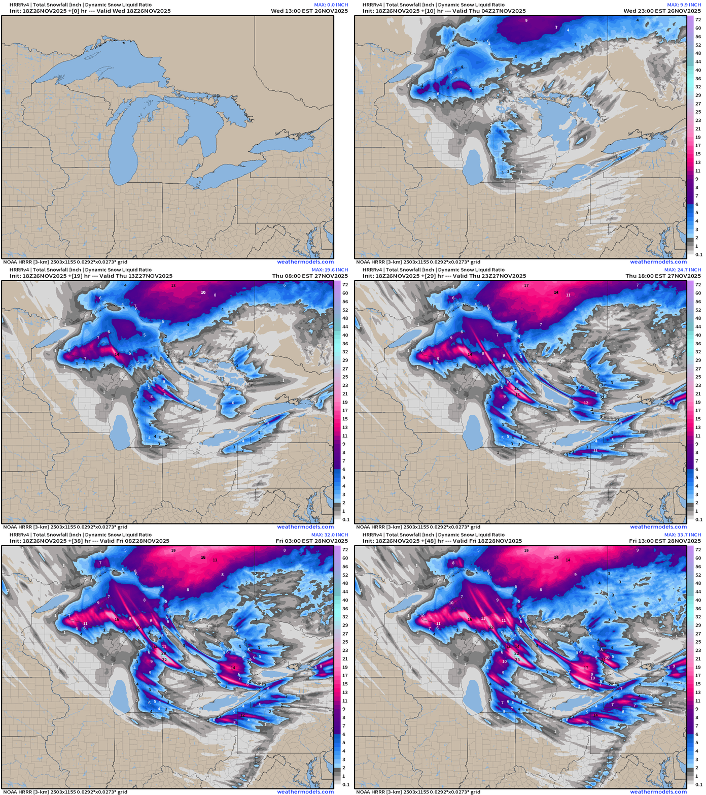
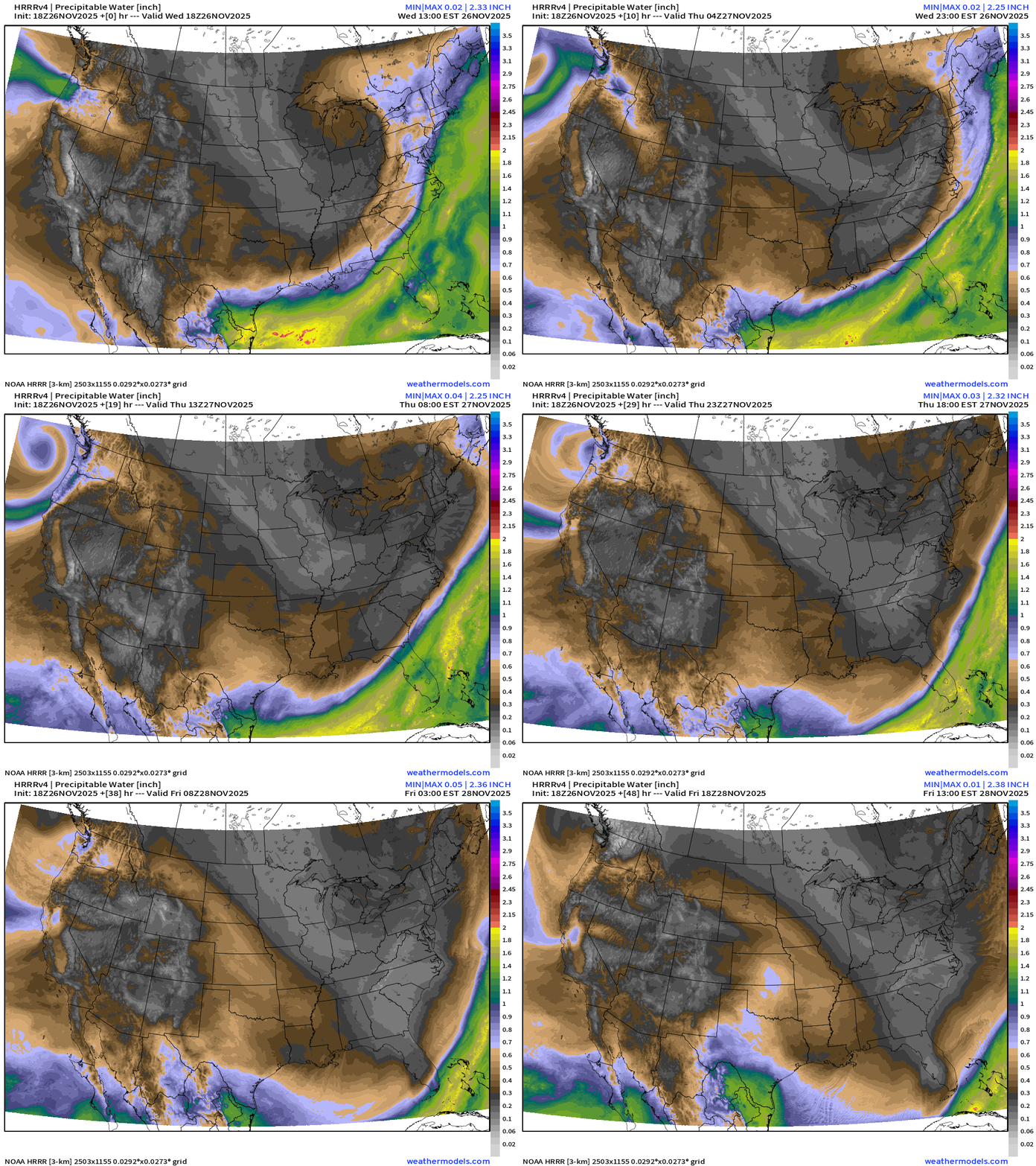
Total Snowfall From HRRR Next 48-hours
Like taking a paint brush and coloring the canvas with beautiful hues of blue and pink, my favorite maps (aside from precipitable water)
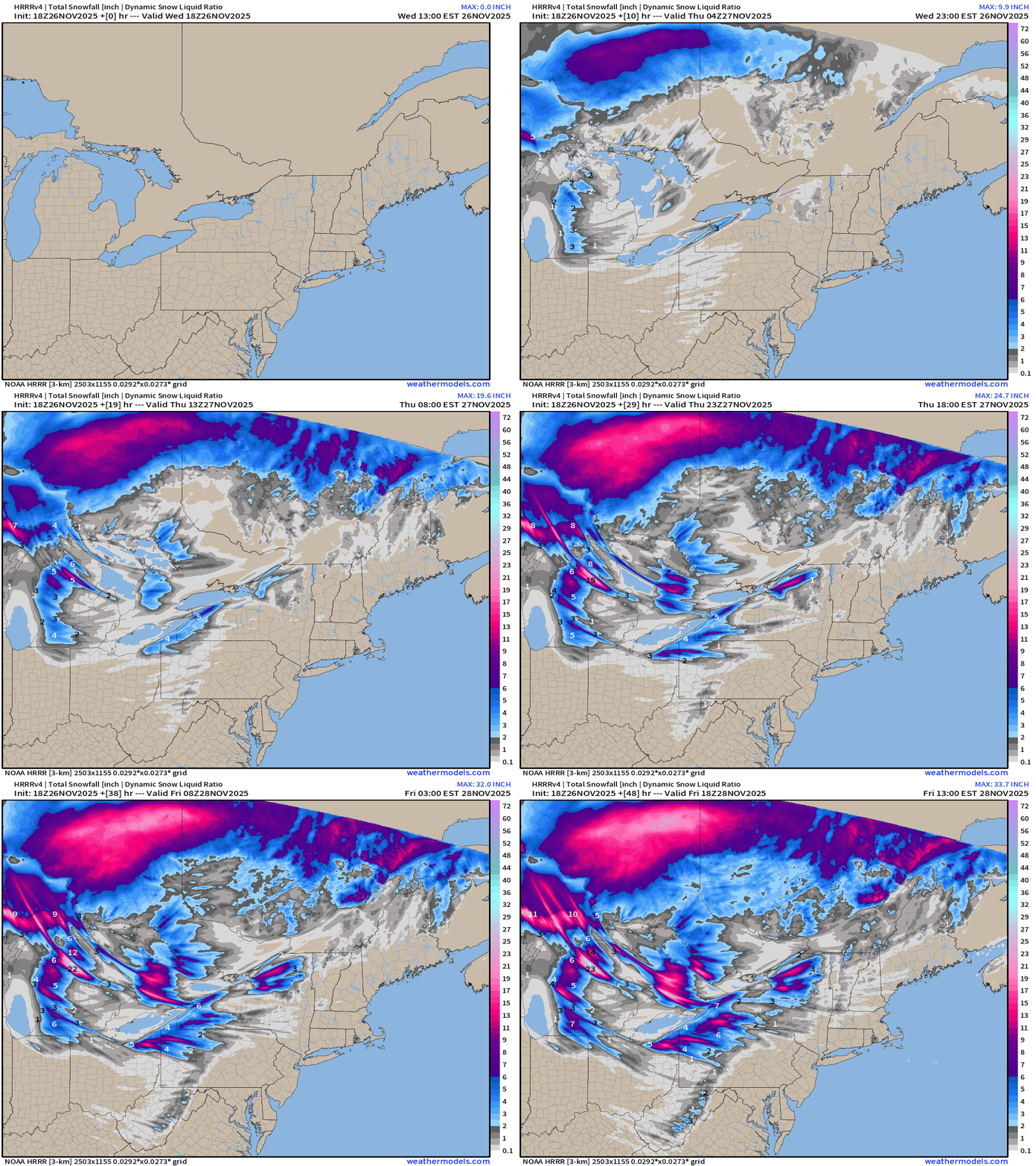
Wind gusts do die down across the Great Lakes and Northeast — but we get a Pacific Northwest storm system that landfalls Washington/Oregon by Friday, and that’s our next major storm system for the central U.S. —> Midwest and Great Lakes for the weekend.
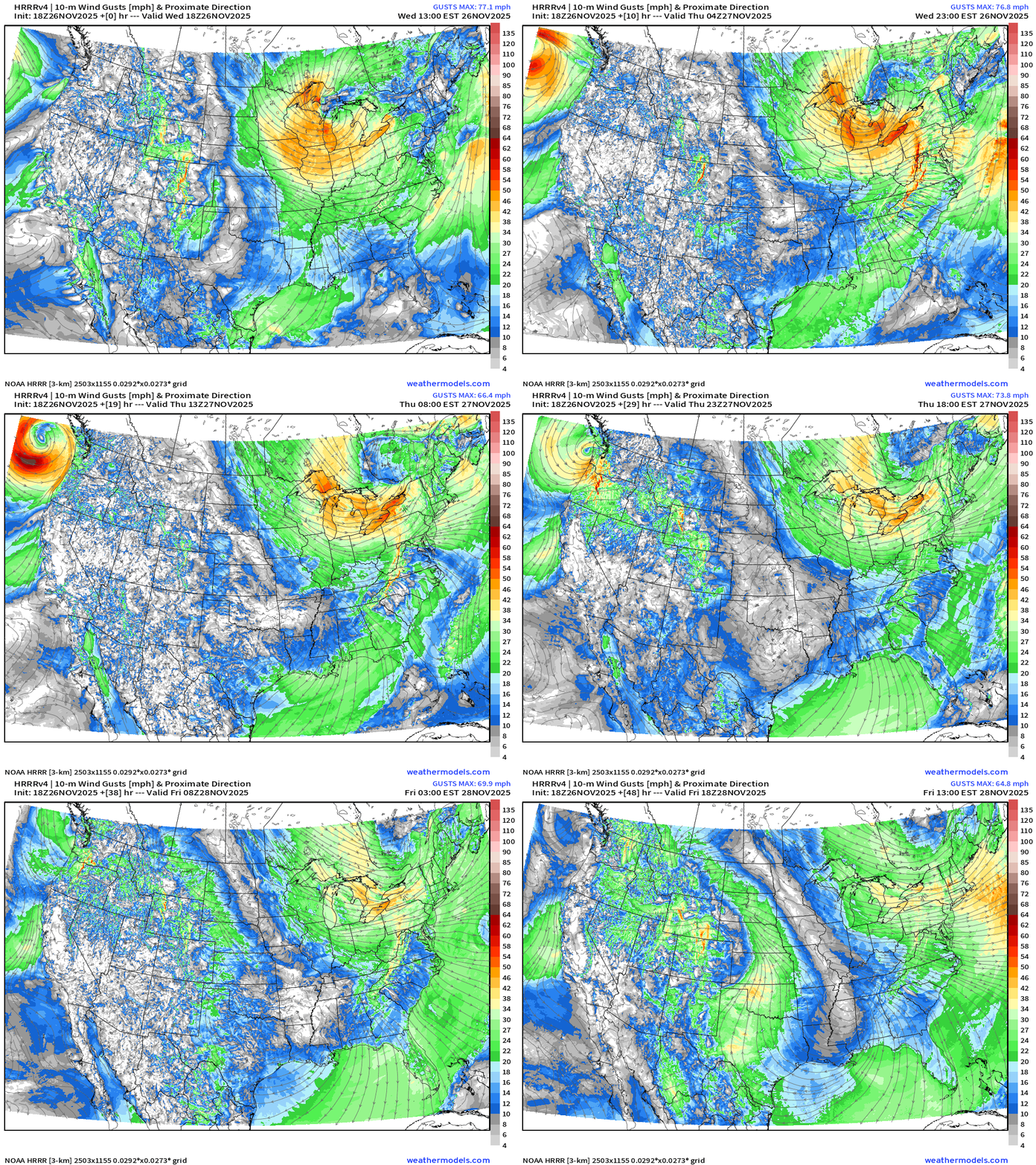
And, here’s my favorite parameter showing the cold/dry air dumping into South Florida (again) as the Arctic cold front sweeps through the Gulf of Mexico.
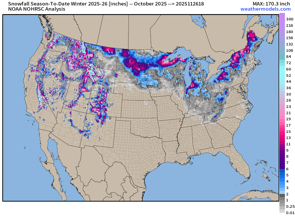
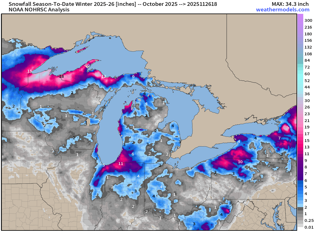
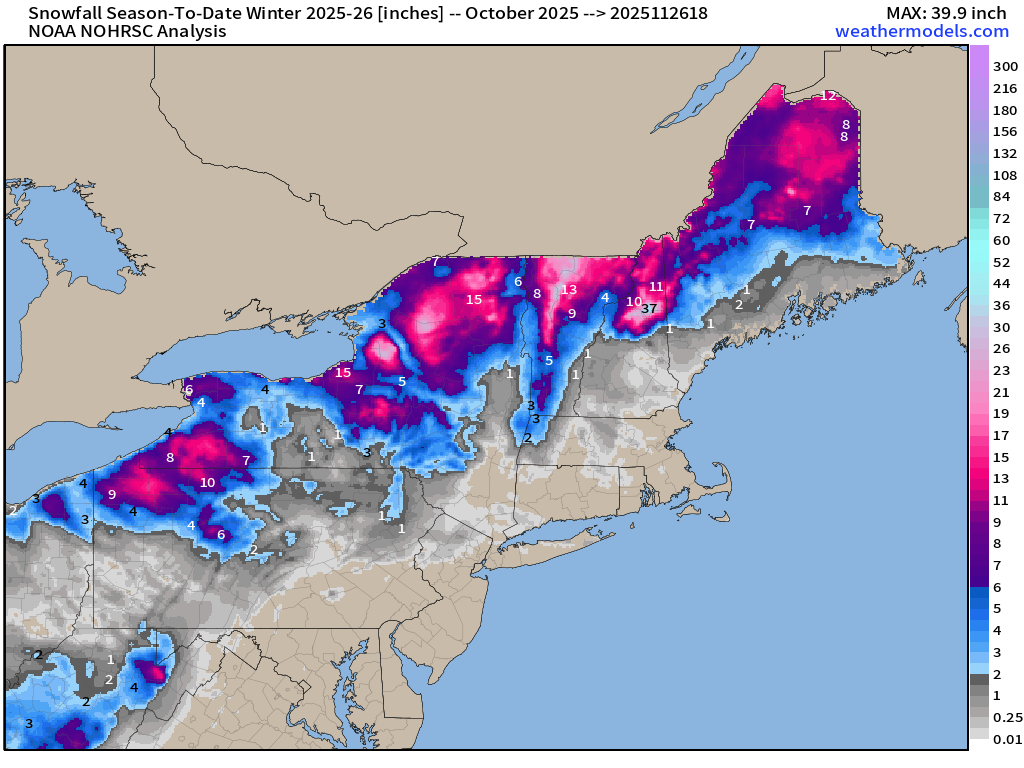
Quick Aside to Show the Snowfall that’s fallen so far this “Winter Season” since October 1, 2025
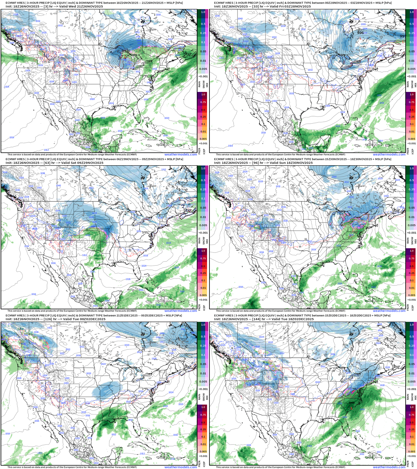
Lower 48 precipitation type + MSLP for the next 6-days | ECMWF 18z
Headlines Wednesday Evening
Colder air behind strong Great Lakes storm system —> Lake Effect Snow Machine cranks up for Thurs-Sat — from Michigan into the Northeast.
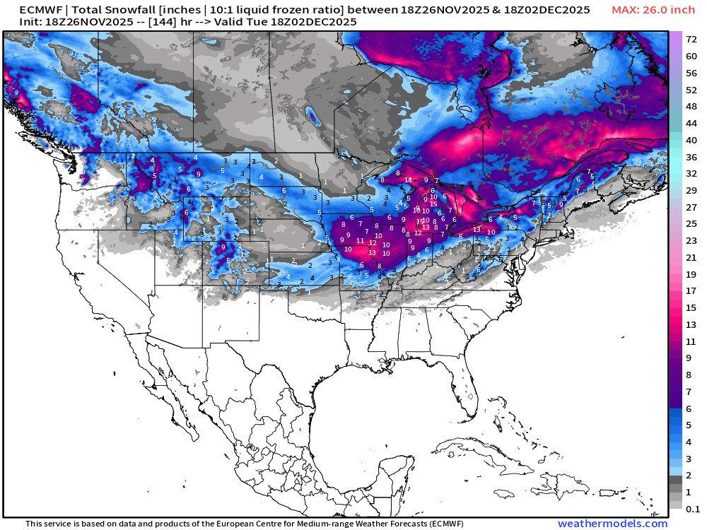
Storm watch (confirmed): ECMWF 18z shows another storm system quickly tracking from the Pacific Northwest (Washington) across the northern Rockies —> then into the Great Lakes. This storm track puts ANOTHER stripe of heavy snow across Iowa and Chicago for travel this weekend.
STILL No change: The main “polar vortex” load of very cold air will remain mostly locked up in Canada through the next 7-10 days. We continue to monitor the “lobes” and polar vortex (PV) intrusion risk into the Lower 48 into December especially with a colder period in the 6-10 day range. But the coldest -50°C air at 500 mb remains bottled up — which isn’t unexpected as the lower atmosphere impacts of the sudden stratospheric warming (SSW) event and polar vortex split usually take 2-3 weeks to manifest (lag time)
Black Friday Coupon: Ends November 30, 2025 for new/upgrade. At my end, the goal is to increase membership, both free and paid, to expand my reach on the Substack platform. Sometimes I’m number 5 or 85 [in the category] depending upon the weather. I’ve published over 300 posts per year, so we’re talking 25 cents per daily update! I do not do advertising, and nothing is done with the subscriber list. All growth is entirely organic.
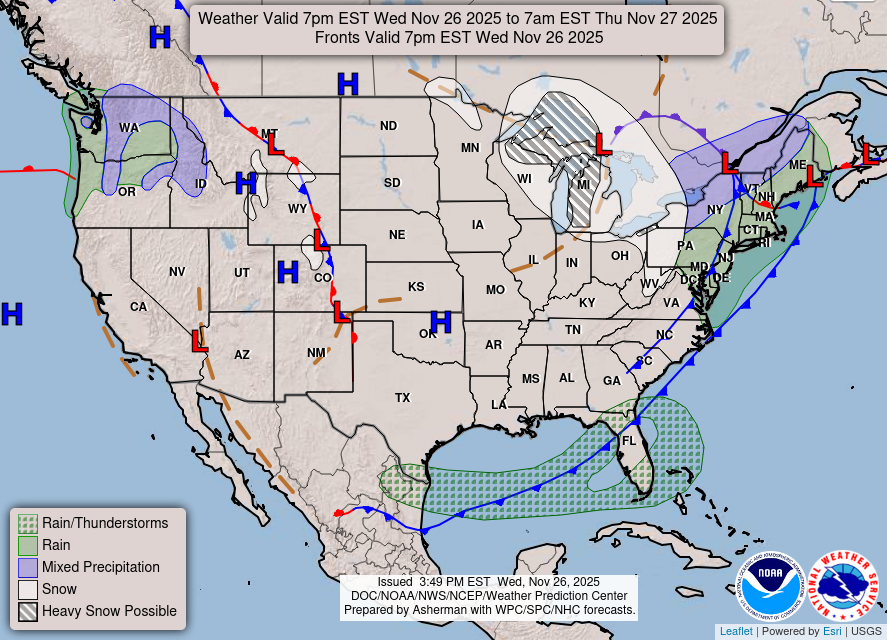
Lower 48 | Frontal Boundaries and storm systems this evening
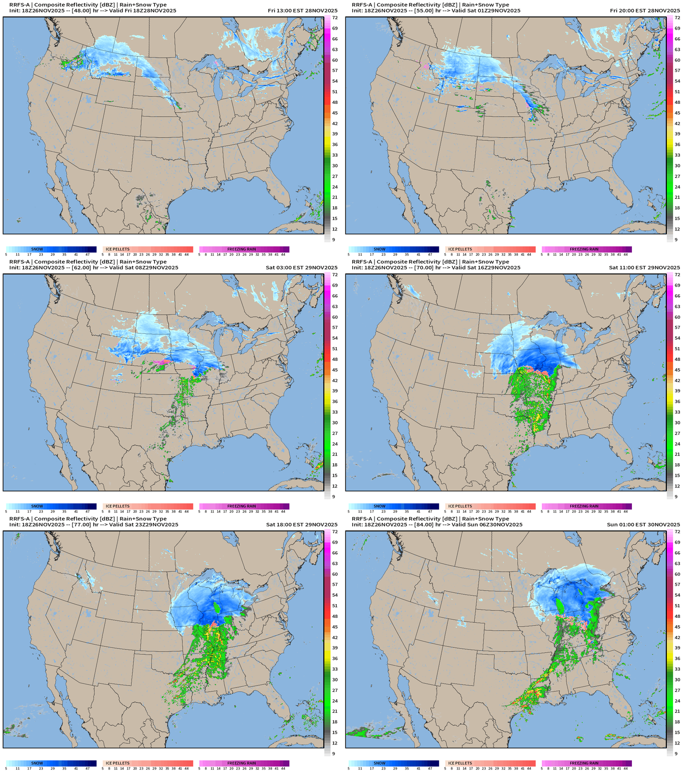
Storm #2 — Hit redial into this weekend!
RRFS-A Simulated Radar | Next 48 to 84-hours | Friday Evening to Sunday early morning
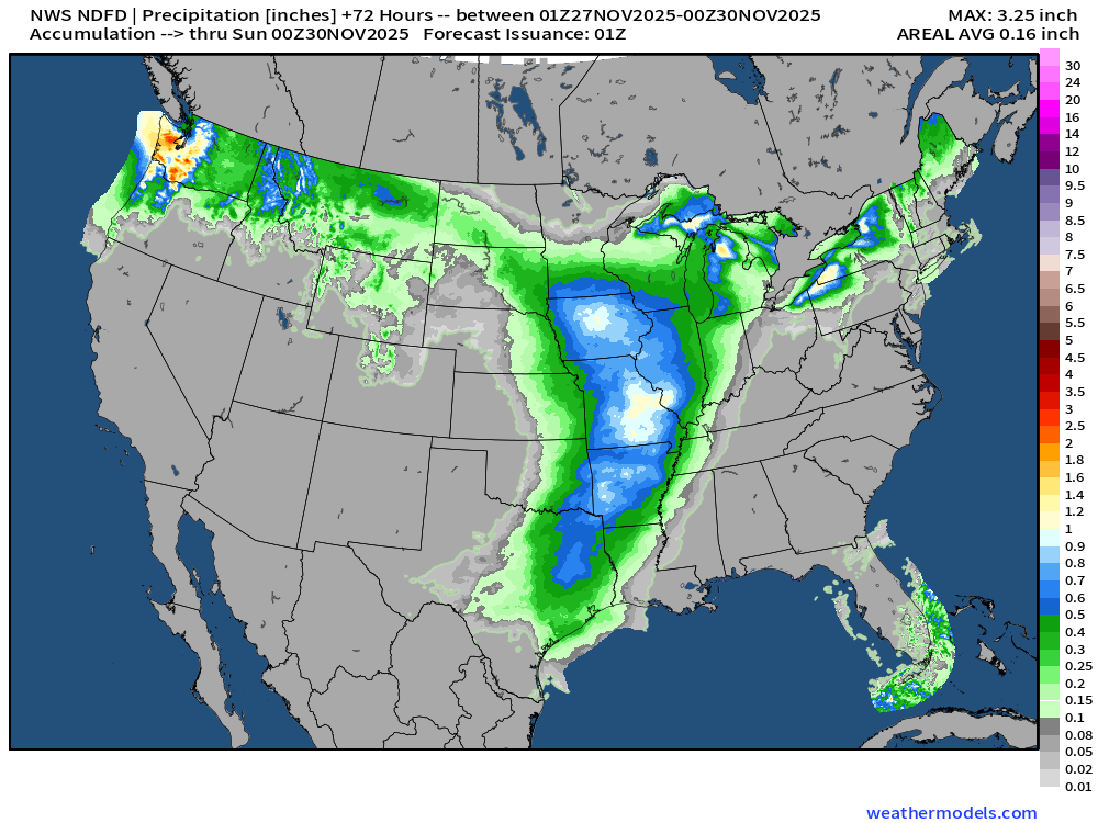
NWS Precipitation Next 72-hours
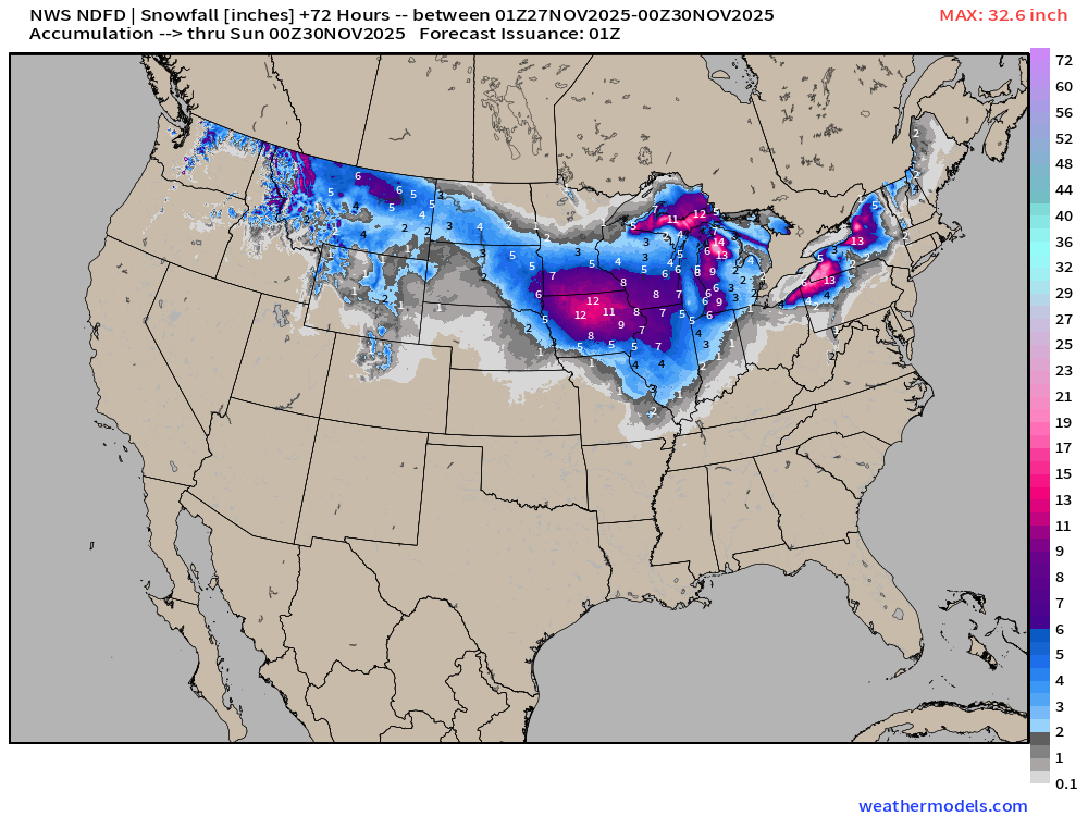
NWS Snowfall Next 72-hours — which won’t include entire event of Storm #2 — see the RRFS-A data next + ECMWF 18z
RRFS-A through 84-hours (Sunday 1 AM ET) | Snowfall totals
These map are beautiful … RRFS-A is a 3-km resolution model and my color table is perfect. Everything about these maps makes me happy.
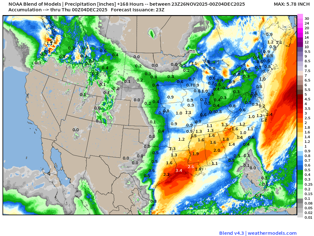
Blend of Models | 7 Days Precipitation Total (includes liquid from snow)
Total Snowfall Next 7-Days
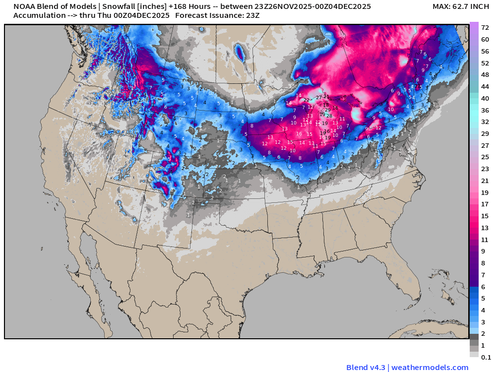
Details about MORE snow from the 2nd storm system are blurred/smoothed out by the Blend of Models, but let’s just assume it’s a repeat of our current potent storm system —> we should hit the 2x multiplier and spin again!
Temperature Analysis | 7:45 PM ET
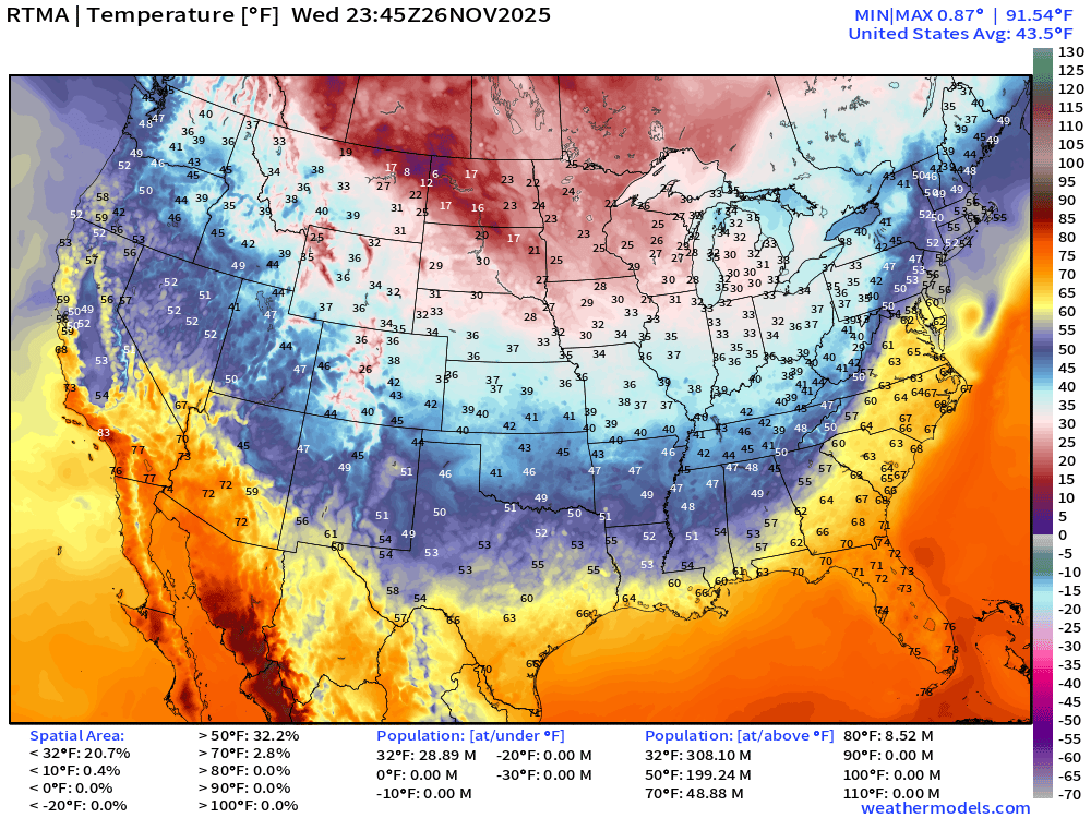
Colder air coming into the Midwest and Great Lakes behind the cold front this evening
Temperature Anomaly | 7:45 PM ET
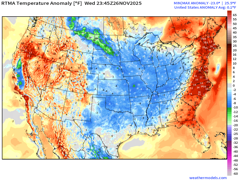
Lower 48 Temperature Anomaly was 0.1°F above normal
Thanksgiving Low Temperatures
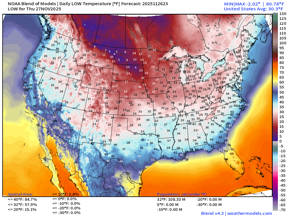
108 million below freezing or ~ 30% of the Lower 48 population
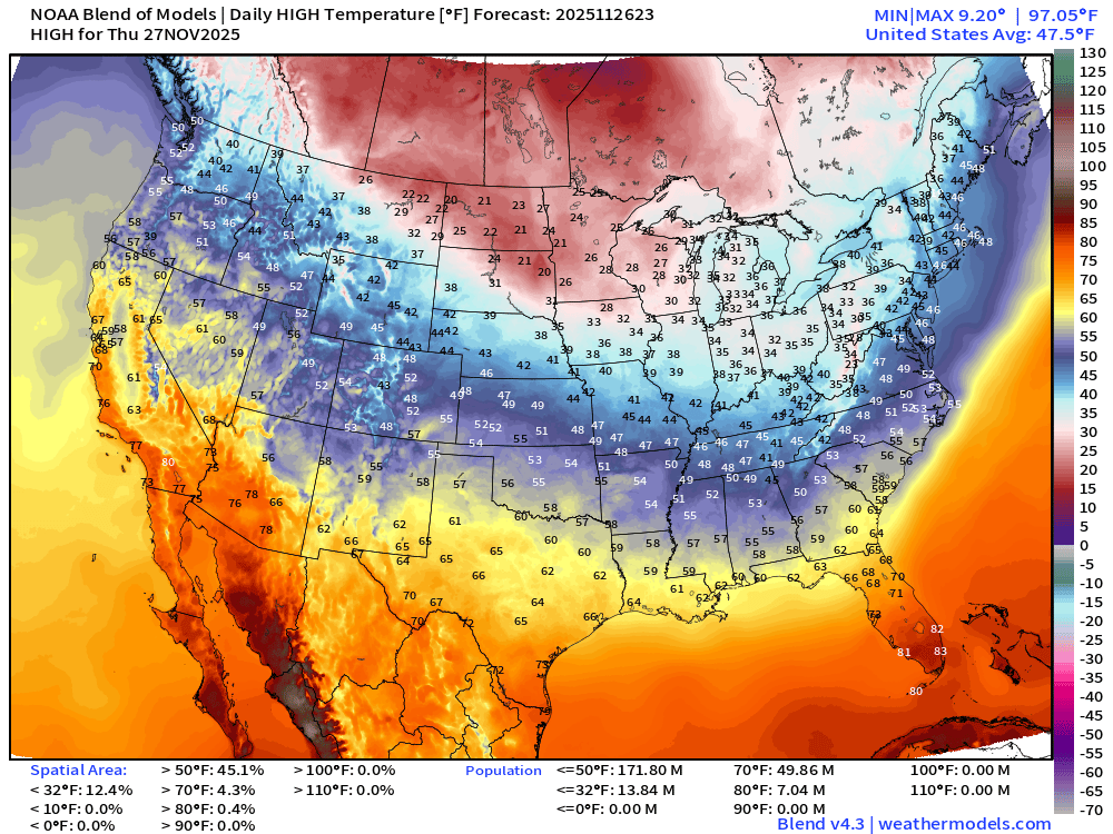
Thanksgiving High Temperatures
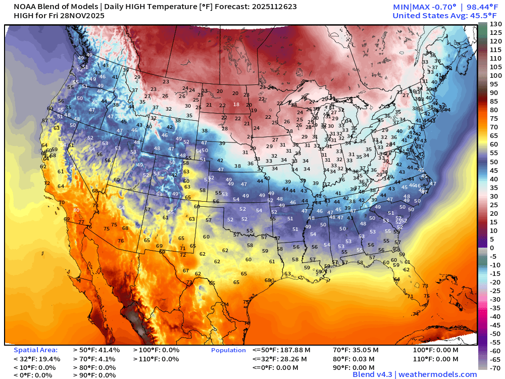
Black Friday High Temperatures
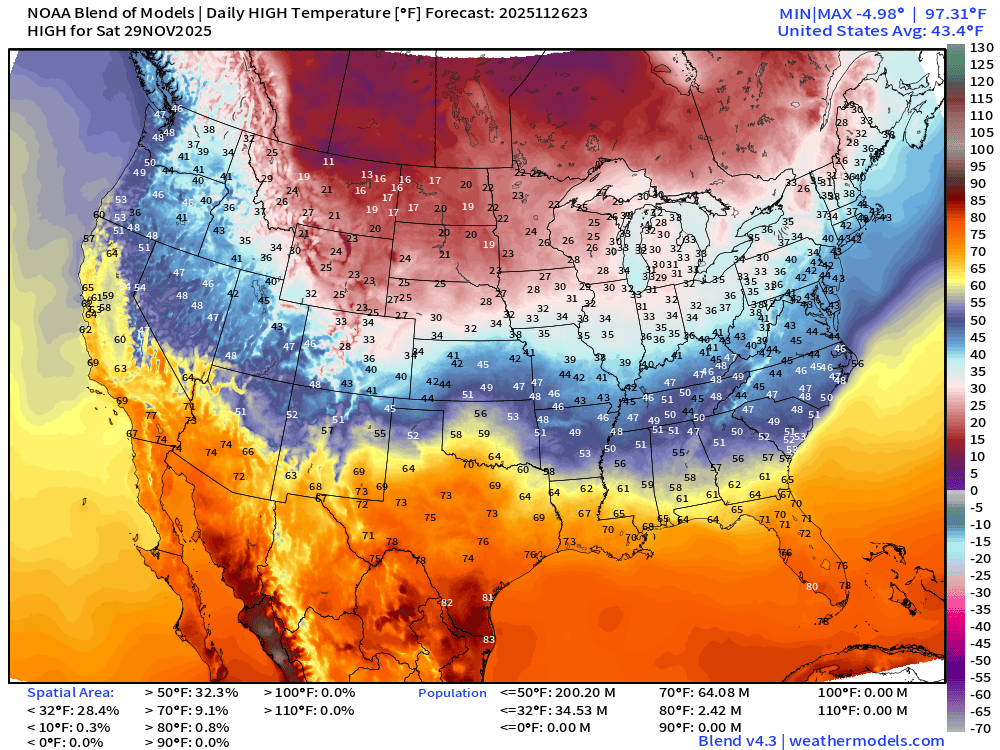
Saturday High Temperatures
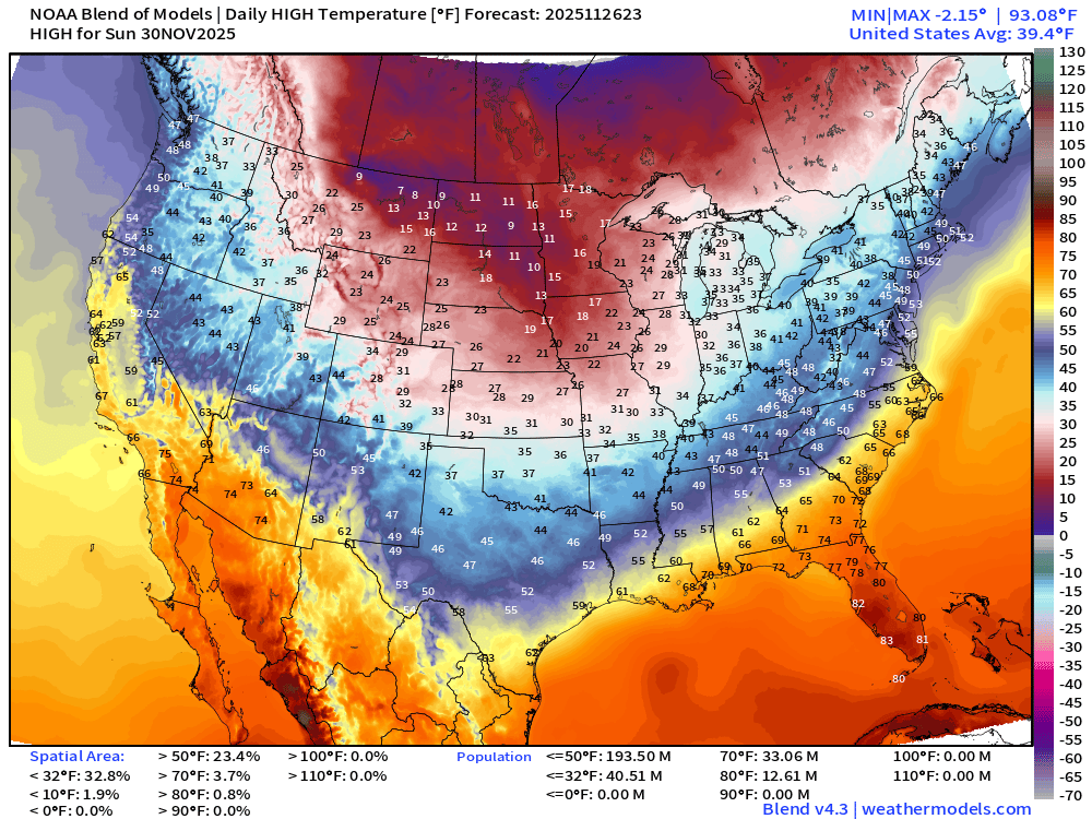
Sunday High Temperatures
Medium Range —> Day 10 Temperatures | 500 mb
New and fancy AI tools from NOAA (Google GraphCast training)
AI-GFS 18z | 500 mb Temperature | Next 10-days
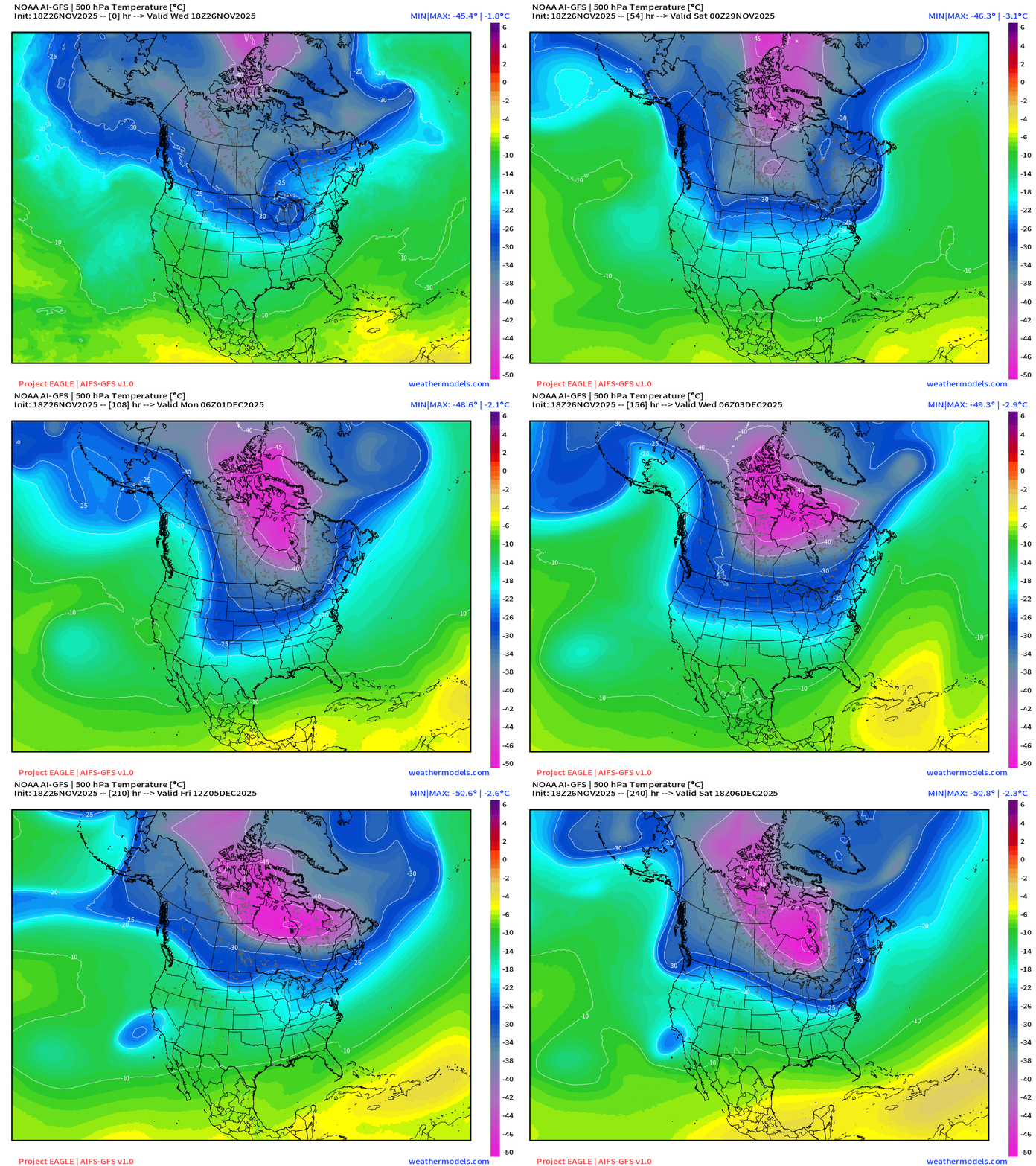
The 30°C isotherm at 500 mb is cold — definitely Arctic origin air with the polar front, and you can see the brief extrusions into the Lower 48 … however, the main/bulk of extremely cold air throughout the atmospheric column < -40°C and even -50°C at 500 mb is locked up around Hudson Bay and cannot dip all the way south (yet)
AI-GEFS 18z | 500 mb Temperature Ensemble Mean | Next 10-days
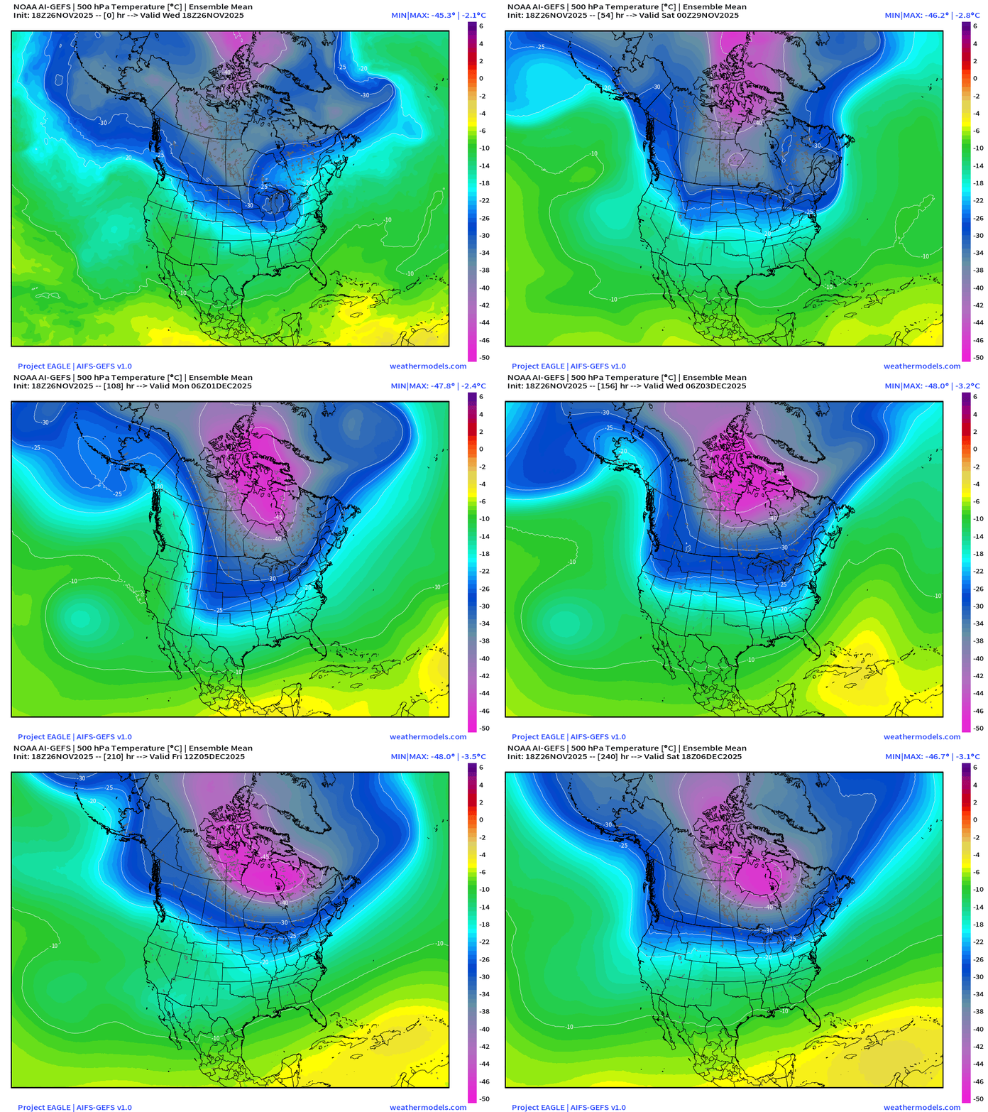
Similar — smooth story from AI-GEFS ensemble mean … the main -40°C core of the PV can’t break out of Hudson Bay anchor — but the minimum pushes -49°C in the ensemble mean (AI-GEFS) which is VERY impressive for early December.
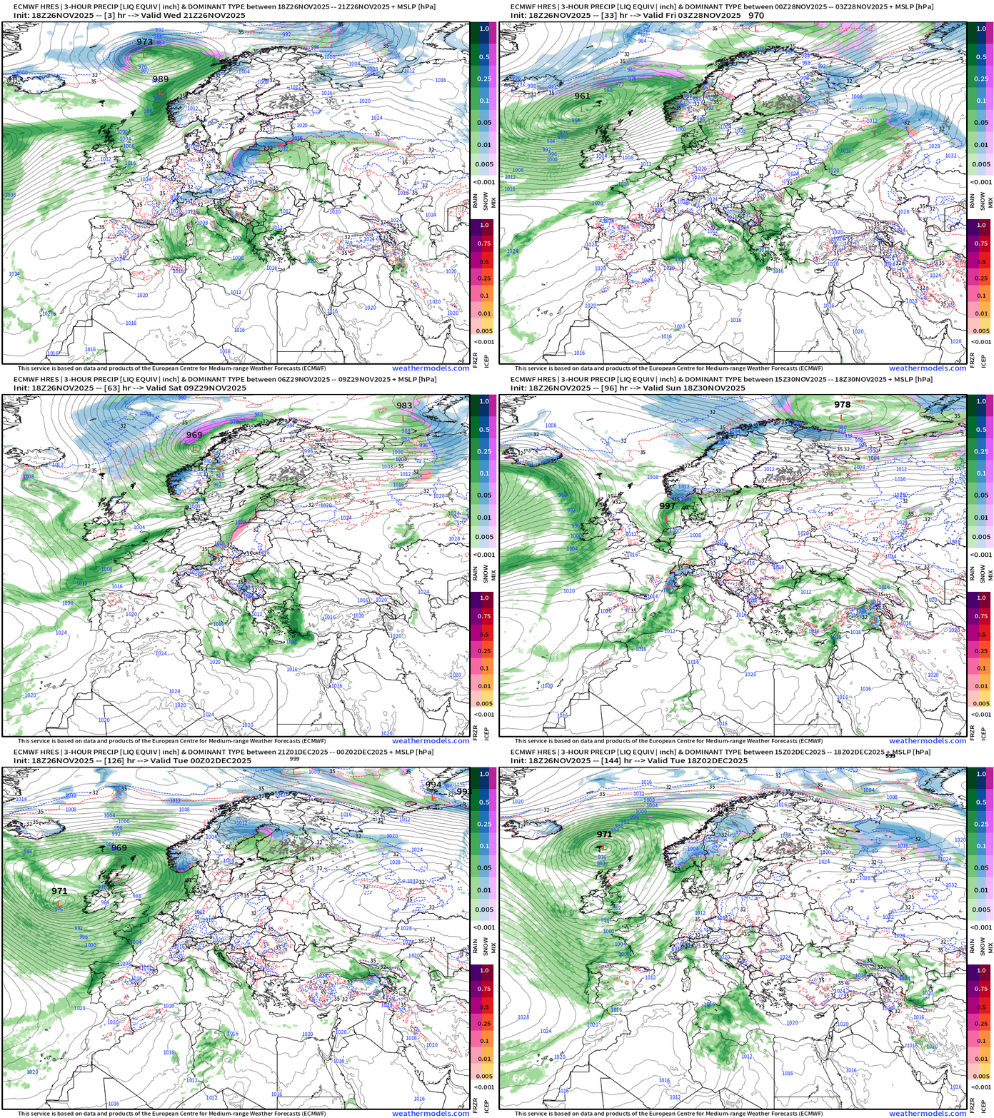
Europe Weather Next 6-days
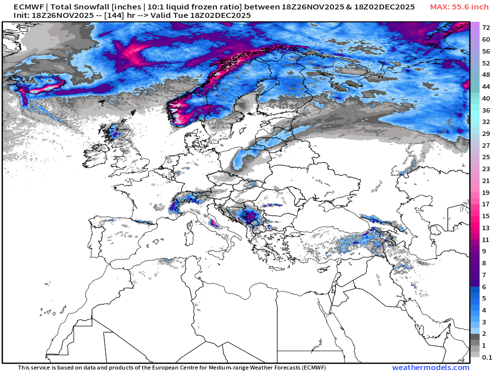
Snowfall Next 6-days
ECMWF EPS 12z | 15-day Ensemble Mean Temperature Anomaly
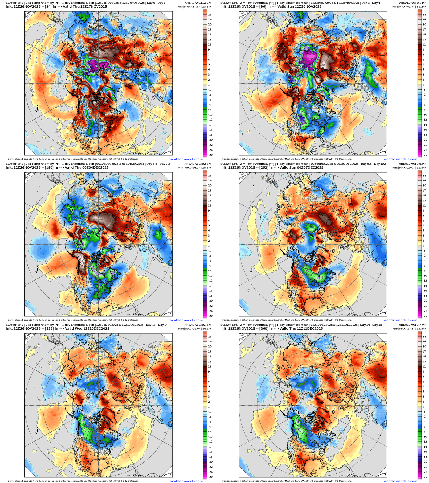
Coldest air compared to normal (and actual temperatures for that matter) spins over northern Siberia with only a piece moving into North America across the Arctic
MAJOR Cold pool formation underway into week 2 across Western Canada and Alaska
Integrated Vapor Transport | Next 10-days ECMWF 12z
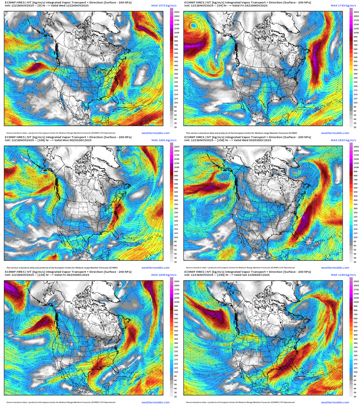
IVT highlights atmospheric rivers of moisture in the atmosphere — and we typically look at the U.S. West Coast … but also works elsewhere, including the East Coast.
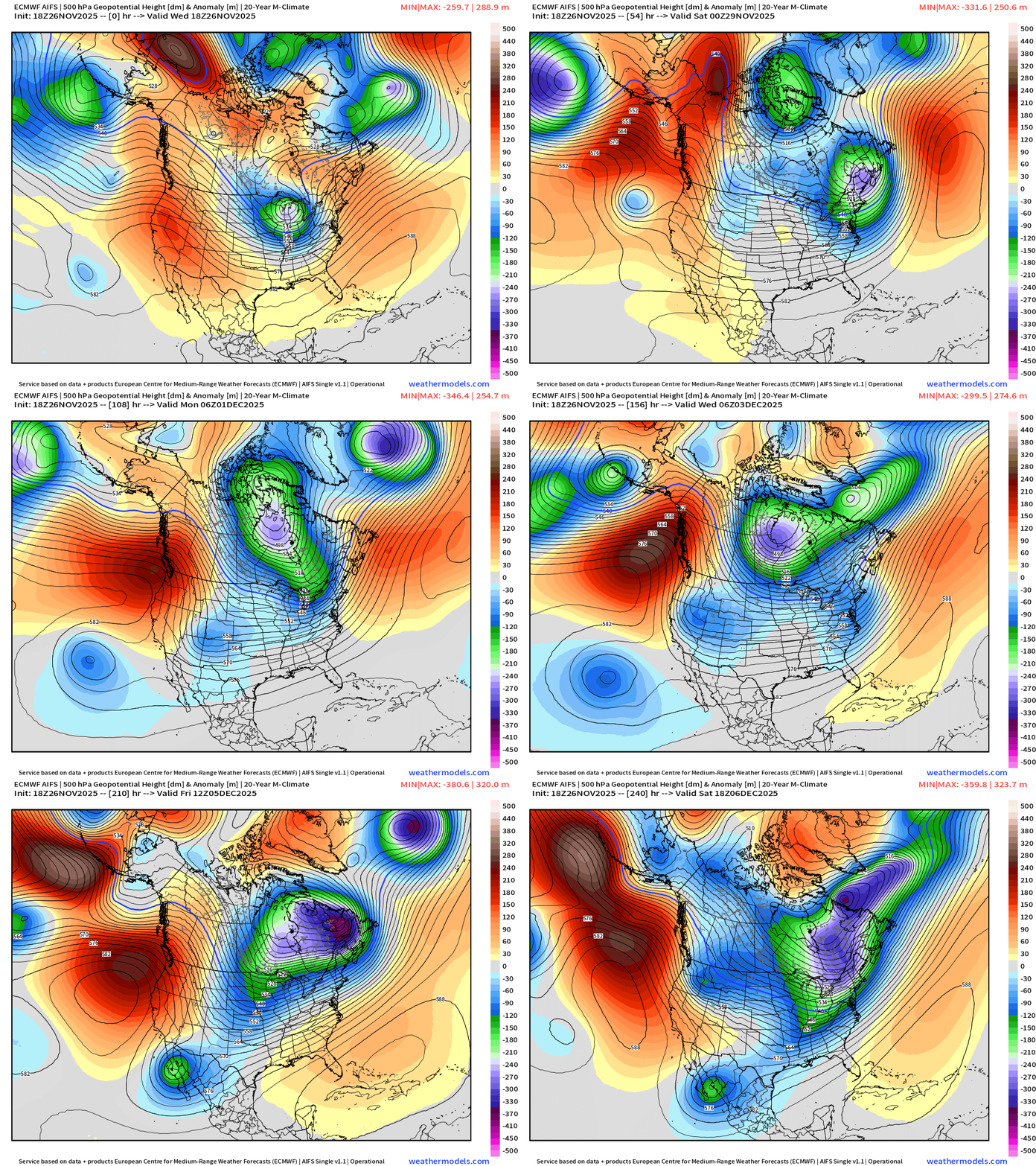
ECMWF AIFS 18z | Height Anomaly (500 hPa) Next 10-days
ECMWF 18z | Snowfall | Next 6-days
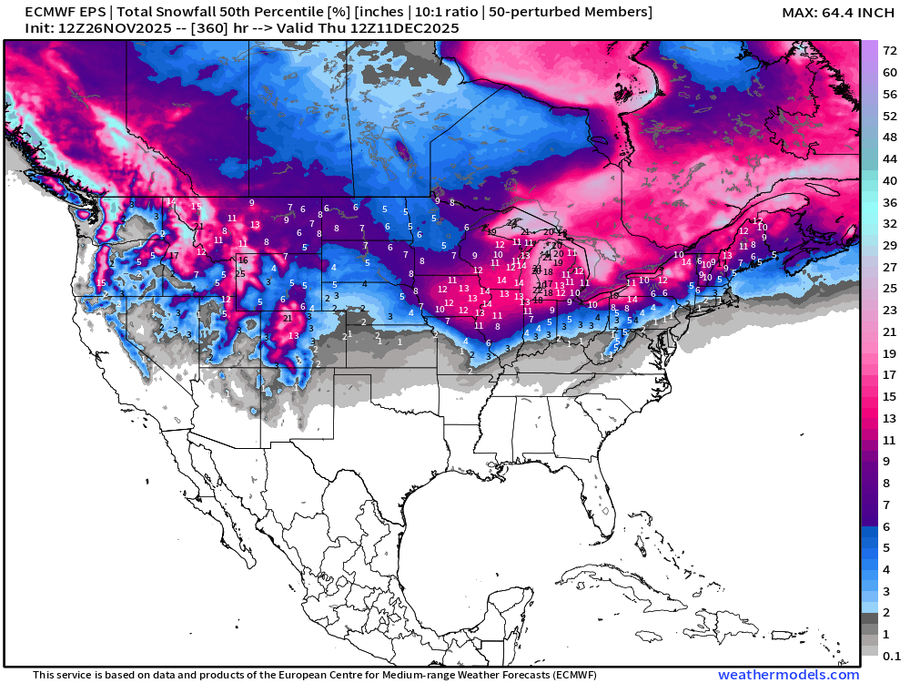
ECMWF EPS 12z | Ensemble Median Snowfall Next 15-days
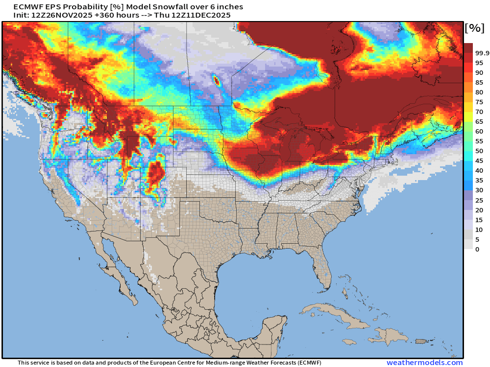
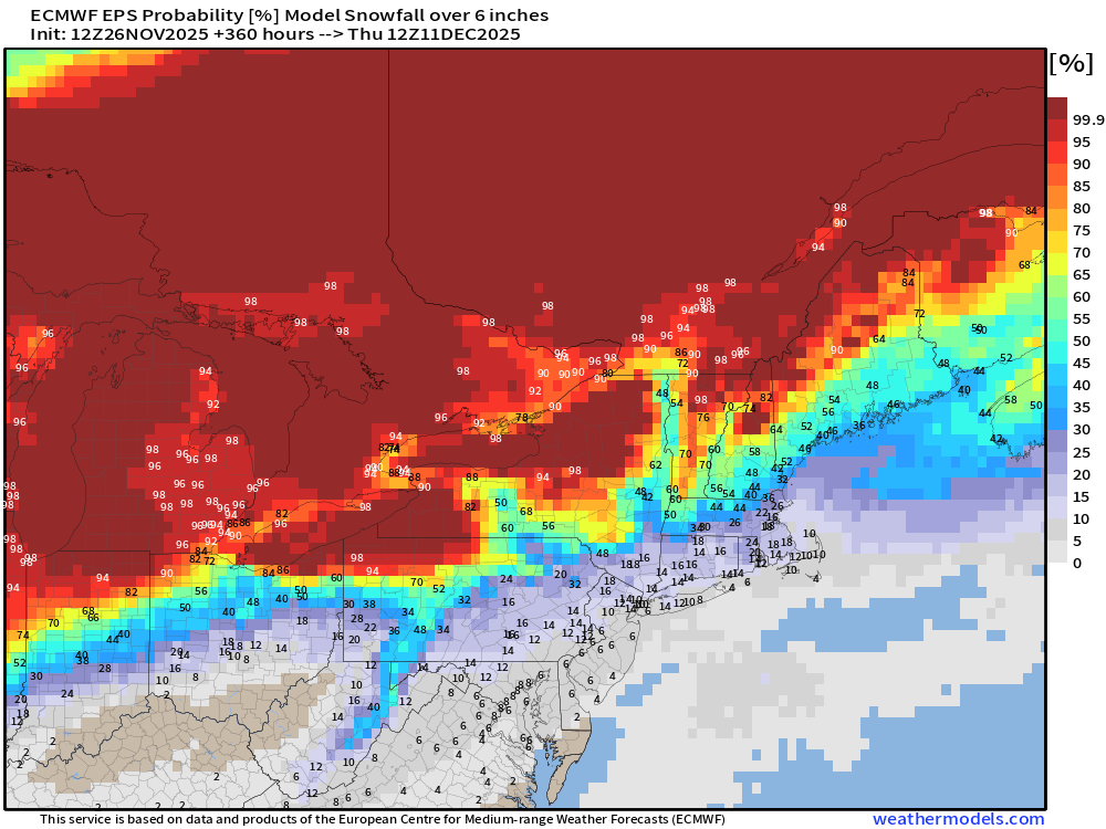
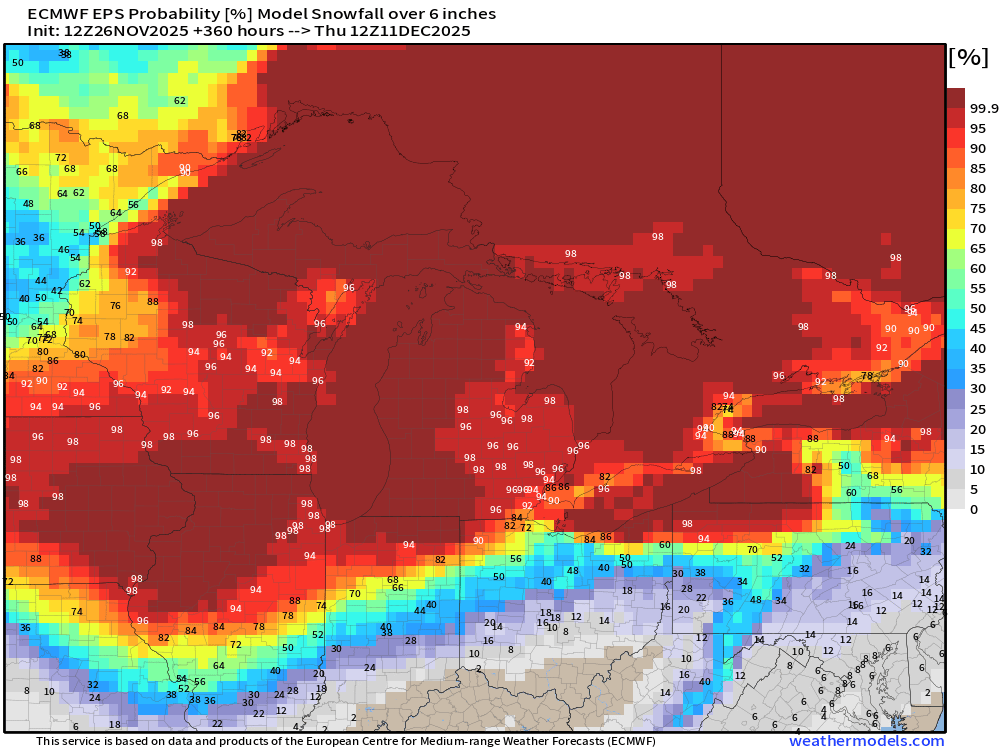
ECMWF EPS 12z | Ensemble Snowfall Probability > 6” | Next 15-days
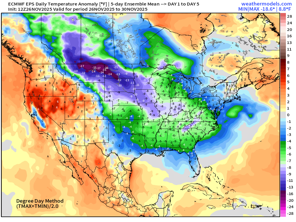
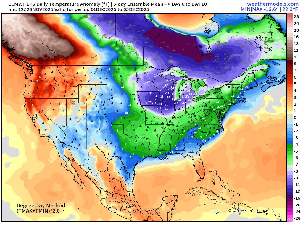
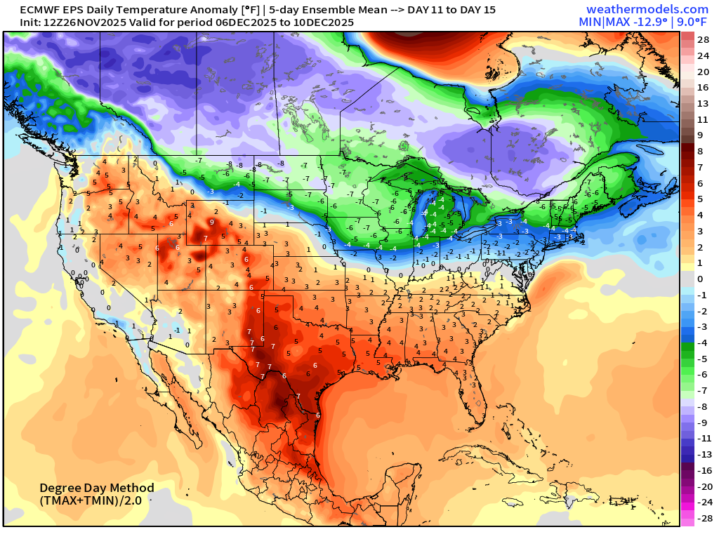
Temperature Anomaly | Next 15-days | ECMWF EPS 12z
5-Day Chunk #1 | Temperature Anomaly | Nov 26 - Nov 30
5-Day Chunk #2 | Temperature Anomaly | Dec 1 - Dec 5
5-Day Chunk #3 | Temperature Anomaly | Dec 6 - Dec 10
Atlantic Hurricane Season | All tracks | 15-days to December 11th
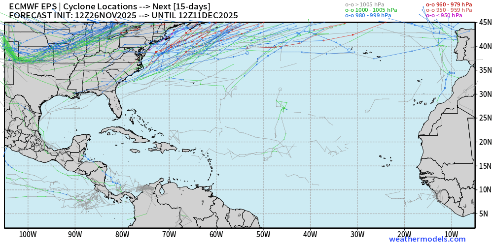
Still a non-zero chance of “something” in the far southern Caribbean, but we’re talking < 6% or only 3 members out of 51. December tropical storms can happen, just very rare in the Atlantic.
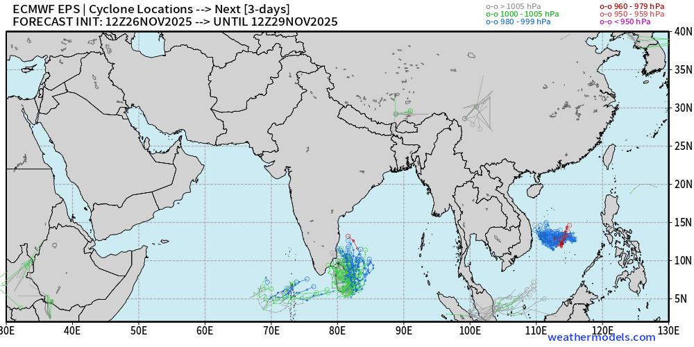
Eastern Hemisphere Tropical Cyclone Activity
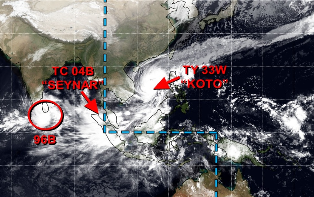
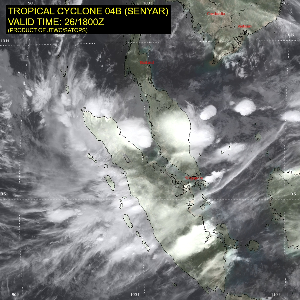
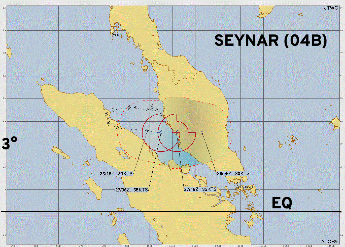
Tropical Cyclone 04B (Seynar) | Rare low-latitude (3°N to 4°N) maintaining minimal TS intensity
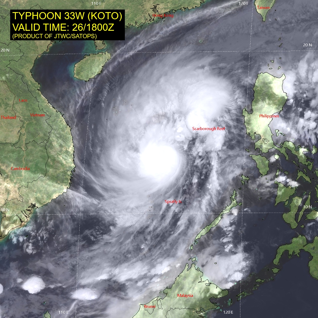
Typhoon Koto (33W) in the South China Sea is not expected to make landfall before weakening substantially
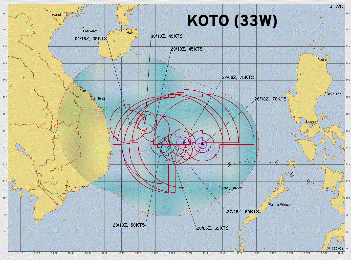
Then watching Invest 96B for Cyclone development near Sri Lanka — heading north up the Indian coast —> potential for a more impactful tropical cyclone into the weekend.
Ensemble Tracks — Next 3 days | All Cyclones | ECMWF EPS 12z
Maps sourced from weathermodels.com designed and innovated by yours truly! Please subscribe there for real-time access to the newest maps, charts from all of the weather models including ECMWF and AIFS, NOAA AI-GFS/AI-GEFS
- Milepost
- 799 · laid 2025-11-27T02:09:08.853000Z
- Source
- https://weather.substack.com/p/november-26-2025-wednesday-winter
- Digest
- 44b140f6c84eac2c3b34b21d37e556105ba9579917d46ba6acc3d6a6d31cf6a1
- Machine
- JSON