November 19, 2025 Wednesday Evening
Heavy rainfall centered on Texas into next week, then Canadian cold for Thanksgiving in Midwest
November 2025 was the 4th-warmest November in the 131-year national record (1895–2025), at 46.7°F against a 1991–2020 normal of 43.0°F (+3.7°F).
November 2025 was the 29th-driest November in the 131-year national record (1895–2025), at 1.7in against a 1991–2020 normal of 2.3in (-0.6in).
NOAA/NCEI Climate at a Glance, contiguous United States. This is the observed record for the month, not a score of anything said in this piece — the forecast ledger begins 2026-08-17 and cannot reach earlier posts.

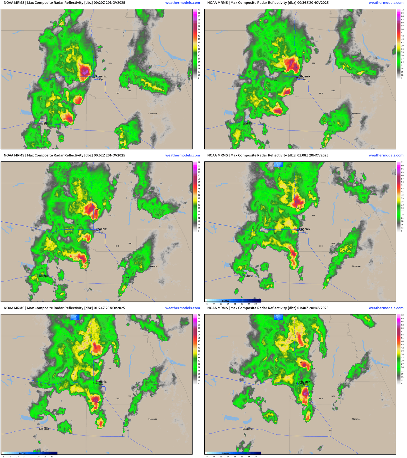
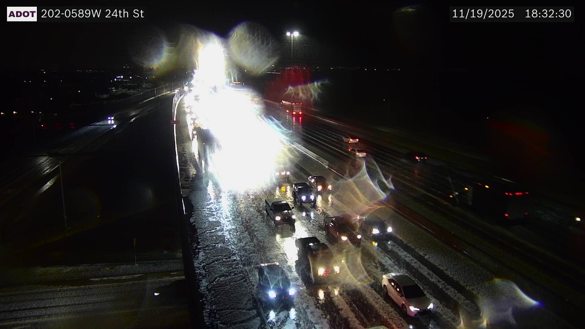
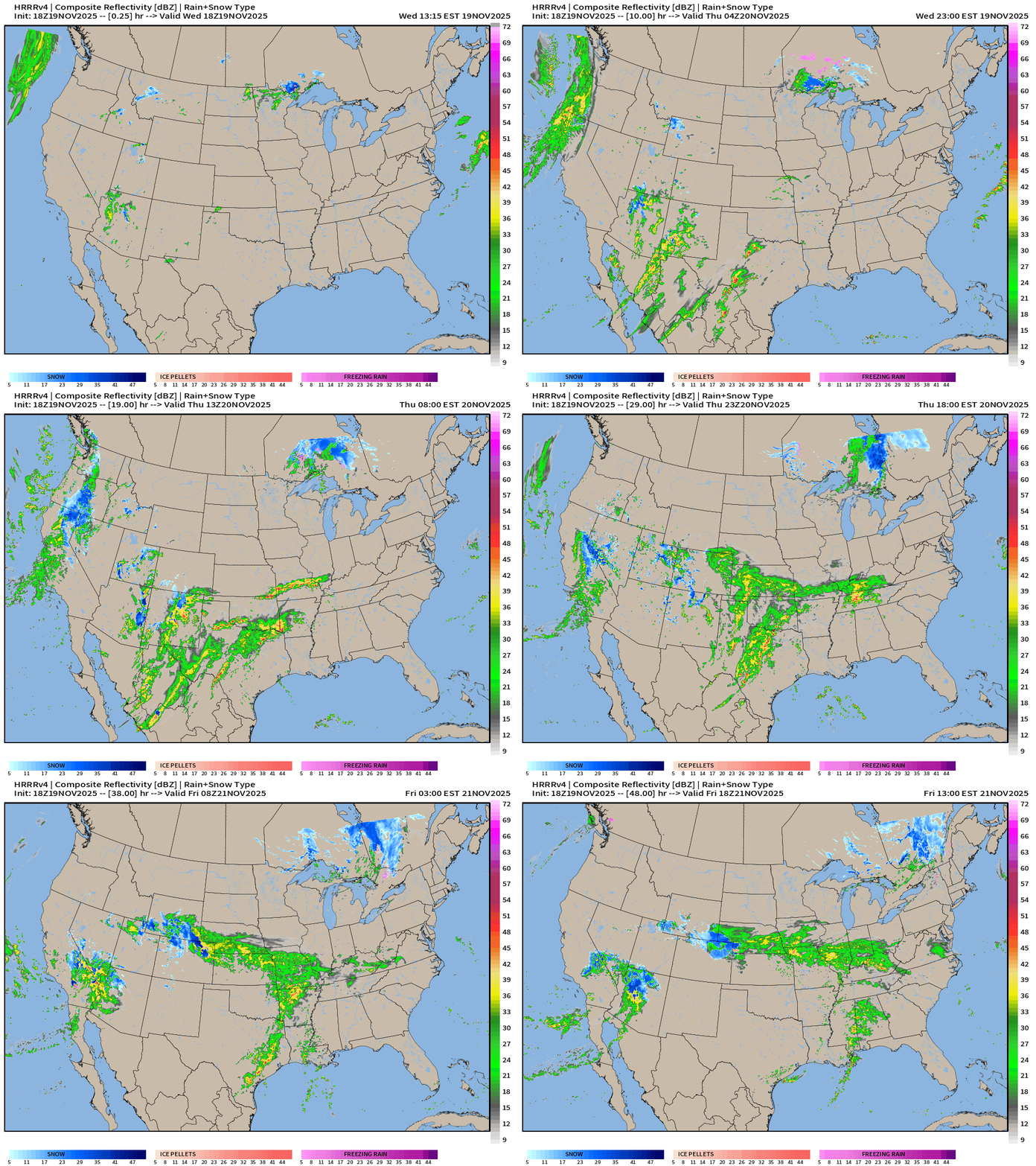
This evening: Significant thunderstorms with hail circulating through Arizona this evening including Phoenix.
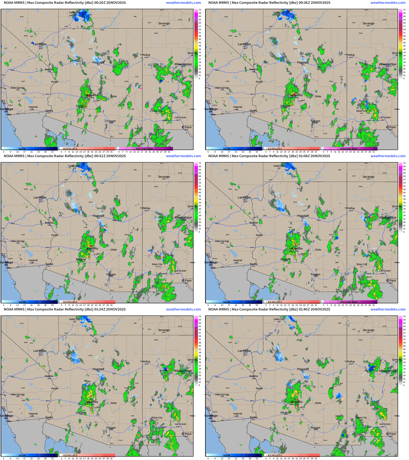
Earlier radar showed a massive hail storm with accumulating hail
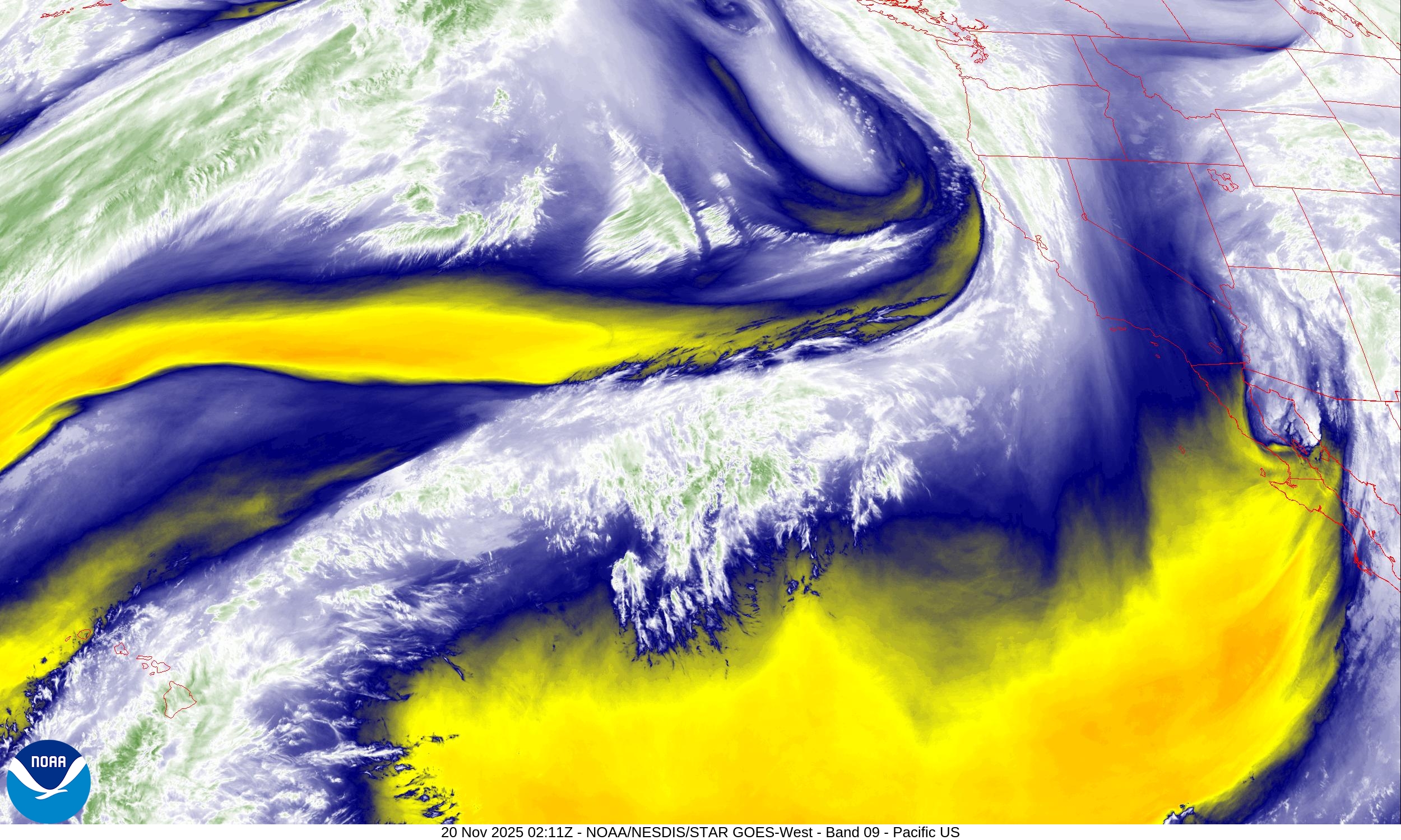
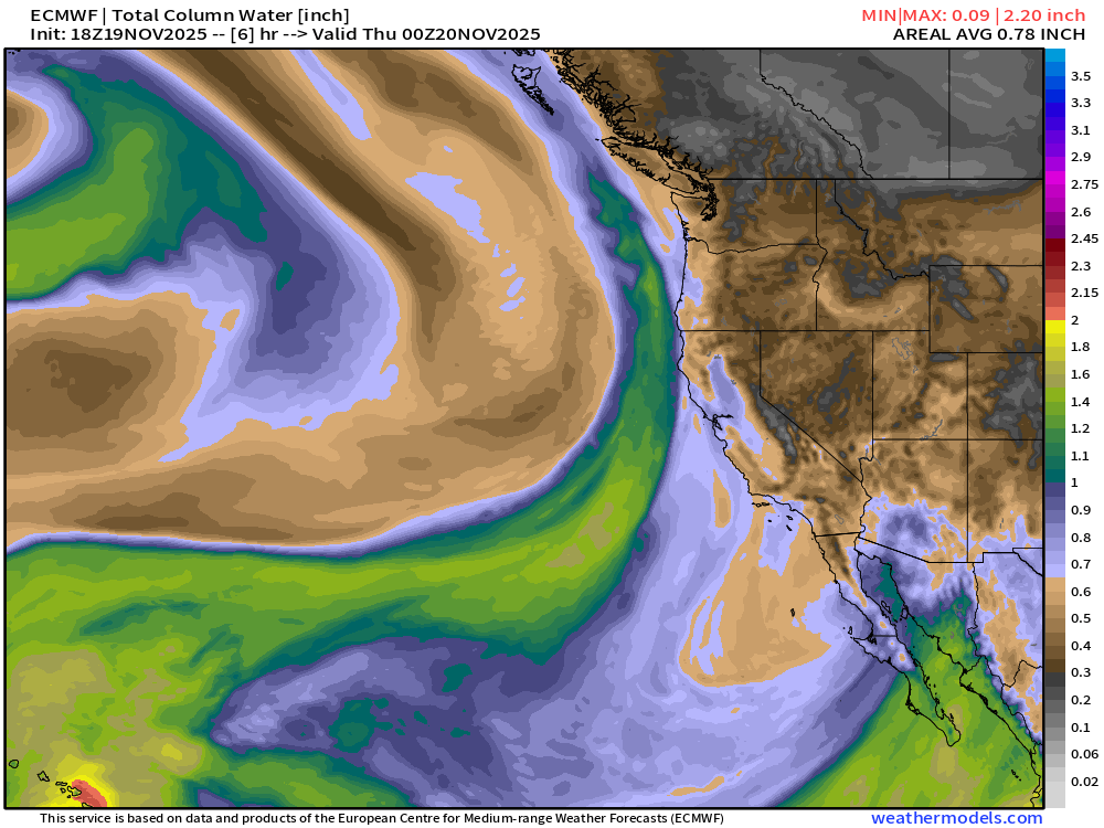
The unusual weather is related to just one in a sequence/parade of upper-level troughs that have broken off the main polar front from the Gulf of Alaska and spun down the California coast to meander into the U.S. Southwest.
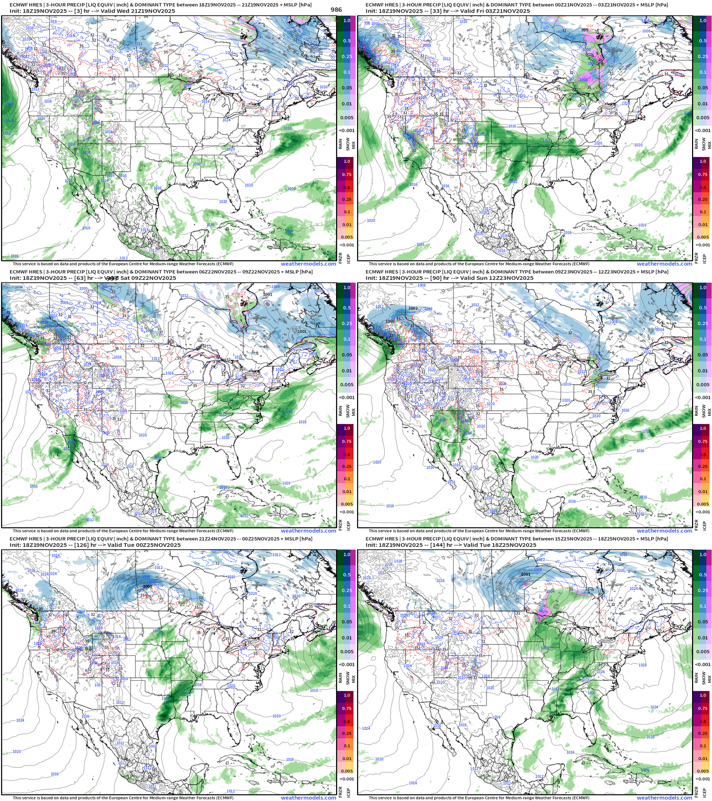
Lower 48 precipitation type + MSLP for the next 6-days | ECMWF 18z
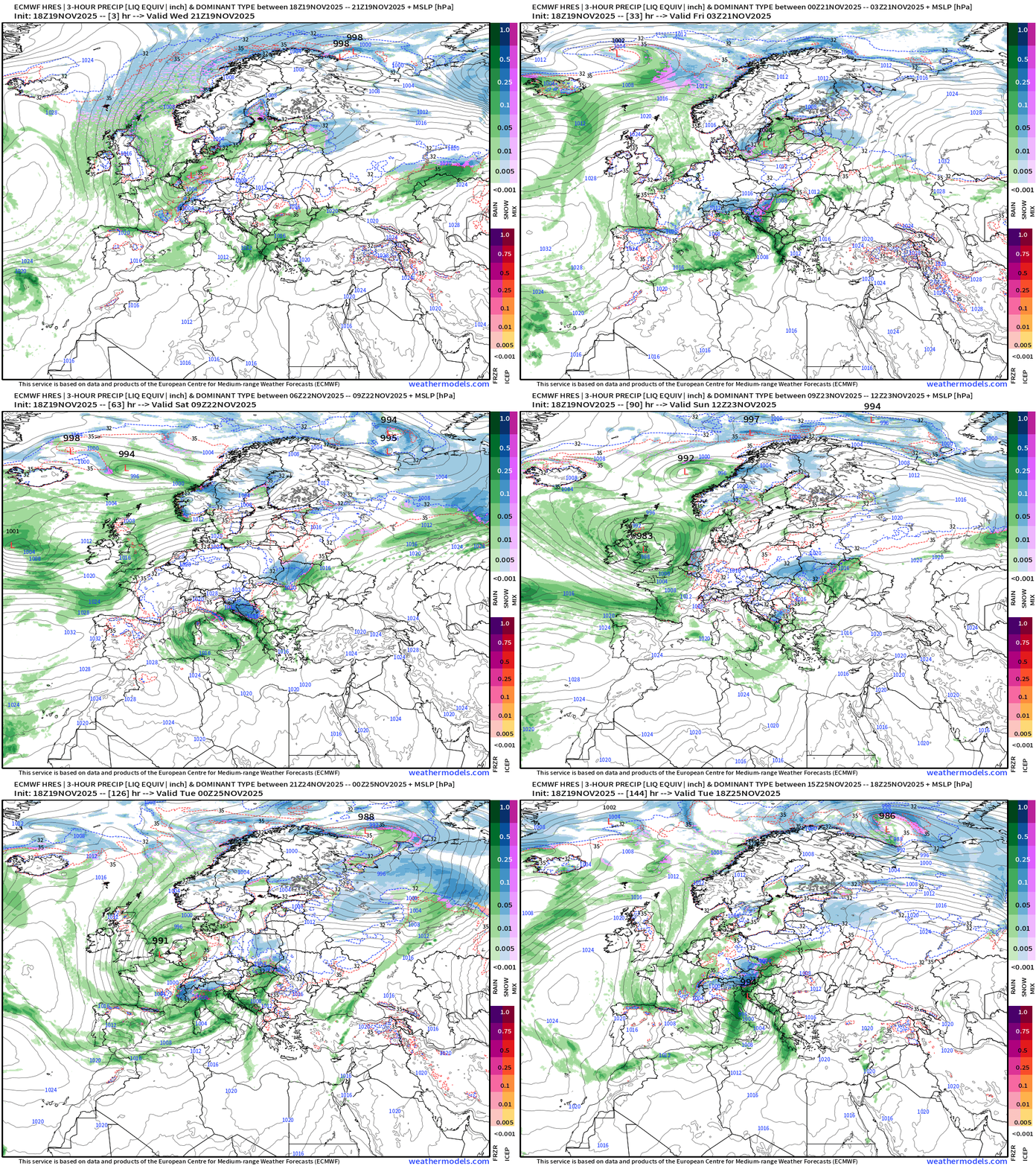
Europe precipitation type + MSLP for the next 6-days | ECMWF 18z
Headlines Monday Evening | Similar Story as this morning
A parade of shortwave troughs keep breaking off the main polar front situated in the Gulf of Alaska (—> Rossby wave trough thinning) & spin down the West Coast. A surface circulation + cold air aloft = instability + Pacific moisture = mini-atmospheric river events for Southern California + thunderstorms in the Southwest …
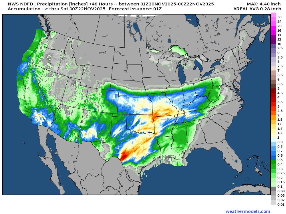
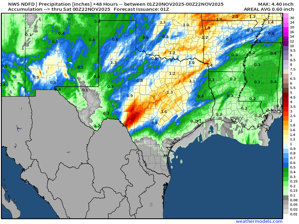
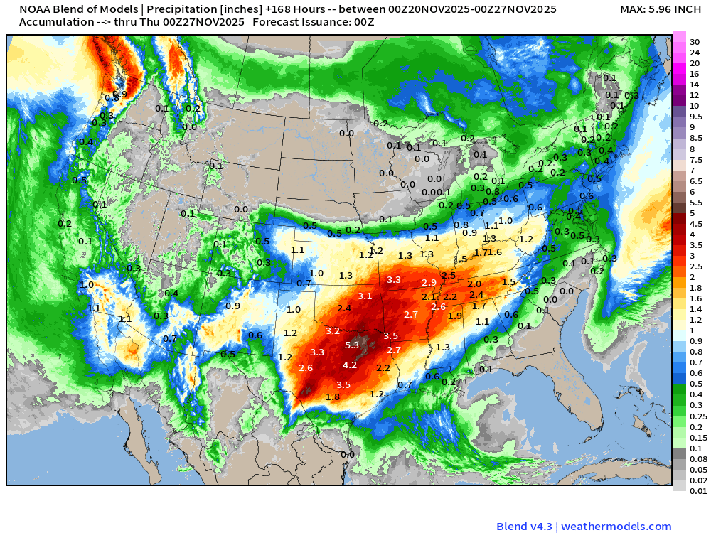
These weak cut-off lows migrate into the Southwest and then east into the central Rockies — pulling up moisture out of the subtropics = rainfall for Southwest into Texas by early next week — really will add up = boatloads.
Medium to long range: ongoing “stratospheric warming event” will see a wind split in the 10-50 mb level … but uncertainty about tropospheric polar vortex disruptions.
Cold period centered upon Thanksgiving/Black Friday weekend with a dip in the jet stream — but the remaining “fully loaded” Arctic polar vortex may remain locked up in Canada (for now) into early December. We will wait for a trigger.
Stratospheric Wind at 10 mb | ECMWF IFS Next 15-days
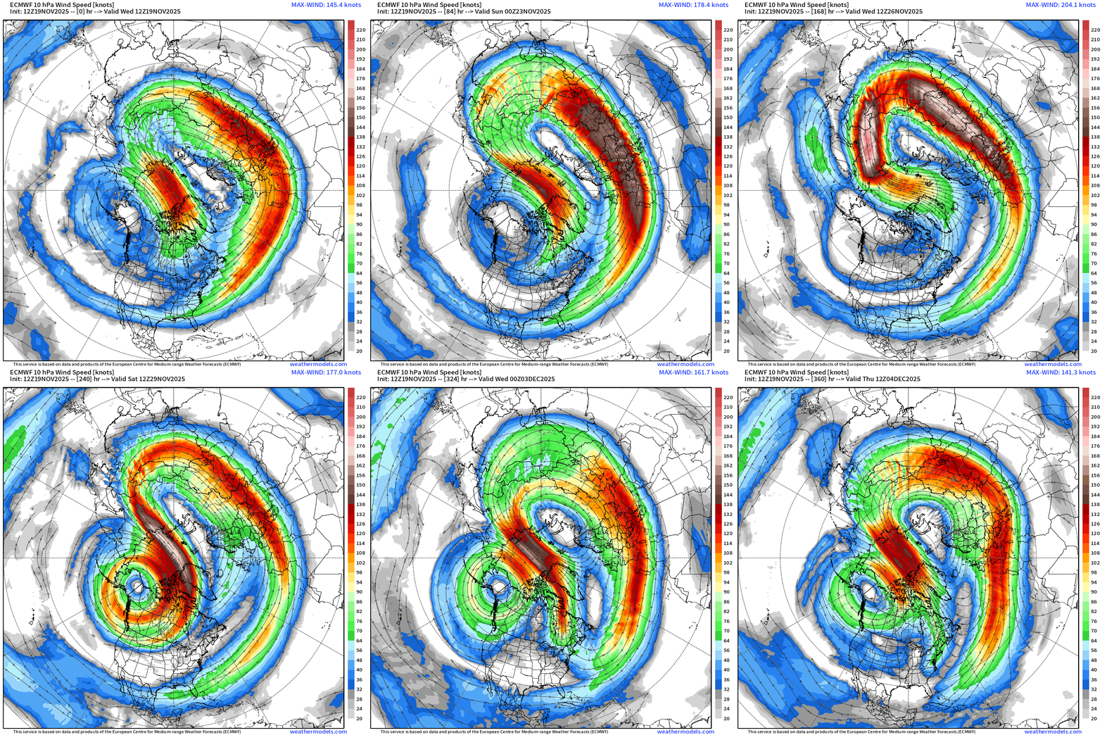
Split type sudden stratospheric warming (SSW) event — with dramatic warming / reversal of the equator / pole temperature gradient
Stratospheric Temperature Anomaly 10 mb | ECMWF EPS Next 15-days
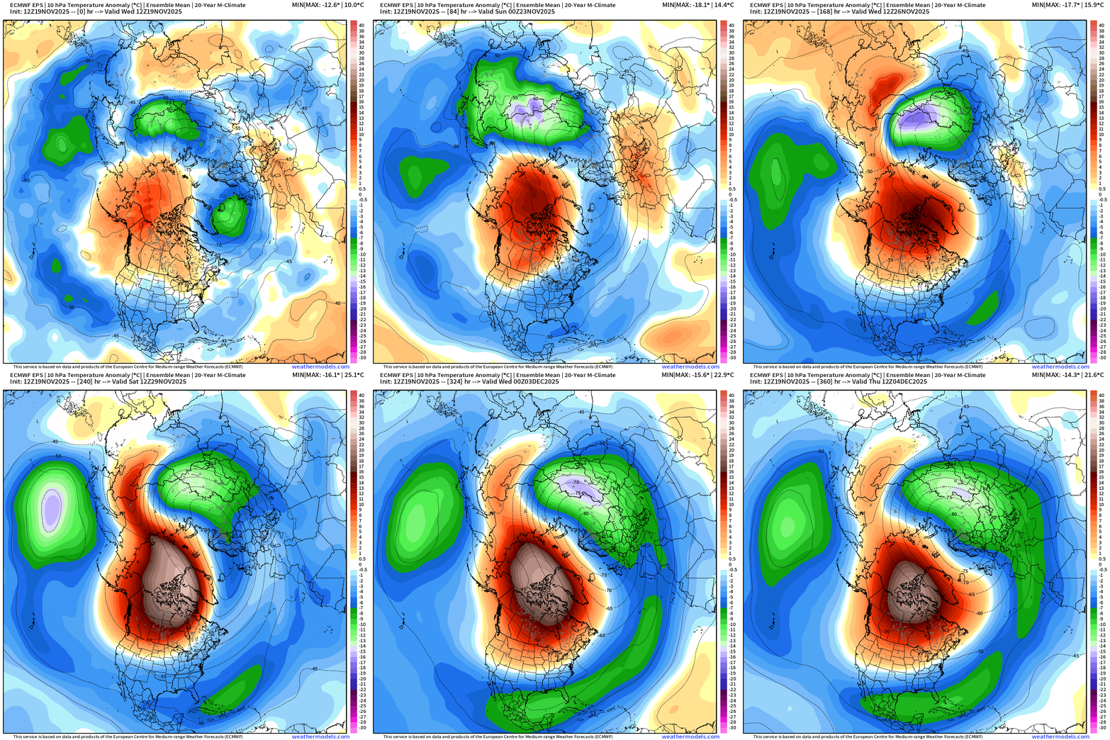
We’ll see what impacts this SSW — perhaps record strong so early in the winter season / late Nov into early Dec — will have on the troposphere below — in the coming days/weeks after.
Temperature Anomaly | EPS 12z | Flagship Ensemble Mean
Cold pool formation over central Arctic Siberia is limited but eventually crosses the Arctic and connects to Canadian Arctic … still pretty early in winter, not as much deep snow cover, so we’re just getting started.
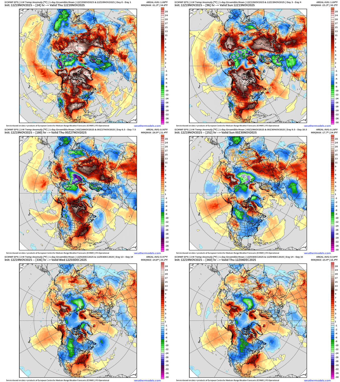
Animation that is the industry standard for monitoring cold air outbreaks: ECMWF EPS full-physics ensemble mean 2-meter temperature anomaly.
AI-GFS 18z | 500 mb Temperature | Next 10-days
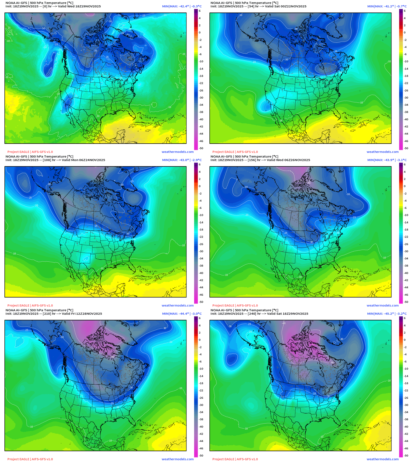
Into Days 7-9 —> strong Midwest trough forms from a Pacific shortwave phasing with the Hudson Bay anchored tropospheric Polar Vortex, however the overall PV / polar front remains rather zonal/flat without a notable southward plunge = weaker and limited longevity.
AI-GEFS 18z | 500 mb Temperature Ensemble Mean | Next 10-days
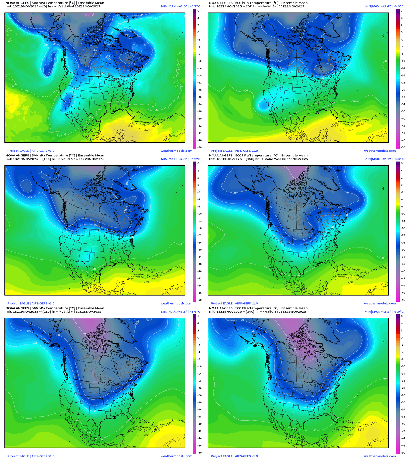
Similar pattern as AI-GFS — but as this is the ensemble mean, we are averaging 31 individual solutions with a negative anomaly in a slightly different location e.g. the trough axis might be faster/slower aligned with the pendulum anchor in Hudson Bay based upon timing.
ECMWF AIFS 18z | 500 mb Temperature | Next 15-days
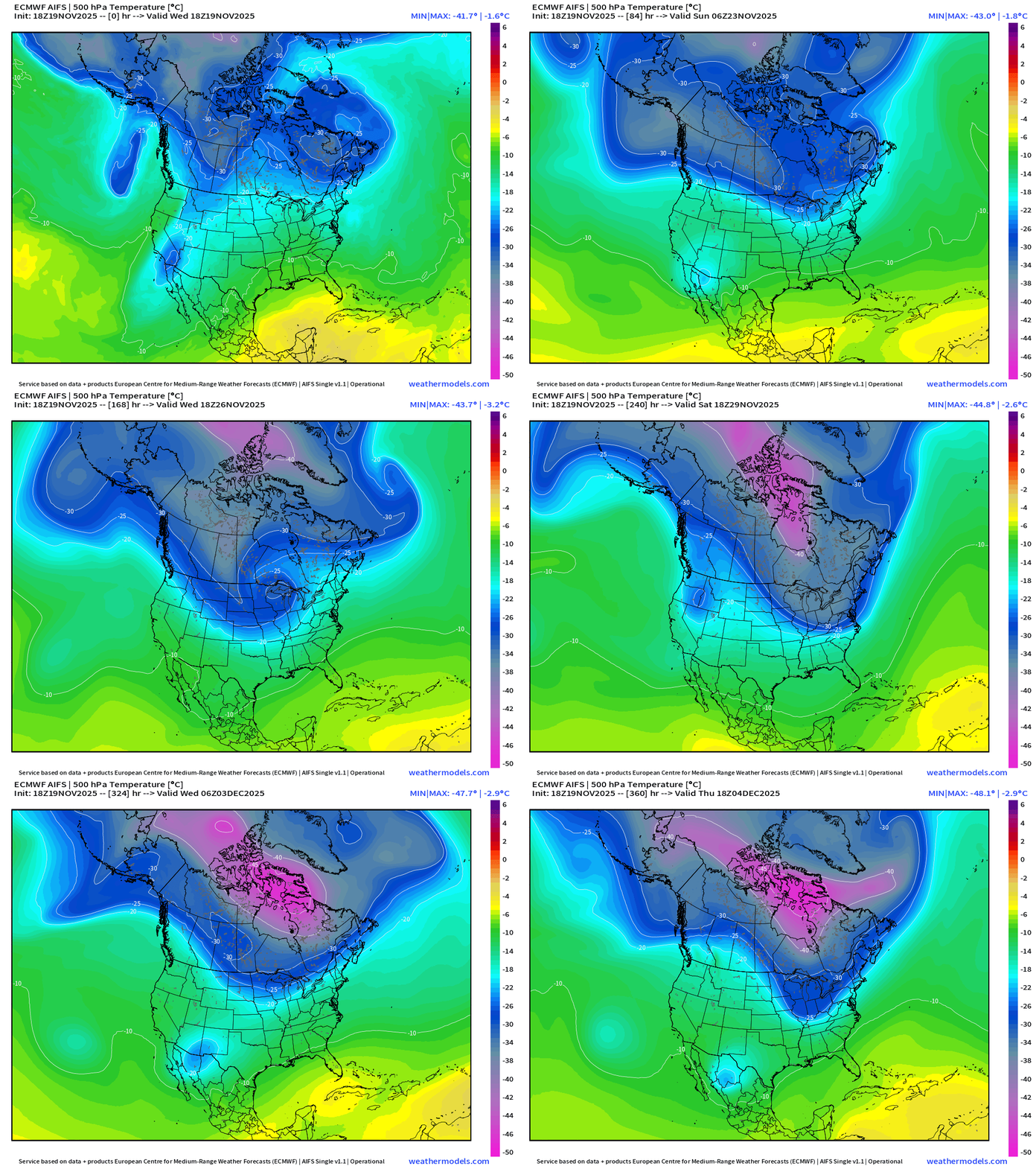
The 500 mb temperature field (middle troposphere) has become quite popular on my X feed as I’ve shared quite a few animations of both North America and Europe.
The dark blue is about -25°C and represents Arctic origin air — shows up nicely within the main blobs over Canada, and the pieces that break off with “lobes” as Rossby wave breaking or trough thinning sends little cut-off low circulations into the subtropics were they cause mischief!
This is a very promising upper-level patten with a “blob” of cold over central Canada just waiting for Pacific shortwaves to drag it south, however it remains largely locked up without a full dump.
ECMWF AIFS-Single 18z | 500 mb Height Anomaly | Next 10-days
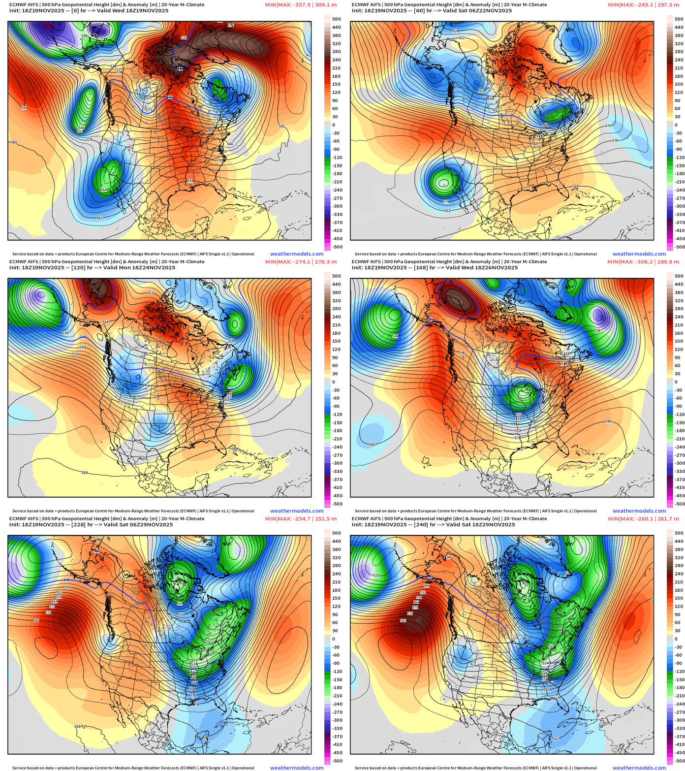
There is a strong ridge over Alaska that needs to break down — influenced by Pacific that is a huge warming influence, limiting the cold pool formation over Alaska and NW Canada —> so our reservoir of cold air will take a while to build — 1-2 weeks.
Verdict: Thanksgiving beginning of colder air into the Midwest and Great Lakes but not a major Arctic blast — just a snack (maybe a yam) before we get the whole turkey (maybe) by the second week of December.
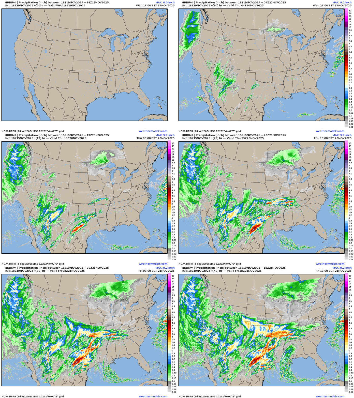
HRRR Simulated Radar | Next 48-hours | Through Friday 1 PM
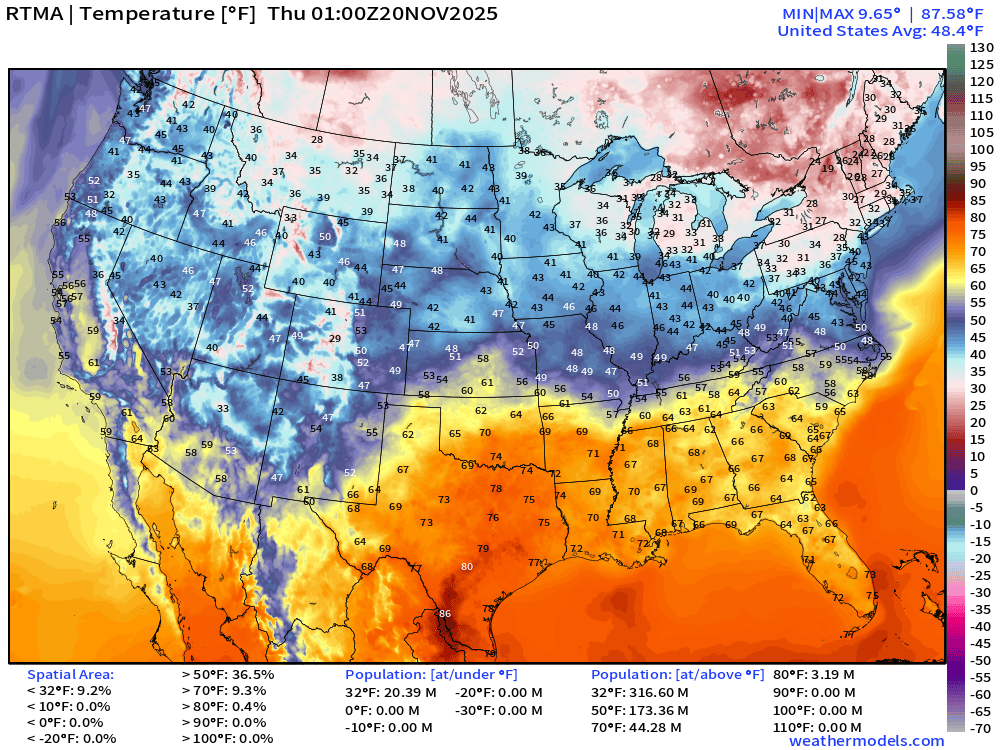
Temperature Analysis | 8:00 PM ET
Temperature Anomaly | 8:45AM ET
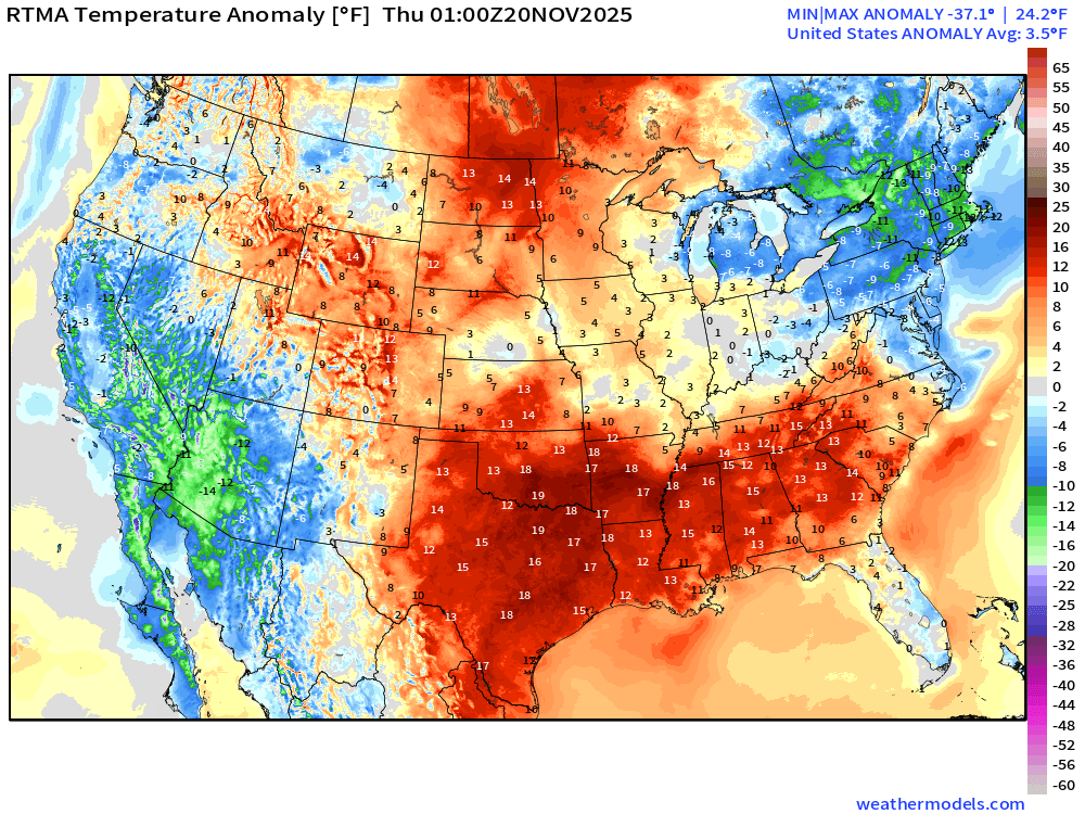
Lower 48 Temperature Anomaly was 3.5°F above normal
Low Temperatures Thursday
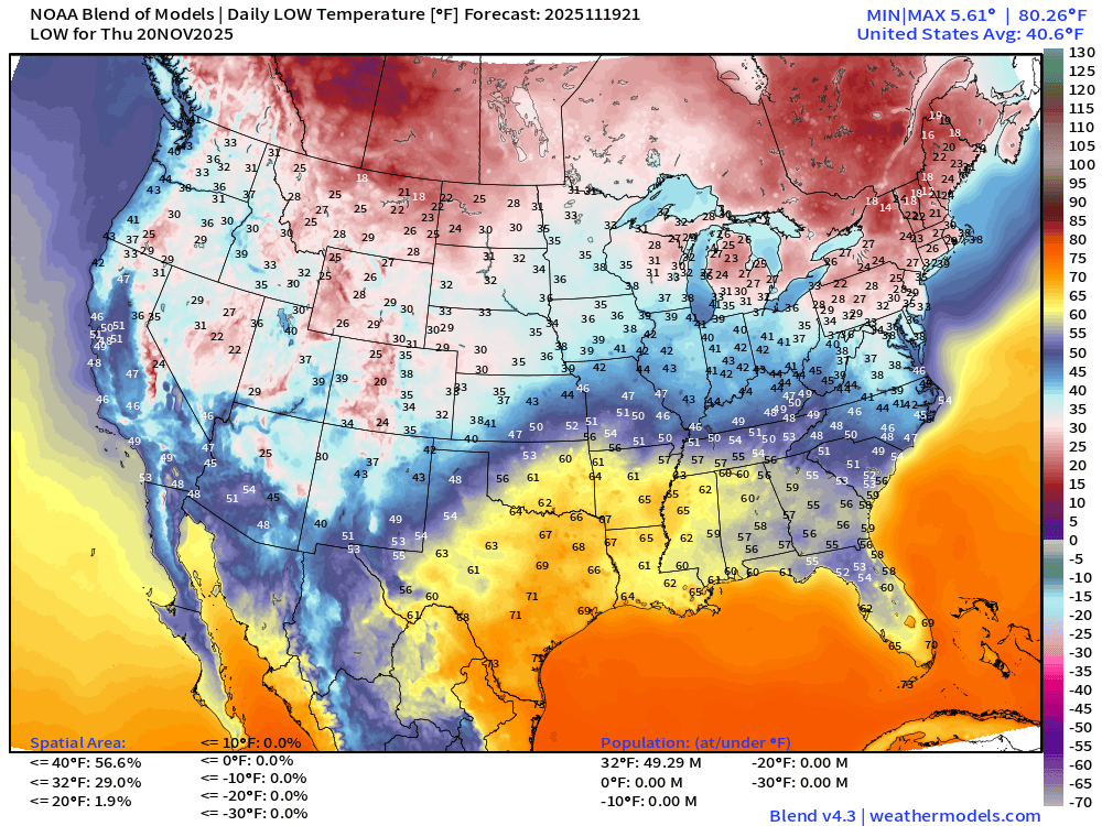
49 million below freezing
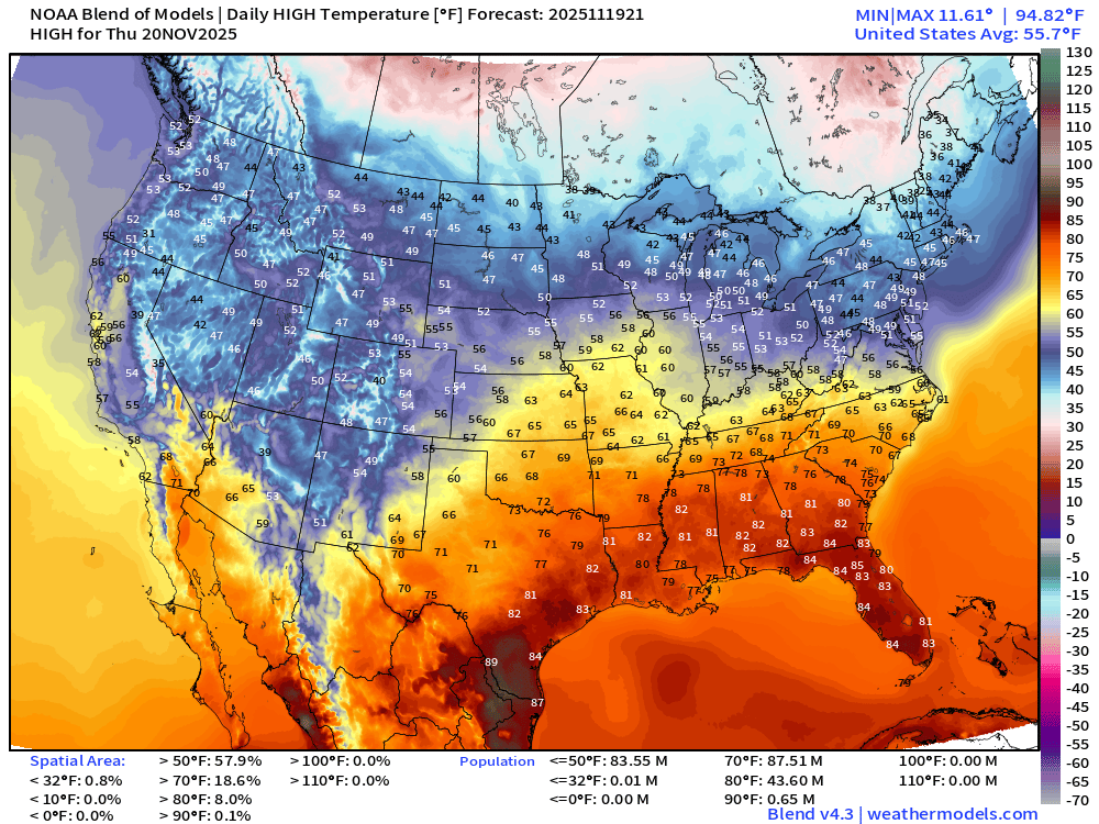
High Temperatures Thursday
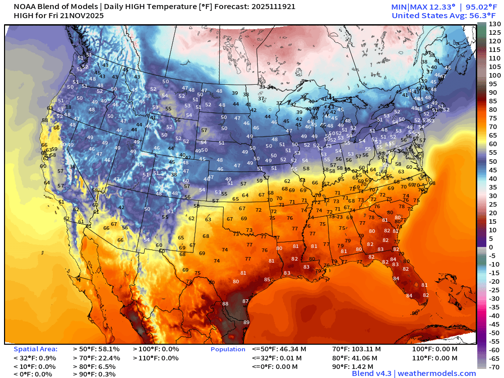
High Temperatures on Friday
HRRR Precipitation Next 48-hours + NWS NDFD 48-Hour Forecast
NWS Snowfall Next 48-hours
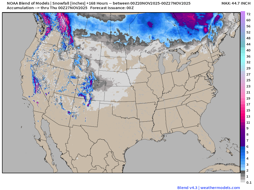
Blend of Models | 7 Days Precipitation and Snowfall Totals
Integrated Vapor Transport | Next 10-days ECMWF 12Z
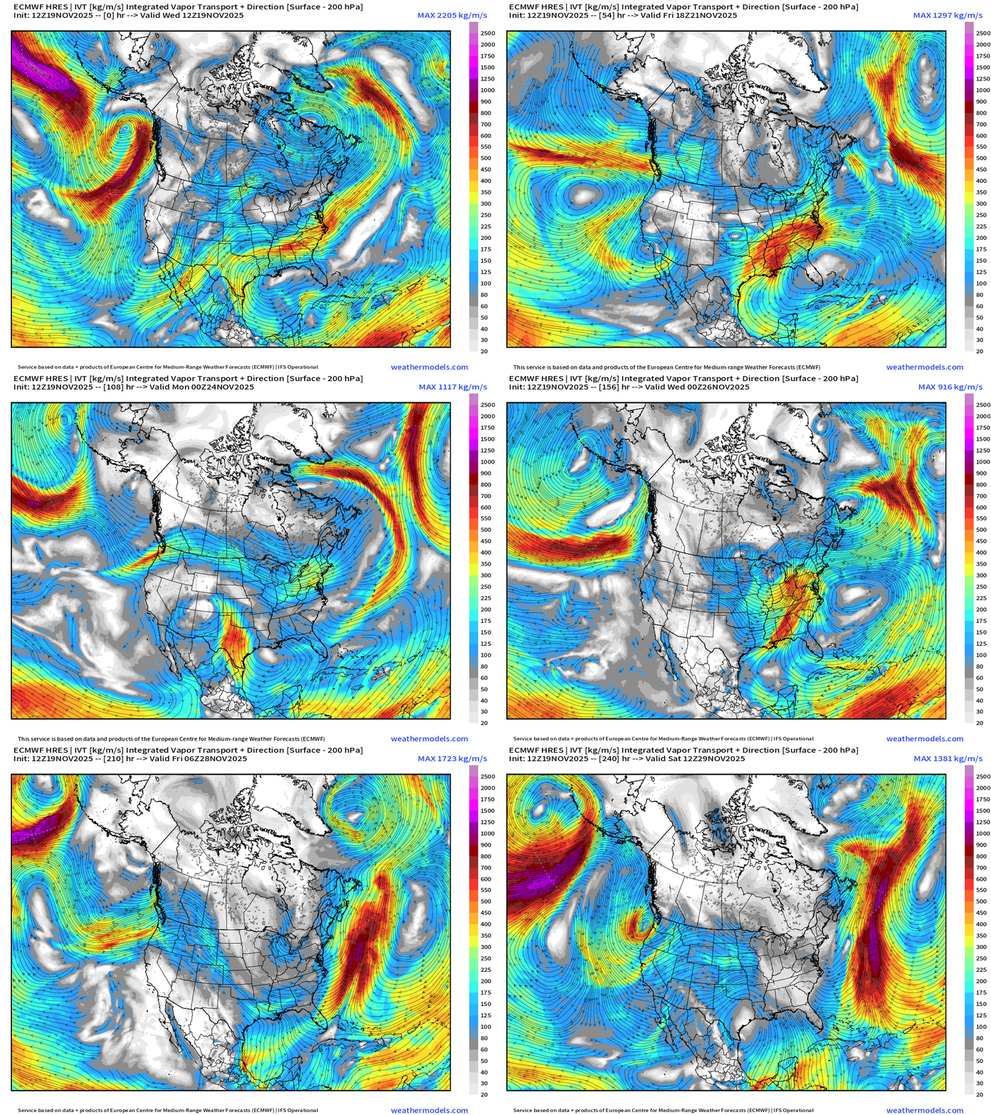
IVT highlights atmospheric rivers of moisture in the atmosphere — and we typically look at the U.S. West Coast … but also works elsewhere, including the East Coast.
ECMWF 18z | Snowfall | Next 6-days
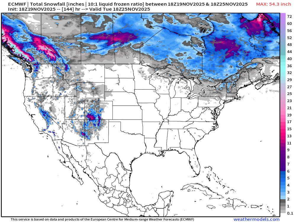
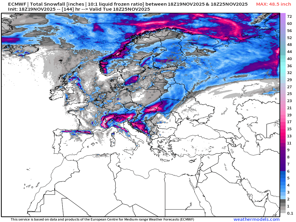
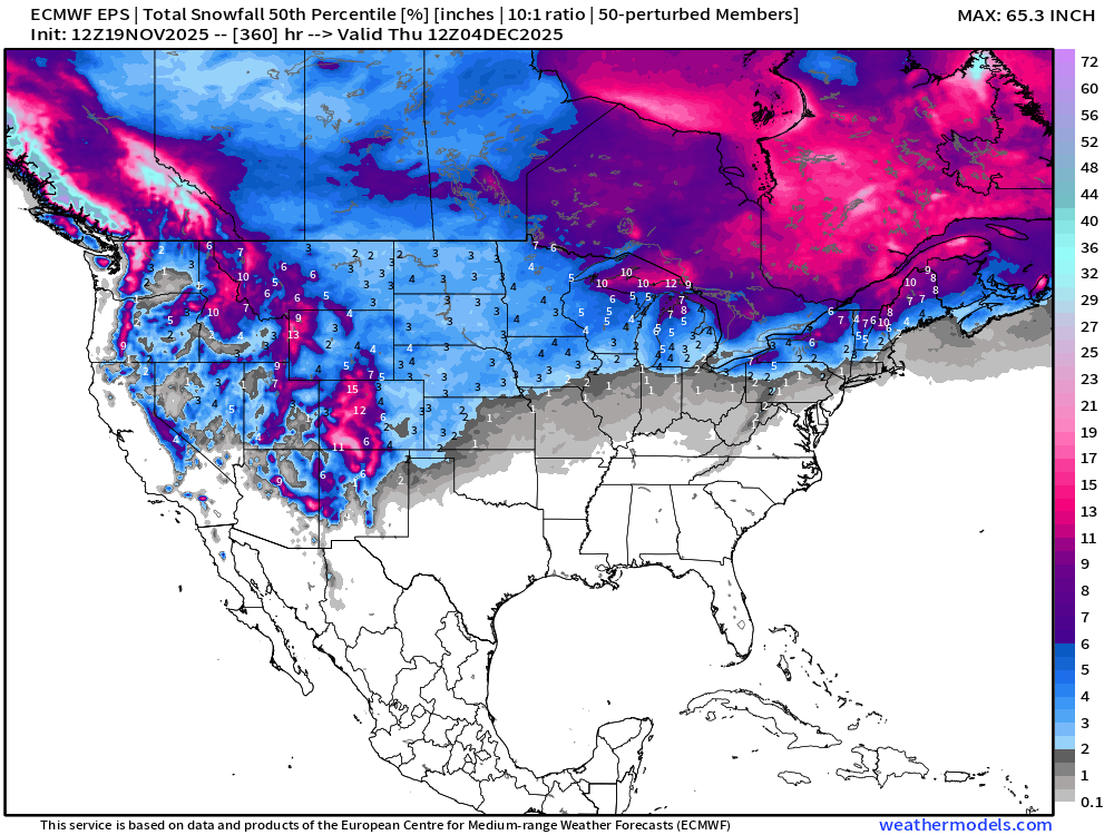
ECMWF EPS 12z | Ensemble Median Snowfall Next 15-days
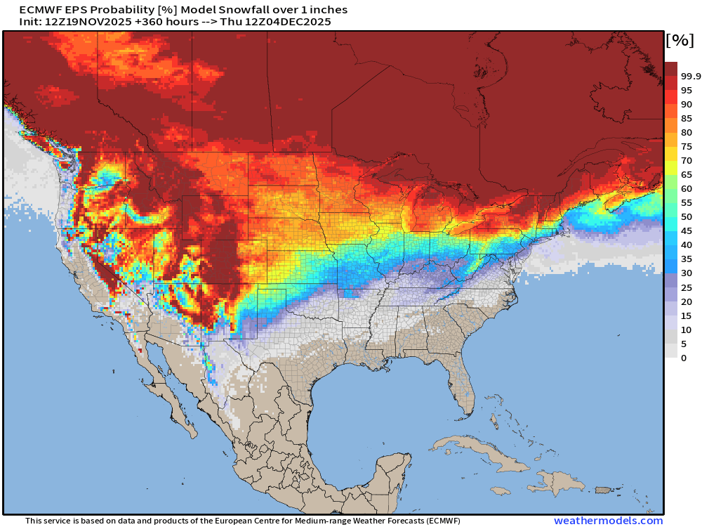
ECMWF EPS 12z | Ensemble Snowfall Probability > 1” | Next 15-days
ECMWF EPS 12z | Ensemble Snowfall Probability > 6” | Next 15-days
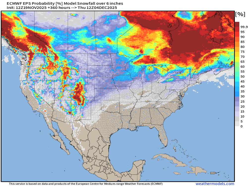
6” is a good signal for a major winter storm — not seeing many of those through two weeks.
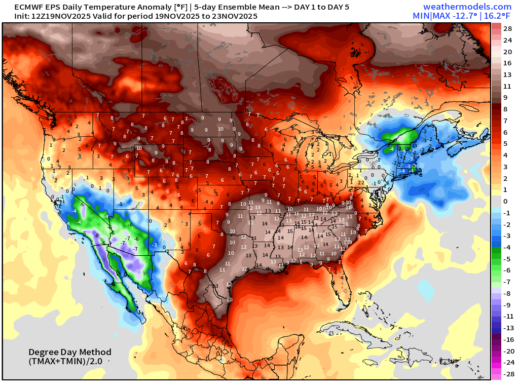
5-Day Chunk #1 | Temperature Anomaly | Nov 19 - Nov 23
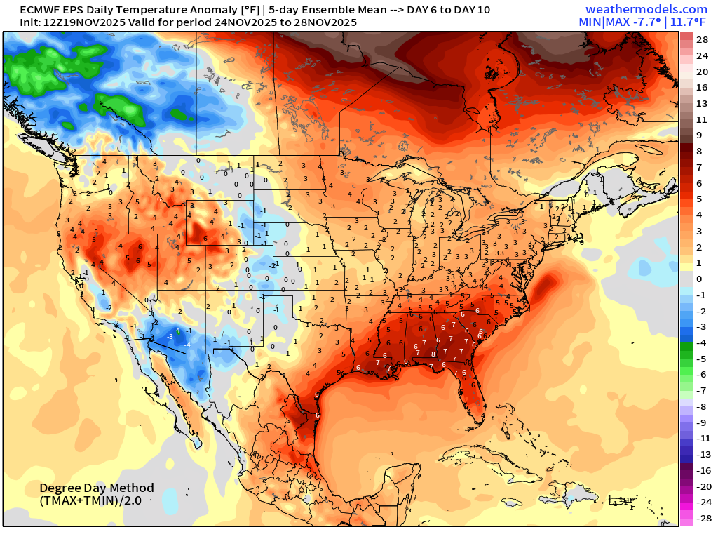
5-Day Chunk #2 | Temperature Anomaly | Nov 24 - Nov 28
5-Day Chunk #3 | Temperature Anomaly | Nov 29 - Dec 3
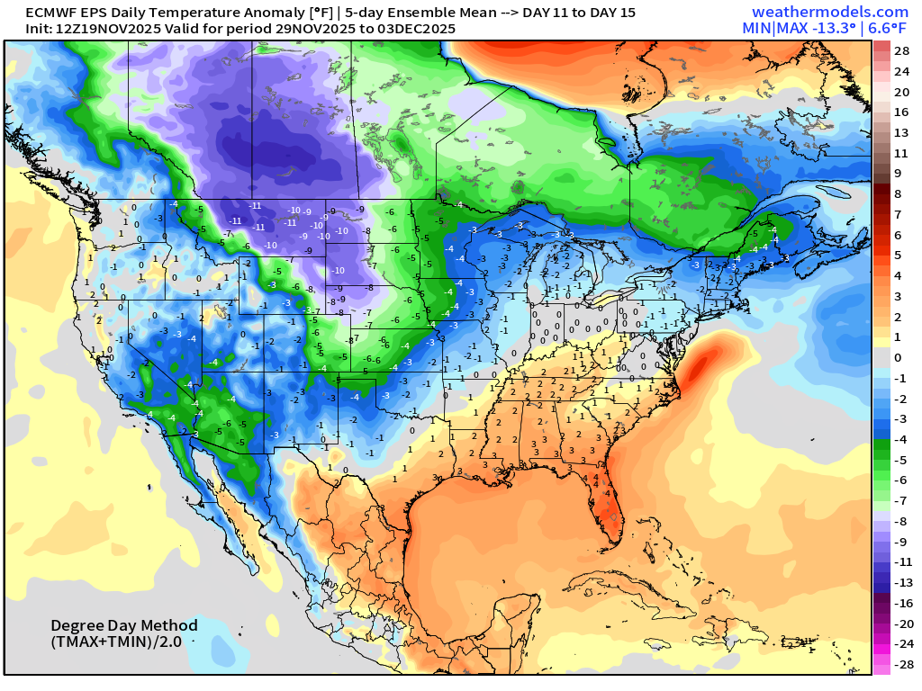
Coldest air is loaded up across the northern Rockies — but as we saw in this morning’s EPS grid, warmth returns across the Southeast.
Atlantic Ocean | 15-day Tropical Storm Tracks | ECMWF 12z
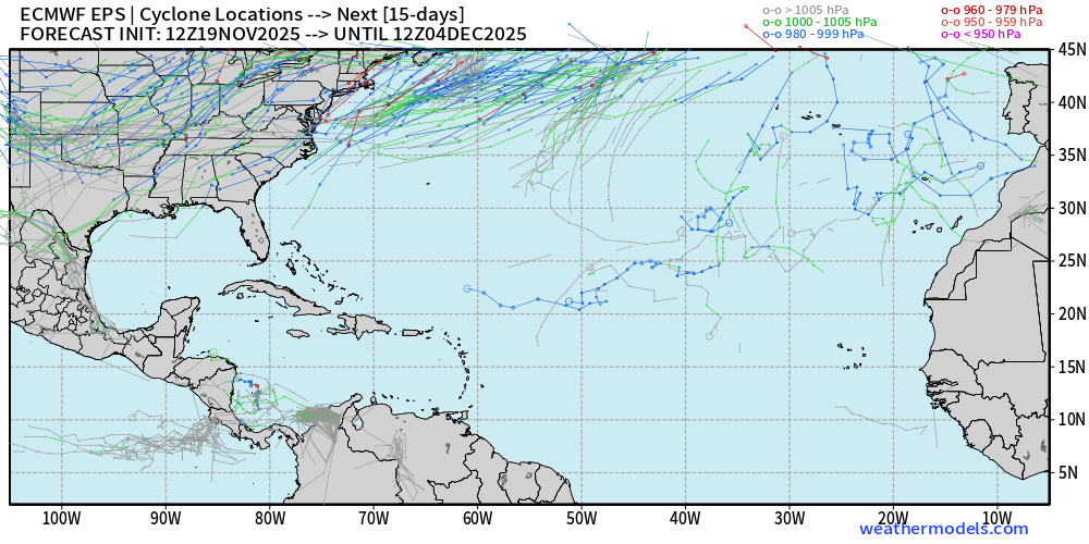
A few tracks — including a hurricane in the Caribbean into early December … so the chance of a late season system is very small (< 10%) in accord with climatology, but not zero!
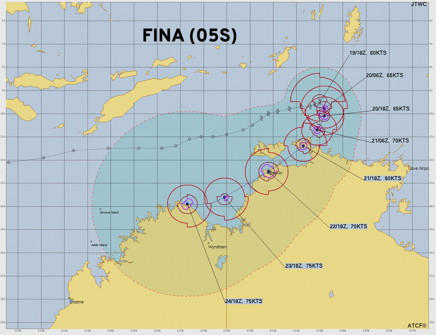
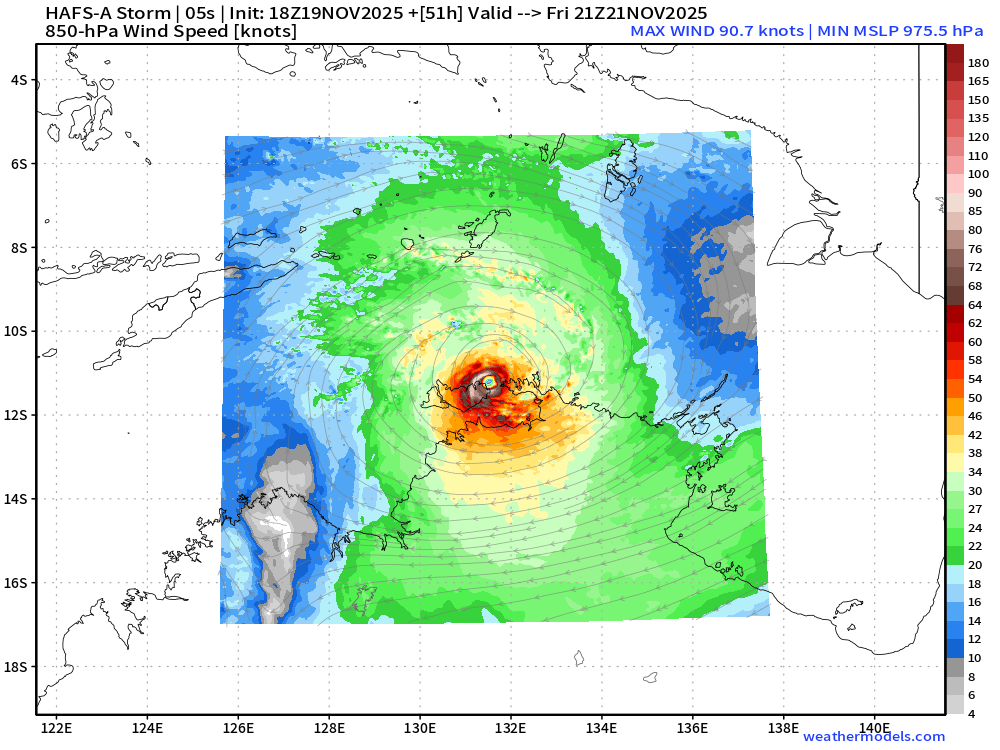
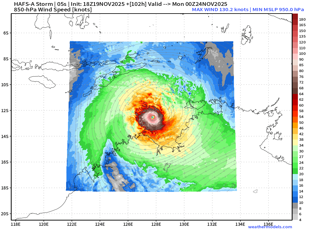
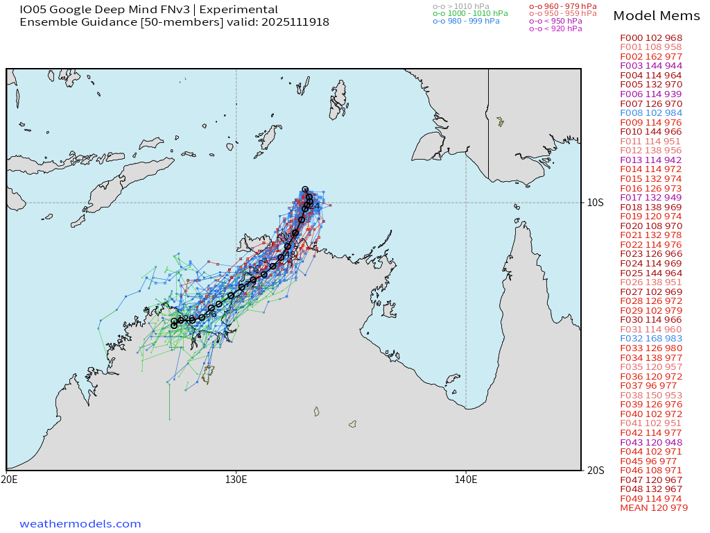
Australia | Tropical Storm Fina (05S) NNE of Darwin
Nearing hurricane intensity — and forecast to reach at least 70 knots prior to a first landfall near Darwin
Friday HAFS-A
Monday HAFS-A —> stays over warm water and deepens to 950 mb —> Cat 3-4
Maps sourced from weathermodels.com designed and innovated by yours truly! Please subscribe there for real-time access to the newest maps, charts from all of the weather models including ECMWF.
- Milepost
- 794 · laid 2025-11-20T02:23:57.716000Z
- Source
- https://weather.substack.com/p/november-19-2025-wednesday-evening
- Digest
- f11e9496e40be84098b1683ab3dc75b09a2cf37eb52c06456f83a966dca72560
- Machine
- JSON