November 11, 2025 Tuesday Morning Weather
Record cold Tuesday morning across Southeast including Florida
November 2025 was the 4th-warmest November in the 131-year national record (1895–2025), at 46.7°F against a 1991–2020 normal of 43.0°F (+3.7°F).
November 2025 was the 29th-driest November in the 131-year national record (1895–2025), at 1.7in against a 1991–2020 normal of 2.3in (-0.6in).
NOAA/NCEI Climate at a Glance, contiguous United States. This is the observed record for the month, not a score of anything said in this piece — the forecast ledger begins 2026-08-17 and cannot reach earlier posts.

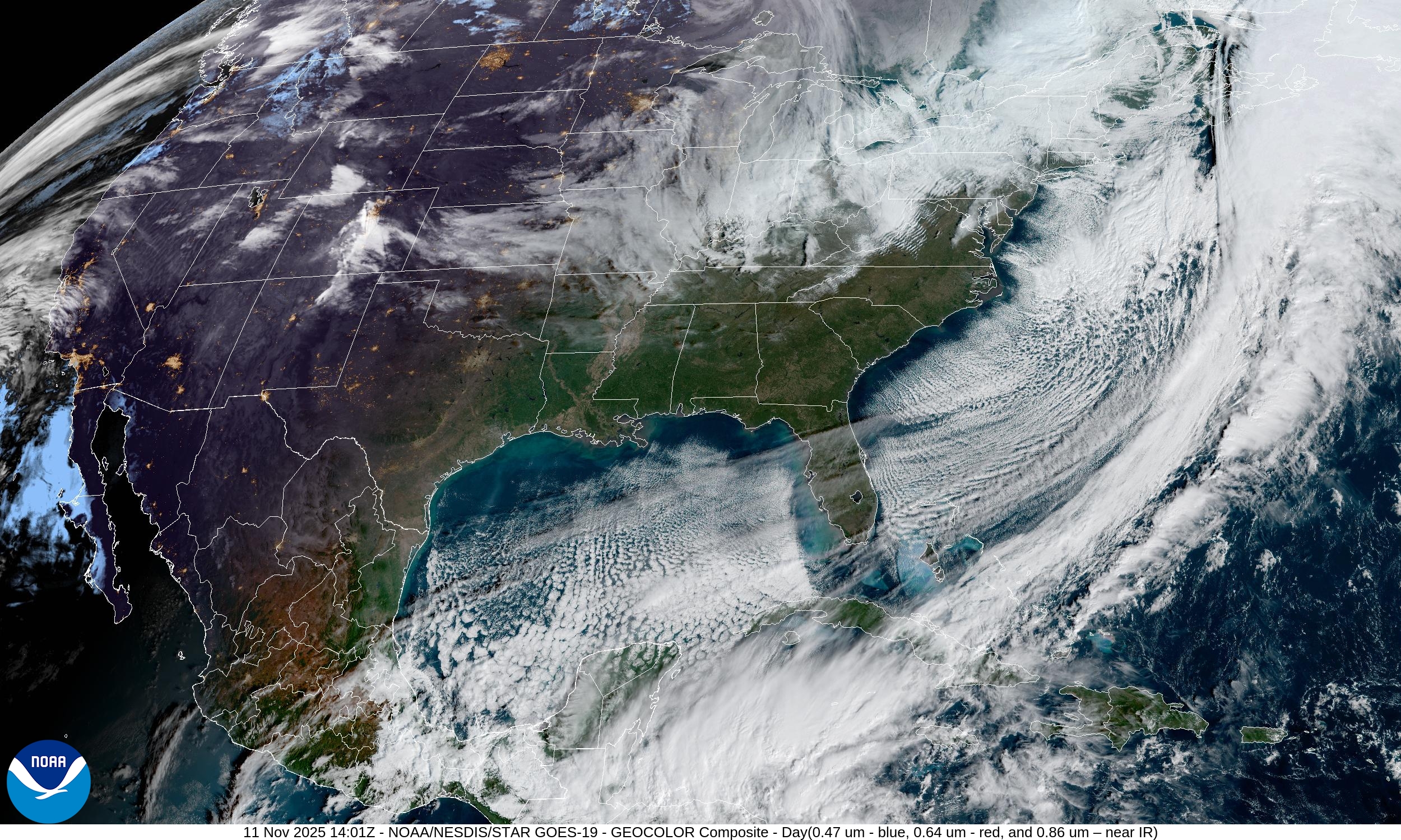
Headlines Tuesday morning
[Historic] Arctic blast with a very sharp upper-level tropospheric “polar vortex” anomaly dipping into the U.S. Southeast with the most extreme cold (compared to normal) sinking through all of Florida into morning [falling iguana alert]. \
Atmospheric river system will impact California with heavy rainfall
Significant warming trend — western moisture/warmth moves eastward to replace this frigid Canadian Arctic air mass with more reasonable/seasonable mid-November temperatures. The Northeast might be slowest to see “warmth” as backdoor troughs downstream of the ridge may linger or reinforce.
Historic maps at 500 mb | 06z
-41°C to -42°C at 500 mb centered over North Carolina is incredible even for mid-winter and it’s only November 11th. This is the equivalent of a Category 5 hurricane rarity, or even more unusual, actually.
Wind gusts at surface quite strong as the cold front blasted through entire Gulf of Mexico and into Central America / Caribbean.
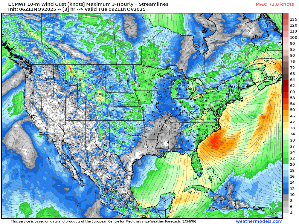
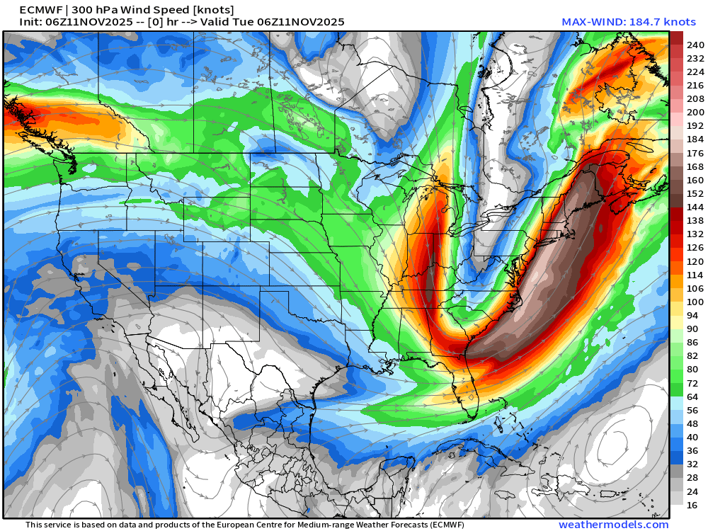
Jet Stream winds show a very sharp dip with the axis touching Florida — with high thin cirrus clouds streaming across the frigid Sunshine State
Earlier Temperatures at 7 AM ET
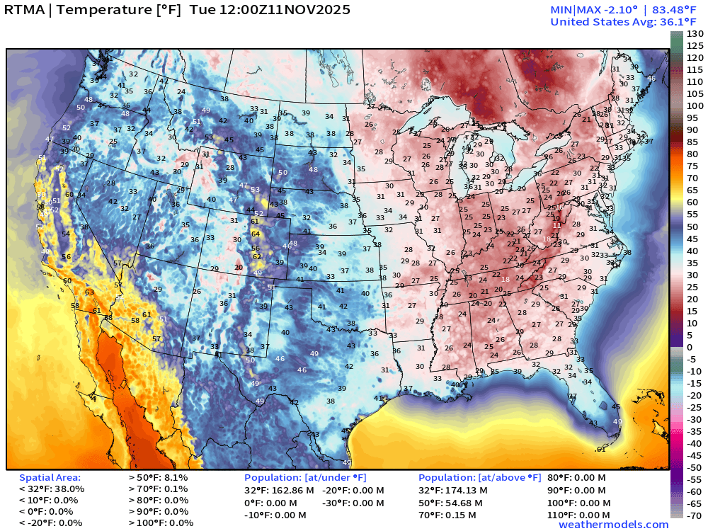
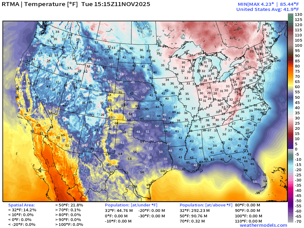
Mainly 20s across the Eastern U.S. with 163 million freezing at this snapshot hour.
Florida Historic Cold Weather … note the over land fetch of wind gusts perfectly aligned to avoid the warmth of the Gulf of Mexico and Atlantic.
Dew points were in the upper-10s
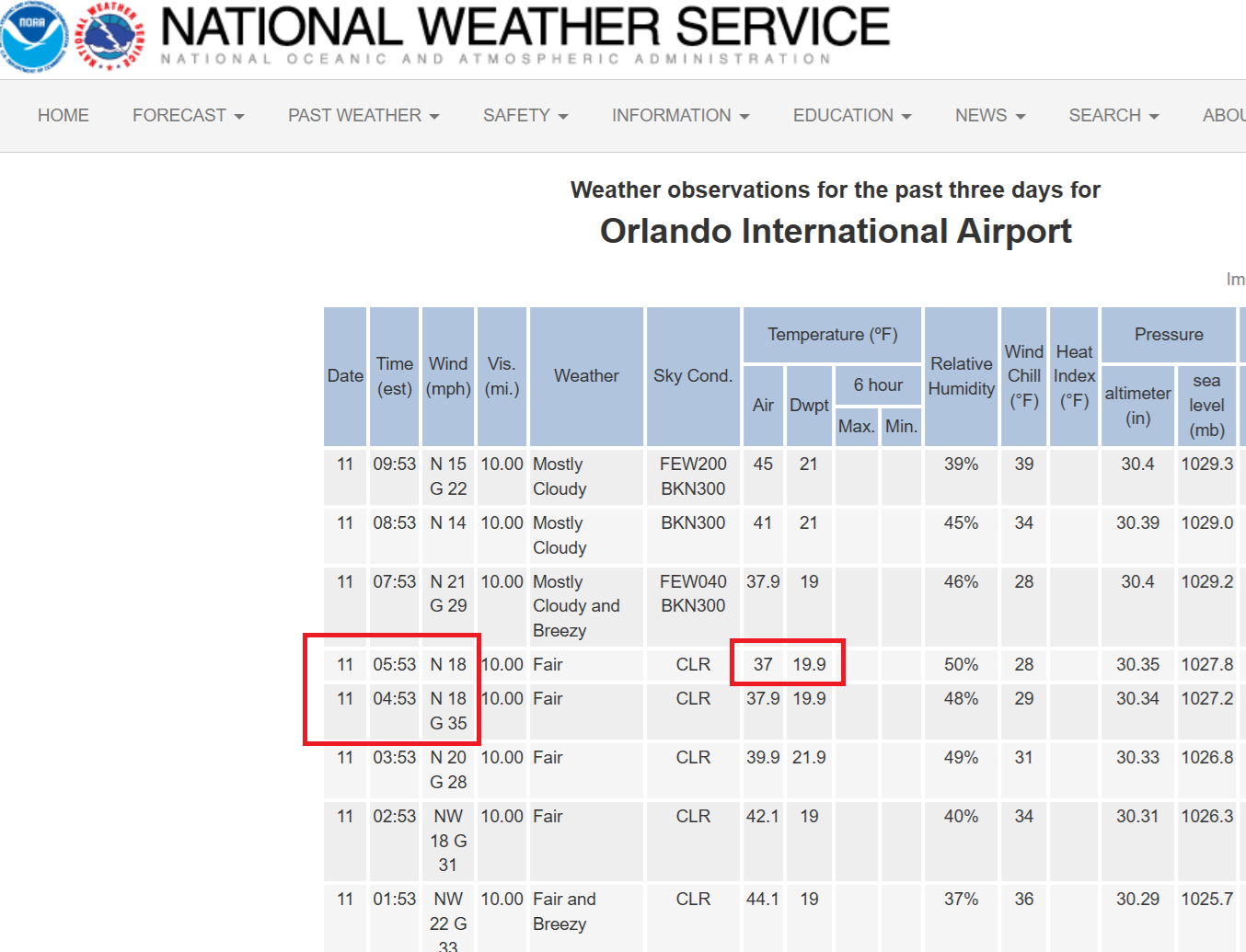
Orlando Observations
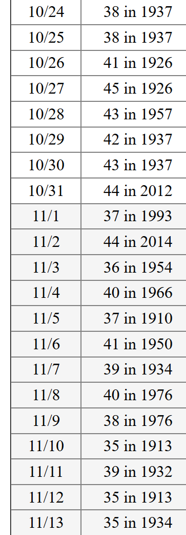
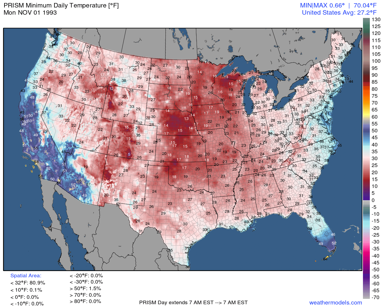
The cold of 37°F in Orlando was a record low by 2°F but not necessarily the earliest/coldest as that would be Nov 1, 1993 (37°F tie)
Threaded Records from Orlando | Minimums (Period of Record: Since 1892)
Reference for November 1, 1993 Lows | 81% of Lower 48 below freezing
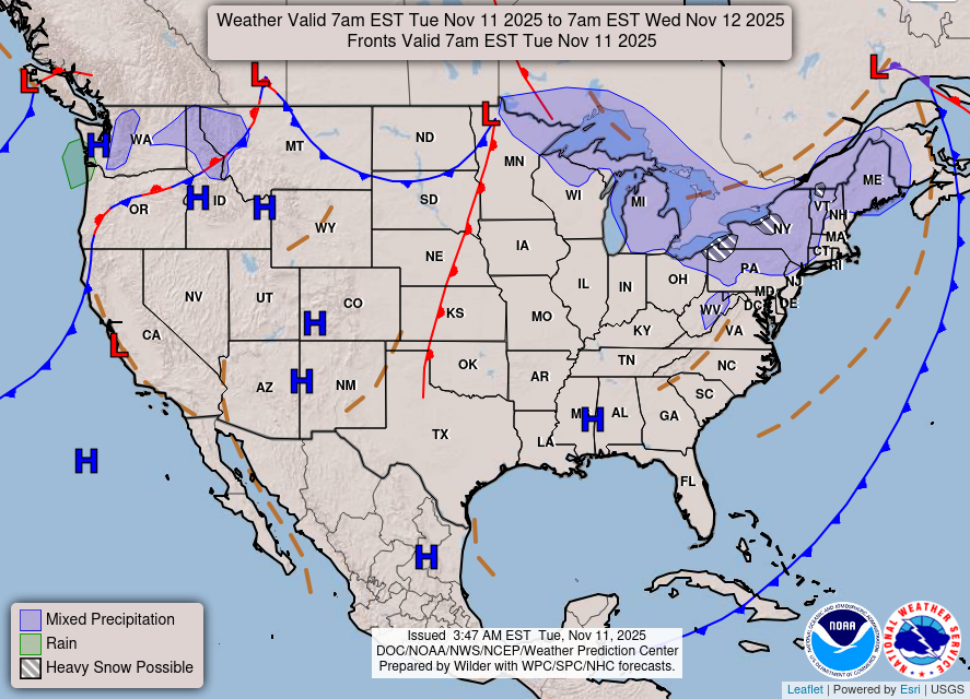
This Morning’s Frontal Boundaries
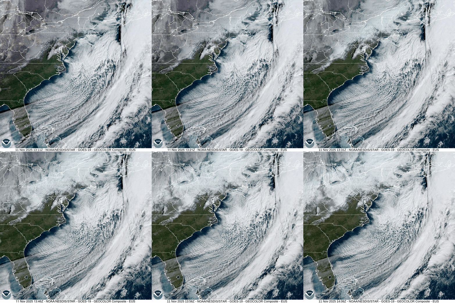
Morning Satellite shows the cloud streets from the very cold air going over the much warmer ocean waters — that will extract significant heat and cool the SSTs
Short Term | HRRR forecasts next 48-hours into 7 AM ET Thursday
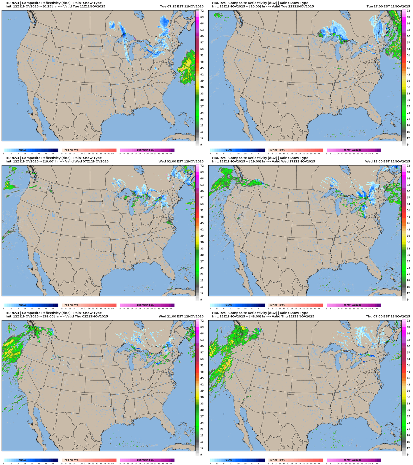
Continued light snowfall across the Great Lakes and Northeast for the next couple days. Then, a storm system comes into the West Coast on Thursday.
ECMWF Precipitable Water Next 6-days
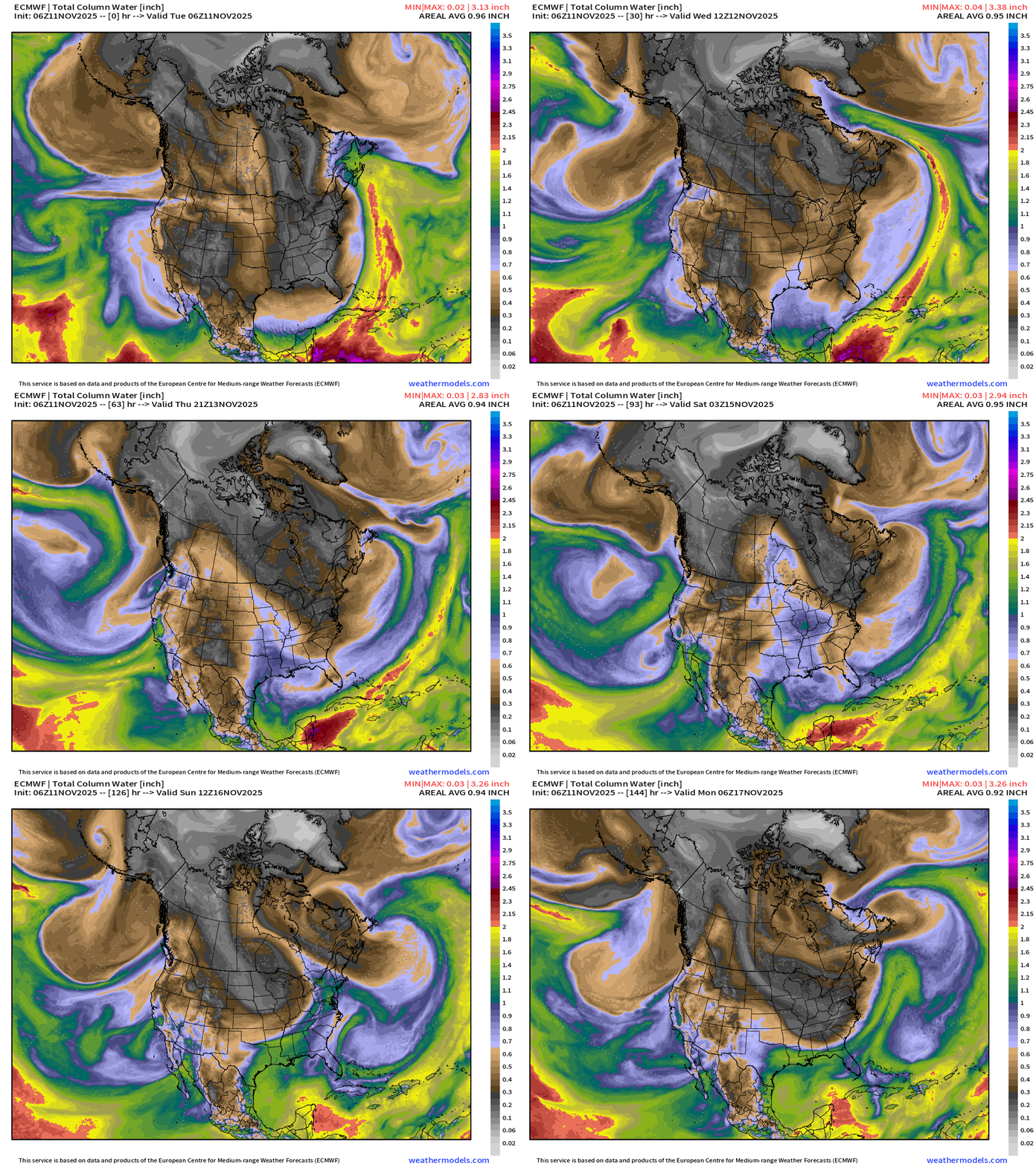
My favorite parameter! Note the black/gray/white coming out of the Canadian Arctic = cold and dry air — crashes through the Gulf of Mexico AND south Florida. Indeed, the shape of the precipitable water dry plume = Florida peninsula Tuesday morning with perfect NNW flow bringing the entirety of the cold/dry plume south.
More southerly flow will moisten the central U.S. until another Canadian cold front this weekend, but thankfully not as cold.
Storm system into Thursday — atmospheric river from the WSW impacts central California coastline, and then becomes a cut-off low across the U.S. Southwest
West Coast Atmospheric River
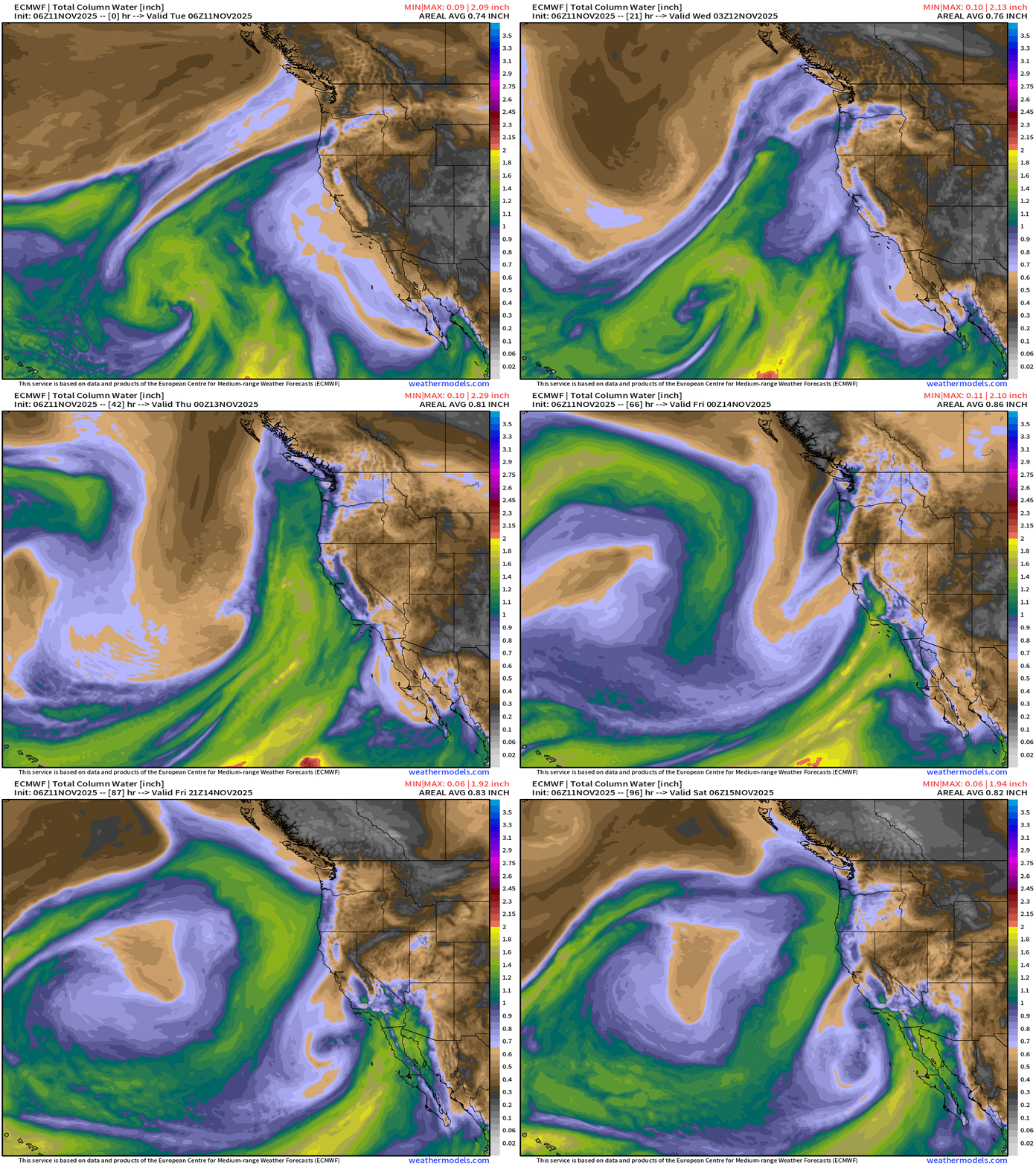
Complicated series of storm systems + cut-off lows combine to send boatloads of moisture into central California — definitely no drought indicators this Fall so far!
Precipitation Type + MSLP Next 6-days
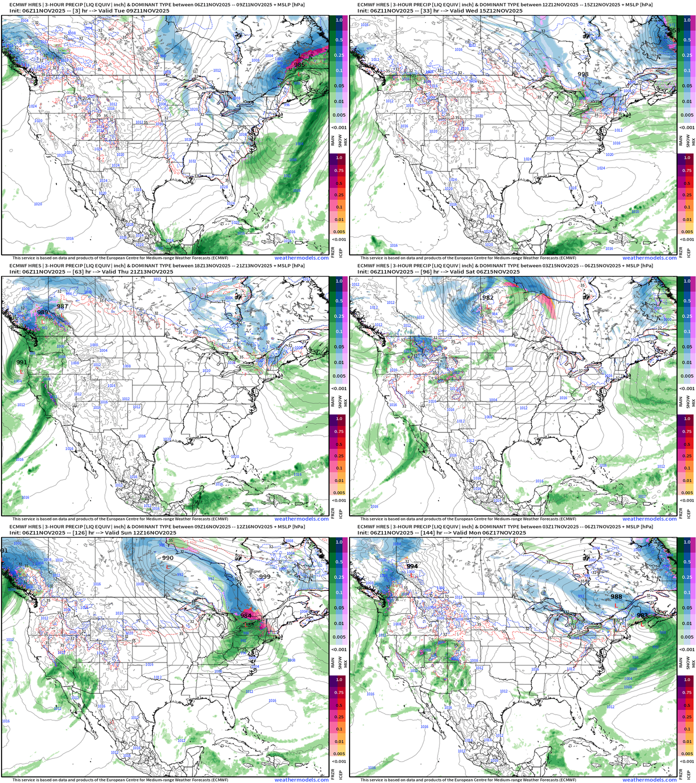
Little clipper system this weekend for the Great Lakes (rain) and some snowfall for the Northeast — mainly northern New England as this juncture in the forecast.
Cut-off low heads into Southern California and Arizona —> wet pattern!
Integrated Vapor Transport | Next 10-days ECMWF 00Z
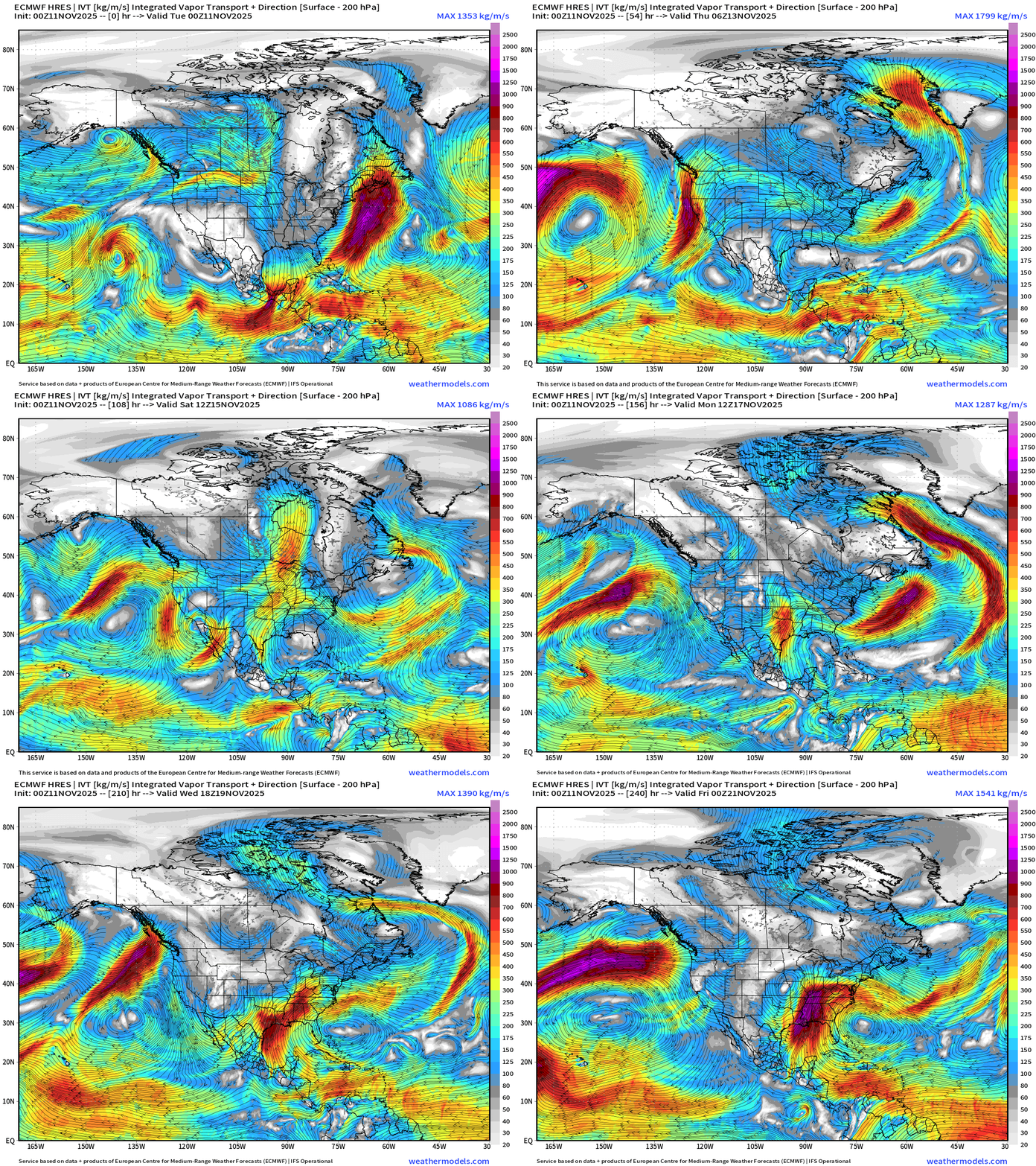
IVT highlights atmospheric rivers of moisture in the atmosphere — and we typically look at the U.S. West Coast … but also works elsewhere, including the East Coast. Not seeing any huge storms on the horizon for the next 10-days in terms of Nor’easters.
ECMWF AIFS 06z Height Anomaly (500 hPa) Next 10-days
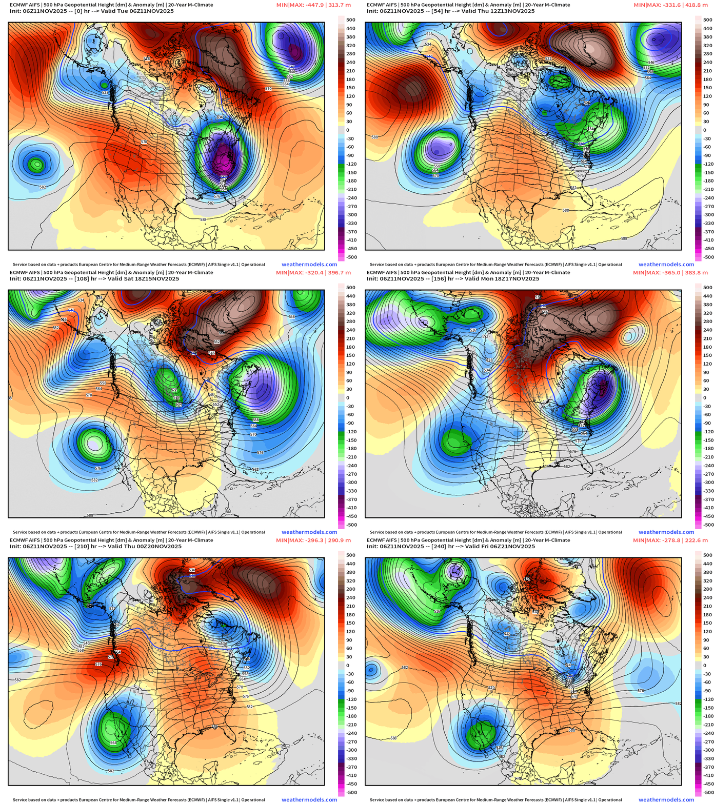
Main weather story for the West Coast is a slow-moving series of troughs that evolve into cut-off lows — and that flow out of the subtropical Pacific —> huge moisture into the Southwest and then eastward in Texas.
Ridging over central U.S. will mean warmth
Unfortunately, a series of strong troughs set up across the Northeast and warming is abated, stunted.
November 2025 Winter Sign Up promotion for new subscribers (ends today). You were given quite a warning of the cold weather — and knew it about days before TV weather or corporate media caught up.
ECMWF EPS Ensemble Mean 06z | Snowfall | Next 6-days
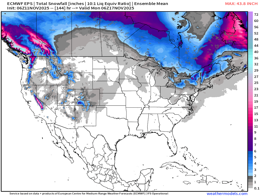
Global model — flagship from ECMWF shows a promising return of Sierra Snowfall.
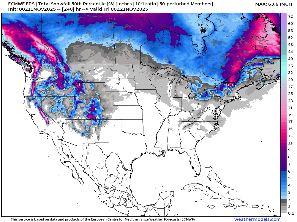
ECMWF EPS 00z | Ensemble Median Snowfall Next 10-days
ECMWF EPS 00z | Ensemble Snowfall Probability > 3” | Next 10-days
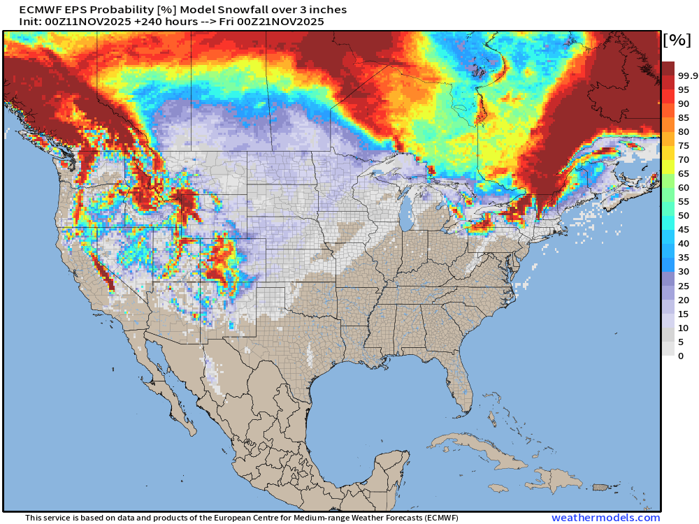
Total for the next 10-days from the flagship ECMWF ensemble model shows nationwide snowfall but still lacking a major East Coast Nor’easter
Temperature Analysis | 10:15 AM ET
Temperature Anomaly | 10:15 AM ET
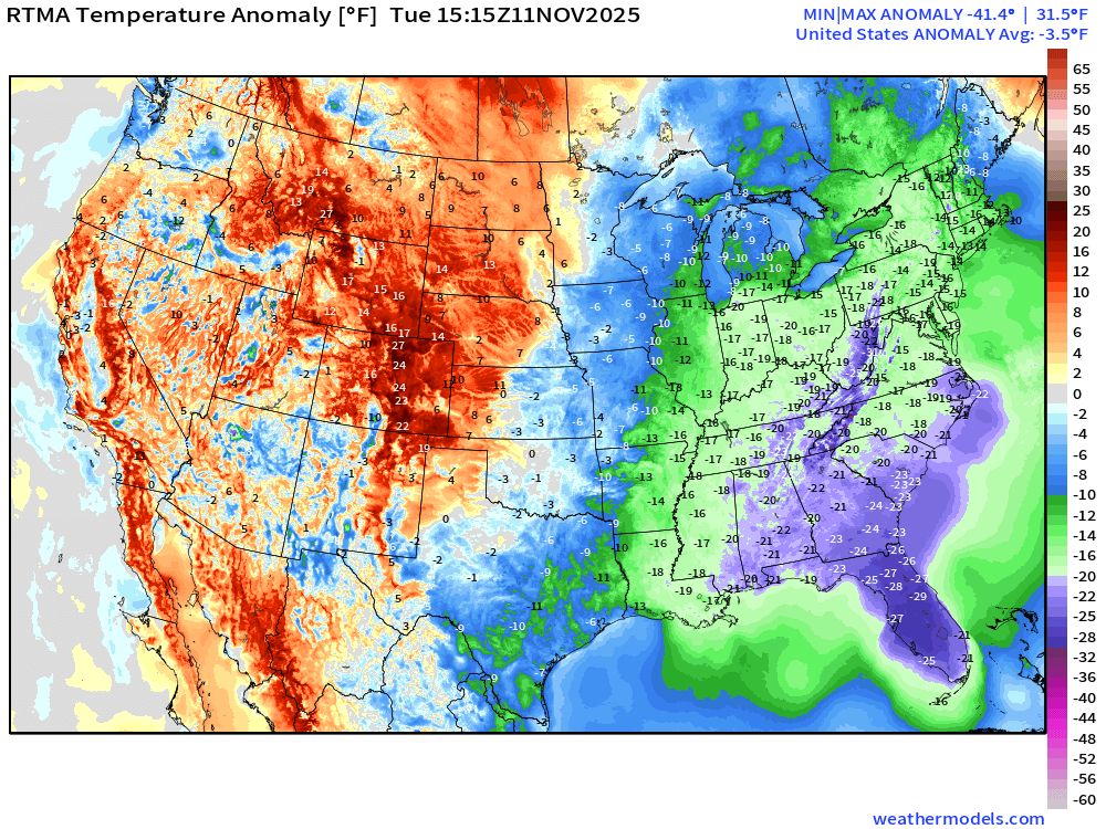
Lower 48 Temperature Anomaly was -3.5°F below normal
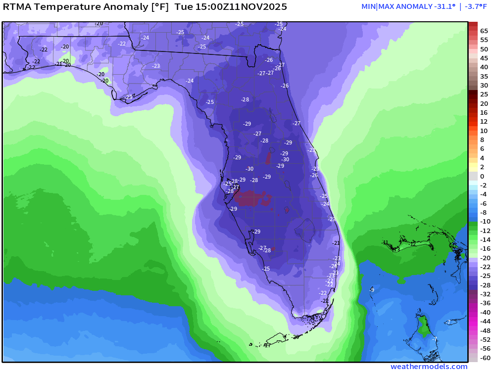
Florida pushing 31°F below normal (coldest) at 10:00 AM ET. Amazing
High Temperatures Tuesday
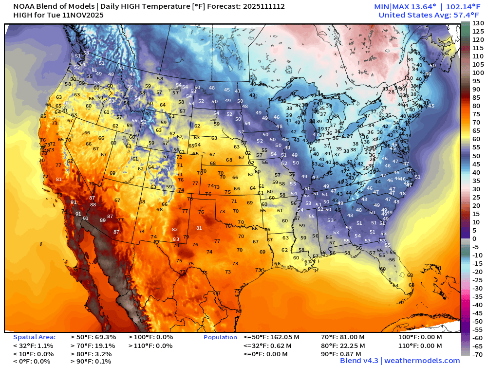
Very nice across the central U.S. and front range of the Rockies … and very warm out west including California into the upper-70s in the Bay Area.
Chilly across the Eastern U.S.
Some moderation into the afternoon as the cold air mass can’t survive long against the still warm sunshine and long enough days on November 11th.
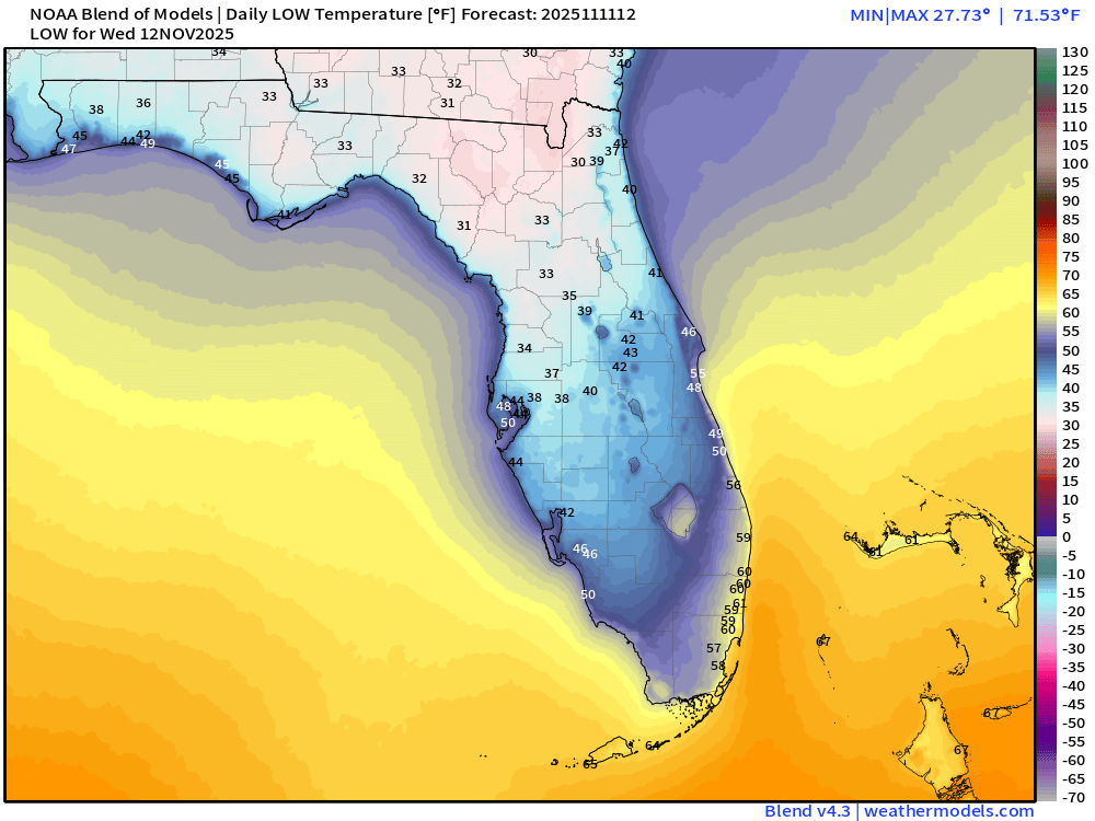
Wednesday Morning Lows
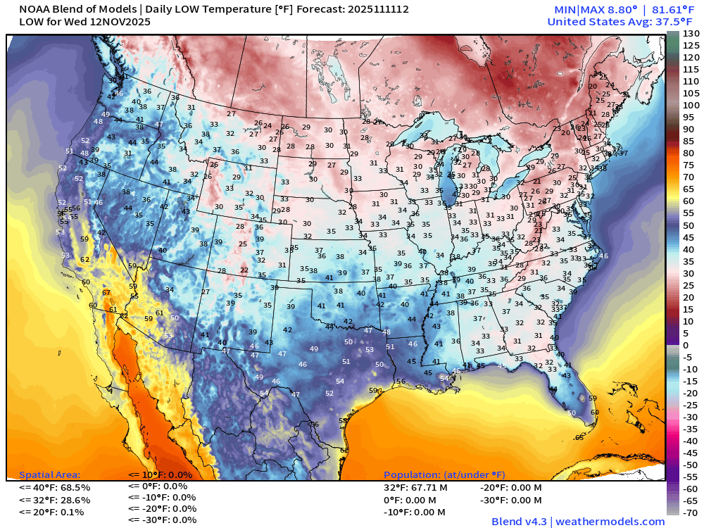
67 million below freezing — significantly less than Tuesday morning
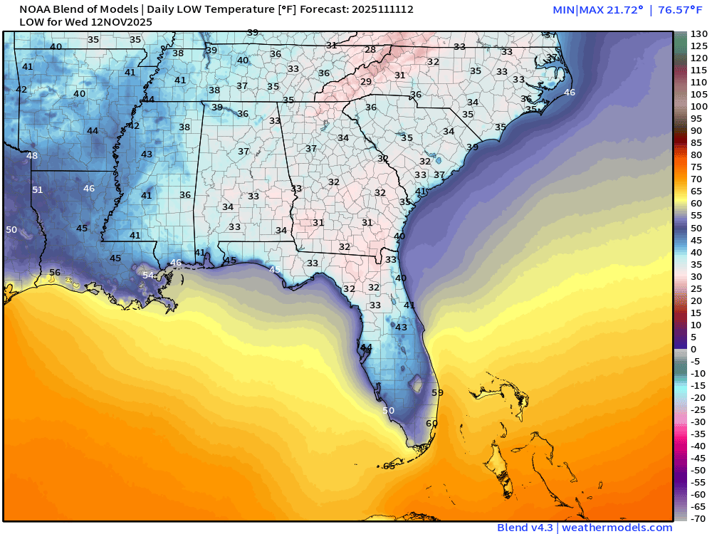
Still COLD across Florida (freezing from Gainesville north up I-75)
High Temperatures Wednesday
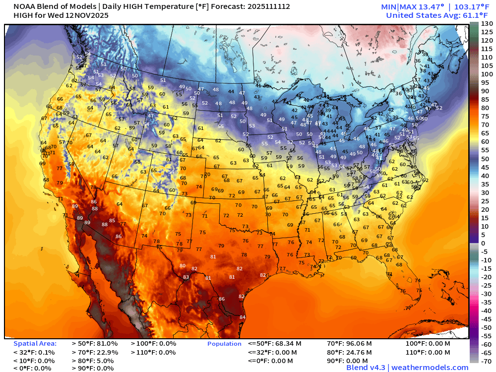
Moderation into the afternoon as the cold air mass can’t survive long against the still warm sunshine and long enough days on November 11th.
NWS Precipitation Next 72-hours
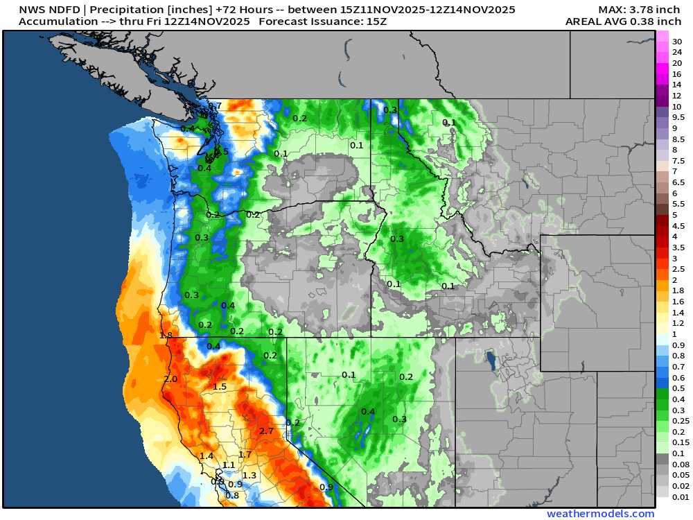
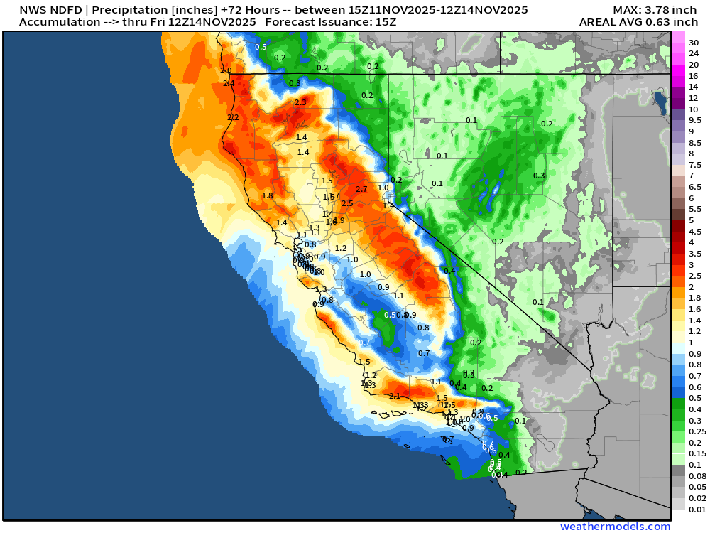
Nice rainfall totals from storm system / atmospheric river
NWS Snowfall Next 72-hours
Blend of Models | 10 Day Precipitation Totals
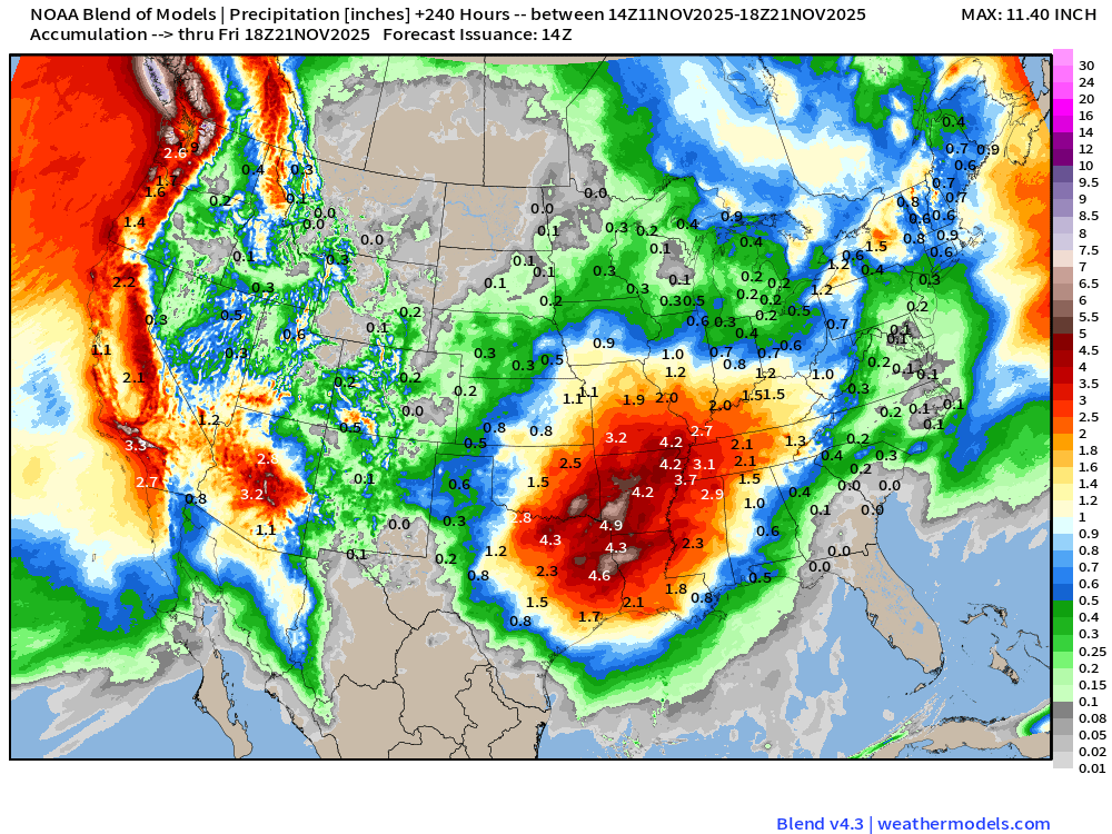
Whoa — that’s a lot of rainfall for unusual location of Phoenix, Arizona … and then heavy > 4-5” centered on the lower Mississippi River Valley and eastern Texas + Arkansas.
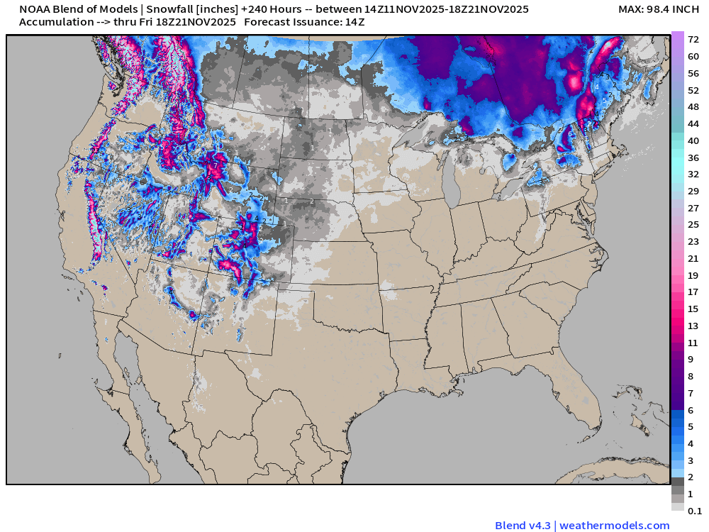
Blend of Models | 10 Day Snowfall Totals
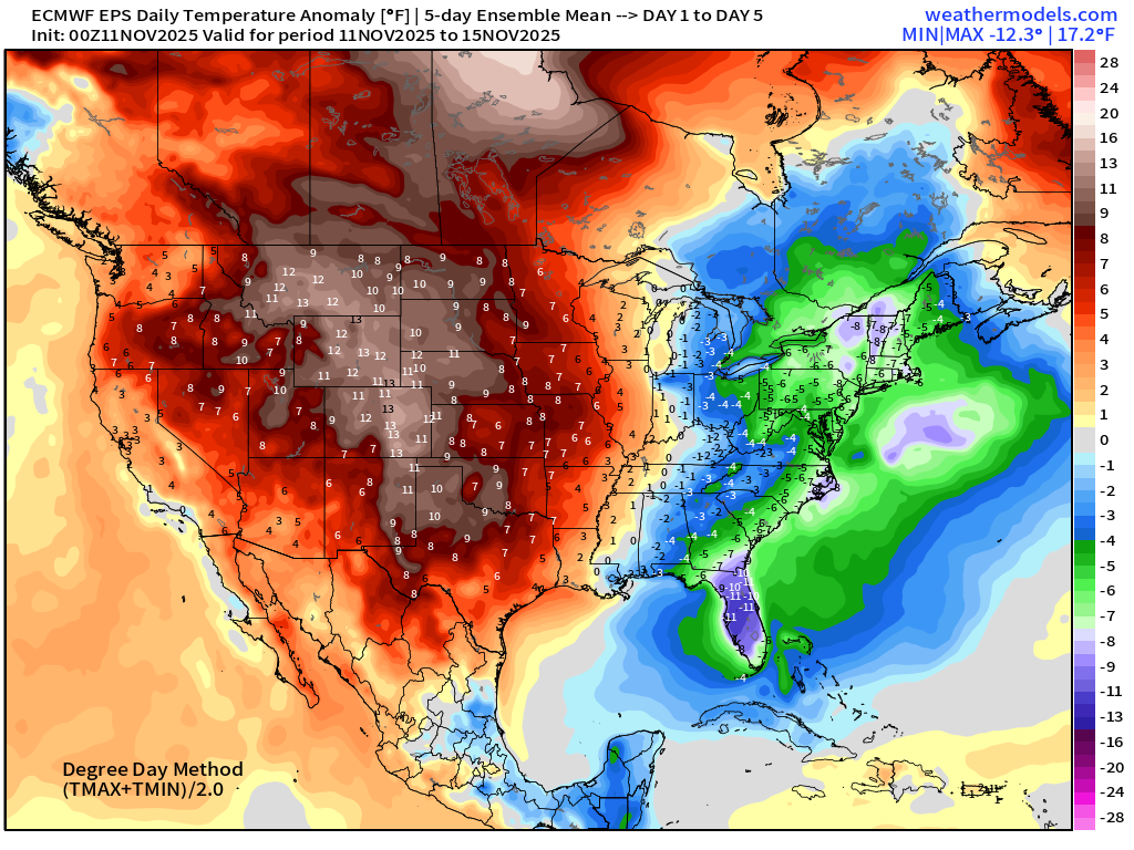
5-Day Chunk #1 | Temperature Anomaly | Nov 11 - Nov 15
5-Day Chunk #2 | Temperature Anomaly | Nov 16 - Nov 20
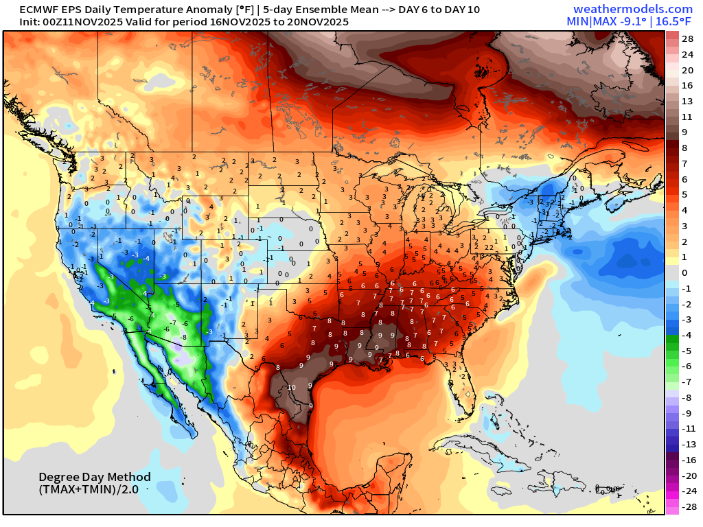
Major Warming Trend for following 10-days after this “Arctic Blast” for the central U.S. but New England remains cool (!)
5-Day Chunk #3 | Temperature Anomaly | Nov 21 - Nov 25
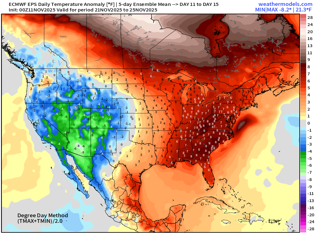
Widespread warmth overtakes the entire Eastern U.S. into Thanksgiving?
Atlantic Hurricane Season Statistics | November 11, 2025
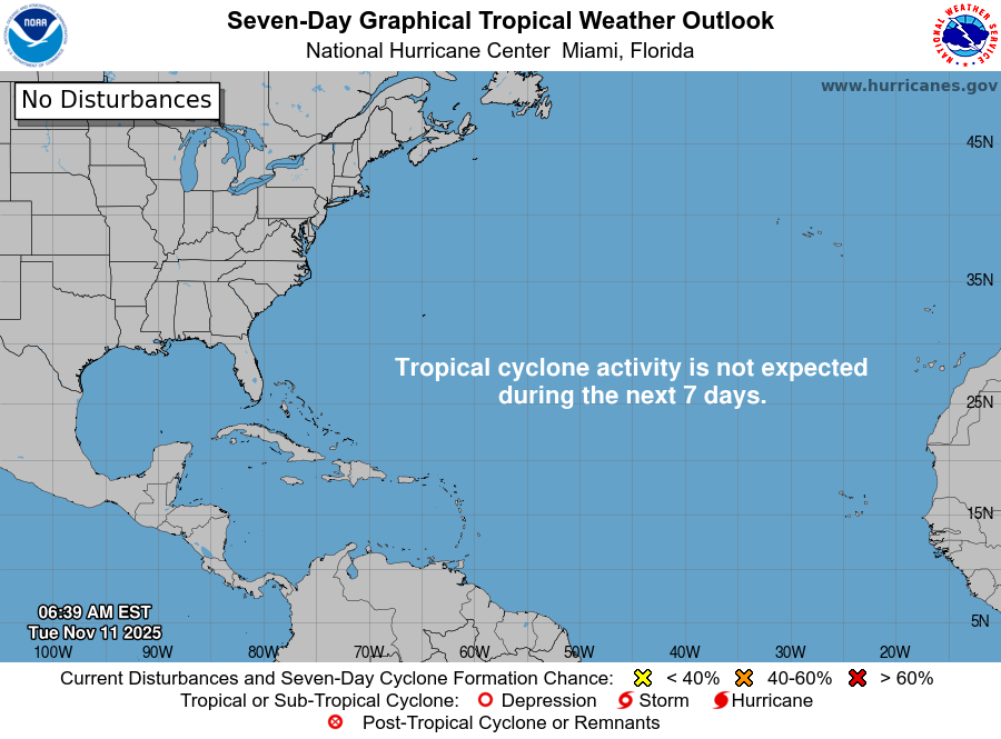
Nothing brewing in the next 7-days —> November 18th according to NHC.
2025 Hurricane Season [Day 164]. My FORECAST for this year was 14 named storms, 7 hurricanes, and 3 major hurricanes (near average)
2025 Season to Date: 13 Named Storms, 5 Hurricanes, and 4 Majors, and 3 Category 5’s | Accumulated Cyclone Energy (ACE) = 135.5
Atlantic Basin Water Vapor and IR Satellite
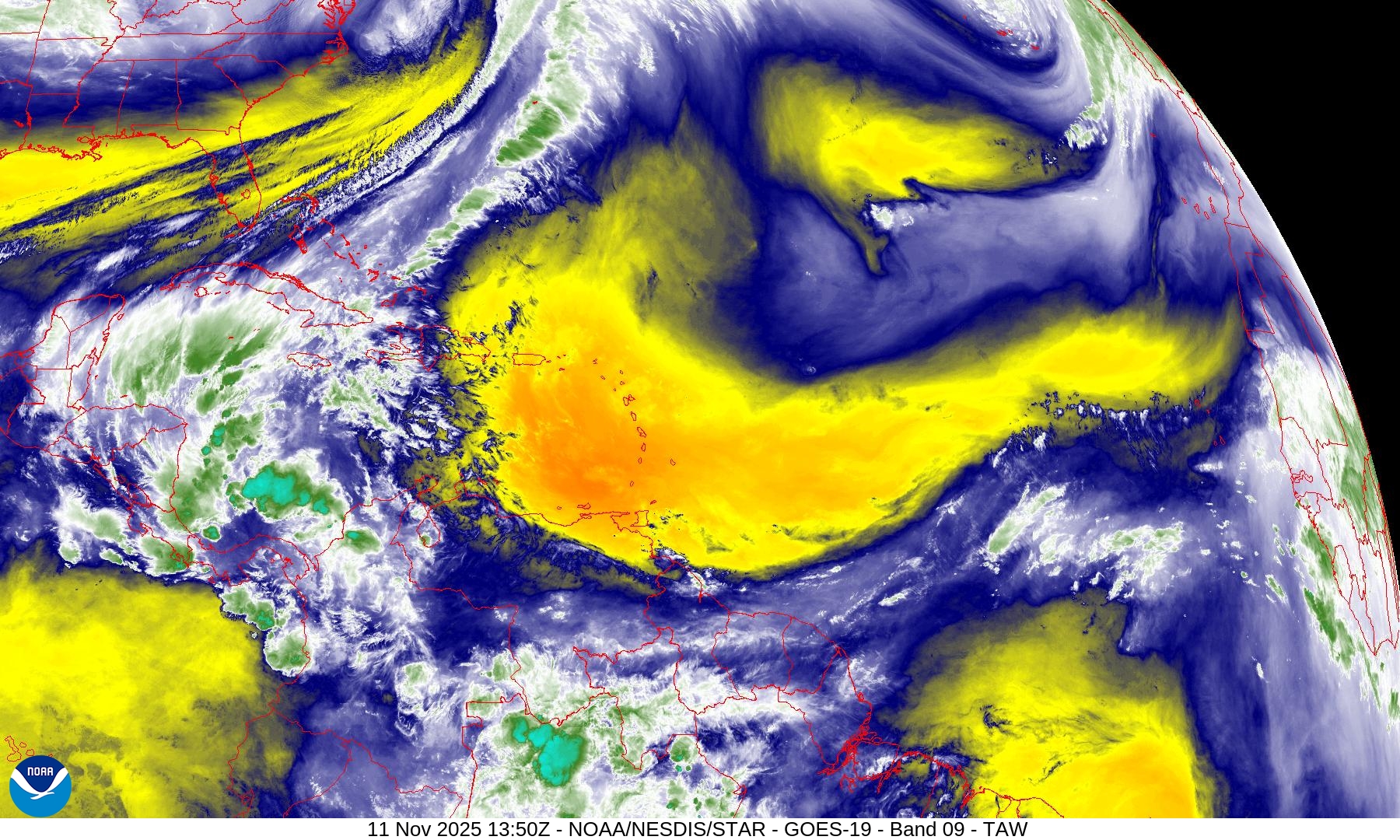
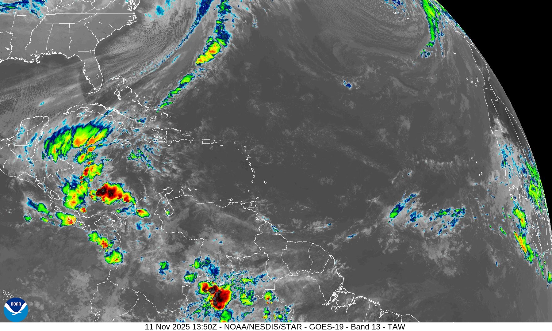
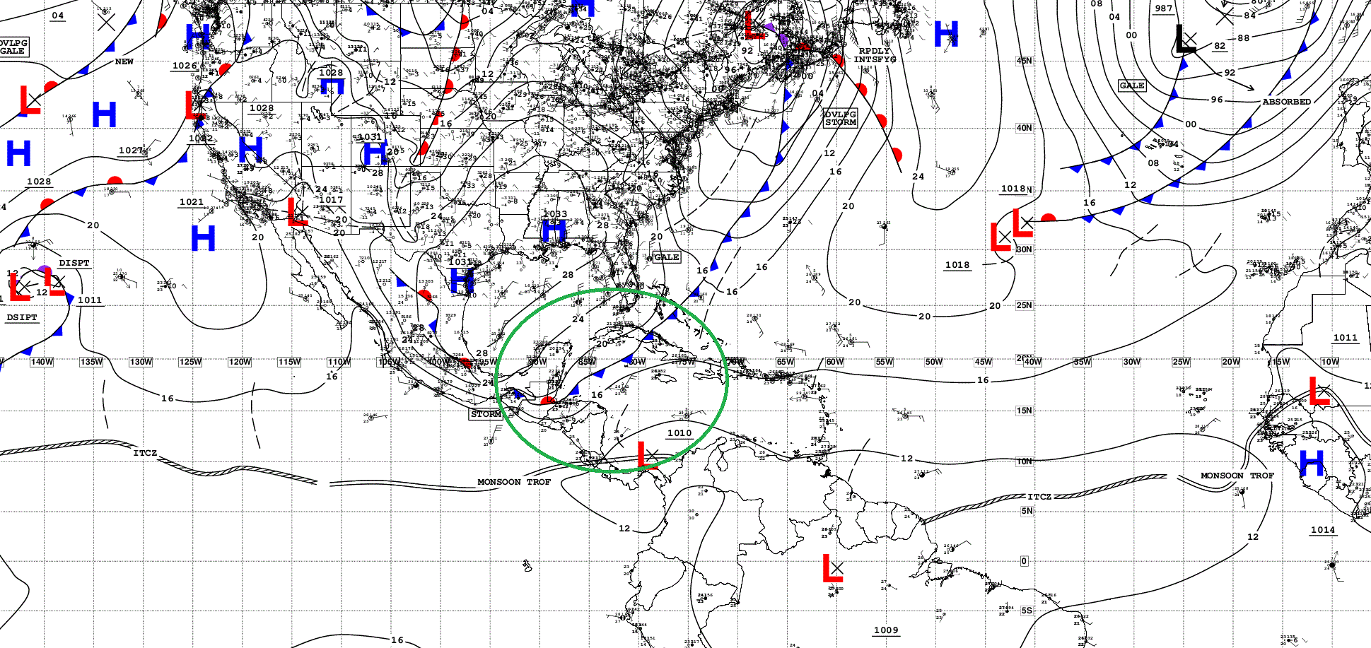
Tropical Surface Analysis | 06z
15-Day Tropical Outlook —> ECMWF AIFS-ENS 06z | All Tracks
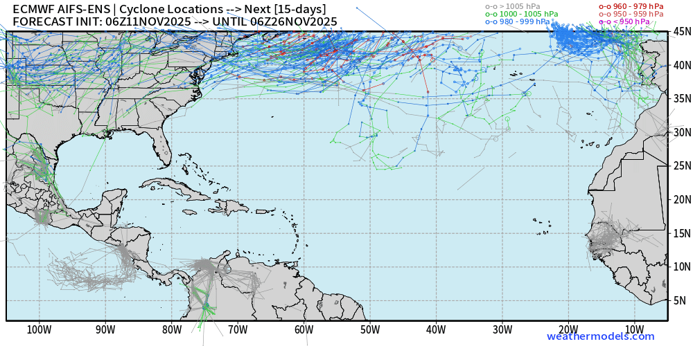
Nothing brewing in the 2-week ensemble tracking —> dead quiet. We’d look in the Caribbean.
Maps sourced from weathermodels.com designed and innovated by yours truly! Please subscribe there for real-time access to the newest maps, charts from all of the weather models including ECMWF.
- Milepost
- 787 · laid 2025-11-11T15:50:10.103000Z
- Source
- https://weather.substack.com/p/november-11-2025-tuesday-morning
- Digest
- 3b7bb7b8eb073865fbcced3e29e0e59f8a5432bd8a9a4c595dbf3ed227c7be86
- Machine
- JSON