November 3, 2025 Monday Weather Update
Warming trend through the week before Arctic blast
November 2025 was the 4th-warmest November in the 131-year national record (1895–2025), at 46.7°F against a 1991–2020 normal of 43.0°F (+3.7°F).
November 2025 was the 29th-driest November in the 131-year national record (1895–2025), at 1.7in against a 1991–2020 normal of 2.3in (-0.6in).
NOAA/NCEI Climate at a Glance, contiguous United States. This is the observed record for the month, not a score of anything said in this piece — the forecast ledger begins 2026-08-17 and cannot reach earlier posts.

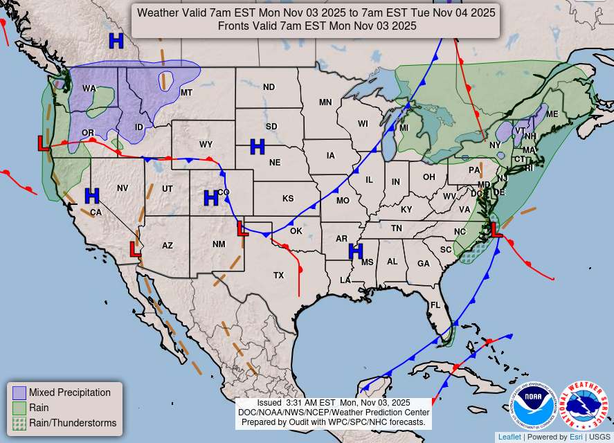
Generally quiet across the Lower 48 this morning, and that should continue this week. However, much colder air is ready to dump out of Canada across the Lower 48 this weekend and early next week with chance of a freeze into Southeast Mon/Tues morning including Atlanta.
Headlines Monday Morning
Bomb Cyclone to Impact Newfoundland with 943 mb central pressure
Atmospheric river parade for the West Coast
Arctic blast this weekend — early next week (coldest air of season) with Lake Effect snow potential
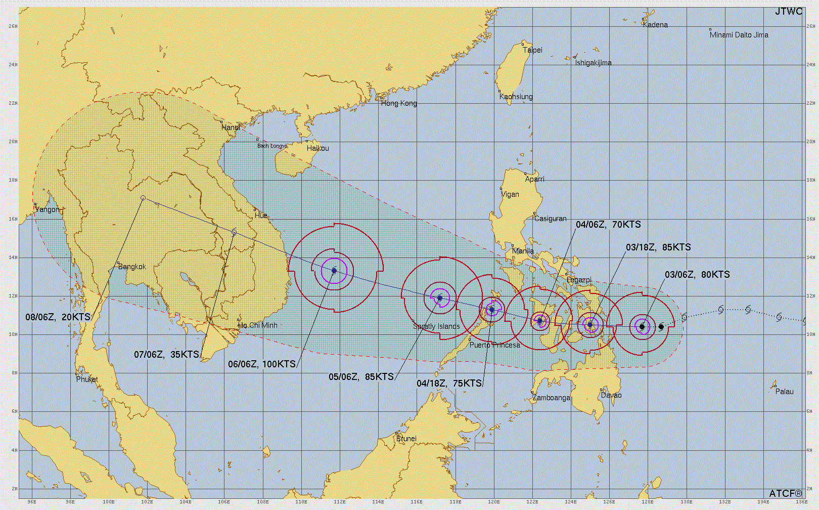
Typhoon Kalmaegi to travel through Philippines — emerge into South China Sea and intensify significantly prior to landfall due west into Vietnam
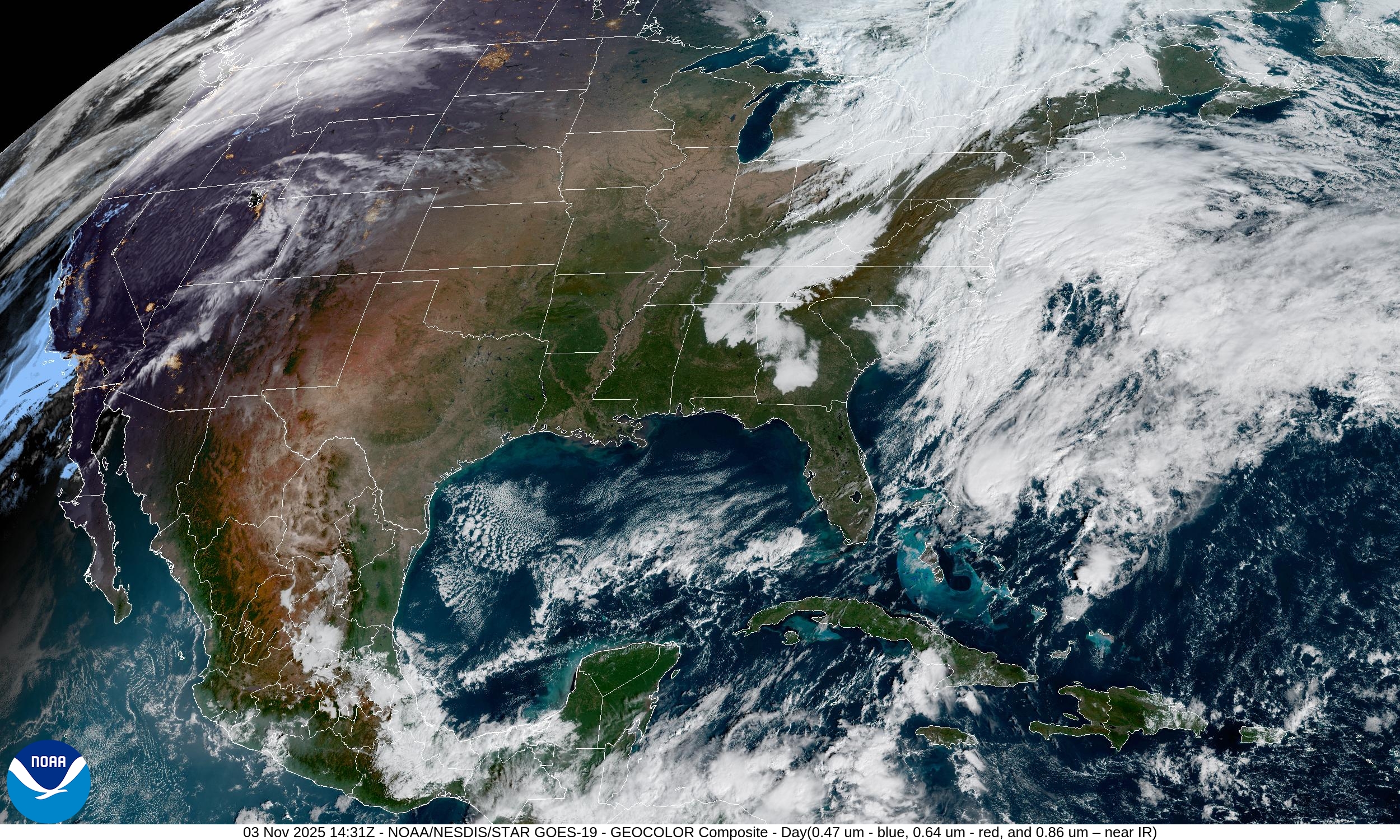
Clearing skies for much of the central U.S. into the Great Lakes behind a cold front … and the Southeast clears out and warms up after a period of gloomy, wet weather
An area of low pressure off the Carolinas will become a powerful “bomb cyclone” crashing into Newfoundland with hurricane force wind gusts.
ECMWF Snowfall Next 15-days
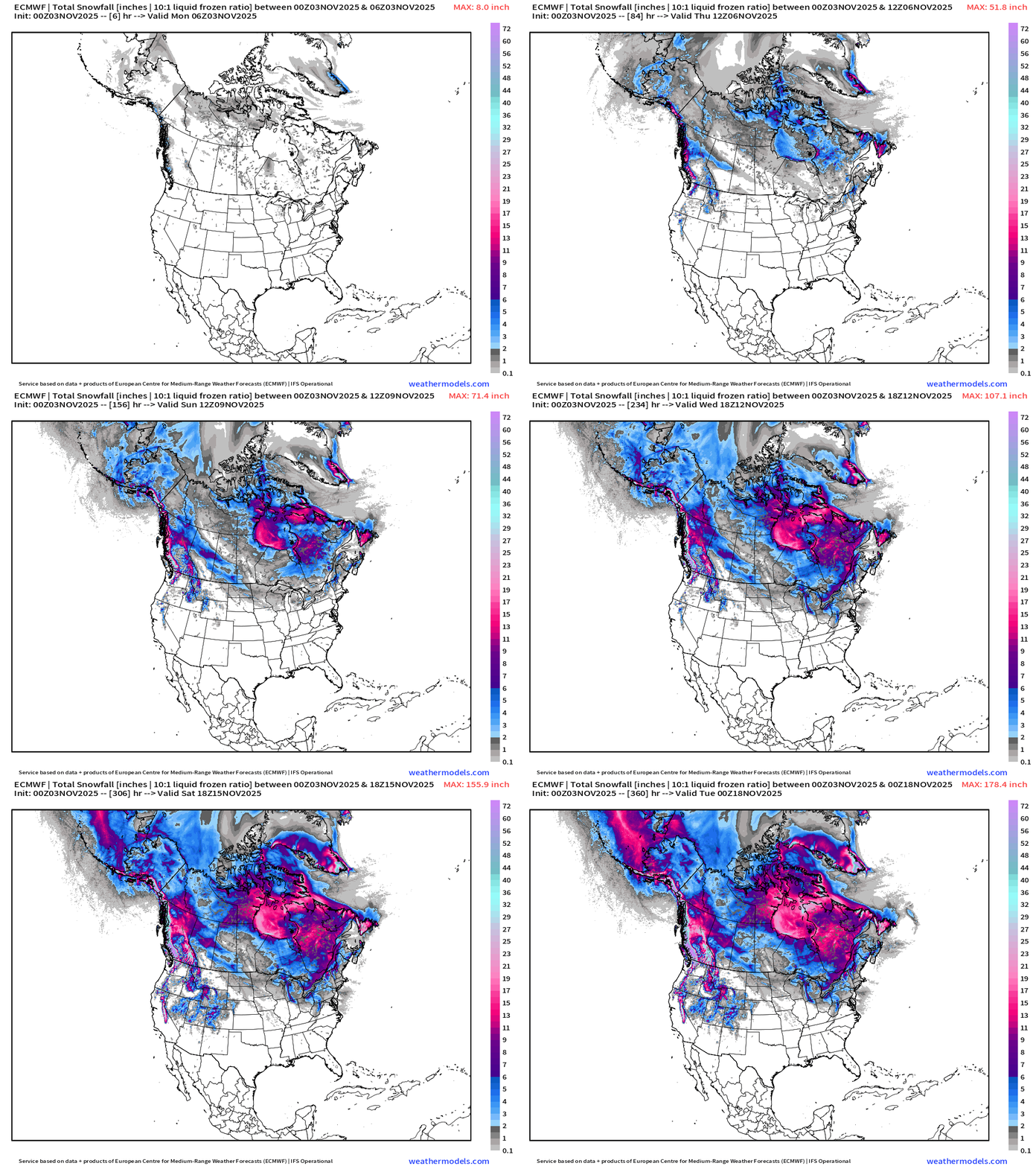
A cool animation to get us into the winter mood — with snowfall accumulation through the next 15-days across North America.
Tons of snow for the Hudson Bay and into Ontario and Quebec. Cold air out of Canada will dump into the Great Lakes and Northeast starting this weekend —> Lake Effect snowfall machine cranks up!
Early Next Major Arctic Blast
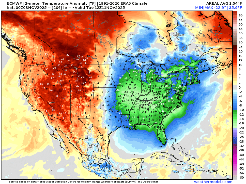
Strong “polar vortex” trough in the middle-levels + surface high pressure = typical setup for an Canadian Arctic Blast of cold air with low temperatures 10°F to 15°F below normal by Tuesday morning … balanced with significant warmth across the Rockies and Western U.S. with Pacific influenced air masses.
Tuesday Morning Temperature Anomaly
Temperature Analysis | 8:45 AM ET
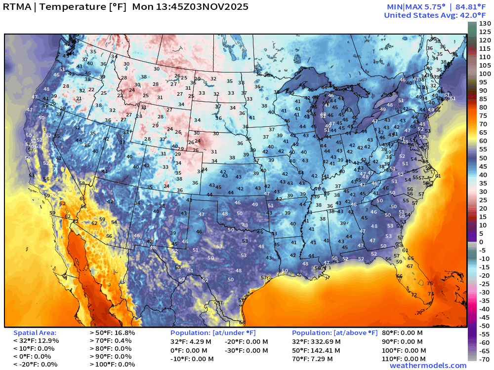
The Lower 48 average temperature is 42.0°F this morning
Temperature Anomaly | 8:45 AM ET
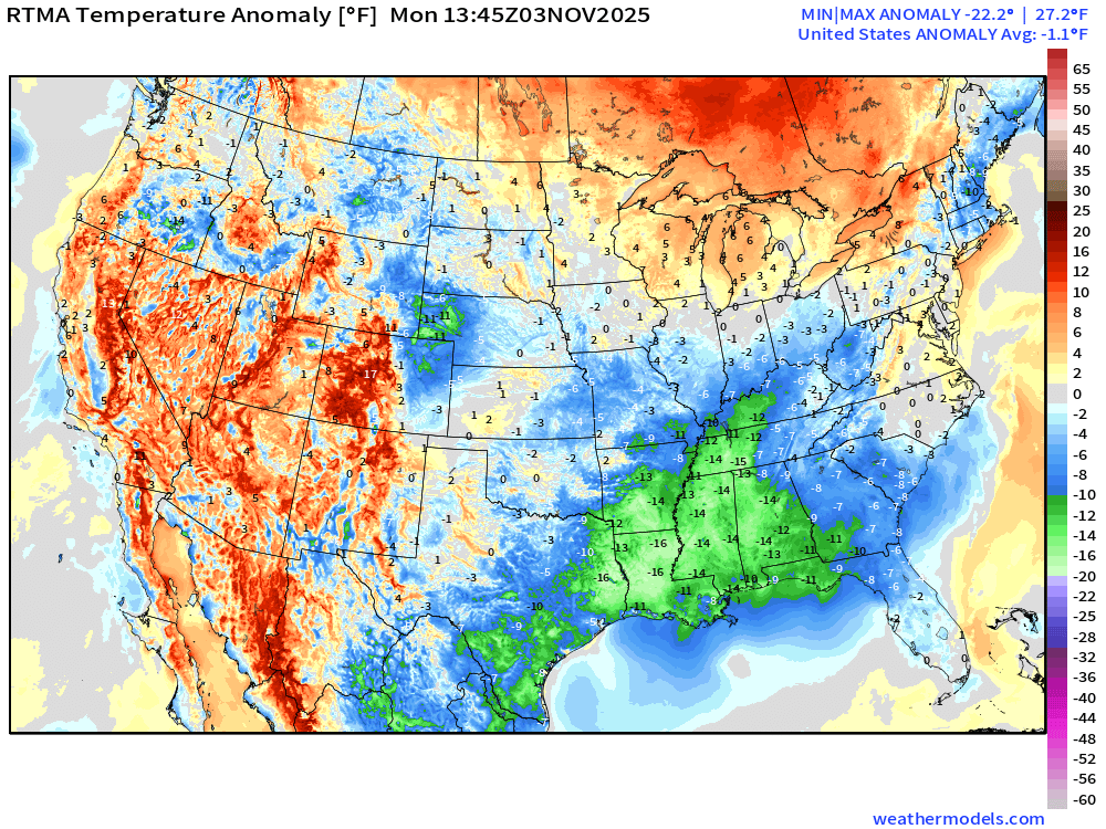
Lower 48 Temperature Anomaly was -1.1°F below normal
High Temperatures Monday
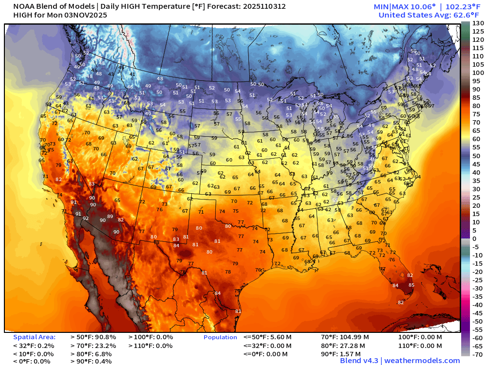
Not too bad — with 60s into the central Plains, Chicago, and up I-95 from D.C. to NYC and Boston.
Low Temperatures Tuesday Morning
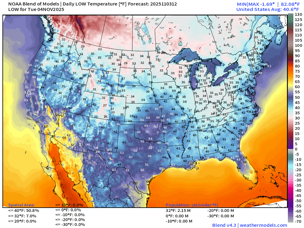
Lower 48 average low temperature is 40.6°F with only 2 million population freezing.
High Temperatures on Tuesday
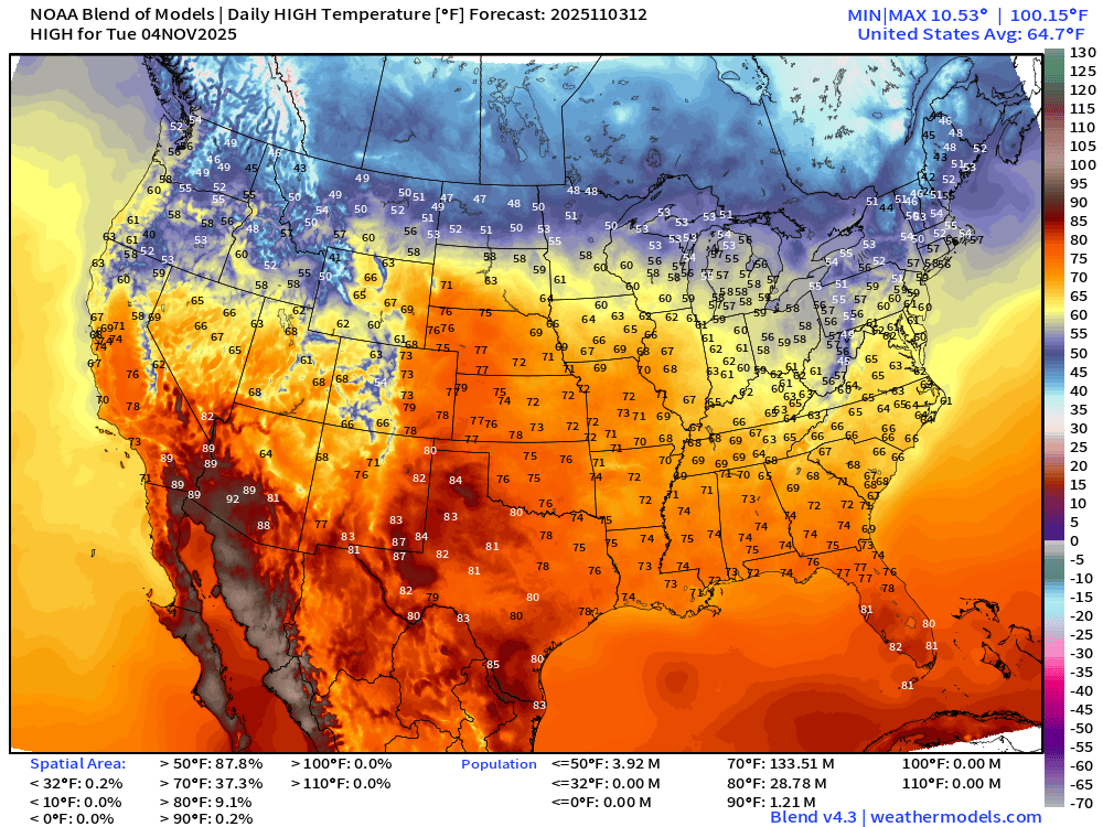
A bit warmer for Tuesday with widespread 70s building across the Plains and returning to the Southeast
High Temperatures Next 8-days —> Through Next Tuesday
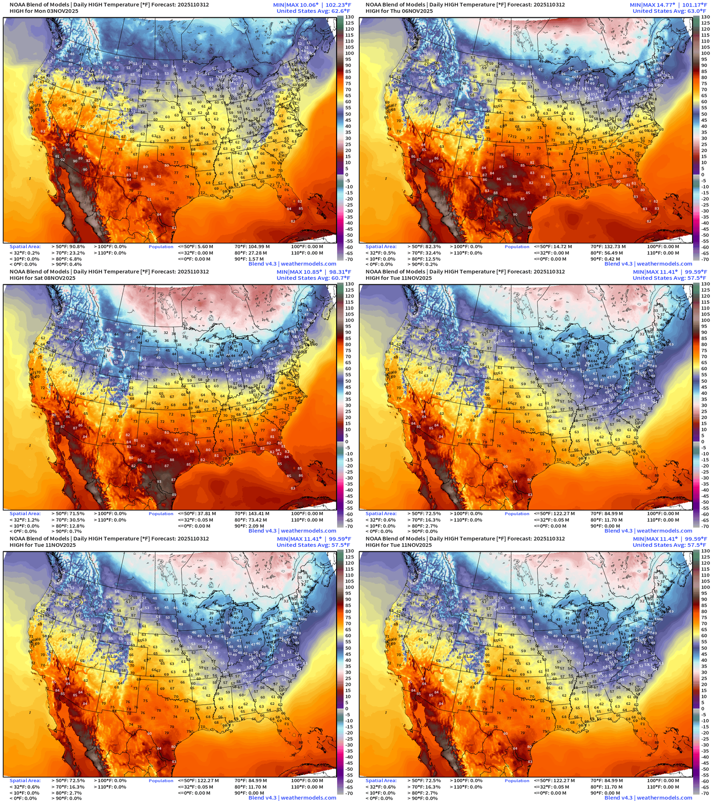
The warming trend continues through the weekend until the major Canadian Arctic cold front erases the warmth across the Eastern U.S.
Large Scale View of Precipitation Type Next 10-days
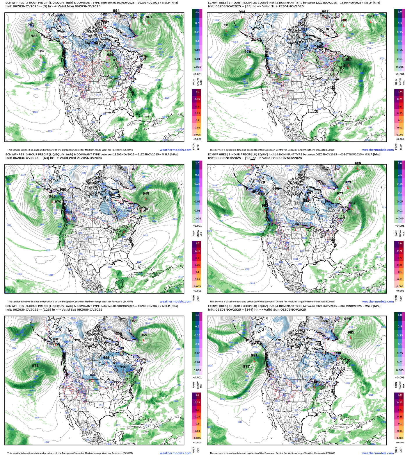
Multiple atmospheric rivers landfall the west coast of the U.S. attached to low pressure systems in the Gulf of Alaska. Some of the moisture streams across the Rockies into the Midwest and Great Lakes … and if it can combine with the coldest air + surface low development = snowfall potential from “Clipper Systems” + Lake Effect snowfall.
ECMWF 850 mb Winds Next 6-days
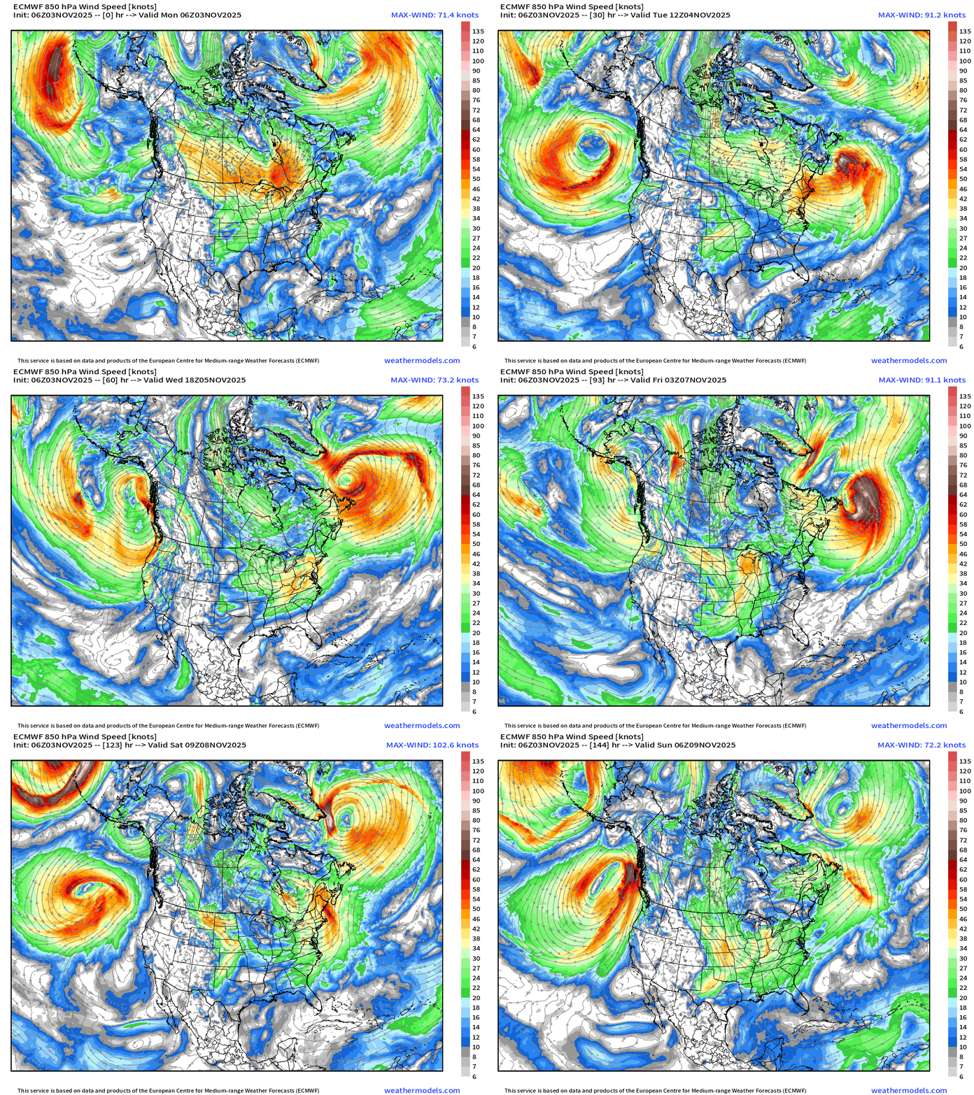
Great depiction of the two “bomb cyclones” that develop off the East Coast this week … and the wind energy with the atmospheric rivers into the West Coast.
ECMWF Precipitable Water Next 6-days
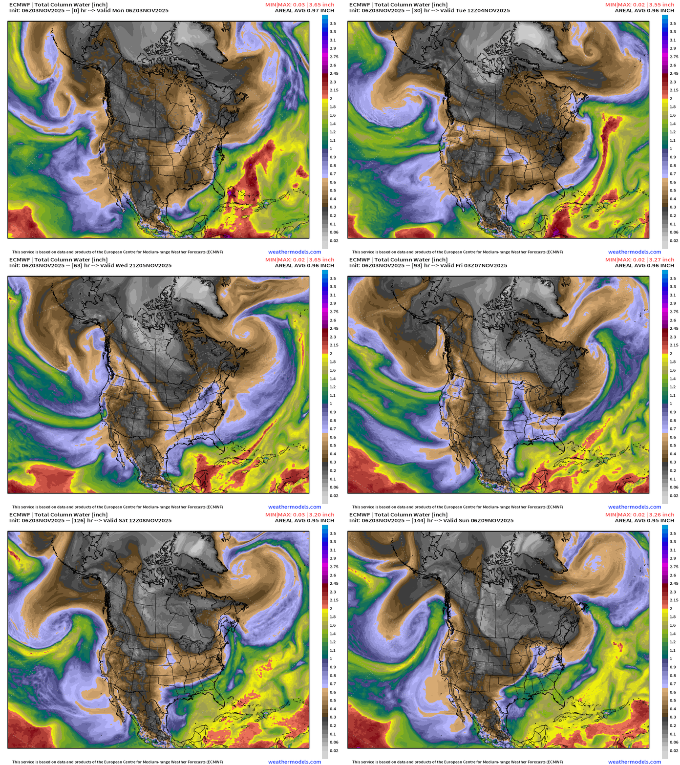
My favorite parameter! Note the black/gray/white coming out of the Canadian Arctic = cold and dry air. Impressive PWAT with western atmospheric rivers … 1.5”+ values.
Powerful Atlantic Bomb Cyclone
Wednesday: 944 mb central pressure ENE of Canada
Wind Gusts = 100-knots just off southern coast
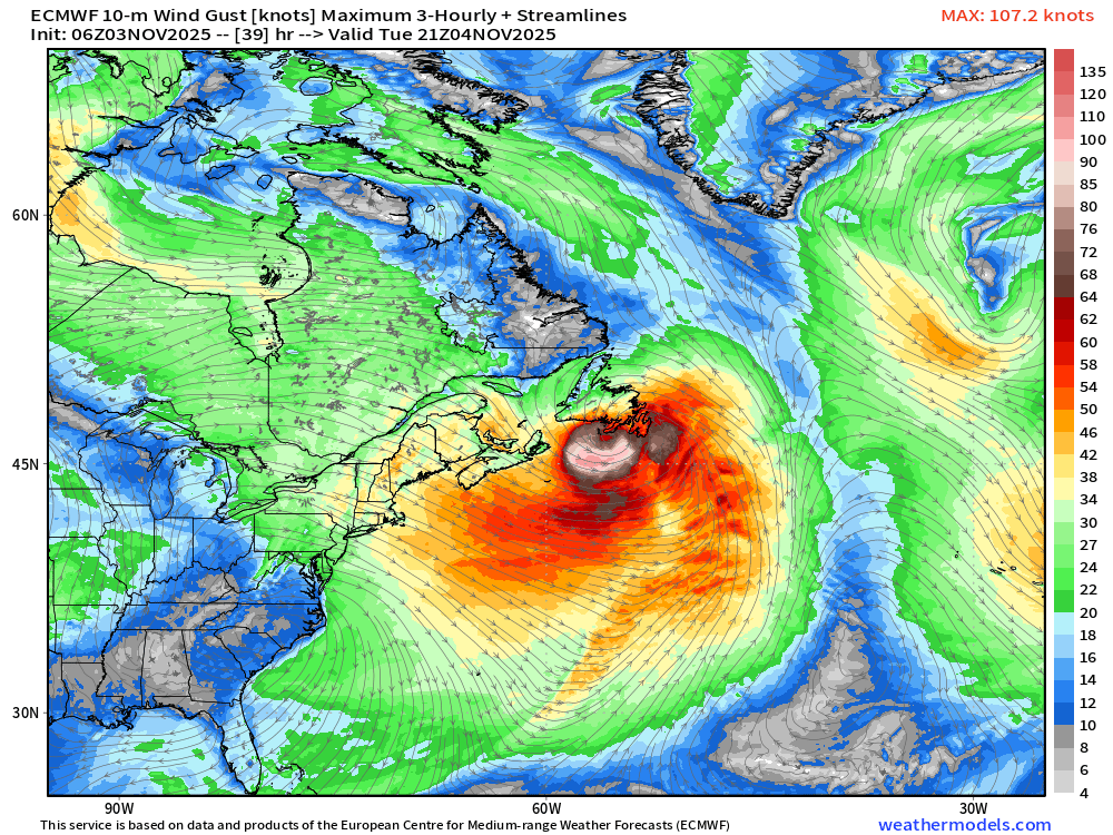
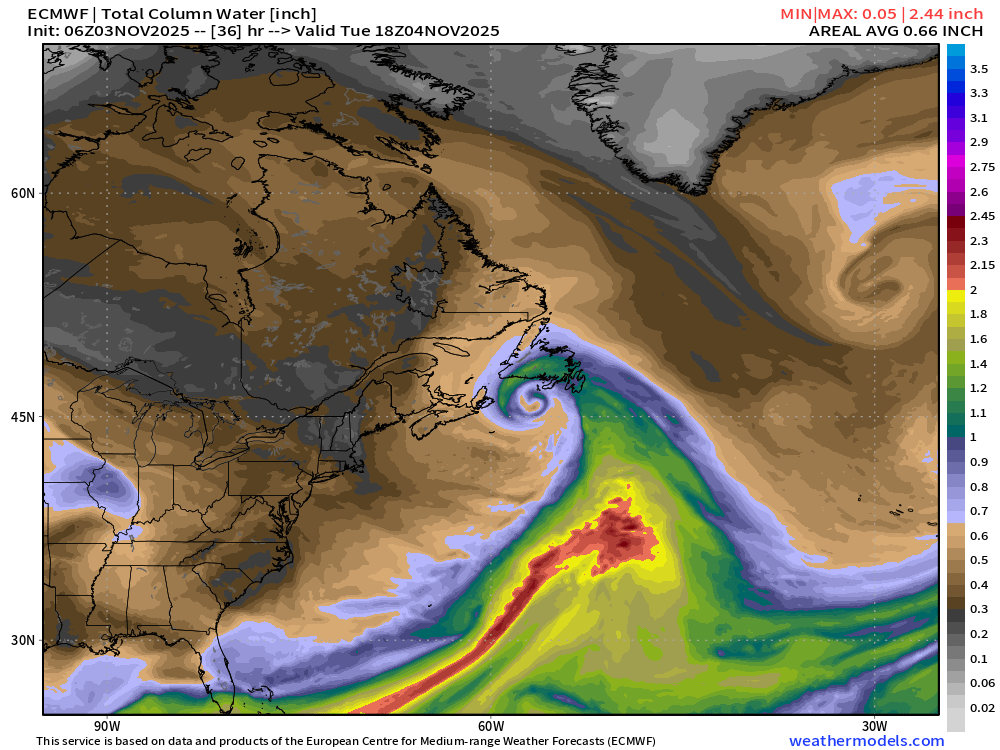
Serpentine wrap up of the “warm seclusion” center of cyclone = will be beautiful on satellite imagery with an eye-like feature
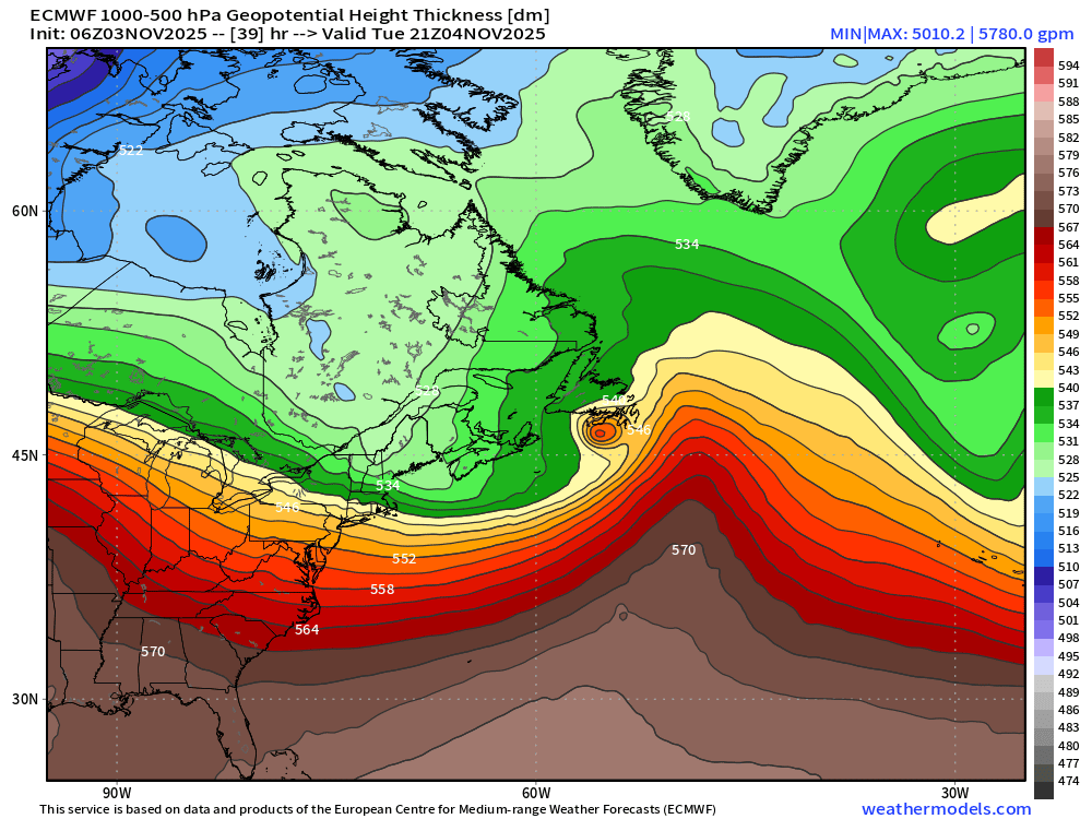
Thickness — Note the “warm core” (!) which is actually warm sector air that has been trapped or secluded by the bent-back warm front
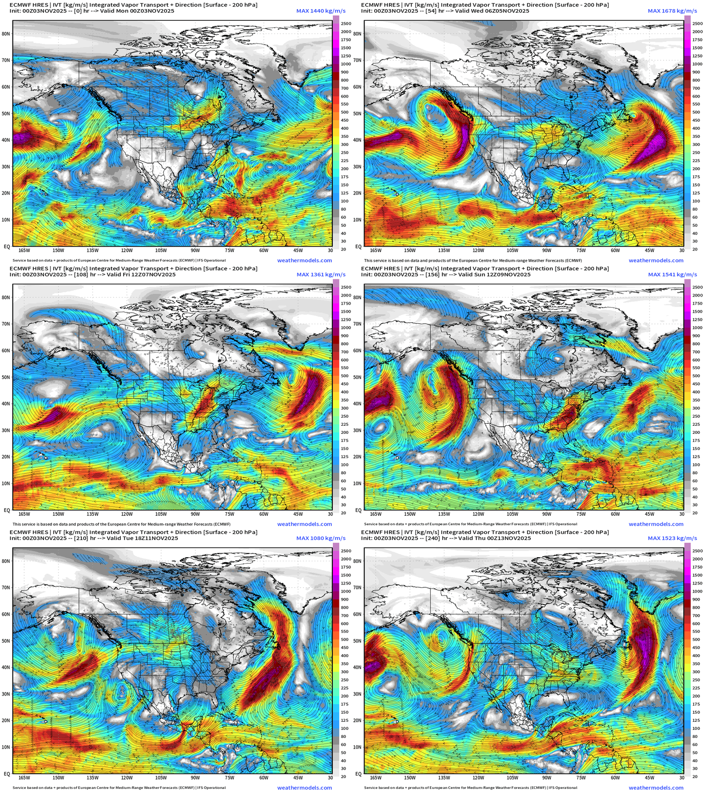
Integrated Vapor Transport | Next 10-days
ECMWF AIFS 06z Height Anomaly (500 hPa) Next 10-days
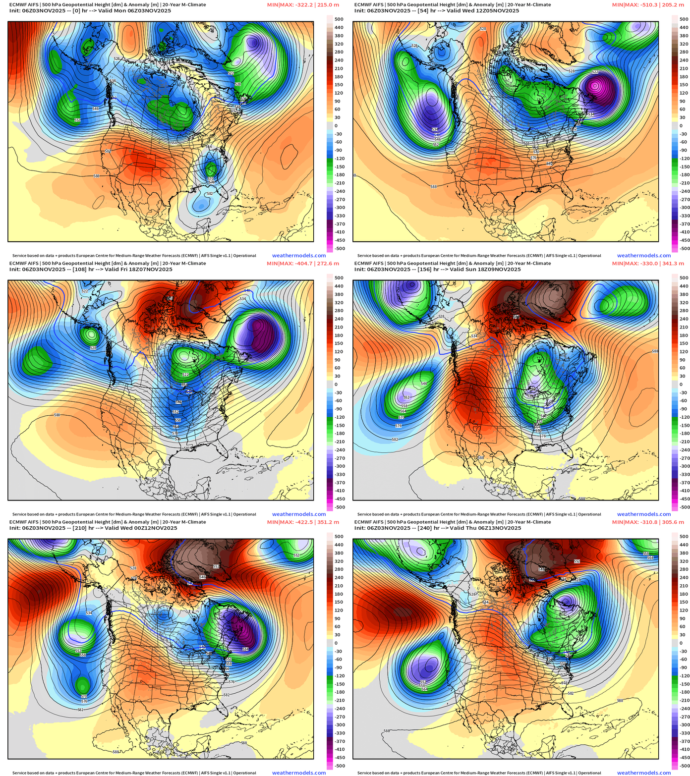
Very impressive trough across the Great Lakes —> Northeast forms this weekend and intensifies into early next week!
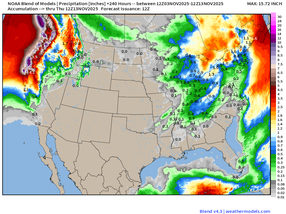
Blend of Models | 10 Day Precipitation Totals
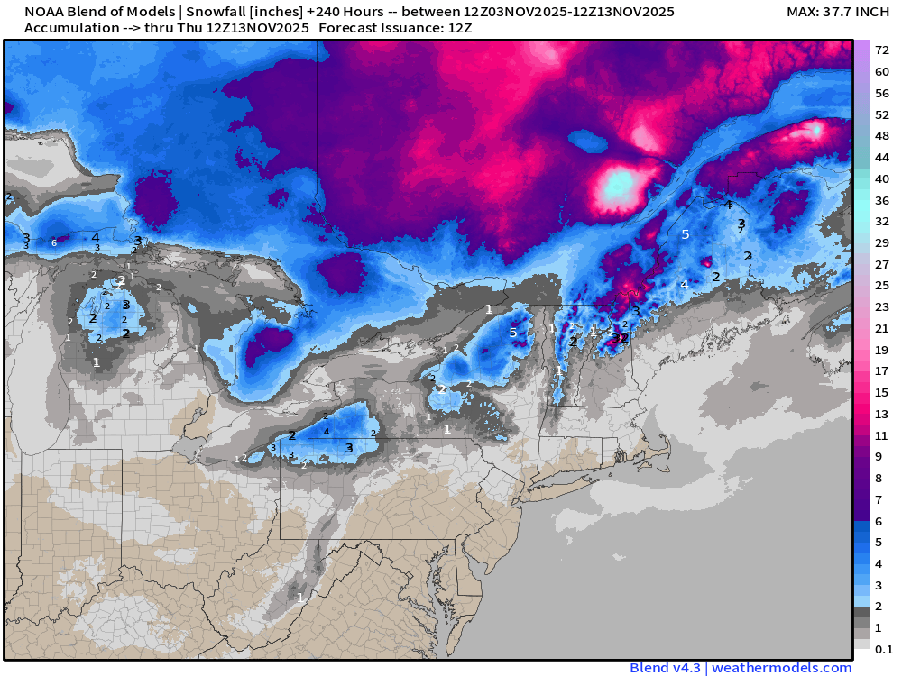
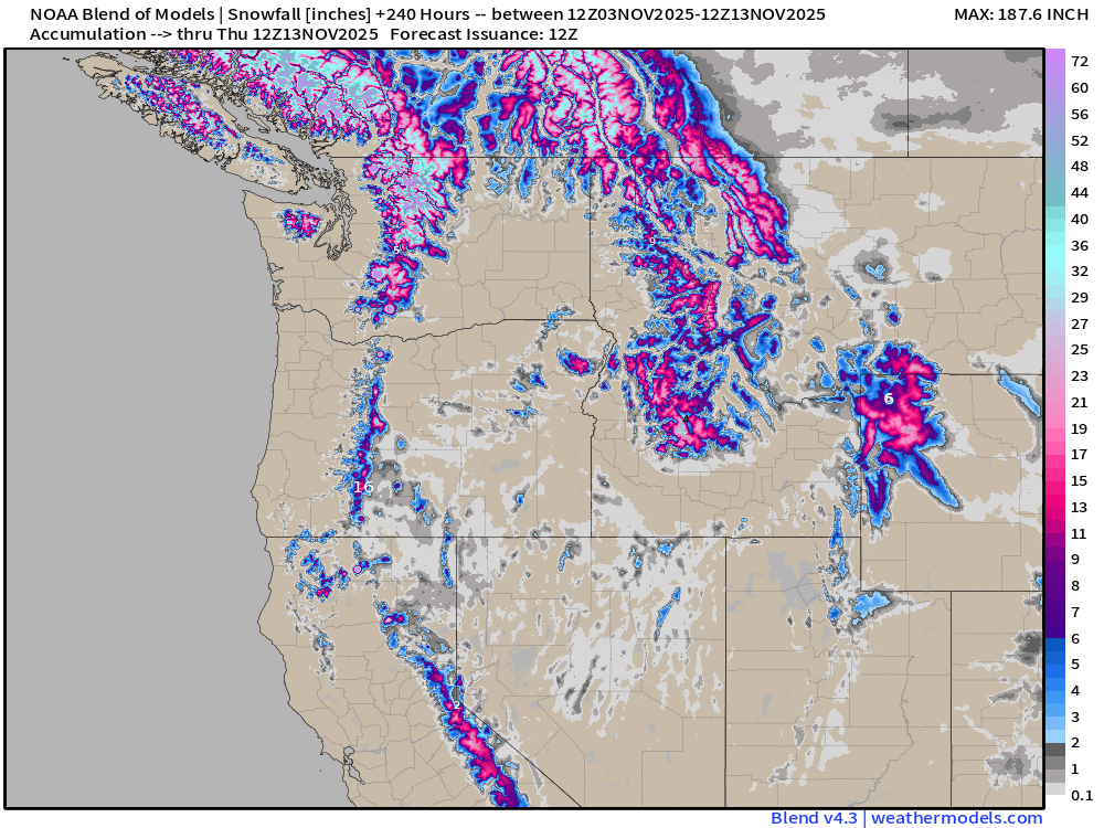
Blend of Models | 10 Day Snowfall Totals
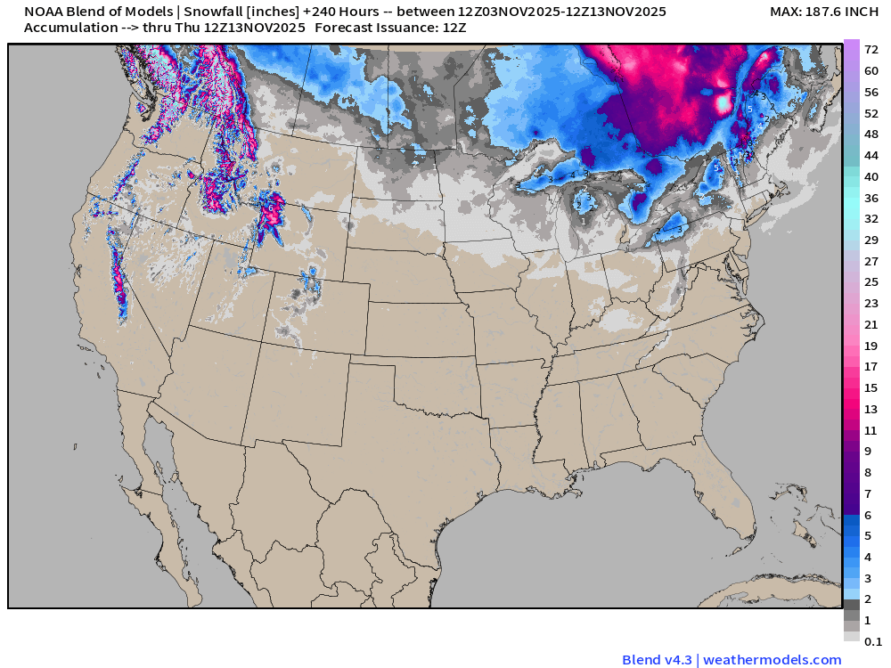
Lake Effect snowfall snowing up in the 10-day maps
Mountain snows at highest elevations
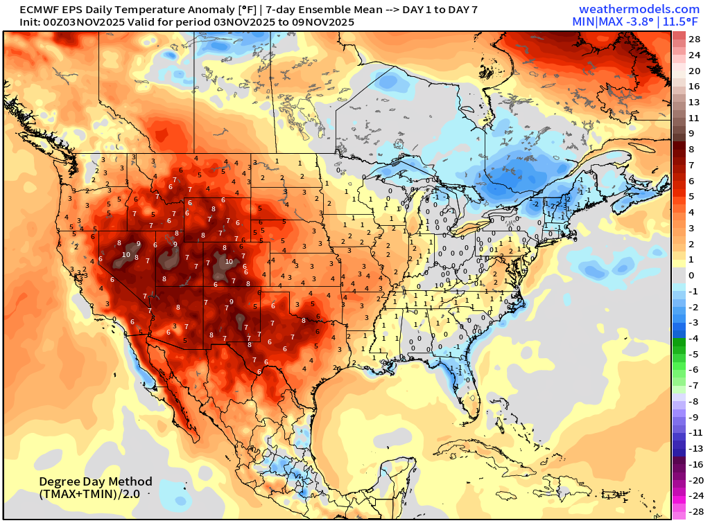
Weekly Temperature Anomaly | Nov 3 - Nov 9
Weekly Temperature Anomaly | Nov 10 - Nov 16
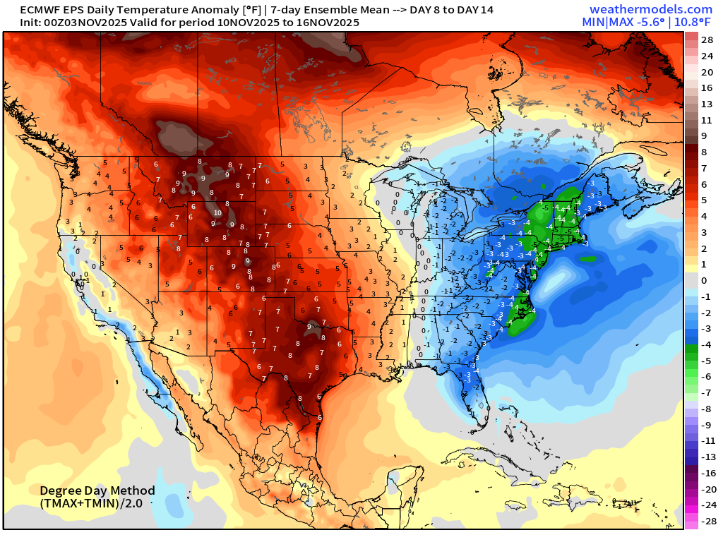
Significant warming trend across the Western U.S. with 7°F warm anomaly in the Week 2 ensemble mean west of the Mississippi
Cold — trough showing up strongly in the Week 2 anomaly across the East centered upon New England (-4°F)
Atlantic Hurricane Season Statistics | November 3, 2025
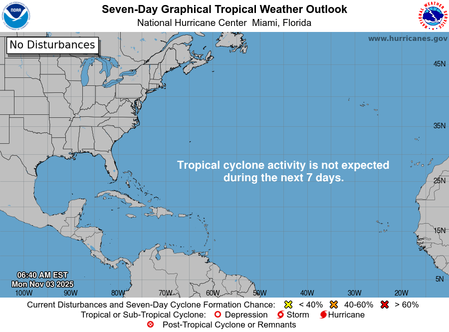
2025 Hurricane Season [Day 156]. My FORECAST for this year was 14 named storms, 7 hurricanes, and 3 major hurricanes (near average)
2025 Season to Date: 13 Named Storms, 5 Hurricanes, and 4 Majors, and 3 Category 5’s | Accumulated Cyclone Energy (ACE) = 135.5
Atlantic Basin Water Vapor
Atlantic tropics are mostly shut down with a MAJOR trough cutting into South America through the MDR signaling the end of any chance seeing tropical waves develop out here.
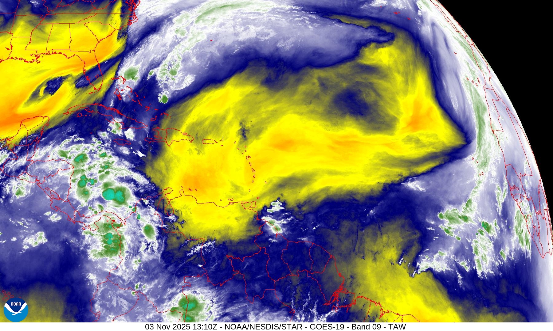
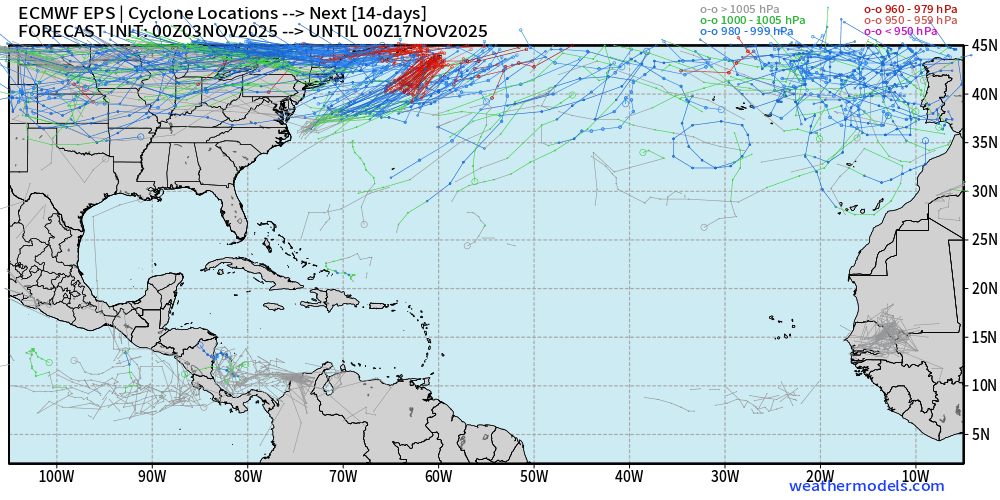
Instead, we’ll keep an eye on the southern Caribbean near Central America for any convection to spin-up in the long-range. Nothing on the horizon through at least 14 days.
14-Day Tropical Outlook —> ECMWF EPS 00z | Active Tracks
West Pacific Typhoon Outlook
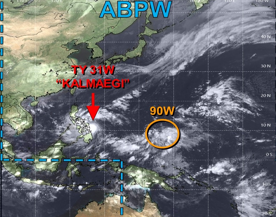
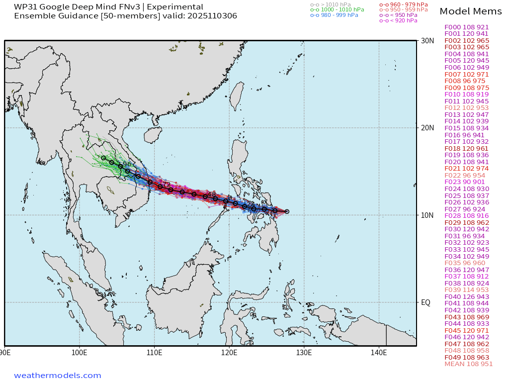
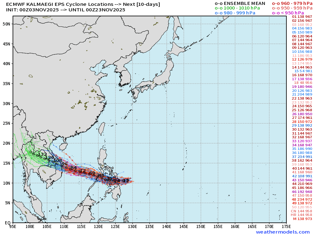
Typhoon Kalmaegi (31W) nearing major hurricane strength (Category 3) with 90-knot winds, but the eye has not emerged. It’s within a small but intense convective canopy.
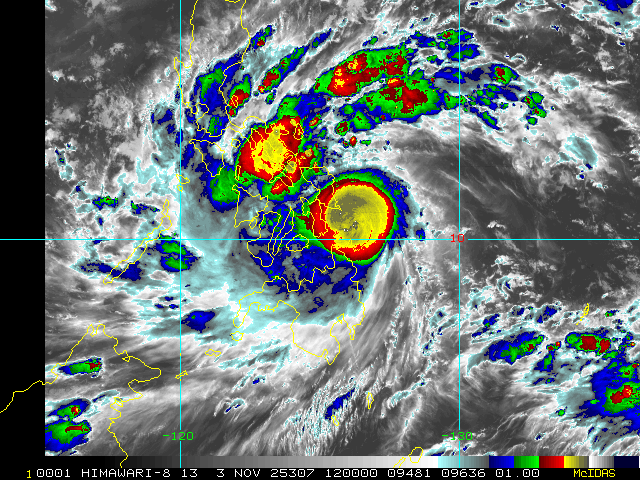
Kalmaegi may weaken slightly due to land interaction across central Philippines but may become Cat 3-4 again by Thursday and landfall in Vietnam
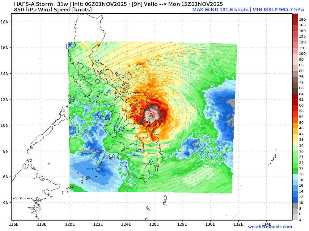
HAFS-A | 960s mb central pressure —> currently
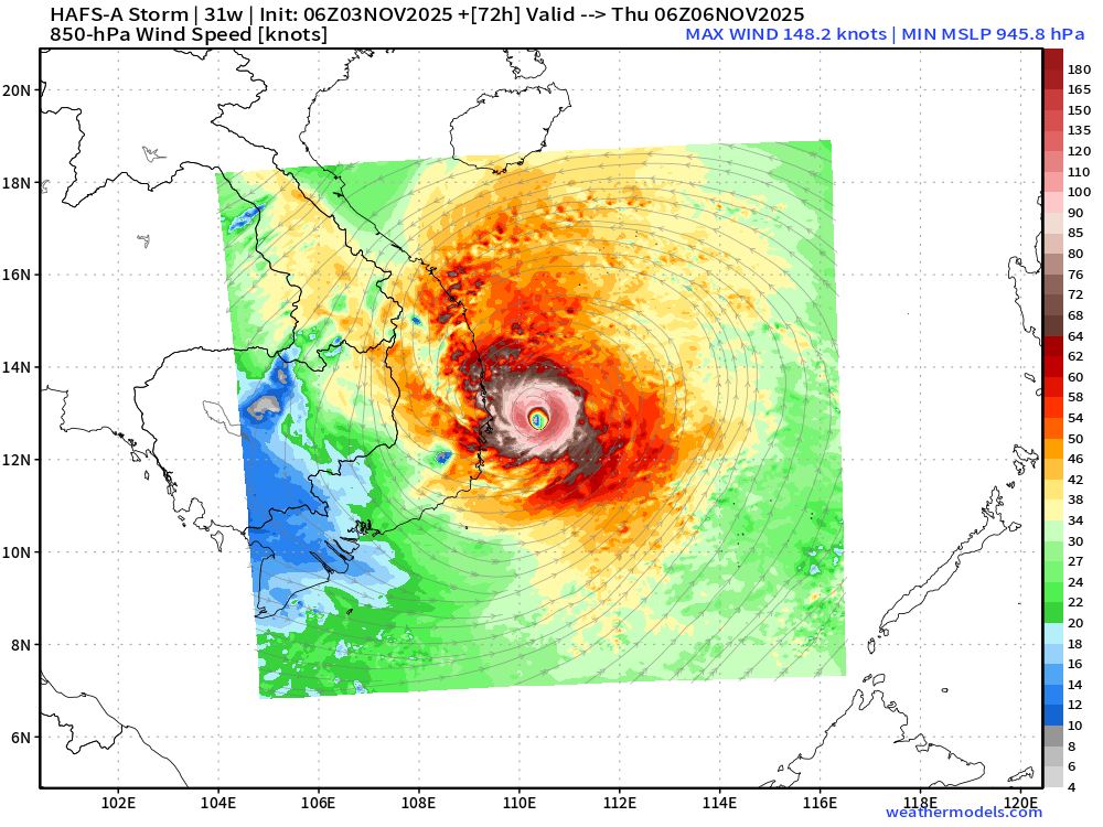
HAFS-A | 945 mb in 72-hours on approach to Vietnam on Thursday
Google Deep Mind overestimated the potential for Rapid Intensification from Kalmaegi … but seems to have recentered the ensemble distribution on 930s to 940s minimum central pressure, more realistic.
ECMWF EPS 00z (9-km) ensembles also show “major typhoon” intensity on average.
After Kalmaegi, another Typhoon (Invest 90W) will follow on a WNW track, and this one looks quite likely to become a Category 5.
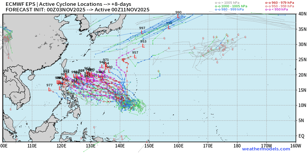
Maps sourced from weathermodels.com designed and innovated by yours truly! Please subscribe there for real-time access to the newest maps, charts from all of the weather models including ECMWF.
- Milepost
- 780 · laid 2025-11-03T15:06:41.157000Z
- Source
- https://weather.substack.com/p/november-3-2025-monday-weather-update
- Digest
- 1565afa66d77ecec1f836cb55e38d90fa63f92eb109e909a89dd941c0090511d
- Machine
- JSON