November 1, 2025 Saturday Weather Update
Powerful extratropical cyclones to develop well away from Northeast next week
November 2025 was the 4th-warmest November in the 131-year national record (1895–2025), at 46.7°F against a 1991–2020 normal of 43.0°F (+3.7°F).
November 2025 was the 29th-driest November in the 131-year national record (1895–2025), at 1.7in against a 1991–2020 normal of 2.3in (-0.6in).
NOAA/NCEI Climate at a Glance, contiguous United States. This is the observed record for the month, not a score of anything said in this piece — the forecast ledger begins 2026-08-17 and cannot reach earlier posts.

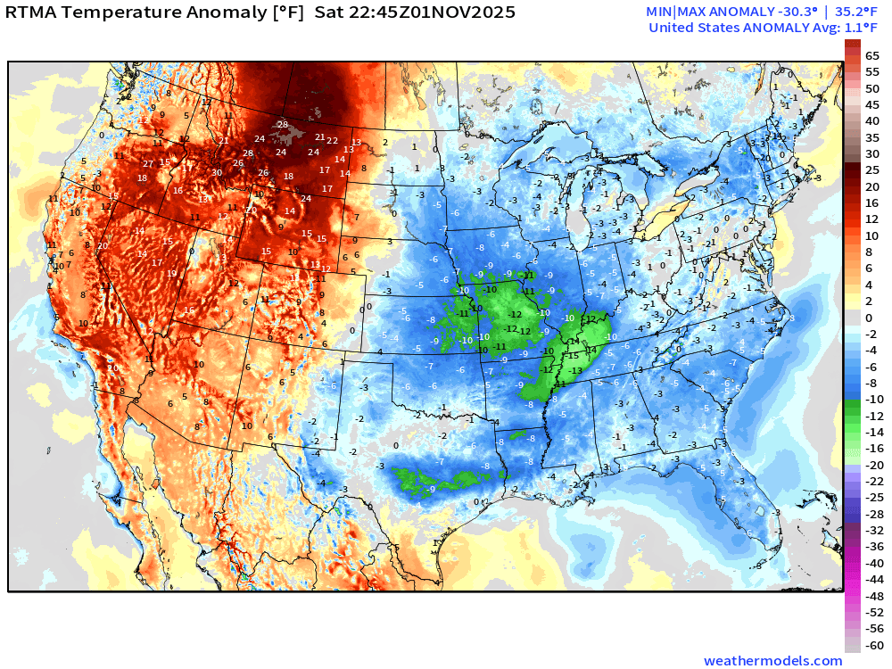
We flipped the calendar into November and mentally we can move into more of an early winter mindset with much colder air especially in the mornings across the Lower 48. Temperatures this evening are only in the 40s across the Midwest into Missouri and 50s and 60s in the Southeast.
With Daylight Saving Time beginning overnight, we’ll get the weather models an hour earlier e.g. GFS 12z starts at 10:45 AM and ECMWF 12z is generally available around 1 PM ET. Of course, UTC doesn’t change.
Temperature Analysis | 6:45 PM ET
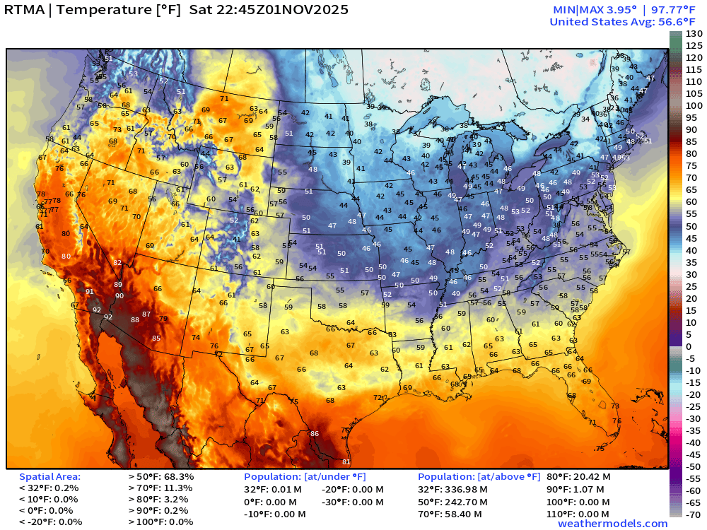
The Lower 48 average temperature is 56.6°F … and still a million people above 90°F on November 1st.
Temperature Anomaly | 6:45 PM ET
Large Scale View of Precipitation Type Next 10-days
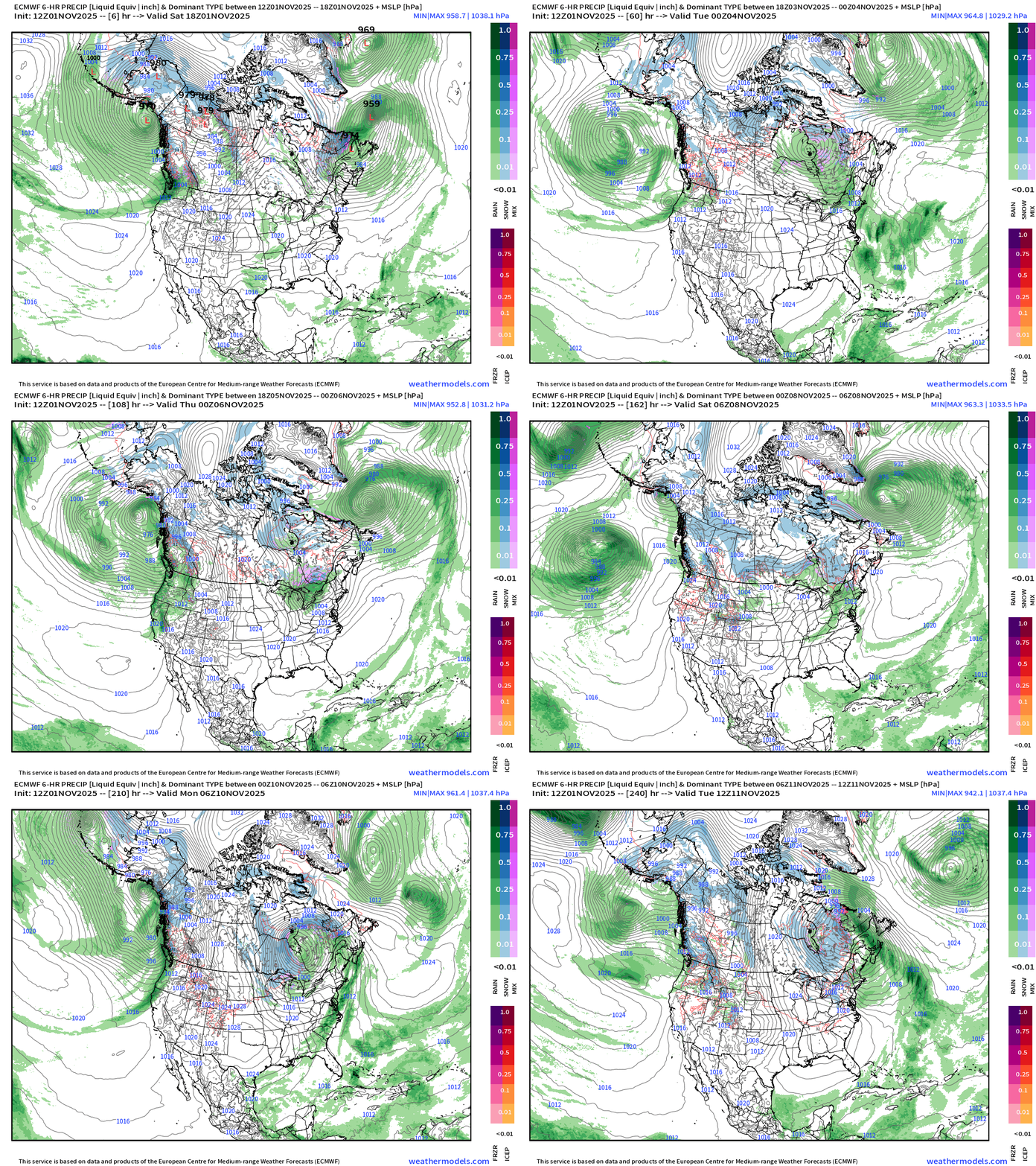
Overall, the weather patterns across North America shows many storms progressing along the mid-latitude storm tracks. The more intense storm systems occur over the oceans where lower friction and more moisture allows coupling with the strong jet stream to produce energy through baroclinic instability. That’s a fancy of way of saying conversion of potential energy in the atmosphere to kinetic energy with the help of latent heat release from convection.
Some hints of “blue” or snowfall showing up on the backside of the strongest low pressure systems but not quite cold enough to power blizzards. But, we’re quickly getting there — another 2-3 weeks and these storm systems will be snowmakers. The main/major question is where the overall storm track sets up: for Nor’easters, the troughs needs to dig into the Midwest and Ohio River Valley w/surface lows on the periphery positioned to couple to the jet stream, take advantage of copious Atlantic Ocean moisture, and “bomb out” into 940 to 960 mb lows.
We’ll have 2 of these “bomb cyclones” in the next week, but NOT snowmakers for the Northeast — not cold enough.
Precipitable Water Next 5-days | Germany ICON
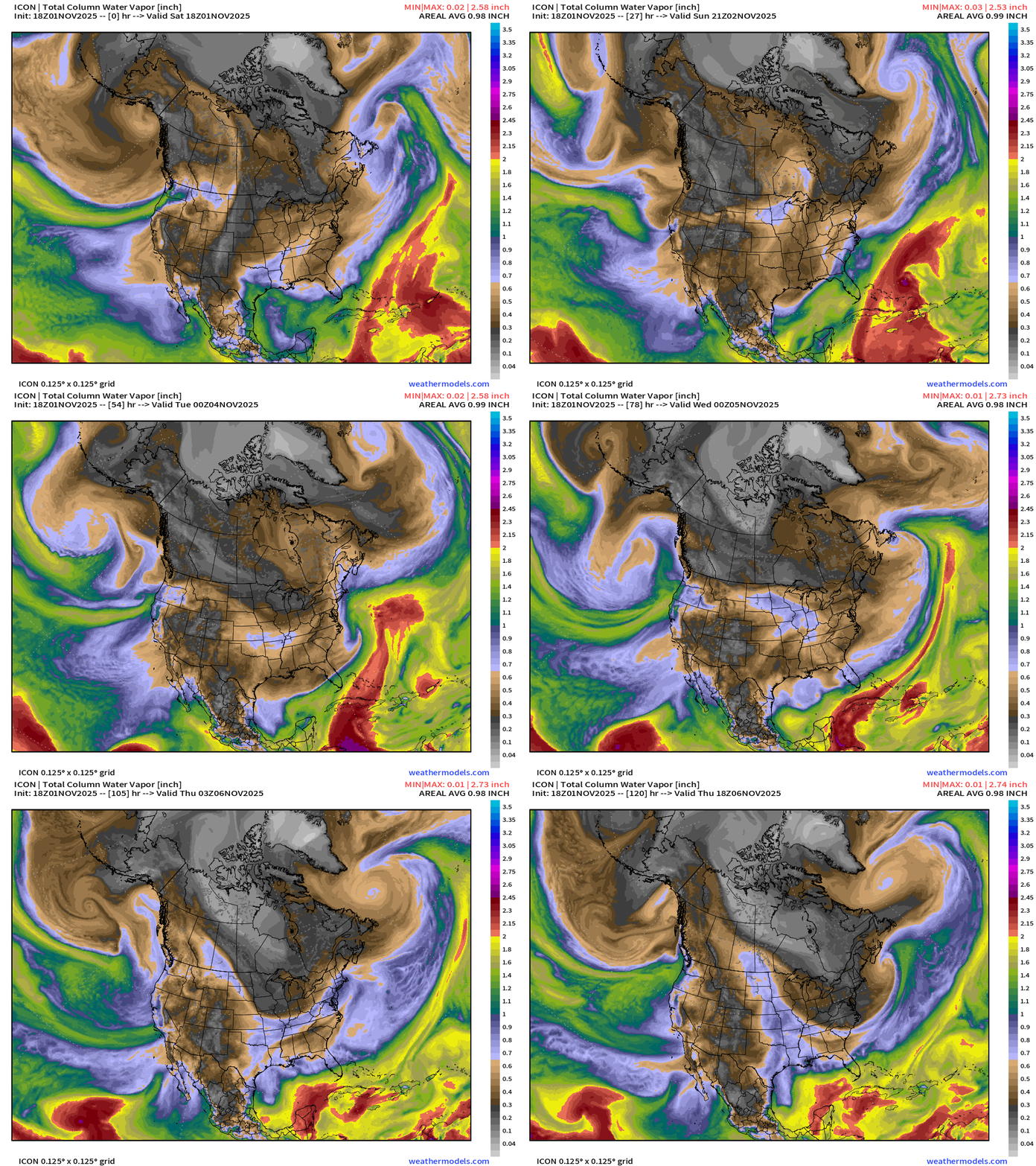
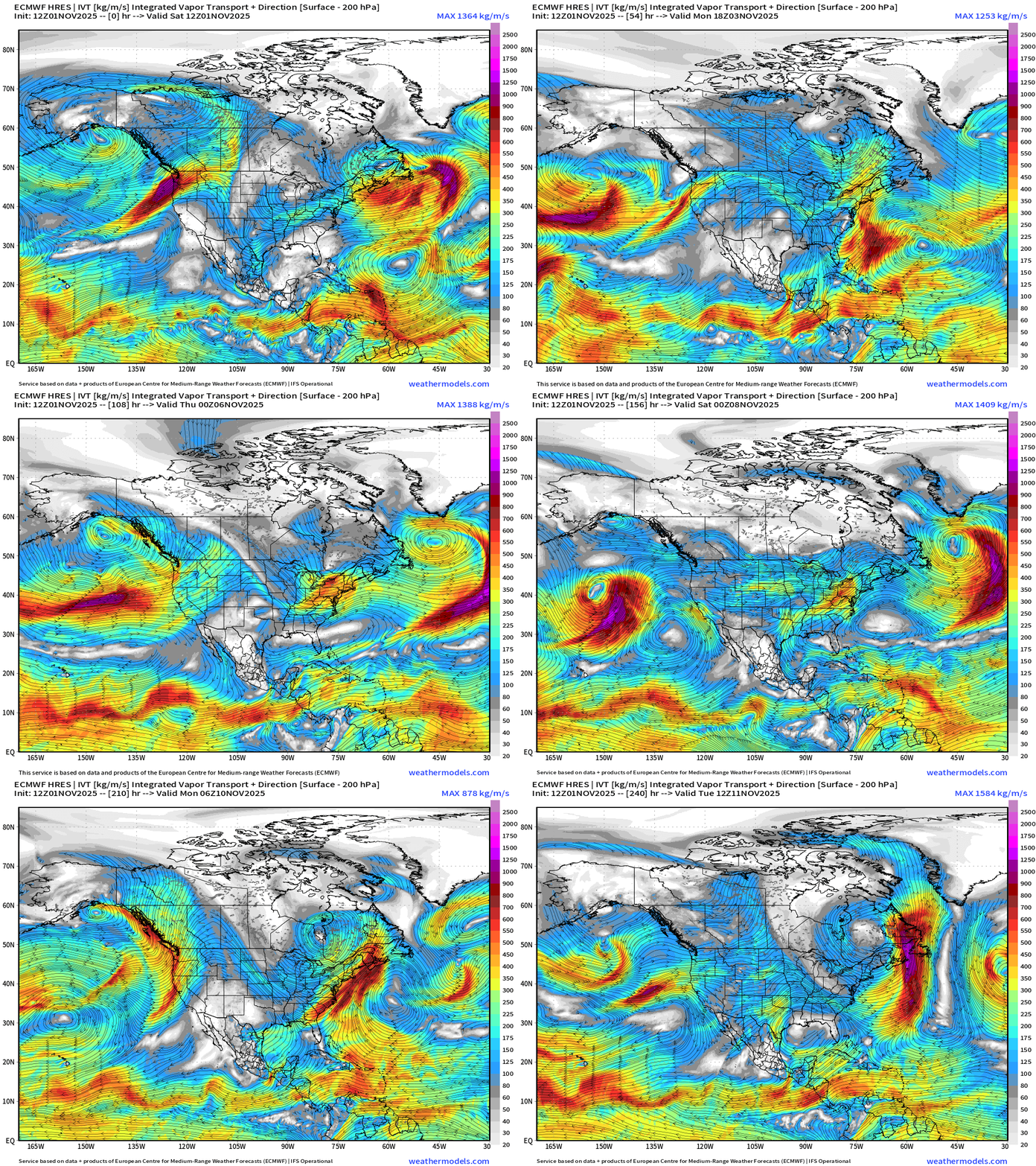
Major features: bomb cyclones off the East Coast of the U.S. and atmospheric rivers into the West Coast.
850 hPa Wind | Next 5-days | Germany ICON
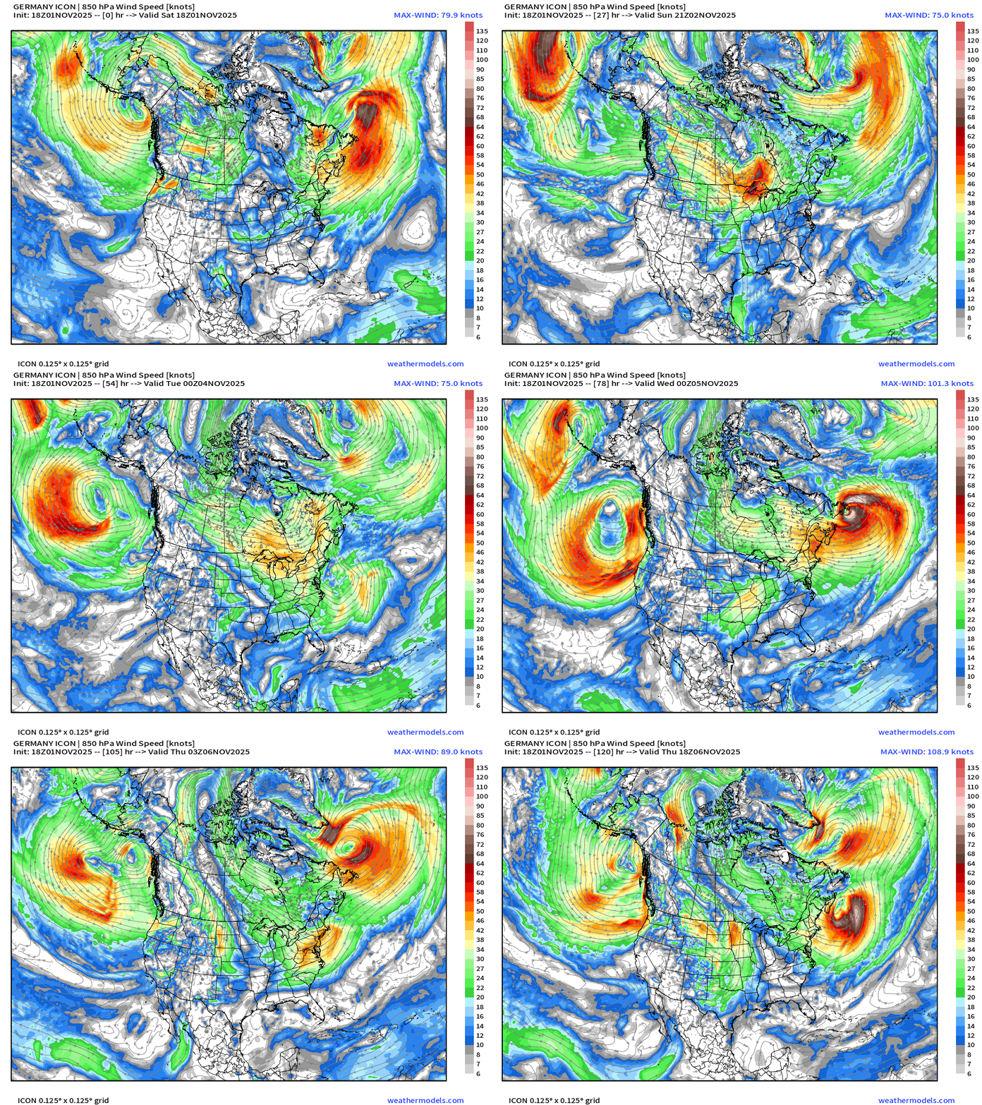
Powerful Atlantic Bomb Cyclones
Wednesday: 943 mb central pressure ENE of Canada
Thursday: 970s mb & intensifying in the Gulf of Maine
Each of these storms will develop hurricane force winds but mostly avoid major impacts to land. Most of the powerful mid-latitude cyclone traverse the open oceans and only bother shipping and mix fish with huge waves during their 3-5 day lifecycles.
Integrated Vapor Transport | Next 10-days
Atlantic Hurricane Season Statistics | November 1, 2025
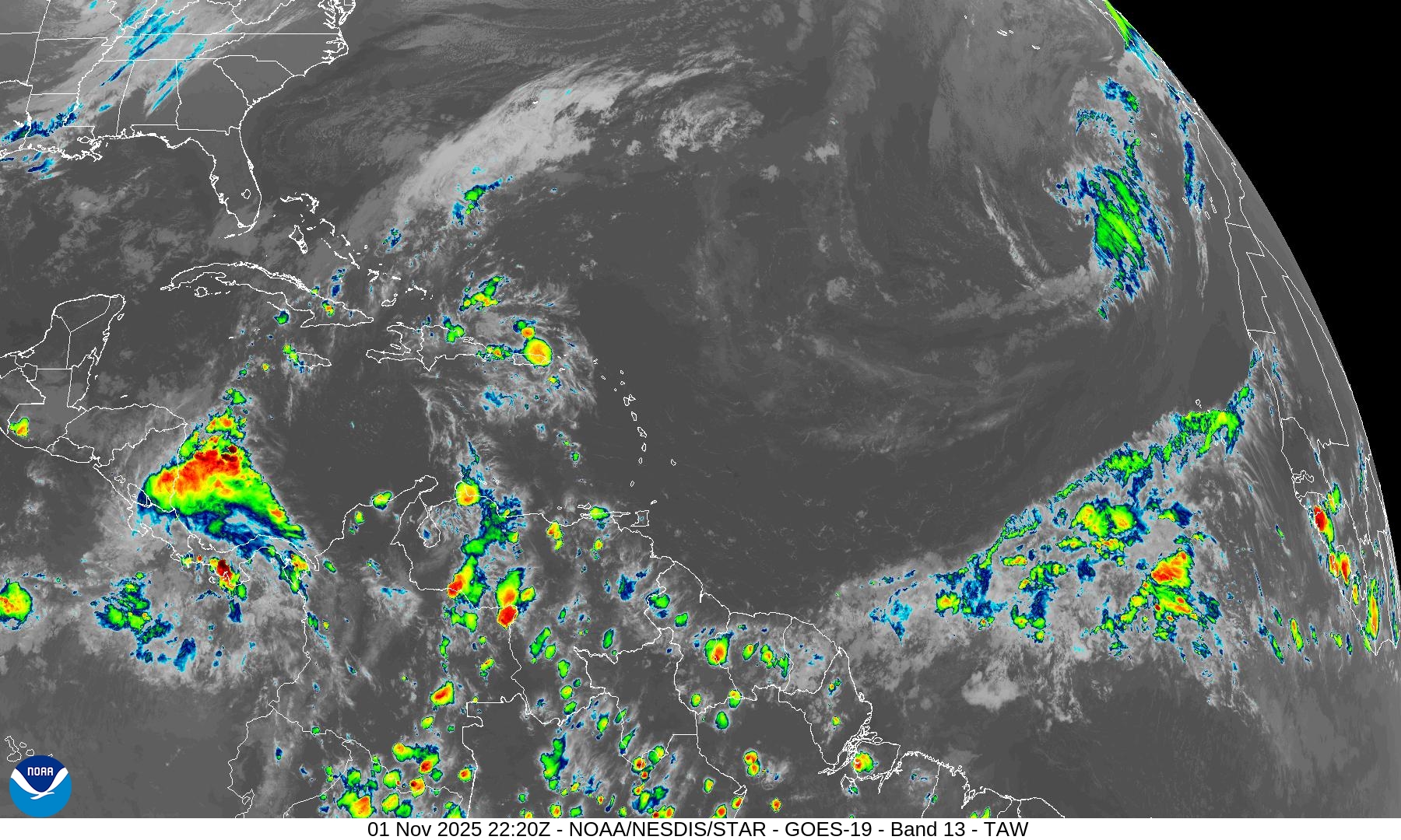

Atlantic tropics are mostly shut down with a MAJOR trough cutting into South America through the MDR signaling the end of any chance seeing tropical waves develop out here.
Instead, we’ll keep an eye on the southern Caribbean near Central America for any convection to spin-up in the long-range. Nothing on the horizon through 7-14 days.
2025 Hurricane Season [Day 154]. My FORECAST for this year was 14 named storms, 7 hurricanes, and 3 major hurricanes (near average)
2025 Season to Date: 13 Named Storms, 5 Hurricanes, and 4 Majors, and 3 Category 5’s | Accumulated Cyclone Energy (ACE) = 135.5
ECMWF AIFS 12z Height Anomaly (500 hPa) Next 10-days
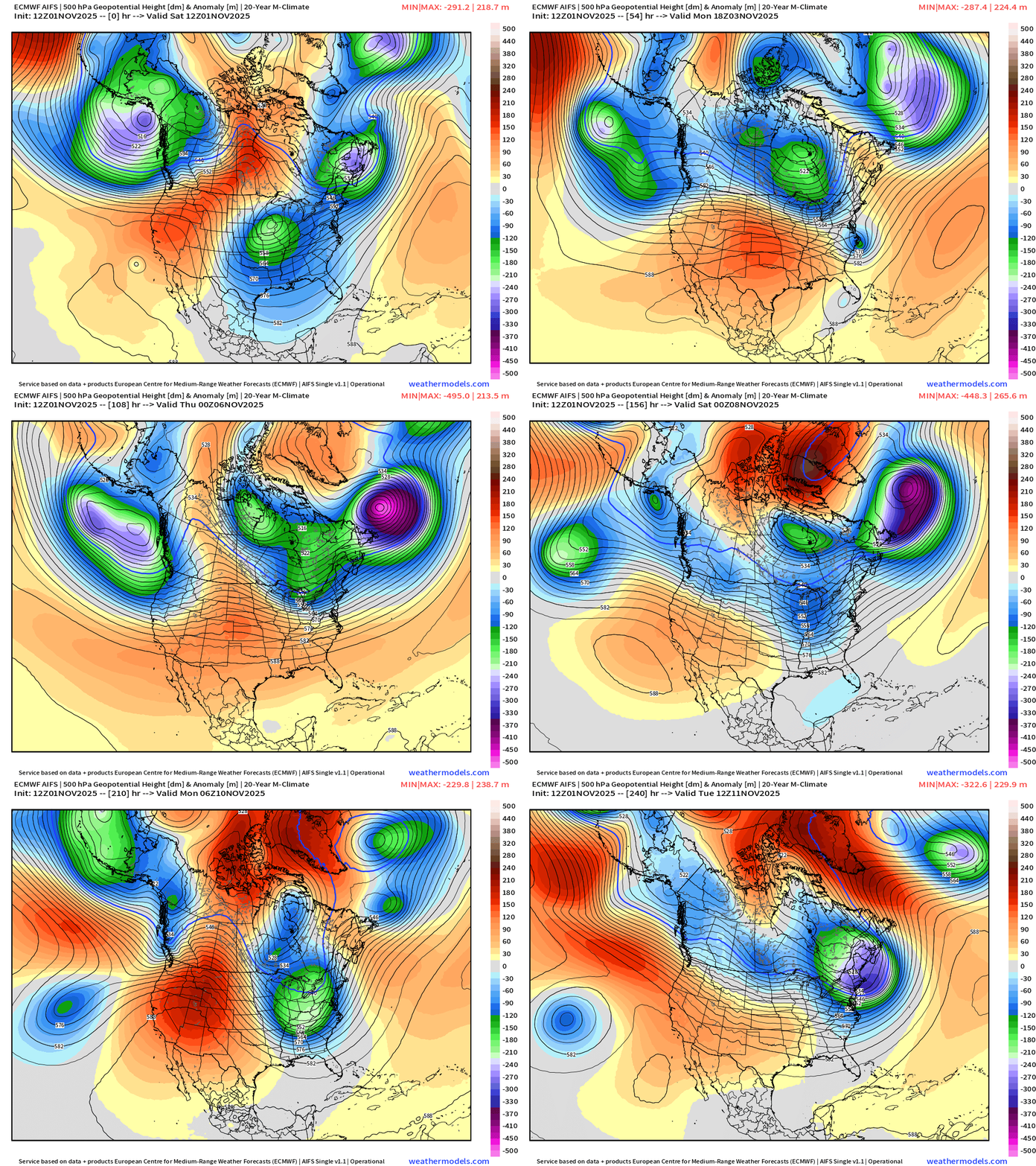
The ridging across the Lower 48 is brief but strongest across the Western U.S. with Pacific influence — warmer air with these atmospheric river systems, which have origin in the subtropics = shut down Rocky Mountain snowfall through at least 10-days.
The sequence of troughs dipping into the Great Lakes and Ohio River Valley into mid-November would be a wonderful signal for winter weather lovers — positioned nicely for Nor’easters!
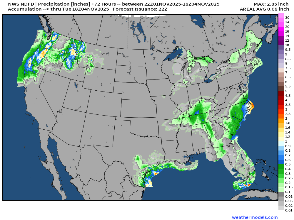
NWS Rainfall Next 72-hours
Blend of Models | 7 Day Precipitation Totals
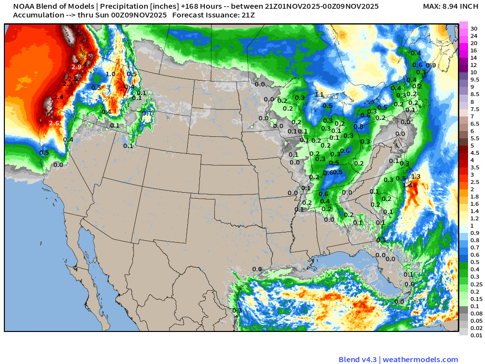
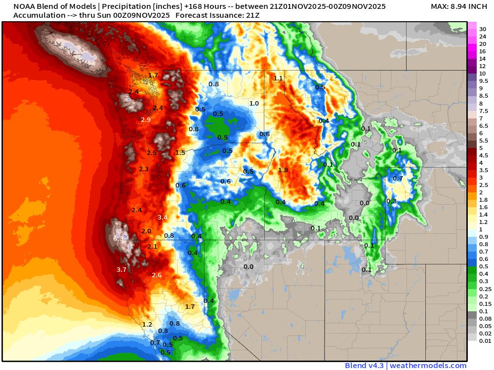
Heavy rainfall for the West Coast through 7-days from atmospheric river systems
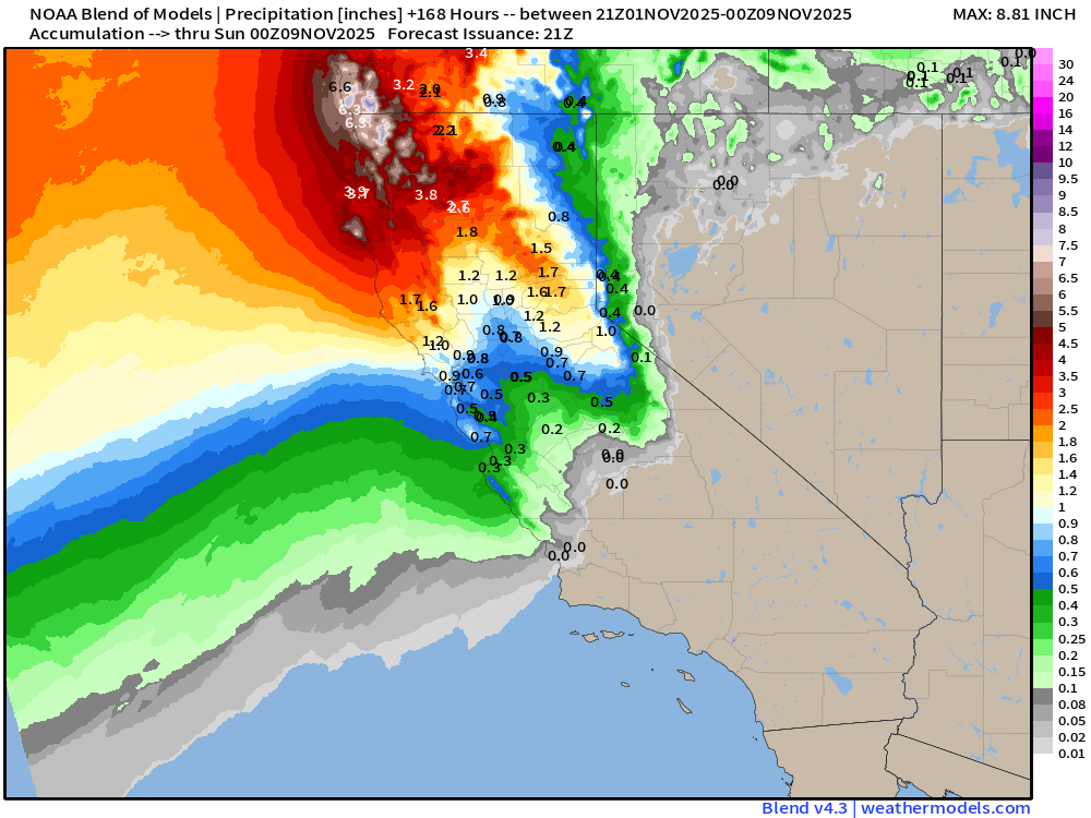
Even an inch or more of rain into San Francisco Bay Area
Blend of Models | 7 Day Snowfall Totals
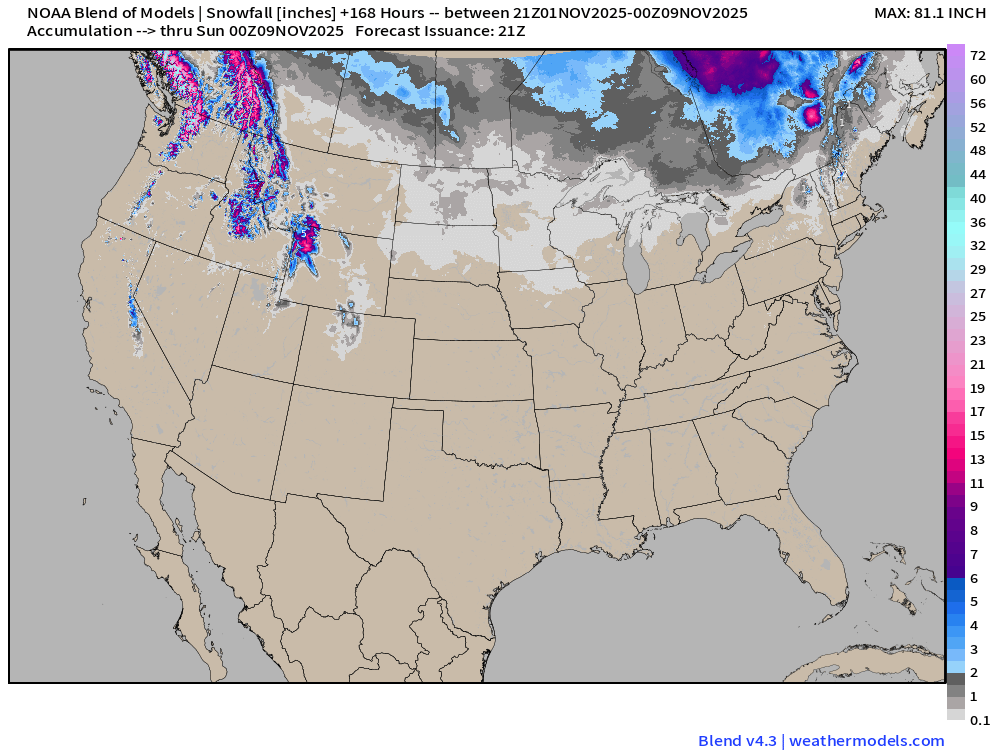
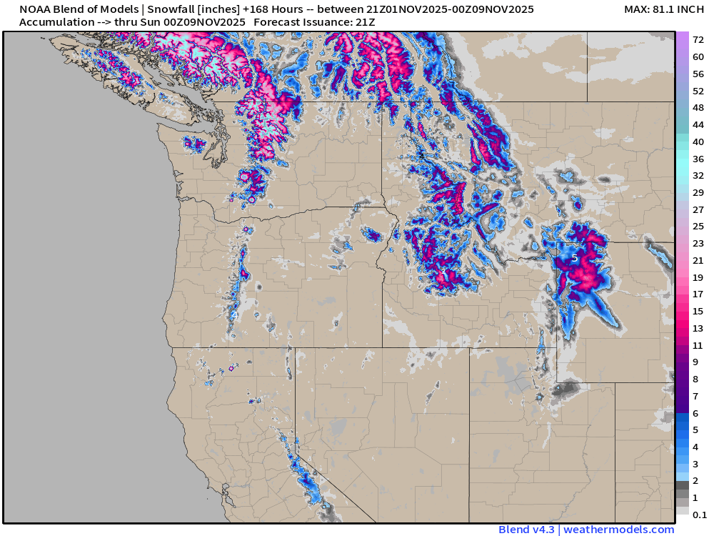
ECMWF Snowfall 12z | Next 14-Days
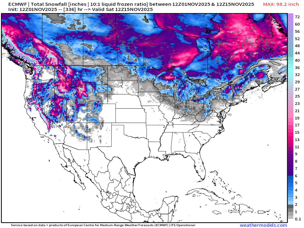
Into November 15th — snowfall returns to the Rockies — and seeing Lake Effect snow in the Great Lakes (!) which would be quite early in the season!
Low Temperatures Sunday Morning
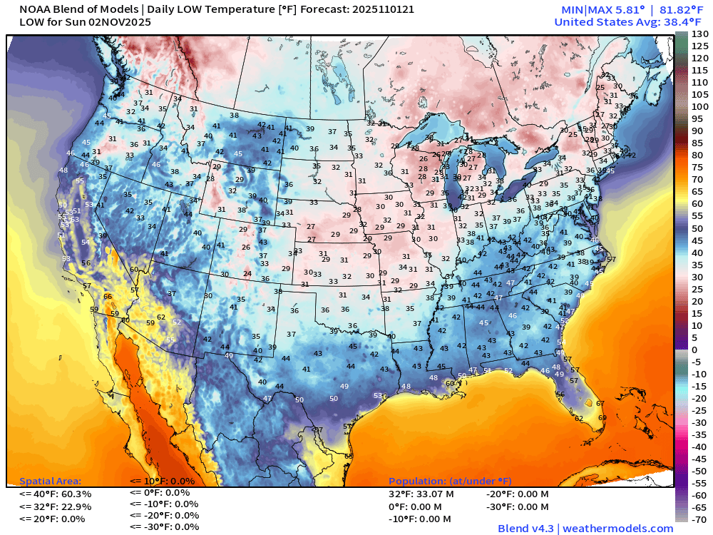
Lower 48 average low temperature is 38.4°F with 33 million population freezing.
High Temperatures on Sunday
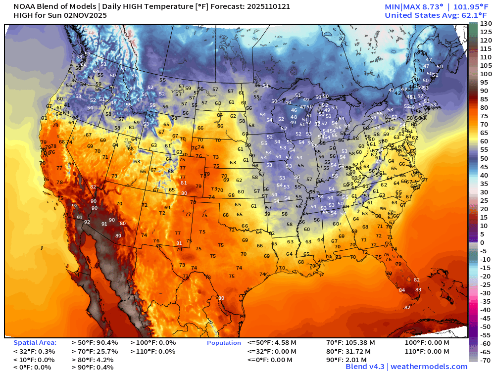
Lower 48 average high temperature is warmer at 62°F with the only heat remaining in the Southwest, and 80s in South Florida.
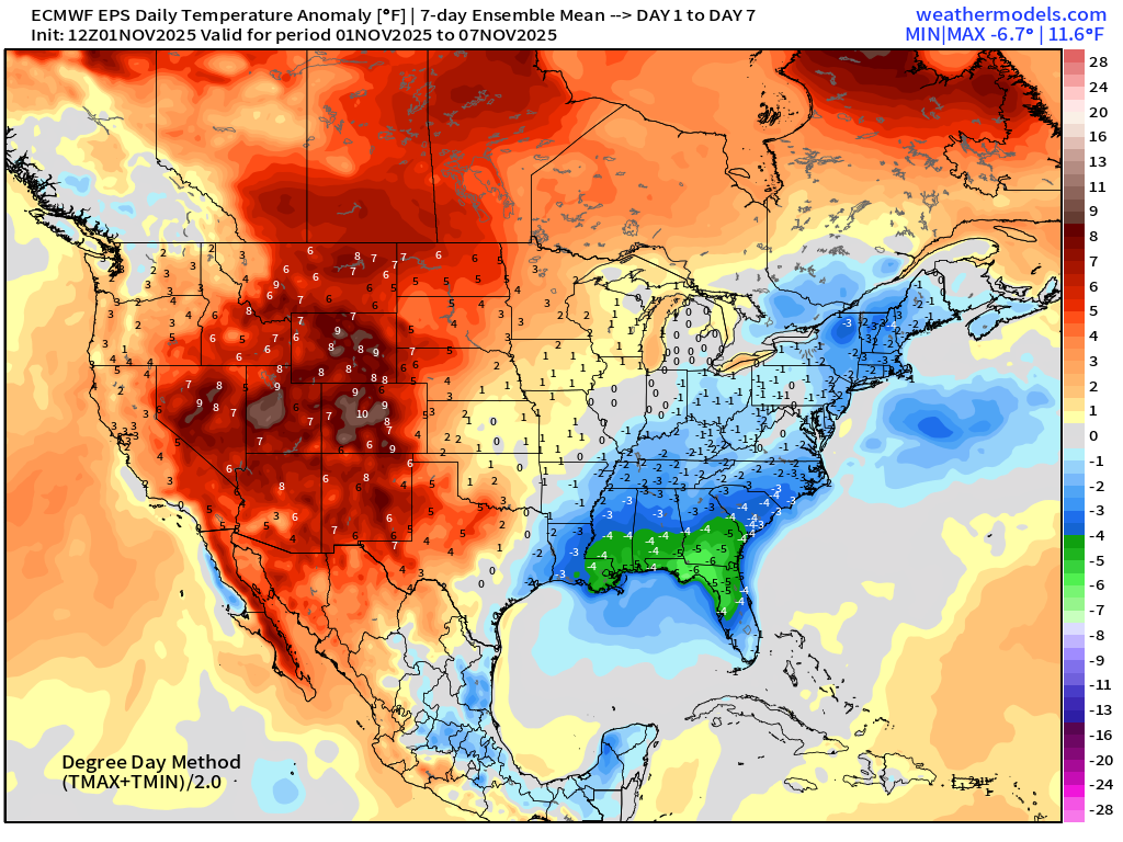
Weekly Temperature Anomaly | Nov 1 - Nov 7
Weekly Temperature Anomaly | Nov 8 - Nov 14
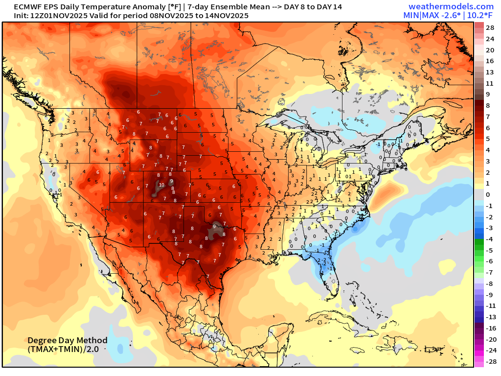
Significant warming trend across the Western U.S. with 7°F warm anomaly in the Week 2 ensemble mean west of the Mississippi
14-Day Tropical Outlook —> ECMWF EPS 12z | Active Tracks
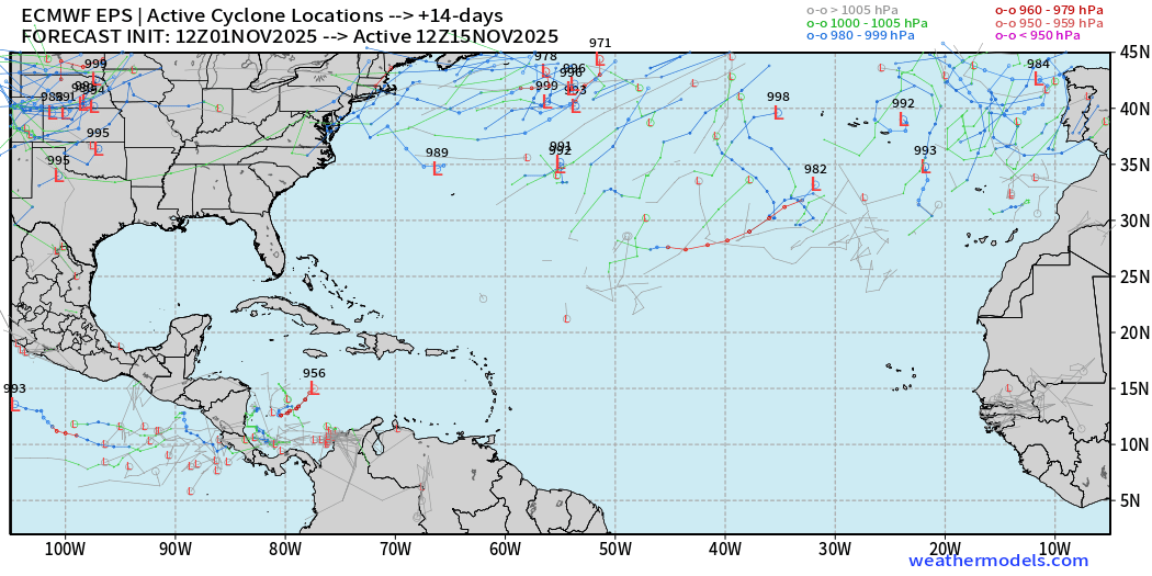
1 track out of the 51 ensemble members = 2% chance of one more named tropical system through November 15 — Tiny chance, but not zero!
West Pacific Typhoon Outlook
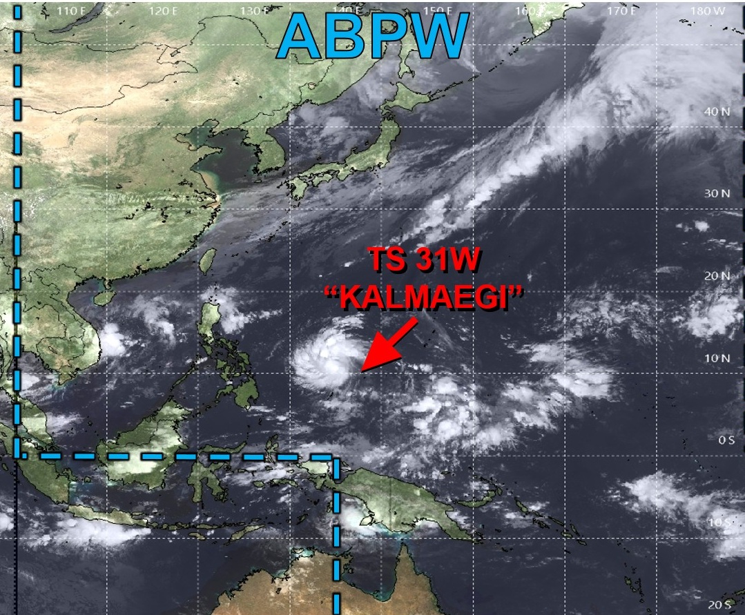
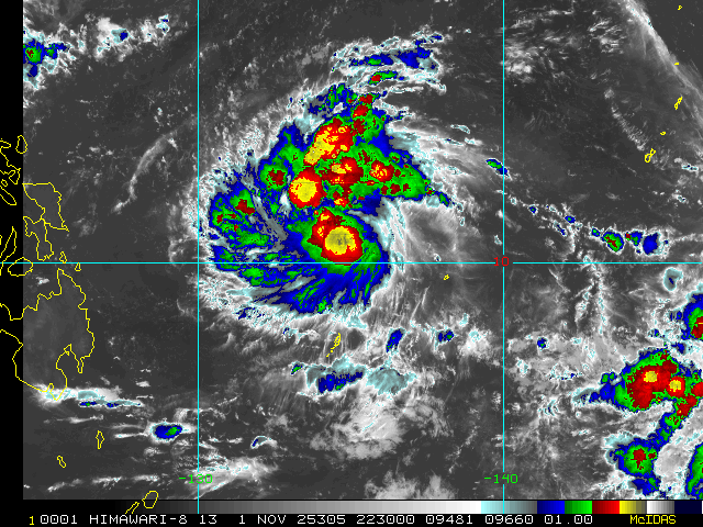
22:00Z (November 1) visible imagery
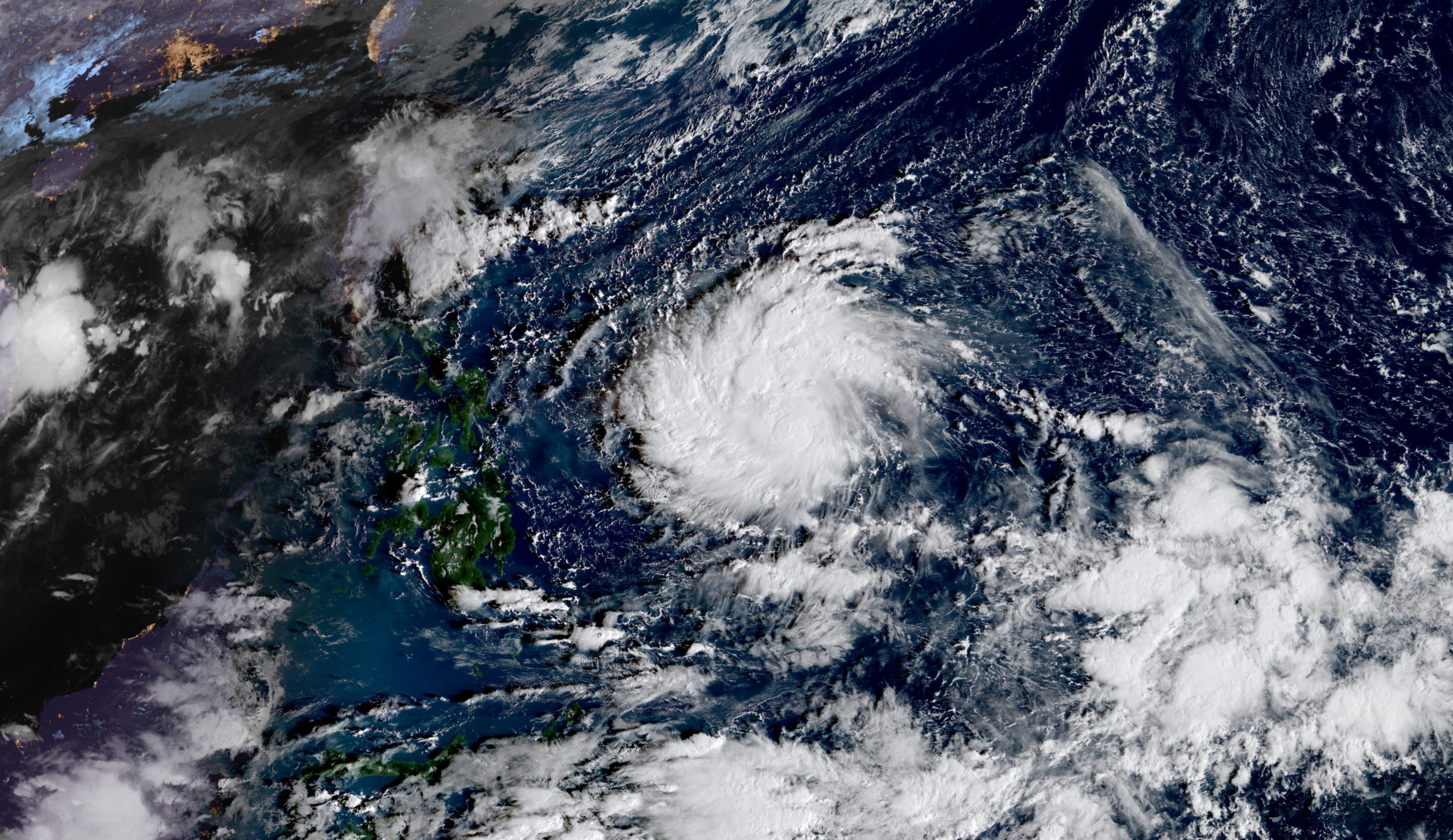
Potential for Rapid Intensification of Tropical Storm Kalmaegi into a powerful typhoon prior to moving through Philippines at a low latitude ~11°N missing the mountainous terrain of Luzon.
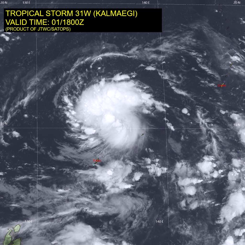
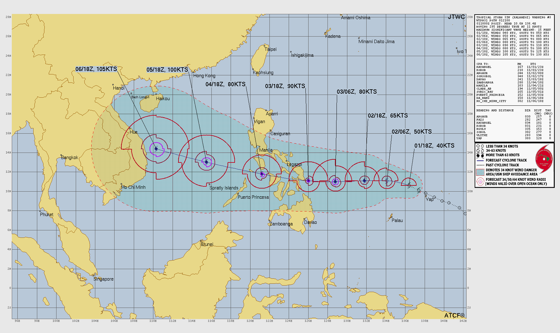
A small inner core this morning (out there) could be ripe for rapid intensification.
HAFS-A 12z showed 970 mb central pressure — so perhaps Category 2, but a very small system.
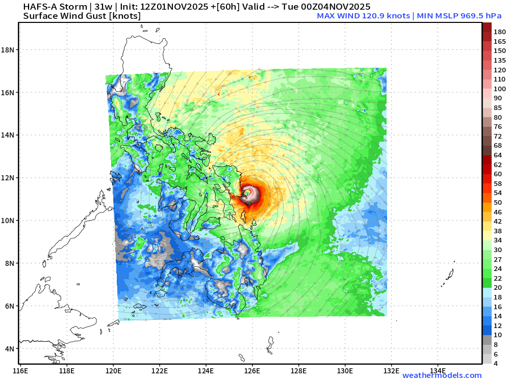
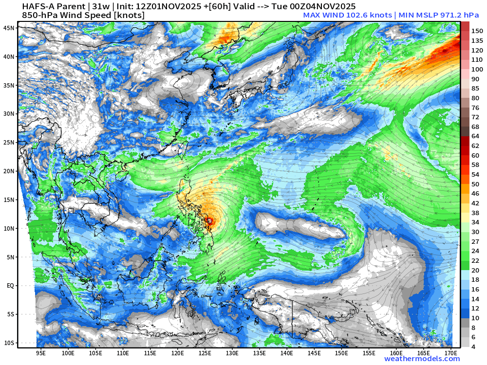
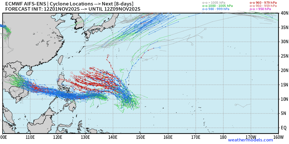
Google Deep Mind Members show a Super Typhoon — Category 5 with many members in the next 48-60 hours — not sure about this, but we’ll monitor.
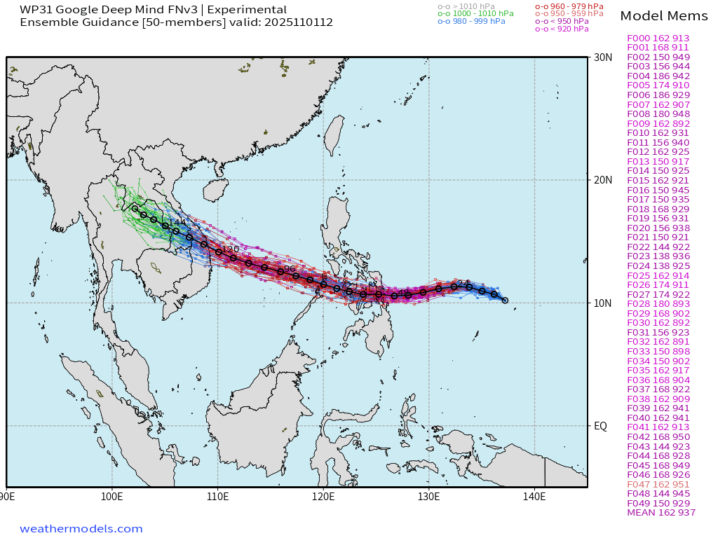
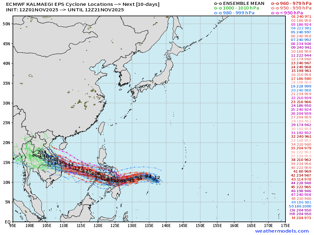
After Kalmaegi, another Typhoon will follow on a WNW track, and this one looks highly likely to become a Category 5.
Maps sourced from weathermodels.com designed and innovated by yours truly! Please subscribe there for real-time access to the newest maps, charts from all of the weather models including ECMWF.
- Milepost
- 779 · laid 2025-11-01T23:35:52.153000Z
- Source
- https://weather.substack.com/p/november-1-2025-saturday-weather
- Digest
- 0f9a20206864c591cdf9a0a58885f487797a5cee897eecf31ebbffea01ab4774
- Machine
- JSON