October 24, 2025 Friday Weather Update
Melissa nearing hurricane intensity on way to Category 5
October 2025 was the 7th-warmest October in the 131-year national record (1895–2025), at 57.0°F against a 1991–2020 normal of 54.5°F (+2.4°F).
October 2025 was the 56th-wettest October in the 131-year national record (1895–2025), at 2.3in against a 1991–2020 normal of 2.5in (-0.2in).
NOAA/NCEI Climate at a Glance, contiguous United States. This is the observed record for the month, not a score of anything said in this piece — the forecast ledger begins 2026-08-17 and cannot reach earlier posts.

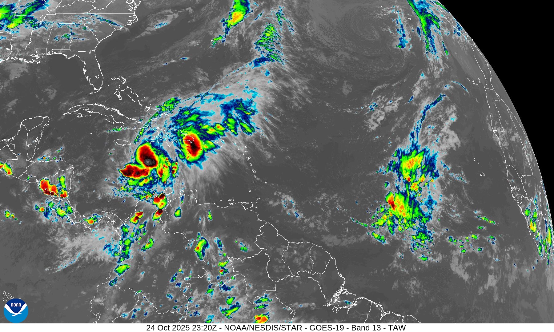
Basin scale IR satellite Imagery shows an asymmetric blob in the Caribbean with some parasitic convection off to the south and to the northwest. Not too impressive — yet.
HAFS-A Inner Core | Track and Intensity
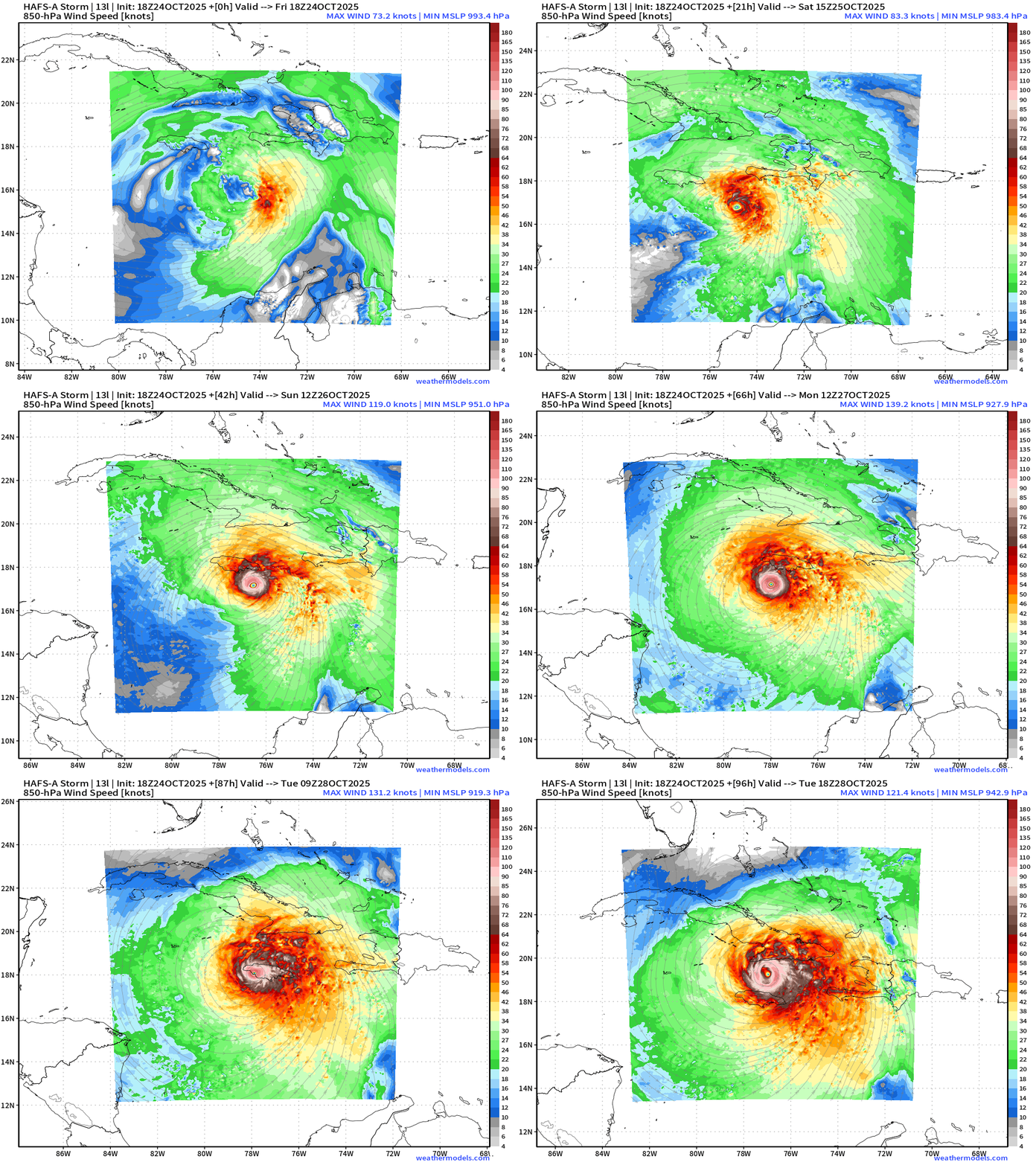
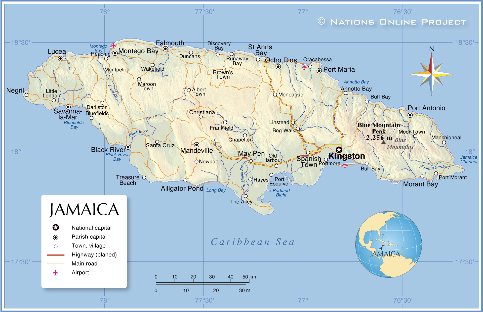
Melissa deepens to Category 5 — pressure in the 910s mb and parallels Jamaica to the south before taking a right turn and making landfall along the southern face of the island. The westward track would push enormous surge into Kingston, unfortunately.
NHC 8 PM Forecast Track + Cone | 993 mb | 65 mph Winds
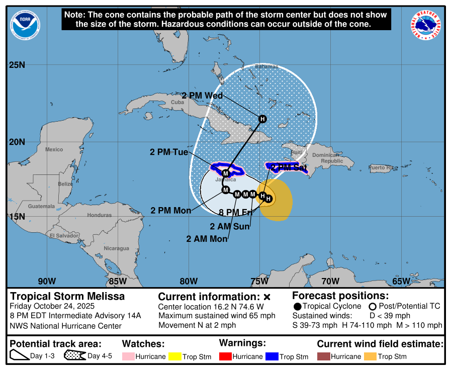
NHC Discussion Highlights | Track
Wind shear is decreasing but the storm is not moving (2 mph N)
The storm has been crawling and moving erratically for the past few days.
The track will turn due westward and then take a dramatic right/north turn on Monday
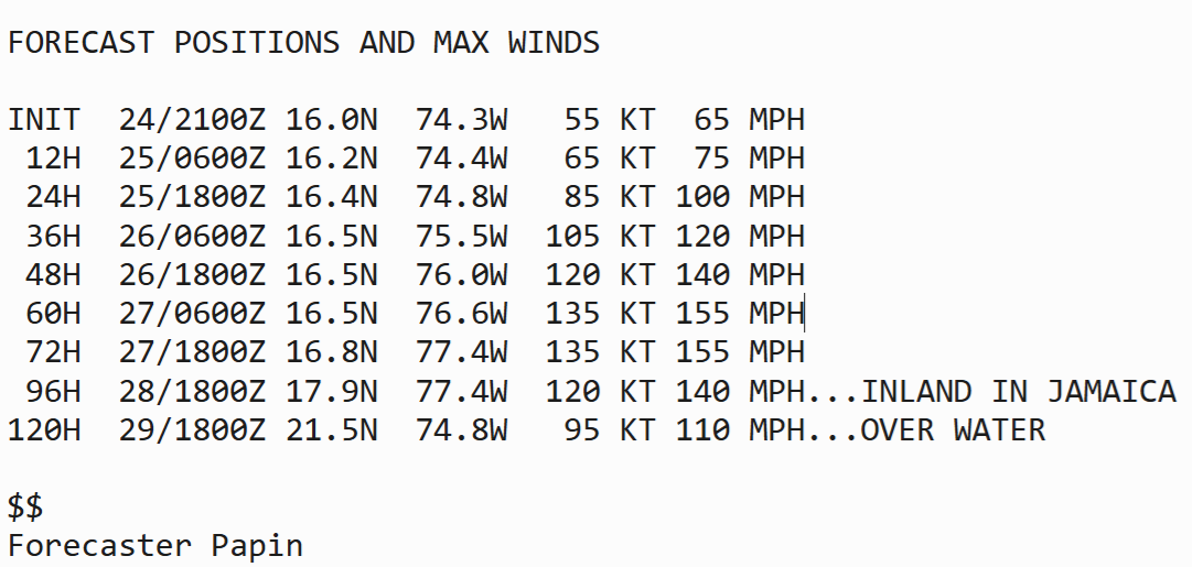
NHC Discussion Highlights | Intensity very close to Category 5
The NHC intensity forecast responds to this guidance change by explicitly show RI earlier and continuing over the weekend. The forecast now shows a 135 kt peak in 60 h, and there is a distinct possibility that Melissa could become a Category 5 hurricane during this time period. In fact, the latest 12z Google DeepMind ensemble distribution shows the majority of its members reaching this lofty intensity.
Current IR Satellite | Tropical Storm Melissa
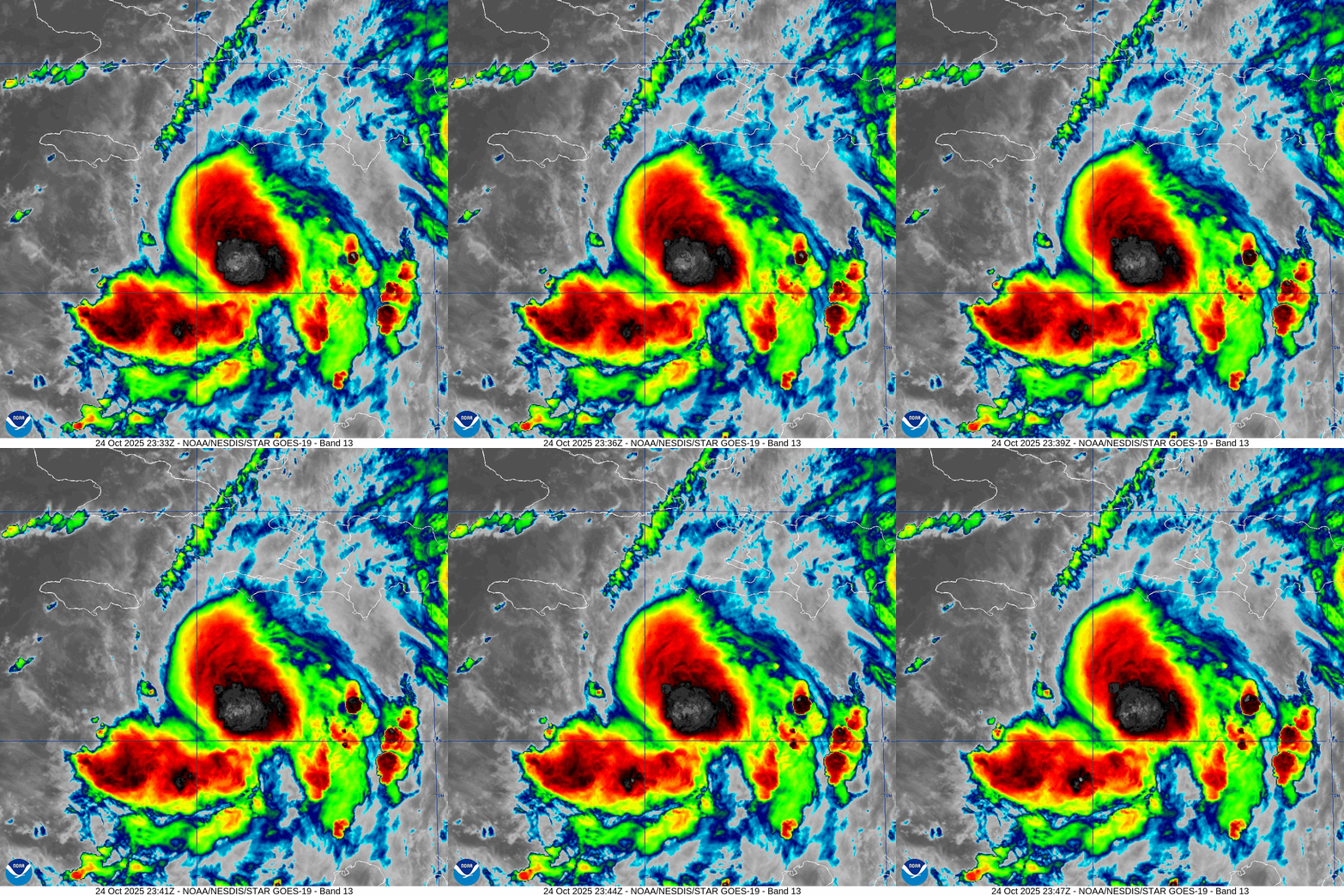
Deep convection near the center continues to bubble up — over very warm water. We don’t see an eye or inner-core quite yet, but it’s only a matter of time < 24 hours perhaps.
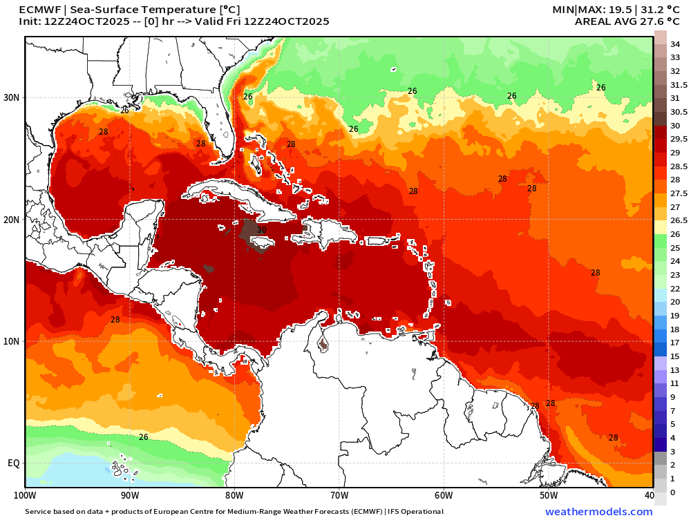
Ocean Surface Temperatures are 29°C + in Caribbean around Jamaica
ECMWF AIFS 12z Height Anomaly (500 hPa) Next 10-days
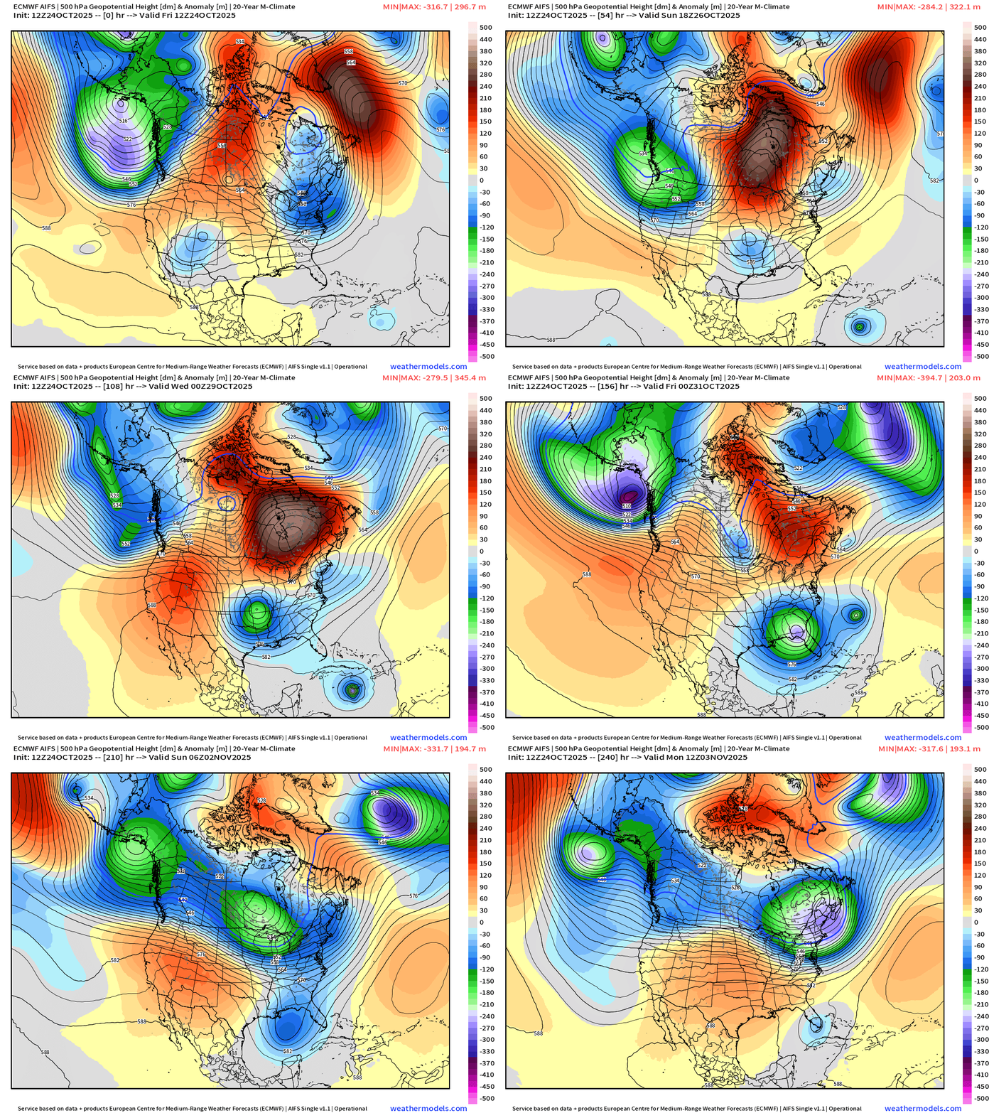
A strong trough drops out of the Rockies from the Pacific Northwest and arrives into the Southeast U.S. just in time to protect the U.S. East Coast from any impacts from Melissa. Not seeing any scenarios where/how Melissa is captured or comes close to the US — good news.
Atlantic Integrated Vapor Transport | Next 10-Days | 12z ECMWF
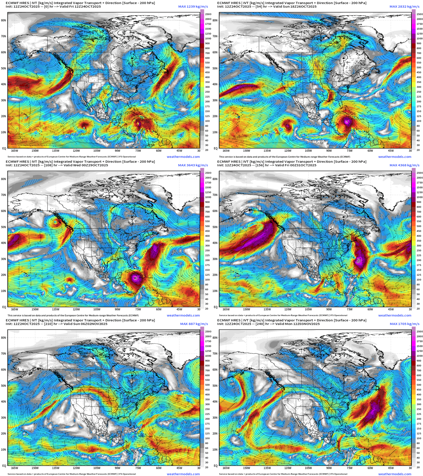
The flagship 12z solution extends here into Day 10 shows a monster Hurricane Melissa spinning over the very warm western Caribbean before sprinting across eastern Cuba into the open Atlantic. Bermuda could be directly impacted.
Precipitable Water Forecast | Next 6-days
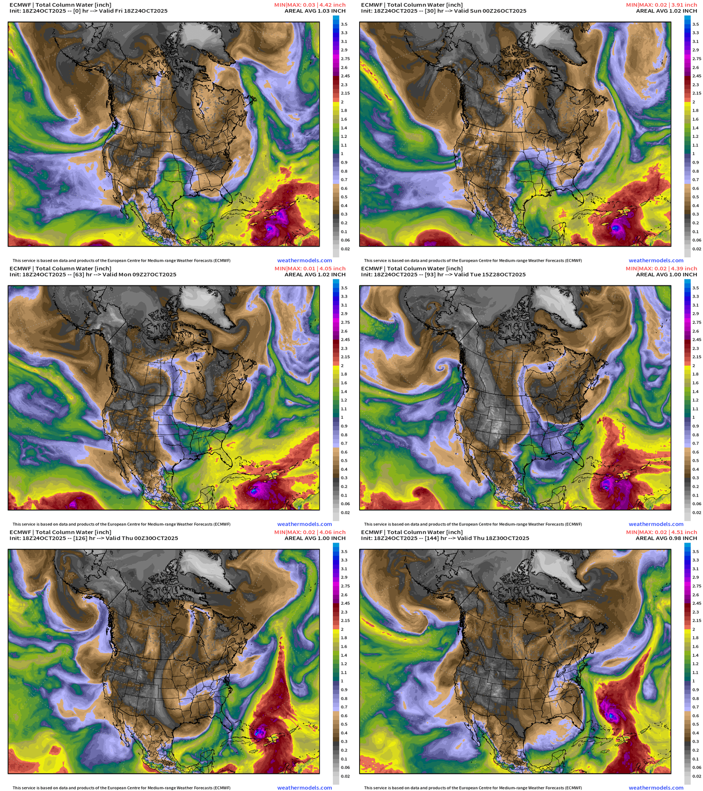
The East Coast will still see unsettled weather related to the upper-level troughs — but thankfully the threat of a strong Nor’easter have decreased. Instead, a larger but still impactful weather system will bring a strong cold front through the Southeast into middle of next week.
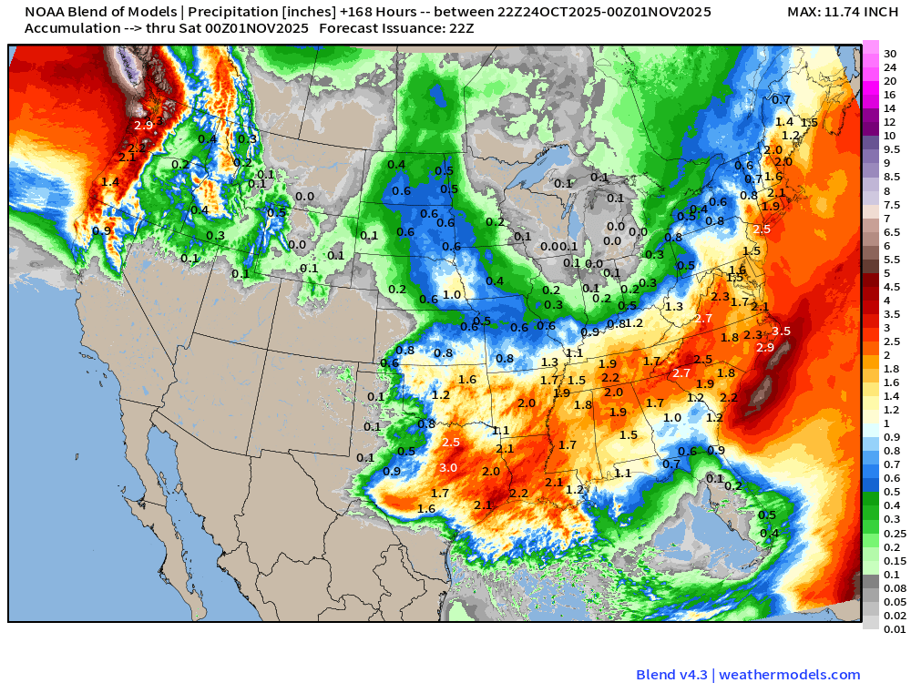
Blend of Models | 7 Day Precipitation Totals
Low Temperatures Saturday Morning
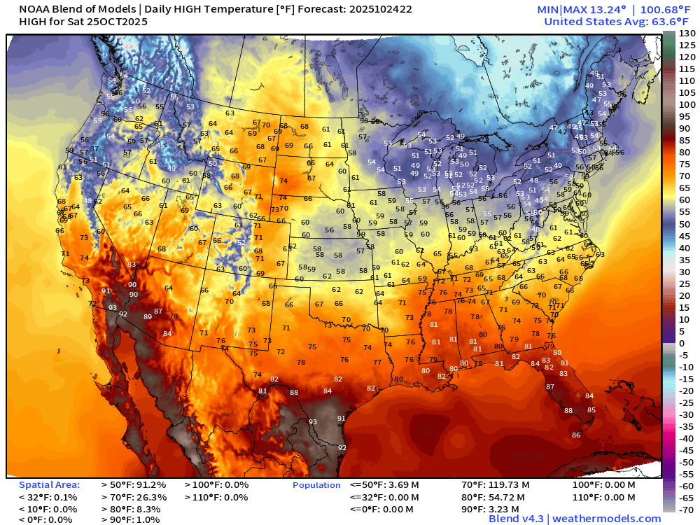
High Temperatures on Saturday
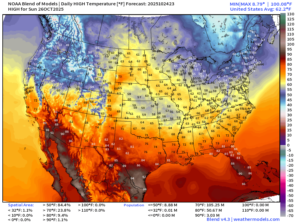
High Temperatures on Sunday
Atlantic Basin Outlook | 8 PM ET Update
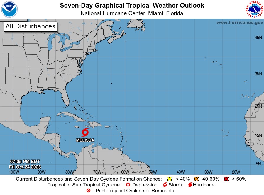
2025 Hurricane Season [Day 146]. My FORECAST for this year is 14 named storms, 7 hurricanes, and 3 major hurricanes (near average)
2025 Season to Date: 13 Named Storms, 4 Hurricanes, and 3 Majors | ACE = 103
ATCF Spaghetti | Melissa 13L
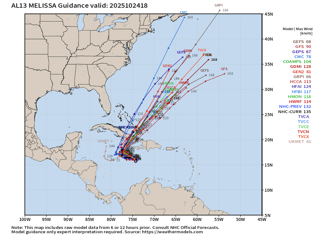
Of course GFS remains on the eastern side of the guidance envelope, but it has finally abandoned a track over Hispaniola. Dreadful performance from NOAA’s flagship global model.
Previous 14 HCCA Consensus Track Forecasts | Through 7 Days
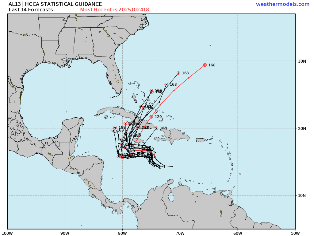
This is the putative “answer key” along with the ECMWF EPS and Google Deep Mind — and has been performing VERY well. Most recent iteration turns northward into central Jamaica.
If the track continues to trend eastward, then we could become very concerned about a direct landfall into Kingston.
Google Deep Mind Forecast Tracks | Melissa 13L
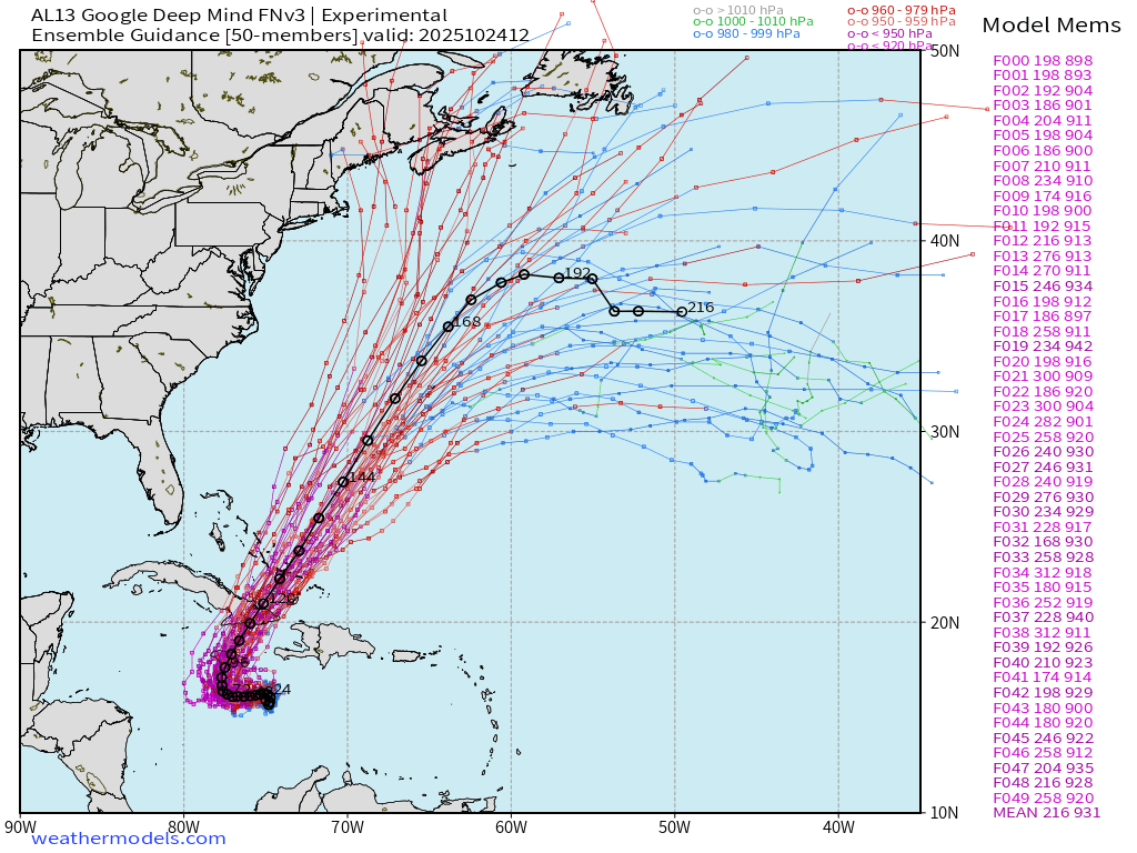
50-members from this A.I. trained system — almost ALL showing a major to Category 5 hurricane. I added the ensemble mean.
ECMWF 12z EPS Internal Tracker | Melissa 13L
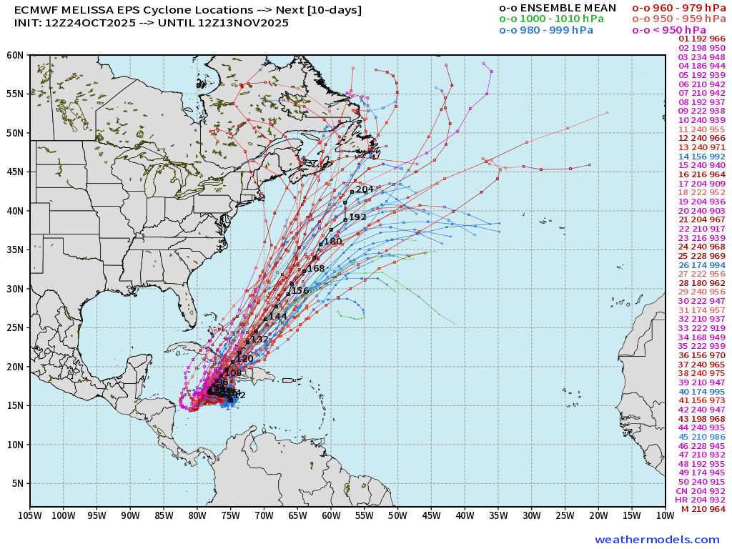
Summary:
All systems go for rapid intensification —> Melissa to Category 5 with a westward track. Uncertainty about the timing of the turn northward in Jamaica.
Eastern Pacific Tropical Weather Outlook | 8 PM ET
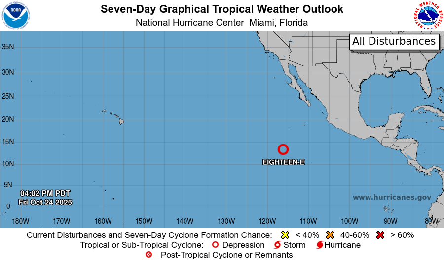
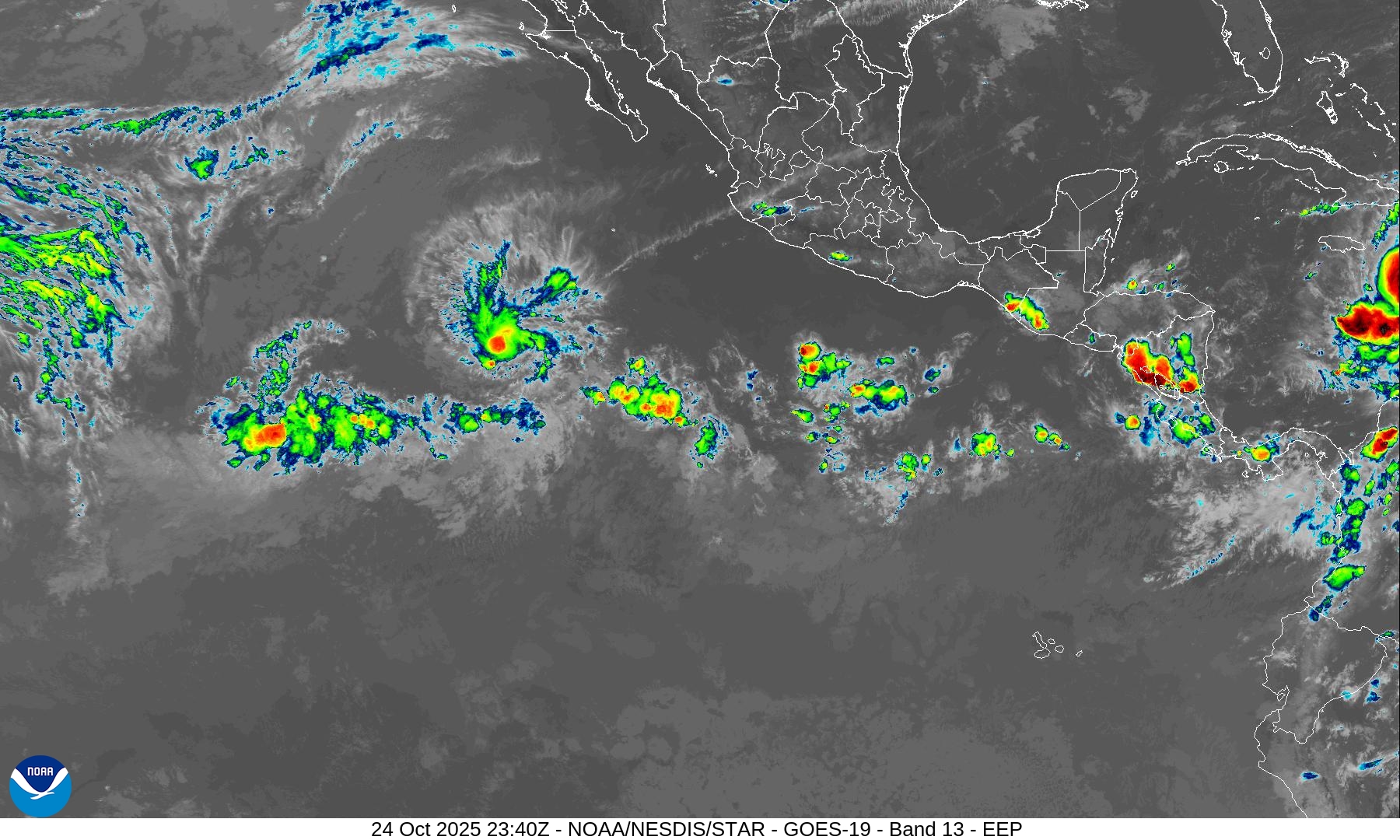
Tropical Depression 18E will become Tropical Storm Sonia.
Ryan in 2025: a kid in a candy store with so many advanced tools, techniques, models and maps to investigate the progress and forecast of Tropical Storm Melissa. I’ve been watching hurricanes and models for over 20-years — and watched the evolution of our world’s models — so much improved!
Maps sourced from weathermodels.com designed and innovated by yours truly! Please subscribe there for real-time access to the newest maps, charts from all of the weather models including ECMWF.
- Milepost
- 773 · laid 2025-10-25T00:16:32.955000Z
- Source
- https://weather.substack.com/p/october-24-2025-friday-weather-update
- Digest
- 7c47ff198065ed4b267156080355037f4820d66e835b30ba4395bf19aca0f170
- Machine
- JSON