October 22, 2025 Melissa Expected to Rapidly Intensify
Major hurricane intensity likely in 4-days
October 2025 was the 7th-warmest October in the 131-year national record (1895–2025), at 57.0°F against a 1991–2020 normal of 54.5°F (+2.4°F).
October 2025 was the 56th-wettest October in the 131-year national record (1895–2025), at 2.3in against a 1991–2020 normal of 2.5in (-0.2in).
NOAA/NCEI Climate at a Glance, contiguous United States. This is the observed record for the month, not a score of anything said in this piece — the forecast ledger begins 2026-08-17 and cannot reach earlier posts.

Since we have the NHC cone for Tropical Storm Melissa, I will mainly post the “official forecast” and not nitpick or second guess the professionals in Miami. I don’t think it’s valuable to “raise awareness” by issuing my own proprietary “path” forecasts.
However, I will focus on particular model solutions that I think have merit and are on the right track, no pun intended, for Melissa especially for intensity up to Category 5.
Current IR Satellite | Atlantic Basin
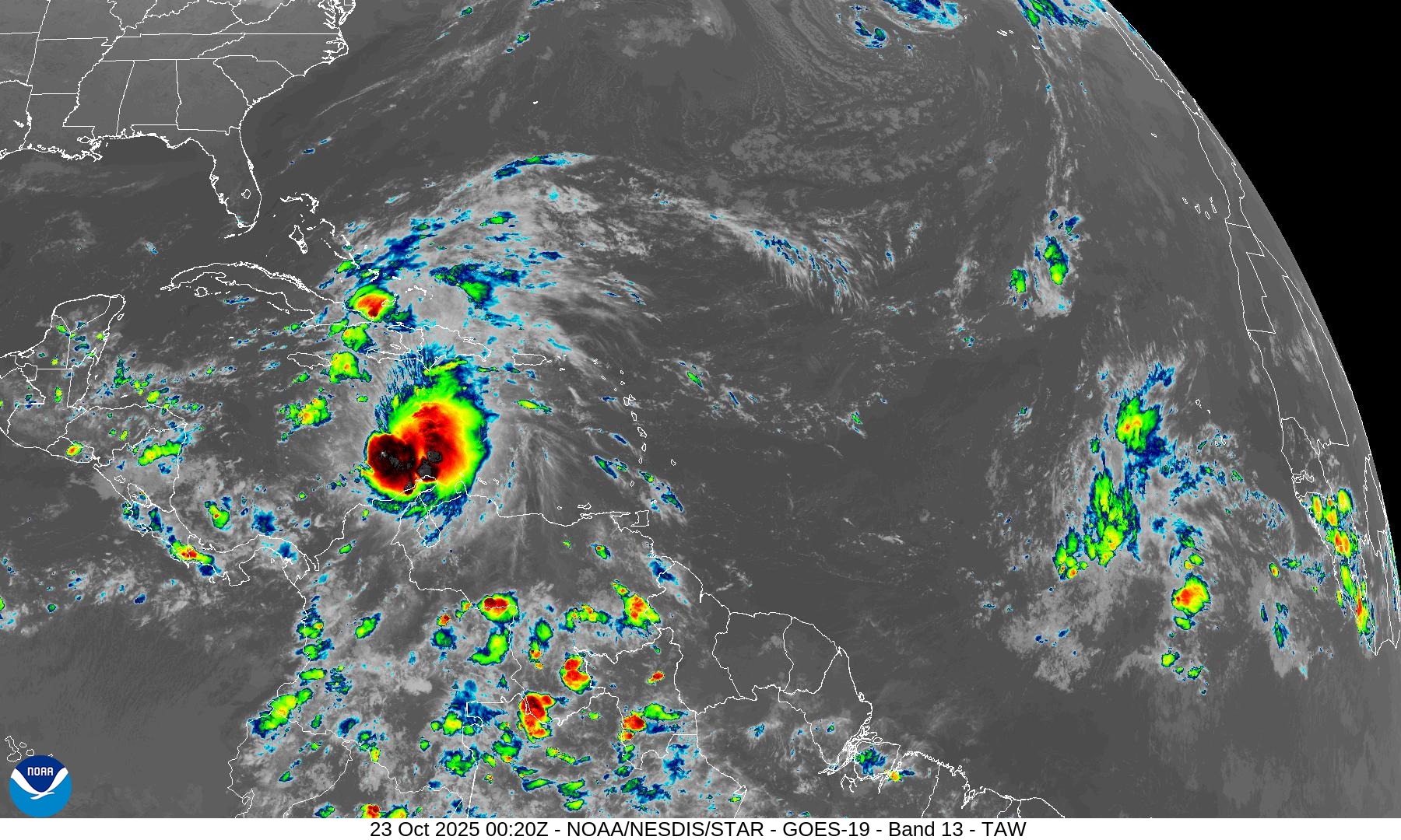
Melissa is heavily sheared but in the next 3-4 days, that completely goes away leaving a vortex ready to explosively intensify over very warm ocean water (and deep warm).
ECMWF Wind Shear | Now and in 4-days
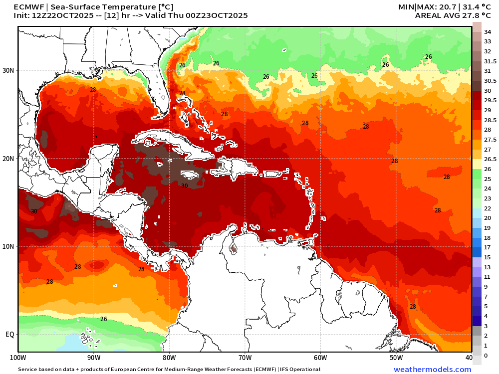
Ocean Surface Temperatures are 29°C to 30°C (+) in the Caribbean around Jamaica
HAFS Mesoscale Hurricane Model Forecast for the Ages
The 12z HAFS hurricane model went bonkers — with massive Category 5 (or extrapolated Category 7) solutions with 850 mb winds in excess of 200-knots and surface pressure in the 880s. Just incredible!
HAFS 18z | Version A
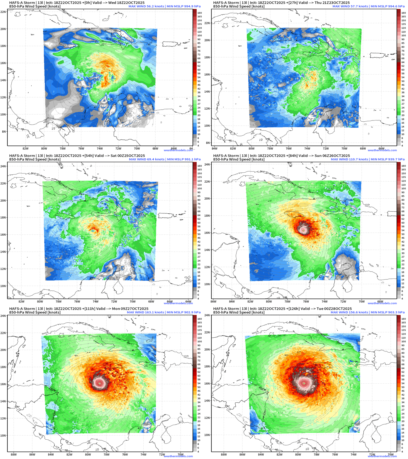
The 18z HAFS-B lost the storm in the beginning of the “nest” tracking — but found it later. So, the HAFS-A solution is really only available with full-nesting through 6-days, and it's a monster … 902 mb and 180 knot winds at 850 hPa — so a reduction from “flight level” to near-surface still means 160-knot sustained winds.
Simulated Satellite looks to be T 8.0 on Dvorak scale
For posterity, here is the HAFS-B 12z that blew up to 883 mb
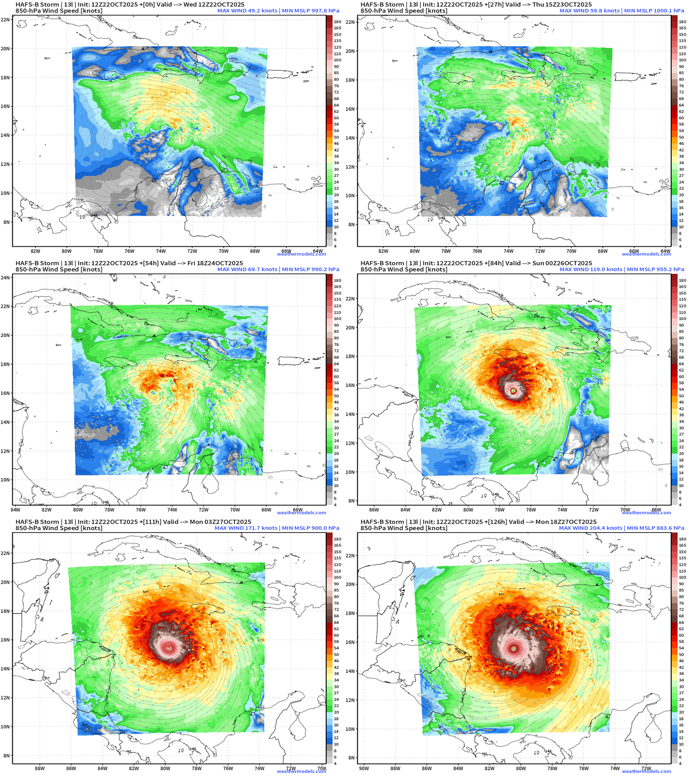
Historically, this would be Wilma/Gilbert territory and potential to set record minimum pressure. This is a perfect environment for a Category 5+ hurricane once the shear vector actually aligns to assist the upper-level outflow channels.
Global Model | ECMWF 18z Height Anomaly (500 hPa) Next 6-days
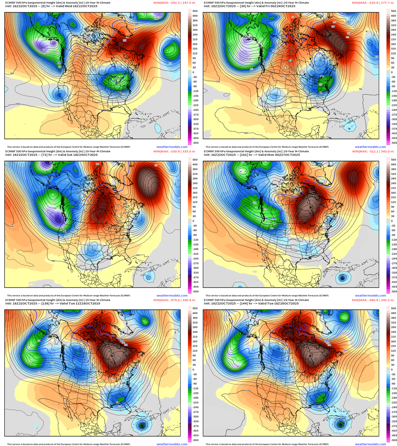
Track of Melissa is tugged a bit northward on this 18z cycle as the trough in the Southeast is more intense than the 12z (and previous) solution. This would mean LESS westward movement — and perhaps temper the expected Category 5 intensity a little bit.
ECMWF Cyclonic Vorticity Next 6-days | 18z
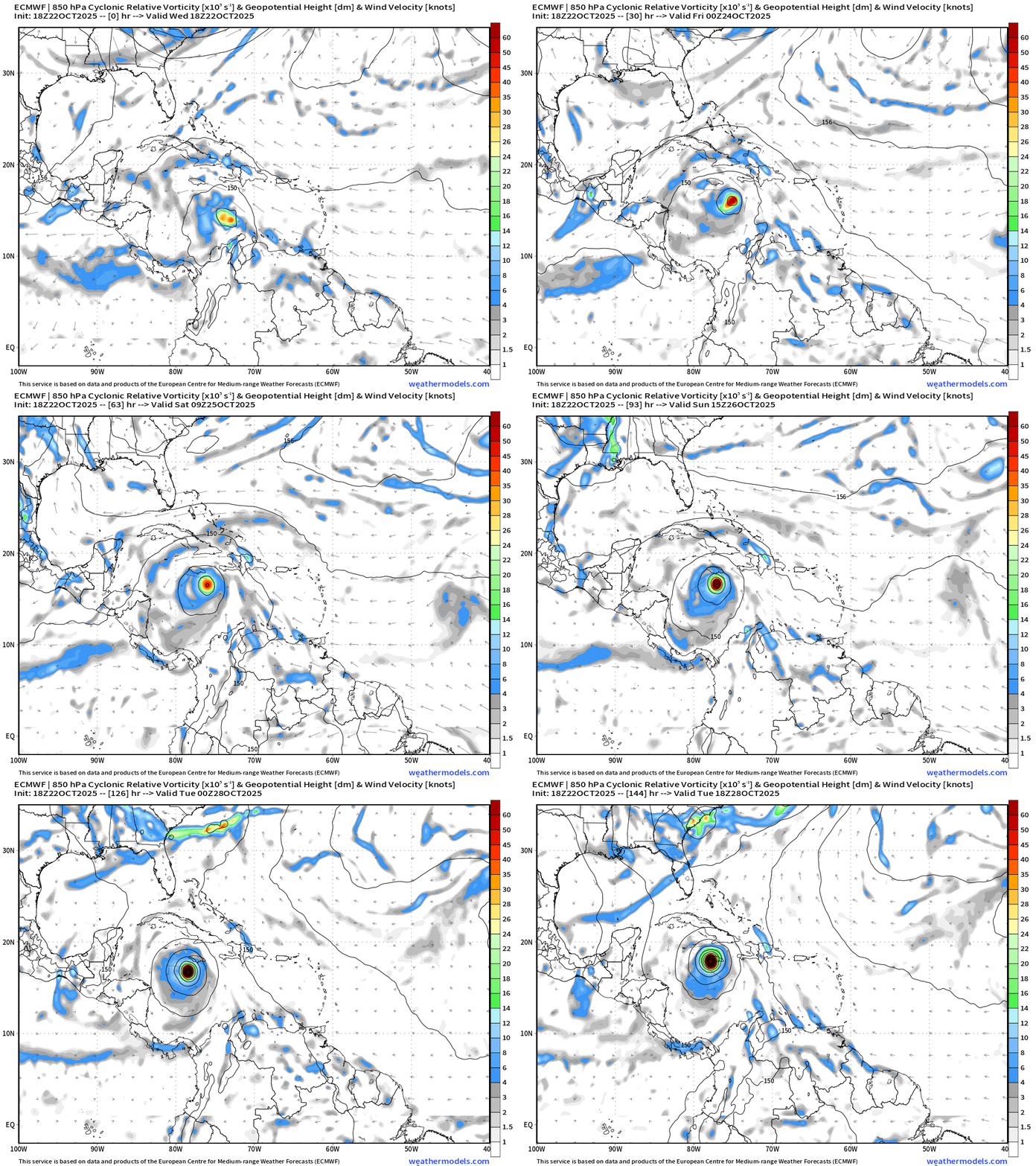
Current ECMWF 18z | Control Track | Not a Perturbed Member of Ensemble
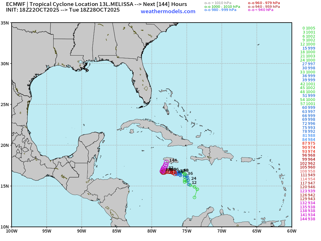
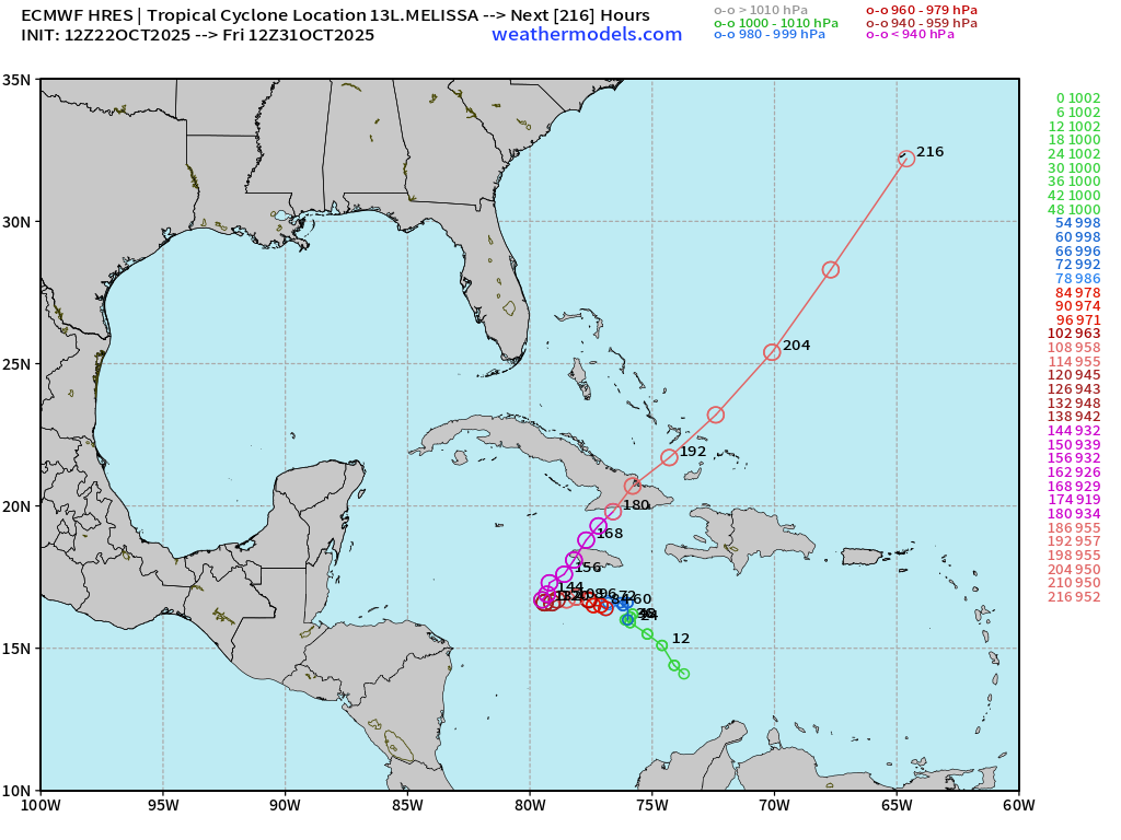
Compare to 12z ECMWF Track
Atlantic Integrated Vapor Transport | Next 10-Days | 12z ECMWF
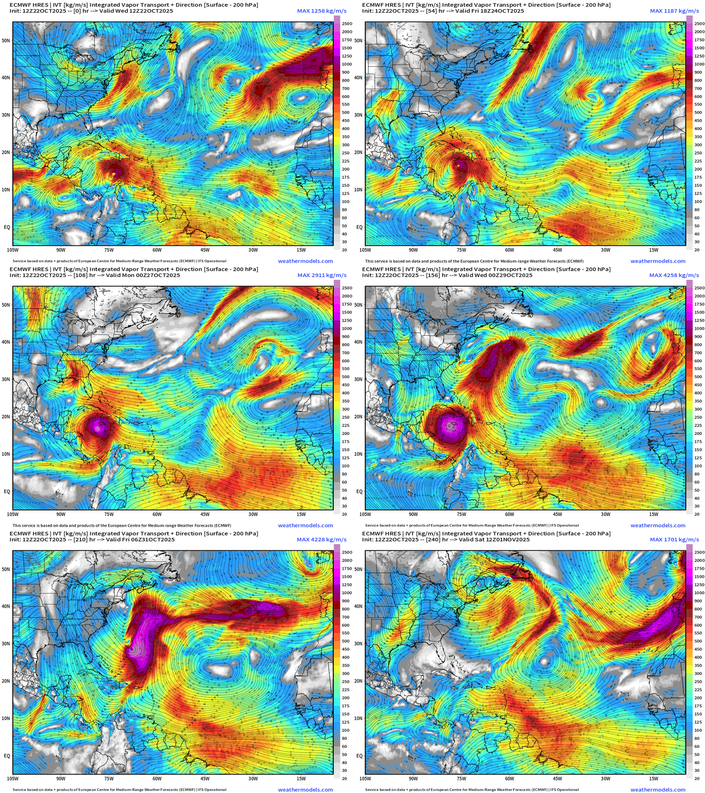
The flagship 12z solution extends here into Day 10 — and shows a monster Hurricane Melissa spinning over the very warm western Caribbean before sprinting across eastern Cuba into the Atlantic. Still not worrying much about the East Coast — that would be 10 days down the road — and would require an extremely rare alignment or weather pattern to repeat a Sandy-like trough capture — while Hurricane Melissa maintains its tropical core.
I would put direct East Coast impacts currently at less than 10%.
However, even if Melissa stays well offshore, there is other weather happening along the East Coast with a mixture of troughs and low-pressure systems from the middle latitudes that can be impactful with rain and wind.
Atlantic Basin Outlook | 8 PM ET Update
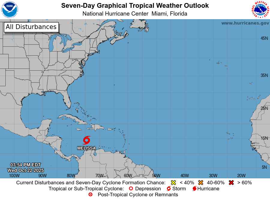
2025 Hurricane Season [Day 144]. My FORECAST for this year is 14 named storms, 7 hurricanes, and 3 major hurricanes (near average)
2025 Season to Date: 13 Named Storms, 4 Hurricanes, and 3 Majors | ACE = 102
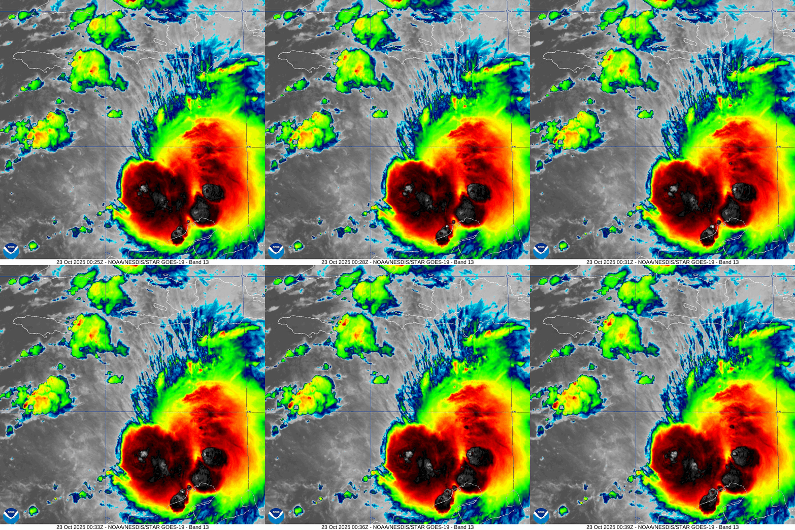
Melissa is asymmetric and heavily sheared but generating very deep convection with overshooting tops
Tropical Storm Melissa | NHC Cone
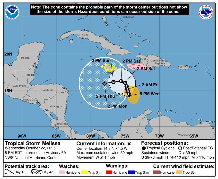
Major Hurricane in 4-days (Sunday) and Category 4 (115-knots) by Monday afternoon — very aggressive intensity forecast
ATCF Spaghetti | Melissa 13L
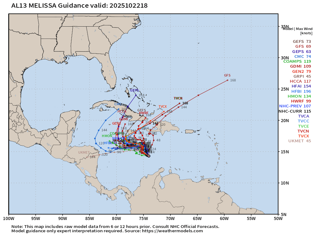
I don’t really want to discuss GFS — it has consistently been pushing Melissa quickly NE across Hispaniola — as a major outlier. NHC is discounting entirely.
Previous 6 HCCA Consensus Track Forecasts | Through 7 Days
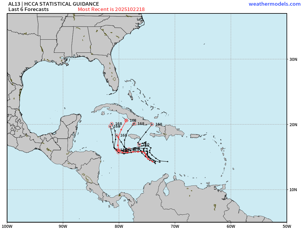
This is the putative “answer key” along with the ECMWF EPS and Google Deep Mind.
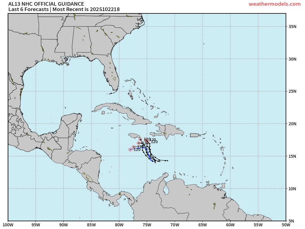
Previous 6 NHC Official Track Forecasts | Through 5 Days
Google Deep Mind Forecast Tracks | Melissa 13L
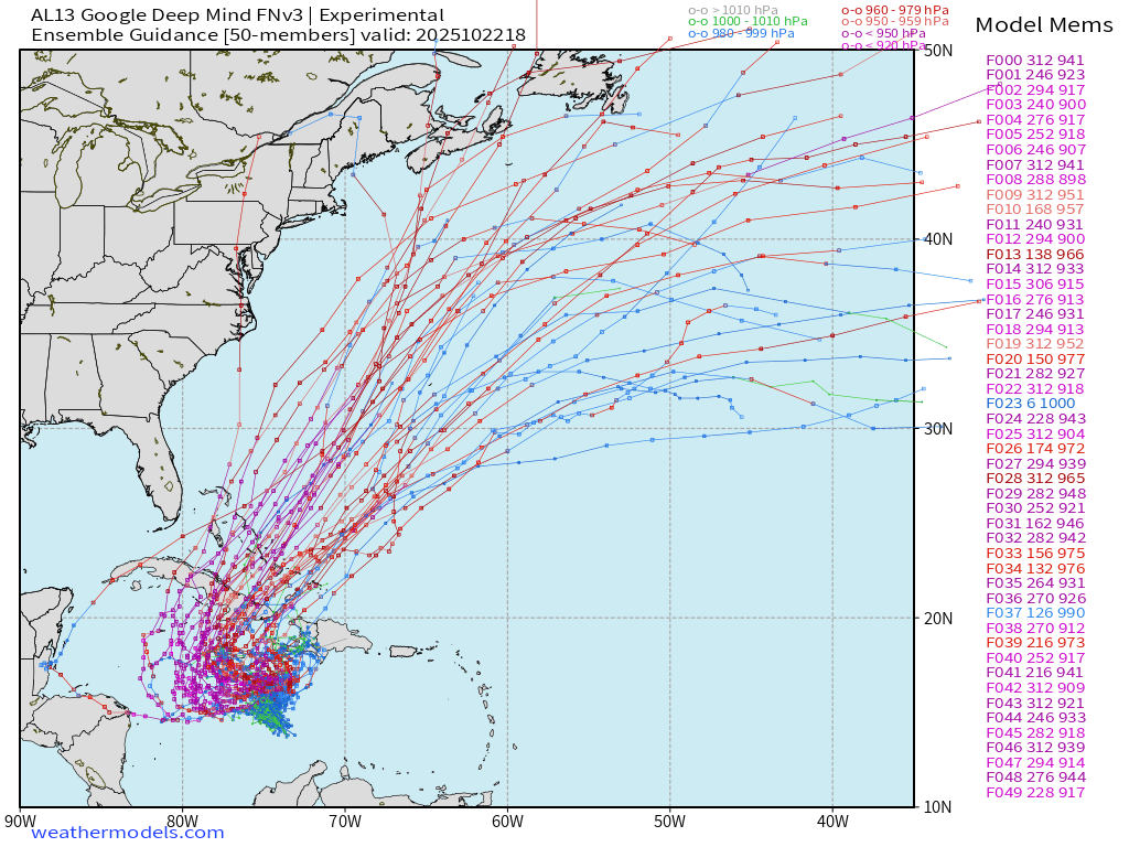
50-members from this A.I. trained system — almost all showing a major to Category 5 hurricane
ECMWF 12z EPS Internal Tracker | Melissa 13L
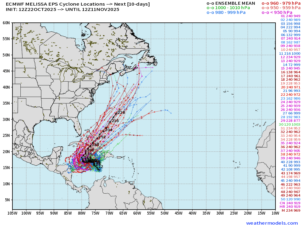
Similar story from the EPS 12z (internal tracking routine provided by ECMWF) — the red tracks = major or even Category 5 hurricanes that linger longer SW of Jamaica before accelerating out-to-sea. There is even a member (#29) at 877 mb minimum pressure.
Summary:
The maps/animations should be a great baseline for the forecast iteration process in the coming days into this weekend as the Wind Shear over Melissa weakens, the vortex aligns, and rapid intensification blasts off.
Category 5 seems likely … with highest risk of catastrophic impacts to Jamaica/Cuba/Haiti.
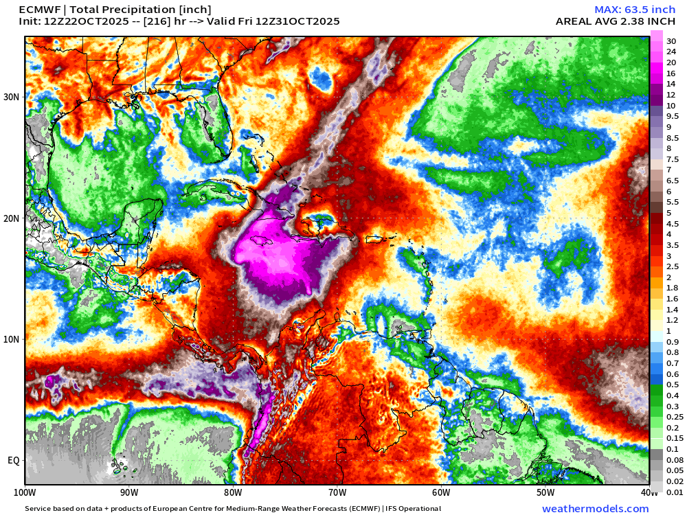
Risk of unfathomable rainfall totals … 63” maximum from ECMWF 12z centered upon Jamaica
Eastern Pacific Tropical Weather Outlook | 8 PM ET
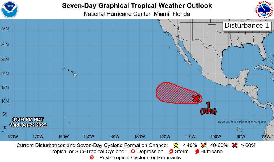
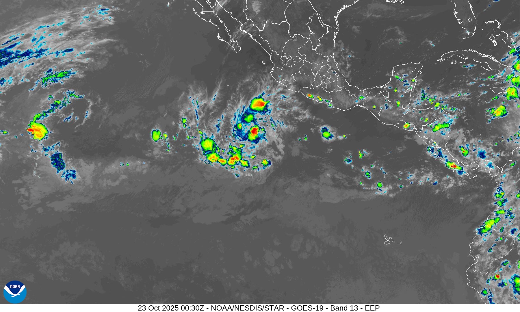
70% chance of formation of another tropical cyclone (next name is Sonia) in the next several days.
Maps sourced from weathermodels.com designed and innovated by yours truly! Please subscribe there for real-time access to the newest maps, charts from all of the weather models including ECMWF.
- Milepost
- 771 · laid 2025-10-23T01:10:07.316000Z
- Source
- https://weather.substack.com/p/october-22-2025-melissa-expected
- Digest
- dd3f86425169c3a74985196df26ac6249bc7ea67597dbc9b54db5c1e9d9a2ab9
- Machine
- JSON