October 14, 2025 Tuesday Afternoon Weather
Strong North Pacific jet amplifies Lower 48 weather pattern for next week
October 2025 was the 7th-warmest October in the 131-year national record (1895–2025), at 57.0°F against a 1991–2020 normal of 54.5°F (+2.4°F).
October 2025 was the 56th-wettest October in the 131-year national record (1895–2025), at 2.3in against a 1991–2020 normal of 2.5in (-0.2in).
NOAA/NCEI Climate at a Glance, contiguous United States. This is the observed record for the month, not a score of anything said in this piece — the forecast ledger begins 2026-08-17 and cannot reach earlier posts.
2025 Season to Date: 12 Named Storms, 4 Hurricanes, and 3 Majors | ACE = 100

Winter is approaching, and we’ll be transitioning to coverage of cold and snow.
North Pacific Wave Train next 8-days | 850 hPa Wind
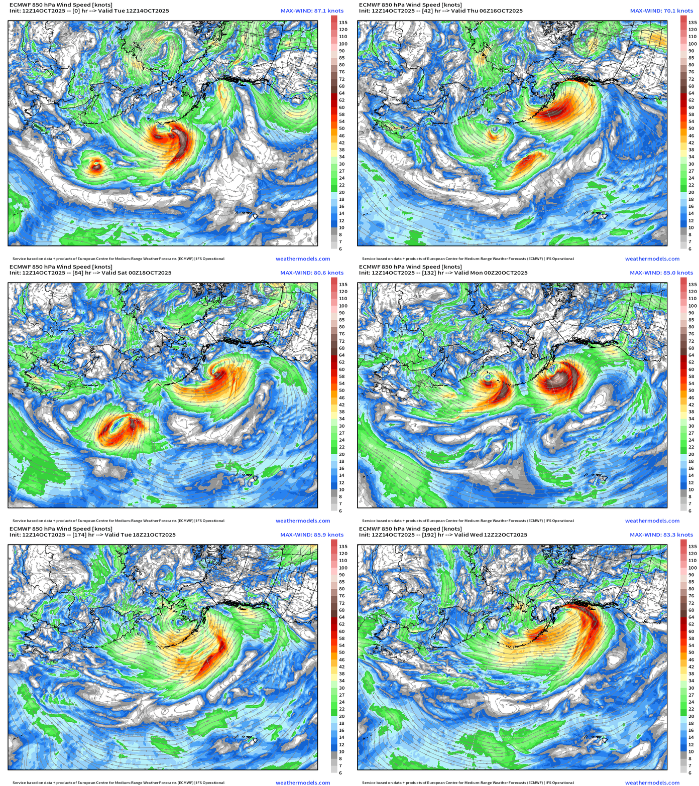
All aboard! Multiple sequential “hurricane force” extratropical cyclones “bombing” out in the Aleutians and then decaying over Alaska or the Gulf of Alaska. The typical extratropical cyclone forms as a shallow frontal wave NE of Japan and then phases with the upper-level jet stream often “rapidly intensifying” with central pressures from the 930s to 960s mb. The entire lifecycle is 3-5 days, but may last longer if the mature or occluded stage becomes stationary or cuts off from the main storm track.
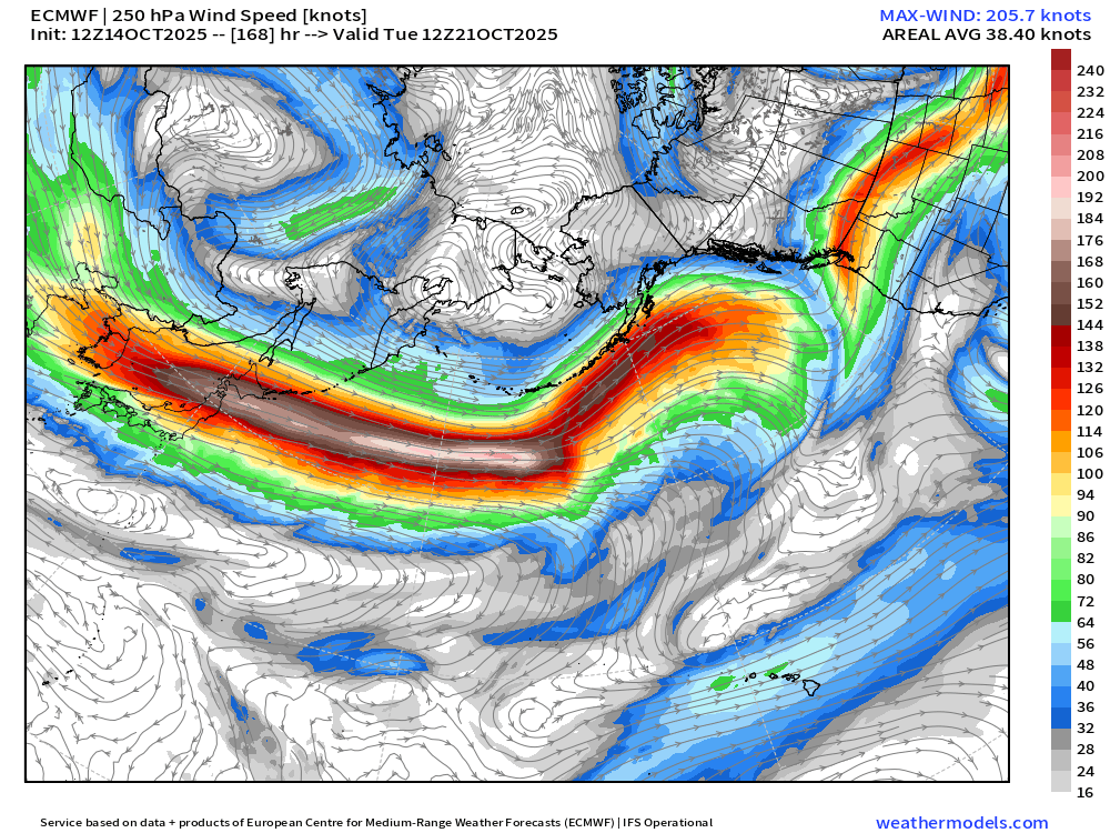
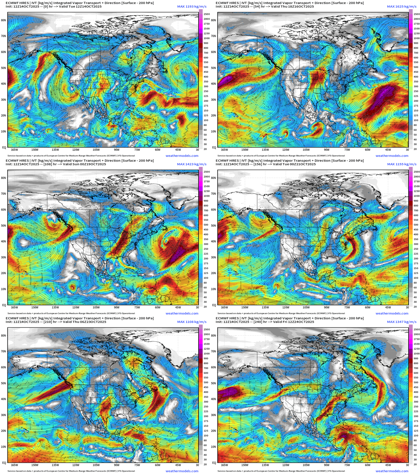
The result of these storms = atmospheric rivers into Alaska, Northwest Canada, and down the U.S. West coast into California = bountiful snowfall at high elevations and boatloads of rainfall near sea level. We’ll that in the “Integrated Vapor Transport” maps. The North Pacific jet screams along zonally even over 200 knots to the Dateline into next week.
North Pacific Jet Stream +7 Days > 205 knots
Water Vapor Loop (middle level)
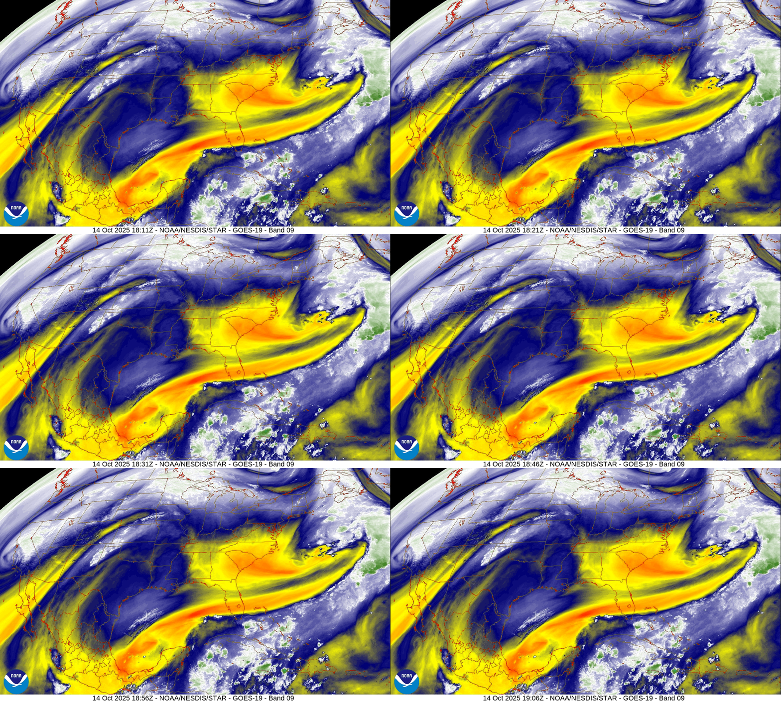
The sharp trough that cut along the Eastern U.S. this weekend has retrograded into the far southern Gulf of Mexico.. A reinforcing shot of mid-level very dry air has arrived in the Southeast wiping out cloud cover.
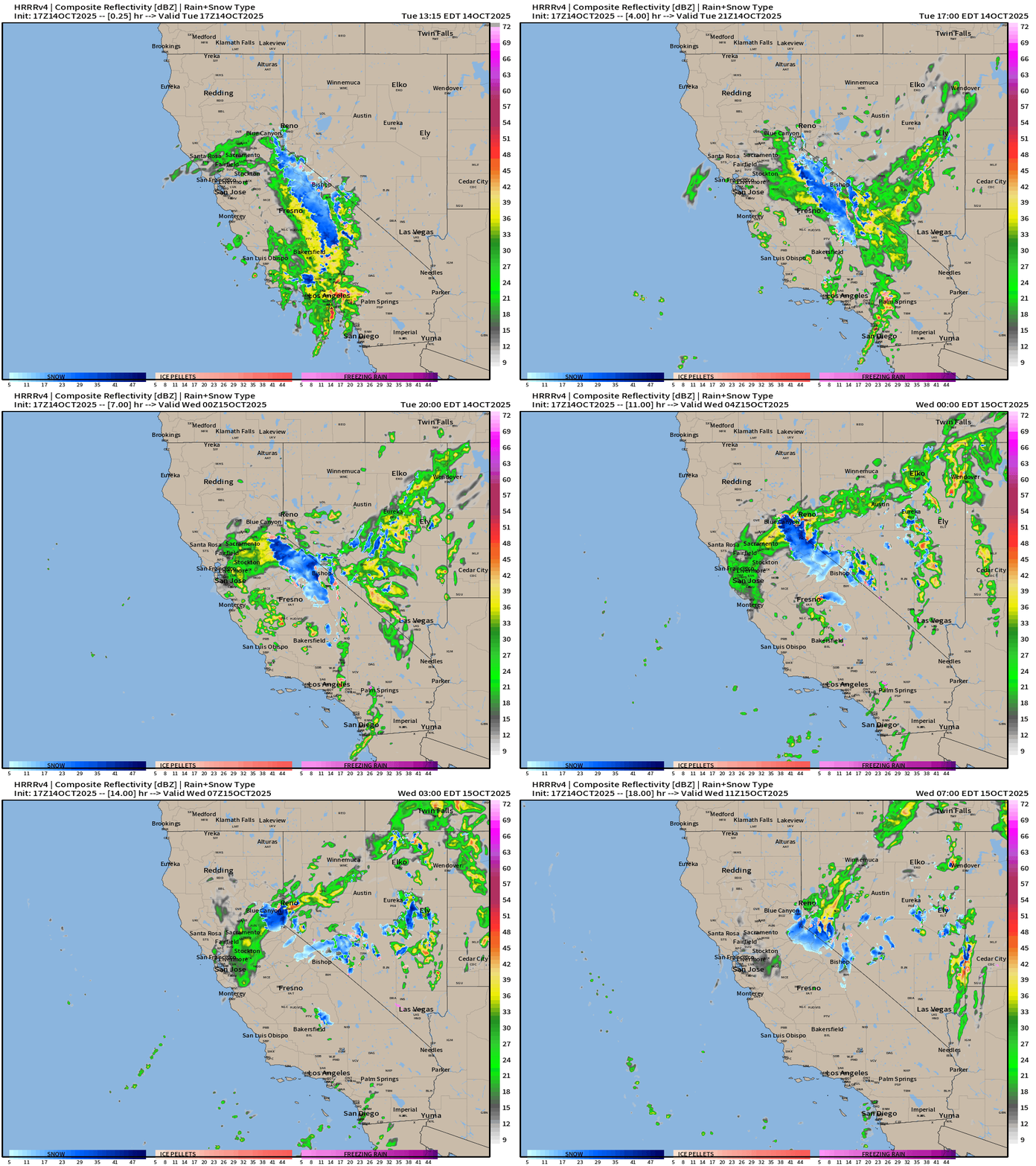
A small but potent storm is currently spinning over California. Brilliant sunshine and warm temperatures in the 80s from Texas to Florida.
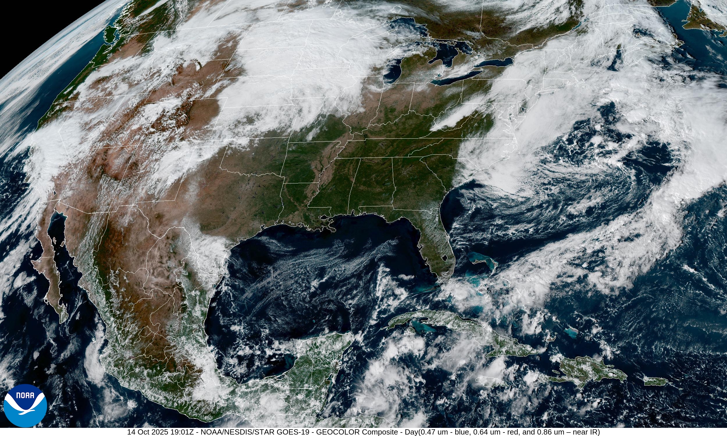
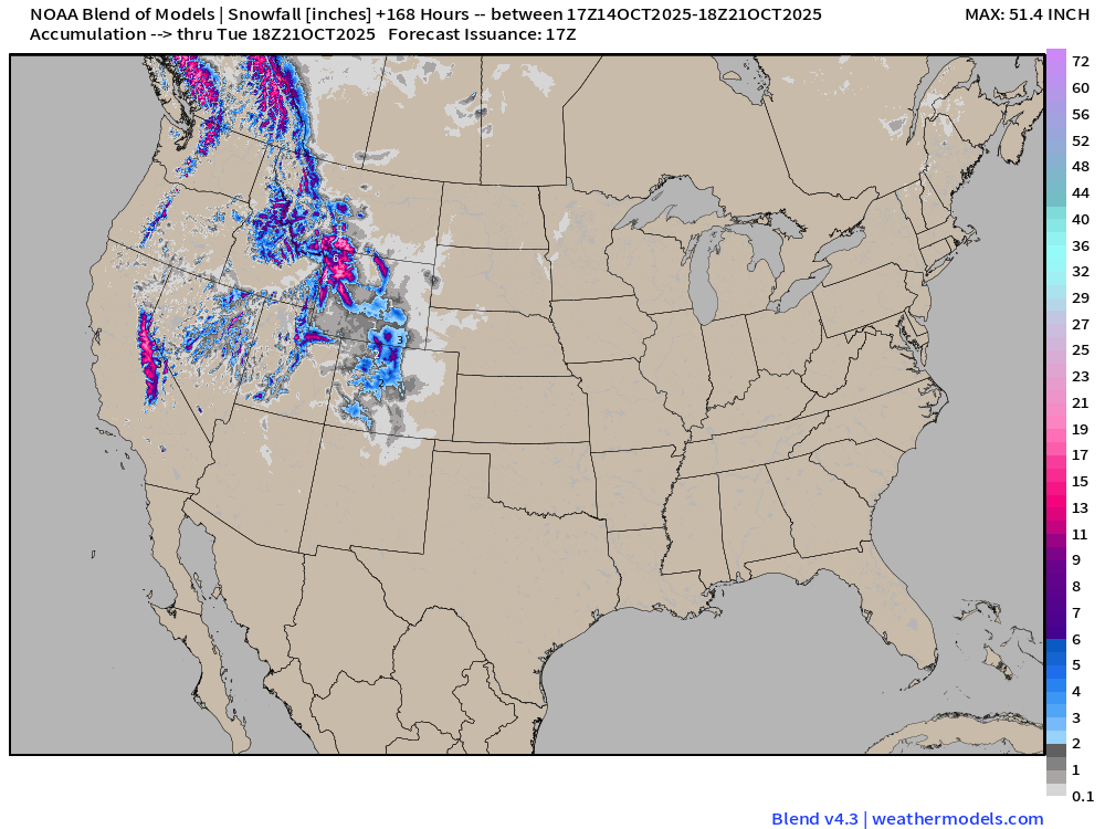
California Storm: coastal rainfall and heavy mountain snow
North America Precipitable Water next 8-Days
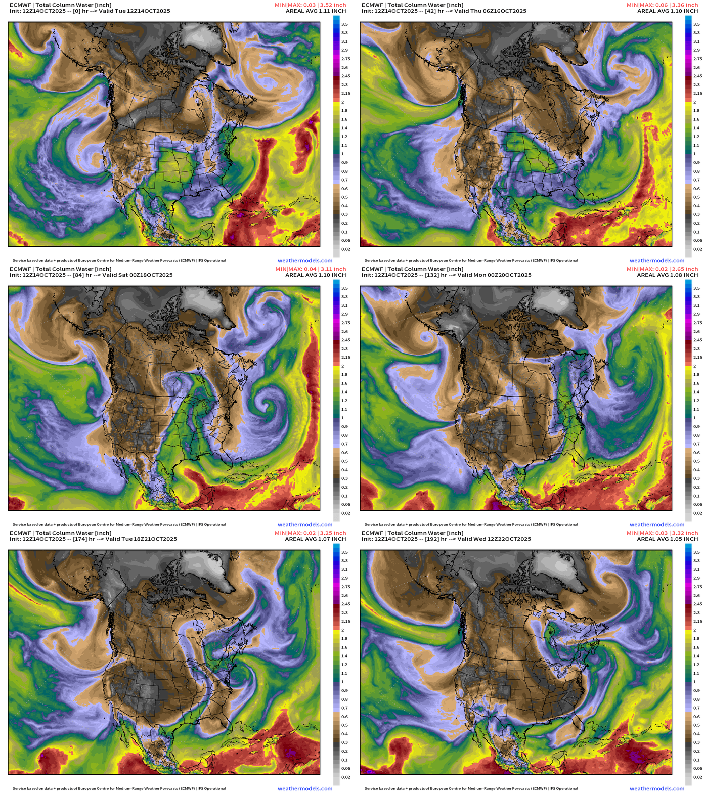
Overview of the continent: Next 8-days
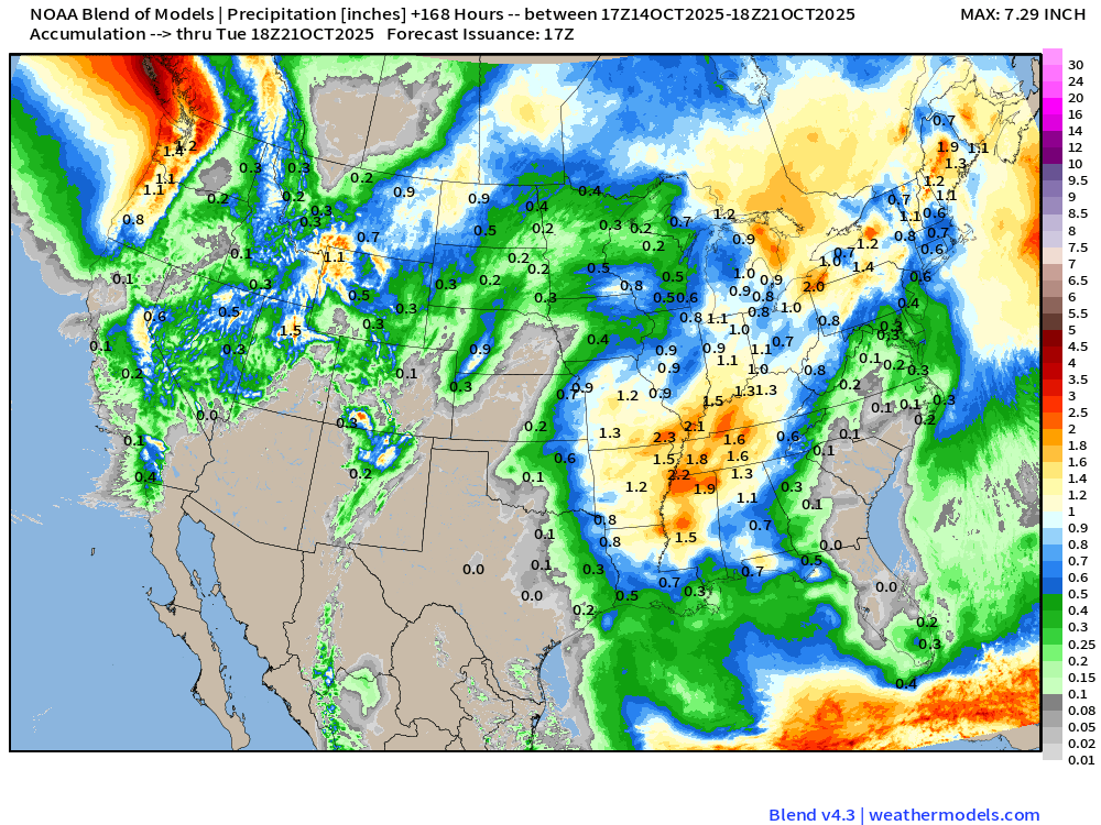
A series of weak/moderate atmospheric rivers descend the west coast from WA/OR into California for a great start to the 2025-26 Water Year as a strong jet stream from North Pacific “wave train” sends repeated “hurricane force” cyclones into the Aleutian Low region.
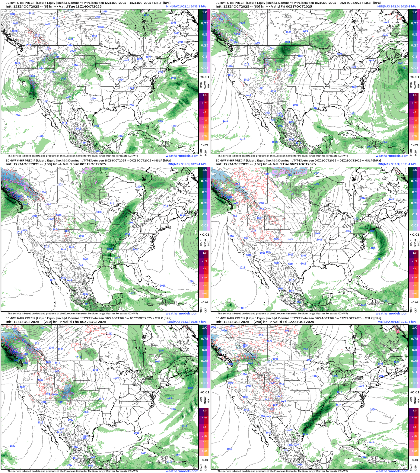
Weekend storm system for the central U.S. moves into Canada by Saturday and deepens to around 980 mb central pressure. Another storm then develops in the Great Lakes into Sunday — not quite cold enough for snowfall.
Could be severe weather along the tail end of the cold fronts with these central U.S. weather systems.
Cool, dry Canadian air blasts through the Lower 48 behind these powerful storms this weekend and next week
Atlantic tropics: Tropical Storm Lorenzo is a mess — sheared and poorly organized.
Look Ahead: Precipitation Type + MSLP | Next 10-days
Current Temperature | RTMA 2:45 PM ET
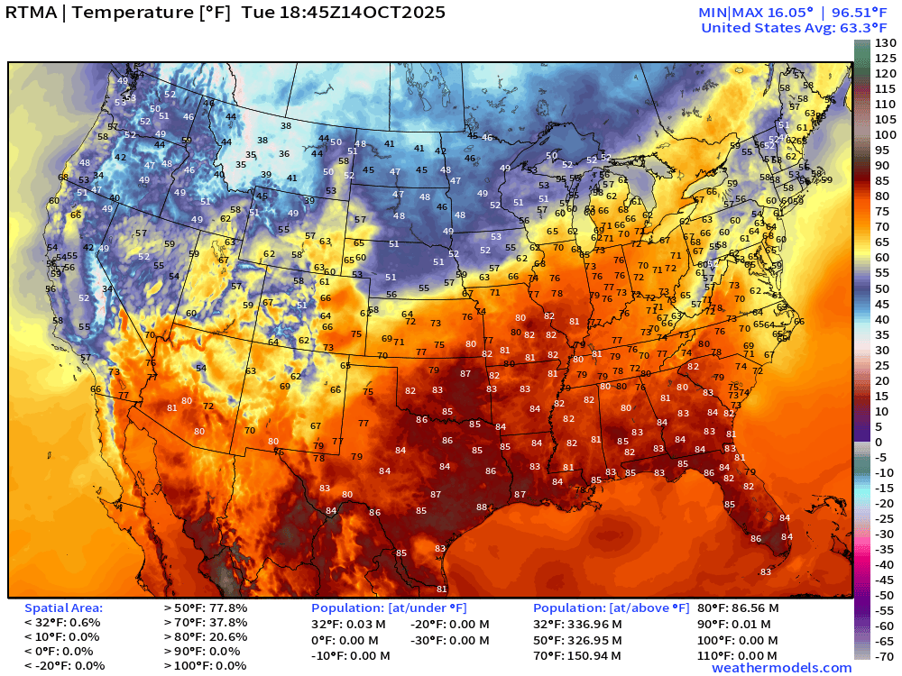
Only 0.01 Million at/above 90°F but at least 87 million in the 80s.
Current Temperature Anomaly | RTMA 2:45 PM ET
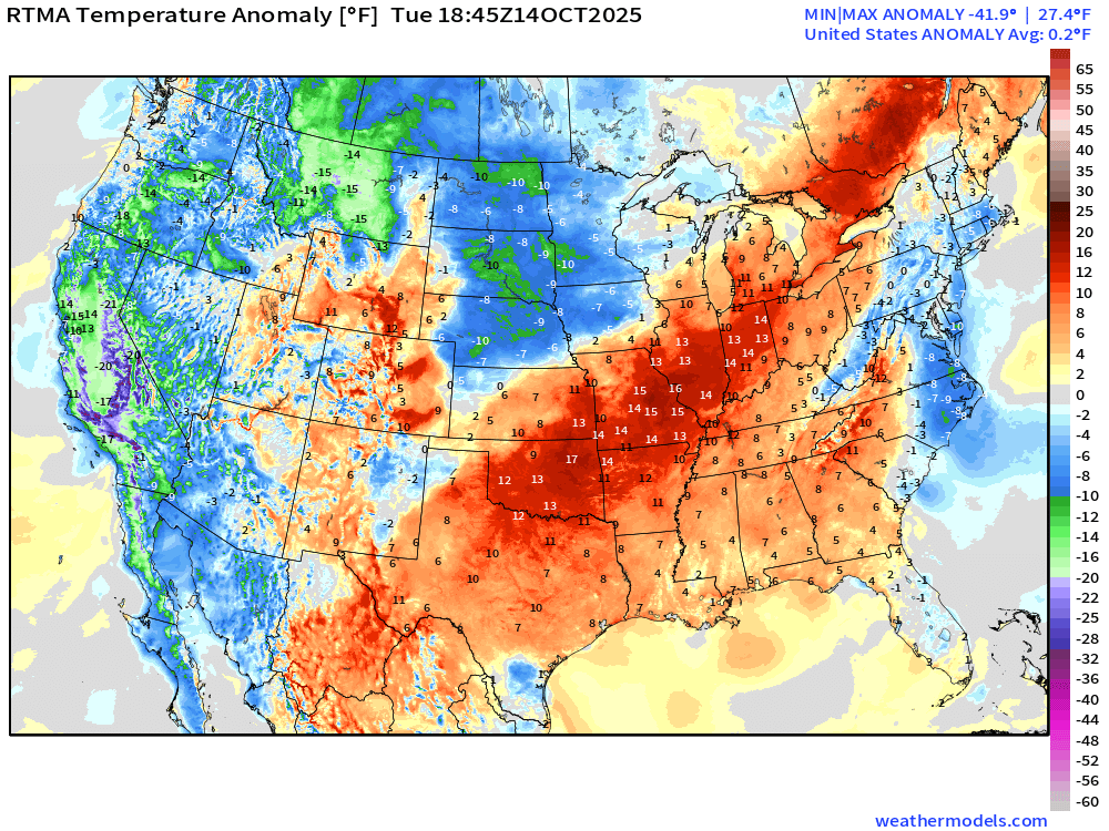
Lower 48 is a +0.2°F above normal with California quite chilly
Low Temperatures Wednesday Morning
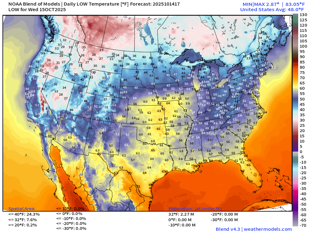
Lower 48 average low temperature of 48.0°F
High Temperatures on Wednesday
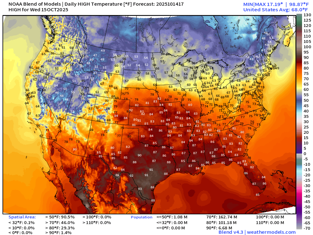
Lower 48 average temperature of 68°F … with 90s in Texas buy only 7 Million population.
Weekly Temperature Anomaly | Days 1-7 | ECMWF 12z EPS
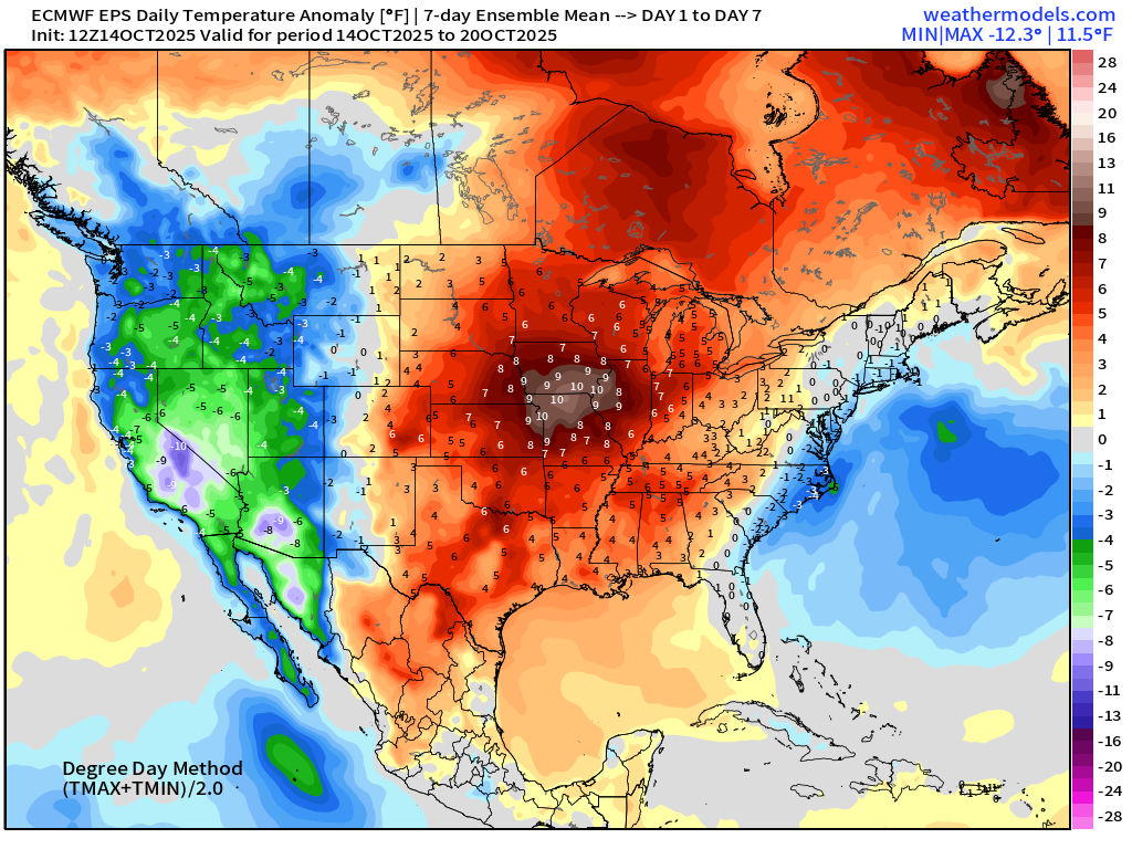
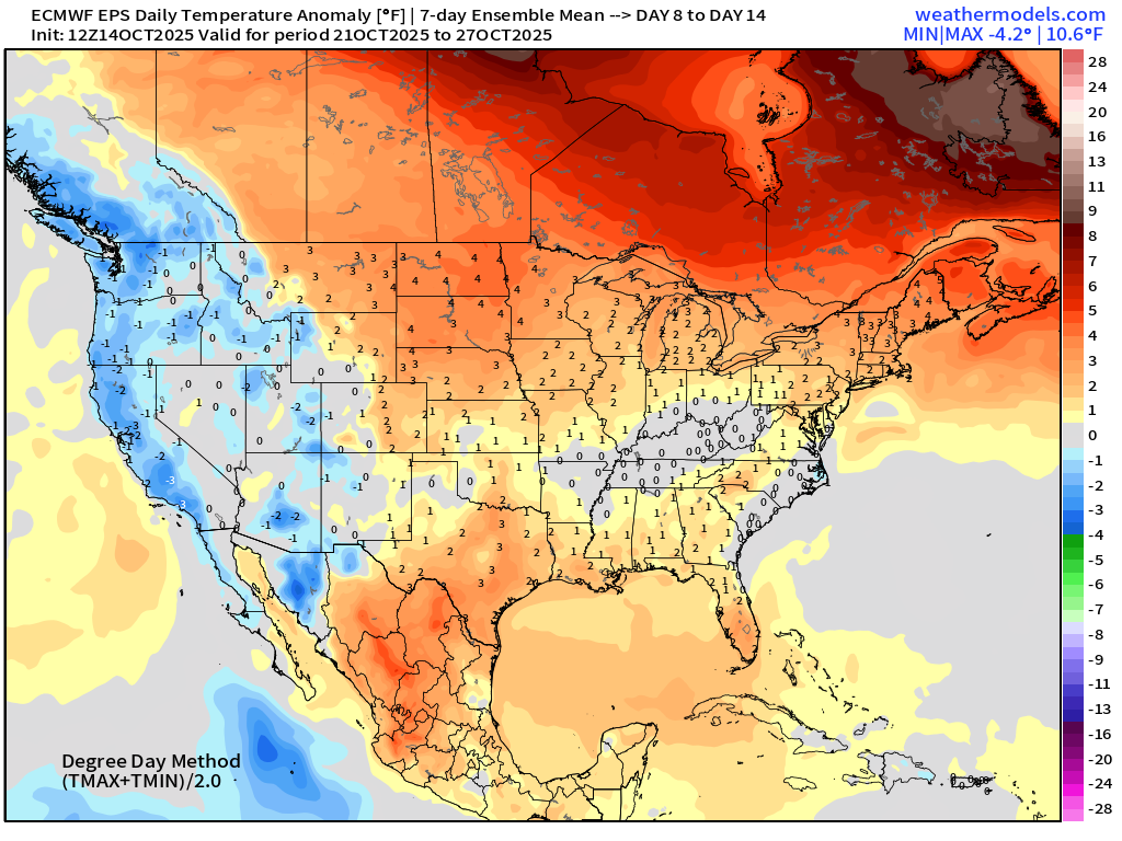
Weekly Temperature Anomaly | Days 8-14 | ECMWF 12z EPS
ECMWF Next 10-Days Integrated Vapor Transport | 12z cycle
Blend of Models 7-Day Precipitation through early next Tuesday
Snowfall Next 7-days | Blend of Models
Medium Range | AIFS 12z | 10-days Height Anomaly
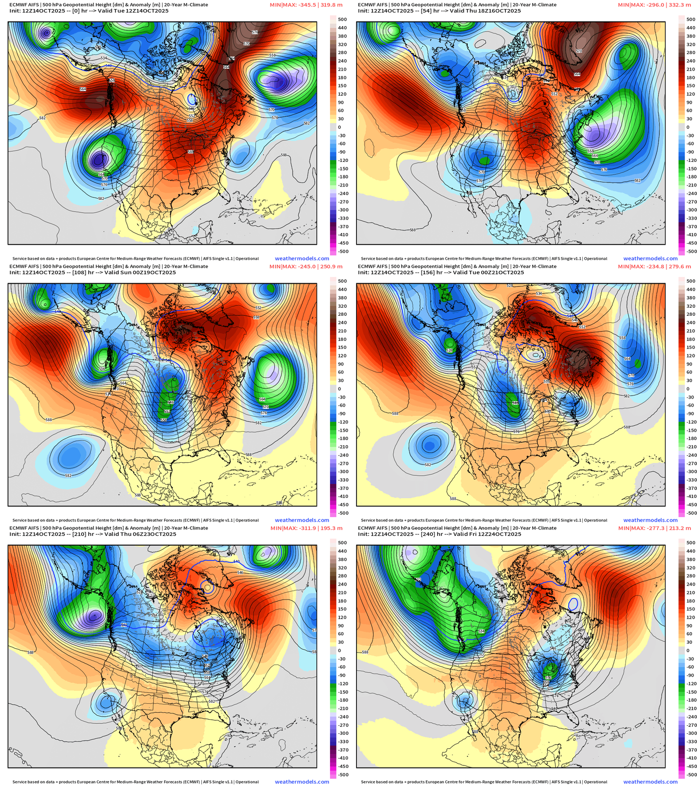
The idea of central U.S. ridging is history into this weekend as a parade of troughs rolls through the Lower 48 with assist from the North Pacific wave train
Atlantic Basin Outlook | 2 PM ET Update
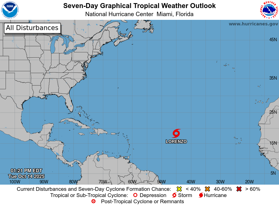
Tropical Storm Lorenzo (12L)
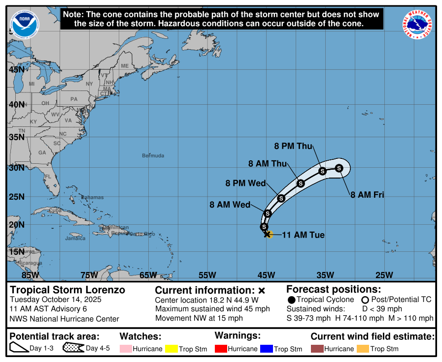
45 mph winds — poorly organized — and not expected to intensify further until dissipation. Lorenzo did help the Atlantic ACE hit 100 for the 2025 season.
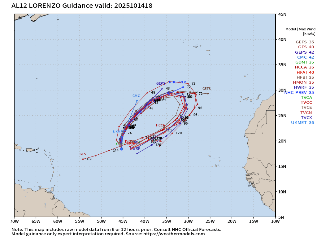
ATCF Spaghetti shows a clockwise loop through 7-days
Central Atlantic IR + Water Vapor Satellite Images
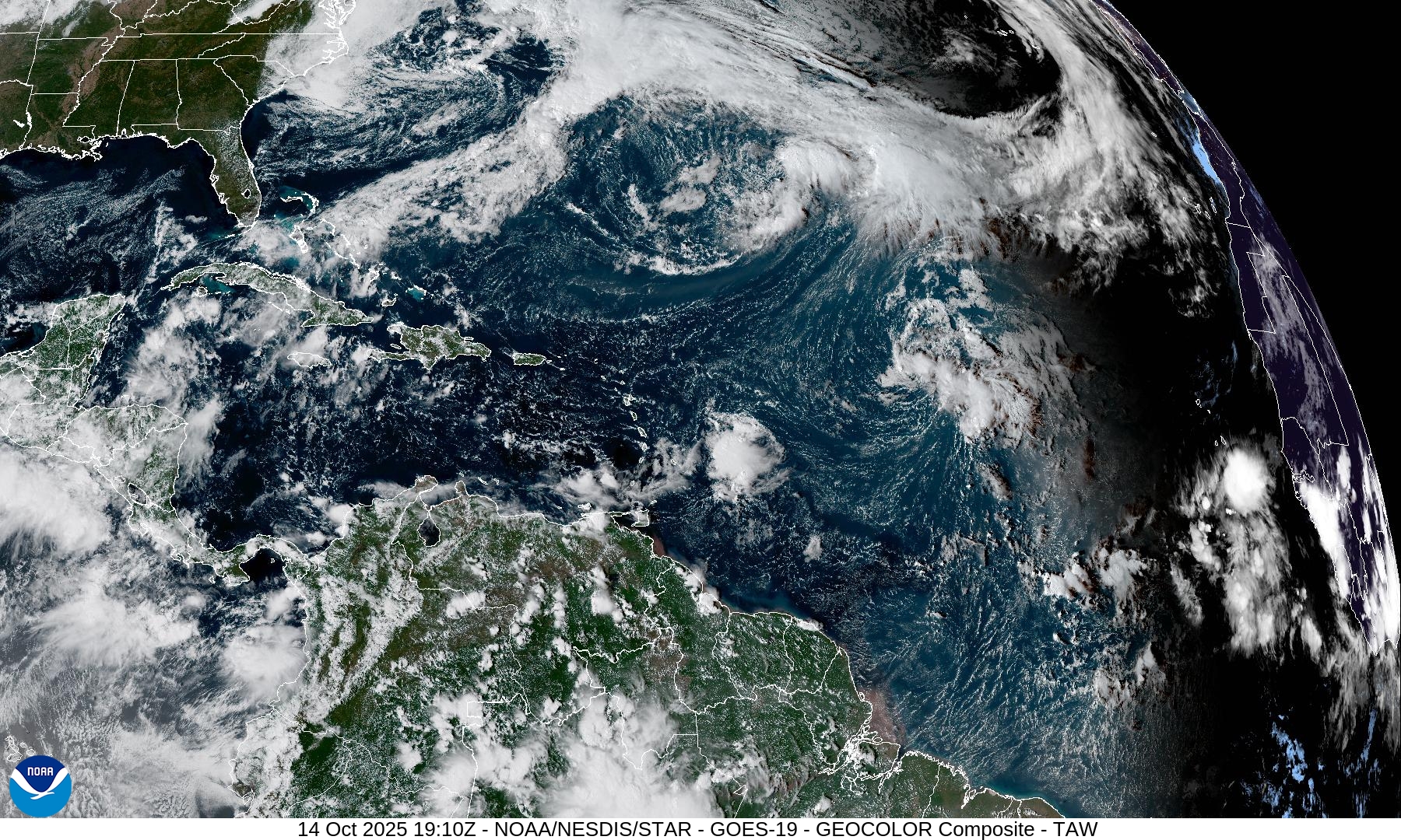
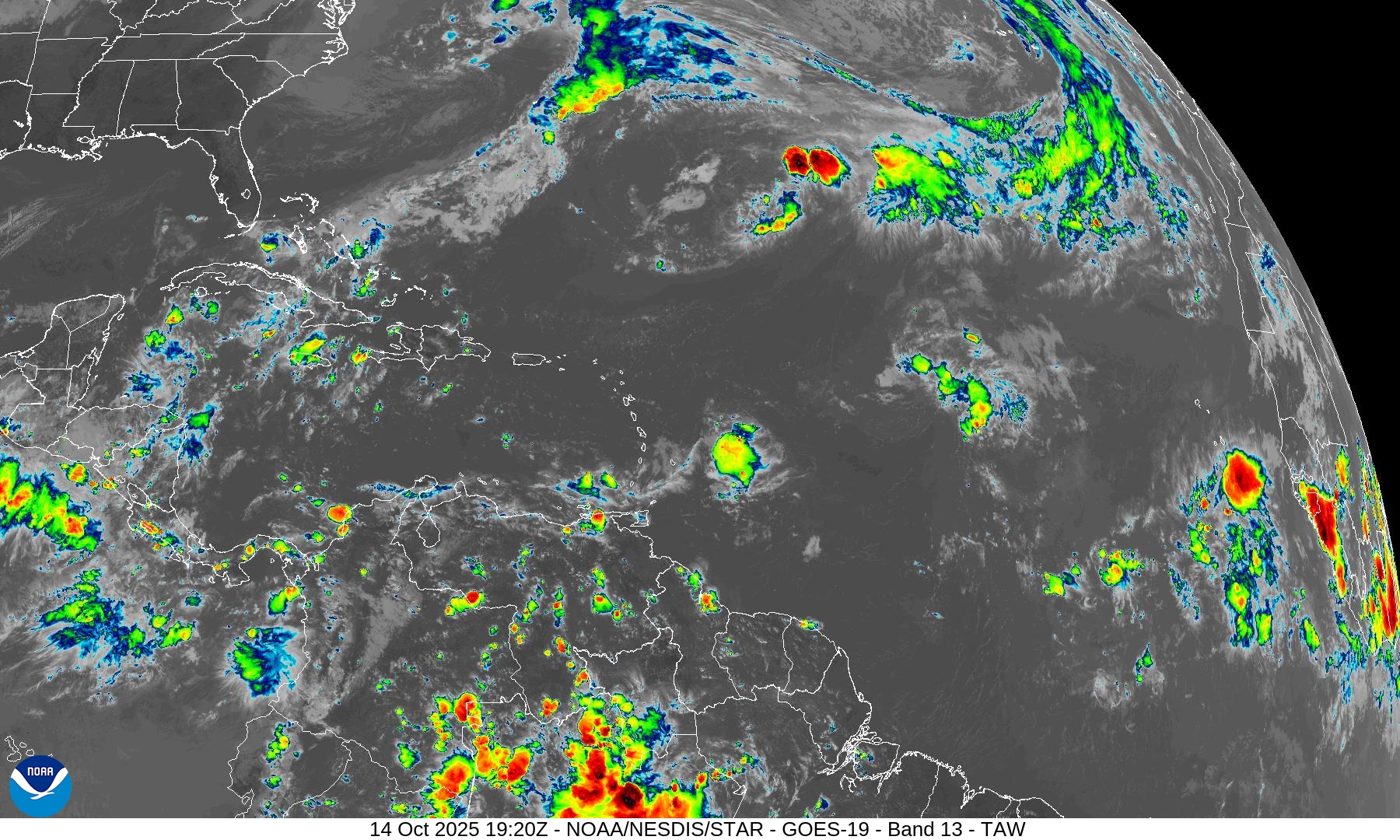
Scattered convection with tropical waves — with Lorenzo difficult to pick out of the basin.
Integrated Vapor Transport | Next 10-days
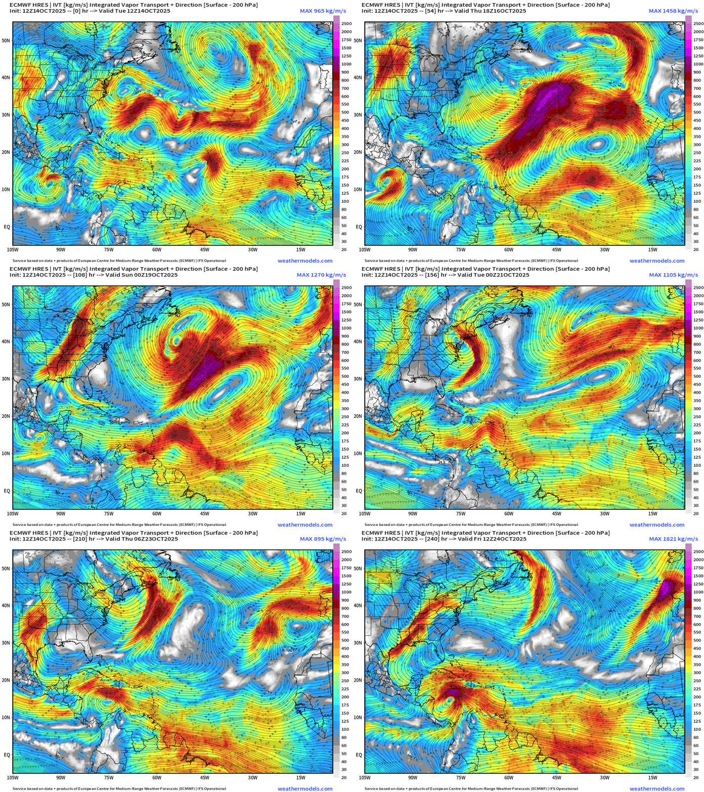
A tropical wave currently off the coast of Africa in the far eastern Atlantic will travel westward and could find more favorable environment conditions for development in the Caribbean in 8-10 days.
NOAA Tropical Surface Analysis | 12z
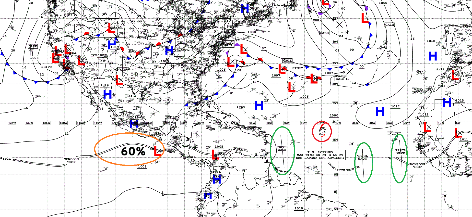
Atlantic Tropical Waves = 3 + TS Lorenzo mixed in
ECMWF EPS 12z | All Storm Tracks Day 7
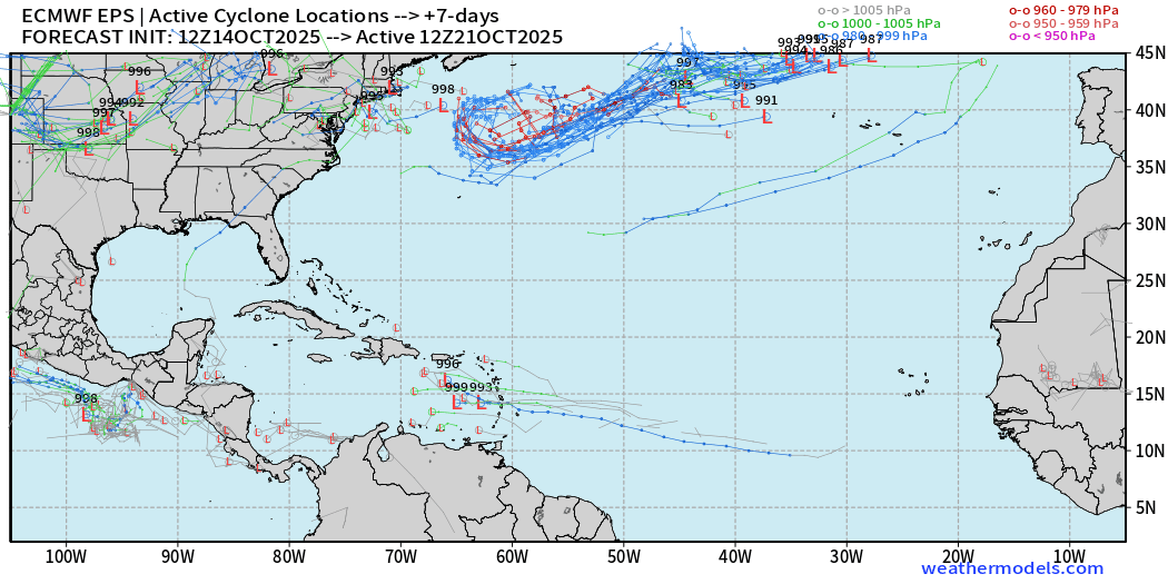
A few members develop the tropical wave into the Caribbean by Day 7 — less than 5%
ECMWF EPS 12z | Active Storm Tracks Day 12
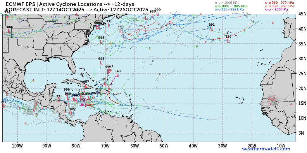
Quite a few more show development into Day 12 … over the very warm waters of the Caribbean. About 50%
ECMWF EPS 12z | Active Storm Tracks Day 15
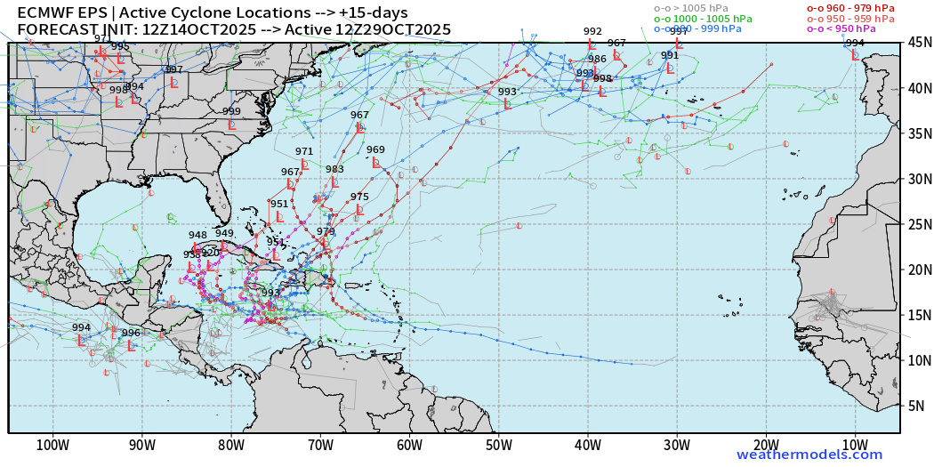
Majority of ensemble members develop the tropical wave — eventually and create a powerful hurricane into late October.
The Caribbean is a favored region, of course, so we will keep a very close eye for the next several days to see how this trends.
AIFS ENS at Day 12 Comparison | Active Storm Tracks
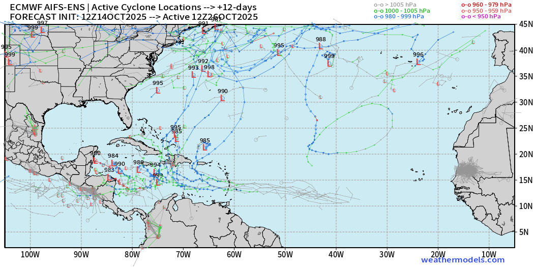
Weaker signal for a tropical storm or hurricane in the Caribbean than the conventional full-physics ensemble suite.
GFS 12z Massive Category 5 Hurricane
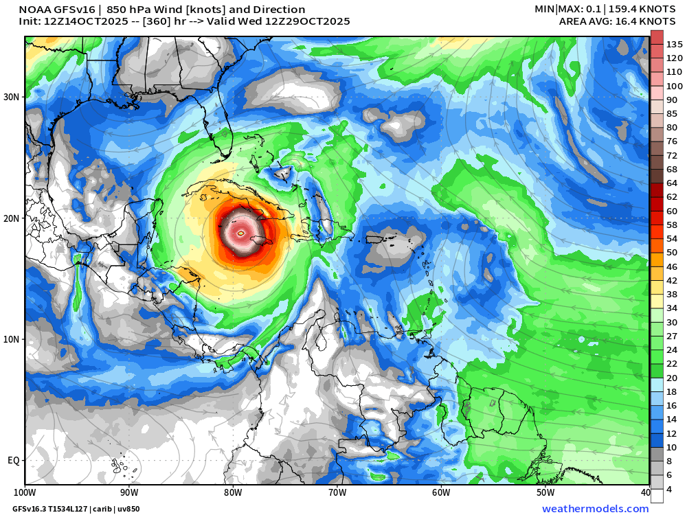
No surprise that GFS would blow up this tropical wave into a Cat 5 — way down the line at Day 15 — over the forecast predictability horizon. You’ll probably see this bad boy on social media — until it disappears.
NOAA GEFS 12z (31-members) | Through 10-days
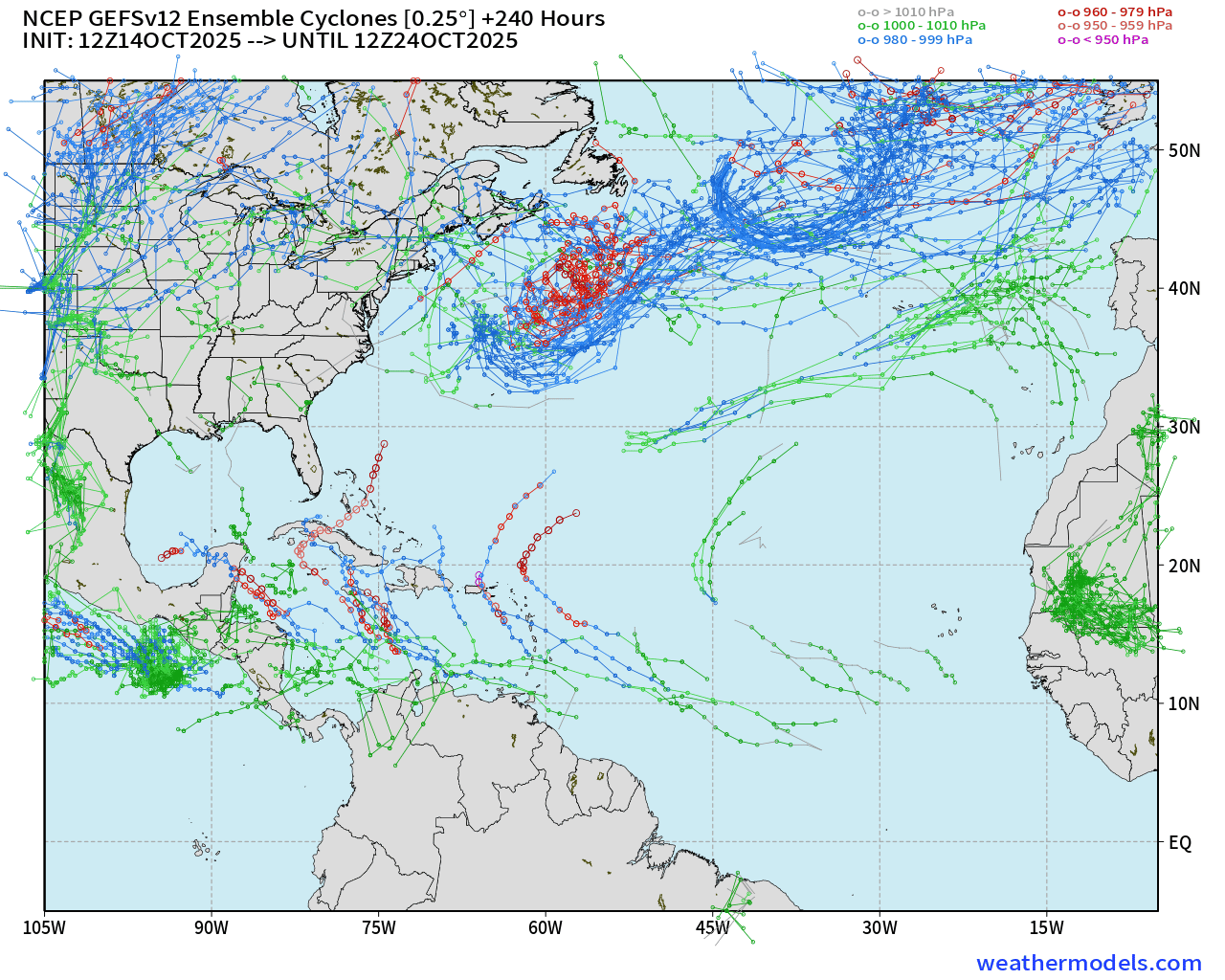
Active Caribbean from 12z GEFS
Eastern Pacific Tropical Weather Outlook | 2 PM ET
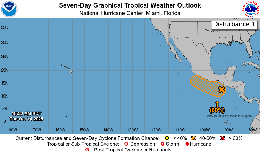
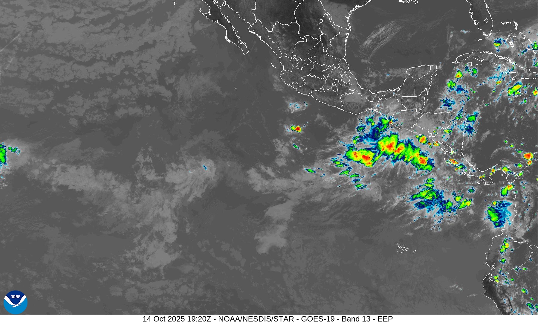
Again watching the immediate coast of Mexico for a new (weak) tropical storm later in the week. However, there is a complete void of convection across the Eastern Pacific monsoon trough / ITCZ this evening.
Next name in the basin = Sonia
Western Pacific Typhoon Season
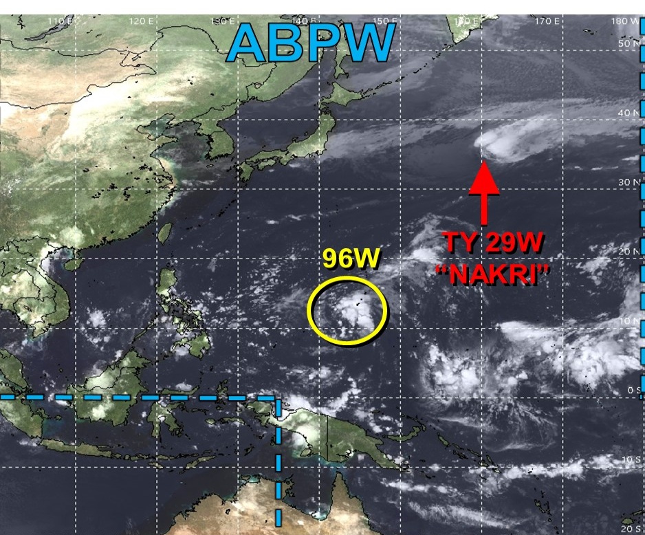
Post-tropical Typhoon Nakri (29W) will head into the North Pacific and join a very active wave train with multiple hurricane force extratropical cyclones lining up in a parade in the coming 1-2 weeks.
Maps sourced from weathermodels.com designed and innovated by yours truly! Please subscribe there for real-time access to the newest maps, charts from all of the weather models including ECMWF.
- Milepost
- 764 · laid 2025-10-14T19:56:04.179000Z
- Source
- https://weather.substack.com/p/october-14-2025-tuesday-afternoon
- Digest
- 842c57f8a57124c0d599d46565ed5c2cf68f8f72ddc02a793b58e531e38b93ac
- Machine
- JSON