October 13, 2025 Monday Weather After Dark
North Pacific wave train amplifies our weather in the Lower 48 this weekend
October 2025 was the 7th-warmest October in the 131-year national record (1895–2025), at 57.0°F against a 1991–2020 normal of 54.5°F (+2.4°F).
October 2025 was the 56th-wettest October in the 131-year national record (1895–2025), at 2.3in against a 1991–2020 normal of 2.5in (-0.2in).
NOAA/NCEI Climate at a Glance, contiguous United States. This is the observed record for the month, not a score of anything said in this piece — the forecast ledger begins 2026-08-17 and cannot reach earlier posts.

2025 Season to Date: 12 Named Storms, 4 Hurricanes, and 3 Majors | ACE = 99
A midnight update to keep the forecast fresh and the weather model maps updating!
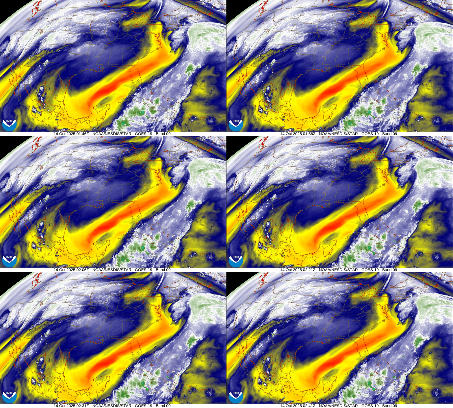
Water Vapor Loop
Massive digging trough into the Gulf of Mexico attached to the 2 “non-tropical” systems spinning off East Coast — very impressive but a pattern we would expect to see into mid-October.
North America Precipitable Water next 6-Days
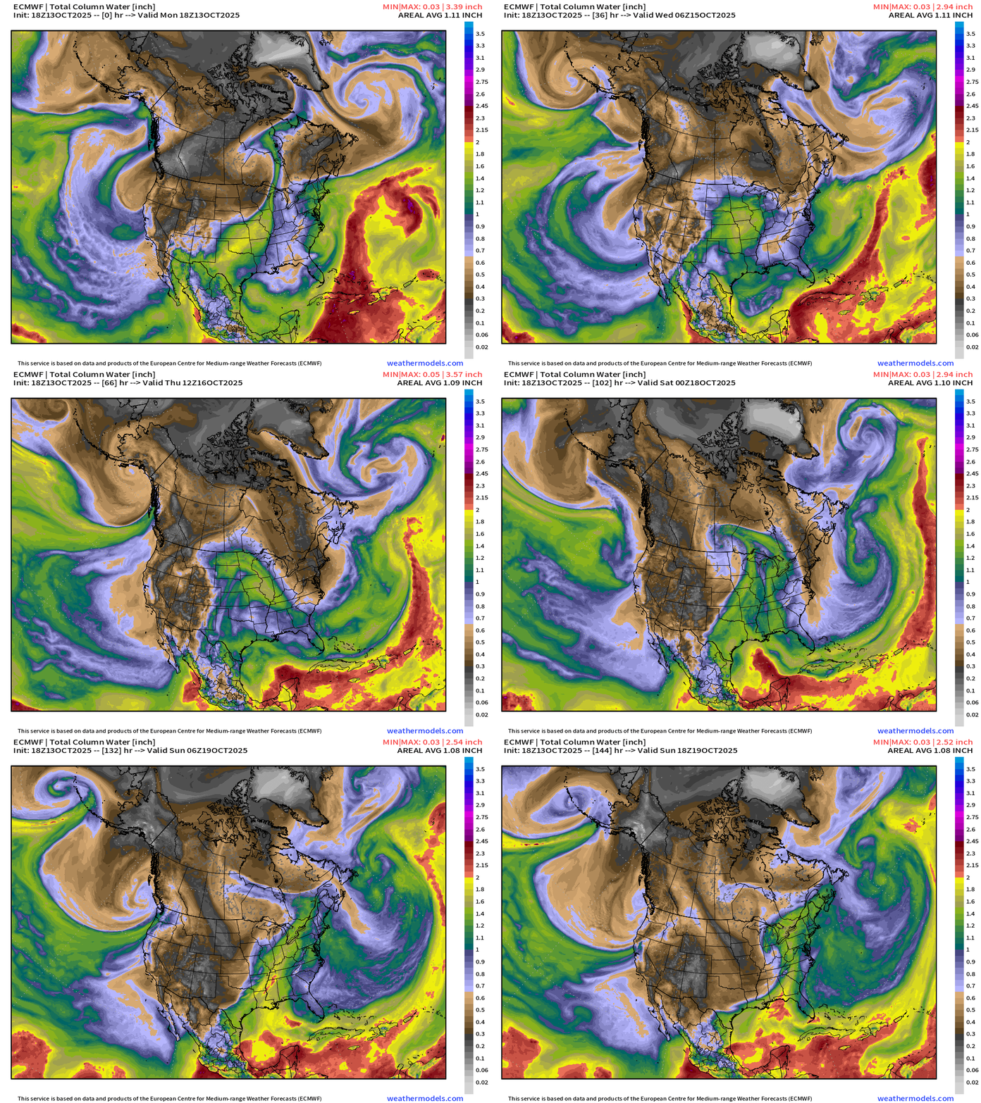
Overview of the continent: Next 6-days
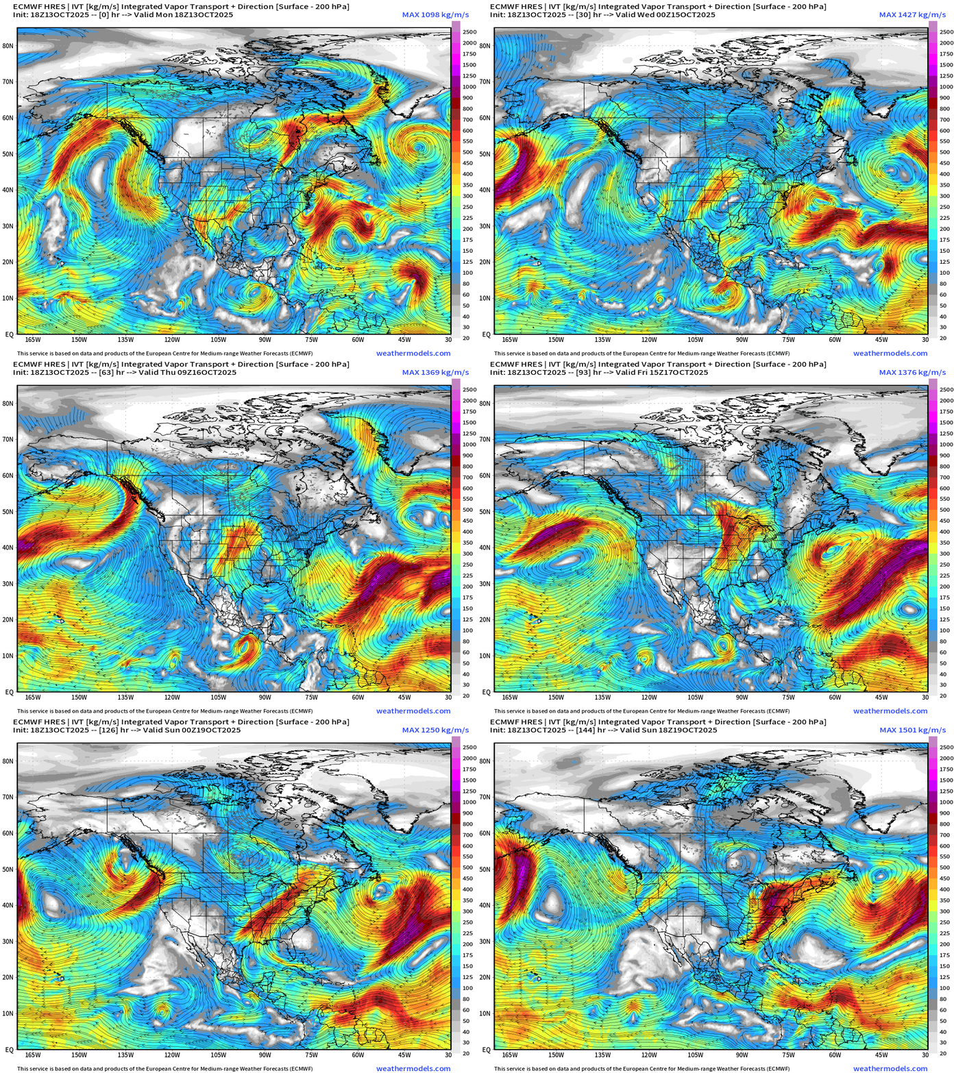
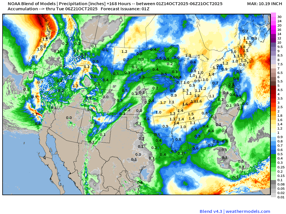
Atmospheric rivers descend the west coast from WA/OR into California for a great start to the 2025-26 Water Year as a strong jet stream from North Pacific “wave train” sends repeated “hurricane force” cyclones into the Aleutian Low region.
Weekend storm system for the central U.S. moves into Canada by Saturday and deepens to around 980 mb central pressure. Another storm then develops in the Great Lakes into Sunday — not quite cold enough for snowfall.
Atlantic tropics: Tropical Storm Lorenzo is a mess — sheared and poorly organized. I’m doing a poor job of predicting these low-% chance development systems.
Precipitation Type _ MSLP | Next 6-days
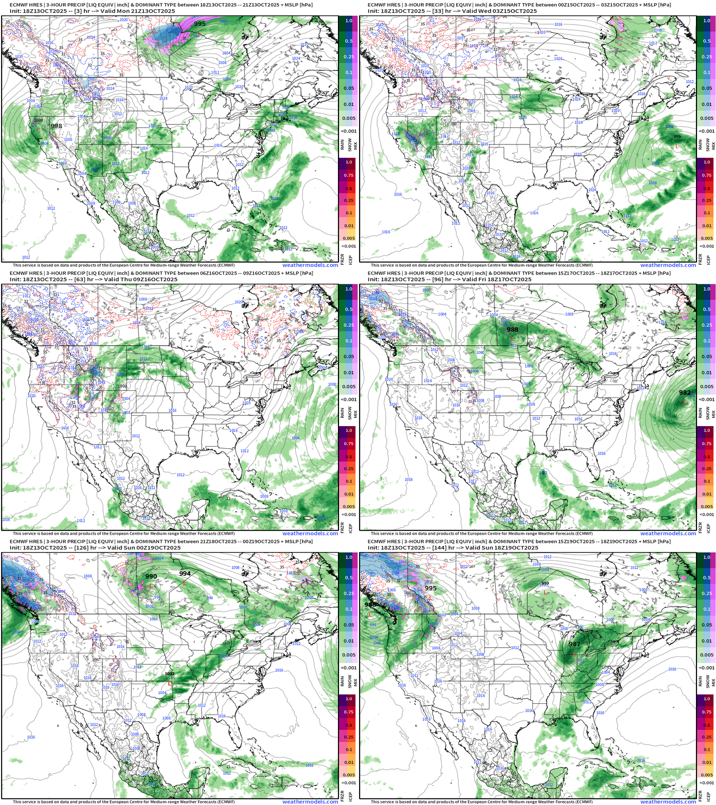
Plenty of west coast moisture into California and then the Pacific Northwest … as we watch the development of 2 storms in the central U.S. and then Great Lakes.
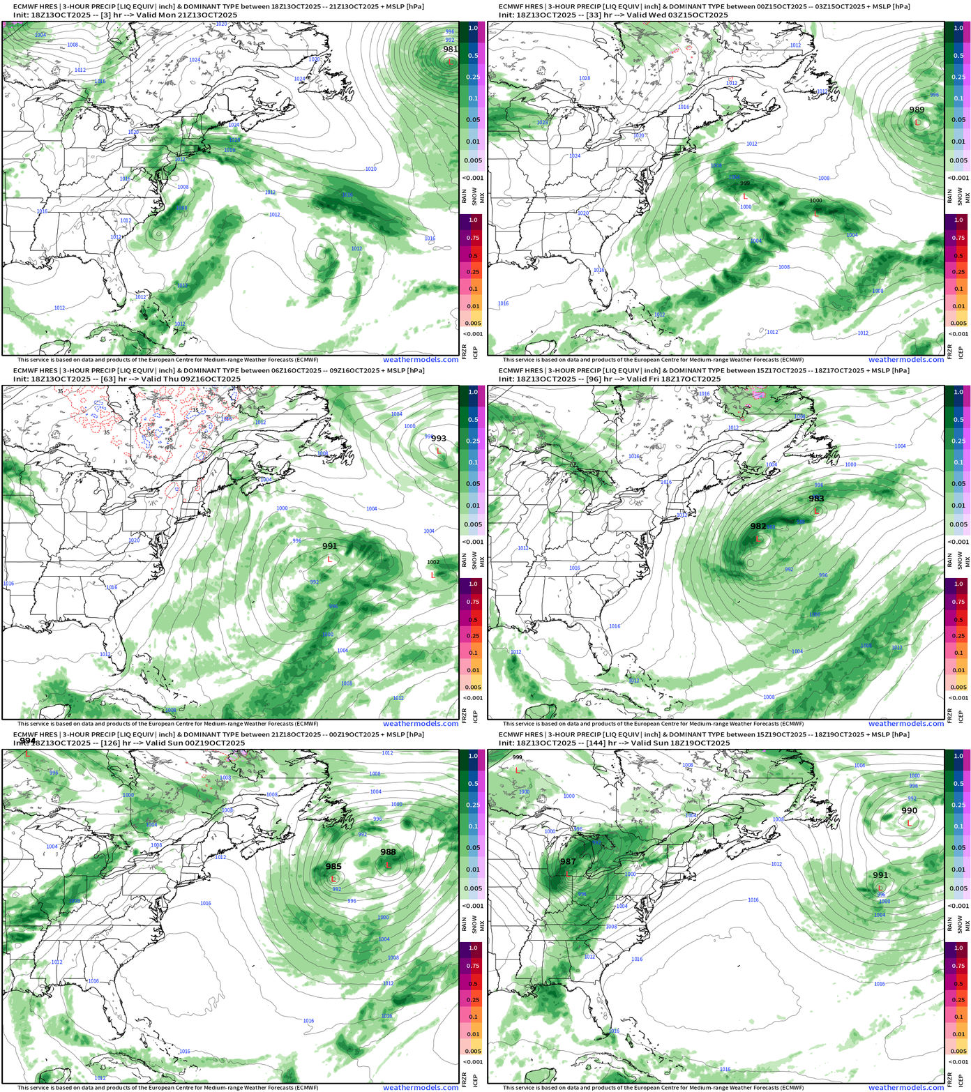
The East Coast storms keep spinning for the next 5-6 days well out to sea, but will be fun to watch!
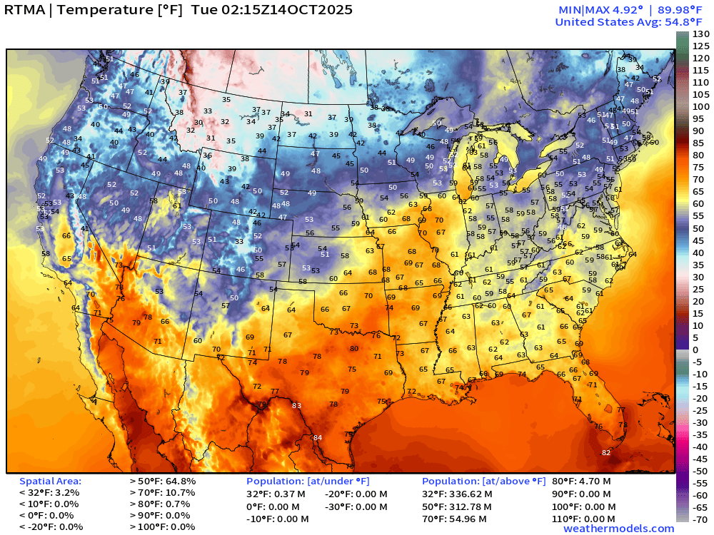
Current Temperature | RTMA 10:15 PM ET
Current Temperature Anomaly | RTMA 10:15 PM ET
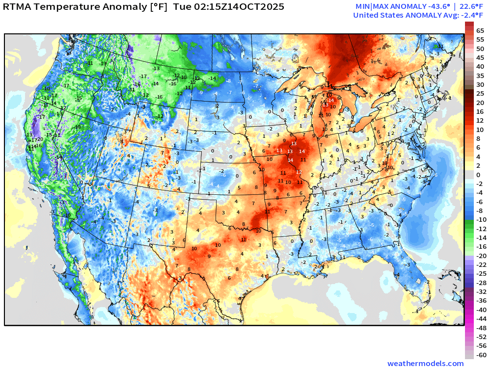
Lower 48 is a -2.4°F below normal
Low Temperatures Tuesday Morning
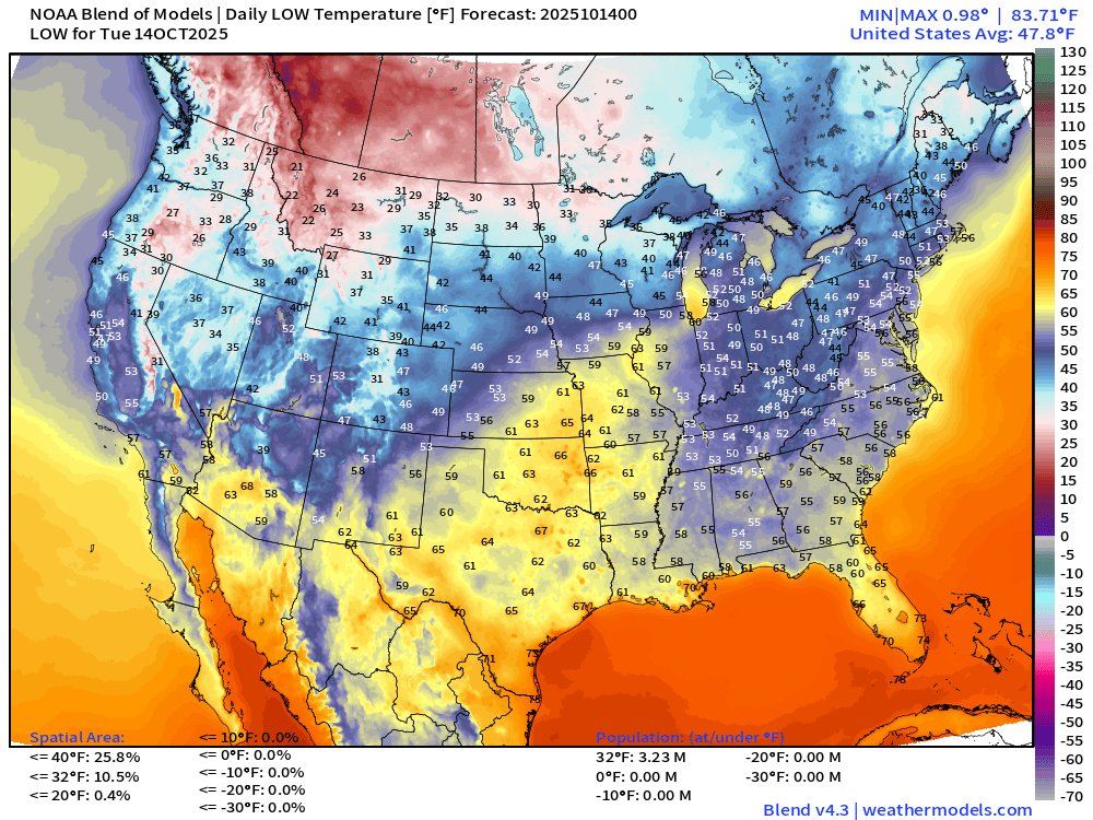
Over 3 million population below freezing but COLD temperatures just on the other side of the border in AB/SK with single digits.
High Temperatures on Tuesday
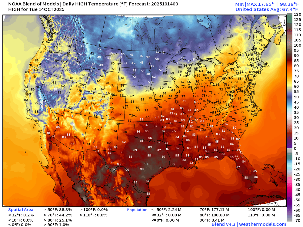
Lower 48 average temperature of 67°F … with 90s in Texas and only 8 Million population. Only in the 40s in the upper-Midwest.
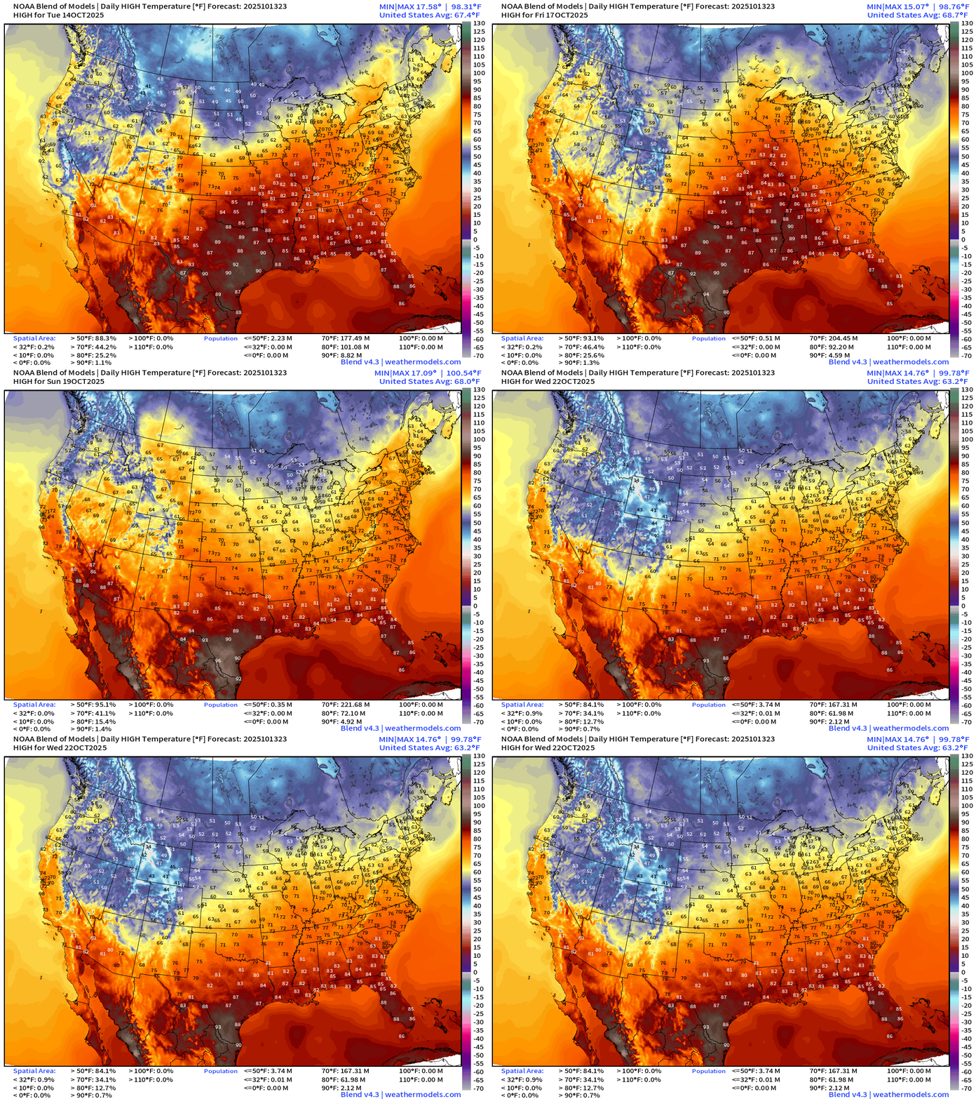
High Temperatures Next 9-days | Blend of Models
ECMWF Next 6-Days Integrated Vapor Transport | 18z cycle
Blend of Models 7-Day Precipitation through early next Tuesday
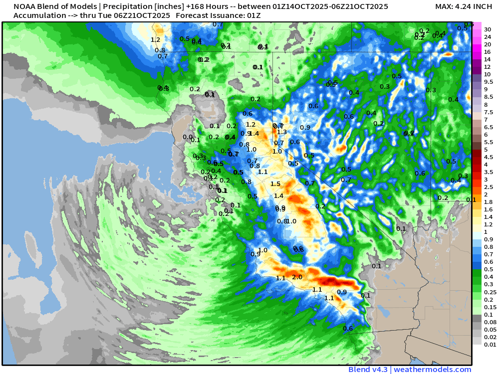
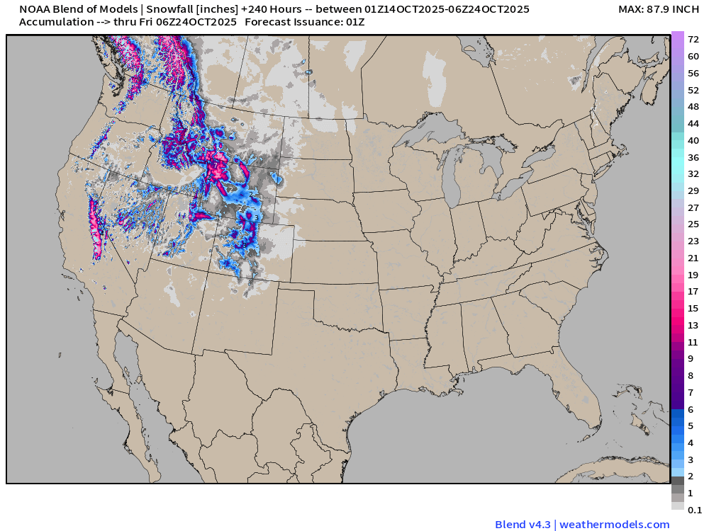
Snowfall Next 7-days | Blend of Models
Medium Range | AIFS 18z | 10-days Height Anomaly
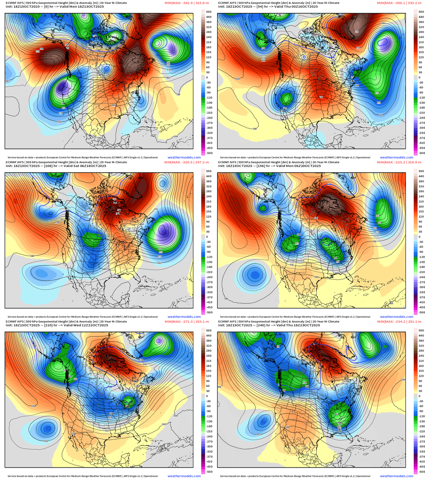
The idea of central U.S. ridging is history into this weekend as a parade of troughs rolls through the Lower 48 with assist from the North Pacific wave train
Atlantic Basin Outlook | 8 PM ET Update
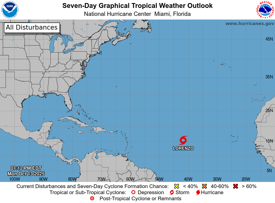
Tropical Storm Lorenzo (12L)
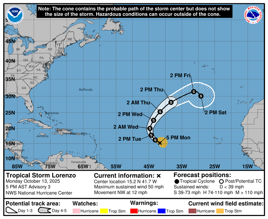
50 mph winds — poorly organized — and currently not forecast to become a hurricane.
Central Atlantic IR + Water Vapor Satellite Images
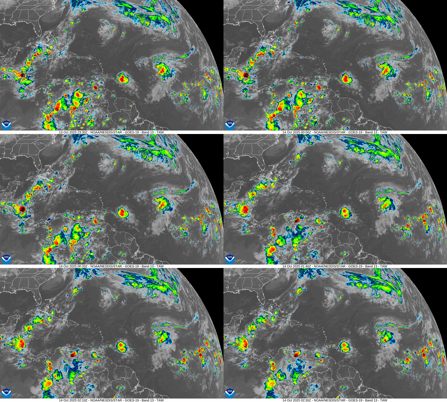
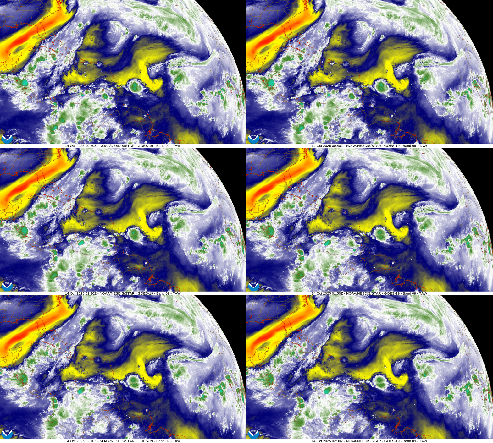
The western half of the Atlantic basin is quite hostile with dry air and wind shear. Lorenzo is already heading NW and soon N then out-to-sea.
ECMWF 18z Precipitable Water | Next 6-days
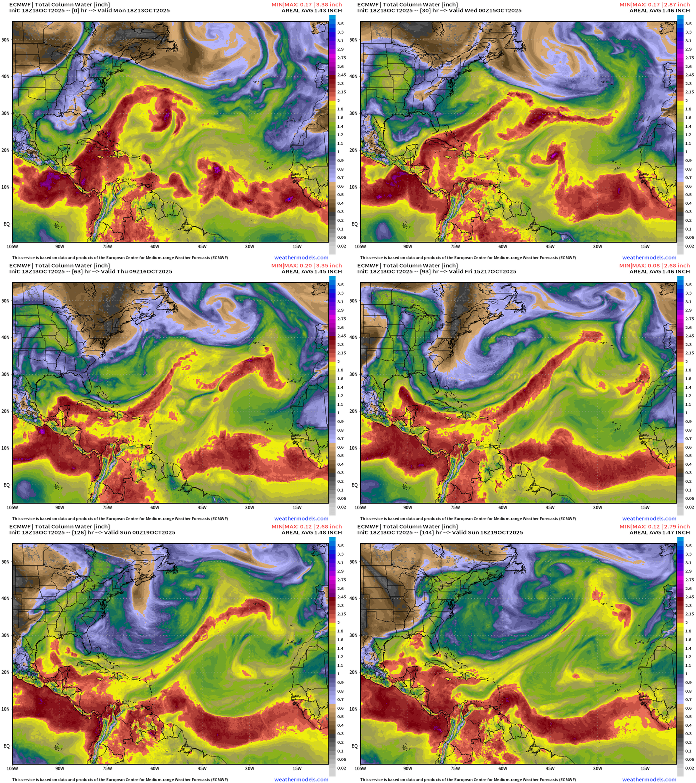
A tropical wave will reach the Lesser Antilles in 6-days on Sunday … and that’s worth watching into the Caribbean in the following week.
SST Analysis and Anomaly | 12z
NOAA Tropical Surface Analysis | 18z
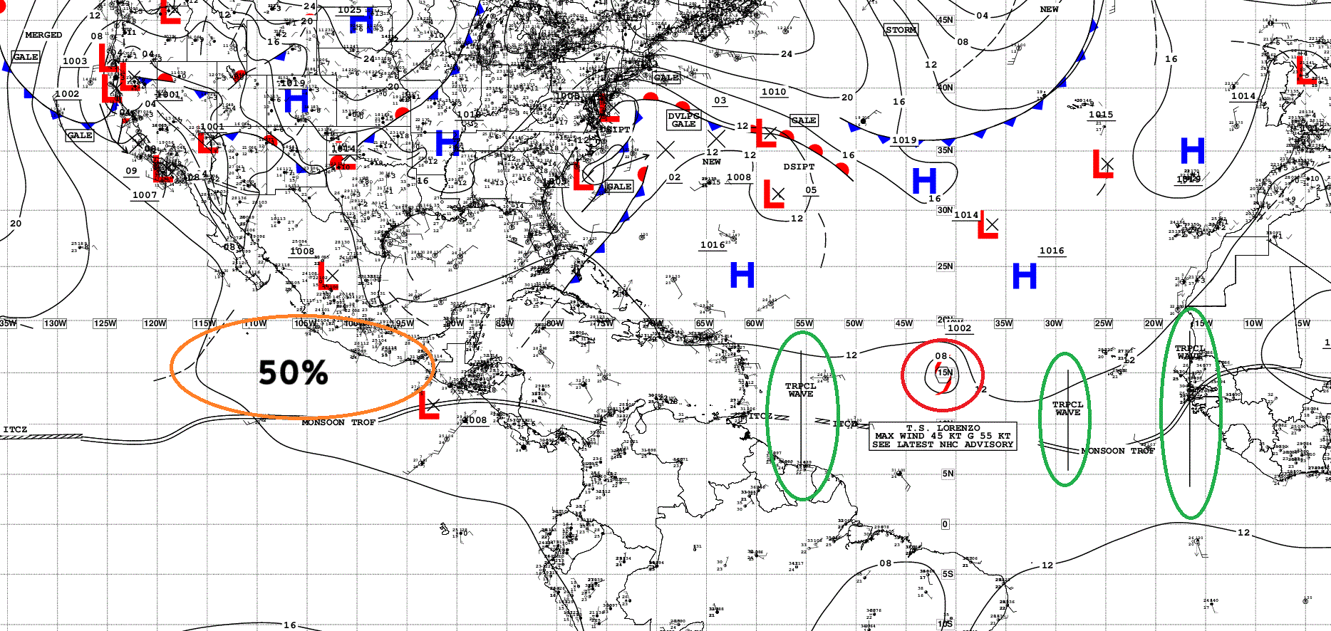
Atlantic Tropical Waves = 3 + TS Lorenzo mixed in
ECMWF EPS 12z | All Storm Tracks Day 3.5
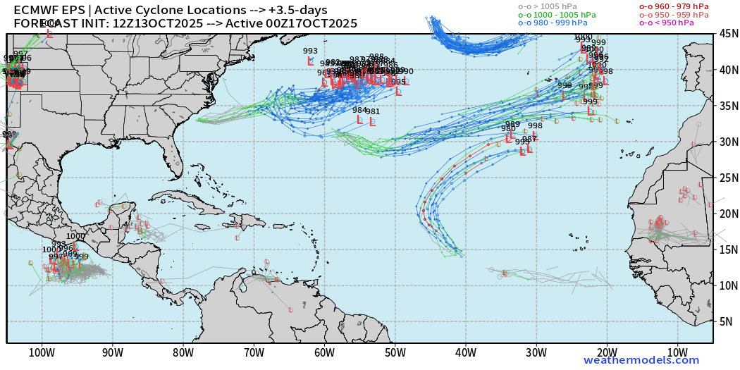
Those tracks in the subtropics are non-tropical … except for Lorenzo, which could be history by 4-days.
ECMWF EPS 12z | Active Storm Tracks Day 10
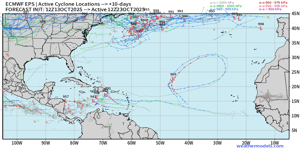
A handful of members in the Caribbean from a westward tracking tropical wave, but low chance (< 10%)
ECMWF EPS 12z | Active Storm Tracks Day 15
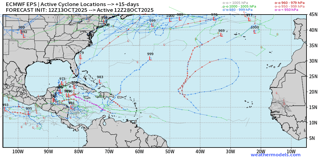
A few more ensemble members pop up storms / hurricanes in the Caribbean by end of October.
This is a favored region, of course, so we will keep a very close eye.
Eastern Pacific Tropical Weather Outlook | 8 PM ET
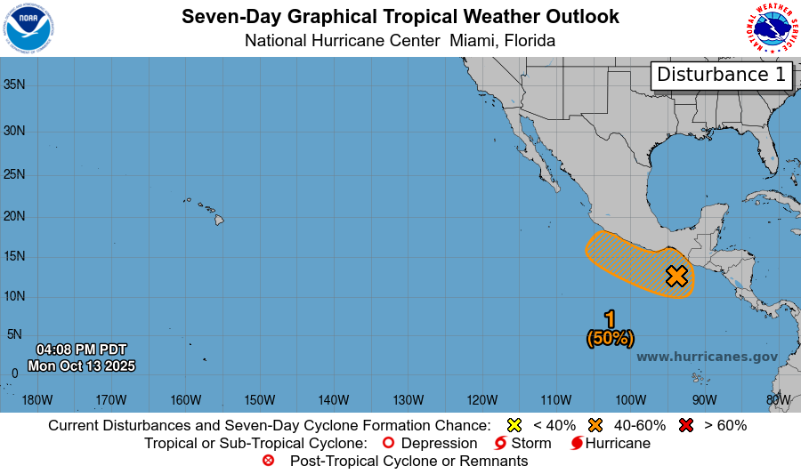
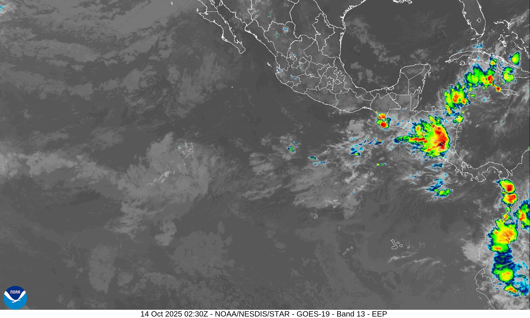
Again watching the immediate coast of Mexico for a new tropical storm later in the week. However, there is a complete void of convection across the Eastern Pacific monsoon trough / ITCZ this evening.
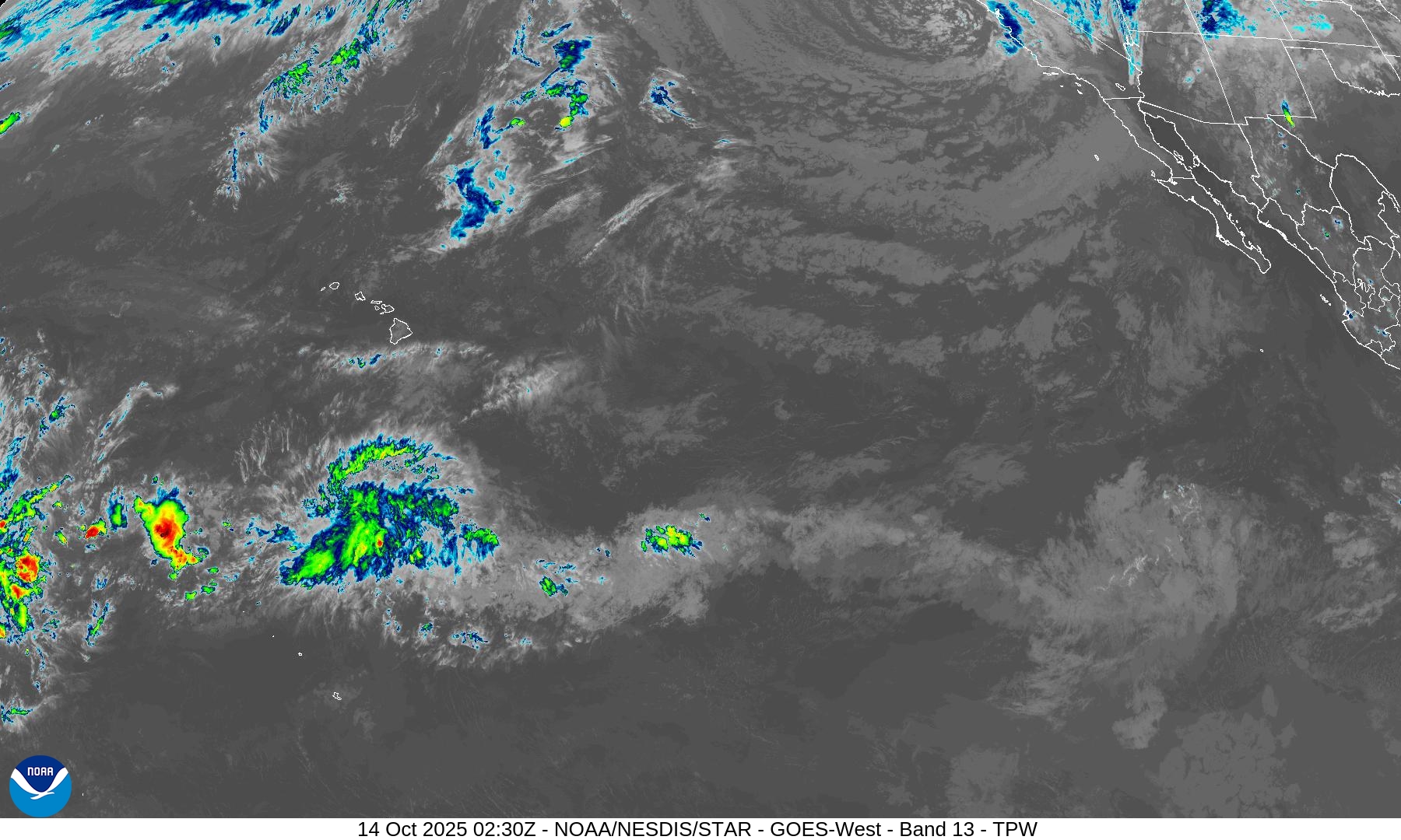
Western Pacific Typhoon Season
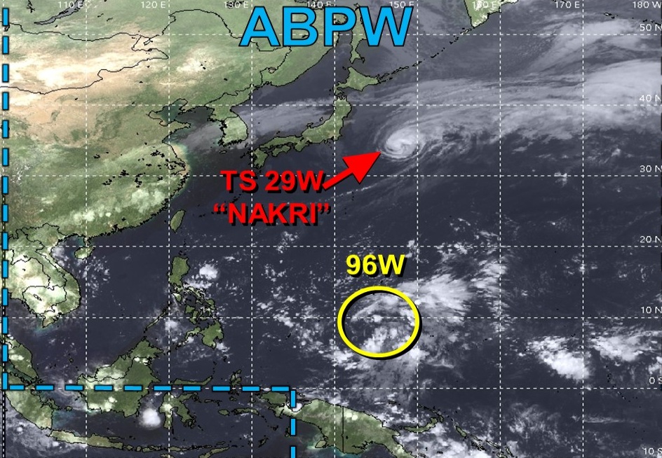
Tropical Storm Nakri (29W) will head into the North Pacific and join a very active wave train with multiple hurricane force extratropical cyclones lining up in a parade in the coming 1-2 weeks.
North Pacific Wave Train
All aboard! Multiple sequential hurricane force extratropical cyclones “bombing” out in the Aleutians with a massive, textbook “warm seclusion” this weekend. She’s a beauty!
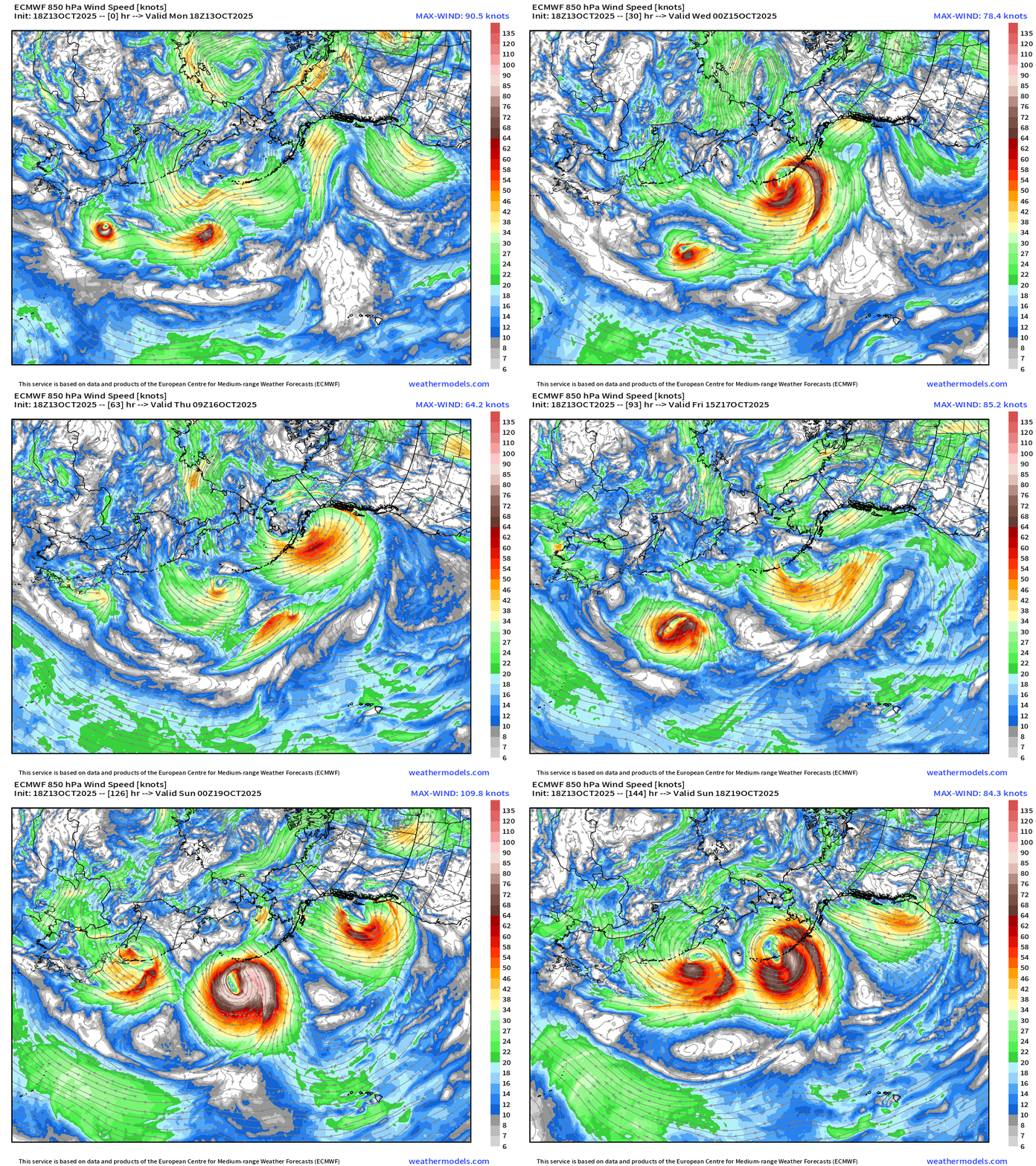
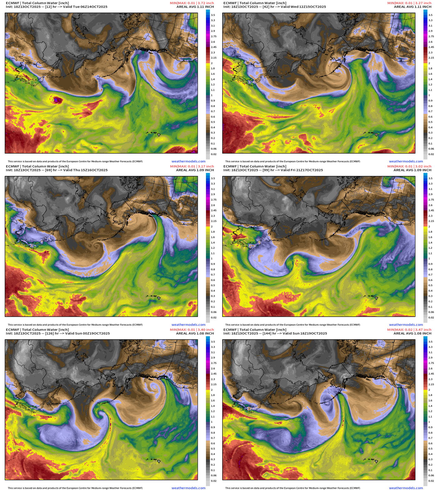
Maps sourced from weathermodels.com designed and innovated by yours truly! Please subscribe there for real-time access to the newest maps, charts from all of the weather models including ECMWF.
- Milepost
- 763 · laid 2025-10-14T03:51:22.455000Z
- Source
- https://weather.substack.com/p/october-13-2025-monday-weather-after
- Digest
- da2bd076e549b83b358494fc67f83ceb5ebd1073adba62b4724a52fe1b2fbbfe
- Machine
- JSON