October 9, 2025 Thursday Weather Update
Southwest rainfall from tropical storms + Nor'easter with gusty winds and rain
October 2025 was the 7th-warmest October in the 131-year national record (1895–2025), at 57.0°F against a 1991–2020 normal of 54.5°F (+2.4°F).
October 2025 was the 56th-wettest October in the 131-year national record (1895–2025), at 2.3in against a 1991–2020 normal of 2.5in (-0.2in).
NOAA/NCEI Climate at a Glance, contiguous United States. This is the observed record for the month, not a score of anything said in this piece — the forecast ledger begins 2026-08-17 and cannot reach earlier posts.

2025 Season to Date: 10 Named Storms, 4 Hurricanes, and 3 Majors | ACE = 96
North America Precipitable Water next 7-Days
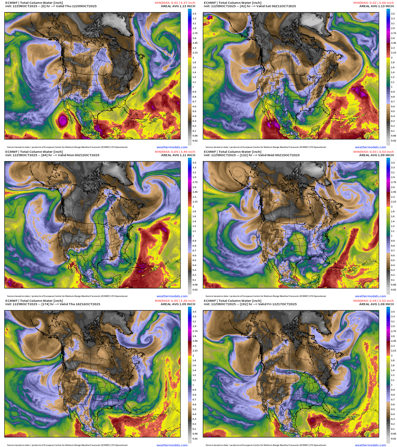
Overview of the continent: Next 7-days
Tropical moisture from former TS Priscilla and newly formed Tropical Storm Raymond will funnel into the U.S. Southwest and then continue ENE into the central Plains and Midwest fueling significant rainfall.
Fall chill continues behind a Canadian cold front across the Great Lakes and Northeast.
A non-tropical “Nor’easter” like system forms off the Carolinas, which lifts north into the Northeast — all the while battering the coast with gusty winds and rainfall — mainly this weekend. Hurricane force wind gusts could be just offshore New Jersey.
Atlantic tropics: Tropical Storm Jerry battling strong wind shear but maintaining convection albeit asymmetric.
Precipitation Type _ MSLP | Next 7-days
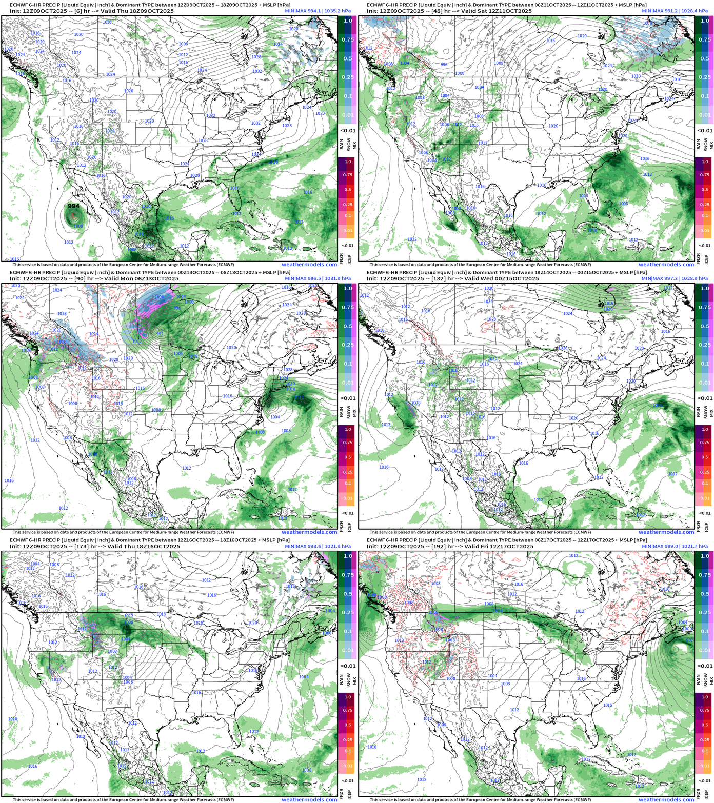
We’re back to showing the precipitation type again! And, there is some snowfall (blue) showing up on the maps across the Rockies and into Canadian Prairies as mid-October is already cold enough for snowfall.
Plenty of moisture into the West Coast + tropical input from Priscilla and Raymond into the Southwest. Meanwhile, the east coast sees a blustery Nor’easter with heavy rain and near hurricane force wind gusts. Not a named system, but similar to a tropical storm — and thankfully no snow (yet).
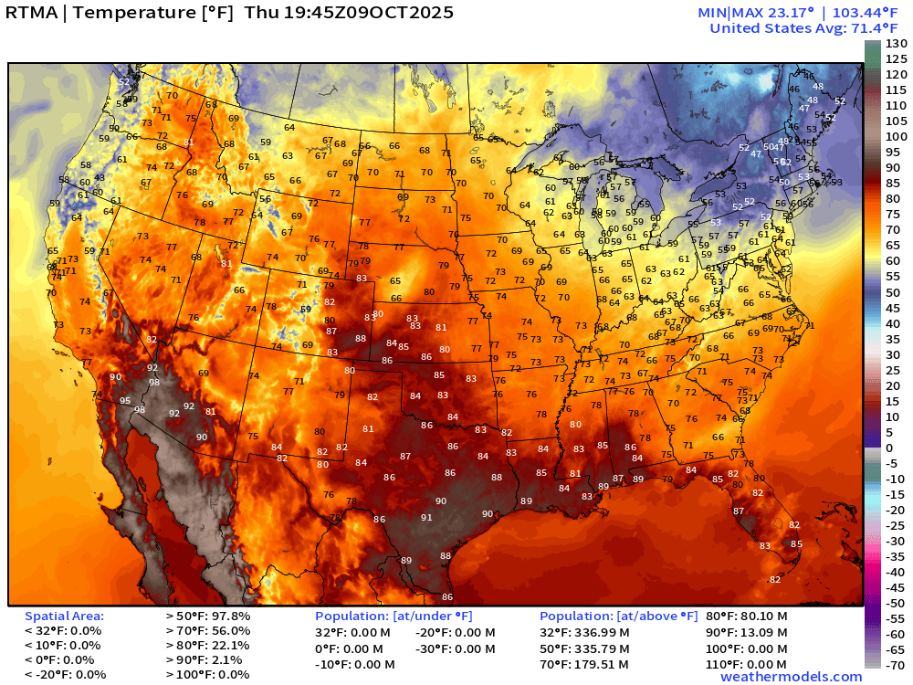
Current Temperature | RTMA 3:45 PM ET
Current Temperature Anomaly | RTMA 3:45 PM ET
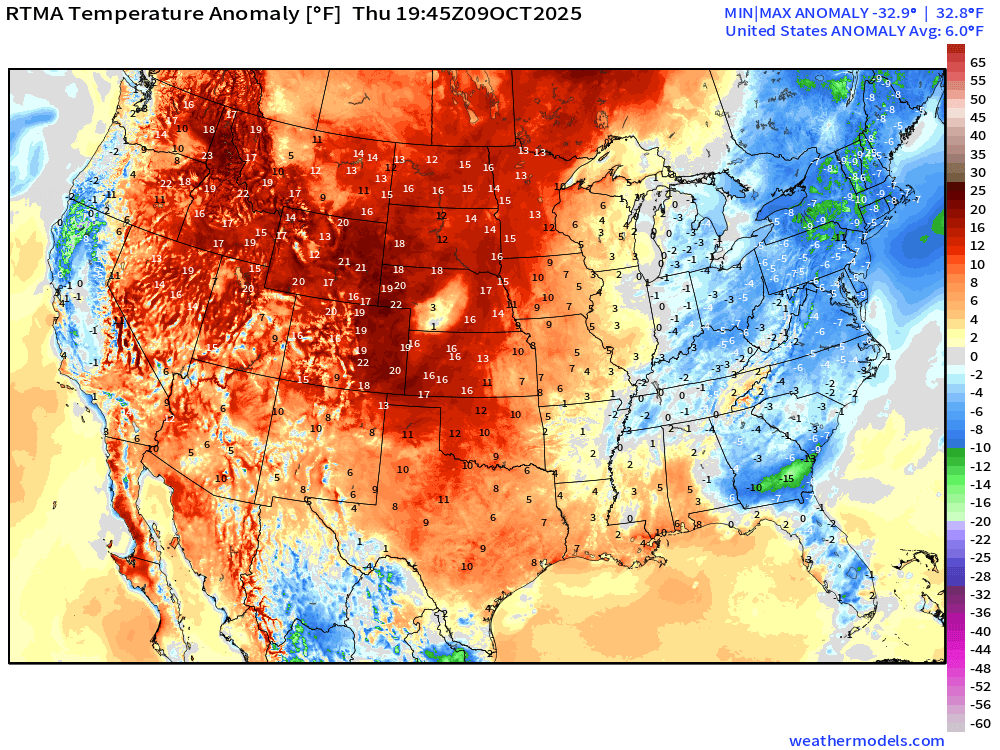
Lower 48 is a whopping +6.0°F above normal
Low Temperatures Friday Morning
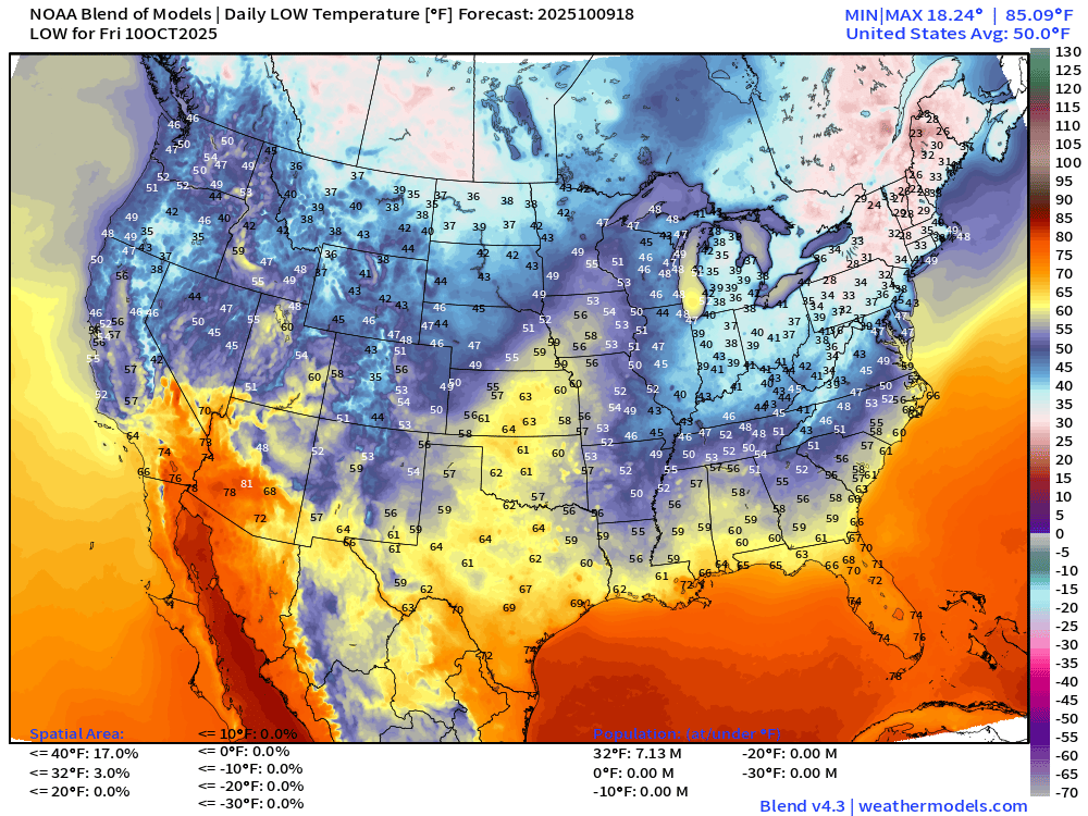
Chilly below freezing mornings continue across New England into the 20s and lower-30s. We now have over 7-million population below freezing!
High Temperatures on Friday
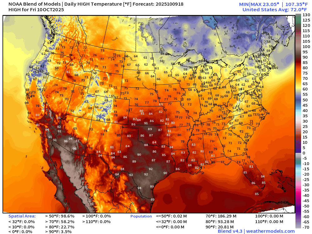
Comfortable across much of the Lower 48 with 60s and 70s from coast to coast. Hottest in the 90s across south Texas and the desert Southwest. .
ECMWF Next 8-Days Integrated Vapor Transport | 12z cycle
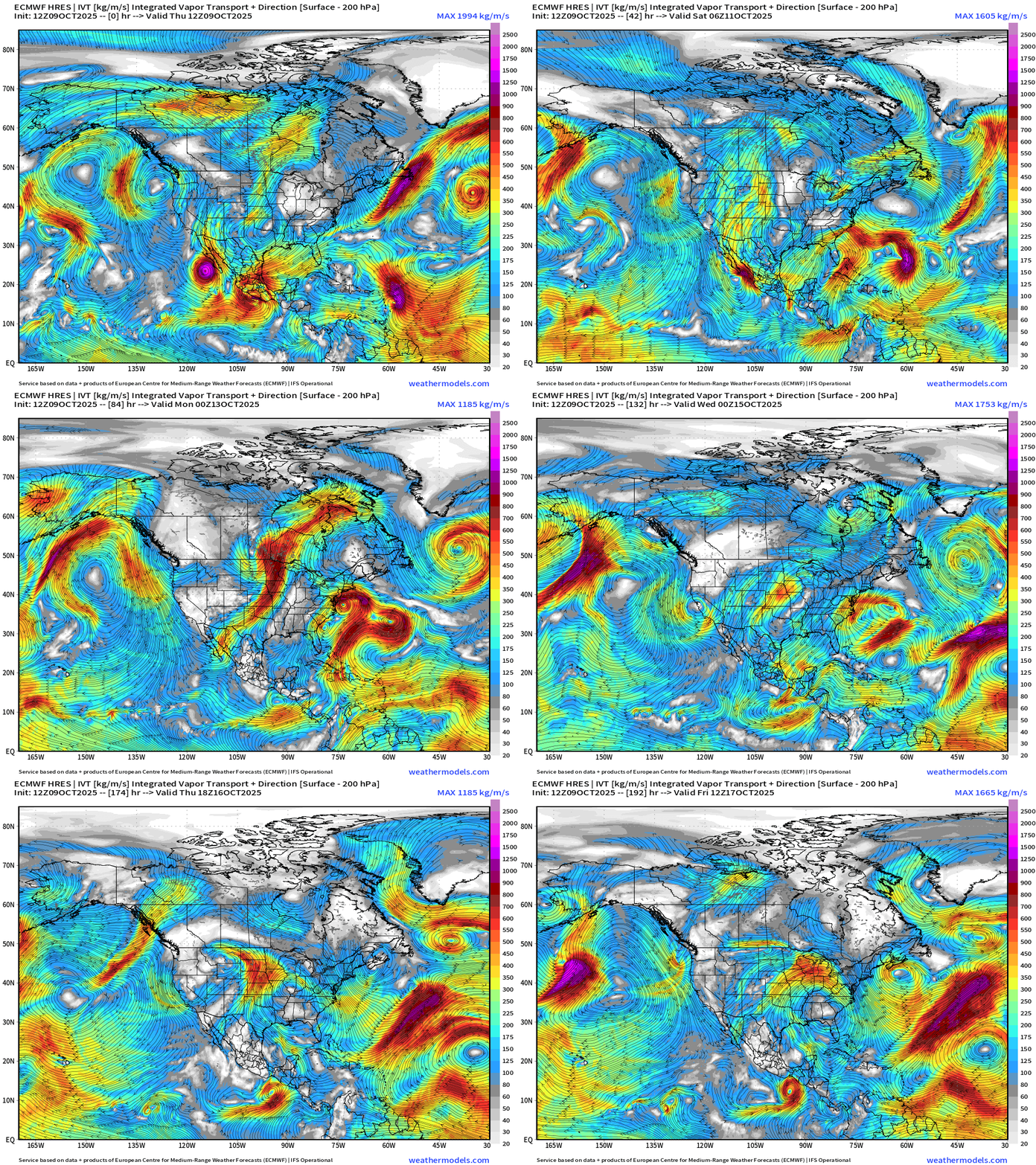
Tropical Storm Priscilla and its moisture plume head into Southwest with significant rainfall and flooding threat to Arizona.
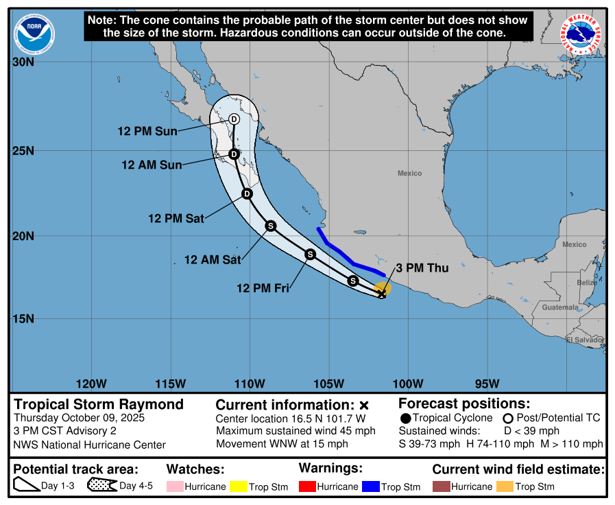
Tropical Storm Raymond formed and is hugging the coast of Mexico
In the Atlantic, Jerry stays just NE of the Caribbean and Leeward Islands, although could see some tropical storm conditions in Guadeloupe.
Nor’easter develops out of a non-tropical trough —> “hybrid system” off the East Coast that could be impactful even if not a named storm (unlikely based upon structure)
Medium Range | AIFS 12z | 10-days Height Anomaly
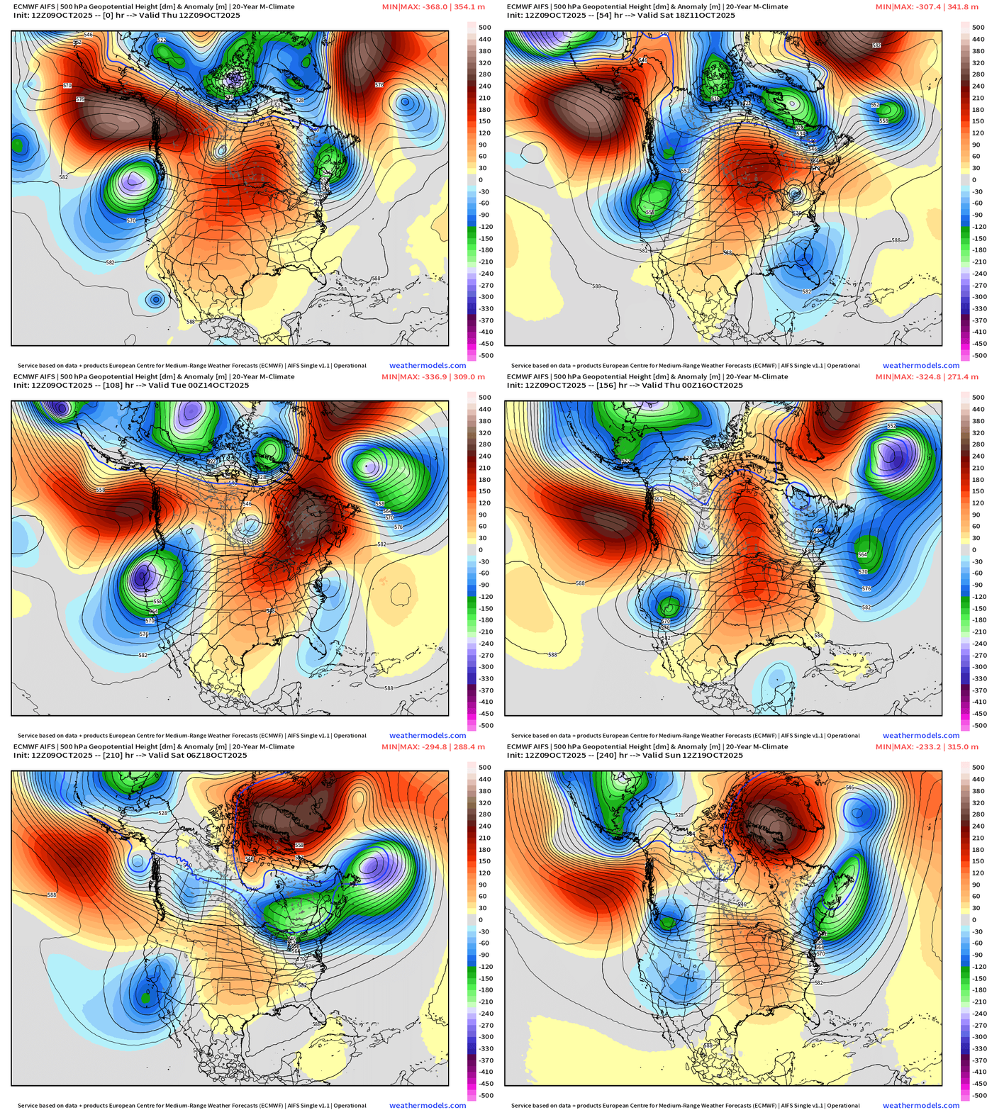
Central U.S. ridging (and warmth) in the story of the next 10-days while the western U.S. deals with cool/cold troughing from Canada. Another major trough develops off the Northeast U.S. as the overall weather pattern repeats itself — including troughing across the West.
East Coast Nor’easter / Hybrid Storm
Central pressure will dip into the 990s — and as the system matures/occludes and loops off the coast, the westward flank will see a large band of strong winds —> could be near hurricane force gusts along the coast w/much strong winds aloft > 80-knots at 850 mb
Vorticity Loop
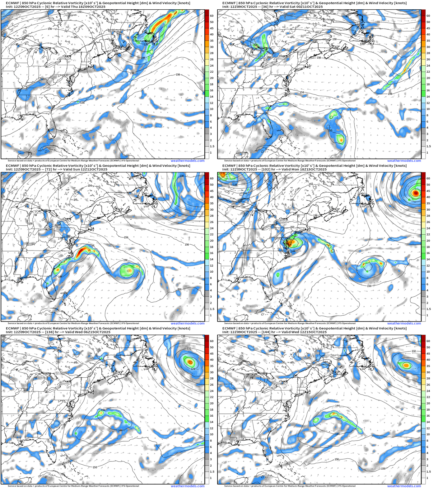
The system has frontal characteristics until occlusion on Monday — and then it decays. Jerry heads away to the east but not expecting a powerful hurricane out of it any longer.
Wind Gusts Next 6-days
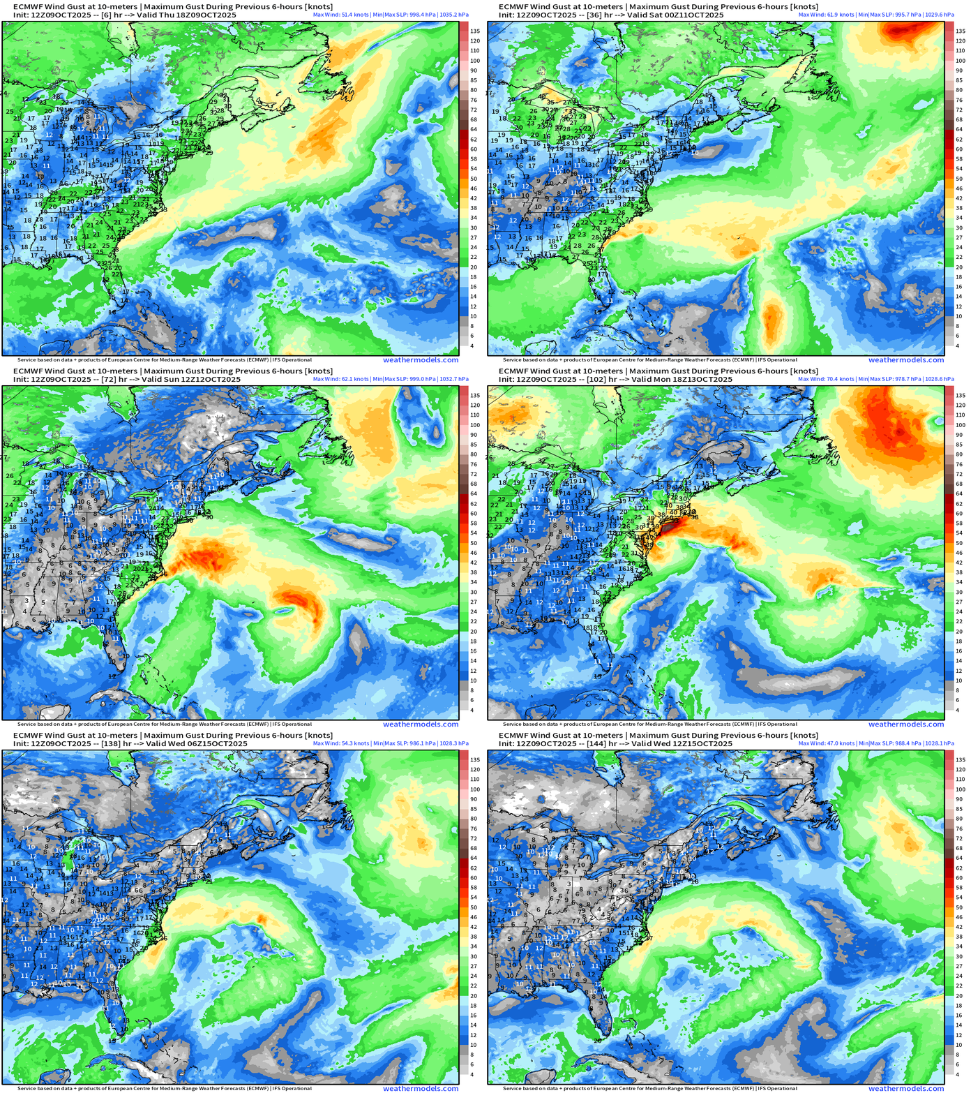
The impactful wind gusts will be Monday and Tuesday
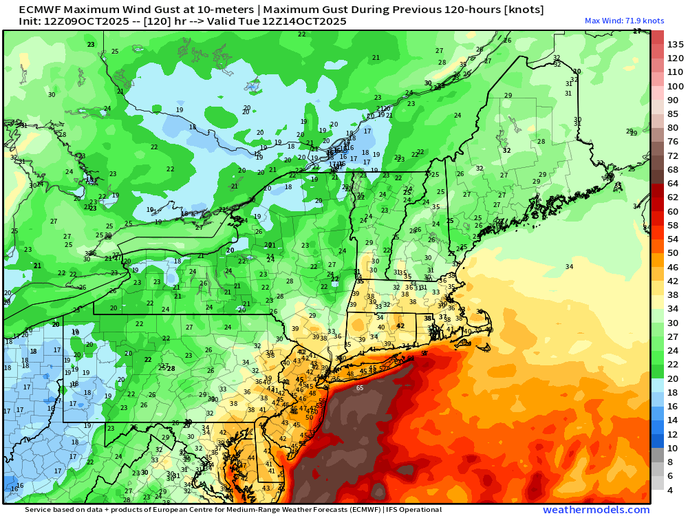
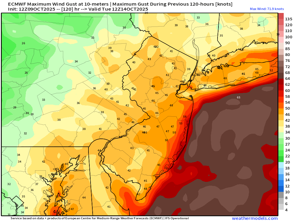
We could easily see 40-60 mph wind gusts … over a long stretch of coastline.
ECMWF EPS 12z Temperature Anomaly | Weekly Chunks
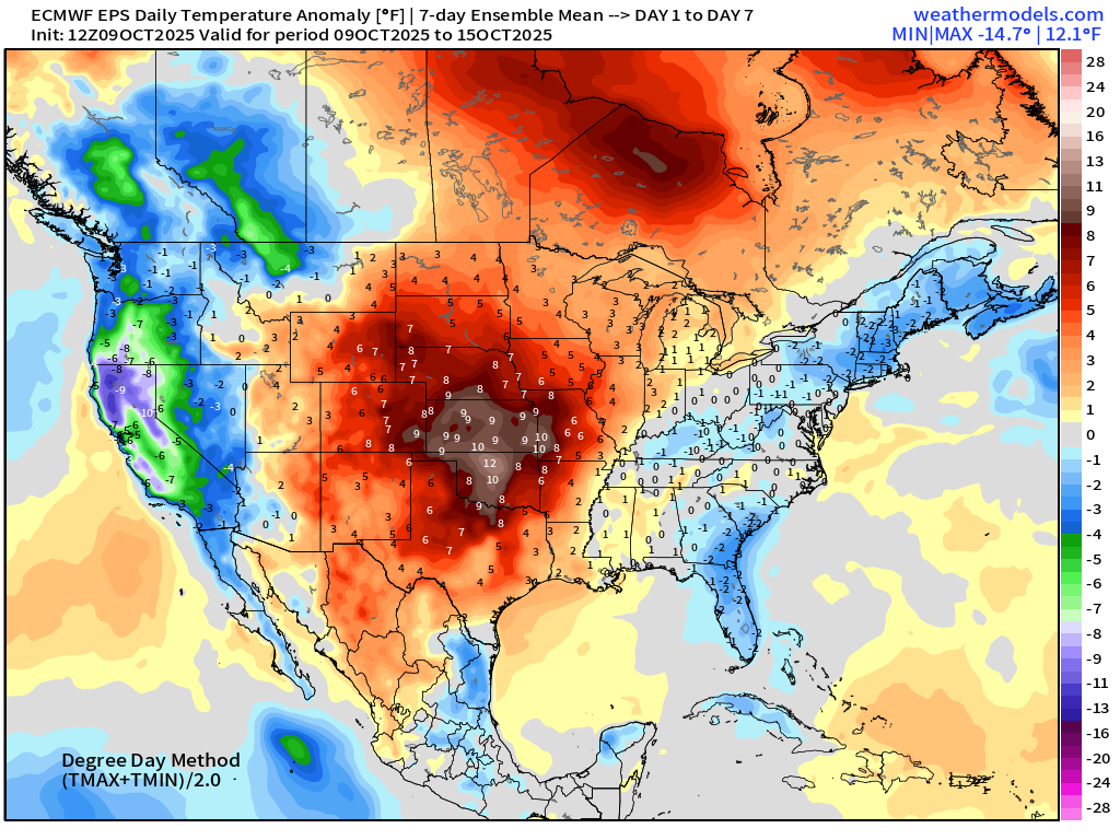
Week 1 —> cooler air in the eastern U.S. including the Mid-Atlantic + California
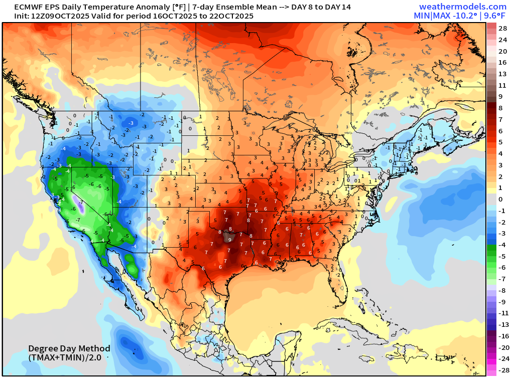
Week 2 —> significant warmth across Texas and the central U.S. while California remains very cool
Snowfall Next 15-days
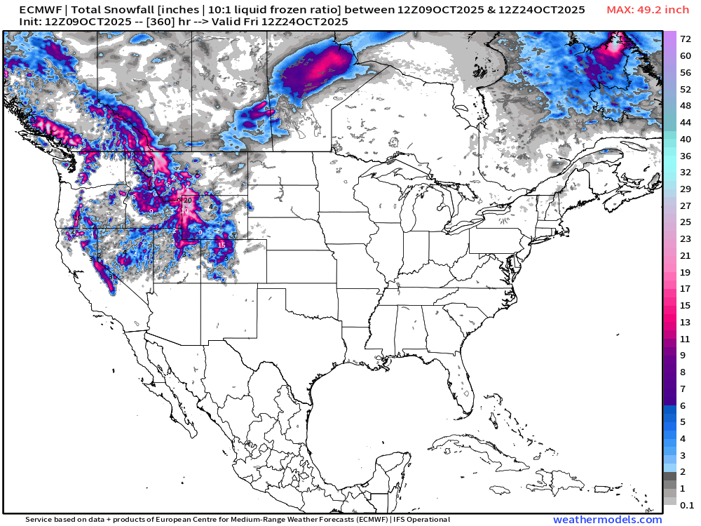
Nothing much east of the Rockies … but significant mountain snows likely into final 10-days of October — right on schedule.
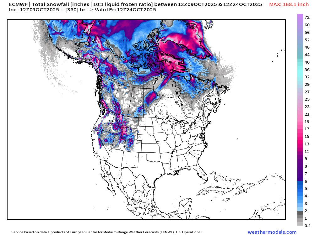
Alaska and Arctic Canada already seeing heavy snowfall —> winter
Blend of Models 7-Day Precipitation
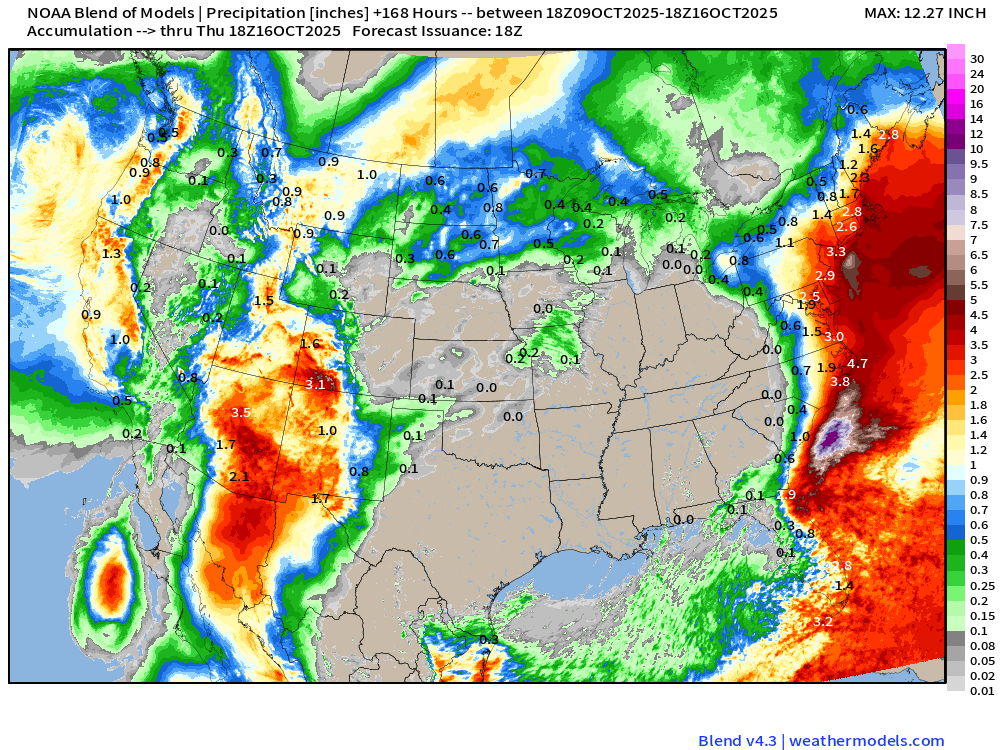
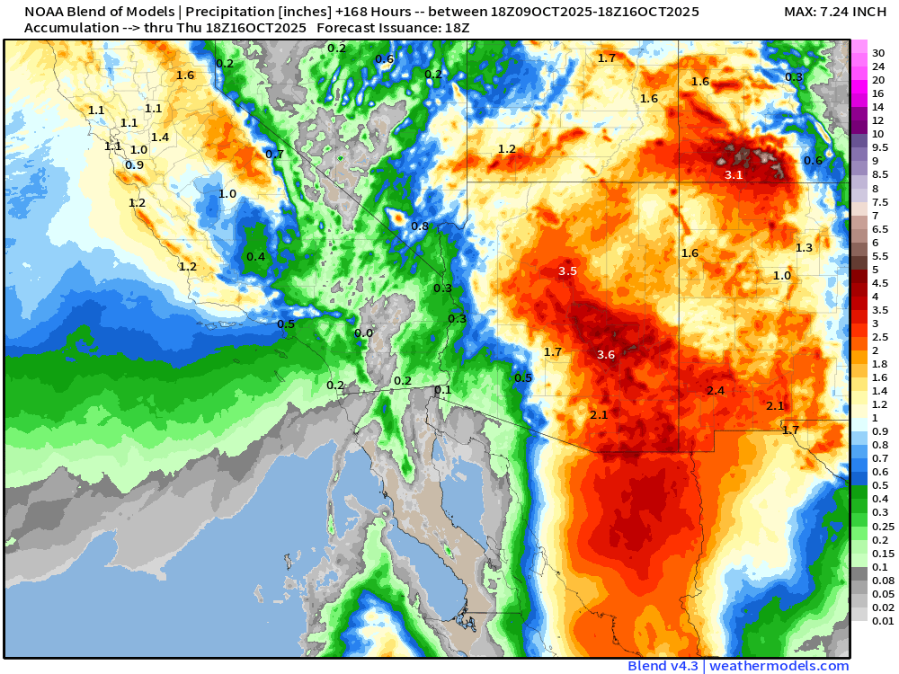
MAJOR rainfall threat for Arizona with widespread 2”-4” (and thus locally more) from the remnants of Priscilla. Also note 1-3” accumulations across the West Coast from Washington to central California.
… and the coastal / hybrid system along the East Coast could dump a lot of locally heavy rain near the coast and just inland — 2-4” as well.
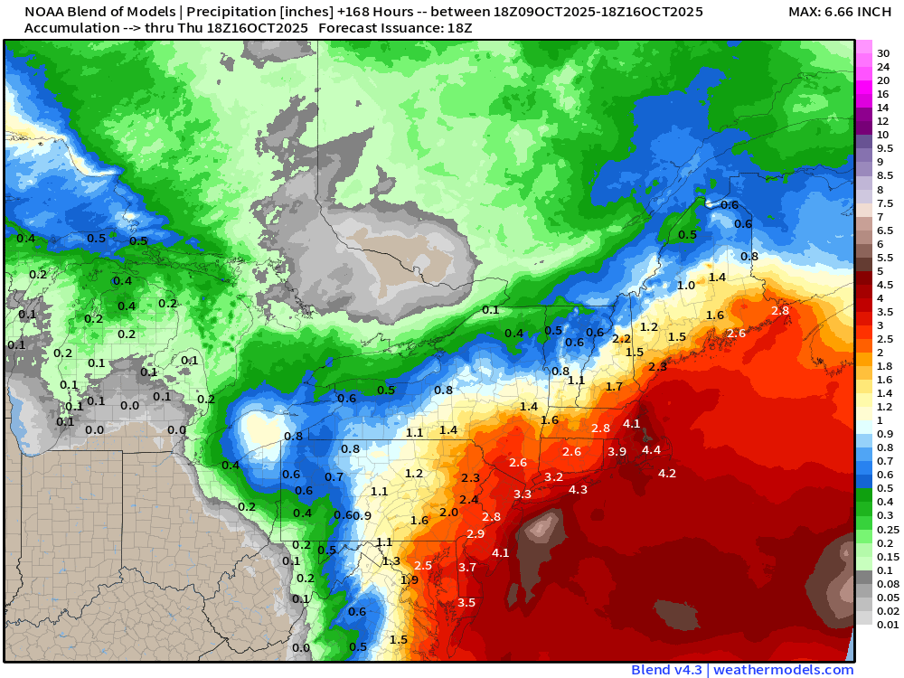
Really could use some rain here in the Southeast in North Georgia. Boo!
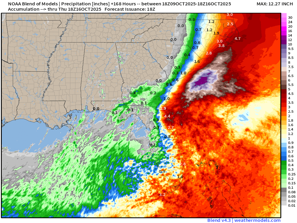
I note the NOAA WPC precipitation is quite similar to the Blend of Models — not sure what value is added at this point, so I’m going to ditch the WPC maps
Atlantic Basin Outlook | 2 PM ET Update
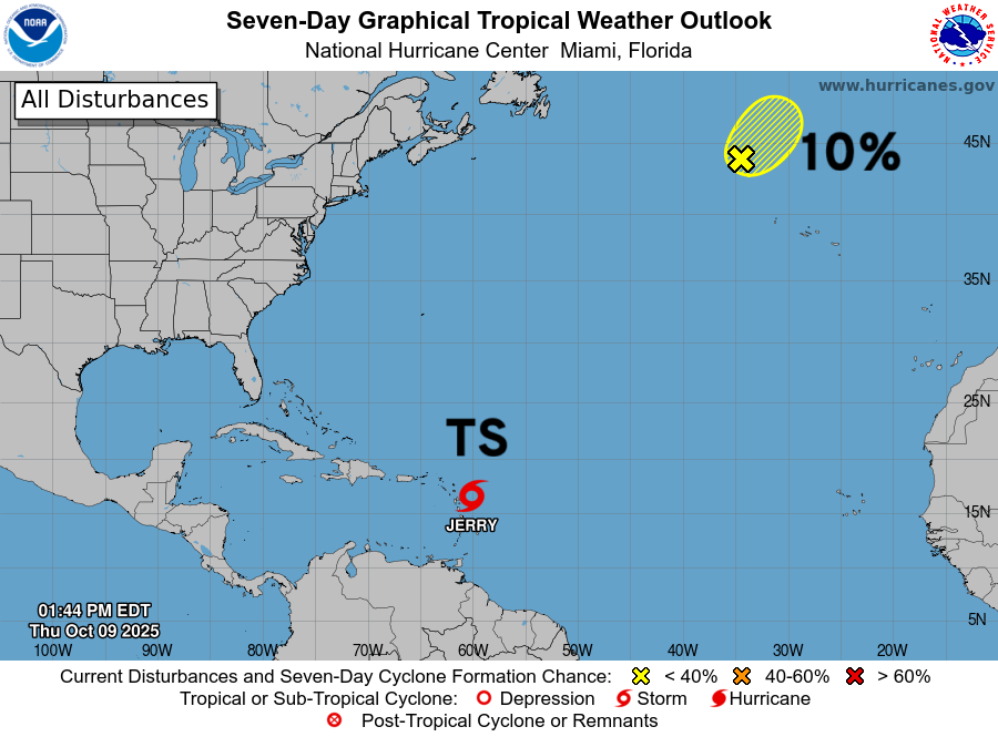
Tropical Storm Jerry (10L)
Poorly organized and heavily sheared tropical storm Jerry
NHC Track of Tropical Storm Jerry | 1001 mb | 65 mph
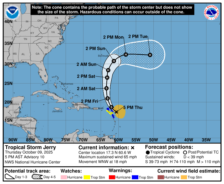
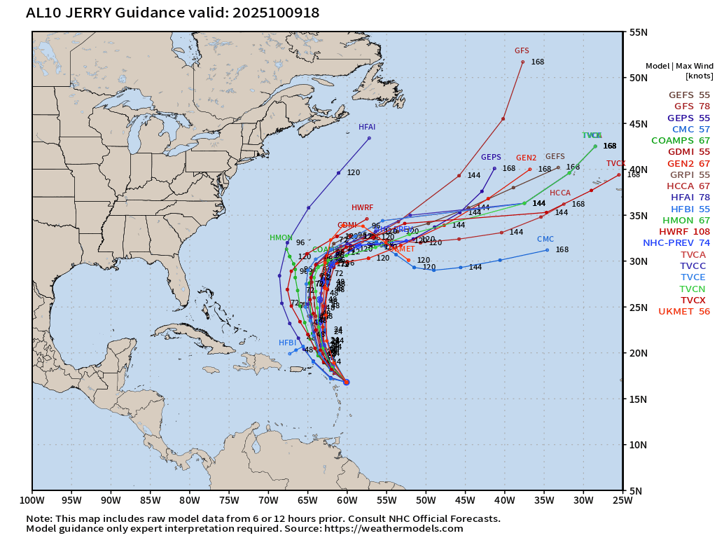
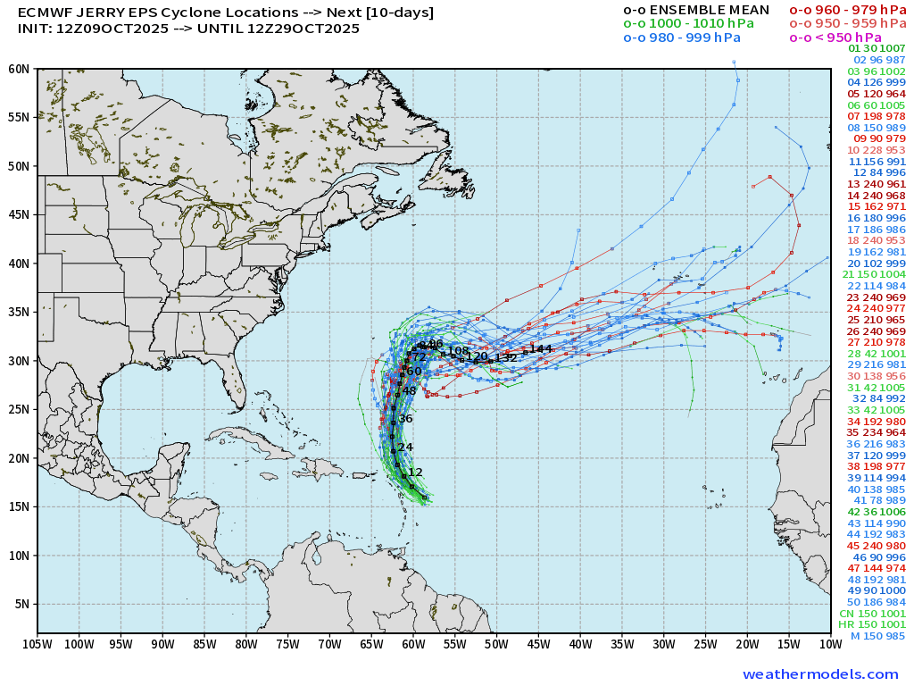
Jerry curves away from the Caribbean on Friday, due north this weekend, and east of Bermuda into next week. Not expecting any surprises from Jerry — it will generate some ACE, mix fish, and get a Wikipedia entry.
Central Atlantic Water Vapor + IR Satellite Images
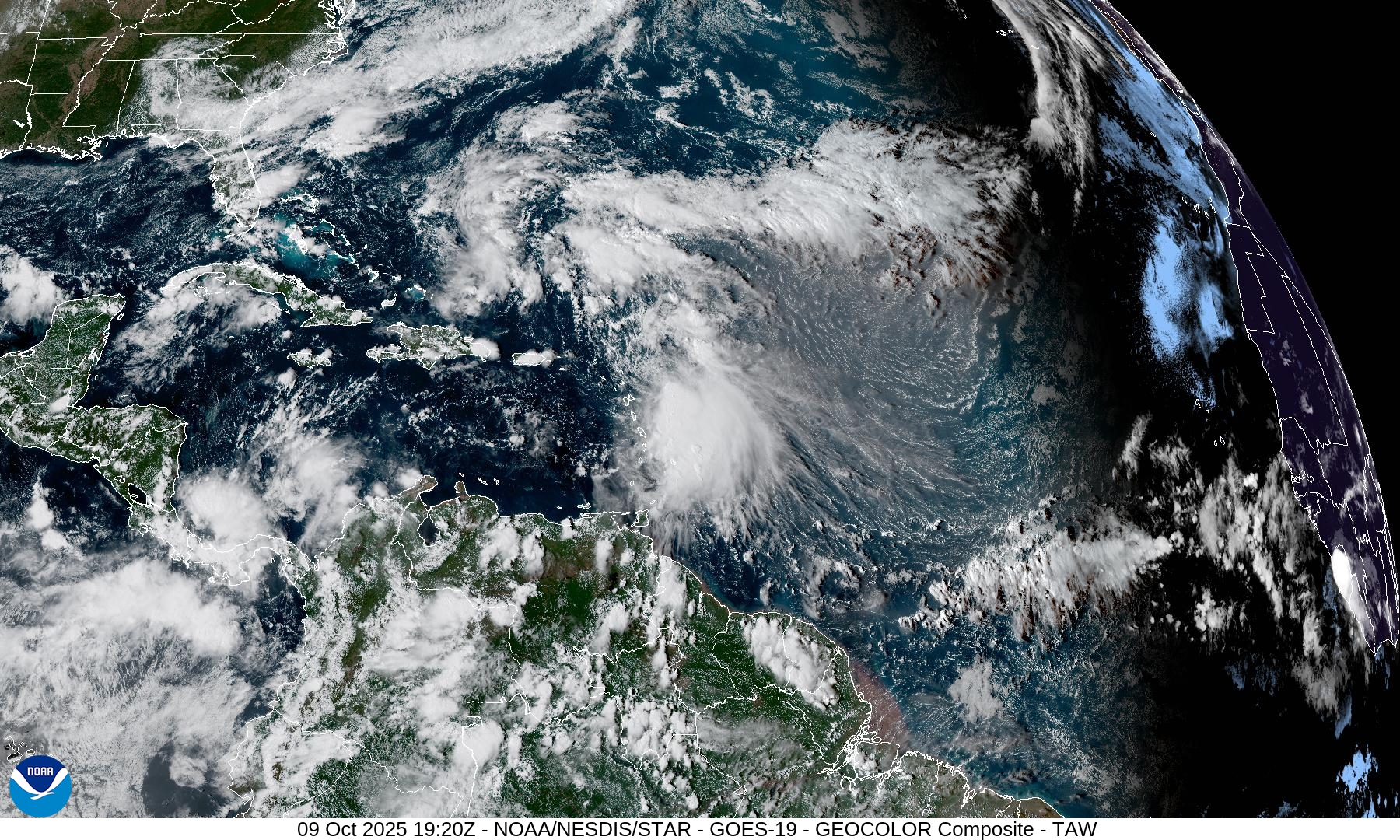
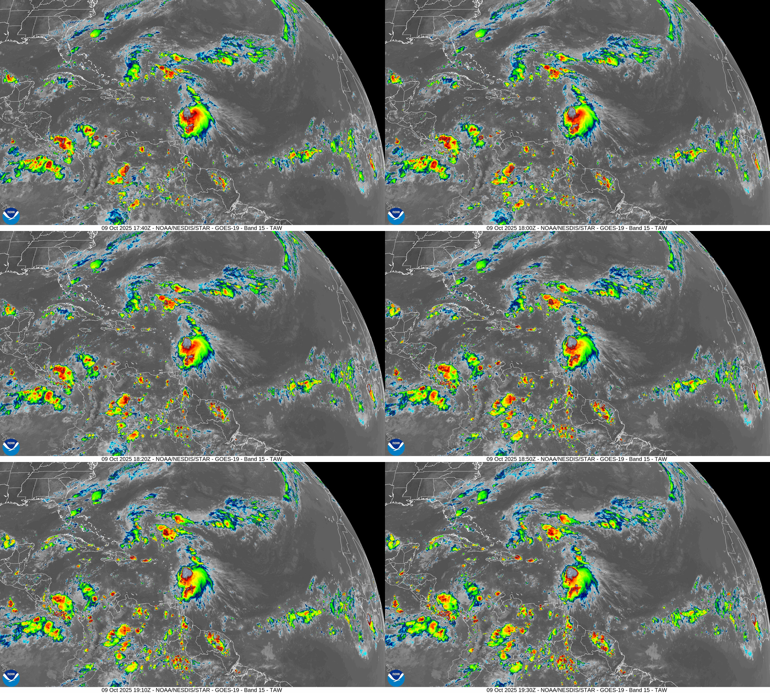
Only show in town is Jerry — and it is not particularly well organized. Overall, the Atlantic tropics remain hostile to development — as we head into the last 7-weeks of the Hurricane Season, our attention shifts to the Caribbean.
Tropical Storm Jerry (10L) | ATCF Spaghetti
ECMWF EPS 12z | Tropical Storm Jerry
ECMWF 12z Precipitable Water | Next 6-days
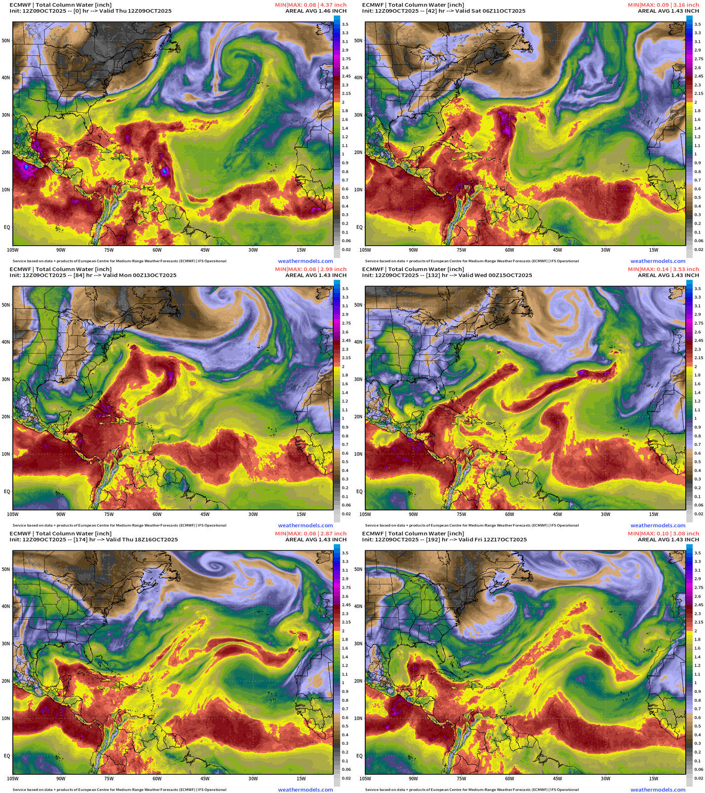
Impressive coastal system — Nor’easter with frontal structure — so likely not going to become a named system
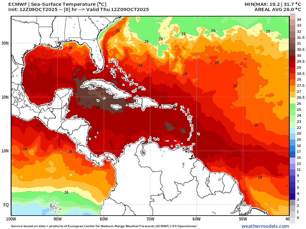
SST Analysis and Anomaly | 12z
SST in Caribbean and Gulf plenty warm
NOAA Tropical Surface Analysis | 12z
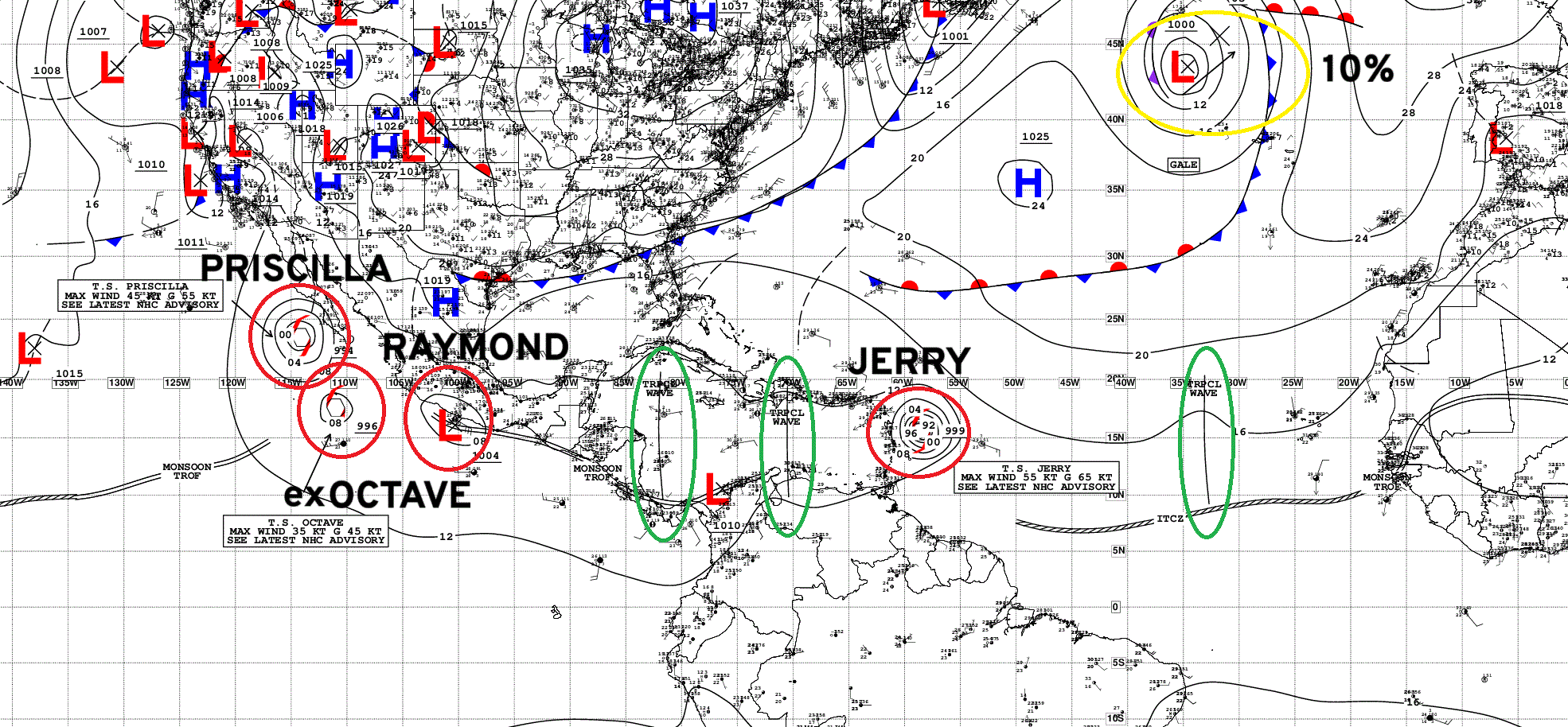
Atlantic Tropical Waves = 3 but none showing development potential
ECMWF EPS 12z | All Storm Tracks Day 6
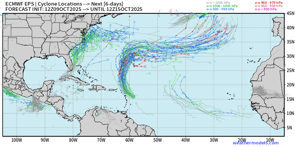
Nor’easter + Jerry + eastern MDR tropical wave (low signal)
ECMWF EPS 12z | Active Storm Tracks Day 15
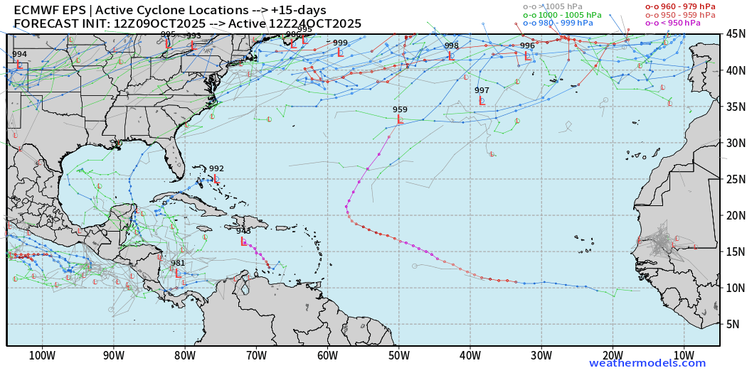
Very quiet across the Atlantic tropics into last 7-days of October with only a few scattered ensemble tracks.
Eastern Pacific Tropical Weather Outlook | 2 PM ET
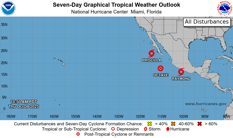
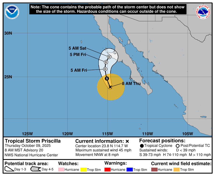
Octave is gone and Tropical Storm Priscilla has fallen apart rapidly but we now have Tropical Storm Raymond
Tropical Storm Priscilla | NHC Cone | 45 mph
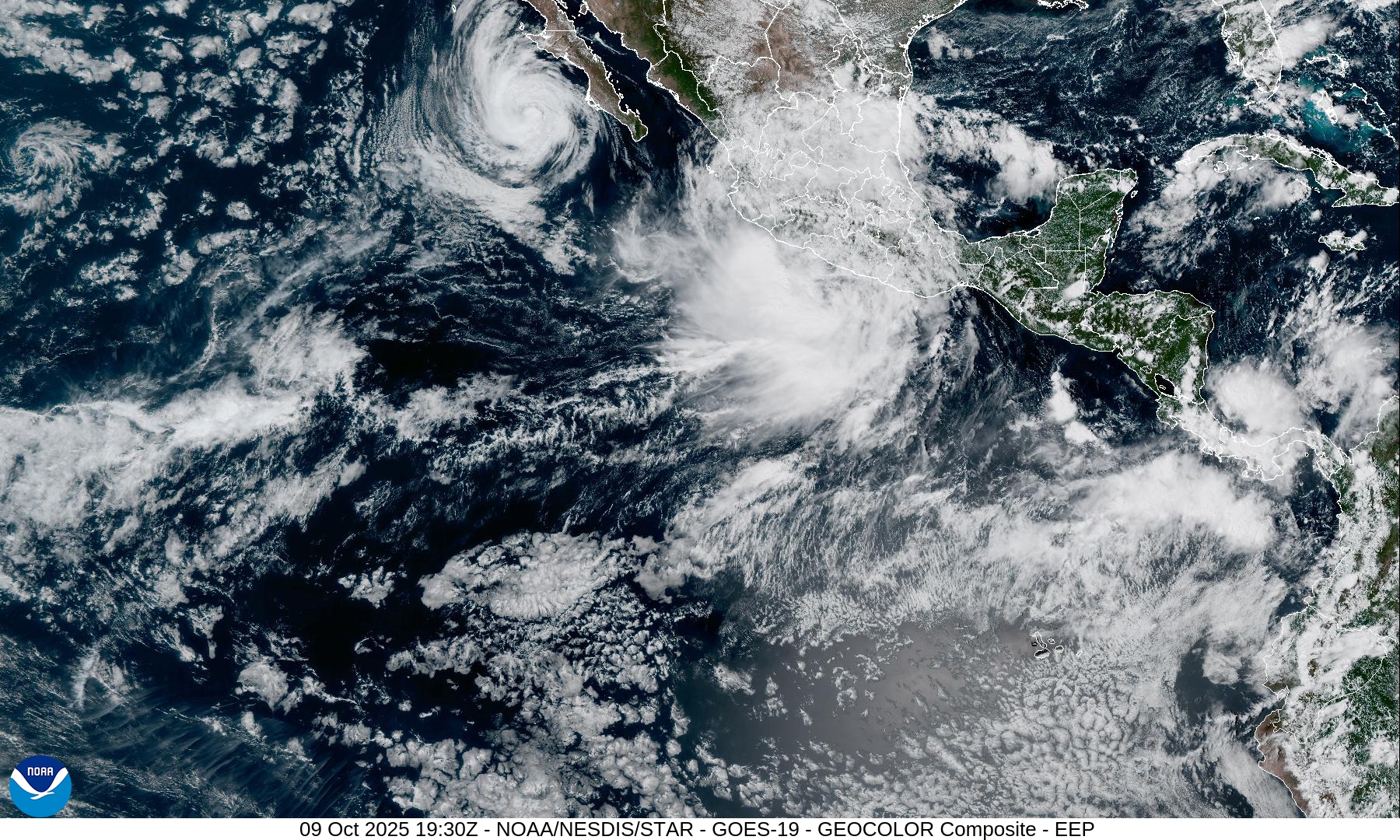
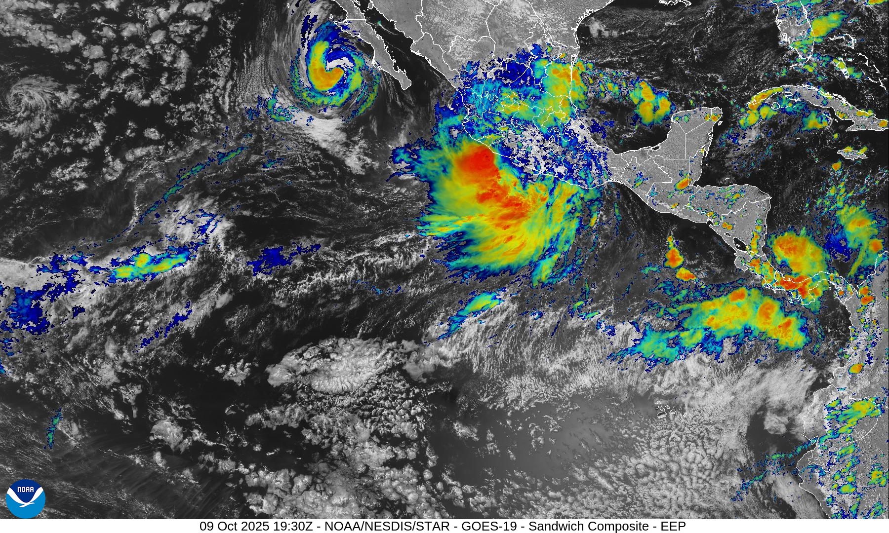
Tropical Storm Raymond will not intensify much in the coming few days
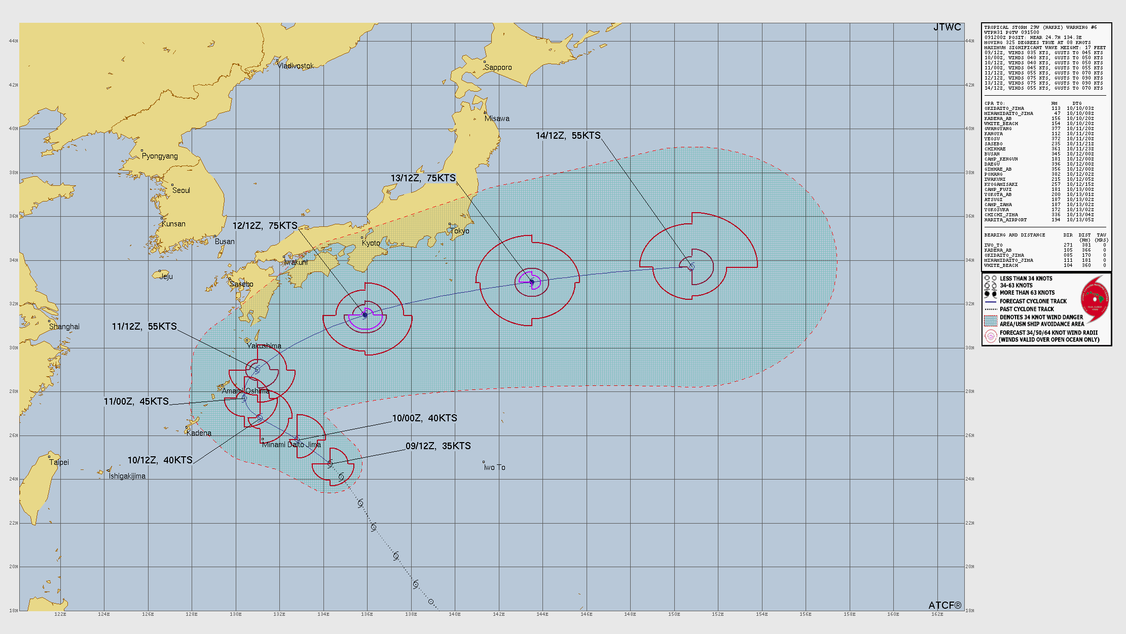
Western Pacific Typhoon Season | 29W (Nakri)
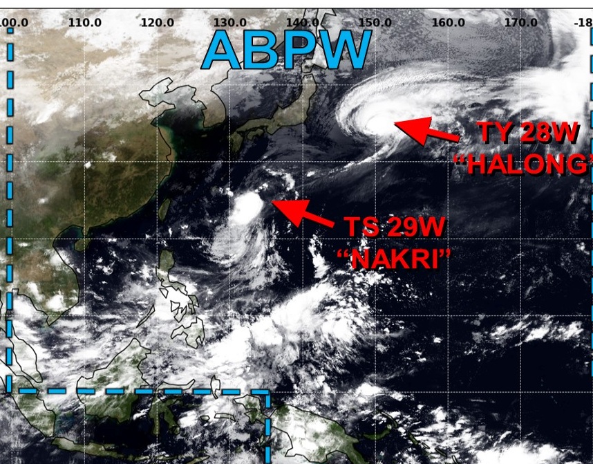
Halong has become post-tropical … so the only show in town is minimal tropical storm Nakri, which will follow on a similar track looping out-to-sea away from Japan.

Maps sourced from weathermodels.com designed and innovated by yours truly! Please subscribe there for real-time access to the newest maps, charts from all of the weather models including ECMWF.
- Milepost
- 761 · laid 2025-10-09T21:03:37.094000Z
- Source
- https://weather.substack.com/p/october-9-2025-thursday-weather-update
- Digest
- 5d4a2b95c15262fe4d2fbb9de35abf5005105380ca0ad0dd2202a1e5fc0afe77
- Machine
- JSON