October 3, 2025 Friday Tropical Update
Confidence increasing for Tropical Storm Jerry forming next week
October 2025 was the 7th-warmest October in the 131-year national record (1895–2025), at 57.0°F against a 1991–2020 normal of 54.5°F (+2.4°F).
October 2025 was the 56th-wettest October in the 131-year national record (1895–2025), at 2.3in against a 1991–2020 normal of 2.5in (-0.2in).
NOAA/NCEI Climate at a Glance, contiguous United States. This is the observed record for the month, not a score of anything said in this piece — the forecast ledger begins 2026-08-17 and cannot reach earlier posts.

2025 Season to Date: 9 Named Storms, 4 Hurricanes, and 3 Majors
Mid-Level Water Vapor Loop
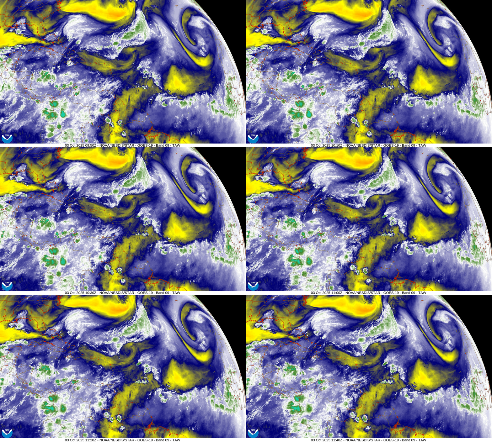
The Atlantic is currently quiet in terms of potential tropical storm development but a tropical wave in the far Eastern Atlantic off the coast of Africa will slowly organize in the coming days. NHC has a 40% chance of development in 7-days.
ECMWF Next 12-Days Integrated Vapor Transport | 00z cycle
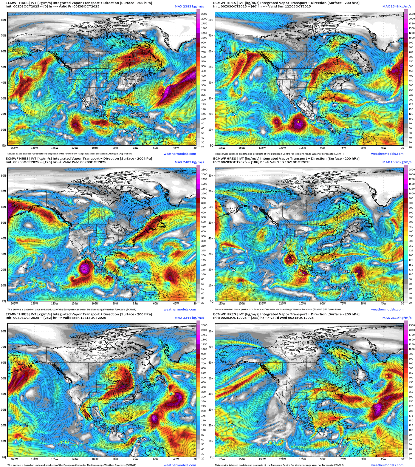
Large view centered on North America shows the development of [Eastern Pacific] Hurricane Priscilla with moisture heading into the U.S. Southwest — also absorbing what’s left of Octave, and then being followed by Raymond.
Today’s flagship 00z model run from ECMWF shows a hurricane (Jerry) developing near the Northeast Caribbean in 7-days — middle to late next week. The system them stalls and heads quickly north out to sea. This is a great outcome — similar to our previous major hurricanes (Erin, Gabrielle, Humberto).
Tropical storm development in not imminent —but increasing chances now up to 40% chance of a far Eastern Atlantic tropical wave developing into a TD in 7-days
Medium Range | AIFS 06z | 10-days Height Anomaly
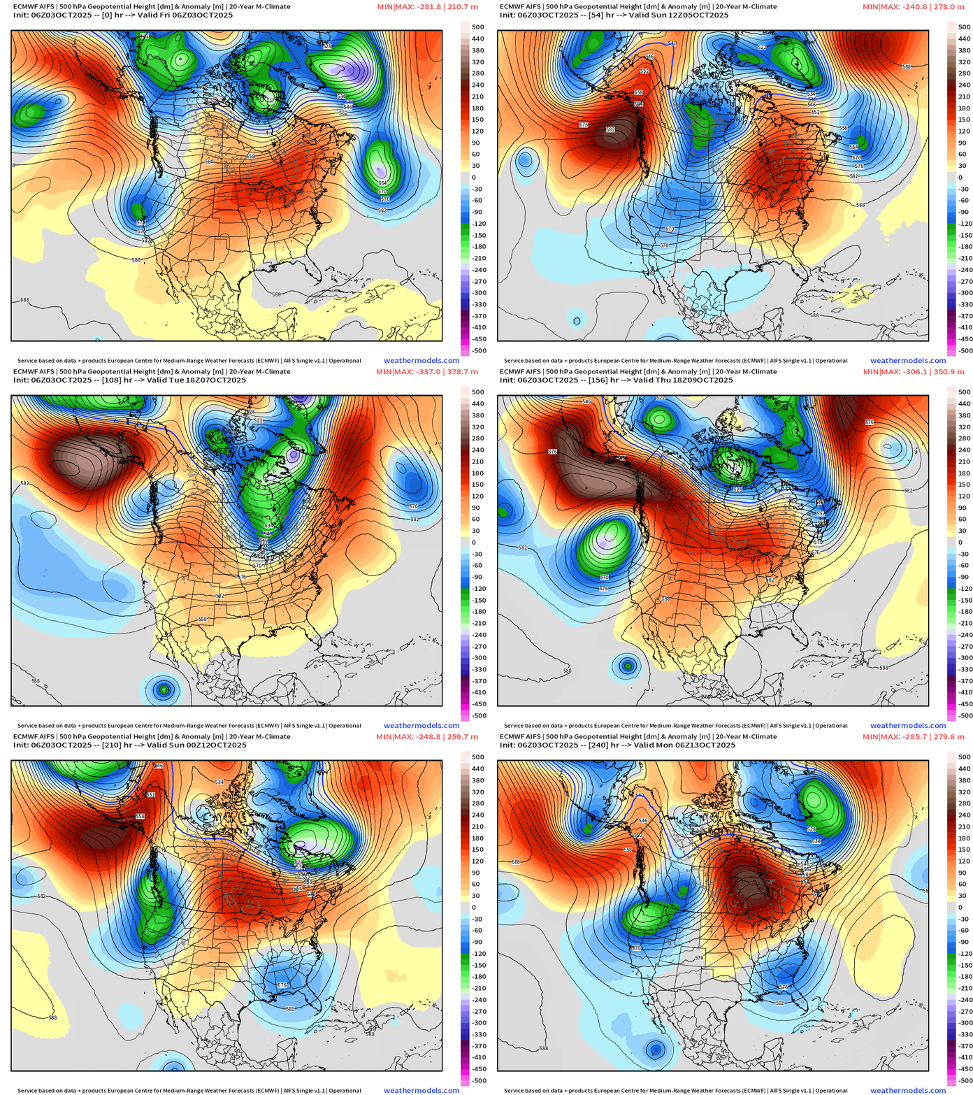
North America will see the rebuilding of a strong high pressure ridge over the central U.S. = warmth again for the middle of the country. However, on either side, troughs will dominate including in the Pacific Northwest and Southeast.
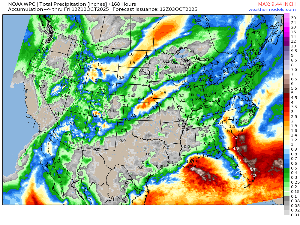
NOAA WPC 7-Day Precipitation
Atlantic Basin Outlook | 8 AM ET Update
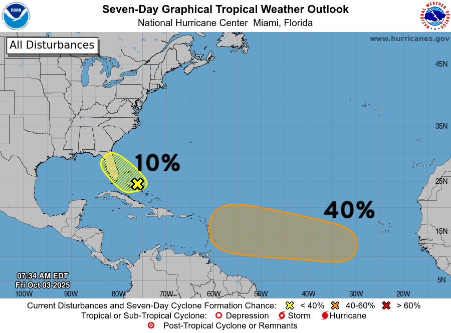
NHC is watching a tropical wave (40%) for a MEDIUM chance of development — and increasing
A non-tropical frontal boundary has a low yellow hatching over Florida (10%)
ECMWF 06z Precipitable Water | Next 6-days
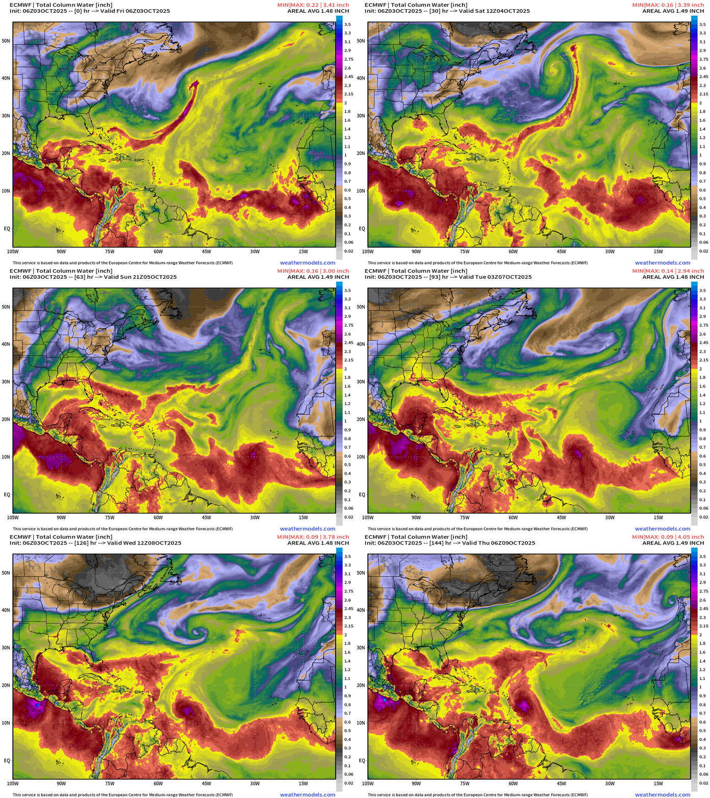
Low latitude tropical wave showing some signs of development perhaps into early next week — 40% according to NHC
ECMWF 06z Relative Vorticity | Next 6-days
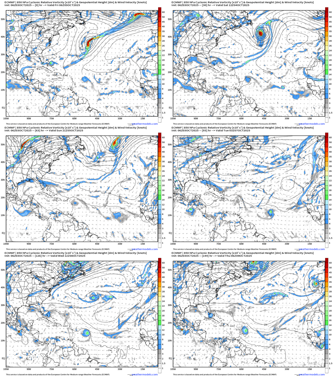
The updated 06z model spins up the tropical wave slowly but surely into next week.
NOAA GFS 06z | Integrated Vapor Transport
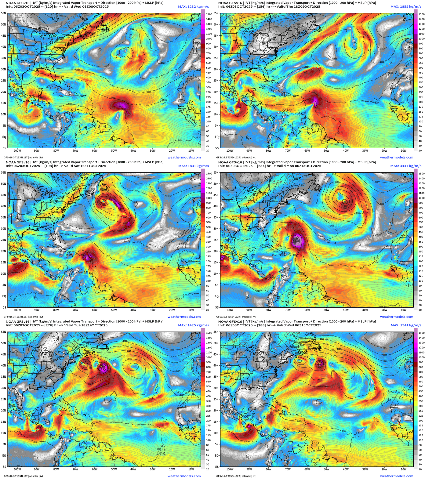
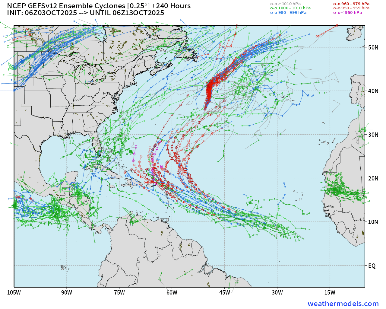
Similar solution with GFS 06z — and the GEFS 06z Ensembles through 10-days with high likelihood of (major) Hurricane Jerry.
SST Analysis and Anomaly | 12z
Ocean temperatures remain plenty warm for any category of hurricane in the tropics up to about 30°N with 28°C and above SSTs.
Atlantic Satellite Image | IR and GeoColor Visible
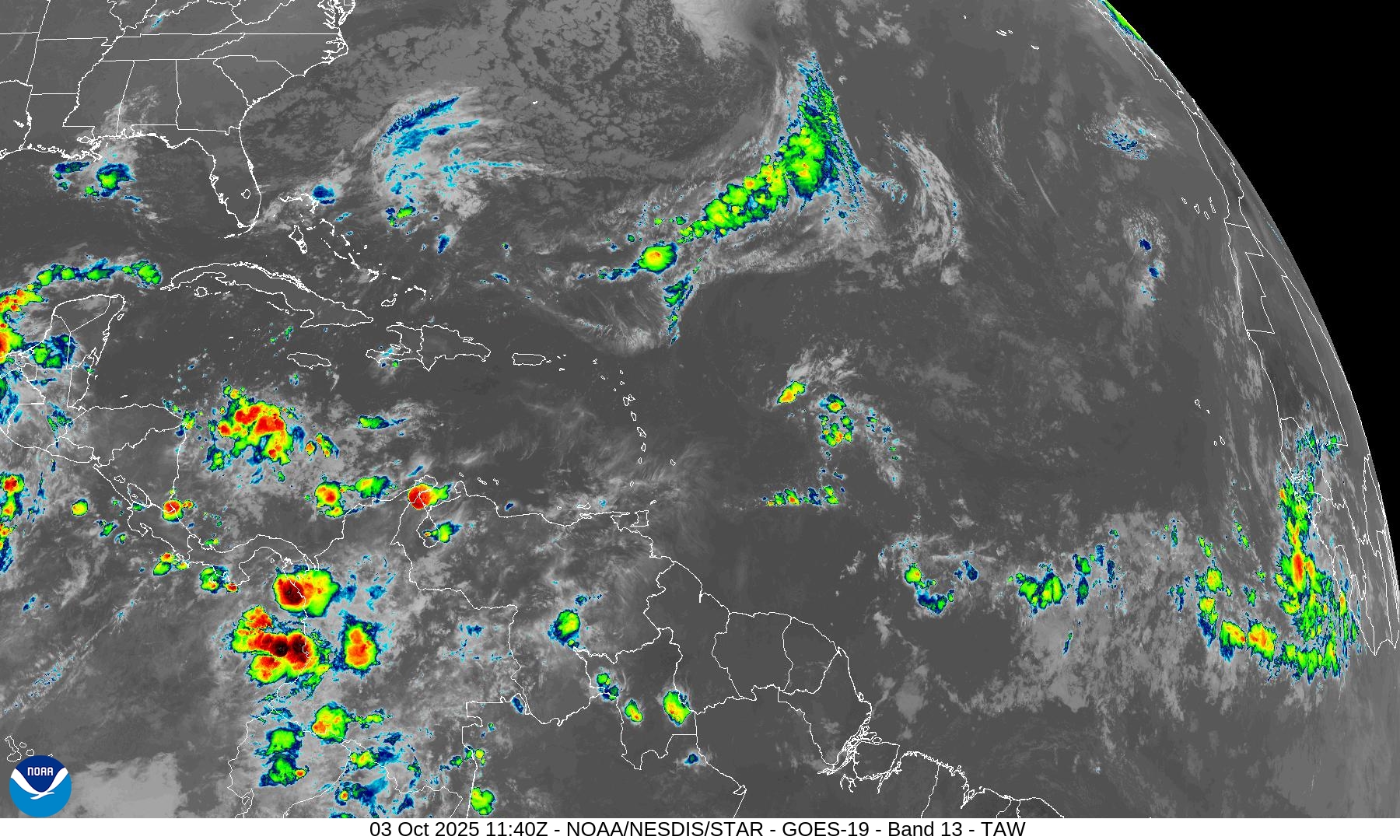
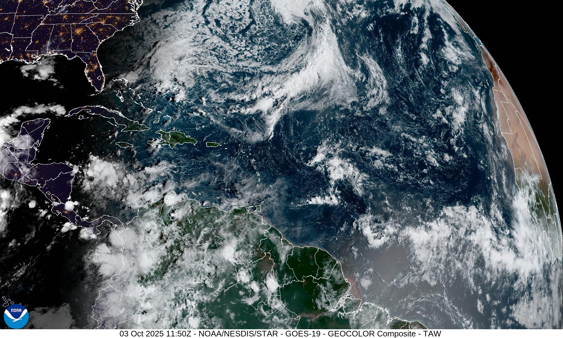
Limited convection over water … we are watching a wave coming in the far Eastern Atlantic
NOAA Tropical Surface Analysis | 06z
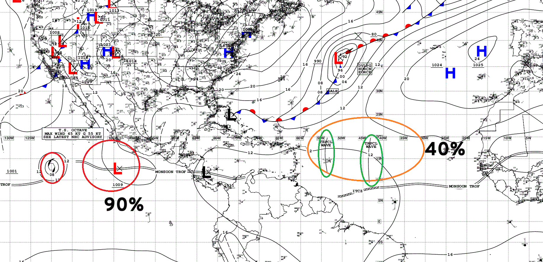
Atlantic Tropical Waves = 2 but neither are flagged as development potential by NHC. The ORANGE 40% hatching is for a wave that NHC didn’t put on the map yet.
Eastern Atlantic Visible Satellite Image
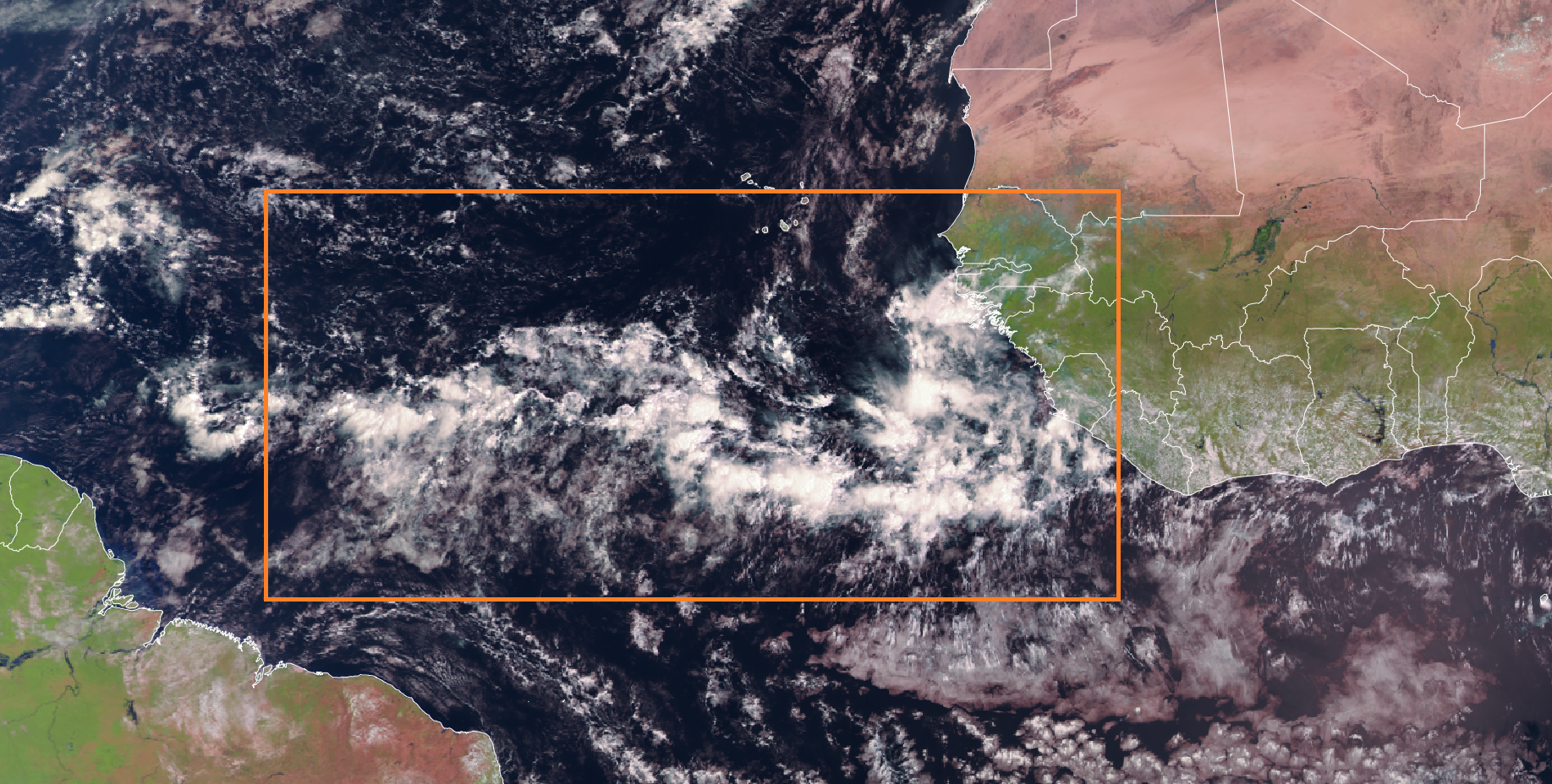
ITCZ/monsoon trough shows up well + area of convection just off African coast
ECMWF EPS 00z | Active Storm Tracks Day 7
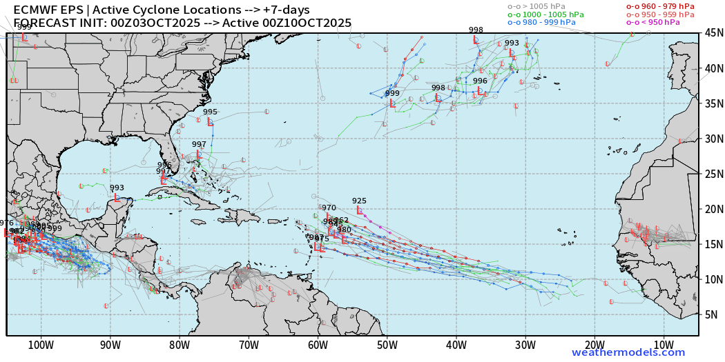
~50% chance of development of tropical wave with a curious member already at 925 mb (Category 5) in 7-days. However, that is only 1 out of 50.
ECMWF EPS 00z | Active Storm Tracks Day 10
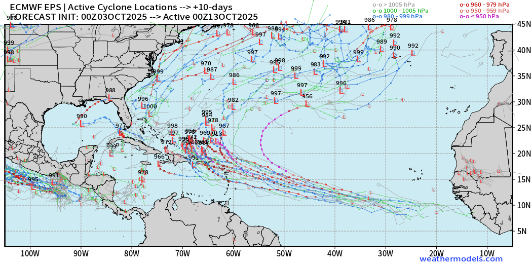
The Northeast Caribbean will need to closely monitor this tropical wave!
ECMWF EPS 00z | Active Storm Tracks Day 15
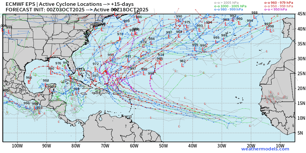
This is “over the predictability horizon” after 2-weeks … but there’s little doubt that the Atlantic hurricane season remains activated even if we don’t know exactly where a particular system will be.
This is typical for mid-October as our focus shifts westward into the Gulf of Mexico and Caribbean.
Eastern Pacific Tropical Weather Outlook | 8 AM ET
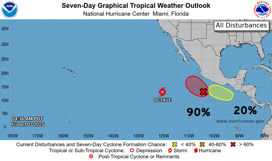
2 more systems coming online in the next 7-days = Priscilla and Raymond
Tropical Storm Octave | NHC Cone
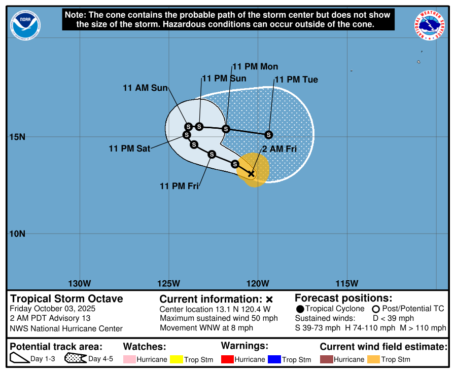
Octave will take a clockwise loop for the next 5-7 days and may interact with Priscilla well down the road.
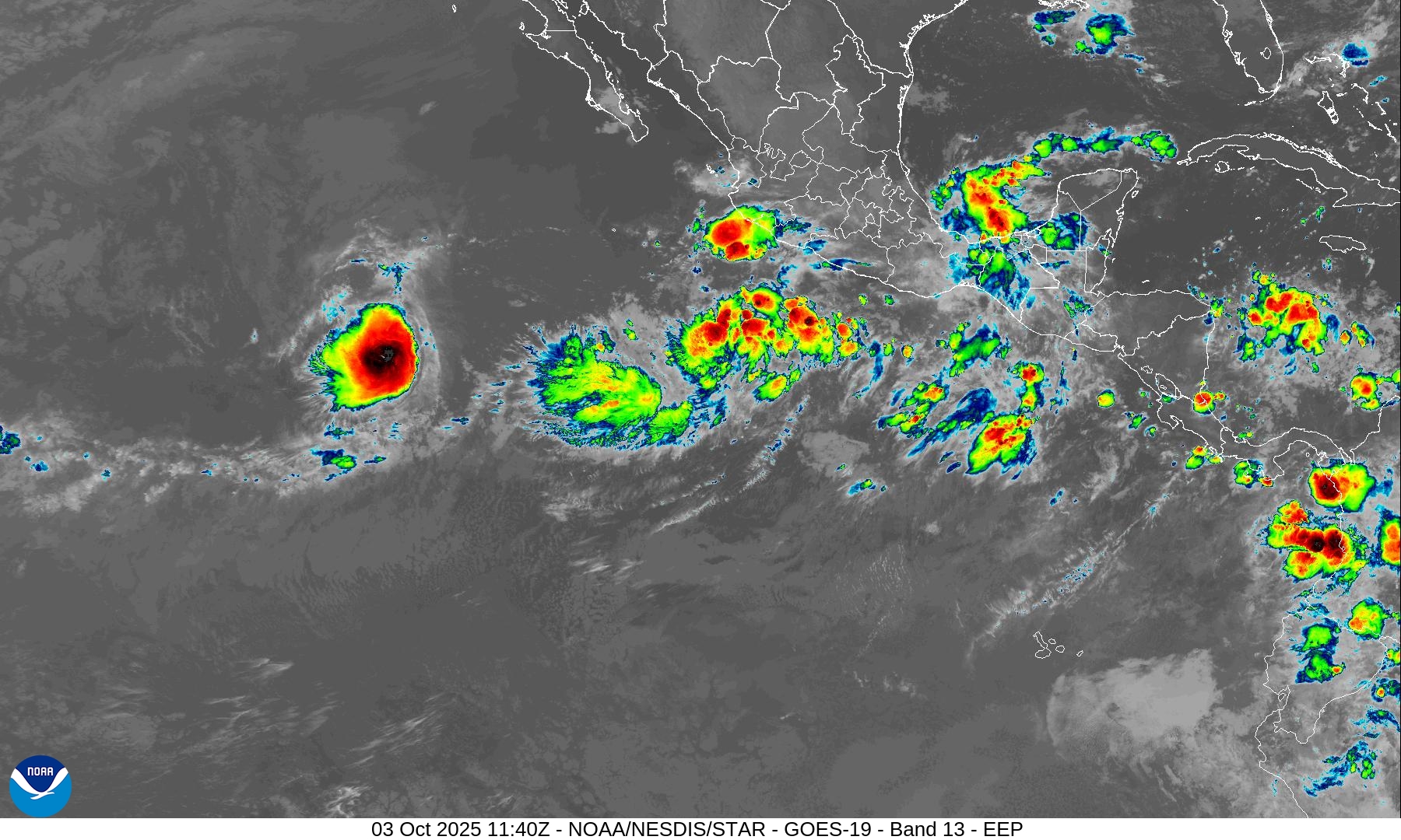
Burst of convection with Octave — the next disturbance likely a TD/TS by this weekend off coast of Mexico (90%) = Priscilla
Eastern Pacific Current Satellite
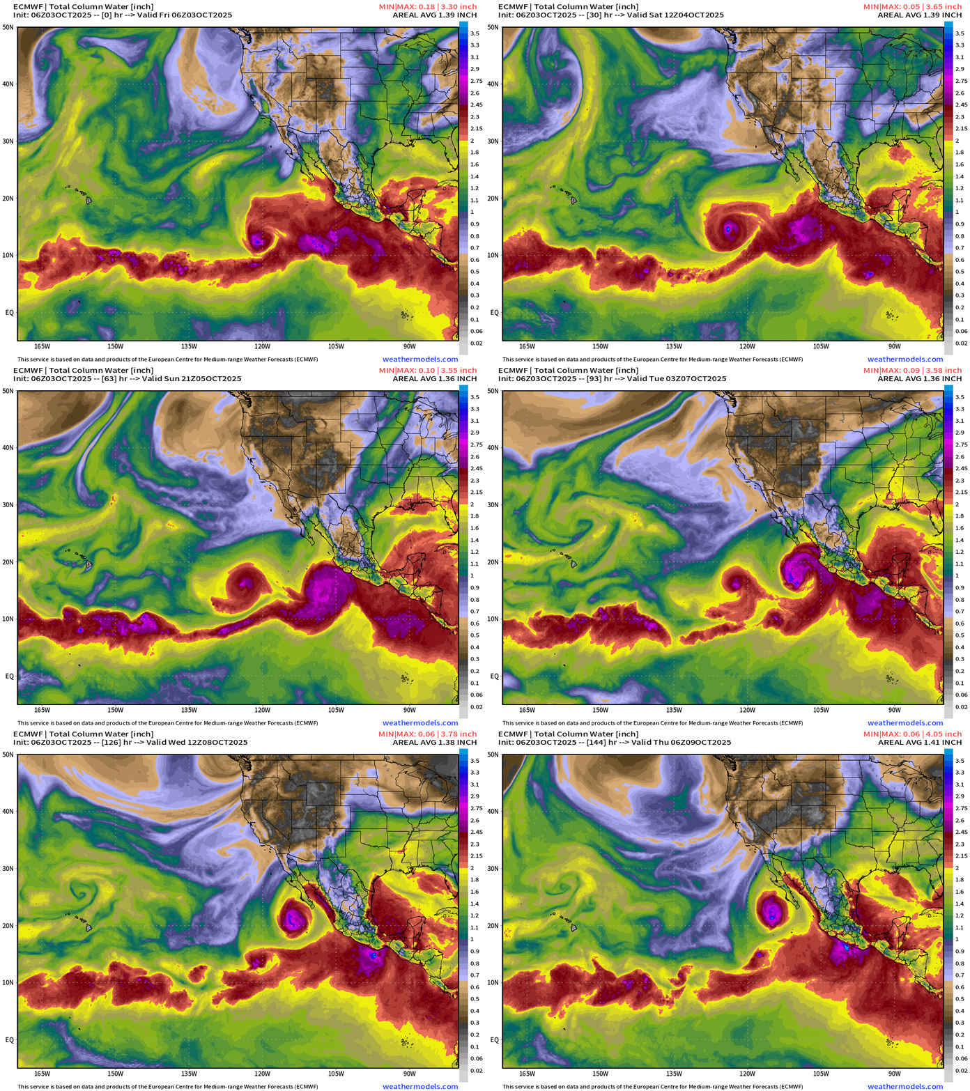
PWAT Next 6-days for Octave and Priscilla — then Raymond!
Western Pacific Typhoon Season
Typhoon Matmo has moved across Luzon into the South China Sea and will intensify to 85-knots (JTWC) before making landfall in China in 2-3 days.
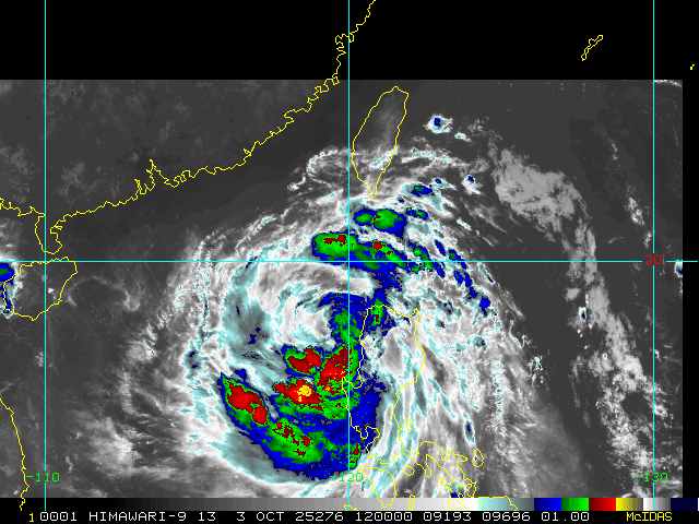
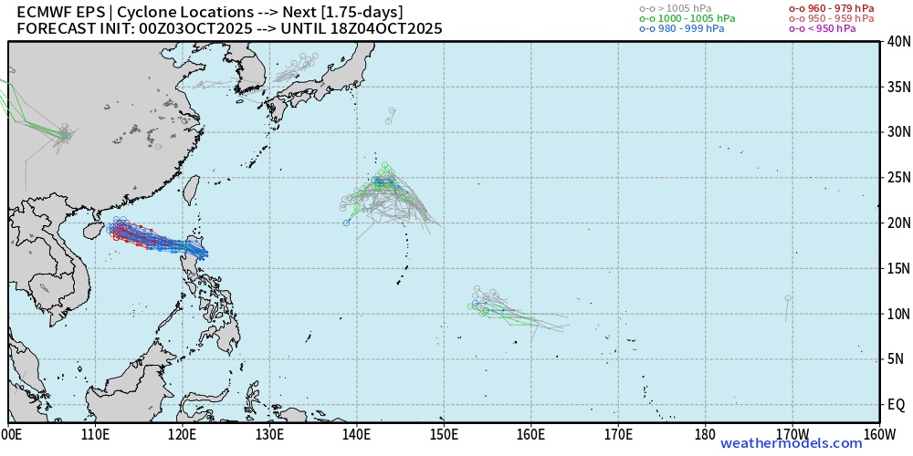
Another Typhoon likely to develop in the NW part of the basin between Taiwan and Japan.
7-day Active Cyclones | Ensemble Spaghetti (50-members) | ECMWF 00z
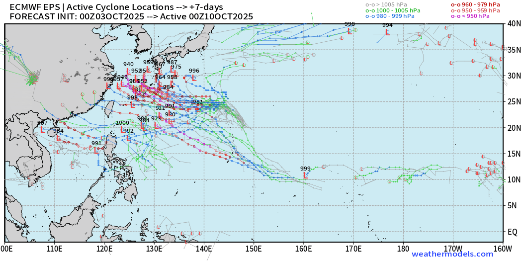
Maps sourced from weathermodels.com designed and innovated by yours truly! Please subscribe there for real-time access to the newest maps, charts from all of the weather models including ECMWF.
- Milepost
- 755 · laid 2025-10-03T12:42:38.673000Z
- Source
- https://weather.substack.com/p/october-3-2025-friday-tropical-update
- Digest
- ff3c196ccd166e653a5e871101646c32d59dec44a8c4fc70c72c7b08b619d05a
- Machine
- JSON