September 10, 2025 Wednesday Morning Update
Atlantic hurricane season returns to action next week
September 2025 was the 7th-warmest September in the 131-year national record (1895–2025), at 67.9°F against a 1991–2020 normal of 66.0°F (+2.0°F).
September 2025 was the 15th-driest September in the 131-year national record (1895–2025), at 1.9in against a 1991–2020 normal of 2.6in (-0.6in).
NOAA/NCEI Climate at a Glance, contiguous United States. This is the observed record for the month, not a score of anything said in this piece — the forecast ledger begins 2026-08-17 and cannot reach earlier posts.

Good Morning!
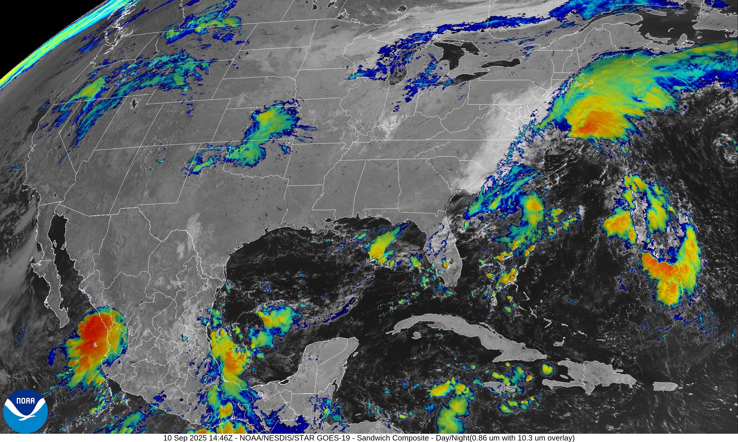
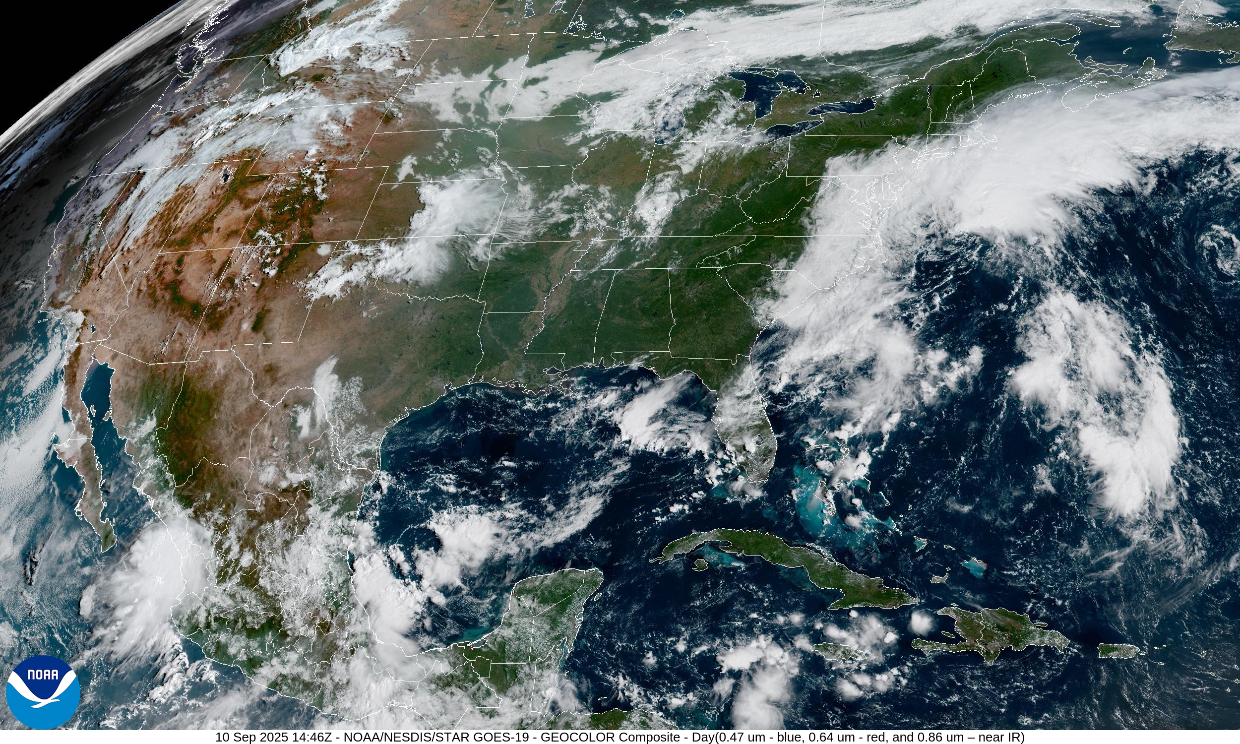
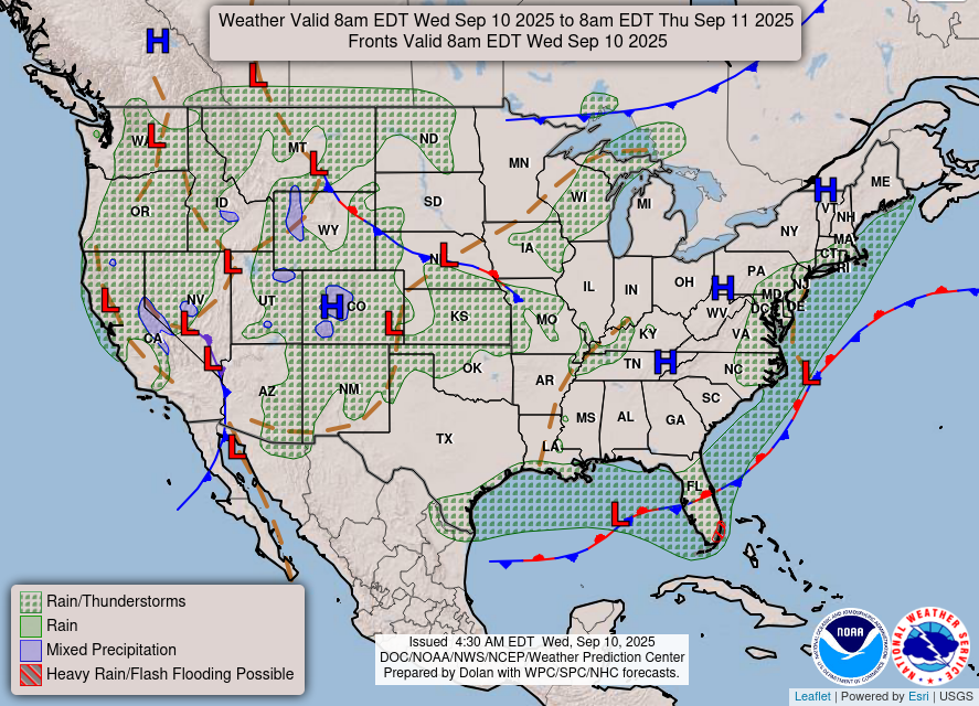
Quiet weather today across the Lower 48 with only a few areas of showers and cloud cover. The mid-September sun angle still has no trouble warming up the dry Canadian origin air mass that plunged southward behind a strong cold front.
Lower 48 Precipitable Water | Next 6-days
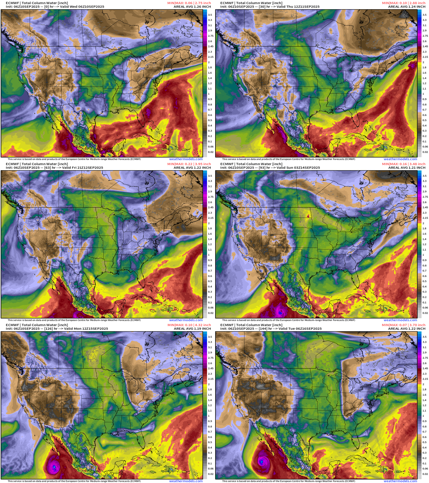
Another trough dips into the Mid-Atlantic and Southeast this weekend into early next week. Tropical Storm Marco could rapidly intensify off the coast of Mexico into a Major Hurricane.
Weather | Fronts this Morning
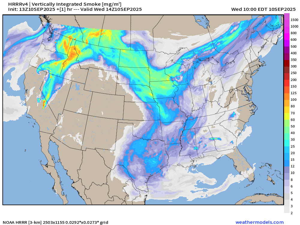
Smoke Analysis | 10 AM ET Wednesday
RTMA Temperatures and Anomaly | 9:45 AM ET
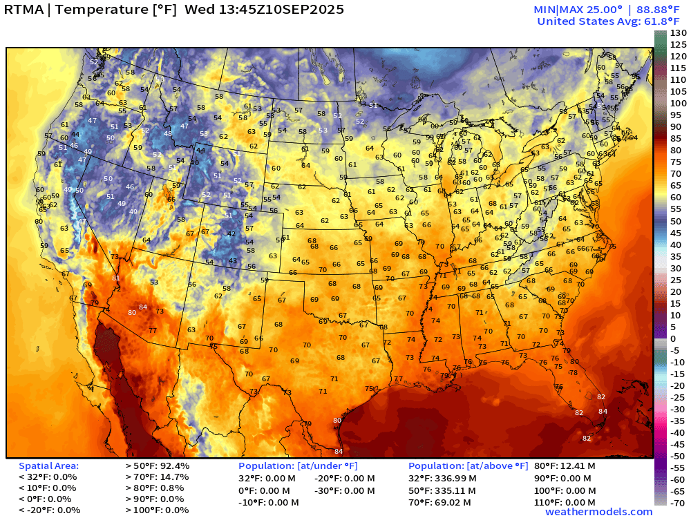
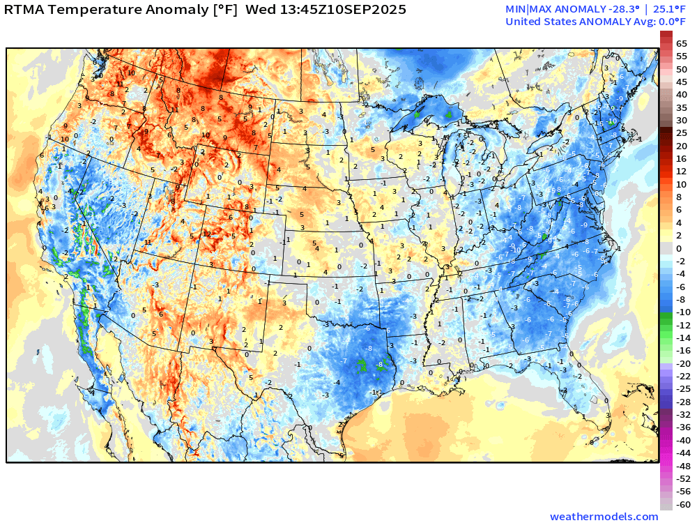
Lower 48 is normal (0.0°F anomaly)
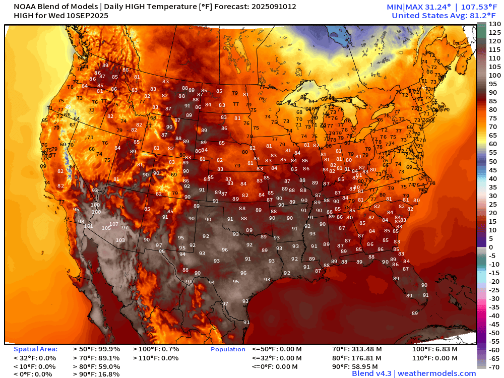
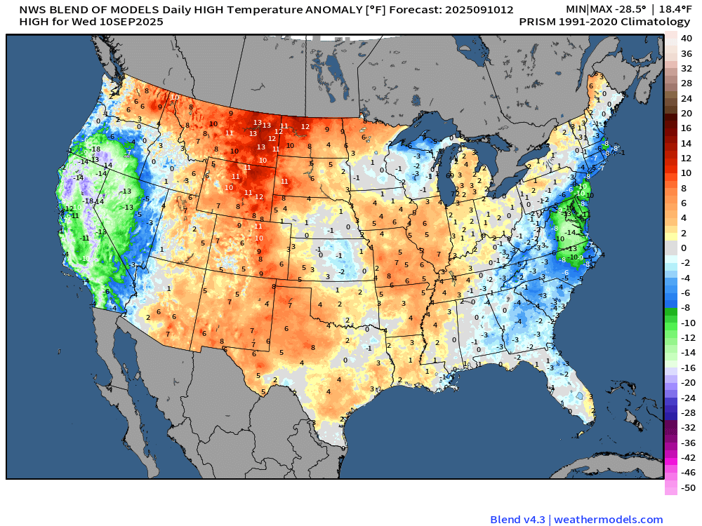
High Temperatures Wednesday and Comparison with Climatology
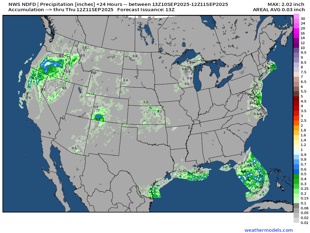
Rainfall Next 24-hours | NWS NDFD
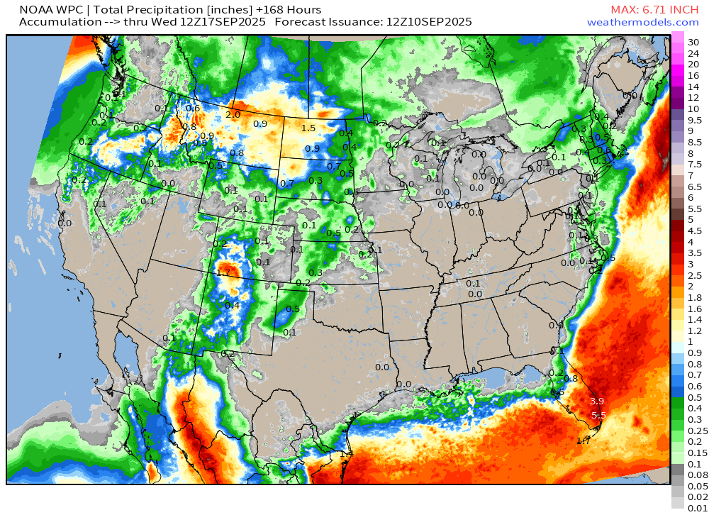
7-Day Precipitation from NOAA WPC
North America Upper Level Height Anomaly | AIFS 06z | Next 10-days
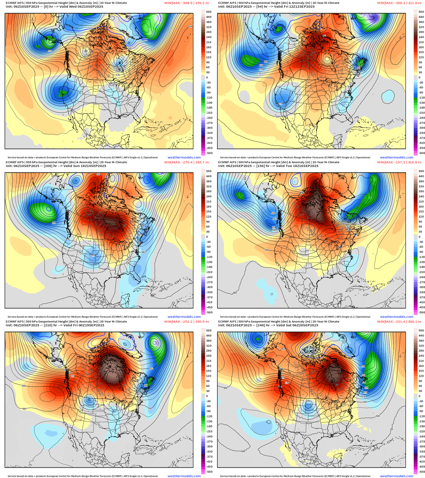
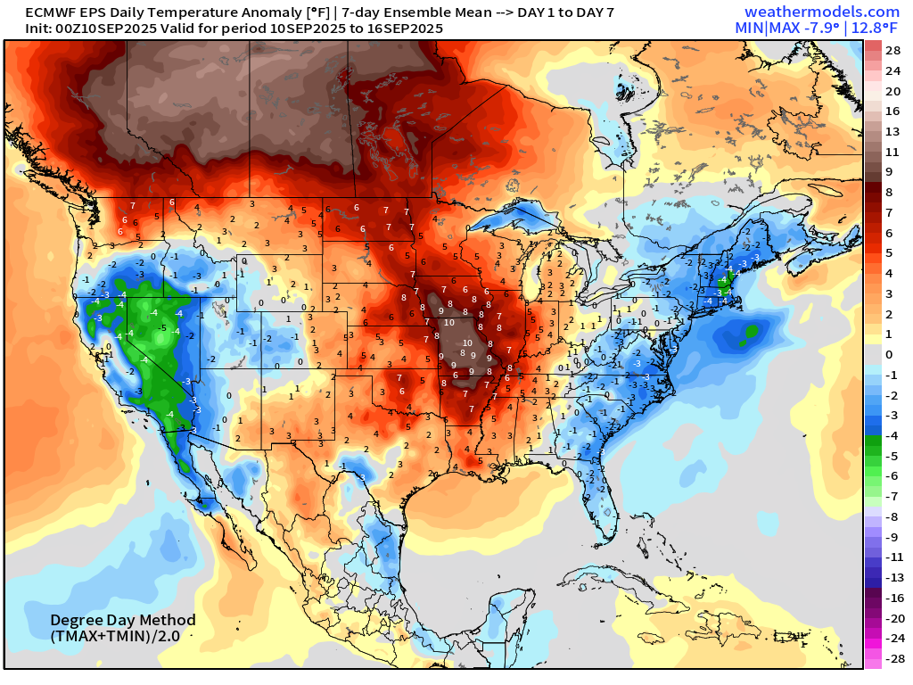
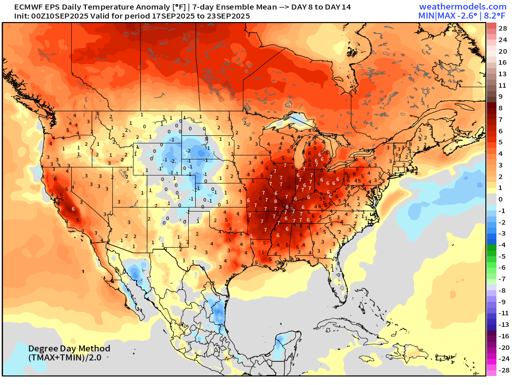
A warming trend in the center of the Lower 48 and into Canada — especially in the western provinces. The troughs on either side of the blocks will filter cooler air from Canada southward into the Carolinas and Southeast — but also very dry.
ECMWF EPS 00z | 7-day Temperature Anomaly | Week 1 (Sept 10-16)
ECMWF EPS 00z | 7-day Temperature Anomaly | Week 2 (Sept 17-23)
Atlantic Hurricane Season
2025 Season to Date: 6 named storms, 1 hurricanes, and 1 majors | ACE = 40 ACE of Erin: 32.2 (140-knots maximum wind)
ECMWF 12-Days Integrated Vapor Transport | 00z cycle
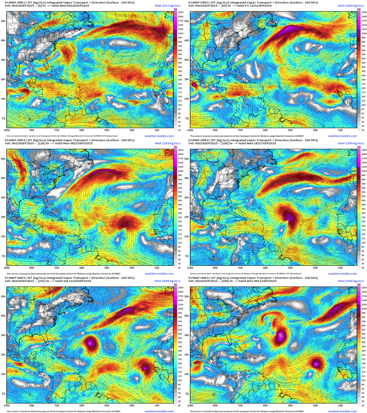
Flagship model simulation shows 2 tropical wave candidates for TS/Hurricane formation: (1) coming off Africa Friday (2) another strong wave the following weekend. These are spaced 1-week apart, which limits the number of storms we can see in the Atlantic, but we should see 2 TS/Hurricanes by September 22.
ECMWF 06z | Precipitable Water Next 6-days
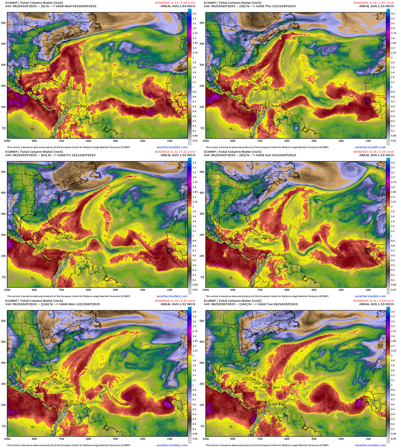
A tropical wave by this weekend coming off Africa is next shot at a tropical system but may not develop into a TD for 7-8 days.
Atlantic Basin Outlook | 8 AM ET Update
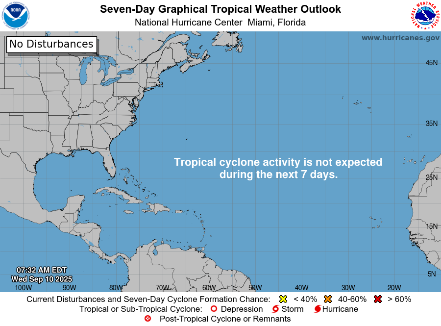
Nobody home — but I’d expect a Yellow Hatching to come online soon for weekend tropical wave.
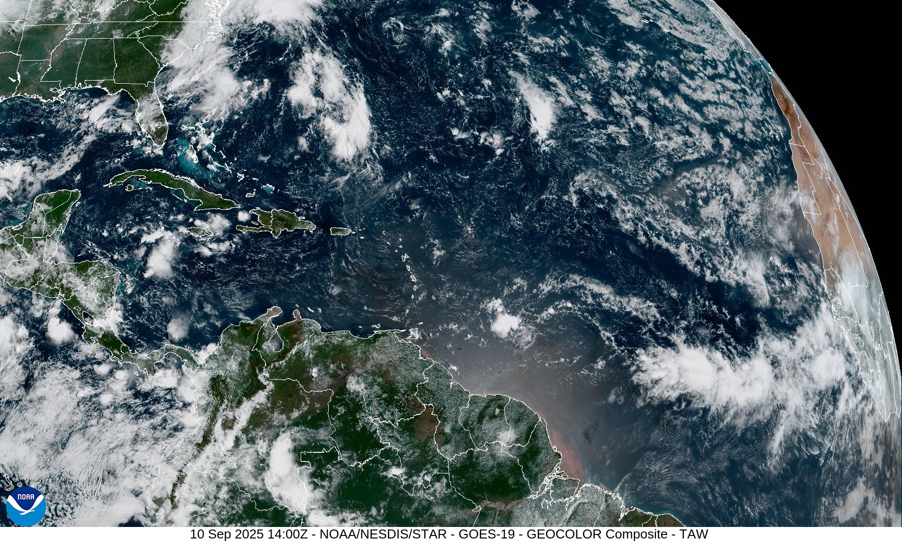
Atlantic Satellite Imagery | GeoColor
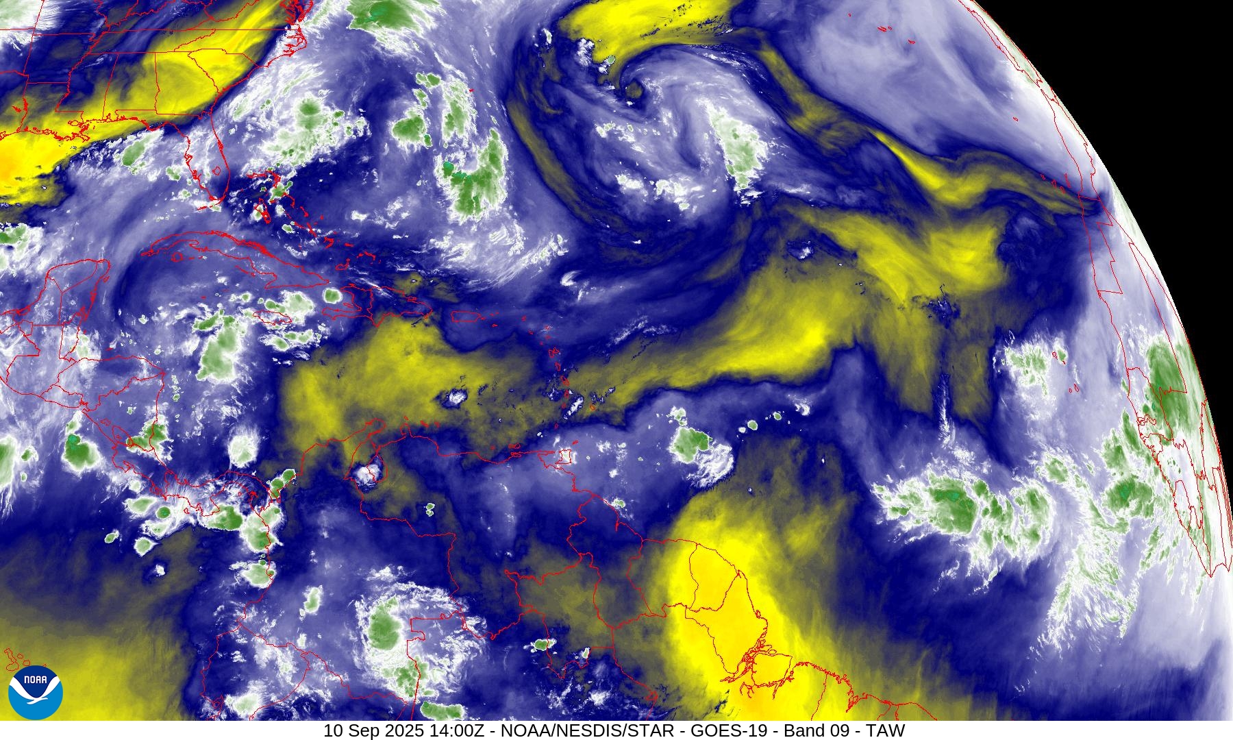
Water Vapor | Mid-level
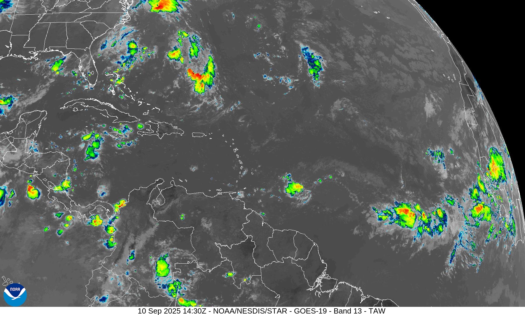
Infrared Imagery
NOAA Tropical Surface Analysis | 06z
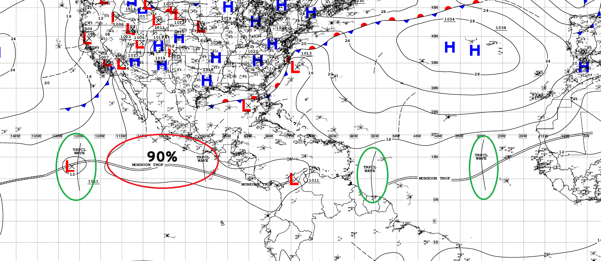
Atlantic Tropical Waves = 2 but not candidates for development
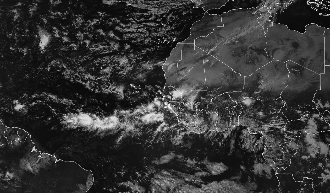
Eastern Atlantic and Africa Visible Satellite
NASA Dust 5-day Forecast
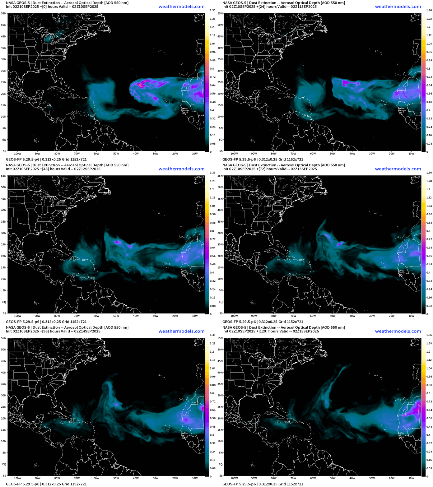
Dust is omnipresent across the Atlantic tropics but at a slightly higher latitude and less intensity that previous weeks, a trend we expect into mid-September.
ECMWF EPS 00z Ensemble | Active Cyclone Tracks Through 7-days
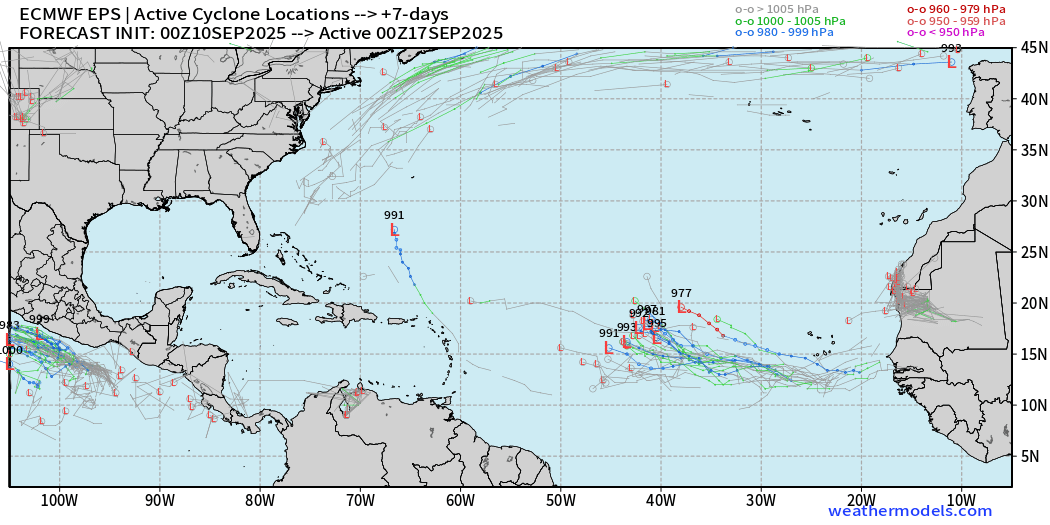
Coherent signal from the ensembles at Day 7 (next Tuesday) > 50%
ECMWF EPS 00z Ensemble | Active Cyclone Tracks Through 12-days
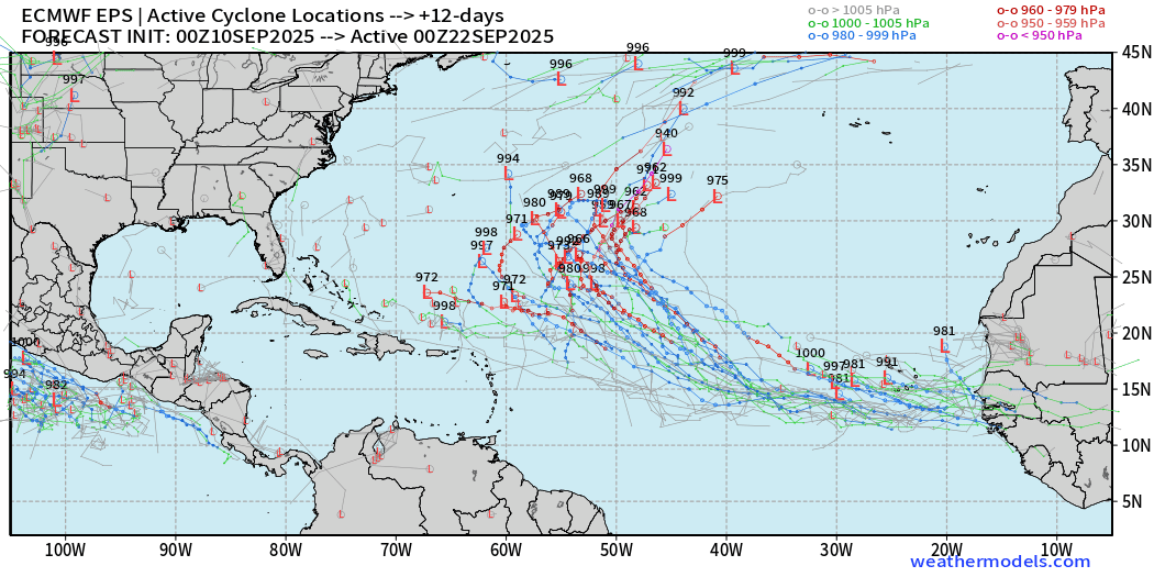
Most members feature a hurricane. Another wave on its heels develops right off the coast of Africa.
ECMWF EPS 00z Ensemble | Active Cyclone Tracks Through 15-days
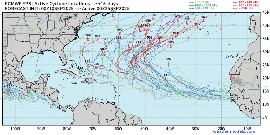
Many major hurricane possibilities — over the central Atlantic (September 24th)
AIFS-ENS Comparison at 06Z | Active Tracks at Day 10
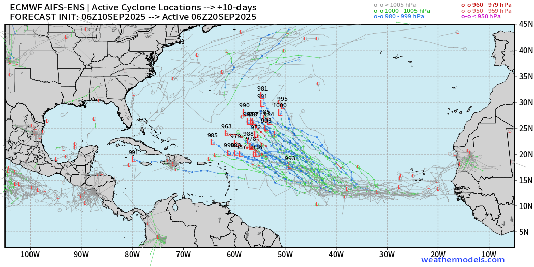
AIFS ENS is very excited about this tropical wave — high chance > 90%
AIFS-ENS Comparison at 06Z | Active Tracks at Day 15
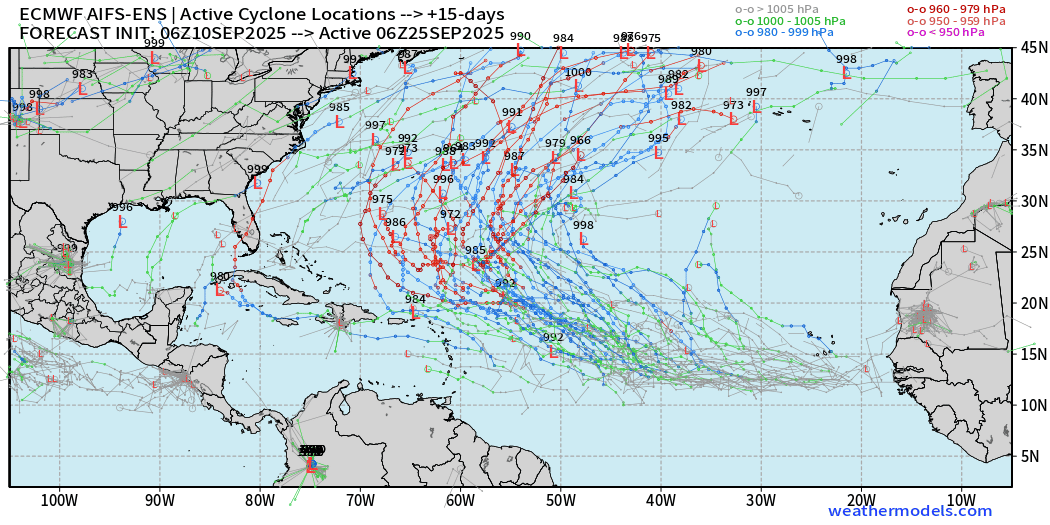
A more active Atlantic basin for sure, but thankfully everything looks to be recurving or staying away off the U.S. mainland.
Eastern Pacific Tropical Update
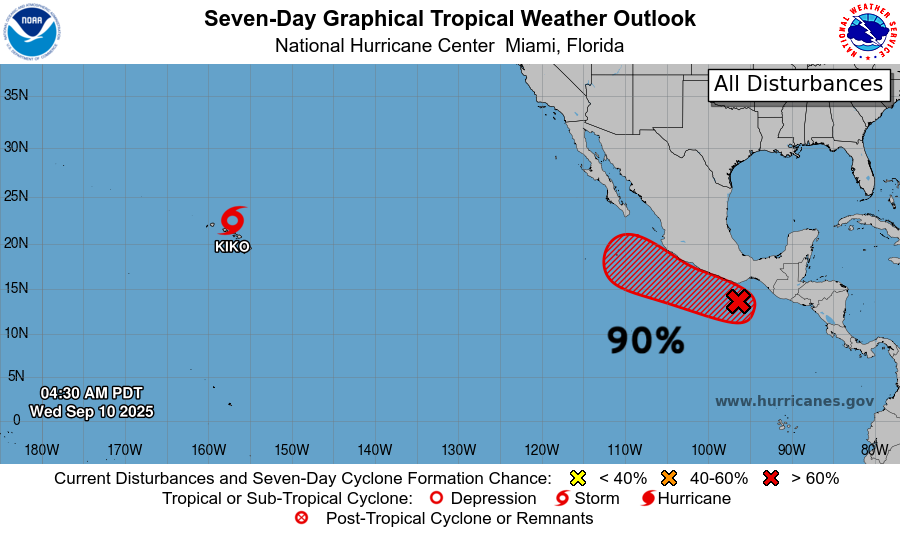
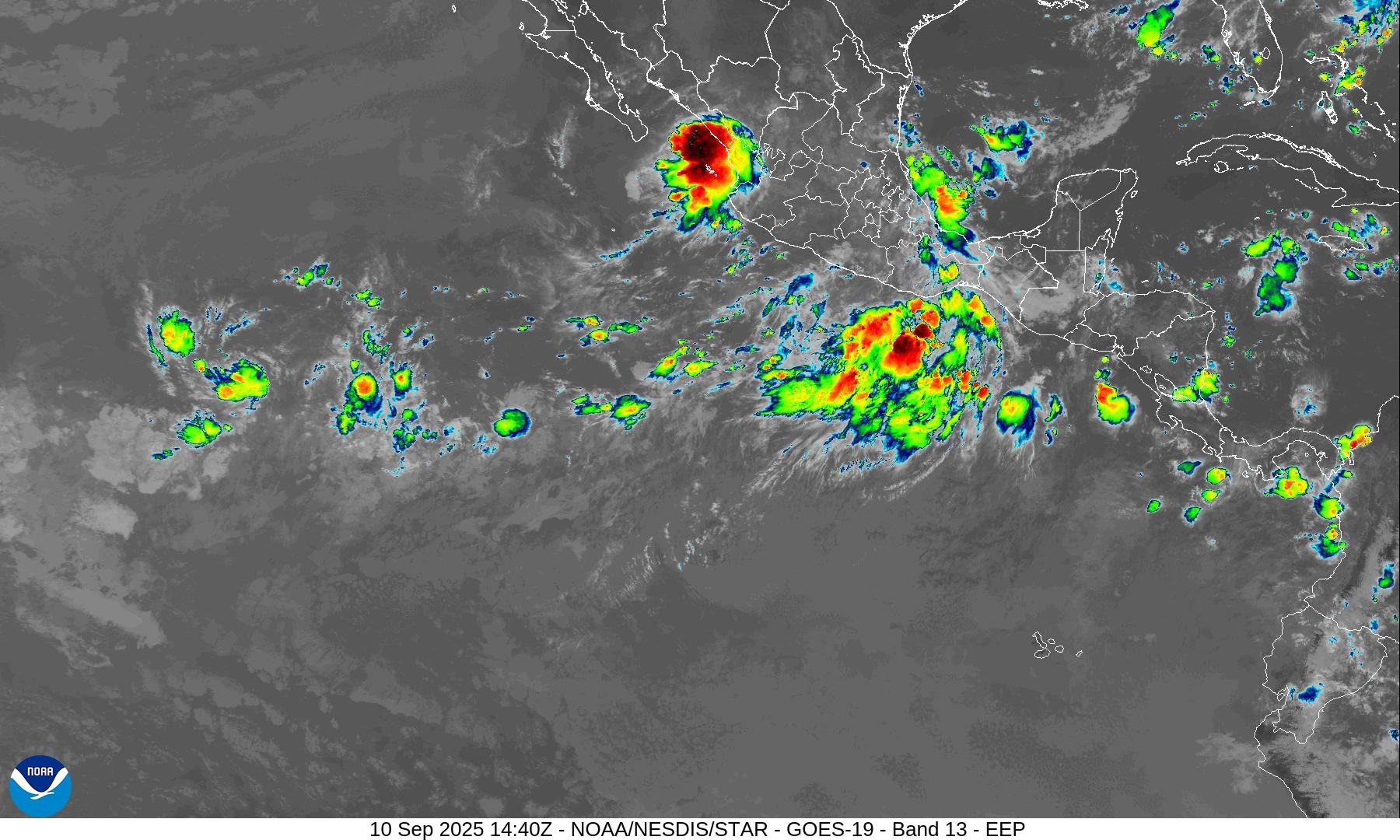
Next system is Marco — coming online in a few days and could become a major hurricane.
Maps sourced from weathermodels.com designed and innovated by yours truly! Please subscribe there for real-time access to the newest maps, charts from all of the weather models including ECMWF.
- Milepost
- 729 · laid 2025-09-10T15:15:52.875000Z
- Source
- https://weather.substack.com/p/september-10-2025-wednesday-morning
- Digest
- c903360bb02eee3cc88b58c77ee2f56a30f2c82a188aff40e245b0832c422e98
- Machine
- JSON