August 19, 2025 Hurricane Erin Evening Update
Erin inner core slightly improved as wind shear decreased
August 2025 was the 28th-warmest August in the 132-year national record (1895–2026), at 73.4°F against a 1991–2020 normal of 73.1°F (+0.3°F).
August 2025 was the 27th-driest August in the 132-year national record (1895–2026), at 2.3in against a 1991–2020 normal of 2.7in (-0.3in).
NOAA/NCEI Climate at a Glance, contiguous United States. This is the observed record for the month, not a score of anything said in this piece — the forecast ledger begins 2026-08-17 and cannot reach earlier posts.

2025 Season to Date: 5 named storms, 1 hurricanes, and 1 majors
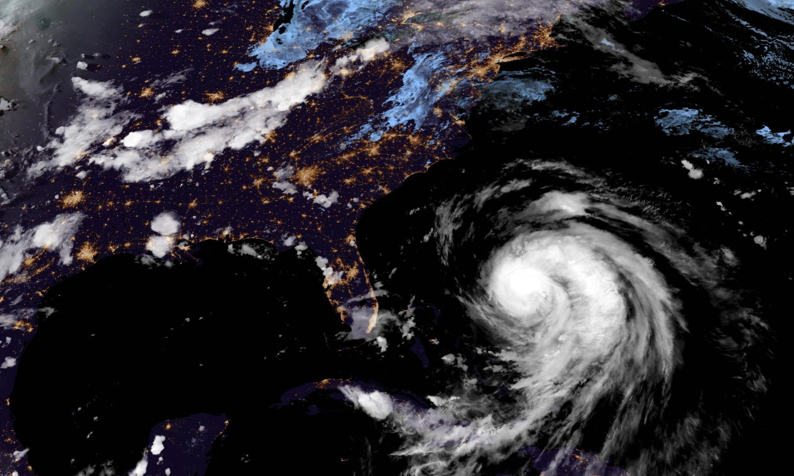
Tuesday Evening Tropical Update
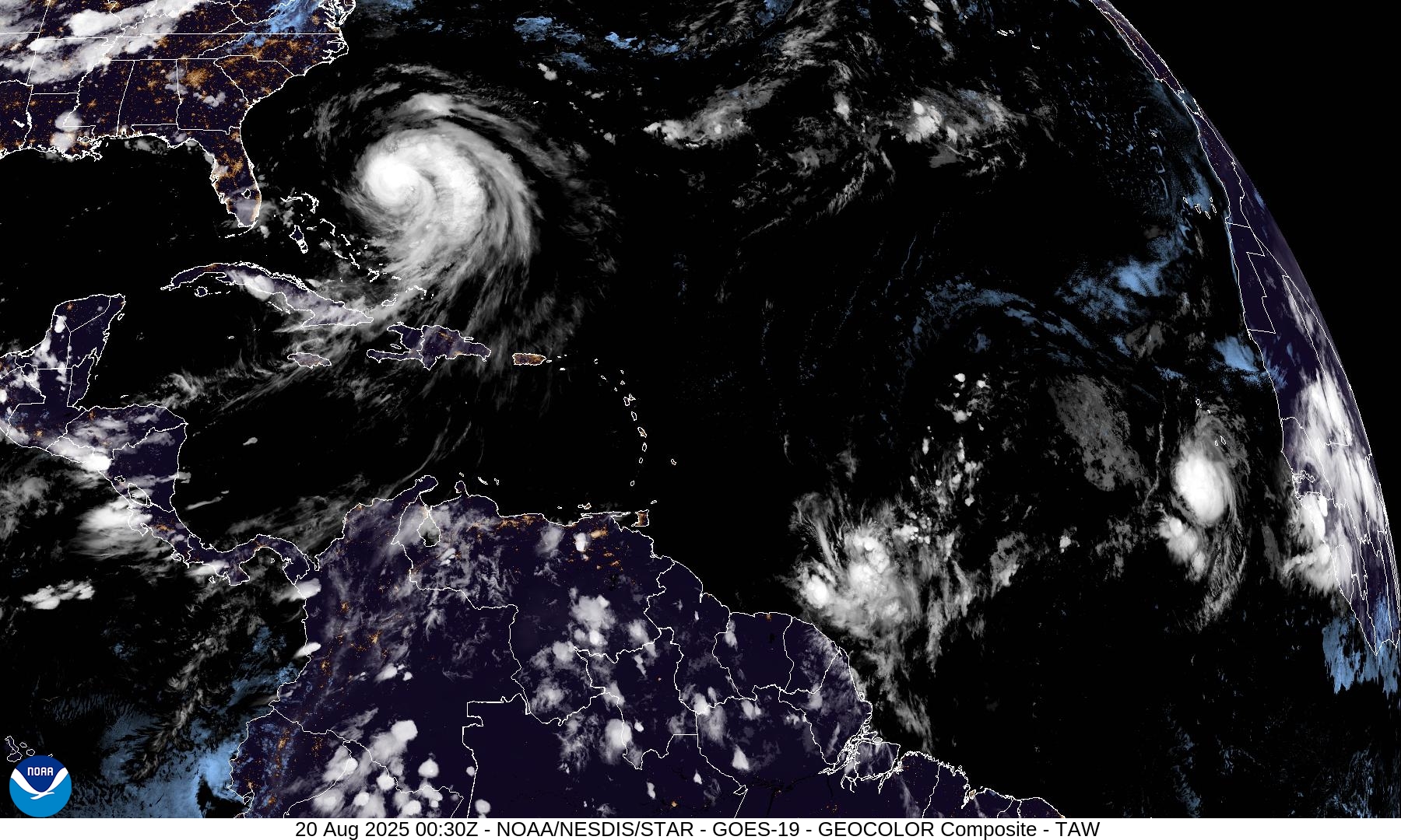
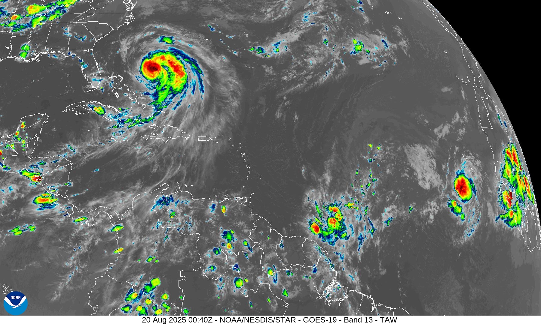
Hurricane Erin a little better organized this evening as the inner-core is more symmetric
Tropical wave off Africa (Invest 99L) still showing sustained convection but time is running out before it apparently degrades into an open wave (30% chance of development)
Central MDR tropical wave — little convection, so much slower development but a TS likely northeast of the Leeward Islands this weekend (60%)
Ensemble packages show the Atlantic going quiet into September.
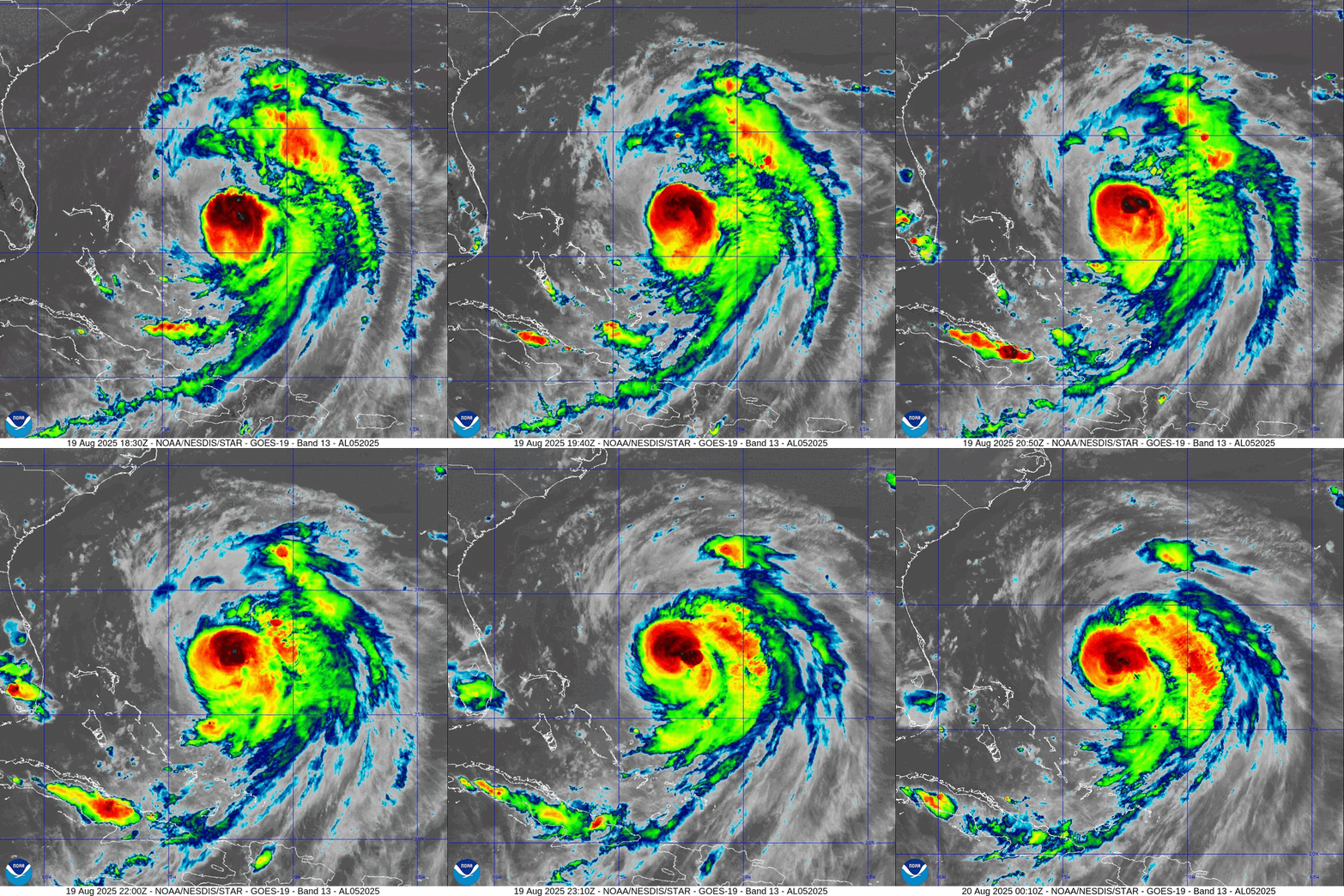
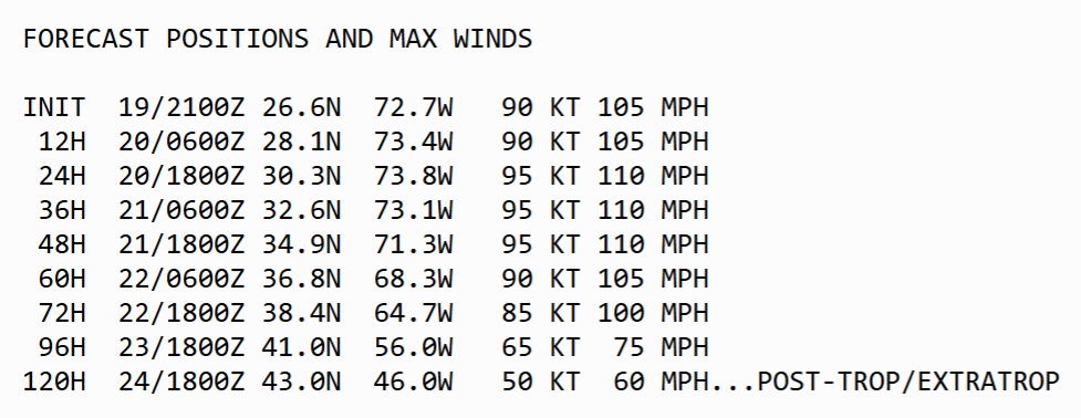
The intensity of Erin is expected to remain near Category 3 (major) for the coming 2 days as the storm tracks through the western Atlantic — in between North Carolina and Bermuda.
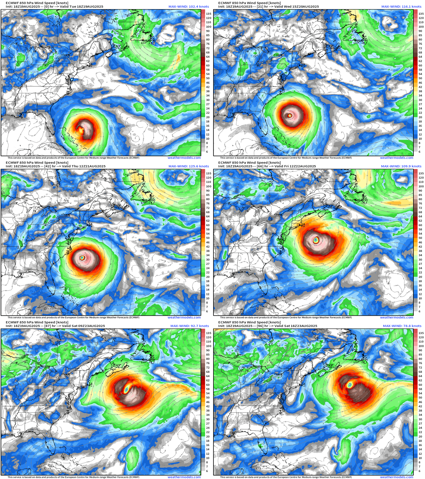
Erin will be a “massive” sized storm and strong tropical storm wind force gusts impacting the Outer Banks + enormous / battering waves + swell along the coastline.
ECMWF 18z | Precipitable Water Next 6-days
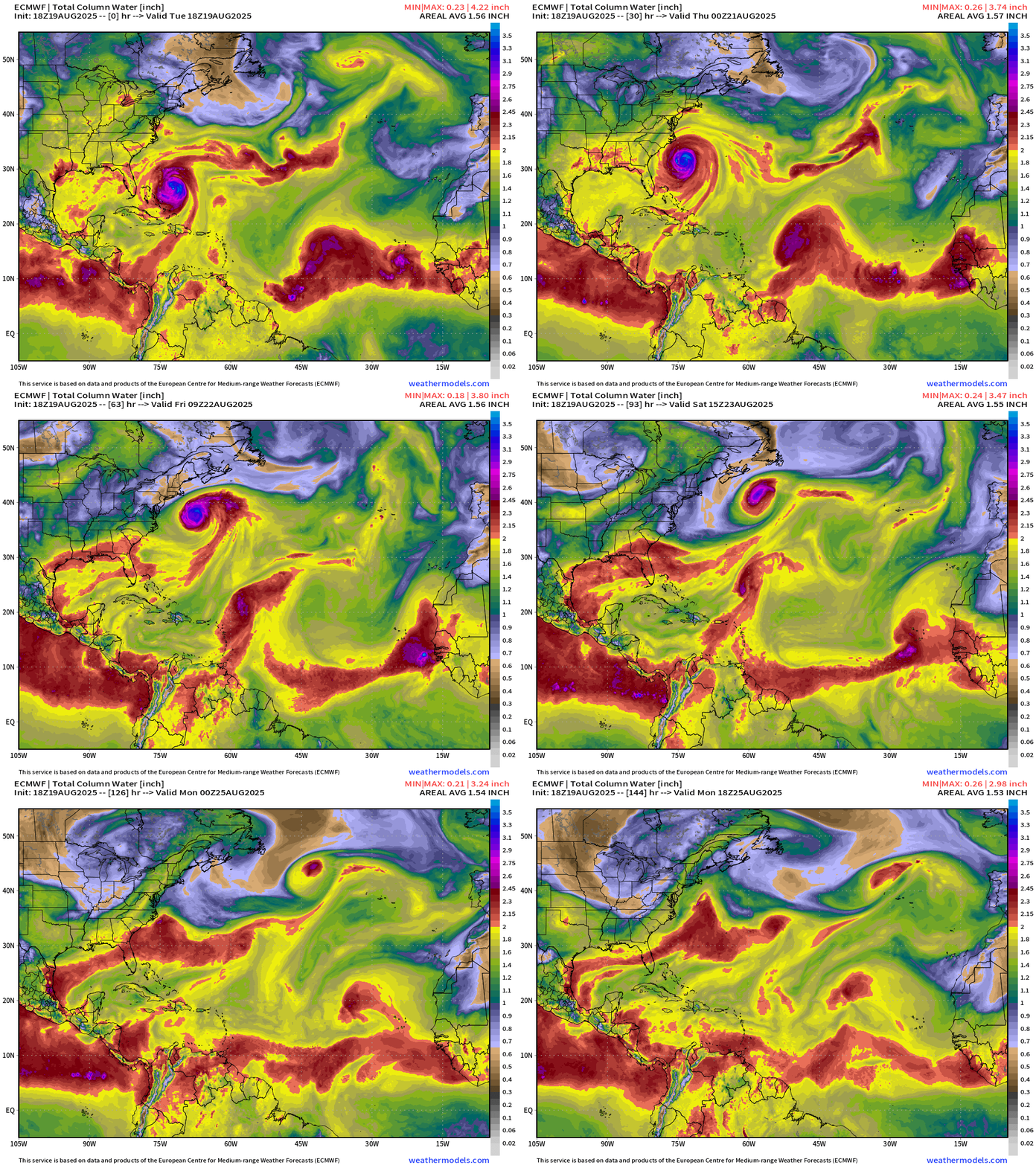
Central MDR tropical wave moving westward crossing 40°W will slowly develop in 3-4 days as it nears the northern Leeward Islands (60% chance)
Small but vigorous Invest 99L just south of the Cape Verde Islands could actually take the next name, briefly —> Fernand — it dips WSW into the monsoon trough.
ECMWF EPS 12z track spaghetti for Hurricane Erin
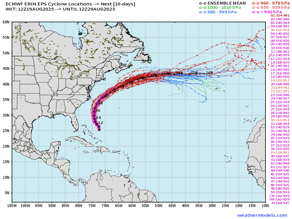
Hurricane Erin may make 75°W and 30°N waypoint — considerably west of previous forecasts — but the curve out to sea will be more pronounced — thankfully. Very close call to the coast — but the actual % chance of a landfall was at most 6% from the ensembles — and that includes the outliers.
ECMWF AIFS 18z | 500 mb Height Anomaly Next 10-days
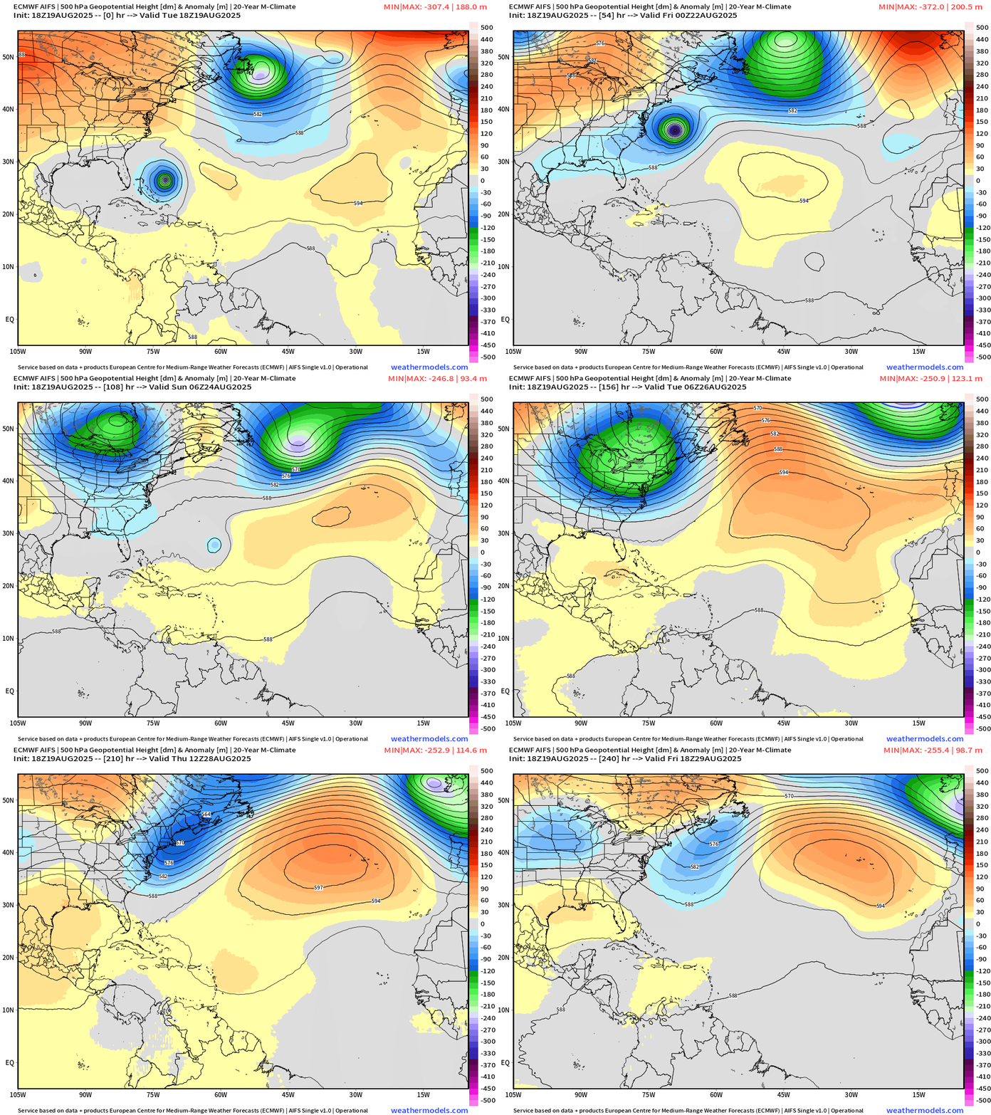
Erin “escapes” out to sea as the trough over far SE Canada erodes the subtropical ridge / Bermuda High and provides the weakness.
A massive trough dips into the Northeast by this weekend shutting the door on any tropical storm activity near the U.S. East Coast for the next 7-10 days.
Also, ridging over the 4 corners of the Western USA = “heat dome” that has just enough power to keep Erin from moving west — and helps direct the Canadian Arctic troughs downstream. The U.S. East Coast is spared a landfall by Erin.
ECMWF 18z | Next 6-days of Vorticity
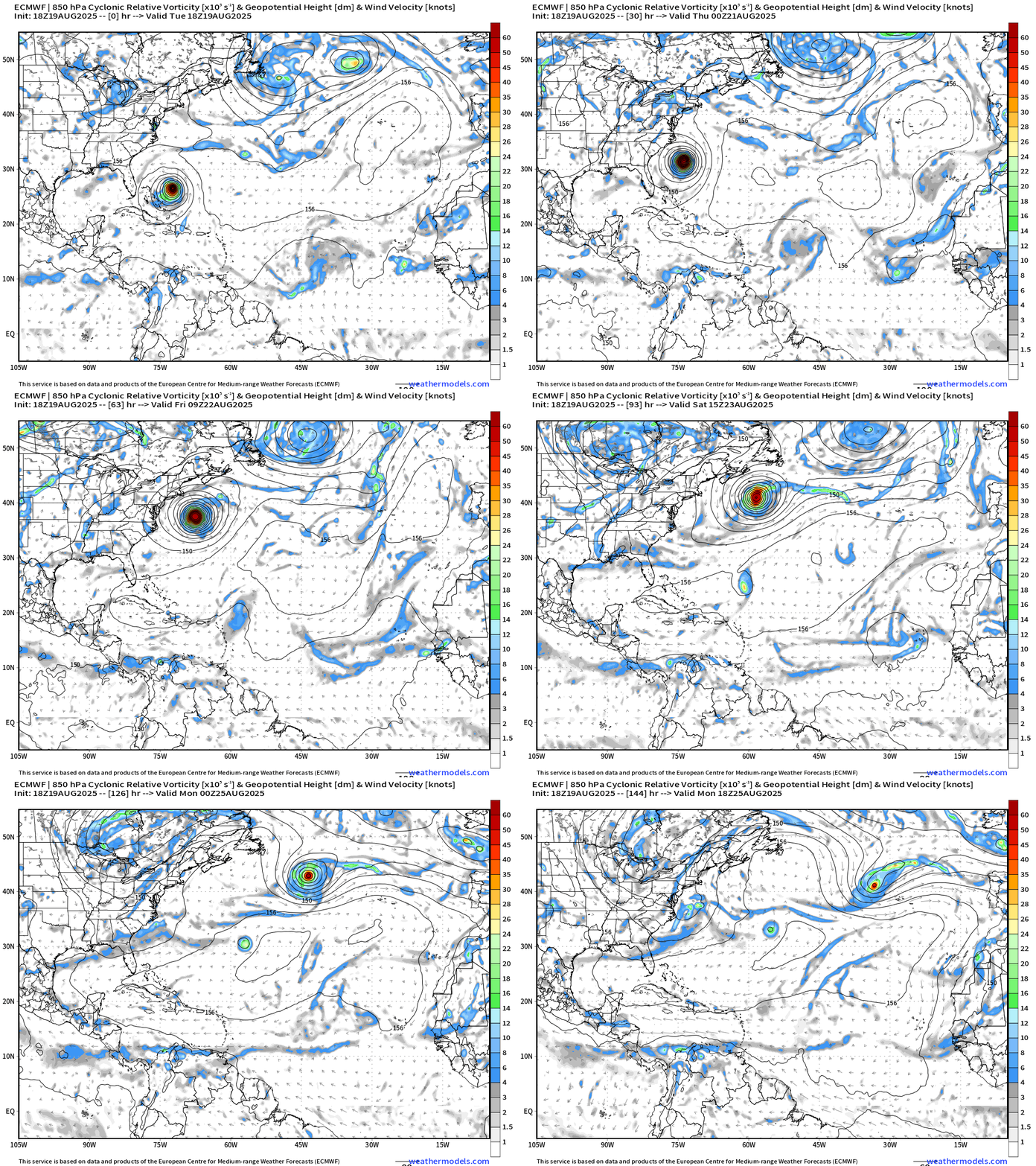
In 3 days, the central MDR tropical wave may have a better opportunity to develop north of Puerto Rico into the weekend —> it has a broad and loose circulation but tightens up as it heads WNW.
Hard to see but a little red dot of cyclonic vorticity appears with Invest 99L south of the Cape Verde Islands and it dips WSW. That could still be Fernand in next 24-hours!
ECMWF 10-Days Integrated Vapor Transport | 12z cycle
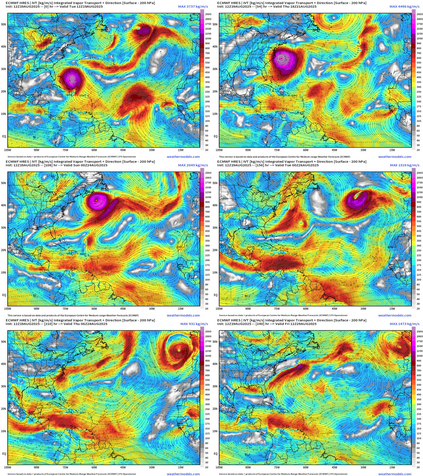
Massive Erin undergoes “extratropical transition” in the central north Atlantic early next week and may affect U.K. or western Europe with some wind/rain as a “post tropical” cyclone.
Thereafter, next week looks quiet across the Atlantic basin … but every African easterly wave needs to be watched into the peak of the season.
Atlantic Basin Outlook | 8 PM ET Update
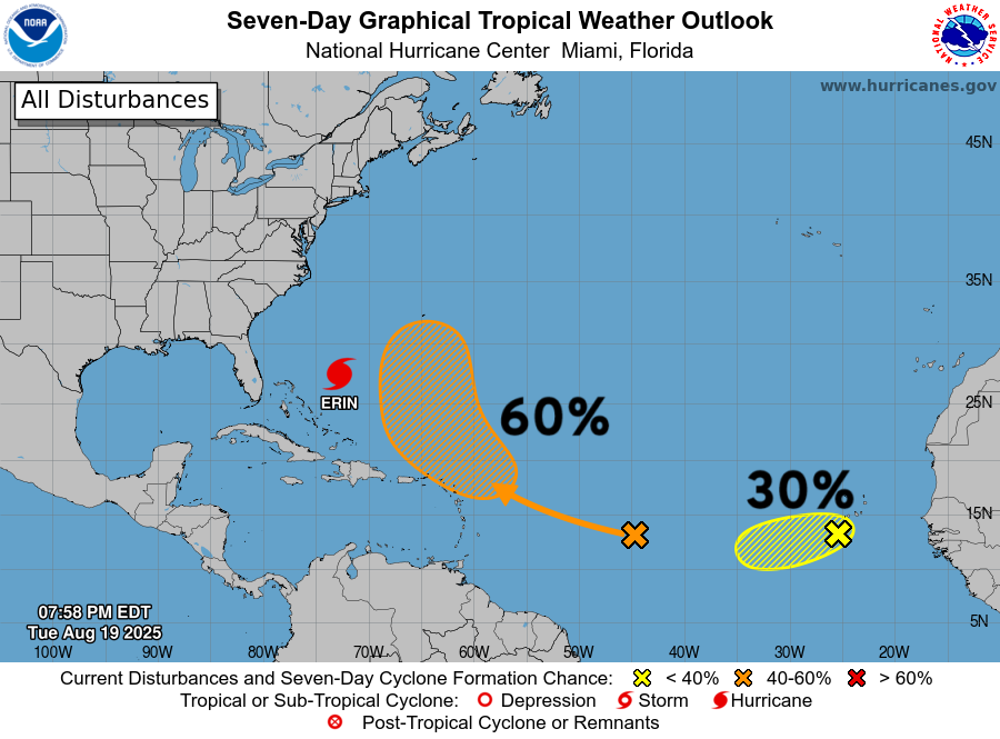
The 30% Yellow Hatching in the Eastern Atlantic is Invest 99L — not the orange 60% area. Invest 99L —> chance at Fernand if convection is maintained!
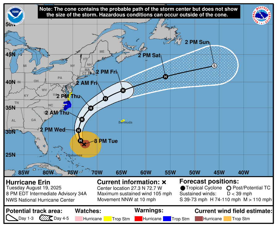
Category 2 Hurricane Erin | 90-knots
NHC forecast maintains near major hurricane status through 60-hours with continued expansion in wind field.
ATCF Spaghetti | 00z Interpolated Models
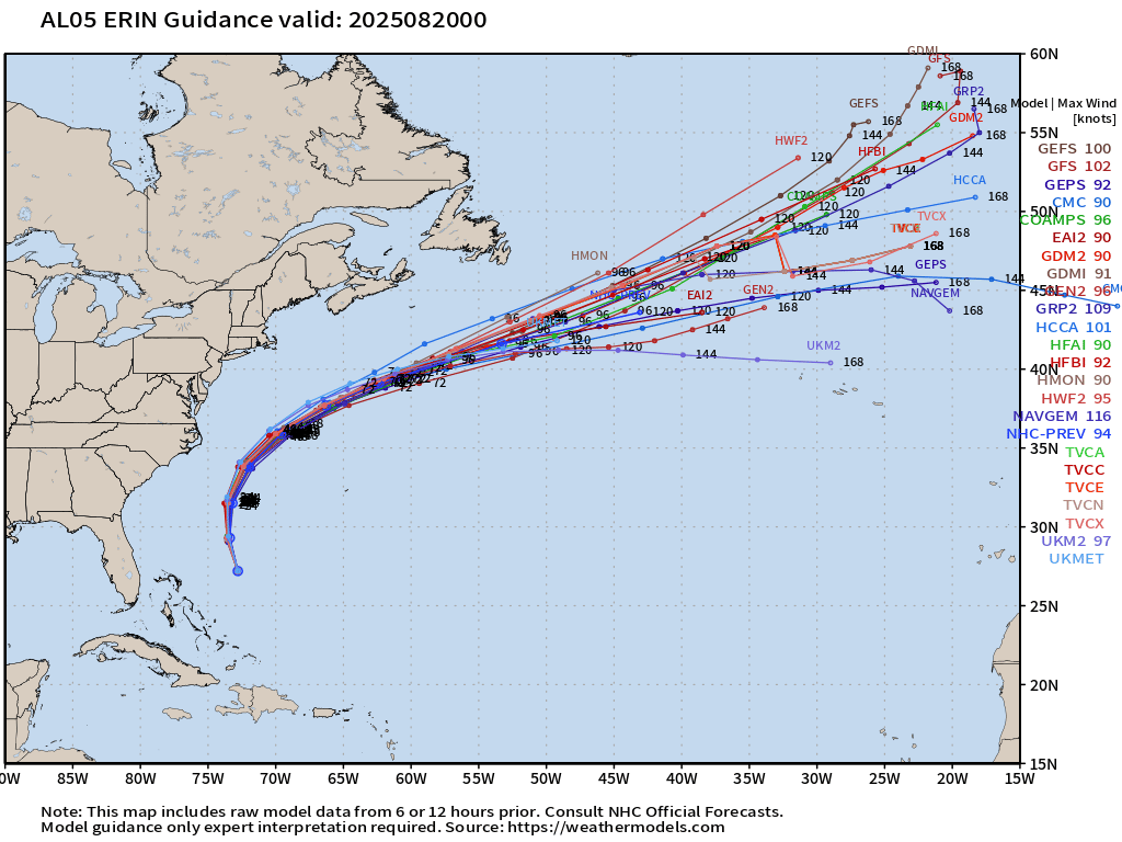
Over the past few days, the model, statistical, and NHC Official forecast have trended WESTWARD — but thankfully we still have a few hundred miles of real estate out in the Atlantic to avoid U.S. landfall.
HAFS-A and HAFS-B closest to coast Wind Gusts
ECMWF 850 mb Winds — massive size of Erin
Atlantic Satellite Imagery | Night GeoColor & Infrared
NOAA Tropical Surface Analysis | 18z
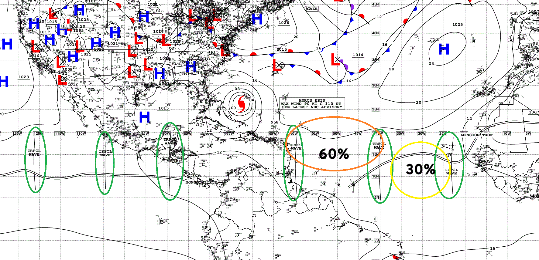
Atlantic Tropical Waves = 3 including Invest 99L + Major Hurricane Erin
Satellite Image of African Easterly Waves
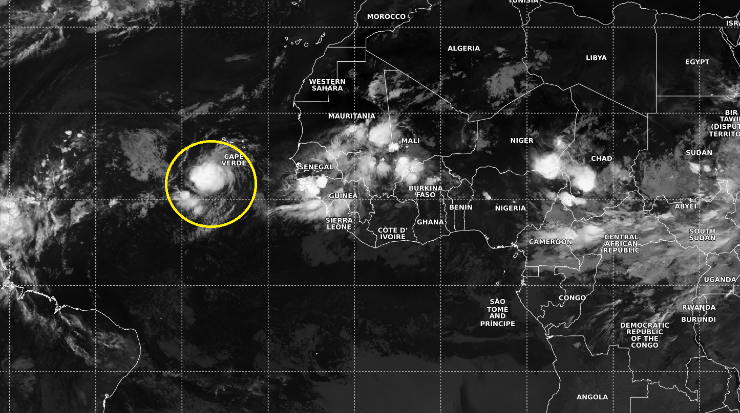
Invest 99L still looks impressive this morning!
ECMWF Ensembles 12z | 51 Members | Full Physics | All Cyclones 15-days
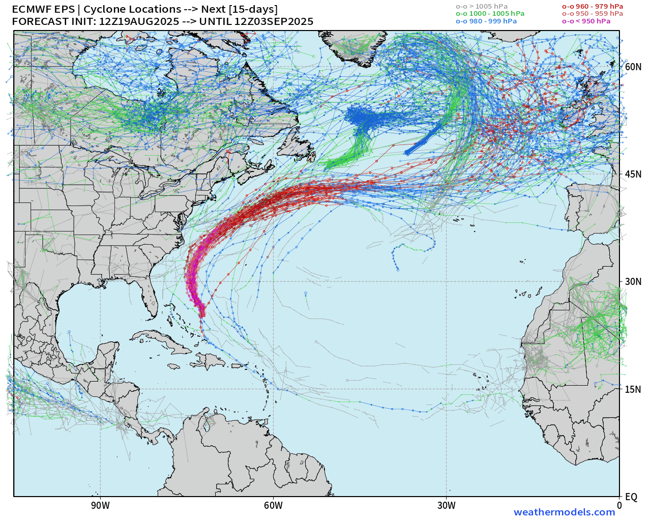
Into early September — Atlantic quiets down completely.
AIFS-Ensemble | A.I. Trained 12Z | Active Tracks at 5 days
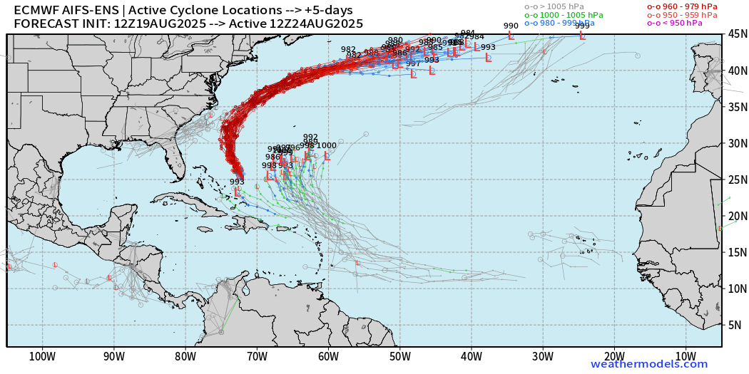
ECMWF AIFS-ENS remains much more aggressive with this system than the conventional/full physics system
Maps sourced from weathermodels.com designed and innovated by yours truly! Please subscribe there for real-time access to the newest maps, charts from all of the weather models including ECMWF.
- Milepost
- 709 · laid 2025-08-20T01:34:32.769000Z
- Source
- https://weather.substack.com/p/august-19-2025-hurricane-erin-evening
- Digest
- cbbb7c75036d4b484beabd4dd6df04c165d0000472a1aa1bfbedb26168275edc
- Machine
- JSON