August 3, 2025 Hurricane Season Sunday
Tropical Storm Dexter likely off U.S. East Coast heading out to sea
August 2025 was the 28th-warmest August in the 132-year national record (1895–2026), at 73.4°F against a 1991–2020 normal of 73.1°F (+0.3°F).
August 2025 was the 27th-driest August in the 132-year national record (1895–2026), at 2.3in against a 1991–2020 normal of 2.7in (-0.3in).
NOAA/NCEI Climate at a Glance, contiguous United States. This is the observed record for the month, not a score of anything said in this piece — the forecast ledger begins 2026-08-17 and cannot reach earlier posts.

Sunday’s Tropical Update
Atlantic Basin: NHC has 3 areas of interest: East Coast of US (70%) for development along a frontal boundary = Dexter likely soon. Another low pressure will develop off the Southeast U.S. coastline. Another area in the central MDR (40%) for yet-to-emerge tropical wave this coming week.
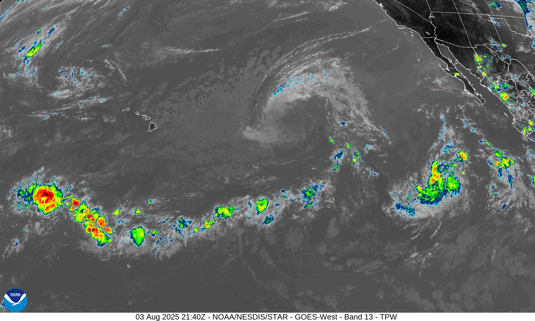
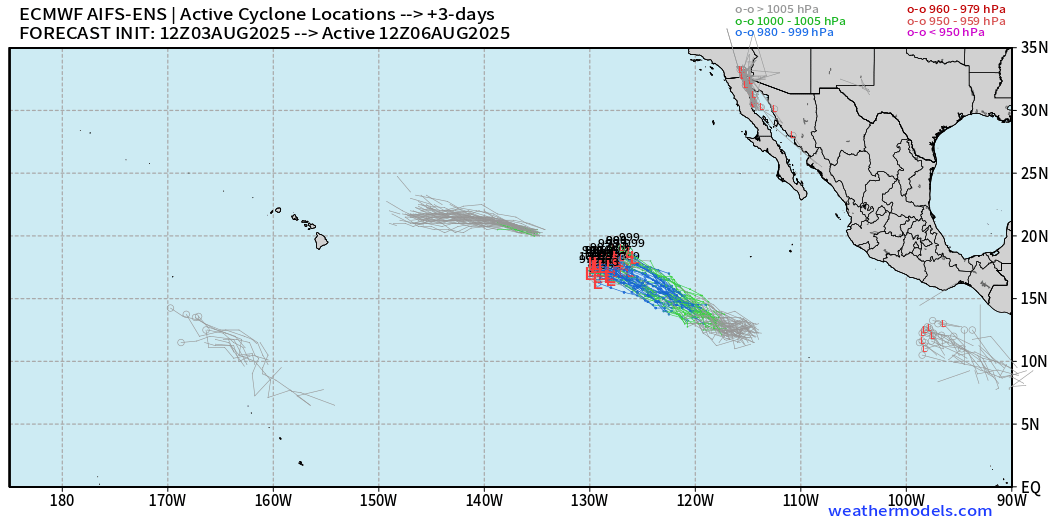
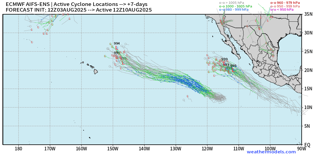
Eastern Pacific Basin: Invest 90E likely to become Tropical Storm Henriette by Monday.
Western Pacific Basin: Higher latitude tropical storms continue to pop-up, but not affect land as they recurve out to sea east of Japan.
Looking down the road, the “African Easterly Wave Train” is back on a more normal track/trajectory over the MDR with more robust convective signatures as Saharan Dust Layers subside into mid-August.
Ensembles are “busy” into Days 10-15 including potential for TS/HU in the western half of the Atlantic basin e.g. closer to the U.S. mainland.
ECMWF 12z | Precipitable Water Next 10-days
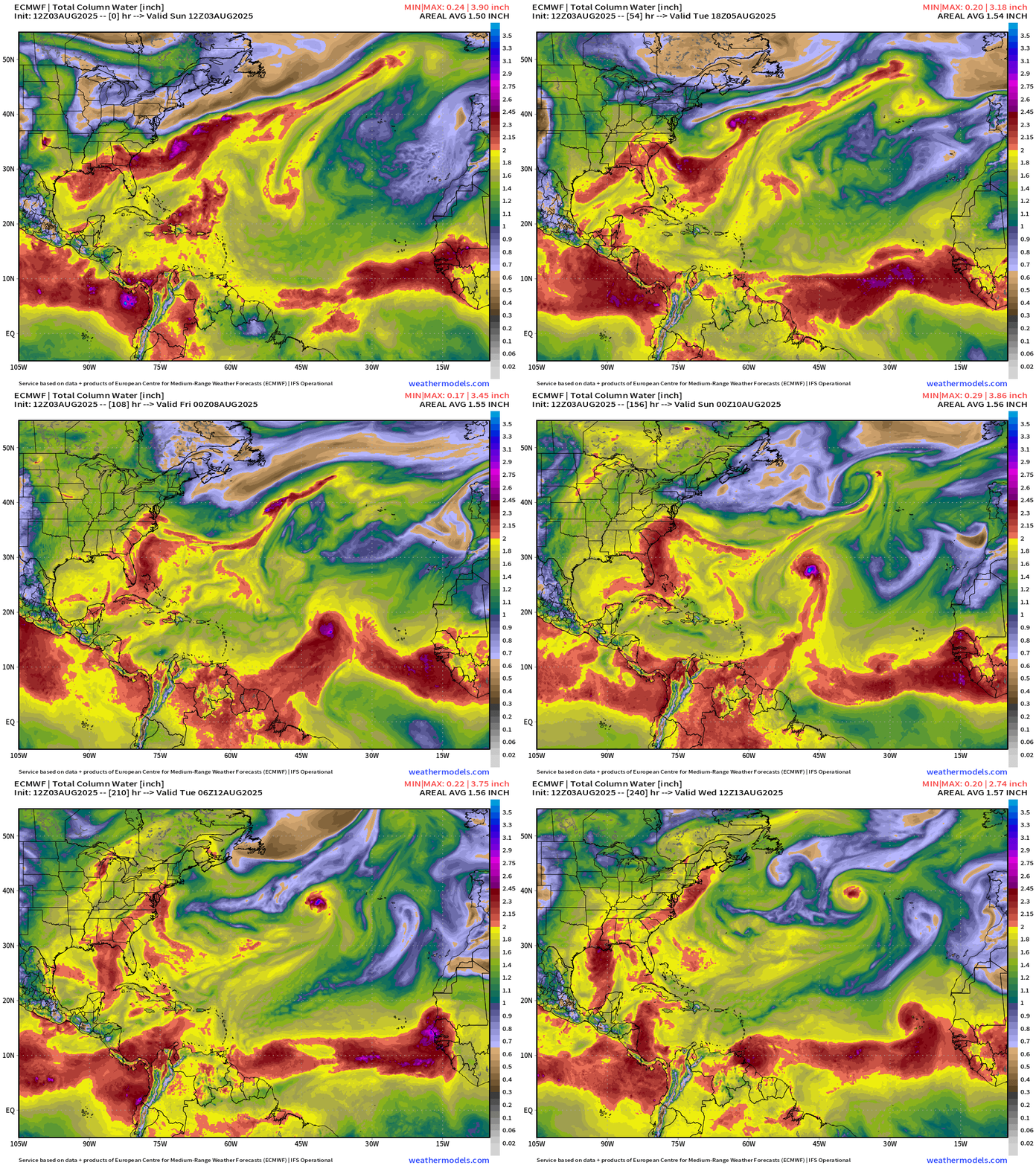
My favorite parameter: Several areas to watch in next 10-days:
Southeast U.S. as Invest 95L (Dexter) heads ENE out to sea: NHC has a 20% chance of development, and models support “something” weak developing and then moving westward = more rainfall for drenched Georgia, Florida, and Carolinas.
Central MDR tropical wave —> Hurricane but moves / recurves quickly northward.
ITCZ looks solid/more robust with high precipitable water content.
ECMWF 12Z | Integrated Vapor Transport Next 10-days | Atlantic Basin
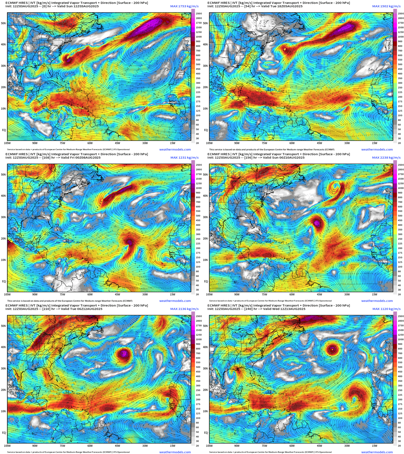
Adding the moisture transport vectors — we can see the various tropical systems over the Atlantic basin. It seems we have indeed “flipped the switch” into mid-August.
ECMWF 12Z | Relative Vorticity 10-days | Atlantic Basin
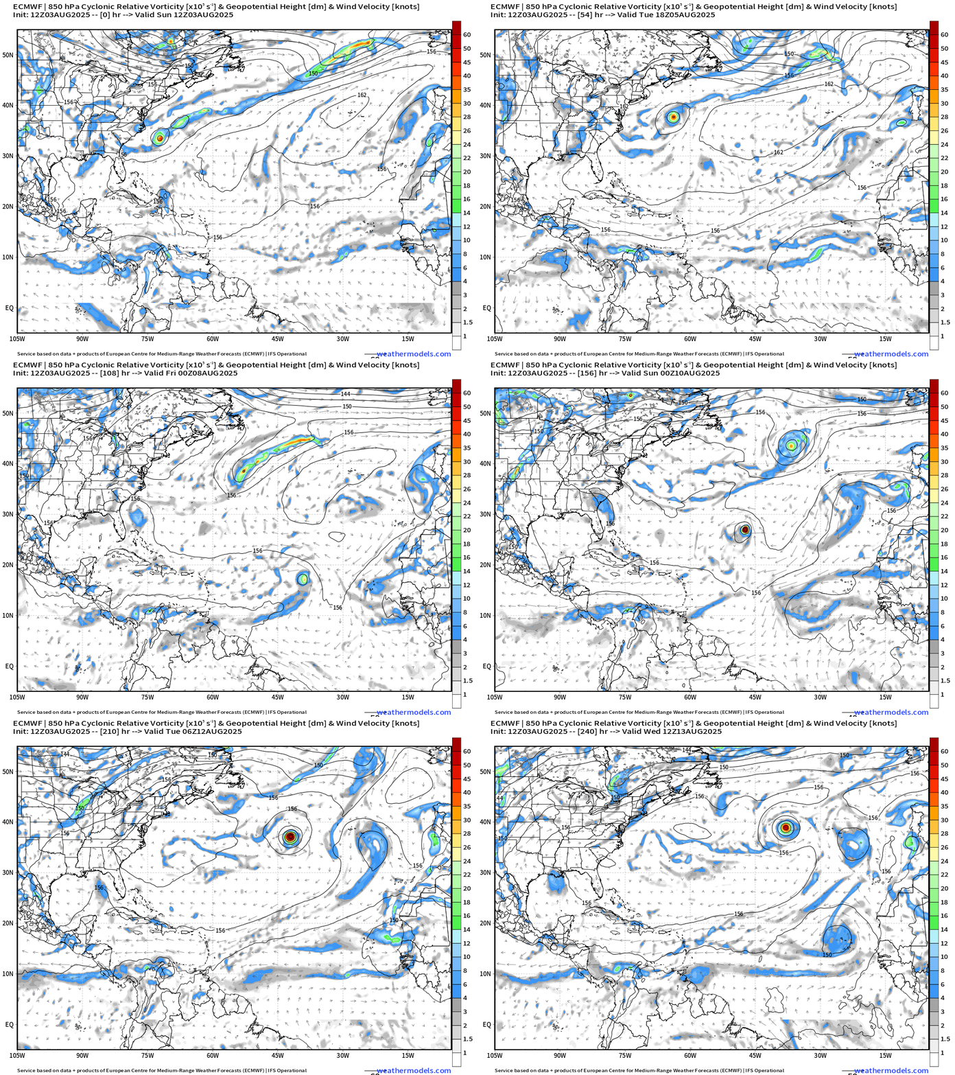
All of a sudden, everything is spinning! Plenty of options — and with the ensembles, as we’ll see, multiple scenarios or tracks with increased uncertainty into Week 2.
ICON Precipitable Water Next 5-days | 18z
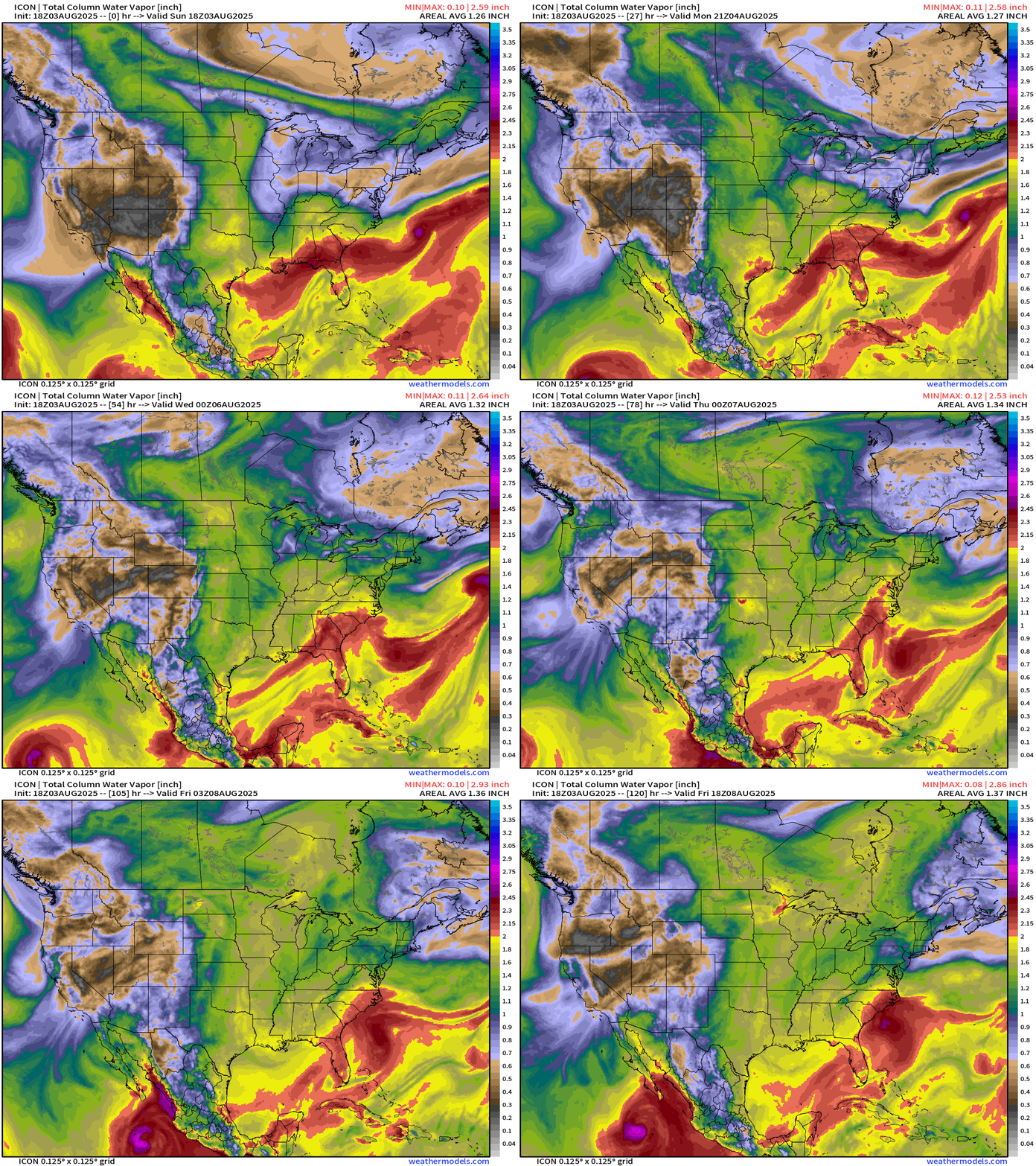
DWD (Germany) ICON model also highlights the weak system off the Southeast U.S. coast by Friday — likely another named storm —> Erin (then Fernand)
Subscribe or Upgrade to Annual (30% off) —> Offer available to everyone
Thank you to readers continuing into this Hurricane Season. My goal is to keep you informed about ongoing extreme weather events inside and outside of the tropics, but also a week (hopefully) heads up on what’s coming. I’ll be using a variety of weather modeling output, some of it may be unfamiliar, but it’s state-of-the-art and industry leading standard.
Atlantic Basin Outlook
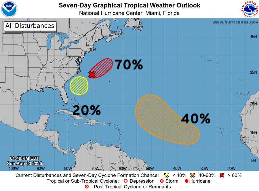
3 areas of interest — and I would bet all 3 become named systems in these next 7-days.
Atlantic Satellite Imagery | Infrared
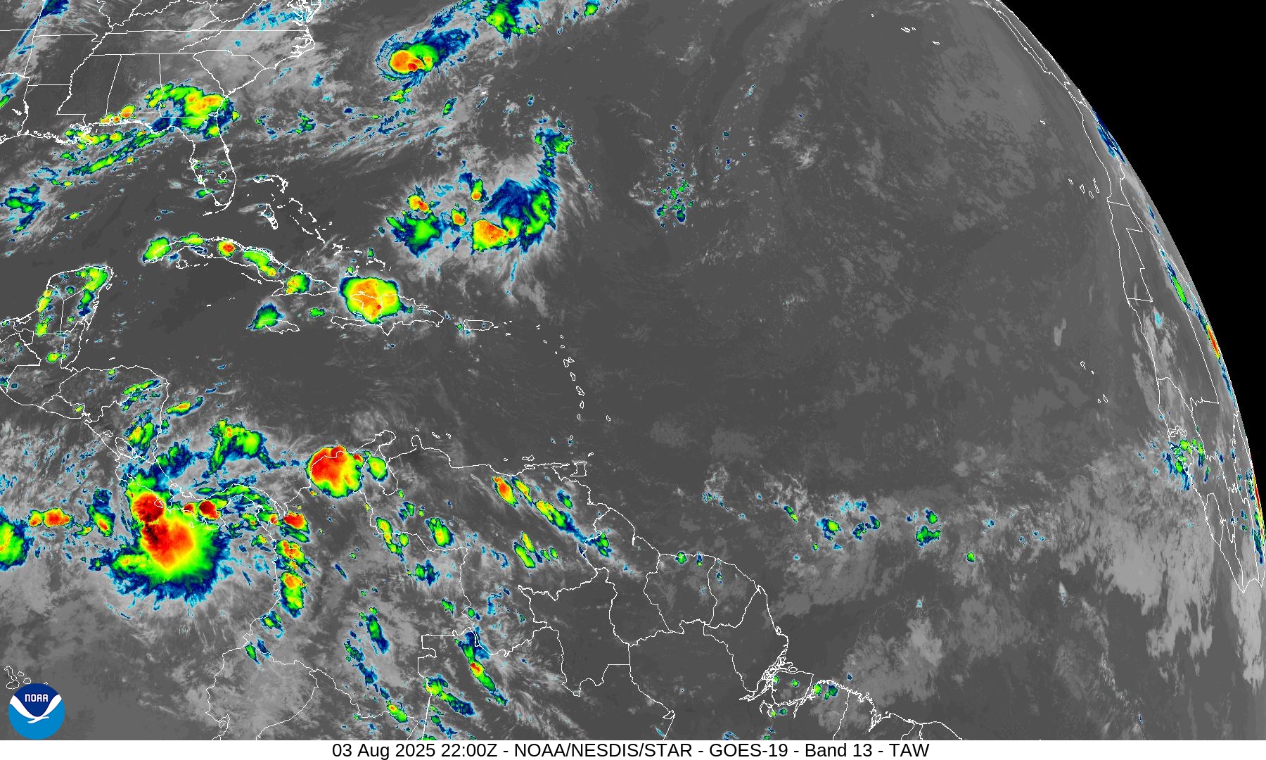
No convection to note in the main development region (MDR) of the Atlantic, but soon-to-be Tropical Storm Dexter looks vigorous — and passes the eye test as a functional tropical system over warm waters.
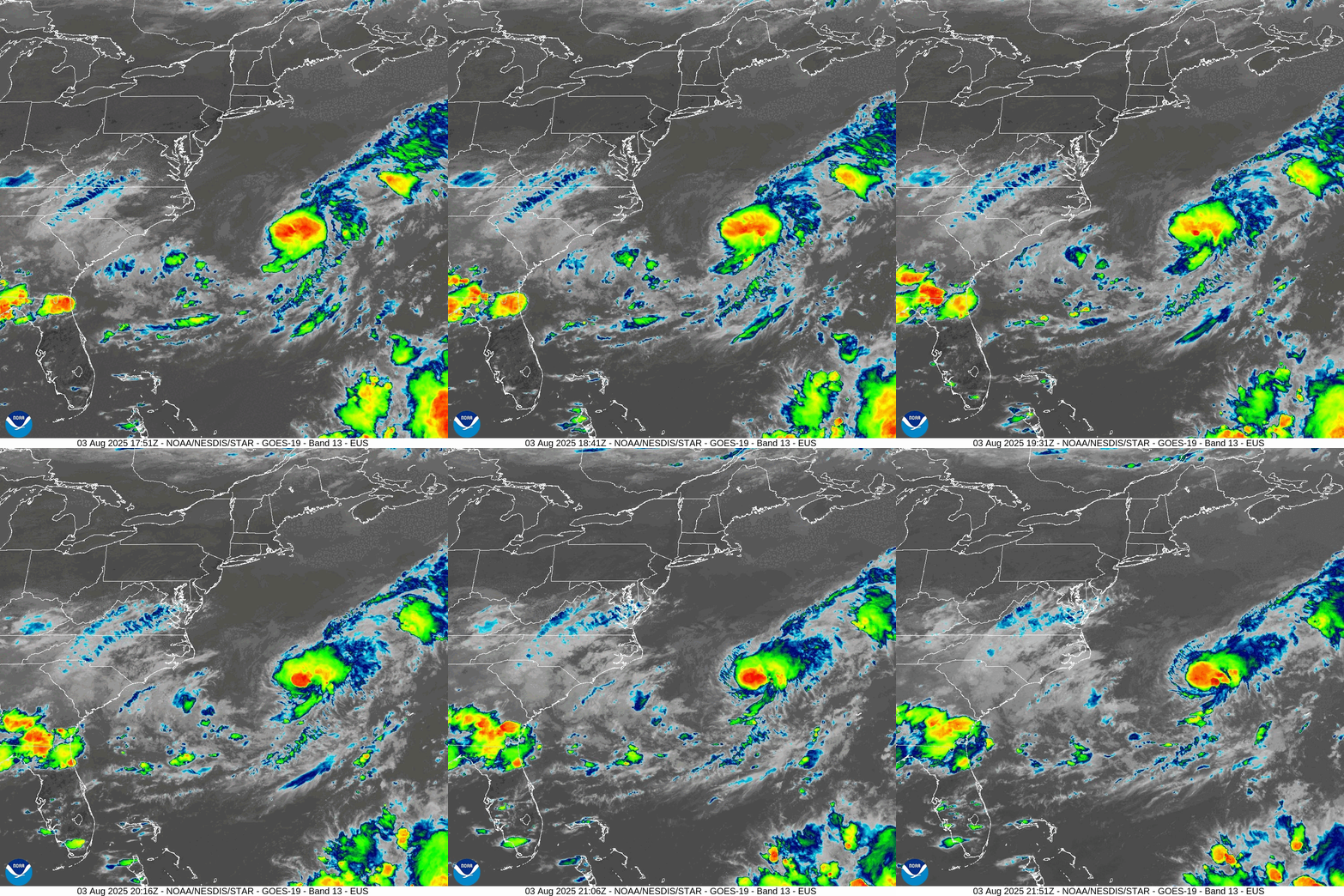
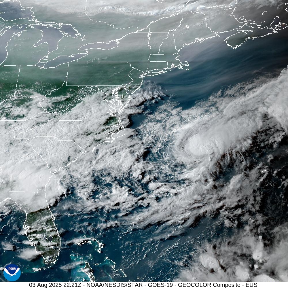
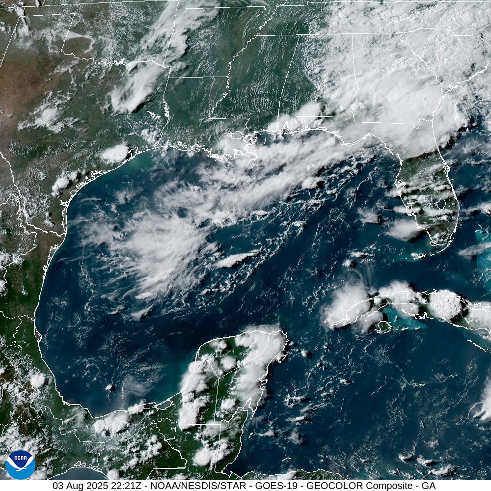
Gulf of Mexico has some clouds but the main blob of moisture is over Georgia and Carolinas with chilly/wedge rain leaving high temperatures in the 60s.
Eastern Atlantic & Tropical Africa | Satellite Image
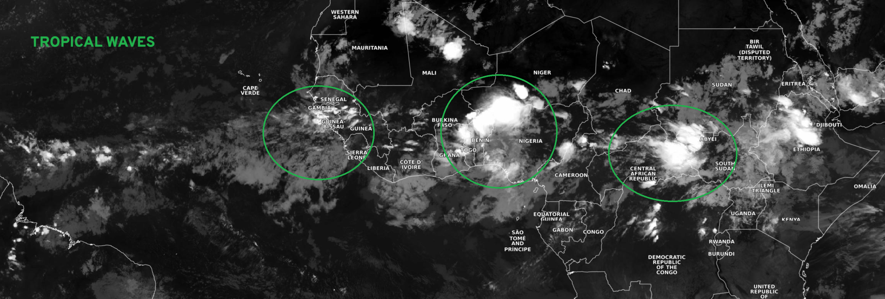
Tropical waves over Africa are convectively active … and we have 3 lined up and ready to go
NASA GEOS-5 | 00z DUST Aerosol Optical Depth | 8-day Forecast
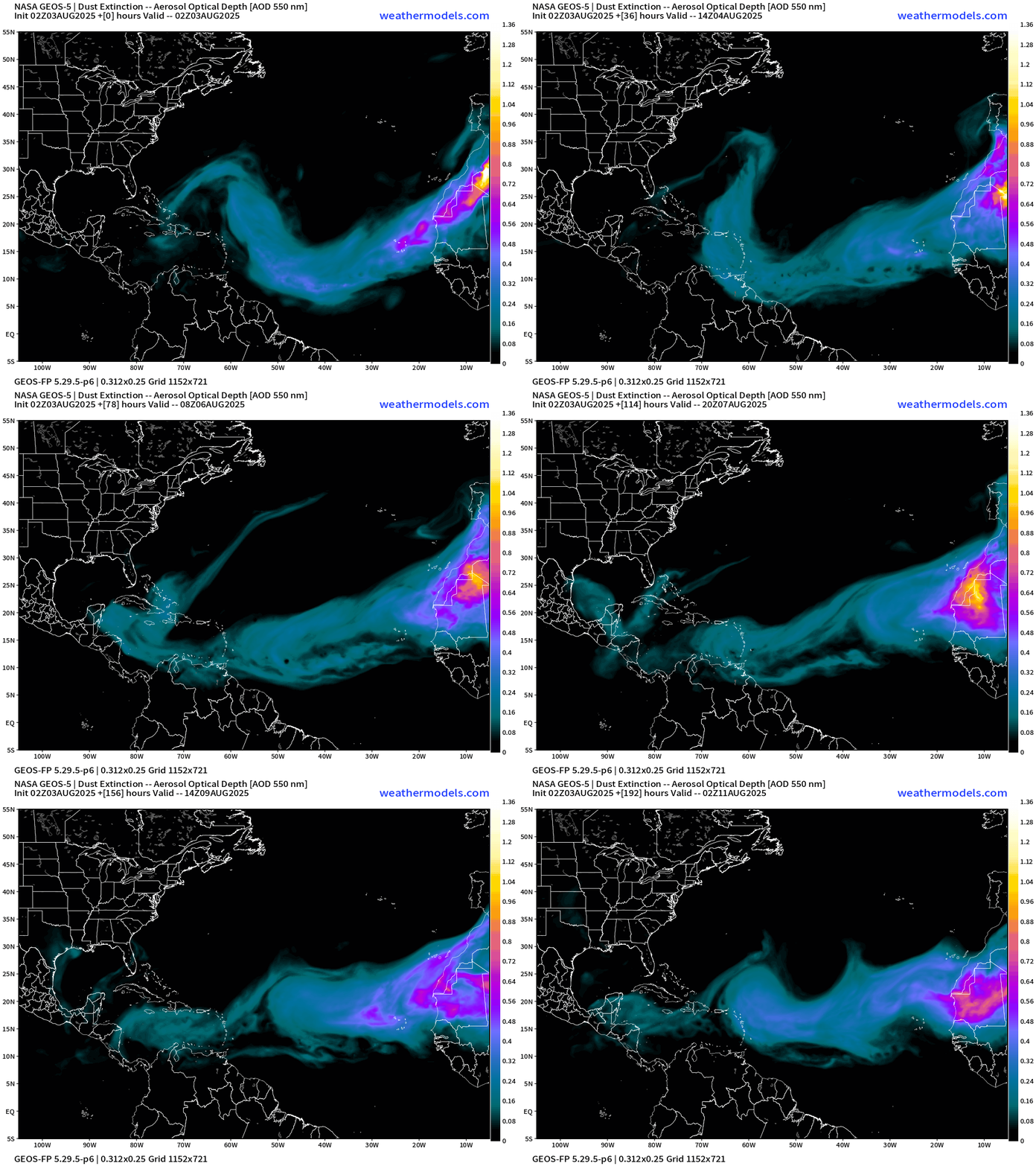
Plumes of Saharan dust coming off African continent to north of tropical wave and monsoon trough.
Atlantic Ocean Surface Temperatures (SST) + Anomaly (vs. last 20-years)
Ocean temperatures remain abnormally warm in the subtropics off the U.S. East Coast to Bermuda. The MDR is near normal.
NOAA Tropical Surface Analysis | 12z
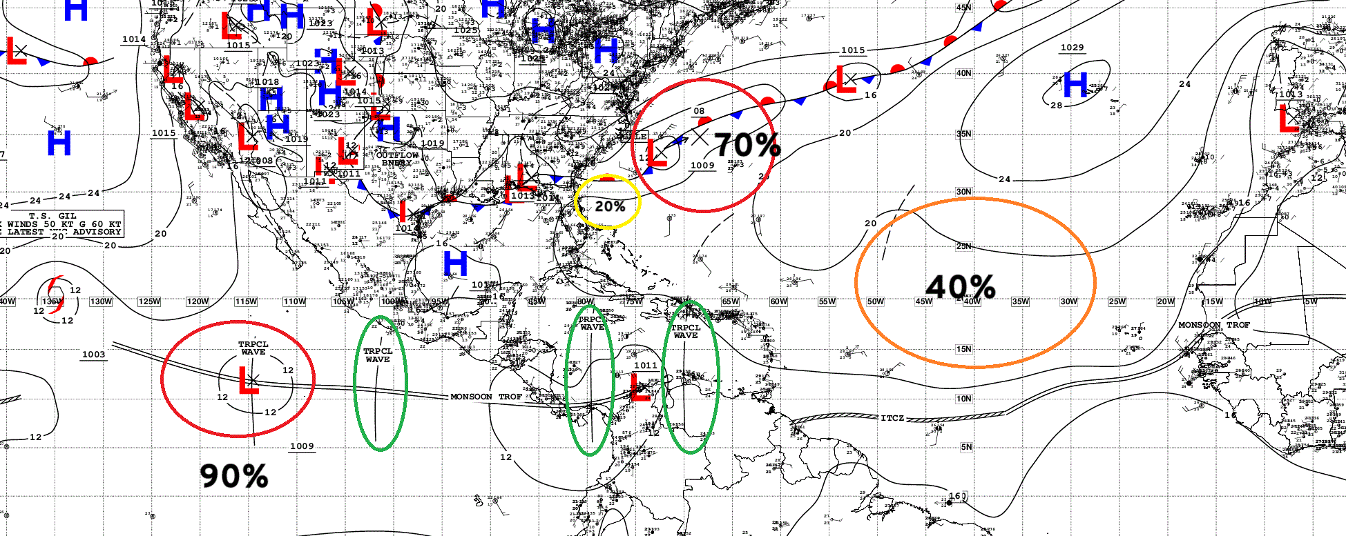
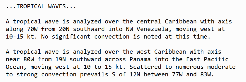
Atlantic Tropical Waves = 2 but these aren’t going to develop in the Caribbean, but could in the Eastern Pacific. The Main Development Region (MDR) is empty!
East Coast Tropical System | Early Tuesday
Tropical Storm or perhaps Hurricane Dexter!
Medium range ensemble model outlook
These are 51-realizations of the same model with different initial conditions. Each ensemble gets equal ~2% weight in a mean calculation.
ECMWF Ensembles 12z | Day 6 Active Tracks
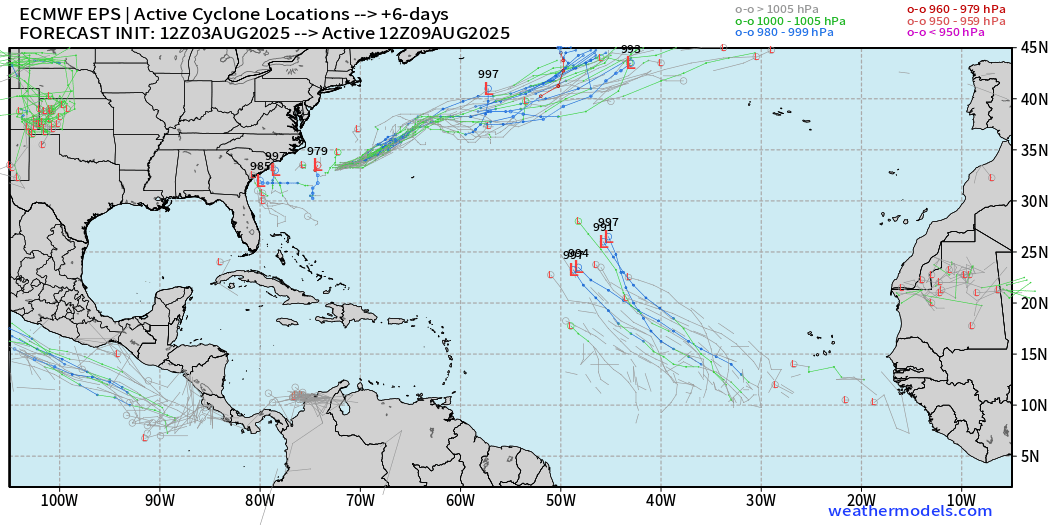
Full-physics conventional model —> central MDR tropical wave with some support, but not as many % members as I’d expect with the Control showing a hurricane. Hmmm, makes you wonder if there’s a LID on the basin that the ECMWF model is missing …
ECMWF Ensembles 12z | Day 10 Active Tracks
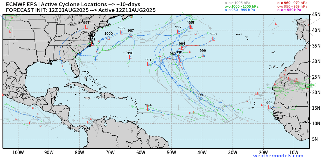
Honestly, not much going on aside from the central mid-Atlantic.
ECMWF Ensembles 12z | Day 14 Active Tracks
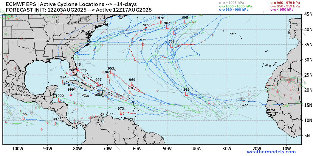
More ensembles show westward transiting tropical waves becoming hurricanes … into August 17th. However, the full-physics is LESS active by a LOT than the AIFS-ENS (AI trained) system.
Compare with AIFS Ensembles 12z | Day 7 Active Tracks
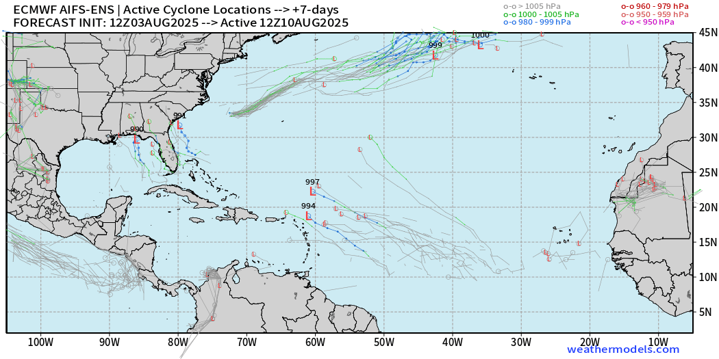
Oddly enough, the AIFS-Ens is not very interested in this central MDR tropical wave coming online …
Compare with AIFS Ensembles 12z | Day 10 Active Tracks
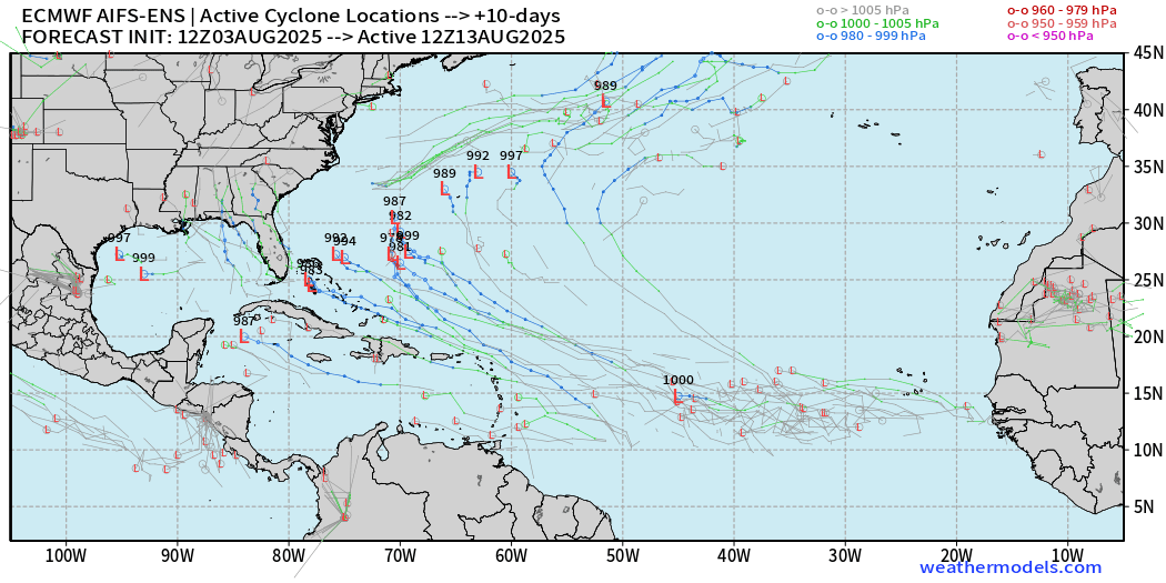
… the window between Days 10-14 — everything breaks loose with multiple systems per ensemble, and some very intense.
Compare with AIFS Ensembles 12z | Day 14 Active Tracks
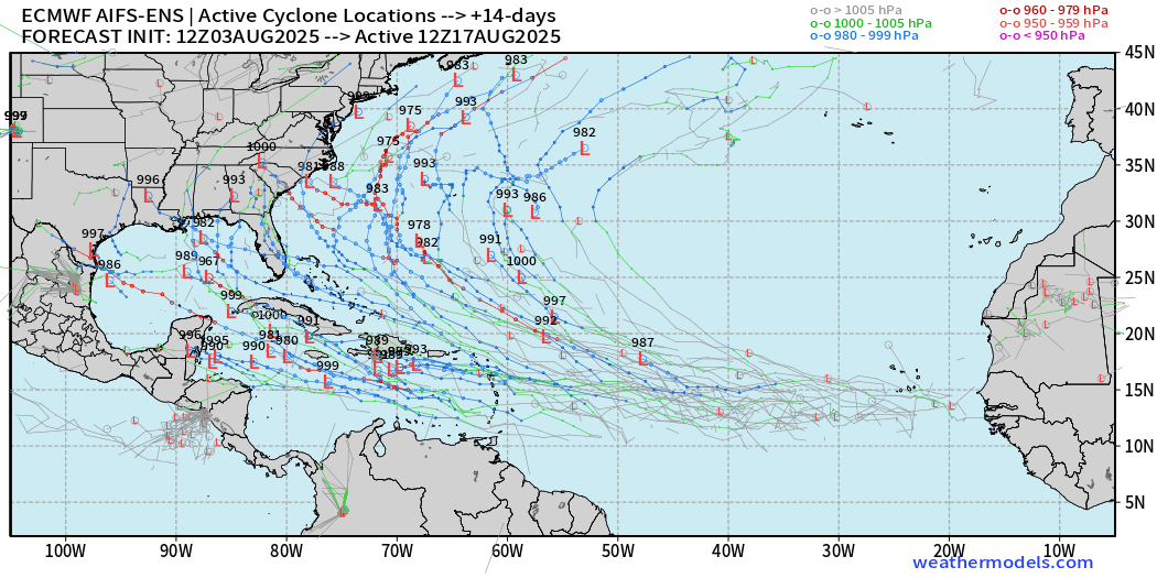
HOWEVER, don’t panic! We don’t have ANYTHING yet and these scenarios are NOT forecasts.
Eastern and Central Pacific Tropical Update
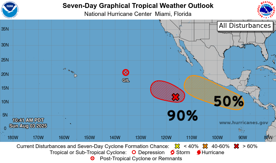
We lost Tropical Storm Gil (07E) over cooler waters of the tropical Eastern Pacific.
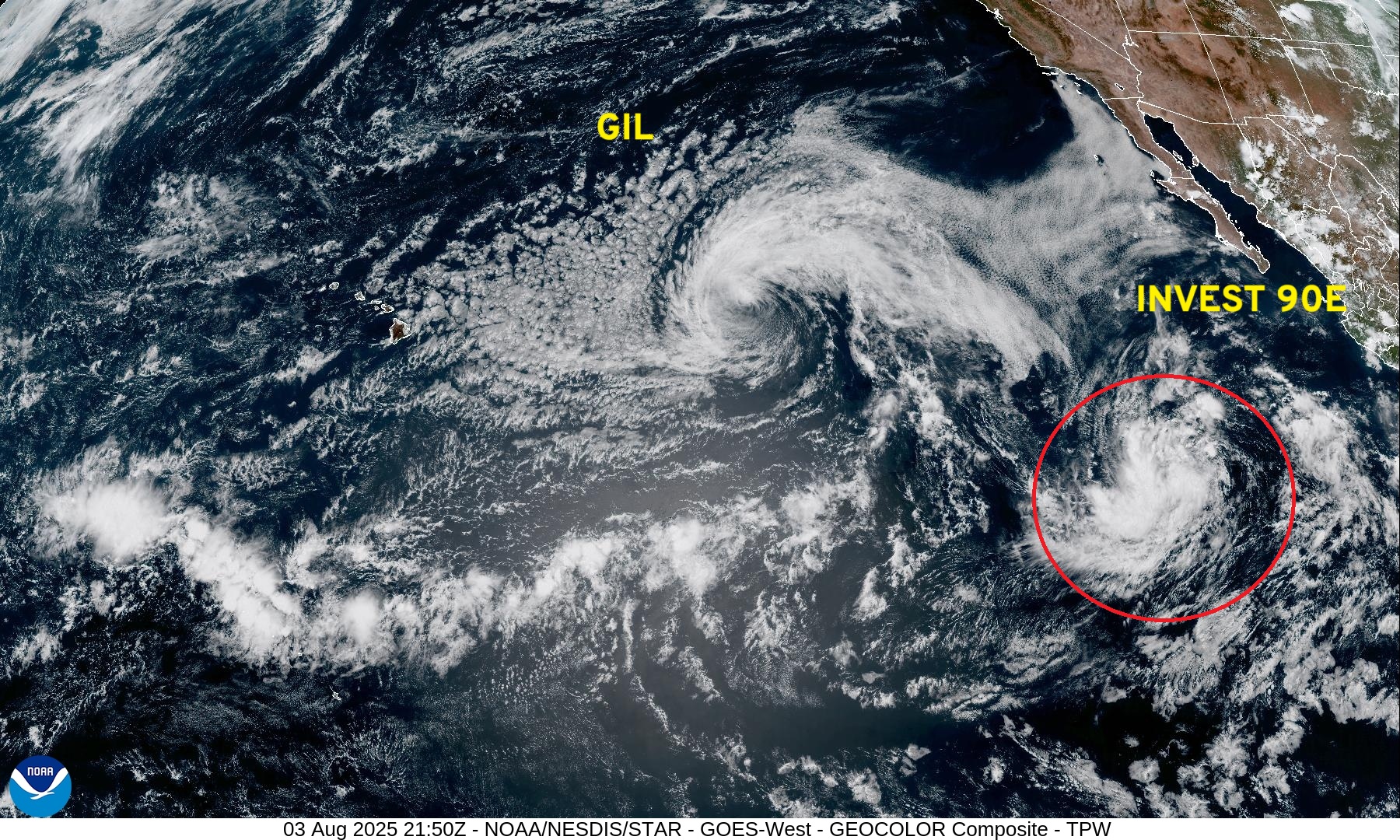
Convection is gone with Gil but gale force winds remain.
Invest 90E + another system in the next 7-days | Ensemble Tracks | Active systems at Day 3 & 7
Western Pacific Tropical Update
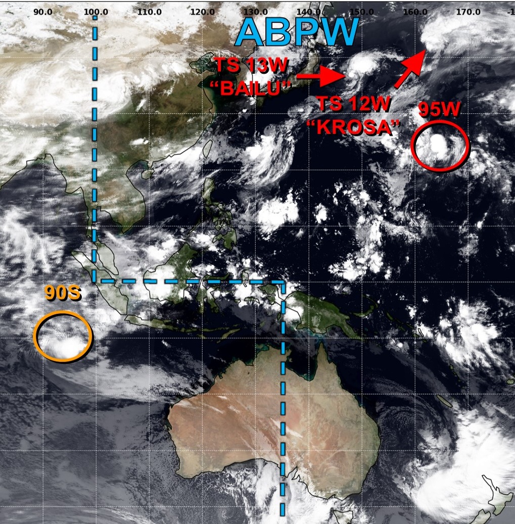
Newly named/numbered Tropical Storm Bailu (13W) will recurve east of Japan
All high latitude “fish storms”
Maps sourced from weathermodels.com designed and innovated by yours truly! Please subscribe there for real-time access to the newest maps, charts from all of the weather models including ECMWF.
- Milepost
- 690 · laid 2025-08-03T23:19:54.246000Z
- Source
- https://weather.substack.com/p/august-3-2025-hurricane-season-sunday
- Digest
- 0394c217268500c785de20fa42366310f9a63a600811c06011117860b192bcf6
- Machine
- JSON