July 24, 2025 Hurricane Season Thursday
Ensembles show low development potential into 12-14 day range off U.S. East Coast
July 2025 was the 20th-warmest July in the 132-year national record (1895–2026), at 75.4°F against a 1991–2020 normal of 74.4°F (+1.0°F).
July 2025 was the 27th-wettest July in the 132-year national record (1895–2026), at 3.1in against a 1991–2020 normal of 2.9in (+0.2in).
NOAA/NCEI Climate at a Glance, contiguous United States. This is the observed record for the month, not a score of anything said in this piece — the forecast ledger begins 2026-08-17 and cannot reach earlier posts.

Thursday’s Tropical Update
Atlantic Basin: NHC tropical weather outlook still has a 10% chance of development for area of showers in northern Gulf, but unlikely to see a depression.
Eastern Pacific Basin: Area closer to Hawaii than Mexico could develop (40%) in deep tropics nearing Central Pacific
Western Pacific Basin: Busy basin with 3 named storms including Typhoon Co-May (11W) impacting the Philippines and new TD 12W (Krosa).
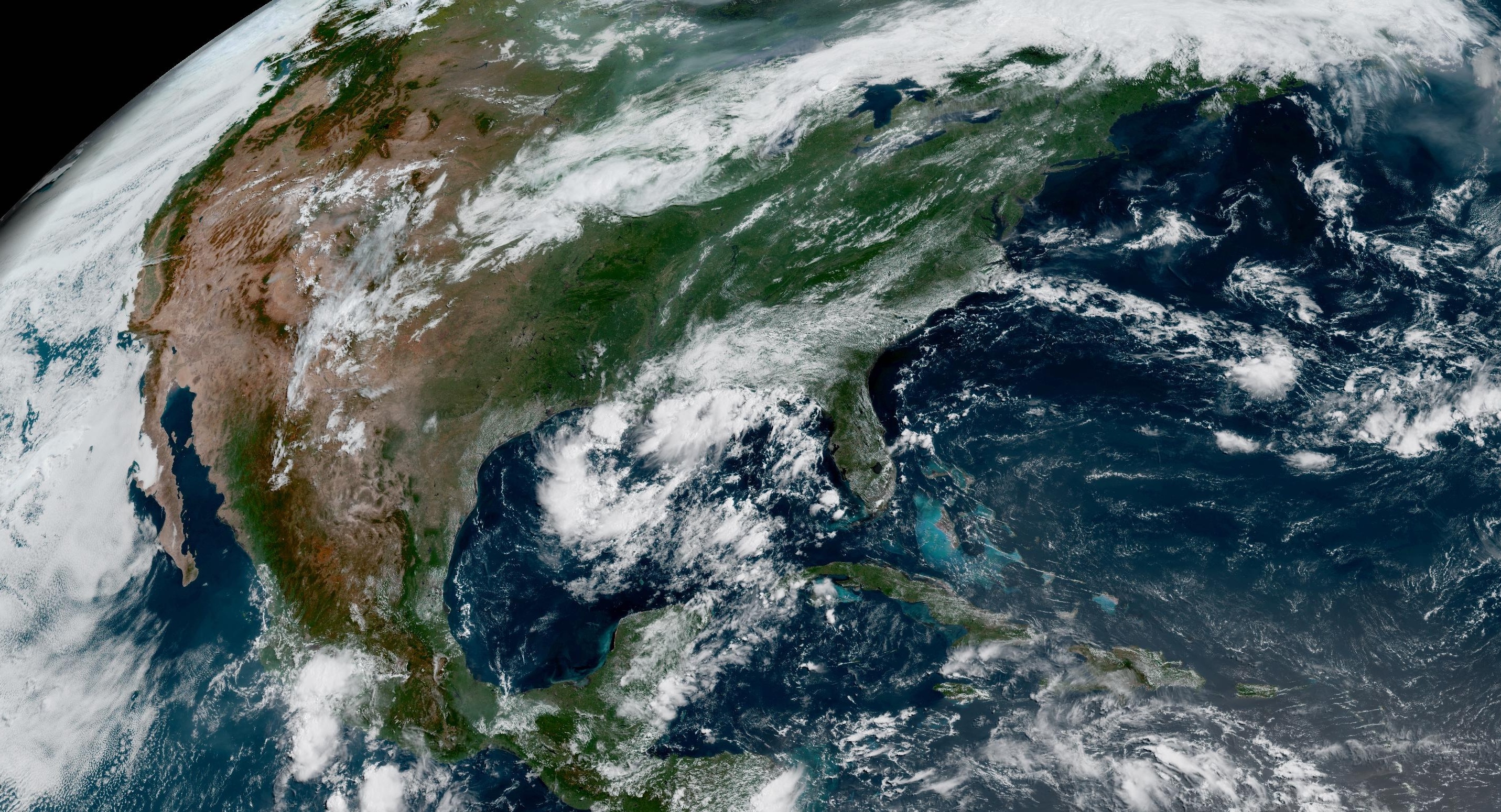
Looking into August, the 12-15 day period is continuing to light up in the ECMWF ensemble model systems for storm / hurricane development in the western Atlantic off the U.S. East Coast. Still a low chance < 20% but now persistent.
Large Basin view of Simulated Water Vapor | ECMWF 00z
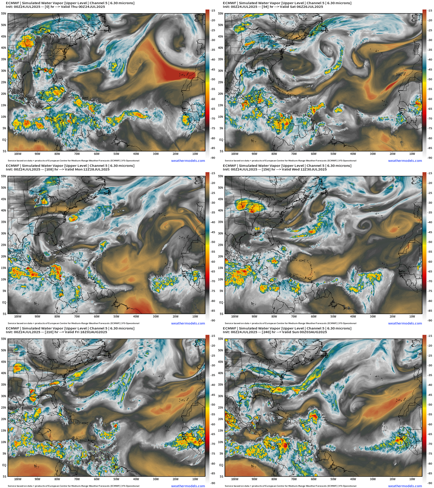
Nothing has developed in the Main Development Region (MDR) of the Atlantic for several reasons:
It’s early in the season so even into the end of July, tropical waves coming off Africa are not likely to develop even with warm ocean temperatures. Also, the influence of Saharan Air Layers and dust to the north of the waves = stable and dry => suppression of convection. You can also see from the orange and light brown colors on the simulated water vapor imagery that middle latitude air is being shunted into the tropics from wave breaking and troughs — with help from the SAL.
The dry, dusty and stable (warm) air near the surface and in the boundary layer puts a lid on convective development. And, we’ve had a lot of SAL influence on the tropics (MDR)
The large-scale or basin scale environment is unfavorable for tropical storm formation with anomalously high pressure and sinking air (subsidence). Note, the Eastern Pacific is also dead after a fast start = hemispheric tropical basin dead period.
However, into August, there may be a change in the sub-seasonal signals to more favorable as the Eastern Pacific gets going in 7-10 days meaning the Atlantic could follow in 2 weeks. The AIFS-Ensembles from ECMWF do show more action albeit low chance into August.
Reminder, the peak of Atlantic hurricane season is around September 10th, still 7 weeks away, and a lot can change when it comes to tropical meteorology.
Integrated Vapor Transport Next 10-days | Atlantic Basin
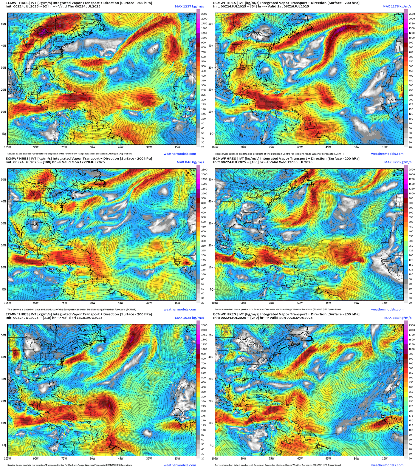
Features: tropical wave now into the central MDR moving steadily westward to Lesser Antilles in a few days, but no development
Sunday: tropical wave emerges into Atlanta but opens within a few days. Again, not seeing development. There may be a short-lived surface circulation that shows up on visible satellite, but lack of convection won’t sustain it. It will take 7-days to reach the Lesser Antilles.
We need to closely watch these waves for gaining latitude and finding more hospitable environment in the subtropics for tropical cyclogenesis.
Thank you to readers continuing into this Hurricane Season. My goal is to keep you informed about ongoing extreme weather events inside and outside of the tropics, but also a week (hopefully) heads up on what’s coming. I’ll be using a variety of weather modeling output, some of it may be unfamiliar, but it’s state-of-the-art and industry leading standard.
Atlantic Basin Outlook
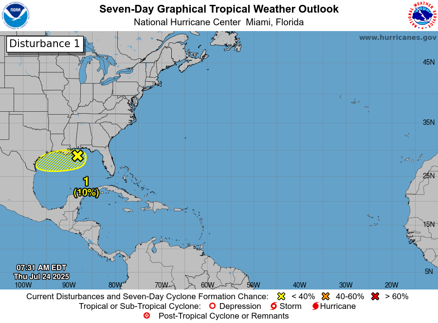
10% chance of development into weekend across the Northern Gulf of Mexico.
Eastern Atlantic Satellite Image
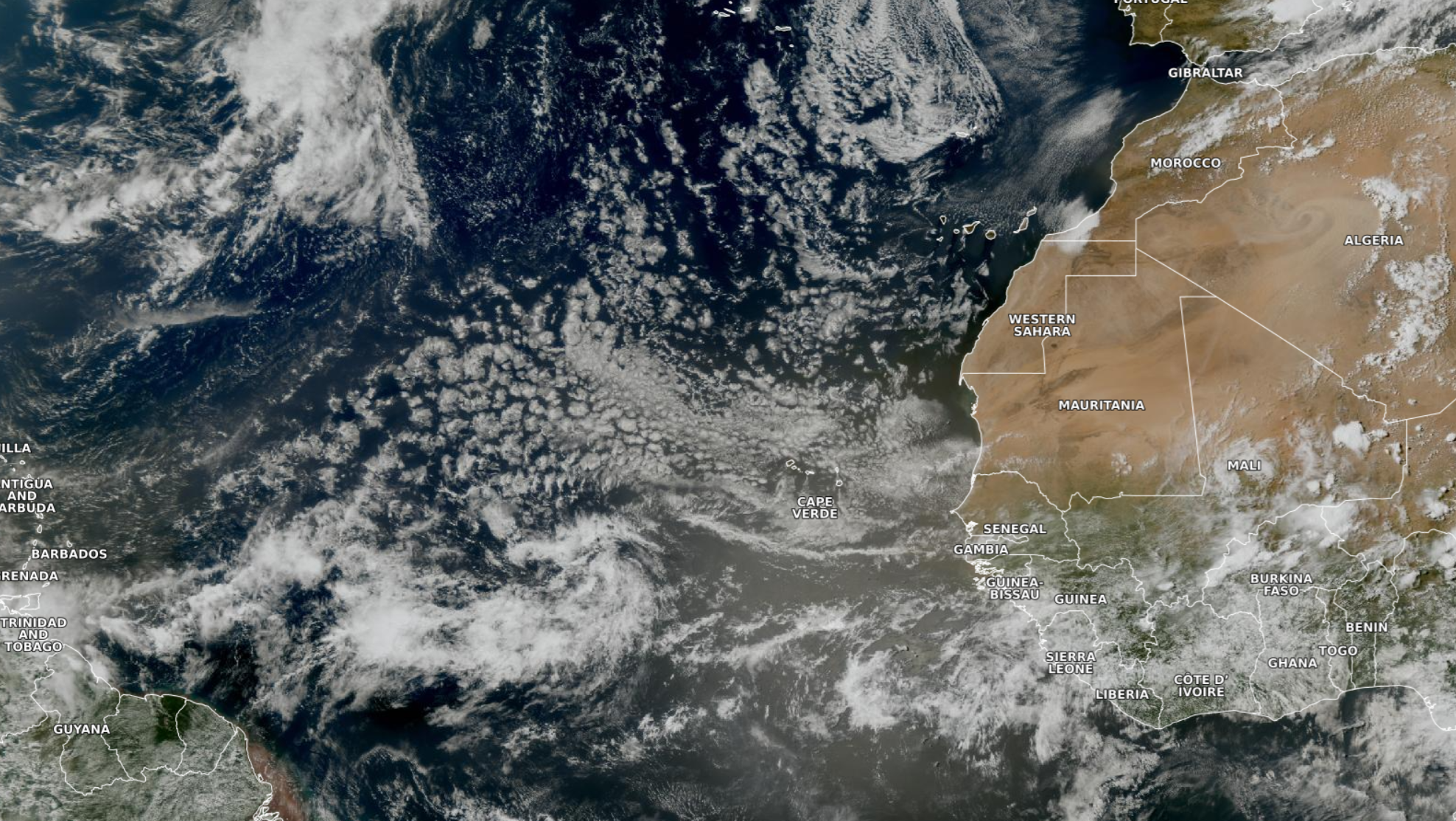
Tropical wave has a large circulation but not much convection. Dust / Saharan Air buries the subtropical Atlantic from Africa well westward.
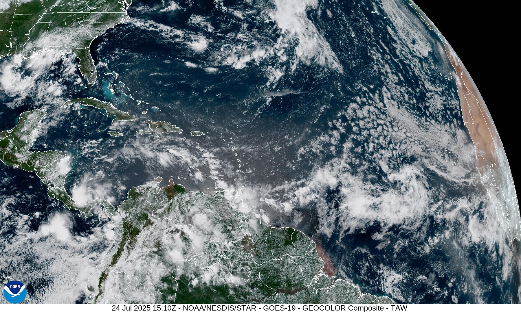
Clear conditions from the Bahamas to Puerto Rico and the subtropical “warm pool”
NASA GEOS-5 | 00z DUST Aerosol Optical Depth (AOD) | 10-d Forecast
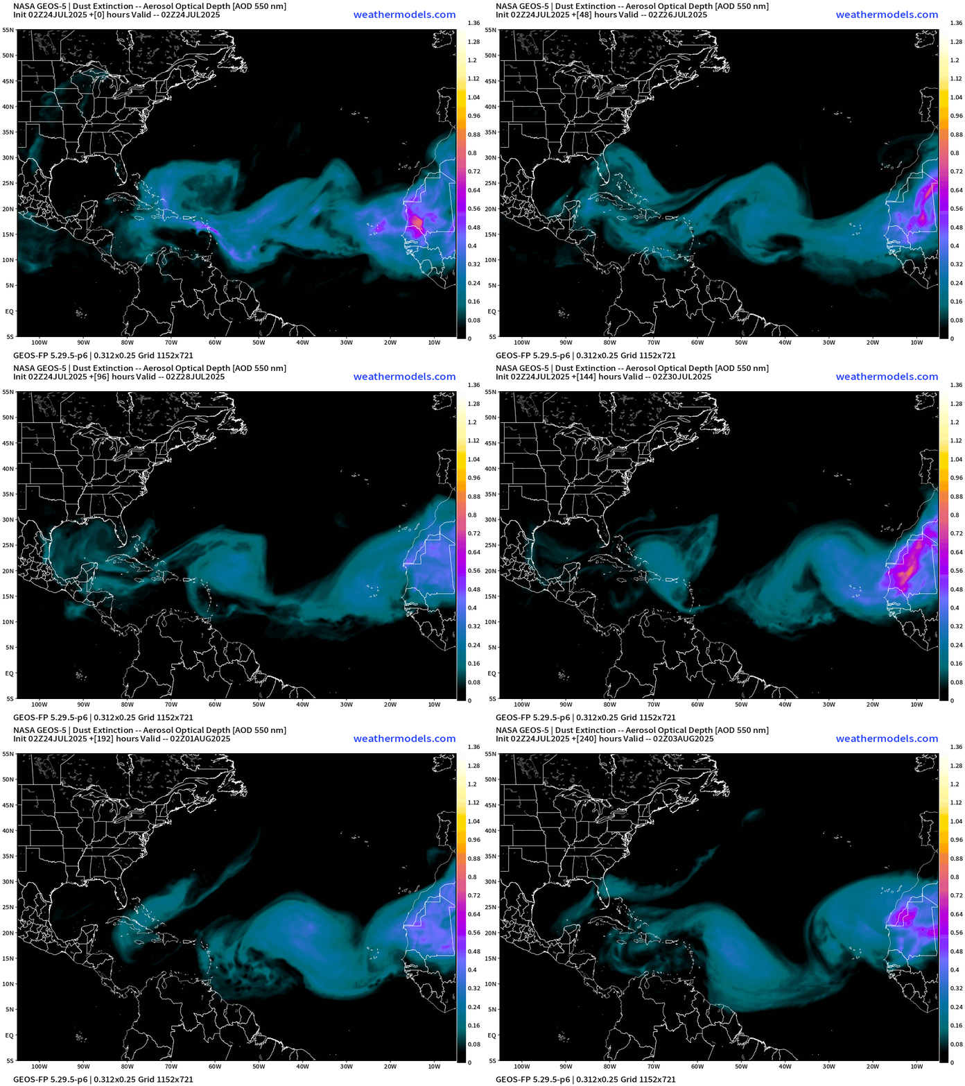
Tropical waves will need to deal with continued dust plumes into August. The intensity of early August plume seems to have decreased in today’s model cycle.
Atlantic Ocean Surface Temperatures (SST) | Anomaly
Ocean temperatures plenty warm from African coast to the Lesser Antilles with 28°C corridor or warm pool extending into the western Atlantic around Bermuda. However, the anomaly (which doesn’t do anything) remains near-normal or slightly below in the Main Development Region (MDR) from Caribbean to Africa.
Gulf of Mexico where the 10% wave spins is > 30°C — very warm — and evidence that you need more than “warm water” to form a tropical storm.
Tropical Atlantic Satellite Imagery
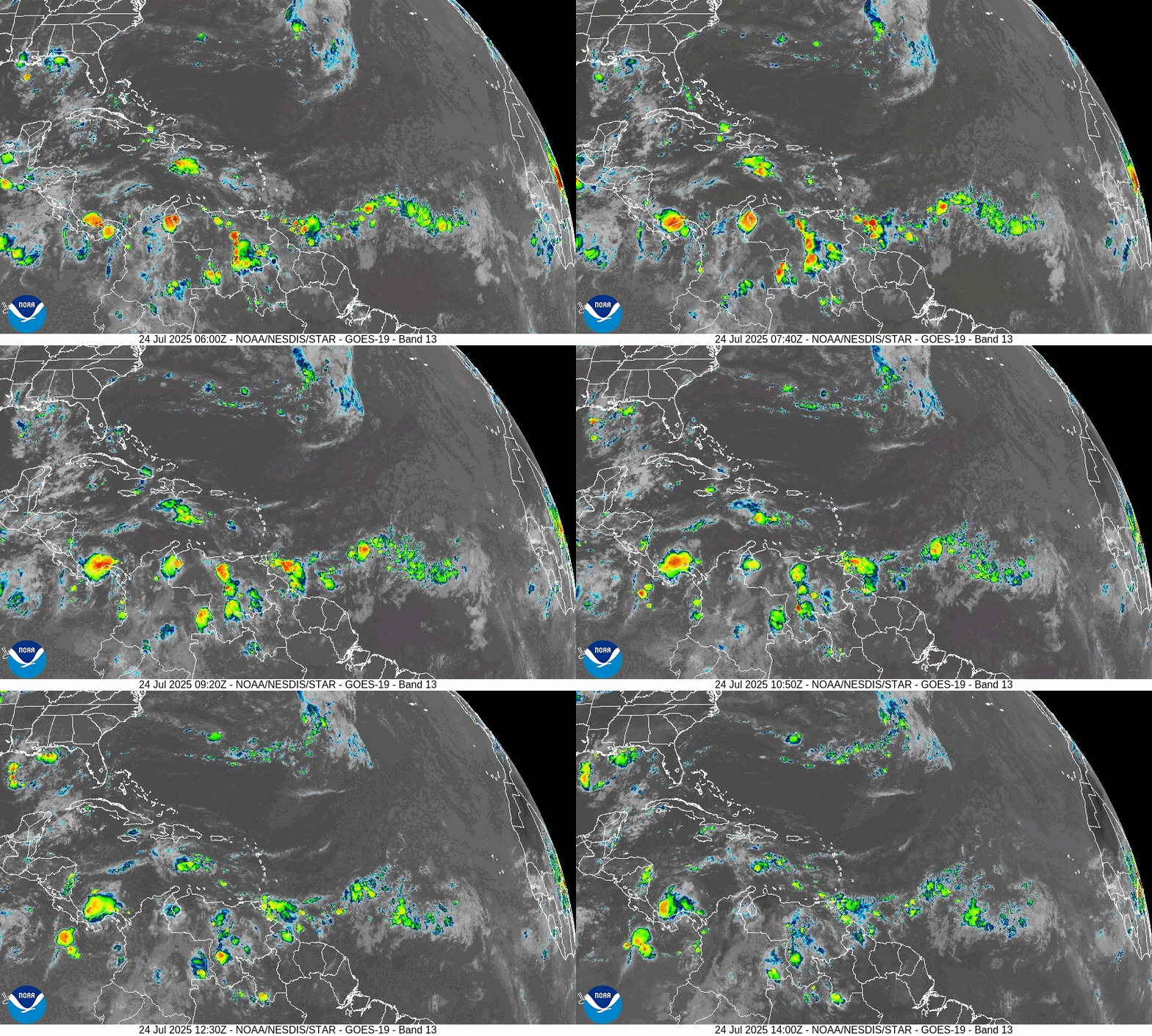
Central MDR has some convection associated with a tropical wave but it’s not much.
ECMWF Precipitation and MSLP | Next 6-days
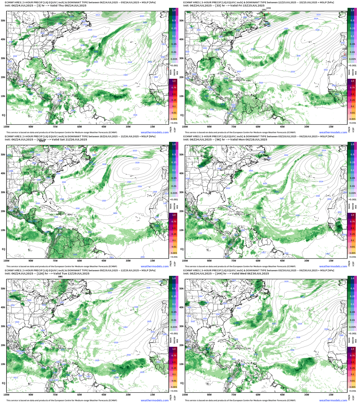
Better / more impressive collection of moisture / convection into the central MDR in 6-days … looks healthier than whatever we’ve seen in the past several weeks.
Germany ICON 12z | Precipitable Water Next 5-days
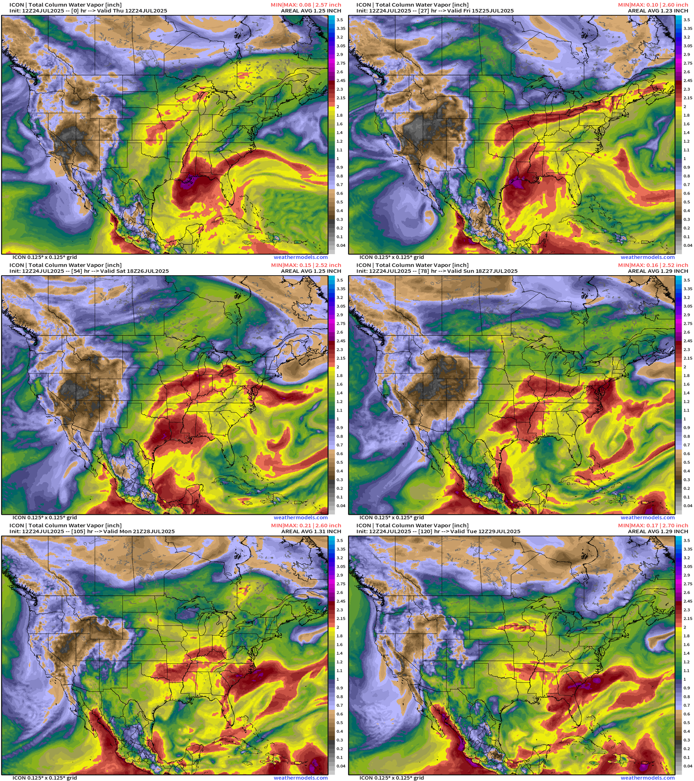
My favorite parameter … Huge amount of tropical moisture continues to rotate around a deep layer ridge anchored over the Southeast U.S.
And, we may see yet another repeat of this weather pattern that brings a blob of moisture from decaying front / backdoor trough into the Southeast.
NOAA Tropical Surface Analysis | 06z
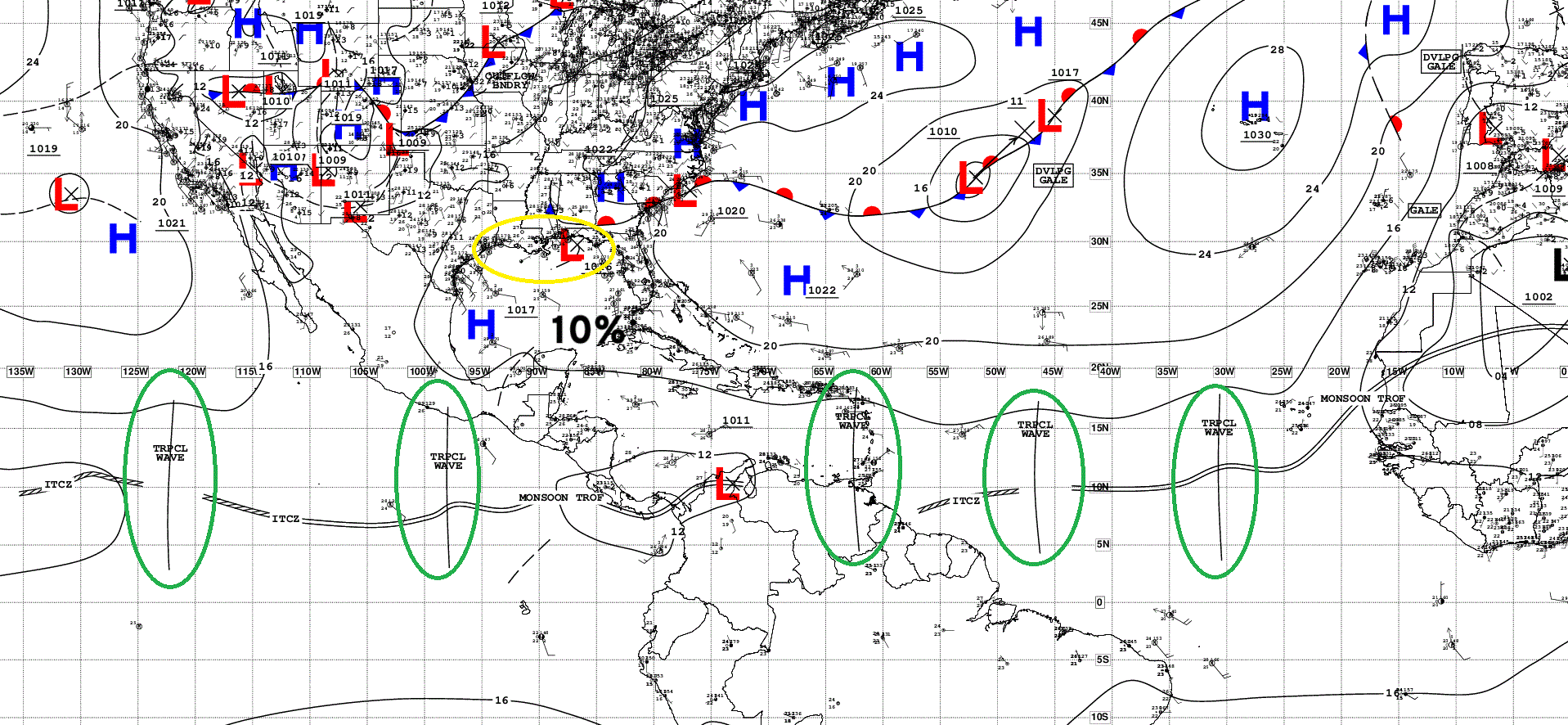
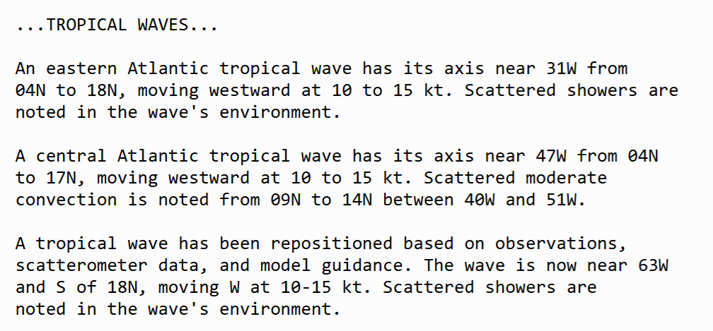
Atlantic Tropical Waves = 3 but not developing. The disturbance in the Gulf is associated with a trough (10%).
Medium range ensemble model outlook
These are 51-realizations of the same model with different initial conditions. Each ensemble gets equal ~2% weight in a mean calculation.
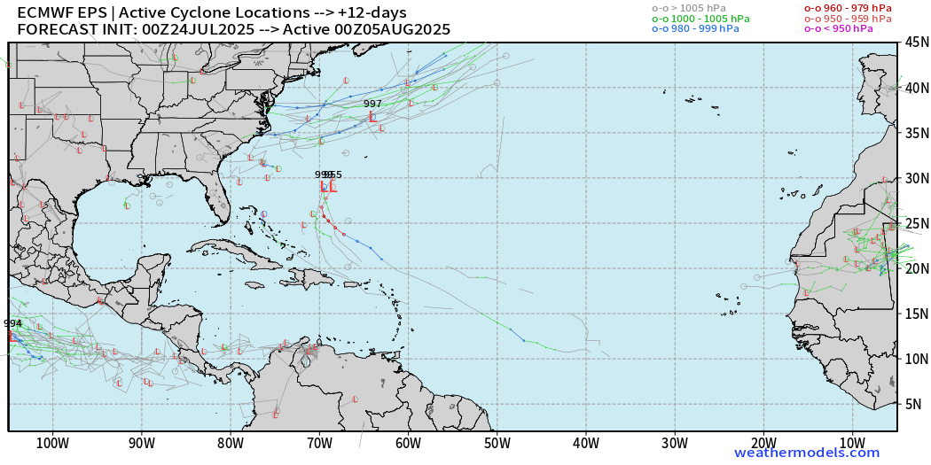
ECMWF Ensembles 00z | Next 12-days | Active Tracks
ECMWF Ensembles 00z | Next 15-days | Active Tracks
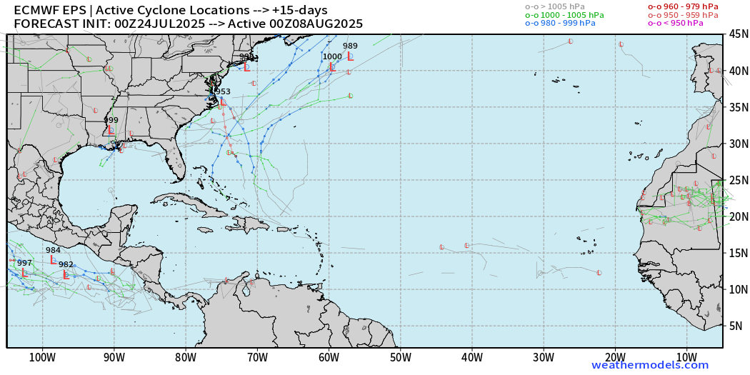
We do have hurricanes in the ensembles (EPS 00z) with 5/51 showing a powerful system in the western Atlantic. However, that is only 10%, so not a strong signal. We will monitor, of course.
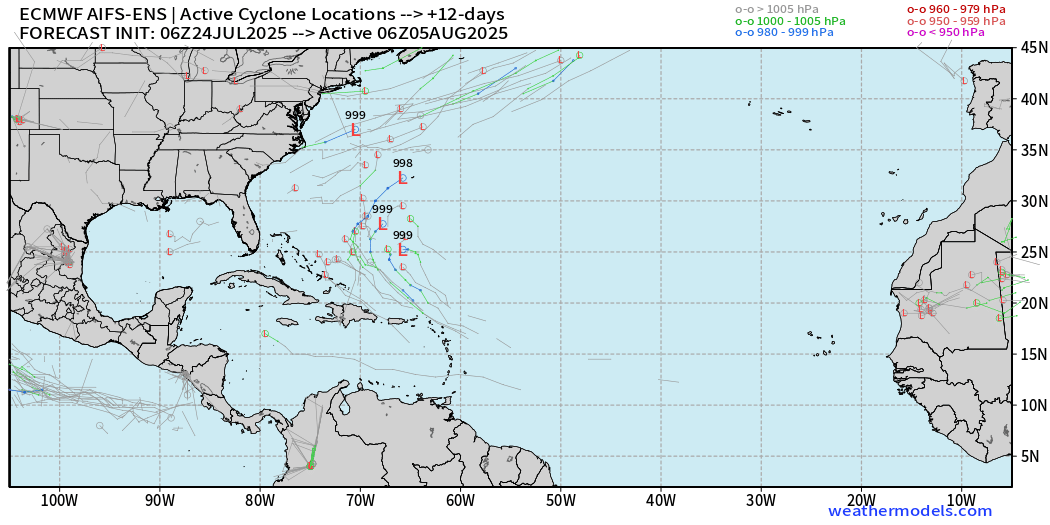
Compare with AIFS Ensembles | Next 12-days | Active Tracks
Next 14-days
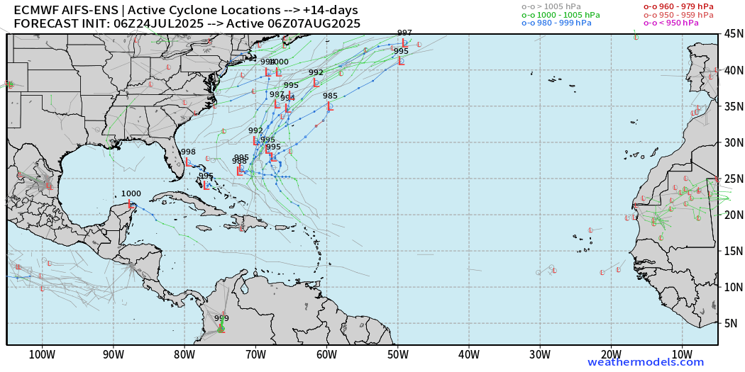
The 10-14 day period lights up with the AIFS-ENS v1 showing many systems. This is a more coherent signal that deserves attention.
Eastern Pacific Tropical Update
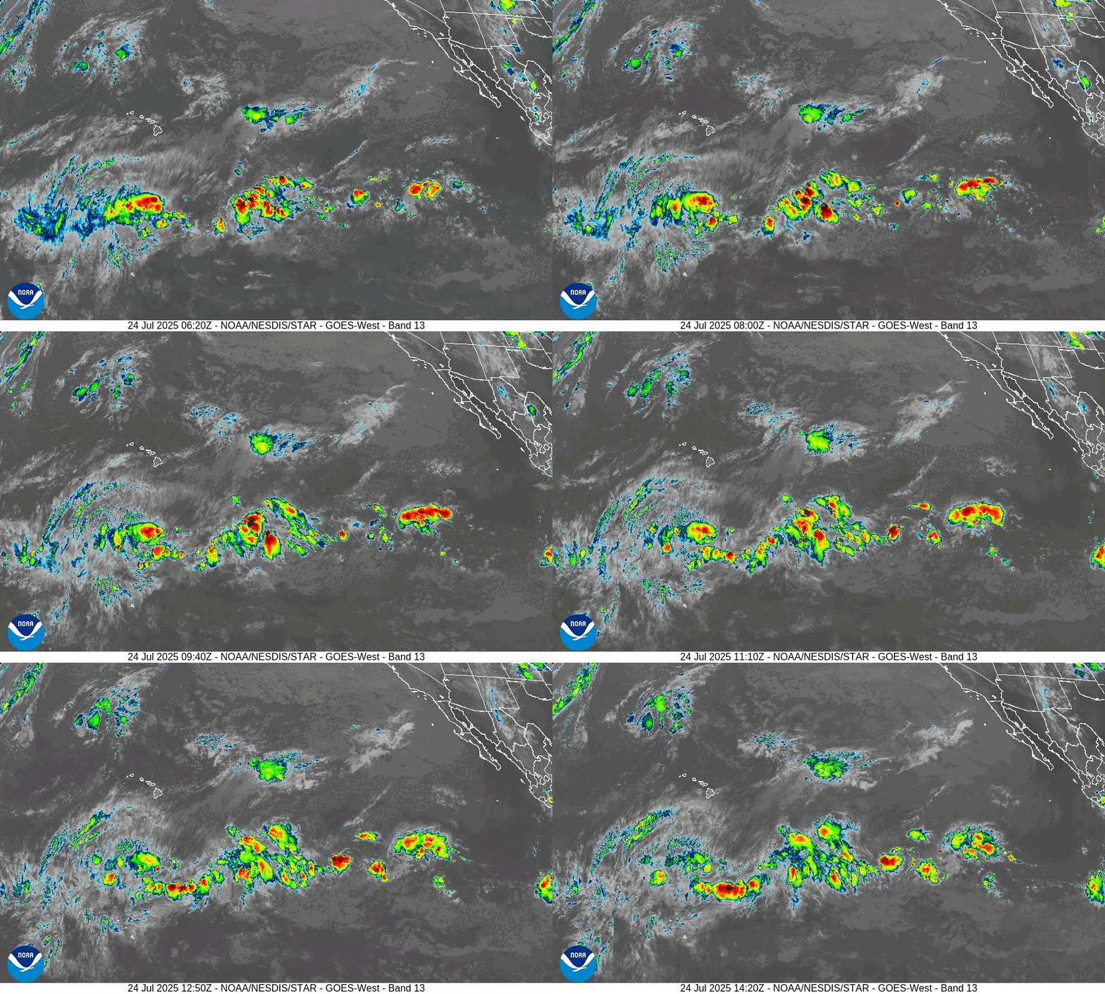
Area of convection well SE of Hawaii showing some signs of development but any storm formation will be slow. NHC has a 40% chance …
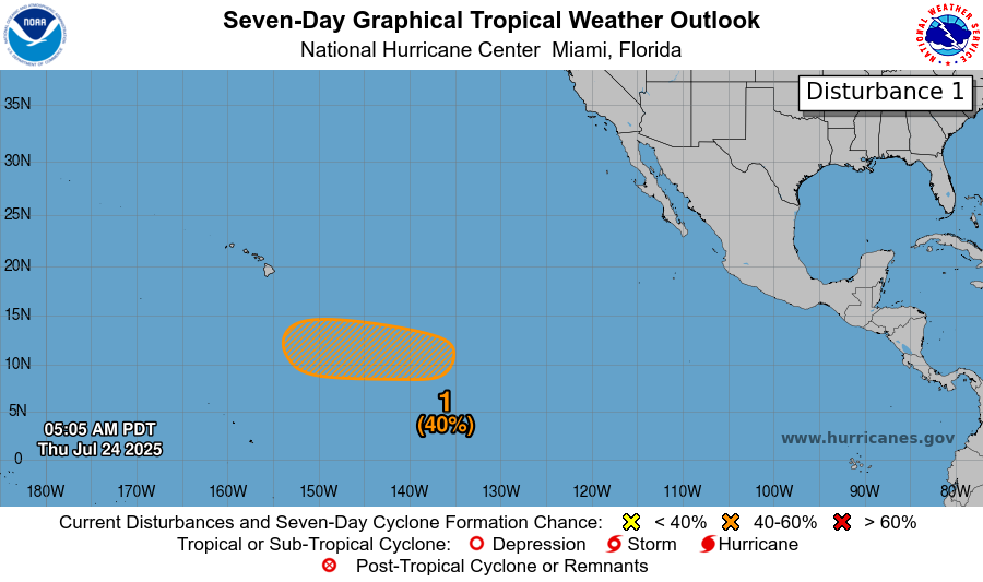
ECMWF in 4-days shows a few areas of vorticity and circulation of moisture transport that may indicate a tropical depression (weak) or storm.
AIFS-Ensembles through 6-days
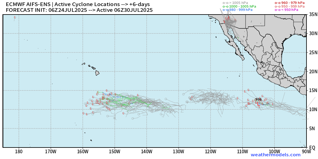
Weak lows in the far southern tropics along the ITCZ
Day 10 Active Tracks
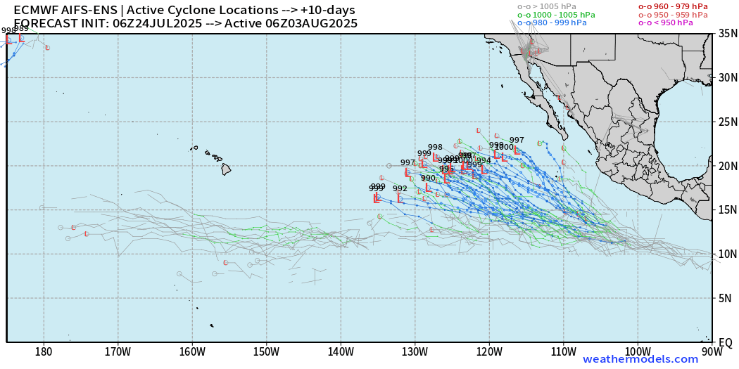
Better chance of significant storm off Mexico going to die over cooler waters.
Western Pacific Tropical Update
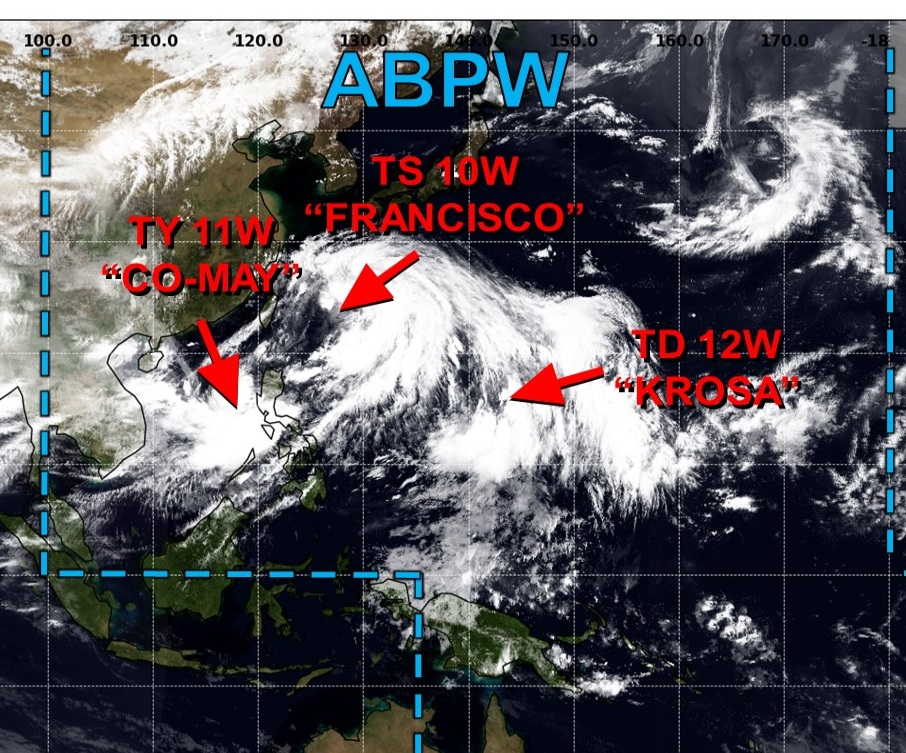
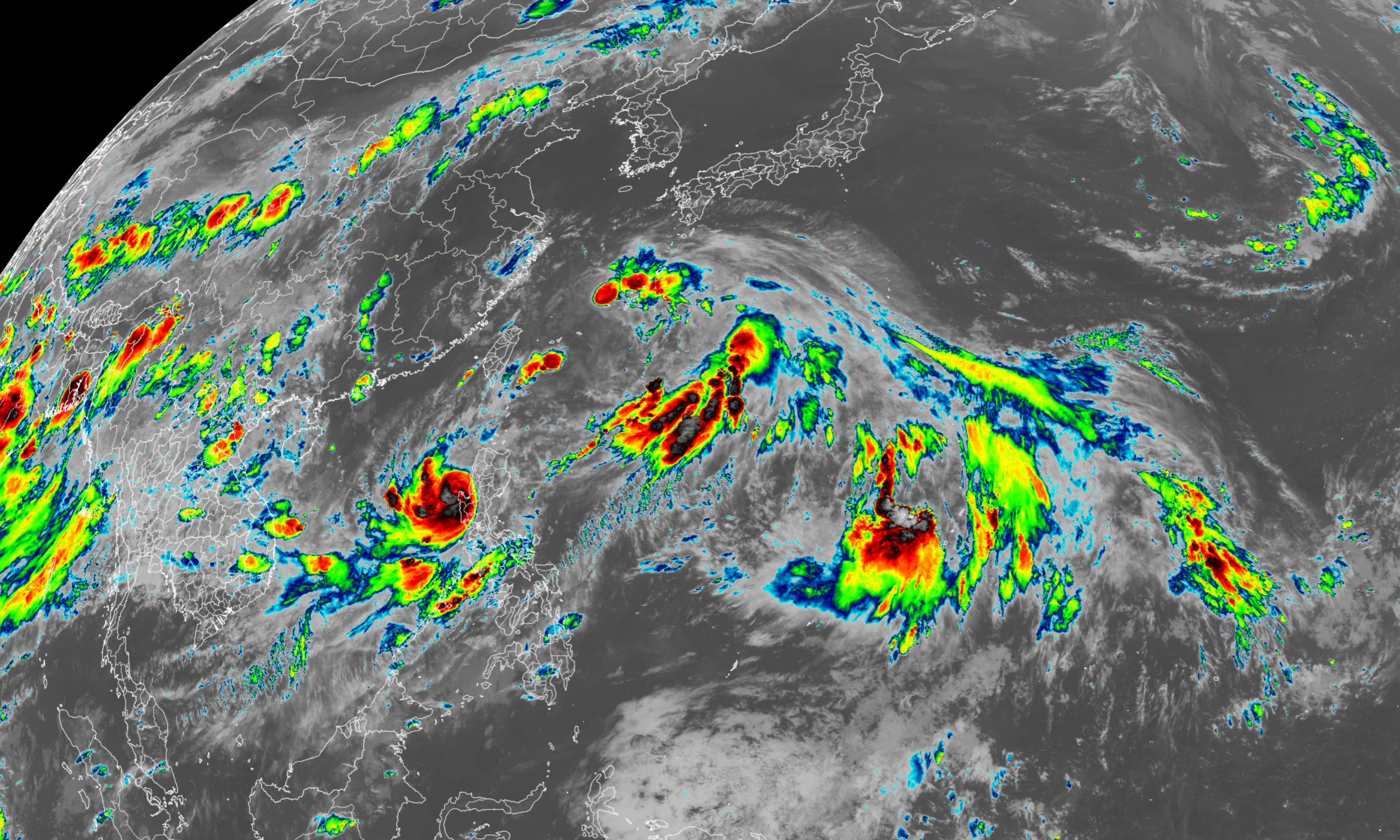
Busy Western Pacific with multiple systems underway. I still think newly designated TD Krosa (12W) will become the most impressive — the further east / detached from the main monsoon trough. Inside that mess, 10W and 11W are underway, and Co-May (11W) has become a Typhoon right off the western coast of Luzon.
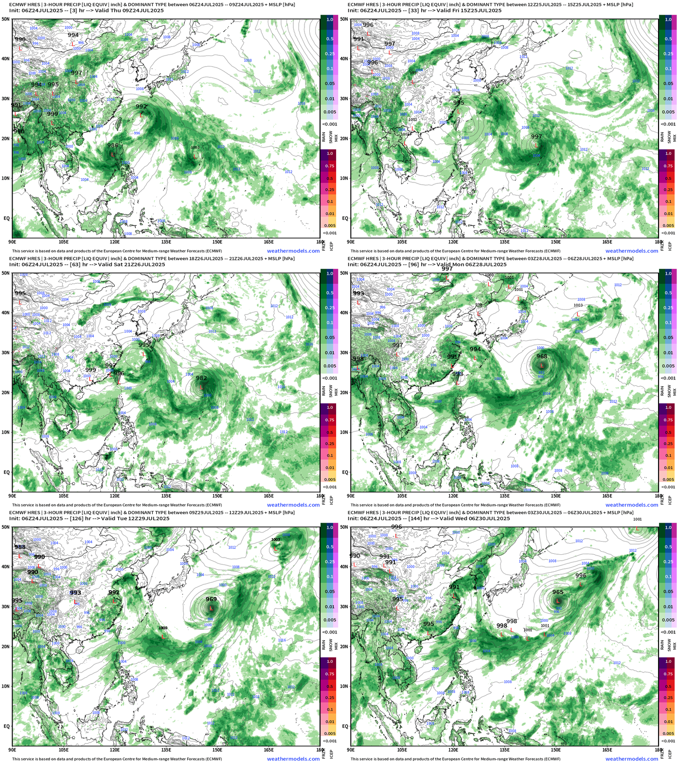
SST and Anomaly
The ocean temperatures have been much, much warmer than normal east of Japan into the northern Pacific due to the persistent monsoon trough / convection that spurs downstream ridging and calm winds / lack of storms.
Tropical Storm 10W (Francisco)
Weakening and won’t be around much longer.
Typhoon 11W (Co-May)
Landfall over Luzon as a minimal typhoon (65-knots) and it will then weaken and heat NE.
Tropical Depression 12W (Krosa)
JTWC is not bullish on Krosa but the ECMWF ensembles show some intense members in the 950s and 960s mb central pressure good enough for a powerful Typhoon.
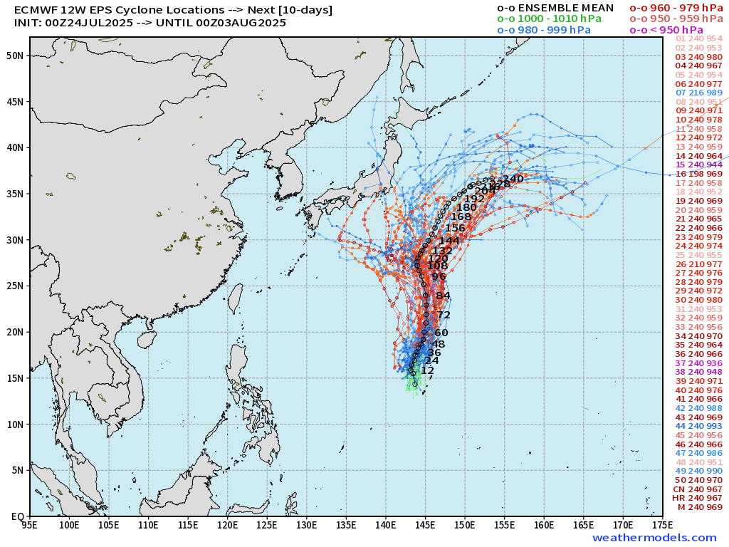
As it’s not affect land, we can watch Krosa develop and it may reach “major typhoon” status.
Maps sourced from weathermodels.com designed and innovated by yours truly! Please subscribe there for real-time access to the newest maps, charts from all of the weather models including ECMWF.
- Milepost
- 680 · laid 2025-07-24T16:02:36.451000Z
- Source
- https://weather.substack.com/p/july-24-2025-hurricane-season-thursday
- Digest
- 793b1bd2b250d8868e9ee4f0e183477a3f93e30771b93e2b50b0757d6d02b157
- Machine
- JSON