April 9, 2025 Wednesday Weather Update
Drying out with trend toward cooler Canadian origin air
April 2025 was the 16th-warmest April in the 132-year national record (1895–2026), at 53.6°F against a 1991–2020 normal of 51.8°F (+1.7°F).
April 2025 was the 31st-wettest April in the 132-year national record (1895–2026), at 2.9in against a 1991–2020 normal of 2.7in (+0.2in).
NOAA/NCEI Climate at a Glance, contiguous United States. This is the observed record for the month, not a score of anything said in this piece — the forecast ledger begins 2026-08-17 and cannot reach earlier posts.

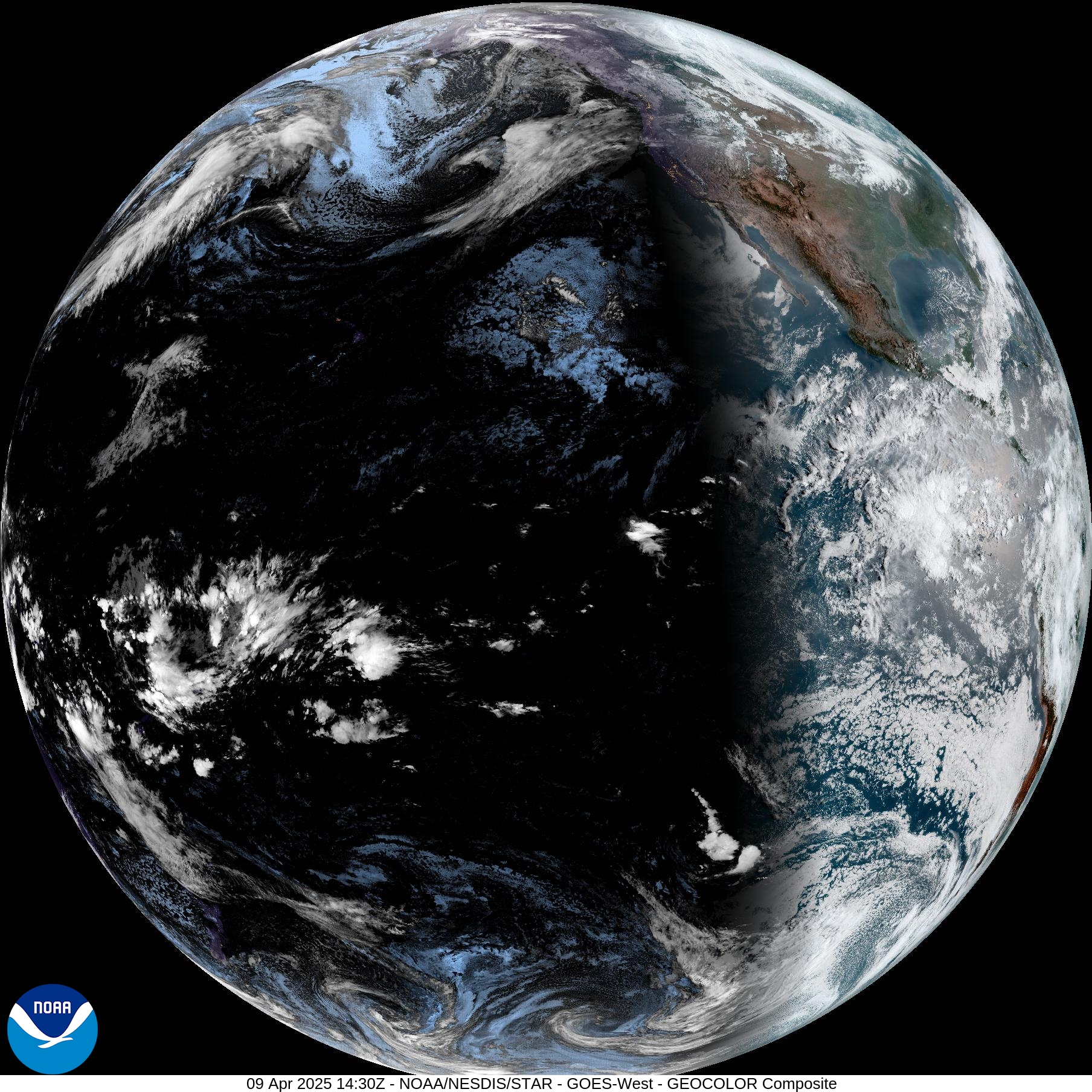
The new GOES-19 [East] imagery is not processing this morning, so I’ll post the full disk image of GOES-West showing the progress of sunrise at 7:30 AM PT.
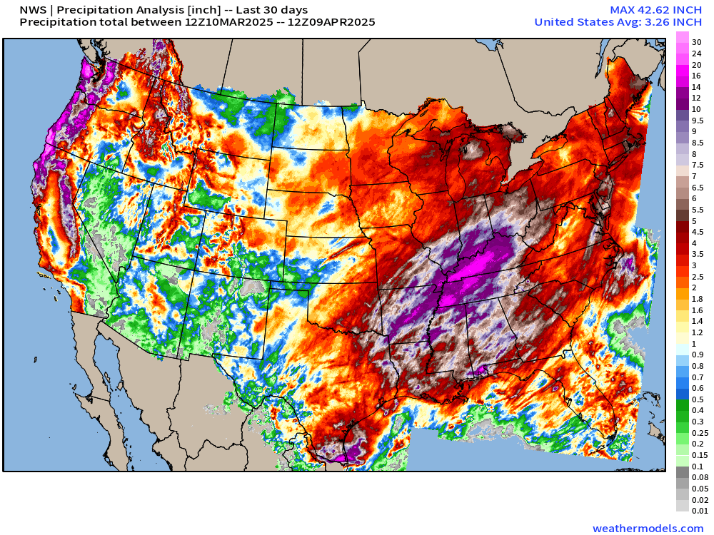
I’m sure you’ve seen the footage of flooding in Cincinnati as the Ohio River has risen well past flood stage. In the last 30-days, the Lower 48 USA has received about 180 Trillion gallons of precipitation which is 3.32” if spread across the country evenly.
In the Ohio River and Mississippi River Valleys, many states received 2-3x their normal monthly rainfall.
Kentucky: 8.3T, Arkansas: 8.2T, Tennessee 7.4T, Ohio: 5.1T, Missouri: 6.2T
TX: 11.2T, WA: 7.2T, OR: 8.6T, CA: 10.0T
Last 30-days Precipitation
Last 30-days Precipitation % of Normal = 118% for Lower 48
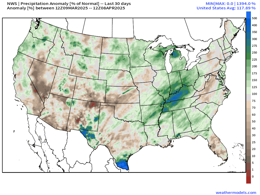
Zoom on Ohio River Valley
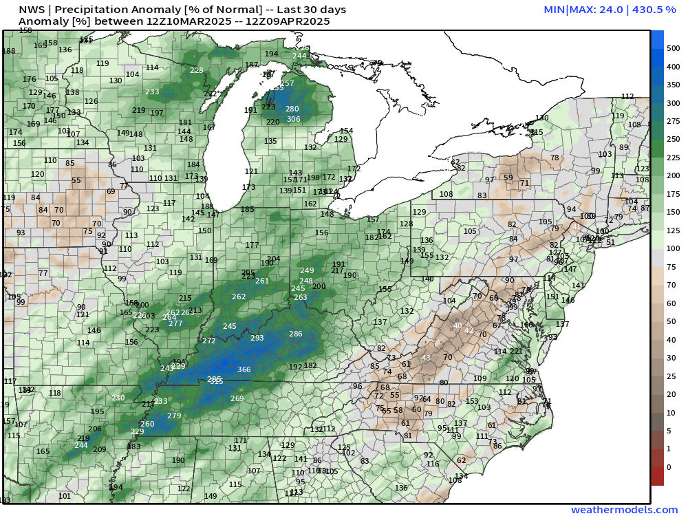
300% to 400% across Kentucky
Also, Great Lakes highly above normal > 250% in the tip of the mitt of Michigan around Gaylord, east of Traverse City.
Weather Today
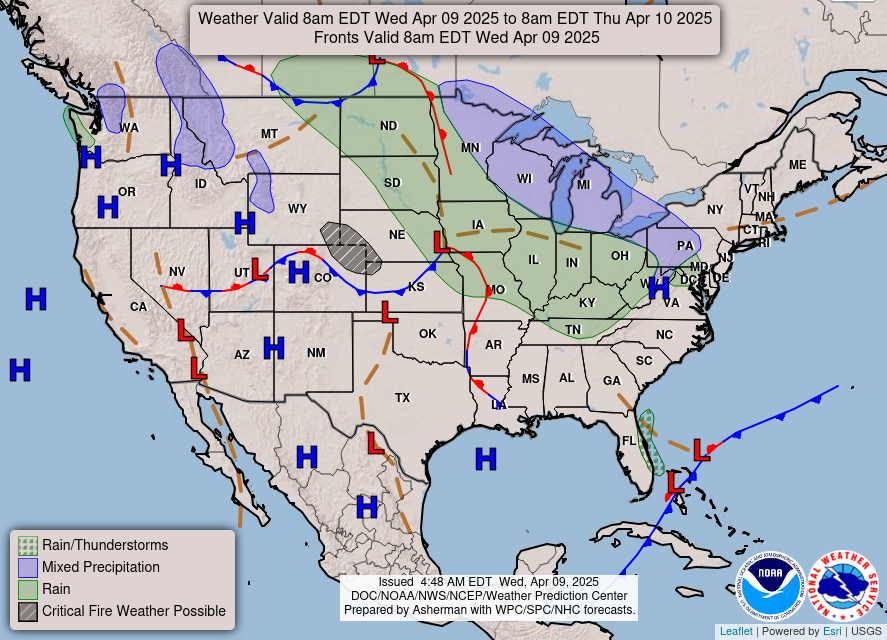
Light precipitation in the Midwest and Great Lakes within the cold air from the Canadian trough.
Slight Chance of Severe Weather on Thursday
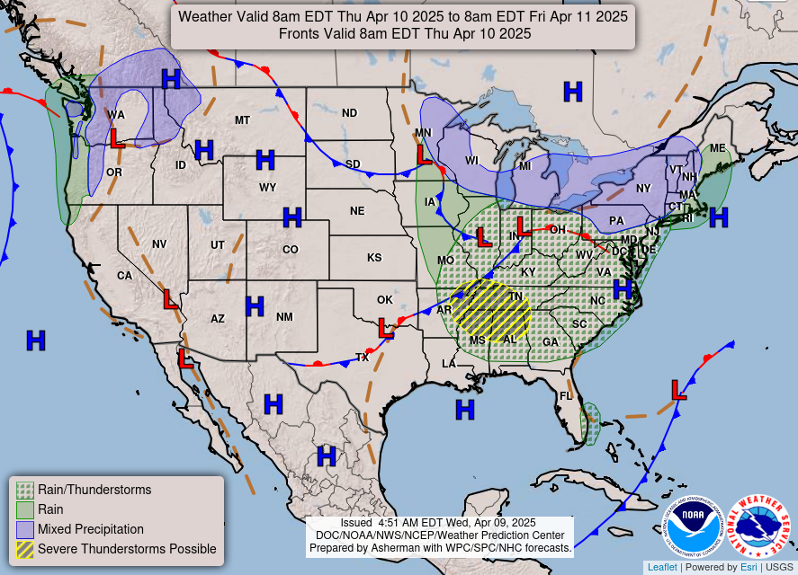
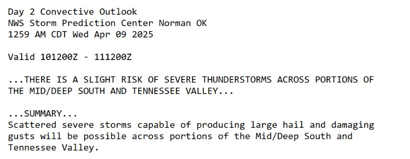
After writing off severe weather chances for the next week in yesterday’s post, we see a Day 2 slight risk show up in the SPC convective outlook.
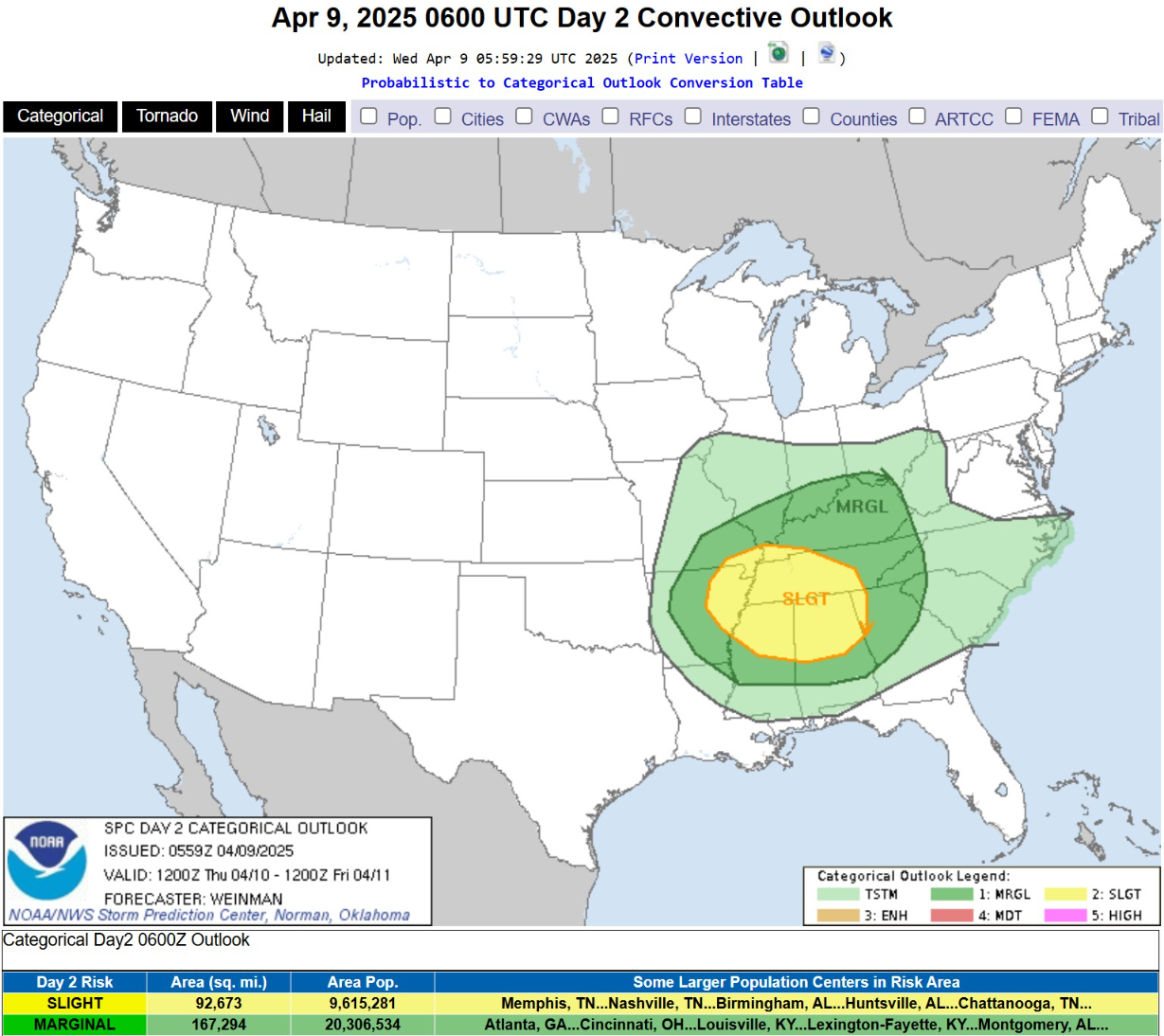
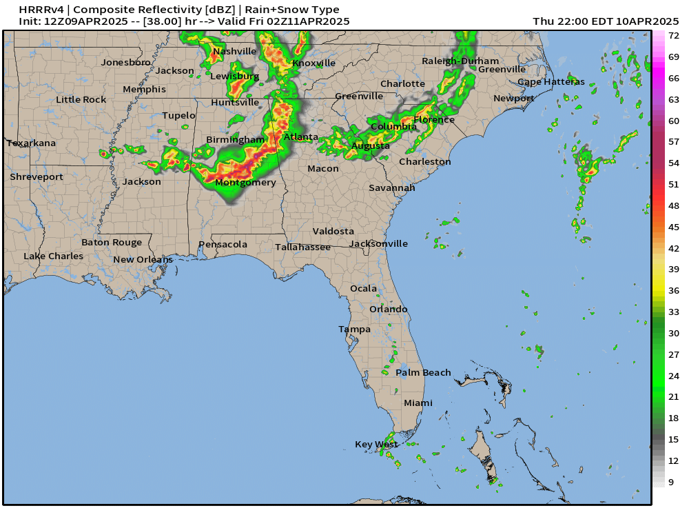
The main risk is gusty winds and hail with a potential derecho into Alabama and Mississippi.
HRRR Simulated Radar Through Friday Morning
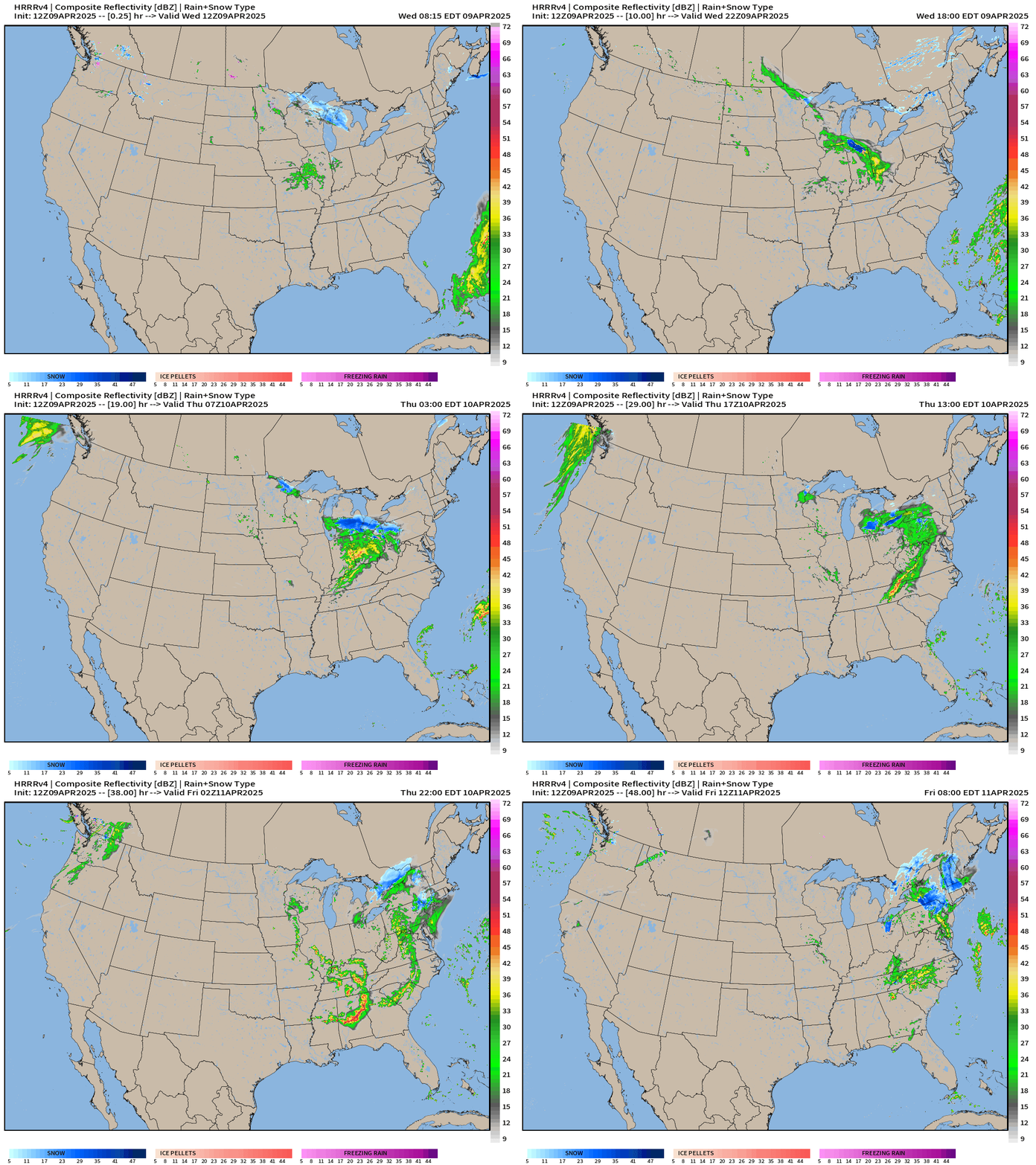
A trough with an area of low pressure will track out of the Great Lakes into the Middle Atlantic, and on the western side of the circulation, bands of rainfall including potentially severe thunderstorms later on Thursday.
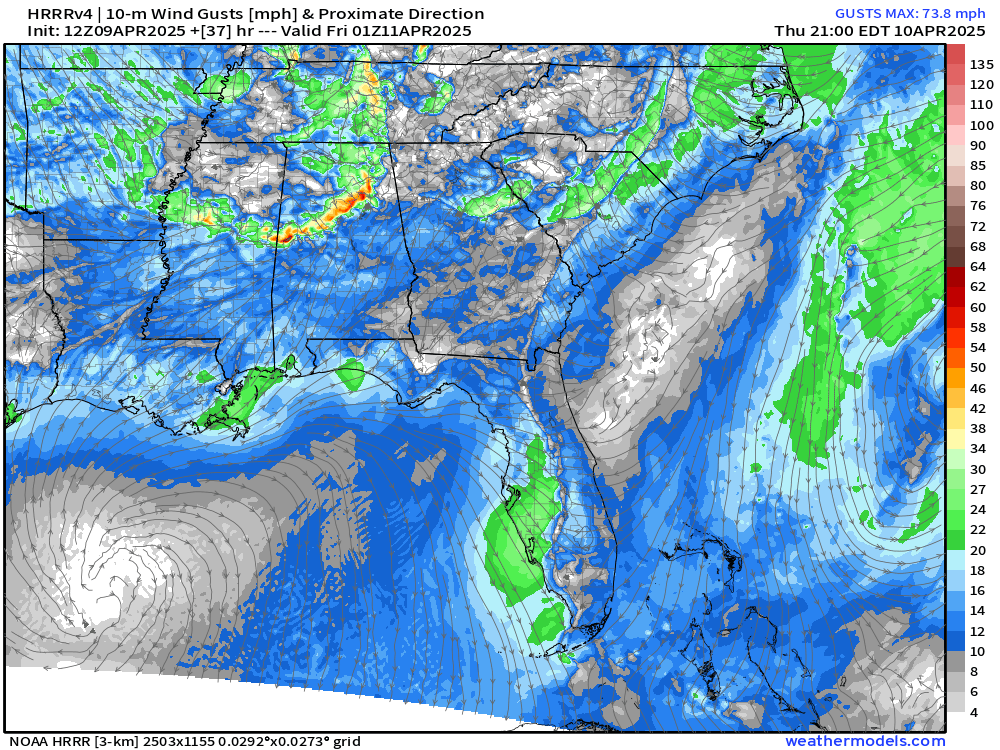
Wind gusts from HRRR at Thursday 9 PM ET show the characteristic gusty/damaging winds from a mesoscale convective complex moving very quickly due south. We’ll see if this remains in the model guidance later this afternoon, but this could be a surprise wind damage event.
High Temperatures on Wednesday
Low Temperatures on Thursday
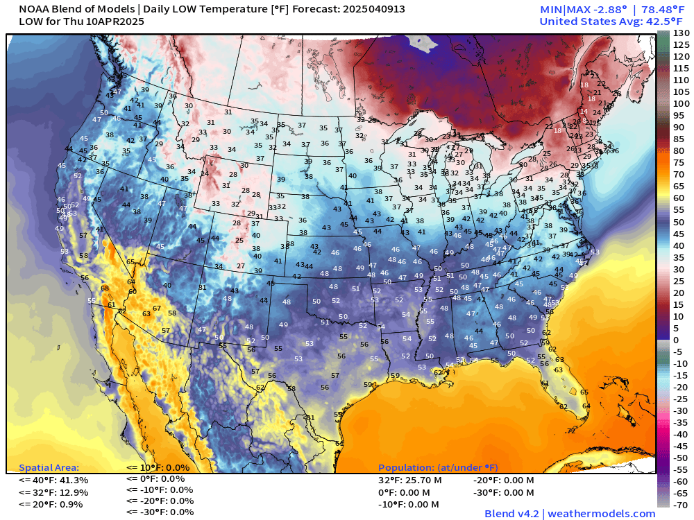
Only 26 million below freezing.
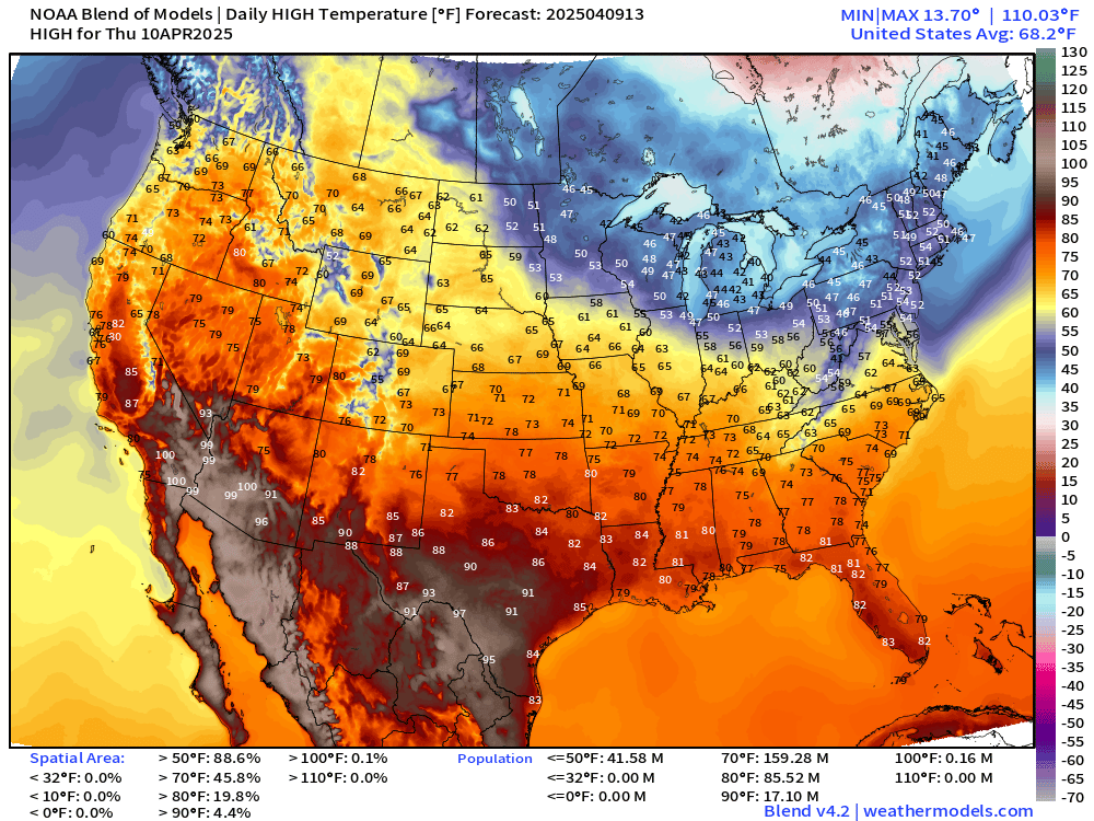
High Temperatures on Thursday
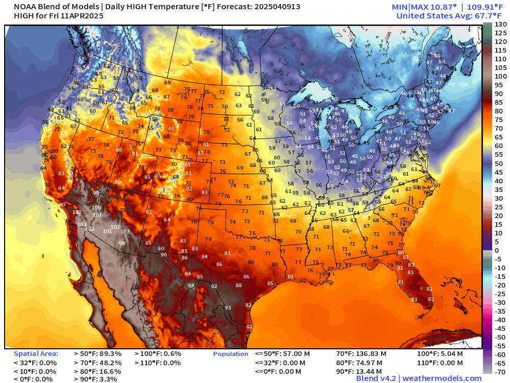
Pushing 102°F in Phoenix. 50s in the Great Lakes and 40s in New England = progress
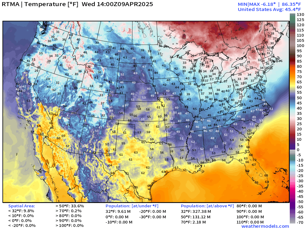
Temperature Analysis | 10:00 AM ET
Temperature Anomaly | 10:00 AM ET
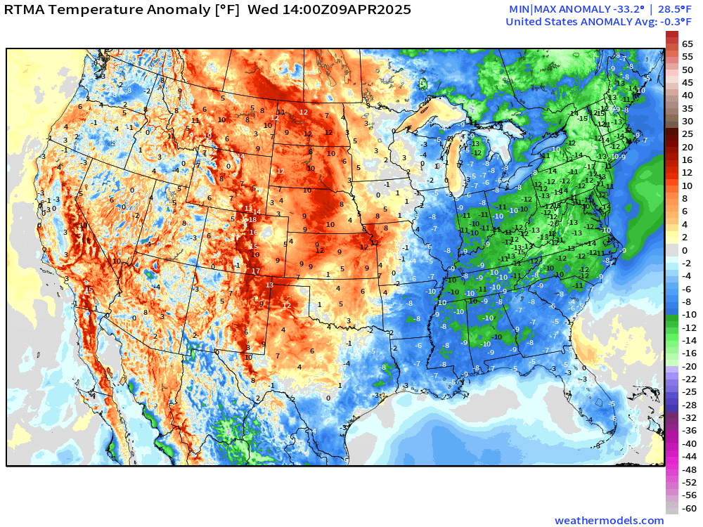
Overall the Lower 48 is -0.3°F below normal with central US warm while the middle Atlantic, Great Lakes, and Northeast still with wintry chill
Storm Systems + Precipitation Type Next 6-Days
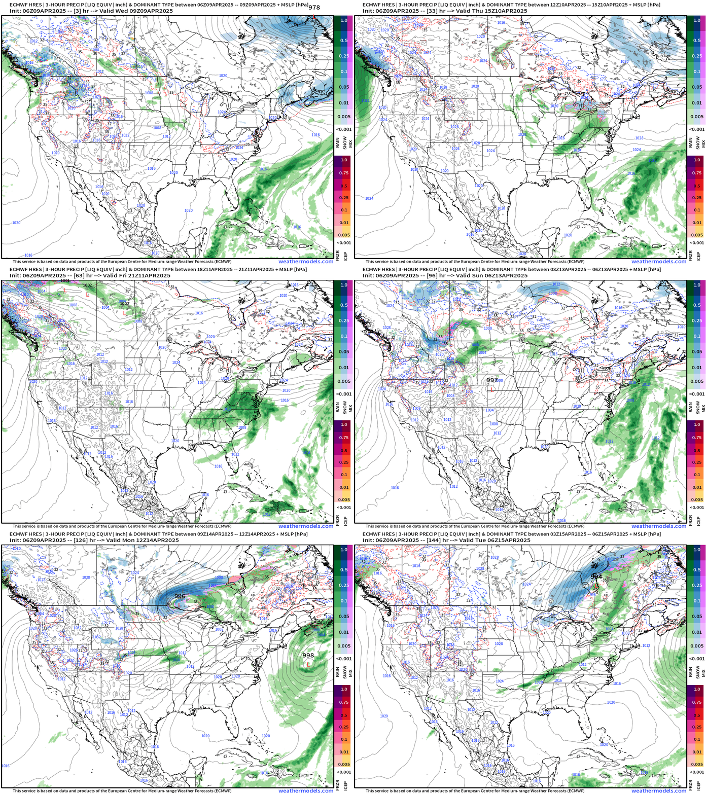
Our next storm system loops into the middle Atlantic and then emerges off the coast by this weekend. 2-inches of rainfall for Maryland.
NWS 60-hours Precipitation
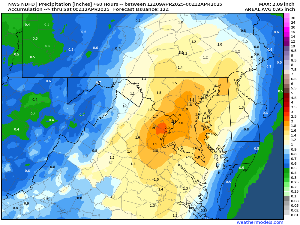
Day 1 Rain through Thursday 8 AM
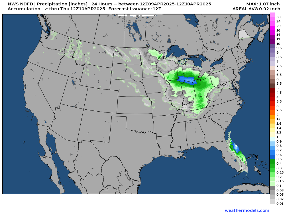
Day 2 Rain Thursday 8 AM to Friday 8 AM
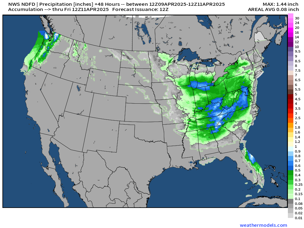
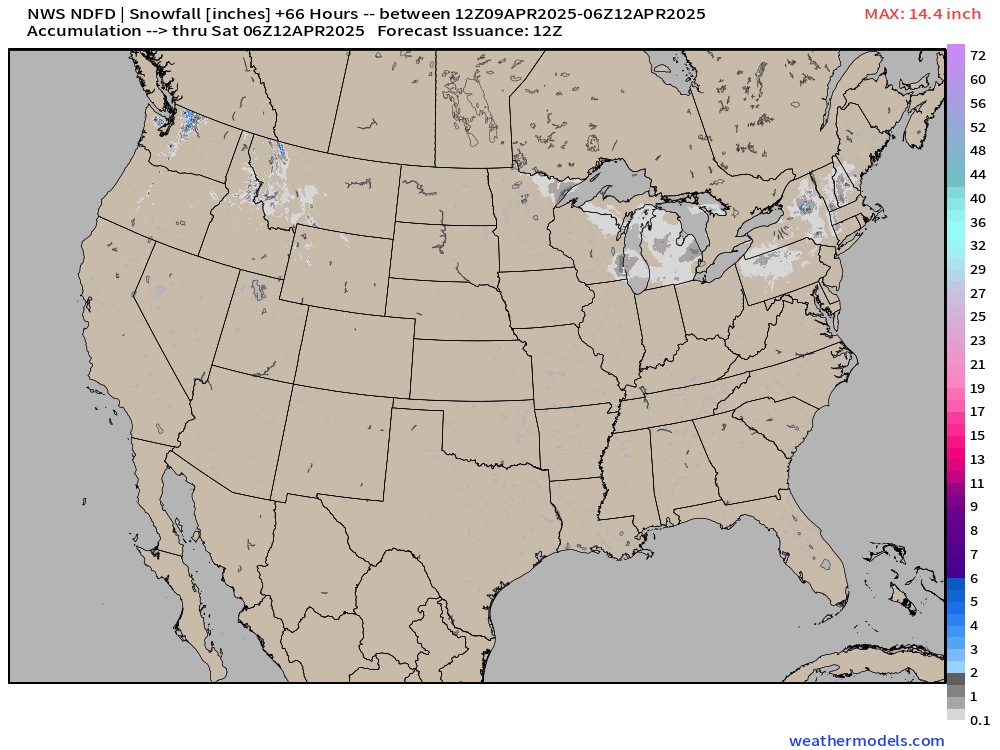
60-Hour Snowfall — not much, thankfully.
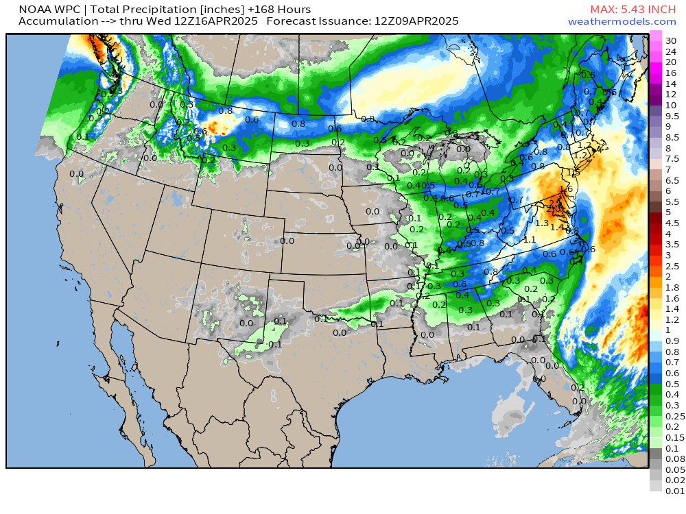
NWS WPC Precipitation | Next 7-days
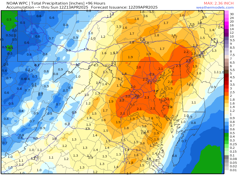
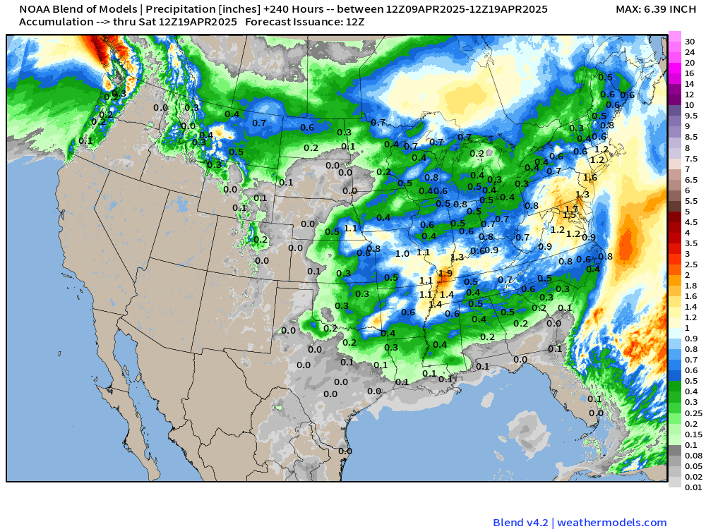
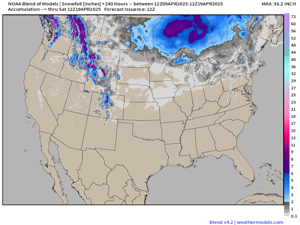
Blend of Models | 10 Days Precipitation and Snowfall
ECMWF 06Z AIFS | Upper-Level Pattern for North America next 10-days
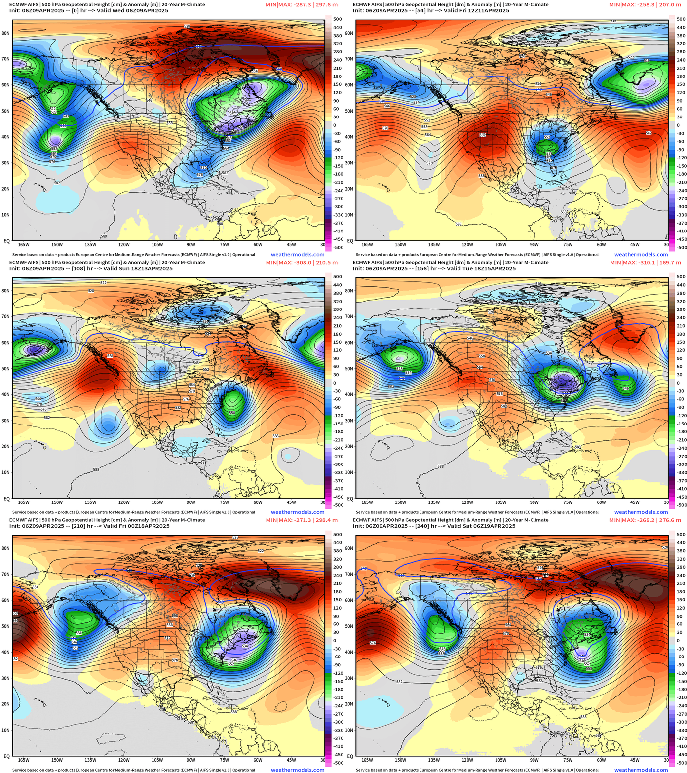
Progressive pattern with favored western ridging and significant troughing over the Great Lakes and Northeast keeping temperatures seasonably cool.
Quick Trip to Europe | Next 6-days
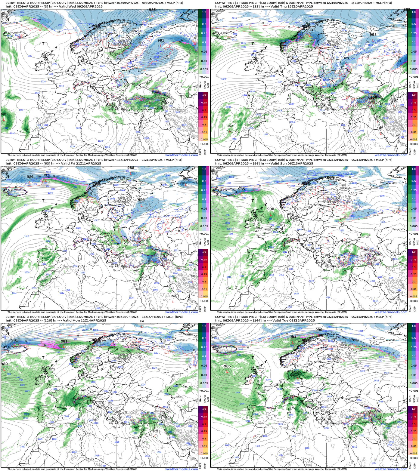
Just a little map animation of the precipitation type and weather systems across Europe for fun.
14-day Ensemble Median Rainfall
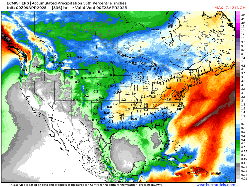
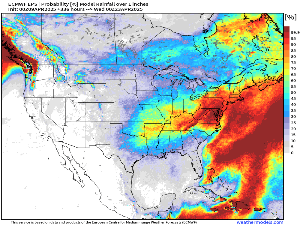
Probability of 1-inch of rainfall in the next 2-weeks
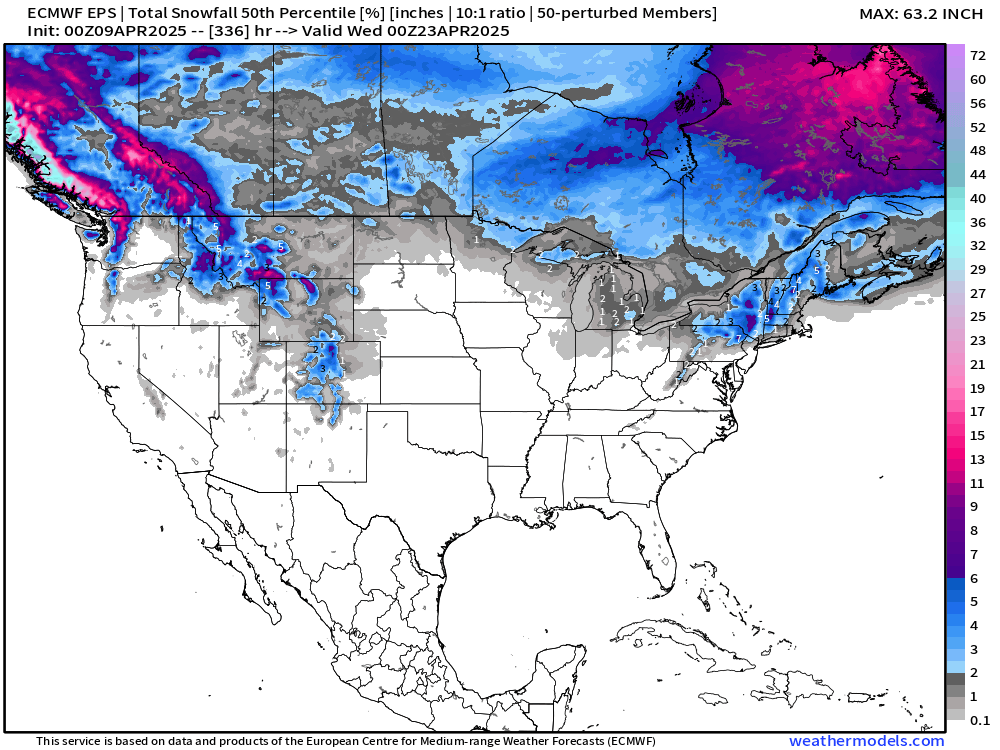
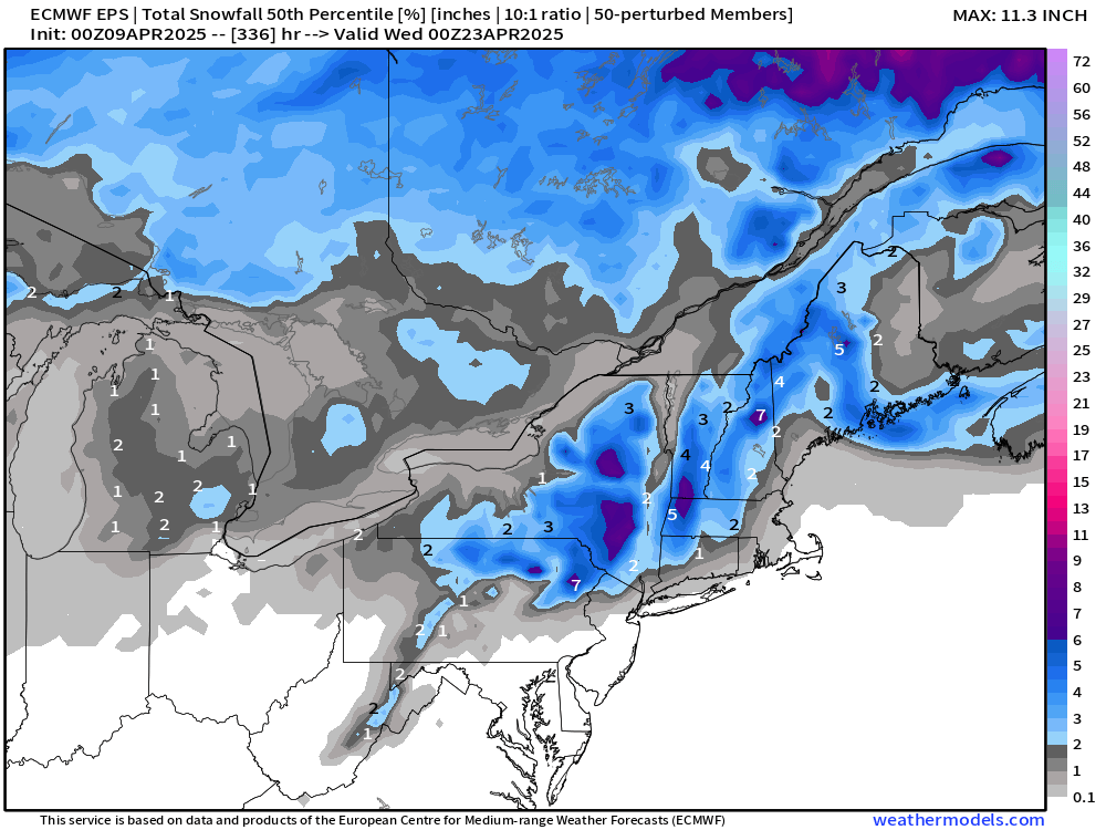
14-Day Snowfall | Ensemble Median
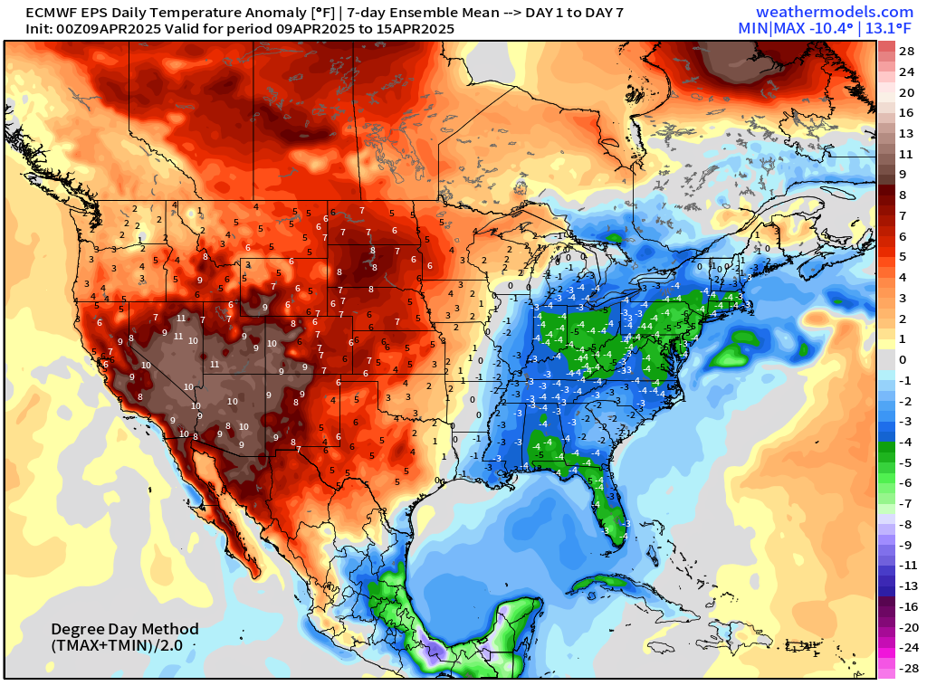
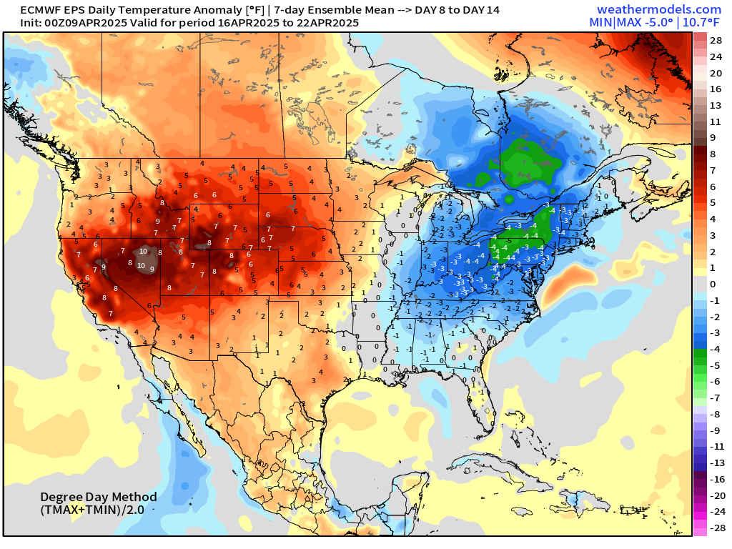
ECMWF EPS 00z | Weekly Temperature Anomaly
Week 1: April 9 - 15
Week 2: April 16 - 22
Who writes and researchers this Newsletter? Dr. Ryan N. Maue [X https://x.com/ryanmaue] with 20-years experience of daily weather model production and analysis. You may have seen my weather maps! I live in Atlanta but was born and raised in Northern Michigan. I know snow, and southern heat and humidity.
Maps sourced from weathermodels.com designed and innovated by yours truly! Please subscribe there for real-time access to the newest maps, charts from all of the weather models including ECMWF.
- Milepost
- 571 · laid 2025-04-09T15:15:29.137000Z
- Source
- https://weather.substack.com/p/april-9-2025-wednesday-weather-update
- Digest
- 4b70d95a5dcadf9e40fbf34a7cf255cafddb919773eb5045d41282cbcb3ed9a4
- Machine
- JSON