April 2, 2025 Wednesday High Risk Severe Weather
Major outbreak of tornadoes possible across mid-Mississippi River Valley
April 2025 was the 16th-warmest April in the 132-year national record (1895–2026), at 53.6°F against a 1991–2020 normal of 51.8°F (+1.7°F).
April 2025 was the 31st-wettest April in the 132-year national record (1895–2026), at 2.9in against a 1991–2020 normal of 2.7in (+0.2in).
NOAA/NCEI Climate at a Glance, contiguous United States. This is the observed record for the month, not a score of anything said in this piece — the forecast ledger begins 2026-08-17 and cannot reach earlier posts.

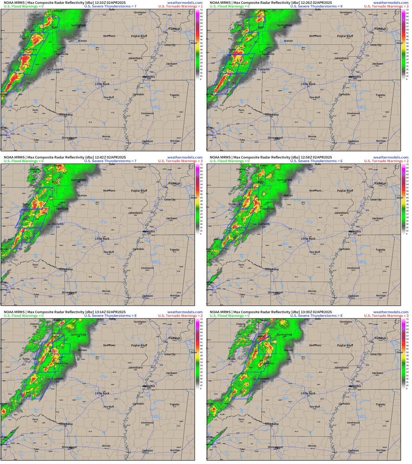
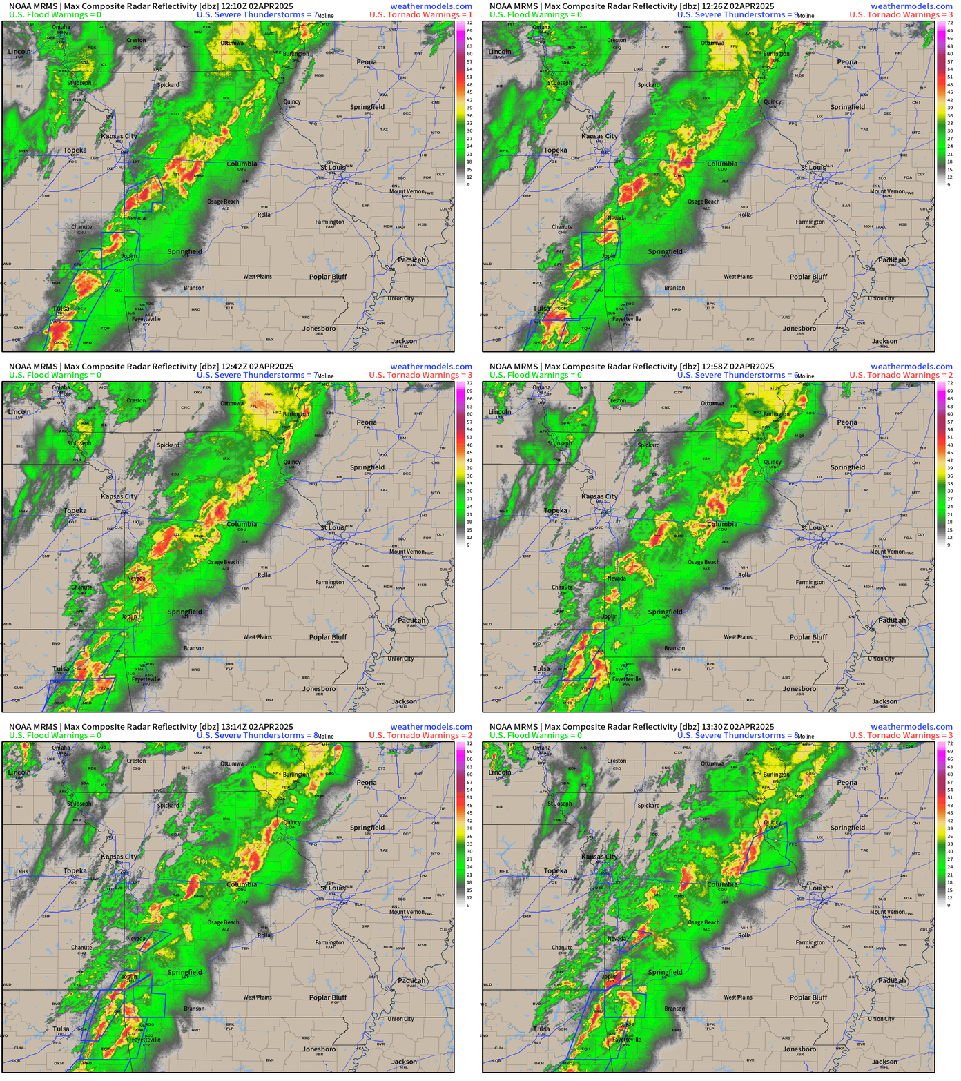
Rough day likely [High Risk of Severe Storms] across the mid-Mississippi River Valley centered on Memphis, Tennessee. Severe storms already embedded within a rather wide front boundary moving through Missouri and Arkansas.
Current radar through 8:30 AM CT
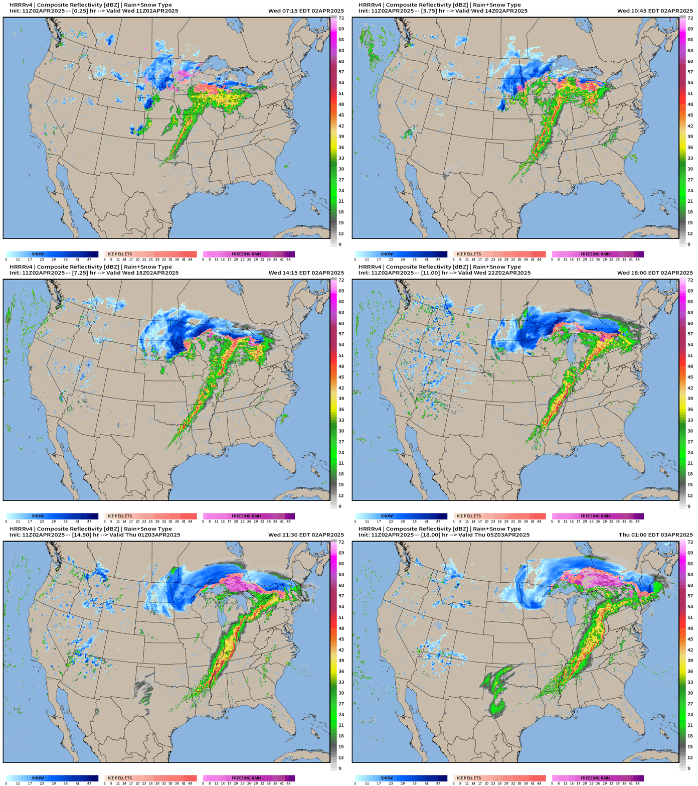
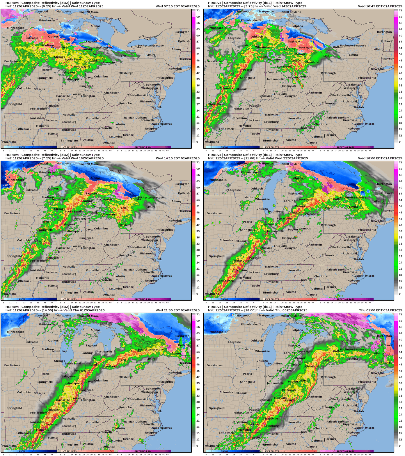
Simulated radar (HRRR 11z) shows a significant linearizing squall line intensifying across Arkansas and Missouri this morning and then pushing eastward into IN/KY/TN into the evening hours.
Zoom on Ohio River Valley (HRRR 11z)
Supercell + Tornado parameters show high values supporting Moderate + High Risk for damaging winds, hail, and tornadoes.
6-Hourly Maximum Helicity
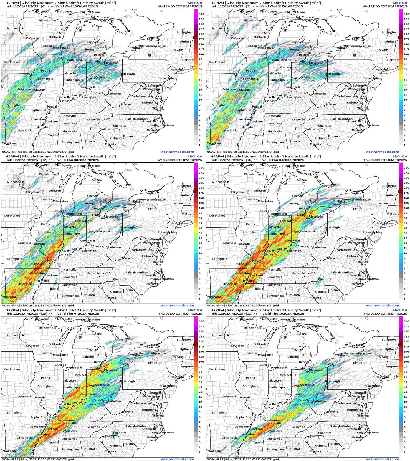
HRRR shows individual long-tracks with potentially rotating updrafts most intense this evening.
SPC High Risk [Day 1 — Wednesday] Corridor centered on Memphis
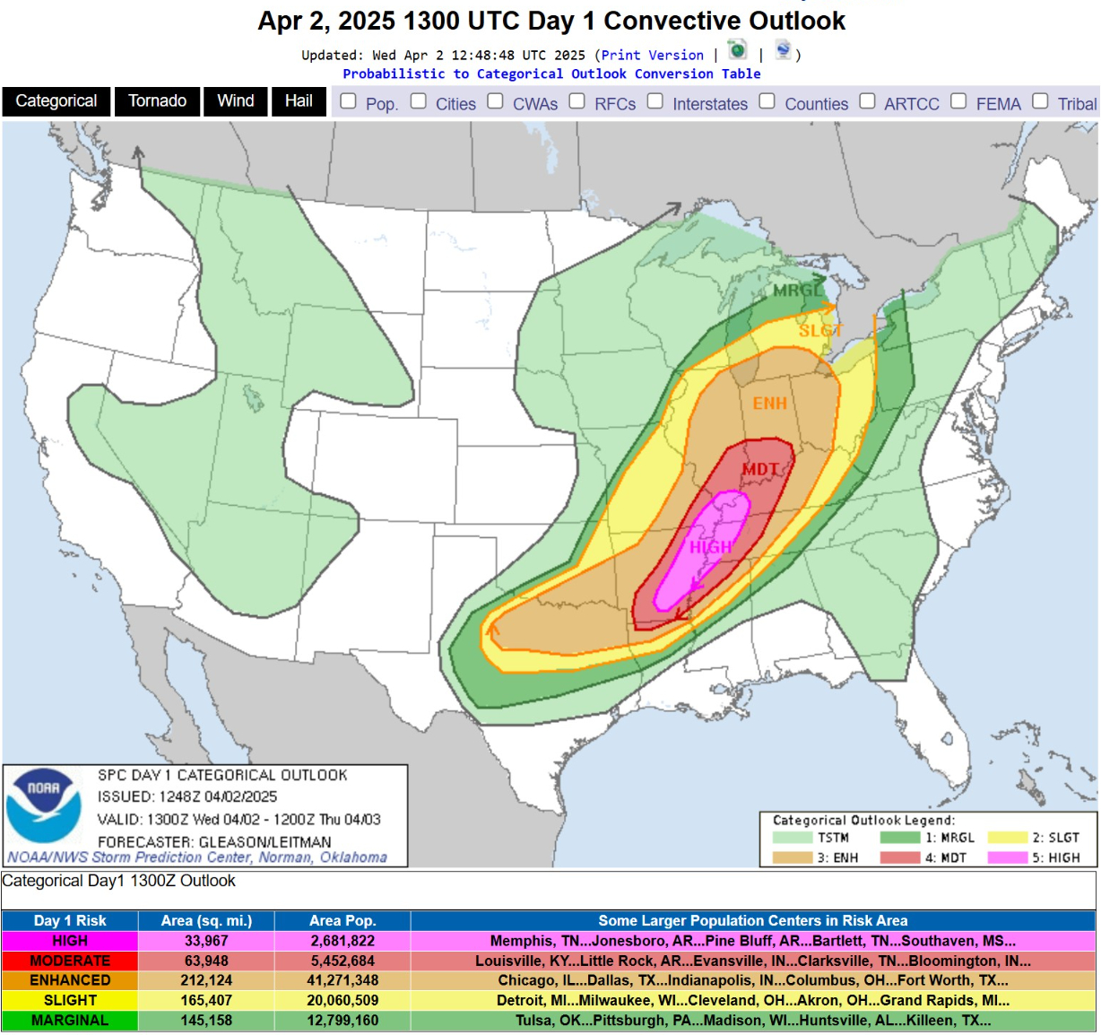
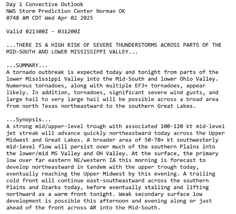
30% chance of Tornado within 25-miles
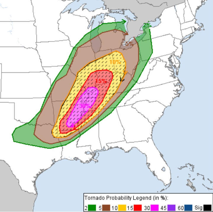
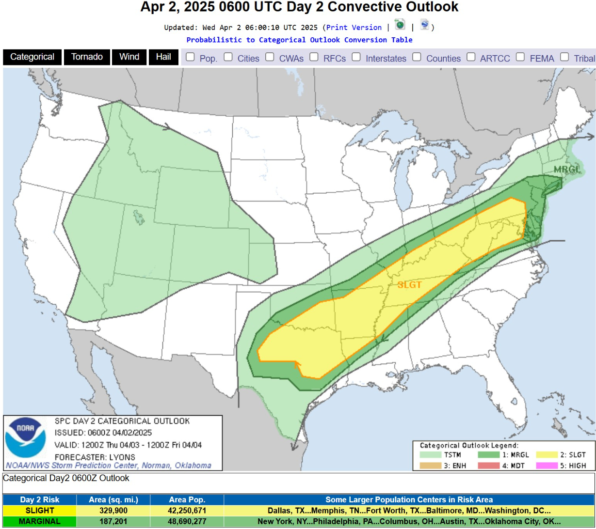
Large Hail and Damaging Winds over larger area from Southern Michigan into North Texas.
Synoptic Overview
Integrated Vapor Transport Next 6-days
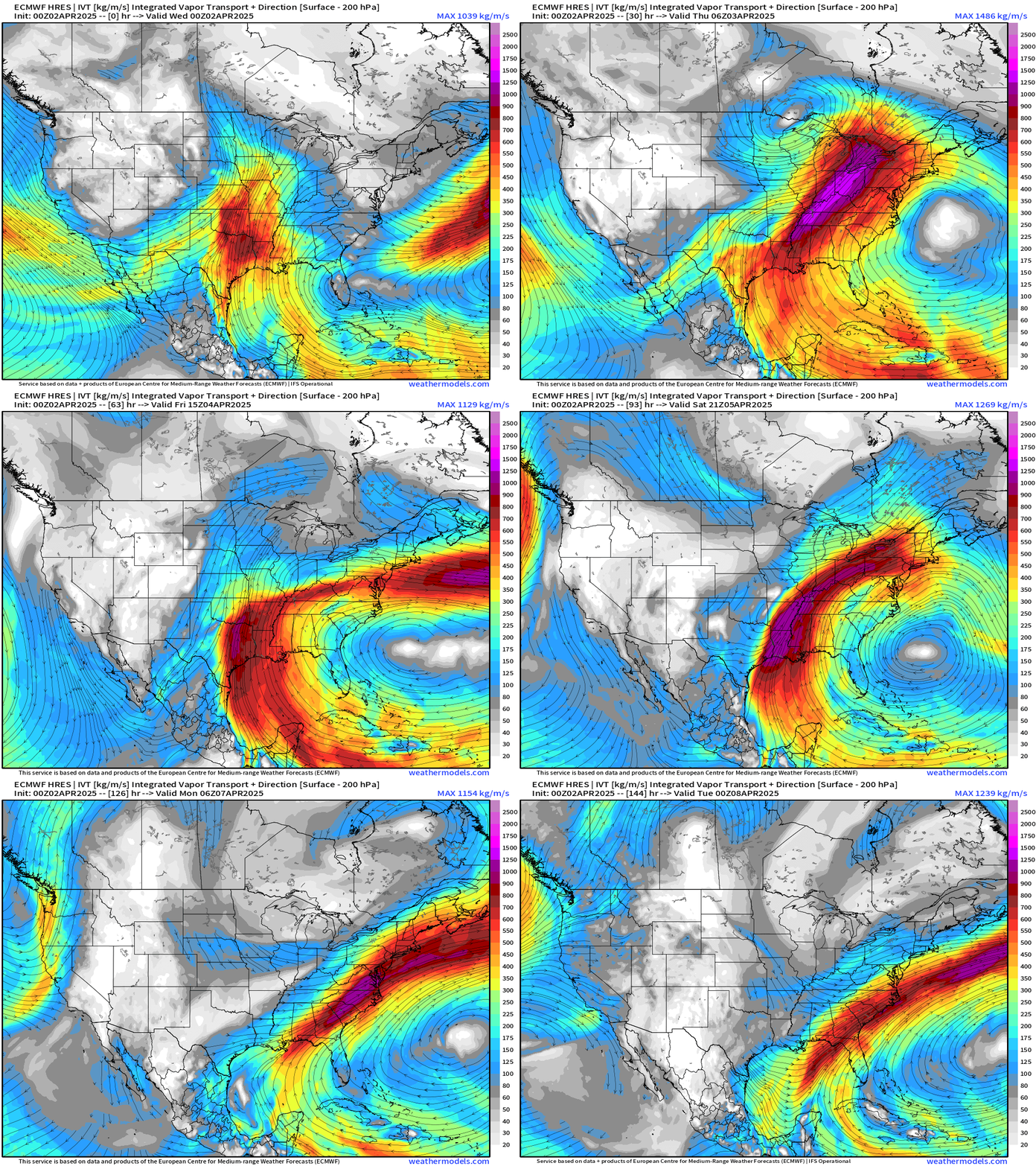
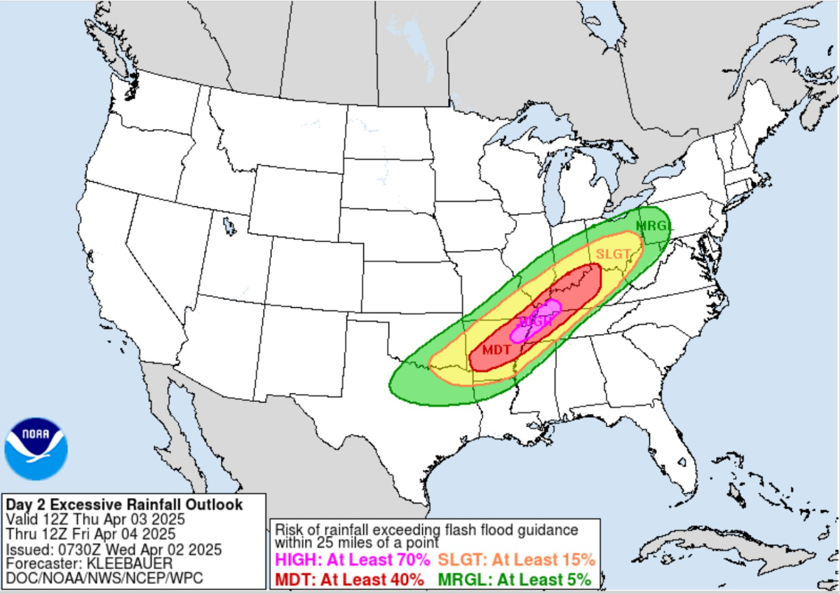
Several days of moisture flowing out of the Caribbean through the Gulf coast into the mid-Mississippi River valley will lead to extreme rainfall totals and flooding.
The circulation associated with a strong subtropical ridge off the U.S. Southeast coast blocks the eastward advancement of the frontal boundary and instead serves as an effective circulation/convergence mechanism for an atmospheric river like moisture feed.
High Temperatures on Wednesday
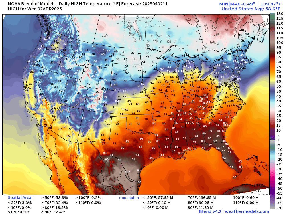
70s and 80s ahead of the frontal boundary this afternoon. mid-80s into Cincinnati. 90s in South Georgia into Tampa, Florida. HOT.
Temperature Analysis | 8:00 AM ET
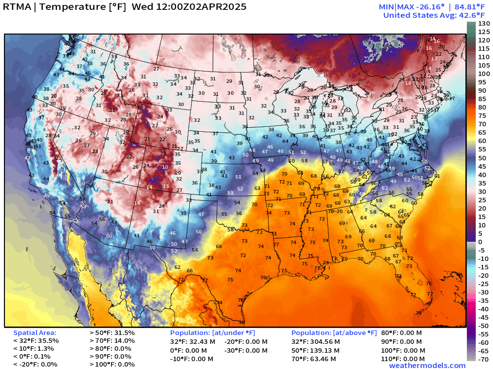
70s already into St. Louis early this morning.
Temperature Anomaly | 8:00 AM ET
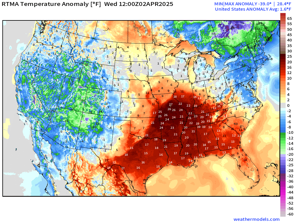
Overall the Lower 48 is +1.6°F above normal with warmth ahead of the storm system.
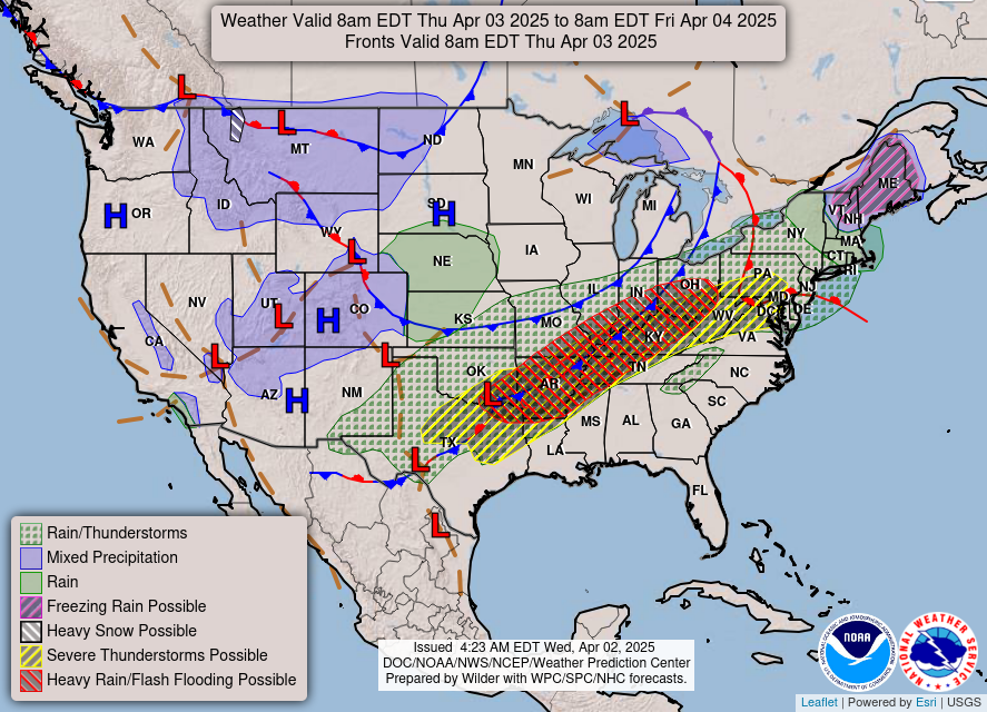
Thursday Frontal Boundary
Thursday Convective Outlook
High Risk of Excessive Rainfall exceeding flash flood guidance
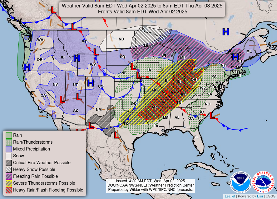
Storm Systems + Precipitation Type Next 6-Days
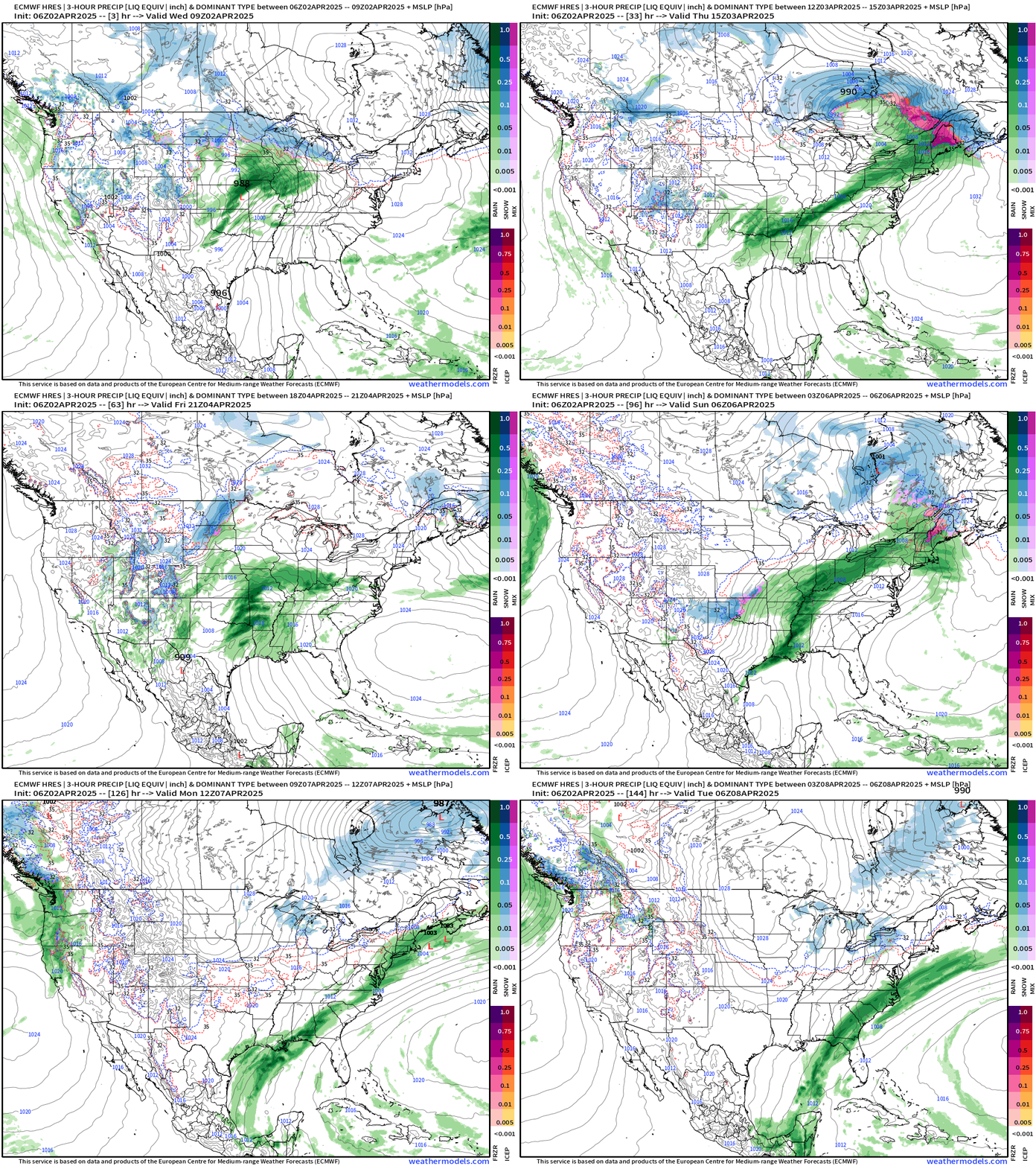
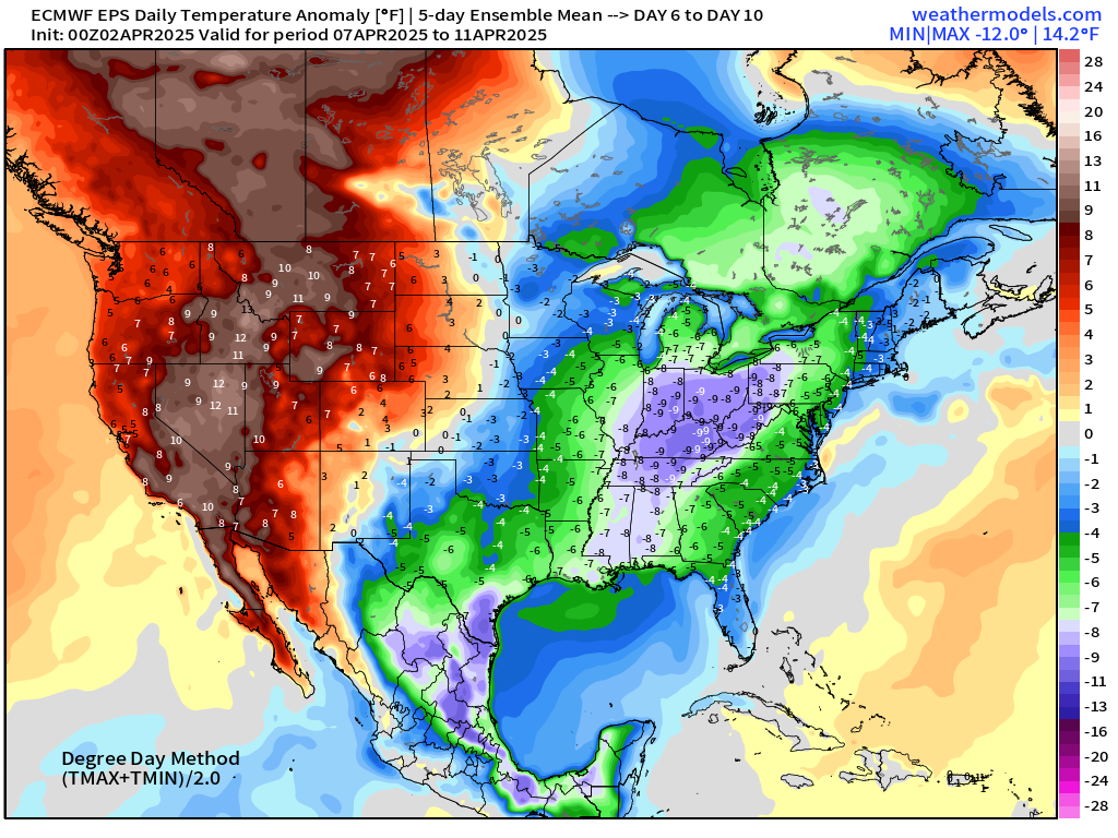
After the boatloads of moisture drop across the Mississippi to Tennessee to Ohio River Valleys, we get a break with a chilly, Canadian air mass into second week of April — maybe quite a long dry spell in the cards.
NWS 72-hours Precipitation and Snowfall
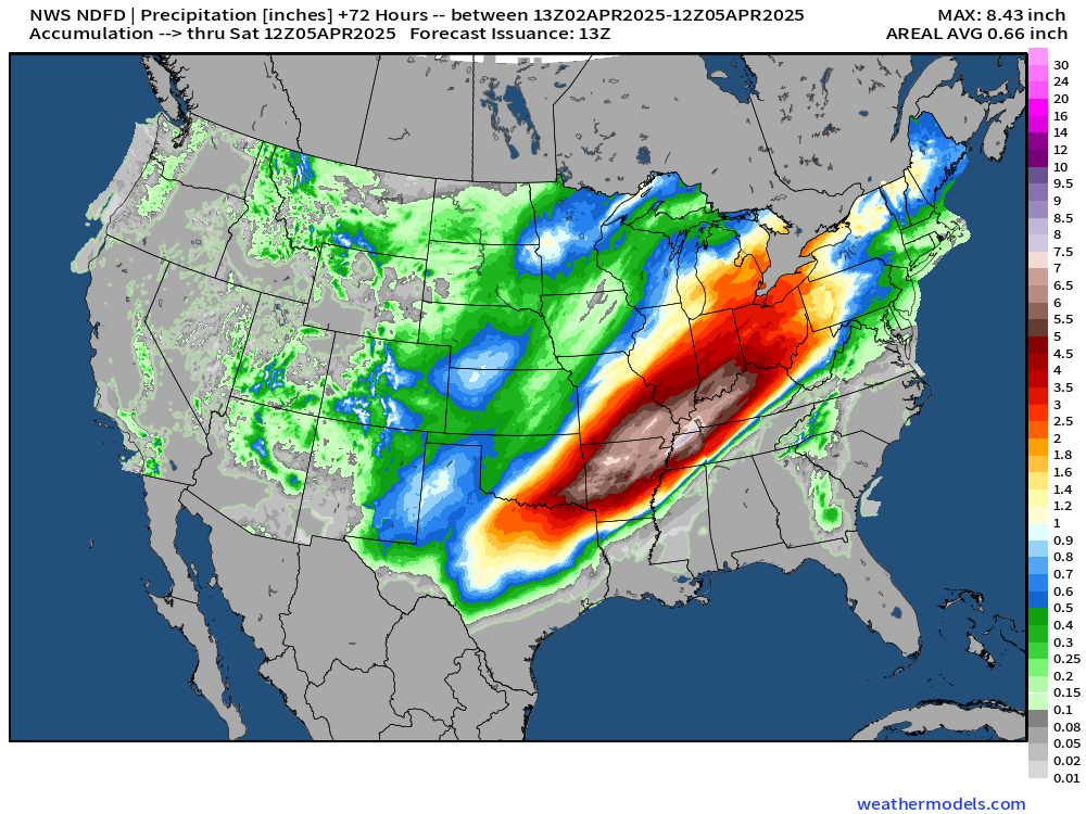
In the next 72-hours — NWS has large area of 6-8” of rainfall from SE Oklahoma into southern Indiana.
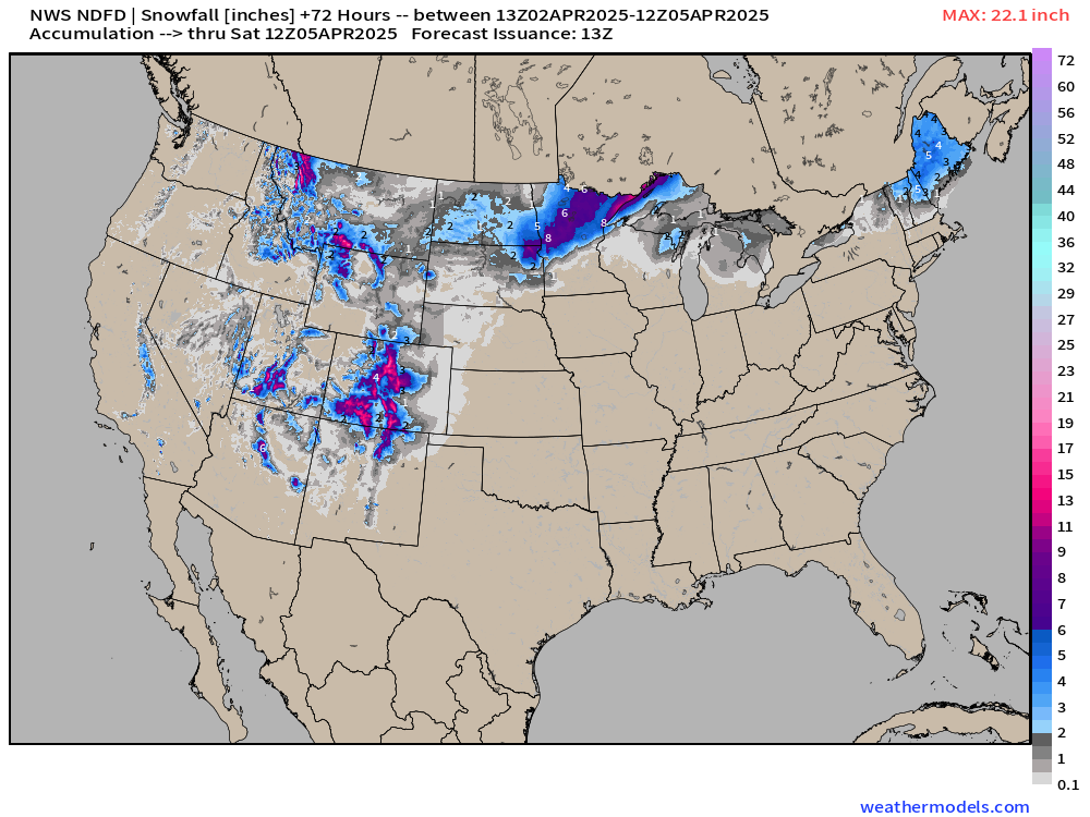
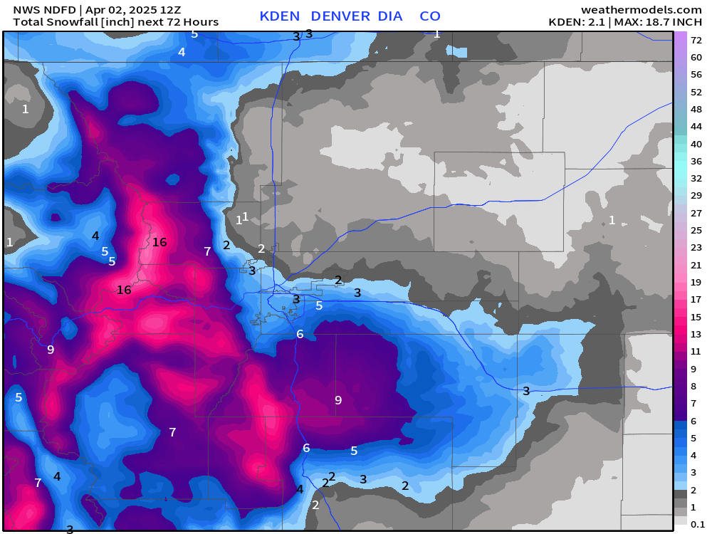
NWS now with 2” of snowfall in Denver.
NWS WPC Precipitation | Next 7-days
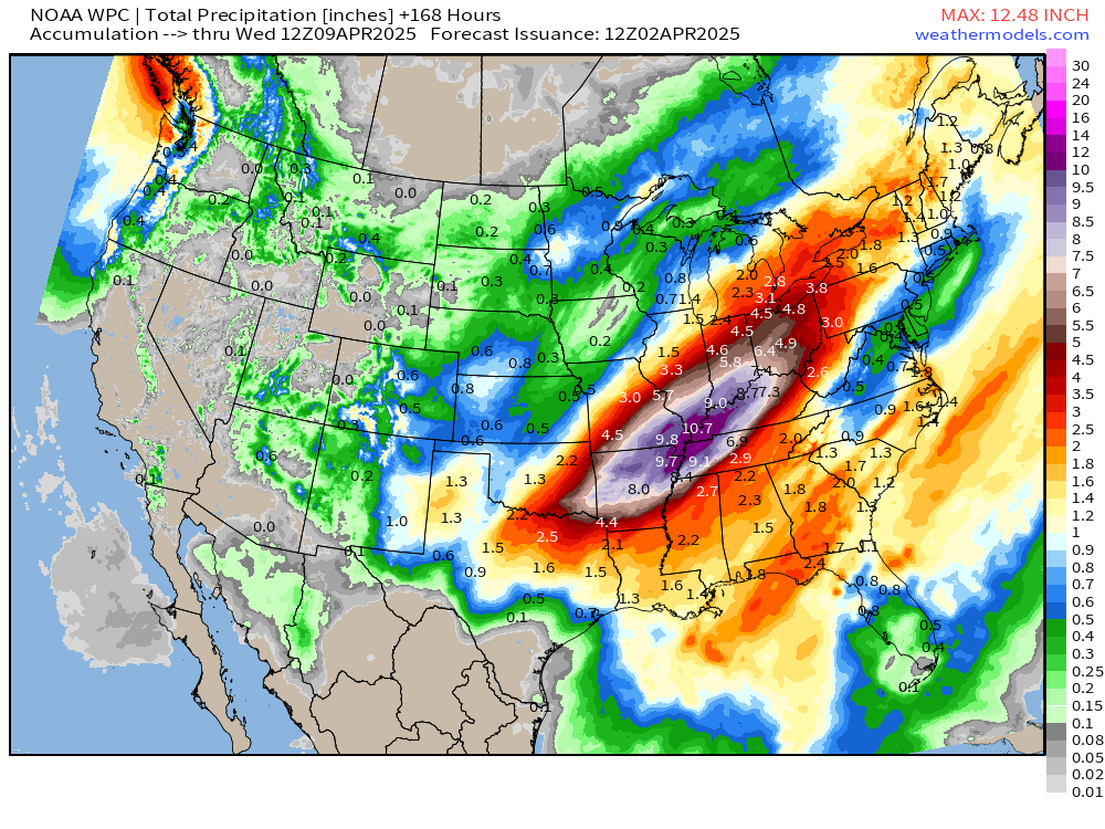
Still 8” to 12” from Arkansas to Cincy — high risk of flooding!
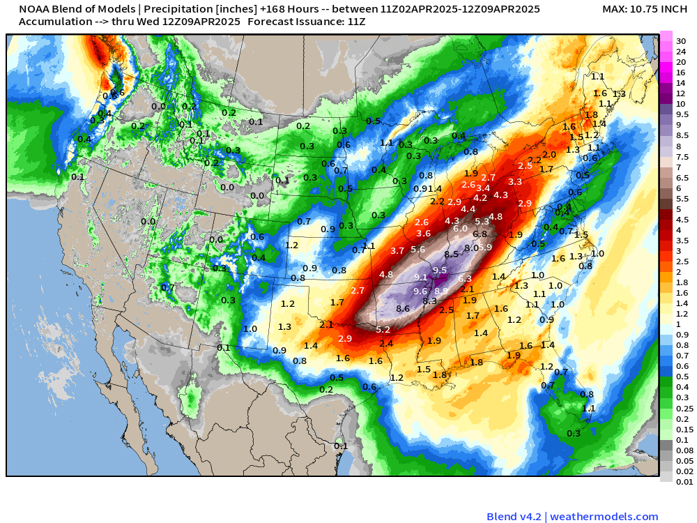
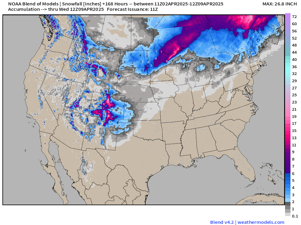
Blend of Models | 7 Days Precipitation and Snowfall
ECMWF 06Z AIFS | Upper-Level Pattern for North America next 12-days
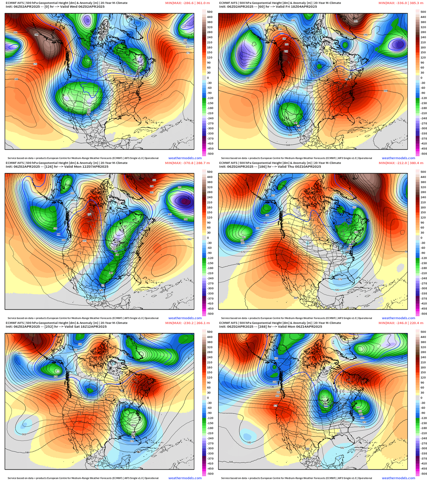
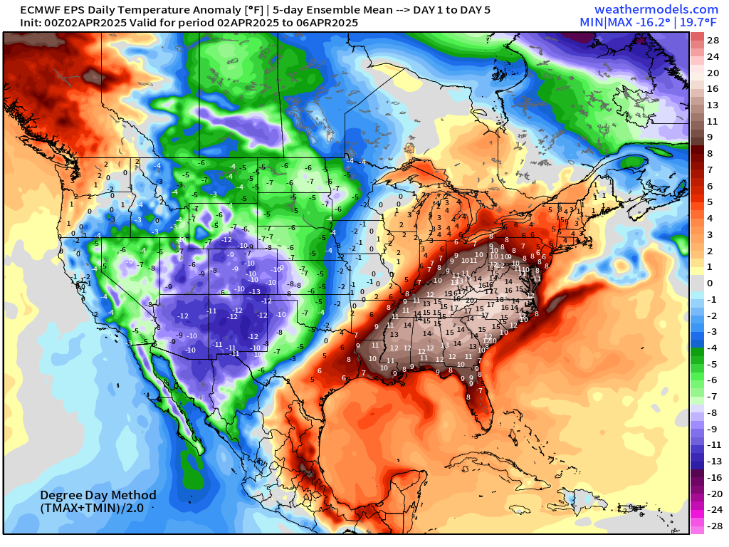
AIFS is consistent with major troughing for Days 7-10 — continuing for the following several days = abnormal cool period ahead for eastern U.S. after a few days of summertime heat and humidity.
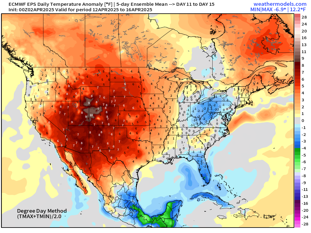
ECMWF EPS 00z | 5-Day Chunk Temperature Anomaly
Days 1-5: April 2 - April 6
Days 6-10: April 7 - April 11
Days 11-15: April 12 - April 16
Who writes and researchers this Newsletter? Dr. Ryan N. Maue [X https://x.com/ryanmaue] with 20-years experience of daily weather model production and analysis. You may have seen my weather maps! I live in Atlanta but was born and raised in Northern Michigan. I know snow, and southern heat and humidity.
Maps sourced from weathermodels.com designed and innovated by yours truly! Please subscribe there for real-time access to the newest maps, charts from all of the weather models including ECMWF.
- Milepost
- 564 · laid 2025-04-02T13:46:31.355000Z
- Source
- https://weather.substack.com/p/april-2-2025-wednesday-high-risk
- Digest
- 70439356d00fb40b34ac7dea60db159d35787f1b0b5a9eeb4d8e1ee6bee6b5d6
- Machine
- JSON