November 12, 2024 Tuesday Weather Update
Hurricane Sara development imminent
November 2024 was the 8th-warmest November in the 131-year national record (1895–2025), at 45.1°F against a 1991–2020 normal of 43.0°F (+2.2°F).
November 2024 was the 13th-wettest November in the 131-year national record (1895–2025), at 3.0in against a 1991–2020 normal of 2.3in (+0.8in).
NOAA/NCEI Climate at a Glance, contiguous United States. This is the observed record for the month, not a score of anything said in this piece — the forecast ledger begins 2026-08-17 and cannot reach earlier posts.

Entirely free posts have dwindled to about 1-per week but I’d like everyone the opportunity to keep up with the daily winter weather — especially with the upgraded ECMWF weather model and various A.I. tools. All maps, data and analysis are mine.
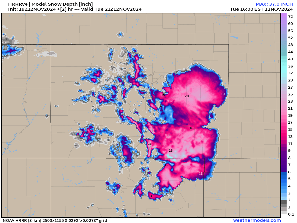
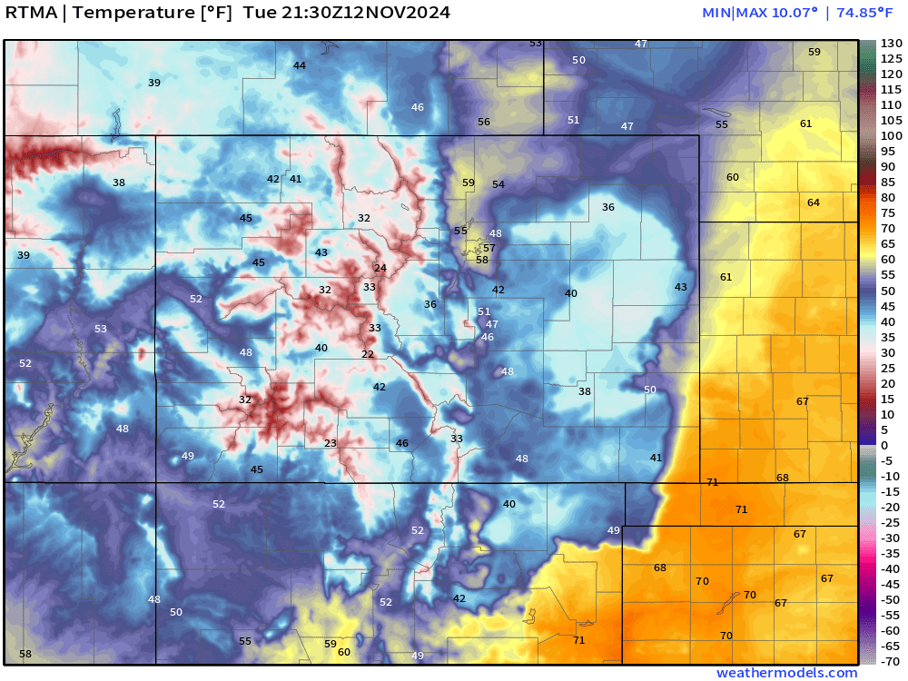
Before diving into the tropics, I’d like to show the snow depth across Colorado and the huge impact upon near-surface temperatures this evening. Still 1-3 feet of snow on the ground and it’s not going anywhere for a little while as temperatures remain quite cold.
Temperatures in the 20s and 30s rather than 60s.
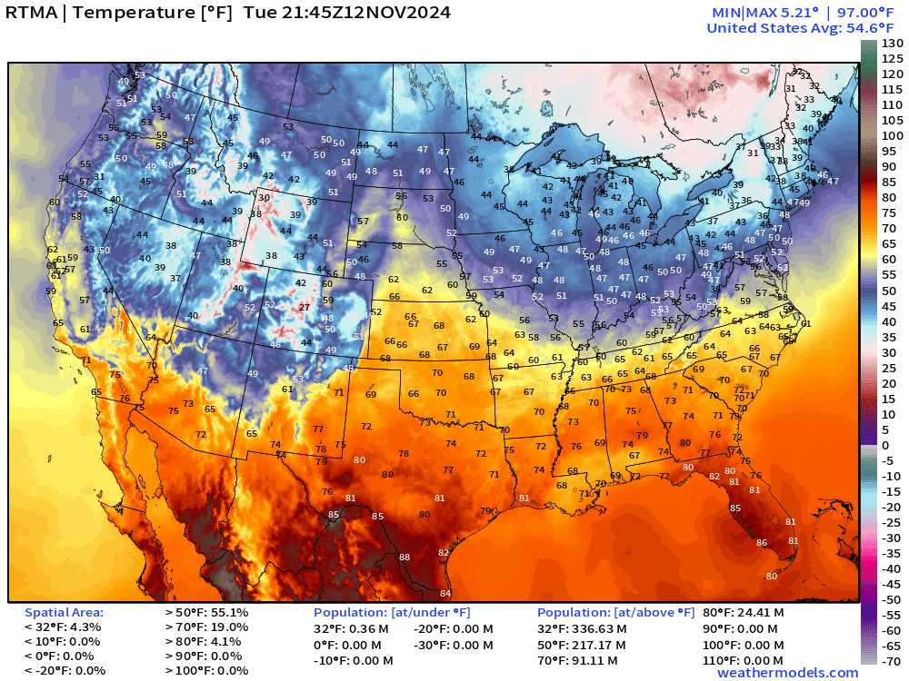
Overall, quite mild across the Southeast under sunny skies earlier.
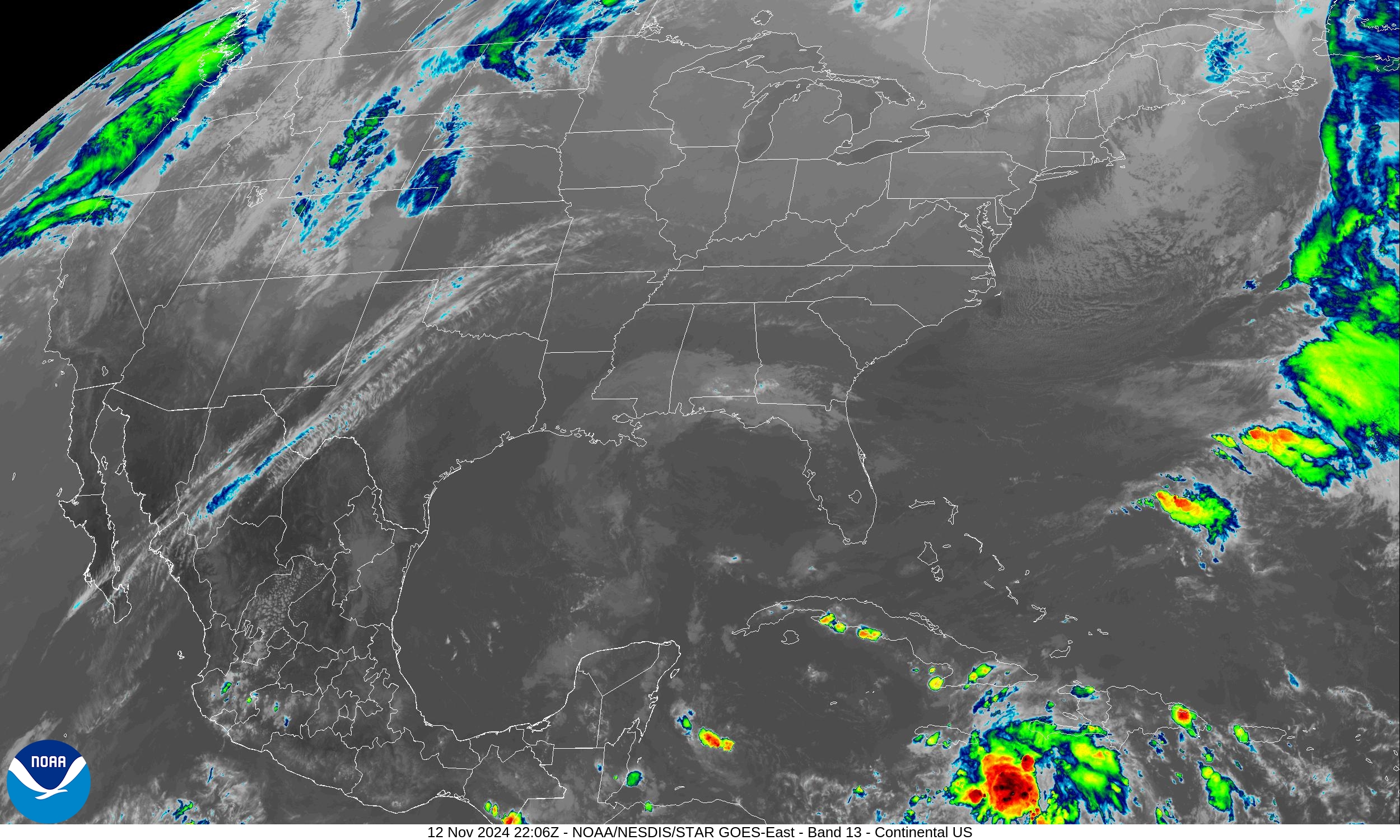
The only inclement weather to speak of is across the Pacific Northwest and upper-Midwest. Invest 99L is lurking south of Hispaniola in the Caribbean.
Atlantic Tropical Update
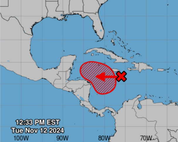
NHC up to 90% chance of development with Invest 99L —> Sara
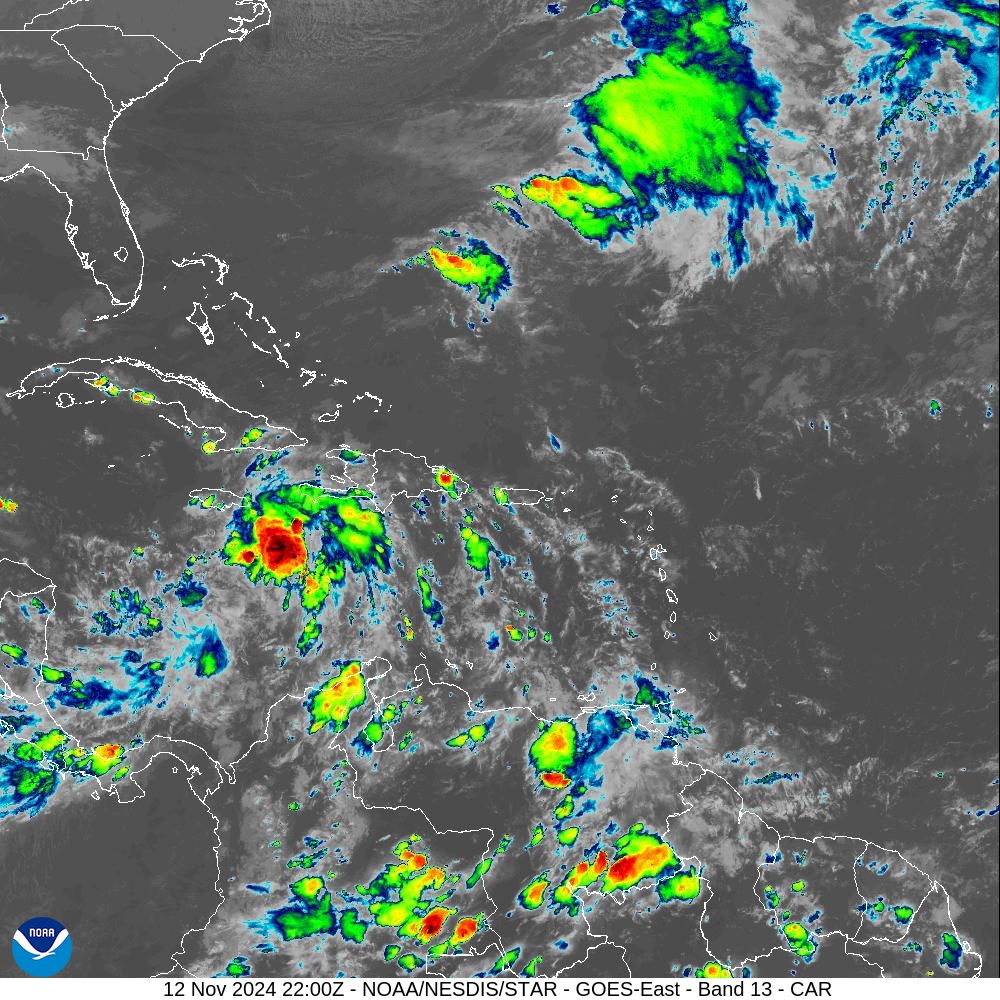
Deep convection will move westward south of Jamaica and could go fast into Tropical Depression stage in the next 2-days.
ECMWF EPS Ensemble signals for tropical disturbance
It’s highly likely that Tropical Storm Sara forms in the Caribbean by this weekend.
Day 3 — November 15 12z
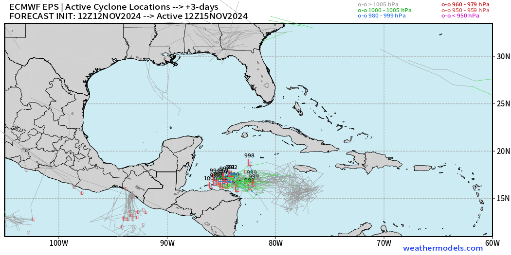
The area of low pressure drifts west but remains over very warm ocean water through 3-days.
Day 5 — November 17 12z
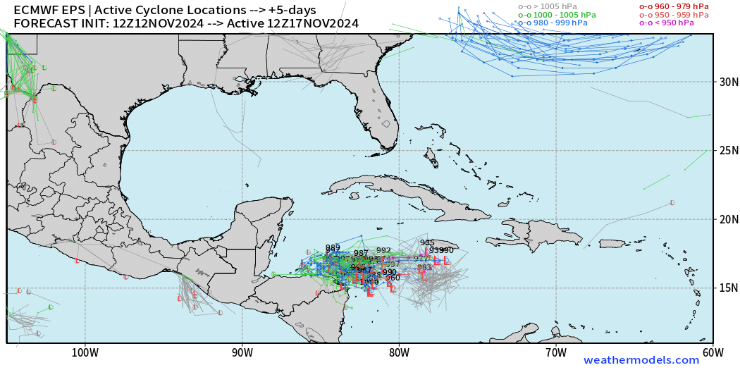
Then, likely TS/HU Sara moves east and begins a loop process.
Day 7 — November 19 12z
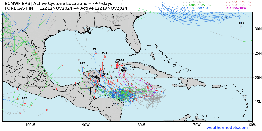
At this point, there are many ensembles with major hurricane potential — up to Category 5 that take a more typical NW track into the Gulf of Mexico.
SST on Sunday (Day 5) in the Gulf of Mexico
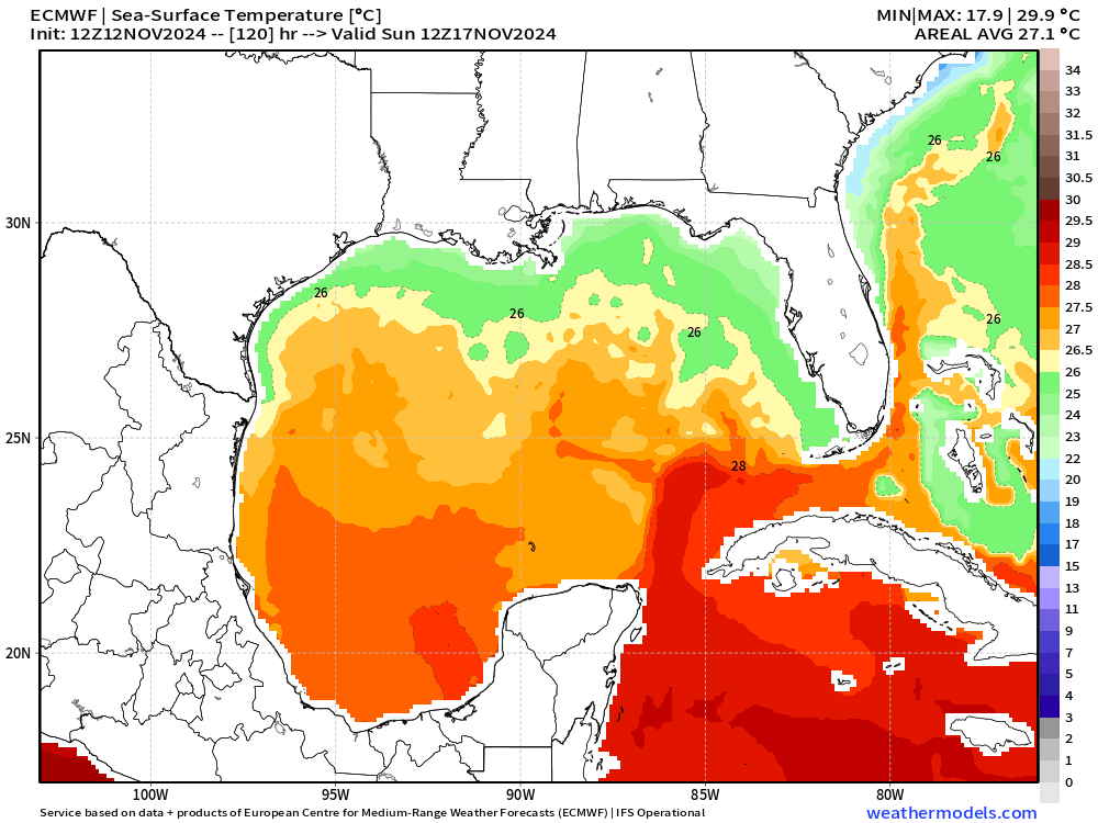
Quick break to show the ocean temperatures are warm enough for a hurricane in the Gulf of Mexico but significantly cooler after the passage of Rafael and onset of mid-November cooler days.
Day 8 — November 20 12z
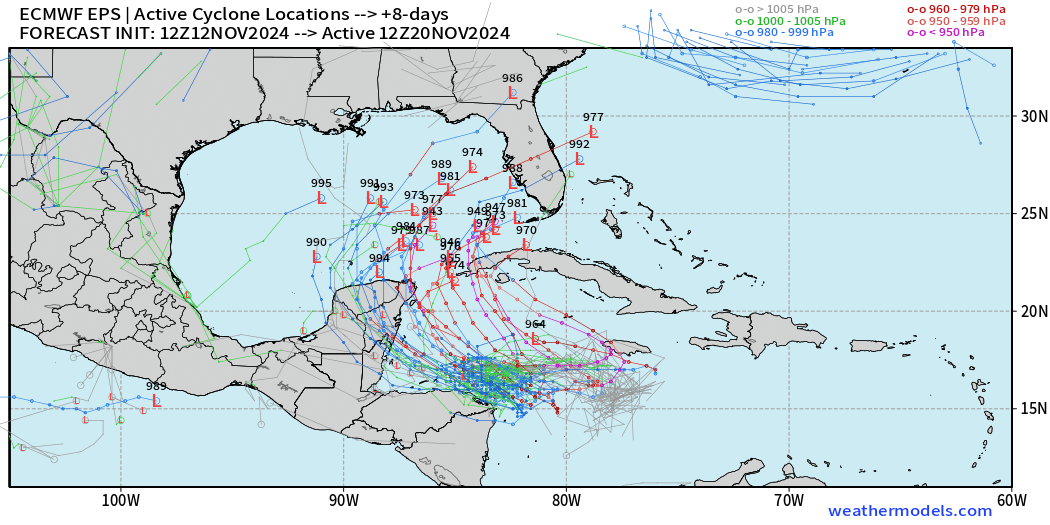
More intense members follow a southern track over the Loop Current
Day 9 — November 21 12z
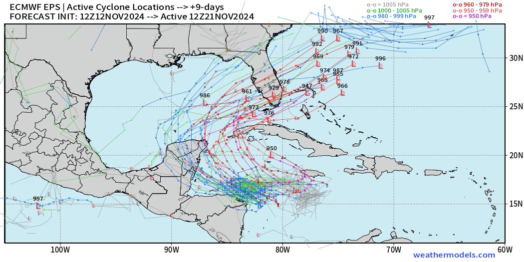
Summary: high likelihood of Hurricane Sara with coin flip signal to impact Florida in 7-9 days.
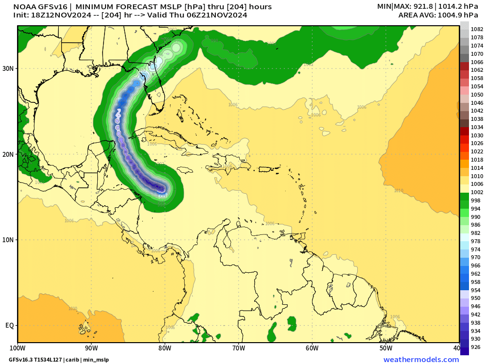
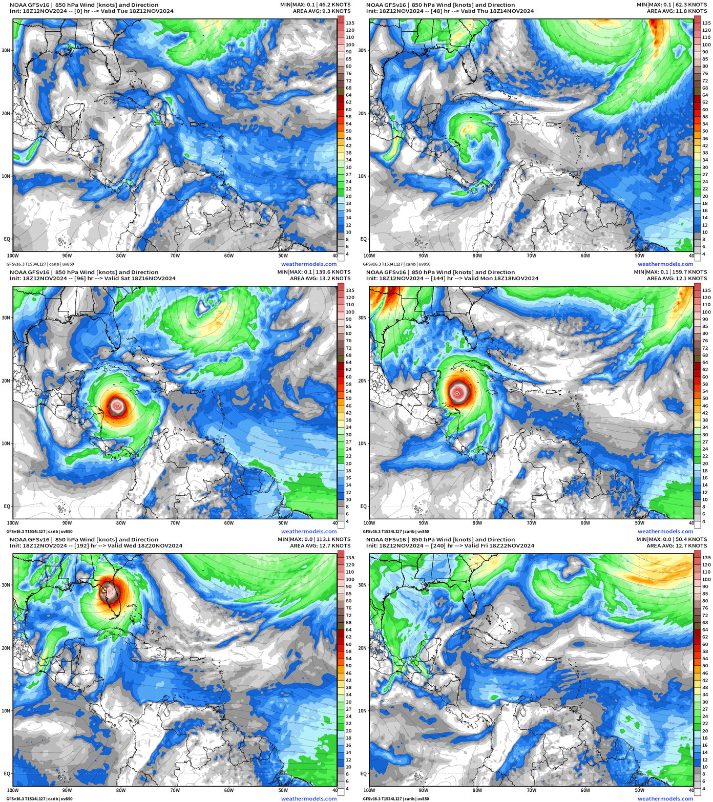
GFS 18z ramps up Sara to Category 5
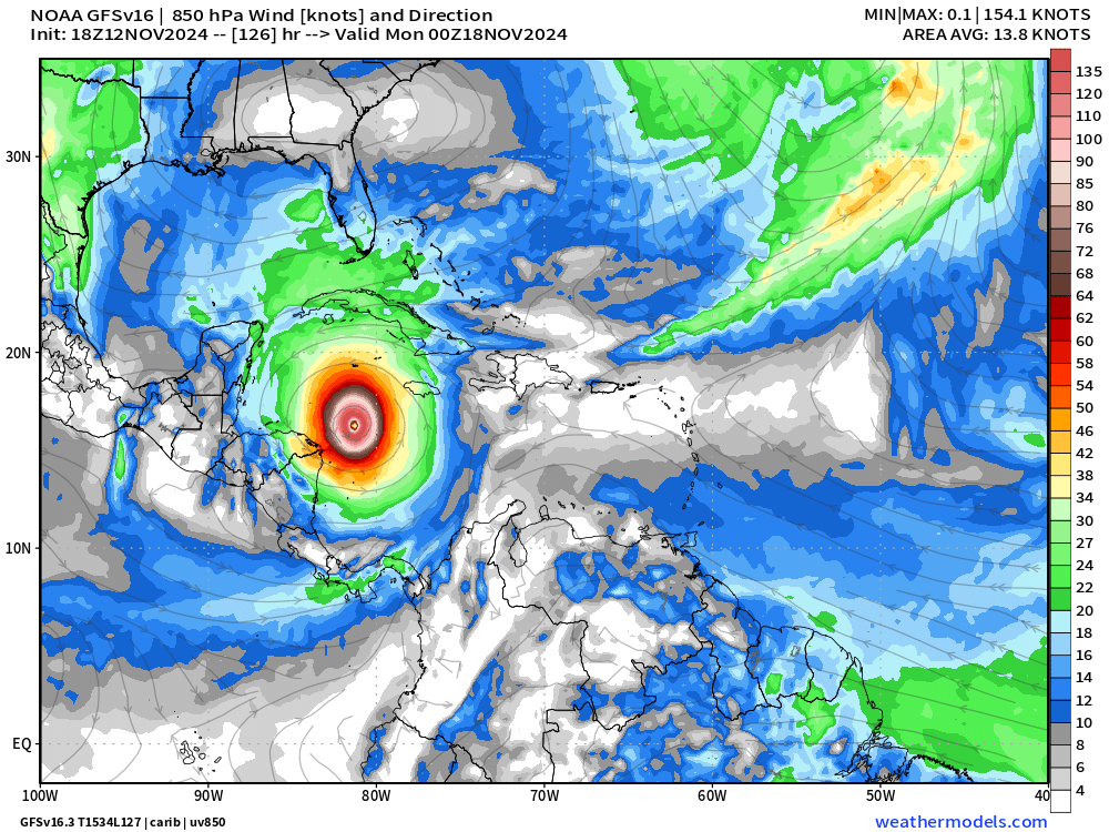
In only 5-days, GFS 18z blows up Sara to Category 5 suggesting a HIGHLY favorable upper-level atmospheric environment for intensification.
Various track scenarios shift along the Florida peninsula — 18z is further north while 12z was over South Florida. Either way, GFS is ominous.
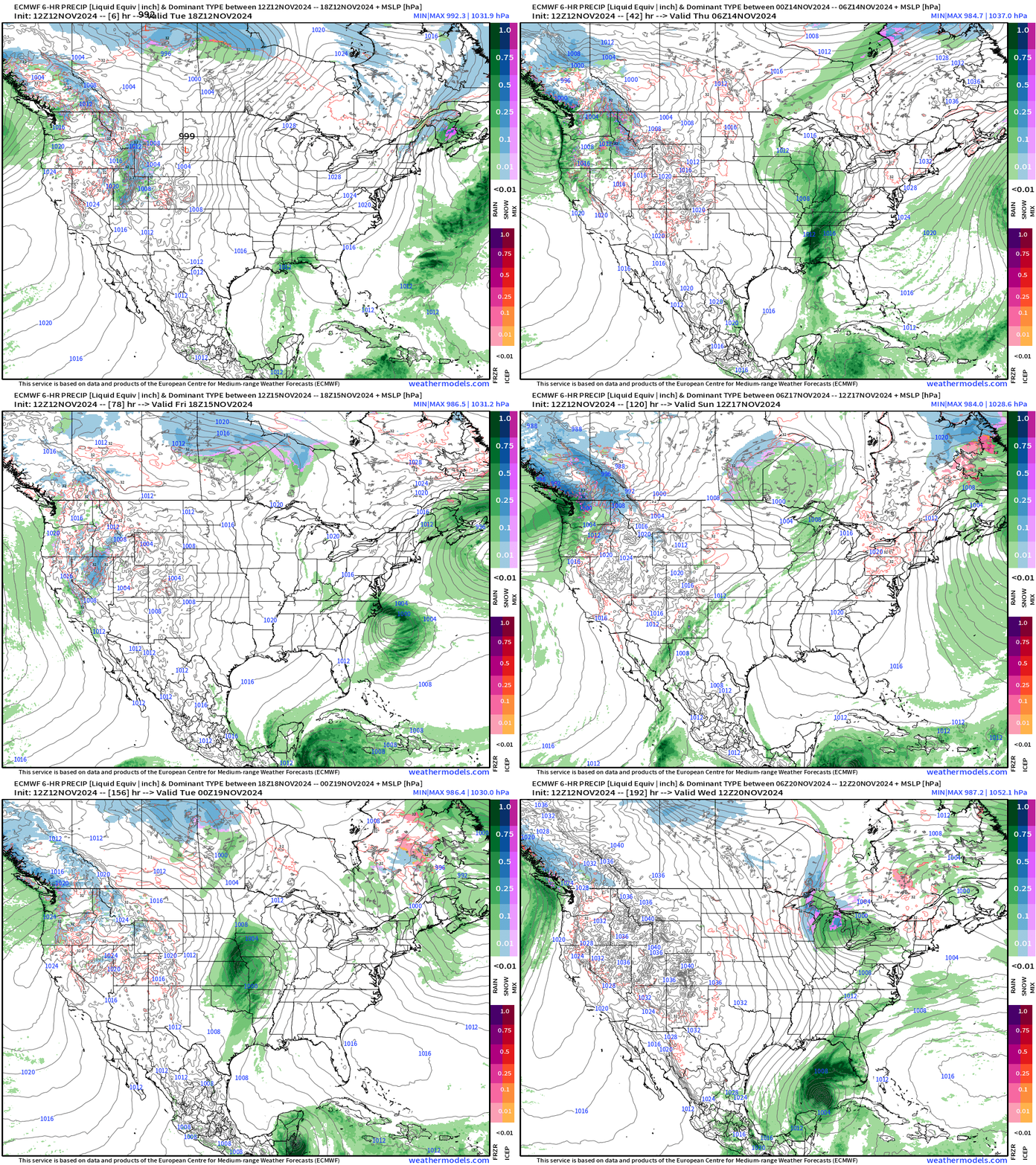
7-Day Precipitation Forecast | ECMWF 12z
ECMWF AIFS 12z | Next 10-days | Height Anomaly
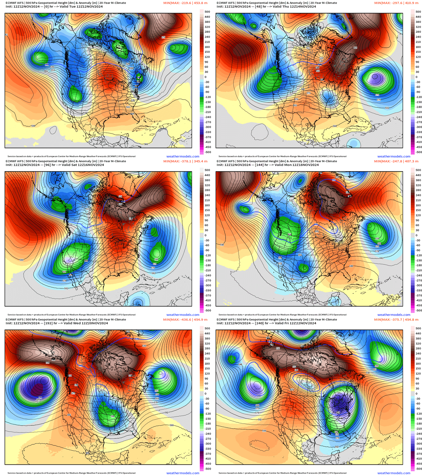
Interesting to see ECMWF AIFS (now running from initial conditions of the 49r1 cycle) lowering the boom with the Polar Vortex on the central and eastern U.S. behind whatever becomes of Sara. This is a major trough and would be a freeze into the Southeast + a major snowstorm for the Great Lakes.
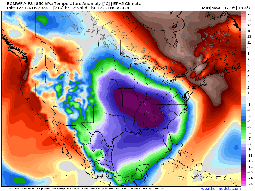
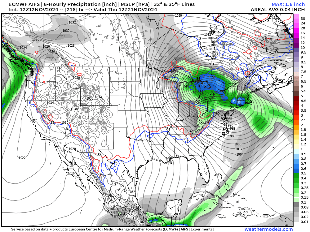
That is probably a blizzard for Thursday November 21.
ECMWF Integrated Vapor Transport | 10-days
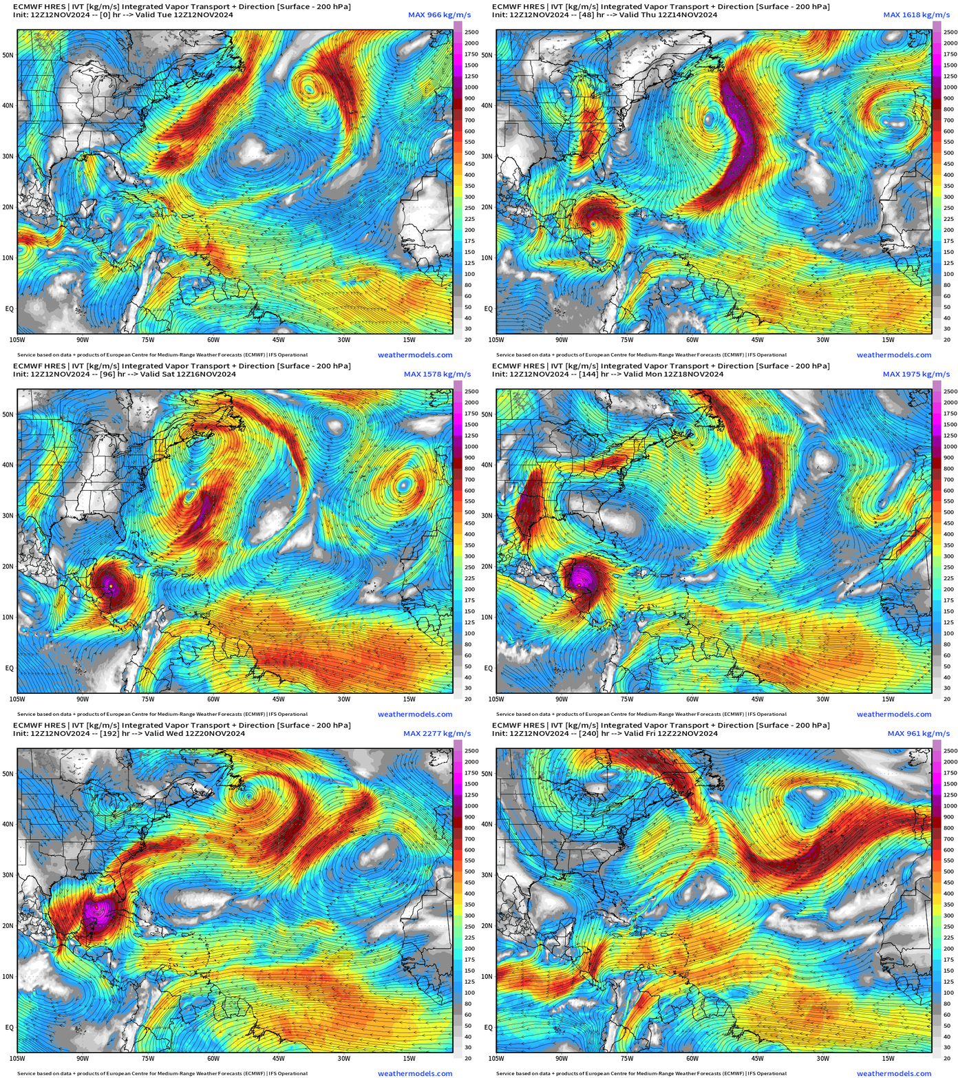
ECMWF HRES 12z takes powerful Hurricane Sara on a looping track around the Caribbean but crashes into the Yucatan potentially disrupting the circulation prior to heading into the Gulf of Mexico and over cooler waters.
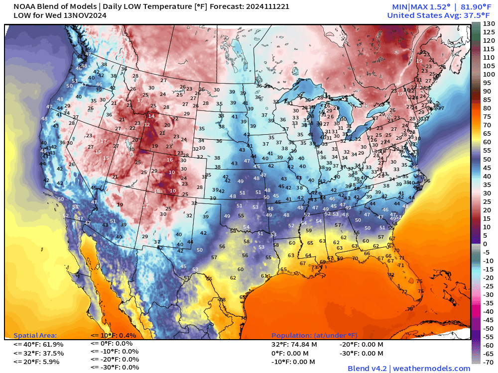
Low Temperatures on Wednesday
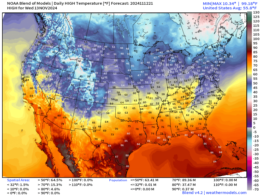
High Temperatures on Wednesday
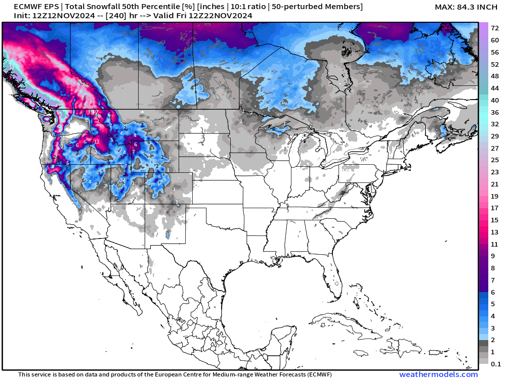
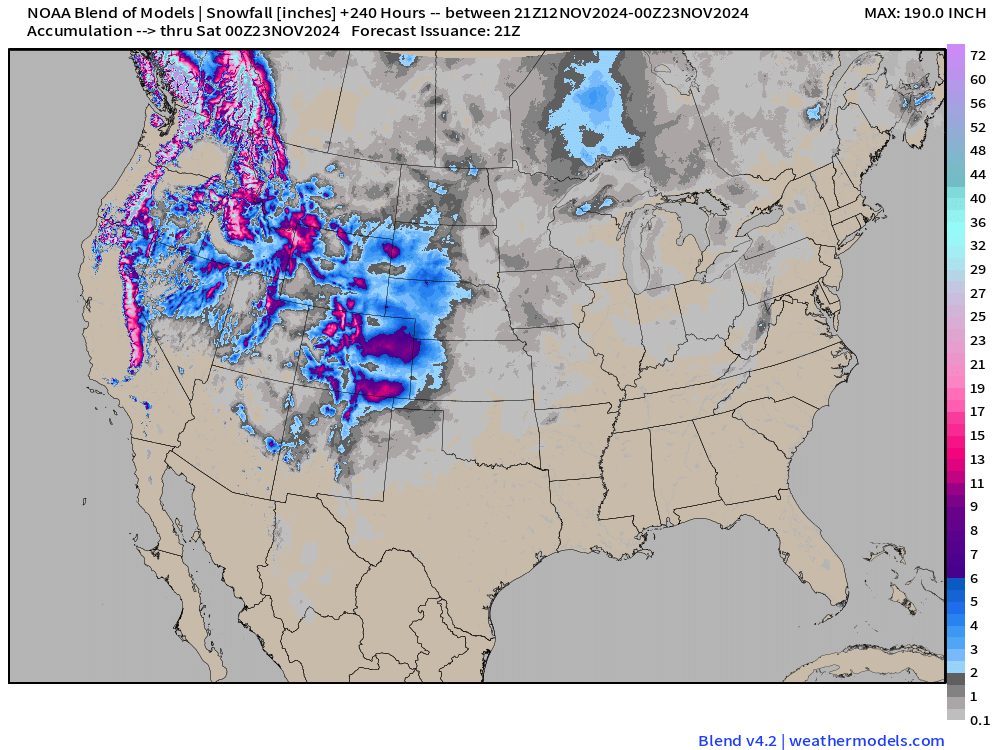
Snowfall Forecasts
ECMWF 12z | 10-day Ensemble Median Snowfall Forecast
Probability of 1” snowfall through 10-days
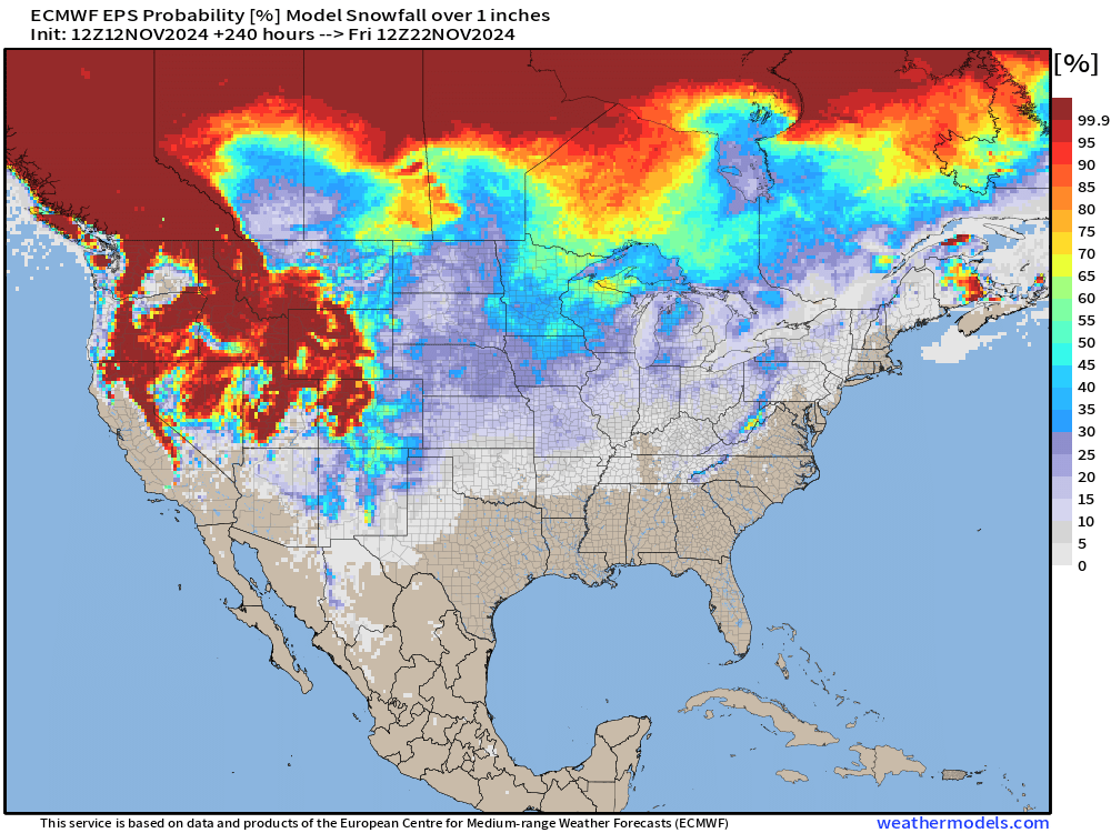
Probability of 1-inch is creeping up significantly in the Great Lakes as ensembles pick upon the winter storm potential.
NOAA Blend of Models 10-day Snowfall Accumulation
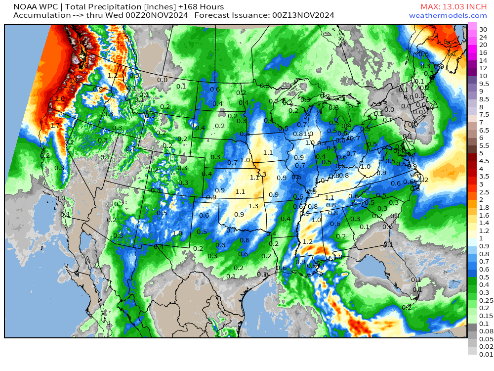
Total Precipitation next 7-Days | NOAA WPC
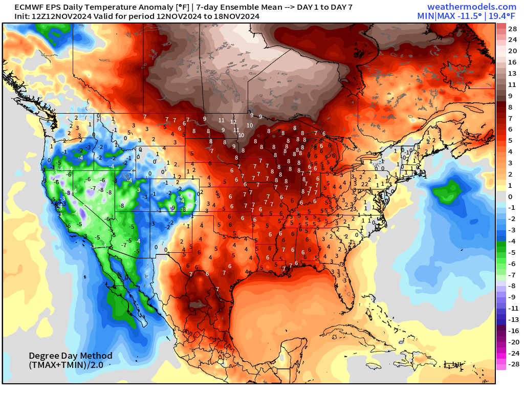
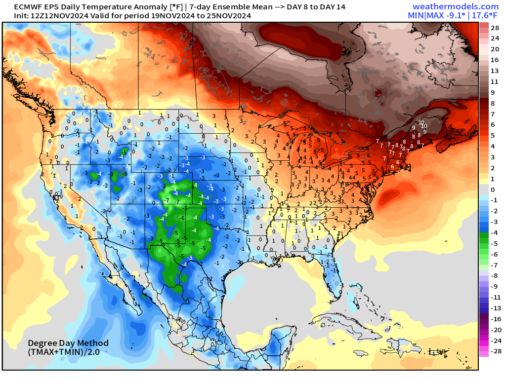
EPS | Weekly Temperature Anomaly
Week 1: November 12 - November 18
Week 2: November 19 - November 25
Maps sourced from weathermodels.com designed and innovated by yours truly! I actually create all of my content from scratch.
- Milepost
- 432 · laid 2024-11-12T23:31:09.310000Z
- Source
- https://weather.substack.com/p/november-12-2024-tuesday-weather
- Digest
- e02b3a8bf79b2bc81efc33842fa6f487e37ca066cda3c108f24fd470971fa19b
- Machine
- JSON