August 7, 2024 Wednesday Tropical Update
Atlantic tropics heating up again next week
August 2024 was the 16th-warmest August in the 132-year national record (1895–2026), at 74.0°F against a 1991–2020 normal of 73.1°F (+1.0°F).
August 2024 was the 44th-driest August in the 132-year national record (1895–2026), at 2.5in against a 1991–2020 normal of 2.7in (-0.2in).
NOAA/NCEI Climate at a Glance, contiguous United States. This is the observed record for the month, not a score of anything said in this piece — the forecast ledger begins 2026-08-17 and cannot reach earlier posts.

Headlines for Wednesday
Apologies for the late post — traveling & couldn’t get in front of a computer.
Debby to make landfall as a tropical storm early in the morning on Thursday in South Carolina. Heavy rain will move inland to Charlotte and then northward into the Mid-Atlantic and Northeast. The last 7-days have already been very wet across the Northeast from thunderstorms associated with a frontal boundary or trough. So, adding another several inches could become unmanageable and lead to flooding.
A strong tropical wave will arrive near the northern Caribbean or SW Atlantic in the next 7-days. This will be watched closely to become a powerful hurricane. There is strong (ensemble) model support.
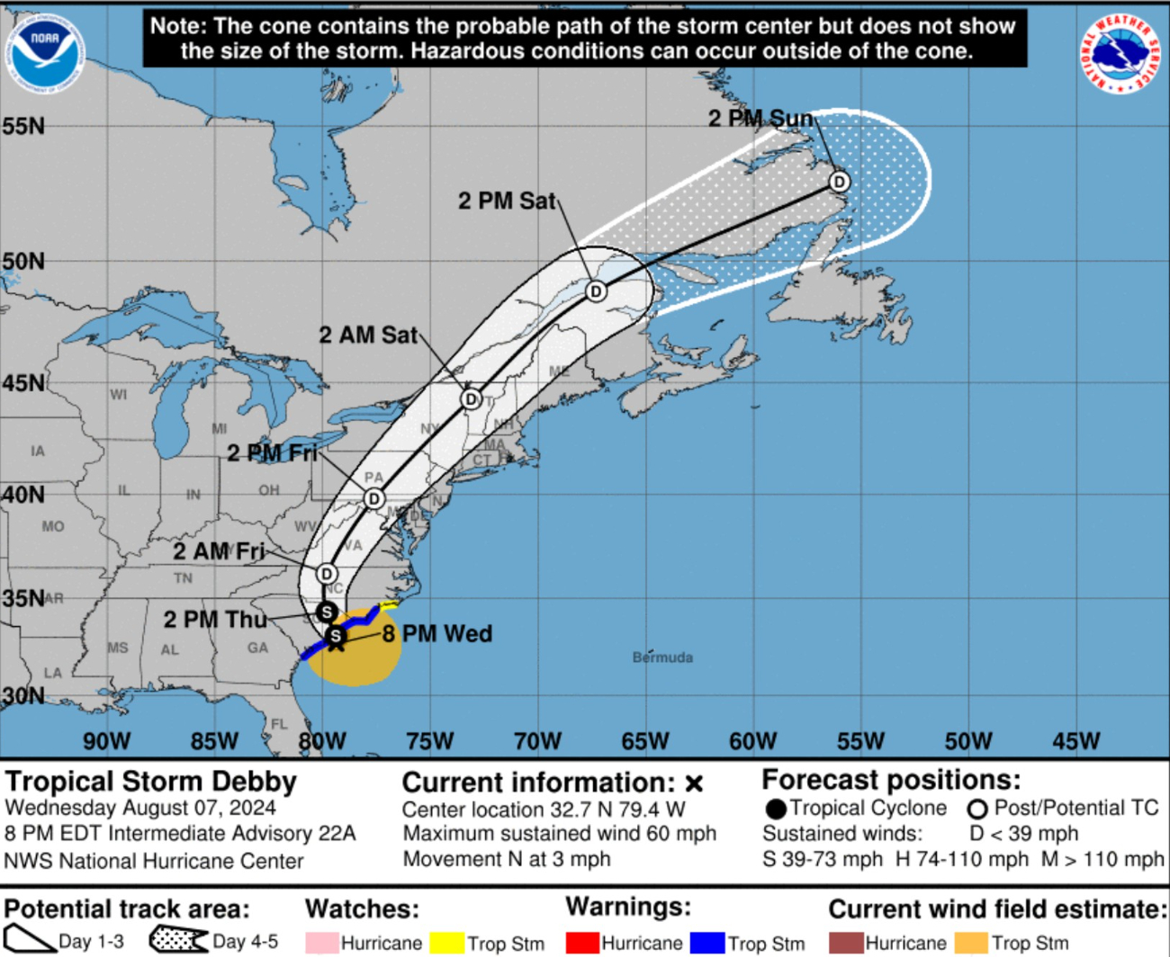
Debby will weaken to a tropical depression and become post-tropical on Friday. The storm will accelerate to the NNE and get out of New England later on Saturday to salvage the weekend!
IR Satellite imagery | 10 PM ET
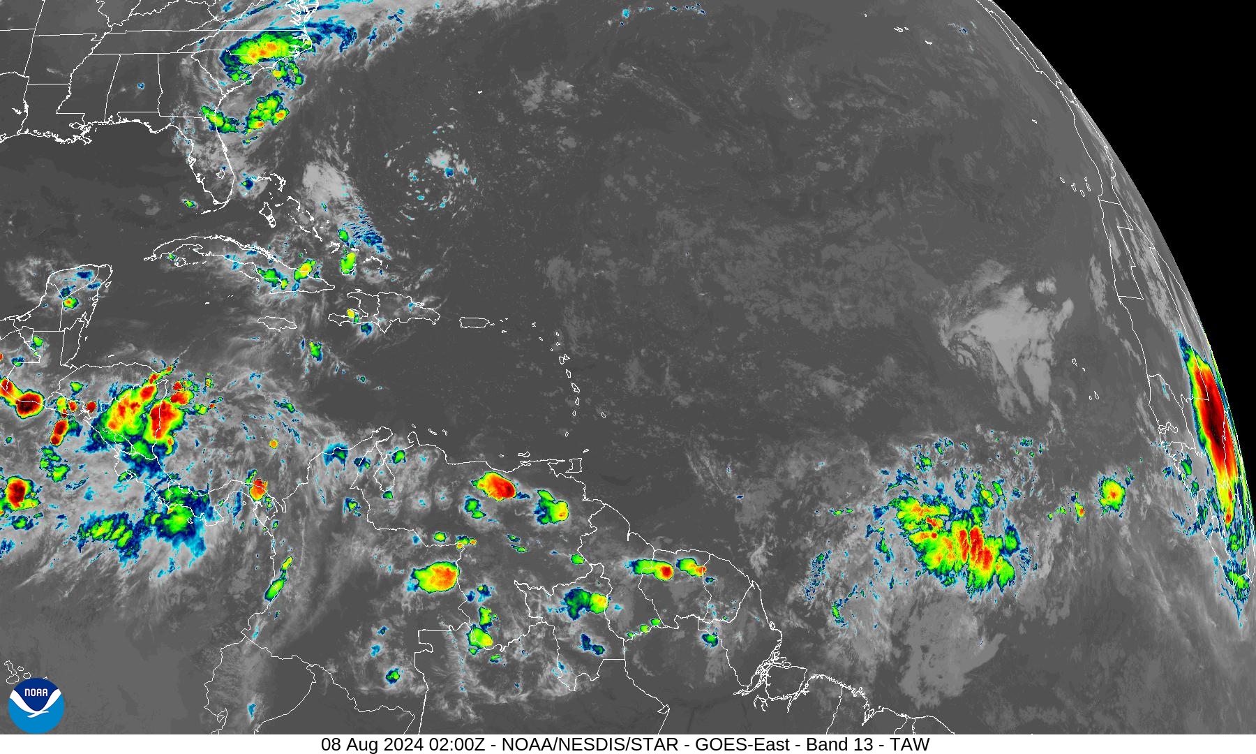
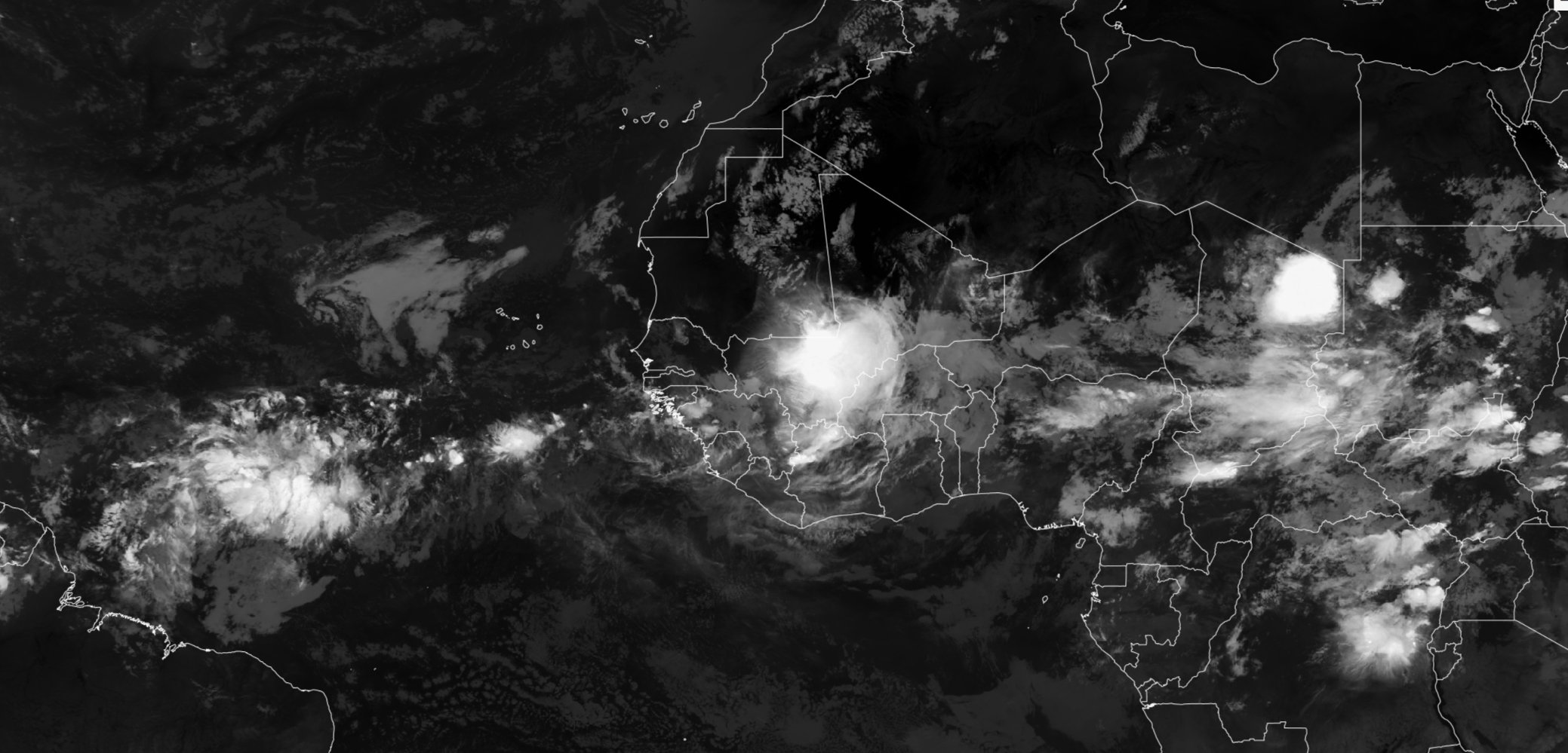
NHC does not have any areas of interest aside from Debby. The tropical wave in the central Atlantic will be monitored, and a monster coming off Africa in 36-hours looks to be a prime candidates for development.
HRRR 00z | 48 hour model radar simulation
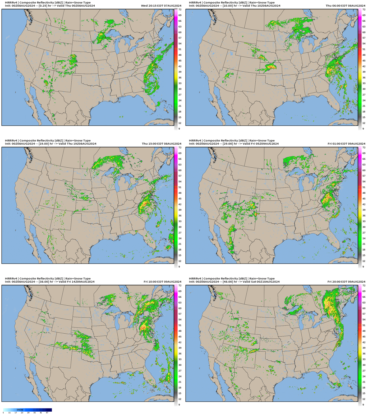
The shield of rain from Debby takes on a more baroclinic leaf appearance as it becomes extratropical. Thankfully Debby will move quickly and limit the most extreme rainfall totals.
NWS Precipitation Analysis
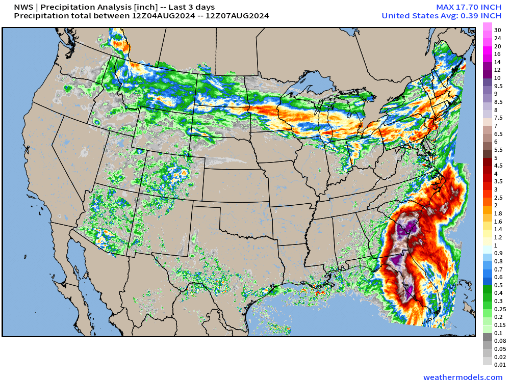
This 3-day accumulation analysis includes from Sunday morning until Wednesday morning. Florida, Georgia, and South Carolina all have areas of 12-15”. More will be added in the next 2-days up the Eastern Seaboard.
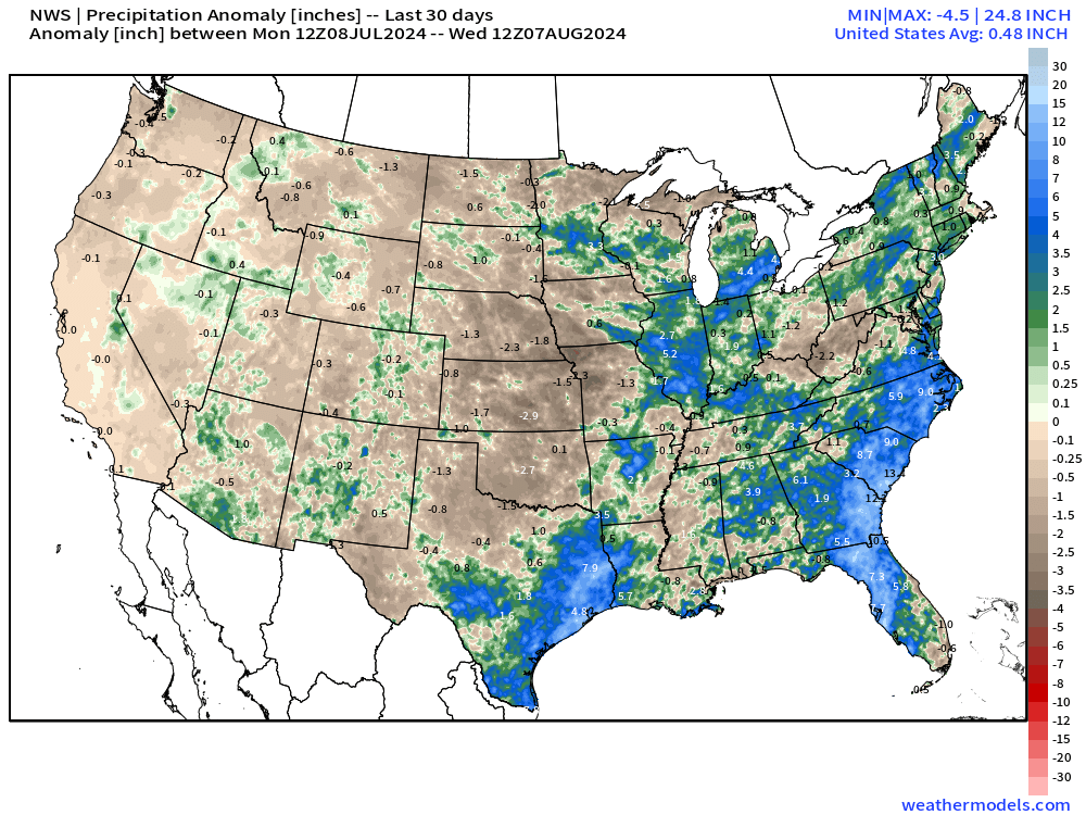
The last 30-days [anomaly] have been very wet in a few locations including eastern Texas with Beryl and the Southeast with Debby. Elsewhere, the brown in the Plains equals a significant deficit or dryness. Overall, the Lower 48 is about 1/2 inch above normal for the last 30-days.
Arctic Canada Heat Wave
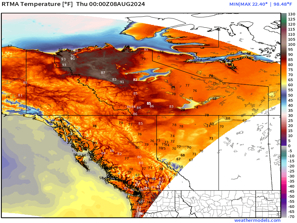
Quick note on mid-90s in far northern Arctic Canada. Even at high latitudes above the Arctic Circle, extreme heat can readily occur with the right weather pattern.
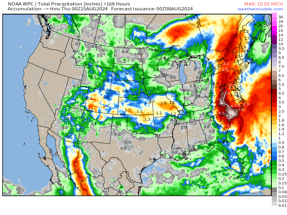
NOAA WPC 7-Day Rainfall Forecast
ECMWF HRES Integrated Vapor Transport [IVT]
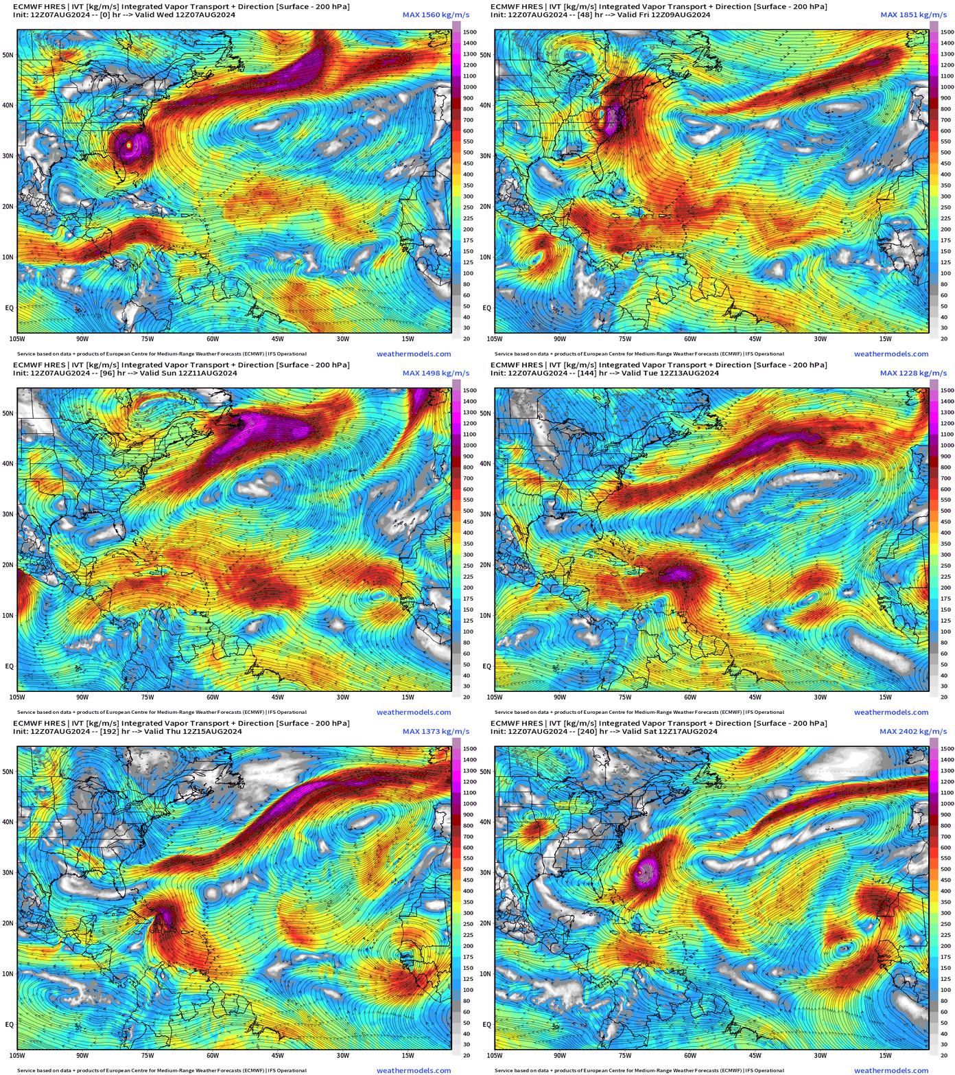
My favorite parameter (IVT) shows the evolution of the tropics in the Atlantic. ECMWF HRES 12z shows a tropical wave becoming a hurricane in 8-days and the curving northward away from the USA. That’s just one solution.
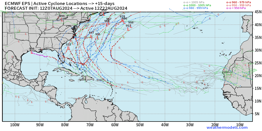
Ensembles | Tropical Storm and Hurricane Tracks
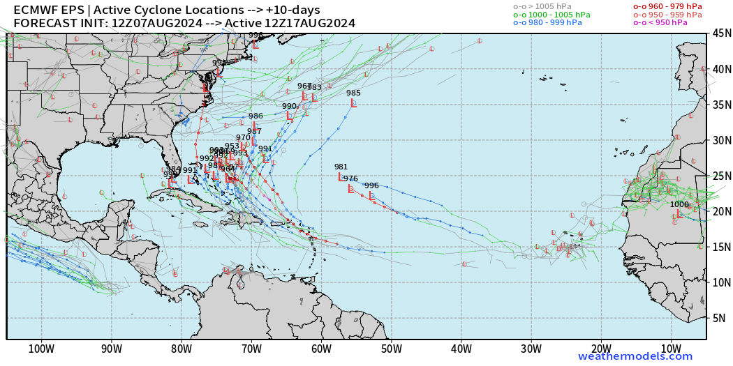
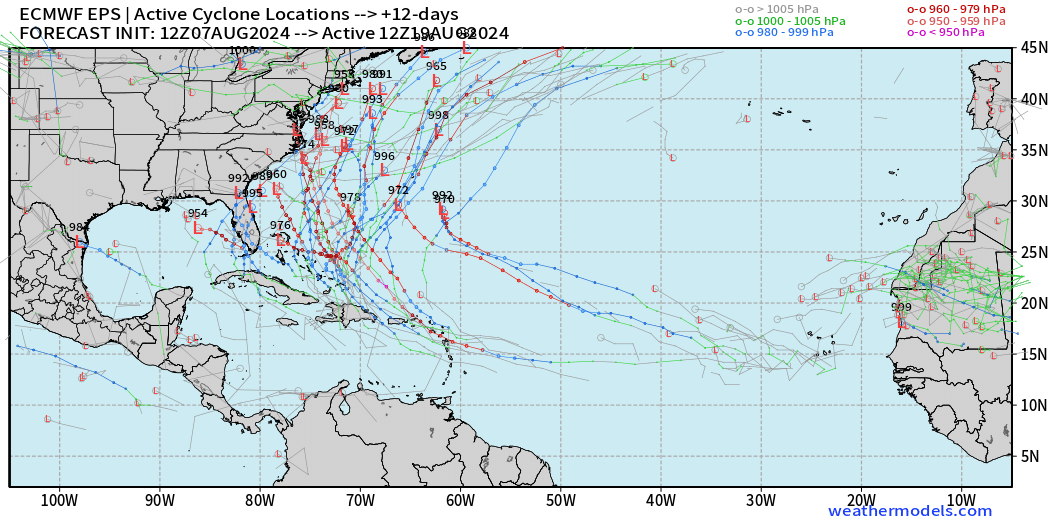
Note: these are trajectories from 51 different solutions of a weather model. Of course there will not be dozens of hurricanes all at once, but think of these like spaghetti.
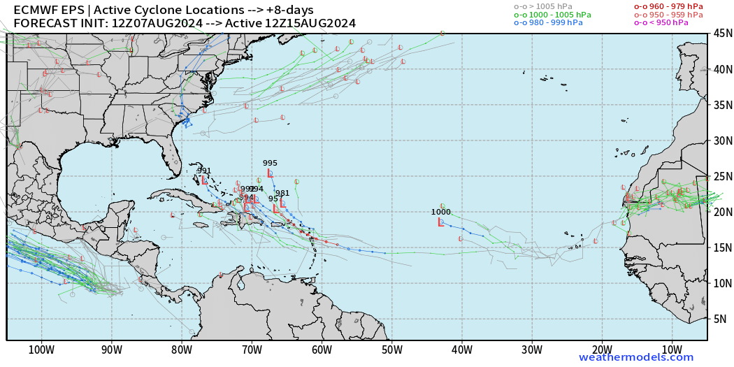
Day 8 (above) and Day 10 (below) Active Cyclones become lit up in the Bahamas.
Then, at Day 12, the rubber meets the road with mostly solutions avoiding the East Coast.
However, at Day 15, there are still many members with uncomfortably close solutions to land. Curiously, there is one that develops a 903 mb Category 5 in the Gulf of Mexico. We’ll just ignore that!
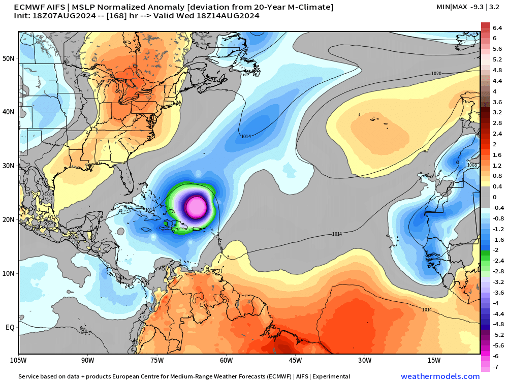
The ECMWF AIFS (Artificial Intelligence) model at 18z showed the development of the tropical wave by next Wednesday.
Thank you to Subscribers and Supporters!
Maps sourced from weathermodels.com designed and innovated by yours truly! I actually create all of my content from scratch.
- Milepost
- 362 · laid 2024-08-08T02:47:26.344000Z
- Source
- https://weather.substack.com/p/august-7-2024-wednesday-tropical
- Digest
- 84f38a8afd2132e324b03dd6d44227379fca7303078cebd52b3e9e991bfbea0f
- Machine
- JSON