July 22, 2024 Monday Update
Mostly quiet period ahead with unsettled weather across the South
July 2024 was the 12th-warmest July in the 132-year national record (1895–2026), at 75.7°F against a 1991–2020 normal of 74.4°F (+1.3°F).
July 2024 was the 21st-wettest July in the 132-year national record (1895–2026), at 3.1in against a 1991–2020 normal of 2.9in (+0.2in).
NOAA/NCEI Climate at a Glance, contiguous United States. This is the observed record for the month, not a score of anything said in this piece — the forecast ledger begins 2026-08-17 and cannot reach earlier posts.

Monday Headlines
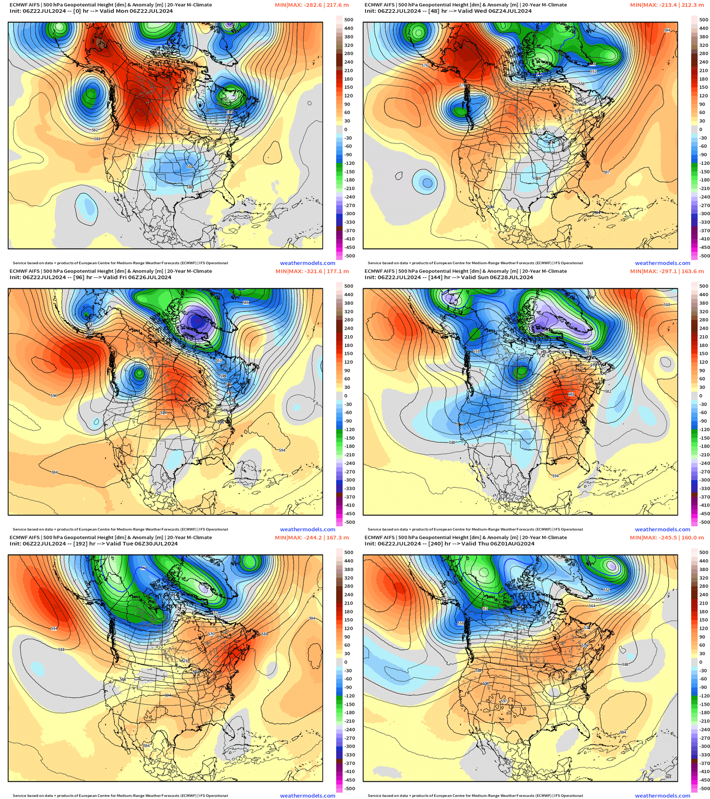
Upper-level pattern slowly transitions from the central US / Mississippi Valley trough to more ridging across the Northeast into the weekend (warming) and the western U.S.
ECMWF AIFS (06z) did not show tropical storm activity through 10-days in the vicinity of the Lower 48.
Monday Weather
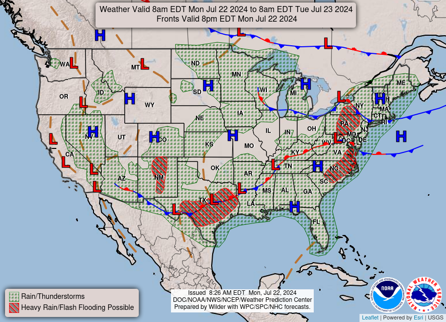
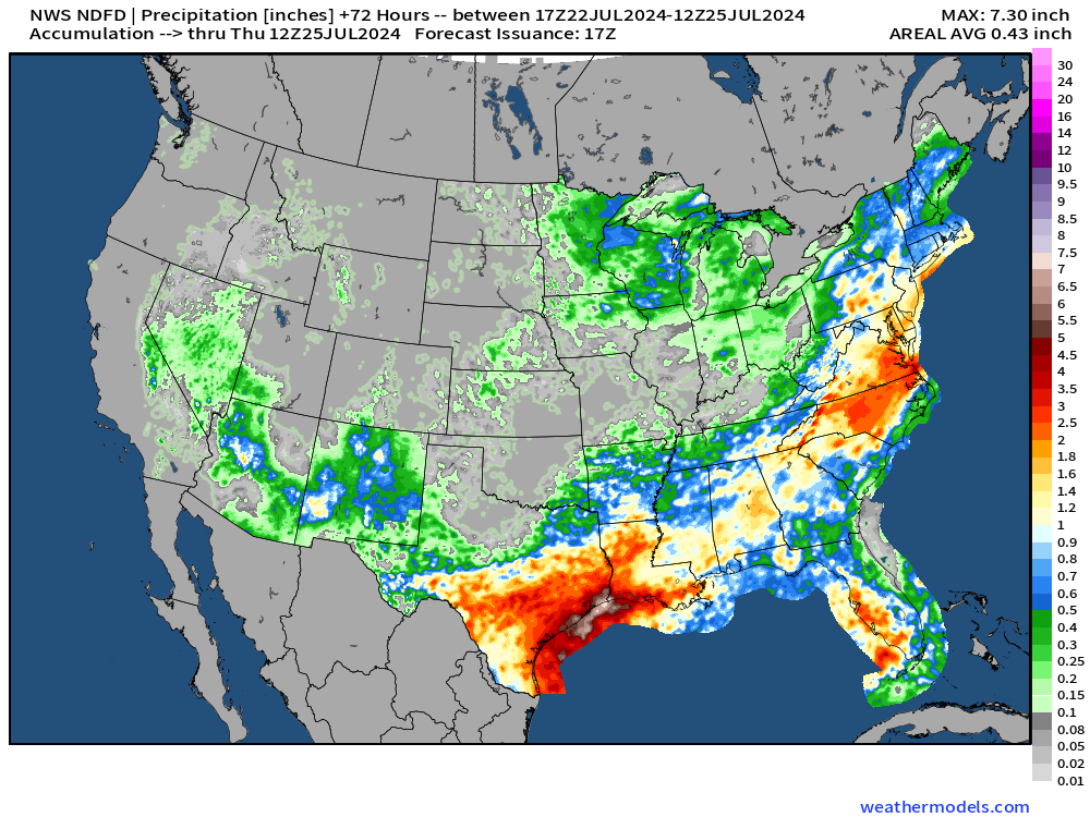
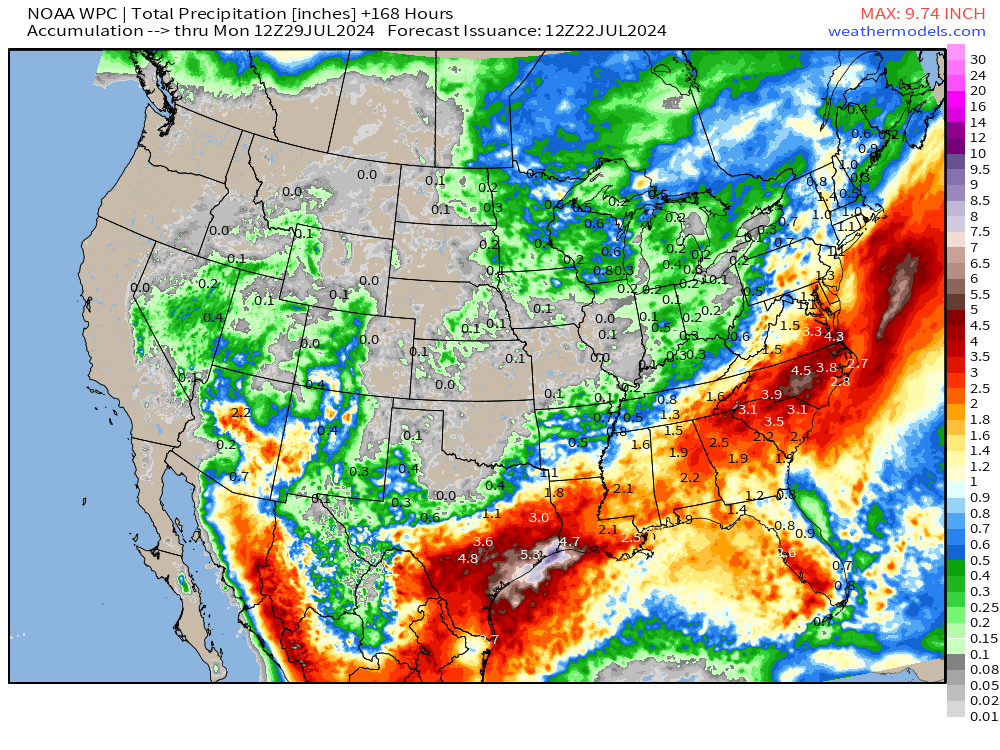
The stationary front extending from Texas into the Mid-Atlantic will focus thunderstorm activity (non-severe) and keep temperatures down with cloud-cover. While painters might not like this weather, it is a bonus to have this rainfall into late-July to mitigate ongoing dryness or drought. Rainfall over the next 72-hours is heavy across Texas including Houston, Florida, and the Carolinas.
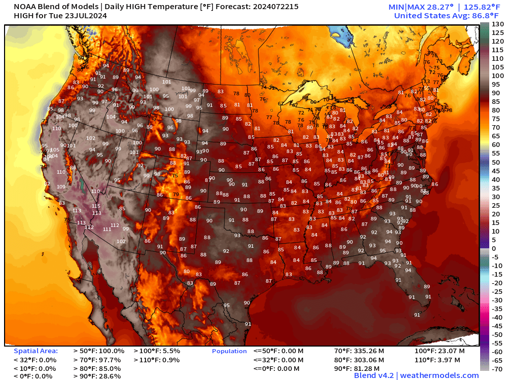
Monday and Tuesday High temperatures: the 90s have been reduced to 1/4 of the Lower 48 land footprint and only 72 million population.
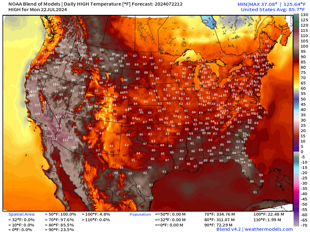
The 90s increase slightly on Tuesday, but again the Midwest and Northeast are more mild in the 80s. Comfortable for late-July.
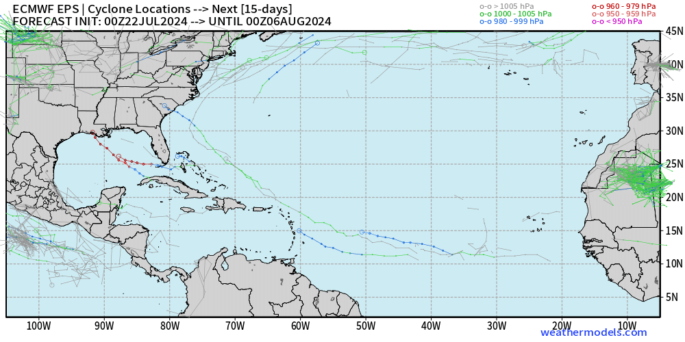
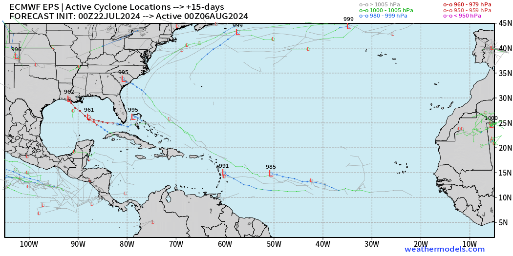
Atlantic Tropics are showing signs of action in early August but remain dead through the remainder of July 2024. The ECMWF ensembles go through August 6, and a few member show hurricanes.
Western Pacific Typhoon Gaemi (05W):
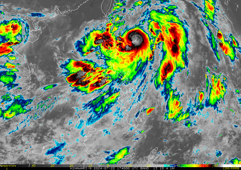
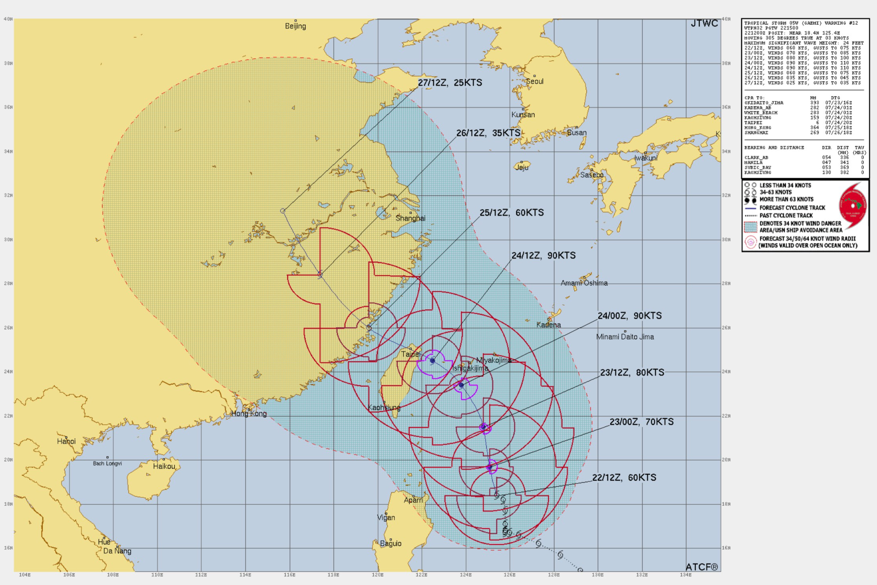
The JTWC has not upgraded Gaemi to a typhoon, but satellite imagery shows a significant Category 1-2 system with -90°C cloud tops and an eyewall on microwave imagery.
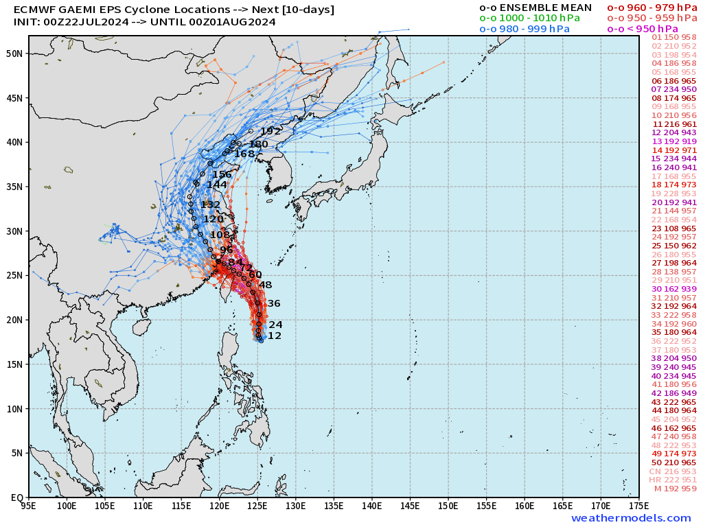
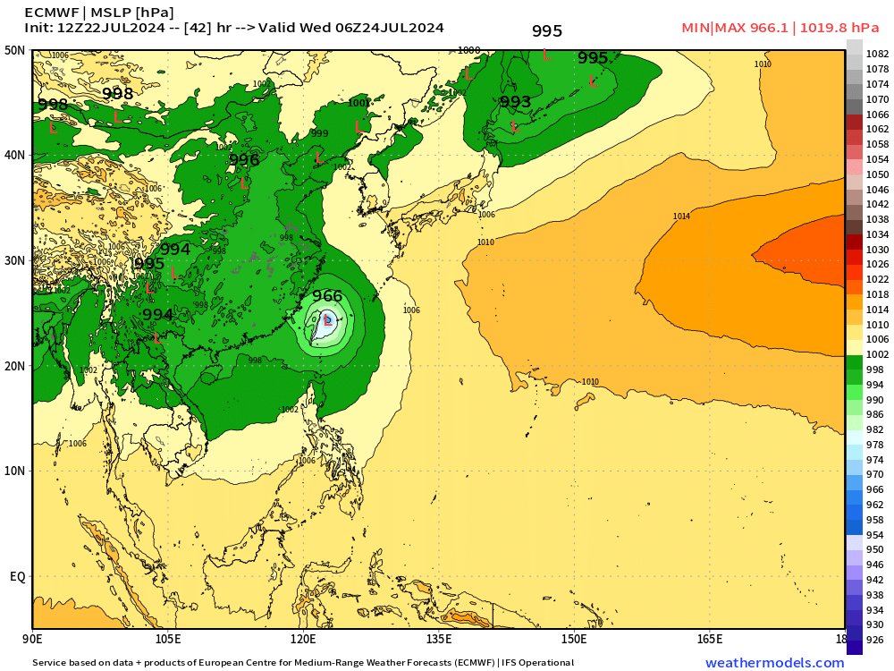
Landfall is possible in northern Taiwan and then China at potentially major typhoon intensity.
Atlantic Basin GeoColor Satellite Imagery
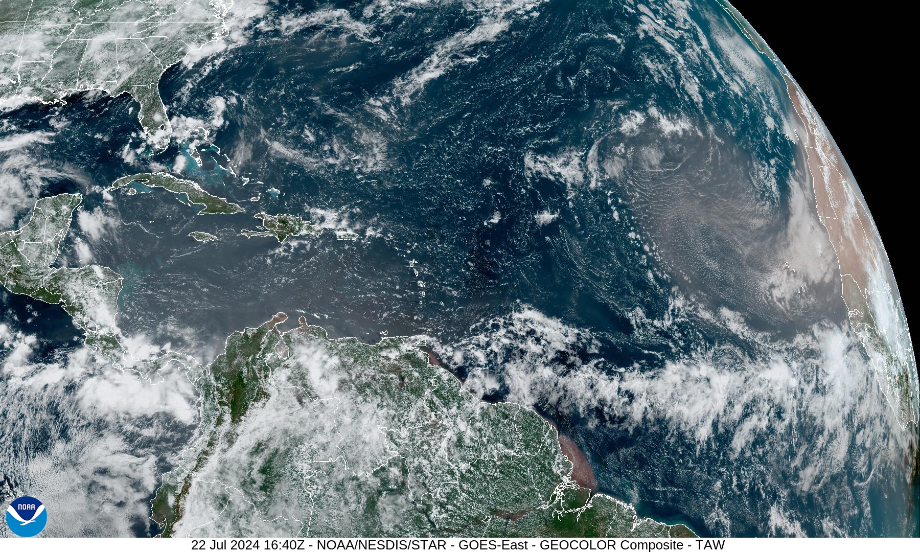
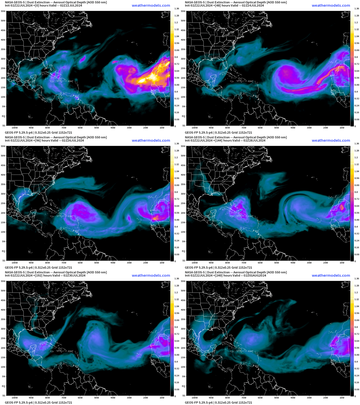
Another dust cloud (major one) coming off Africa and beginning its journey across the Atlantic.
NWS WPC 7-Day Precipitation Forecast | Watering Needs
15-Day Precipitation Anomaly (%)
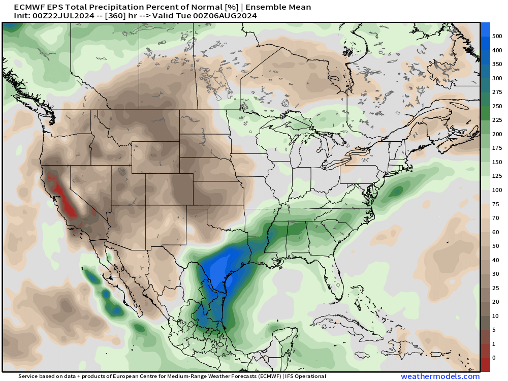
Very wet across Texas in aggregate over the next 2-weeks
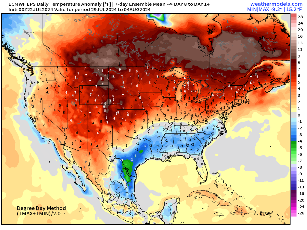
Weekly Temperature Anomaly
EPS Week 1: July 22-28, 2024
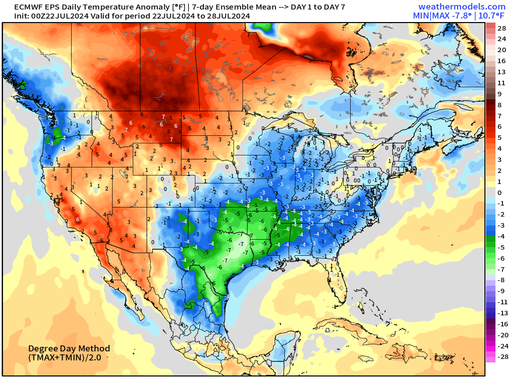
EPS Week 2: July 29-Aug 4, 2024
Thank you to Subscribers and Supporters!
Maps sourced from weathermodels.com designed and innovated by yours truly! I actually create all of my content from scratch.
- Milepost
- 347 · laid 2024-07-22T18:20:37.803000Z
- Source
- https://weather.substack.com/p/july-22-2024-monday-update
- Digest
- 163cb1a8688ebc7a2562e01f868e7b25c5cf7ea3800e7c9169d2e4af8be02160
- Machine
- JSON