March 4, 2024 Eastern Deluge
Excessive rain from Southeast to New England
March 2024 was the 21st-warmest March in the 132-year national record (1895–2026), at 44.9°F against a 1991–2020 normal of 43.6°F (+1.4°F).
March 2024 was the 29th-wettest March in the 132-year national record (1895–2026), at 2.9in against a 1991–2020 normal of 2.5in (+0.4in).
NOAA/NCEI Climate at a Glance, contiguous United States. This is the observed record for the month, not a score of anything said in this piece — the forecast ledger begins 2026-08-17 and cannot reach earlier posts.

Weather Trader Update | Monday
Weather story for the coming week will be heavy rainfall along the Gulf Coast, into the Southeast and then up the Eastern Seaboard into New England.
Widespread 3-4” or more of rainfall likely through the next 7-days from two storm systems. It no longer looks like either will provide snow accumulations for the coastal New England cities, but perhaps inland there could be significant snowfall this weekend.
Tuesday High Temperatures | March 5, 2024
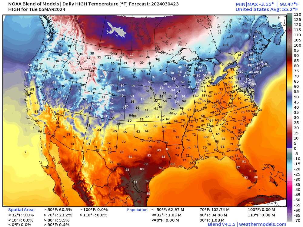
Temperatures remain very mild across the Ohio Valley into Tuesday with 70s to Buffalo. Cooler behind the front, but the coldest Arctic air remains across the upper-Midwest and Canadian Prairies.
Next 8-Days Weather | ECMWF 12z HRES
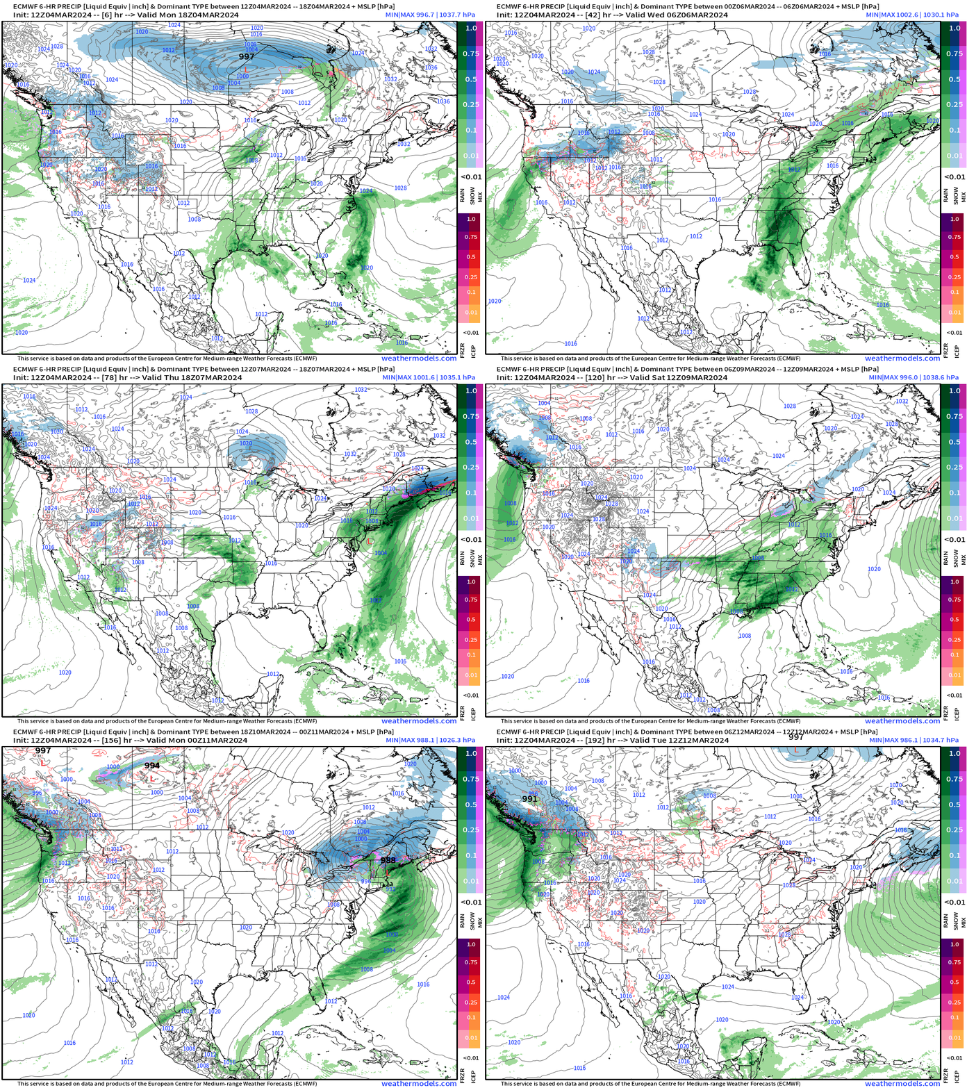
2 major storm systems for Wed-Thurs and Sat-Sun sweeping from the Gulf Coast to New England.
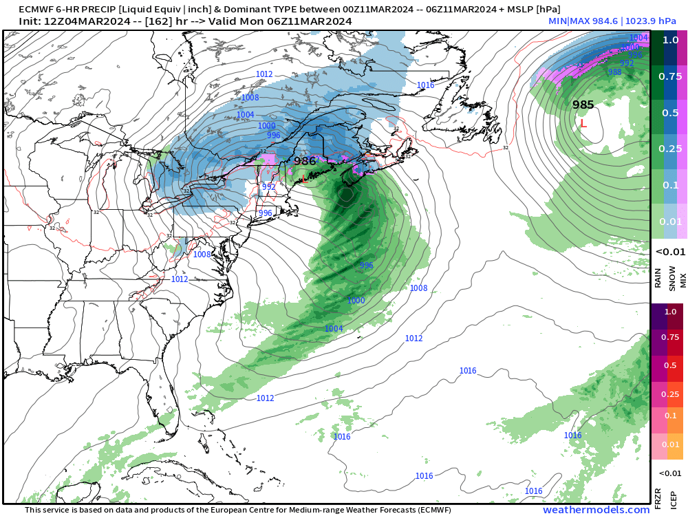
Sunday and Monday — the storm system over the Northeast seems to be on a track that keeps the warm, marine air over the Big Cities. However, still enough cold air on March 11th for snowfall over interior New England.
The probability for snowfall in Boston plummeted to 5% for 3”+
The most impactful weather will be flooding / excessive rain first for the Gulf Coast and Southeast and then up into the mid-Atlantic and Northeast.
7-Day NWS WPC Rainfall
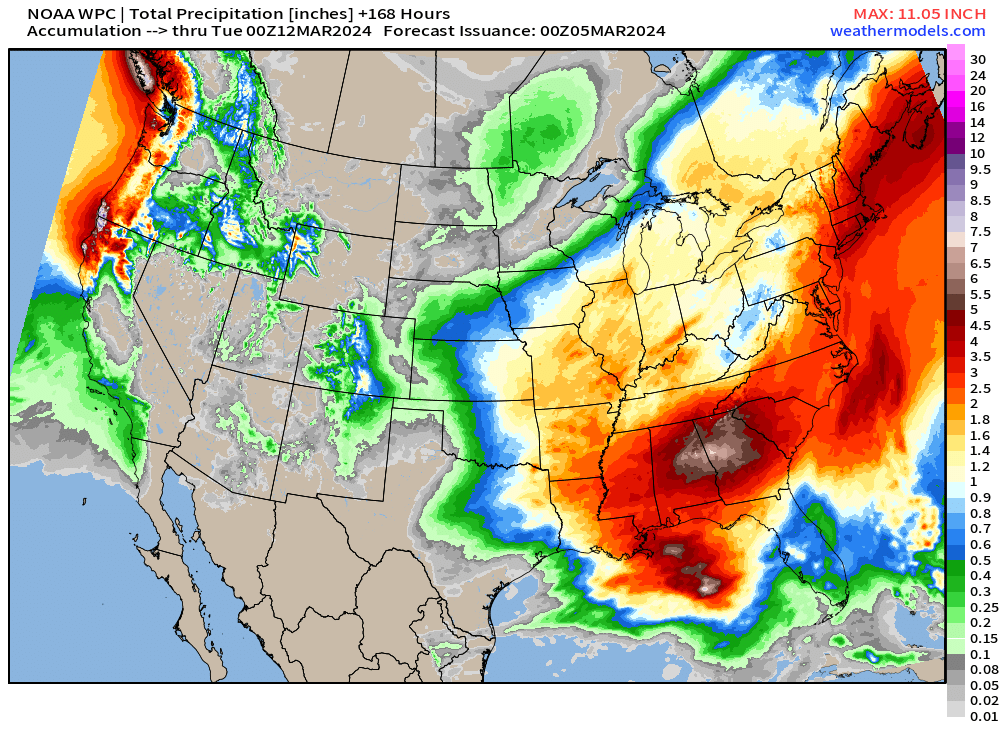
Yellow is 1-inch+ of rainfall so that covers every state east of the Mississippi through 7-days.
Red is 2-4” with locally more up to 6-7” around Atlanta. Yikes!
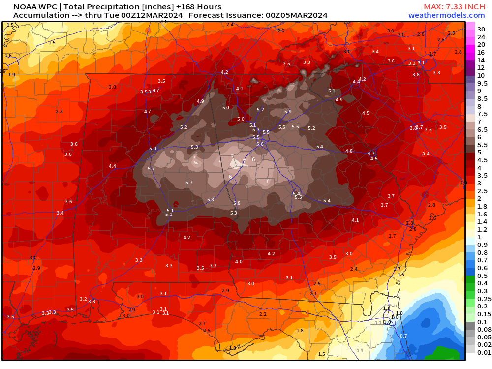
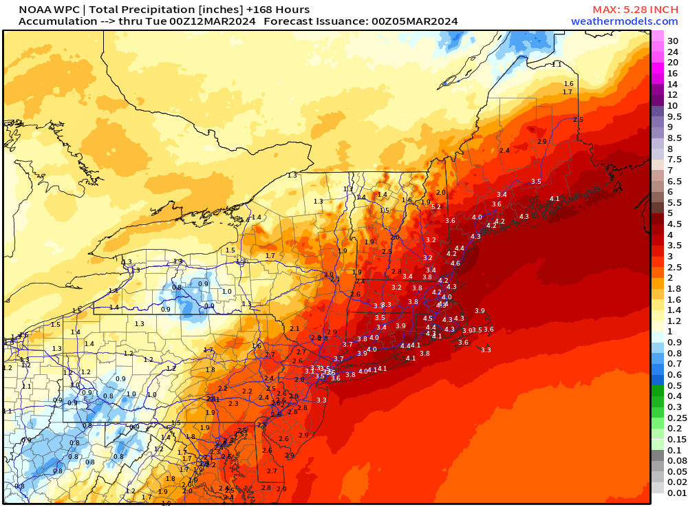
3-5” of rainfall from D.C. to Philly, and New York City, and Boston.
Winter Weather Chances in the Northeast
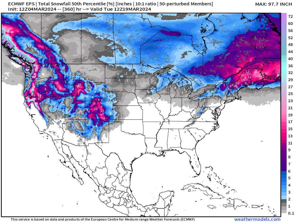
Looking through the next 15-days until March 19th: Good chance of significant snow over Maine, but we might need to put a cork in winter for Chicago, Cleveland, D.C. NYC and Boston.
The Western U.S. will continue to build snowpack with significant mountain accumulations continuing for another 2-weeks at least!
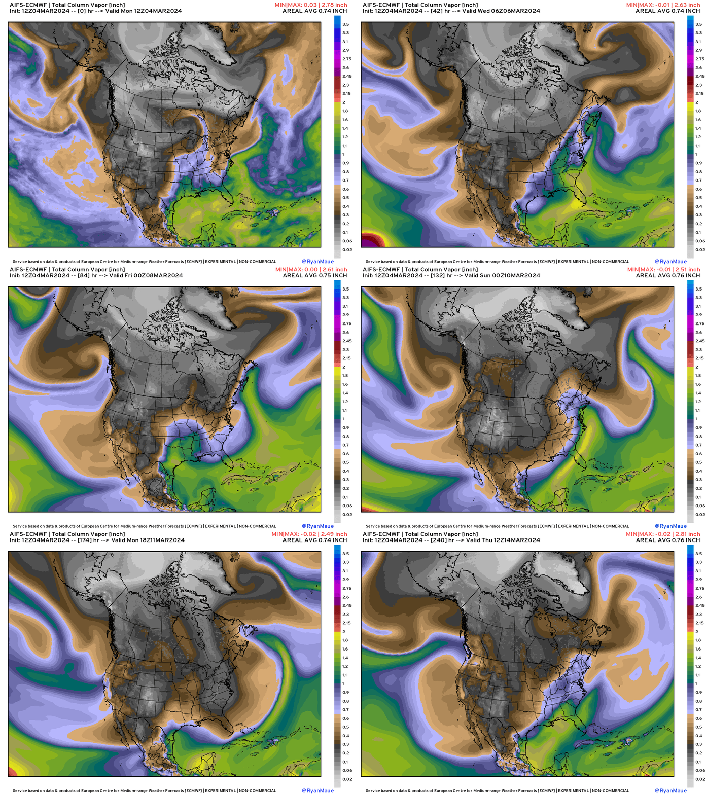
AIFS ECMWF | Artificial Intelligence Inference
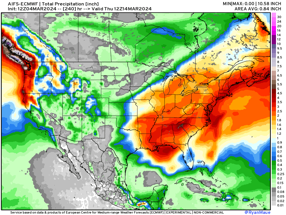
The 10-day precipitation totals from ECMWF-AIFS look quite similar to a conventional weather model — hard to tell otherwise. This is a very wet pattern — which matches up well to the precipitable water animation shown at the top.
Early Sunday AIFS
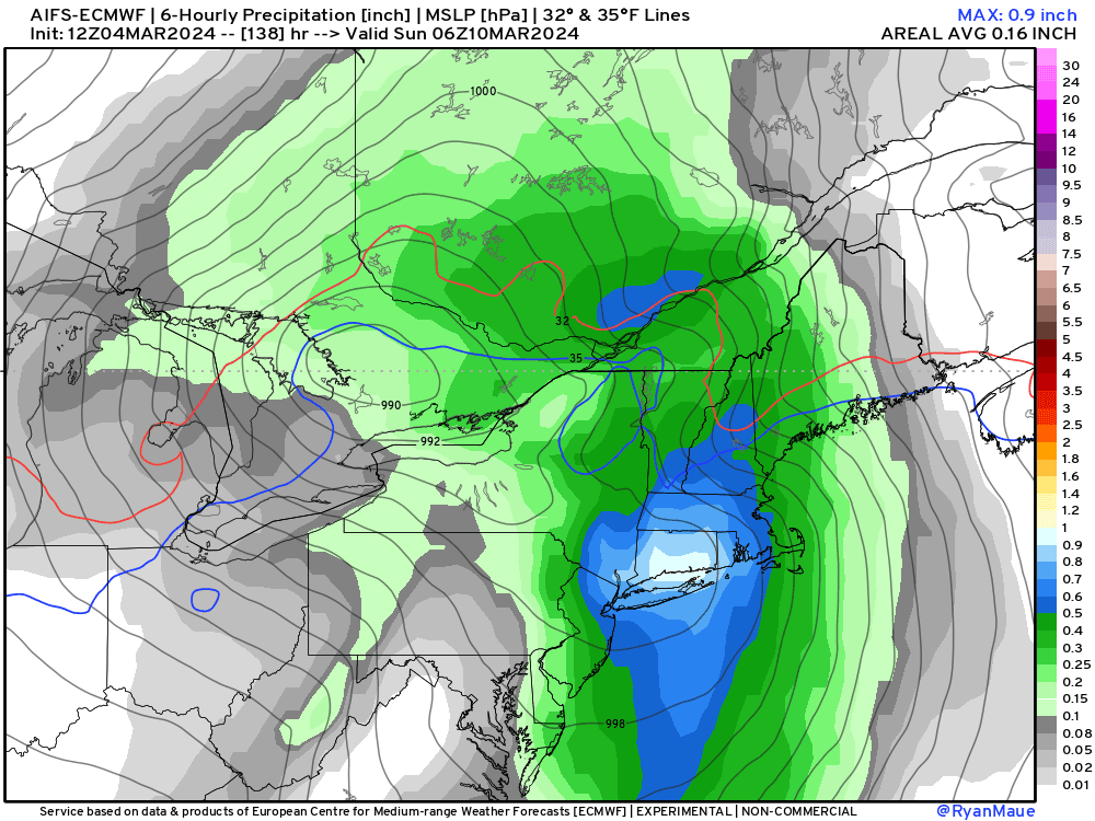
ECMWF-AIFS gave up on the blizzard for Boston — not surprising. This model is not perfect, either. That’s why ECMWF is developing an ensemble system using the AIFS!
Hopefully we get the data from that system as well!
You can view the AIFS-ECMWF as well as the other 4 A.I. models here at Climate Atlas:
Overall Warmth Continues into Mid-March
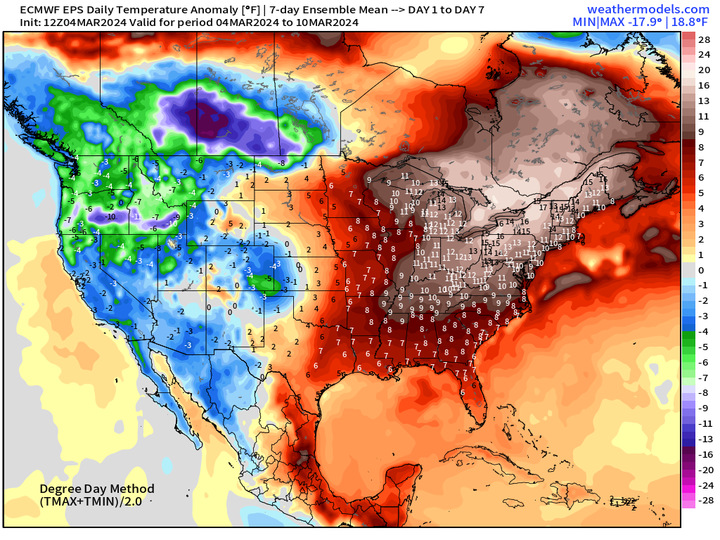
ECMWF Ensemble Temperature Anomaly
Week 1 | Next 7-Days | March 4 - March 10, 2024
Week 2 | March 11 - March 17, 2024
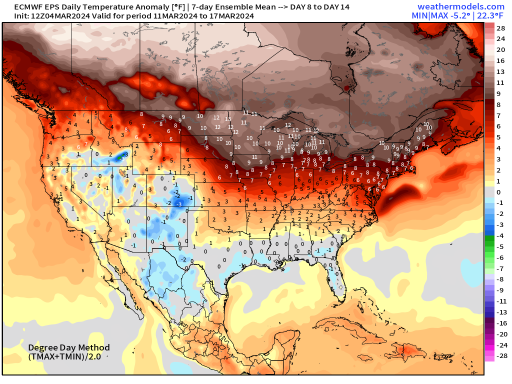
Using the degree day methodology on the recent ECMWF ensembles, widespread warmth continues across the Eastern U.S. over the next week and then takes over Canada in Week 2.
Thank you to Subscribers and Supporters! Welcome to March 2024 — so much is going on in the world of weather! Please come along for the ride!
- Milepost
- 228 · laid 2024-03-05T01:07:14.623000Z
- Source
- https://weather.substack.com/p/march-4-2024-eastern-deluge
- Digest
- e638783aa7cf003b5a267cdf255675b8391ff9748363c11914d195c03263a0b6
- Machine
- JSON