February 16, 2024 Weekend Ahead
A Nor'easter pops up in the 7-day forecast
February 2024 was the 3rd-warmest February in the 132-year national record (1895–2026), at 40.8°F against a 1991–2020 normal of 35.6°F (+5.1°F).
February 2024 was the 62nd-driest February in the 132-year national record (1895–2026), at 2.0in against a 1991–2020 normal of 2.1in (-0.1in).
NOAA/NCEI Climate at a Glance, contiguous United States. This is the observed record for the month, not a score of anything said in this piece — the forecast ledger begins 2026-08-17 and cannot reach earlier posts.

Friday Evening Update
New maps coming tomorrow to Weather Trader with a more “TV look” for temperatures, precipitation, wind, and clouds for several models. The goal is not to replicate what I have built for professional/hobbyist meteorologists at various outfits, but create more visually appealing and polished maps for the public e.g. sharing on social media or using in presentations.
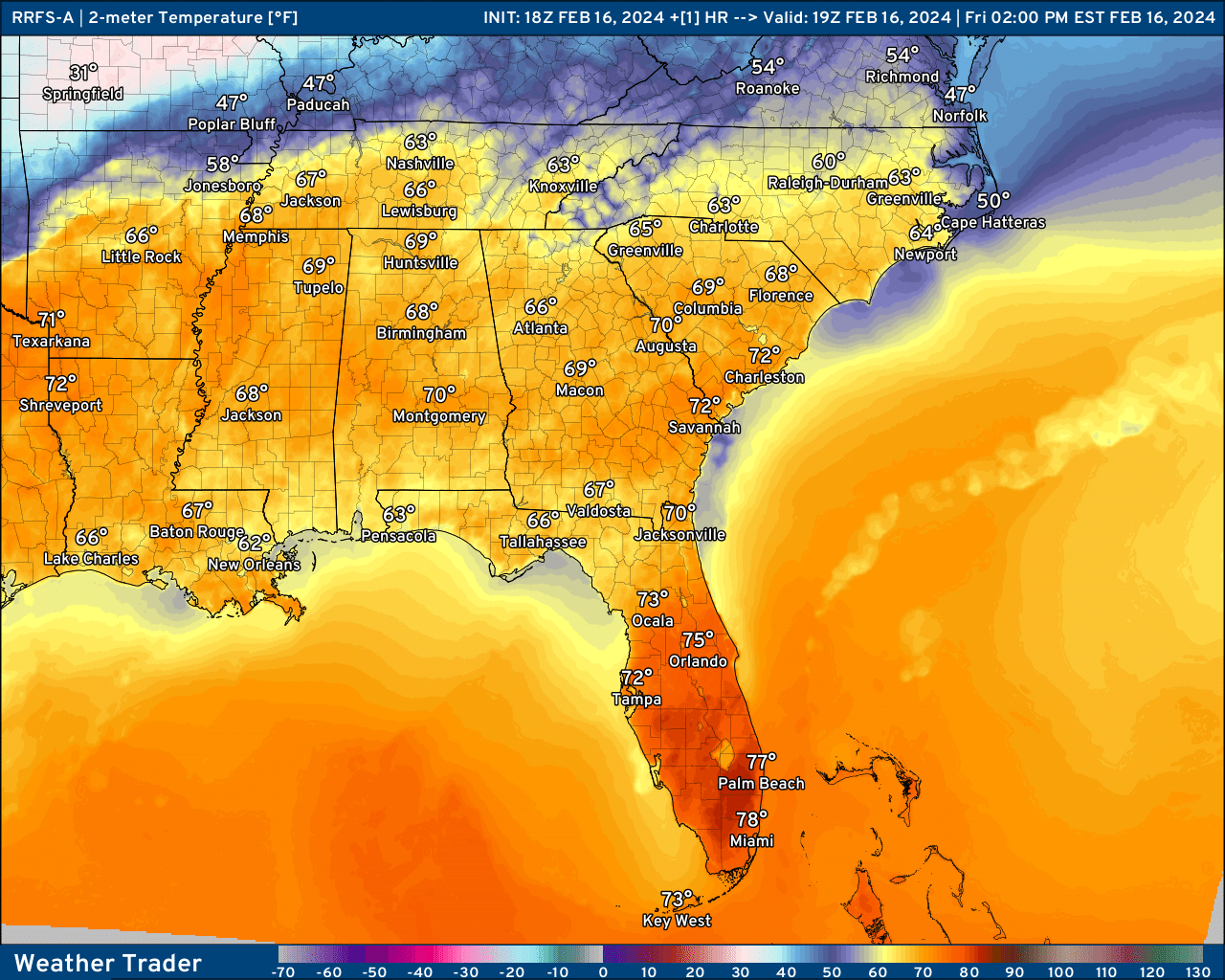
Ohio Valley Clipper System
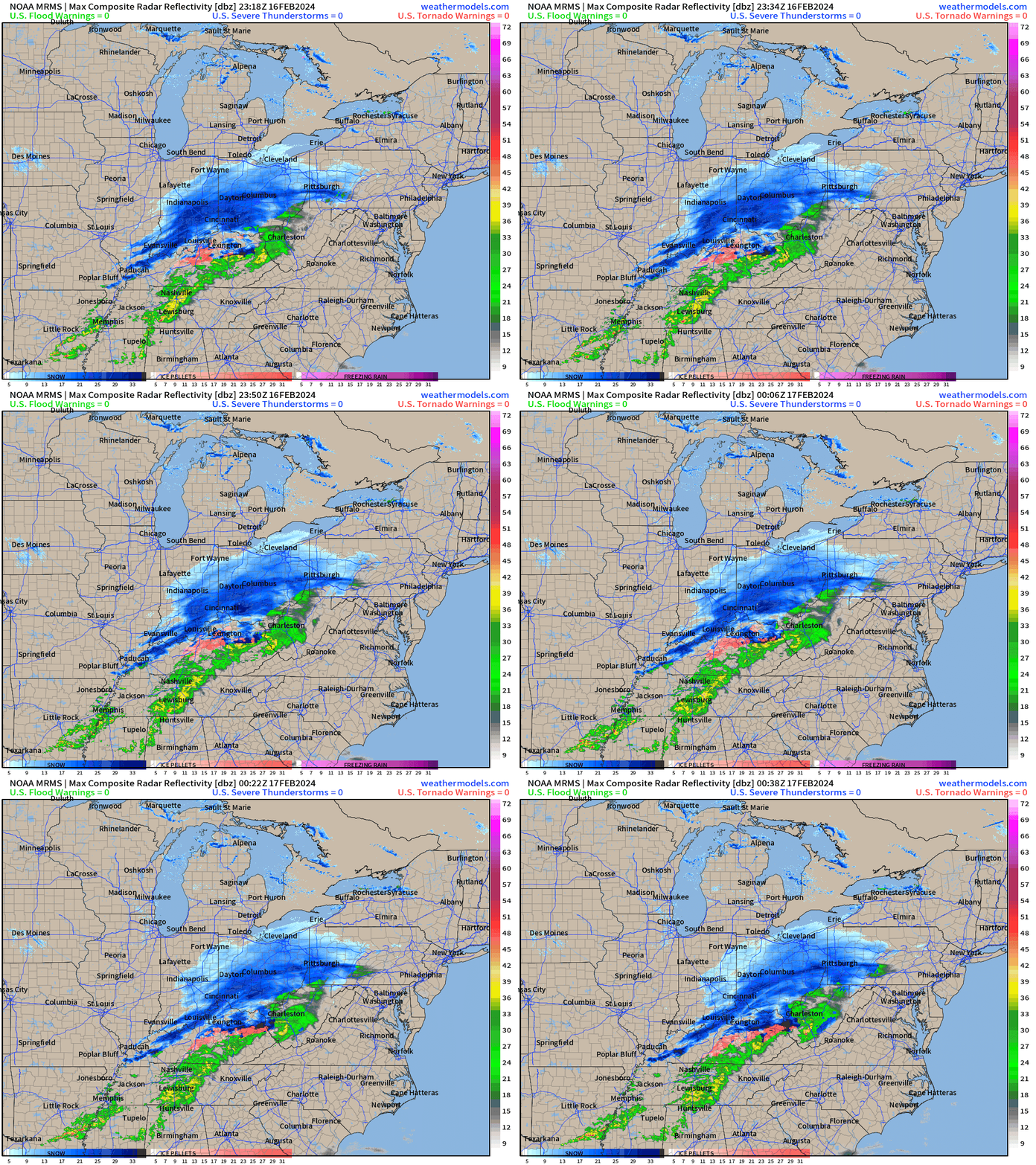
Current radar through 7:38 PM ET
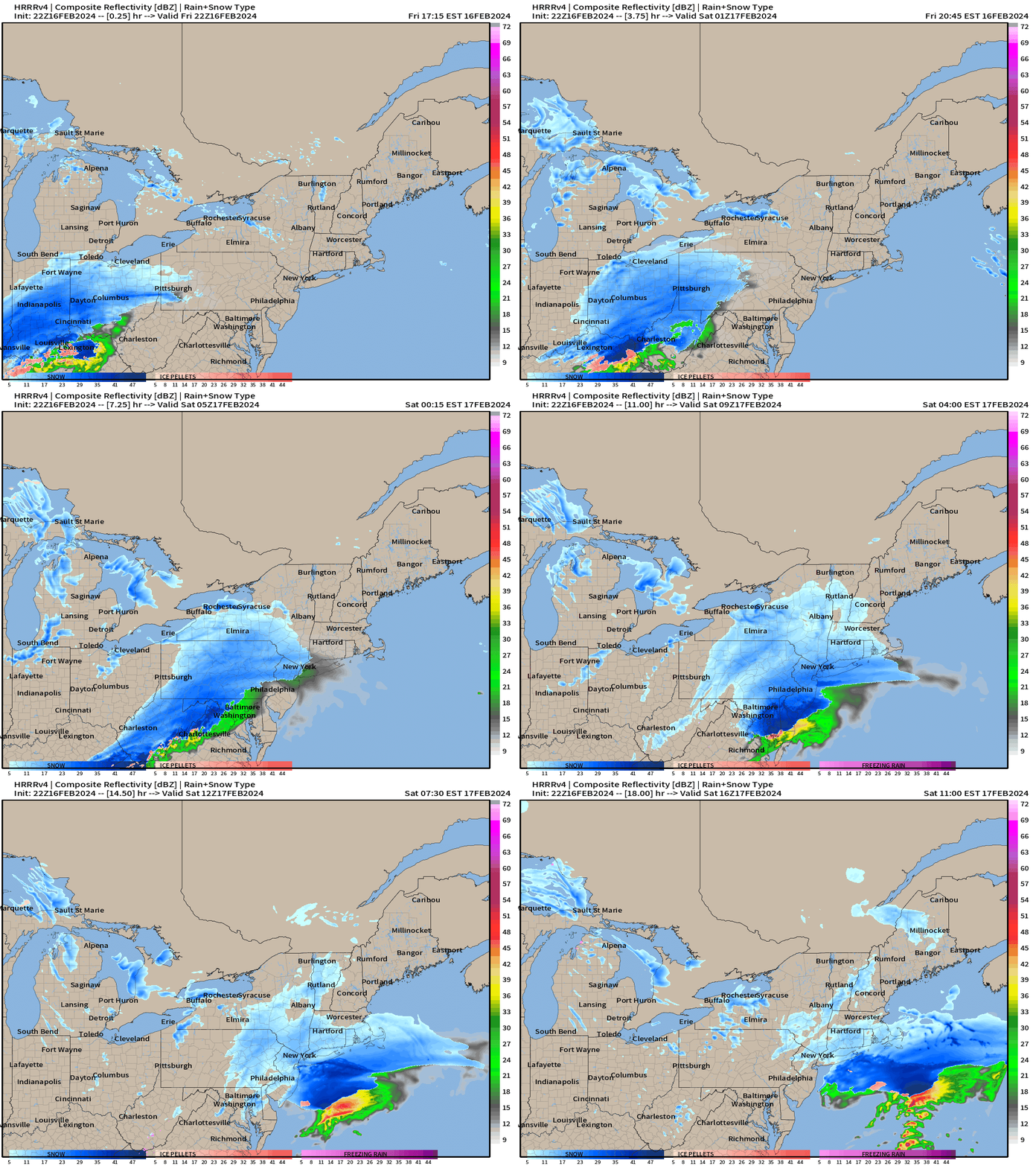
Future HRRR forecast next 18-hours
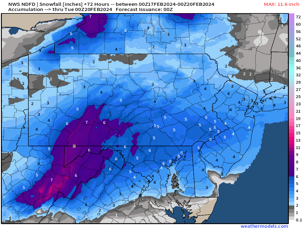
Snowfall forecasts remain steady.
The clipper system is moving through the Ohio Valley into the Mid-Atlantic overnight leading to a blanket of 3” to 5” of snowfall including Washington D.C. by Saturday morning. Washington D.C. NWS forecast is at 3.5” and NYC at 3.3”.
Very Warm Pattern into March
More Ensemble Clustering Tools at Weather Trader
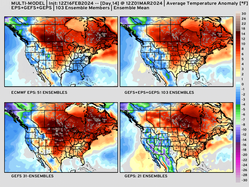
I created more Clustering Tools — as well as a 4-panel pane of the ensembles from ECMWF EPS, NOAA GEFS, and Canada GEPS + the 103 member mean in the animation above.
Lower 48 Temperatures
Saturday Highs and Anomaly | February 17, 2024
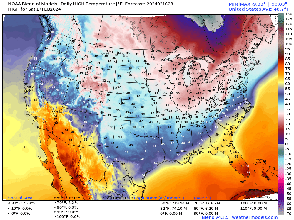
Chilly high temperatures about 20°F below normal into Texas and the Southeast. Hot in the 80s still in South Florida. Also quite warm in the Southwest in the 70s.
Sunday Highs | February 18, 2024
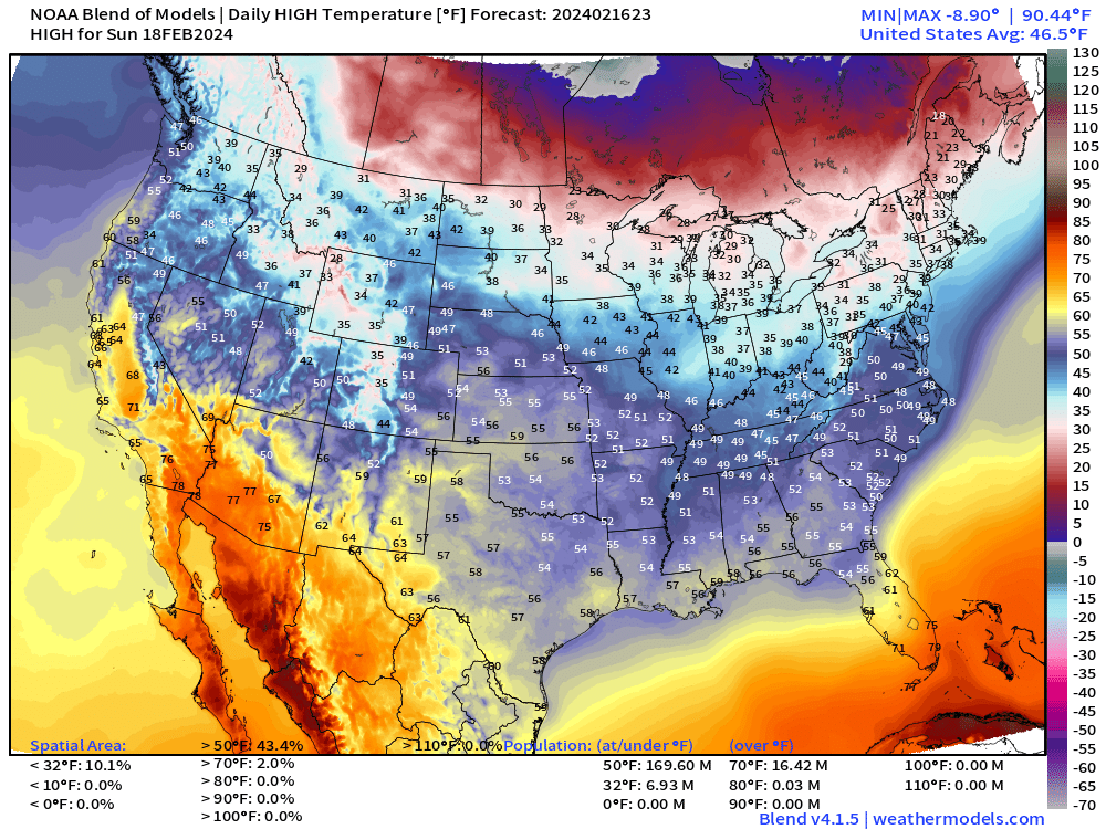
Temperatures moderate under warming sunshine into the 50s in the Plains and Southeast.
WPC 7-Day Precipitation Totals
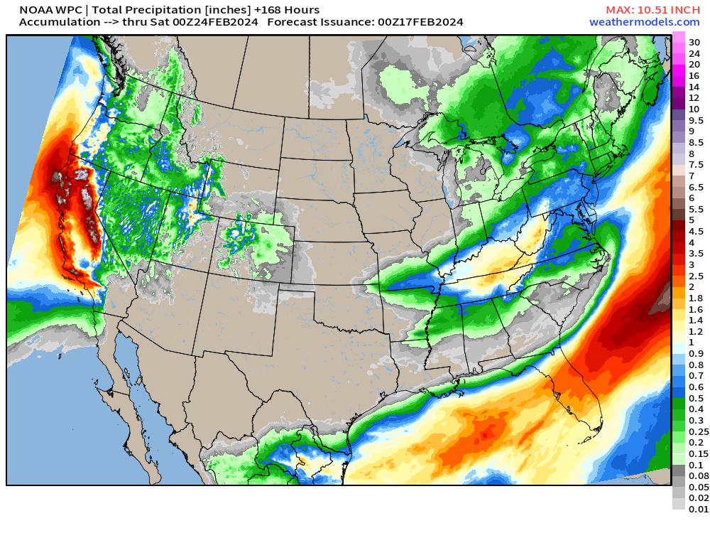
A powerful atmospheric river is due into California early next week on Tuesday with wind and rain with heavy mountain snowfall. We’ve seen several of these events this winter and they keep coming!
Next 6-days precipitation type + MSLP:
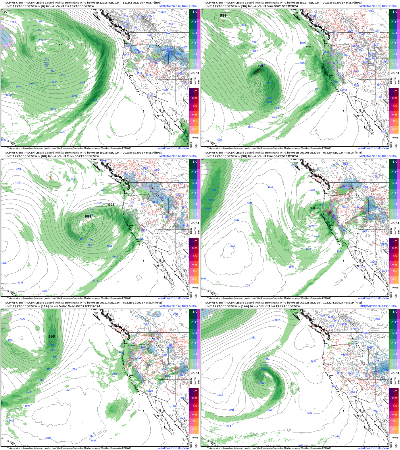
15-Day ECMWF EPS Median Snowfall
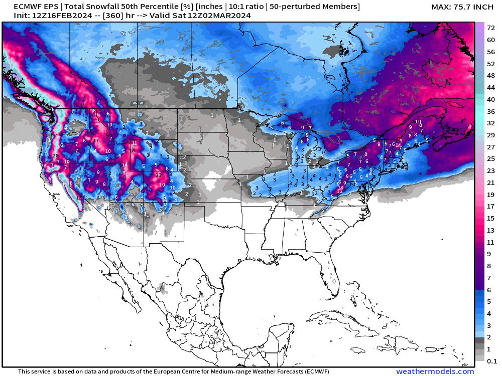
The ensemble map shows the potential for a major winter storm by sorting the various ensemble members. However, it is a low probability at this juncture e.g. 7-days out at Hour 186 as shown in the HRES.
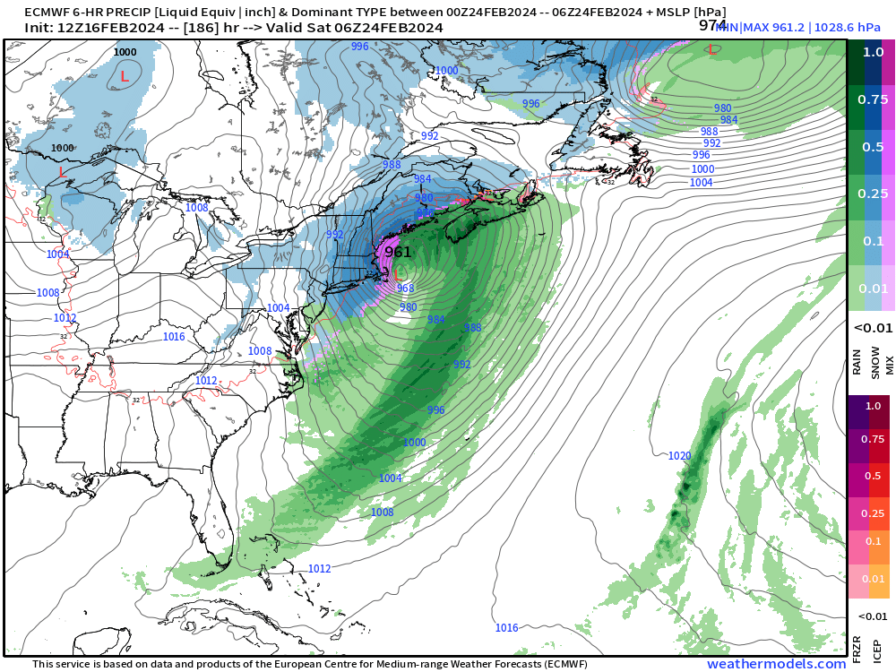
However, this would be a blockbuster blizzard with significant wind and snowfall especially in Boston.
What is the probability of this happening? Around 10%. We’ll watch to see if the other models jump on board like the GraphCast, which does not have this intense of a low pressure system at all. You can see those maps here —> Research GraphCast + FourCastNet maps
(Maps from weathermodels.com and weathertrader.com)
Thank you to my paying subscribers! Consider upgrading to a Yearly Plan if you find these updates valuable and wish to support my development at Weather Trader. Here is a little discount valid until February 20th:
Also, it allows me to provide (usually) interesting and valuable commentary on scientific topics on X. Feel free to say hello and follow on X/Twitter (@RyanMaue)
- Milepost
- 213 · laid 2024-02-17T00:57:37.137000Z
- Source
- https://weather.substack.com/p/february-16-2024-weekend-ahead
- Digest
- 5f0b67bbc70c40634a66828f98ec1a6dc2aee90ee5669720bb54d831c9eade13
- Machine
- JSON