January 31, 2024 Stormy Pattern Continues
Another California storm and Southeast system in weird pattern
January 2024 was the 46th-warmest January in the 132-year national record (1895–2026), at 31.9°F against a 1991–2020 normal of 32.3°F (-0.5°F).
January 2024 was the 7th-wettest January in the 132-year national record (1895–2026), at 3.3in against a 1991–2020 normal of 2.3in (+0.9in).
NOAA/NCEI Climate at a Glance, contiguous United States. This is the observed record for the month, not a score of anything said in this piece — the forecast ledger begins 2026-08-17 and cannot reach earlier posts.
Weather Trader | Wednesday Update
RRFS-A North America will eventually replace the HRRR [launched in 2012] and a much larger domain in early 2025. In the meantime, it is running in experimental mode with the data provided to the AWS S3 buckets for free collection and processing. For Weather Trader, I am gobbling in about 3 TB of data per day and generating beautiful and rich imagery, which will be up on the WT website shortly. The goal isn’t to replicate what’s available elsewhere, but provide new, useful items for a wider range of users.
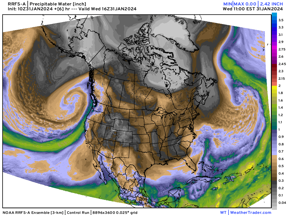
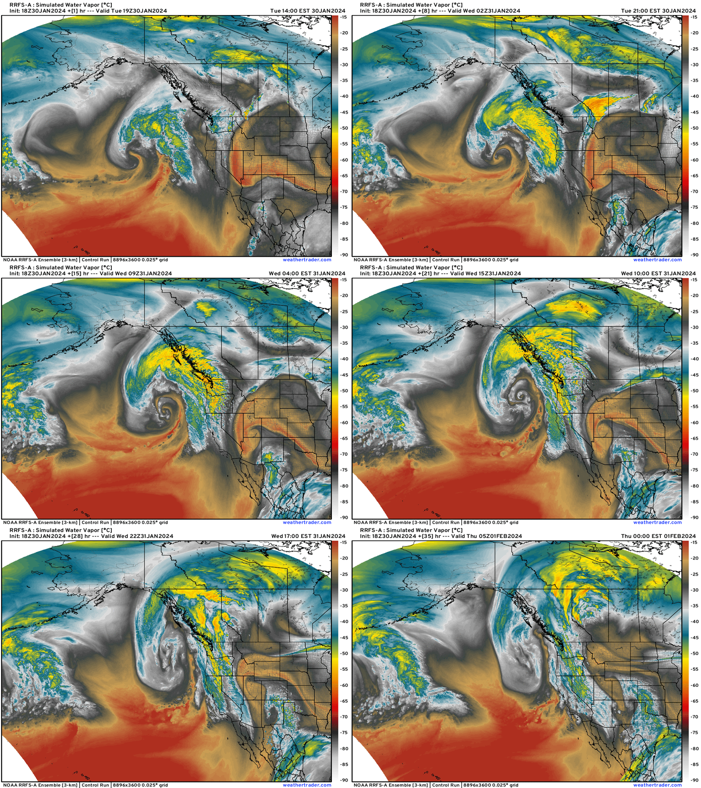
The RRFS-A domain extends from Hawaii to Alaska and then to Puerto Rico and Greenland at about 3-kilometer grid spacing. The animation below is from the water vapor channel of simulated GOES-18 satellite — and it’s incredible!
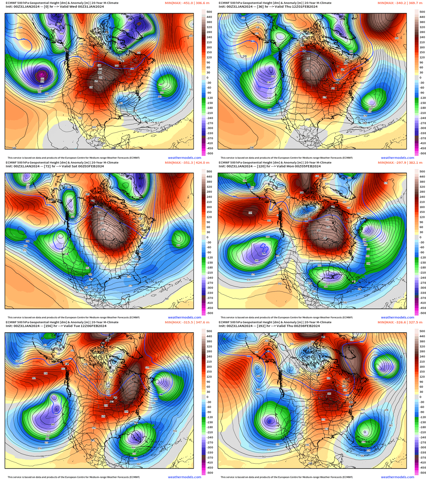
Unusual blocking weather pattern to continue over the next 7-10 days until the block breaks down in Canada — if it does! The cut-off troughs are like bowling balls orbiting the polar anti-vortex. This is reminiscient of a pattern in March that generates a lot of severe weather as wind shear and warm, moist air collide for thunderstorms. The southeast U.S. severe weather season begins in February as I remember from my synoptic classes at FSU in Tallahassee.
Next 7-days of weather across the Lower 48 shows the Western U.S. being bombarded with 2-storms. Moisture from the current system streams in the Southeast underneath this ridge and sets up an interesting severe weather episode on Sunday across the Gulf states.
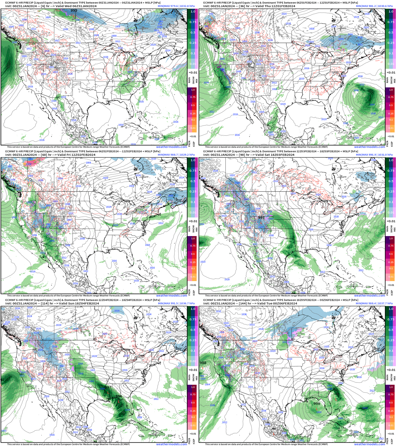
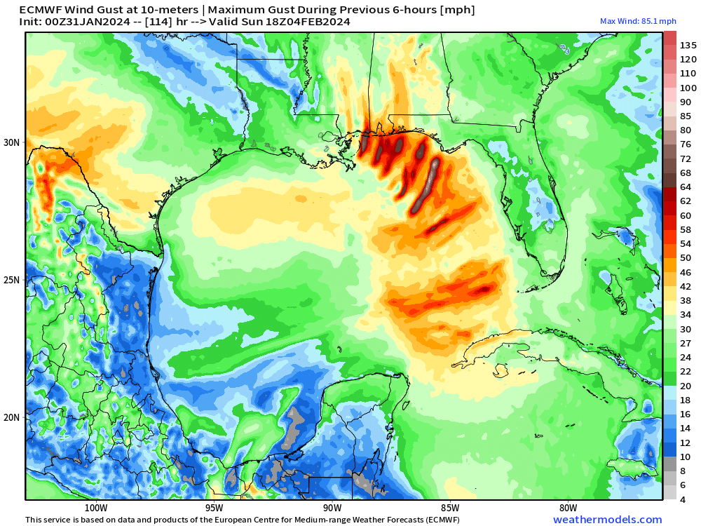
The wind gusts from the ECMWF HRES in 6-hour max shows signature of supercell thunderstorms over the Gulf in a sheared environment. Really wish we had mesoscale model imagery at Day 4-5, but that’s what I’ve worked on over the past 2-days to get WRF downscale up and running — now successfully at 9-km over the eastern U.S. based upon GFS, but probably use DWD ICON analysis in the near-future.
Another atmospheric river event with a powerful “bomb cyclone” off the California coast on Sunday-Monday. This is a blockbuster!
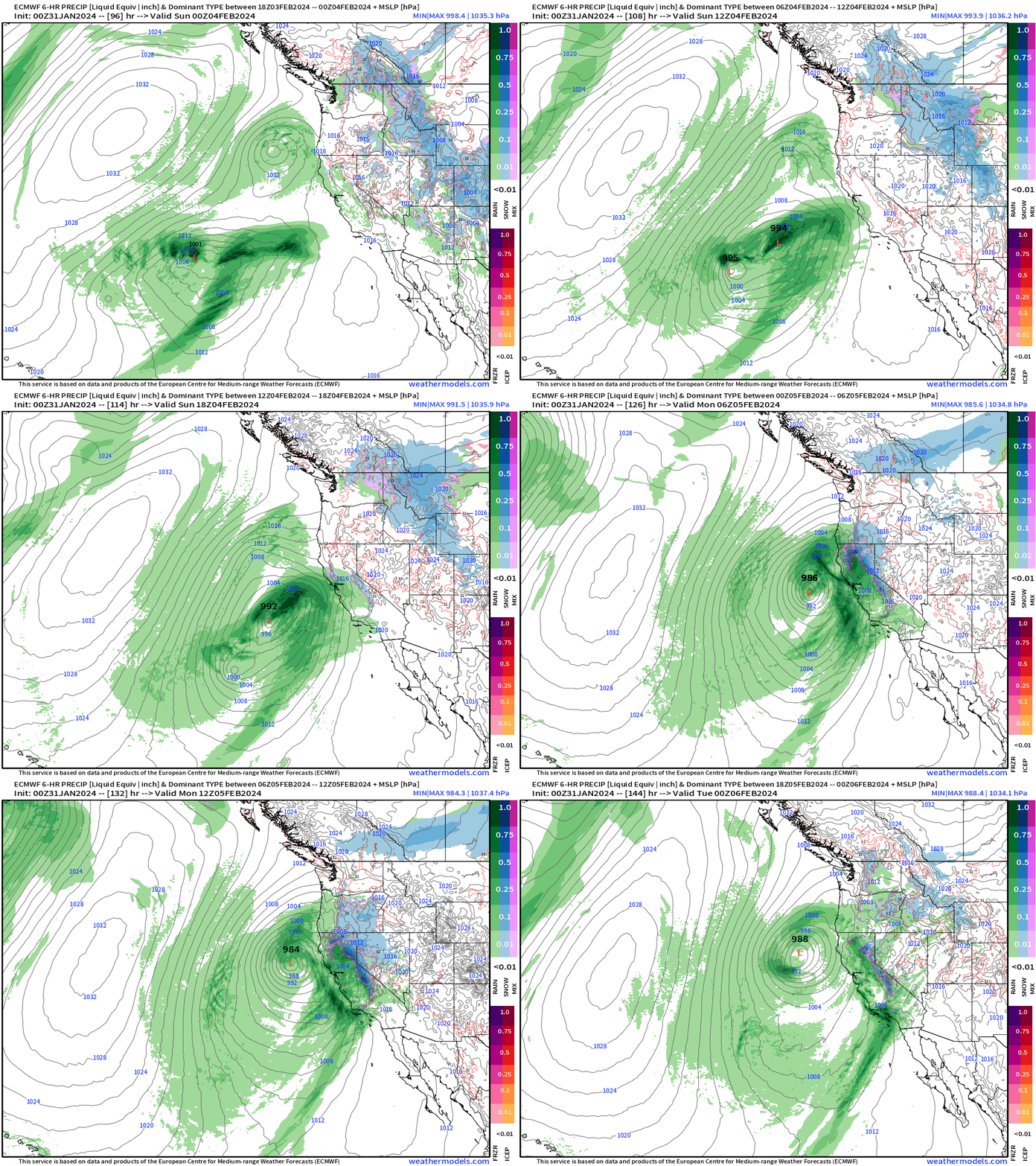
Rainfall will be excessive along the entire California coastline with significant impacts! We’ll see the WPC rainfall forecast for 7-days further down the newsletter.
February Thaw — Winter on Hiatus east of the Rockies
Wednesday Highs | January 31, 2024
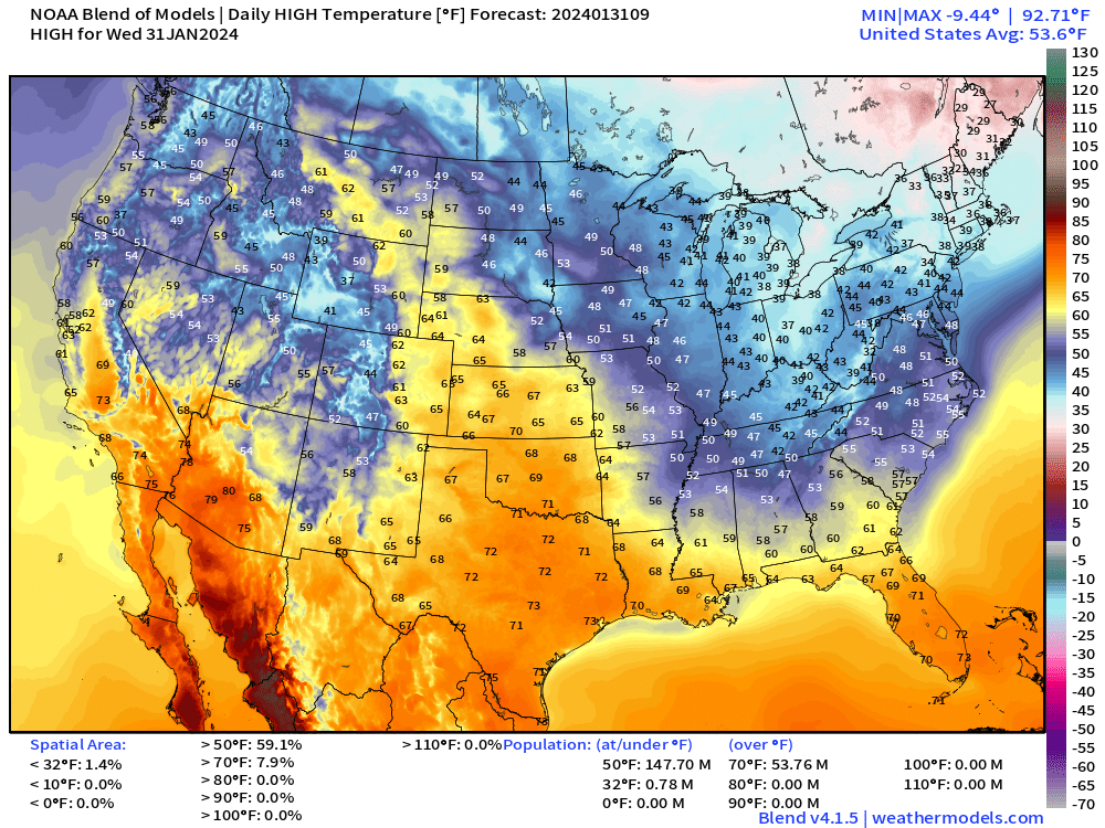
Surging warmth from Texas to Montana in the 60s and 70s. Only a few folks, 780K under freezing across the Lower 48. Average high temperature is almost 54°F, which is more like March.
Thursday Lows | February 1, 2024
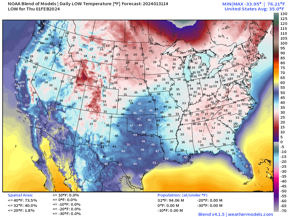
Starting February very mild with New England the only chilly spots, but even there, that’s above seasonal norms.
Thursday Highs | February 1, 2024
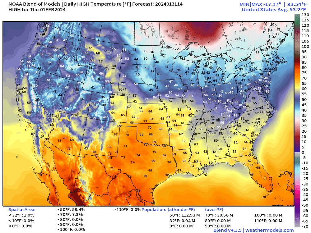
Texas in the 70s! No Arctic air to be found on February 1st. Amazing!
Next 14-days Temperature Anomaly
7-day Chunks from January 31 to February 14, 2024 [00Z]
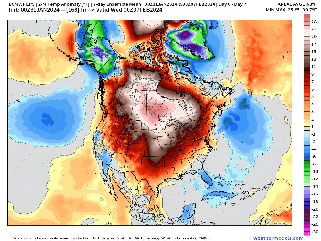
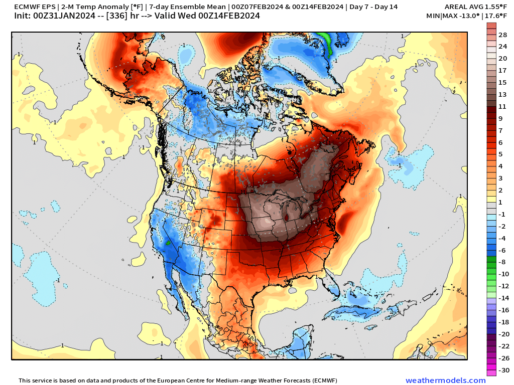
This broken record of warmth continues across the Midwest and central U.S. — not much of away to run a winter!
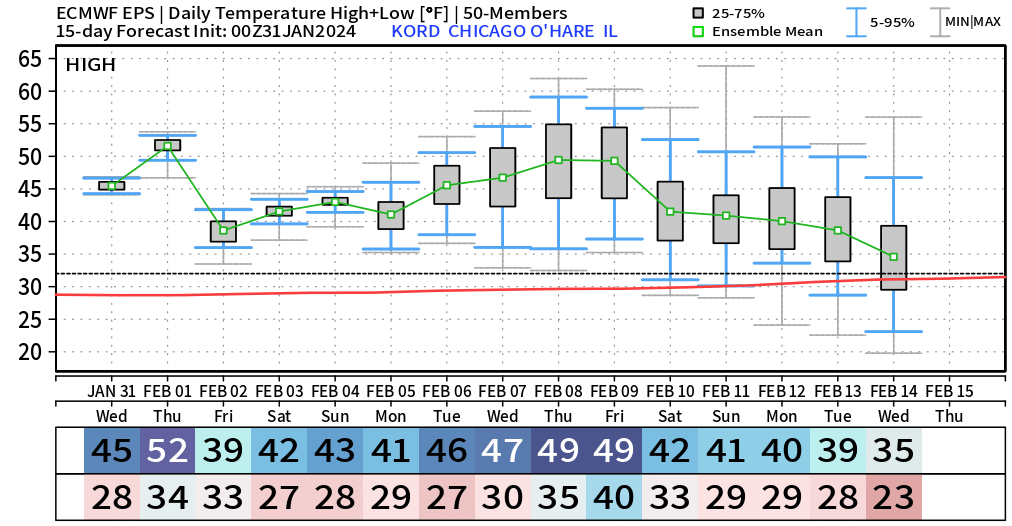
Example of Chicago over the next 15-days — well above average with some ensembles pushing into the 50s and 60s!
7-day Total Precipitation from WPC
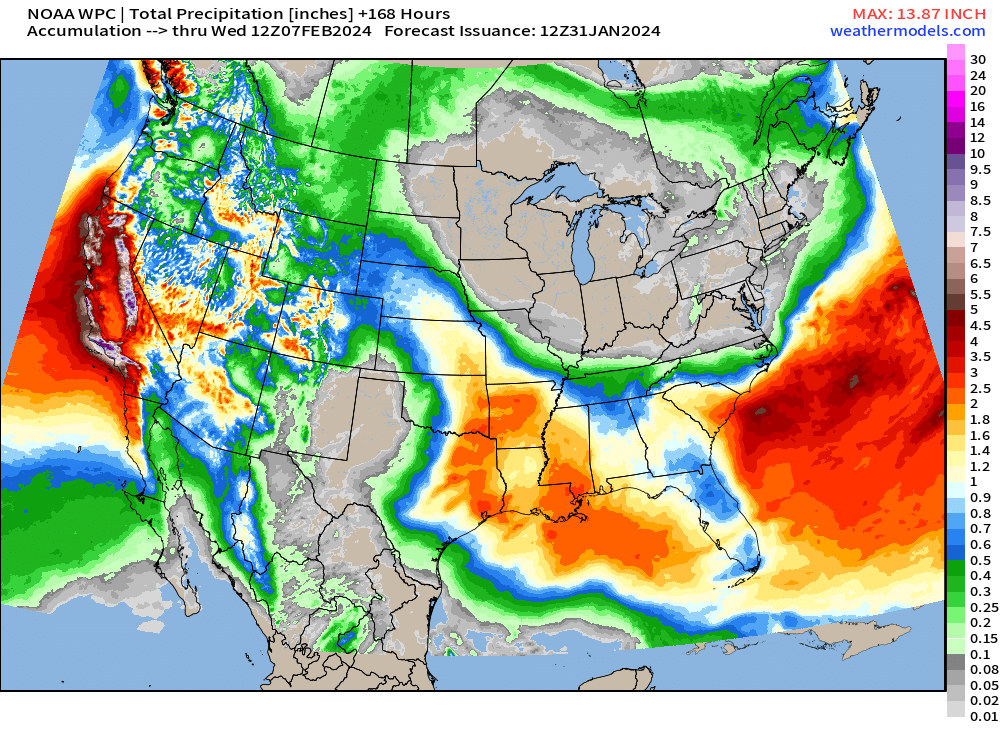
Through 7-days, California is the big winner with precipitation with almost 11 Trillion gallons of precipitation (rain + liq equivalent snowfall) with that western moisture flowing into Texas and the southeast with the bowling ball cut-off troughs.
10-day Snowfall ECMWF HRES Accumulations
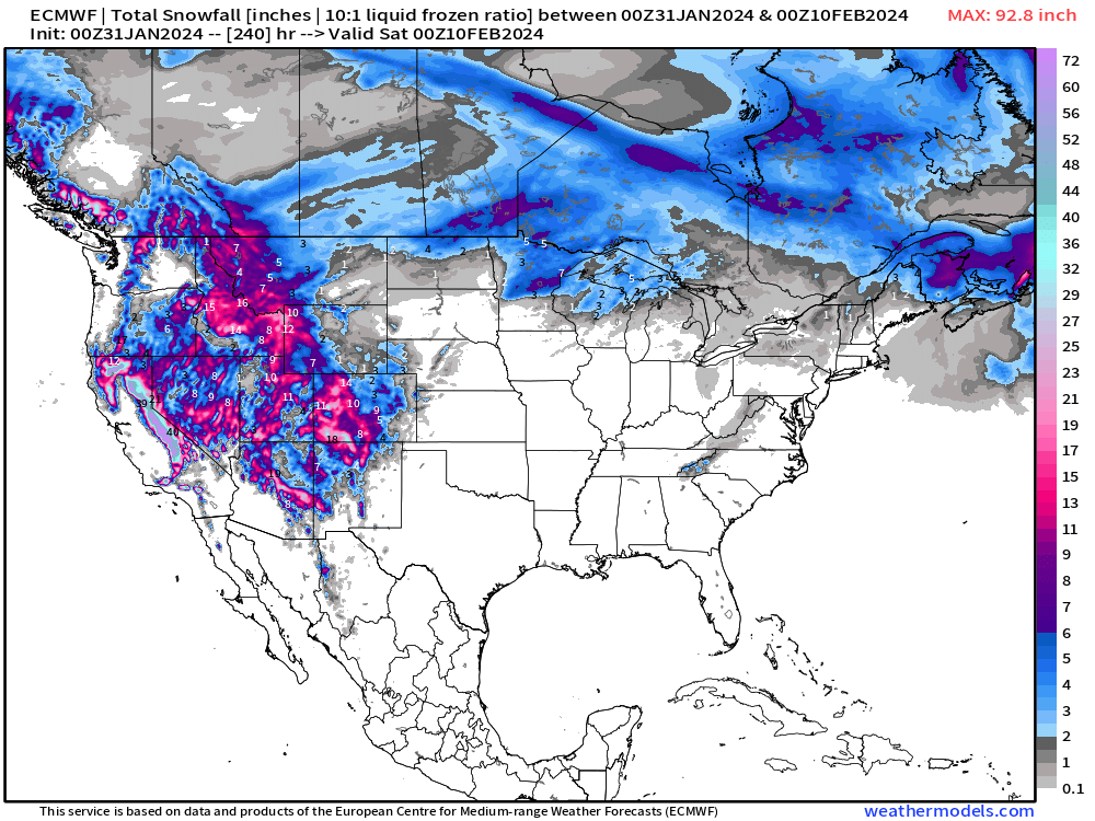
Still no update here: You can probably put away your snow shovels in Minnesota, Iowa and Chicago at least until Valentine’s Day — and just use a broom or a leaf blower. That forecast remains solid — so far. The Western U.S. will be buried in snow from the Sierra into the Rockies across Colorado. Ski season will be going full tilt!
(Maps from weathermodels.com and weathertrader.com)
Thank you to my paying subscribers!
Your support pays for my Linux servers and product development. Also, it allows me to provide (usually) interesting and valuable commentary on scientific topics on X. Feel free to say hello and follow on X/Twitter (@RyanMaue)
- Milepost
- 197 · laid 2024-01-31T16:10:07.543000Z
- Source
- https://weather.substack.com/p/january-31-2024-stormy-pattern-continues
- Digest
- aa624e5060f394deb66f9b7836e5ce11a5ffc6f651a5ca97c6b164f15cc50a39
- Machine
- JSON