January 24, 2024 Sneaky Nor'easters
Potential for significant snowfall in the Northeast as rest of continent warms
January 2024 was the 46th-warmest January in the 132-year national record (1895–2026), at 31.9°F against a 1991–2020 normal of 32.3°F (-0.5°F).
January 2024 was the 7th-wettest January in the 132-year national record (1895–2026), at 3.3in against a 1991–2020 normal of 2.3in (+0.9in).
NOAA/NCEI Climate at a Glance, contiguous United States. This is the observed record for the month, not a score of anything said in this piece — the forecast ledger begins 2026-08-17 and cannot reach earlier posts.
Weather Trader | Wednesday Update
Warmth is taking off for the next 2-weeks
Heavy rainfall continues across the south from Texas into Ohio Valley
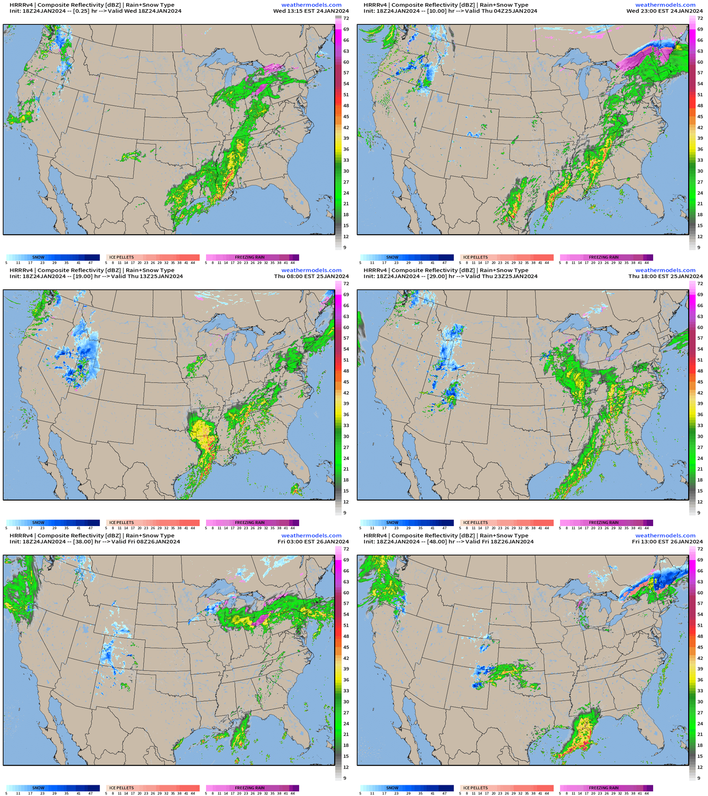
Next 48-hours from HRRR shows the soggy southern U.S. with waves of moisture that eventually move into the Northeast on Friday. The precipitation bumps into the cold air in Maine and turns to snow.
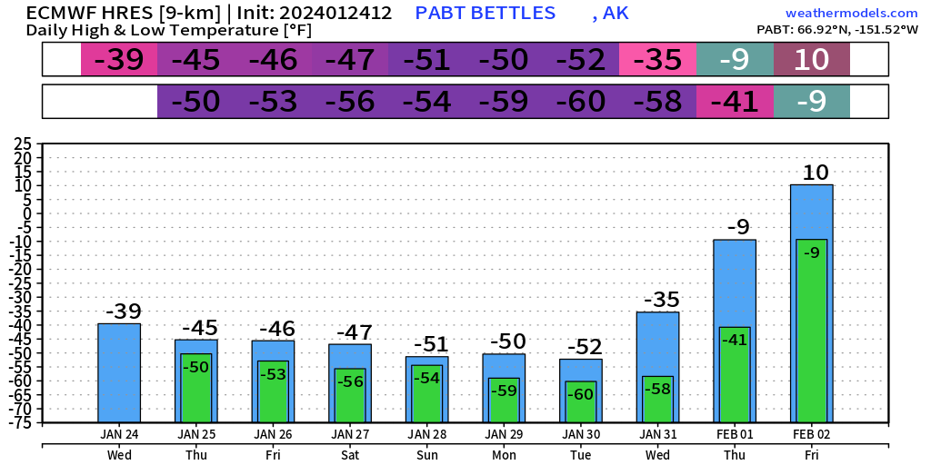
Alaska will go into the very deep freeze
Increasing confidence in coastal storm off NYC this Sun/Monday could be impactful. Then another Clipper system week from Friday (?). The ECMWF HRES 12z is very bullish with significant impacts
Cyclone Kirrily 07P nearing Queensland, Australia coast as a Tropical Storm
January into February Thaw — Exceptional Warmth
Thursday Morning Lows | January 25, 2024
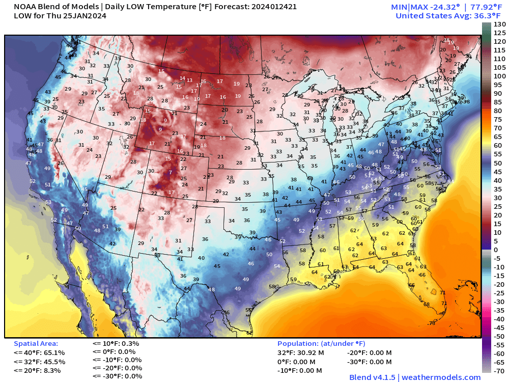
60s in the Southeast will be muggy with fog and rainfall Most of the Lower 48 population is above freezing — amazing for late January.
Thursday Highs | January 25, 2024
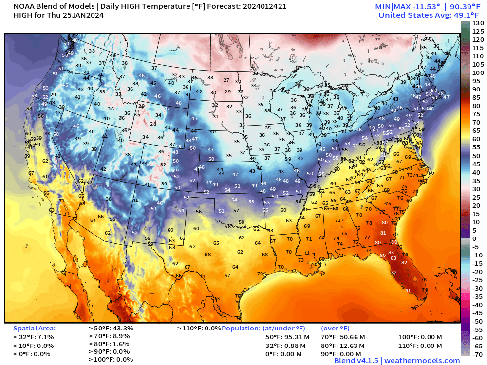
Get your shorts out in the Southeast with 70s!
Friday Highs | January 26, 2024
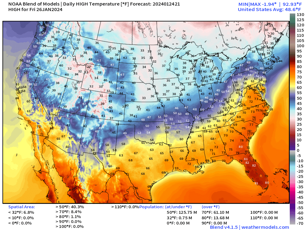
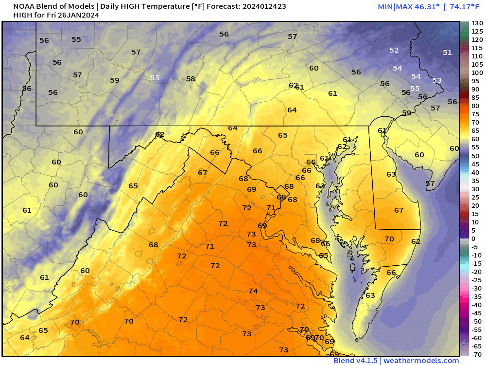
January heat wave — upper-60s maybe 70°F into D.C. Mid-70s up into Charlotte. Whoa!
Next 14-days Temperature Anomaly
7-day Chunks from January 24 to February 7, 2024
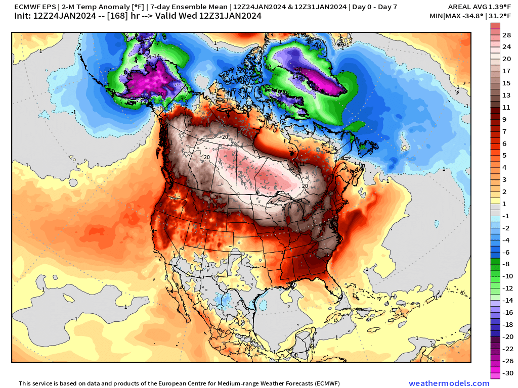
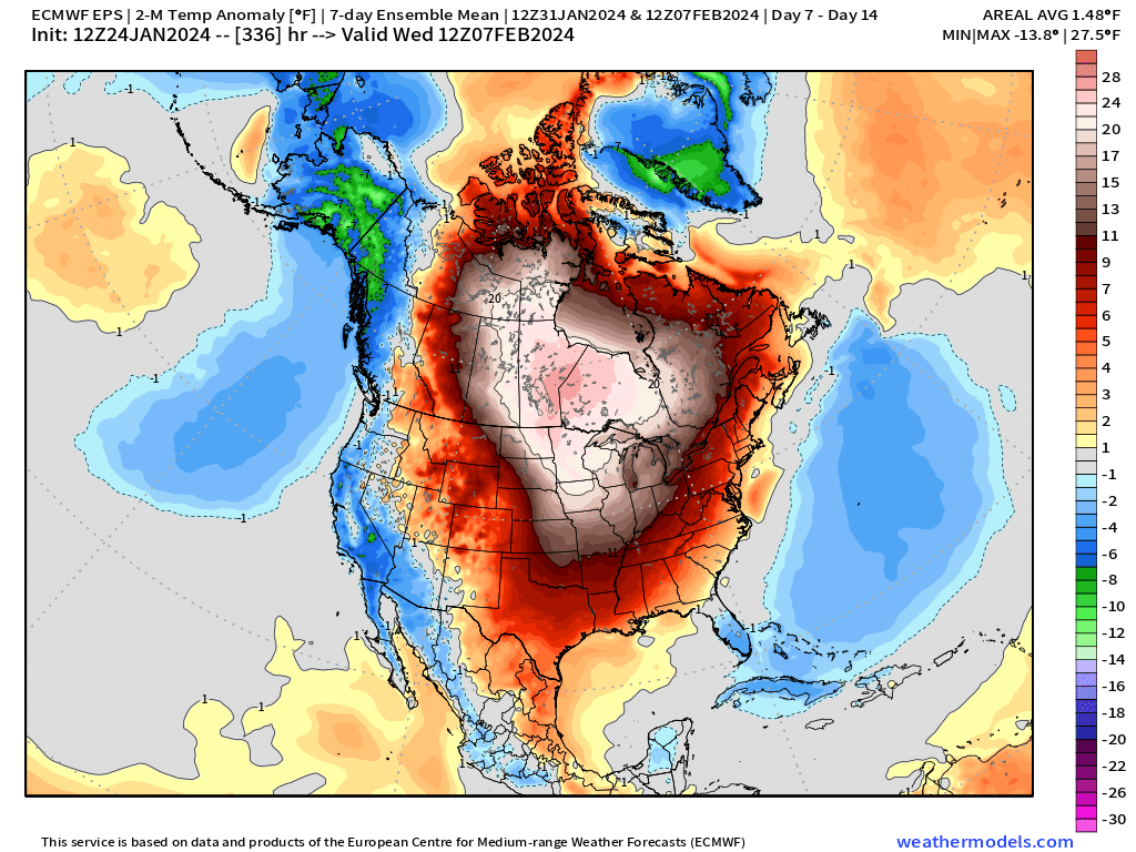
Week 1 and Week 2 centroid of 25-30°F above normal average temperatures centered on Canada. That’s astounding! The minor exceptions will be Alaska and Greenland with the opposite, more than 30°F below normal, which is very cold in late January and early February. -60°F in Bettles, Alaska!
7-day Total Precipitation from WPC
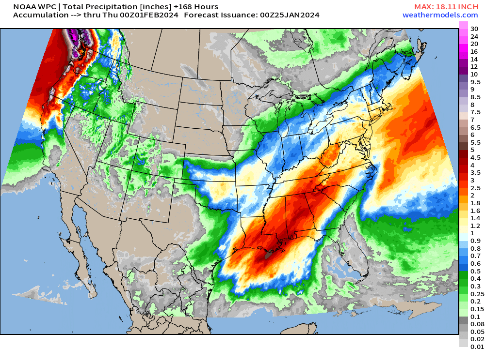
Heaviest precipitation over the next 7 days will be in the South from Houston into Knoxville with 2-4”
10-day Snowfall Ensemble Median Accumulations
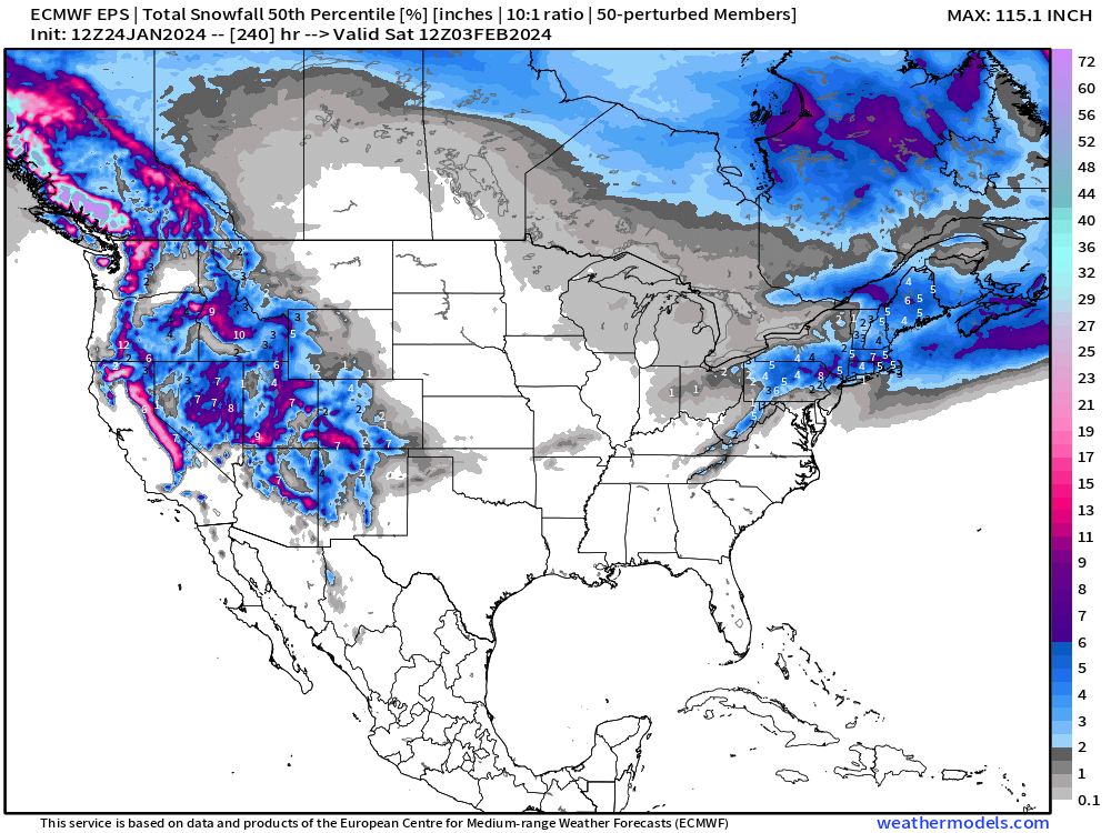
The ECMWF HRES 12z is one realization of the 52-ensemble members from the EPS. I want to show the two winter storm chances for the Northeast on Sun/Mon as a bonafide intensifying Low Pressure system, and then a Clipper in the 8-10 day range next Friday.
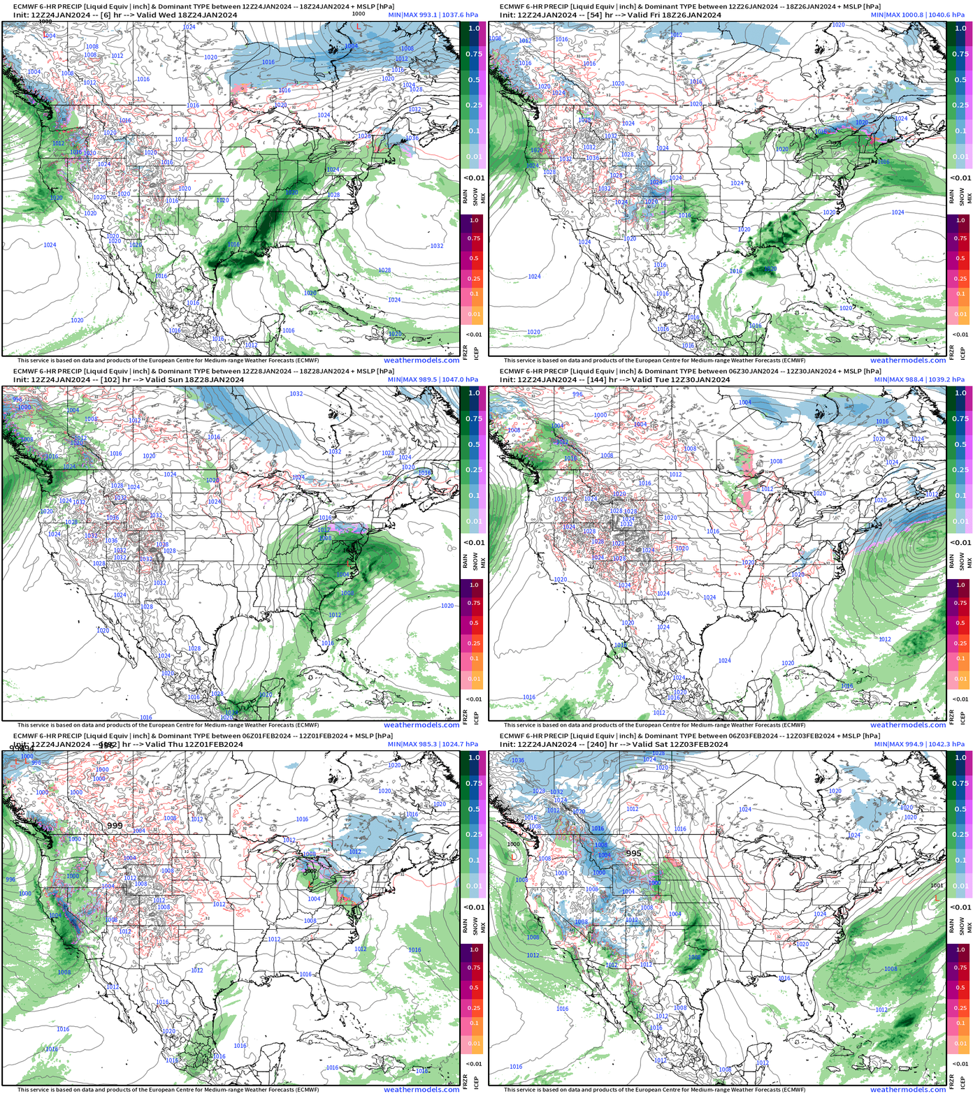
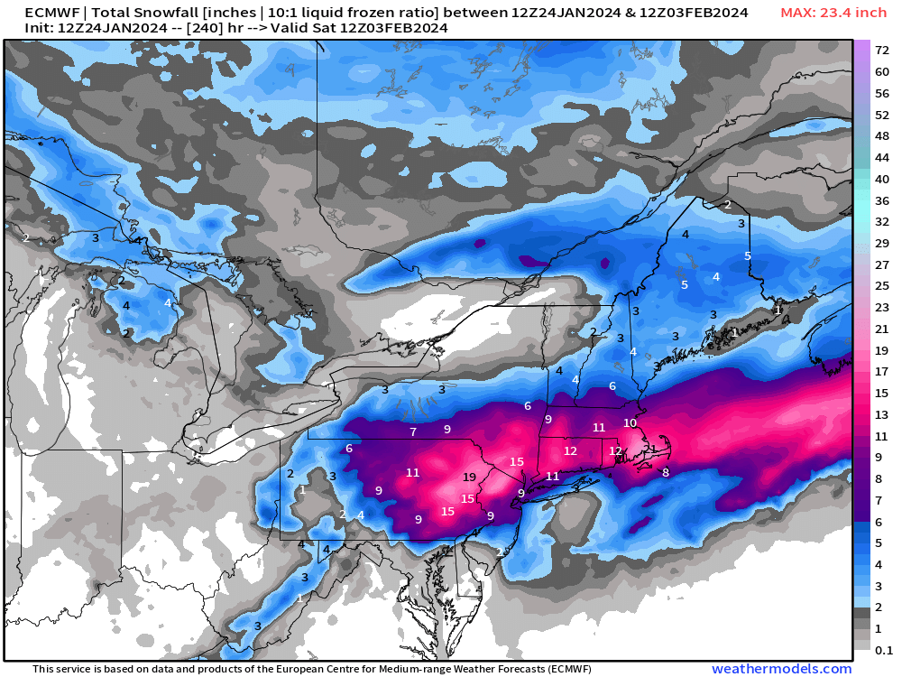
The full 10-day snowfall totals are wild! Of course, need to always qualify these snowfall maps as a plausible solution out of many possible solutions.
If we zoom out and only look through 6-days into early next week, the snowfall swath shows up beautifully. I guess I’m wish-casting a little bit, but will have a more confident answer on this coastal storm tomorrow.
At least we don’t need to talk about blow torch for 2-weeks.
(Maps from weathermodels.com)
Thank you to my paying subscribers!
Your support pays for my Linux servers and product development. Also, it allows me to provide (usually) interesting and valuable commentary on scientific topics on X. Feel free to say hello and follow on X/Twitter (@RyanMaue)
- Milepost
- 191 · laid 2024-01-25T00:26:11.971000Z
- Source
- https://weather.substack.com/p/january-24-2024-sneaky-noreasters
- Digest
- 2f12e98f9f3ffa6e55ca10ccb5164b70ae3b948b11fd03ab1d0df70c16e33352
- Machine
- JSON