January 10, 2024 Texas Arctic Blast
Extremely cold Canadian Arctic air to descend upon Lower 48
January 2024 was the 46th-warmest January in the 132-year national record (1895–2026), at 31.9°F against a 1991–2020 normal of 32.3°F (-0.5°F).
January 2024 was the 7th-wettest January in the 132-year national record (1895–2026), at 3.3in against a 1991–2020 normal of 2.3in (+0.9in).
NOAA/NCEI Climate at a Glance, contiguous United States. This is the observed record for the month, not a score of anything said in this piece — the forecast ledger begins 2026-08-17 and cannot reach earlier posts.
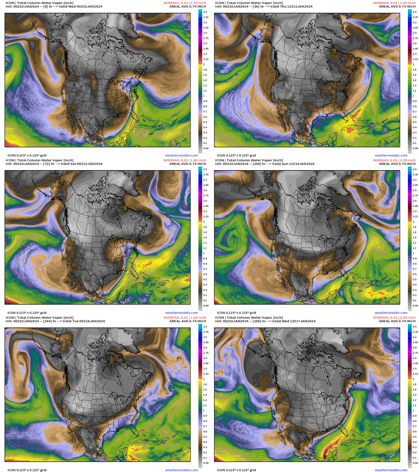
Over the next several days, an intense cold pool forming and intensifying over NW Canada will slowly but surely drain southward into the Lower 48. My favorite variable is precipitable water (PWAT) because it shows in a beautiful and simple way the weather systems e.g. fronts + atmospheric rivers, cyclones, and, of course polar air high pressure systems.
A battle is underway for Pacific moisture to smash into the high pressure associated with the Arctic blast by this weekend. However, it gets entrained into the subtropical jet and goes under the coldest air. However, some of that moisture will encounter the Arctic air on Monday and lead to potential for wintry precipitation across Texas that would exacerbate impacts from the Arctic blast.
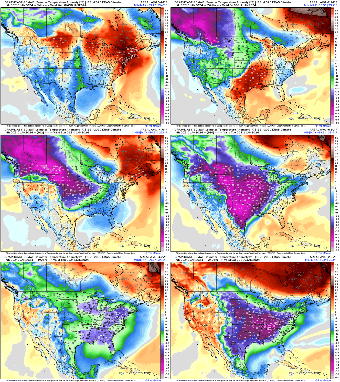
The GraphCast A.I. experimental model has been performing spectacularly with the intensity and details of the Arctic blast weather pattern. Indeed, it has been insistent upon a second surge of Arctic air in 8-10 days! Another Arctic blast. It should be noted that it accurately “sniffed out” and pinged the recent Winter Storms affecting the Northeast, and the A.I. system infers another major Nor’easter (like ECMWF) for the Northeast in 7-days.
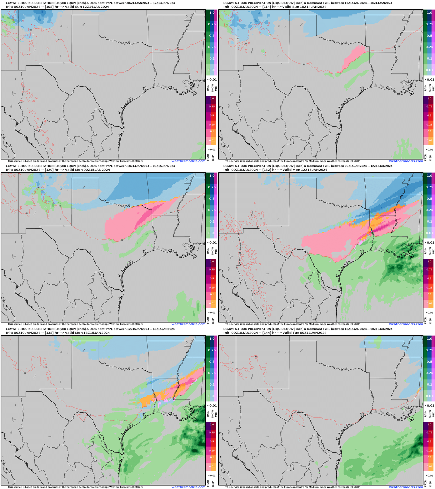
The conventional weather model (ECMWF) shows the evolution of the cold front and Arctic blast smashing undercutting the moisture in place across Texas. There is a threat of snow, freezing and sleet mainly late Sunday into Monday. However, amounts will be light and impacts should be more limited — compared to the debacle in February 2021.
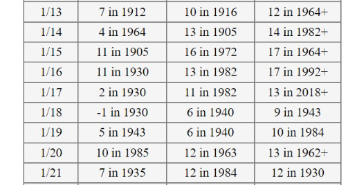
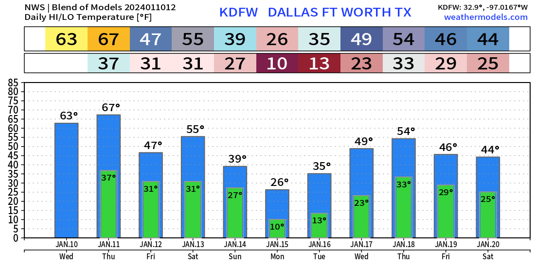
Dallas low temperatures into Monday and Tuesday morning will be in the 10° to 13°F range which could set record lows for the date. Texas is no stranger to extremely cold air in January, but this event is surprising since it is occurring during a strong El Nino winter and during the hottest year ever recorded on Earth in 100,000 years+ according to climate change experts.
The Blend of Models point forecast for DFW is close to the National Weather Service human-adjusted numbers in the next maps.
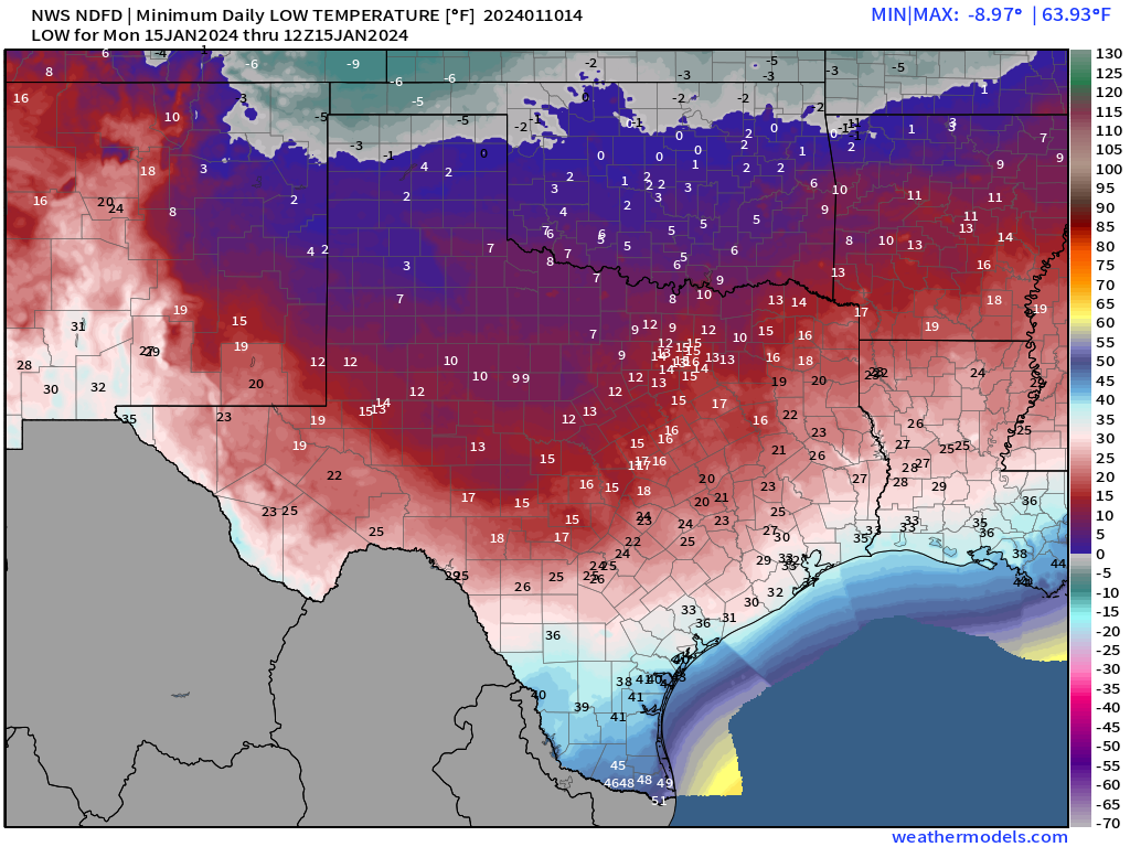
As the weather event approaches in the 5-7 day range, we get NWS forecast grids generated by human forecasters at each National Weather Service office.
Monday morning’s lows will be Step 1 with some warming during the day on Monday, and then colder again on Tuesday.
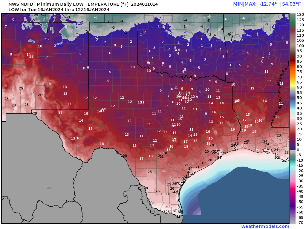
Tuesday morning lows statewide would be around 14.5°F
Some historical context for January in Texas — statewide average low temperatures:
Last time this cold in January?
Jan 9, 2010: 13.8°F
Jan 21, 1985: 14.1°F
Jan 19, 1984: 14.4°F
Overall:
Dec 23-24, 2022 Christmas Eve cold snap 12.2° | 13.0°F
Feb 15-17, 2021 6.6° | 5.0° | 12.2°F
Blend of Models Forecasts
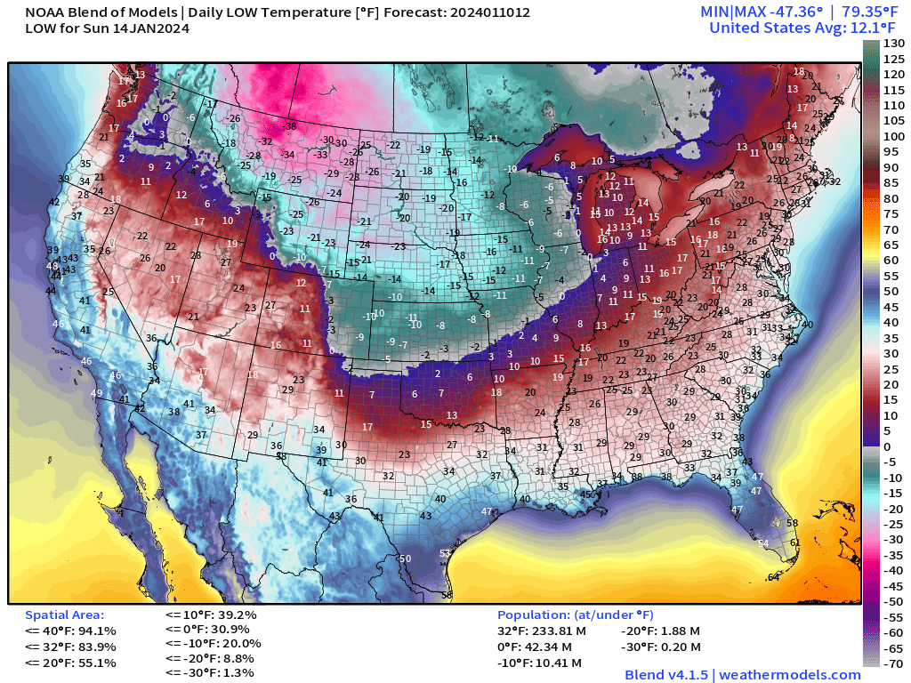
Lower 48 view of Low temperatures from Sunday to Tuesday from an ensemble system.
Next Sunday Low Temperatures | January 14, 2024
Next Monday Low Temperatures | January 15, 2024
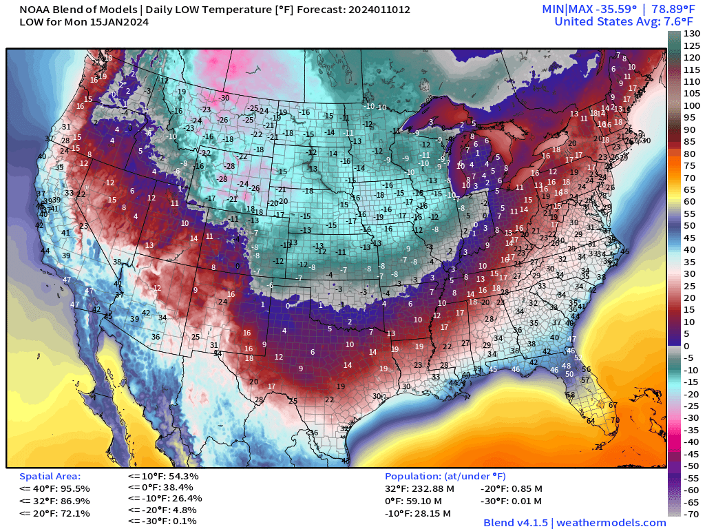
Lower 48 average low temperature of 7.6°F. This is trending downward in the Blend of Models. 87% of Lower 48 area below freezing and 233 Million Americans. 59 Million at/below 0°F.
Next Tuesday Low Temperatures | January 16, 2024
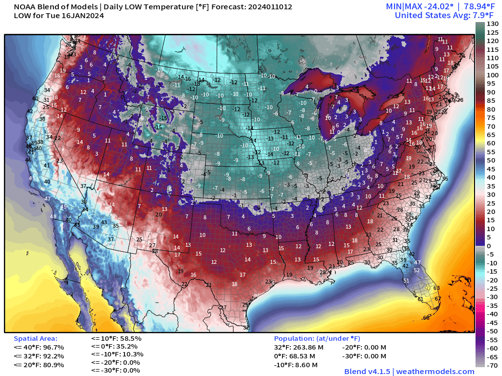
Similar low temperature of 7.9°F for Tuesday as well. 264 Million Americans at/below freezing and 69 Million below 0°F.
The Blend of Models in the 7-day + range uses the various global models and ensembles to build temperature forecasts out to 10-days.
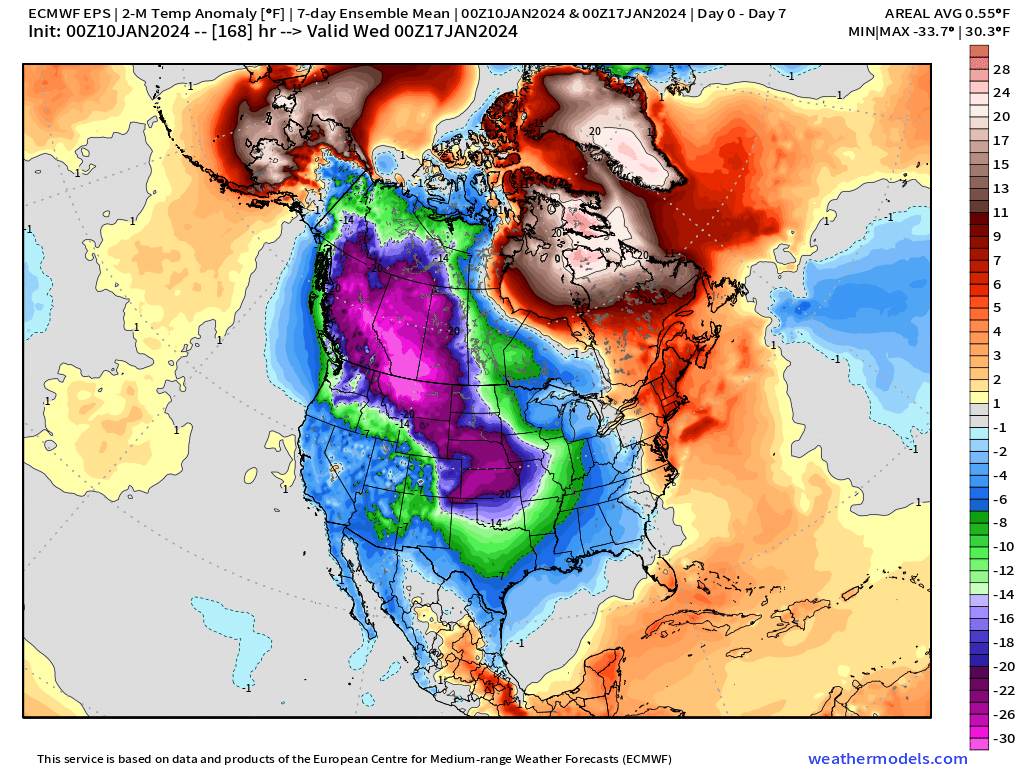
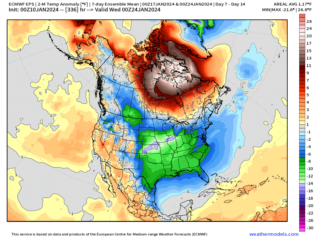
Temperature Outlook Next 2 Weeks
Week 1: January 10 - January 17, 2024 [EPS Mean 12z]
Week 2: January 17 - January 24, 2024 [EPS Mean 12z]
8-Day Snowfall Median | EPS 12Z
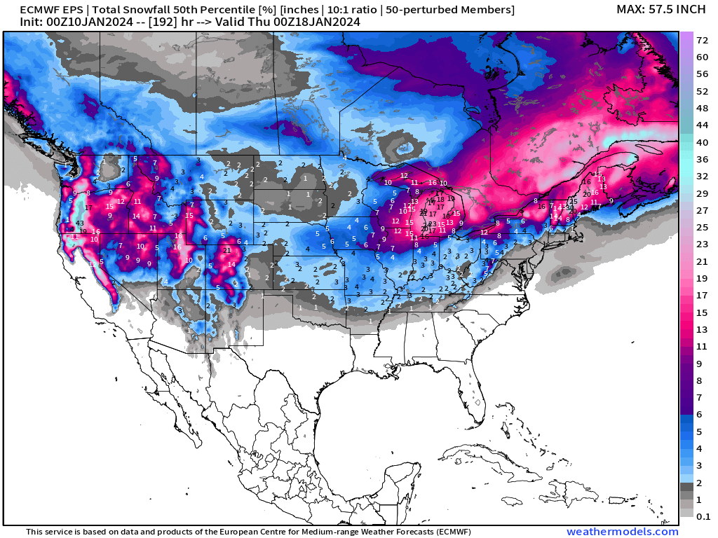
Coming Down the Pike
Midwest “bomb cyclone” Friday-Saturday
Nor’easter next week — potentially very intense
Another Arctic Blast?
All maps are probably from weathermodels.com (please subscribe there for affordable, professional, and beautiful weather maps created by yours truly).
Thank you to my paying and freemium subscribers!
Your support pays for my Linux servers and product development. Also, it allows me to provide (usually) interesting and valuable commentary on scientific topics on X. Feel free to say hello and follow on X/Twitter (@RyanMaue)
Old News:
This newsletter will rebrand in 2024 as part of roll out of [WT] https://weathertrader.com
- Milepost
- 179 · laid 2024-01-10T15:23:44.688000Z
- Source
- https://weather.substack.com/p/january-10-2024-texas-arctic-blast
- Digest
- 0ad81acd4ff97af41237c87971032280864751b66fcf06dfa73604d044add88a
- Machine
- JSON