Arizona and Florida drenched over the past several days with flooding rains

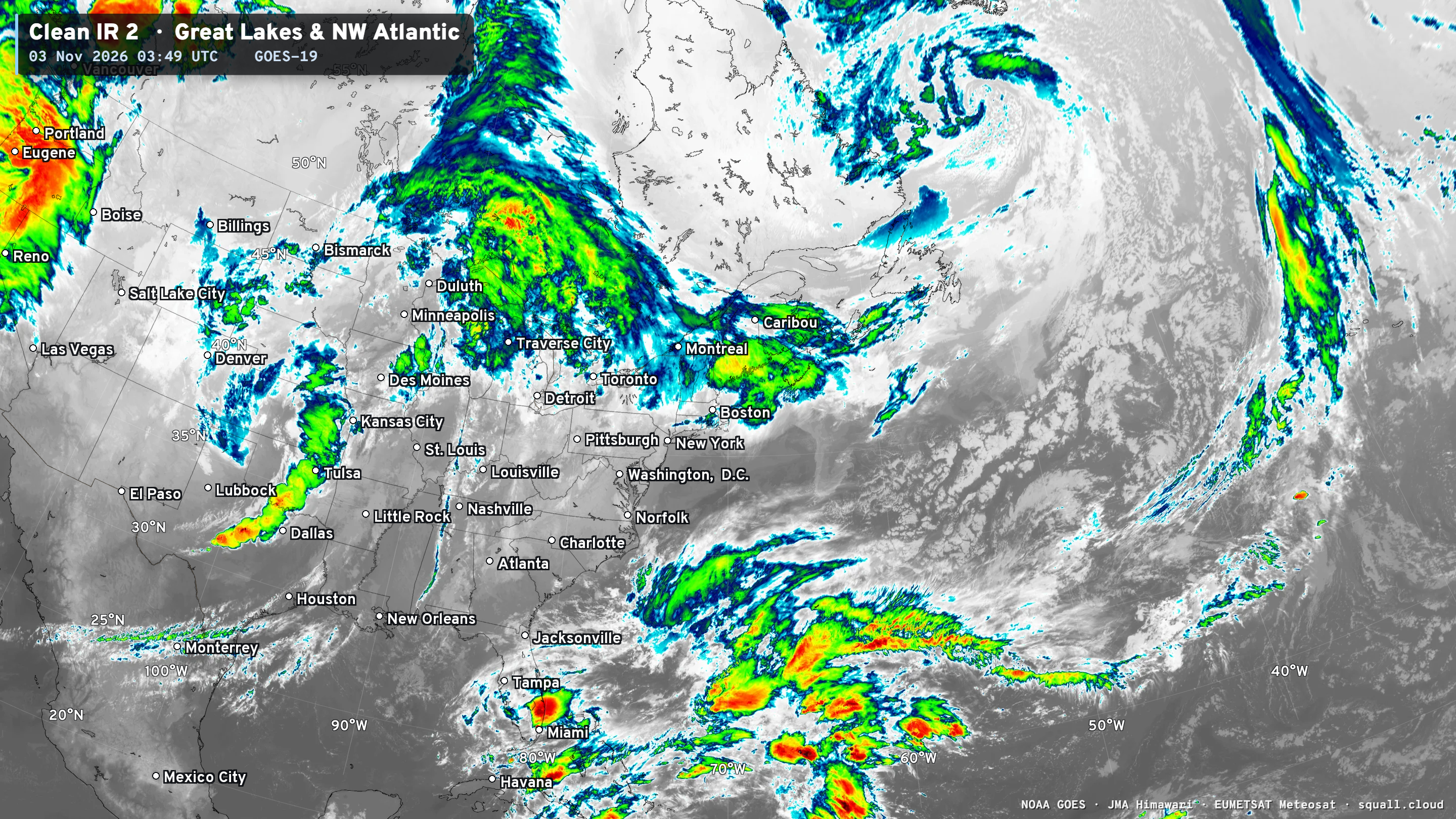
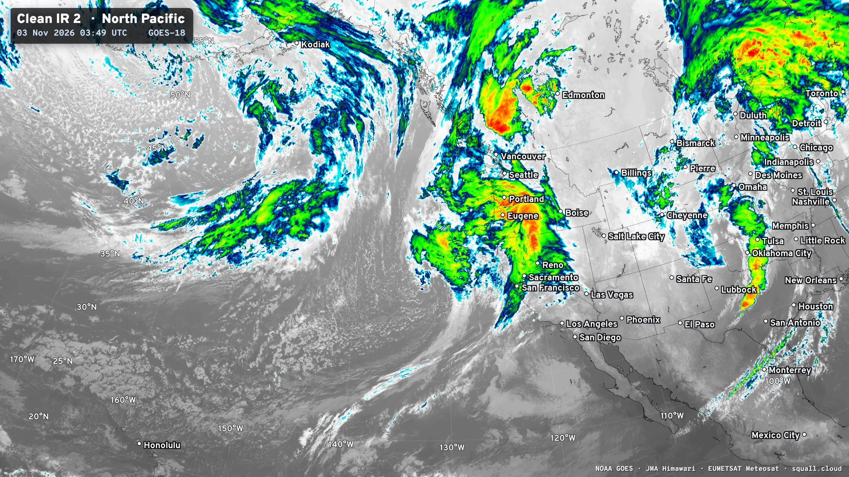
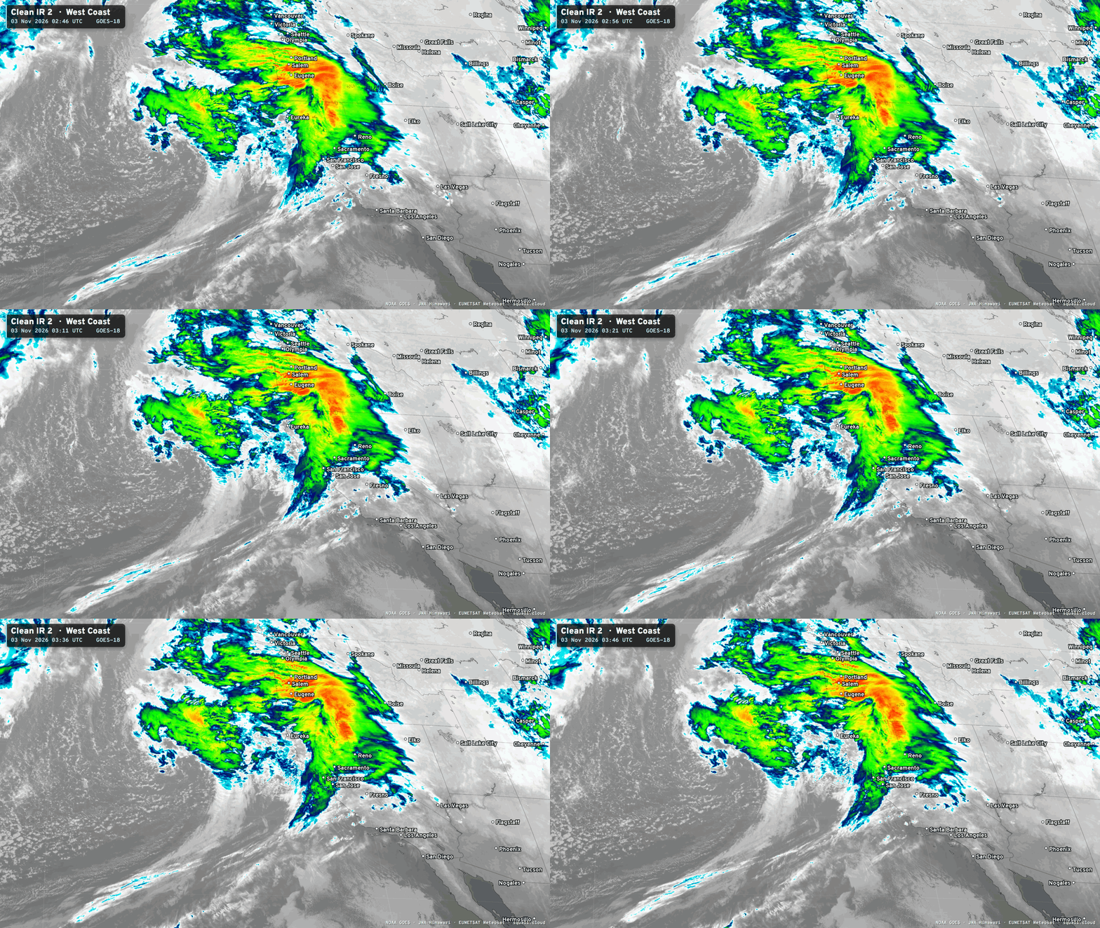
A storm system is swirling off the West Coast of California this evening
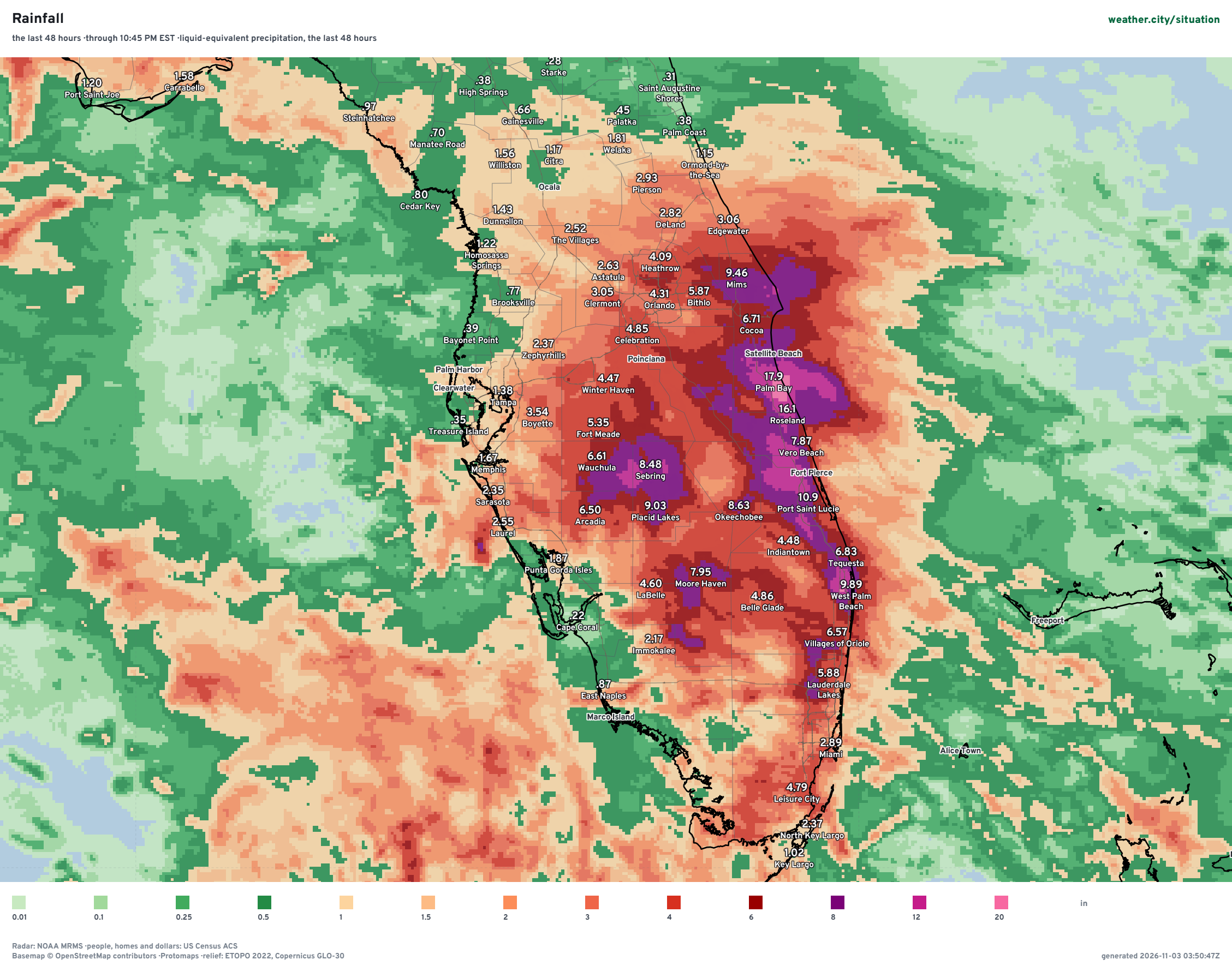
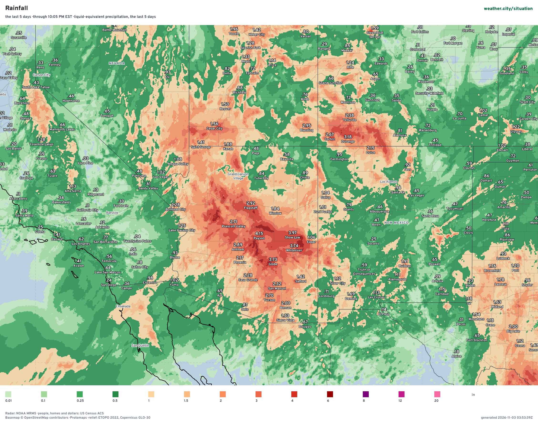
Situation Monitor (Weather City) Last 48-hours of Rainfall
Florida — flooding emergency in Brevard County with upwards of 20” of rainfall in short order (last 12-24 hours) … these would be decent snowfall numbers for a winter storm, but instead we have 8”-12” of rainfall from easterly flow from the Atlantic.
Not sure how much of this is related to El Niño specifically.
Much easier case to make for Arizona and the Four Corners with Phoenix metro seeing 2” to 4”+ rainfall — and widespread similar accumulation for the rest of the state. The “stubby” atmospheric river and storm system — now in the central U.S. — really did a number on the Southwest. I would link the subtropical moisture plume to the exceptional warmth in the Central Pacific due to El Niño. But, we still need a mechanism to help “conveyor” the rain into the SW — and that’s an upper-level trough / cut-off low — like a bowling ball in the middle-levels rotating cyclonically. Its origin was off the main polar front in the Gulf of Alaska.
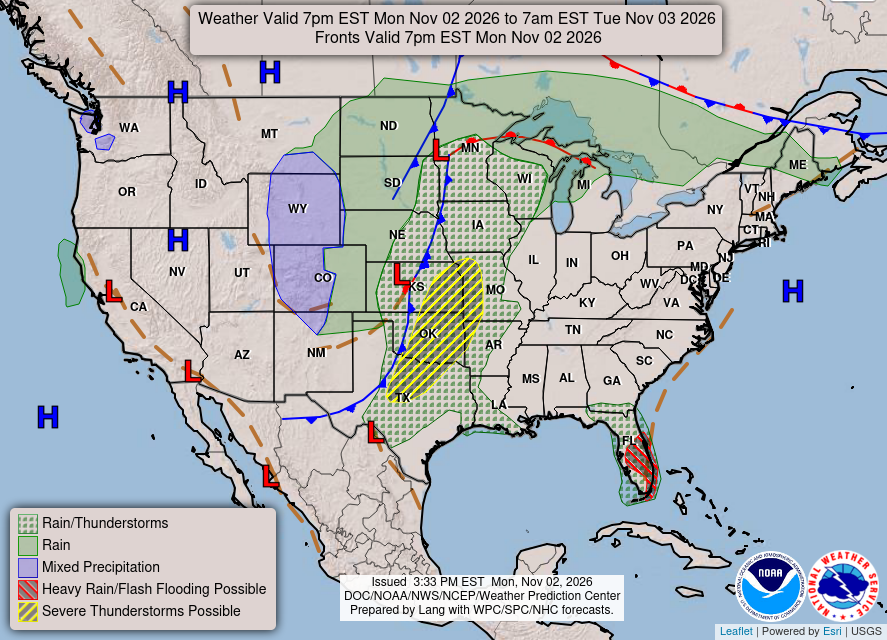
Weather Late Monday Evening | Frontal Boundary and Low Pressure in Kansas and Minnesota and severe storms in Oklahoma. Continued heavy rain in Central and South Florida.
HRRR Simulated Radar through Wednesday 7 PM ET
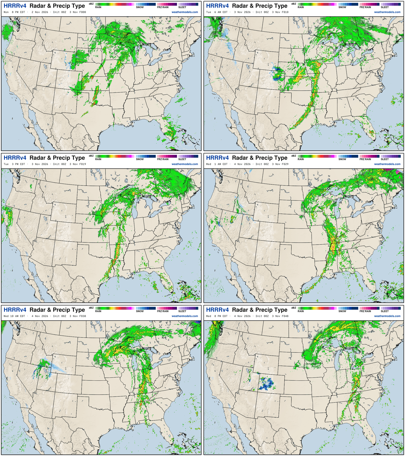
Storm system matures over the Great Lakes — and the frontal boundary nicely adds Gulf moisture — to give the rest of the Southeast a welcome drink — could be some severe weather, too on Tues/Wed along the front.
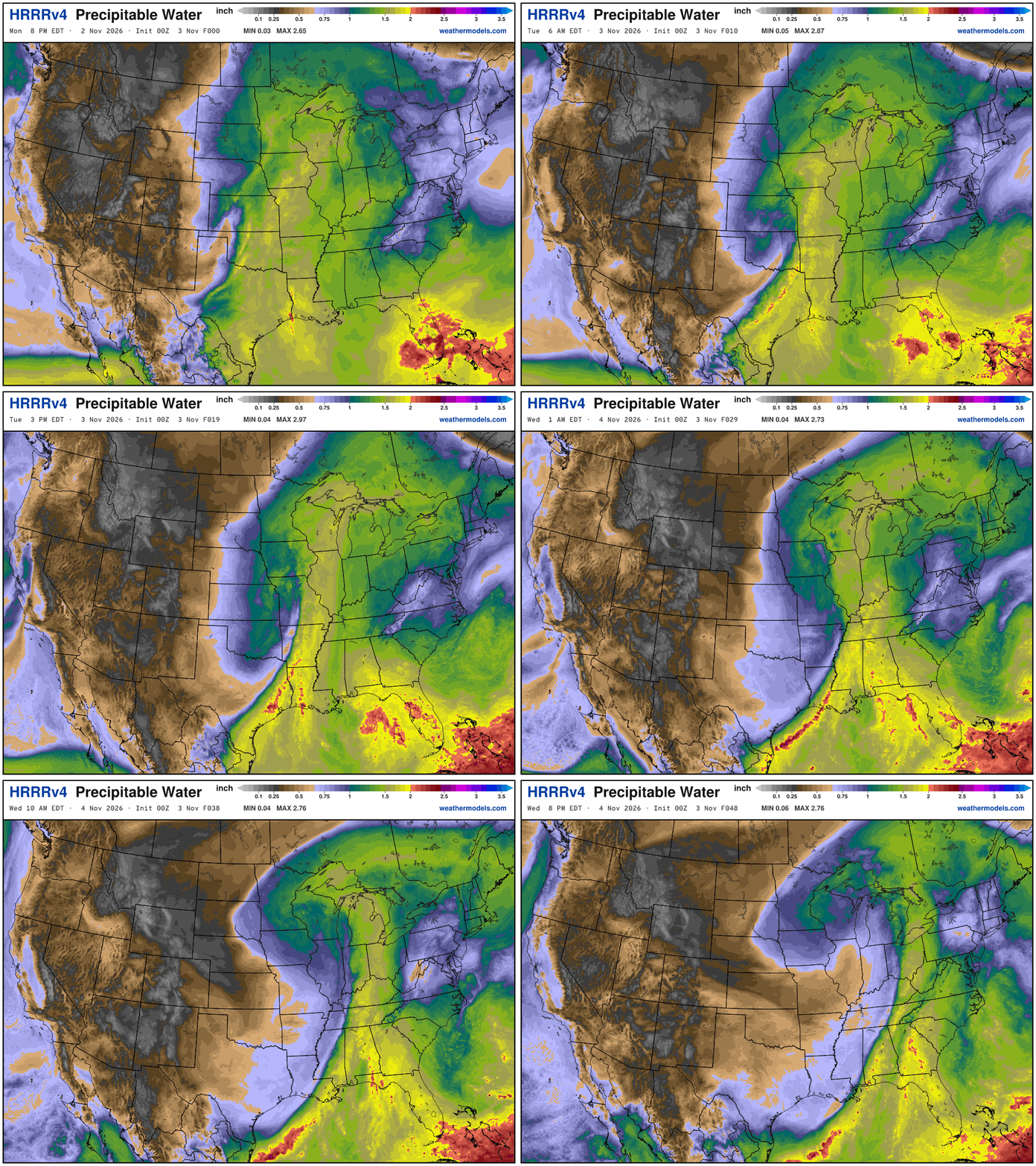
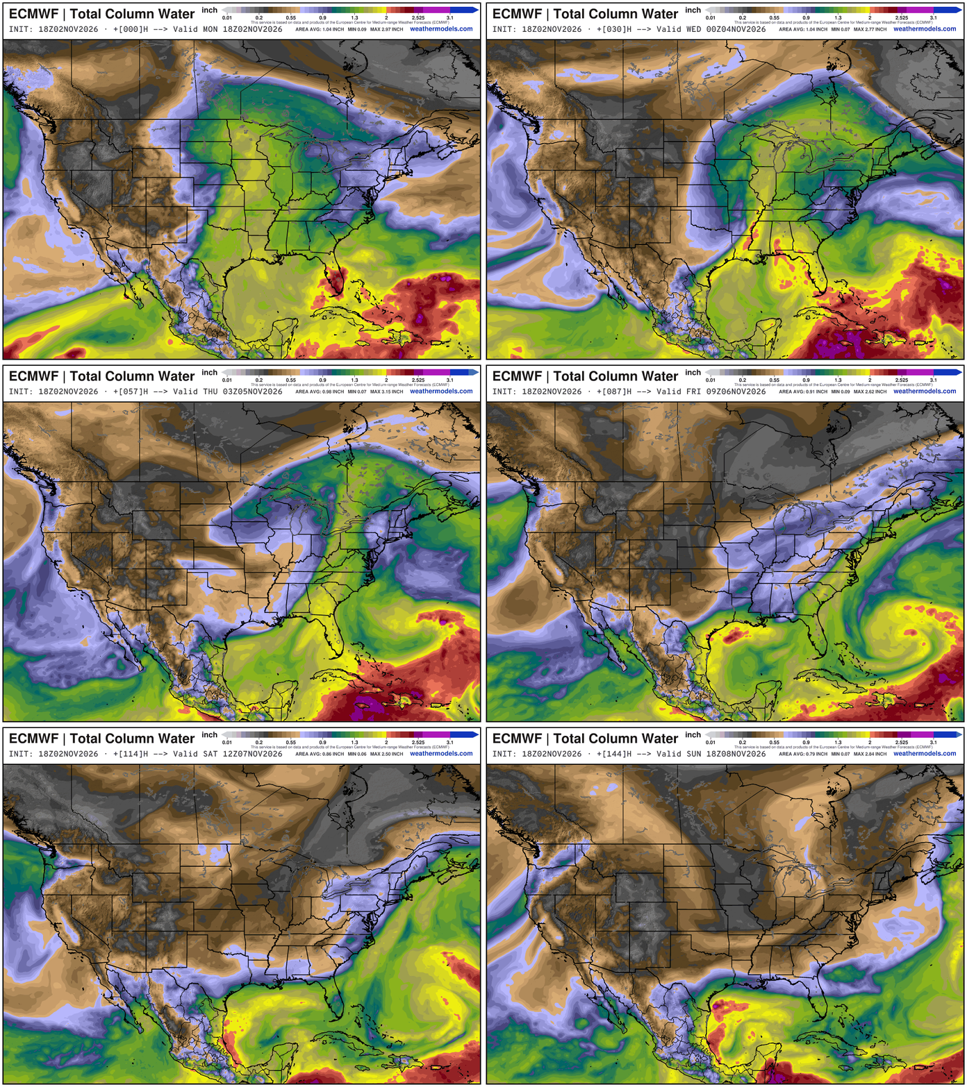
My favorite parameter with a “giant eraser” frontal boundary + the disturbance moving westward across Florida.
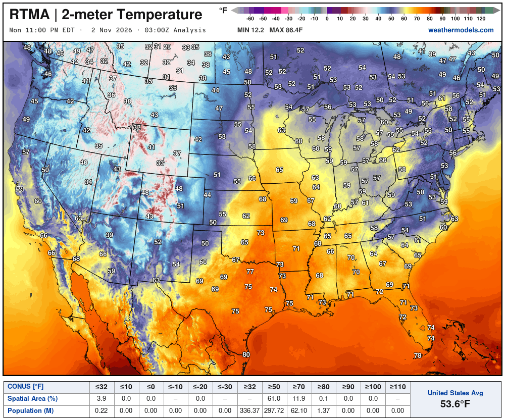
Temperature Analysis this Morning at 10:00 PM ET
Temperature Analysis | Anomaly from Normal
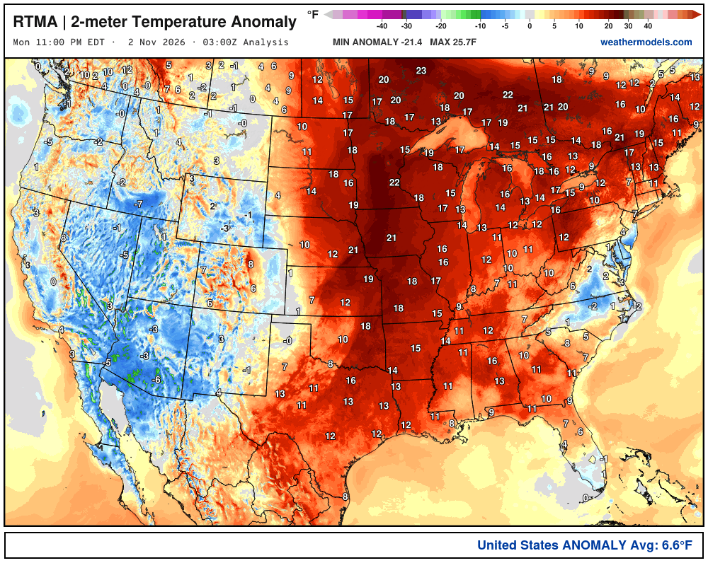
Lower 48 was a whopping 6.6ºF above normal
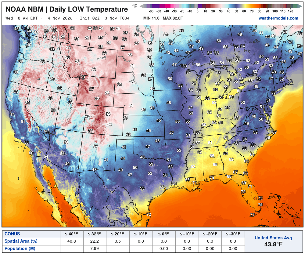
Low Temperatures Tuesday Morning
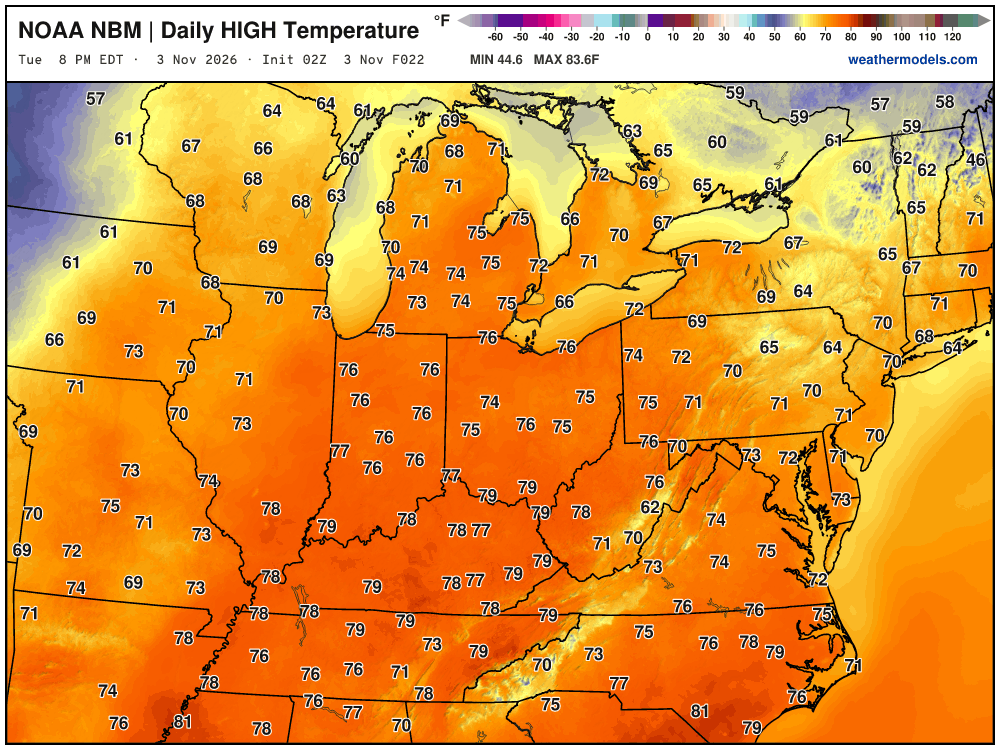
High Temperatures on Tuesday | Election Day
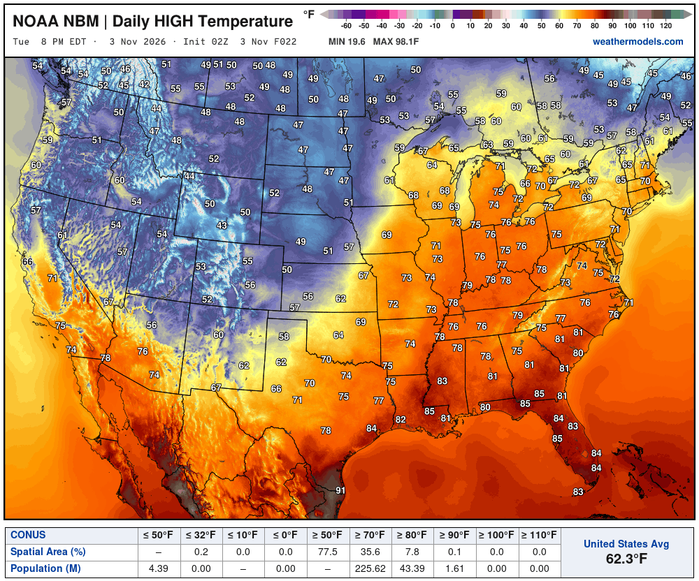
Very warm — in the 70s across the Eastern U.S.
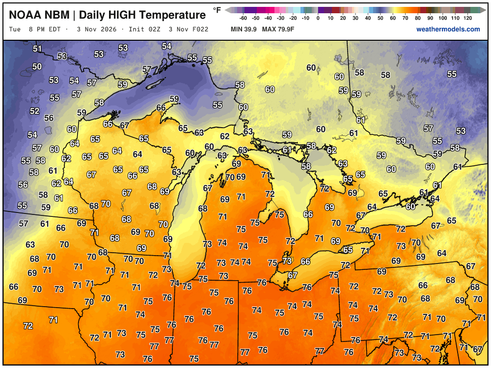
75°F to 77°F
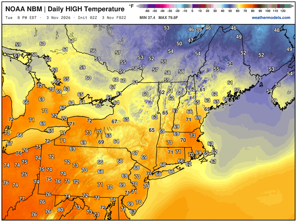
Around 70° in New York City on November 3rd. No complaining.
High Temperatures next 9-Days through November 12th
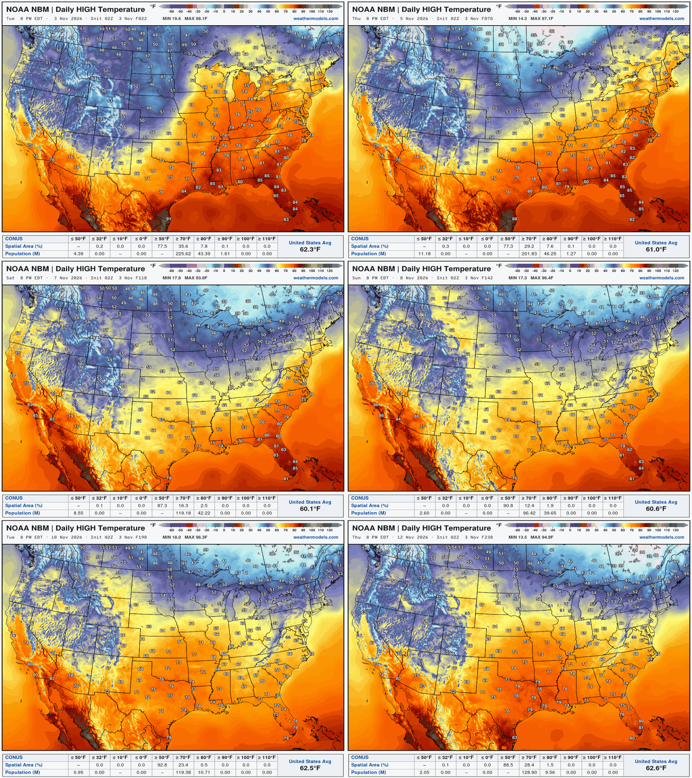
Well above normal temperatures continue into mid-November as any Arctic air is bottled up somewhere up in the Arctic near Greenland.
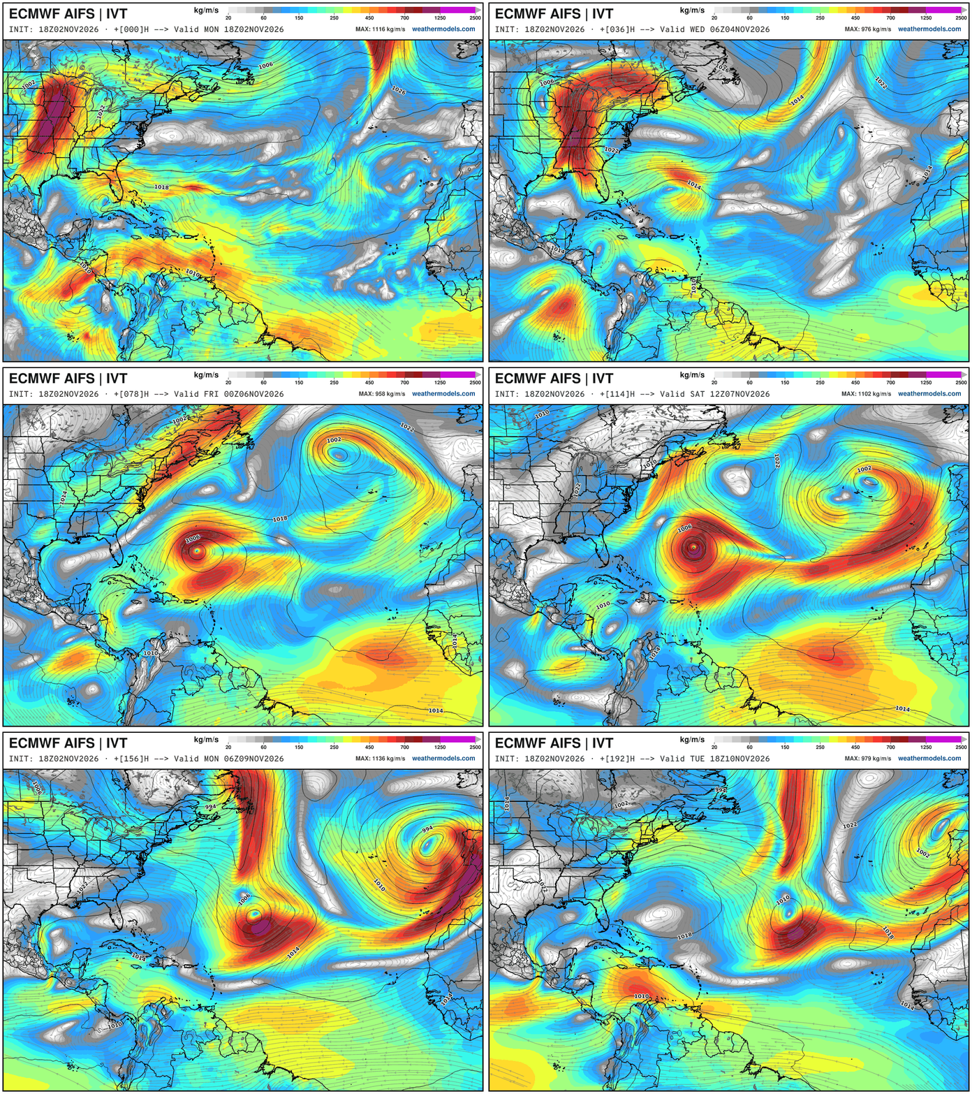
Integrated Vapor Transport Next 10-days | ECMWF AIFS 18z
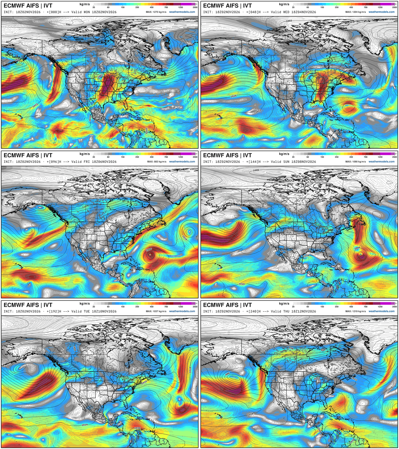
Pattern shift to strong Pacific troughs — crashing southward along the Pacific NW coast … until perhaps California gets involved in 10-days.
The ridging in the central U.S. means a very warm central and Eastern U.S. but we need to watch the Northeast for shortwaves, and then perhaps a cut-off on the downstream flank of the omega block.
A likely named Subtropical Storm forms east of the Bahamas, and continues out to sea.
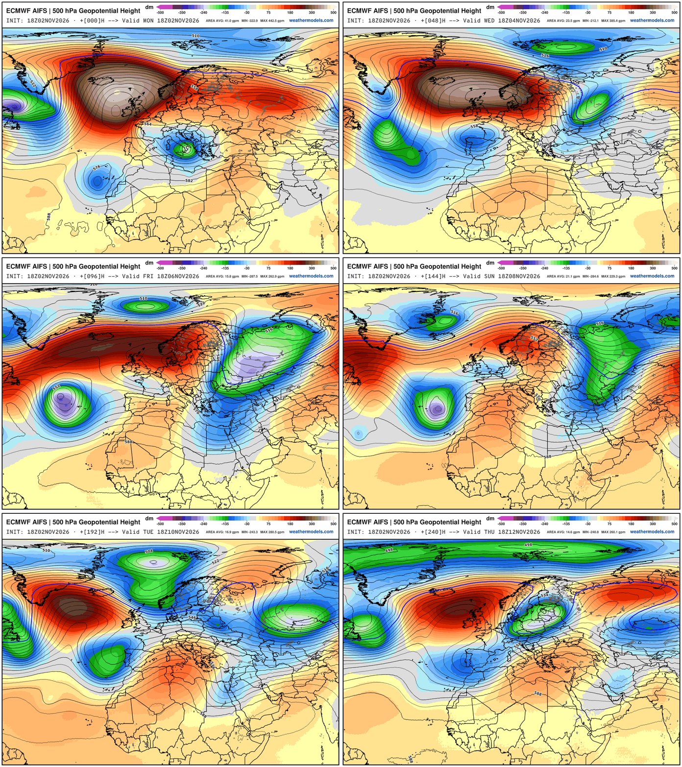
Height Anomaly Pattern | Next 10-days | AIFS 18z | Flagship model
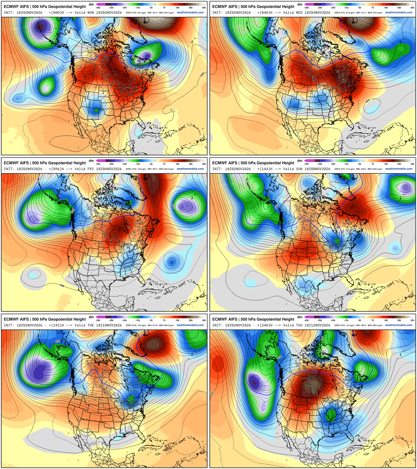
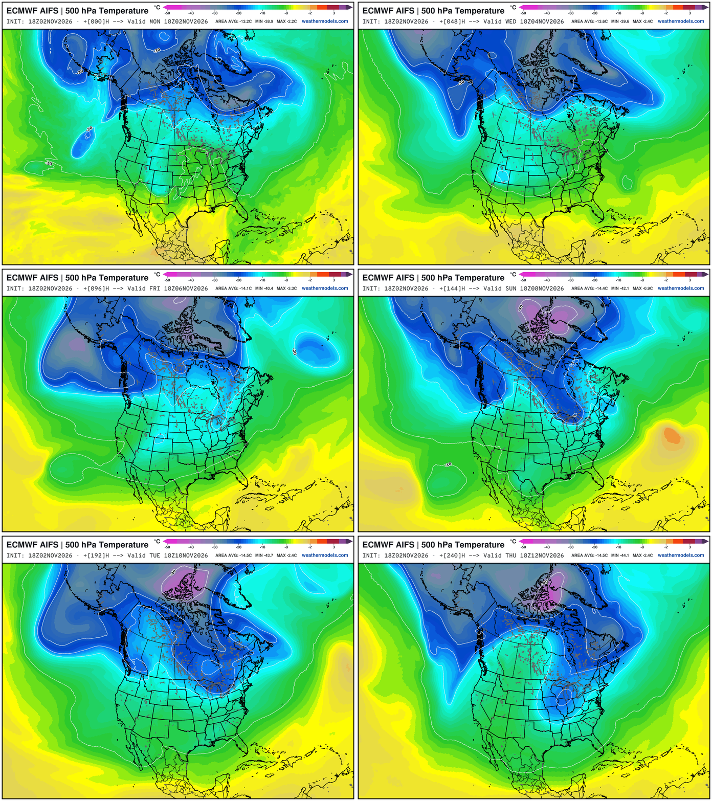
Large scale pattern —> Parade of troughs dipping across the West Coast — and ridging east of the Rockies. But, the new feature for late next week is one of these Pacific cut-offs travels through the southern U.S. under the block, and then finds access to the polar front again, accessing some colder Arctic air … 500 hPa Temperature is the best way to show the “polar vortex” intrusions. We should watch for some interior New England snowfall potential into next weekend.
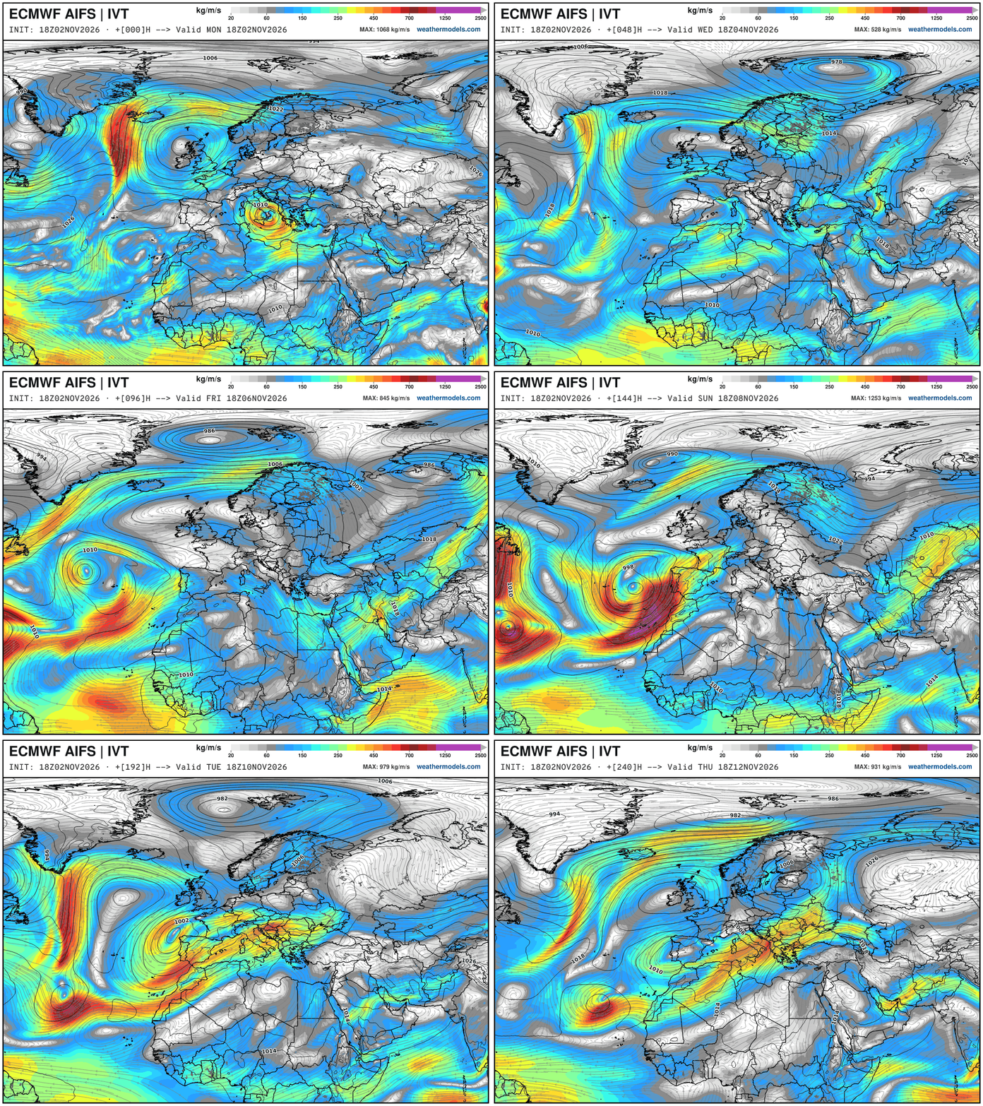
European pattern shift with warmer Atlantic air finally arriving with a strong storm system + atmospheric river into Spain by weekend.
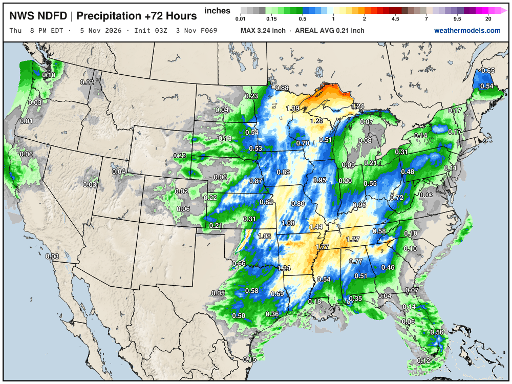
NWS NDFD Next 3-days precipitation
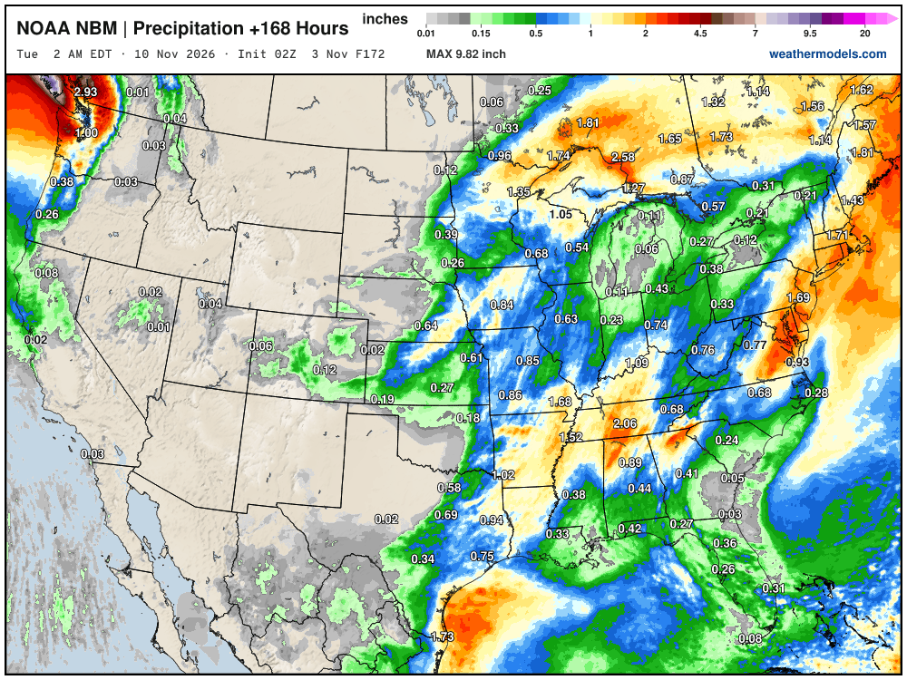
Blend of Models Precipitation Next 7-days | Lower 48
My favorite parameter — precipitable water | ECMWF 18Z next 6-days
Blend of Models Snowfall Next 10-days
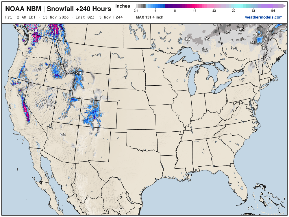
Still waiting on our first Eastern U.S. snowfall through first 13 days of November.
Snowfall Next 15-days | ECMWF Ensemble 12z Median
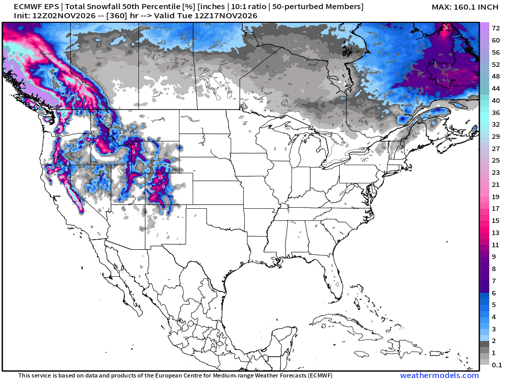
Slowly but surely as these maps head into early November — we’ll see our first legitimate chances of a snow storm for the Midwest, Great Lakes, and Northeast — not yet. Zilch.
Probability of 1-inch or more of snowfall through November 17th
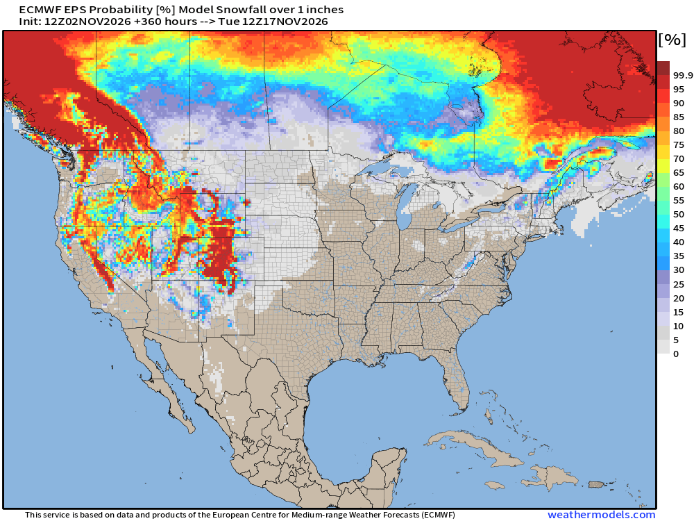
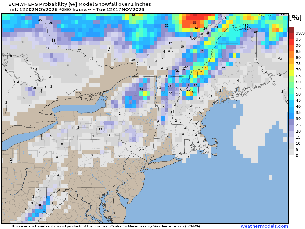
Only high elevation snowfall chances.
Week 1 Temperature Anomaly | Nov 2 - Nov 8 | Eastern Warmth
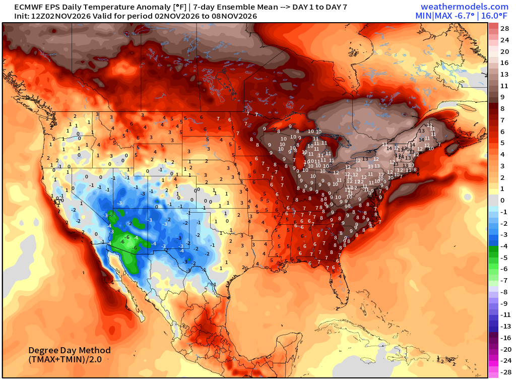
10° to 15°F warmth for the Midwest …
Week 2 Temperature Anomaly | Nov 9 - Nov 15
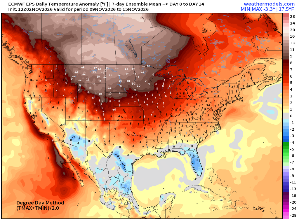
Blow torch continues into second week of November across Canada, and much of the Lower 48
North Atlantic Hurricane Season
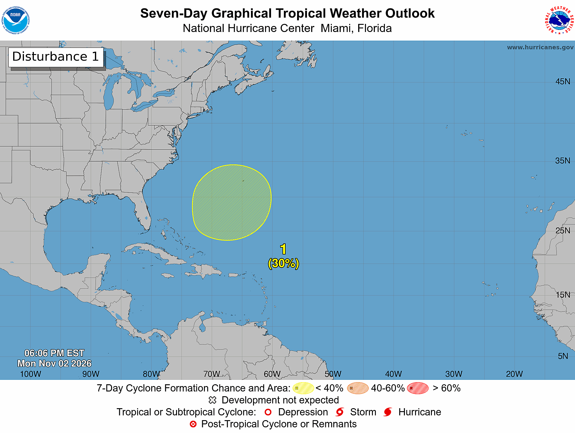
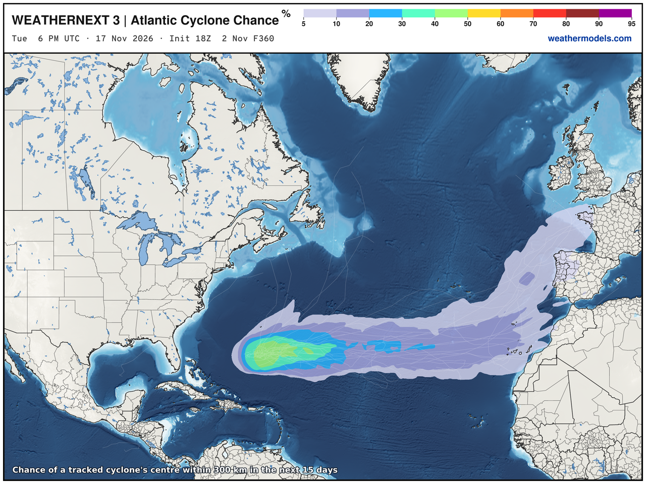
30% chance of subtropical storm formation — I think it’s going to happen
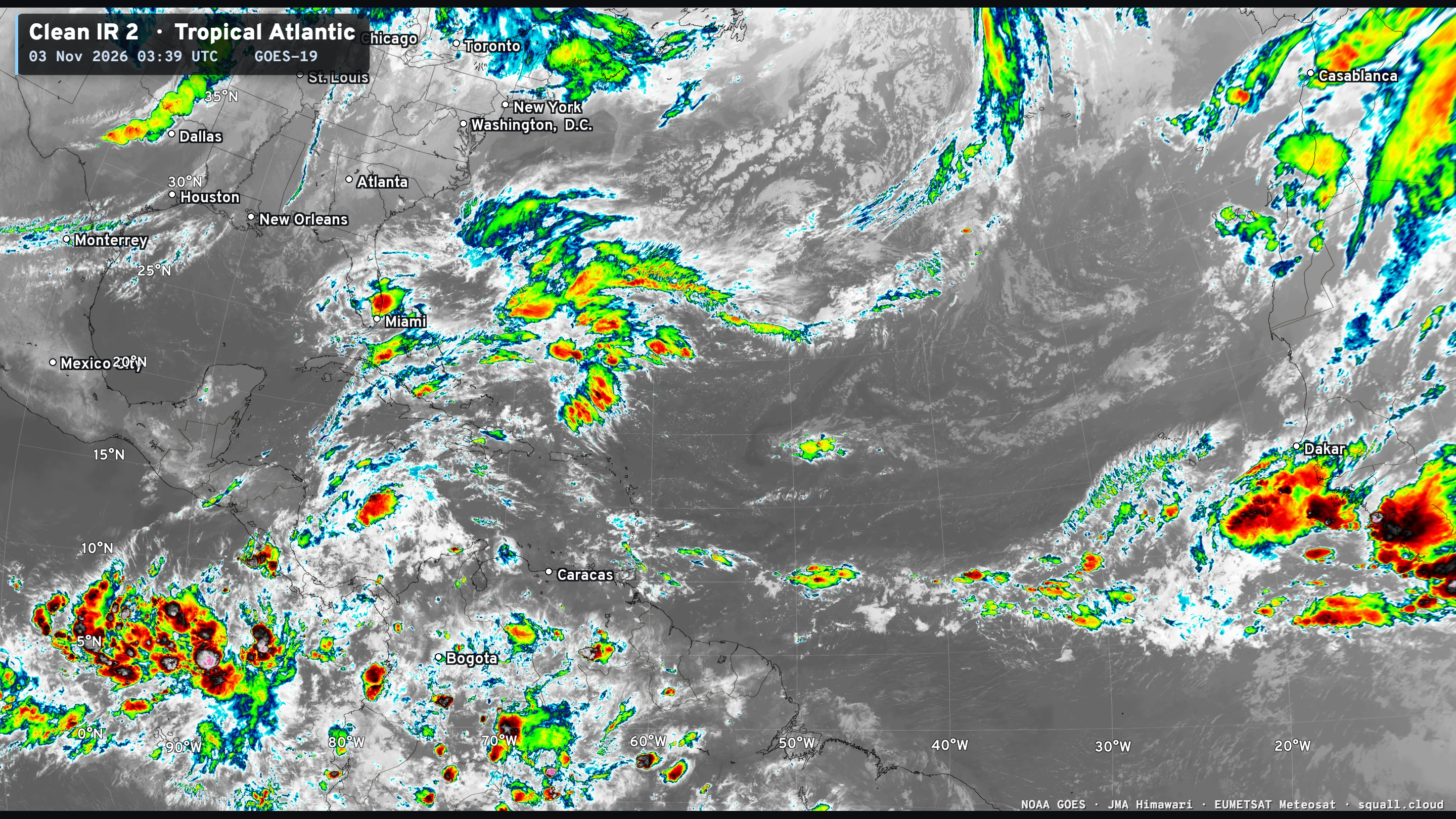
The storm system ahead of the Subtropical System is extratropical — and associated with a trough (cut-off) and might be impactful for Portugal and Spain.
So, the hurricane season continues — with named subtropical storms.
Next name is Kyle.
Eastern Pacific | 70% area at low latitude
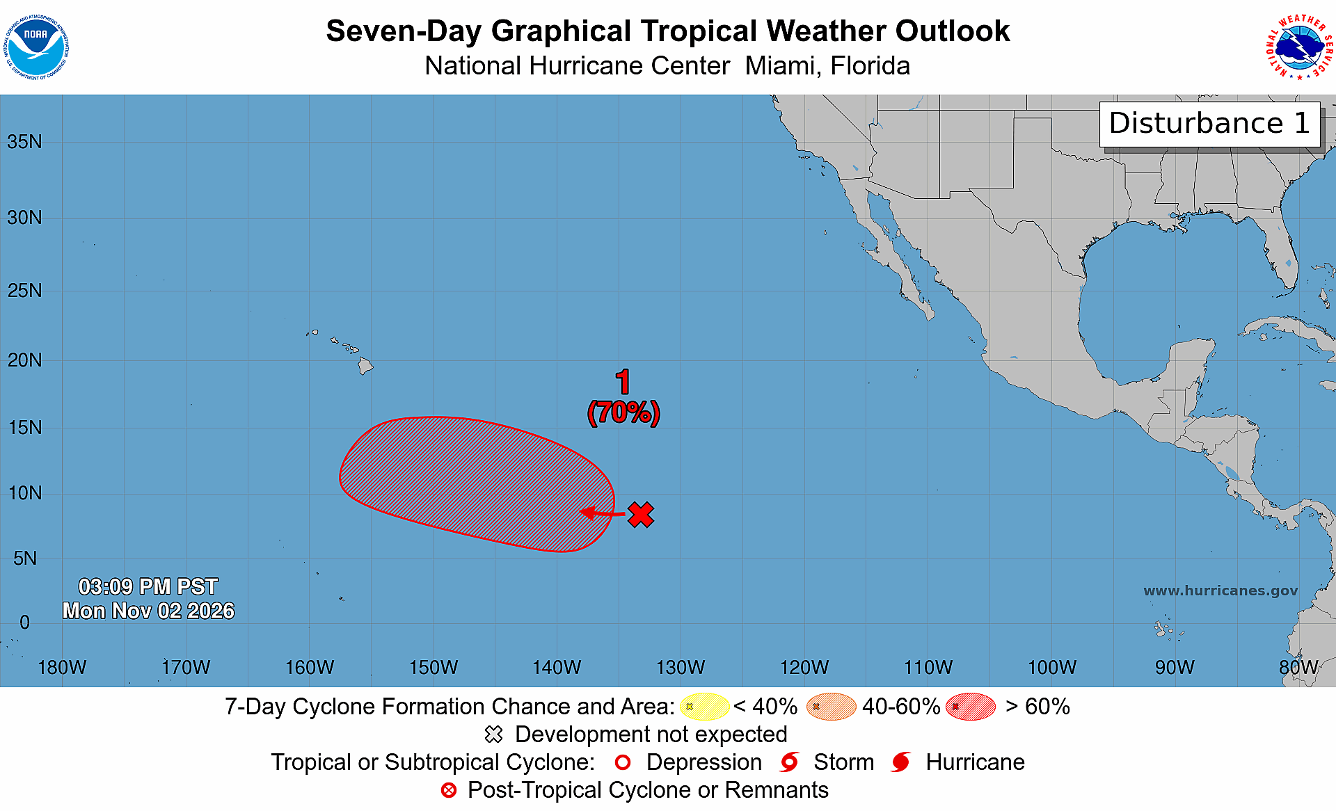
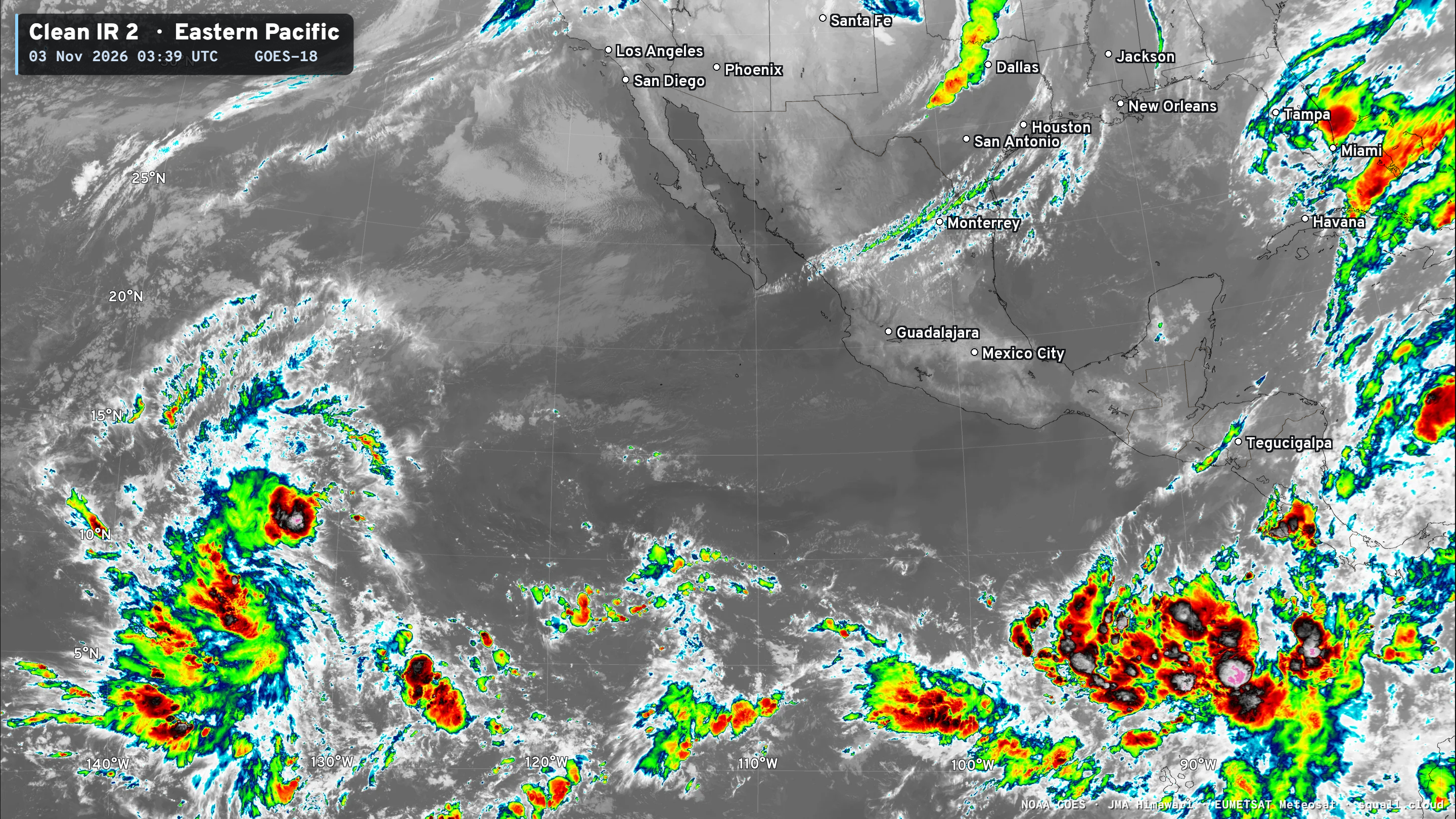
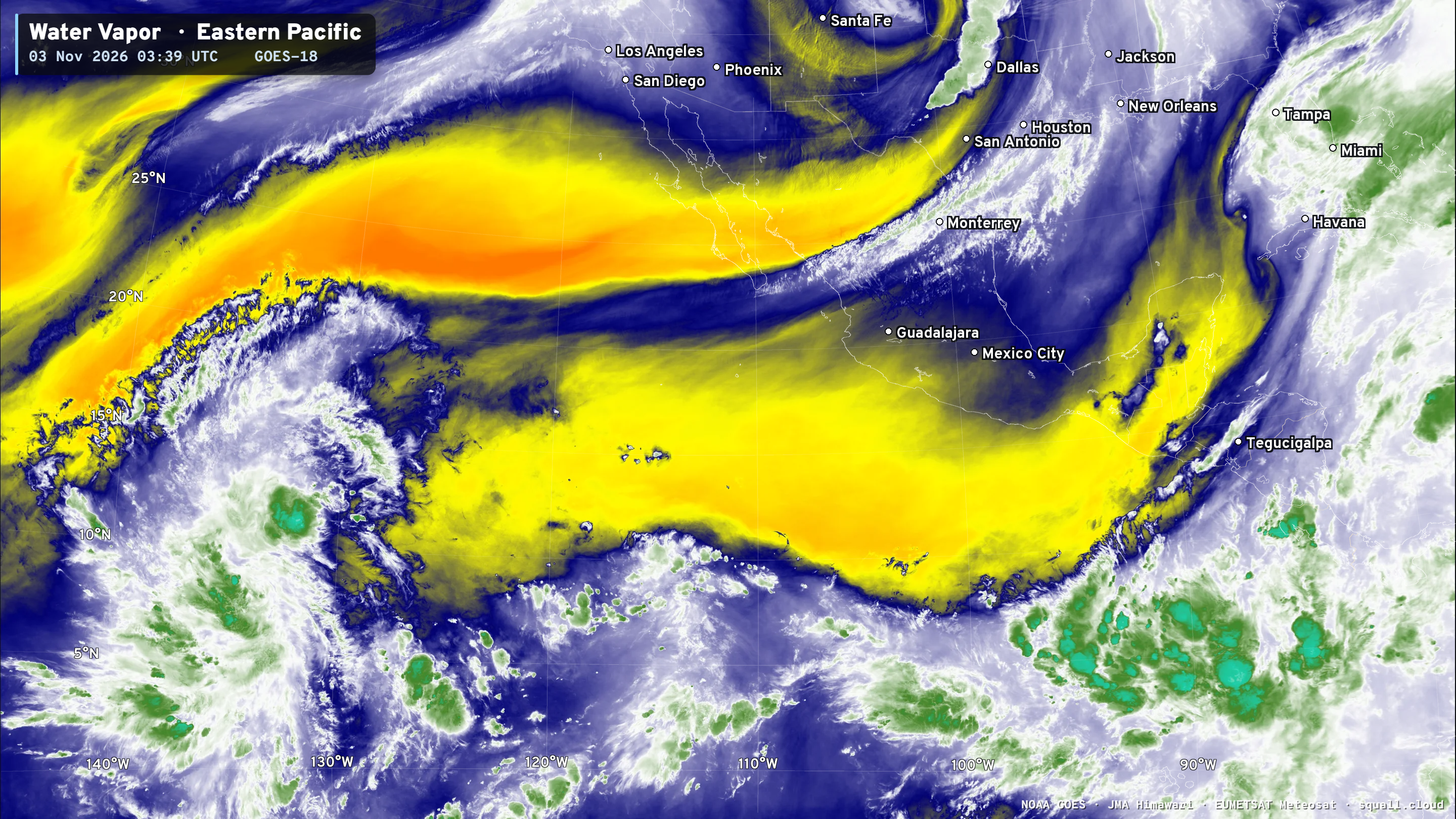
Next name in the Central Pacific is Pena — but I’m not sold on it happening.
Thank you for visiting / reading — always more to come!
Visit Global Tropical Cyclones w/Dr. Pielke Jr. for more ACE information, as well as my original climatlas.com/tropical site with much new research including a calibrated “Best Track” and historical tropical cyclone browser with plenty of interesting features like rankings of storms by their IKE (size). ACE up to 945

Satellite imagery from Squall Cloud. Maps sourced from weathermodels.com designed and innovated by yours truly! Please subscribe there for real-time access to the newest maps, charts from all of the weather models including ECMWF and AIFS, and NOAA GFS/GEFS, HRRR/RRFS and Blend of Models (NBM). NOAA WPC and SPC for fronts/convective outlooks. Our own content is now sourced from hottestsince.com and weather.city and celsius.earth, and global-tropical-cyclones.com and precip.earth and forecastcanada.com and forecastgermany.com
Atlantic Hurricane Season | YTD: 10 Named Storms, ACE = 19.5
NE Pacific Hurricane Season: YTD: 24 Named Storms, ACE = 355
My Atlantic Hurricane Season Forecast (2026)
From April 7, 2026: Atlantic Seasonal Hurricane Forecast: (11/5/2)
9-13 Named Storms (11 most likely)
4-7 Hurricanes (5 or 6 most likely)
1-3 Major Hurricanes (2 most likely)
Accumulated Cyclone Energy: 75-85 (well below normal)
NOAA 2026 Atlantic Hurricane Season Forecast
- Milepost
- 1634 · laid 2026-11-03T04:39:51Z
- Source
- https://weather.substack.com/p/november-2-2026-monday-weather-update · November 2, 2026 Monday Weather Update
- Tagged
- I-500 Daily Weather · Florida (28.1, -81.7) · by rule, at build
- Digest
- 31b7db916196a571bcb41f68550f468c756262dfefaf9761504b8c35da616ffb