September 6, 2026 Sunday Evening Weather
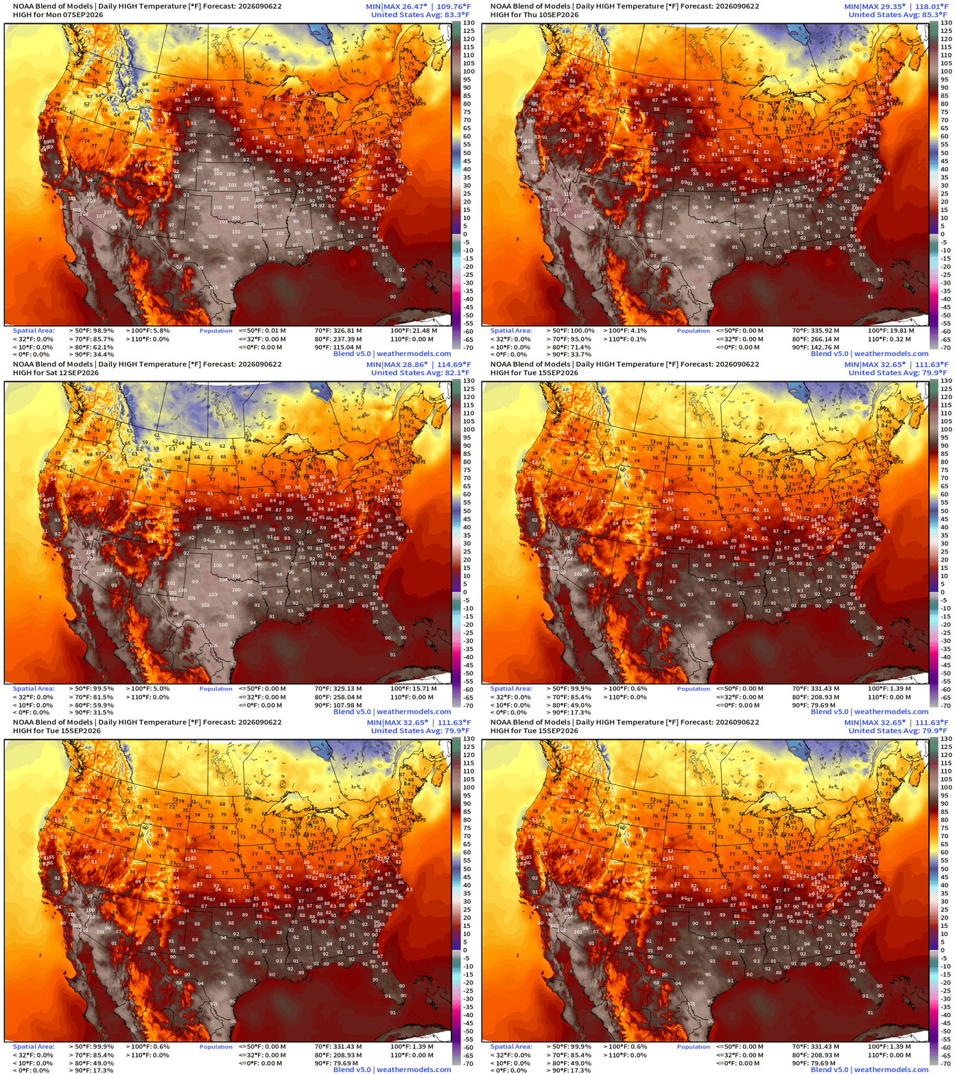
Very hot week ahead as a stubborn heat dome remains anchored over the Lower 48

Happy Labor Day Weekend from Weather Trader! (Ryan)
And, Go Blue! There’s always a second left on the clock!
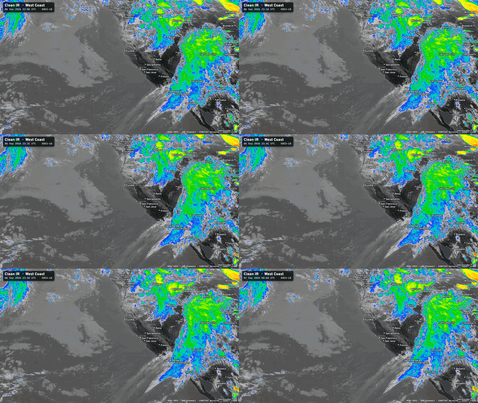
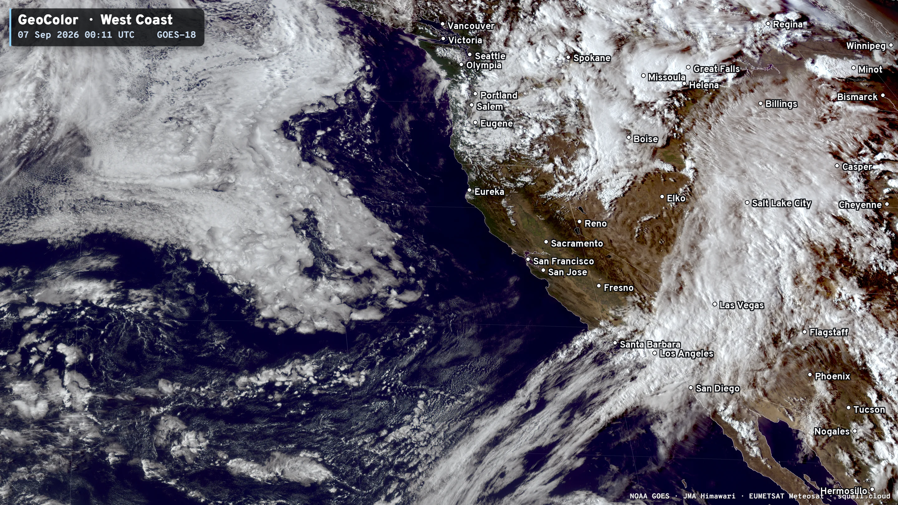
Plenty of rain/shower activity this evening across the Lower 48 including a tropical moisture stream into Southern California ahead of an upper-level trough.
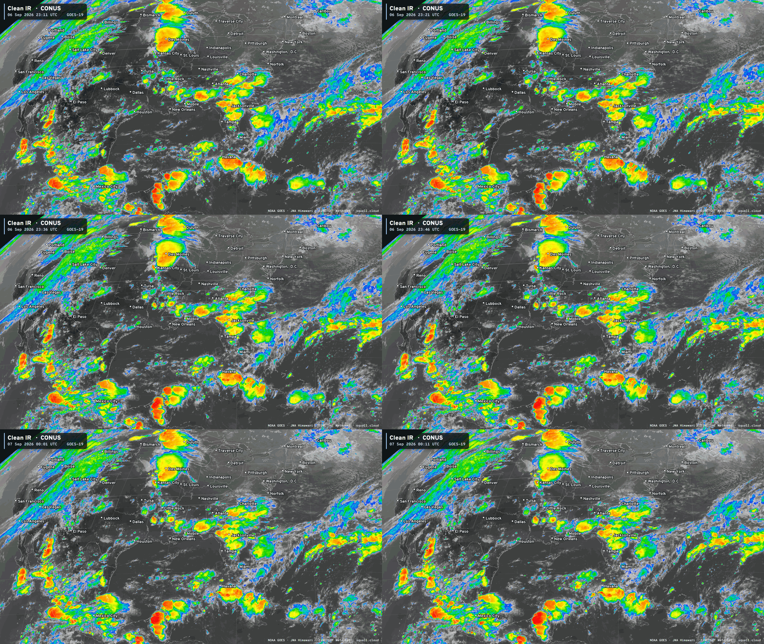
The Los Angeles Dodgers are not going to be rained out Sunday night, but rare drenching rains through SoCal for early September, of course related to El Niño and Hurricane Marie well off shore.
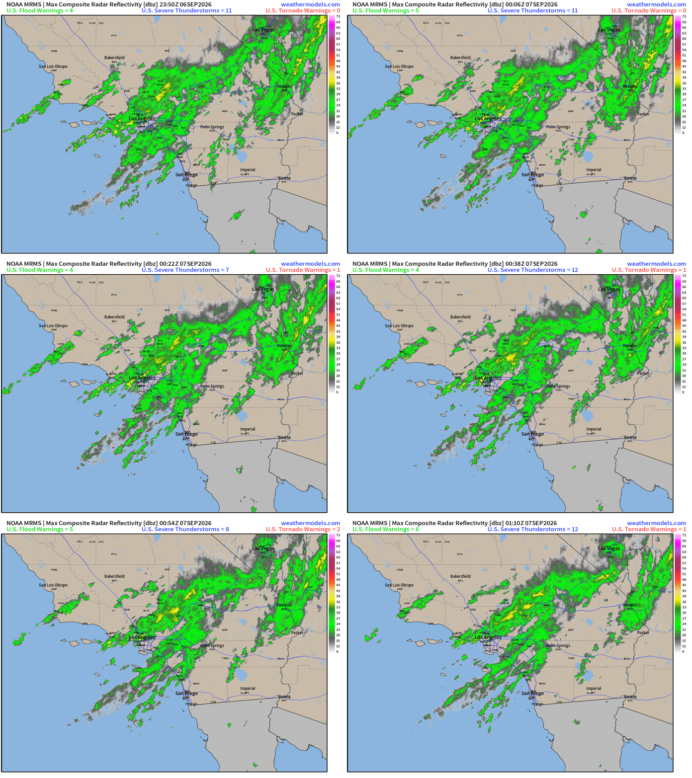
Radar earlier this evening showed rain showers streaming into LA but quickly drying out across the high desert.
Headlines Sunday Evening in the Tropics
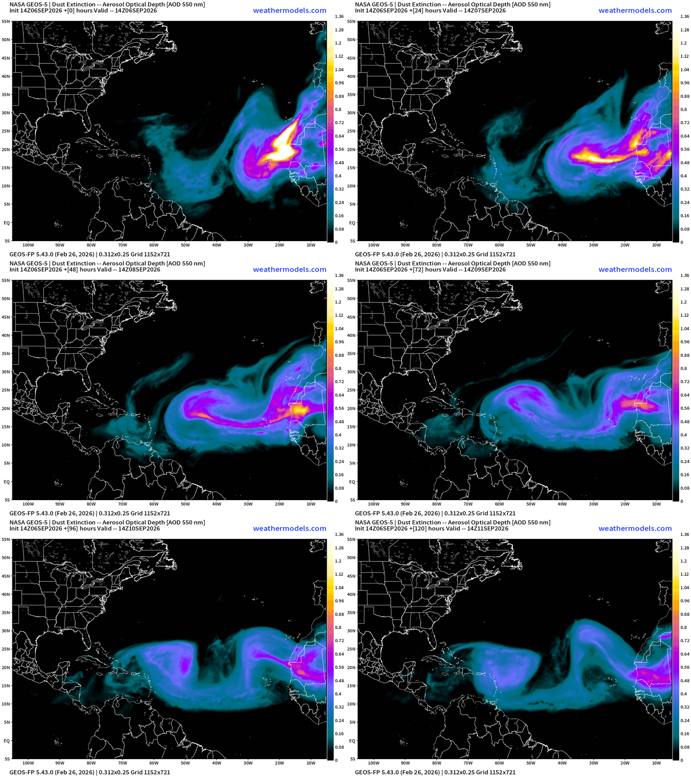
Atlantic tropics completely shut down until further notice, right through the heart/peak of hurricane season. A massive Saharan Air Layer and dust cloud is coming off Africa this week.
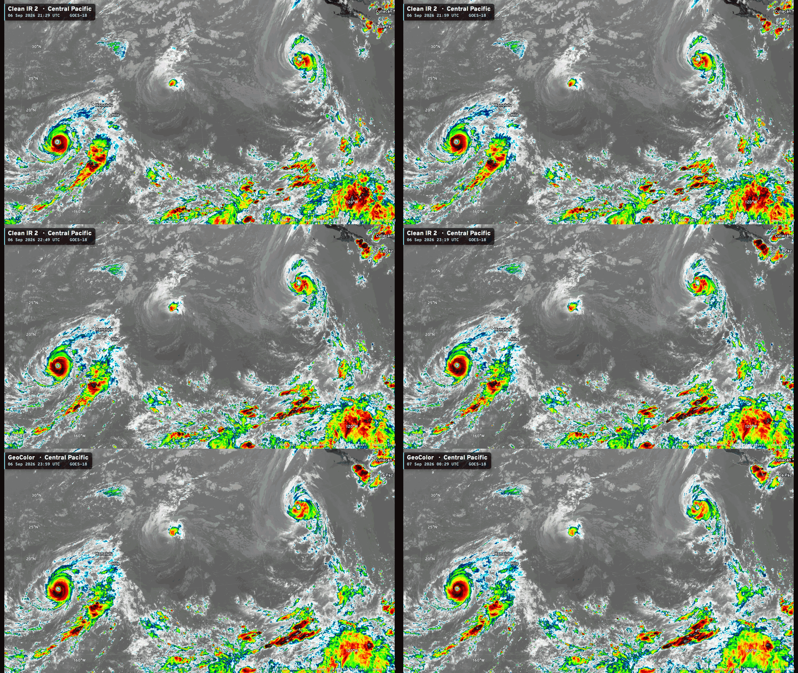
Hurricane Lowell maintaining high-end Major status (105-knots) with a large, well defined and warm eye.
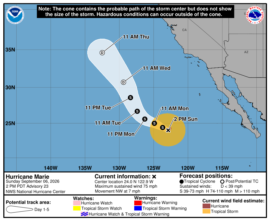
The Central and Eastern Pacific still has the 3 systems, but Karina is almost completely devoid of convection over cooler water NE of Hawaii. Marie is slowly decaying but still a minor hurricane.
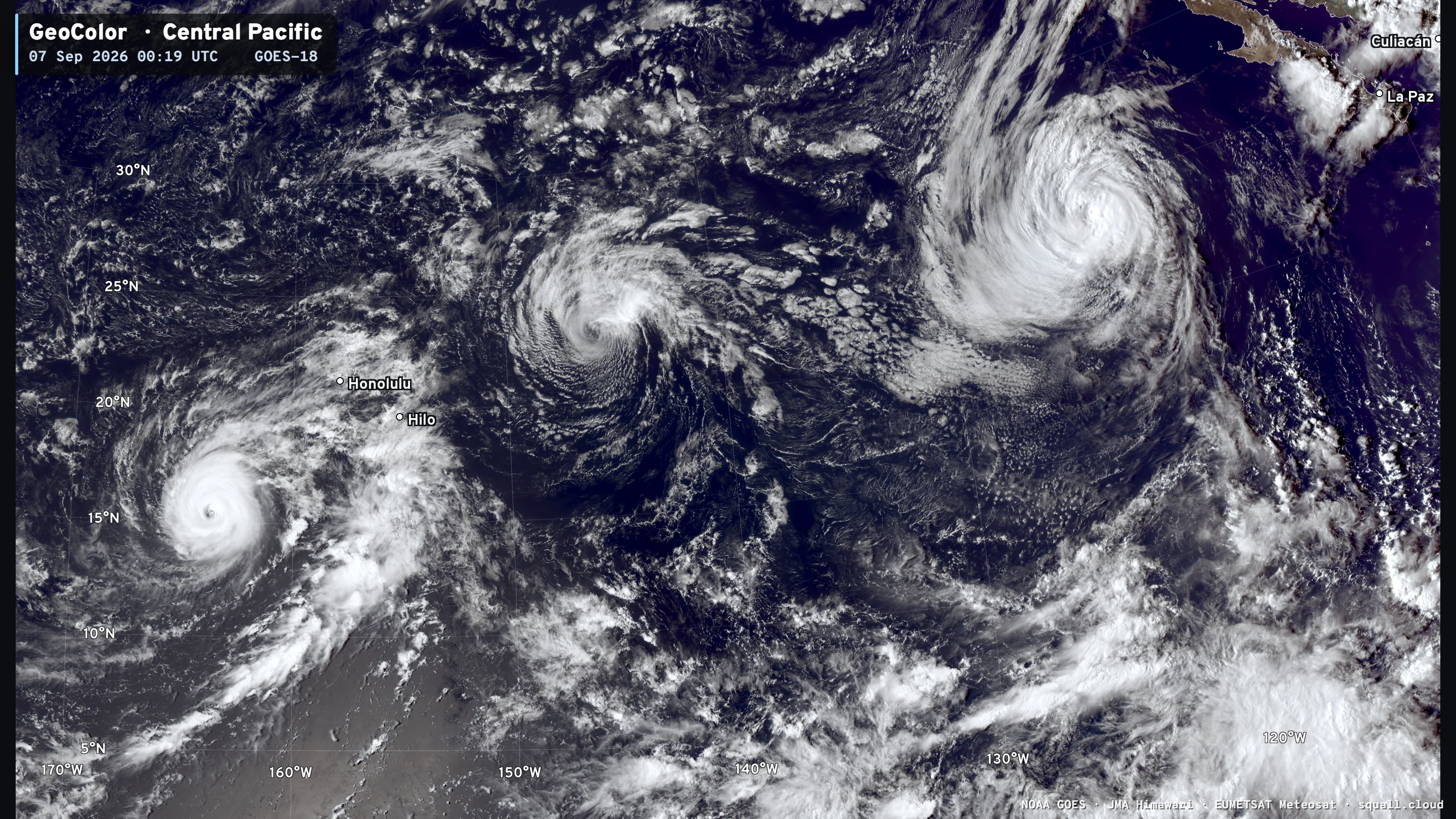
Hurricane Lowell will affect Kauai and the entire Hawaii Island chain with gusty winds and rainfall but only the monuments to the far west will see hurricane conditions most likely.
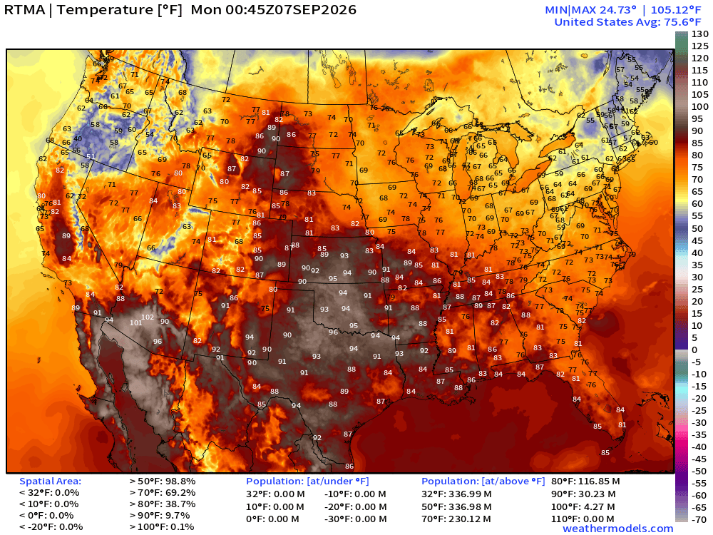
Temperature Analysis this evening 8:45 PM ET
Temperature Anomaly this evening 8:45 PM ET
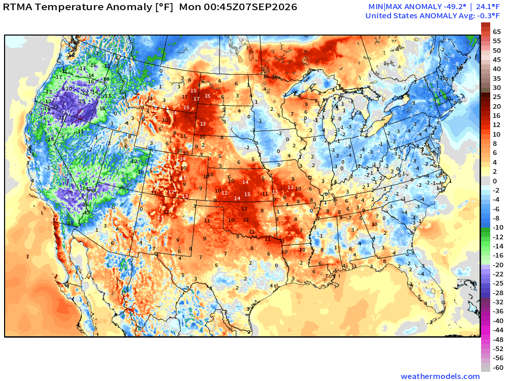
Lower 48 was -0.3ºF below normal with the coolest air across Oregon and dipping into southern California with clouds and some rain
HRRR Precipitable Water Next 48-hours
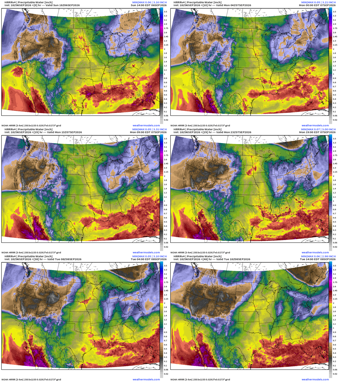
Tropical Moisture into Southern California and even up the coast into Tuesday as a more tropical airmass surges northward with help from Marie’s large circulation
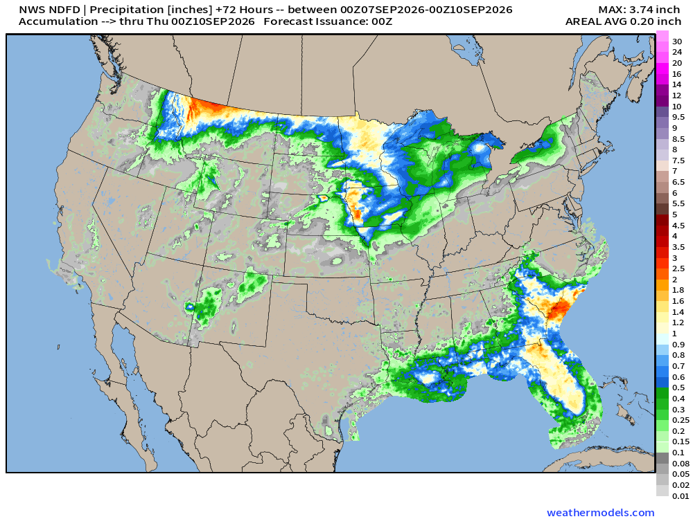
NDFD NWS Precipitation Next 72-hours
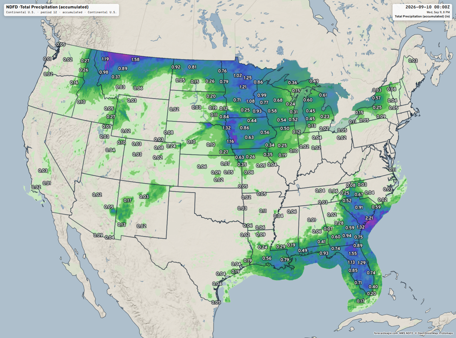
I actually really like my legacy maps at Weather Models, and the legacy look is unbeaten. However, I realize that some folks want interactive maps so that’s why I built Forecast Eagle. See the NDFD maps here —> LINK … and we can output the static maps, too!
Precipitable Water | My Favorite Parameter (10-days AIFS 18z)
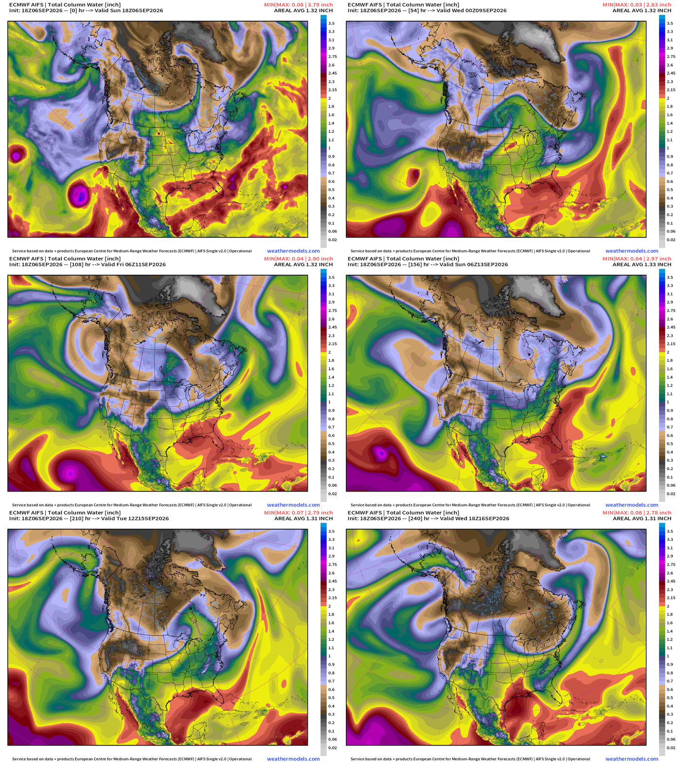
Another hurricane likely across the Eastern Pacific hurricane basin factory.
A lot of tropical moisture along the Gulf coast but not seeing an organized tropical storm. However, we should keep an eye out for additional “Edouard-like” developments.
Note, starting to see “Fall” coming out of Canada with cooler/dryer northwesterly flow!
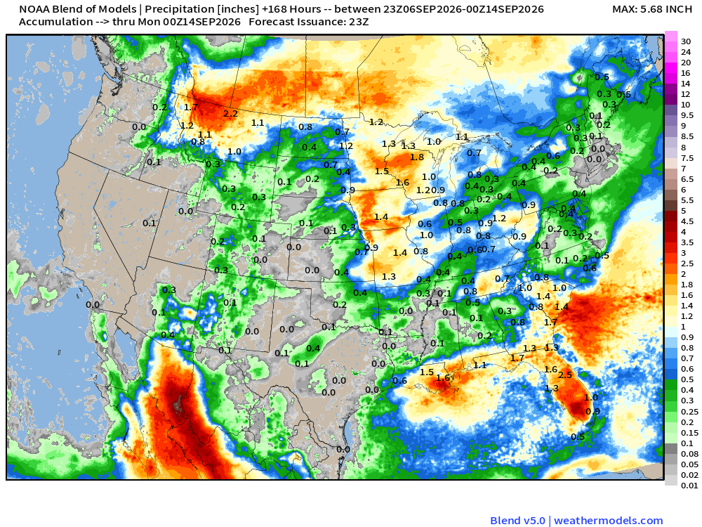
Blend of Models — Precipitation Next 7-days
Height Anomaly 10-days | AIFS 18z —> upper-level circulation pattern
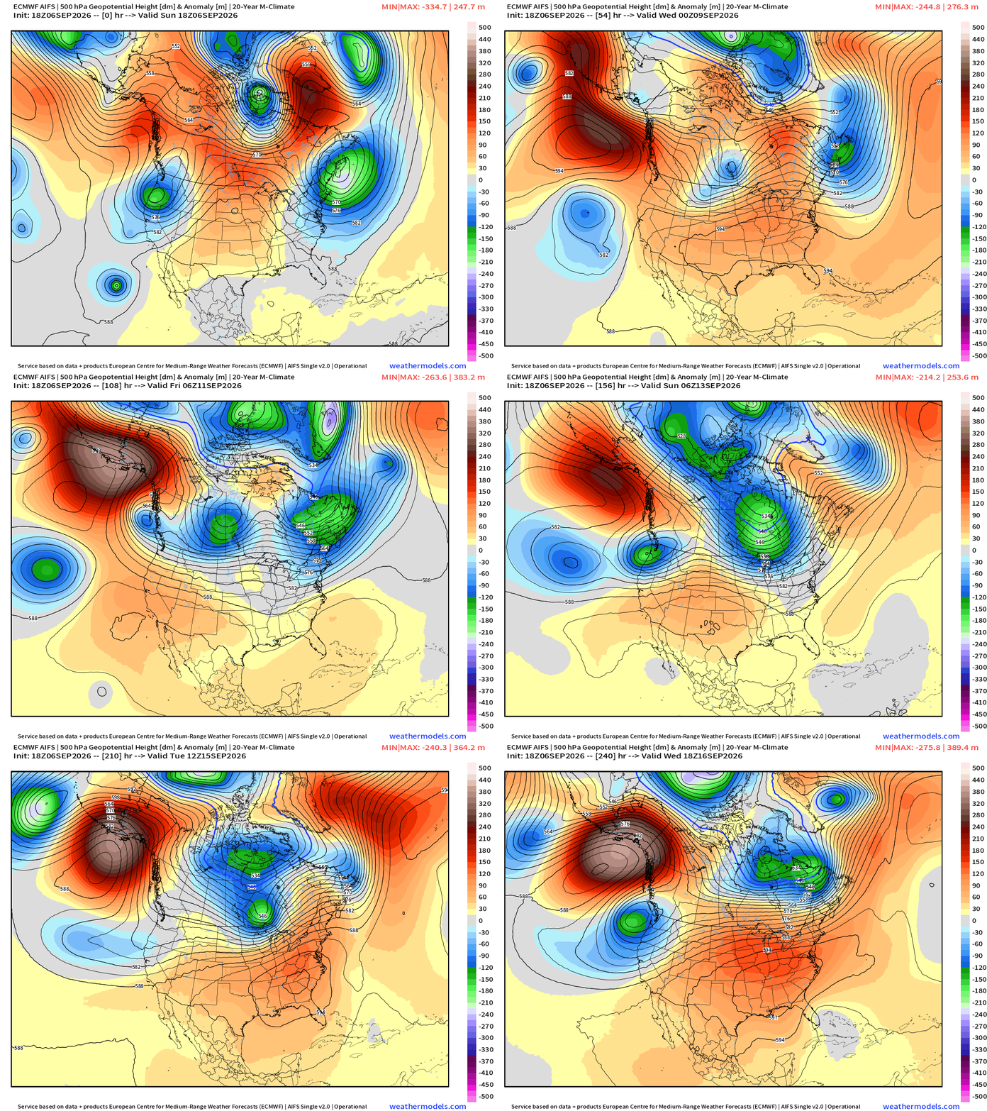
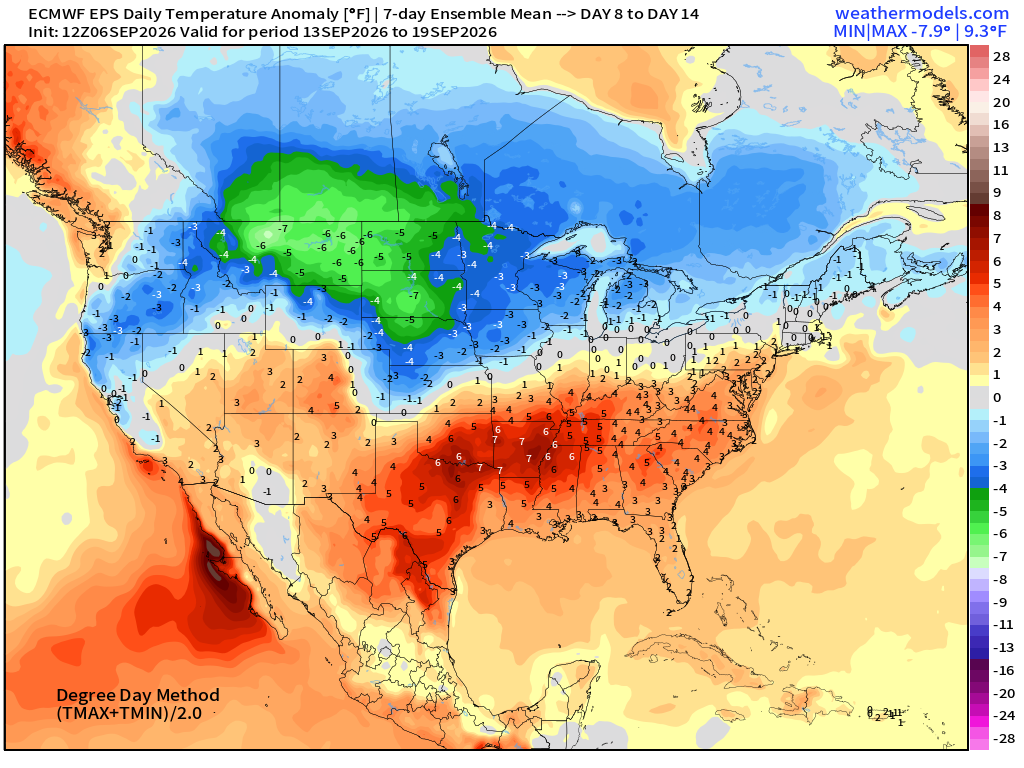
Nice cold front / trough into this weekend across the Midwest and Great Lakes but we need to watch for another ridge building into Week 2 (mid-September)
High Temperatures Next 8-days
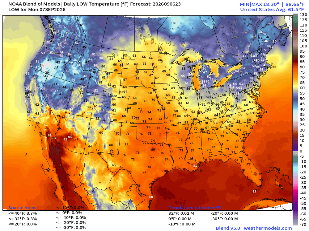
Low Temperatures Monday Morning
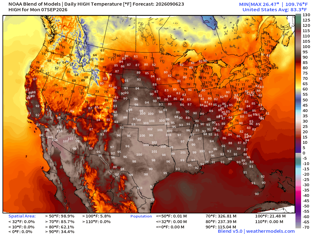
High Temperatures on Monday —> Labor Day
Weekly Temperature Anomaly Next 2-Weeks | EPS 12z
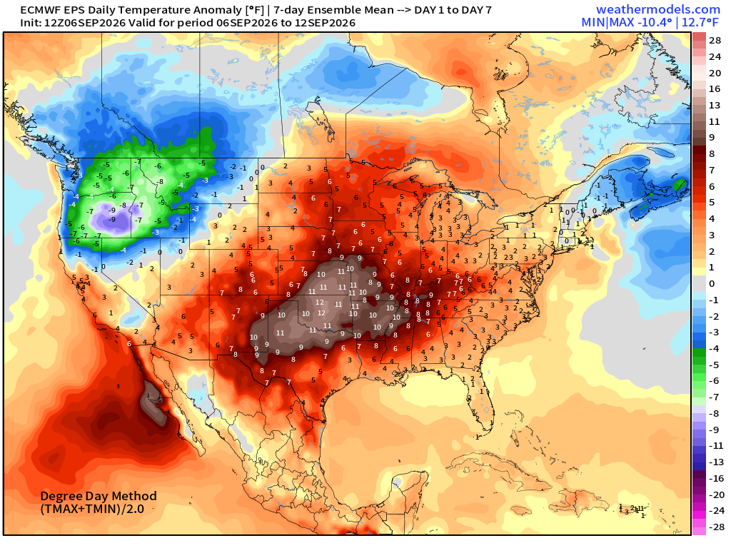
Much cooler across the Pacific Northwest … and then it extends across the northern Rockies into mid-moth
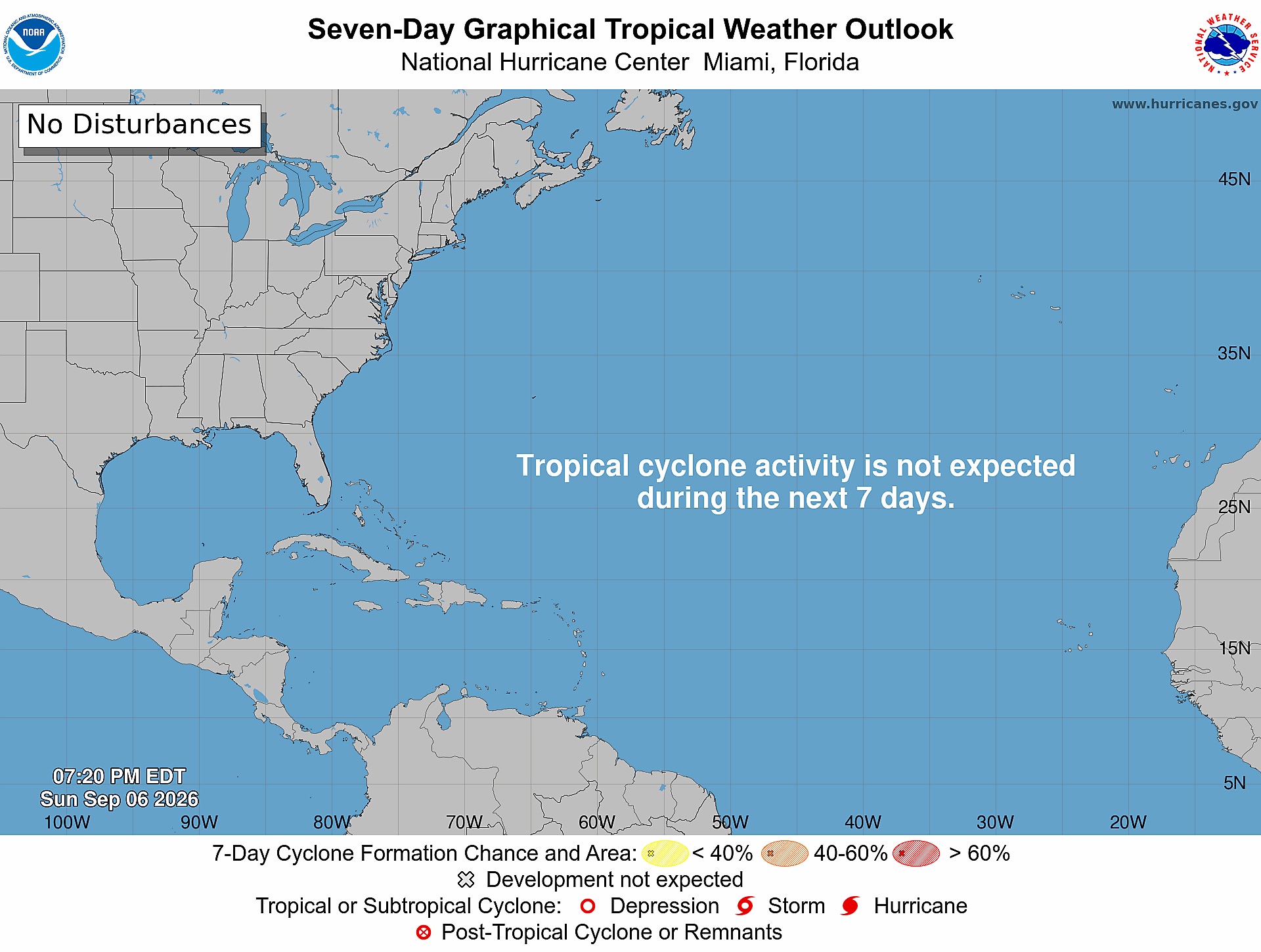
Atlantic Tropical Outlook
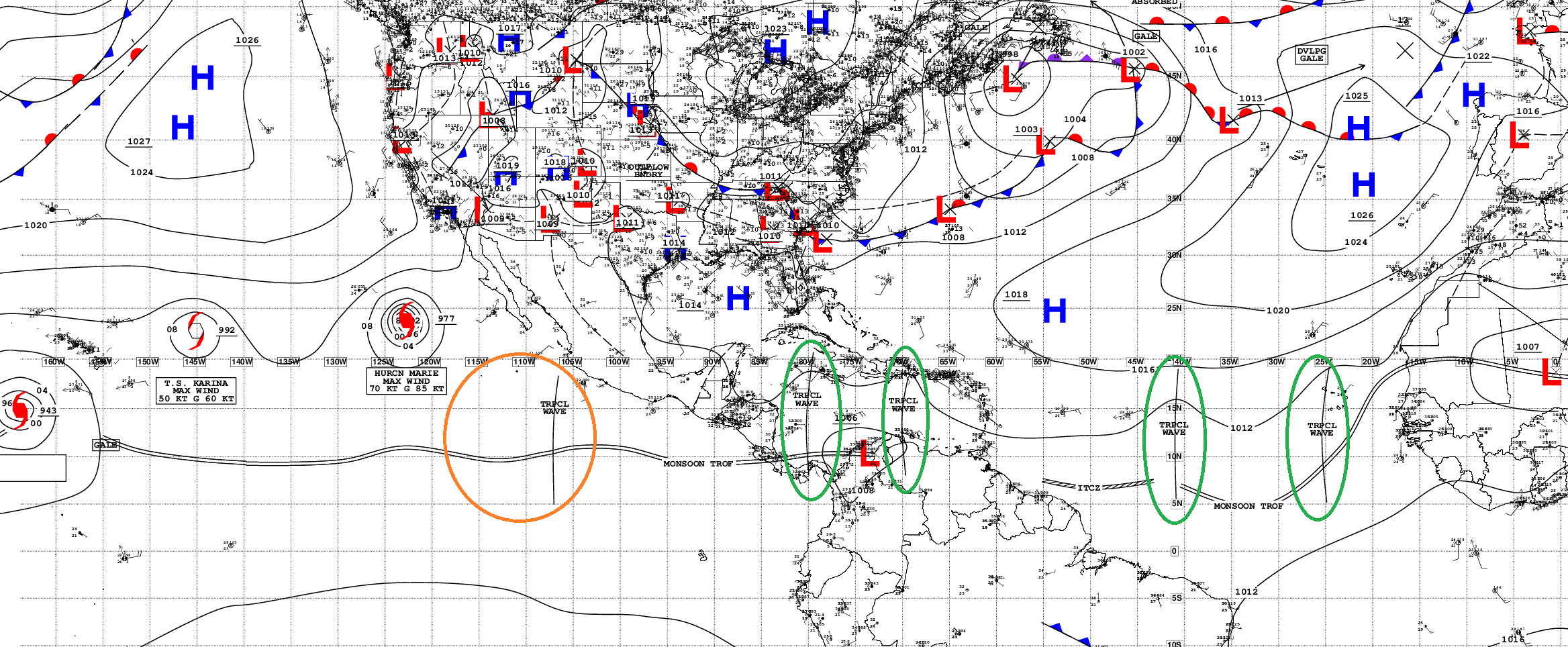
Ghost Town | Tropical Waves Analysis
NASA GEOS-5 Dust — Next 5-days —> huge plumes still coming off Africa and completely wiping out the tropics!
Atlantic Satellite | Nothing going on
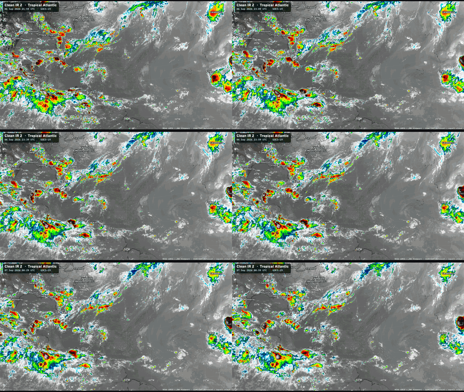

You can see more Satellite Imagery at Squall Cloud —> LINK
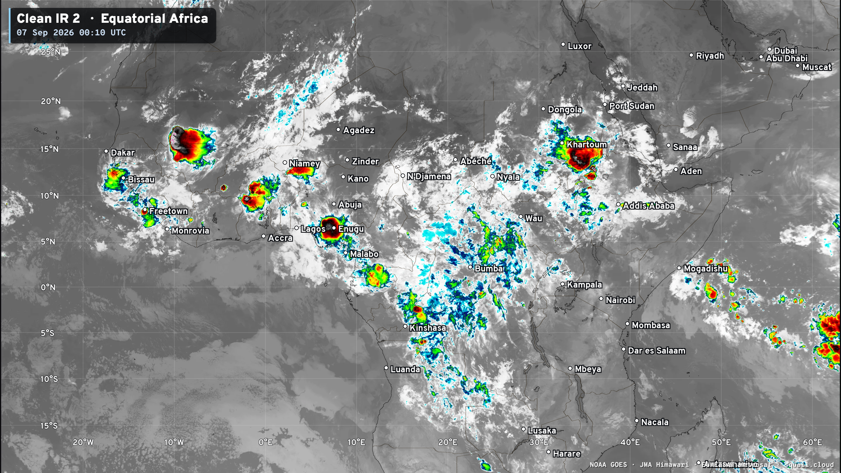
Equatorial Africa tropical waves look unhealthy
ECMWF Ensemble 12z full-physics tracks next 15-days
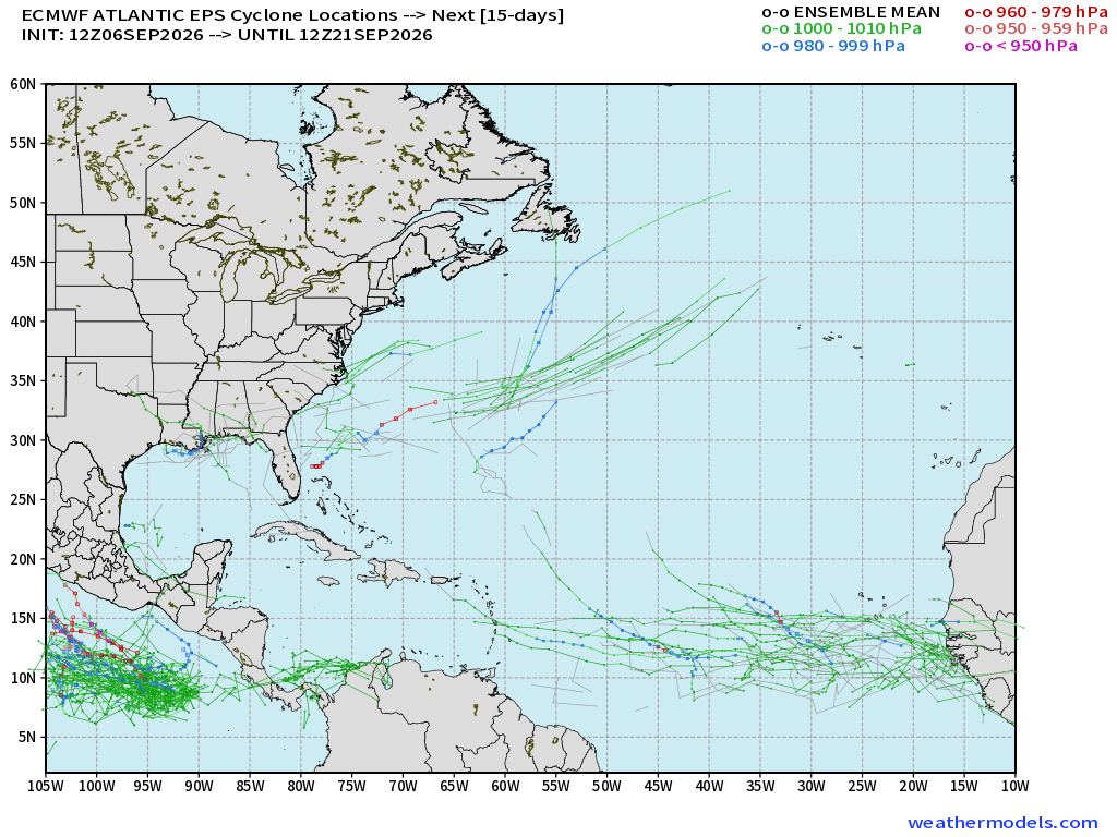
Some MDR action into week 2, but not a strong signal for a hurricane anyways, only 3-4 members so less than 10% and that’s way below climatology for mid-September.
Google Deep Mind | Weather Next 2 | 18z Ensemble Tracks (50-mems)
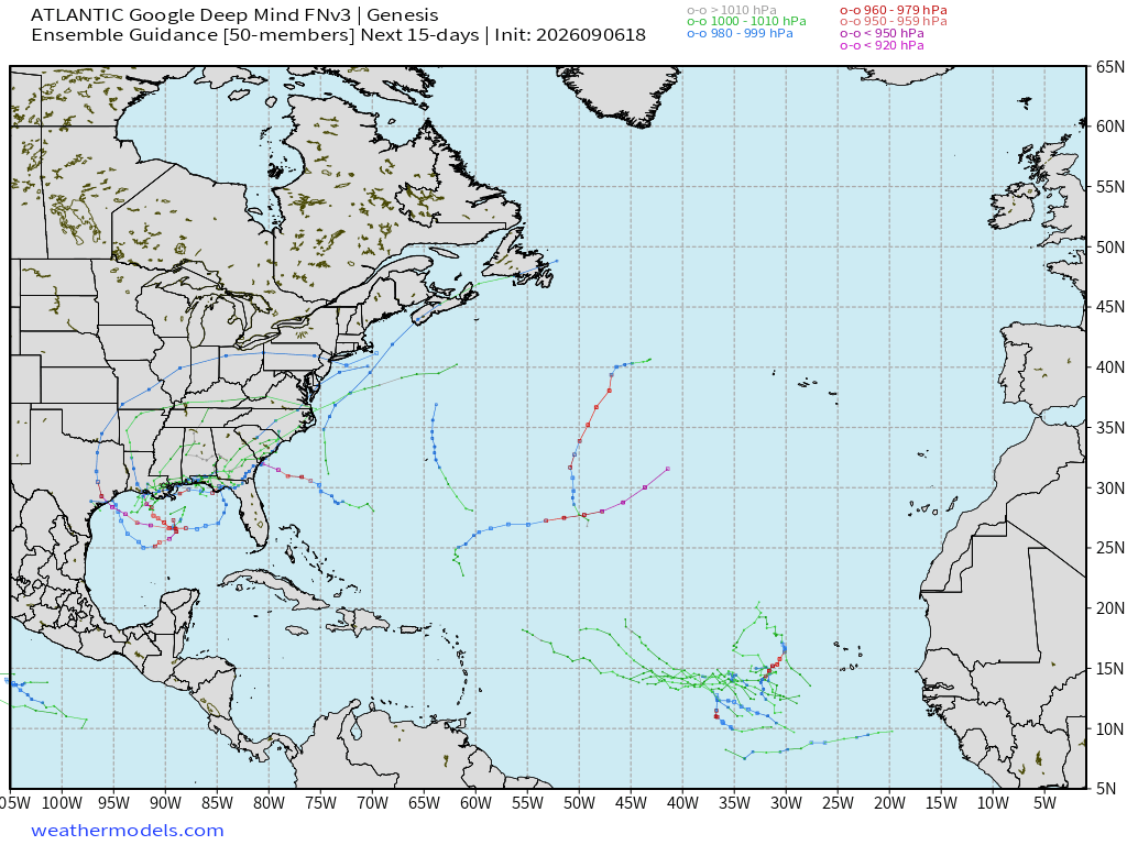
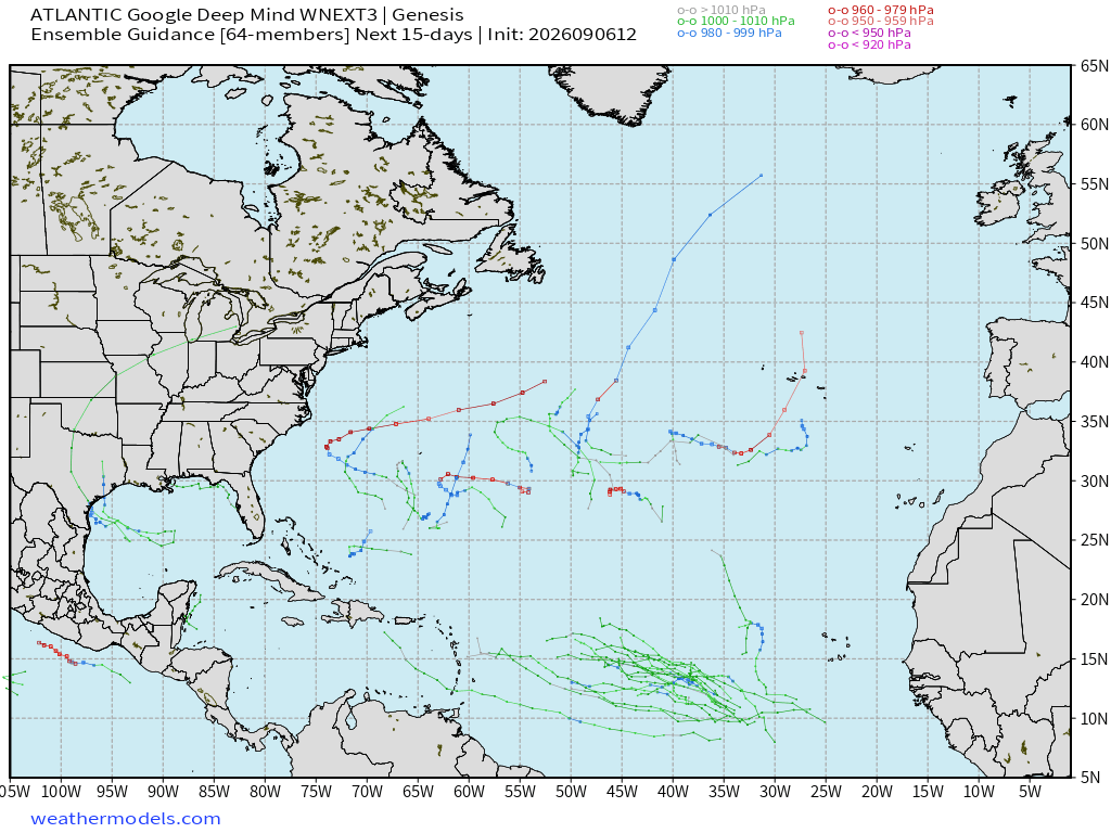
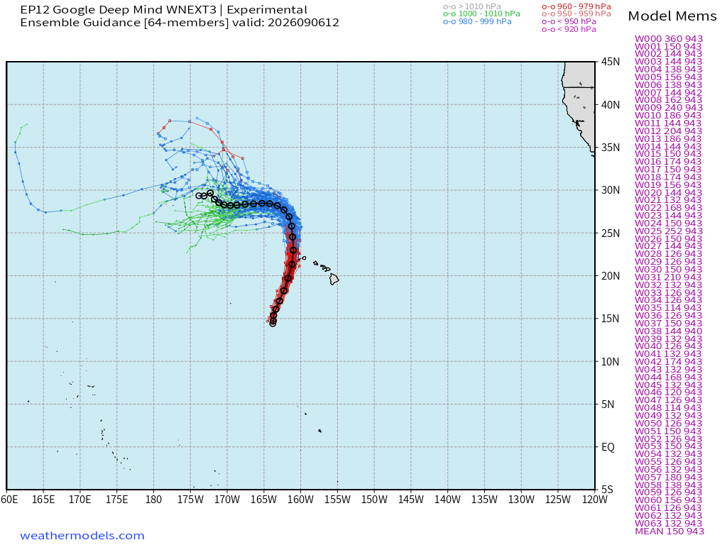
Same story from Weather Next models (versions 2 and 3) with some scattered tracks … but until we see a strong signal, these are just random developments, and low/tiny chance.
Google Deep Mind | Weather Next 3 | 12z Tracks (64-members)
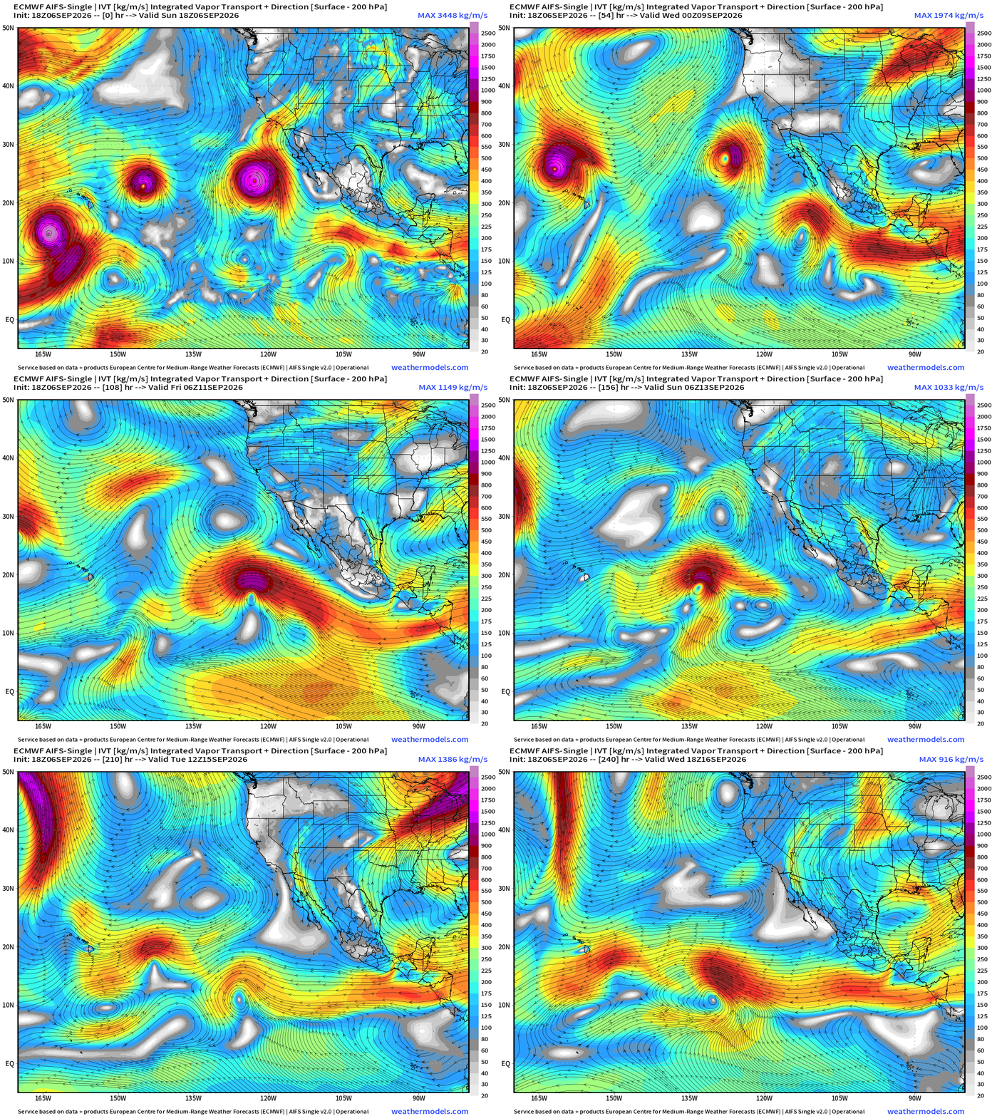
Flagship model: ECMWF AIFS 18z —> Integrated Vapor Transport next 10-days
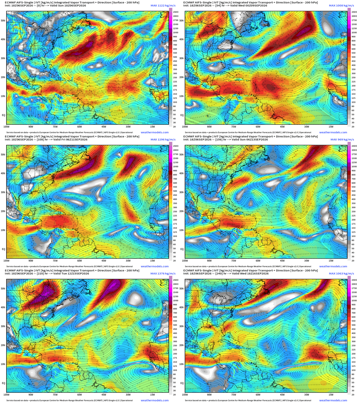
Atlantic —> completely shut-down through mid-September!
Eastern Pacific Tropics
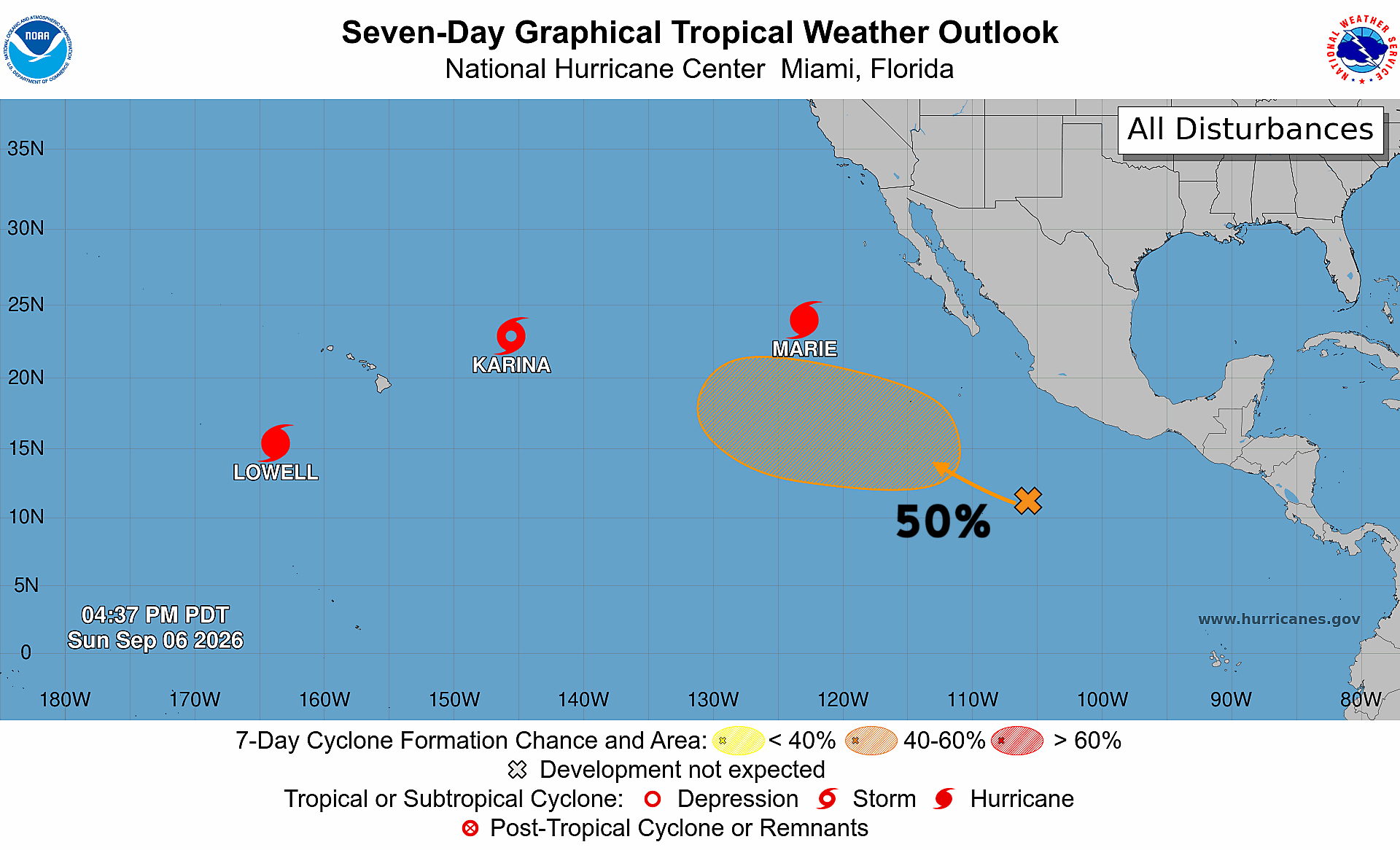
Karina + Lowell + Marie — then Norbert (still 50% chance)
Hurricane Lowell (12E) — 105 knots (Category 3) — 948 mb
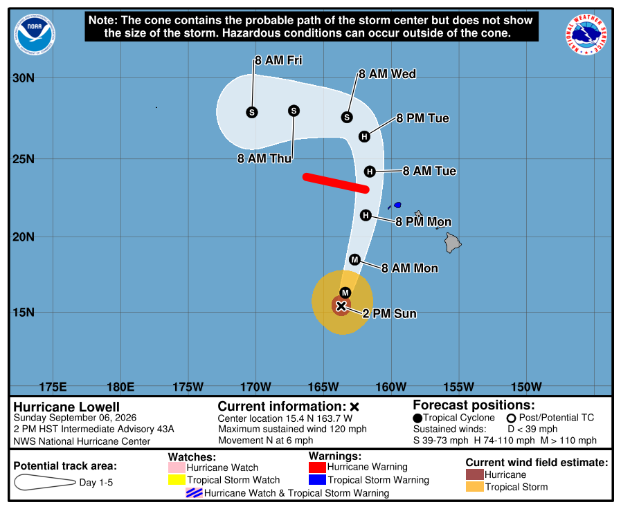
The center stays west of Kauai but the hurricane will be huge … so definitely tropical storm conditions.
Hurricane Marie (13E) — 65-knots (Category 1)
AIFS 18z Integrated Vapor Transport next 10-days
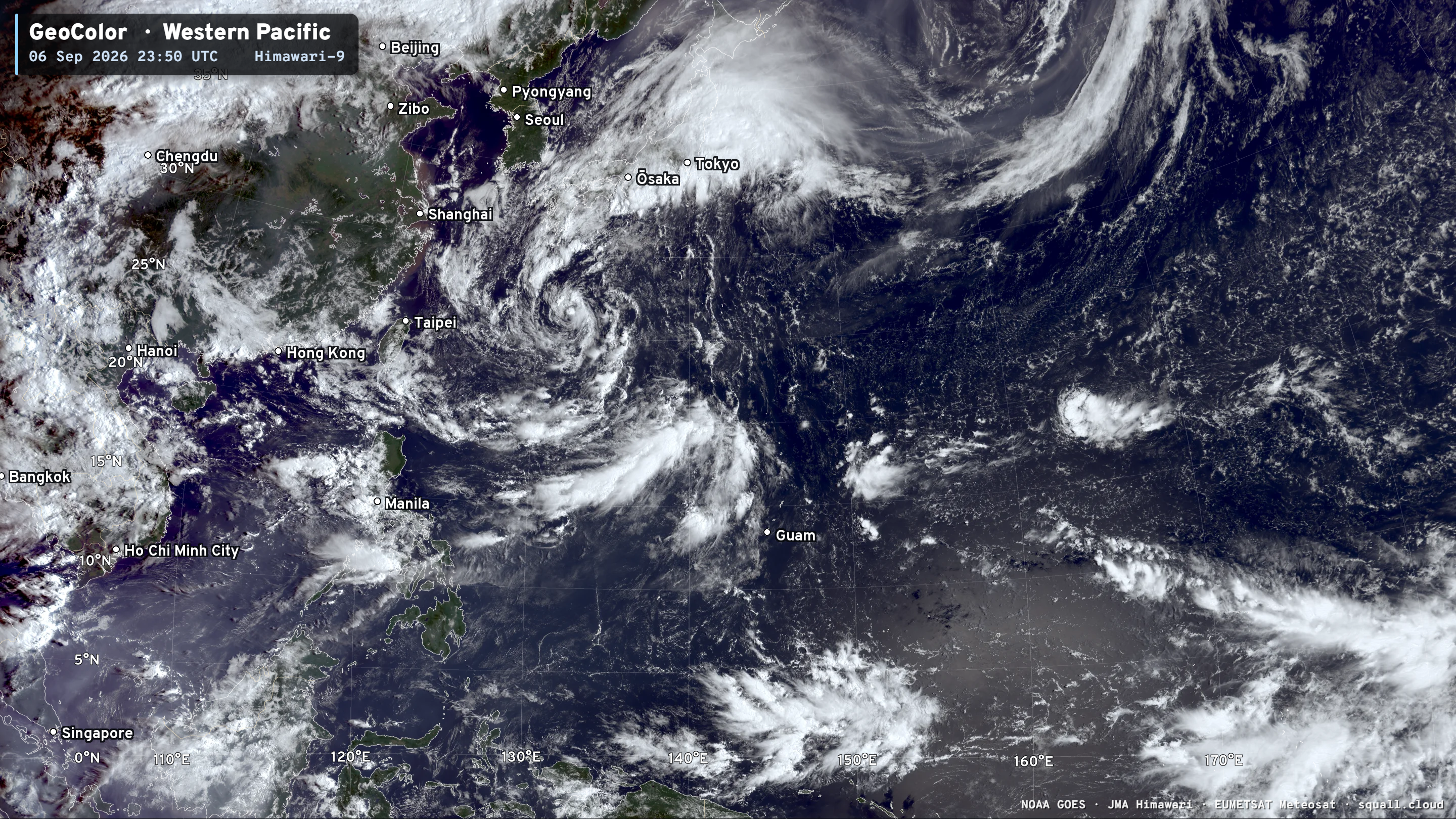
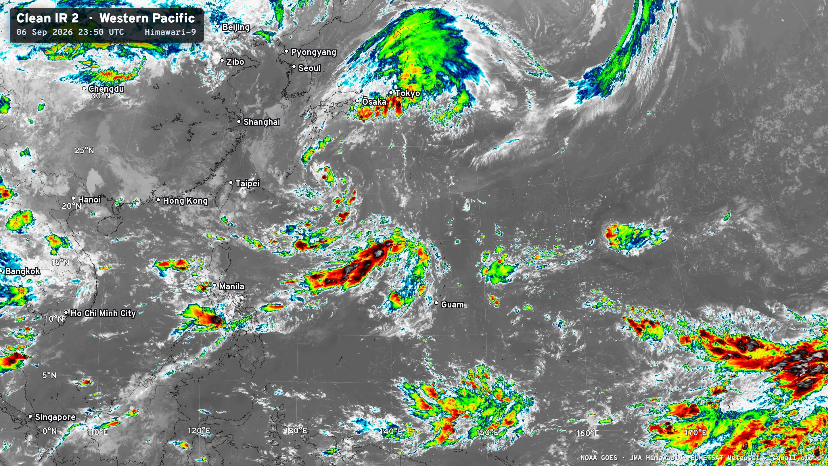
Western Pacific Tropics
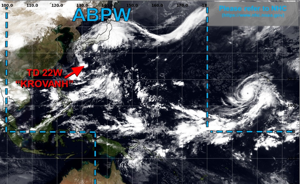
Quiet except for weak tropical depression. Nothing brewing in next 48-hours.
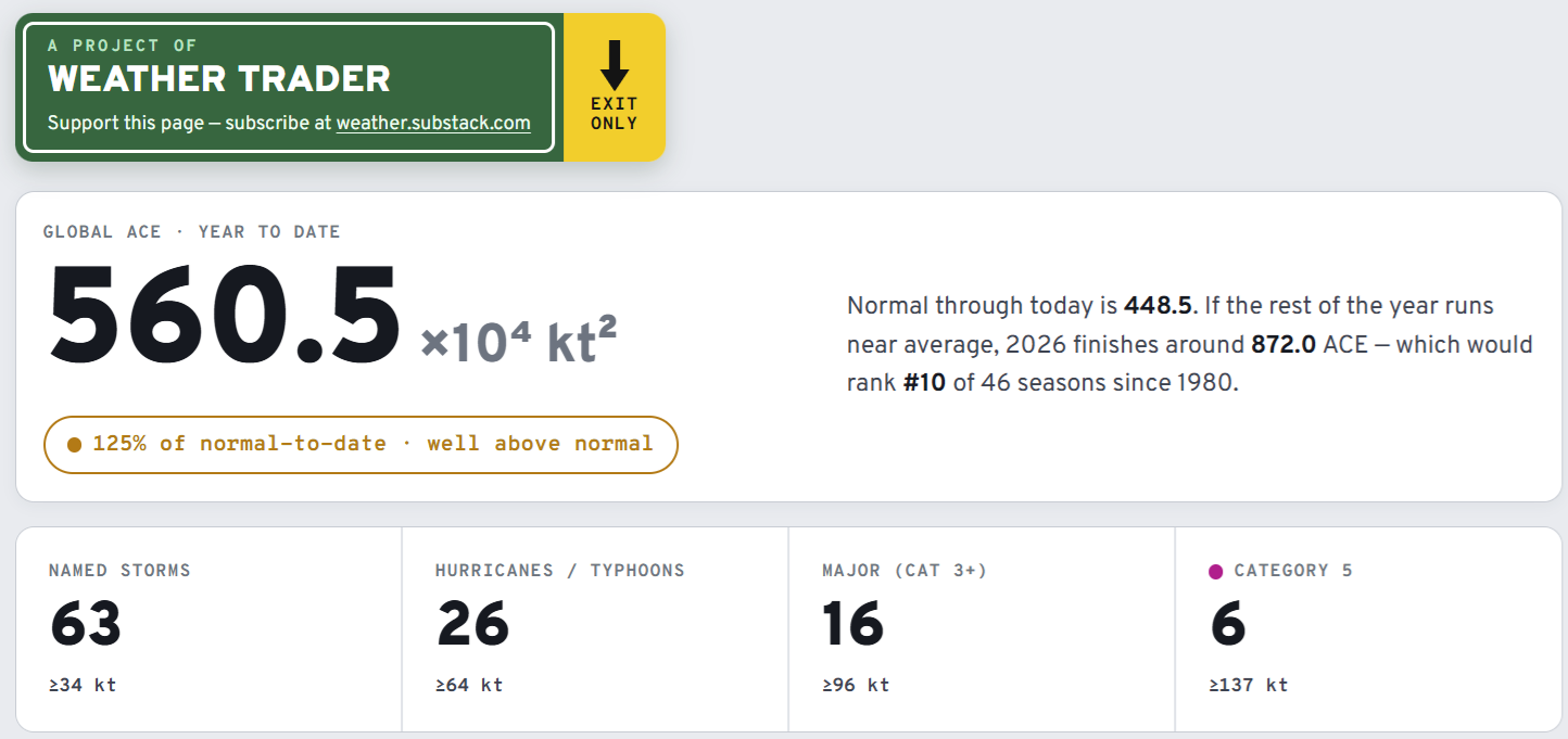
Visit Global Tropical Cyclones for more ACE information, as well as my original climatlas.com/tropical site now with the beautiful Interstate Highway theme and full of interesting content! ACE now over 560.
Forecast Eagle maps explorer in beta for another week. Trying to make into a functional mobile app, too.

Satellite imagery from Squall Cloud. Maps sourced from weathermodels.com designed and innovated by yours truly! Please subscribe there for real-time access to the newest maps, charts from all of the weather models including ECMWF and AIFS, and NOAA GFS/GEFS, HRRR/RRFS and Blend of Models (NBM). NOAA WPC and SPC for fronts/convective outlooks. Our own content is now sourced from hottestsince.com and weather.city and celsius.earth, and squall.cloud and weather.football and global-tropical-cyclones.com and precip.earth
My Atlantic Hurricane Season Forecast (2026)
From April 7, 2026: Atlantic Seasonal Hurricane Forecast: (11/5/2)
9-13 Named Storms (11 most likely)
4-7 Hurricanes (5 or 6 most likely)
1-3 Major Hurricanes (2 most likely)
Accumulated Cyclone Energy: 75-85 (well below normal)
NOAA 2026 Atlantic Hurricane Season Forecast
- Milepost
- 1026 · laid 2026-09-07T02:23:13.639000Z
- Source
- https://weather.substack.com/p/september-6-2026-sunday-evening-weather
- Digest
- 8c751df6662e3c04286c63d9e2337f8bbf01eddf247540a3b058b1c39a95be75
- Machine
- JSON