September 4, 2026 Friday Evening Weather
Hurricane Lowell remains a powerful Category 4 storm south of Hawaii and may come close to Kauai next week

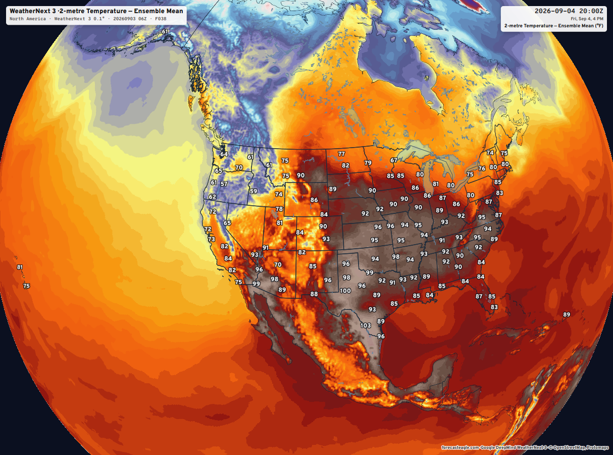
Google Deep Mind launched their "world-leading” A.I. weather model system on Thursday. The upgrade is called Weather Next 3 (WN3) and is significantly more skillful in several areas including resolution (0.25° —> 0.10° and even 5-km for 2-meter temperature), precipitation trained against IMERG satellite, and hourly update by incorporating ongoing observations. I can access the data, and there is a minimal cost involved. The overarching problem is that making maps (aside from the example below) and sharing in a Forecast Eagle Explorer would violate their terms of service. For whatever reason, Google has adopted the product rules and restrictions that ECMWF operated 5-years ago prior to their journey to open data. There are no restrictions on internal usage, so I can merge and blend WN3 with other models, and generate more advanced tools like probability of precipitation, daily min/max temperature, and anything else that is value added.
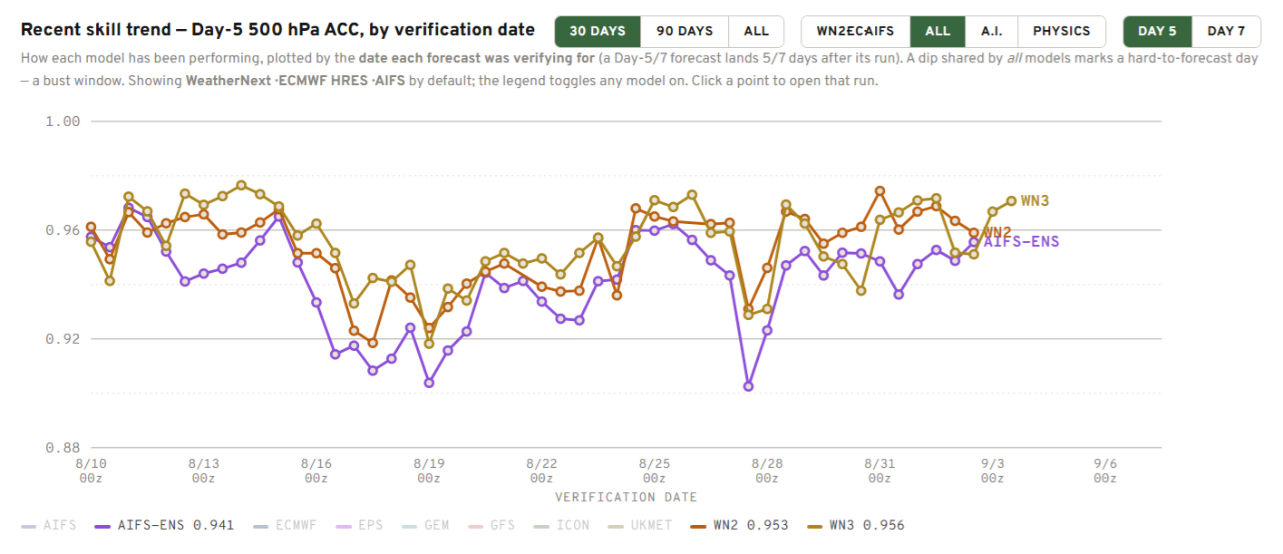
WN3 (0.956) shows a small bump up in skill over WN2 (0.953) … and significantly so over AIFS-ENS v2 (0.941) —> Z500 Geopotential Height at 5-days —> VERIFICATION
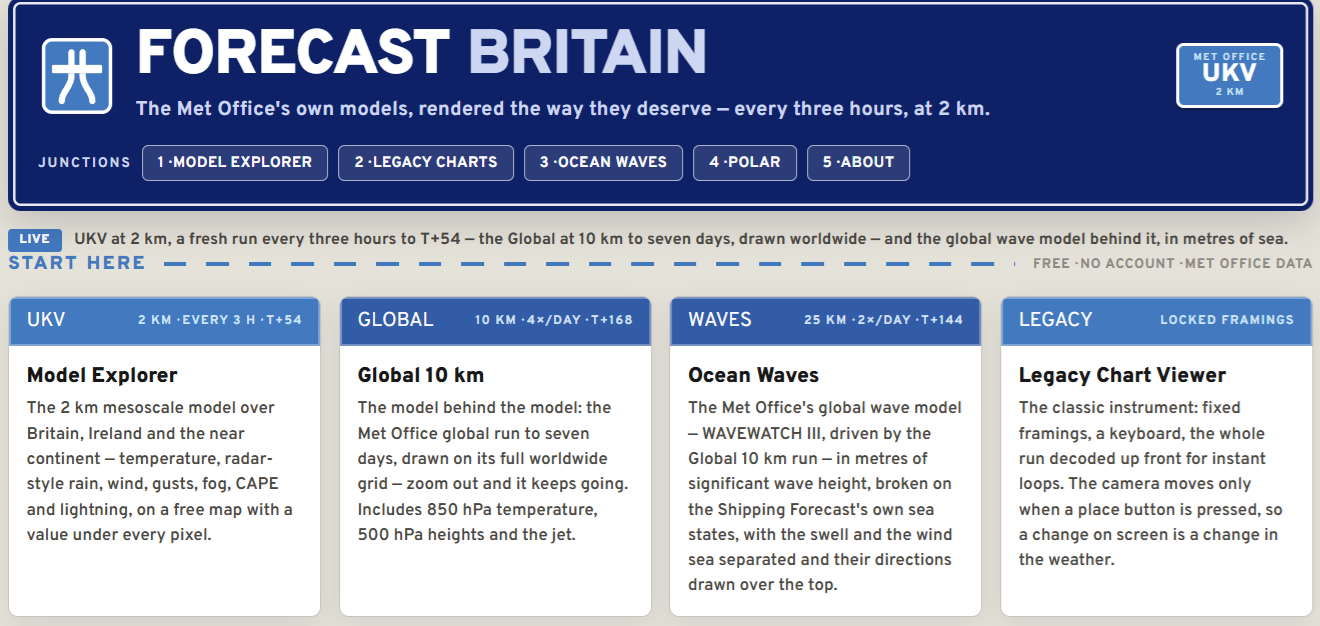
One more fun addition to the “Forecast Network” is Forecast Britain that uses the Met Office global and mesoscale model. All of these sites are in preview/beta mode for another week or two. Forecast Ireland will come next.
Saturday is ECMWF SEAS5 — SEASONAL FORECAST DAY
Headlines Friday Evening in the Tropics
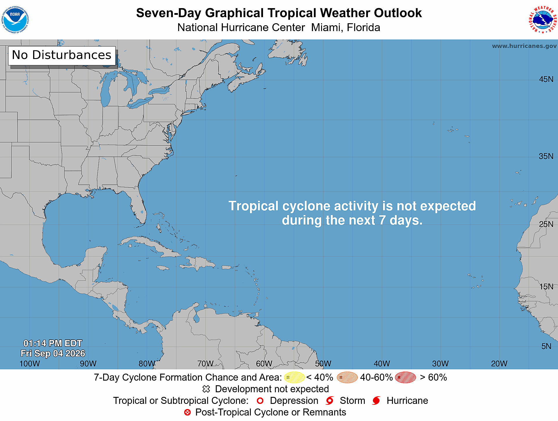
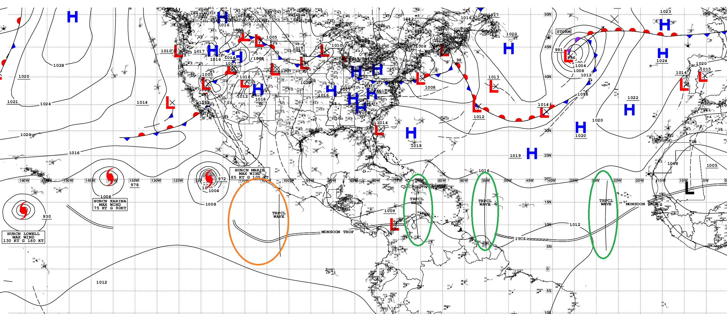
Atlantic tropics completely shut down until further notice, right through the heart/peak of hurricane season.
Hurricane Lowell is a strong Category 4 hurricane and has a huge eye now. It may fluctuate up/down in the coming days. Expectation in 3-4 days to pass far enough west of Kauai to limit direct impacts, but Lowell will be large. We’ll need a substantial buffer.
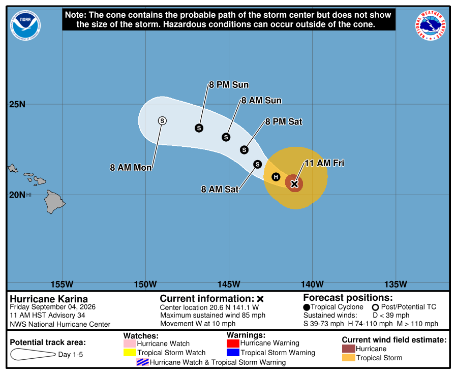
Hurricanes Karina and Marie are both are happily mixing fish! Another system may form next week and be named Norbert.
Precipitable Water | My Favorite Parameter (10-days AIFS 18z)
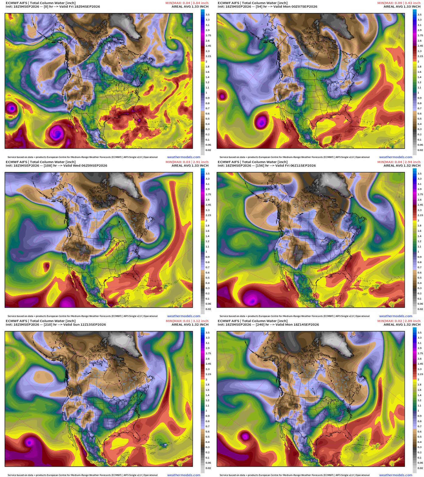
Still watching some beneficial tropical moisture associated with the strong upper-level trough dragged away from Hurricane Marie into California and the Southwest.
Blend of Models — Precipitation Next 7-days
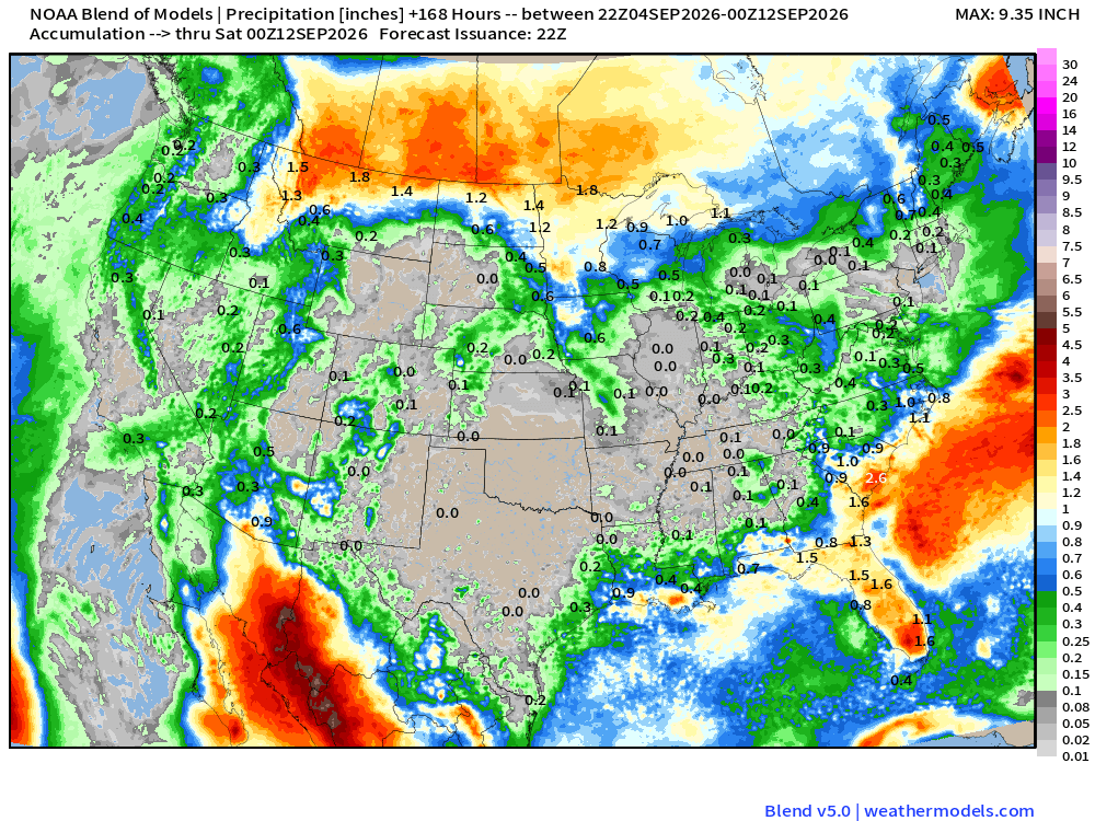
Huge monsoon moisture plume through western Mexico and creeps into the desert Southwest.
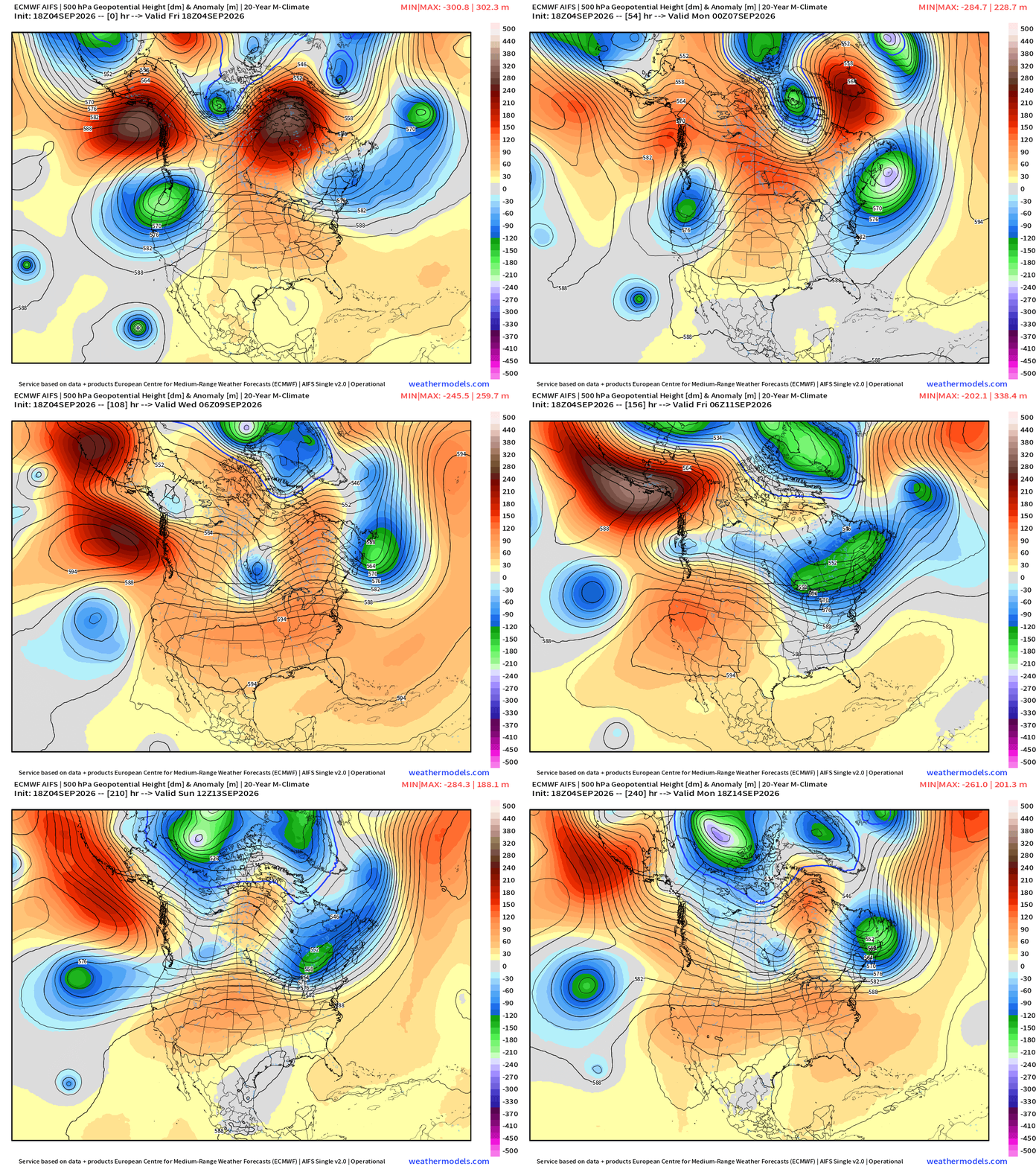
Height Anomaly 10-days | AIFS 18z —> upper-level circulation pattern
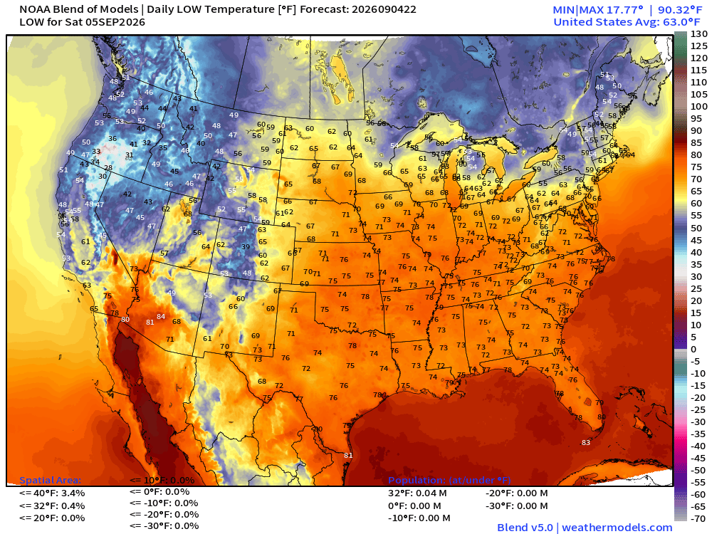
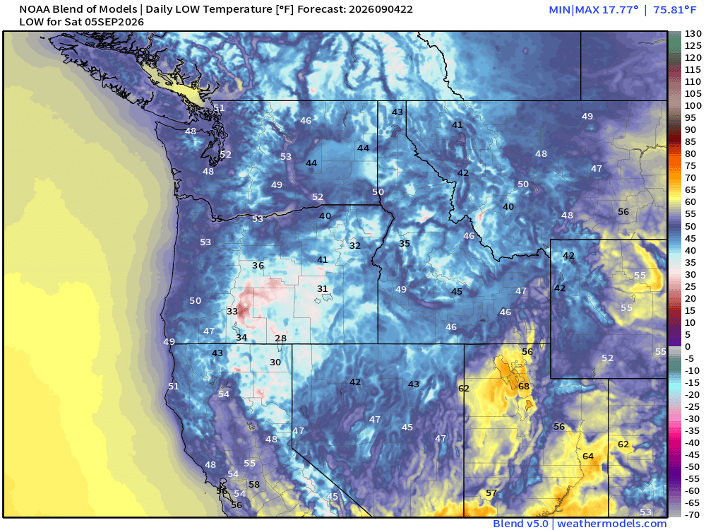
Low Temperatures Saturday Morning
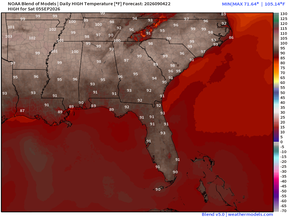
High Temperatures on Saturday
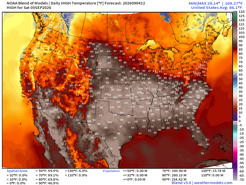
Very hot for college football Saturday!
Atlantic Tropical Outlook
Ghost Town | Tropical Waves Analysis
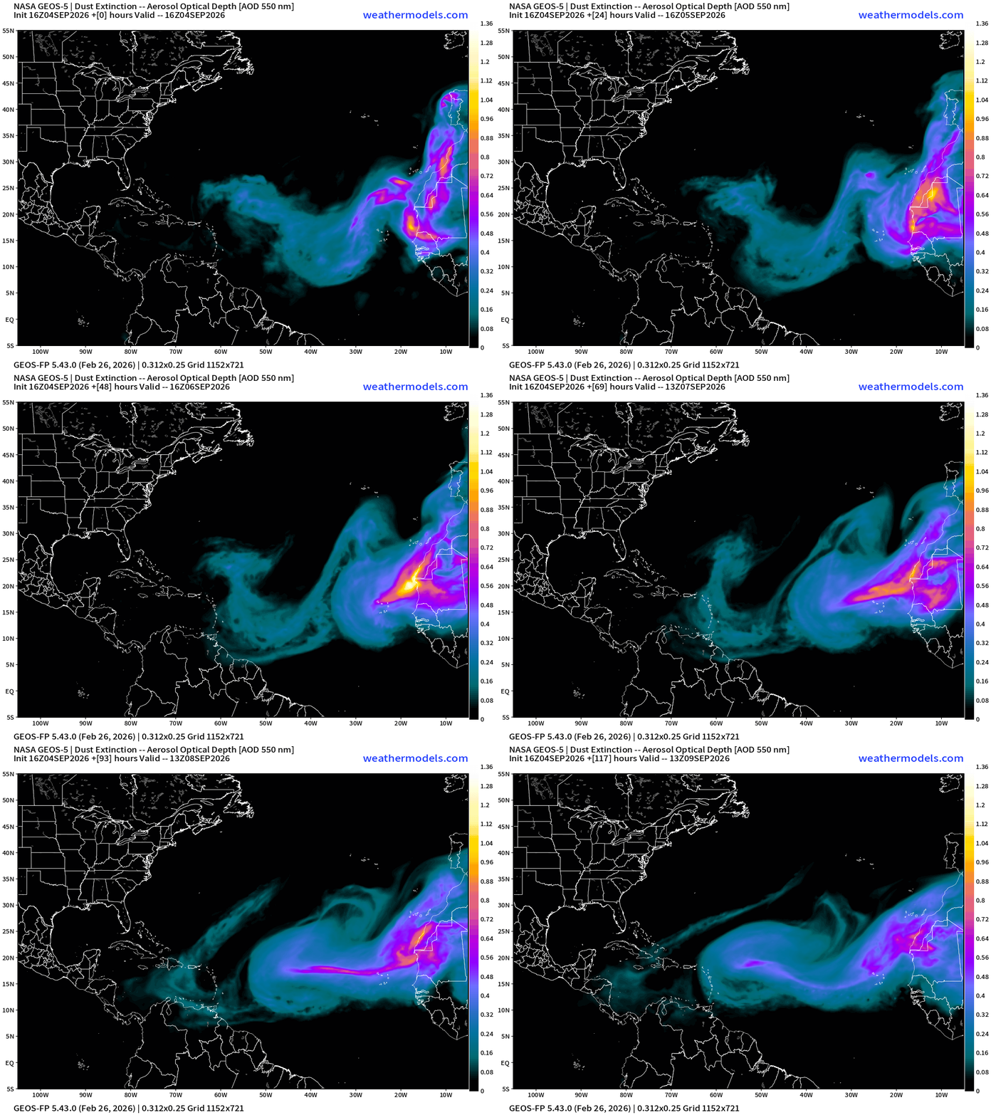
NASA GEOS-5 Dust — Next 5-days —> huge plumes still coming off Africa
Atlantic Satellite | Nothing going on
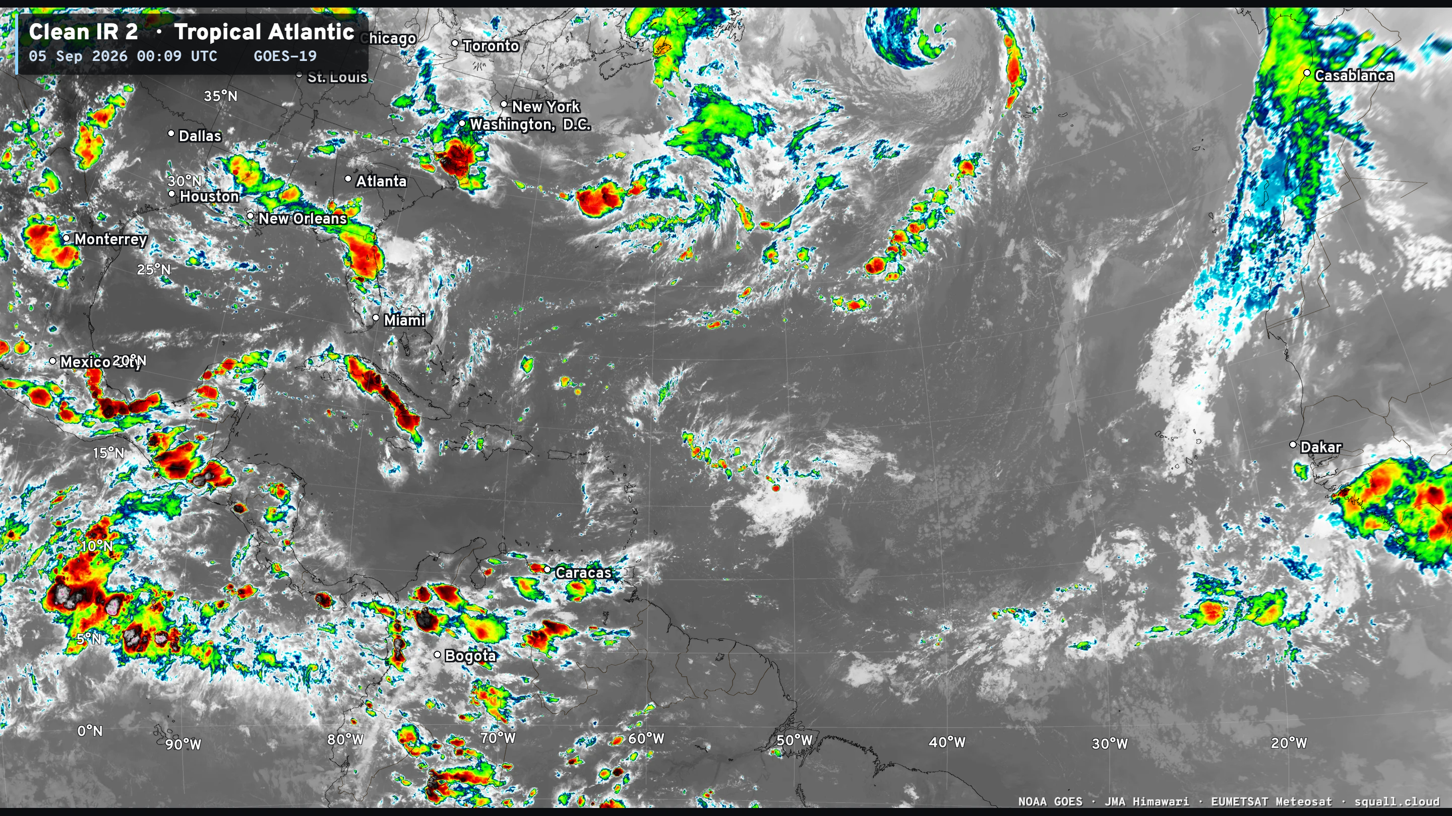
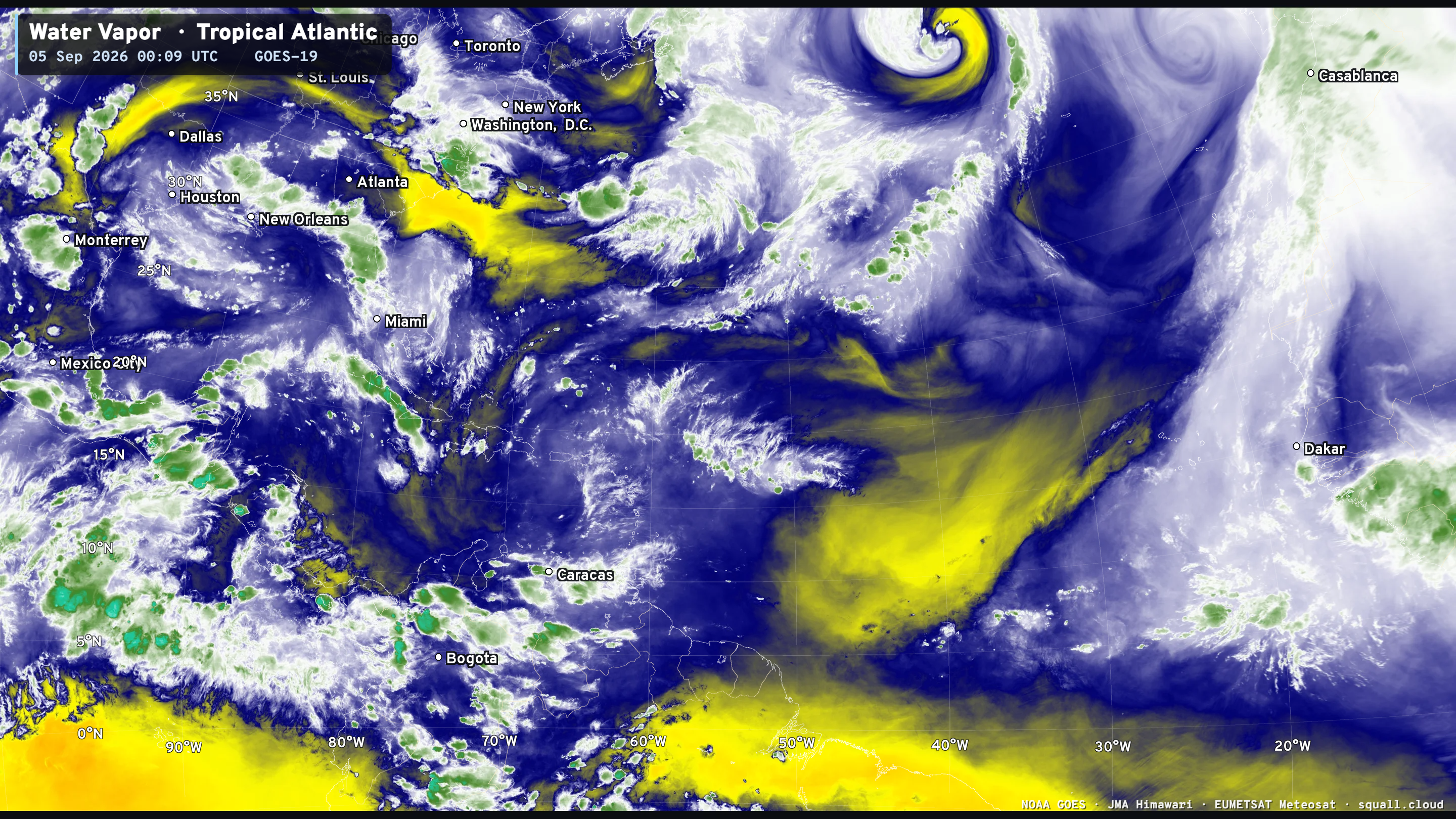

You can see more Satellite Imagery at Squall Cloud —> LINK
ECMWF Ensemble 12z full-physics tracks next 15-days
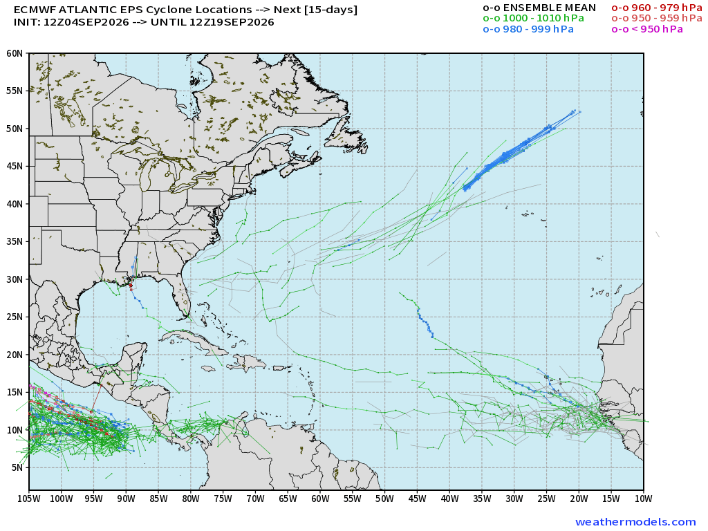
Very little action — maybe 3 members with a hurricane = 6% —> ghost town!
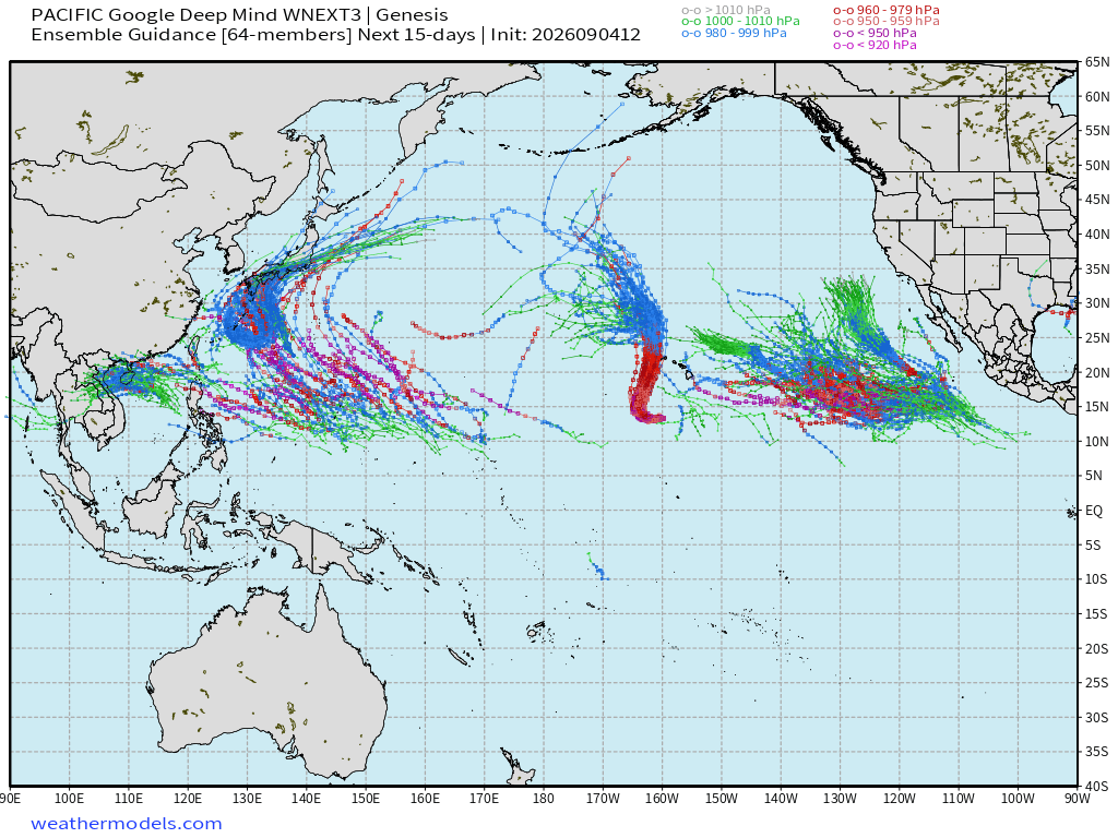
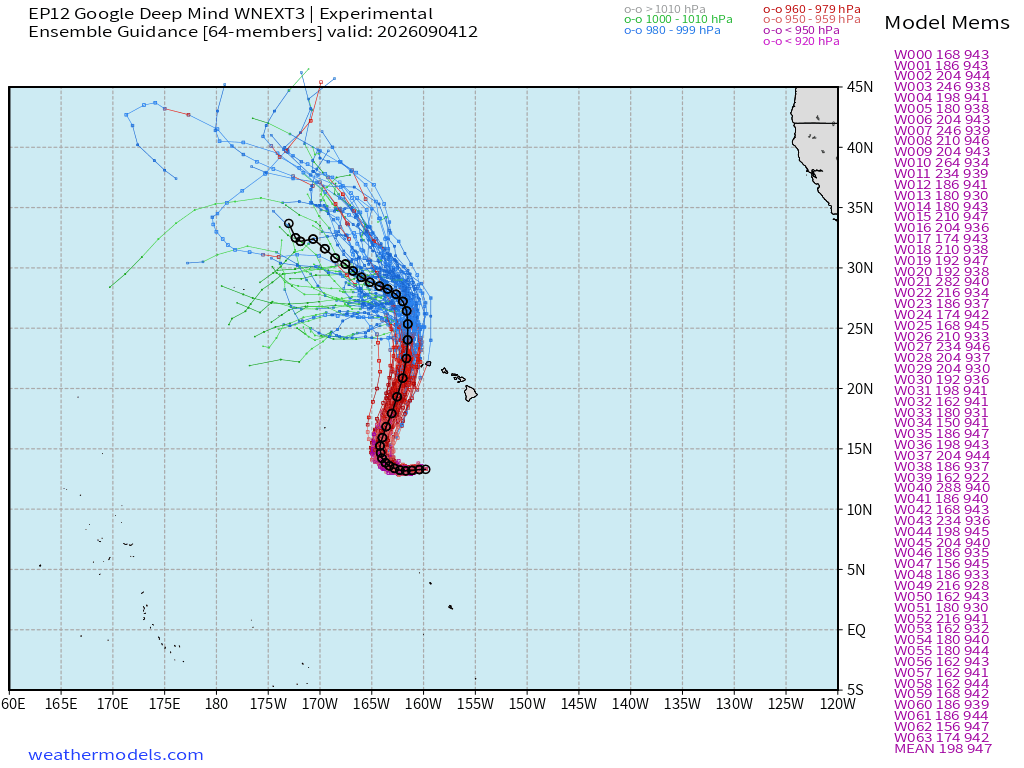
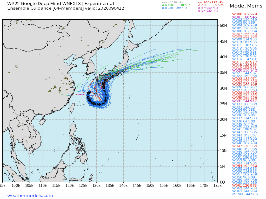
Google Deep Mind | Weather Next 3 | 12z Ensemble Tracks
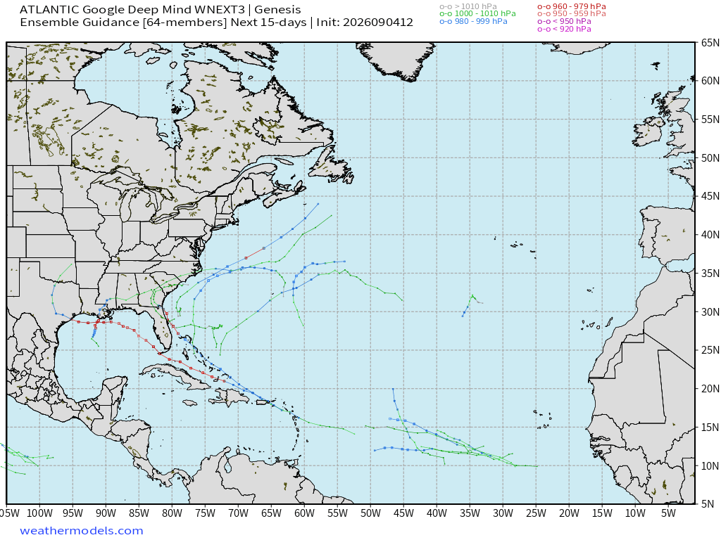
Almost a blank map / a few members out of 64! Here’s the Pacific to prove my code isn’t broken.
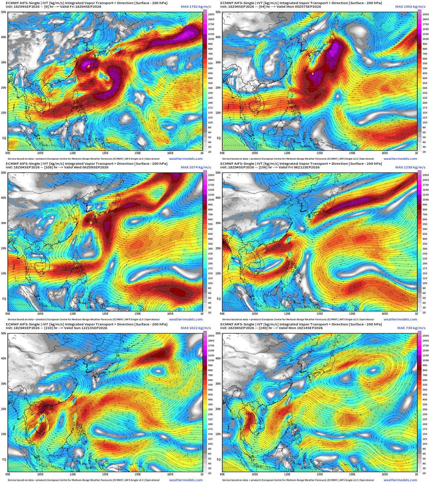
Flagship model: ECMWF AIFS 18z —> Integrated Vapor Transport next 10-days
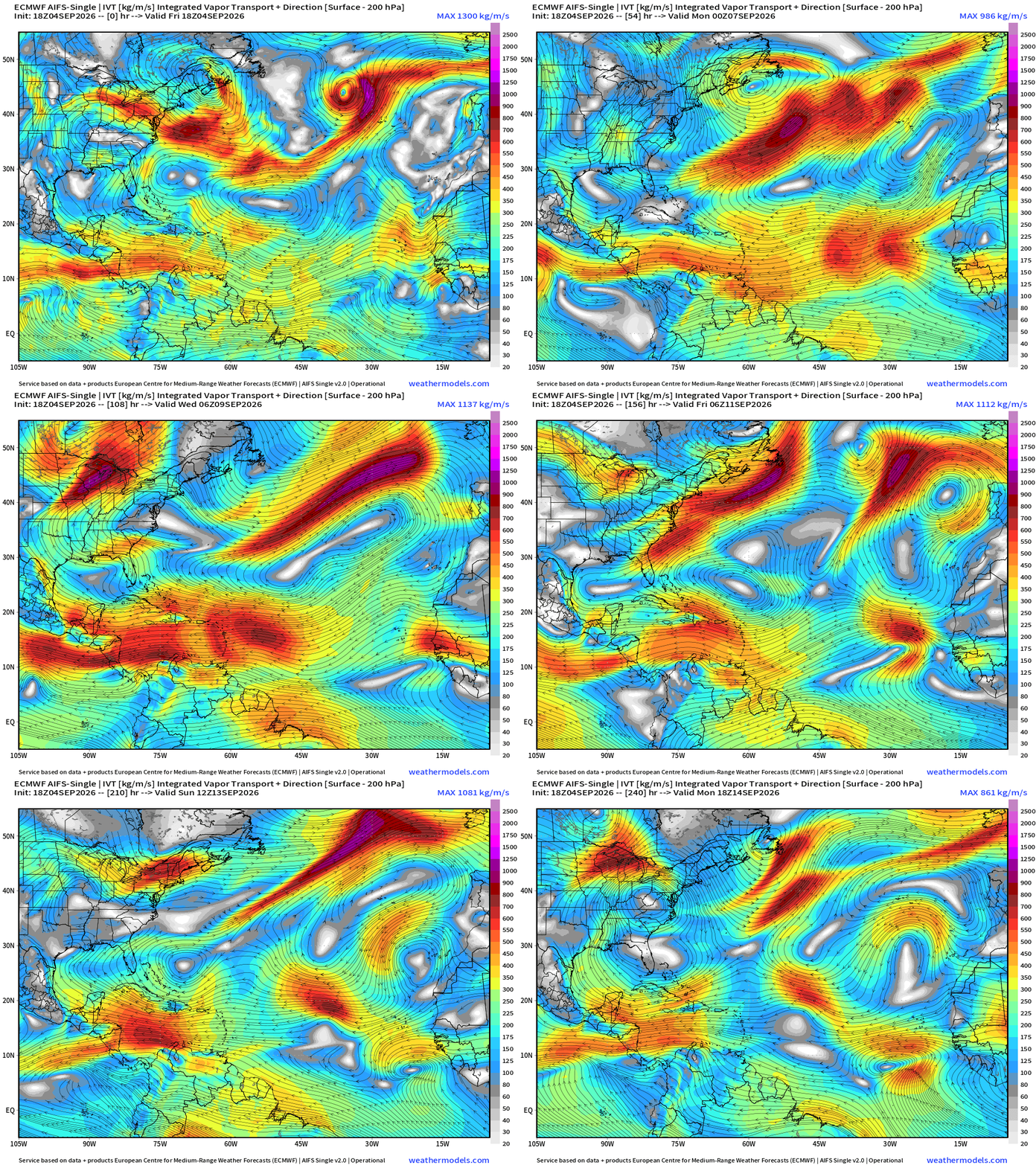
Atlantic —> completely shut-down into mid-September!
Eastern Pacific Tropics

Karina + Lowell + Marie — then Norbert (50% chance)
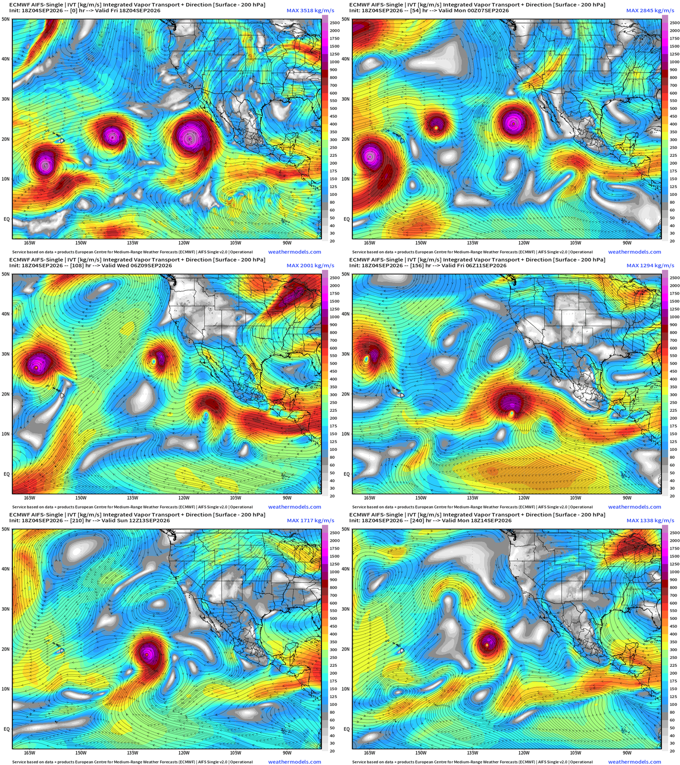
Three Hurricanes in different stages of their lifecycles
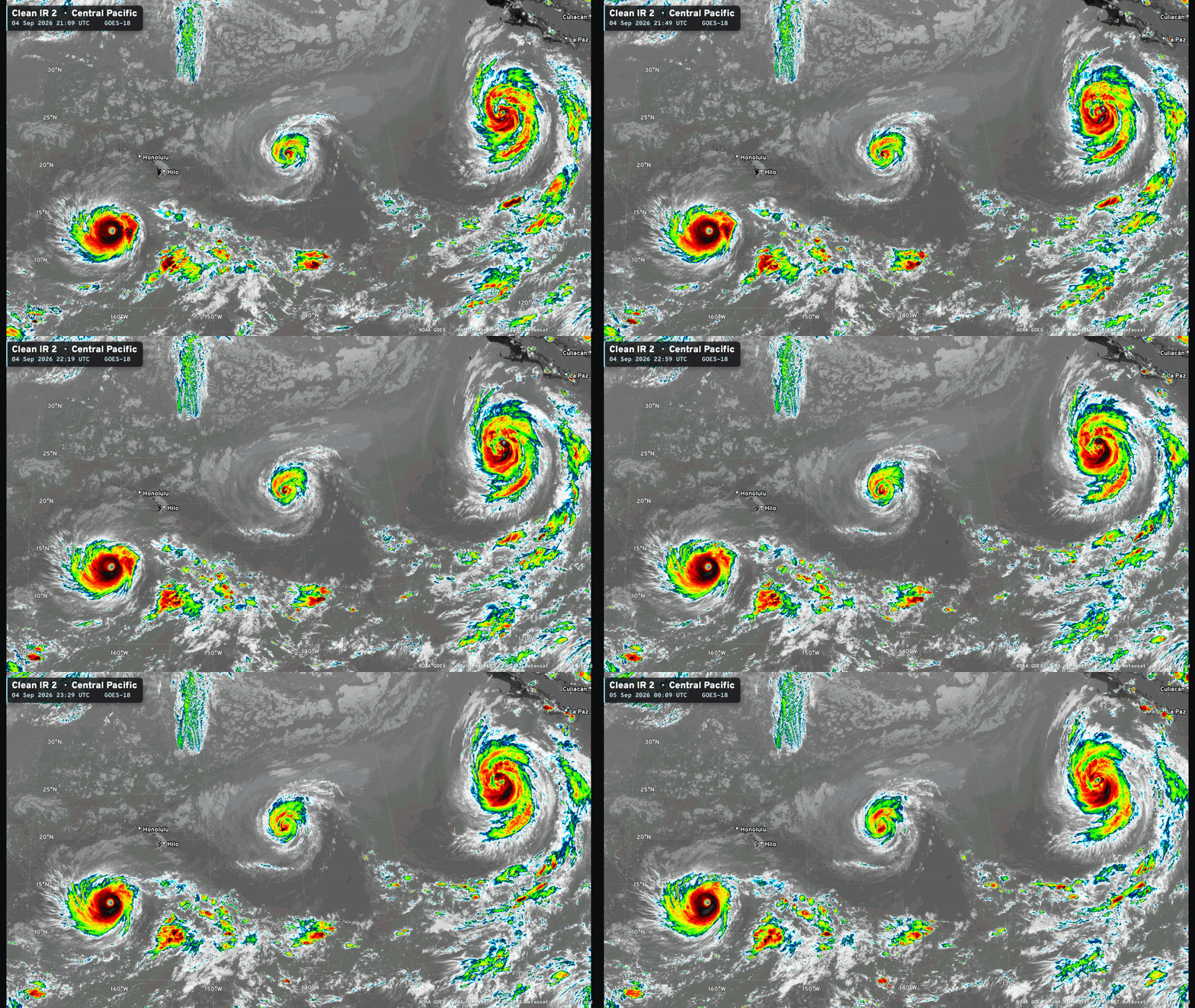
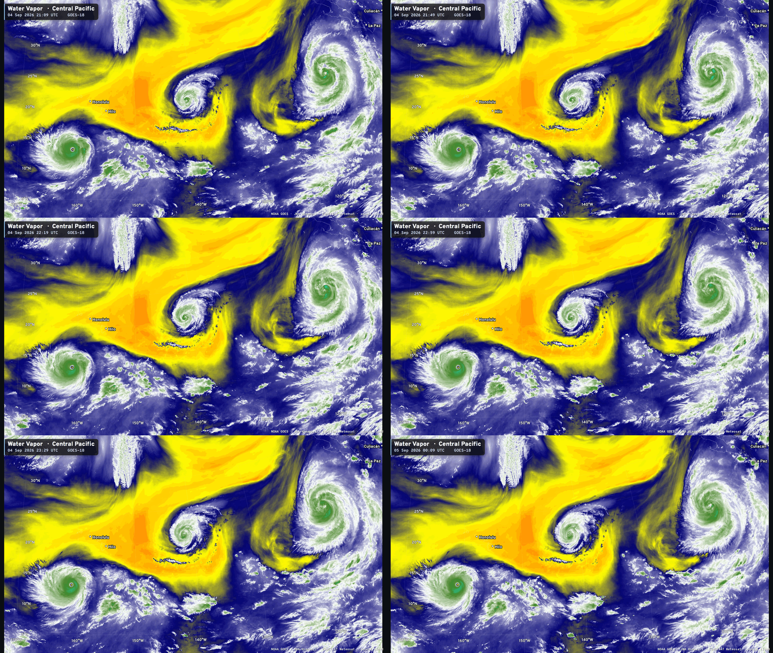
Hurricane Lowell (12E) — 130 knots (Category 4) + 926 mb
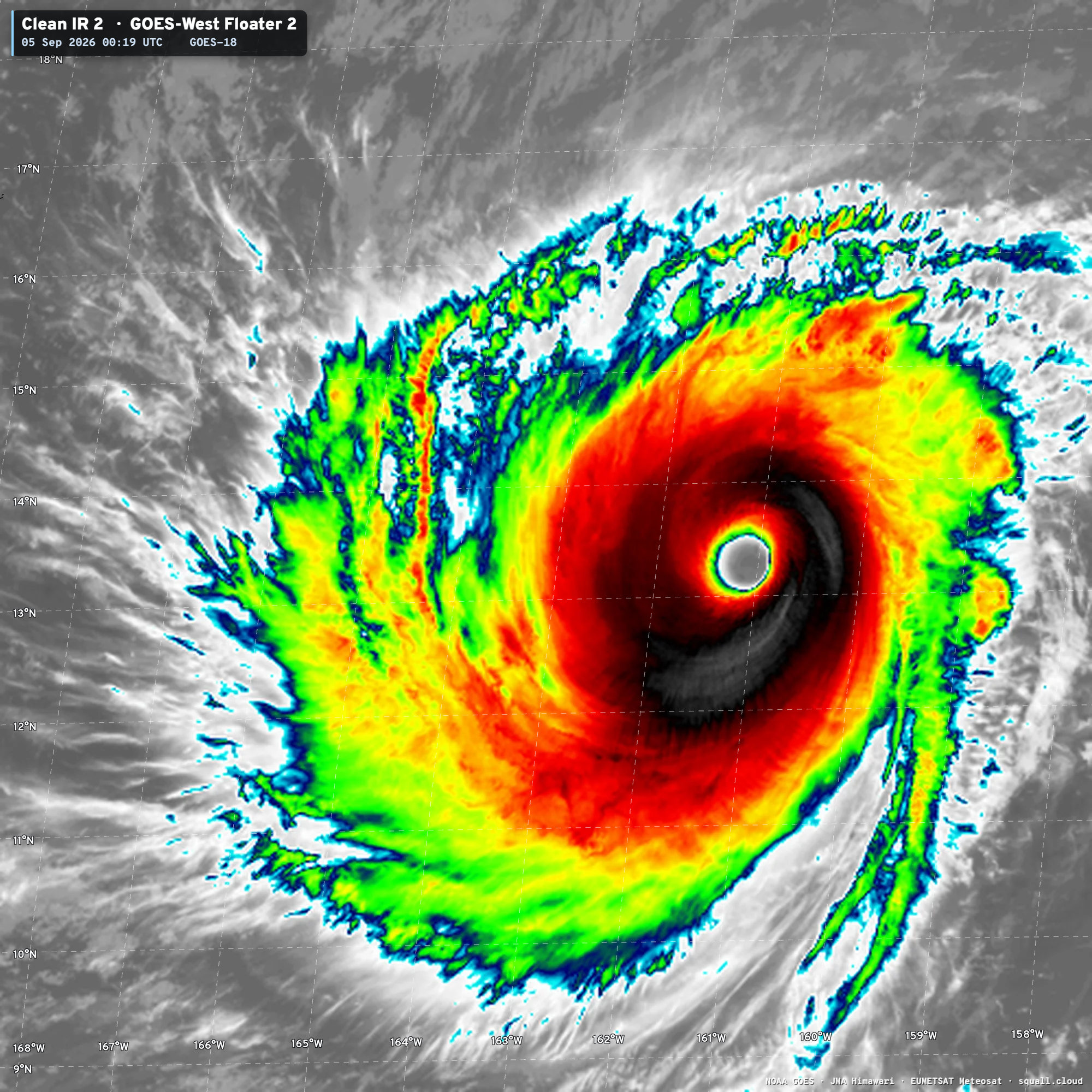
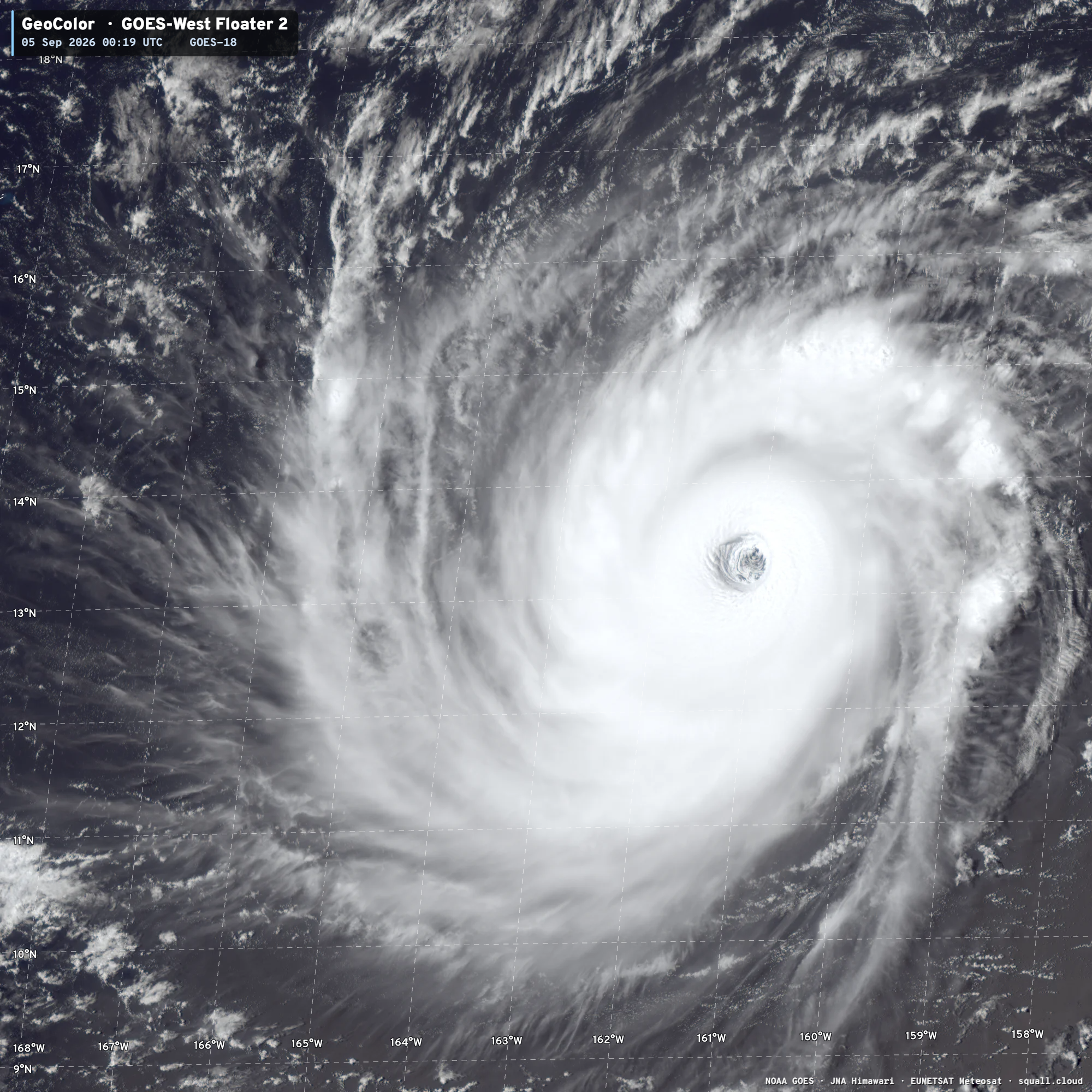
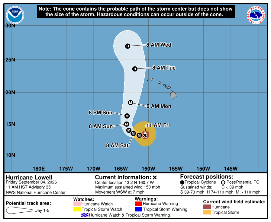
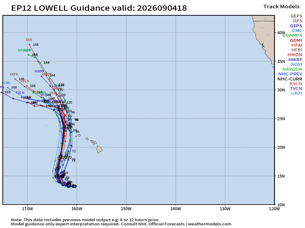
The center stays west of Kauai but the hurricane will be huge … so still potential for major impacts into early next week!
Hurricane Karina (11E) — 75 knots Category 1
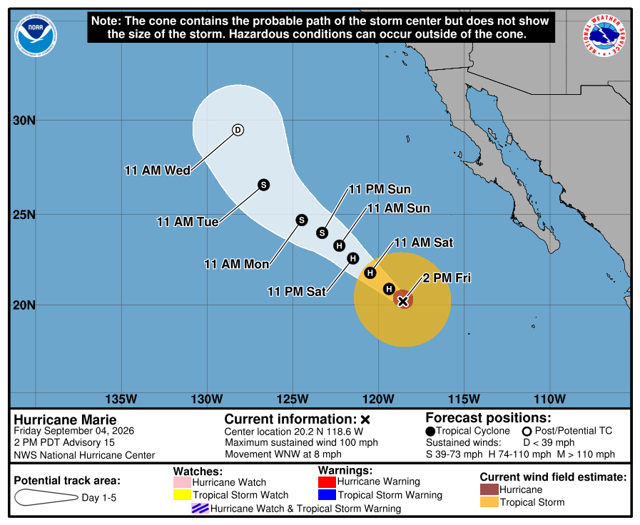
Hurricane Marie (13E) — 85-knots (Category 2)
Western Pacific Tropics
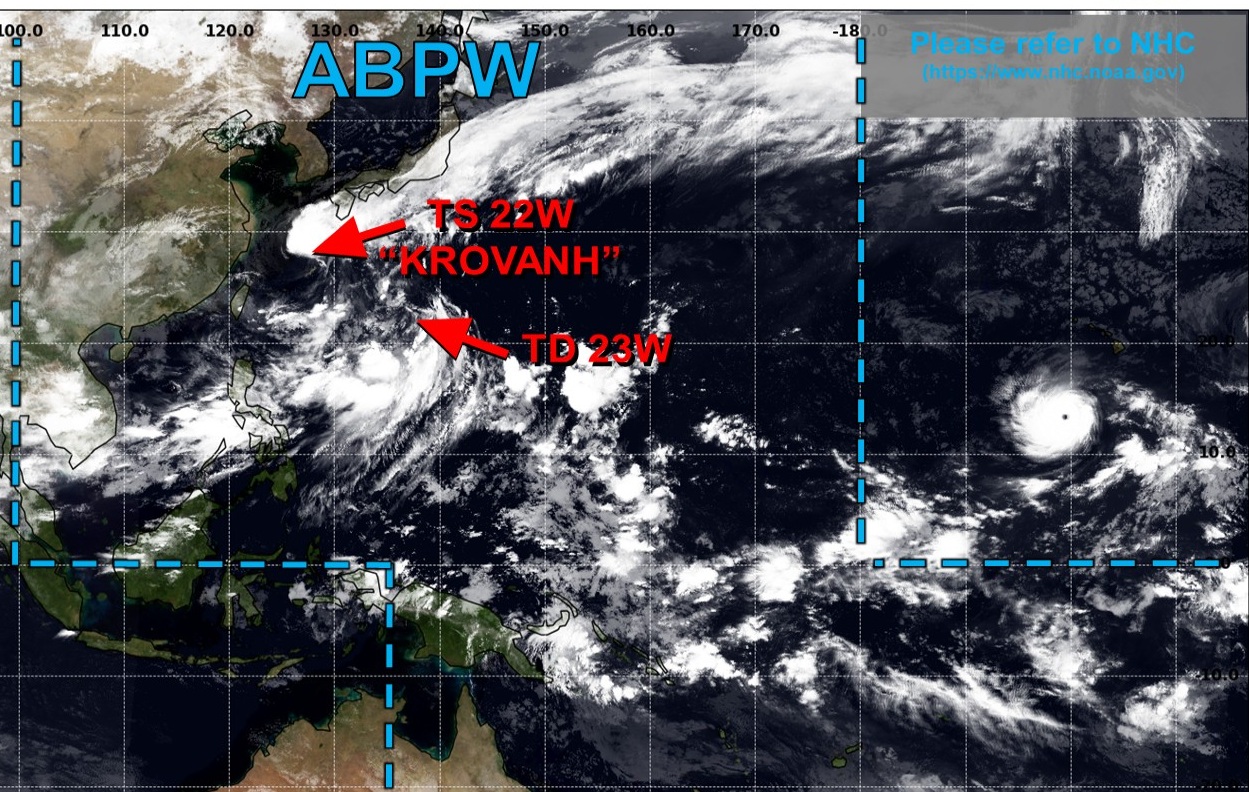
Bizarre track with Tropical Storm Krovanh
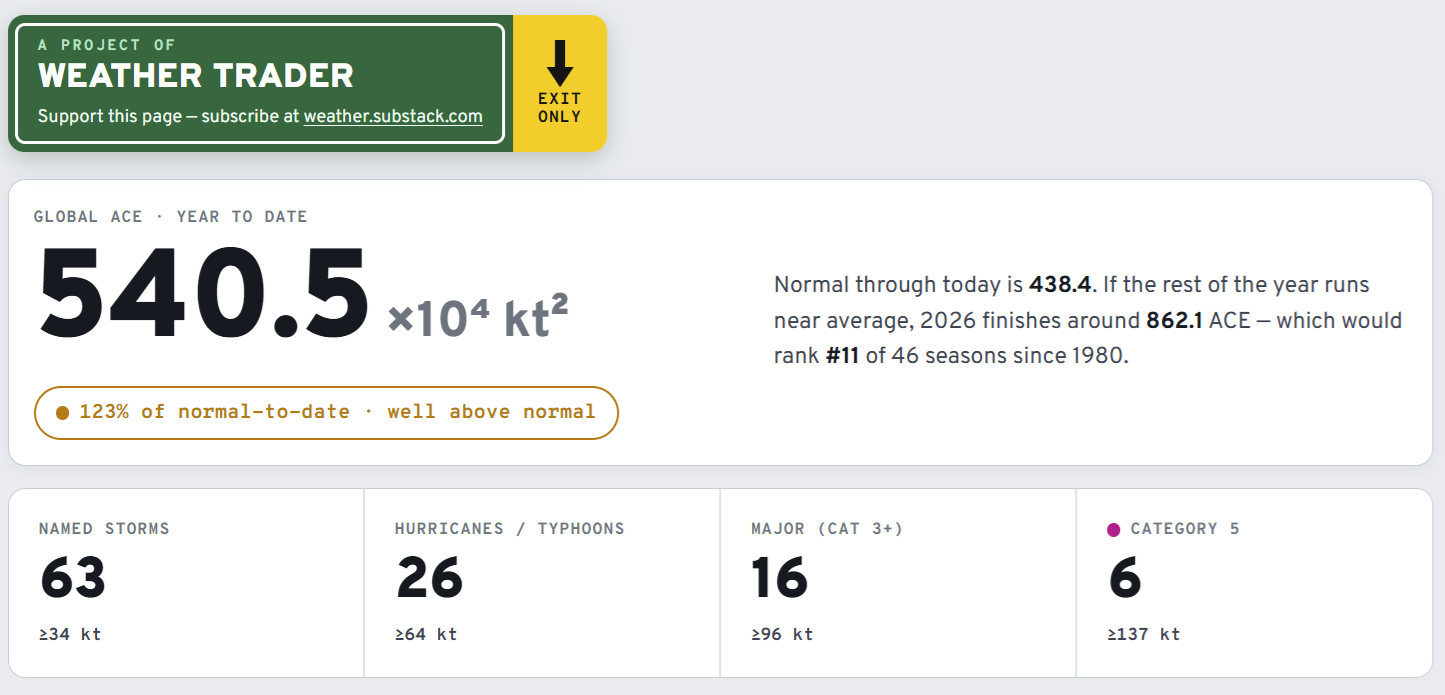
Global Tropical Cyclones for more ACE information, as well as my original climatlas.com/tropical site now with the beautiful Interstate Highway theme and full of interesting content! ACE now over 515!
Forecast Eagle maps explorer in beta for another ~2 weeks.

Satellite imagery from Squall Cloud. Maps sourced from weathermodels.com designed and innovated by yours truly! Please subscribe there for real-time access to the newest maps, charts from all of the weather models including ECMWF and AIFS, and NOAA GFS/GEFS, HRRR/RRFS and Blend of Models (NBM). NOAA WPC and SPC for fronts/convective outlooks. Our own content is now sourced from hottestsince.com and weather.city and celsius.earth, and squall.cloud and weather.football and global-tropical-cyclones.com and precip.earth
My Atlantic Hurricane Season Forecast (2026)
From April 7, 2026: Atlantic Seasonal Hurricane Forecast: (11/5/2)
9-13 Named Storms (11 most likely)
4-7 Hurricanes (5 or 6 most likely)
1-3 Major Hurricanes (2 most likely)
Accumulated Cyclone Energy: 75-85 (well below normal)
NOAA 2026 Atlantic Hurricane Season Forecast
- Milepost
- 1025 · laid 2026-09-05T00:45:07.211000Z
- Source
- https://weather.substack.com/p/september-4-2026-friday-evening-weather
- Digest
- 2fcc5f6308867cc67f4f4f2a4607810262b83d8b2bcae6685bca6988499f1c9e
- Machine
- JSON