August 31, 2026 Monday Evening Weather
Tropical Storm Edouard slowly organizing in the Gulf. Eastern Pacific going bonkers with potential of 3 major hurricanes in a row.

Thank you for sticking with me during this admittedly “very quiet” Atlantic hurricane season due to El Niño.
Weather Trader is entirely reader-supported publication [no ads]. To receive all new posts and support our growing platform, consider becoming a paid subscriber / supporter. The main platform is almost done — so many moving parts, but you (subscribers) will have a fully functional model-based “weather trading” system including forecasts, verification, and insight into circulation regimes, model strengths and weaknesses, ensemble clusters, and forecast forks. Connected through weather.city also updated with help from Forecast Points and Forecast Eagle Maps. This is way beyond simple picking the high temperature tomorrow in a city. That’s boring and useless, and instead, you’ll get the whole load.
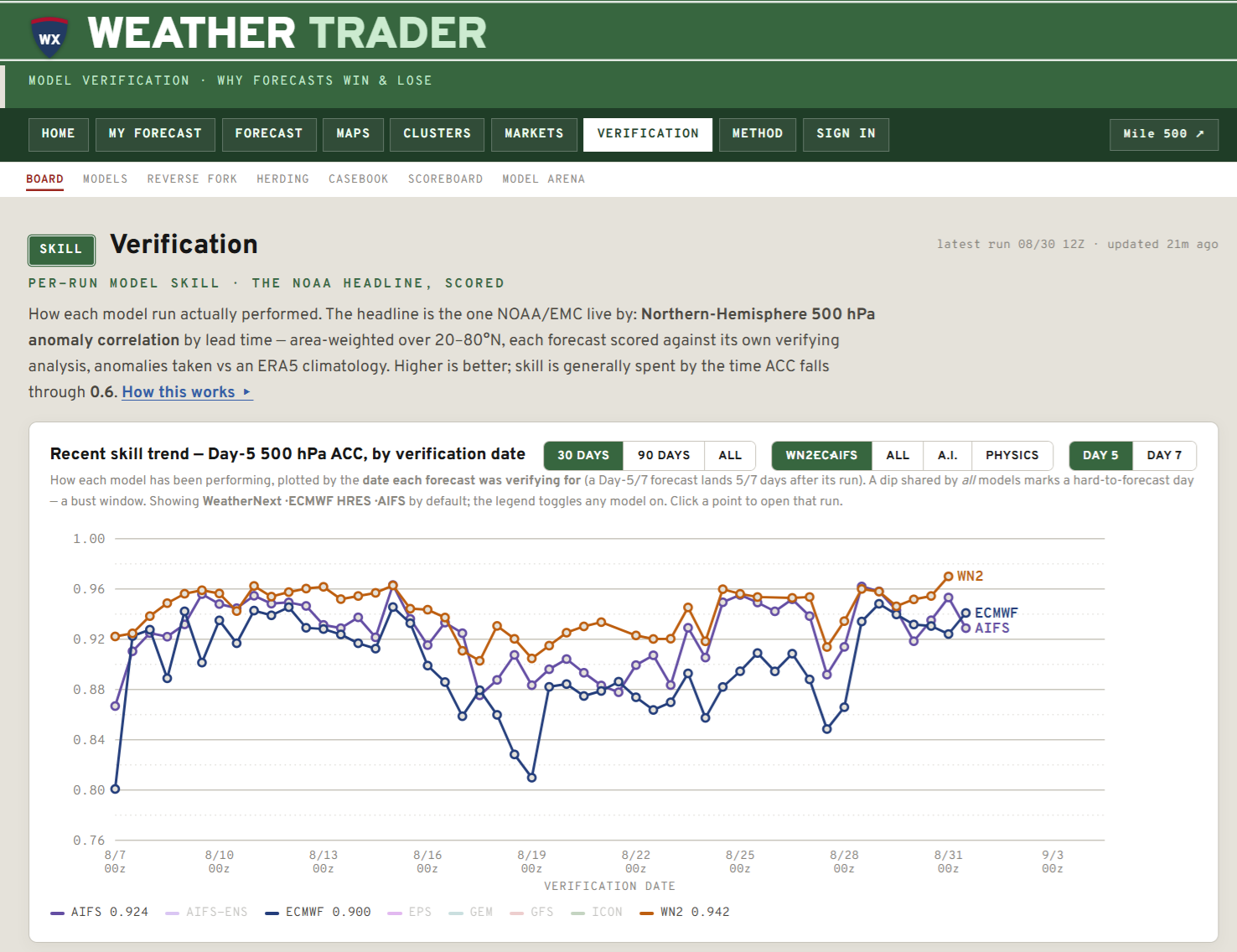
For fun, announcing climate.events library of the history of climate over the past 2,500 years. I’m actually an accidental scientist / meteorologist as my undergraduate degree focus was history (Russian/Soviet) and I dabbled in atmospheric sciences at Michigan (Go Blue!). My undergrad honors thesis was at the Gerald R. Ford library on the engineering campus right down the hill from my atmospheric sciences building.
I’m fascinated about climate history and fervently think that it is highly neglected as a discipline perhaps because it takes focus off much more political climate change. I read a lot, and while this iteration of climate.events is the culmination of several weeks of A.I. assisted research, I’m eager to dig deeper into many historical events and write about why they matter. Please have a look around: I certainly want the site to be beautiful — part of my “Weather Made Beautiful” outlook on weather maps, too.
As new papers are published in the peer-reviewed literature (or books), I’ll be updating the page to include the new found wisdom and add context.

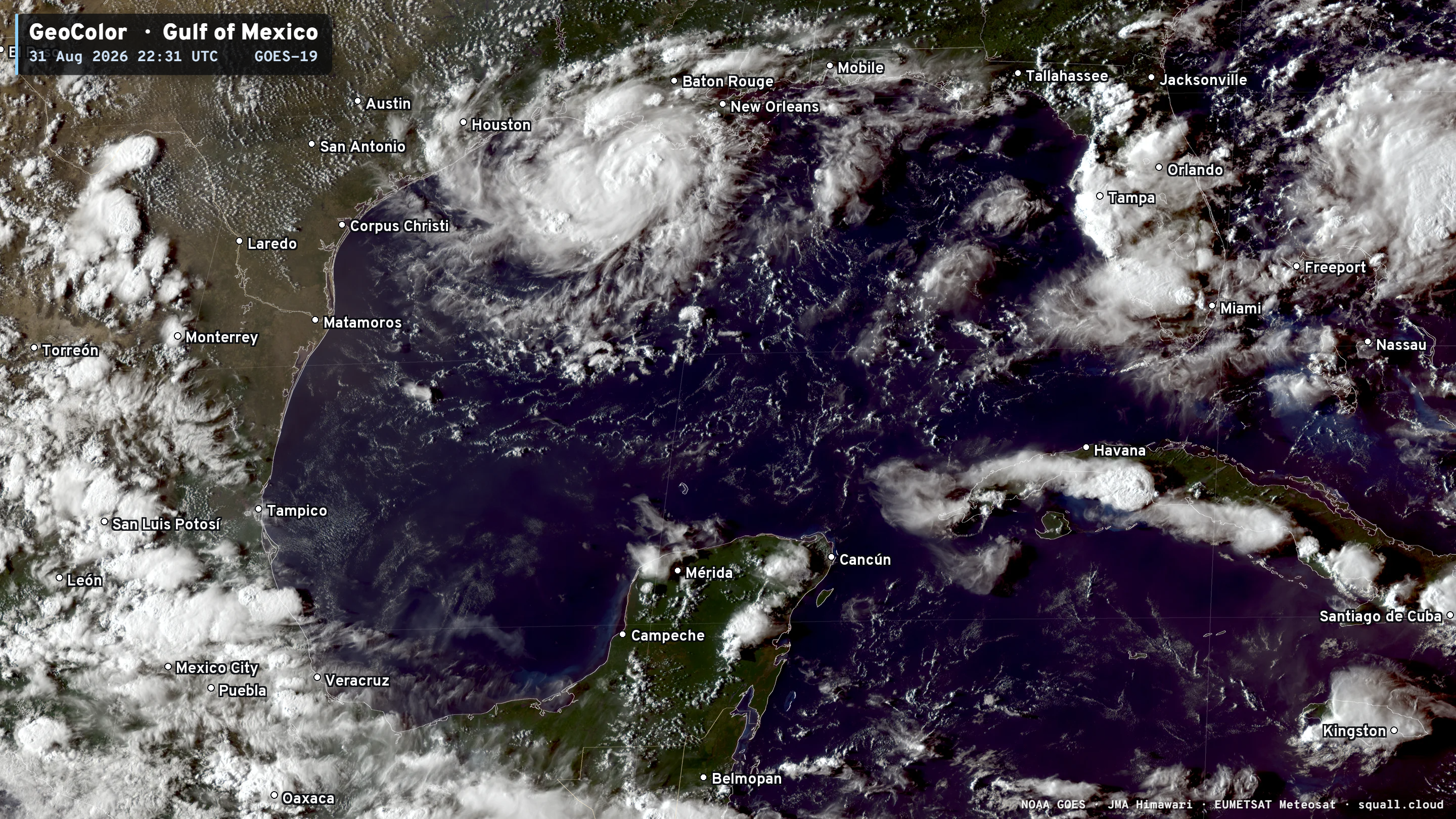
Headlines Monday Evening in the Tropics
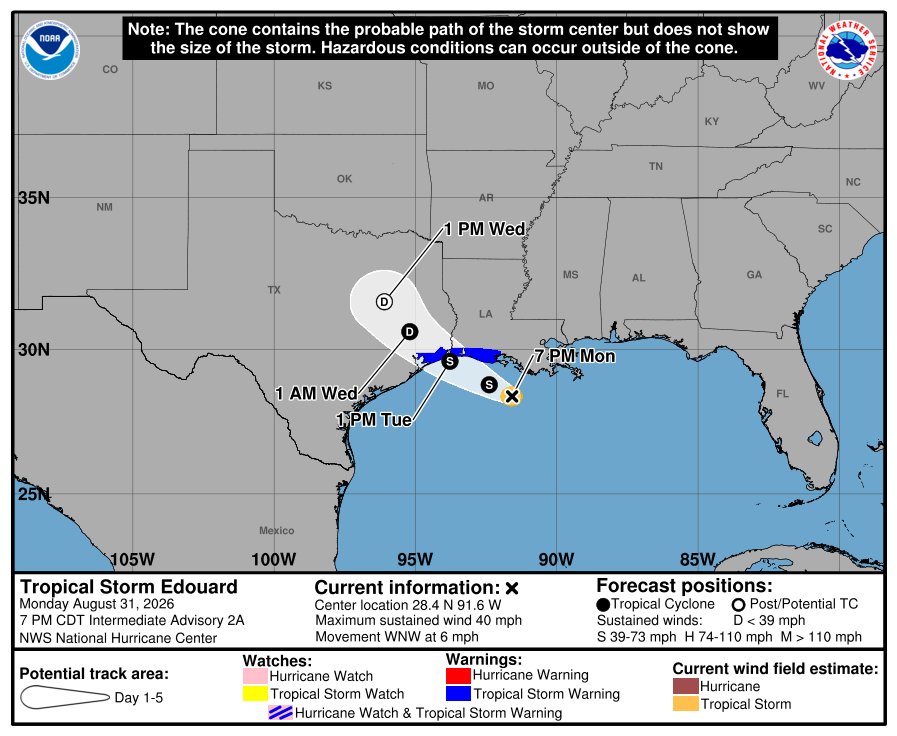
Tropical Storm Edouard landfalls Texas near Houston later on Tuesday with up to 60 mph winds and heavy rainfall. This is actually great news for Texas which has been baking under a heat dome.
The remnants of Tropical Storm Dolly then cross into the Gulf from Florida and increase the threat of rain along the coast. Also, great news.
Very warm and humid conditions start September across the eastern half of the Lower 48 with an assist from a “heat dome” anchored over the Central Plains
Hurricanes Karina, Lowell, and soon Marie will be mixing fish in the Eastern and Central Pacific —> huge ACE makers for the hurricane factory.
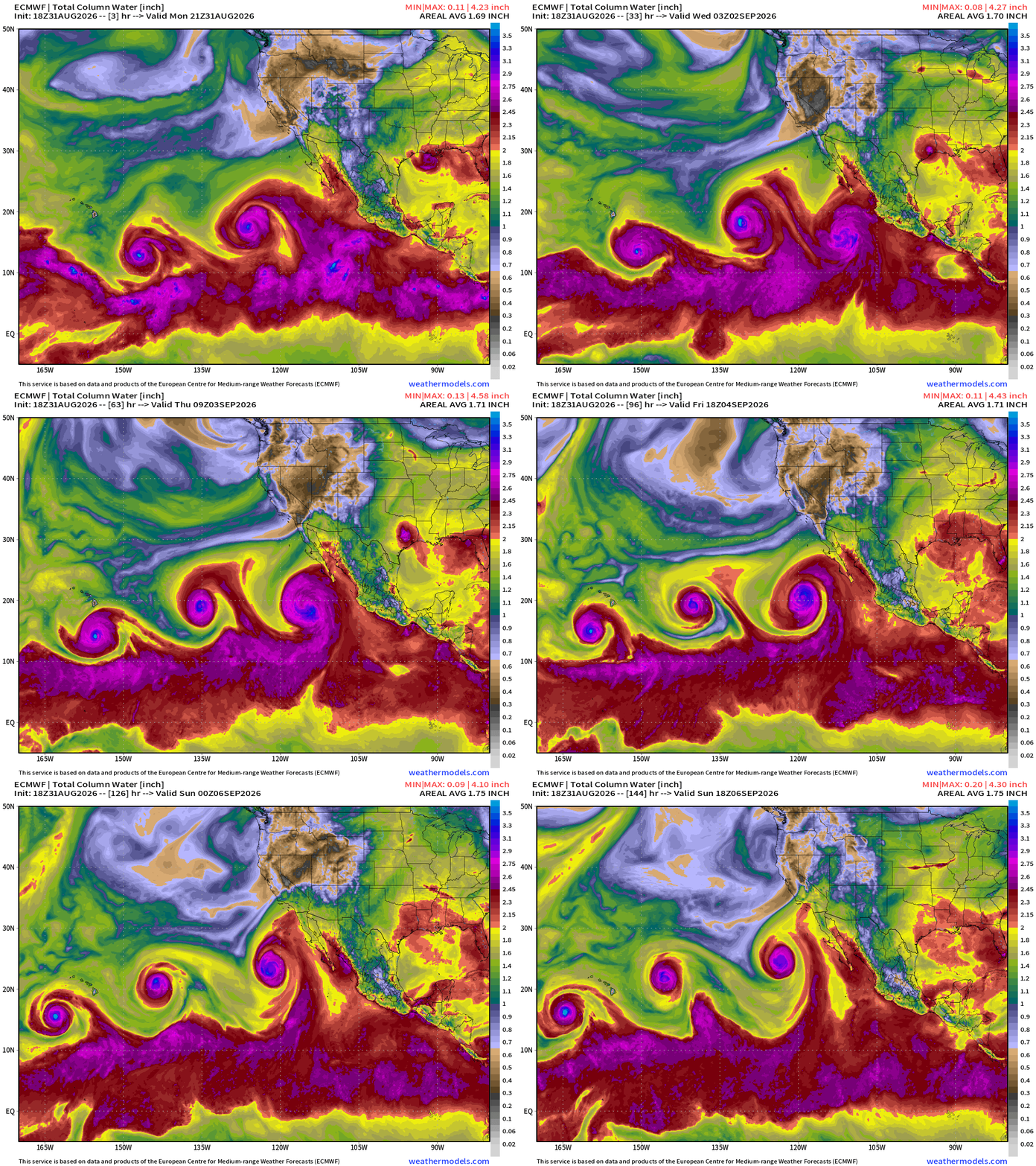
Precipitable Water | My Favorite Parameter (6-days ECMWF 18z)
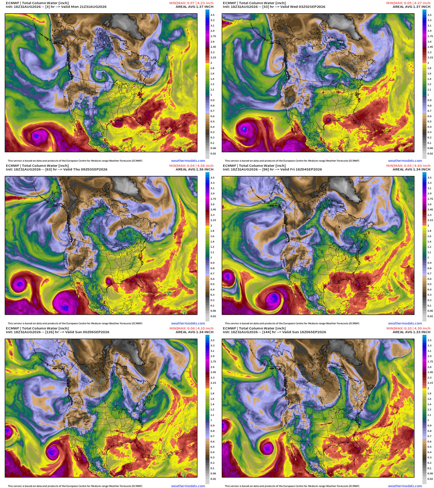
Moisture from Hurricane Marie will be dragged into Southern California and the desert Southwest —> potential for major monsoonal rainfall with an upper-level trough providing some lift and instability and cool air at mid-levels.
Height Anomaly 10-days | AIFS 18z —> upper-level circulation pattern
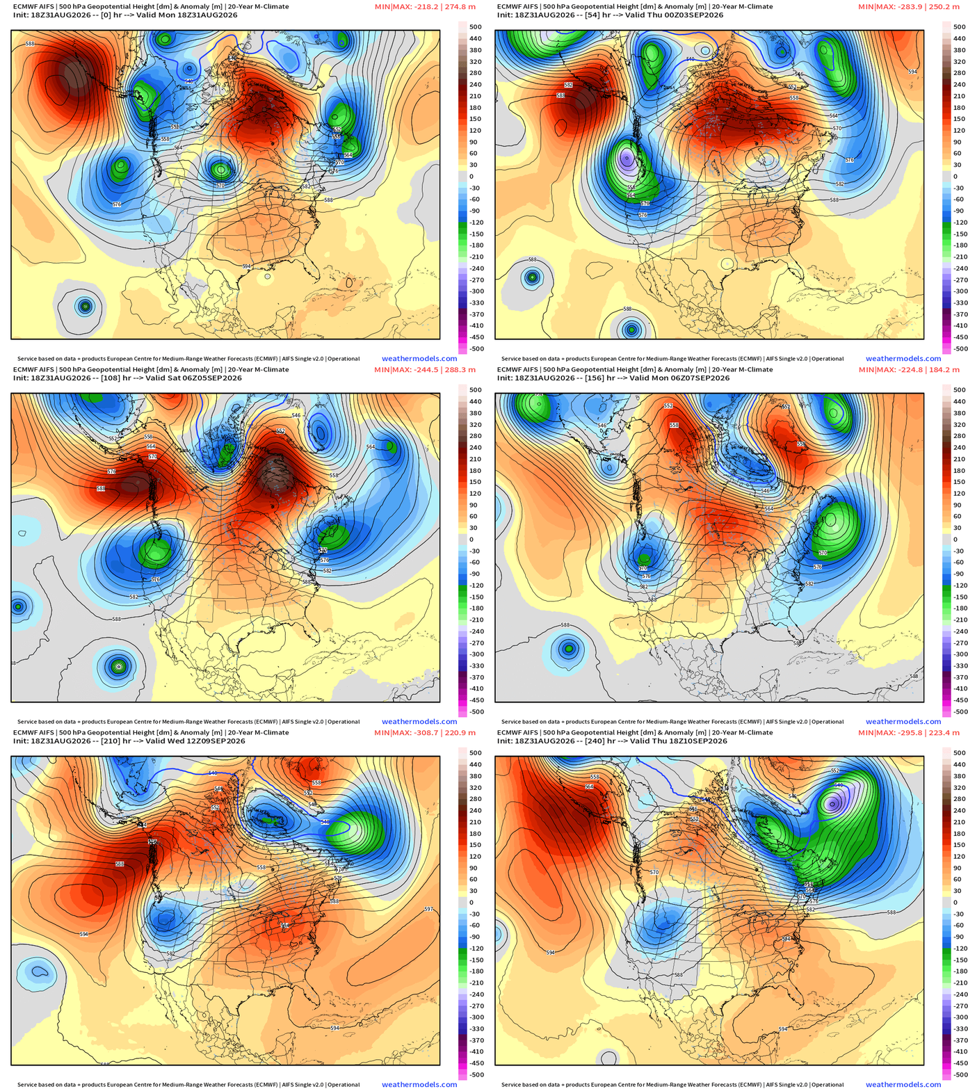
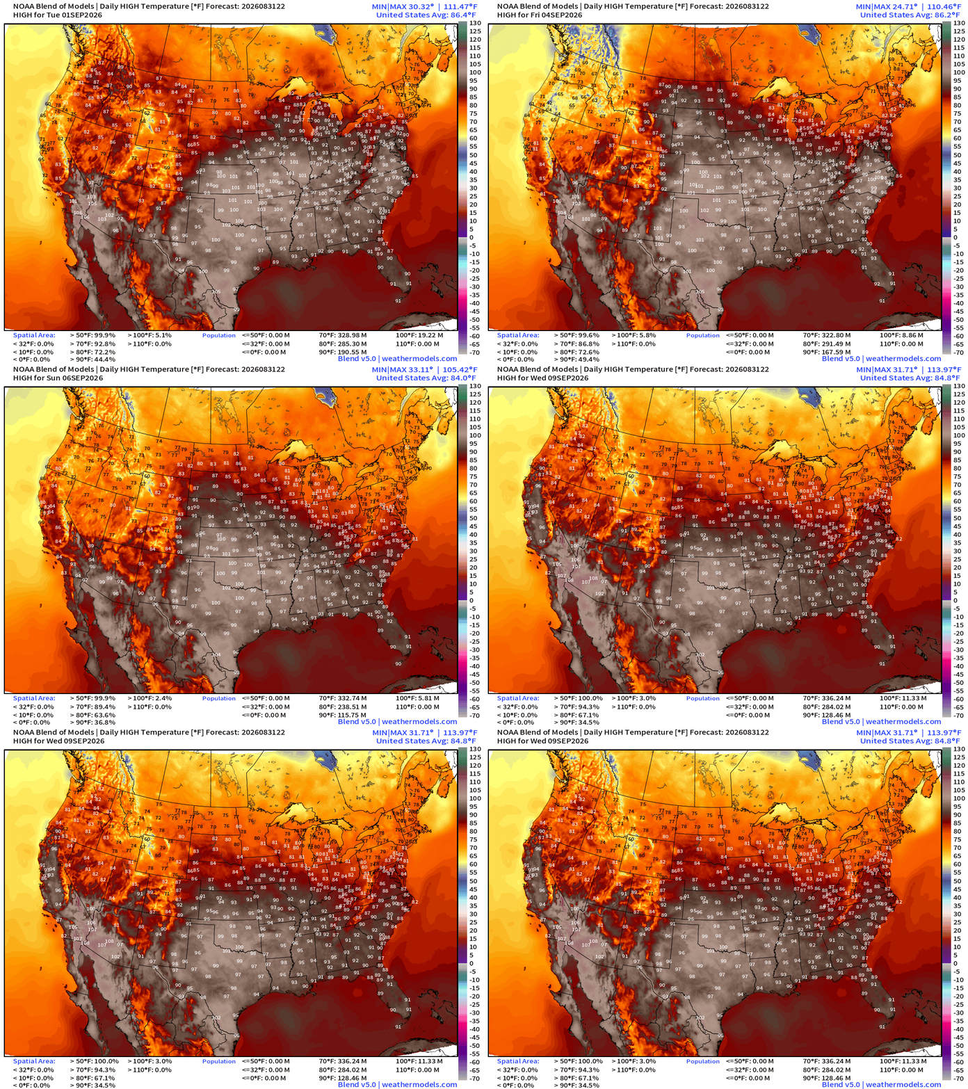
Heat dome ridge doesn’t really break for the next 10-days … the center wavers between the Southeast and Texas, and then back into the Mid-Atlantic, keeping much above average temperatures in place into mid-September —> HOT.
Multiple strong shortwave troughs dump out of Alaska down the West Coast —> unsettled, cool and wet. Combined with the monsoon moisture —> recipe for some very welcome heavy rainfall across California and the Great Basin and Four Corners.
Low Temperatures Tuesday Morning
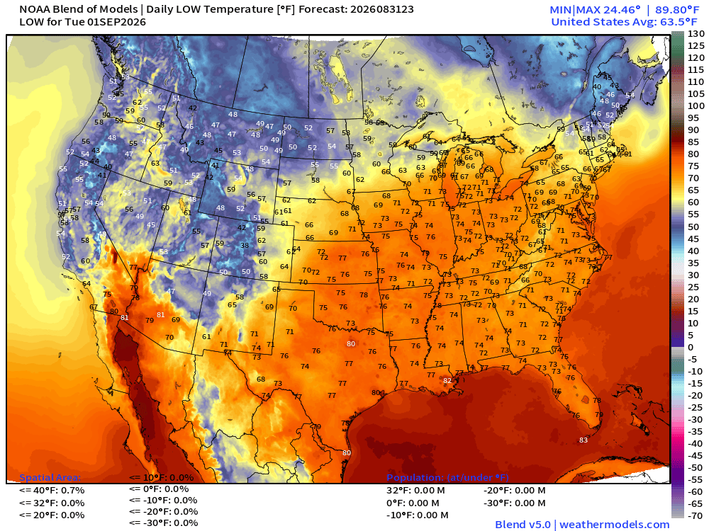
mid-70s into Michigan overnight — sultry … you’ll need to get into Maine for the 30s and 40s —> if you’re still out camping before Labor Day.
High Temperatures on Tuesday
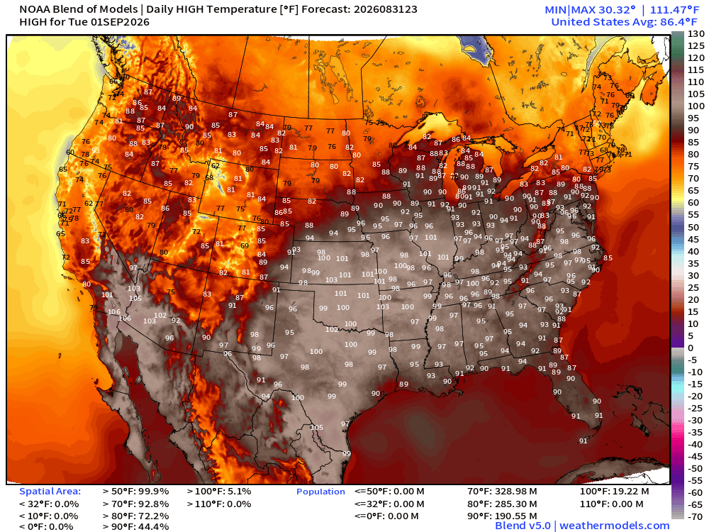
Very hot with 100s in into central Illinois and mid-90s into Virginia. A whopping 191 million at least 90°F to start September!
High Temperatures through Wednesday, September 9th
Blend of Models — Precipitation Next 7-days
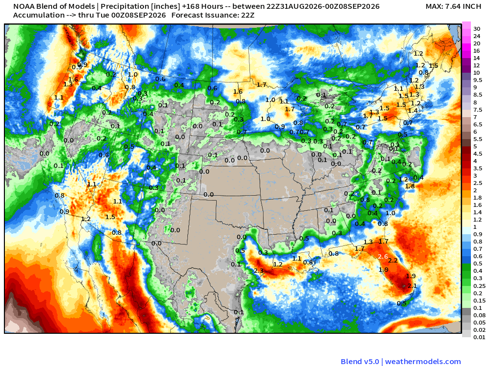
Good news to see the rainfall across Southern California and Arizona and Las Vegas, and Florida, too!
Temperature Anomaly | Next 2-weeks | ECMWF EPS 12z
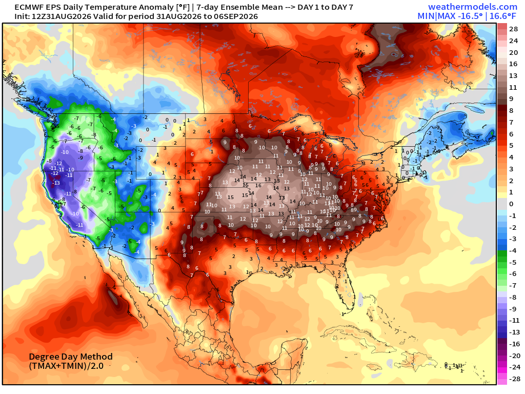
Very cool across the west with multiple troughs especially across California — but incredibly HOT in the center of the Lower 48 with the “heat dome” extending into the Midwest and Great Lakes.
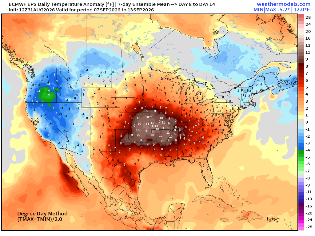
Heat dome still anchored across the Plains —> stuck into September 12th
Atlantic Tropical Outlook | Tropical Storm Edouard
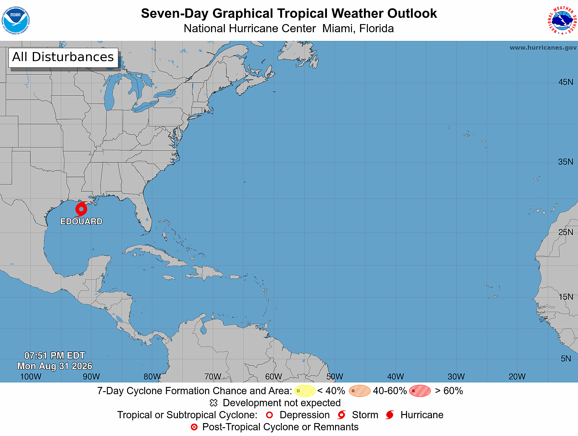
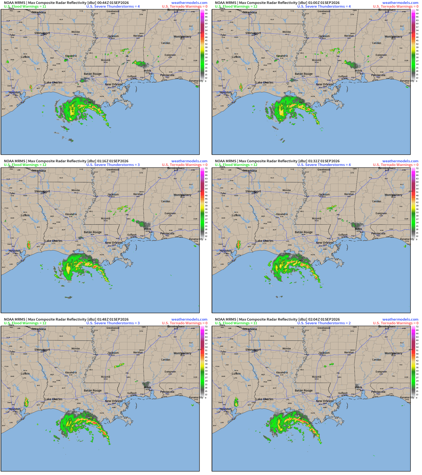
Tropical Storm Edouard looks a bit anemic this evening, but should improve organization up until landfall in Texas northeast of Houston.
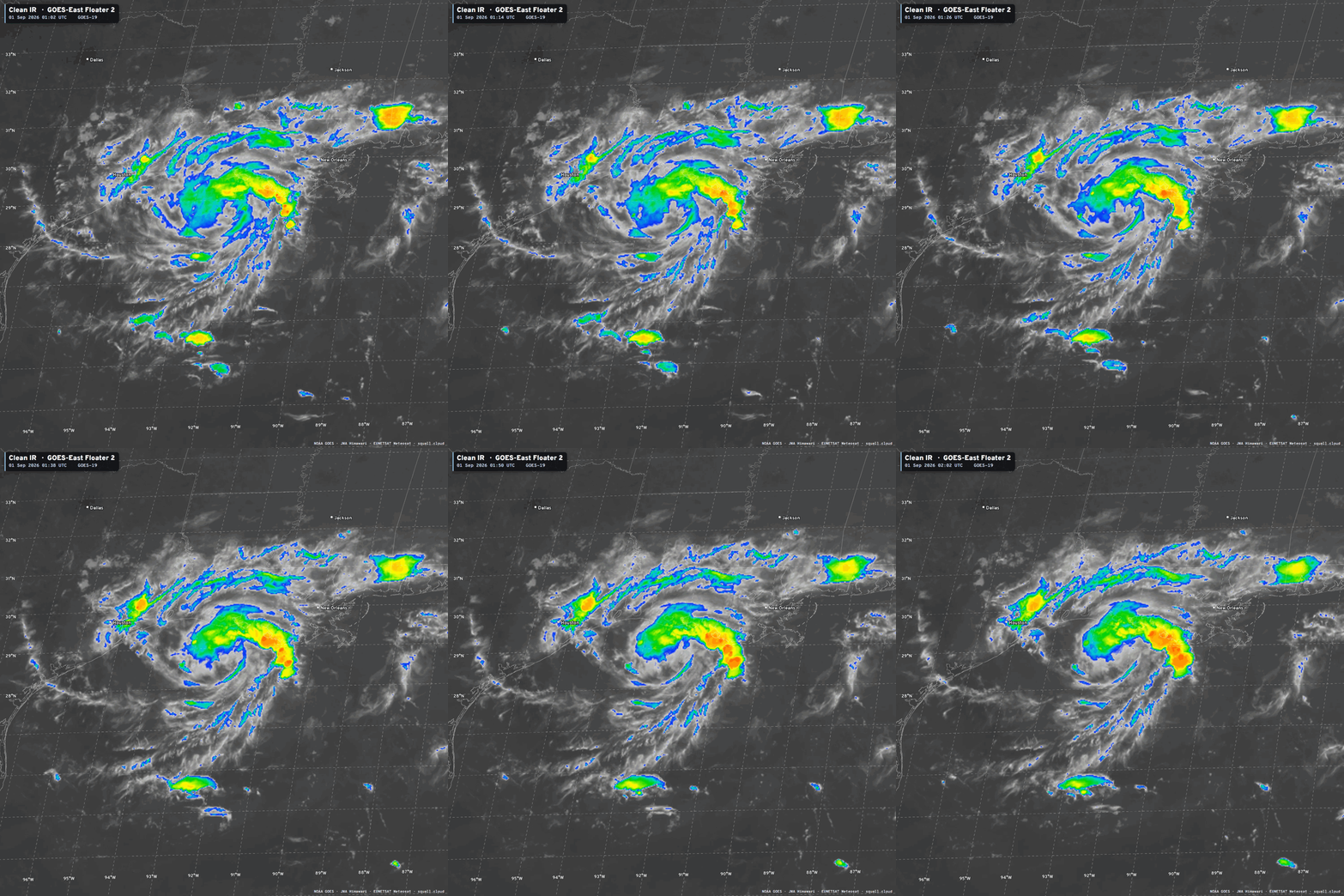
Radar:
Maximum sustained winds are around 40 mph — but could increase to 60-mph prior to landfall — short lifecycle, thankfully very little time to blow up into a major hurricane.
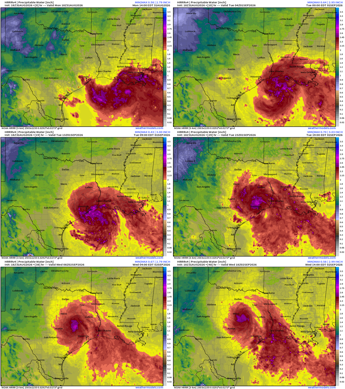
The huge blob of moisture might hold together nicely up to Dallas Fort Worth into Wednesday —> welcome rainfall and clouds.
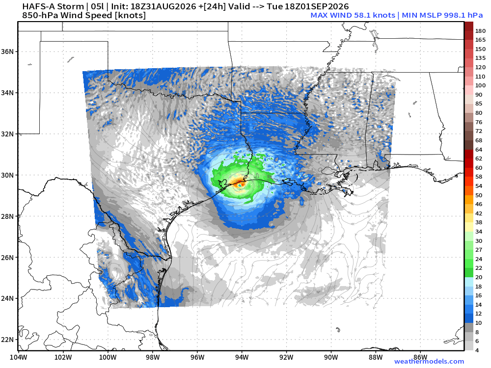
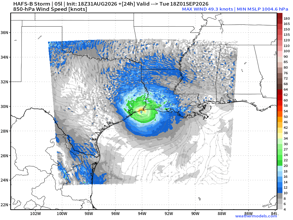
HAFS-A and HAFS-B should a mini-hurricane like circulation but winds are only 40-50 knots maximum near the surface. However, we should keep an eye on this little guy.
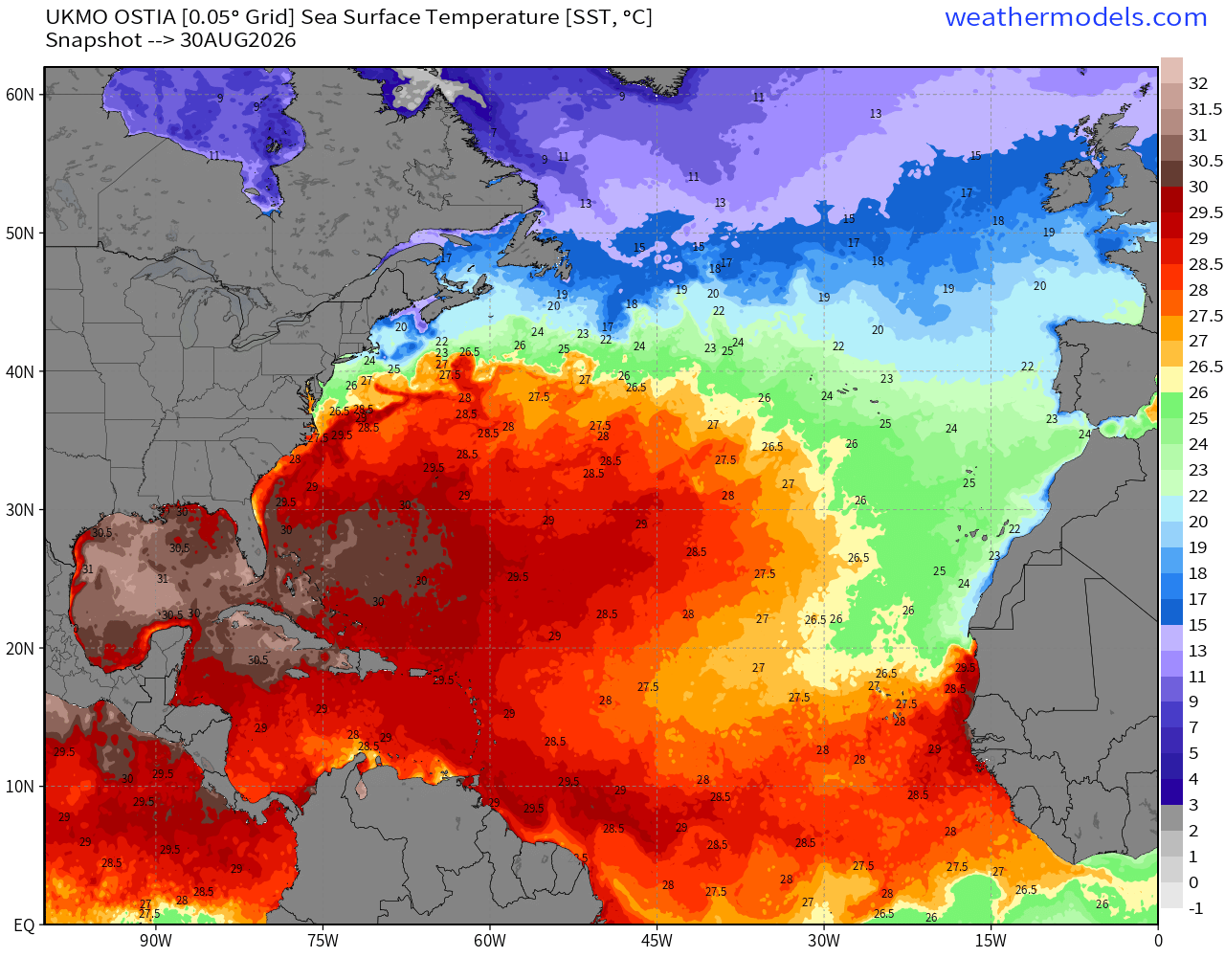
Sea Surface Temperatures across the Atlantic Basin (28°C — very warm = red)
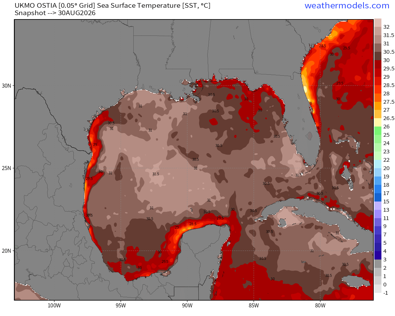
Note the > 31°C warmth in the Eastern Gulf of Mexico
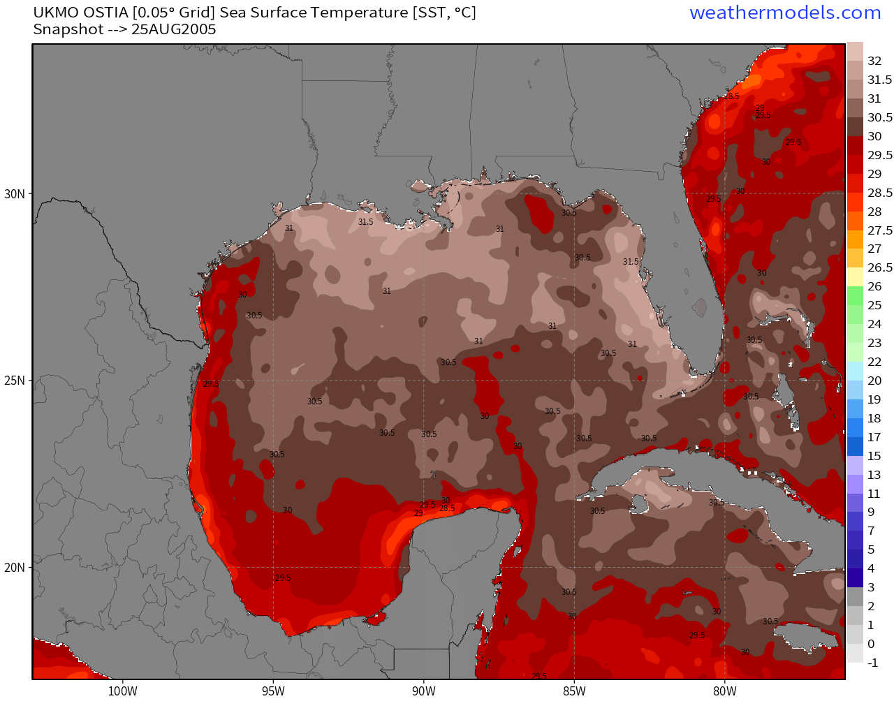
Comparison with August 25, 2005 right before Katrina!
Atlantic IR Satellite Loop | The rest of the Atlantic is dead
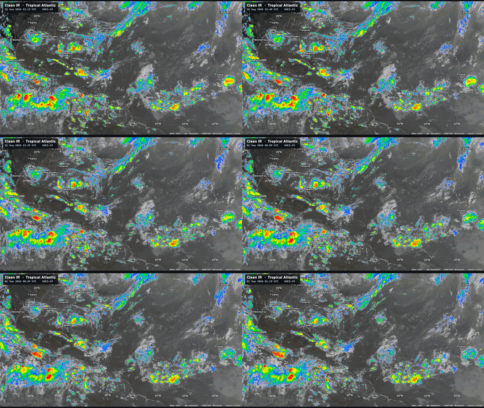

You can see more Satellite Imagery at Squall Cloud —> LINK
Atlantic Basin Tropical Spaghetti Next 15-days | AIFS-ENS
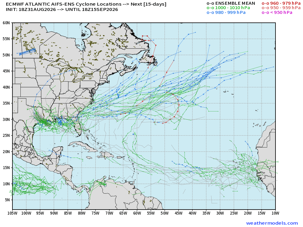
Tracks from 51-member ensemble of AIFS-18z only show scattered tracks off the U.S. east coast —> subtropical/hybrid systems, or just extratropical
ECMWF Ensemble 12z full-physics tracks next 15-days
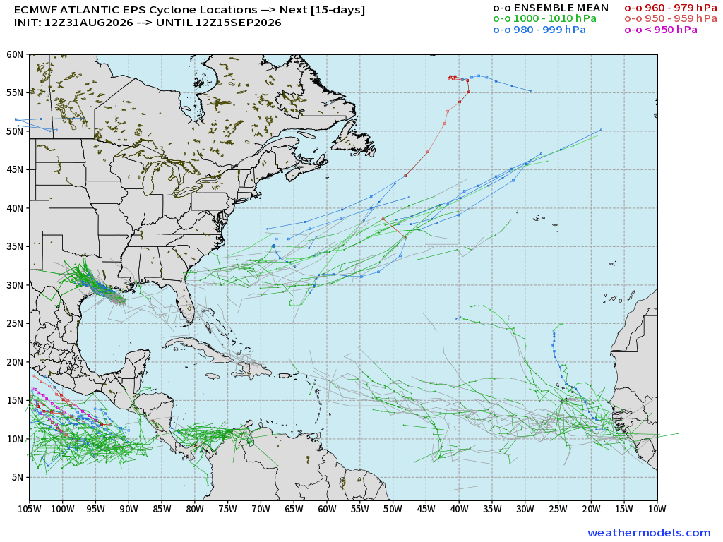
Really nothing going on …
Google Deep Mind 18z Ensemble Tracks
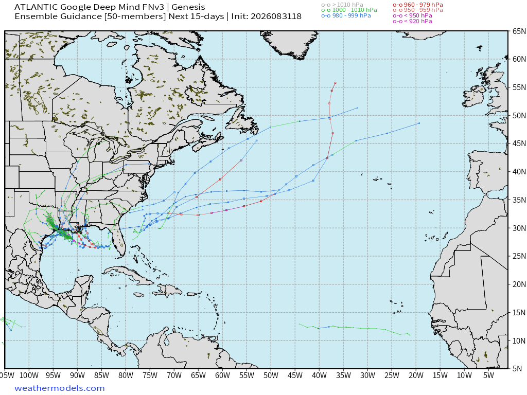
Very tiny signal for a random development in the Gulf (aside from Edouard) and out to sea … at most 10% chance of something in 2-weeks —> ghost town.
Flagship model: ECMWF AIFS 18z —> Integrated Vapor Transport next 10-days
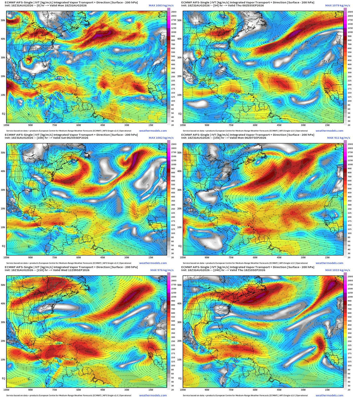
Atlantic is really hostile — and tropical waves are contorted/weak, and it’s curtains for the basin until at least mid-September.
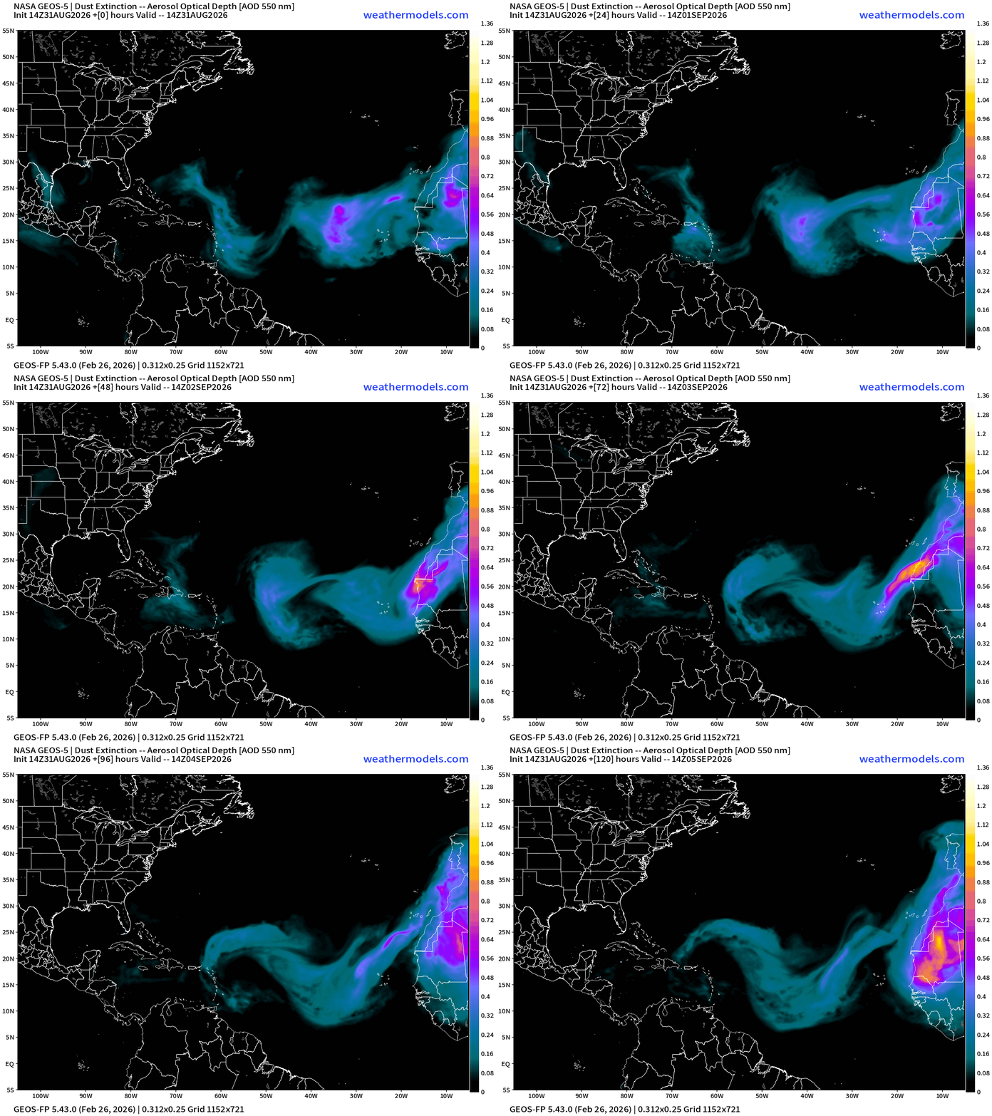
More dust over the next 5-days … into early September hostile basin
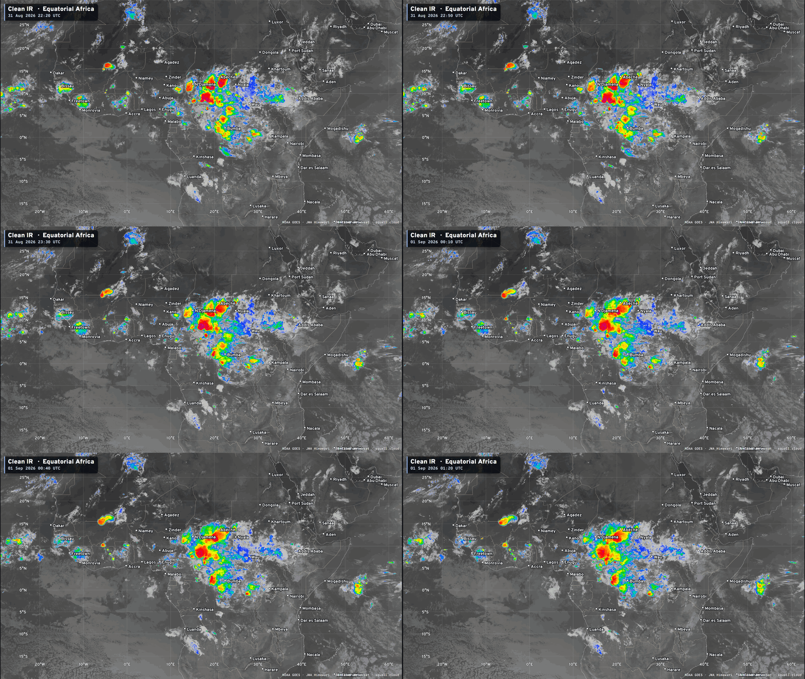
Equatorial Africa | Tropical Wave Train quiets down — only one convectively active wave over central Africa.
Eastern Pacific Tropics | Karina and Lowell (Marie soon)
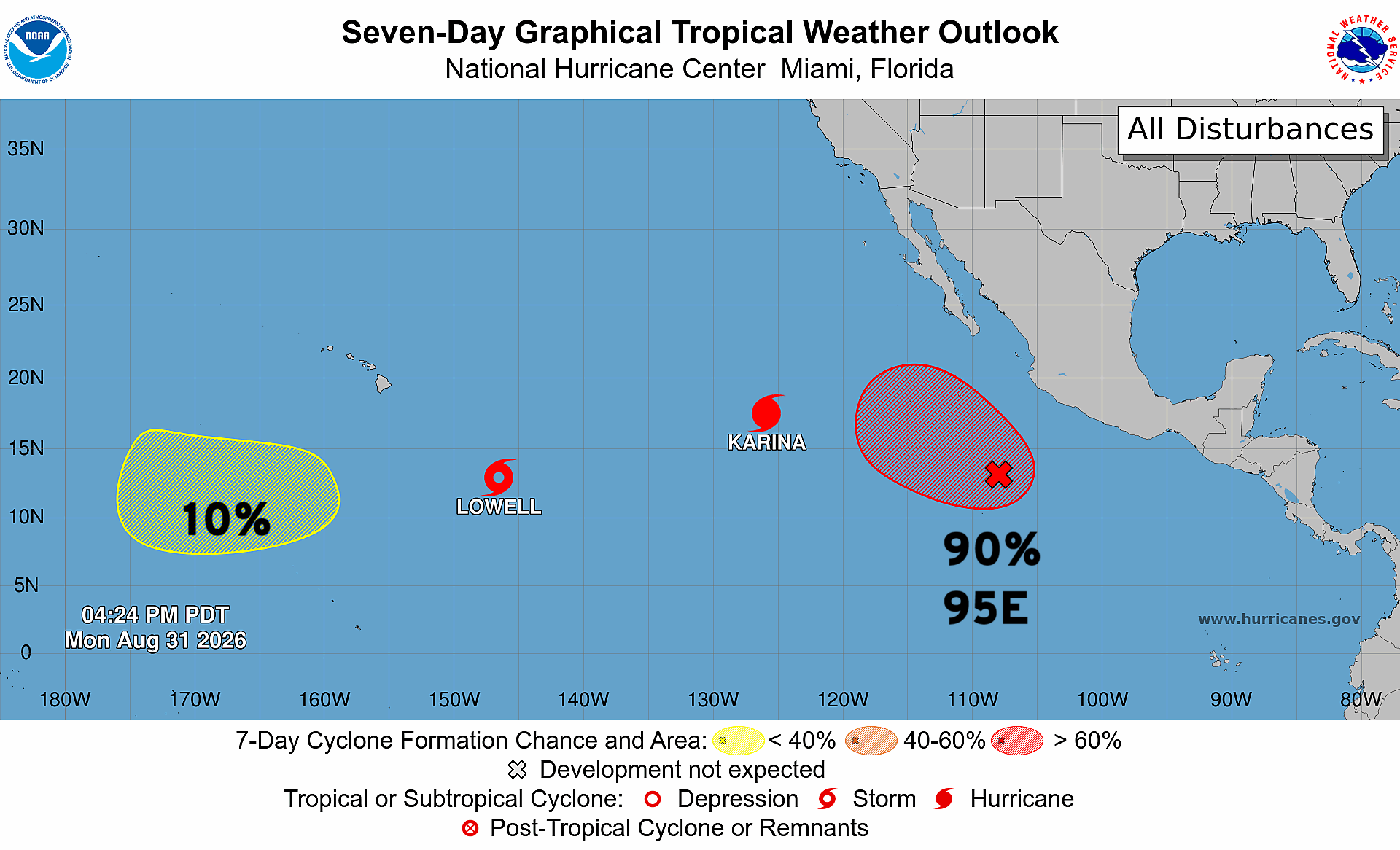
Lowell (to the left/west) is suffering from some northerly wind shear but is about to explosively intensify. Karina remains at Category 4 with a well defined eye. Waiting on TD 13E out of 95E —> Marie.
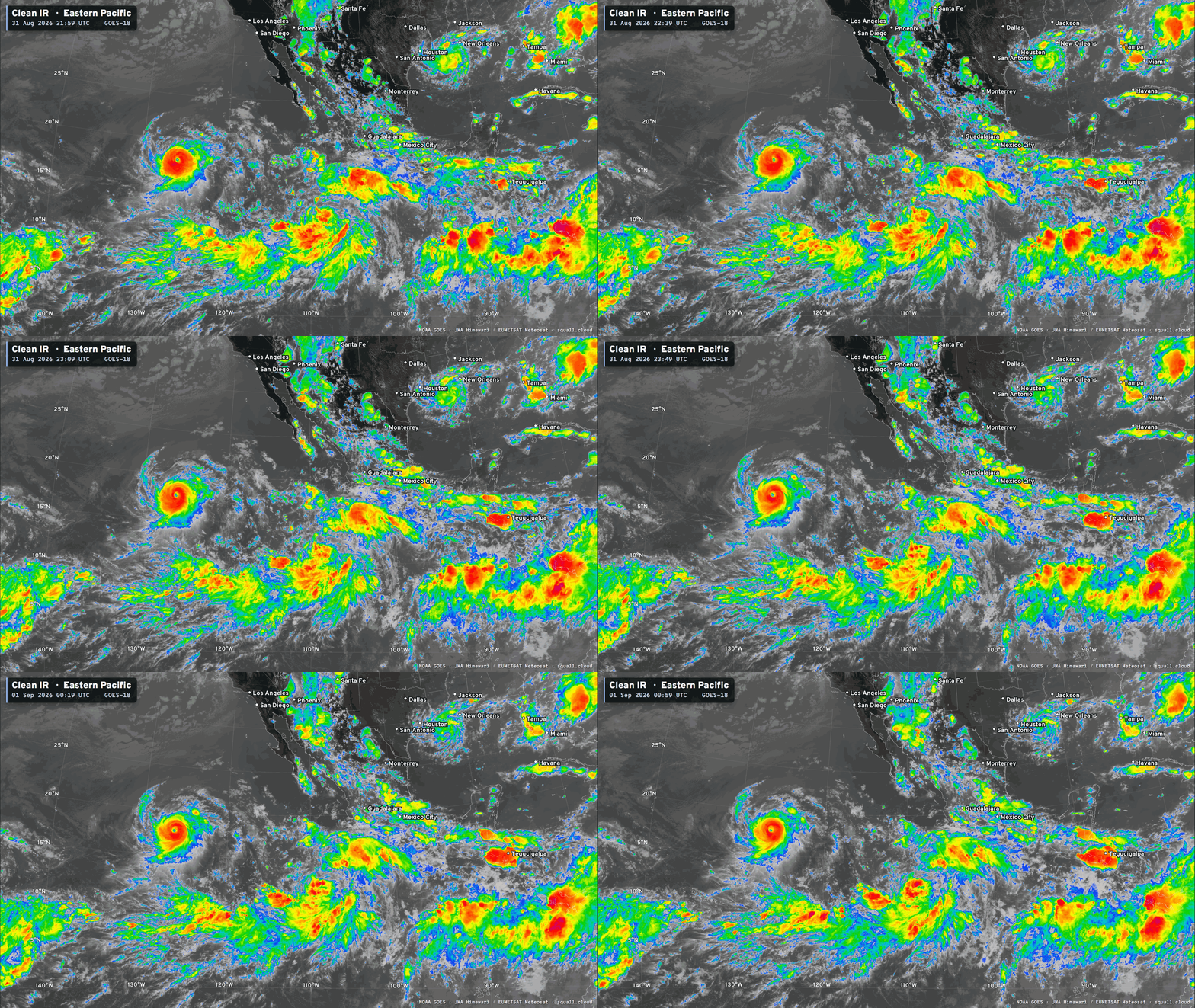
Lowell looks small and innocent, but it’s going to blow up to Category 5.
Three Major Hurricanes! Awesome Maps!
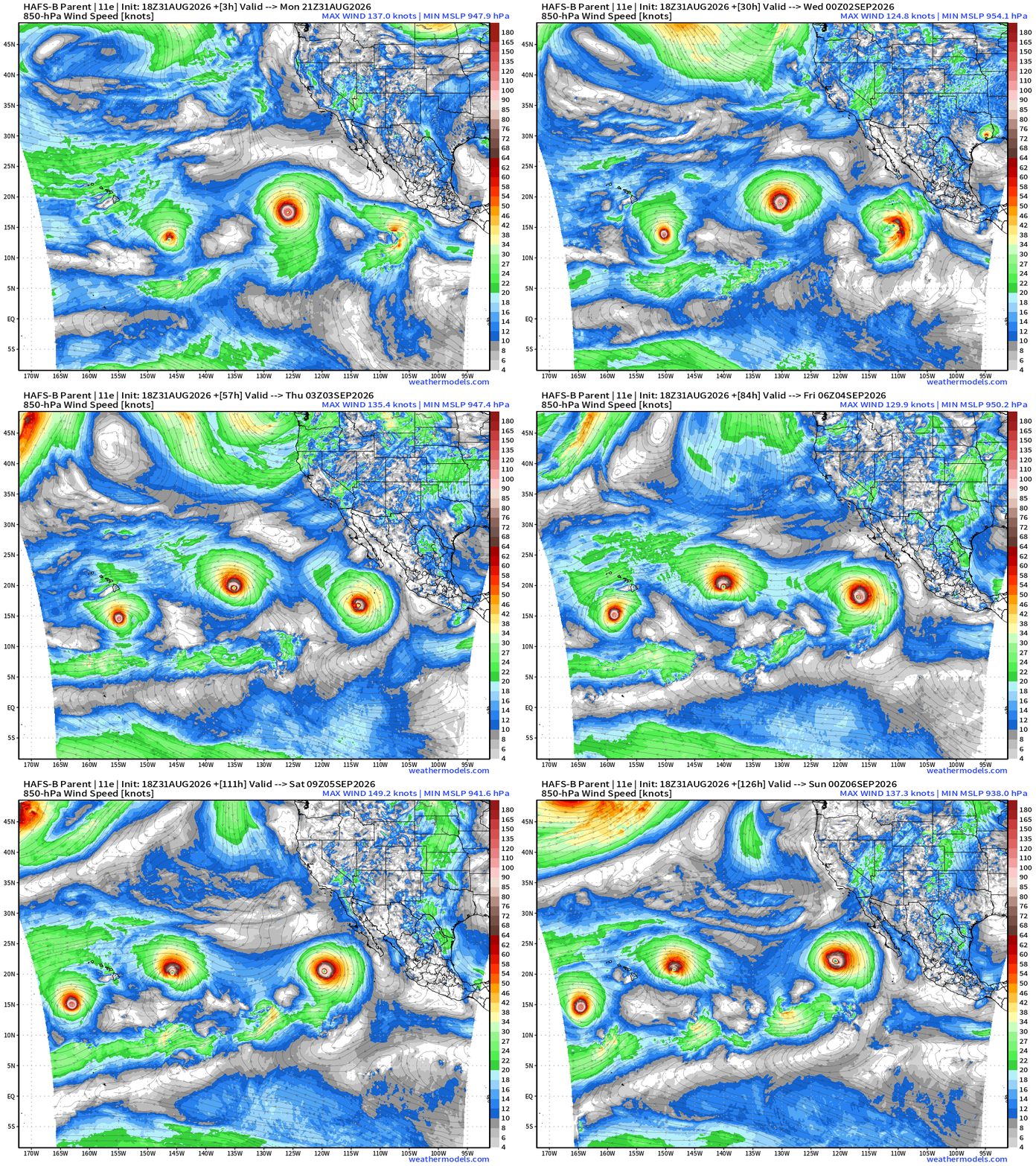
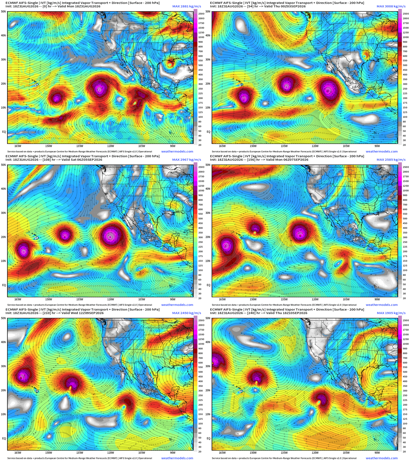
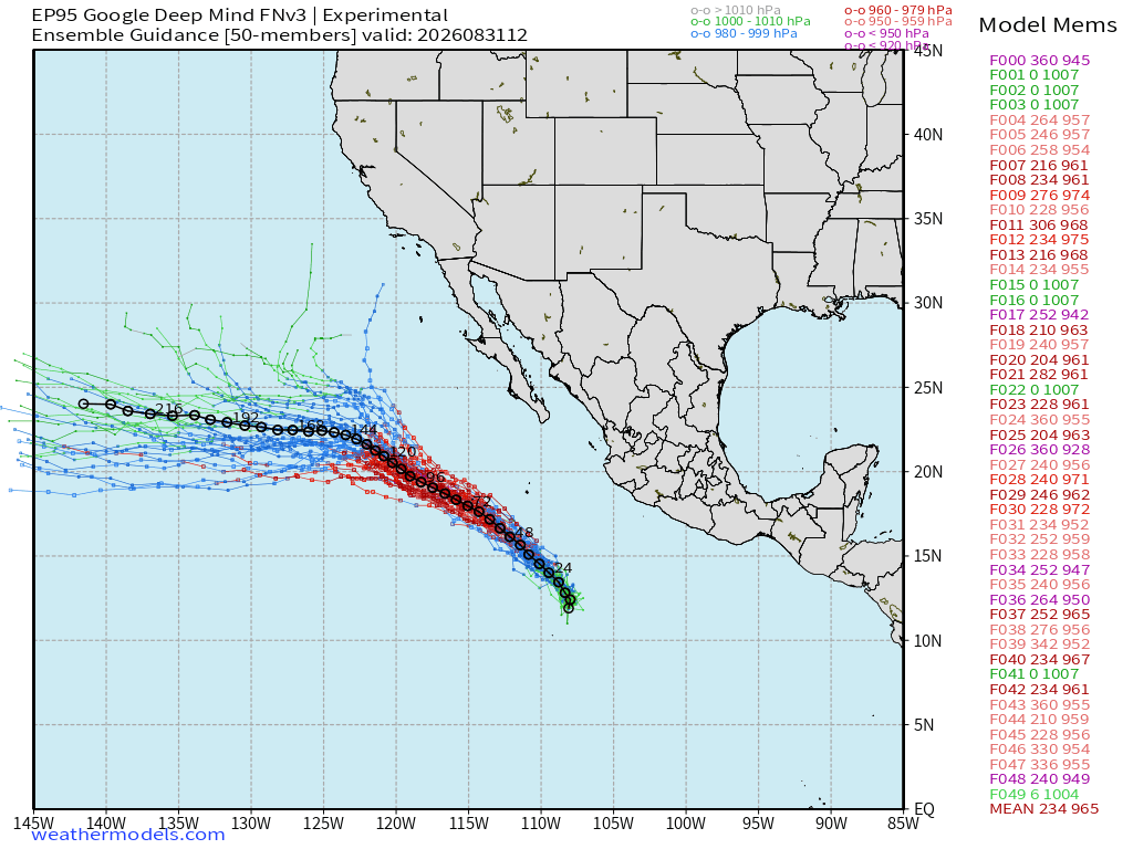
Invest 95E —> major hurricane potential — no threat to California!
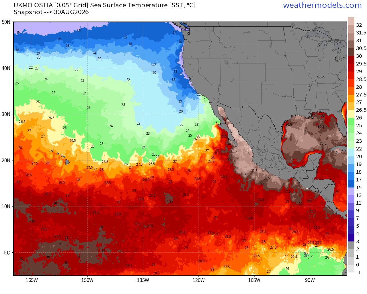
Sea Surface Temperatures across the Eastern Pacific Basin (28°C — very warm = red) —> Hurricane Factory
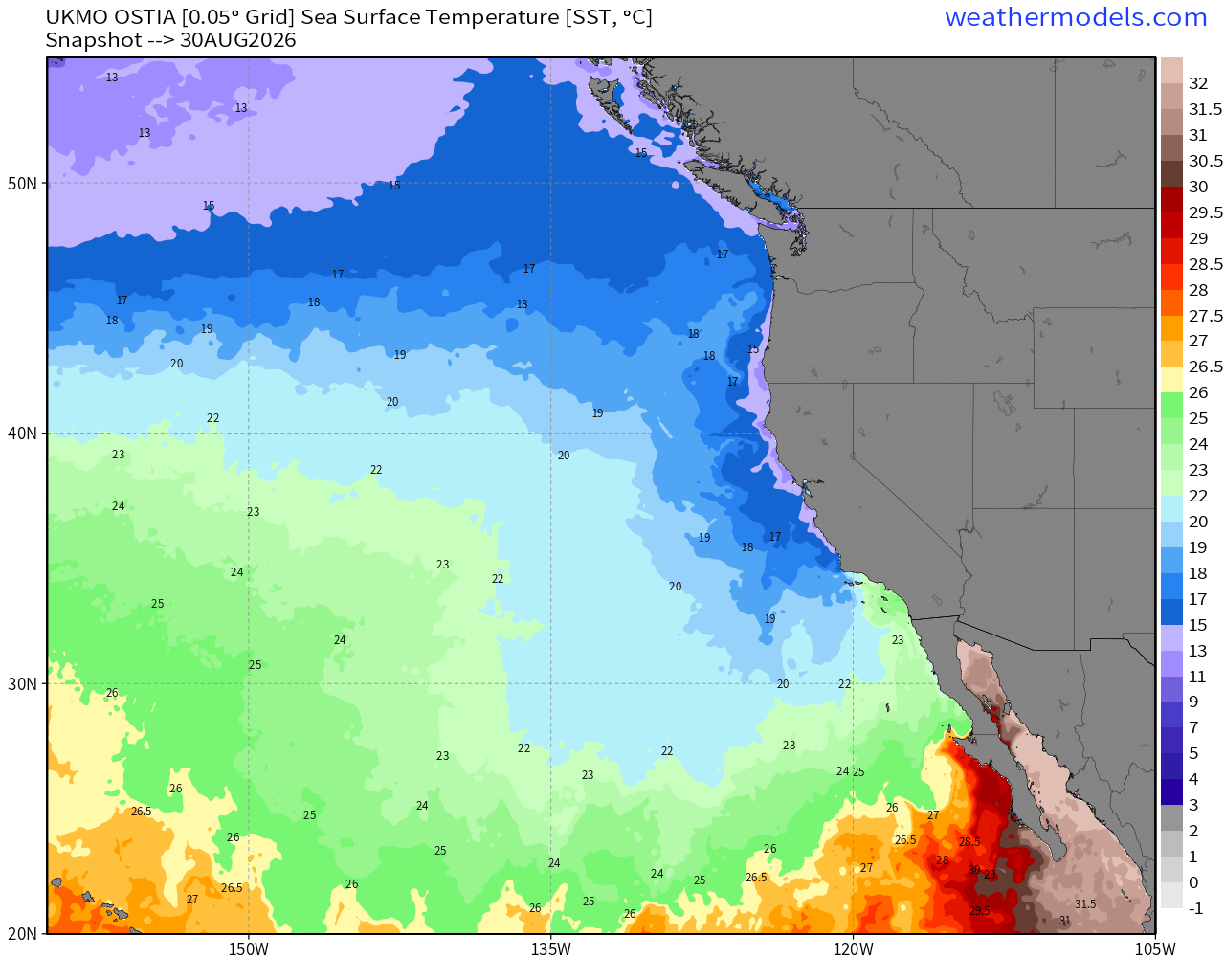
Water is way too cool off the California coast … 23°C will not be enough to sustain deep tropical convection.
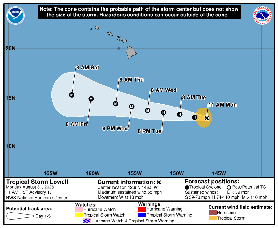
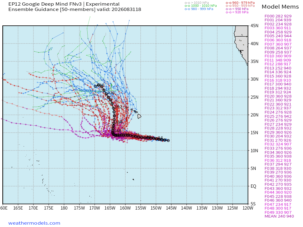
Lowell —> westward w/explosive intensification!
Definitely Category 5 potential!
Google Deep Mind 18z shows Lowell turning sharply to the NORTH in 6 days and potential risk to Hawaiian Islands from the south/southeast
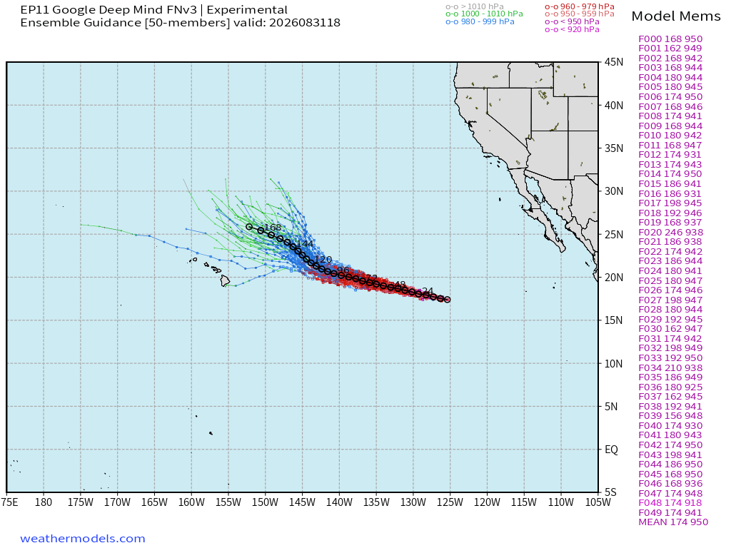
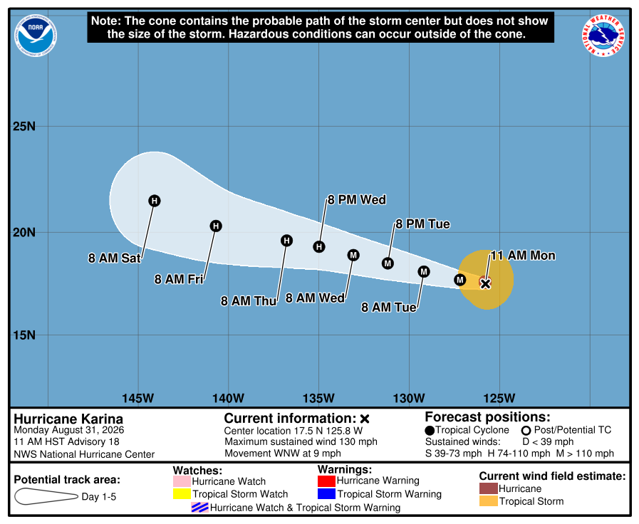
Karina is no threat to land — and should remain away from Hawaii as it decays over cooler water.
Western Pacific Tropics
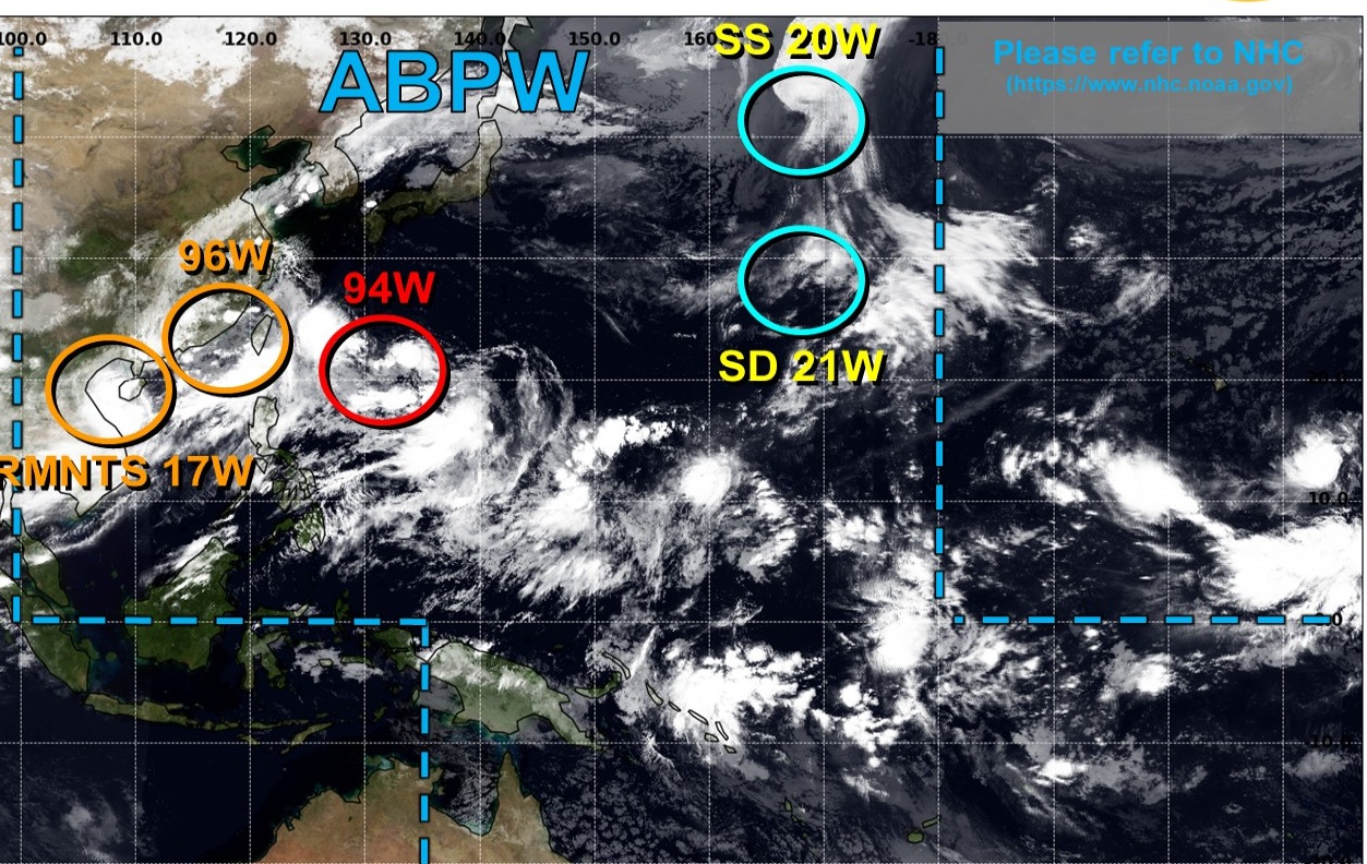
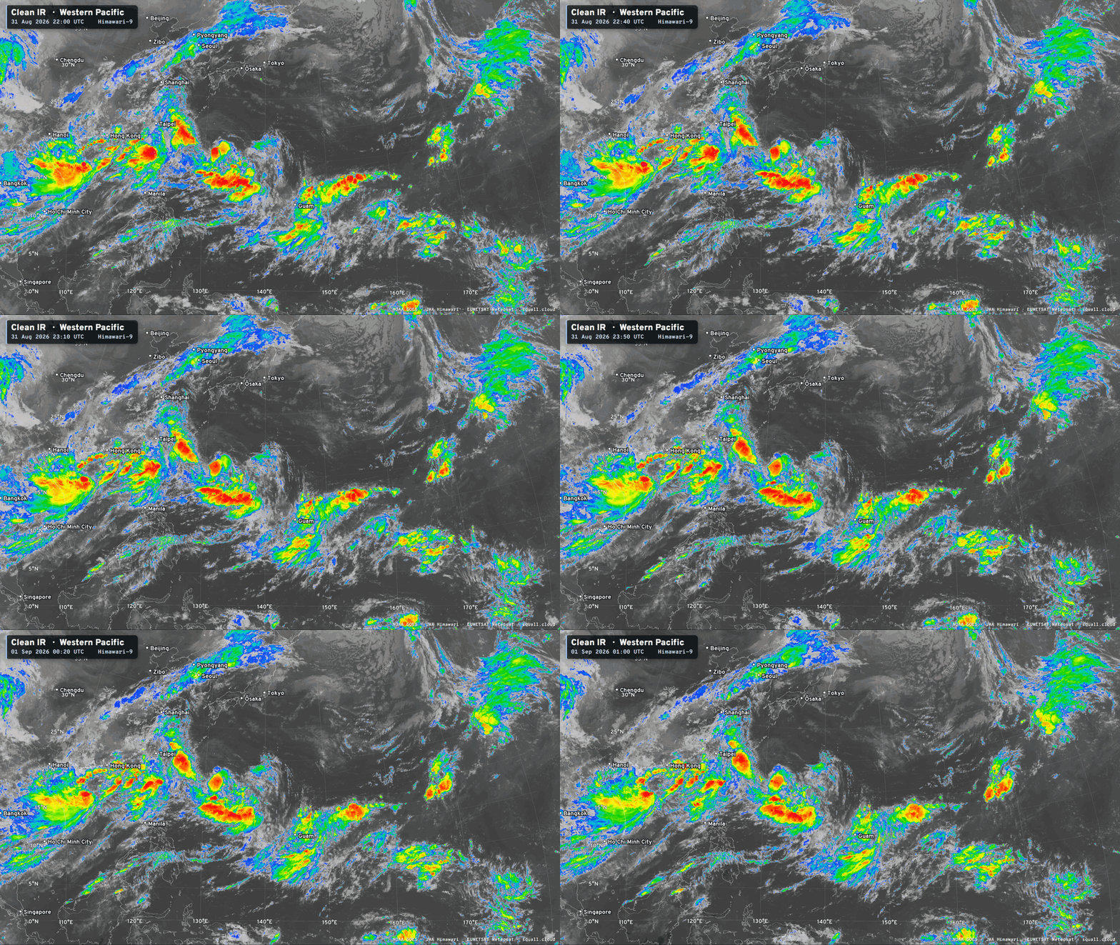
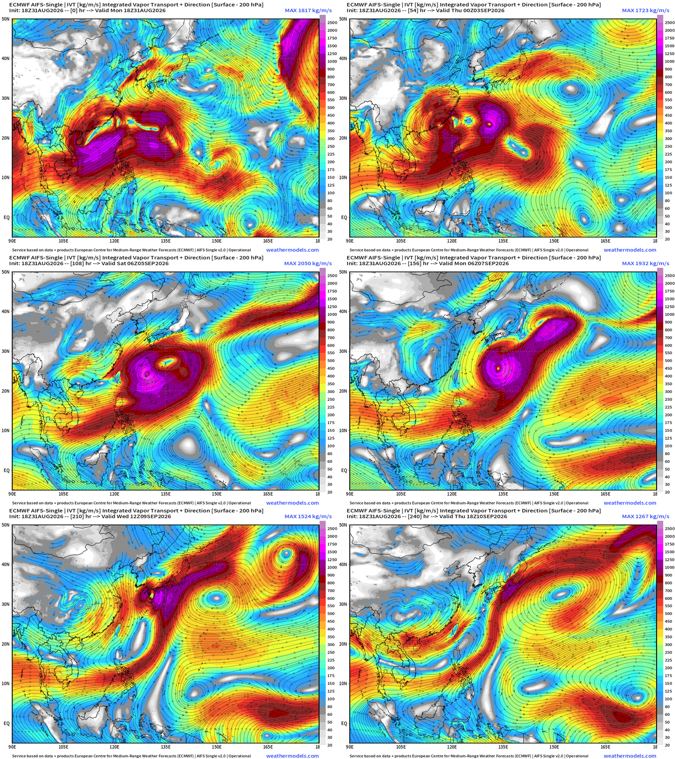
94W —> Next Typhoon on an unusual track!
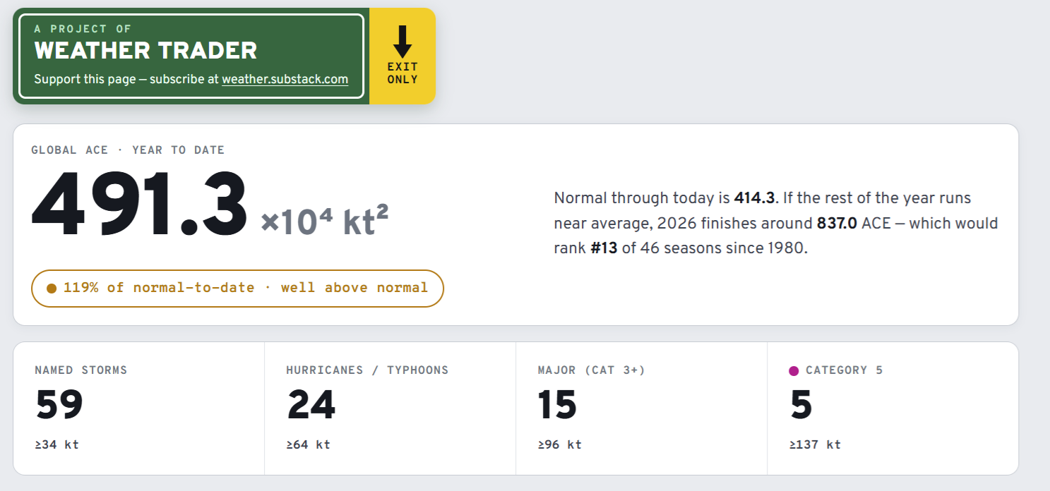
Global Tropical Cyclones for more ACE information, as well as my original climatlas.com/tropical site now with the beautiful Interstate Highway theme and full of interesting content!
Forecast Eagle maps explorer in beta for another ~2 weeks.

Satellite imagery from Squall Cloud. Maps sourced from weathermodels.com designed and innovated by yours truly! Please subscribe there for real-time access to the newest maps, charts from all of the weather models including ECMWF and AIFS, and NOAA GFS/GEFS, HRRR/RRFS and Blend of Models (NBM). NOAA WPC and SPC for fronts/convective outlooks. Our own content is now sourced from hottestsince.com and weather.city and celsius.earth, and squall.cloud and weather.football and global-tropical-cyclones.com and precip.earth
My Atlantic Hurricane Season Forecast (2026)
From April 7, 2026: Atlantic Seasonal Hurricane Forecast: (11/5/2)
9-13 Named Storms (11 most likely)
4-7 Hurricanes (5 or 6 most likely)
1-3 Major Hurricanes (2 most likely)
Accumulated Cyclone Energy: 75-85 (well below normal)
NOAA 2026 Atlantic Hurricane Season Forecast
- Milepost
- 1022 · laid 2026-09-01T02:25:48.253000Z
- Source
- https://weather.substack.com/p/august-31-2026-monday-evening-weather
- Digest
- ac3554fd1ca3f6e45f851991c32129e9eeb4e39d9fbb6fb57fd3c5163ed9da7e
- Machine
- JSON