August 29, 2026 Saturday Evening Weather
Remnants of Dolly affected by strong wind shear. 97L in the Gulf mainly a rainmaker. The Eastern Pacific continues very busy.
August 2026 was the warmest August in the 132-year national record (1895–2026), at 75.6°F against a 1991–2020 normal of 73.1°F (+2.5°F).
August 2026 was the 22nd-driest August in the 132-year national record (1895–2026), at 2.3in against a 1991–2020 normal of 2.7in (-0.4in).
NOAA/NCEI Climate at a Glance, contiguous United States. This is the observed record for the month, not a score of anything said in this piece — the forecast ledger begins 2026-08-17 and cannot reach earlier posts.

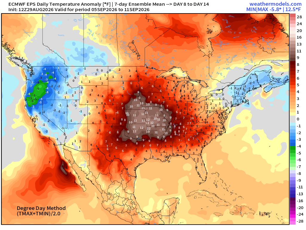
Plenty of monsoon moisture across the Western U.S. going up and around the “heat dome” anchored strongly in place over Texas and the southern Plains.
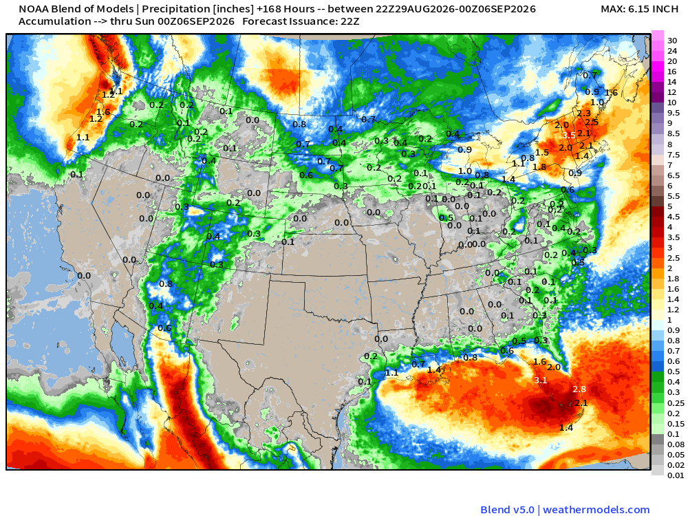
Florida and the Gulf coast seeing plenty of tropical moisture and enhanced storms for the next week as the remnants of Tropical Storm Dolly (04L) arrive by next weekend.
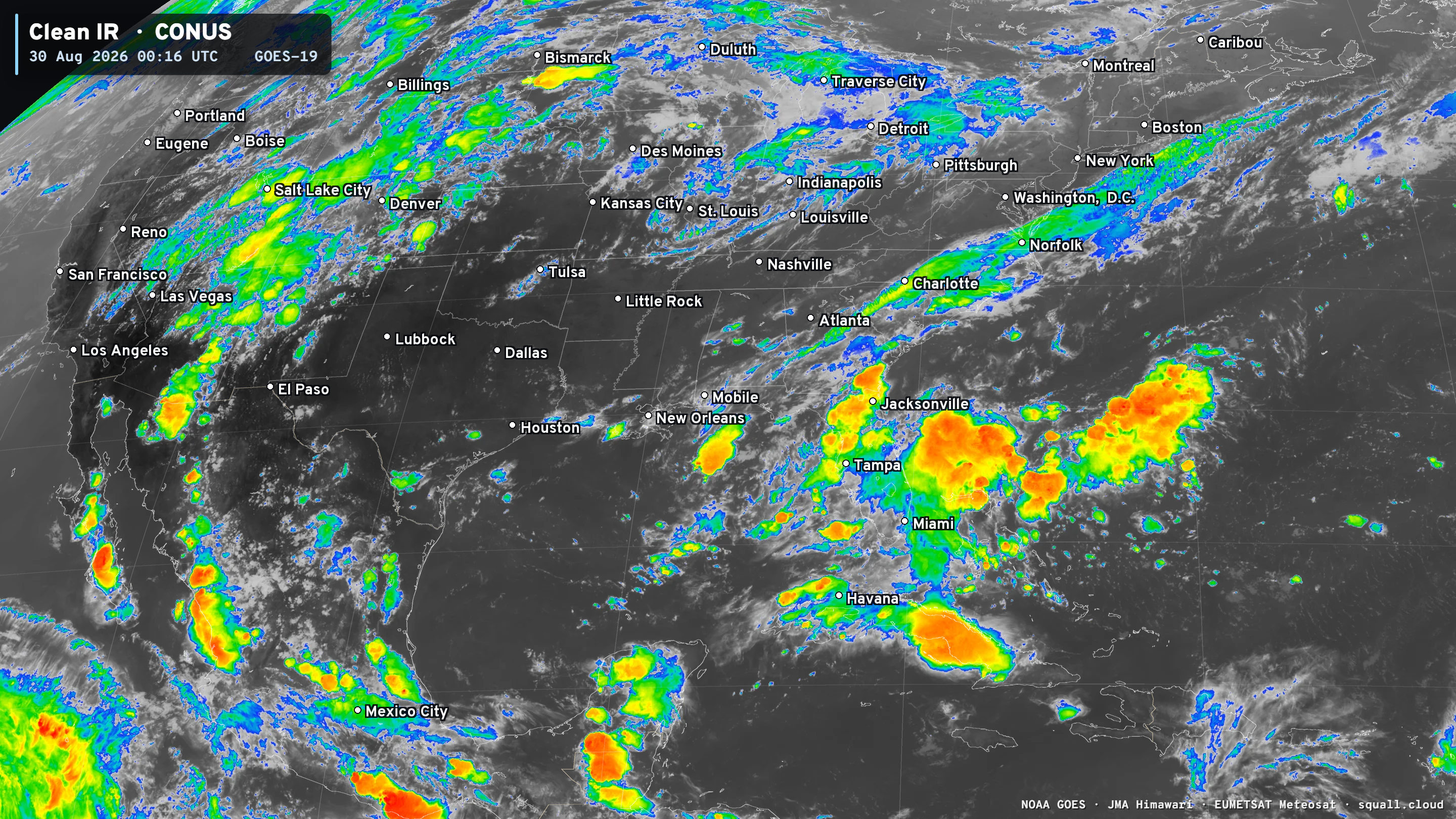
Headlines Saturday Evening in the Tropics
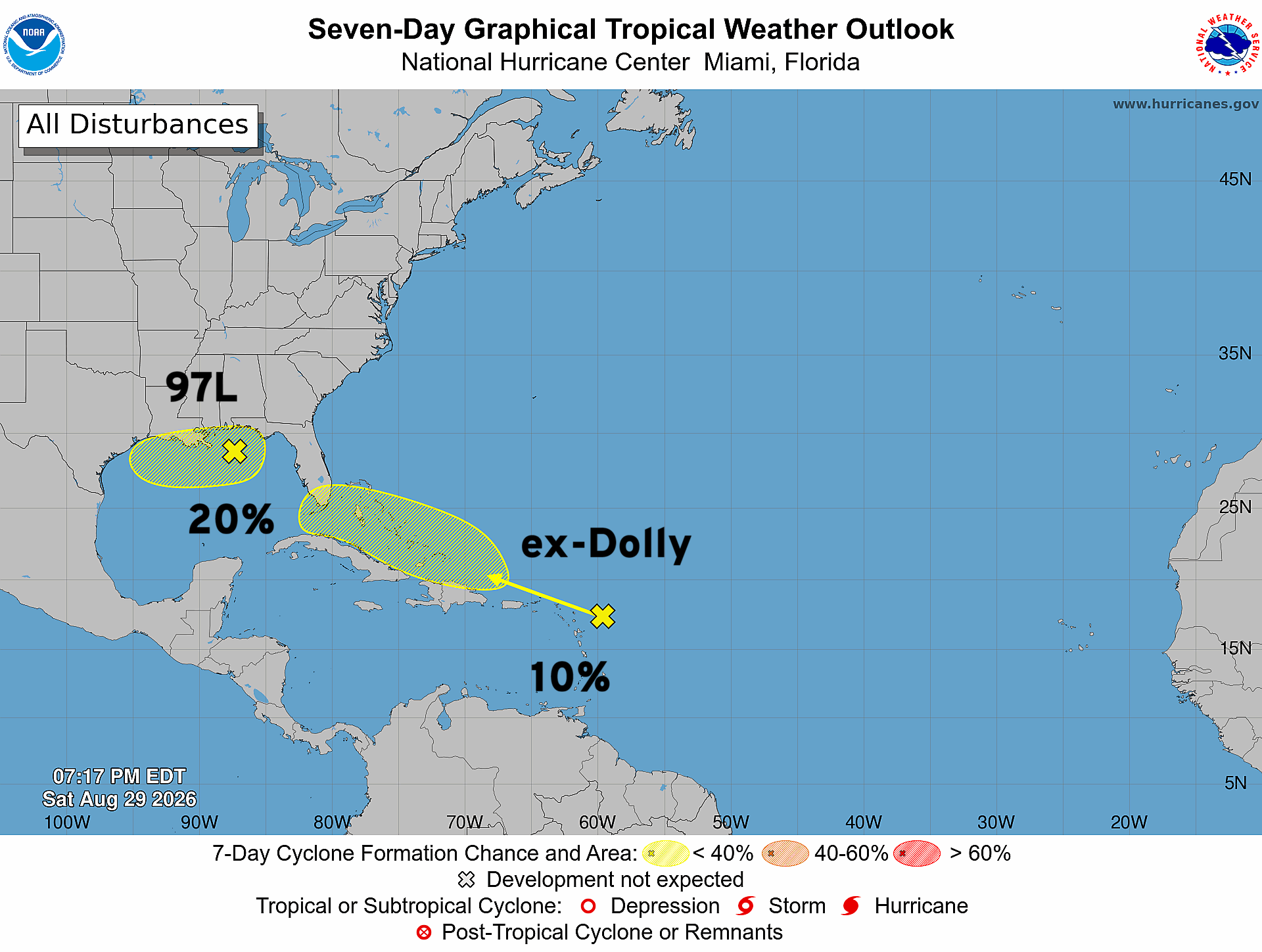
Remnant's of Dolly (04L) being watched for redevelopment over next 7-days but chances are very low (10%)
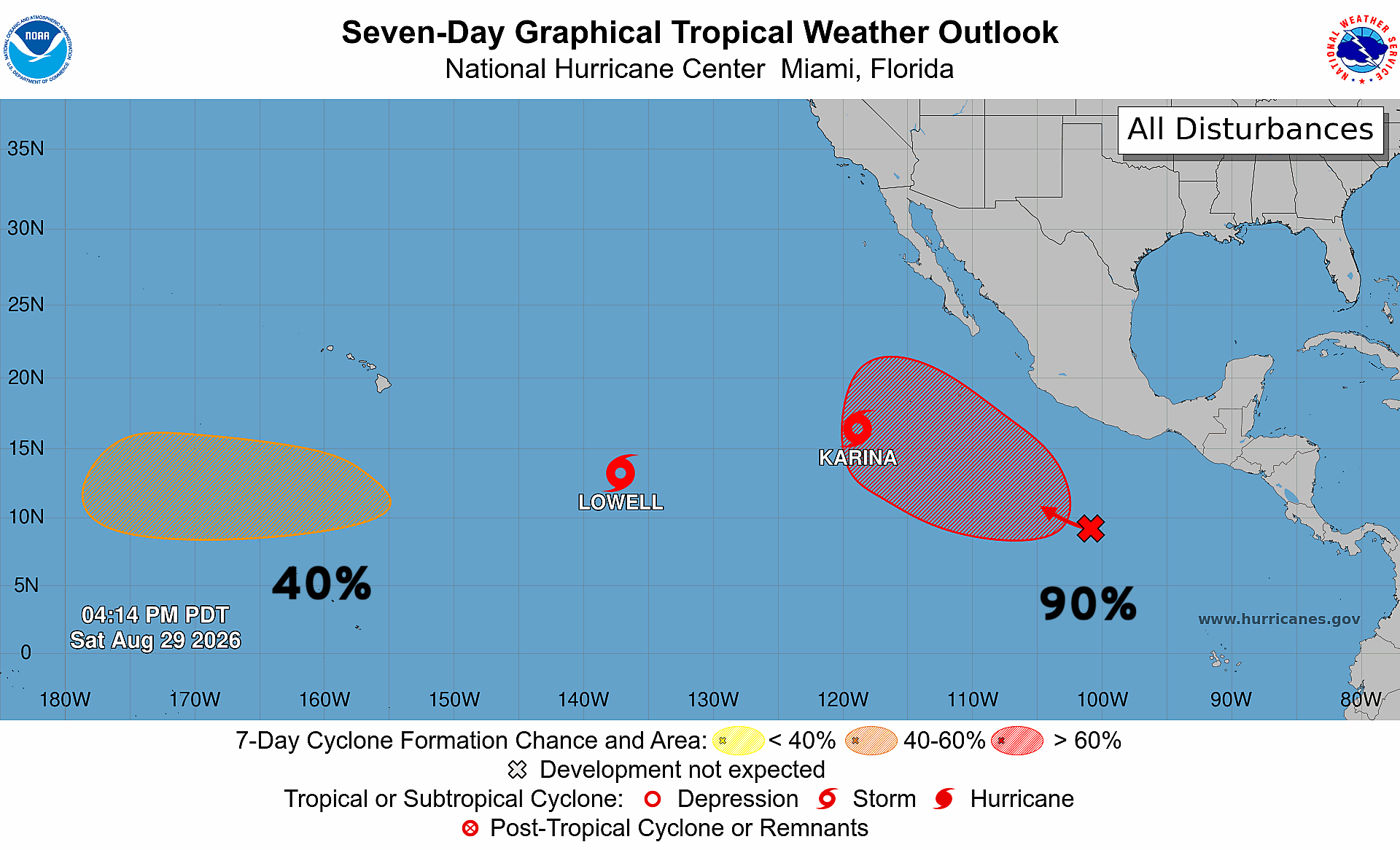
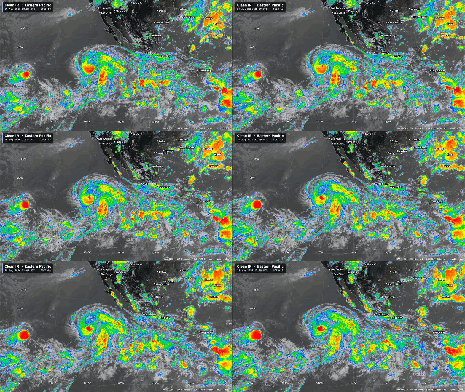
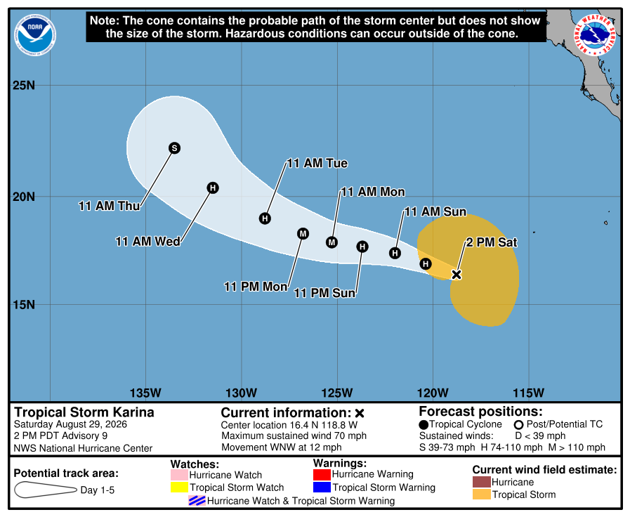
In the Eastern Pacific, Tropical Storm Karina is nearly a hurricane. Tropical Storm Lowell is having tougher time with wind shear but will eventually become a hurricane — perhaps a major in 5-days. Both storms may end up near Hawaii in 8-10 days.
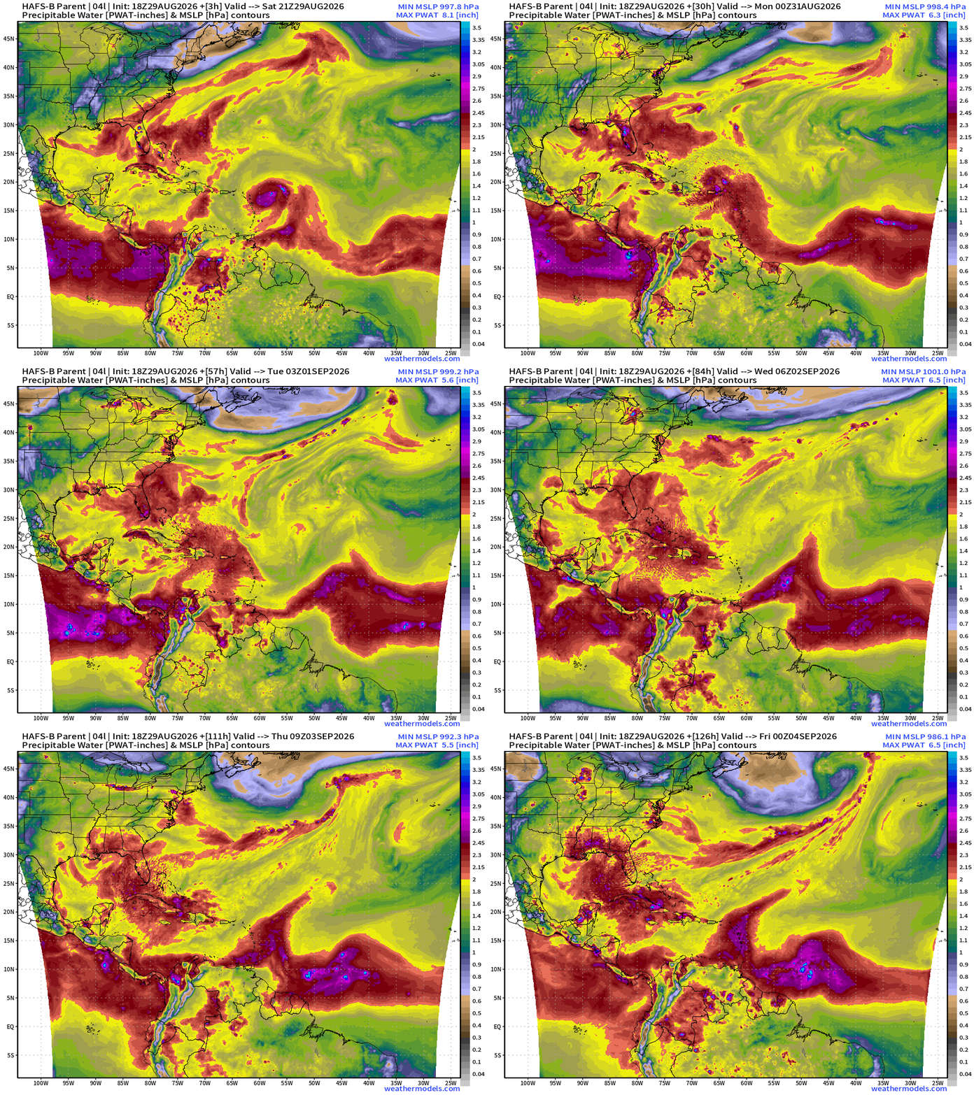
Precipitable Water | My Favorite Parameter (6-days ECMWF 18z)
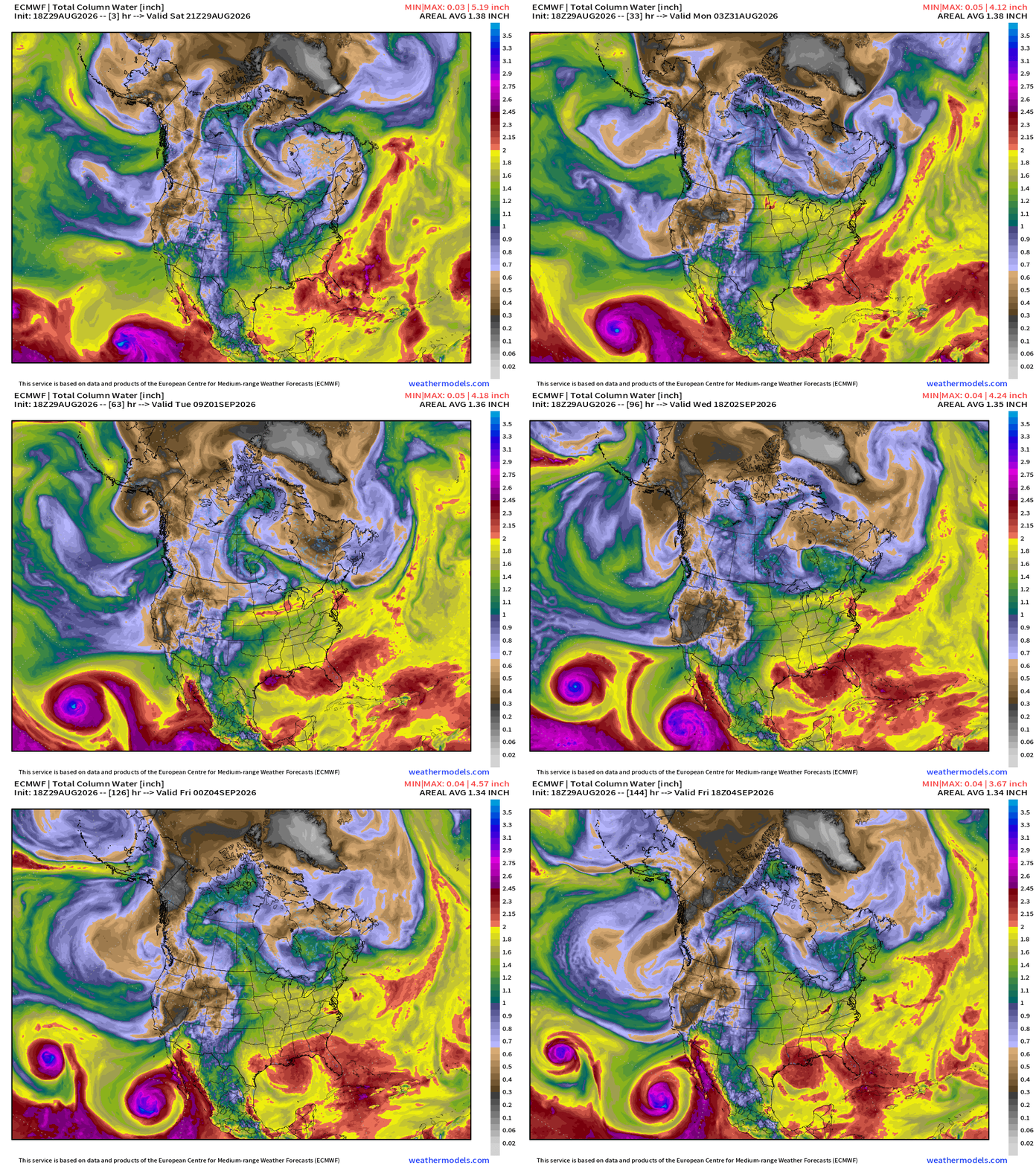
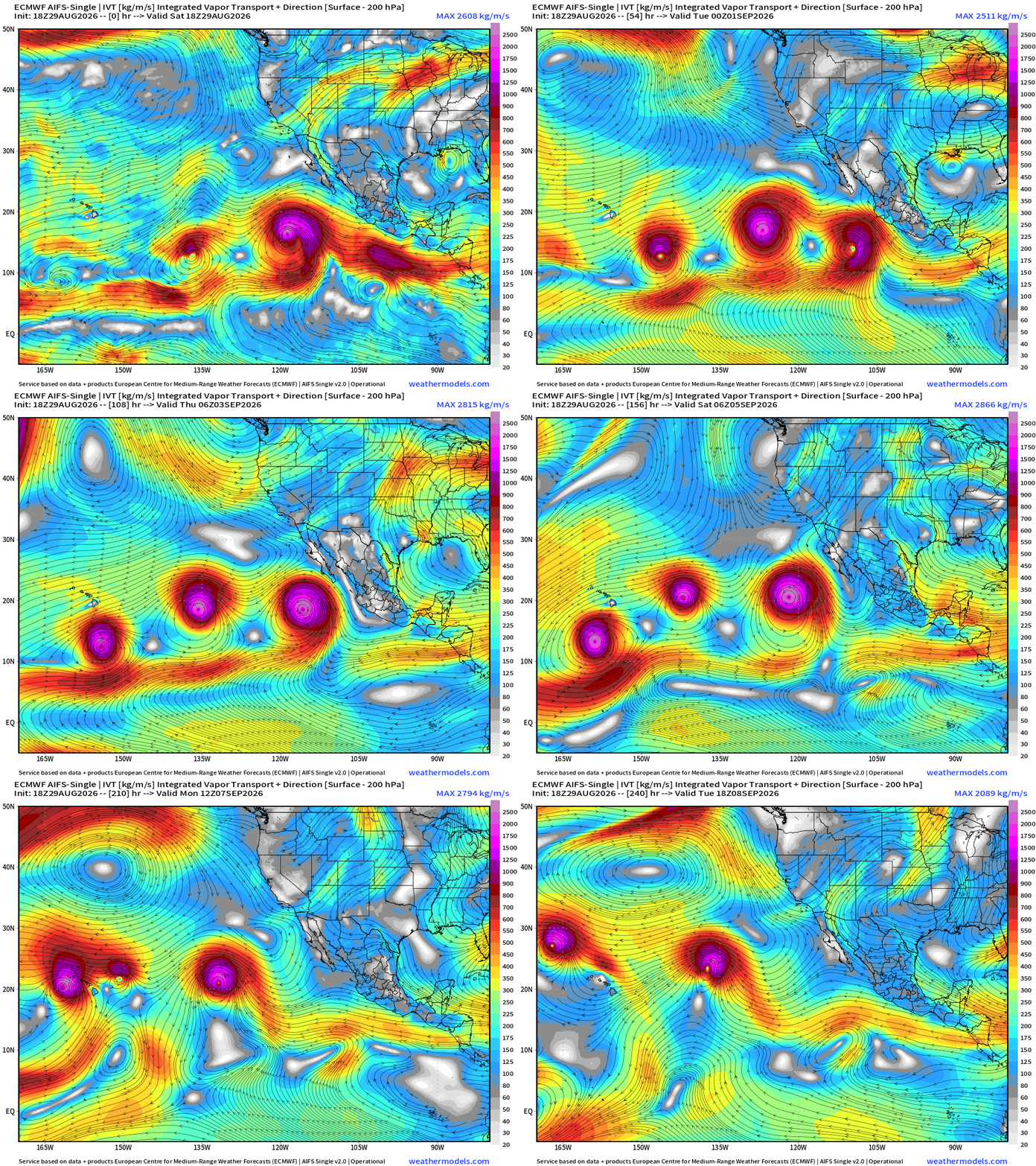
The two hurricanes spinning in the Eastern Pacific are HUGE moisture makers. Also, note continued tropical depression like circulations along the Gulf coast —> enhanced moisture and rainfall where it is needed.
Height Anomaly 10-days | AIFS 18z —> upper-level circulation pattern
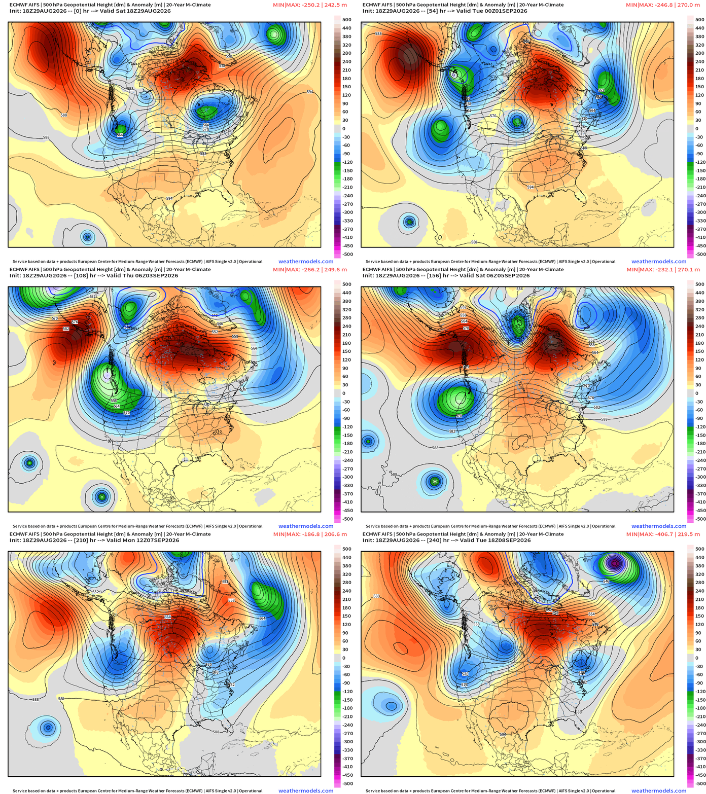
Heat dome ridge doesn’t really break for the next 10-days … the center wavers between the Southeast and Texas
A bunch of shortwave troughs dump out of Alaska down the West Coast —> unsettled, cool and wet. Maybe a touch cooler in the Northeast, too.
Low Temperatures Sunday Morning
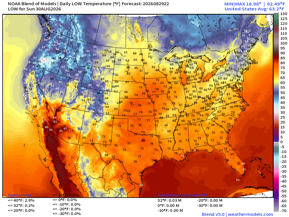
mid-70s into Iowa overnight — sultry … but look at the chilly 30s and 40s across the Pacific Northwest, and 40s and 50s in New England.
High Temperatures on Sunday
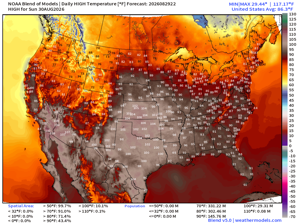
Very hot with 100s in Kansas, Missouri, Oklahoma and Texas
Still 146 million at least 90°F
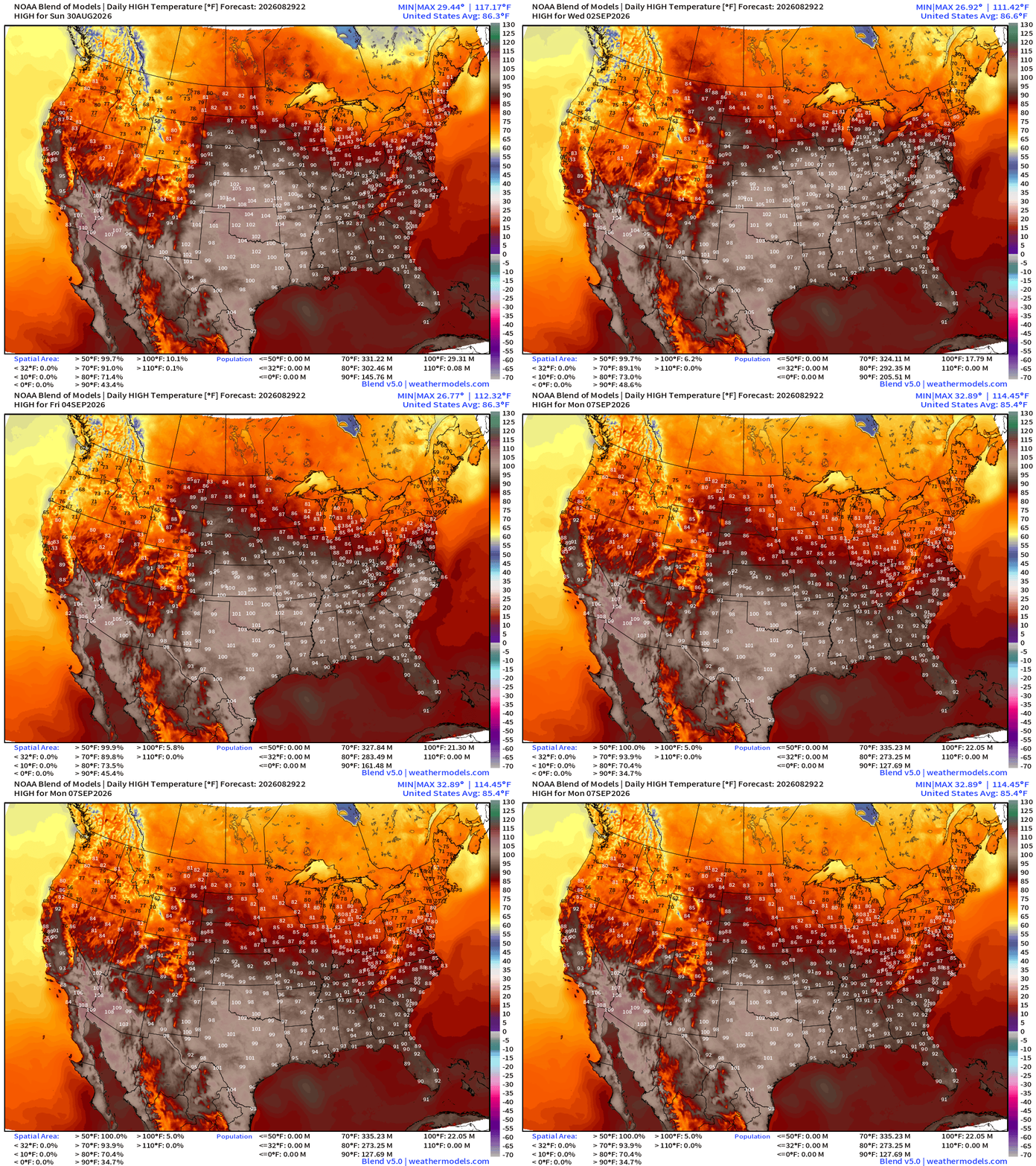
High Temperatures next Week into Monday, September 7th
Blend of Models — Precipitation Next 7-days
Temperature Anomaly | Next 2-weeks | ECMWF EPS 12z
Cool across the west with multiple troughs — but very HOT in the center of the Lower 48 with the “heat dome”
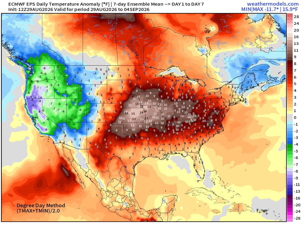
Heat dome anchored across the Plains —> stuck into September 10th
Atlantic Tropical Outlook | 2 Weak Areas of Interest
Sea Surface Temperatures across the Atlantic Basin (28°C — very warm = red)
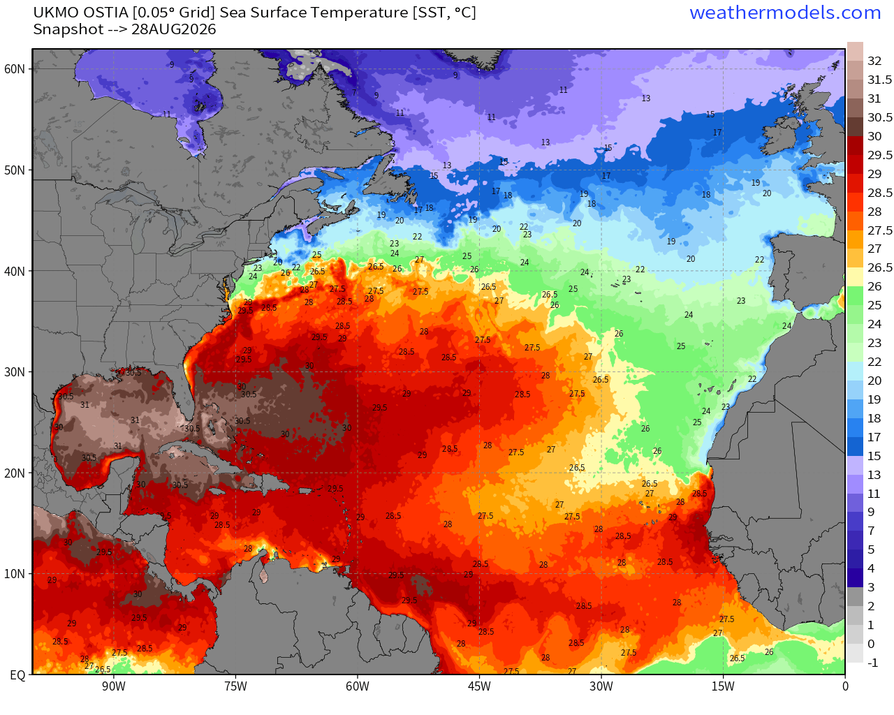
Note the > 30°C warmth in the Gulf of Mexico
Atlantic IR Satellite Loop | Remnants of Dolly only show in town.
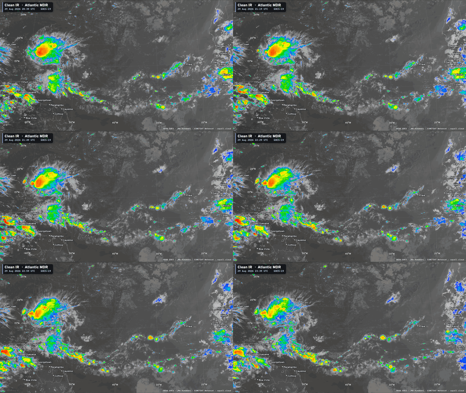
Invest 97L —> 20% chance development (NHC) disorganized showers
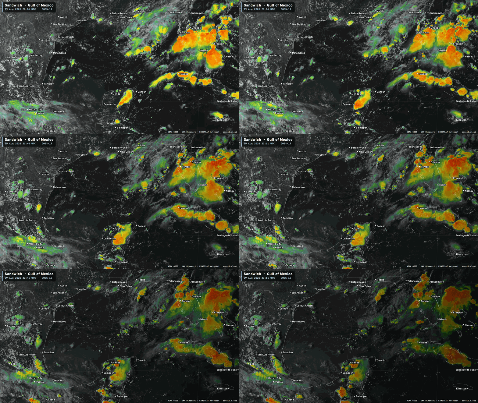

You can see more Satellite Imagery at Squall Cloud —> LINK
Watching the remnants of Dolly (10% chance NHC)
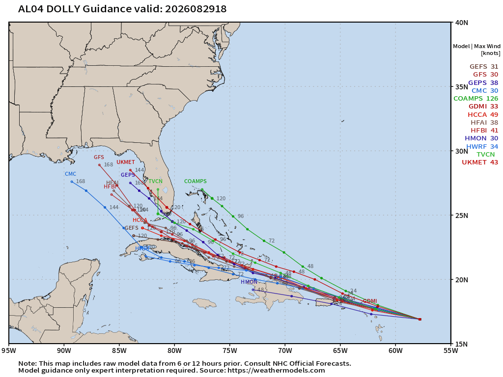
Atlantic Basin Tropical Spaghetti Next 15-days | AIFS-ENS
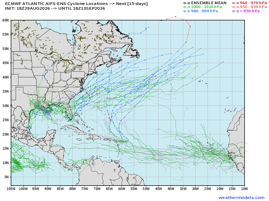
Tracks from 51-member ensemble of AIFS-18z do show 97L development quite strongly, and then some other ancillary tracks off the U.S. East Coast
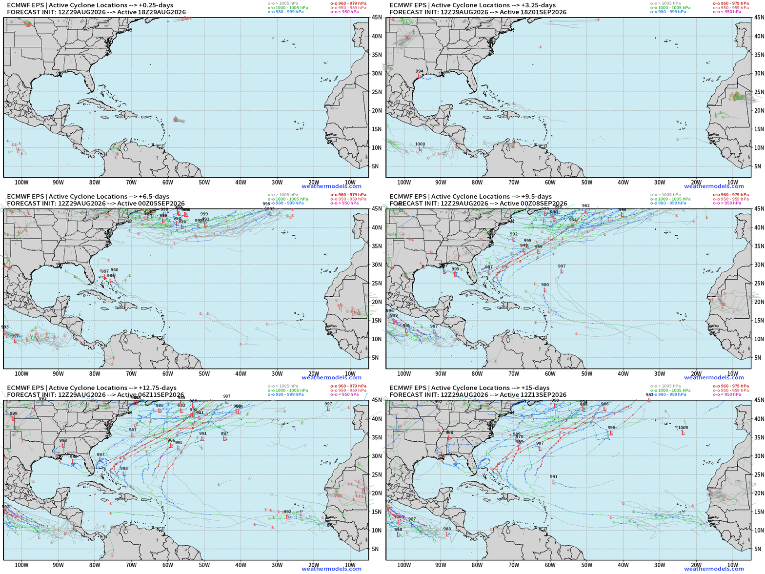
ECMWF Ensemble 12z full-physics tracks next 15-days
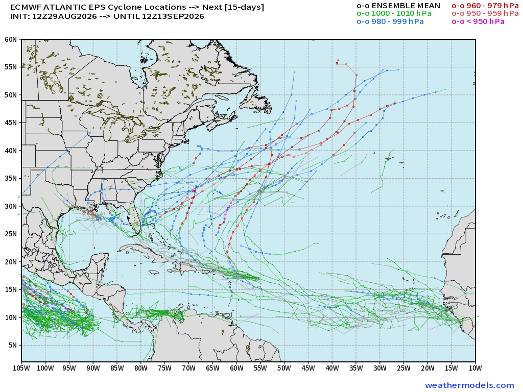
Leftover tropical waves drift through the Bahamas across Florida and into the Gulf of Mexico (low chance 10%) but slightly more likely (20% or so) heading out to sea with major hurricane through 2-weeks. Not a strong signal into the peak of hurricane season.
Google Deep Mind 18z Ensemble Tracks
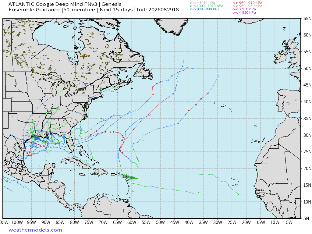
Still watching the Gulf of Mexico (low chance 10% or less) for a random development.
Huge mess of tropical moisture from remnants of Dolly into Bahamas and then Florida over the next 5-days
Flagship model: ECMWF AIFS 18z —> Integrated Vapor Transport next 10-days
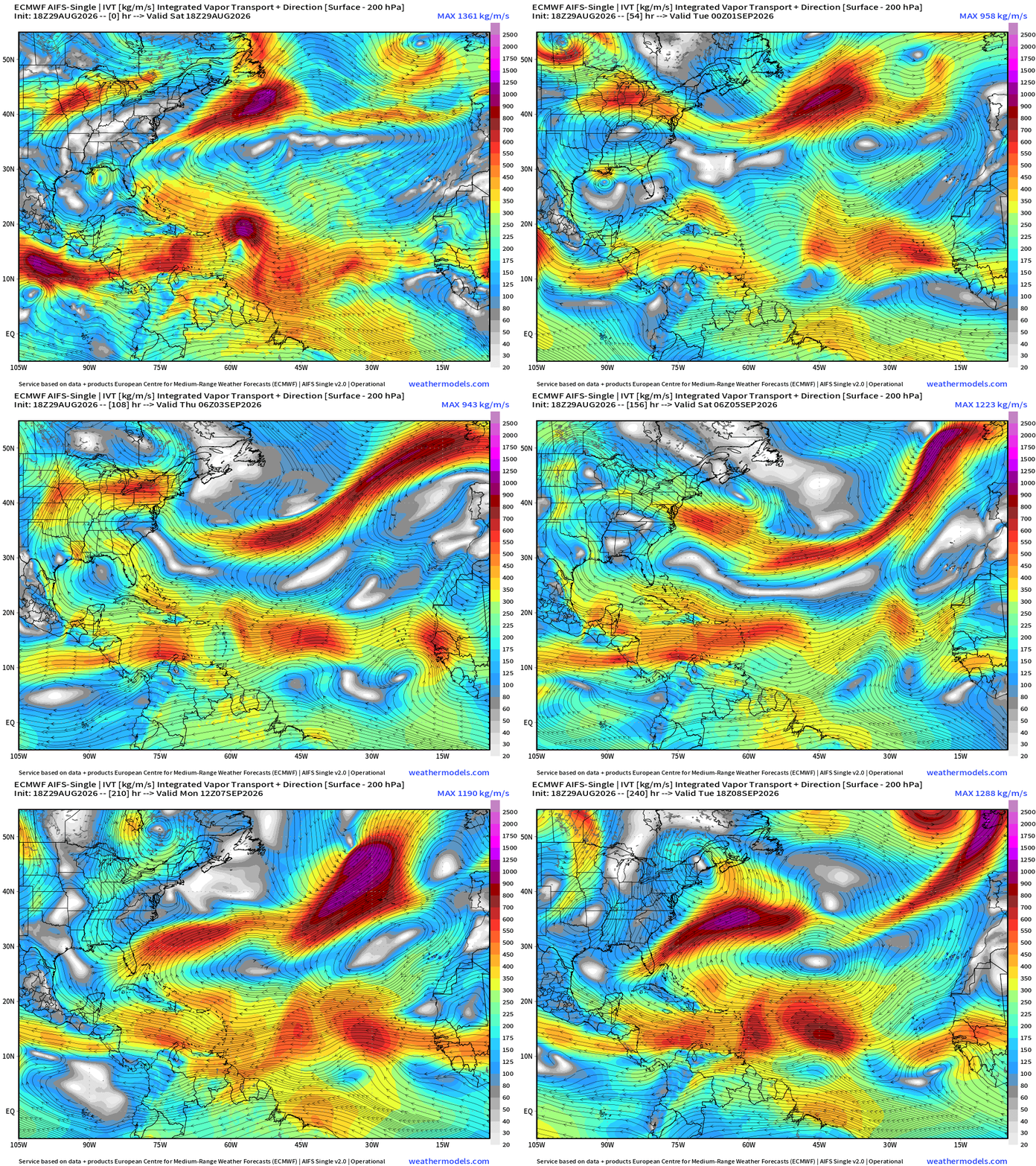
Remnants of Dolly are lost in the Bahamas in next several days. No other tropical waves catch fire in the main development region (MDR)
A little circulation with 97L along the Gulf coast
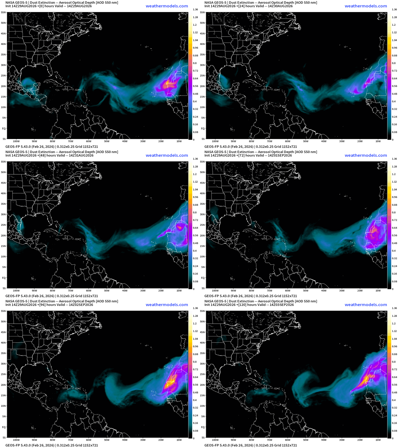
More dust over the next 5-days … into early September hostile basin
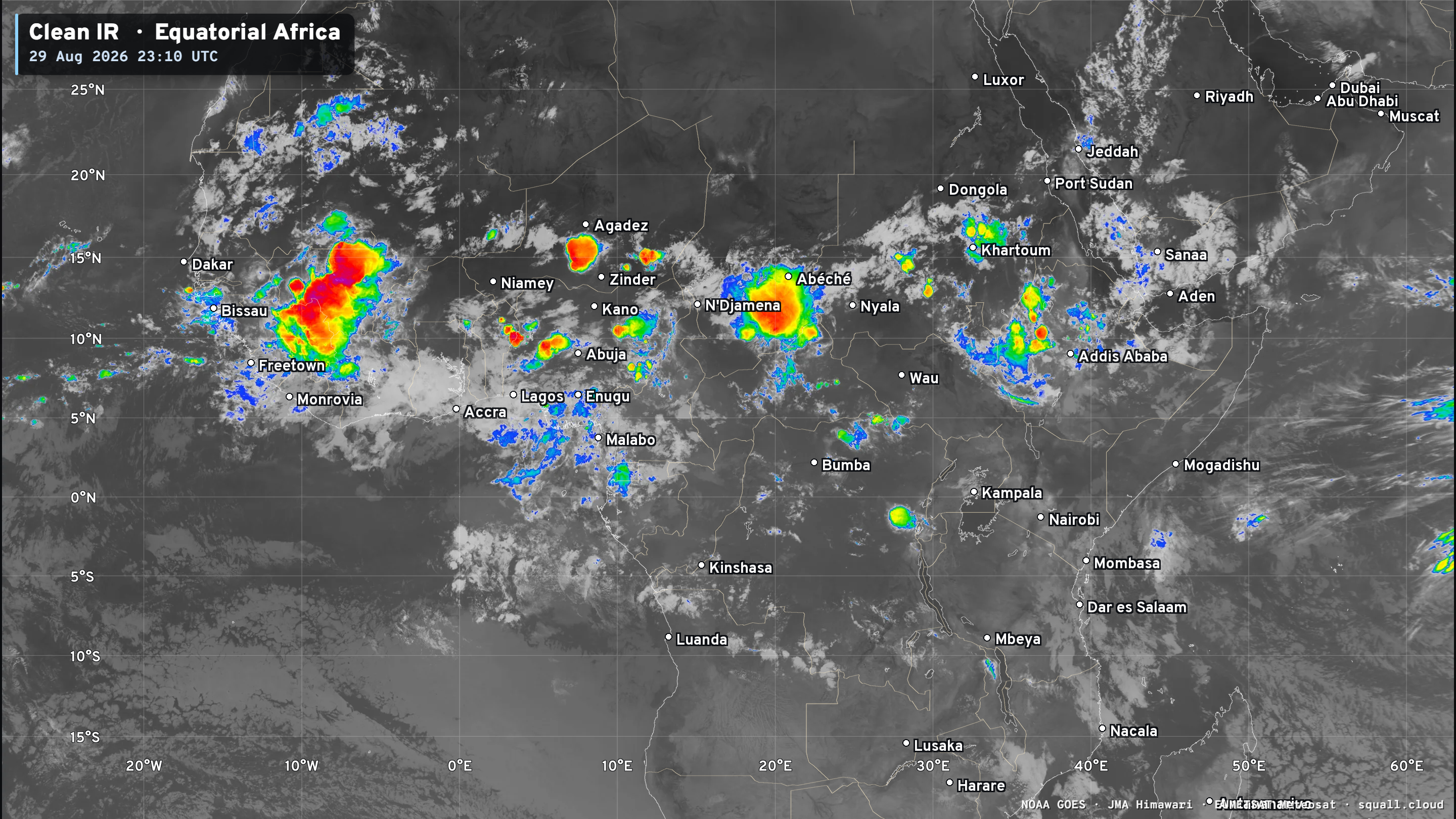
Equatorial Africa | Tropical Wave Train quiets down — but one more major wave to come off into the Atlantic on Sunday
Eastern Pacific Tropics | Karina and Lowell (Marie soon)
Lowell (to the left/west) is suffering from northerly wind shear. Karina is probably a hurricane (or will be at 11 PM ET)
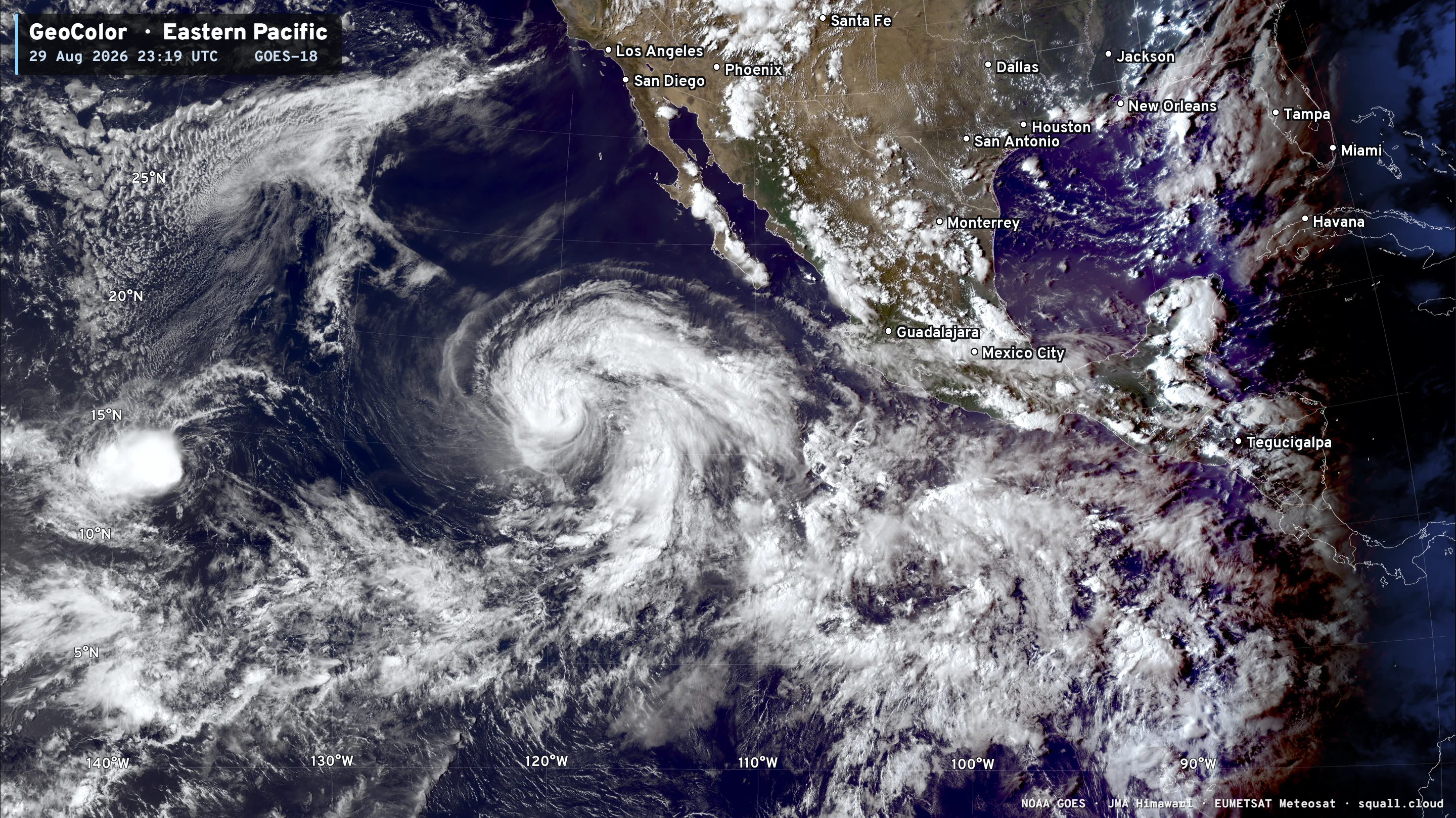
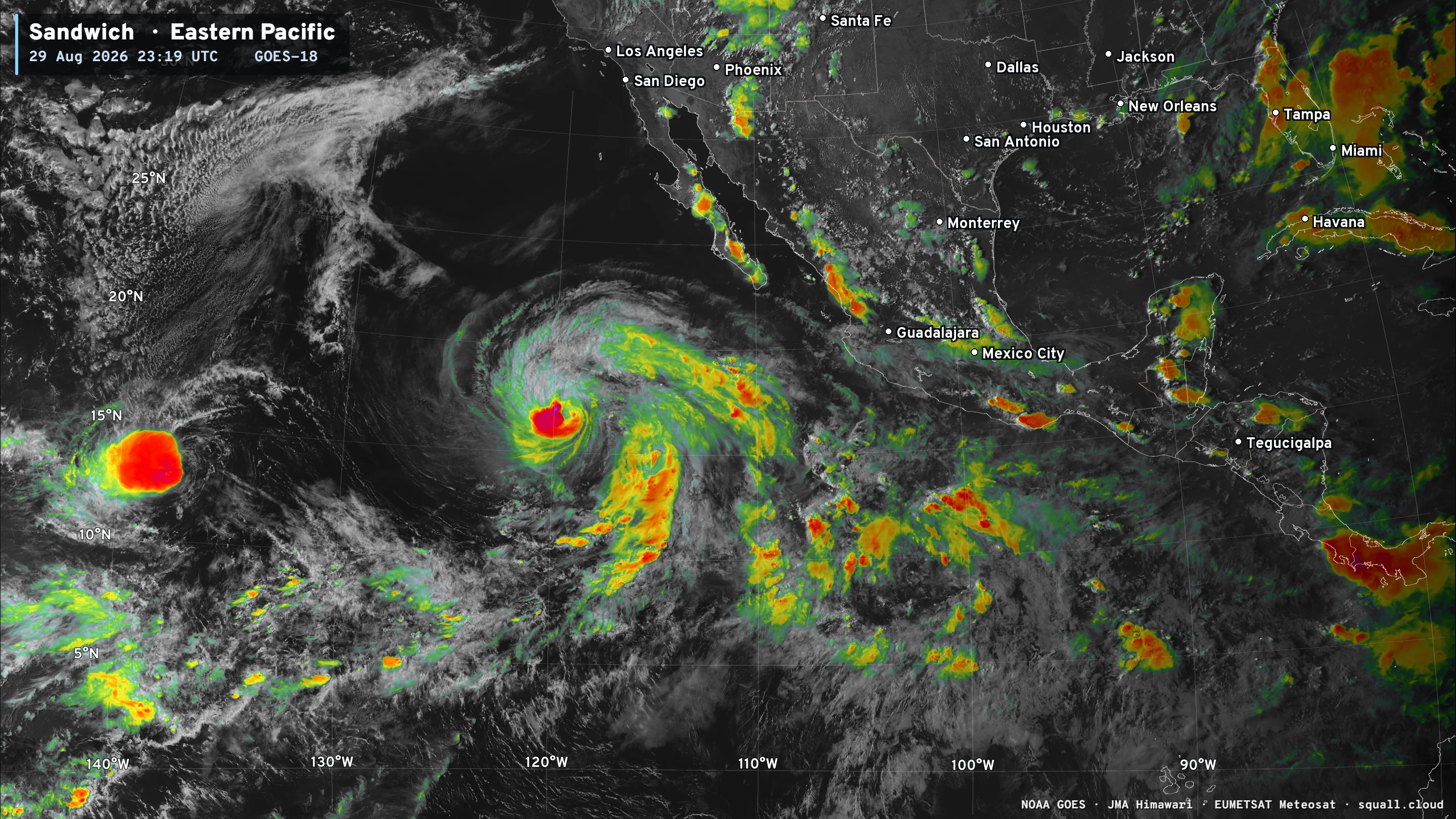
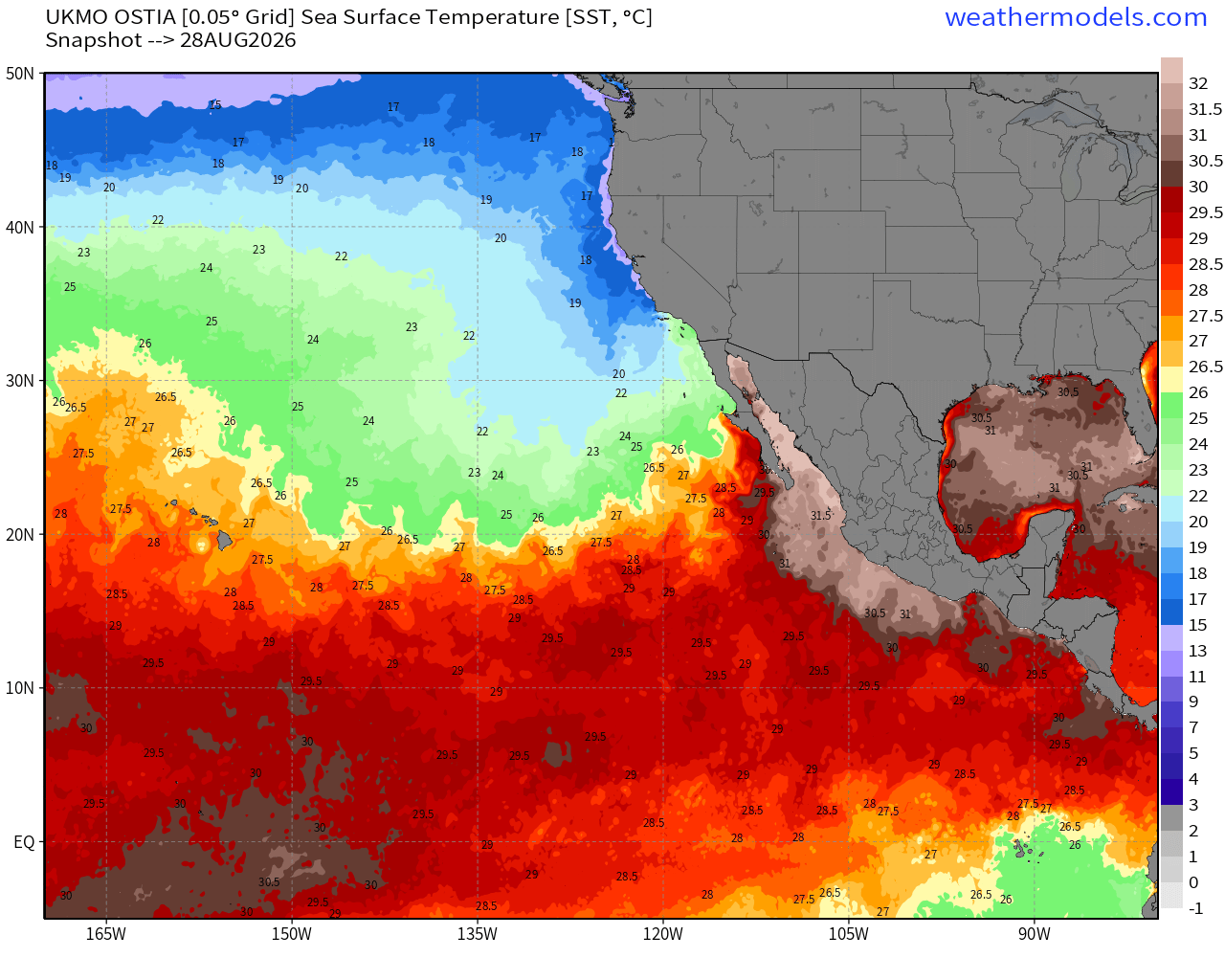
Sea Surface Temperatures across the Eastern Pacific Basin (28°C — very warm = red) —> Hurricane Factory
Lowell —> westward w/slow intensification
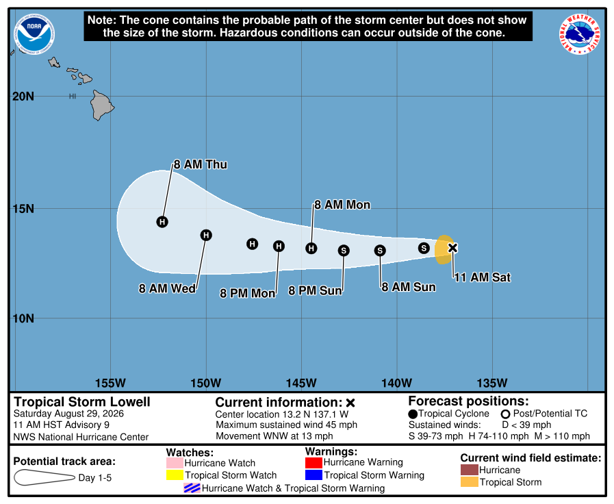
Google Deep Mind 18z shows Lowell turning sharply to the NW in 7-8 days and potential risk to Hawaiian Islands from the south
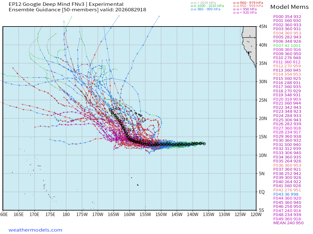
Karina is no threat to land — and should remain well away from Hawaii as it decays — but that’s not a guarantee — as remnants could drift toward Hawaii from the north
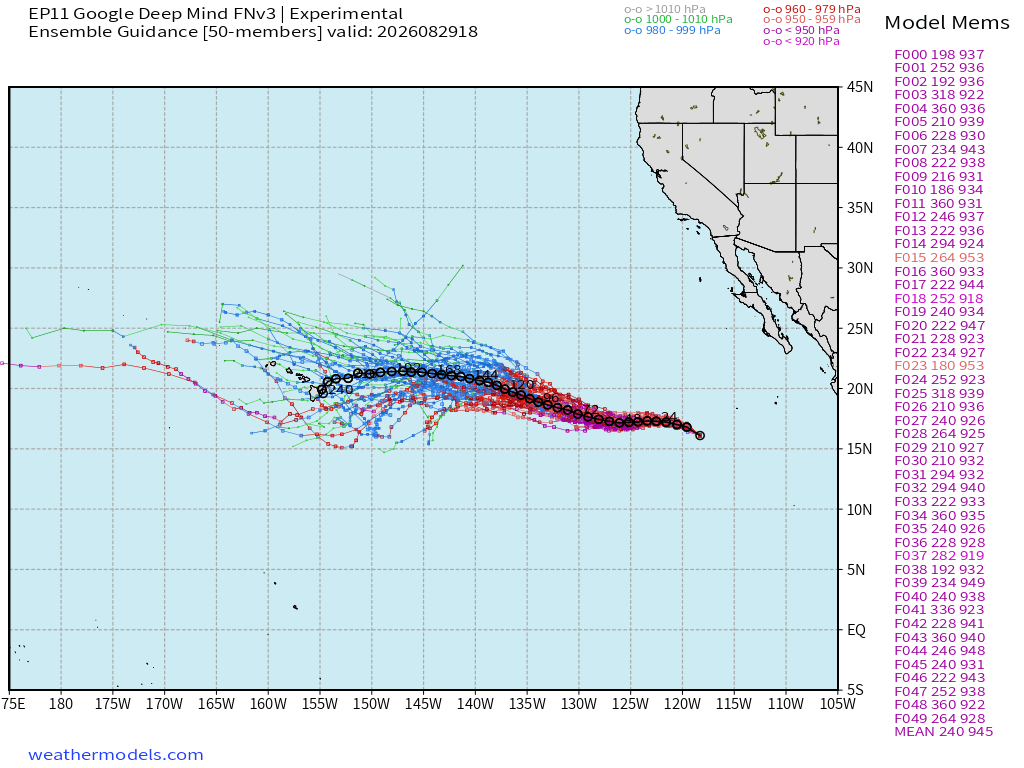
After Lowell and Karina —> Marie follows — looks even larger.
Need to watch Lowell into Hawaii from the south — but 8-days away!
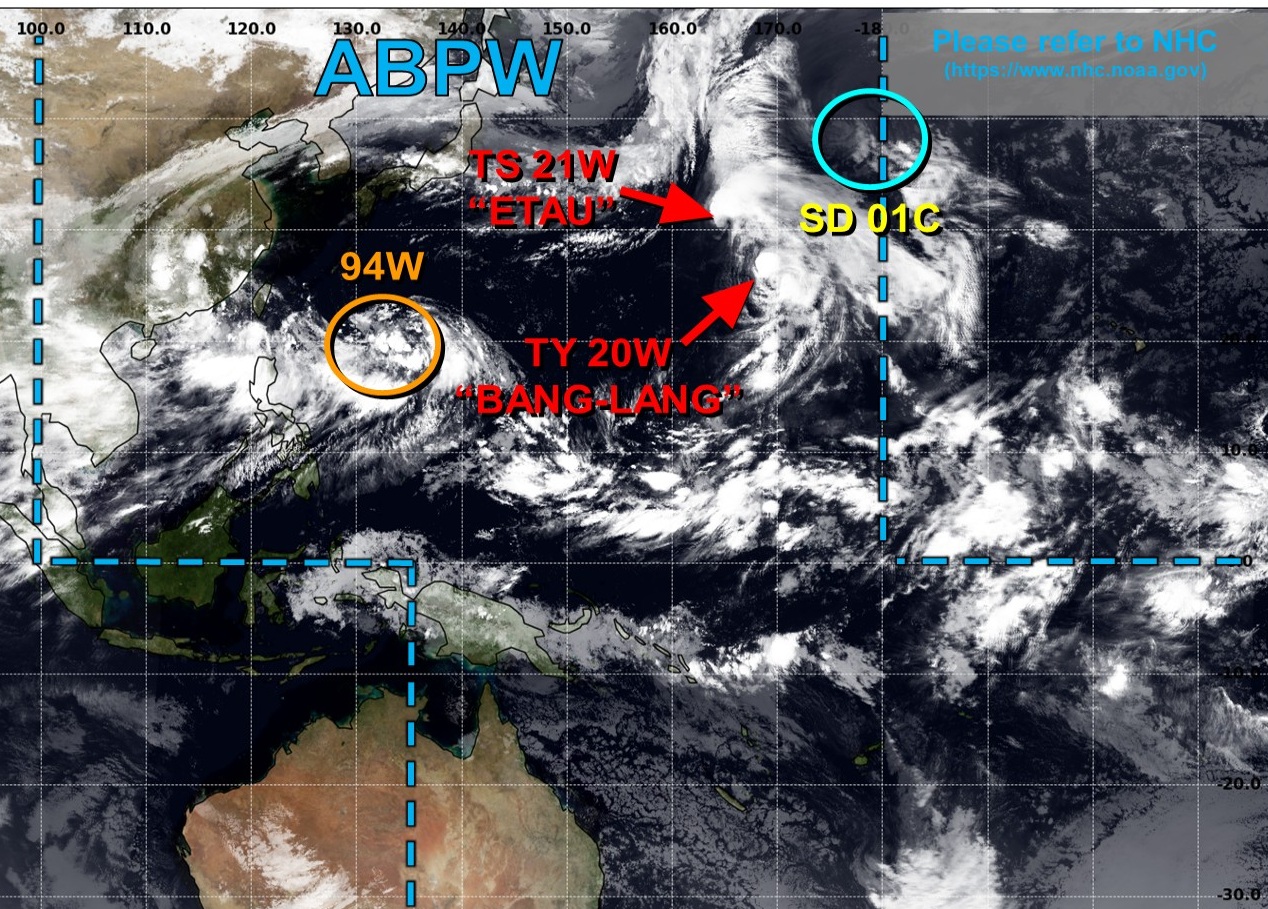
Western Pacific Tropics
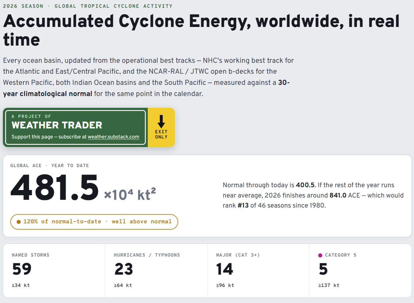
Global Tropical Cyclones for more ACE information, as well as my original climatlas.com/tropical site now with the beautiful Interstate Highway theme and full of interesting content!
Forecast Eagle maps explorer in beta for another ~2 weeks.

Satellite imagery from Squall Cloud. Maps sourced from weathermodels.com designed and innovated by yours truly! Please subscribe there for real-time access to the newest maps, charts from all of the weather models including ECMWF and AIFS, and NOAA GFS/GEFS, HRRR/RRFS and Blend of Models (NBM). NOAA WPC and SPC for fronts/convective outlooks. Our own content is now sourced from hottestsince.com and weather.city and celsius.earth, and squall.cloud and weather.football and global-tropical-cyclones.com and precipitation.earth
My Atlantic Hurricane Season Forecast (2026)
From April 7, 2026: Atlantic Seasonal Hurricane Forecast: (11/5/2)
9-13 Named Storms (11 most likely)
4-7 Hurricanes (5 or 6 most likely)
1-3 Major Hurricanes (2 most likely)
Accumulated Cyclone Energy: 75-85 (well below normal)
NOAA 2026 Atlantic Hurricane Season Forecast
- Milepost
- 1021 · laid 2026-08-30T01:19:31.098000Z
- Source
- https://weather.substack.com/p/august-29-2026-saturday-evening-weather
- Digest
- 0651fc27c4f0eb28ad0572b7dde9445ad54cc2c604219dc2385418b55e631087
- Machine
- JSON