August 16, 2026 Sunday Tropical Update
Lala pulling away from Hawaii. The Atlantic is again a ghost town.
August 2026 was the warmest August in the 132-year national record (1895–2026), at 75.6°F against a 1991–2020 normal of 73.1°F (+2.5°F).
August 2026 was the 22nd-driest August in the 132-year national record (1895–2026), at 2.3in against a 1991–2020 normal of 2.7in (-0.4in).
NOAA/NCEI Climate at a Glance, contiguous United States. This is the observed record for the month, not a score of anything said in this piece — the forecast ledger begins 2026-08-17 and cannot reach earlier posts.




El Niño Update —> VERY STRONG or as they say — Super
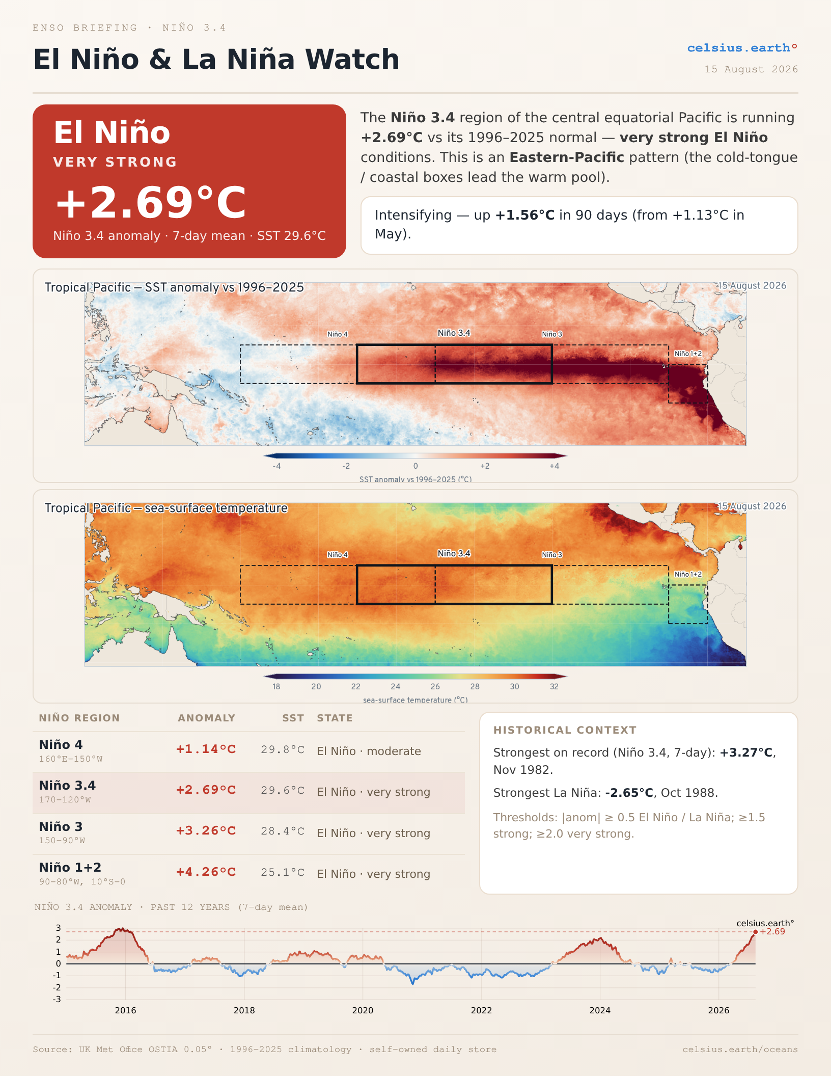
Not expressed often: The equatorial Niño regions’ SST anomaly will go up as the summer progresses — into the autumn — because the seasonal cycle (climatology) eventually goes downward meaning the warm water reservoir becomes more anomalous because what’s normal is cooling in itself.
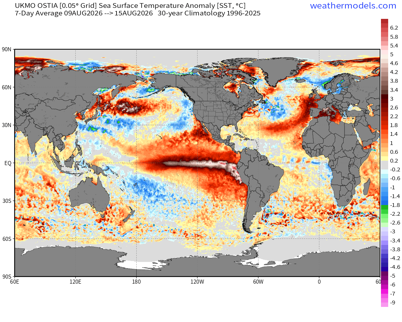
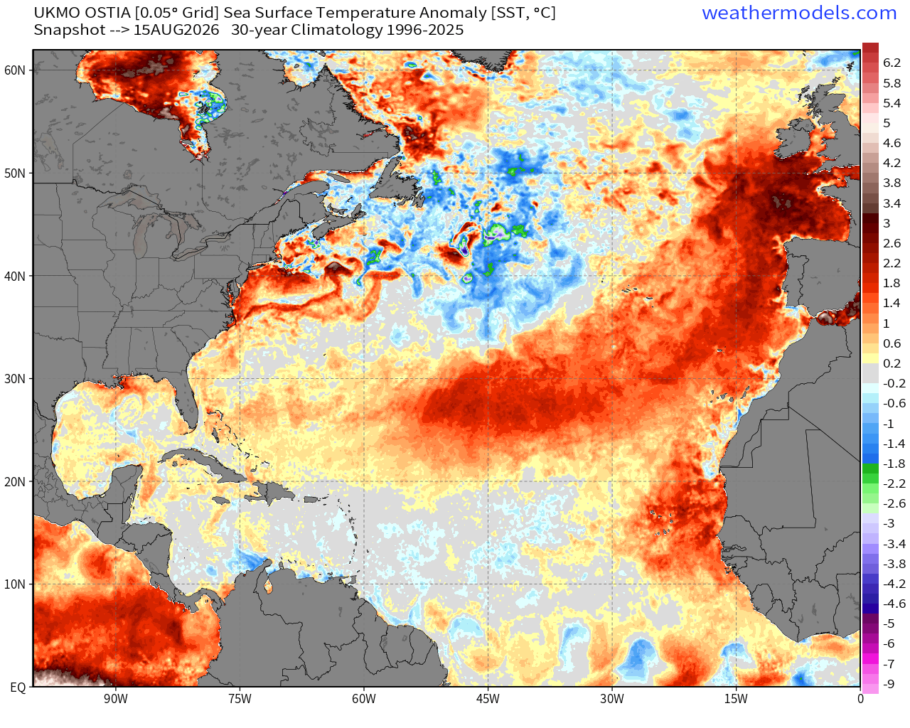
While the Eastern Pacific tropics are quite warm, we’re seeing the “heat dome” pattern showing up across the Northeast Atlantic and now spreading outward into the subtropical Atlantic. These SST footprints are due to lack of wind forcing, cloud cover and rain. The atmosphere imprints upon the ocean surface —> creates the memory below.
Monday’s Low Temperatures
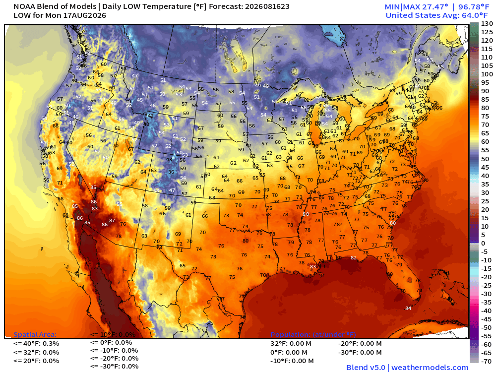
Cooler air slowly but surely filtering into the Midwest and Great Lakes with 50s showing up.
Monday’s High Temperatures
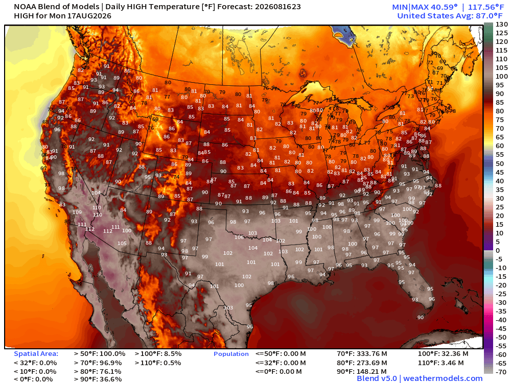
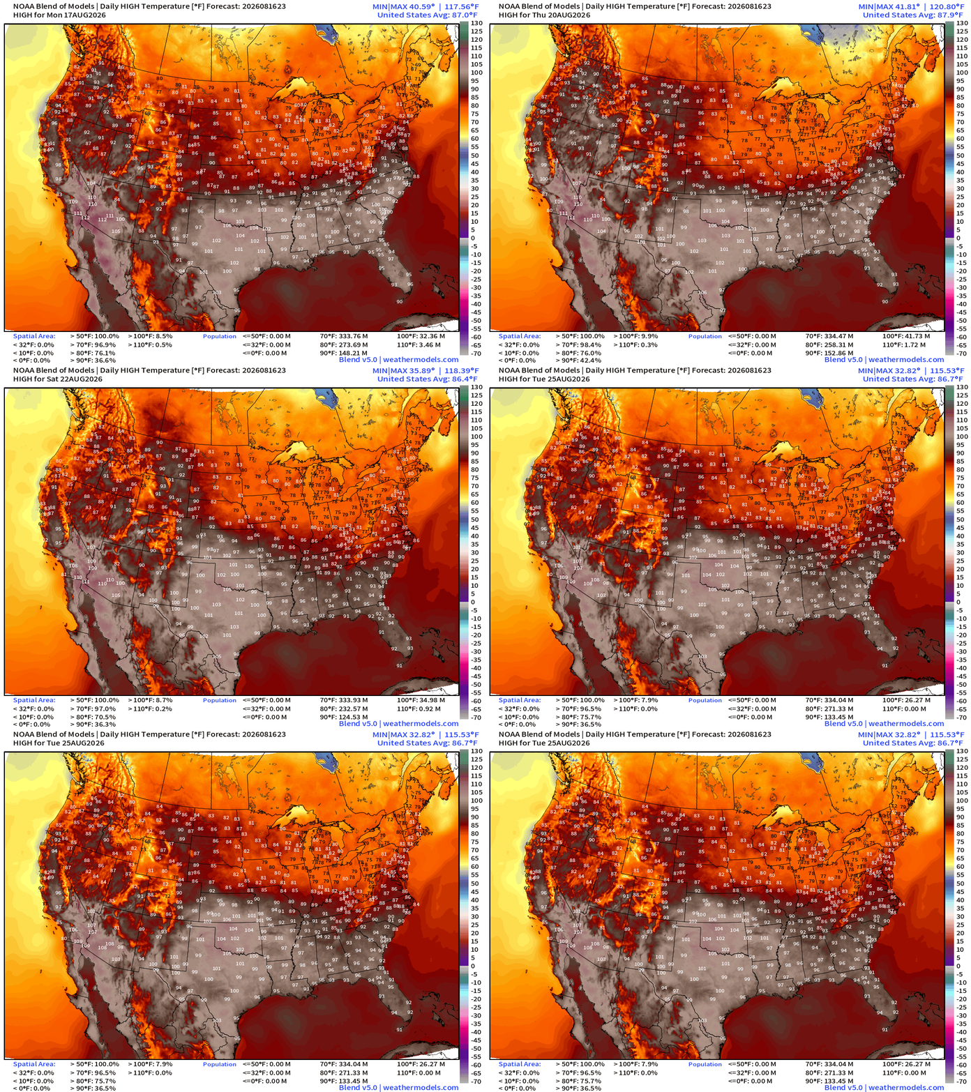
Widespread 90s and 100s from Texas into the Carolinas with 33 million population at least 100°F
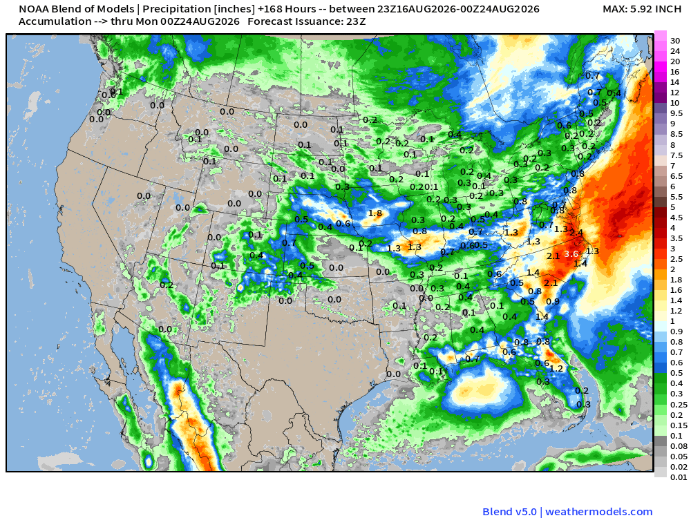
Blend of Models Precipitation Next 7-days
Tropical Spaghetti
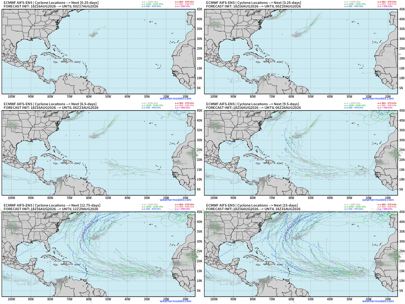
AIFS-ENS 18z does pick up tropical waves in the MDR and many develop enough of a low pressure + circulation to be picked up by the storm tracker. Two major waves that could develop in the 7-10 day range. The next week looks mostly quiet.
ECMWF Ensemble 12z full-physics tracks next 15-days
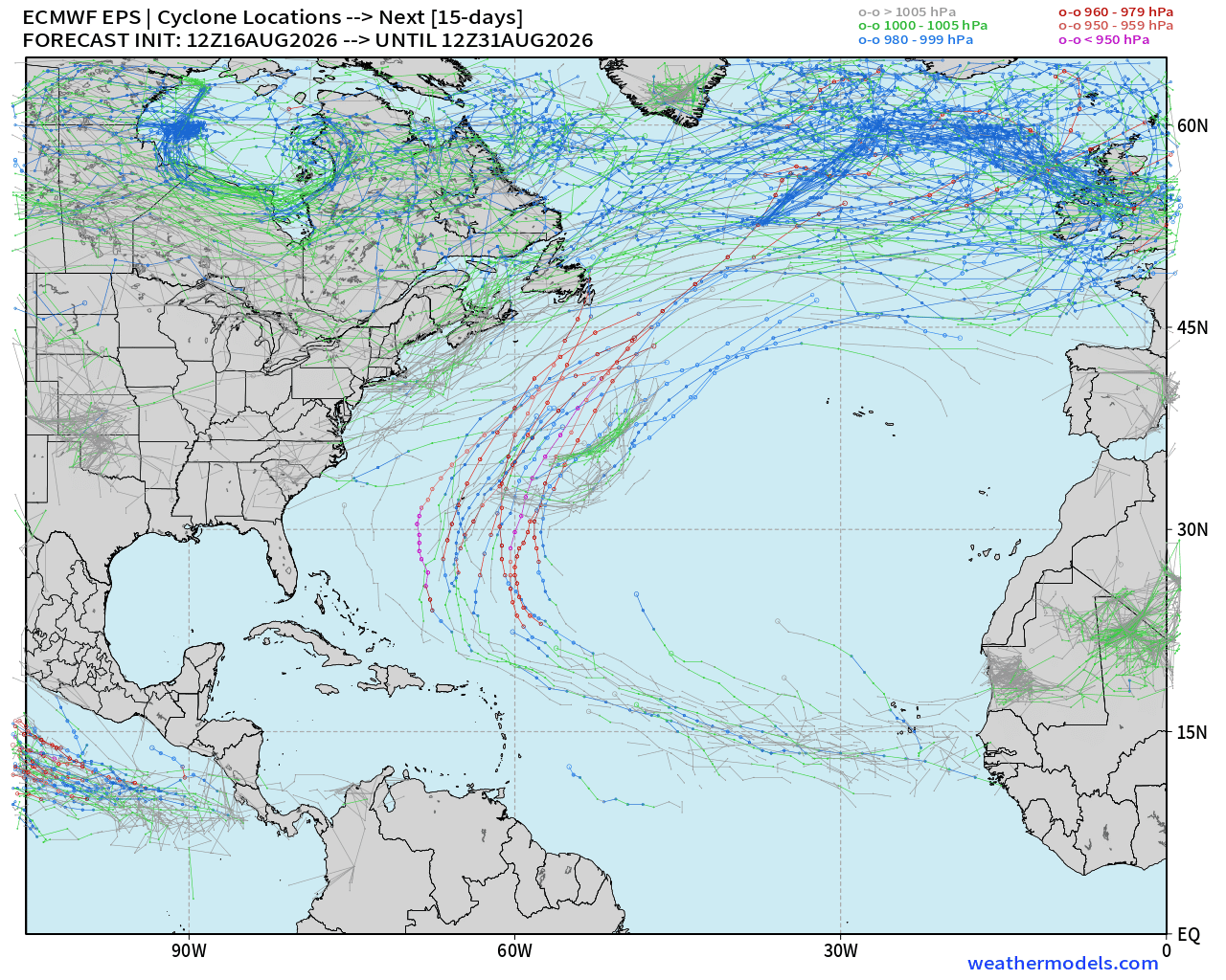
Looking at the full-physics gives another outlook —> and we see some many ensemble members with hurricanes out of the tropical wave in 7-10 days with more favorable environment in the Western Atlantic — out to sea.
Tough Sledding for Tropical Waves — not enough firepower (convection) to overcome the wind shear and Saharan Air Layers + Dust
—> Ghost Town for the next 5-days
ECMWF HRES | Precipitable Water | Atlantic Tropics Next 6-days
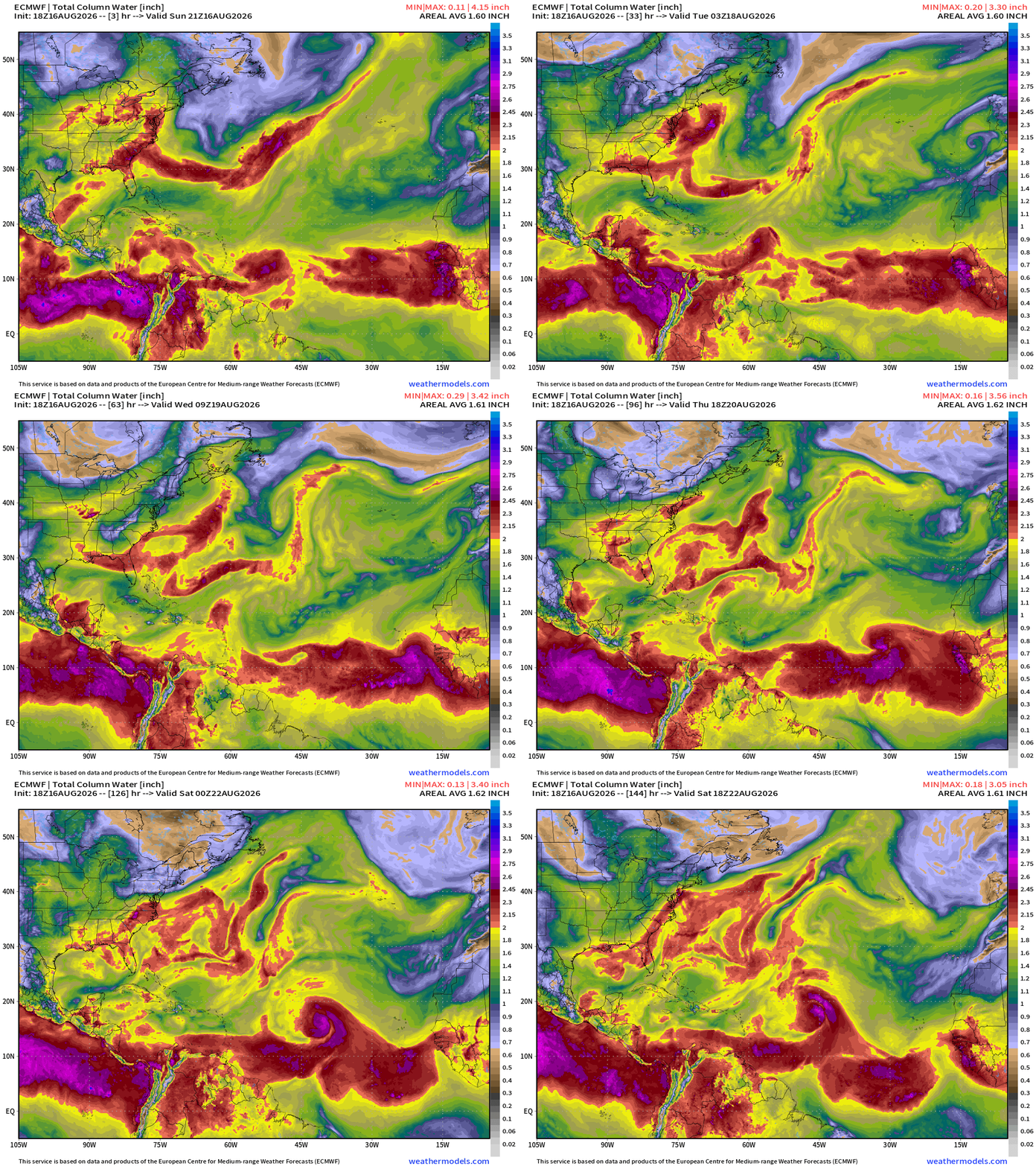
A tropical wave coming off Africa on Wednesday is probably the next best chance for an area of Invest into the weekend.
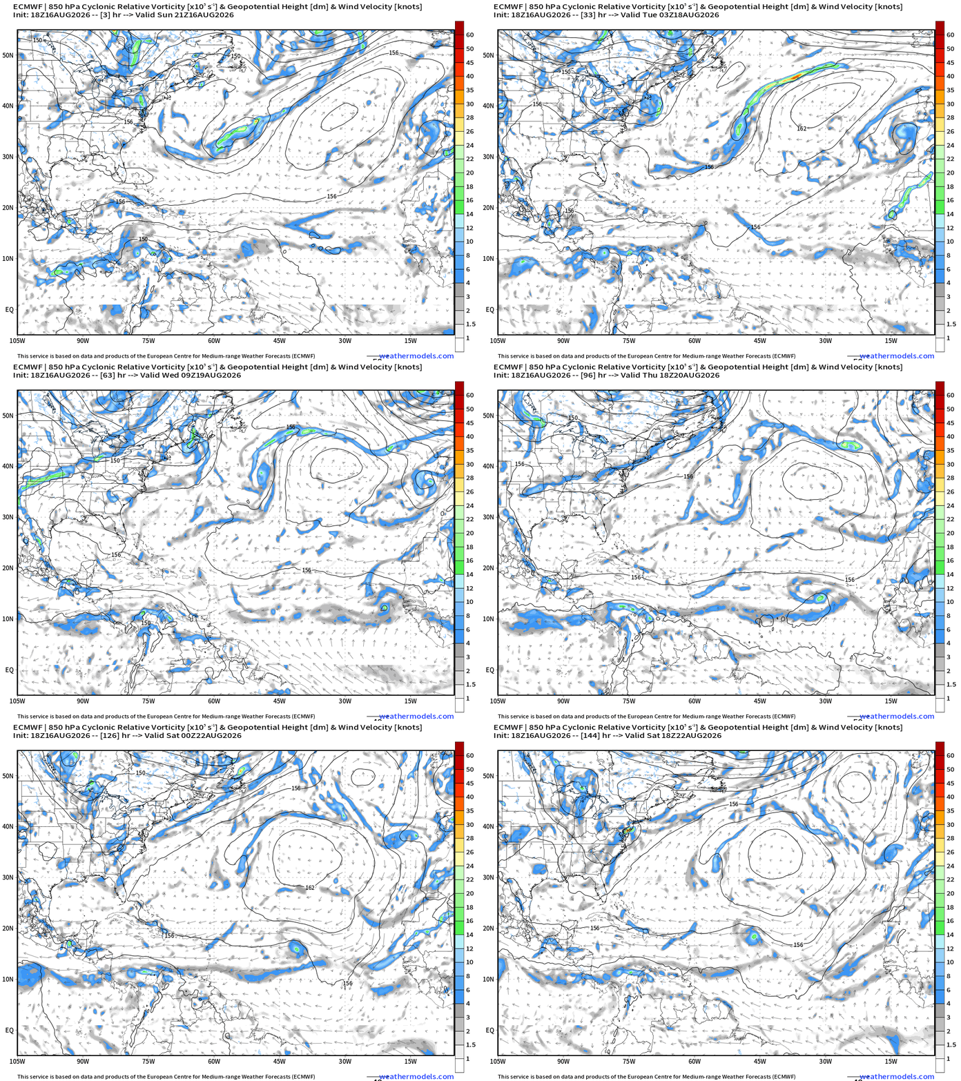
The cyclonic vorticity from ECMWF 18z does show the tropical wave with a circulation but it’s quite weak … yet survives the trip out of the MDR into the open Atlantic.
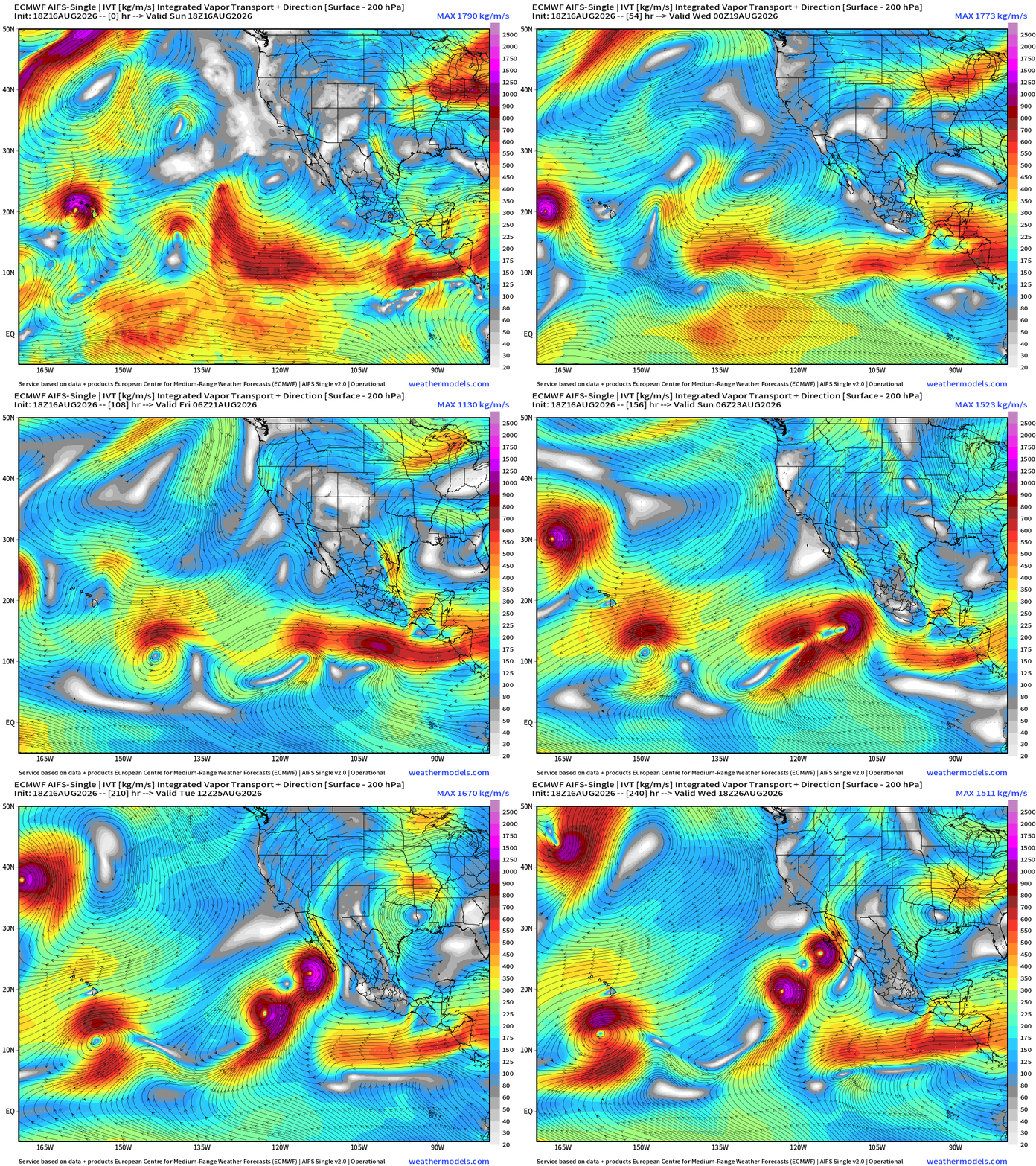
Flagship model: ECMWF AIFS 18z —> Integrated Vapor Transport next 10-days
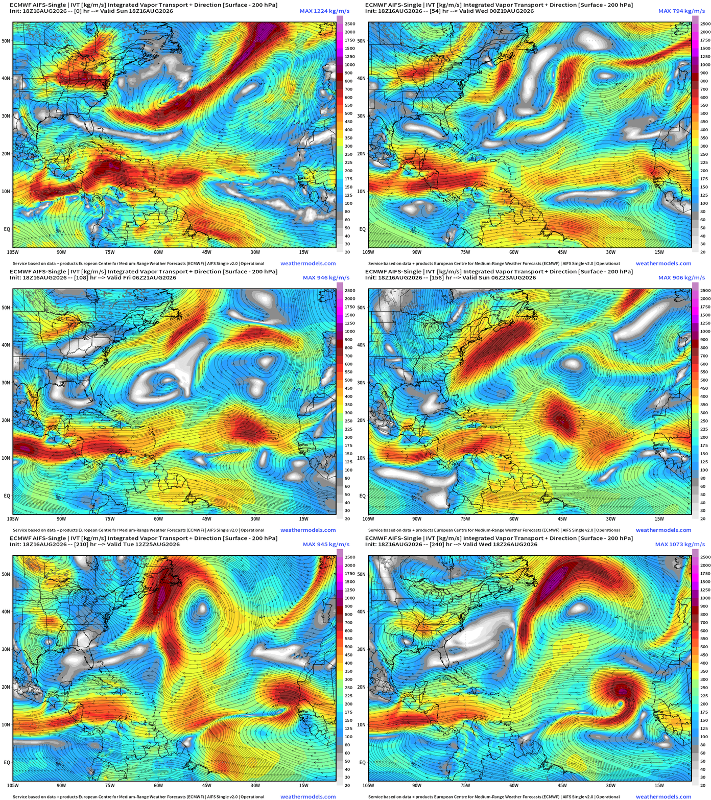
AIFS-Single not too interested in Wednesday’s tropical wave … but another one in 9-10 days off Africa looks more impressive. That’s into August 25/26. Long way down the road.
AIFS 18z Height Anomaly next 10-days
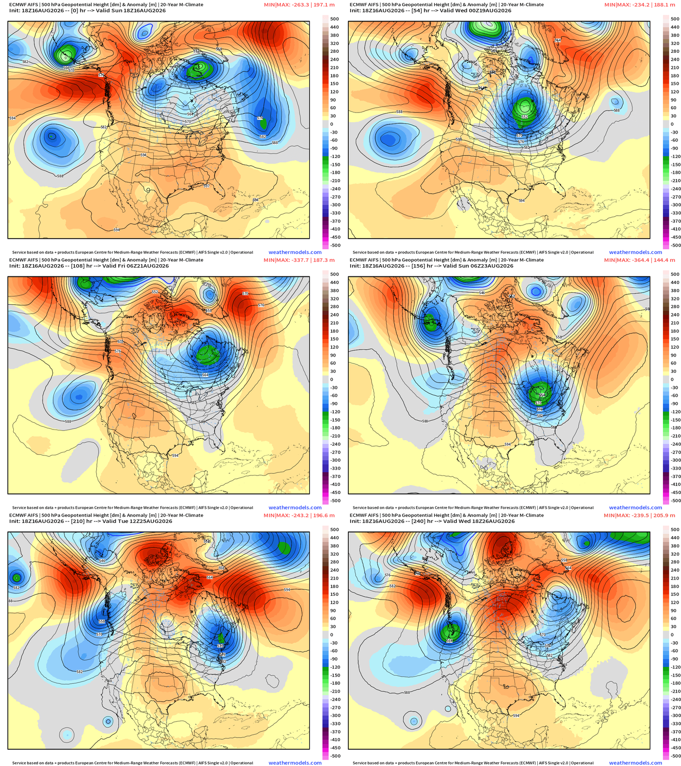
The heat dome is battled back to the Southwest by a series of strong troughs out of Canada into the Northeast = 70s and 80s rather than 90s across the Great Lakes into the Mid-Atlantic
Temperatures Next 8-days
Atlantic Tropics | Back to a Ghost Town
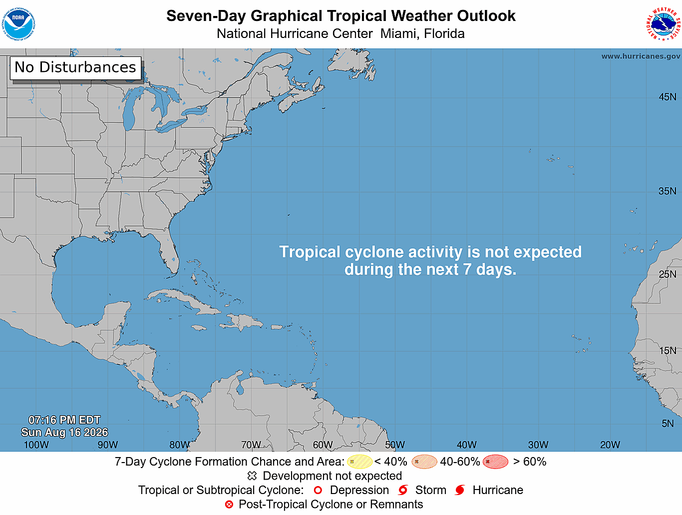
The previous tropical waves 92L and 94L have “poofed” and are difficult to locate on satellite imagery. A new “very large” wave coming off Africa will likely meet the same fate.
Tropical Waves
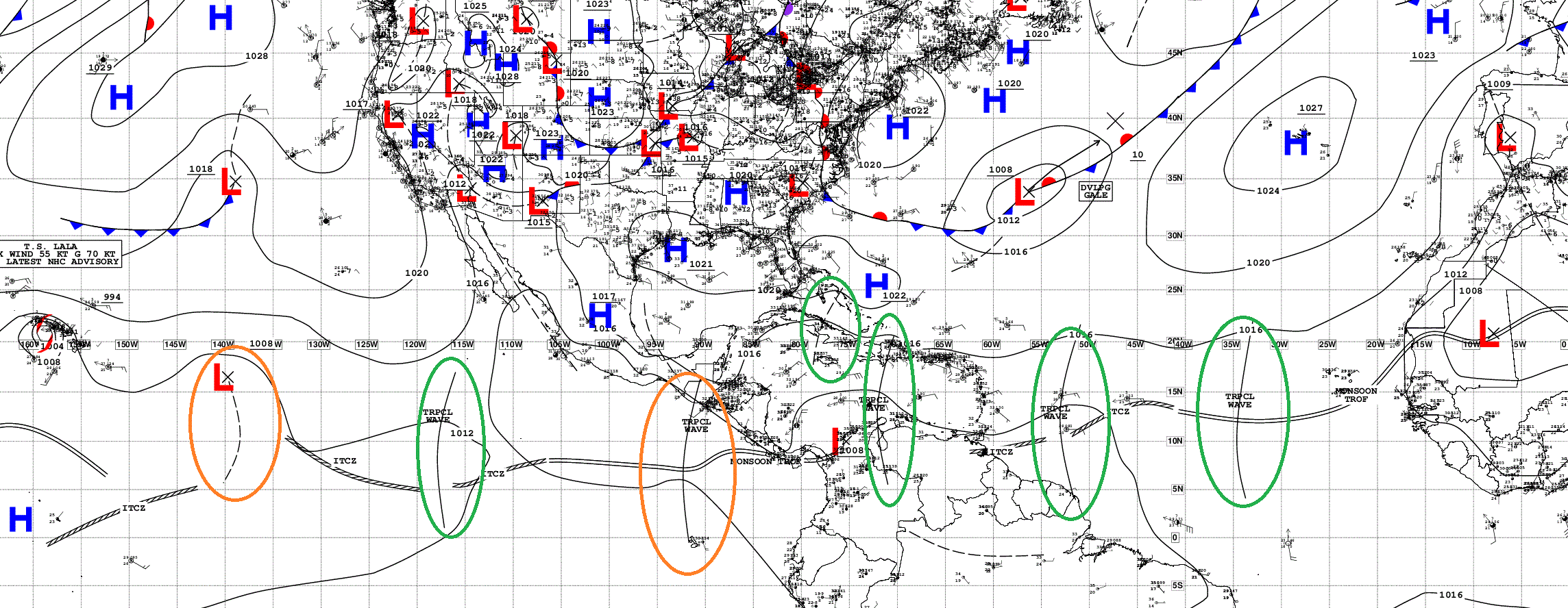
Multiple Atlantic tropical waves but all are barely functioning.
Sea Surface Temperatures plenty warm now > 28°C (red)
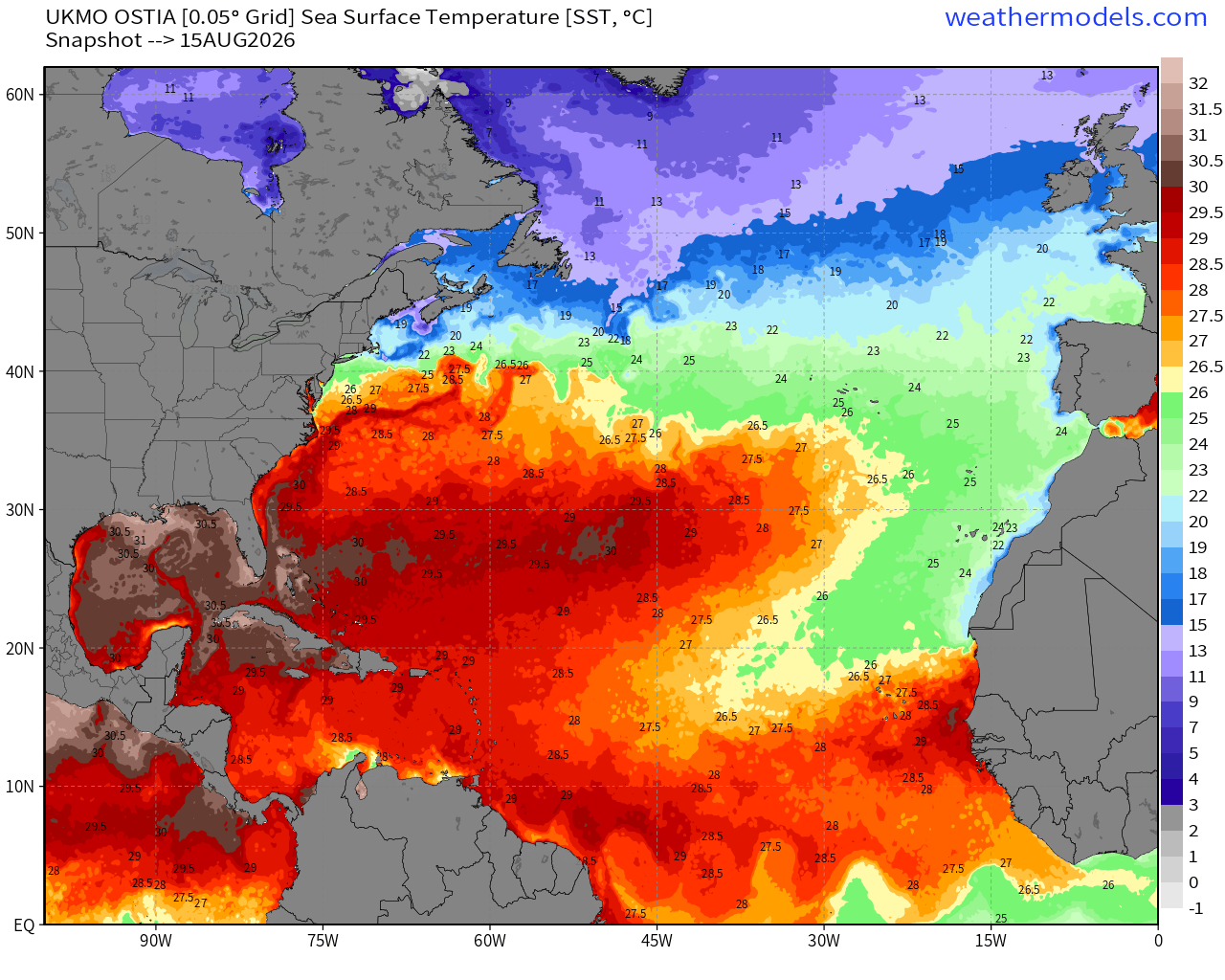
The warmth in the MDR is quickly expanding to carve into the cool <26°C water from the cold Canary Current, so I think any tropical waves that stay below 20°N latitude will have sufficient warm water to develop. Huge area of warmth (above normal SST) in the subtropics and northeast Atlantic.
NASA Dust (GEOS-5) — Saharan Air Layers continue to cruise across the Atlantic doing damage to tropical waves and stabilizing the tropical environment with warmth at lower levels.
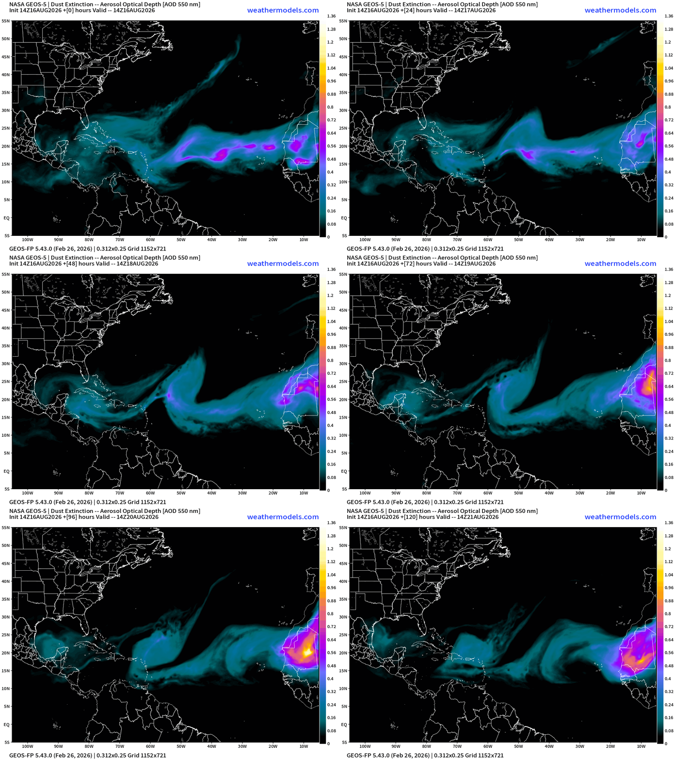
Tropical Equatorial Africa — still more waves to come!
Eastern and Central Pacific Hurricane Basin
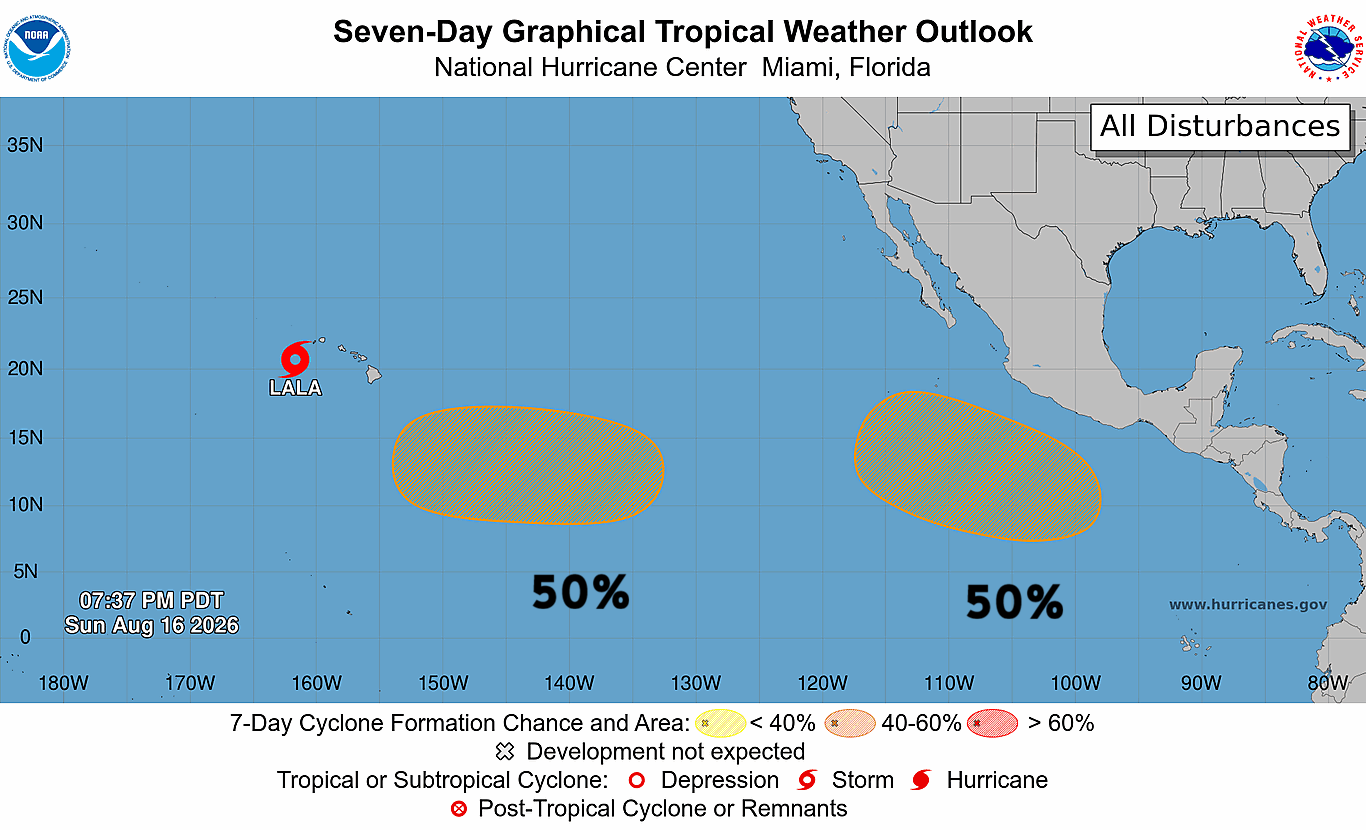
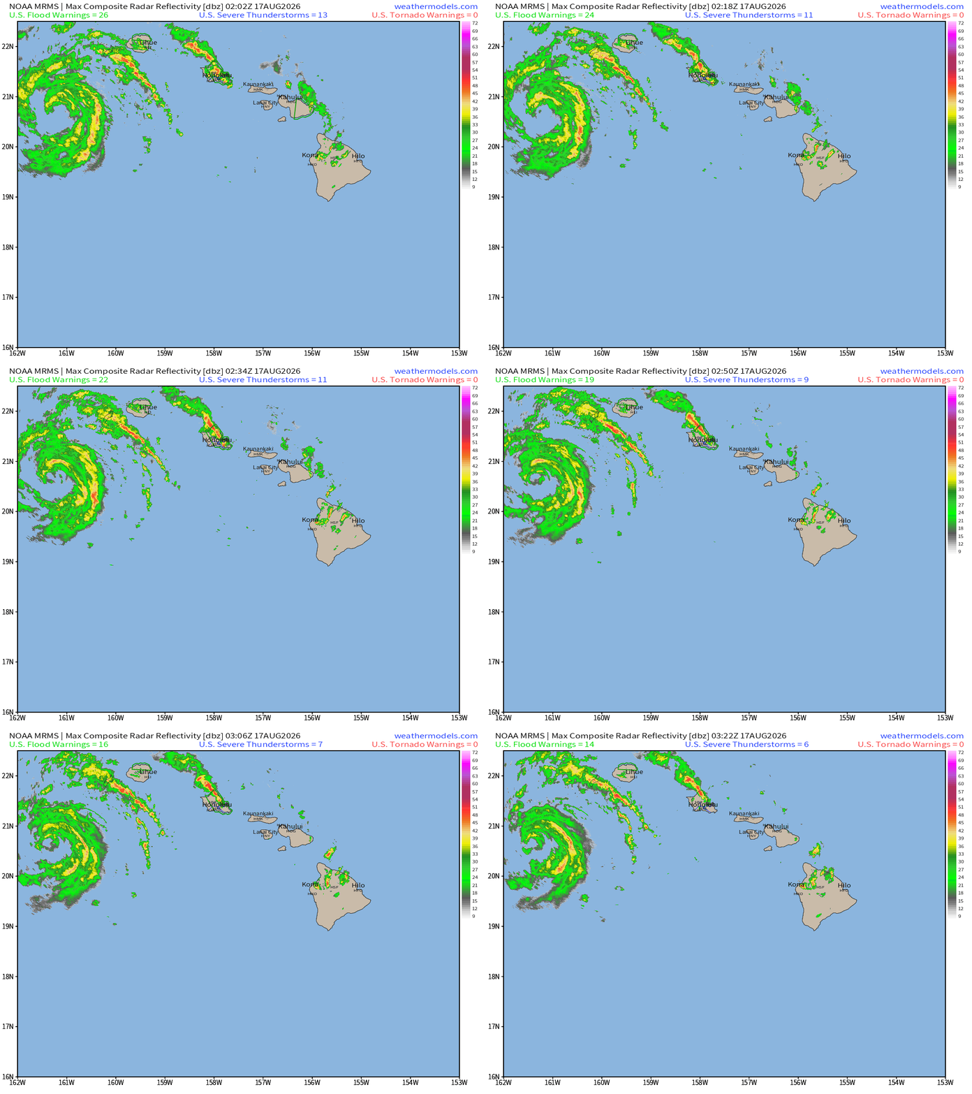
Tropical Storm Lala is pulling away from Hawaiian Island chain w/65 mph winds
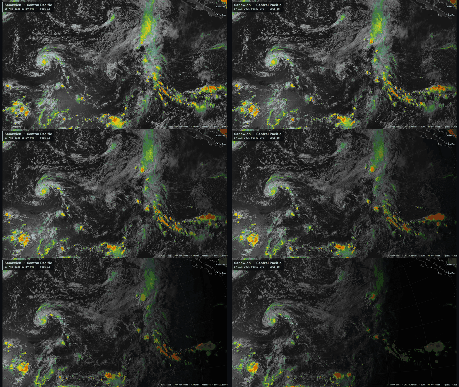
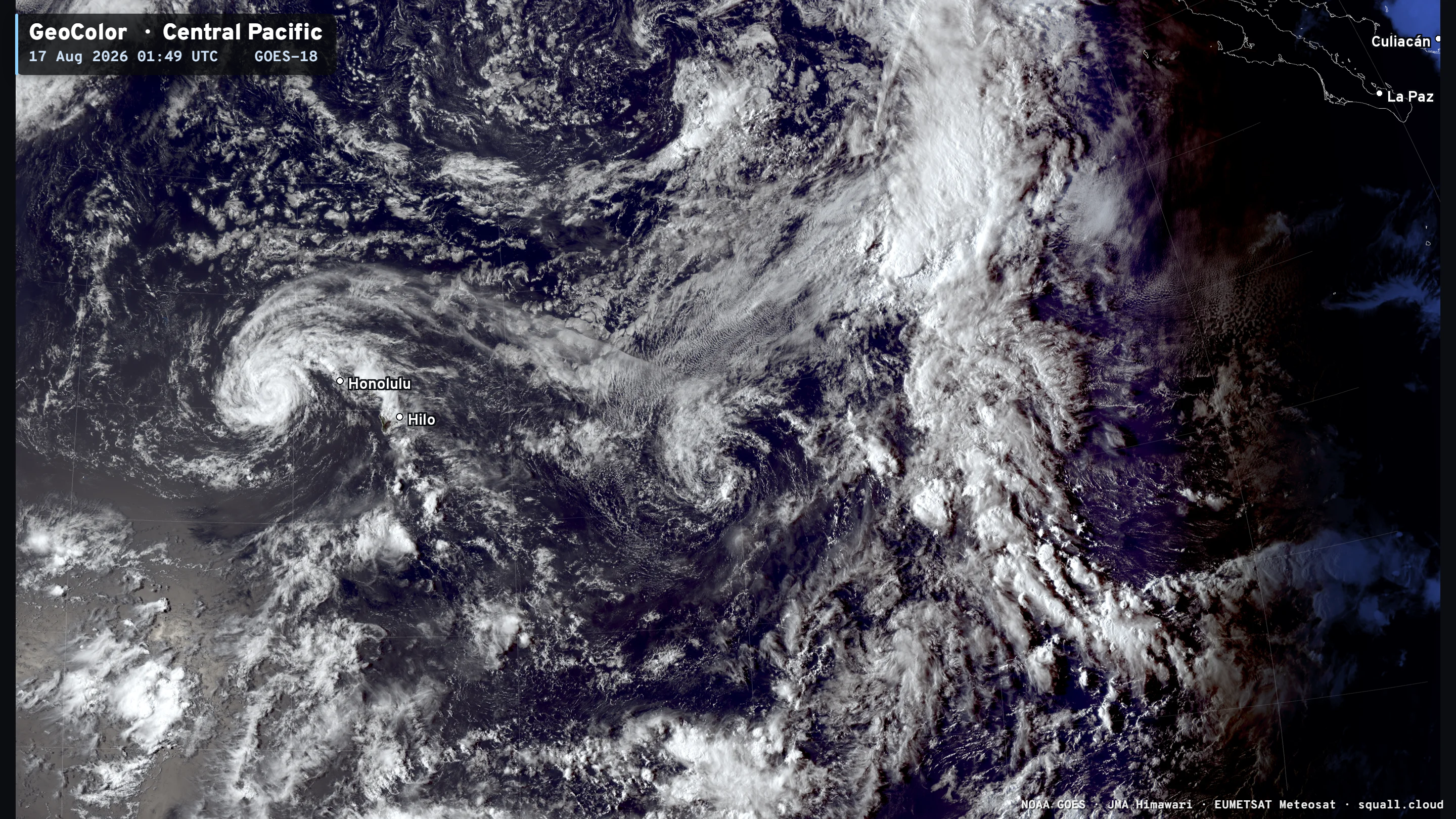
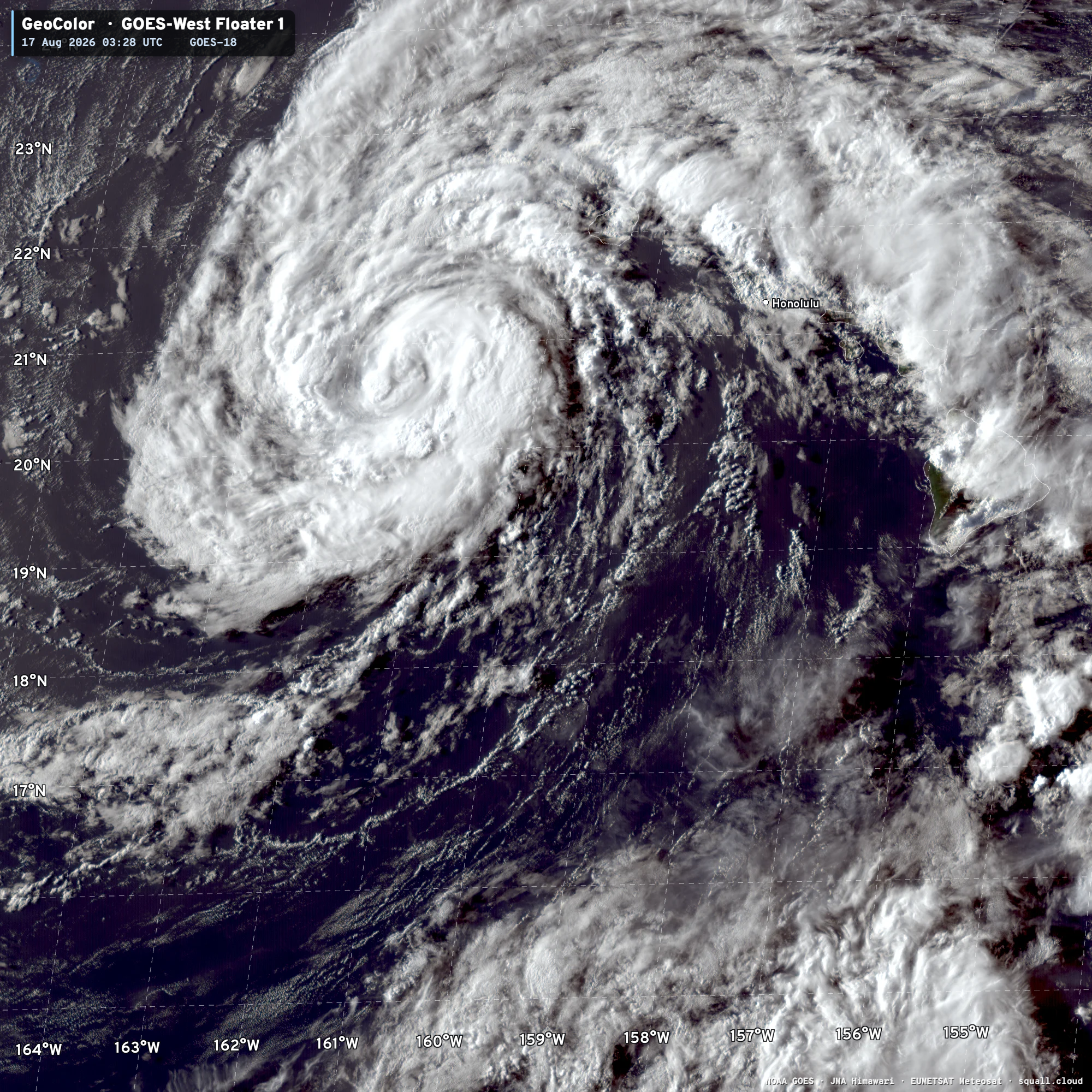
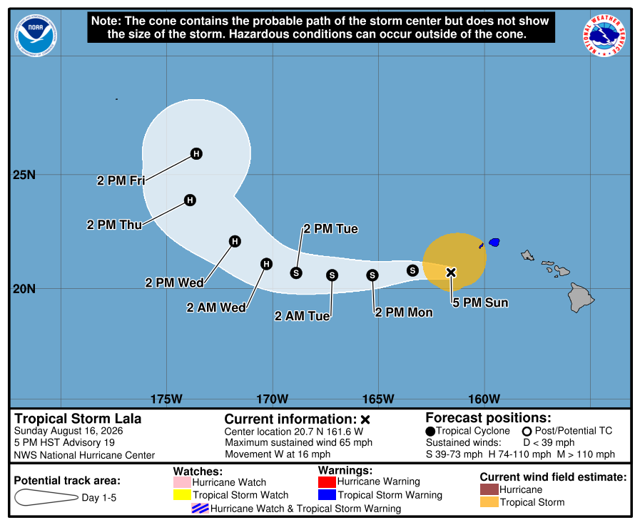
Bye bye Lala!
Lala will continue WNW until a strong mid-latitude trough pulls it northward
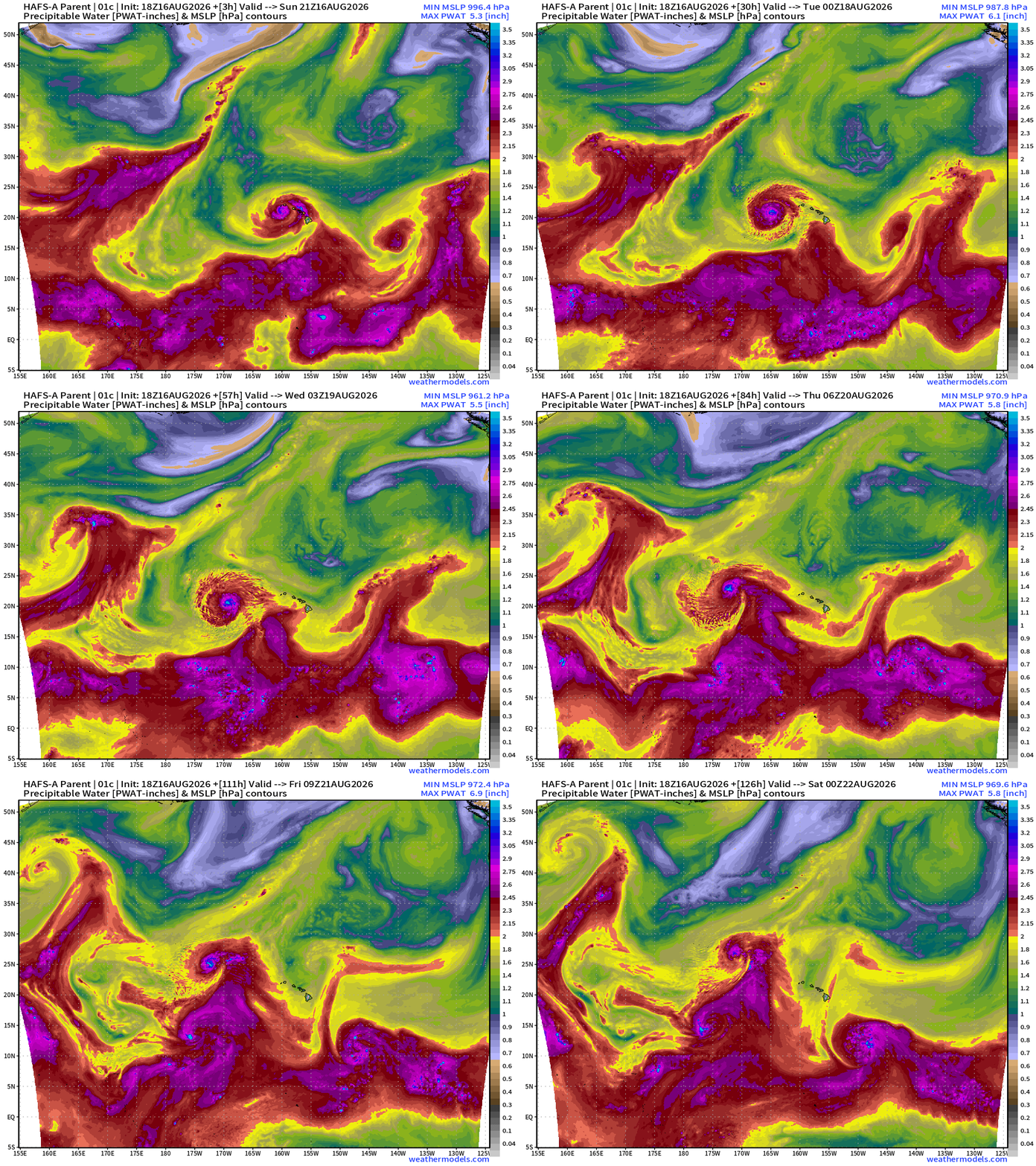
Lala still plenty of time and warm water to become a major hurricane
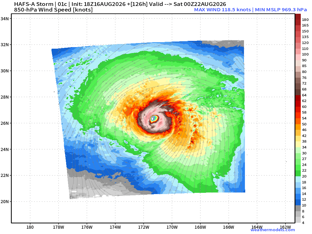
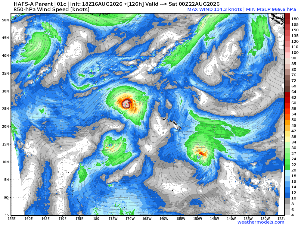
Spaghetti Tracks from Google Deep Mind and ECMWF EPS
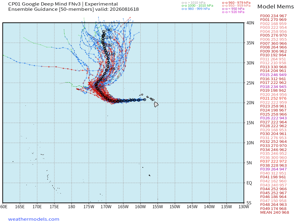
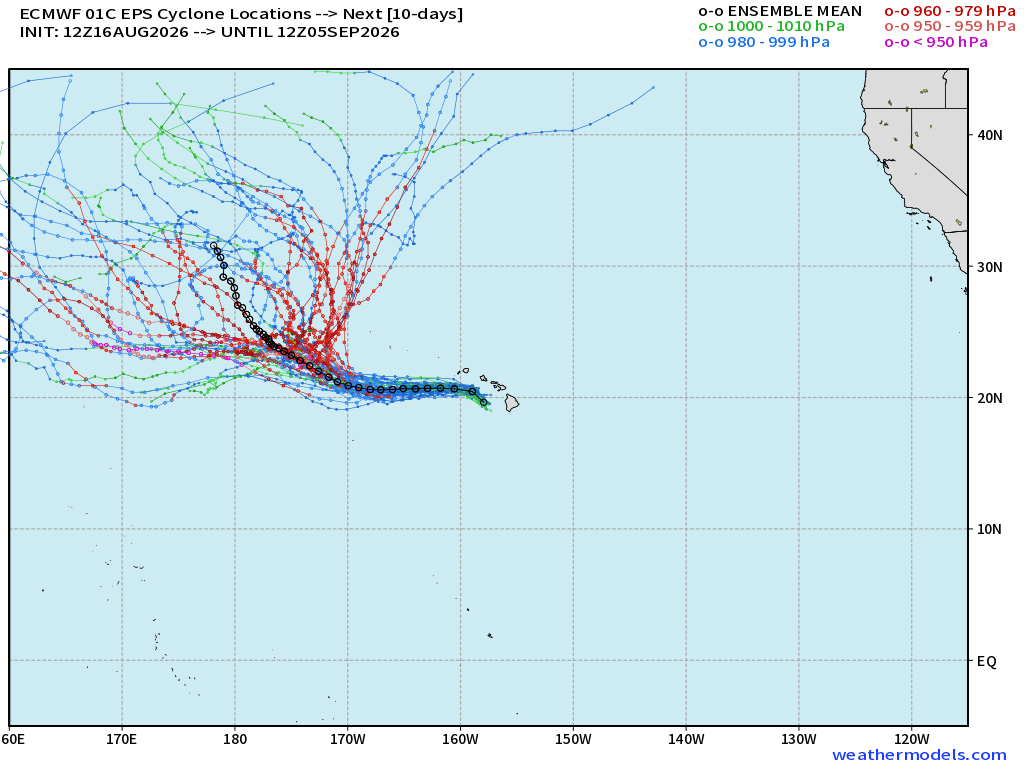
Interesting: chance of 2-more storms in the EPAC and another south of Hawaii in next 10-days
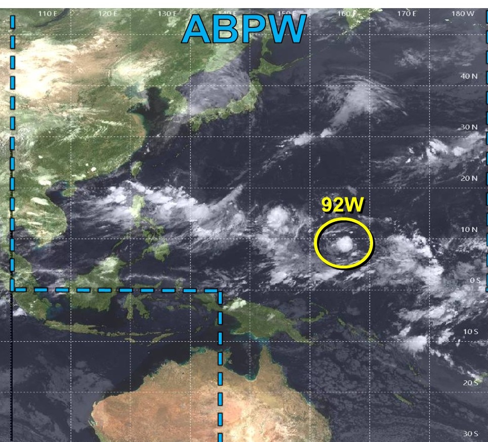
Western Pacific Typhoon Basin
Integrated Vapor Transport from ECMWF AIFS 18z
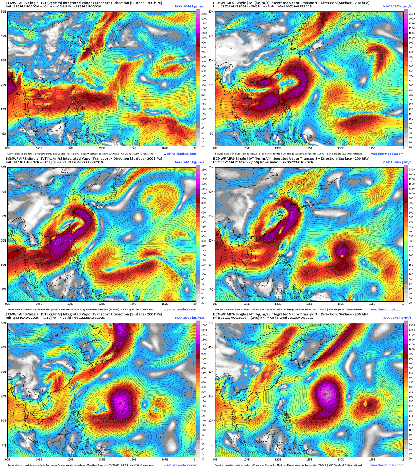
By this weekend, should have our next typhoon the radar.
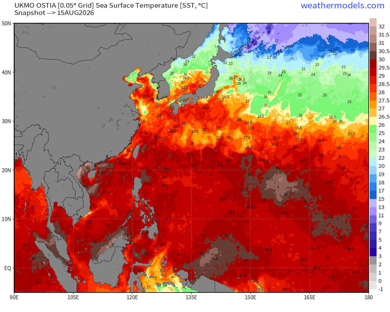
Ocean Temperatures are actually below normal in the subtropical Western Pacific with cold wakes / upwelling or mixing caused by very large Typhoon Dolphin, and the rest of the monsoon trough that was dragged well north off Japan.
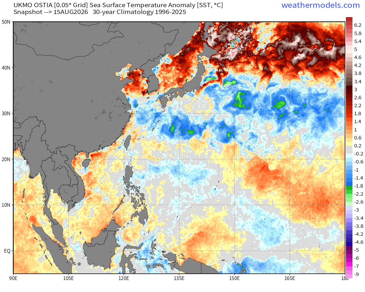
The WPAC will warm back up — still August/September plenty of time to recover the cooler SST back to 28.5º-29º
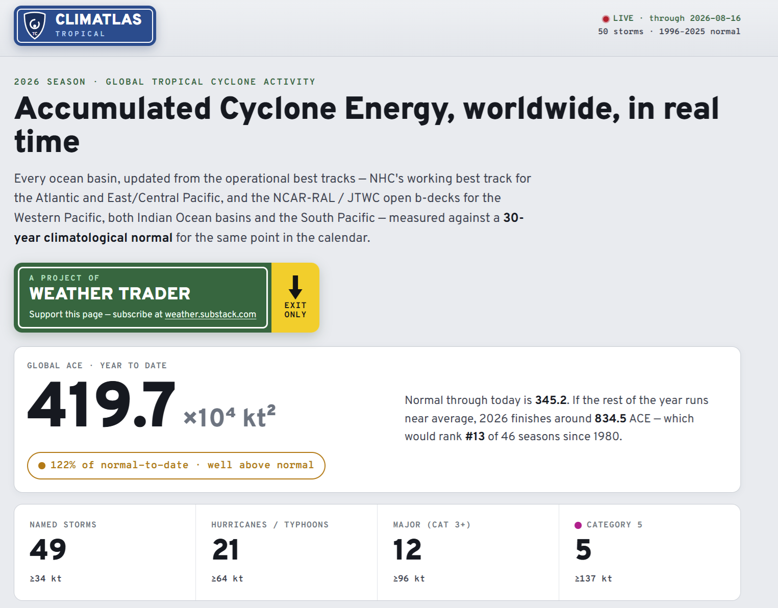
Global Tropical Cyclones for more ACE information, as well as my original climatlas.com/tropical site now with the beautiful Interstate Highway theme and full of interesting content!
Maps sourced from weathermodels.com designed and innovated by yours truly! Please subscribe there for real-time access to the newest maps, charts from all of the weather models including ECMWF and AIFS, and NOAA GFS/GEFS, HRRR/RRFS and Blend of Models (NBM). NOAA WPC and SPC for fronts/convective outlooks. Our own content is now sourced from hottestsince.com and weather.city and celsius.earth, and squall.cloud and weather.football and global-tropical-cyclones.com and precipitation.earth
My Atlantic Hurricane Season Forecast (2026)
From April 7, 2026: Atlantic Seasonal Hurricane Forecast: (11/5/2)
9-13 Named Storms (11 most likely)
4-7 Hurricanes (5 or 6 most likely)
1-3 Major Hurricanes (2 most likely)
Accumulated Cyclone Energy: 75-85 (well below normal)
NOAA 2026 Atlantic Hurricane Season Forecast
- Milepost
- 1008 · laid 2026-08-17T03:39:49.642000Z
- Source
- https://weather.substack.com/p/august-16-2026-sunday-tropical-update
- Digest
- 44efa254f5cc0eb2888f8d11854eb7d9e20bd3adca726e8b3b4eace4c3f94d36
- Machine
- JSON