Category 5 Hurricane Genevieve
Atlantic tropics remain very quiet but Pacific is full tilt El Niño with Category 5 Genevieve, and soon monster Super Typhoon Dolphin in the far Western Pacific
July 2026 was the warmest July in the 132-year national record (1895–2026), at 76.9°F against a 1991–2020 normal of 74.4°F (+2.5°F).
July 2026 was the 26th-driest July in the 132-year national record (1895–2026), at 2.5in against a 1991–2020 normal of 2.9in (-0.3in).
NOAA/NCEI Climate at a Glance, contiguous United States. This is the observed record for the month, not a score of anything said in this piece — the forecast ledger begins 2026-08-17 and cannot reach earlier posts.
Genevieve is the first category 5 hurricane in the East Pacific since Kristy of 2024.
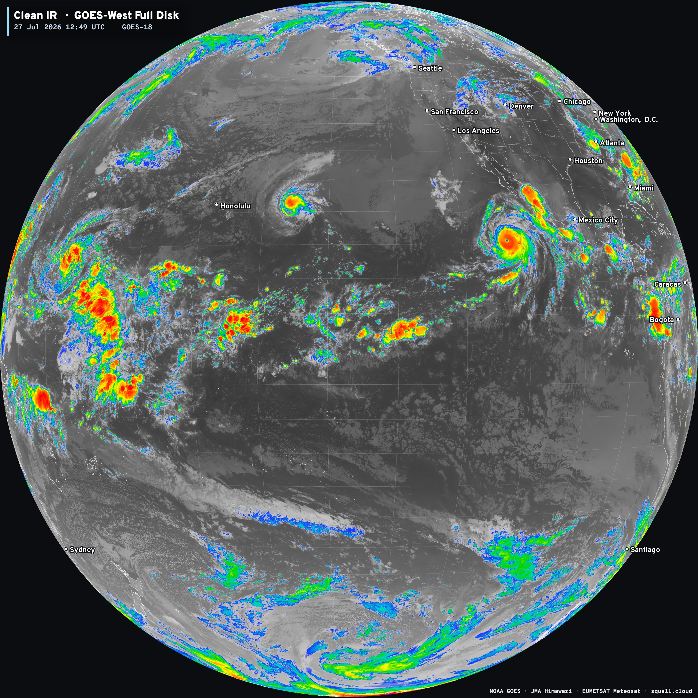
Genevieve rapidly intensified over very warm ocean water fueled by an ongoing strong El Niño. It is the first major hurricane and intense hurricane of the Eastern Pacific season, and we should expect several more heading into autumn as environmental conditions will remain very favorable for hurricane development. In El Niño years, the Eastern Pacific basin is a “hurricane factory” with many major systems.
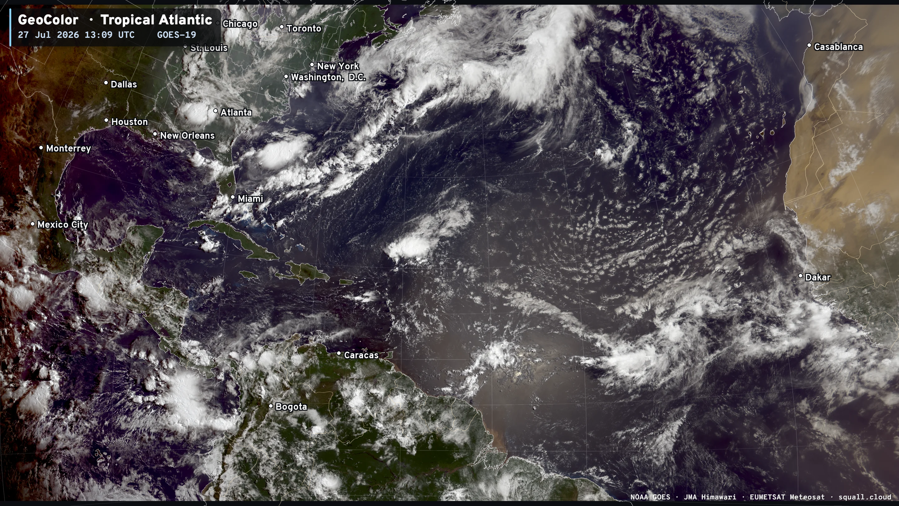
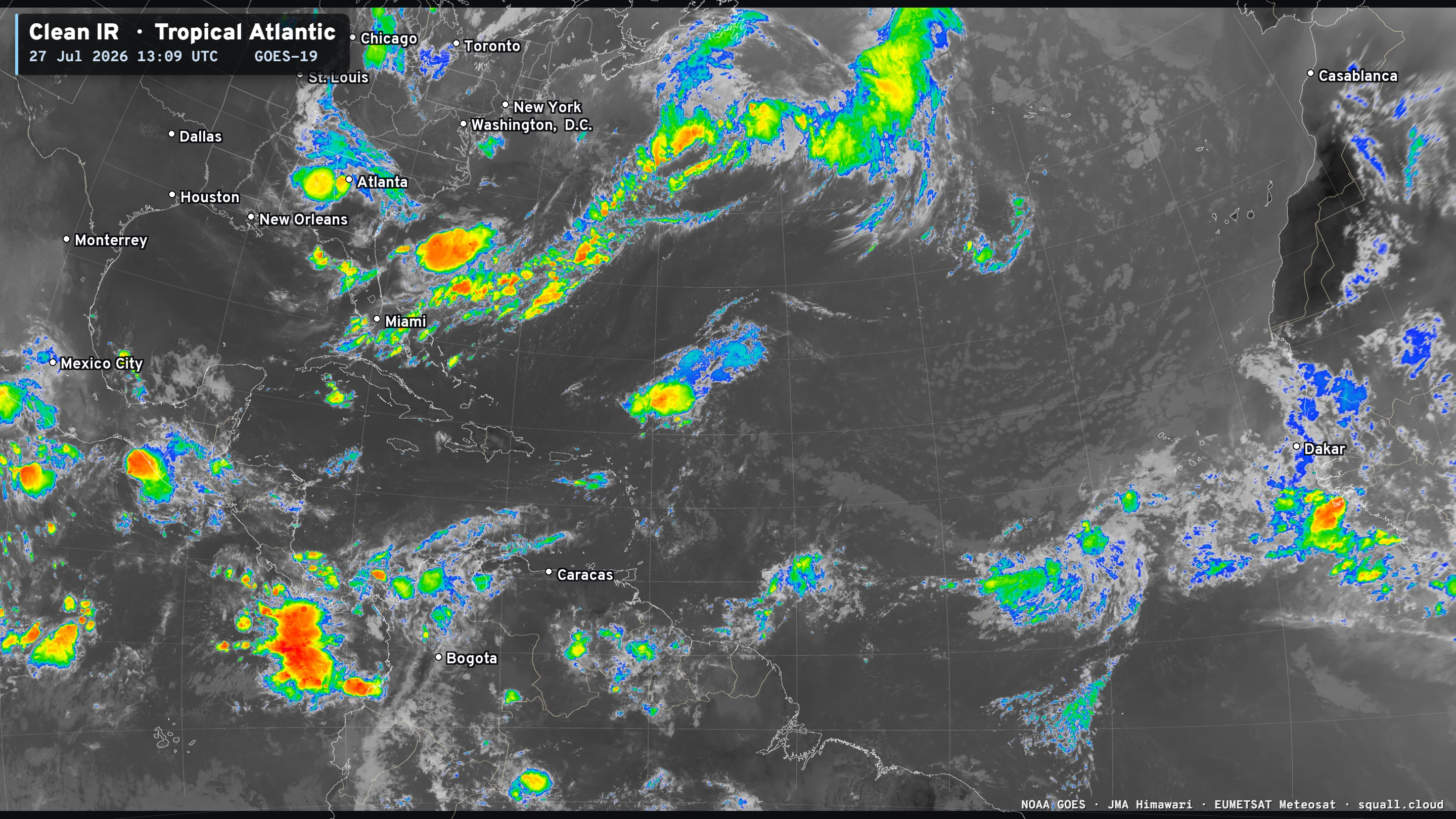
Atlantic tropics remain very quiet this morning — with fair weather from the coast of Africa to the Caribbean and Gulf. Saharan Dust Layers continue to track westward with the trade winds. One tropical wave in the Central Atlantic Main Development region is bubbling up convection, but not being watched for tropical storm formation.


Now Operational: Squall Cloud global weather satellite viewer will soon have full MRMS radar coverage for the United States with some fun surprises.
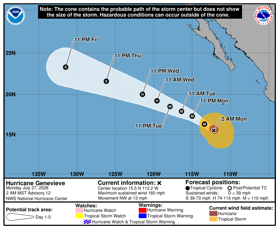
Hurricane Genevieve will not directly impact land. The major hurricane will weaken over the next few days, and eventually become a tropical storm over much cooler ocean waters by Friday.
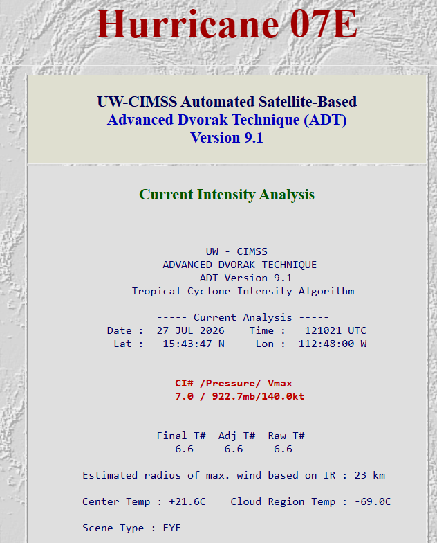
Peak Intensity at 11 PM ET Sunday (0310z): Automated Dvorak T 7.3
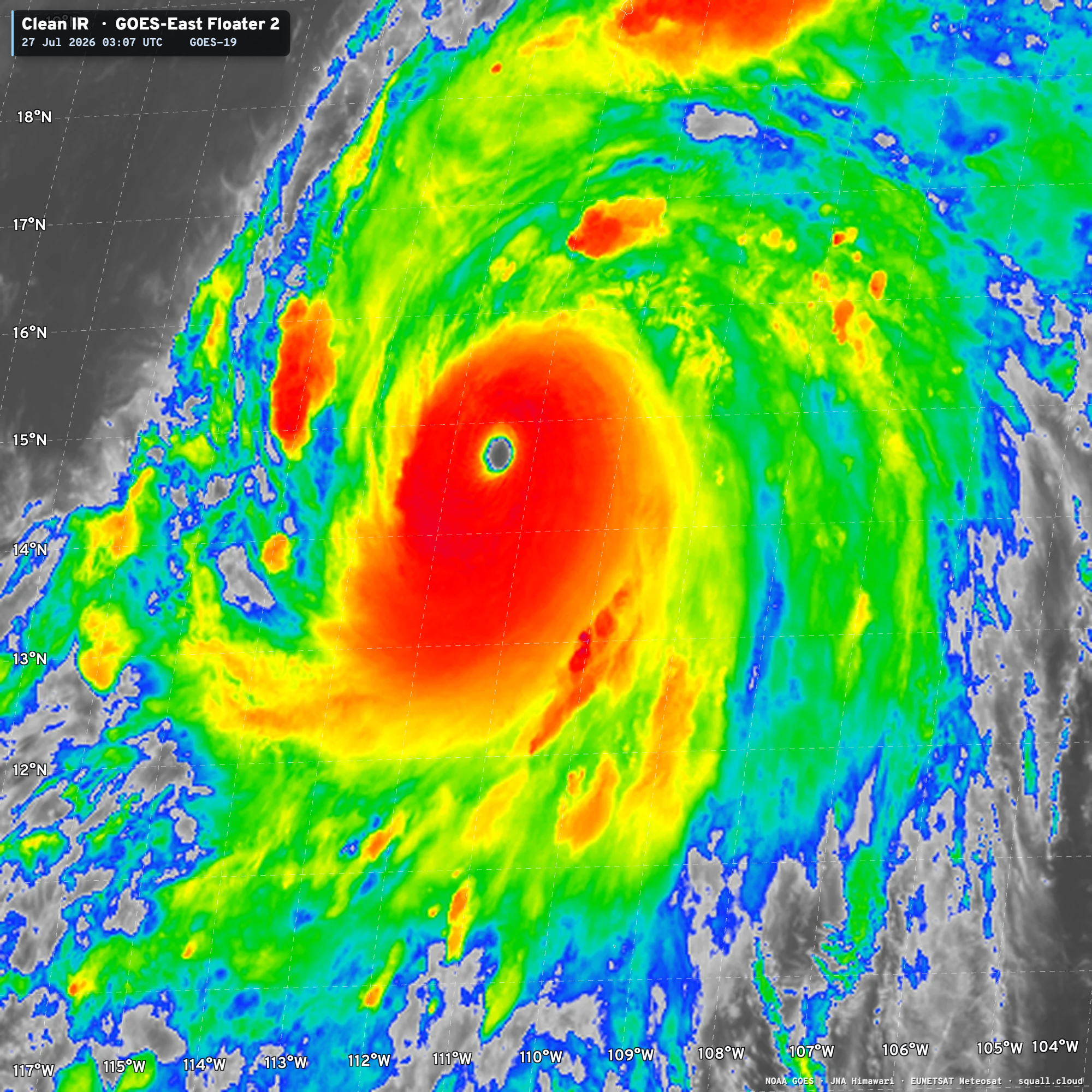
The satellite intensity algorithm called the Automated Dvorak Technique pinged at T 7.3 maximum suggesting Genevieve was perhaps close to 150 knots briefly around midnight ~9 hours ago. Since, the convection in the large overcast cloud region around the eye has warmed slightly (less intense) so the hurricane is probably ready for an eyewall replacement cycle later Monday.
2026JUL27 031021 6.9 923.4 137.4 6.9 7.3 7.3 NO LIMIT OFF OFF OFF OFF 20.20 -74.45 EYE
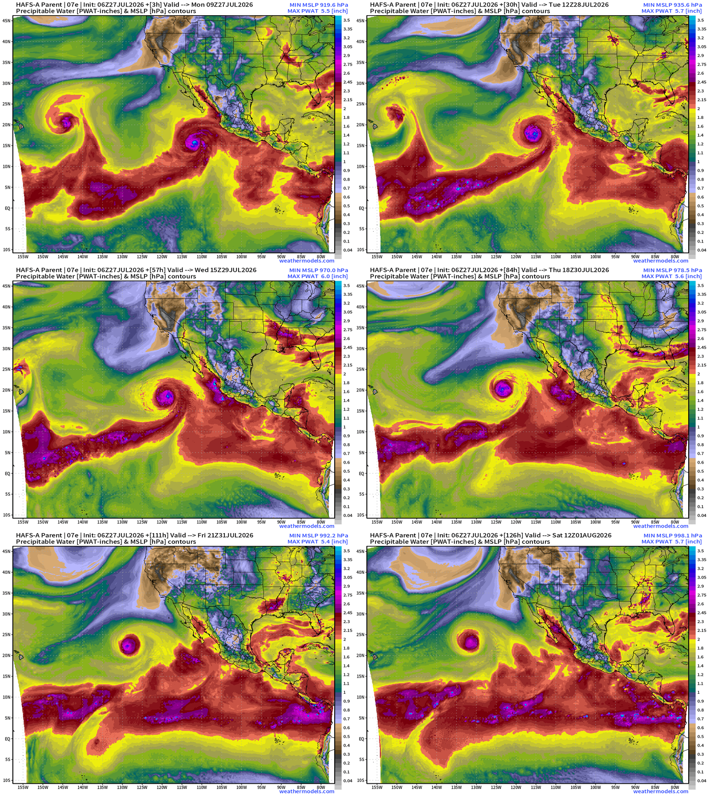
HAFS-A Hurricane Model shows a VERY powerful circulation of this rather small but potent hurricane
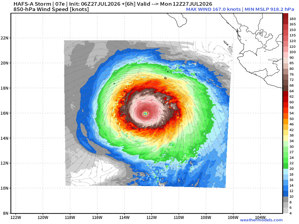
The ocean temperatures were in the 28.5°C range during the rapid intensification
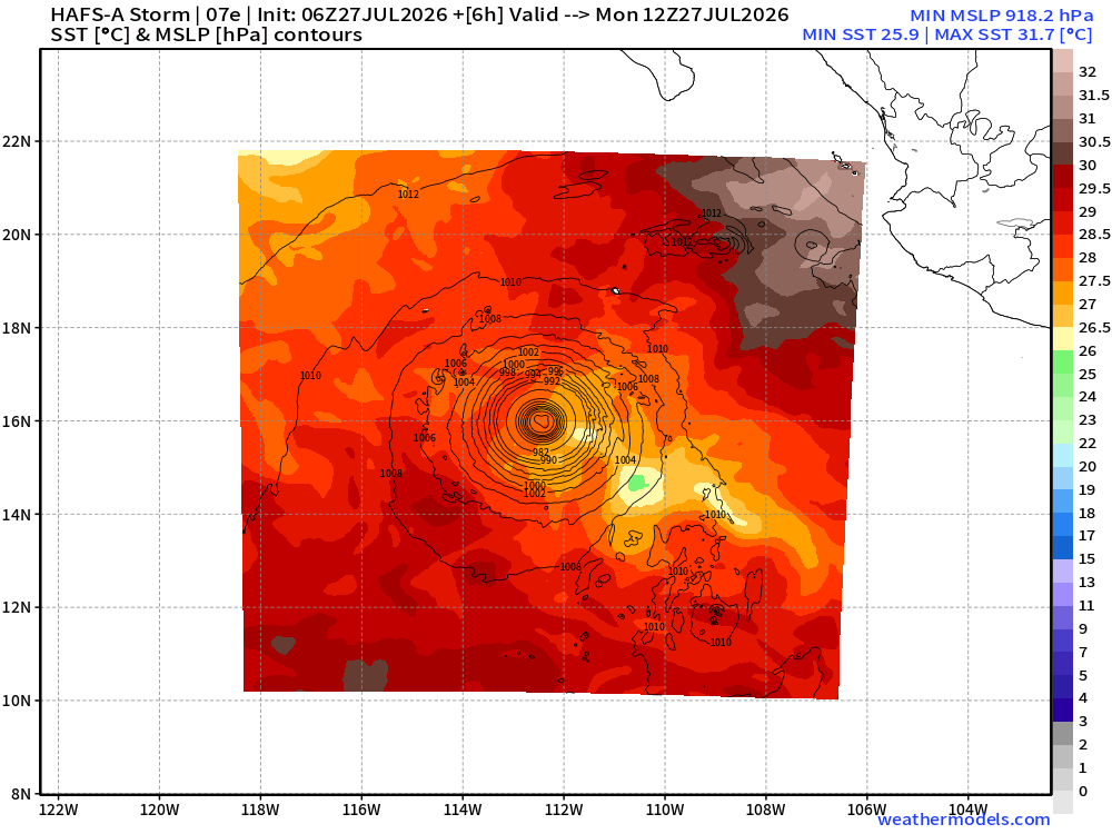
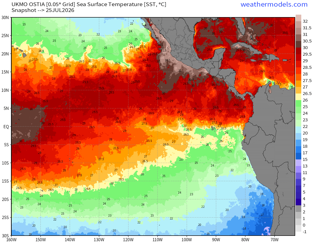
The Eastern Pacific basin is very warm overall —> hurricane factory
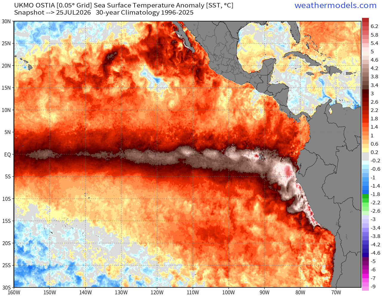
And, the huge El Niño SST Anomaly along the equatorial Pacific — extends from the central Pacific to the Coast of South America
Genevieve will weaken in the coming days — as it completes its lifecycle over cooler ocean water, but it will take quite a while to spin down the formerly Category 5 circulation.
Flagship model: ECMWF AIFS 06z —> Integrated Vapor Transport next 10-days
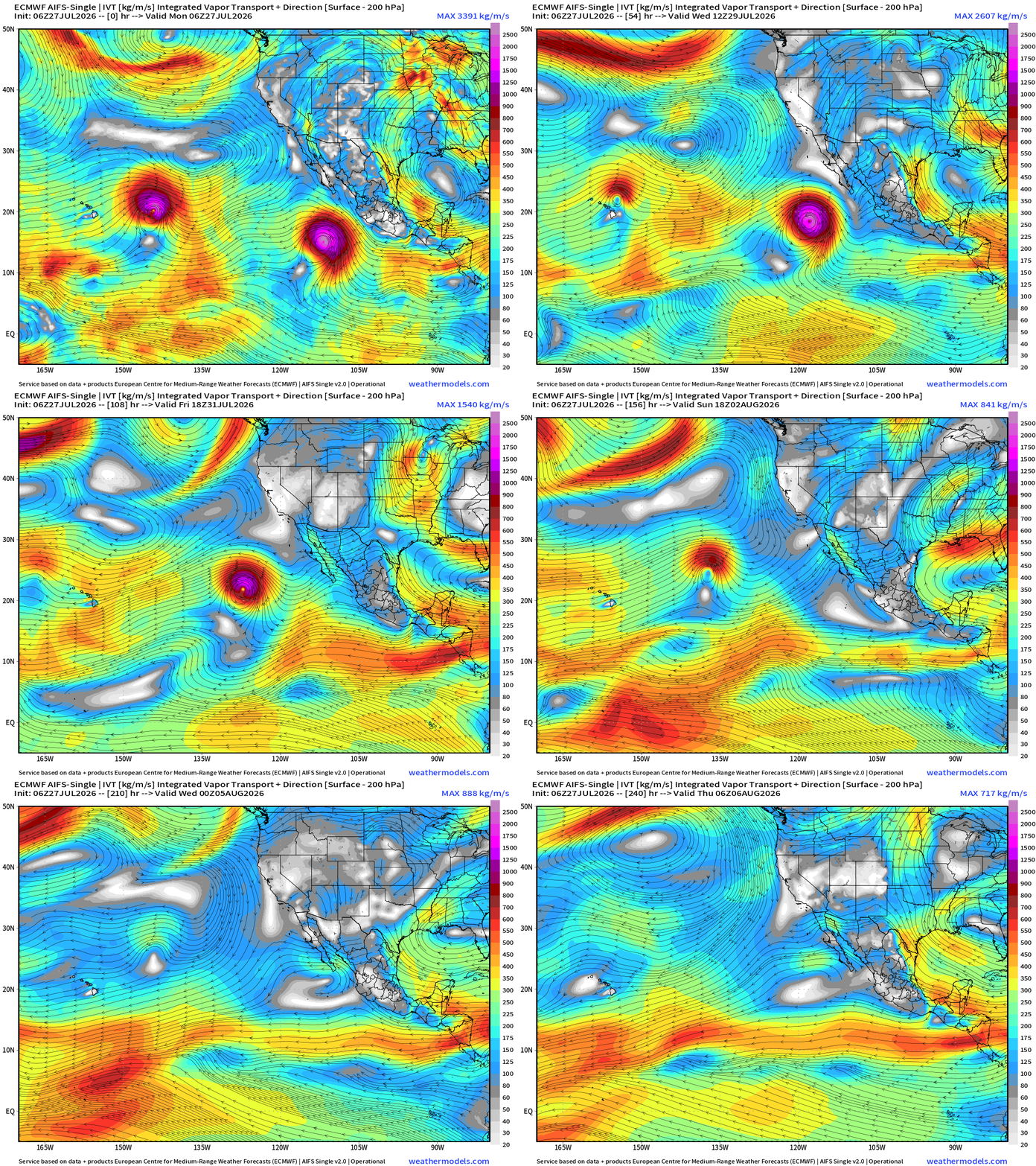
Genevieve at Category 5 will continue WNW over cooler water and become a remnant low well north of Hawaii in 8-10 days
Hurricane Fausto currently passing safely north of the Hawaiian Islands to avoid direct impacts
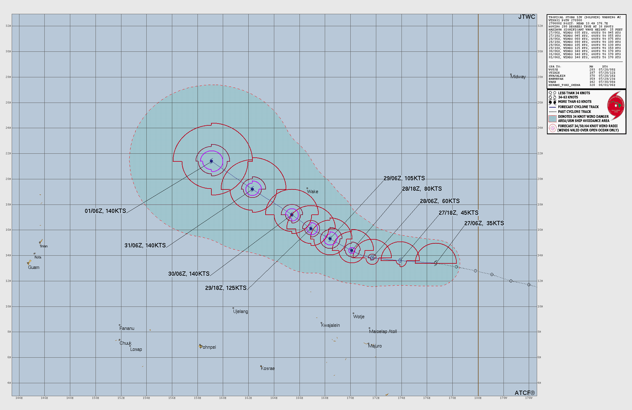
Tropical Storm Dolphin (12W) in the far Western Pacific formed today!
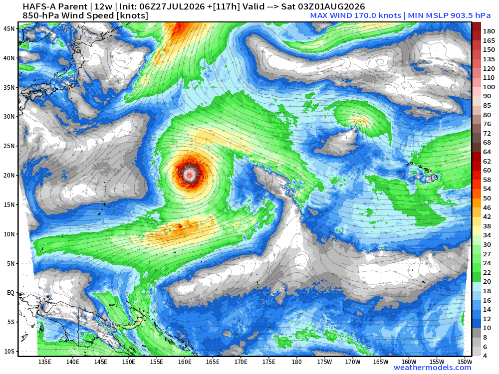
JTWC is already out of the gate with 140 knots maximum wind speed forecast = Super Typhoon and Category 5
Google Deep Mind Ensembles (06z fresh) show most intensity outcomes in the lower 900s mb and even as low as 890 mb
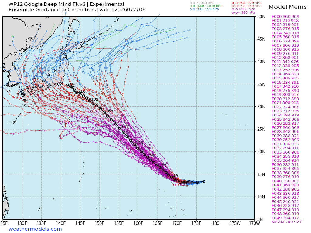
HAFS-A comes in around 902 mb for minimum central pressure in 5-days
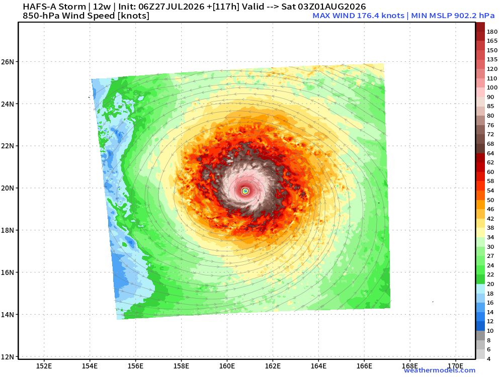
Dolphin will be well away for land for the next week, at least, so we can watch the massive Super Typhoon with awe from space.
Atlantic Tropics —> ghost town into early August
Ensembles (50-members) through Aug 11th —> nothing stirring or threatening.
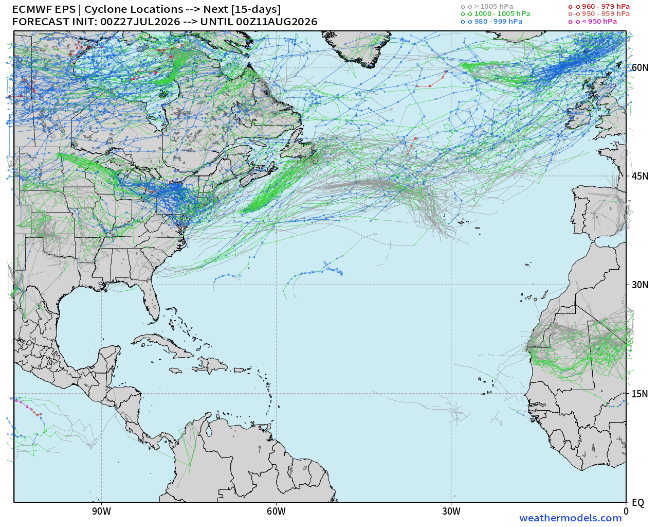
Maps sourced from weathermodels.com designed and innovated by yours truly! Please subscribe there for real-time access to the newest maps, charts from all of the weather models including ECMWF and AIFS, and NOAA GFS/GEFS, HRRR/RRFS and Blend of Models (NBM). NOAA WPC and SPC for fronts/convective outlooks. Our own content is now sourced from hottestsince.com and weather.city and celsius.earth, and soon squall.cloud and weather.football
My Atlantic Hurricane Season Forecast (2026)
From April 7, 2026: Atlantic Seasonal Hurricane Forecast: (11/5/2)
9-13 Named Storms (11 most likely)
4-7 Hurricanes (5 or 6 most likely)
1-3 Major Hurricanes (2 most likely)
Accumulated Cyclone Energy: 75-85 (well below normal)
NOAA 2026 Atlantic Hurricane Season Forecast
- Milepost
- 992 · laid 2026-07-27T13:37:41.478000Z
- Source
- https://weather.substack.com/p/category-5-hurricane-genevieve
- Digest
- 44f3624cfa1a8a061fa5251a7326da34d1f17b19198dbc0d66140d324c9d12c8
- Machine
- JSON