June 29, 2026 Monday Mega Heat Dome
Forecasts trending hotter across the Big Cities of the Eastern Seaboard with 100°F+ likely for 71 million Americans into 4th of July weekend
June 2026 was the 18th-warmest June in the 132-year national record (1895–2026), at 70.6°F against a 1991–2020 normal of 69.5°F (+1.2°F).
June 2026 was the 32nd-wettest June in the 132-year national record (1895–2026), at 3.3in against a 1991–2020 normal of 3.1in (+0.2in).
NOAA/NCEI Climate at a Glance, contiguous United States. This is the observed record for the month, not a score of anything said in this piece — the forecast ledger begins 2026-08-17 and cannot reach earlier posts.

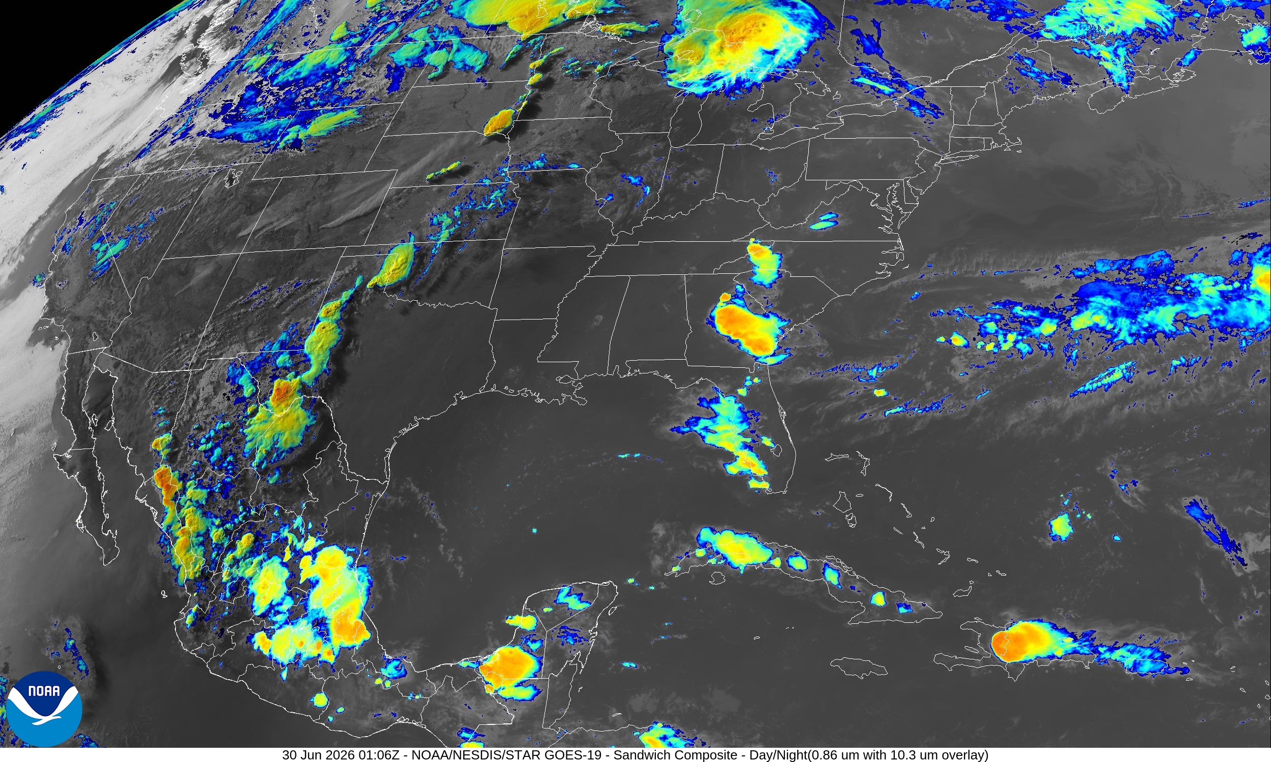
The main weather story this week continues to be the “Mega Heat Dome” forming across the Eastern United States.
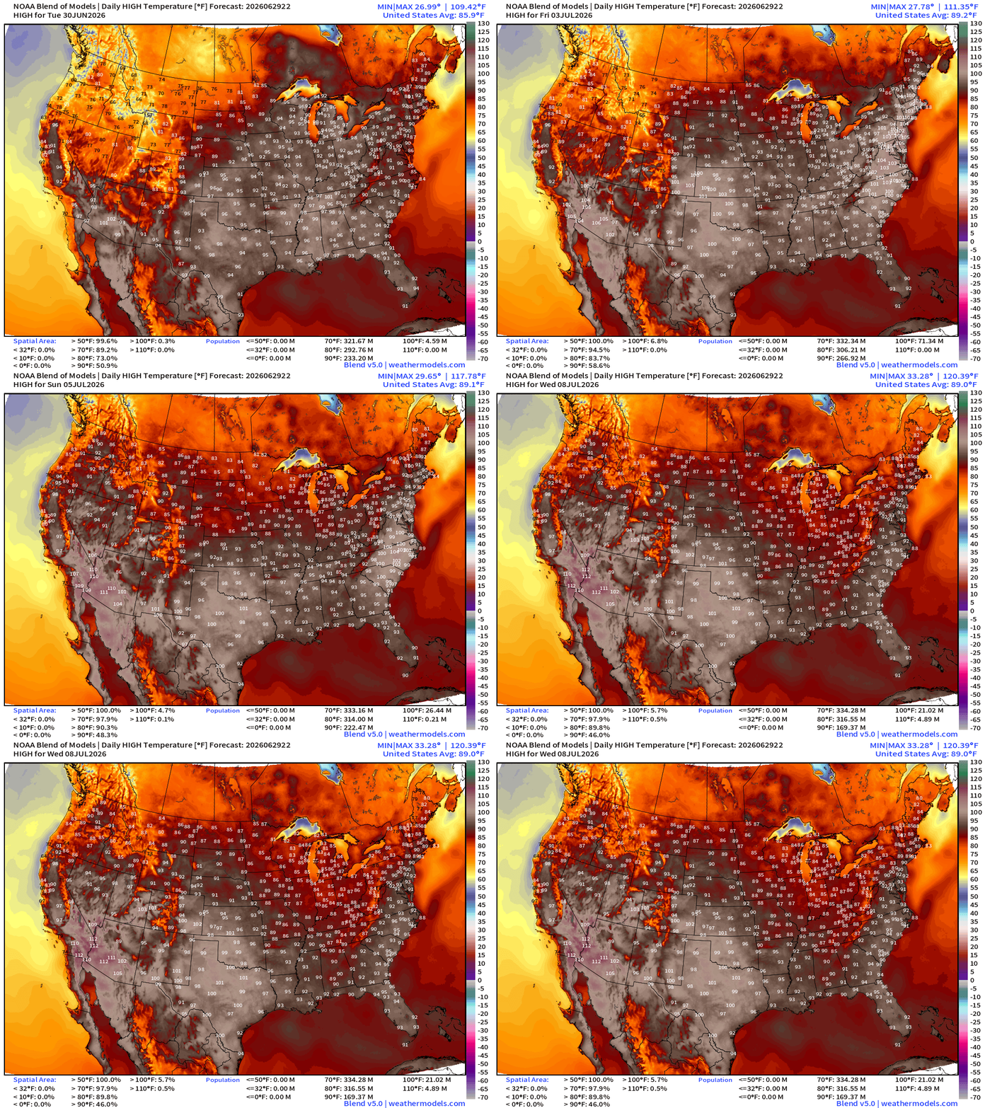
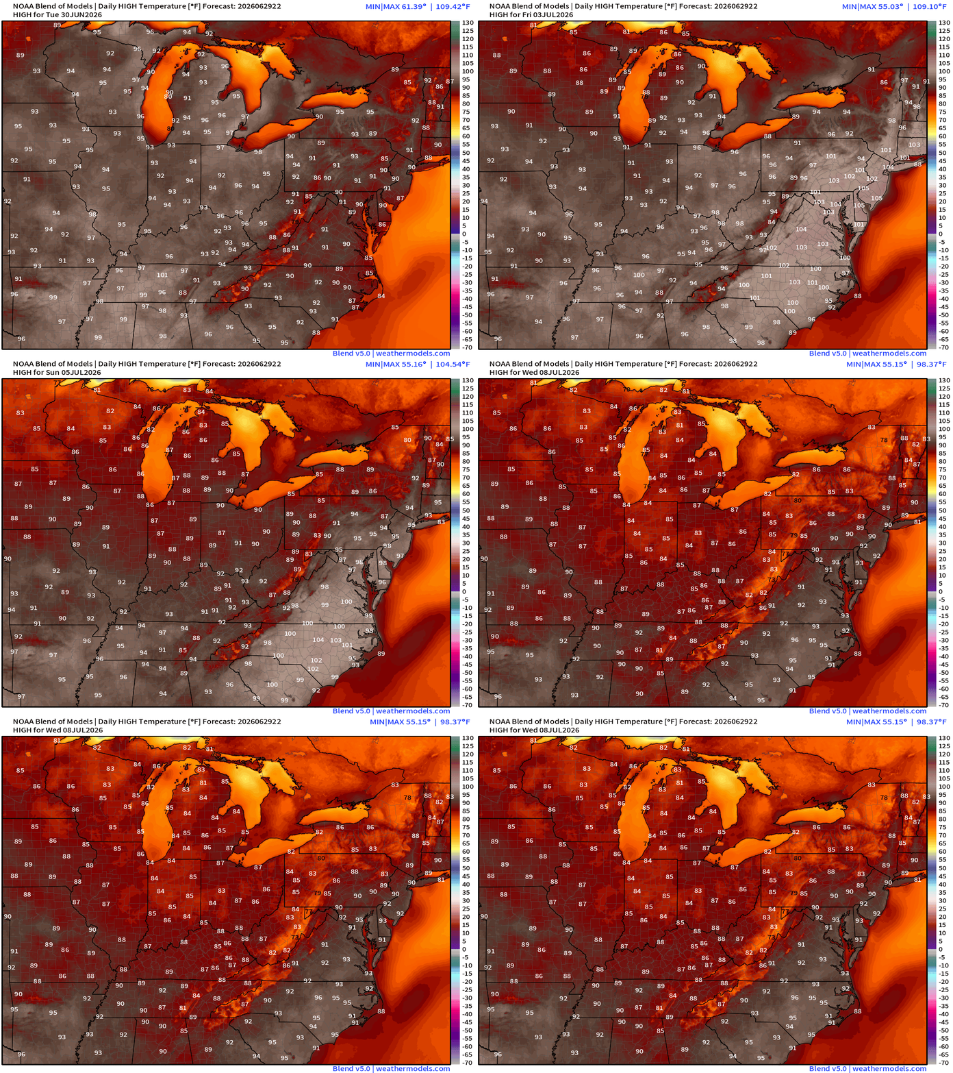
High Temperatures next 8-days — watching the population of at least 90°F + 100°F skyrocketing as the large population centers of the East Coast see extreme heat wave for multiple days.
Help support this newsletter (nearing post 1,000!) —> June 2026 Coupon
Upper-Level Height Anomaly | AIFS-Single Next 10-days
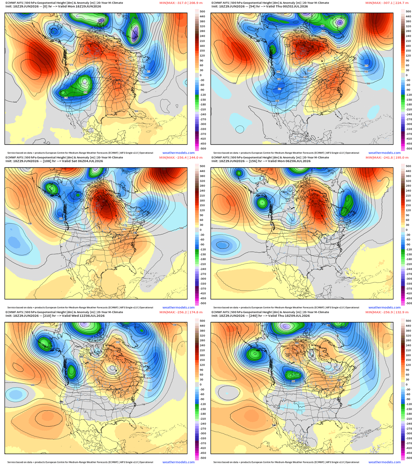
While very strong troughing digs into the Pacific Northwest = much cooler air across the West, a major ridge forms over NE Arctic Canada and extends down an axis into the U.S. Southeast forming the heat dome.
Ridging builds across the Eastern U.S. —> dry and hot —> HEAT DOME
Into Summer —> Height Anomalies don’t tell entire story … actual height does!
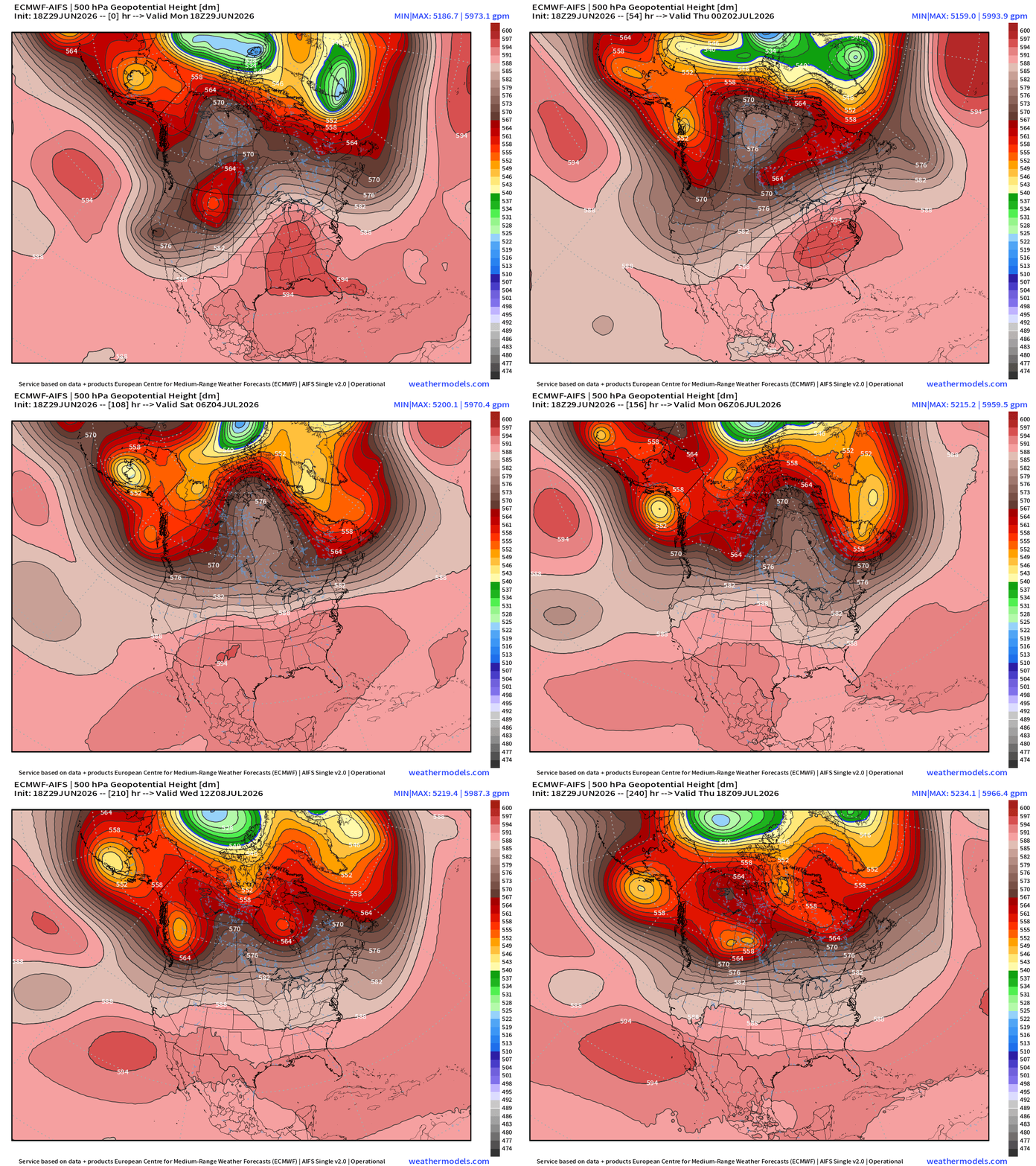
5940 m height contours — not quite record level near 6000 m but plenty of subsidence to ensure very hot surface temperatures. We’re entering the “dog days of summer” when the weather pattern stagnates with long-lasting, slow moving ridges.
NWS Precipitation Next 72-hours —> Thursday Afternoon
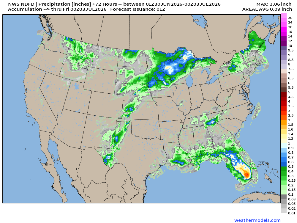
Nice to see South Florida with heavy rain from the easterly flow around the bottom periphery of the “heat dome”
My favorite parameter — next 48-hours of HRRR Precipitable Water
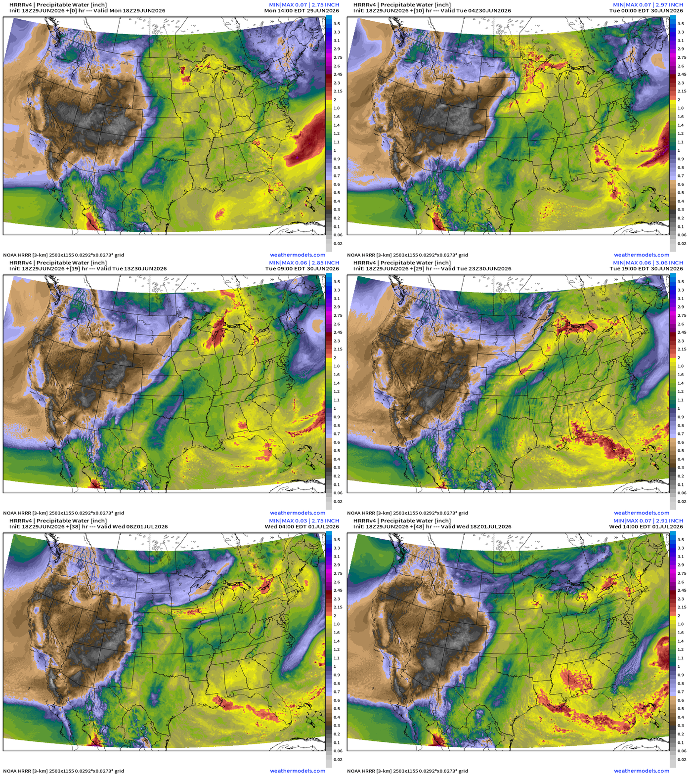
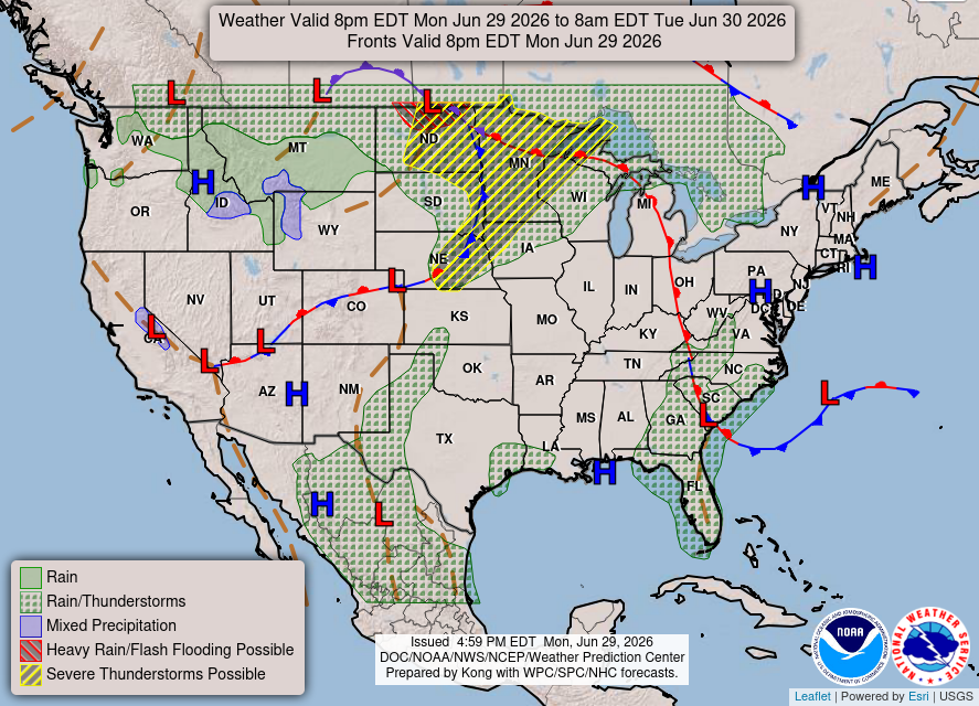
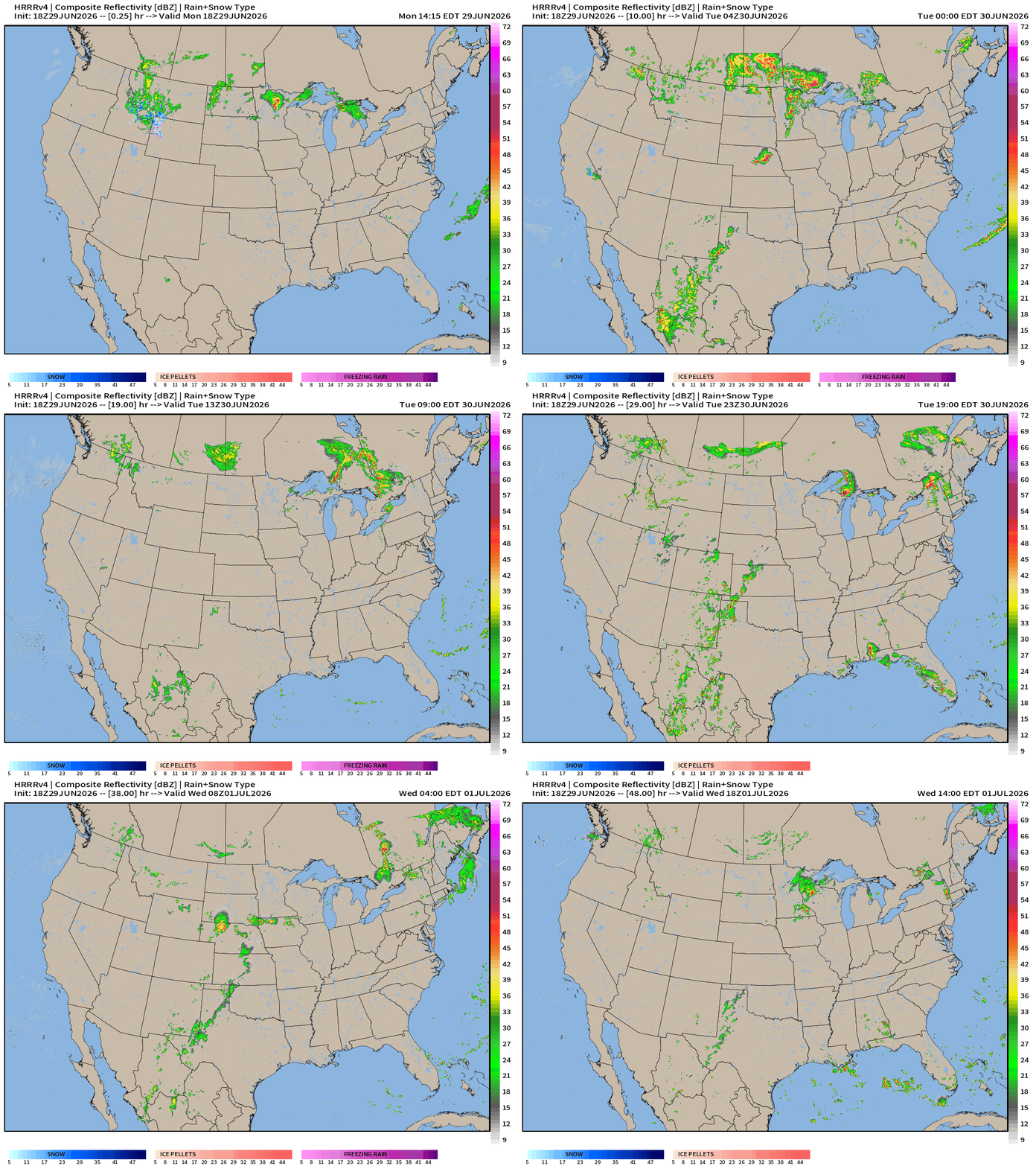
Weather Into Tuesday Morning
HRRR radar next 18-hours through Tuesday Noon ET
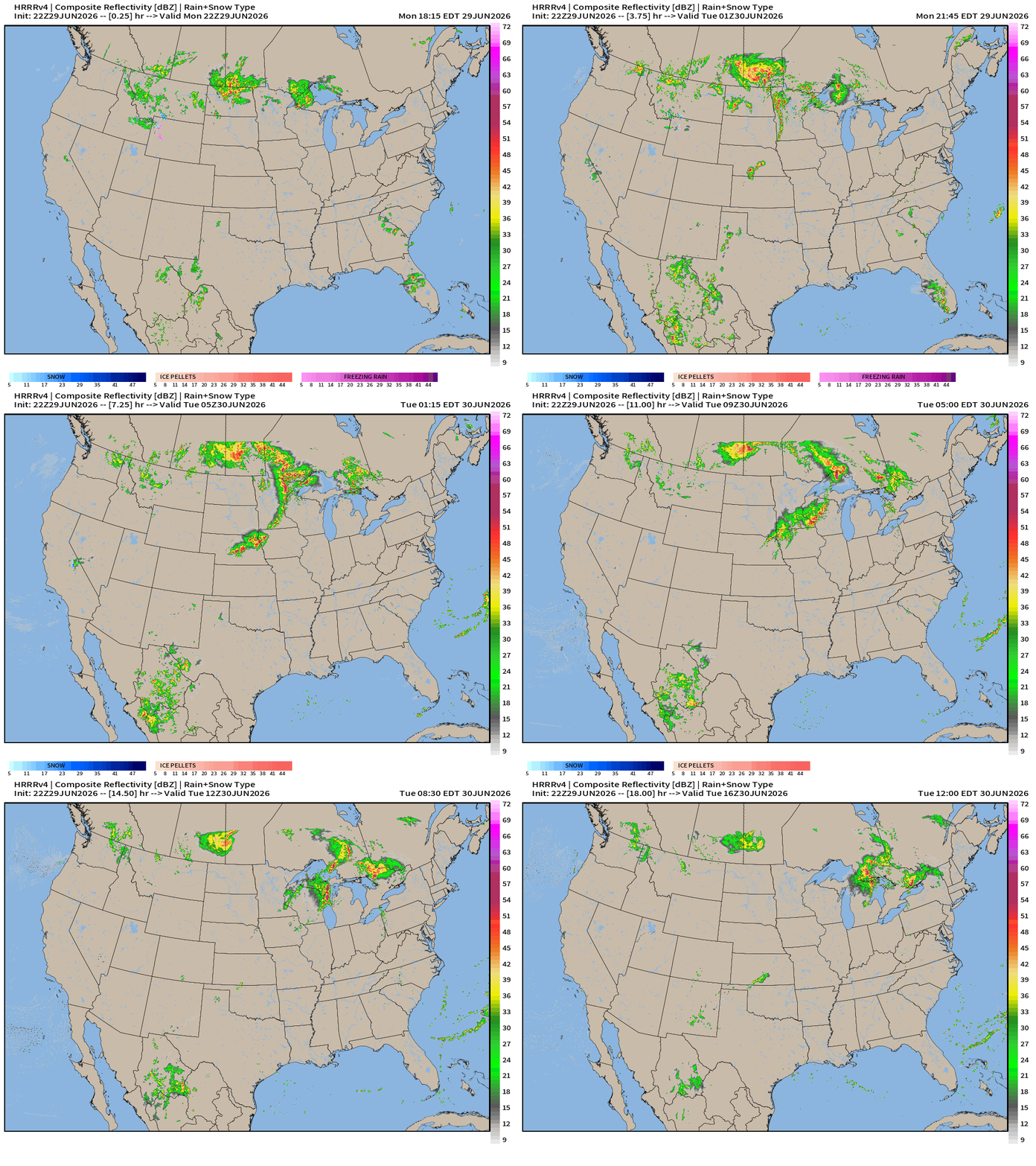
HRRR Next 48-hours simulated Radar through Wednesday 2 PM ET
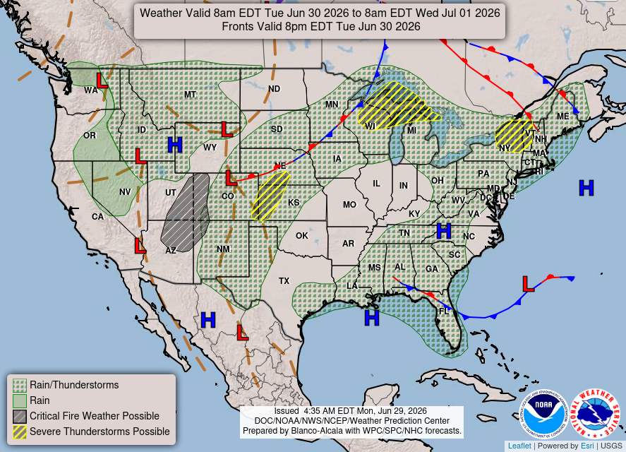
Weather on Tuesday
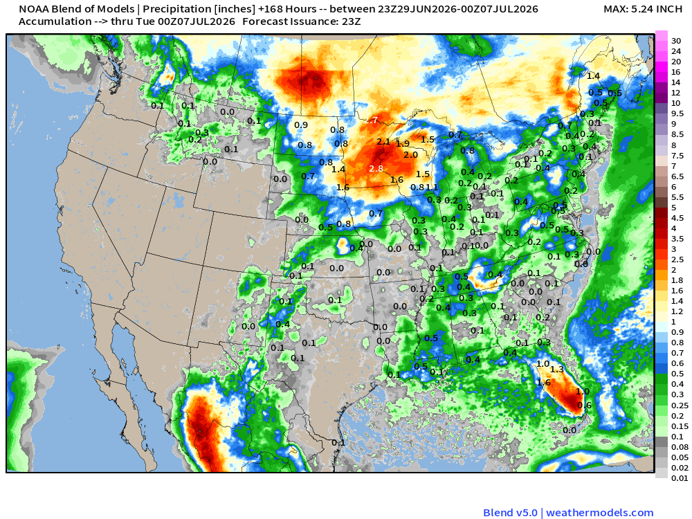
Blend of Models —> Precipitation Next 7-days
Help support this newsletter (nearing post 1,000!) —> June 2026 Coupon
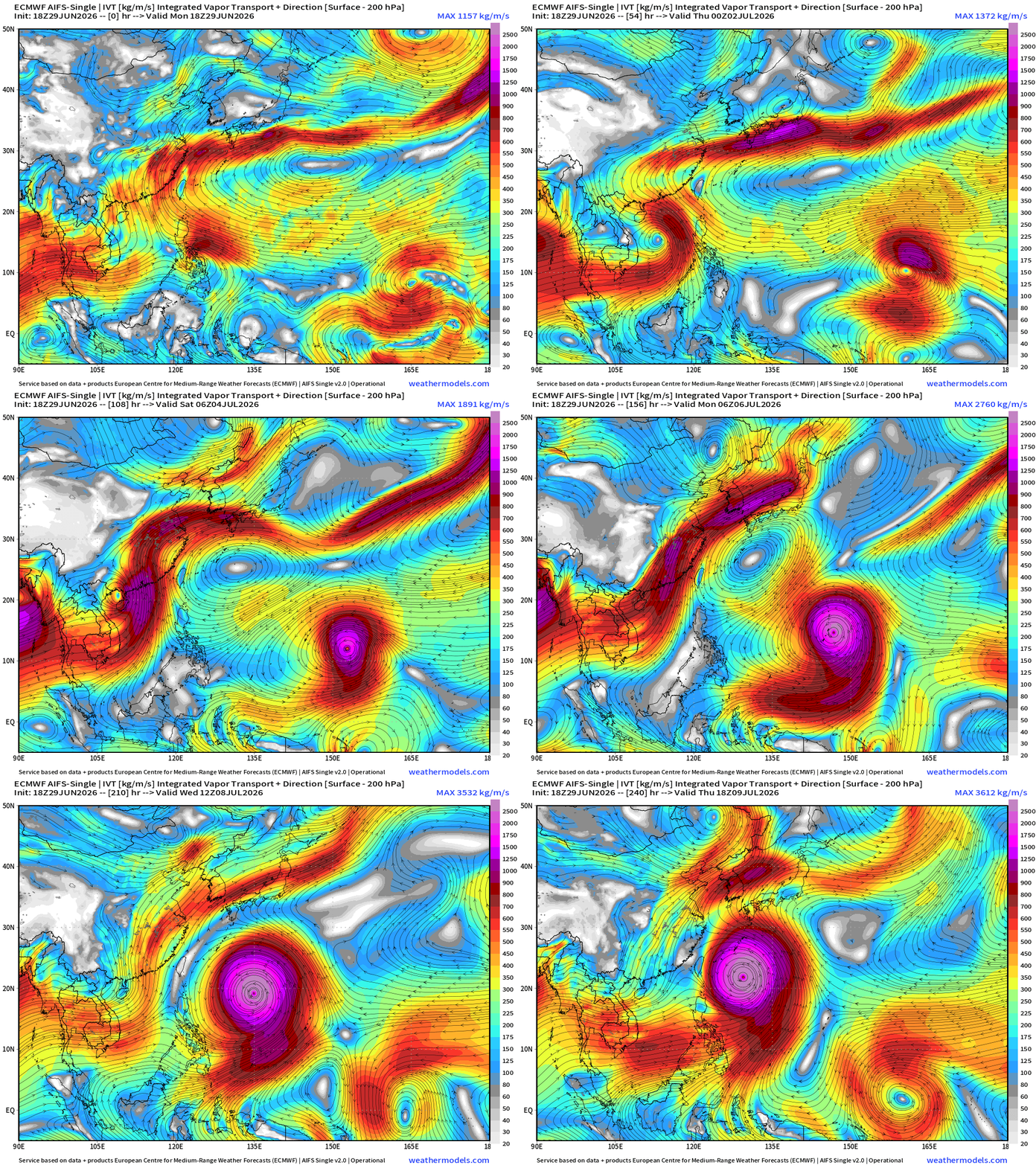
Flagship model: ECMWF AIFS 18z —> Integrated Vapor Transport next 10-days
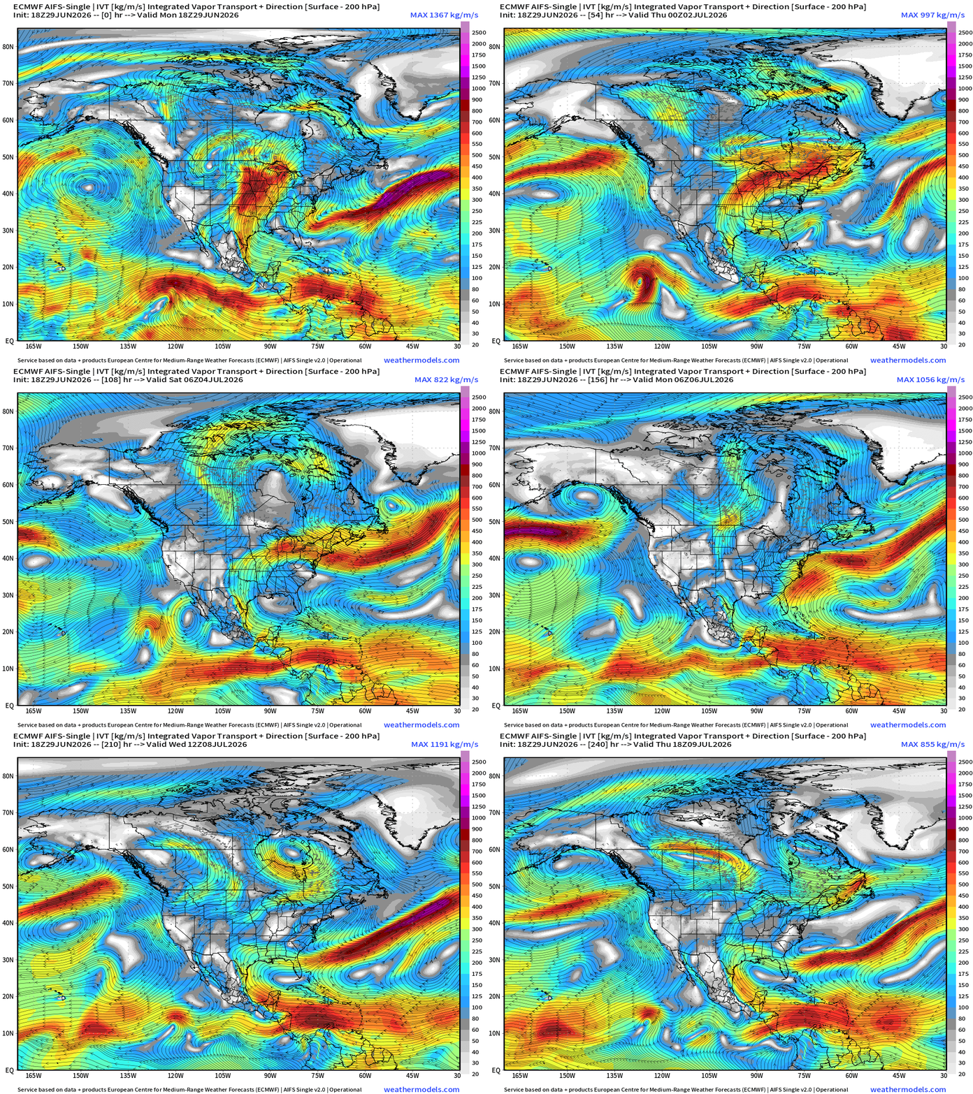
Heat dome shuts down the Gulf of Mexico. Looks like a much drier than normal period ahead for the next 10-14 days to start July.
Germany ICON 18z | Precipitable Water | My Favorite Parameter
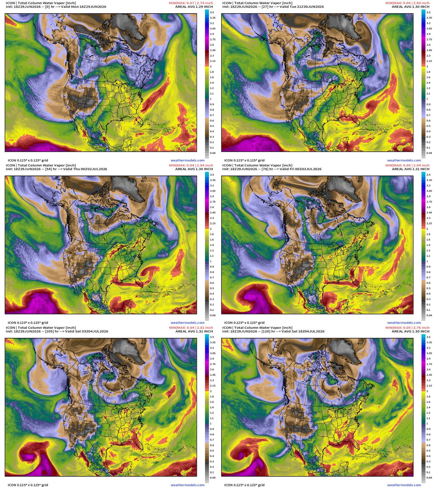
Tropical system off the Southeast coast has a nice blob of 2”+ PWAT and maybe become a nice tropical depression or storm for Georgia / North Florida / South Carolina = rainfall and clouds to break the “heat dome”
Temperature Analysis | RTMA | 7:45 PM ET
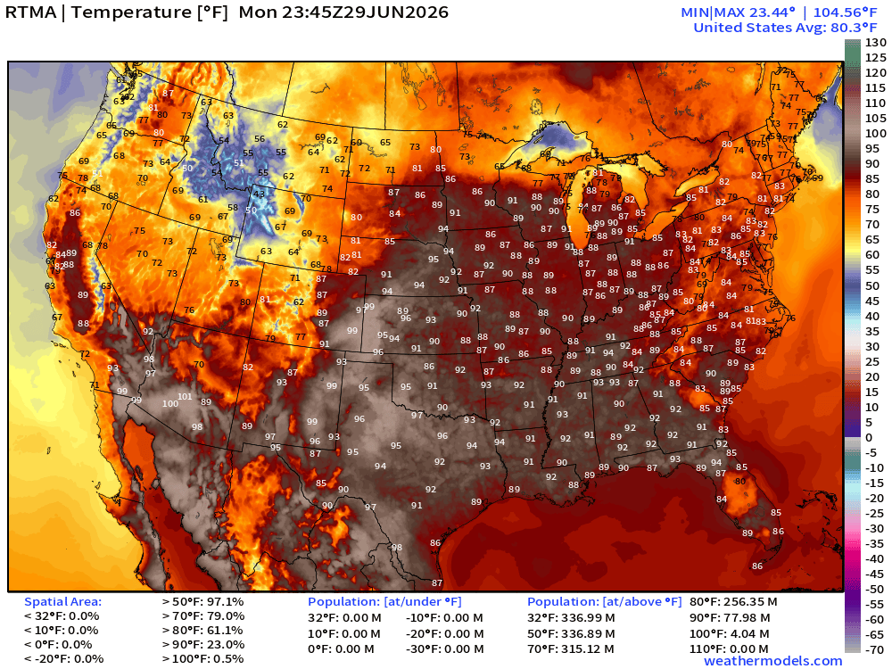
About 78 million population at least 90°F at 7:45 PM ET
Temperature Anomaly | RTMA | 7:45 PM ET
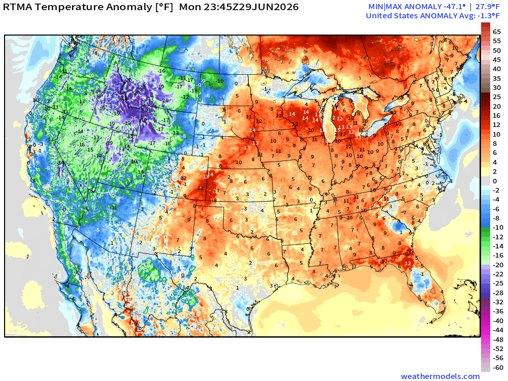
Lower 48 was -1.3°F below normal with chilly temperatures (relative to last days of June) across the Pacific Northwest and Northern Rockies
Heat Index Temperature | RTMA | 7:45 PM ET
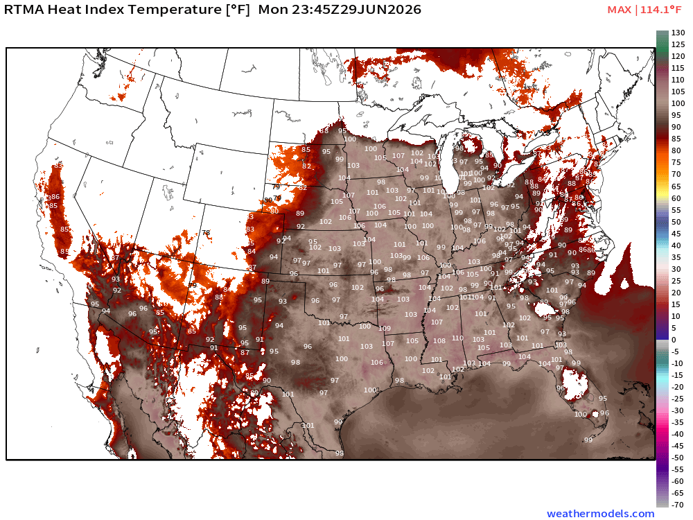
100s into the Great Lakes
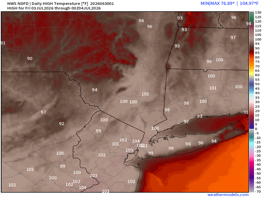
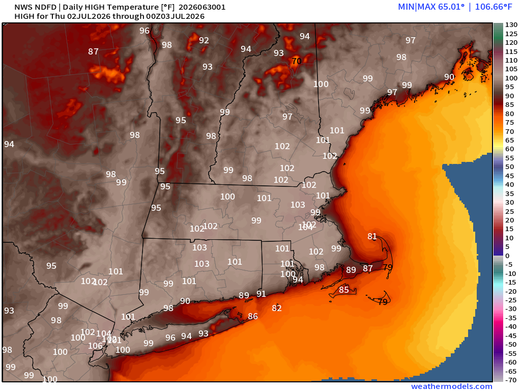
High Temperatures Next 9-Days —> Wednesday July 8th
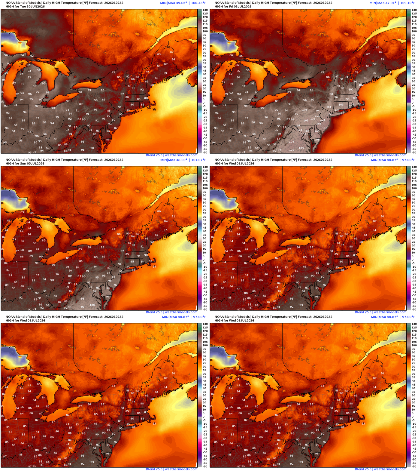
Northeast Regional Zoom
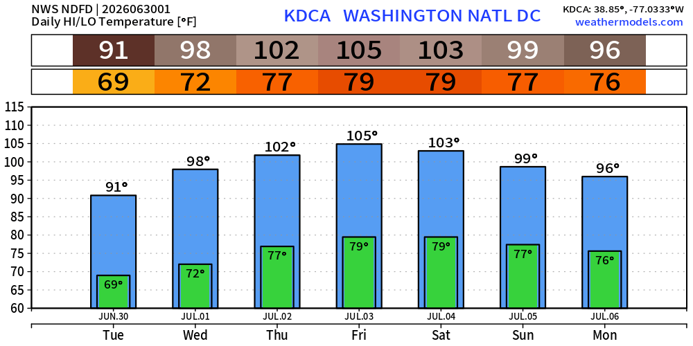
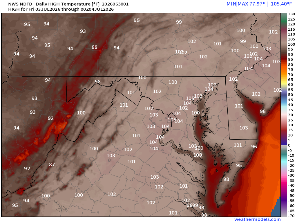
Washington D.C. hottest on Friday with 105°F (very hot)
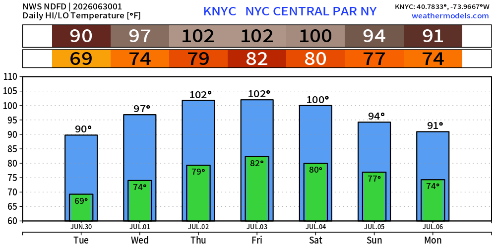
NYC Central Park at 102°F on Thursday and Friday, and 100°F on Saturday, July 4th
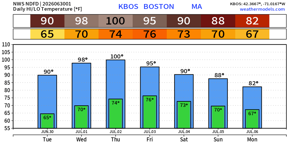
Boston to 100°F on Thursday
Low Temperatures on Tuesday
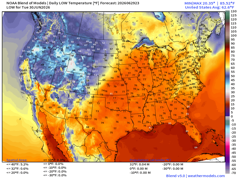
Muggy with lows in the mid-70s into Great Lakes
High Temperatures on Tuesday
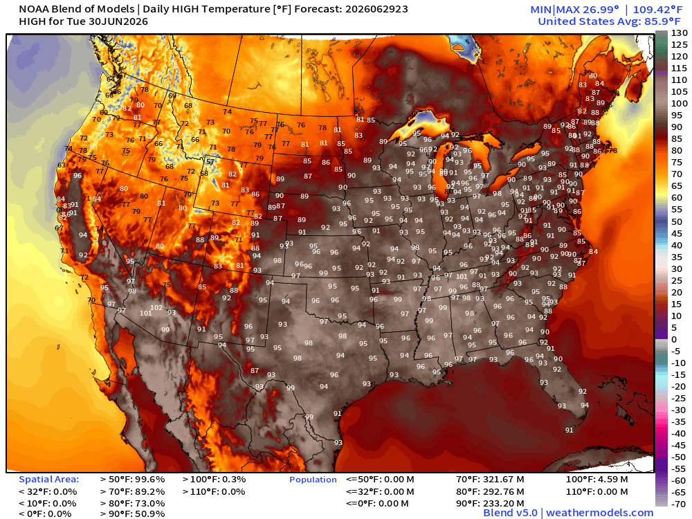
233 Million at least 90°F
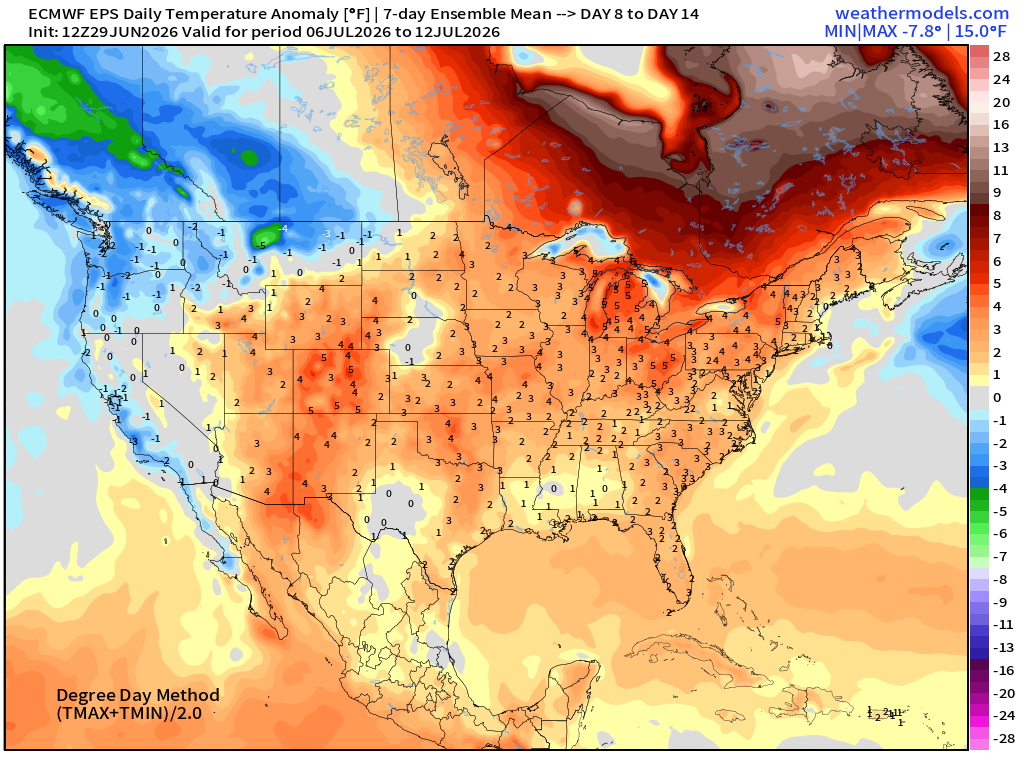
ECMWF Flagship Ensemble Mean Temperature Anomaly next 15-days
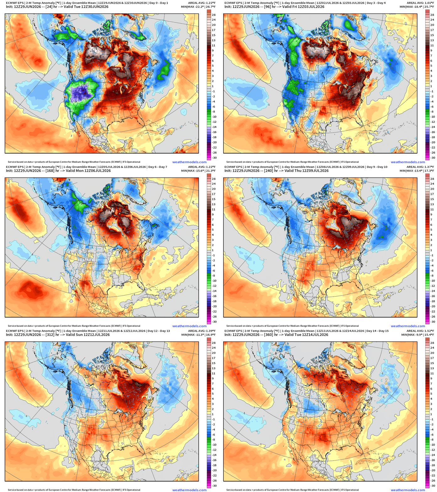
Trough —> cooler across the Pacific Northwest with huge negative anomalies of -20°F vs. the formation of a ridge / heat dome across the Great Lakes and into the Mid-Atlantic + Canada
Week 1 —> June 29 to July 5
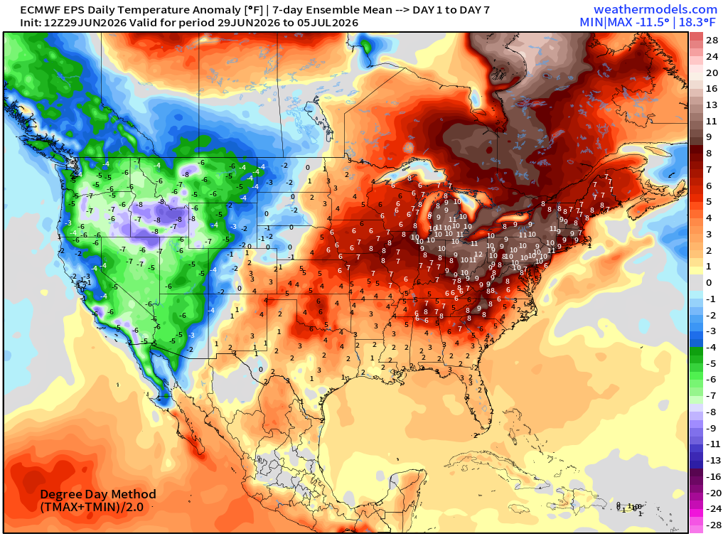
Week 2 —> July 6 to July 12
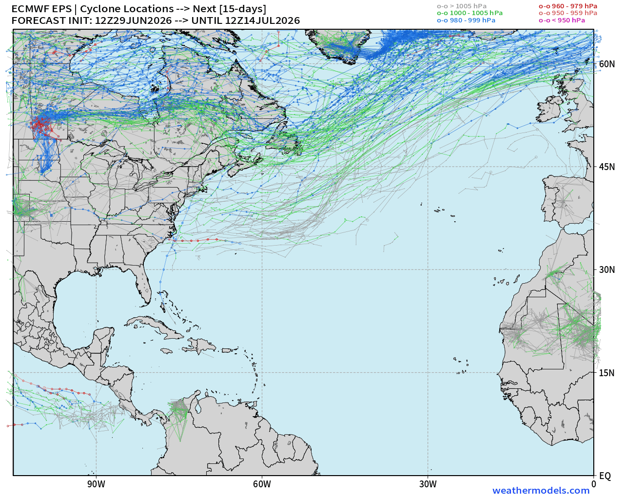
Tropical Update: Atlantic Basin — (15-day tracks forecast from EPS 12z)
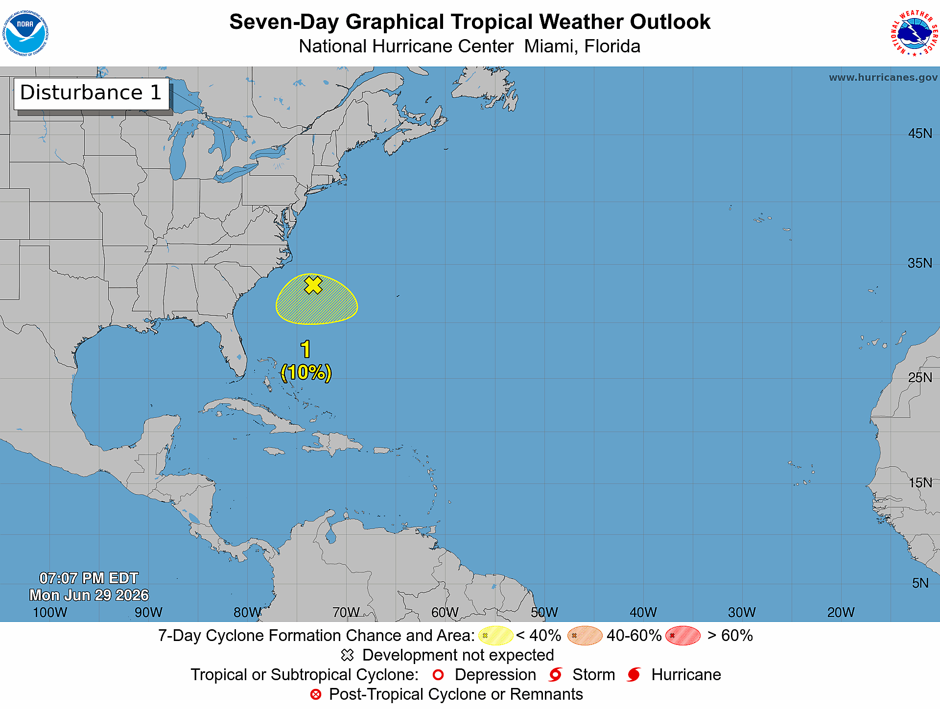
This disturbance (10%) is not being picked up by my storm tracker, but the minimum sea level pressure might be too high against the background environment of Bermuda High
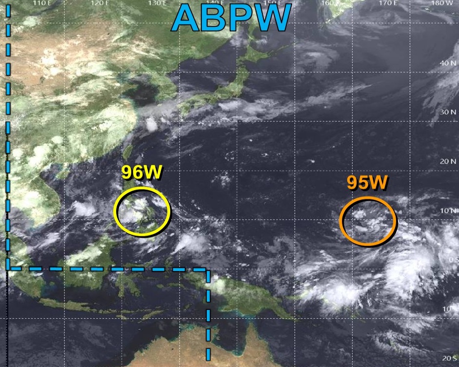
Western Pacific lights up with 2+ Typhoons likely with long-tracks = huge ACE
Next names are Bavi & Maysak
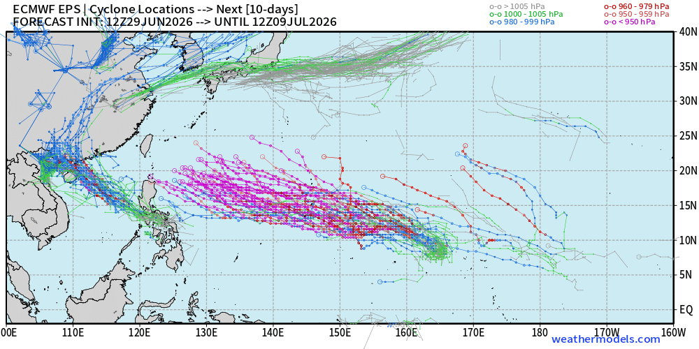
Invest 95W will become a MONSTER. I would not be surprised to see Category 5 — 155 knots (T 7.5) or higher
Thank you for reaching the end of this post! Hopefully you enjoyed the beautiful weather maps. Please help increase the visibility of Weather Trader on Substack: Share or Like!
Help support this newsletter (nearing post 1,000!) —> June 2026 Coupon
Maps sourced from weathermodels.com designed and innovated by yours truly! Please subscribe there for real-time access to the newest maps, charts from all of the weather models including ECMWF and AIFS, and NOAA GFS/GEFS, HRRR/RRFS and Blend of Models (NBM). NOAA WPC and SPC for fronts/convective outlooks.
My Atlantic Hurricane Season Forecast (2026)
From April 7, 2026: Atlantic Seasonal Hurricane Forecast: (11/5/2)
9-13 Named Storms (11 most likely)
4-7 Hurricanes (5 or 6 most likely)
1-3 Major Hurricanes (2 most likely)
Accumulated Cyclone Energy: 75-85 (well below normal)
NOAA 2026 Atlantic Hurricane Season Forecast
- Milepost
- 970 · laid 2026-06-30T01:36:46.057000Z
- Source
- https://weather.substack.com/p/june-29-2026-monday-mega-heat-dome
- Digest
- d0eae62446982224296e5c0faae28f82be6600484d599137c8335c7efc090ebf
- Machine
- JSON