June 25, 2026 Eastern US Heat Dome Watch
Thursday weather models trending toward more extreme temperatures into early July with widespread 90s and 100s
June 2026 was the 18th-warmest June in the 132-year national record (1895–2026), at 70.6°F against a 1991–2020 normal of 69.5°F (+1.2°F).
June 2026 was the 32nd-wettest June in the 132-year national record (1895–2026), at 3.3in against a 1991–2020 normal of 3.1in (+0.2in).
NOAA/NCEI Climate at a Glance, contiguous United States. This is the observed record for the month, not a score of anything said in this piece — the forecast ledger begins 2026-08-17 and cannot reach earlier posts.

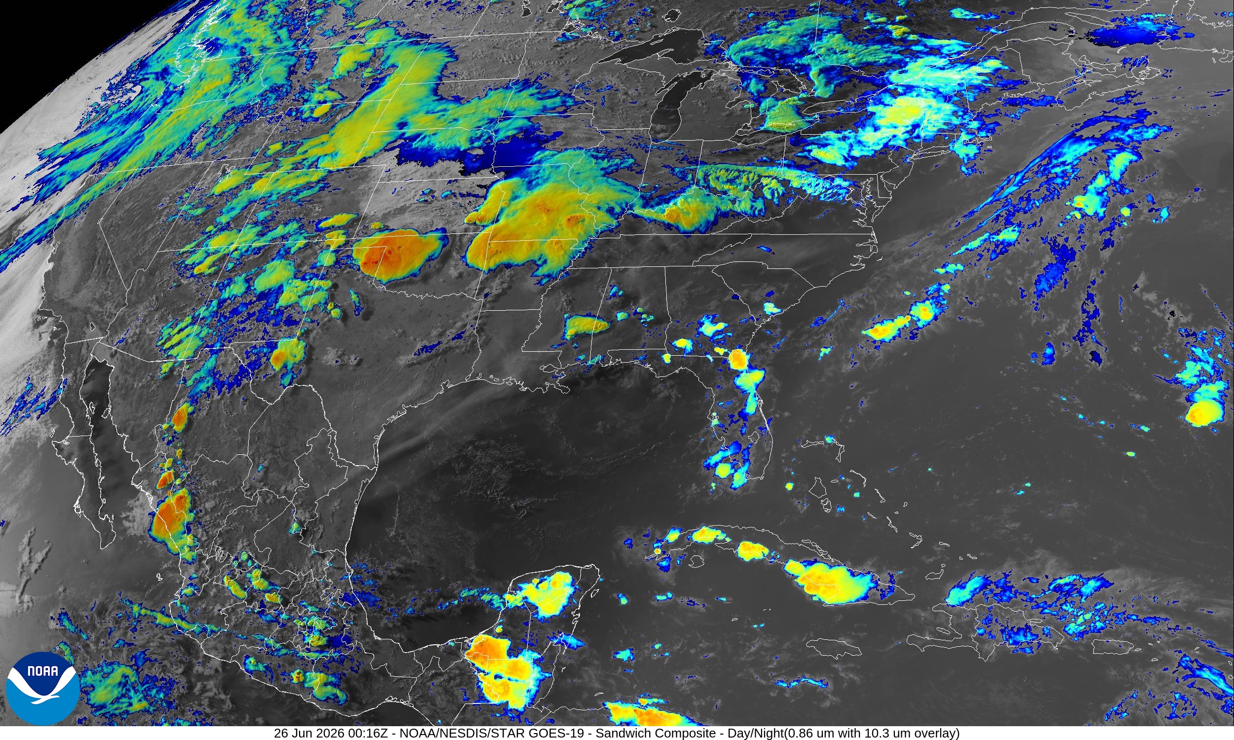
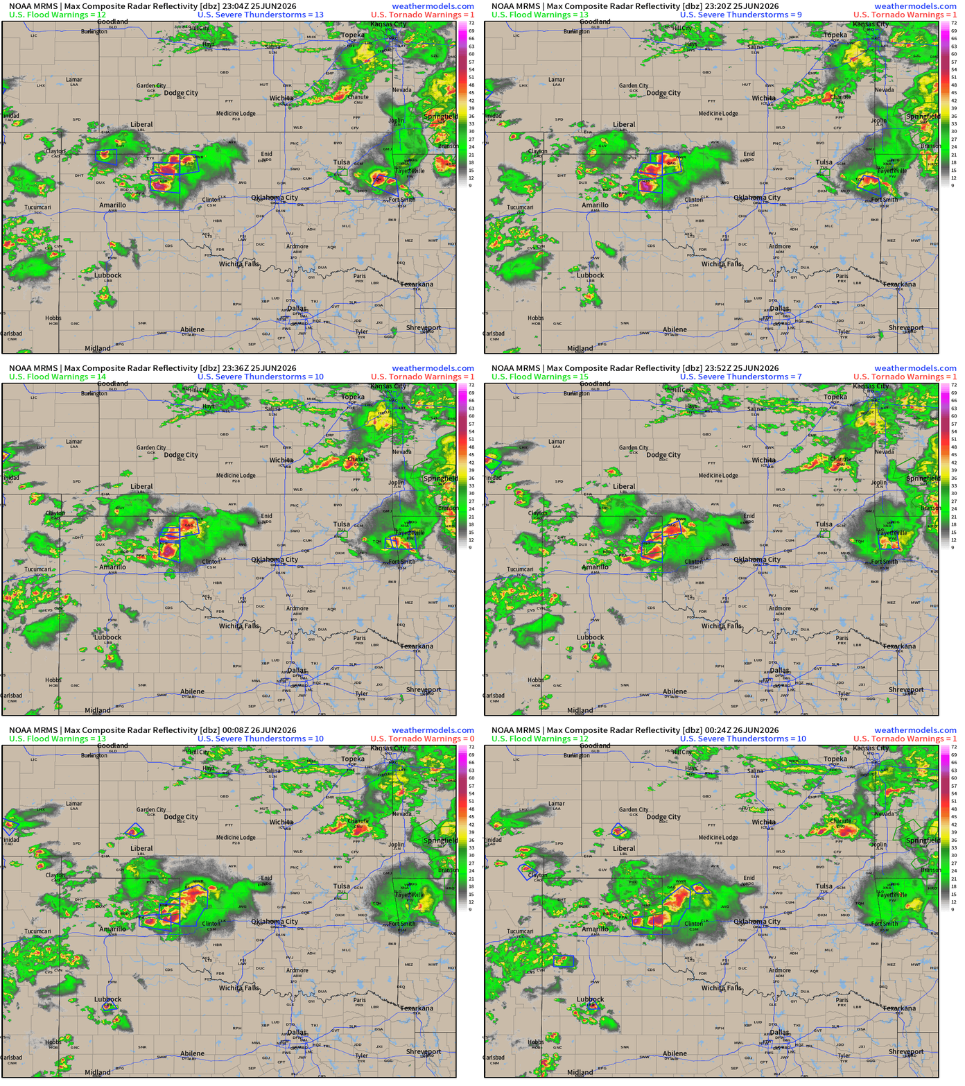
Early summer evening with mostly tranquil weather across the Lower 48. A frontal boundary continues to fire storms from Oklahoma into mid-Mississippi River Valley. The main U.S. weather story will be a major heat dome building into July 4th.
Help support this newsletter (nearing post 1,000!) —> June 2026 Coupon
Upper-Level Height Anomaly | AIFS-Single Next 10-days
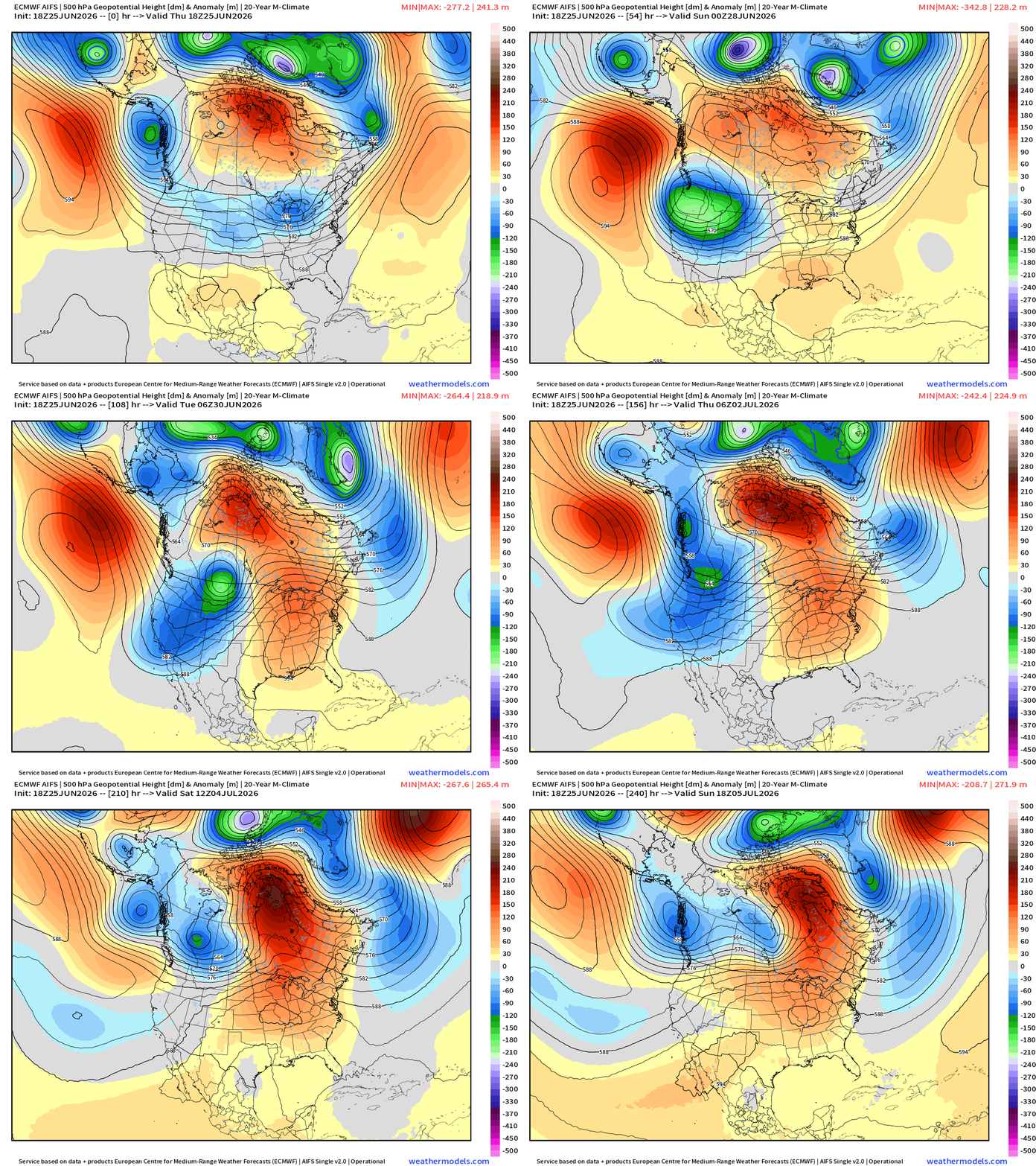
While very strong troughing digs into the Pacific Northwest = much cooler air across the Western U.S. for perhaps 2-weeks, a major ridge forms over NE Arctic Canada and extends down an axis into the U.S. Southeast.
Ridging builds across the Eastern U.S. —> dry and hot —> HEAT DOME
Into Summer —> Height Anomalies don’t tell entire story … actual height helps!
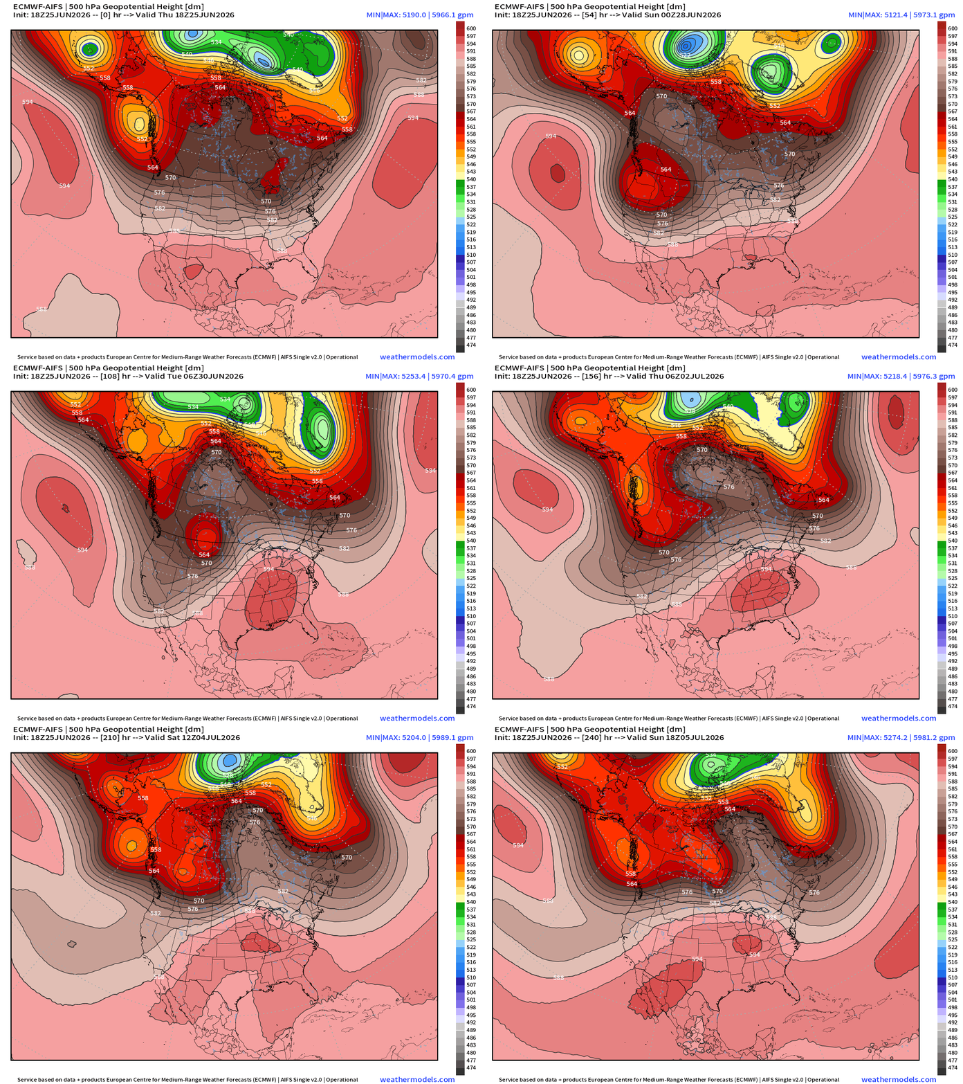
5940 m height contours — not quite record level near 6000 m but plenty of subsidence to ensure very hot surface temperatures. We’re entering the “dog days of summer” when the weather pattern stagnates with long-lasting, slow moving ridges.
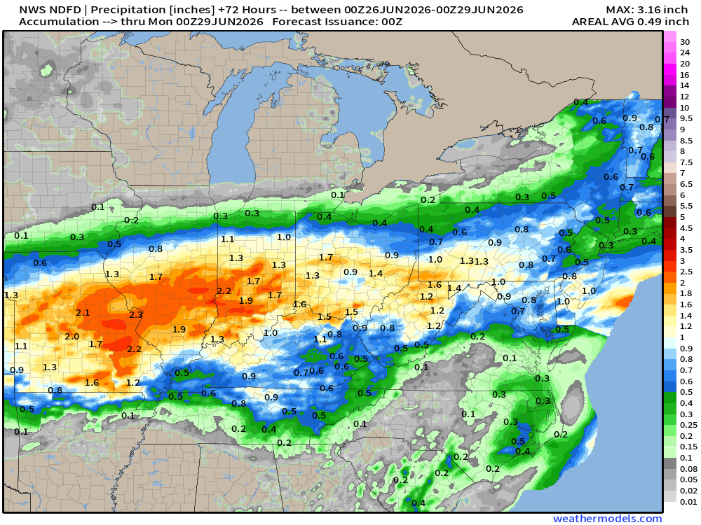
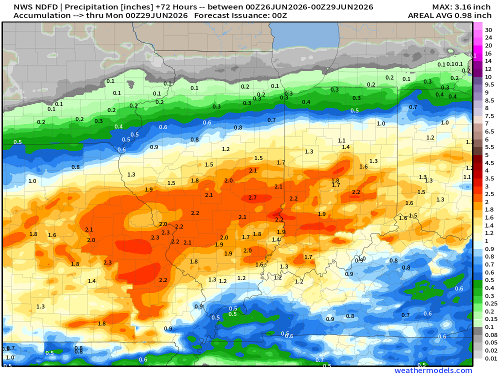
NWS Precipitation Next 72-hours —> Sunday Afternoon
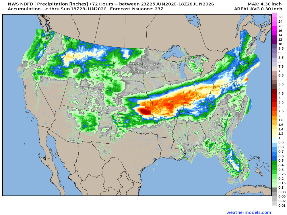
Heavy rainfall will be focused on Kansas through Missouri, and into Illinois to Indianapolis with upgrades of 2” to 4” possible in just next few days.
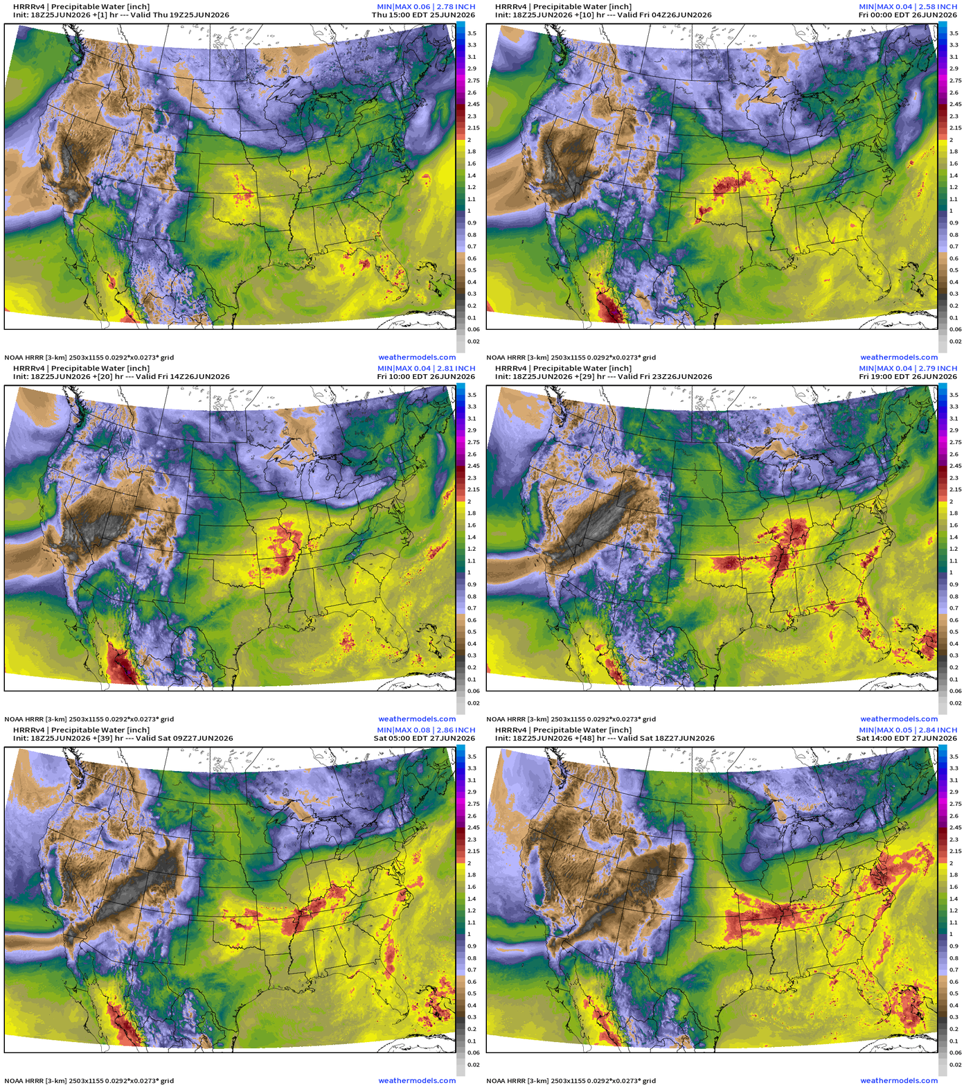
My favorite parameter — next 48-hours of HRRR Precipitable Water
Weather Into Friday Morning
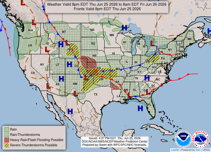
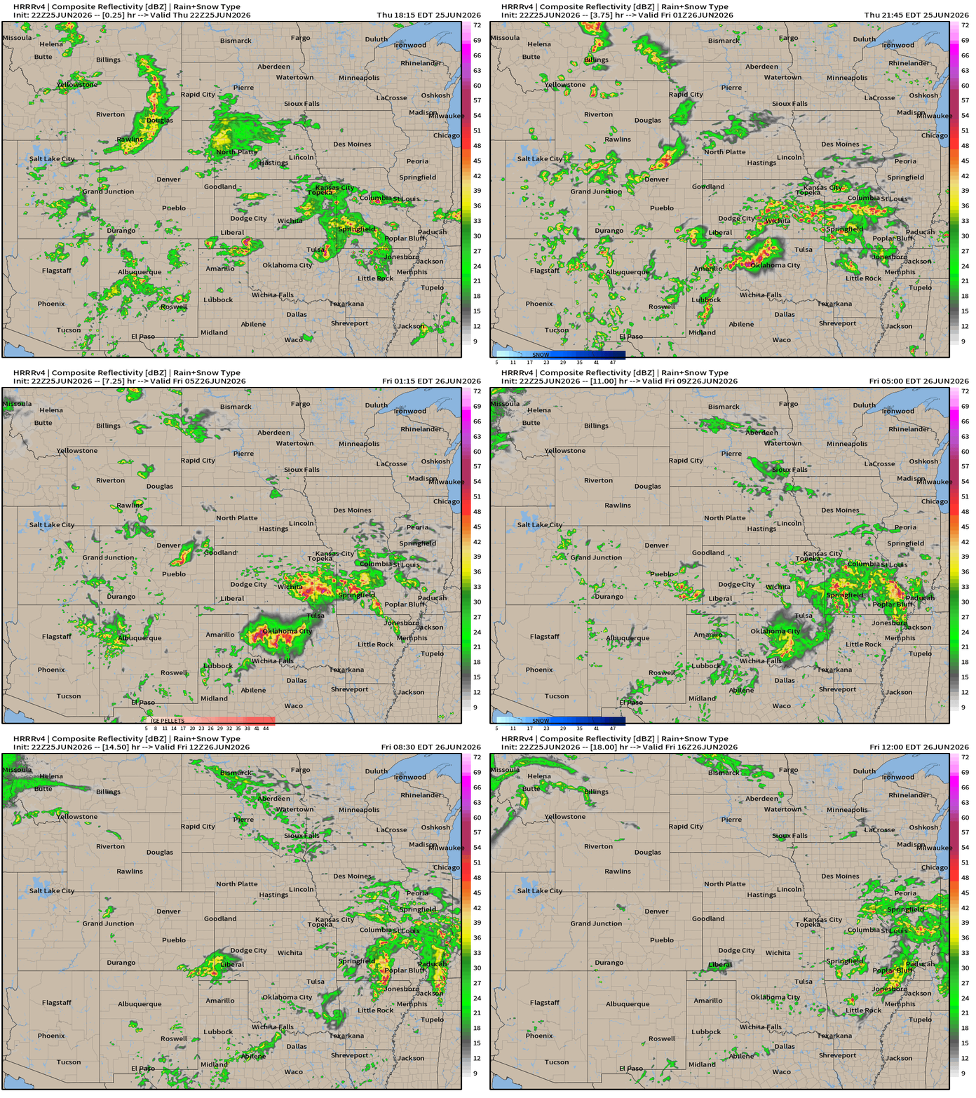
Storms will continue across Oklahoma — with Moderate Risk according to SPC — of severe weather including tornadoes and large hail
HRRR radar next 18-hours through Friday Noon ET
HRRR Next 48-hours simulated Radar through Saturday 2 PM ET
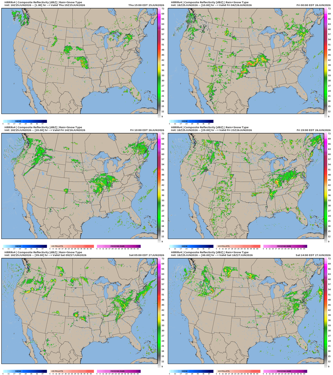
Plenty of moisture across the Lower 48 from the Pacific Northwest through the Rockies with some monsoon convection, and then quickly across the Ohio River Valley.
Weather on Friday — Stationary Front from Kansas City to D.C.
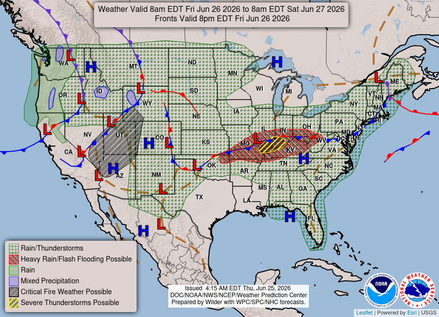
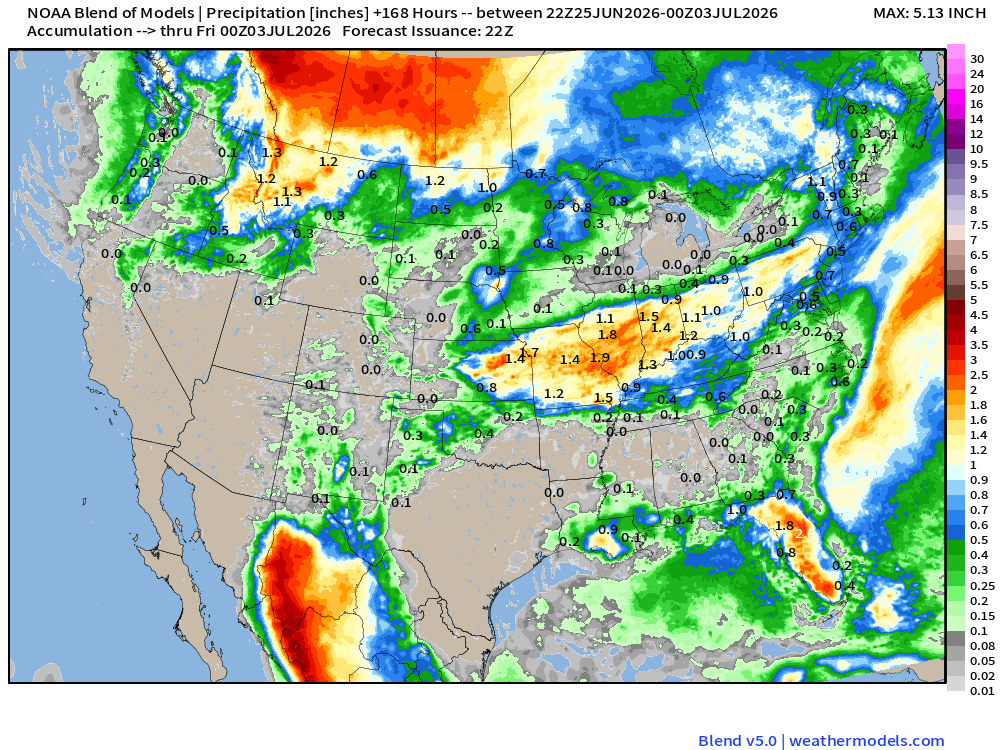
Blend of Models —> Precipitation Next 7-days
Help support this newsletter (nearing post 1,000!) —> June 2026 Coupon
Flagship model: ECMWF AIFS 18z —> Integrated Vapor Transport next 10-days
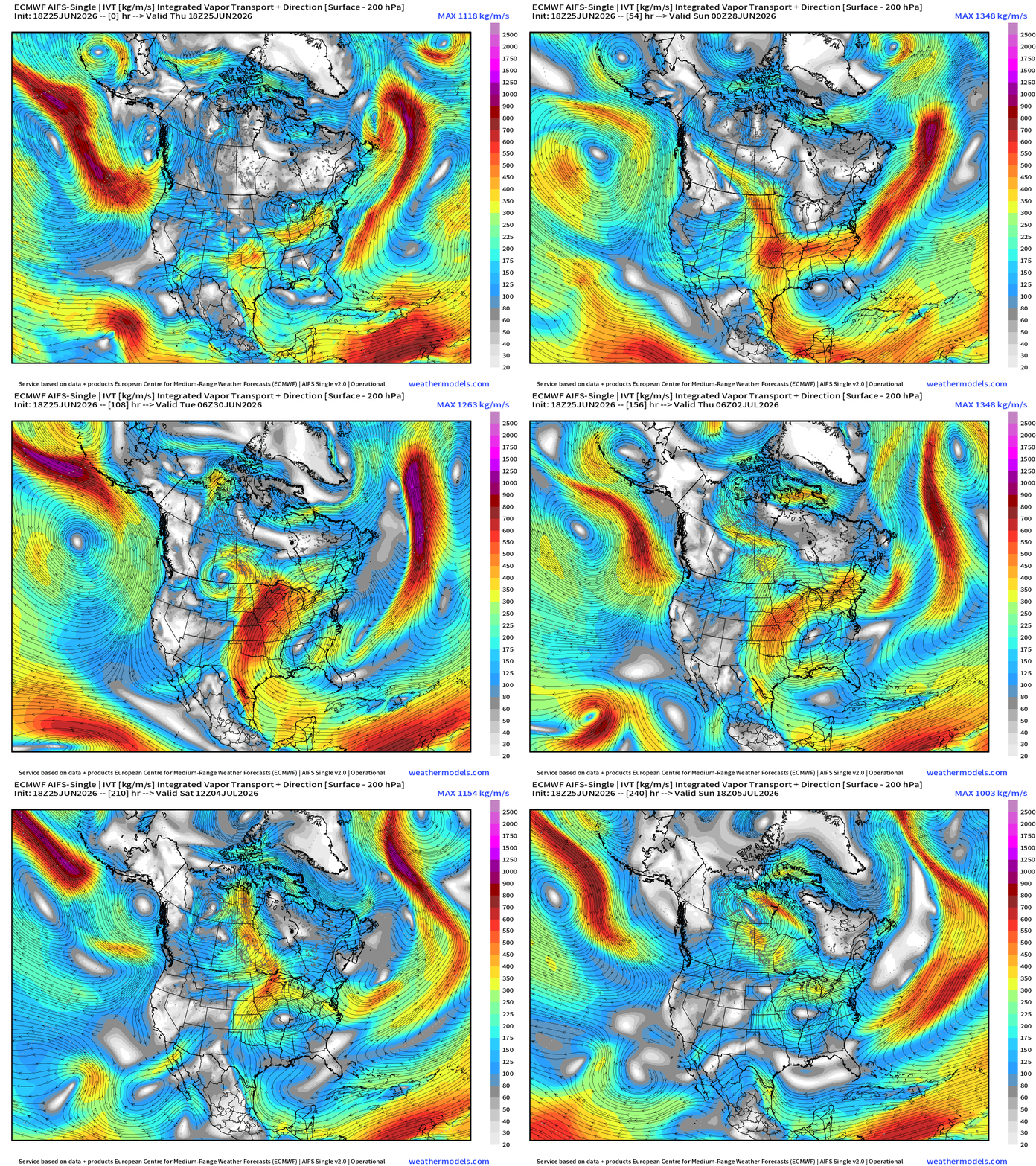
The magnitude of the tropical moisture feed into the USA from the Caribbean and Gulf is dialed down/back significantly as ridging strengthens over the Southeast U.S. —> heat dome.
We can see the anticyclonic turning of the ridge centered over the southern Mississippi River Valley with limited moisture transport —> really going to heat up for early July centered on North Carolina with subsidence over the Appalachians.
ECMWF AIFS 18z | Precipitable Water | My Favorite Parameter
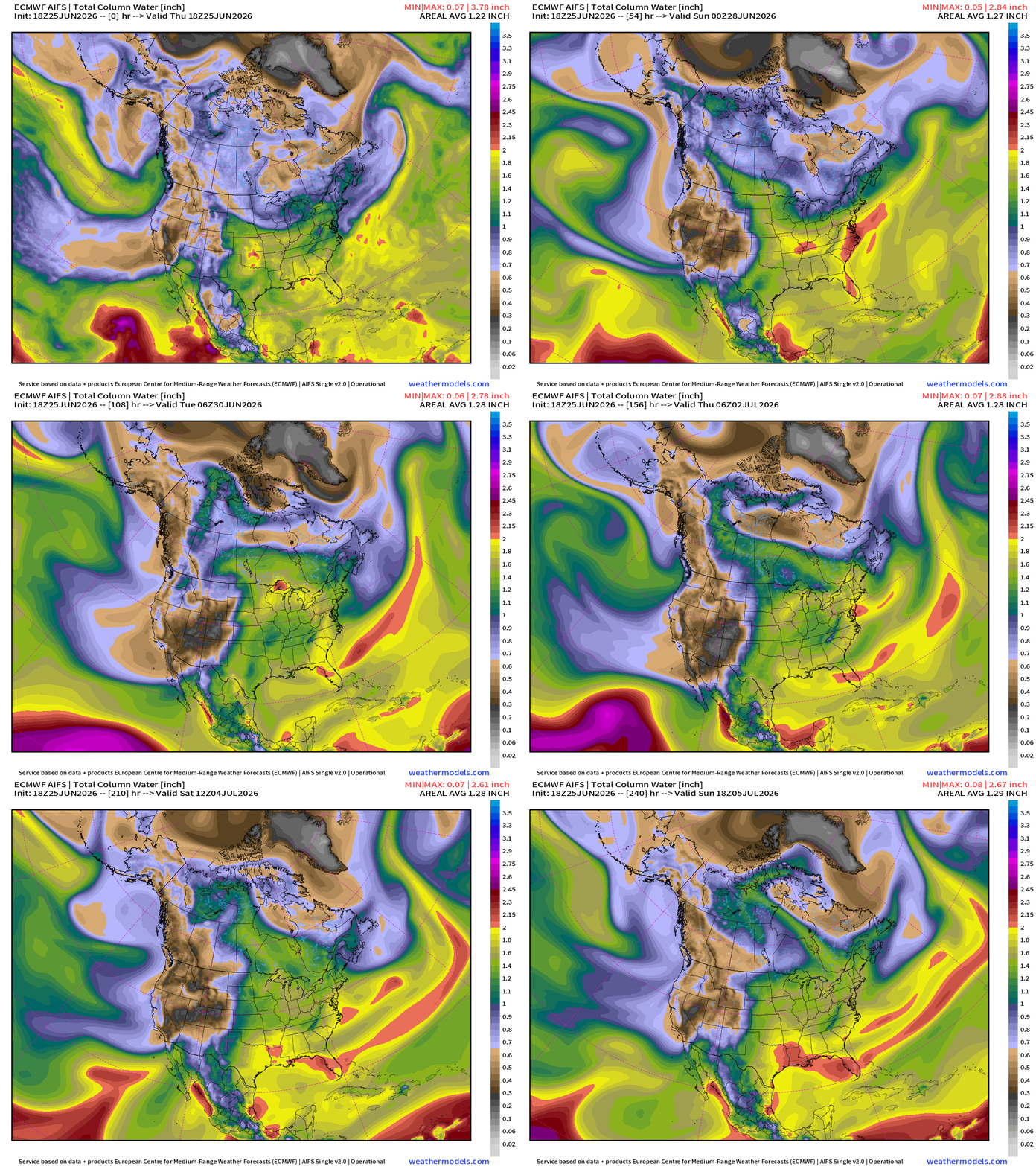
Generally 1.8” (yellow) PWAT with embedded > 2” convective cells but the heat dome really dials back the moisture coming out of the Gulf of Mexico. Perhaps this will be a “dry heat”
Temperature Analysis | RTMA | 7:30 PM ET
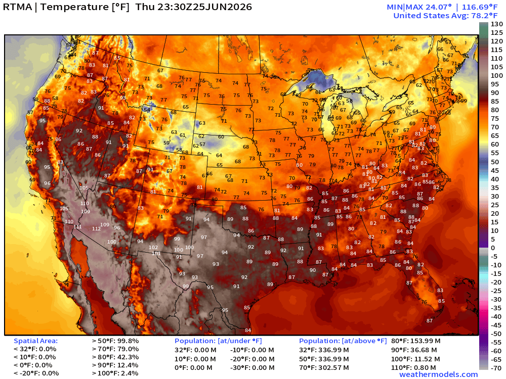
About 37 million population at least 90°F at 7:30 PM ET but plenty of comfortable 70s blanketing the Lower 48 east of the Rockies.
Temperature Anomaly | RTMA | 7:30 PM ET
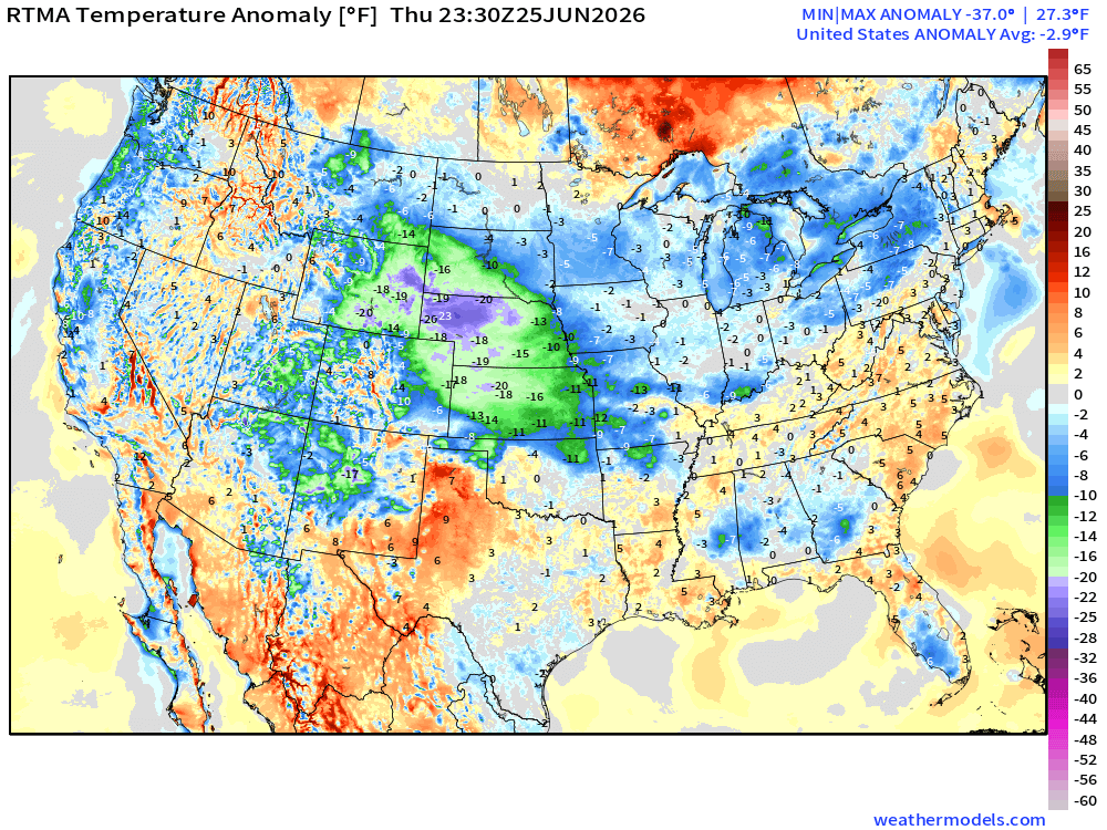
Lower 48 was -2.9°F below normal behind the stationary front and within the clouds + rain cooled atmosphere in Nebraska
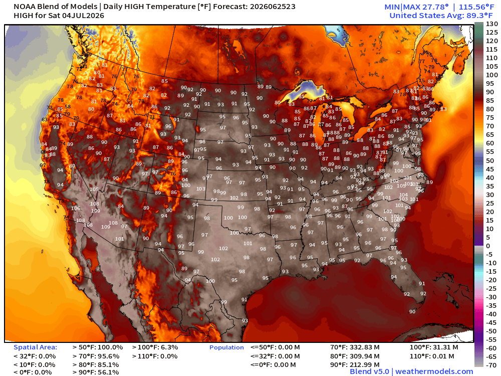
High Temperatures Next 9-Days —> Saturday July 4th
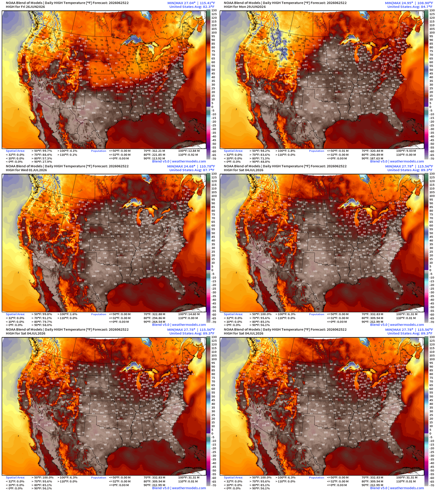
Trend to much hotter temperatures across the board into early July with 100s building across all of Texas with the much dryer conditions. Southeast including Atlanta and Carolinas push well into the 90s, and even 100s in the Carolinas.
With less tropical moisture plume activity from the Gulf of Mexico, we’ll see much warmer temperatures and lower rain chances —> warming trend into 4th of July.
Friday July 3rd Extreme Heat: 271 million at least 90°F and 38M > 100°F
Lower 48 spatial average high temperature almost 90°F
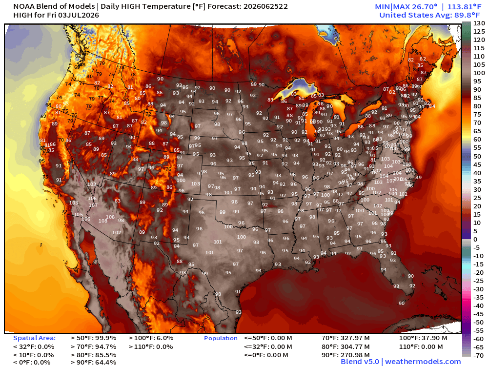
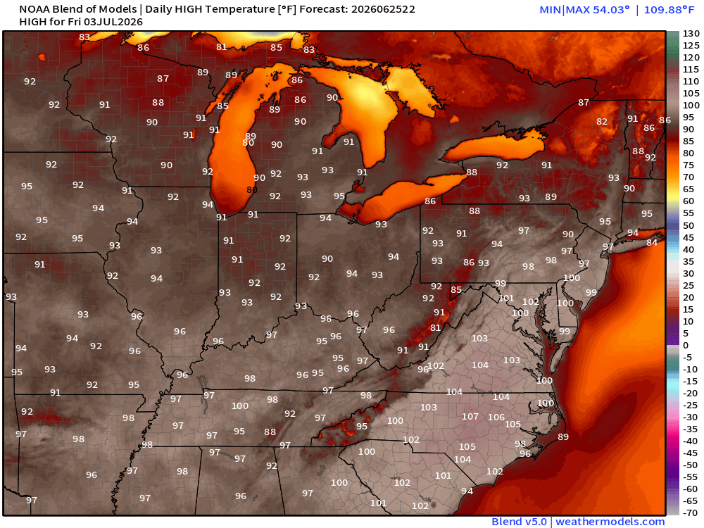
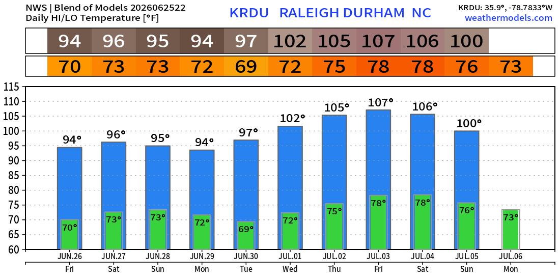
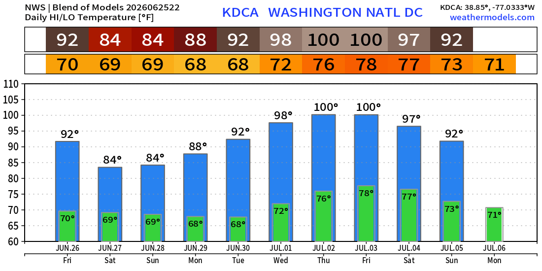
107°F in Raleigh on Friday, July 3rd, and 100°F in Washington D.C.
Saturday July 4th. Only slightly less hot!
Lower 48 Average High Temperature 89.3°F
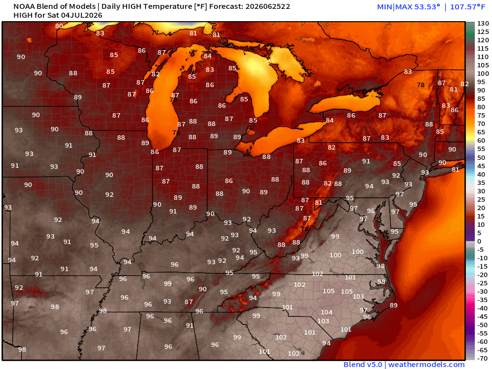
Next 10-days for Raleigh Durham —> brutal with 102° to 107°F for 4-5 days
Washington D.C. with a pair of 100s
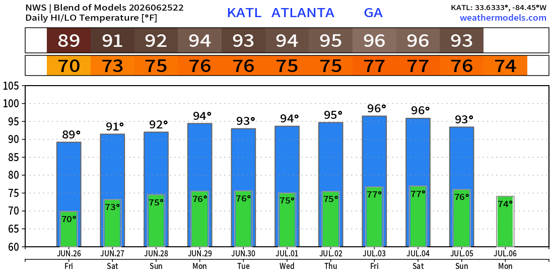
Atlanta in the mid-90s but potential for much hotter as forecast comes closer
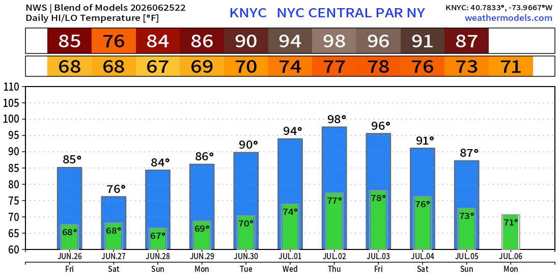
NYC Central Park at 98°F on Thursday
Low Temperatures on Friday
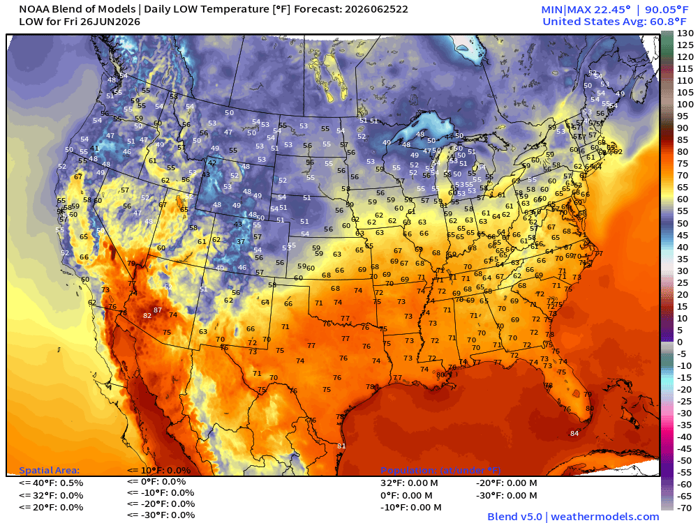
Pretty comfortable across much of the Lower 48
High Temperatures on Friday
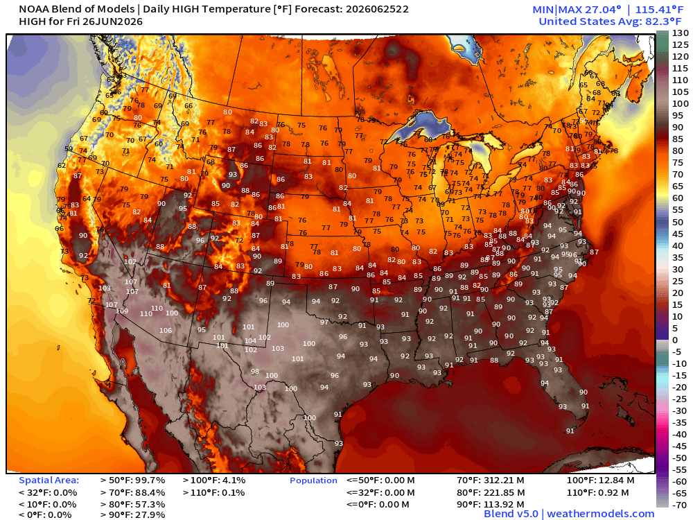
114 at least 90°F
ECMWF Flagship Ensemble Mean Temperature Anomaly next 15-days
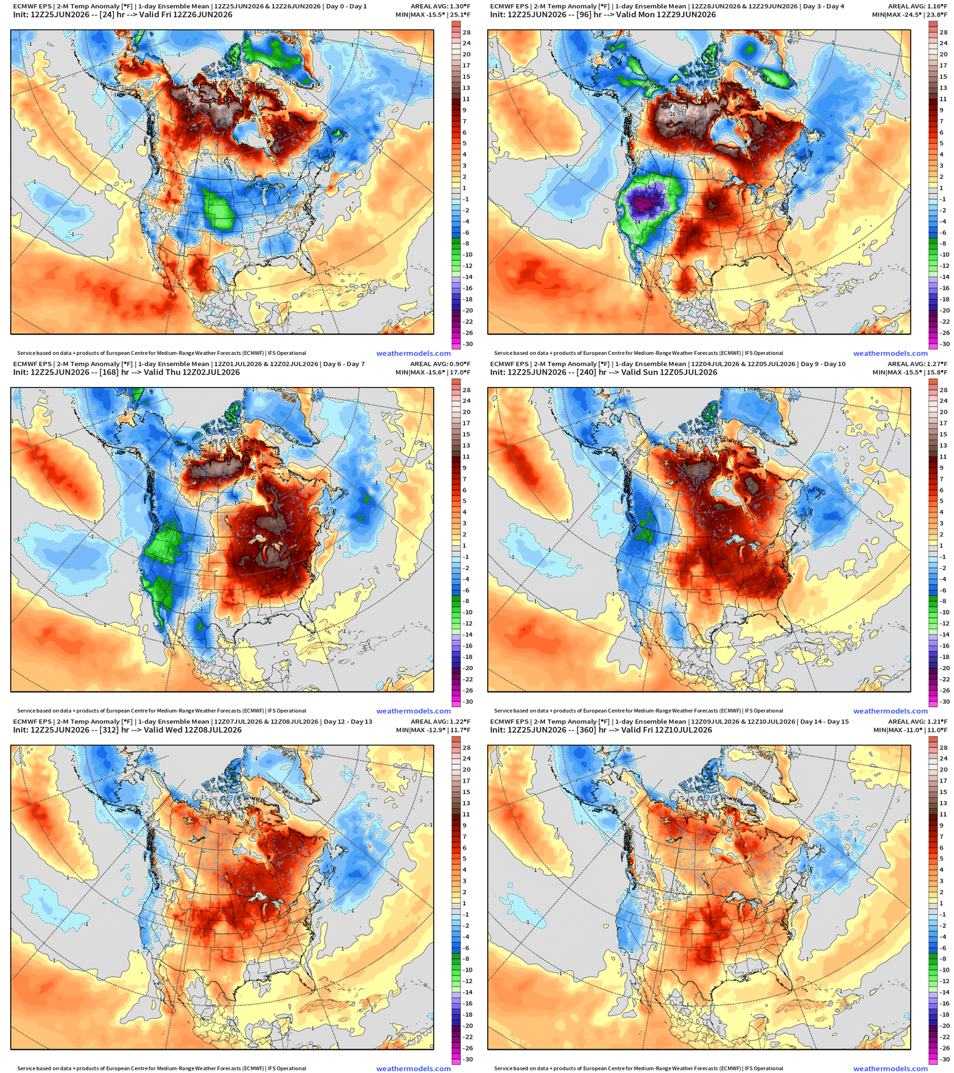
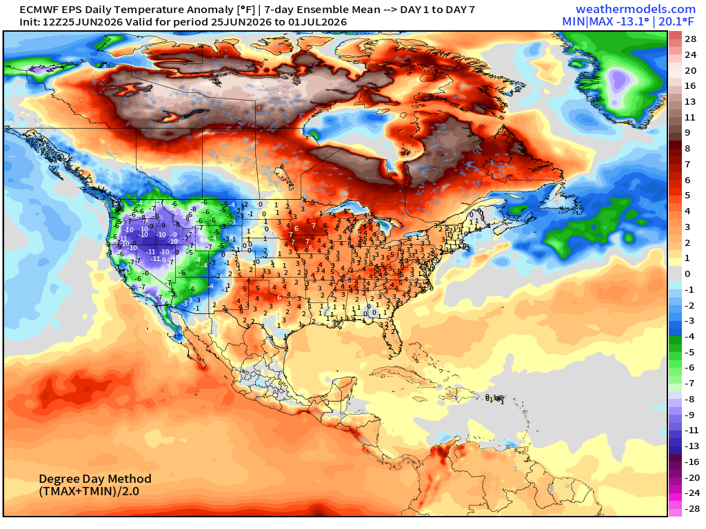
Trough —> cooler across the Pacific Northwest with huge negative anomalies of -20°F vs. the formation of a ridge into later June and HEAT across the Great Lakes and into the Mid-Atlantic + Canada
Week 1 —> June 25 to July 1
Week 2 —> July 2 to July 8
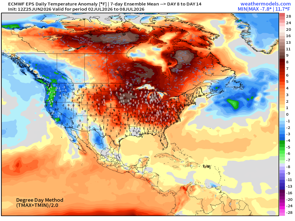
Pattern flip with trough in the NW and Western U.S. —> cooler than normal with much warmer than normal into 4th of July east of the Rockies —> trending HOTTER
Tropical Update: Atlantic Basin — Very Quiet into mid-July (15-day tracks forecast from EPS 12z)
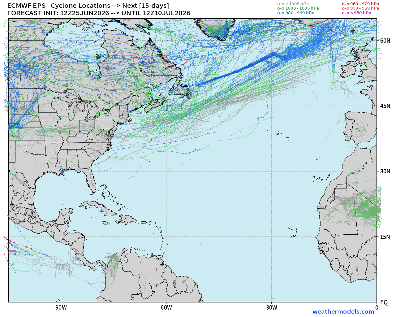
Global cyclone tracks (tropical + extratropical) over next 15-days
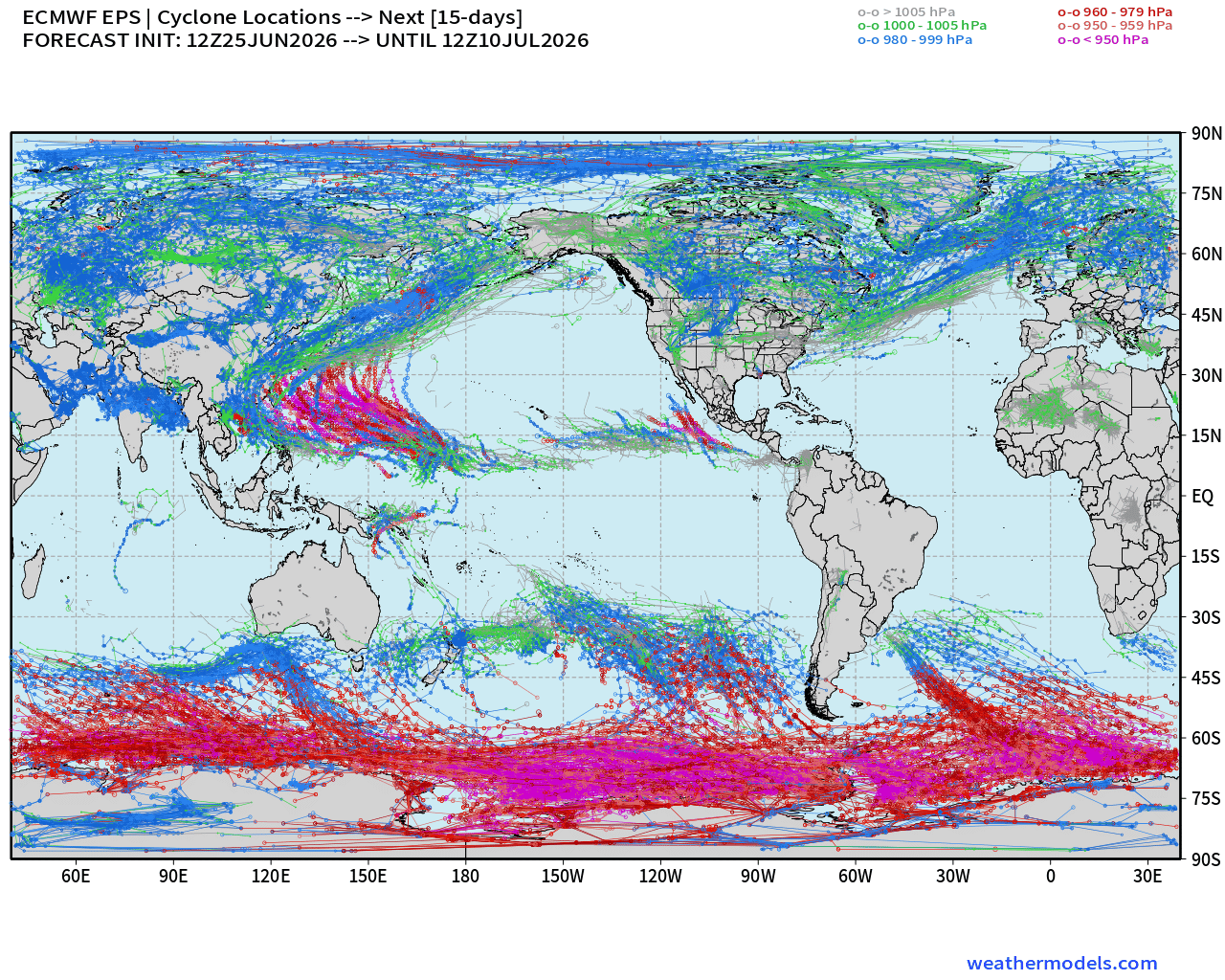
Global cyclone tracks from ECMWF EPS 12z (ensembles) n=50-members
Western Pacific lights up with 2+ Typhoons likely with long-tracks = huge ACE
Light activity in Eastern Pacific. Complete ghost town in Atlantic basin
Note elsewhere around the world where cyclones just do not exist: between 0°S and 25°S in South Atlantic, huge void in Southeast Pacific, and the dominance of the North Pacific high + Bermuda high in North Atlantic.
Global Precipitation Anomaly next 2-weeks
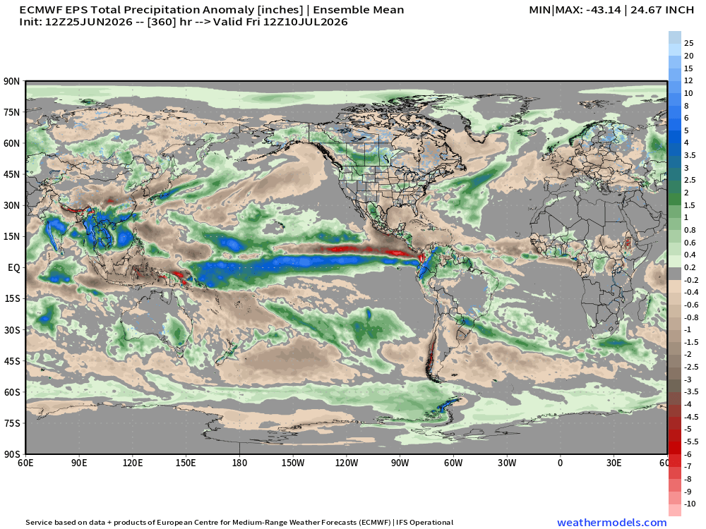
Central Pacific convection is “boiling over” with massive precipitation surplus falling along the Equator from South America to Papua New Guinea.
These showers trigger downstream Rossby waves and can help form “heat domes” or blocking ridges over North America and Europe.
—> full tilt atmospheric coupling with ocean surface —> El Niño
Thank you for reaching the end of this post! Hopefully you enjoyed the beautiful weather maps. Please help increase the visibility of Weather Trader on Substack: Share or Like!
Help support this newsletter (nearing post 1,000!) —> June 2026 Coupon
I’m working on a few major projects, but on the side, an idea I’ve had for quite a while, but didn’t have the time — Weather MapMaker — with help from Claude to create highly customized 4K weather maps with impeccable design. A lot of the interaction with Claude Code remains fine tuning and polishing weak first efforts.
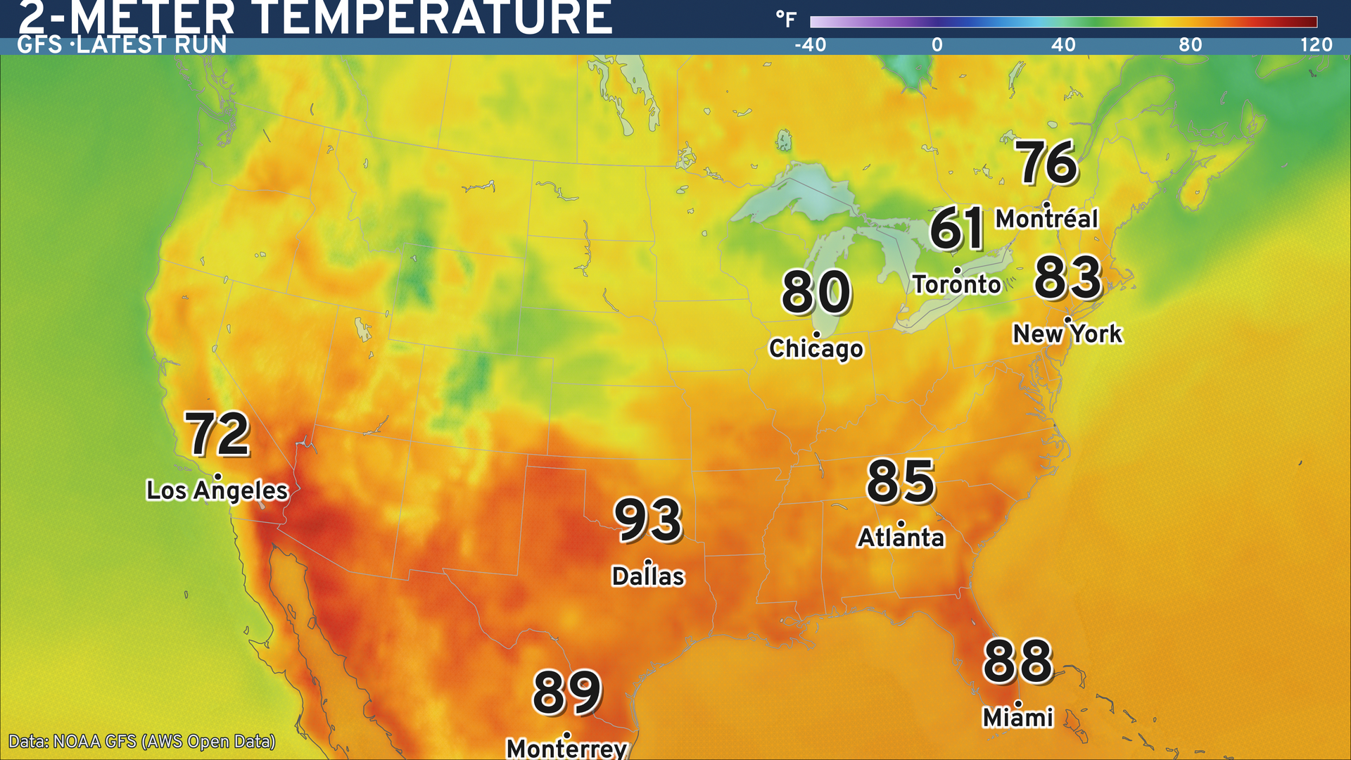
Maps sourced from weathermodels.com designed and innovated by yours truly! Please subscribe there for real-time access to the newest maps, charts from all of the weather models including ECMWF and AIFS, and NOAA GFS/GEFS, HRRR/RRFS and Blend of Models (NBM). NOAA WPC and SPC for fronts/convective outlooks.
My Atlantic Hurricane Season Forecast (2026)
From April 7, 2026: Atlantic Seasonal Hurricane Forecast: (11/5/2)
9-13 Named Storms (11 most likely)
4-7 Hurricanes (5 or 6 most likely)
1-3 Major Hurricanes (2 most likely)
Accumulated Cyclone Energy: 75-85 (well below normal)
NOAA 2026 Atlantic Hurricane Season Forecast
- Milepost
- 968 · laid 2026-06-26T01:04:20.074000Z
- Source
- https://weather.substack.com/p/june-25-2026-eastern-us-heat-dome
- Digest
- 160b09d961add9f24a69d46422a364c653639ff0ffd3c9ae71c3434d2ca4ca0d
- Machine
- JSON