June 23, 2026 Tuesday Summer Weather
Heat dome to form across Southern US into early July with widespread 90s and 100s
June 2026 was the 18th-warmest June in the 132-year national record (1895–2026), at 70.6°F against a 1991–2020 normal of 69.5°F (+1.2°F).
June 2026 was the 32nd-wettest June in the 132-year national record (1895–2026), at 3.3in against a 1991–2020 normal of 3.1in (+0.2in).
NOAA/NCEI Climate at a Glance, contiguous United States. This is the observed record for the month, not a score of anything said in this piece — the forecast ledger begins 2026-08-17 and cannot reach earlier posts.

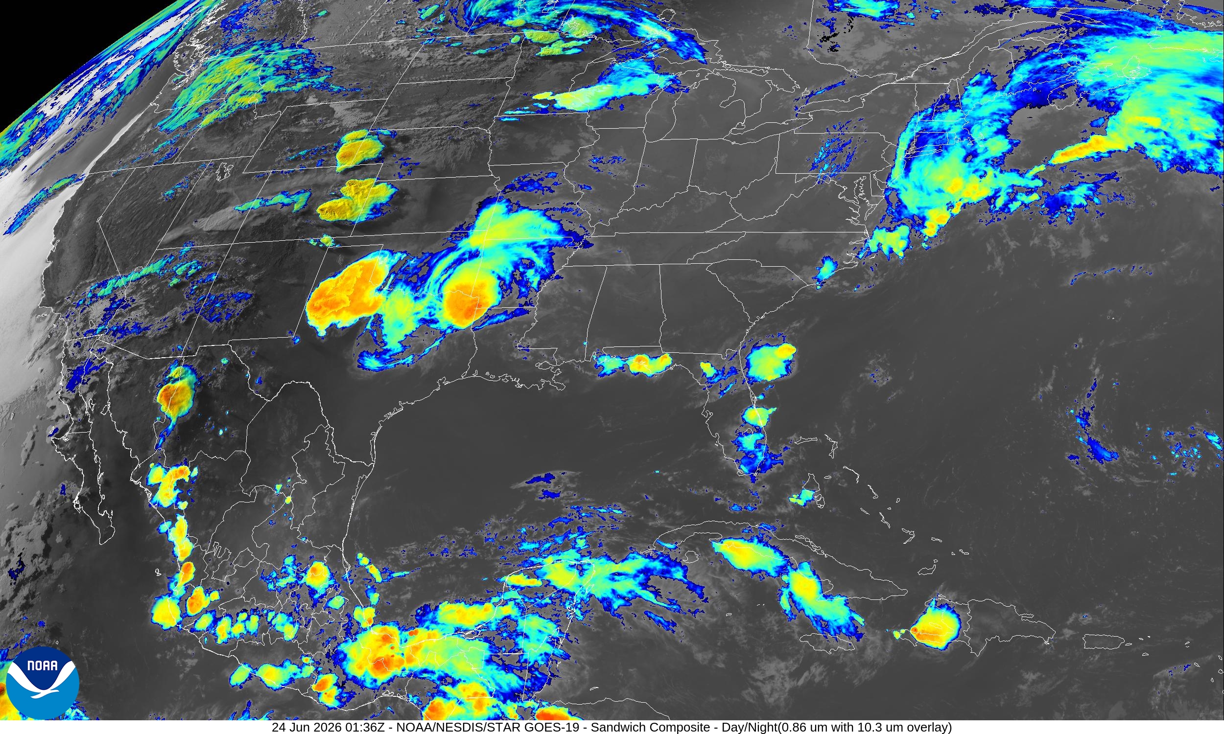
However, we need to start looking ahead to July and the formation of a powerful “heat dome” centered on Memphis, TN and baking the Southeast.
Help support this newsletter (nearing post 1,000!) —> June 2026 Coupon
Radar through 8:44 PM CT (earlier this evening)
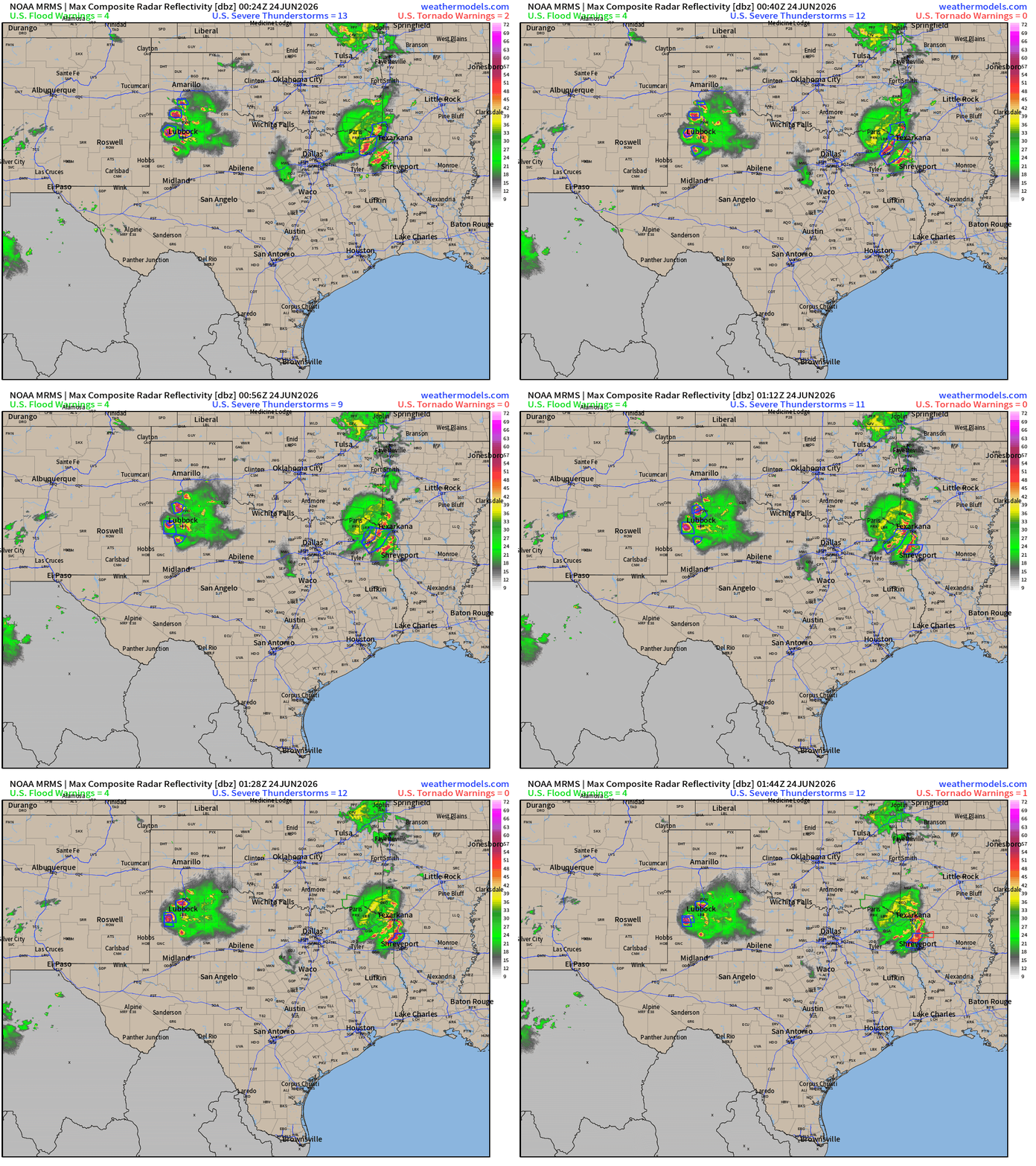
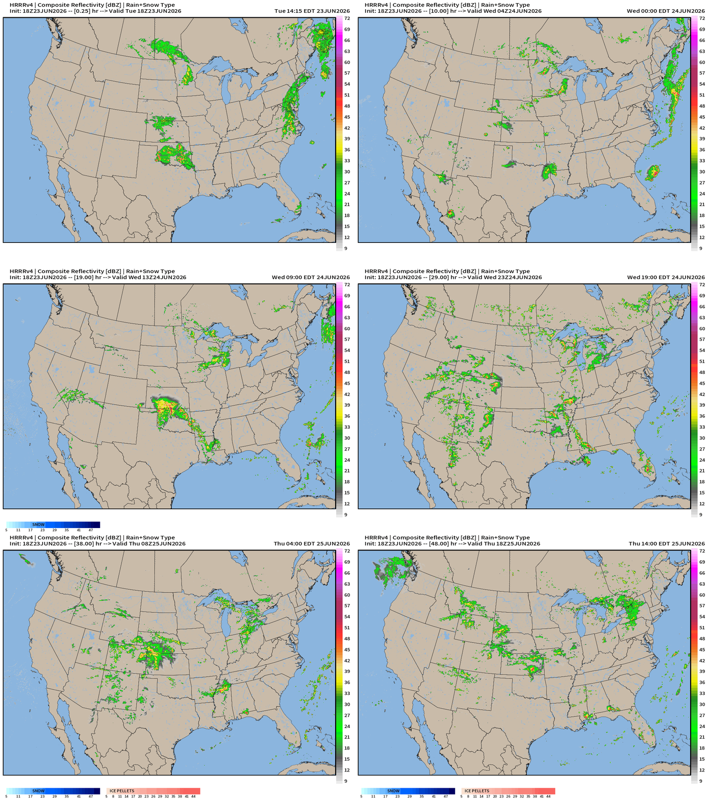
Watching a couple storm complexes moving along — dumping heavy rainfall.
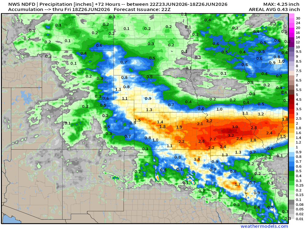
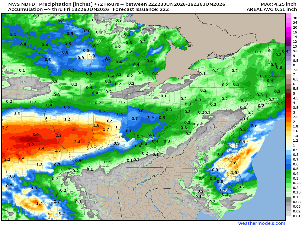
NWS Precipitation Next 72-hours —> Friday Evening
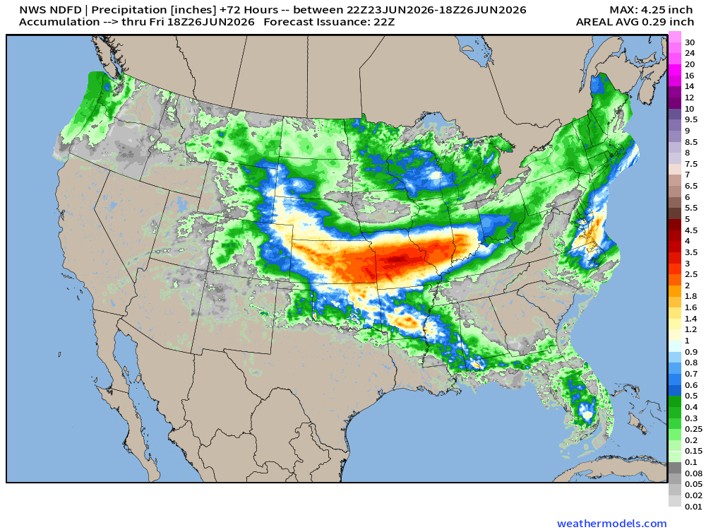
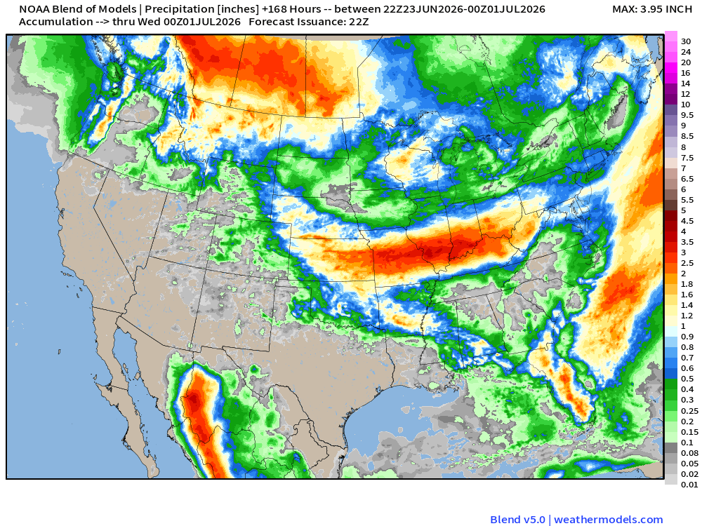
Heavy rainfall will be focused on Kansas through Missouri, and into Illinois to Indianapolis with upgrades of 2” to 4” possible in just next few days.
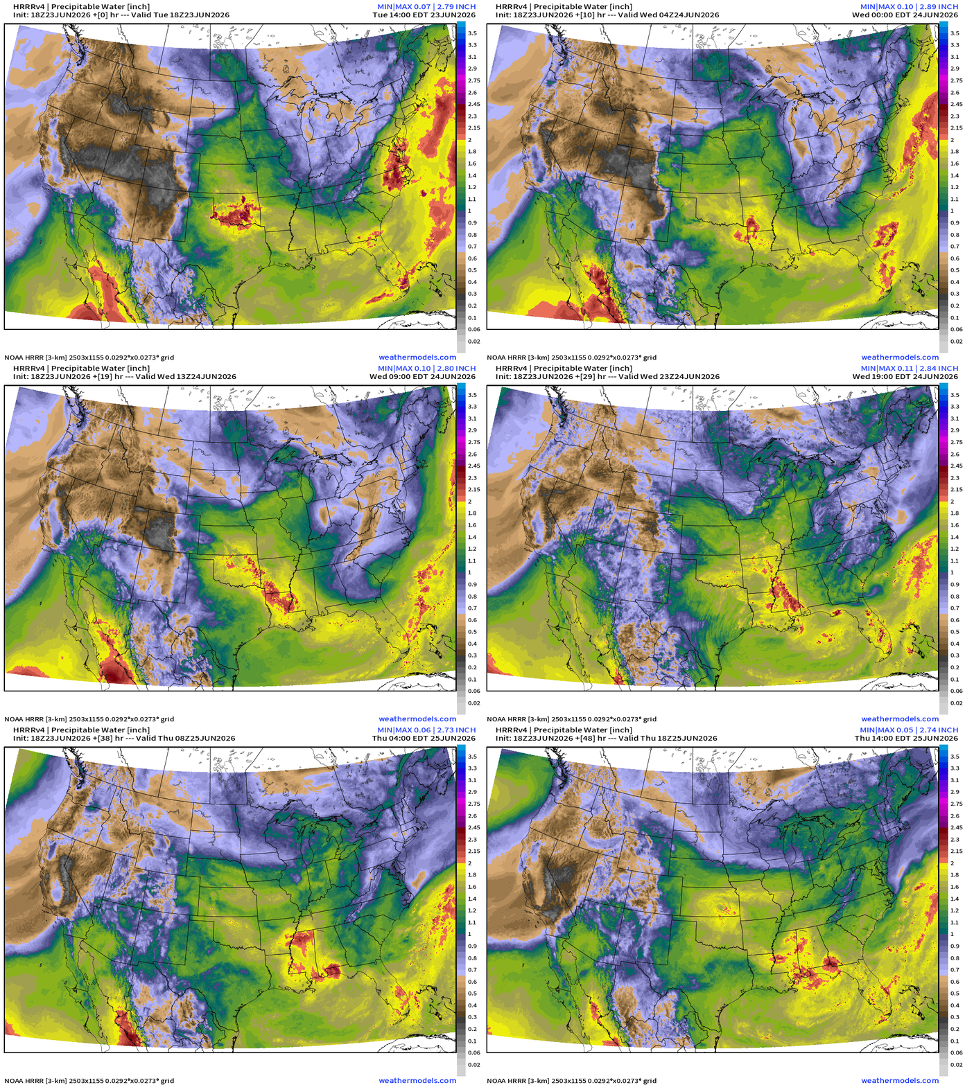
My favorite parameter — next 48-hours of HRRR Precipitable Water
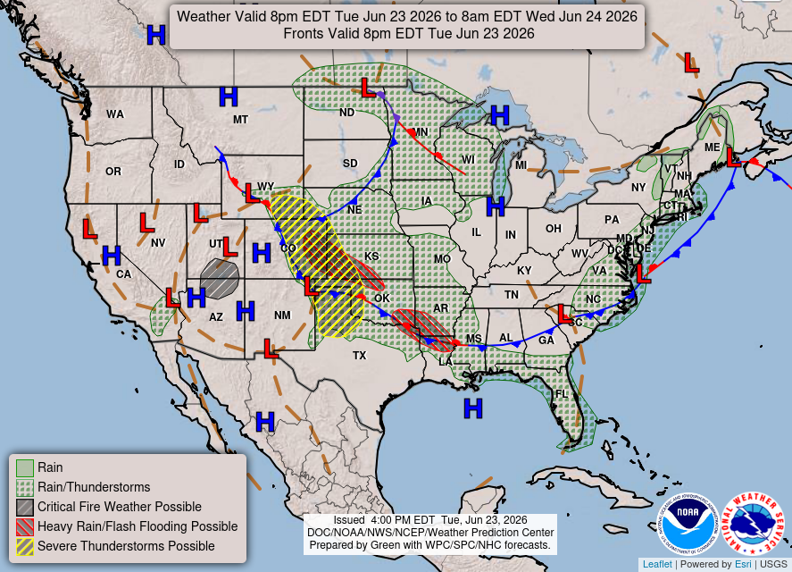
Weather Into Wednesday Morning
HRRR Next 48-hours simulated Radar through Thursday 2 PM ET
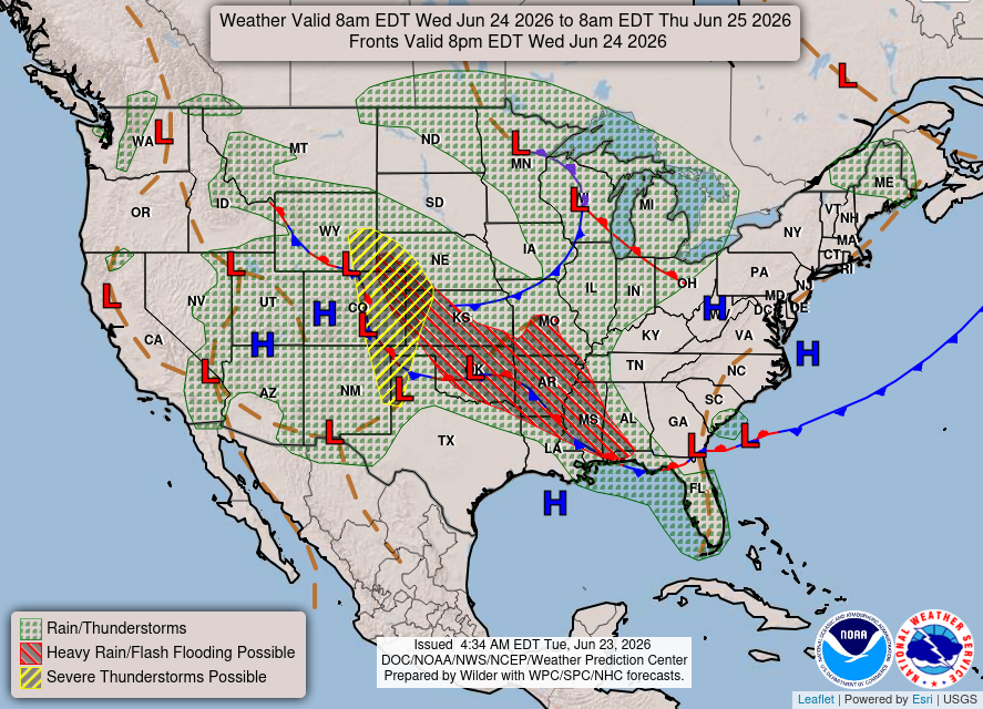
Weather on Wednesday — Cold front dips to the Gulf Coast
Blend of Models —> Precipitation Next 7-days
Help support this newsletter (nearing post 1,000!) —> June 2026 Coupon
Flagship model: ECMWF AIFS 18z —> Integrated Vapor Transport next 10-days
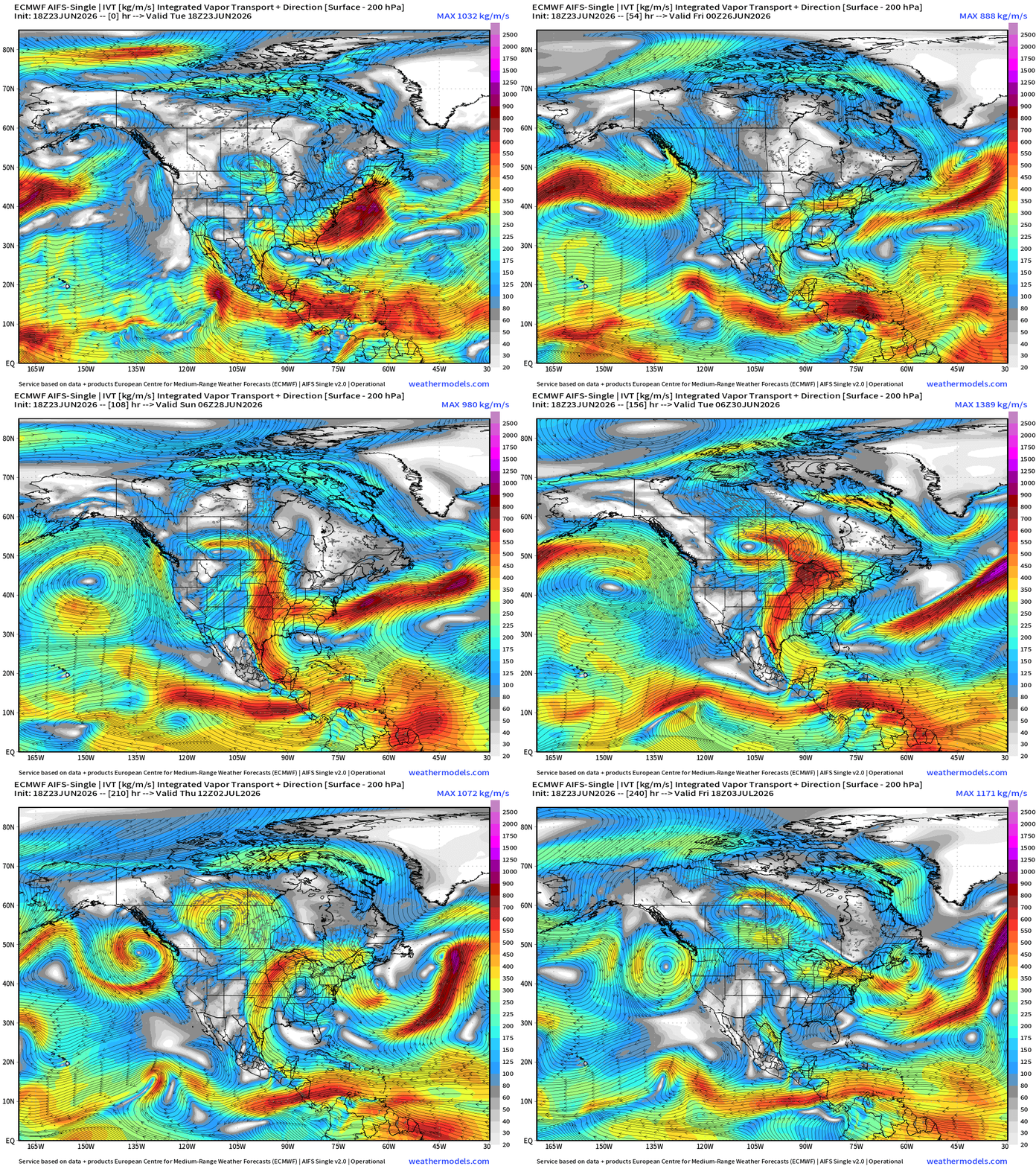
The magnitude of the tropical moisture feed into the USA from the Caribbean and Gulf is dialed down/back significantly as ridging strengthens over the Southeast U.S. —> heat dome?
Update: Yes, we can see the anticyclonic turning of the ridge centered over the southern Mississippi River Valley with limited moisture transport —> really going to heat up for early July.
ECMWF 18z | Precipitable Water | My Favorite Parameter
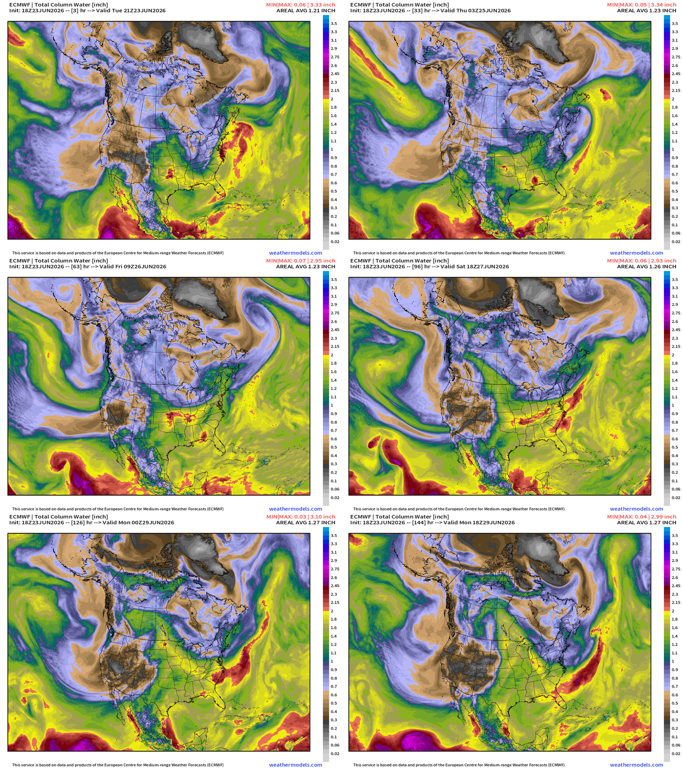
Generally 1.8” (yellow) PWAT with embedded > 2” convective cells = heavy downpours across Central U.S. into the Southeast.
Temperature Analysis | RTMA | 8:45 PM ET
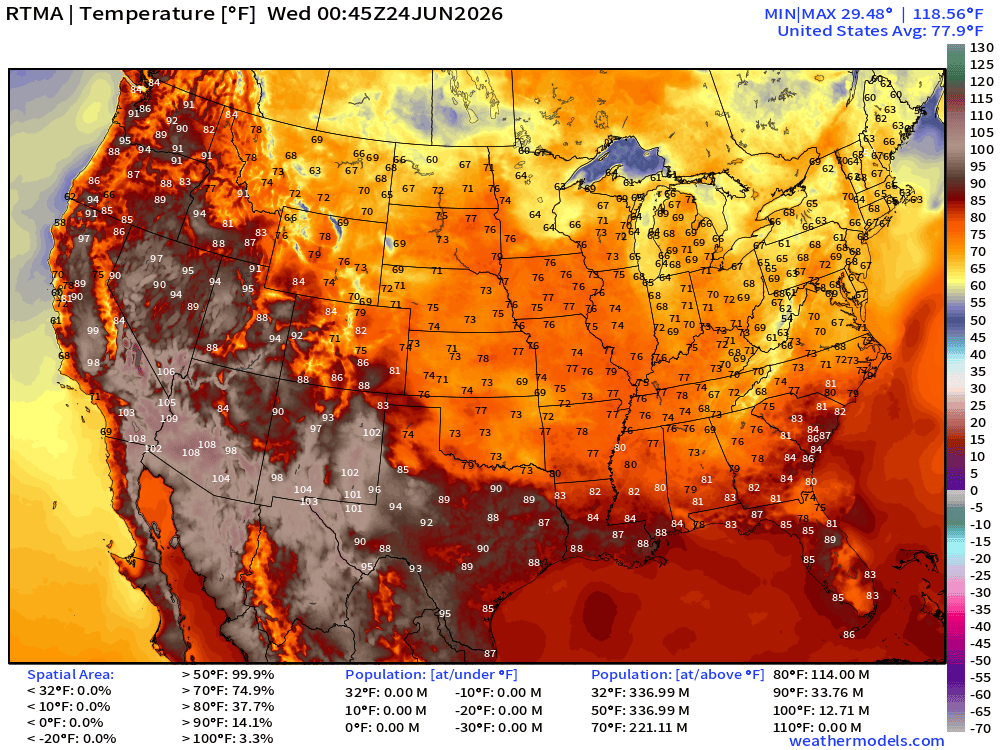
About 34 million population at least 90°F at 8:45 PM ET but plenty of comfortable 60s and 70s blanketing the Lower 48 east of the Rockies.
Temperature Anomaly | RTMA | 8:45 PM ET
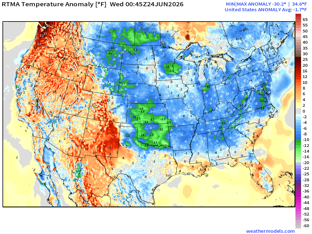
Lower 48 was -1.7°F below normal behind the amazing cold front
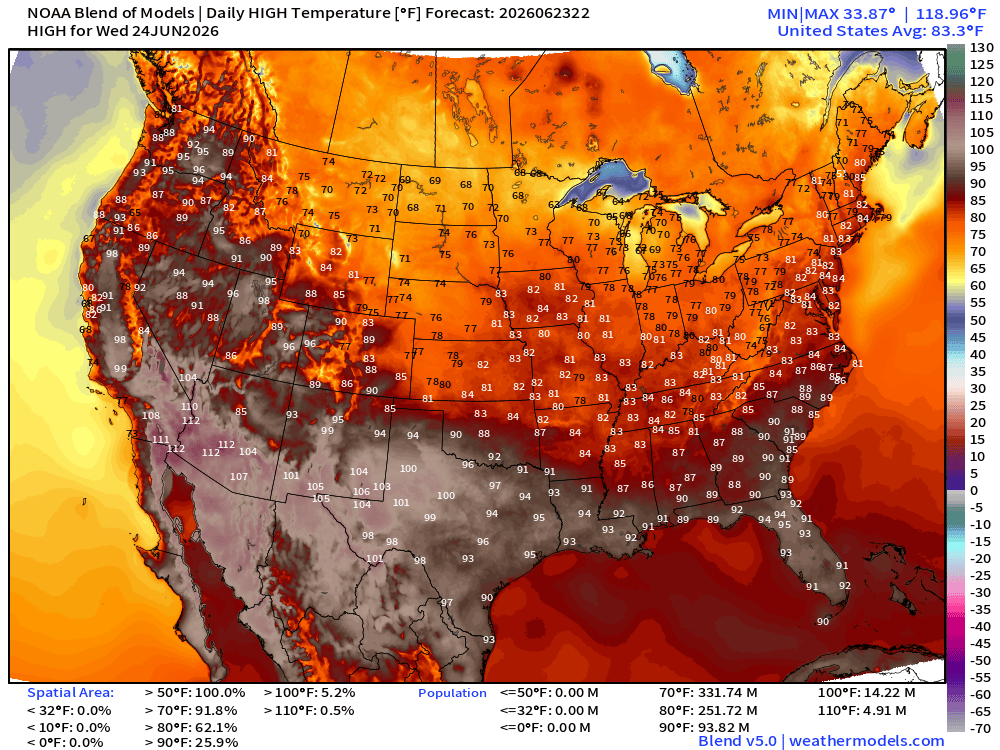
High Temperatures Next 8-Days —> Thursday July 2nd
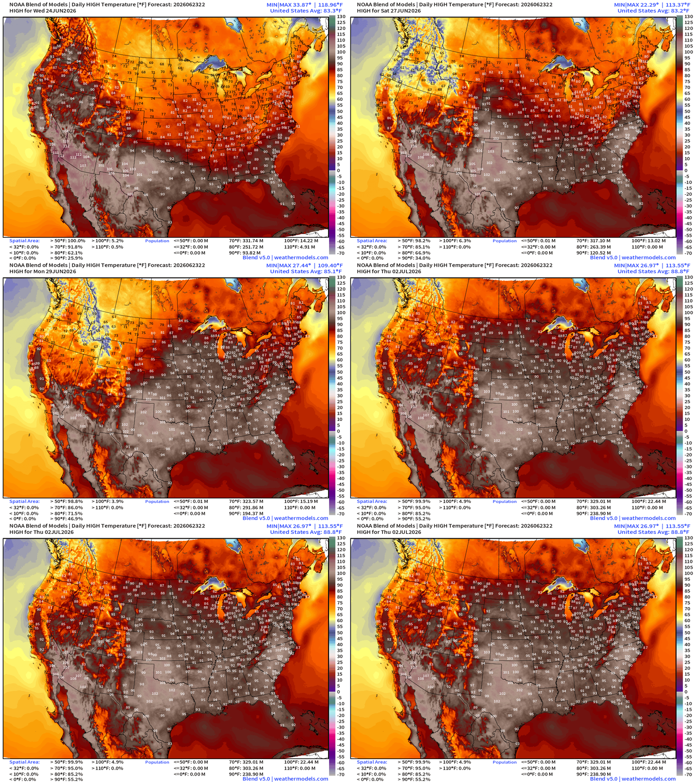
Trend to much hotter temperatures across the board into early July with 100s building across all of Texas with the much dryer conditions. Southeast including Atlanta and Carolinas push well into the 90s, and even 100s in the Carolinas.
With less tropical moisture plume activity from the Gulf of Mexico, we’ll see much warmer temperatures and lower rain chances —> warming trend into 4th of July.
239 million+ at least 90°F by July 1st with Lower 48 average high of 88.1°F
Low Temperatures on Wednesday
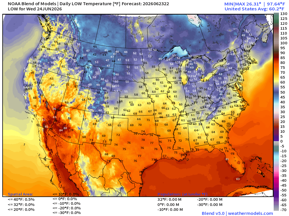
High Temperatures on Wednesday
Upper-Level Height Anomaly | AIFS-Single Next 10-days
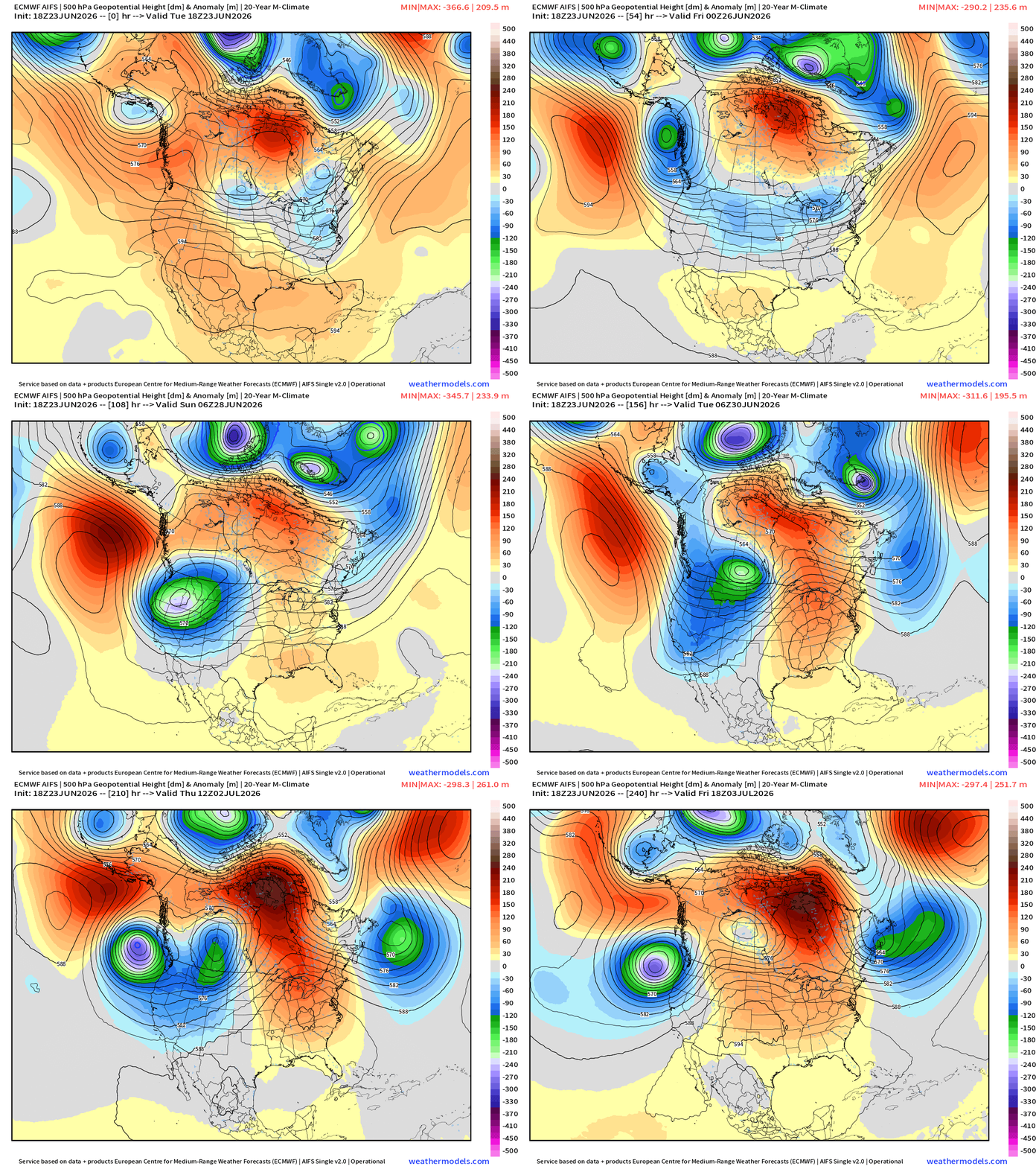
Very strong troughing digs into the Pacific Northwest in the medium range = much cooler across the Western U.S. with potential for mountain snow into early July.
Ridging builds across the Eastern U.S. —> dry and heating up especially across the Southeast —> HEAT DOME
Into Summer —> Height Anomalies don’t tell entire story … actual height helps!
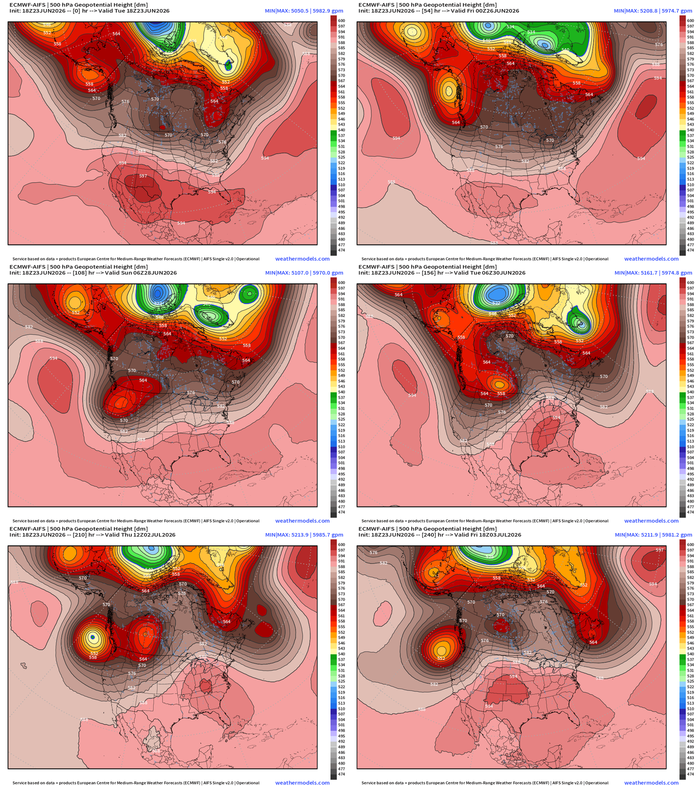
Same story as yesterday: 594 dm to 597 dm contours pop up across the U.S. border in AZ/NM and then in the Southeast … trending warmer —> more typical “heat dome” centered over the Southeast into early July.
European Heat Dome | Temperature Anomaly next 12-days
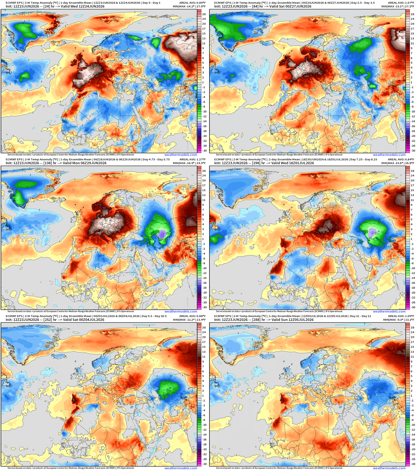
ECMWF Flagship Ensemble Mean Temperature Anomaly next 15-days
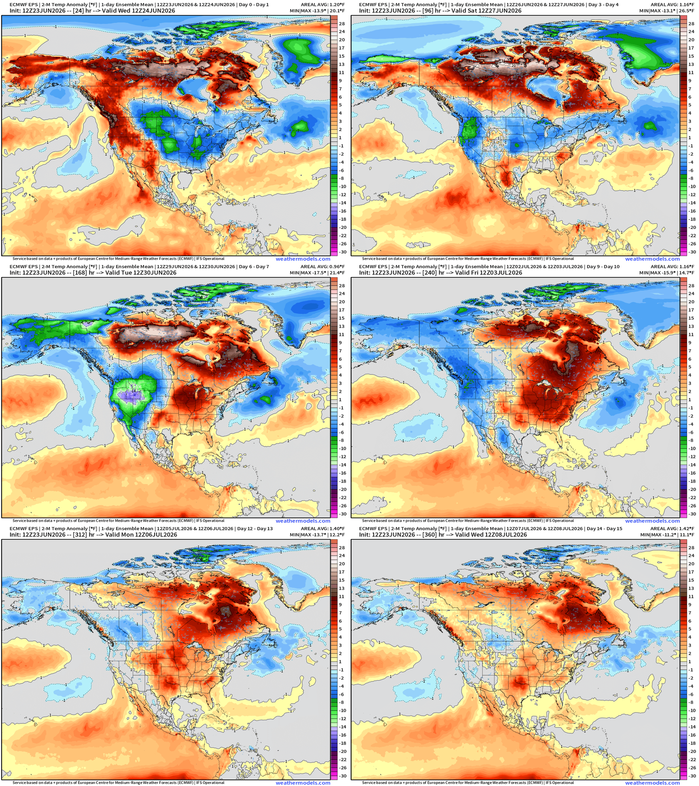
Trough —> cooler across the Pacific Northwest with huge negative anomalies of -20°F vs. the formation of a ridge into later June and HEAT across the Great Lakes and into the Mid-Atlantic + Canada
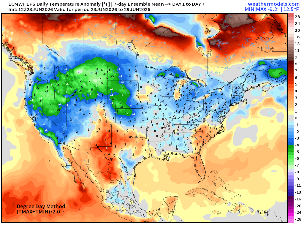
Week 1 —> June 23 to June 29
Week 2 —> June 30 to July 6
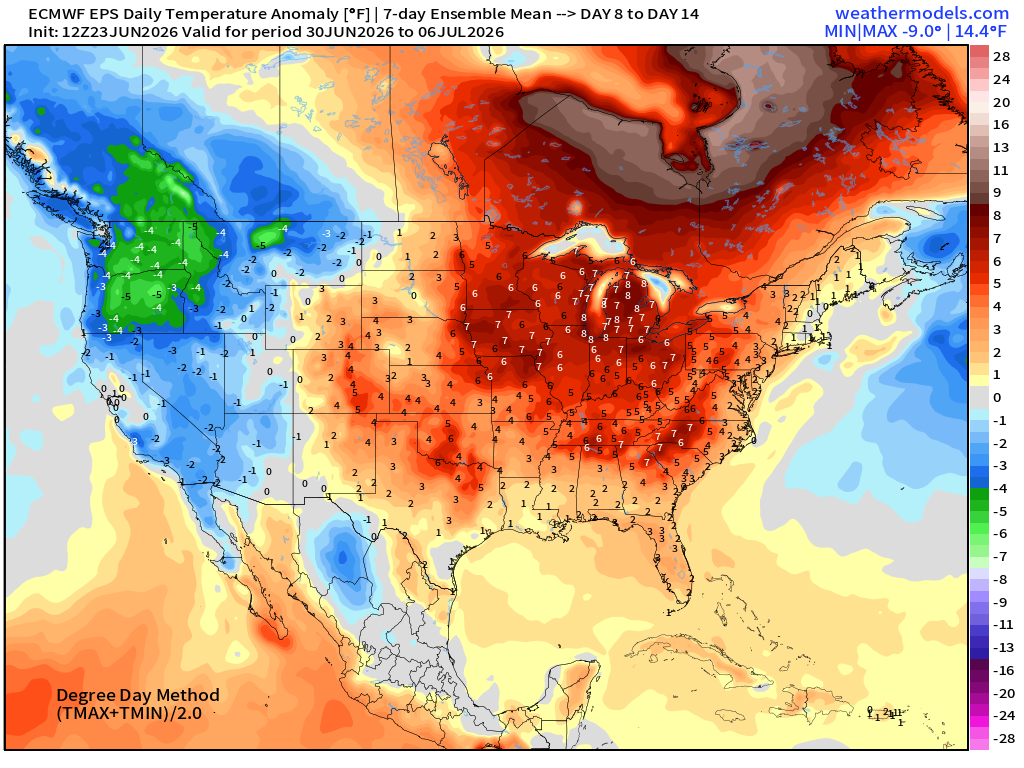
Pattern flip with trough in the NW and Western U.S. —> cooler than normal with much warmer than normal into 4th of July east of the Rockies —> trending HOTTER
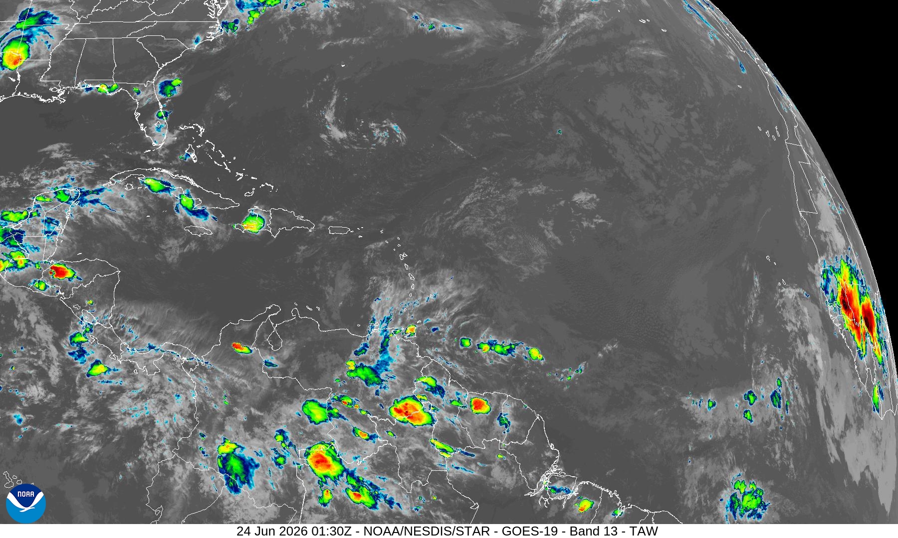
Atlantic Basin — Very Quiet through end of June 2026
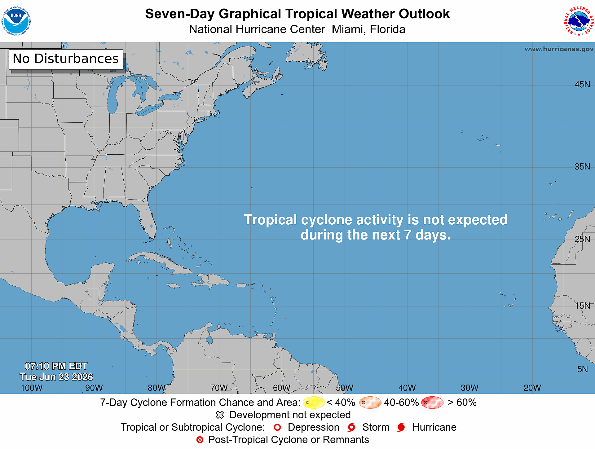
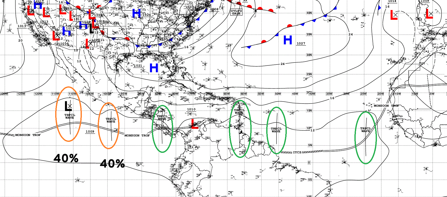
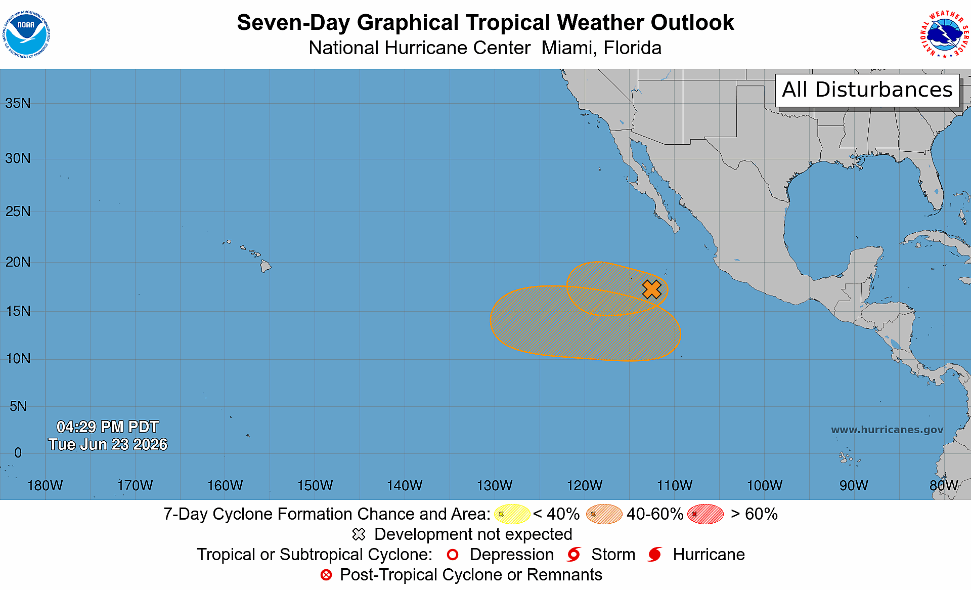
Tropical Waves … multiple across the 2 basins but nothing active for certain in the Atlantic. These waves move into the Eastern Pacific but marginally favorable conditions (40%)
Saharan Air Layer with African Dust — next 10 days
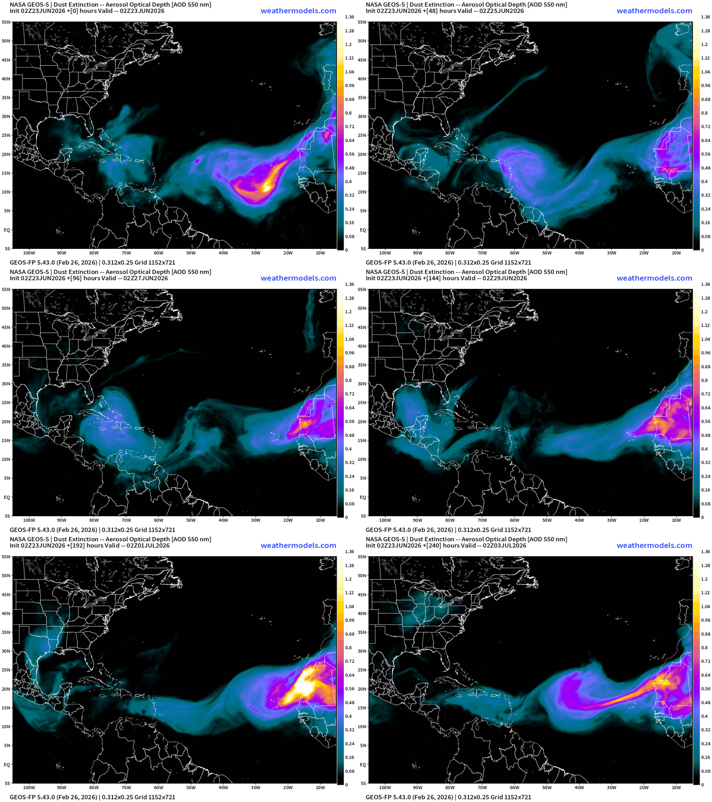
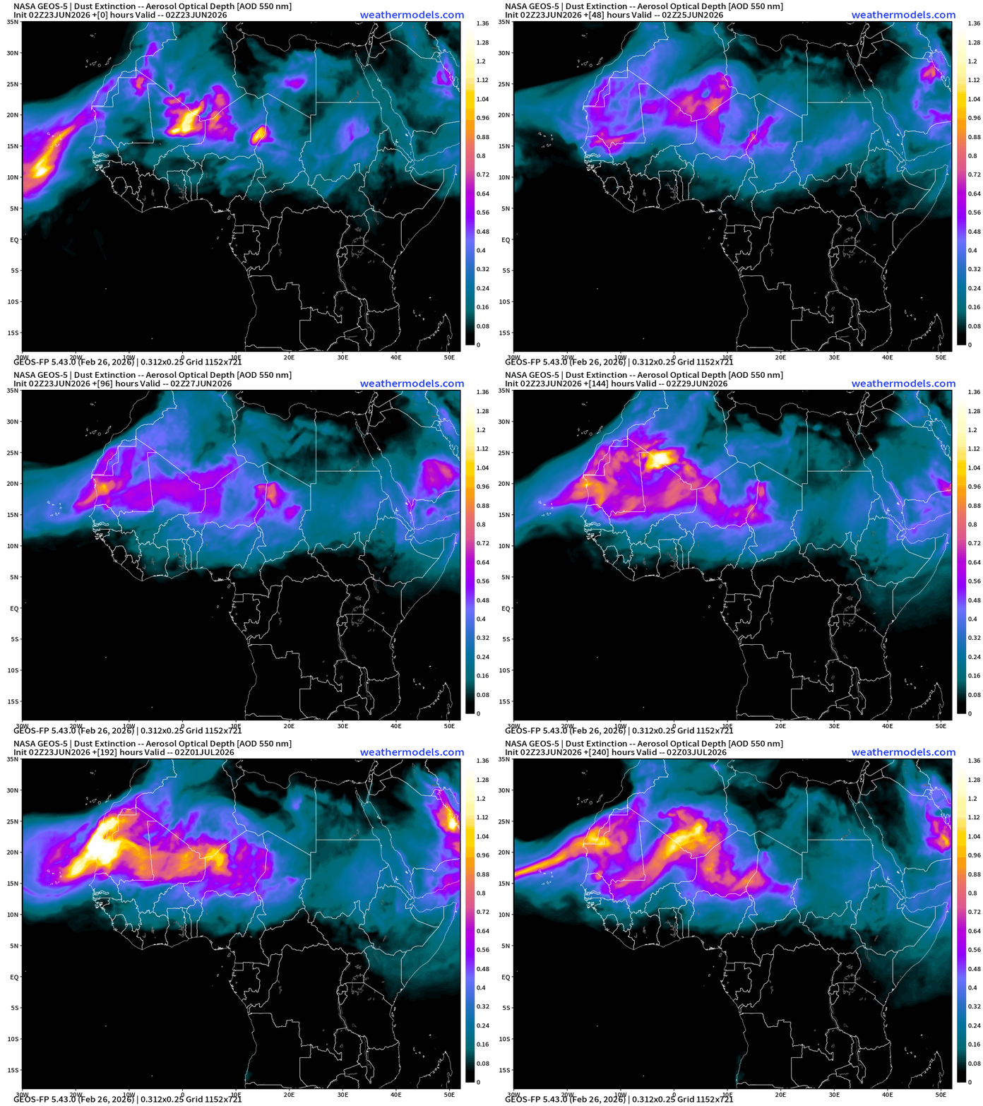
During the months of June and July, winds over the African continent pick up sand and dust from the deserts and loft it into the boundary layer around 850-700 mb creating a stable and warm layer. The prevailing trade winds (east to west) in the tropics capture the dust layers and move them along into the Atlantic and eventually the Caribbean and even the Gulf of Mexico to provide beautiful & colorful sunsets for folks in Florida and Texas.
While the African dust plumes expected over the next 7-days aren’t the most intense, NASA GEOS-5 shows a whopper in the Eastern Atlantic by early July.
Zooming out to North Africa — origin of the Saharan Air Layers + Sand/Dust
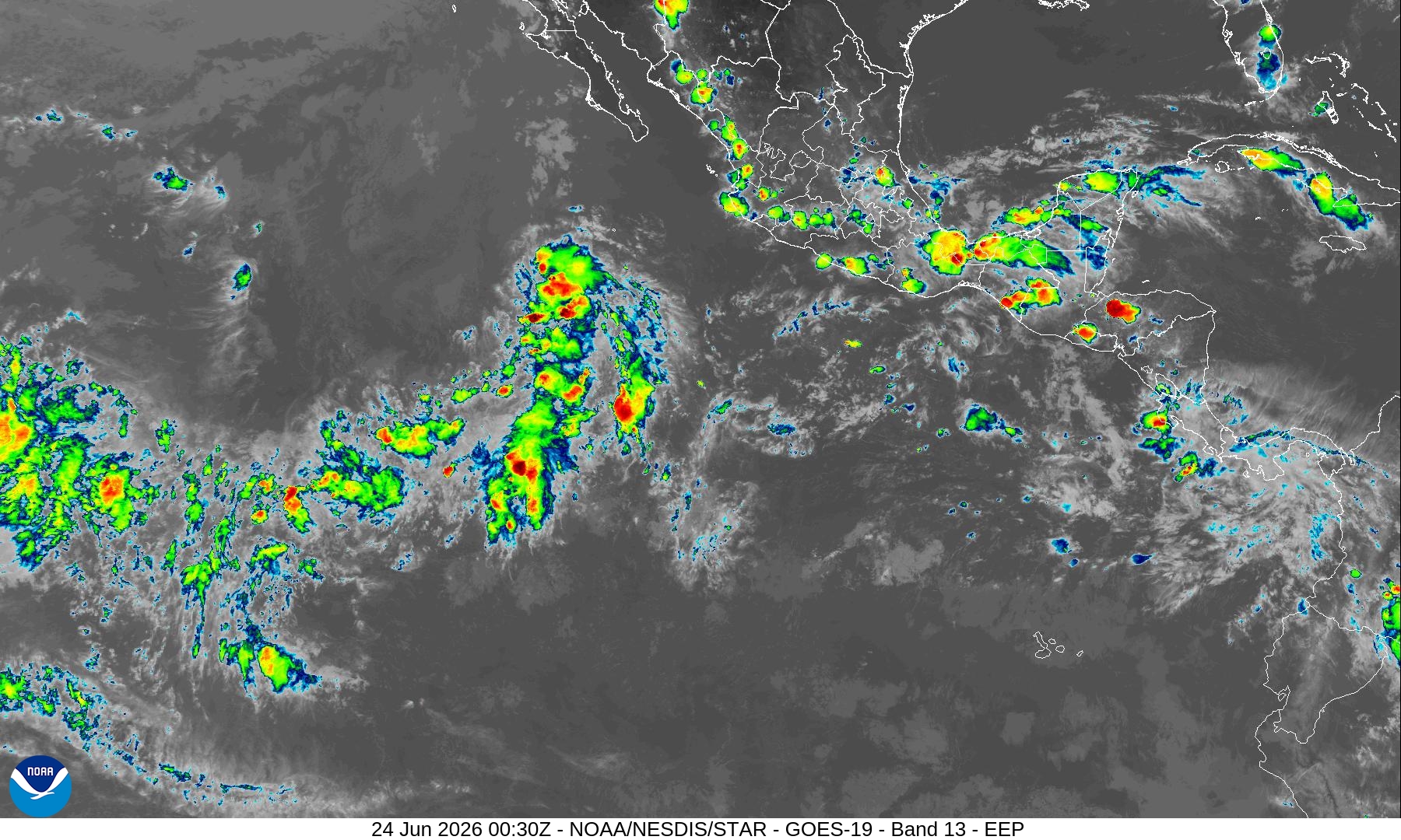
Satellite Imagery — not much active convection across the entire Atlantic tropics
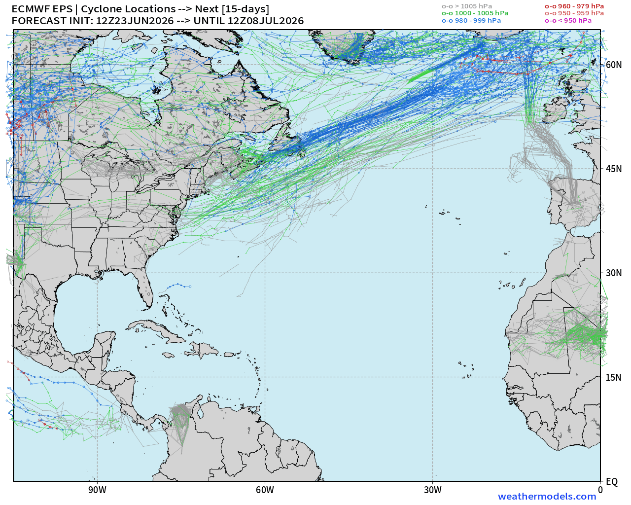
Ensemble Storm Tracks Next 15-days —> Complete Ghost Town in Atlantic
2 Tropical Waves in Eastern Pacific with Medium Chance (40%) in coming week
Western Pacific Typhoon Season
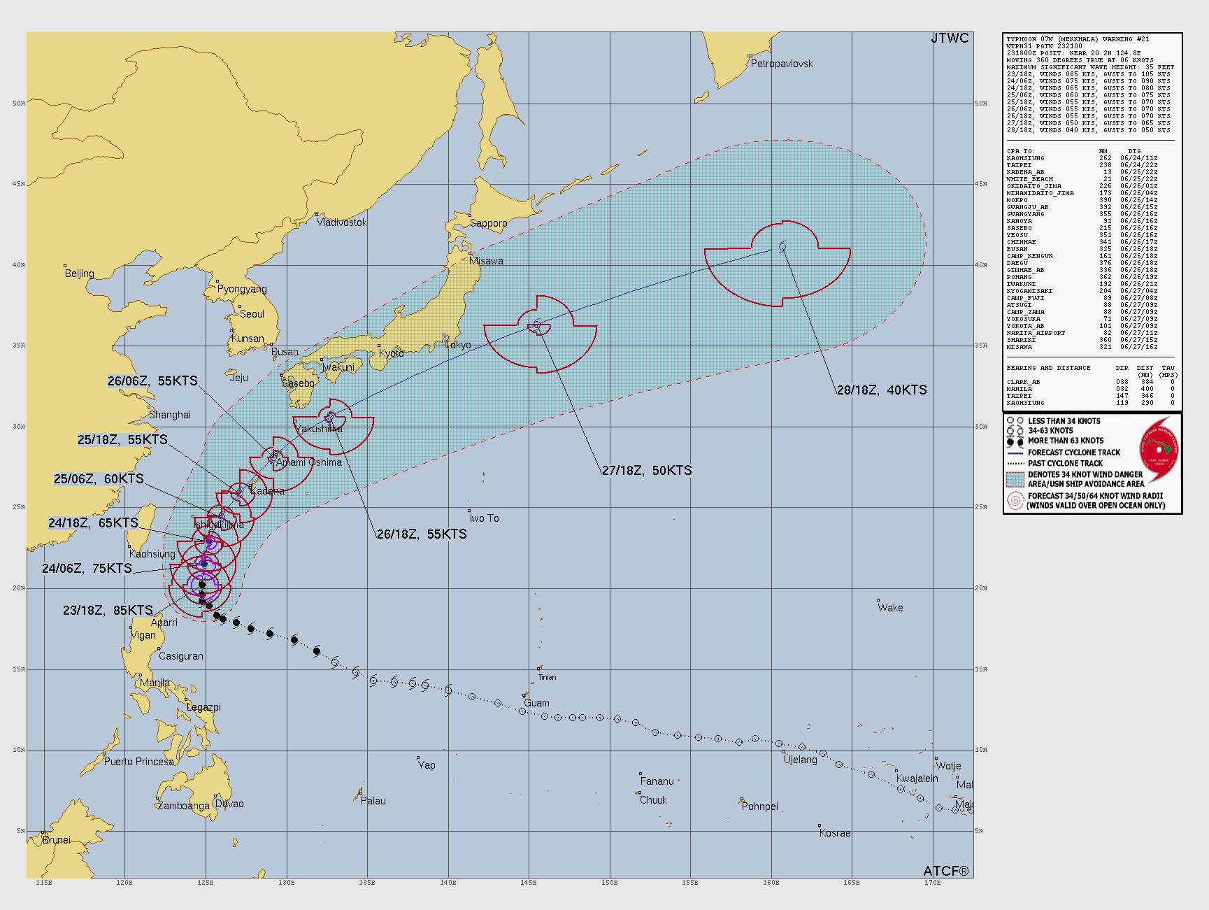
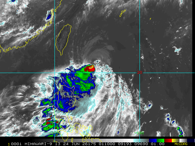
Typhoon Mekkhala BLEW a tire … almost sheared complete part with strong northerly wind shear decoupling the low level circulation from the convection. Tough break!
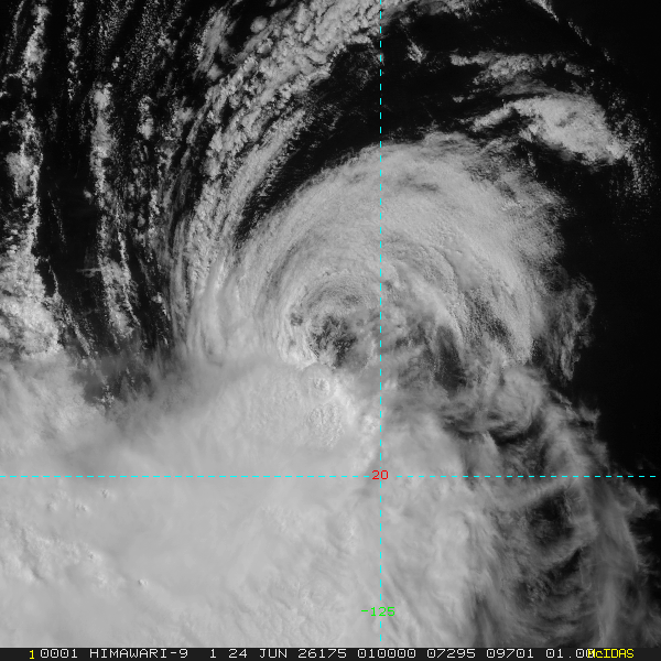
We’ll see if the wind shear relaxes, or else this storm may struggle to regain convection, and be a large remnant low.
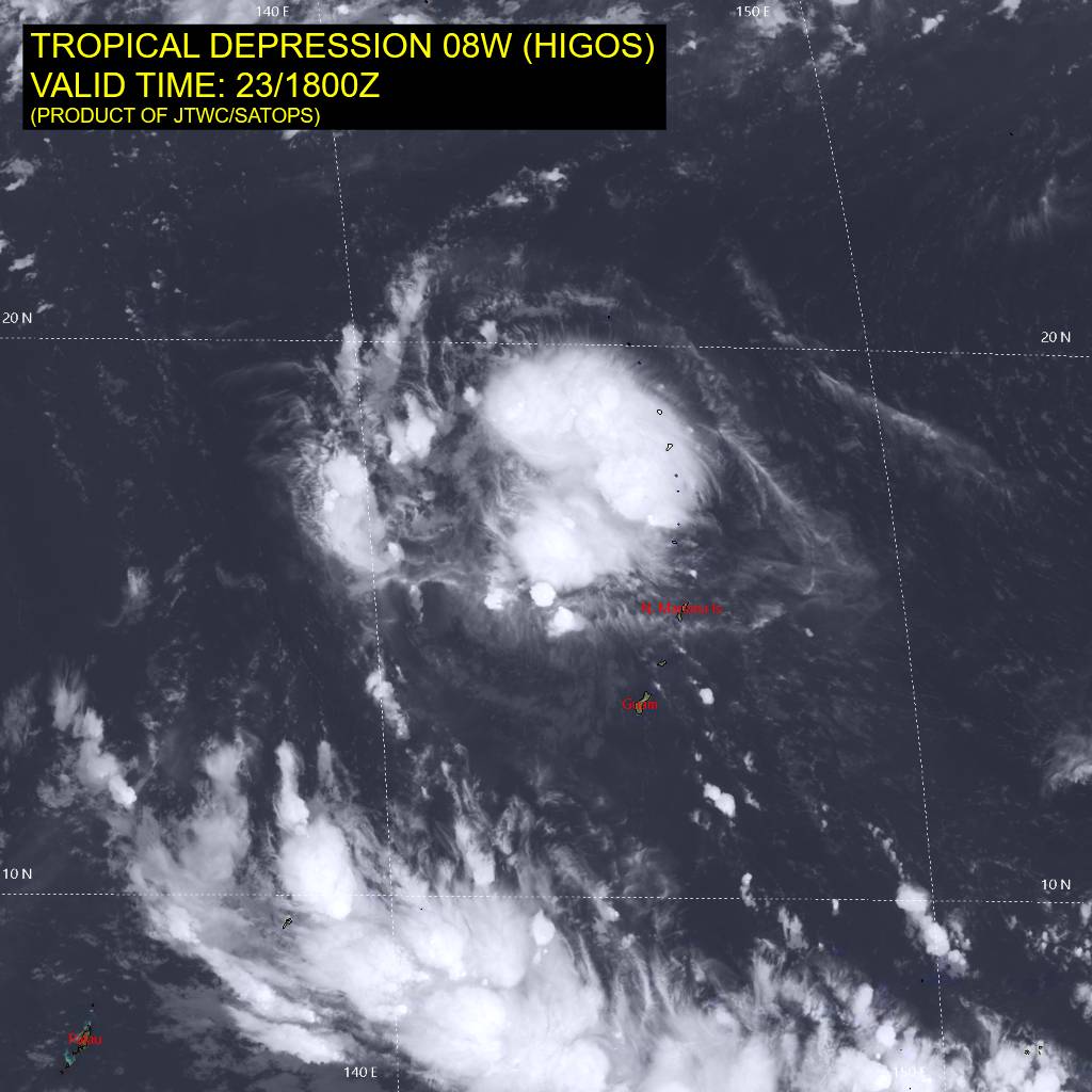
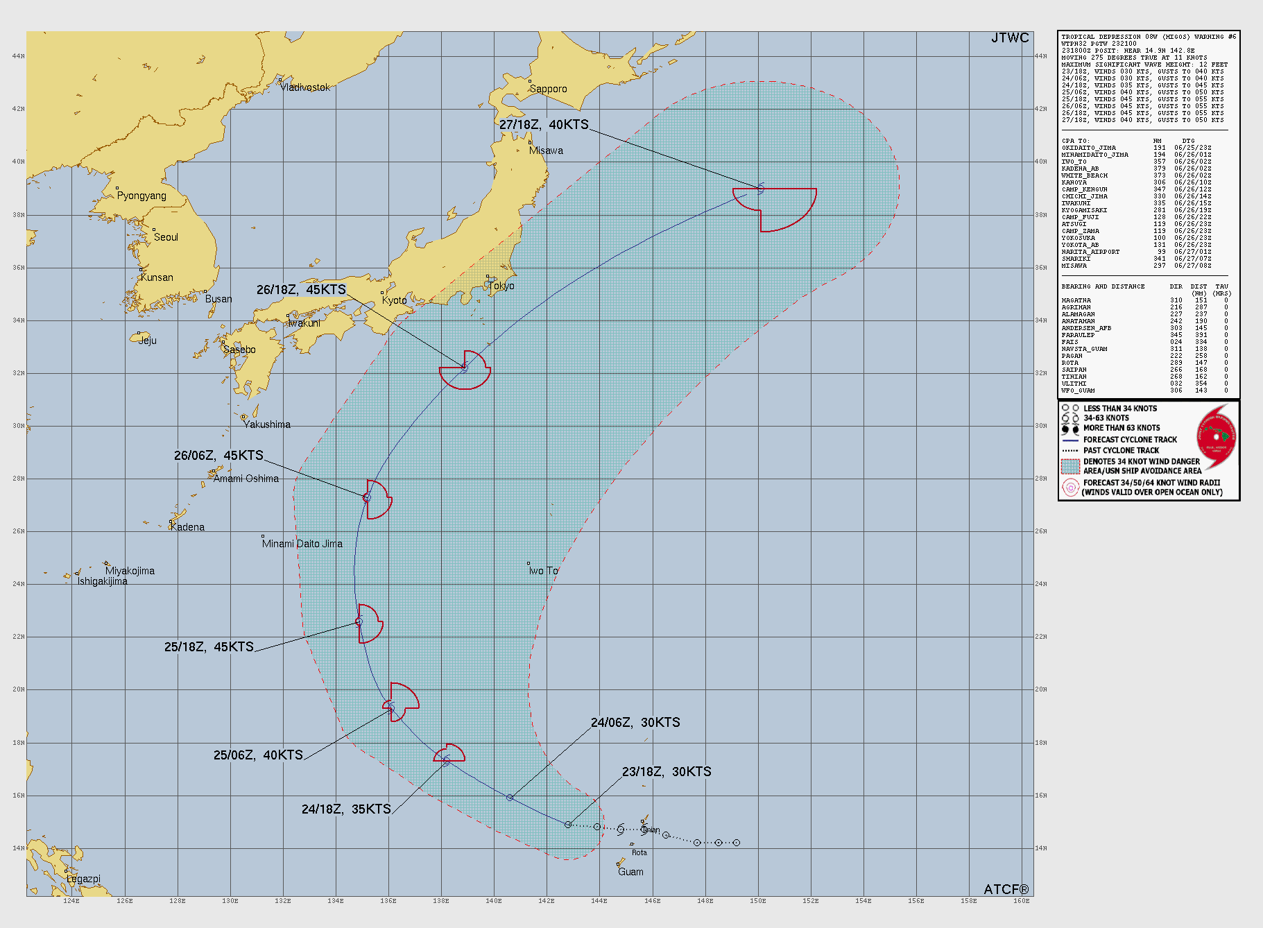
Tropical Depression Higos (08W) will become a weak tropical storm. No threat to land but it will come close to Japan.
Full Physics ECMWF Ensembles | Next 15-days | Active Storm Tracks
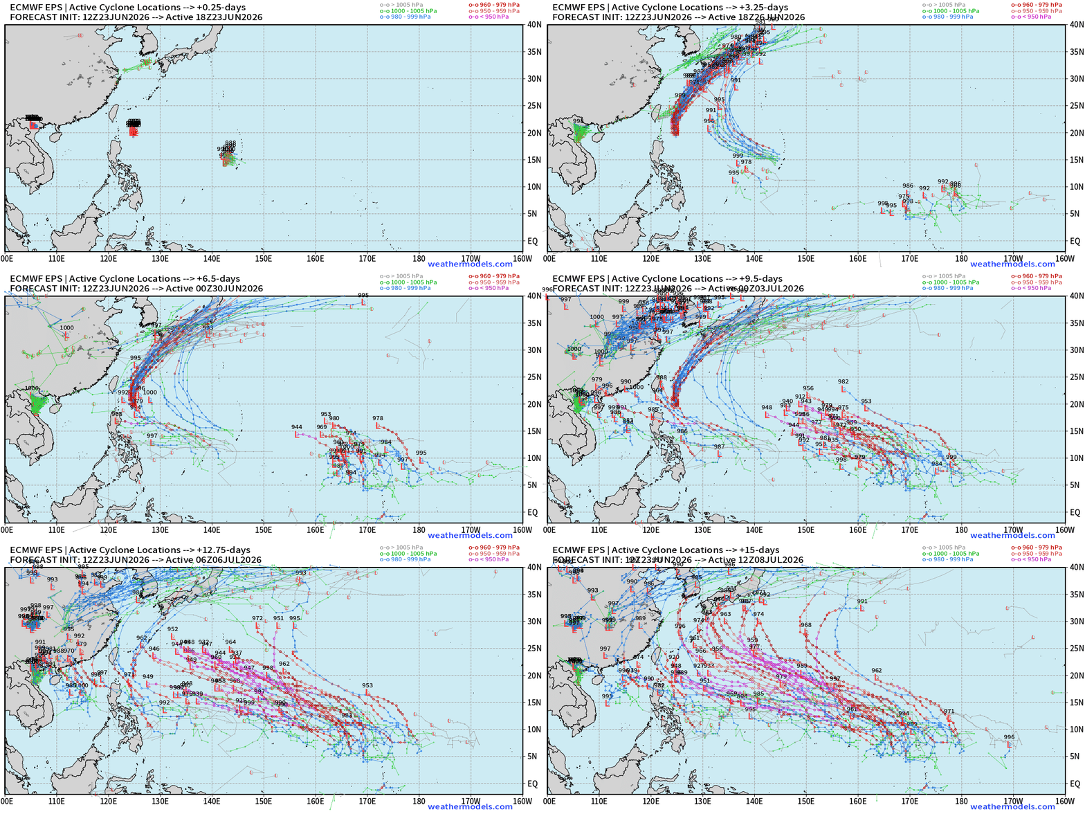
Long track, powerful Typhoon coming out of the far eastern part of the basin near the Dateline is typical of El Niño summers —> Lots of ACE
Thank you for reaching the end of this post! Hopefully you enjoyed the beautiful weather maps. Please help increase the visibility of Weather Trader on Substack: Share or Like!
Help support this newsletter (nearing post 1,000!) —> June 2026 Coupon
Maps sourced from weathermodels.com designed and innovated by yours truly! Please subscribe there for real-time access to the newest maps, charts from all of the weather models including ECMWF and AIFS, and NOAA GFS/GEFS, HRRR/RRFS and Blend of Models (NBM). NOAA WPC and SPC for fronts/convective outlooks.
My Atlantic Hurricane Season Forecast (2026)
From April 7, 2026: Atlantic Seasonal Hurricane Forecast: (11/5/2)
9-13 Named Storms (11 most likely)
4-7 Hurricanes (5 or 6 most likely)
1-3 Major Hurricanes (2 most likely)
Accumulated Cyclone Energy: 75-85 (well below normal)
NOAA 2026 Atlantic Hurricane Season Forecast
- Milepost
- 966 · laid 2026-06-24T02:01:34.065000Z
- Source
- https://weather.substack.com/p/june-23-2026-tuesday-summer-weather
- Digest
- fd6adf862b585841b669a1ccdc5aad85683c09452807e6ccdf305fe8f4df0817
- Machine
- JSON